Suspension Bridges Completed 1930-1939
This is a list of all 250 bridges from the suspension bridge inventory completed in the decade 1930-1939. Wherever you see a Bridgemeister ID number click it to isolate the bridge on its own page.
Related Lists:
1930: (footbridge)
Grey Valley, Slaty Creek vicinity, New Zealand - Big River
| Bridgemeister ID: | 734 (added 2003-03-08) |
| Year Completed: | 1930 |
| Name: | (footbridge) |
| Location: | Grey Valley, Slaty Creek vicinity, New Zealand |
| Crossing: | Big River |
| References: | GAP |
| Use: | Footbridge |
1930: (footbridge)
Hartola, Finland - Tainionvirta
| Bridgemeister ID: | 5544 (added 2020-12-13) |
| Year Completed: | 1930 |
| Name: | (footbridge) |
| Location: | Hartola, Finland |
| Crossing: | Tainionvirta |
| Coordinates: | 61.568078 N 26.019536 E |
| Maps: | Acme, GeoHack, Google, OpenStreetMap |
| Use: | Footbridge |
| Status: | In use (last checked: 2020) |
| Main Cables: | Wire (steel) |
| Suspended Spans: | 1 |
1930: (pipeline bridge)
Hollenberg, Kansas, USA - Little Blue River
| Bridgemeister ID: | 167 (added before 2003) |
| Year Completed: | 1930 |
| Name: | (pipeline bridge) |
| Location: | Hollenberg, Kansas, USA |
| Crossing: | Little Blue River |
| Principals: | Matthews & Kenan |
| References: | USS |
| Use: | Pipeline |
| Main Cables: | Wire (steel) |
| Suspended Spans: | 3 |
| Main Span: | 1 x 152.4 meters (500 feet) |
| Side Spans: | 2 x 70.1 meters (230 feet) |
1930: (suspension bridge)
Anderson's farm, New Zealand - Tangarakau River
| Bridgemeister ID: | 733 (added 2003-03-08) |
| Year Completed: | 1930 |
| Name: | (suspension bridge) |
| Location: | Anderson's farm, New Zealand |
| Crossing: | Tangarakau River |
| References: | GAP |
1930: (suspension bridge)
Te Araroa vicinity, New Zealand - Kopuapounamu River
| Bridgemeister ID: | 730 (added 2003-03-08) |
| Year Completed: | 1930 |
| Name: | (suspension bridge) |
| Location: | Te Araroa vicinity, New Zealand |
| Crossing: | Kopuapounamu River |
| References: | GAP |
1930: (suspension bridge)
Whangaehu Valley, Kakatahi, New Zealand - Whangaehu River
| Bridgemeister ID: | 731 (added 2003-03-08) |
| Year Completed: | 1930 |
| Name: | (suspension bridge) |
| Location: | Whangaehu Valley, Kakatahi, New Zealand |
| Crossing: | Whangaehu River |
| At or Near Feature: | Field's Track |
| Coordinates: | 39.621392 S 175.422532 E |
| Maps: | Acme, GeoHack, Google, OpenStreetMap |
| References: | GAP |
| Status: | Removed |
| Main Span: | 1 x 53.5 meters (175.5 feet) |
Notes:
- GAP: "On Field's Track, which links the Parapara (Wanganui-Raethi) Road at Kakatahi with the Whangaehu Valley."
- Coordinates are for the current (2020) Field's Track crossing of the Whangaehu River.
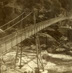
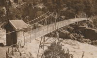
1930: Alexandra
Launceston, Tasmania, Australia - South Esk River
| Bridgemeister ID: | 444 (added before 2003) |
| Year Completed: | 1930 |
| Name: | Alexandra |
| Also Known As: | Basin |
| Location: | Launceston, Tasmania, Australia |
| Crossing: | South Esk River |
| At or Near Feature: | First Basin Water, Cataract Gorge Reserve |
| Coordinates: | 41.44681 S 147.11813 E |
| Maps: | Acme, GeoHack, Google, OpenStreetMap |
| References: | STC |
| Use: | Footbridge |
| Status: | In use (last checked: 2019) |
| Main Cables: | Wire (steel) |
| Suspended Spans: | 3 |
| Main Span: | 1 x 45.7 meters (149.9 feet) |
| Side Spans: | 1 x 16.8 meters (55.1 feet), 1 x 10.7 meters (35.1 feet) |
Notes:
- 2004: Refurbished, including replacement of cables which supposedly dated to the first Alexandra bridge.
- 2020, October: Maintenance project started focused on corrosion prevention including stripping paint and repainting.
- Replaced 1904 Alexandra (Basin) - Launceston, Tasmania, Australia.
- Near 1939 Duck Reach - Launceston, Tasmania, Australia.
- Near 1995 Duck Reach - Launceston, Tasmania, Australia.
External Links:
1930: Bolko
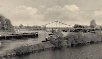
Opole, Poland - Oder River
| Bridgemeister ID: | 7903 (added 2023-10-15) |
| Year Completed: | 1930 |
| Name: | Bolko |
| Also Known As: | Bolkobrücke |
| Location: | Opole, Poland |
| Crossing: | Oder River |
| Coordinates: | 50.658406 N 17.921887 E |
| Maps: | Acme, GeoHack, Google, OpenStreetMap |
| Status: | Destroyed, 1945 |
| Suspended Spans: | 2 |
| Characteristics: | Self-anchored |
External Links:
1930: Capens
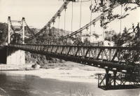
Capens, Haute-Garonne, France - Garonne River
| Bridgemeister ID: | 6742 (added 2021-10-23) |
| Year Completed: | 1930 |
| Name: | Capens |
| Location: | Capens, Haute-Garonne, France |
| Crossing: | Garonne River |
| Use: | Vehicular |
| Status: | Removed |
| Main Cables: | Wire (steel) |
| Main Span: | 1 |
Notes:
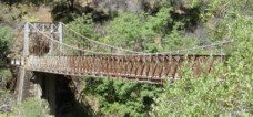
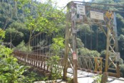
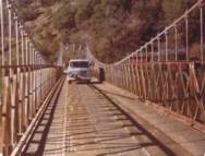
1930: Colfax-Foresthill
Yankee Jims, Colfax vicinity, California, USA - North Fork American River
| Bridgemeister ID: | 165 (added before 2003) |
| Year Completed: | 1930 |
| Name: | Colfax-Foresthill |
| Also Known As: | Yankee Jims |
| Location: | Yankee Jims, Colfax vicinity, California, USA |
| Crossing: | North Fork American River |
| Coordinates: | 39.040306 N 120.902667 W |
| Maps: | Acme, GeoHack, Google, OpenStreetMap |
| Use: | Vehicular (one-lane) |
| Status: | In use (last checked: 2023) |
| Main Cables: | Wire (steel) |
| Suspended Spans: | 1 |
| Main Span: | 1 x 53 meters (173.9 feet) estimated |
Notes:
- 2023: Replacement announced. The suspension bridge will be preserved and remain in place.
- Companion to 1928 Colfax-Iowa Hill - Colfax vicinity, California, USA.
External Links:
- Facebook - Placer County Government. Video discussing the history of the bridge and planned replacement project.
- Structurae - Structure ID 20011089
1930: Cranberry Lake
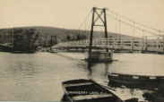
Cranberry Lake, Byram, New Jersey, USA - Cranberry Lake
| Bridgemeister ID: | 153 (added before 2003) |
| Year Completed: | 1930 |
| Name: | Cranberry Lake |
| Location: | Cranberry Lake, Byram, New Jersey, USA |
| Crossing: | Cranberry Lake |
| Coordinates: | 40.95401 N 74.73714 W |
| Maps: | Acme, GeoHack, Google, OpenStreetMap |
| References: | BONJ, PQU |
| Use: | Footbridge |
| Status: | Closed, 2019 (last checked: 2020) |
| Main Cables: | Wire (steel) |
| Suspended Spans: | 3 |
| Main Span: | 1 x 61.5 meters (201.7 feet) estimated |
| Side Spans: | 2 x 21.8 meters (71.5 feet) estimated |
Notes:
- 1928 and 1931 also sometimes cited as years of completion. Construction appears to have completed in December 1930, possibly opening in early 1931.
- 2019: Closed pending repairs and rehabilitation.
External Links:
- Save Our Bridge. "Dedicated to restoring and preserving the historic Cranberry Lake footbridge - one of the oldest pedestrian footbridges in the state of New Jersey."
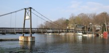
1930: Diffloo Hanging
Panbari N.C., Assam, India - Diffloo River
| Bridgemeister ID: | 7422 (added 2022-12-09) |
| Year Completed: | 1930 |
| Name: | Diffloo Hanging |
| Also Known As: | ডিফলু হ্যাংগিং ব্রিজ |
| Location: | Panbari N.C., Assam, India |
| Crossing: | Diffloo River |
| Coordinates: | 26.605922 N 93.581004 E |
| Maps: | Acme, GeoHack, Google, OpenStreetMap |
| Status: | In use (last checked: 2022) |
| Main Cables: | Wire (steel) |
| Suspended Spans: | 1 |
1930: General Juan Vicente Gómez
El Dorado, Bolívar, Venezuela - Rio Cuyuní
| Bridgemeister ID: | 4772 (added 2020-07-03) |
| Year Completed: | 1930 |
| Name: | General Juan Vicente Gómez |
| Location: | El Dorado, Bolívar, Venezuela |
| Crossing: | Rio Cuyuní |
| Coordinates: | 6.715560 N 61.610438 W |
| Maps: | Acme, GeoHack, Google, OpenStreetMap |
| Use: | Vehicular (one-lane) |
| Status: | Restricted to foot traffic (last checked: 2018) |
| Main Cables: | Wire (steel) |
| Suspended Spans: | 1 |
External Links:
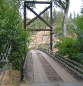
1930: Horse Creek
Horse Creek, California, USA - Klamath River
| Bridgemeister ID: | 586 (added 2003-01-05) |
| Year Completed: | 1930 |
| Name: | Horse Creek |
| Location: | Horse Creek, California, USA |
| Crossing: | Klamath River |
| Coordinates: | 41.824678 N 122.997667 W |
| Maps: | Acme, GeoHack, Google, OpenStreetMap |
| Use: | Vehicular (one-lane) |
| Status: | In use (last checked: 2012) |
| Main Cables: | Wire (steel) |
| Suspended Spans: | 1 |
Notes:
External Links:
1930: Kamoro
Antanambazaha, Madagascar - Mahajamba River
| Bridgemeister ID: | 4750 (added 2020-06-27) |
| Year Completed: | 1930 |
| Name: | Kamoro |
| Location: | Antanambazaha, Madagascar |
| Crossing: | Mahajamba River |
| Coordinates: | 16.460751 S 47.168838 E |
| Maps: | Acme, GeoHack, Google, OpenStreetMap |
| Principals: | Gaston Leinekugel Le Cocq |
| References: | KSBM |
| Use: | Vehicular (one-lane) |
| Status: | Restricted to foot traffic (last checked: 2017) |
| Main Cables: | Wire (steel) |
| Suspended Spans: | 2 |
| Main Span: | 1 x 206.5 meters (677.5 feet) |
| Side Span: | 1 x 54 meters (177.2 feet) |
| Deck width: | 4 meters |
Notes:
External Links:
1930: Klenklen
Pilot Grove vicinity, Missouri, USA - Lamine River
| Bridgemeister ID: | 1570 (added 2004-12-05) |
| Year Completed: | 1930 |
| Name: | Klenklen |
| Location: | Pilot Grove vicinity, Missouri, USA |
| Crossing: | Lamine River |
| Coordinates: | 38.828284 N 93.034299 W |
| Maps: | Acme, GeoHack, Google, OpenStreetMap |
| Principals: | Joseph A. Dice |
| References: | HAERMO91 |
| Use: | Vehicular (one-lane) |
| Status: | Removed, c. 1996 |
| Main Cables: | Wire (steel) |
| Suspended Spans: | 2 |
| Main Span: | 1 x 61 meters (200 feet) |
| Side Span: | 1 x 9.1 meters (30 feet) |
Notes:
- Partially collapsed. Closed and replaced 1994, demolished c. 1996.
- Coordinates are approximate, showing location of replacement.
- Sometimes spelled as "Klenken."
- Sometimes cited as having been completed in 1929, HAER MO-91 (reference HAERMO91) states construction began September 1929 and completed in April 1930.
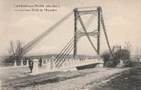
1930: Layrac-sur-Tarn
Layrac-sur-Tarn, Haute-Garonne, France - Tarn River
| Bridgemeister ID: | 7184 (added 2022-07-02) |
| Year Completed: | 1930 |
| Name: | Layrac-sur-Tarn |
| Location: | Layrac-sur-Tarn, Haute-Garonne, France |
| Crossing: | Tarn River |
| Use: | Vehicular |
| Status: | Removed |
| Main Cables: | Wire (steel) |
| Suspended Spans: | 1 |
| Main Span: | 1 |
Notes:
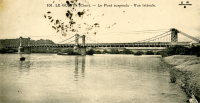
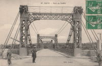
1930: Le Guétin
Le Guétin, Cuffy vicinity, Cher and Gimouille, Nièvre, France - Allier River
| Bridgemeister ID: | 2844 (added 2005-03-19) |
| Year Completed: | 1930 |
| Name: | Le Guétin |
| Location: | Le Guétin, Cuffy vicinity, Cher and Gimouille, Nièvre, France |
| Crossing: | Allier River |
| Coordinates: | 46.947881 N 3.073013 E |
| Maps: | Acme, GeoHack, Google, OpenStreetMap |
| References: | AAJ |
| Use: | Vehicular |
| Status: | Replaced |
| Main Cables: | Wire (steel) |
| Suspended Spans: | 5 |
| Main Spans: | 5 |
Notes:
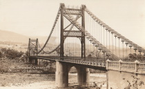
1930: Libertador
San Cristobal and Táriba, Táchira, Venezuela - Rio Torbes
| Bridgemeister ID: | 4580 (added 2020-06-05) |
| Year Completed: | 1930 |
| Name: | Libertador |
| Location: | San Cristobal and Táriba, Táchira, Venezuela |
| Crossing: | Rio Torbes |
| Coordinates: | 7.810055 N 72.232265 W |
| Maps: | Acme, GeoHack, Google, OpenStreetMap |
| Use: | Vehicular |
| Status: | In use (last checked: 2019) |
| Main Cables: | Wire (steel) |
| Suspended Spans: | 3 |
| Main Span: | 1 |
| Side Spans: | 2 |
External Links:
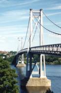
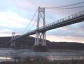
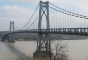
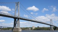
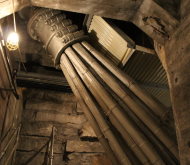
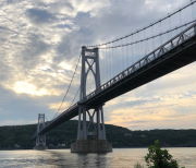
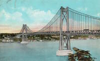
1930: Mid-Hudson
Poughkeepsie and Highland, New York, USA - Hudson River
| Bridgemeister ID: | 166 (added before 2003) |
| Year Completed: | 1930 |
| Name: | Mid-Hudson |
| Also Known As: | Franklin Delano Roosevelt Mid-Hudson |
| Location: | Poughkeepsie and Highland, New York, USA |
| Crossing: | Hudson River |
| Coordinates: | 41.702933 N 73.946683 W |
| Maps: | Acme, GeoHack, Google, OpenStreetMap |
| Principals: | Ralph Modjeski |
| References: | AAJ, BPL, PTS2, SJR, USS |
| Use: | Vehicular (two-lane, heavy vehicles), with walkway |
| Status: | In use (last checked: 2019) |
| Main Cables: | Wire (steel) |
| Suspended Spans: | 3 |
| Main Span: | 1 x 457.2 meters (1,500 feet) |
| Side Spans: | 2 x 228.6 meters (750 feet) |
| Deck width: | 39 feet |
Notes:
- Although the length of the main span of the bridge is officially 1,500 feet, the actual length is 1,495 feet. During construction one of the caissons slid and tilted from its intended location. While efforts were made to move the caisson back, it was ultimately fixed in a position that left the main span five feet short of 1,500. Not wanting to lose the claim of having a 1,500-foot bridge, the shortfall has been kept out of official records since.
External Links:
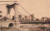
1930: Riscle
Riscle, Gers, France - Adour River
| Bridgemeister ID: | 7316 (added 2022-08-28) |
| Year Completed: | 1930 |
| Name: | Riscle |
| Location: | Riscle, Gers, France |
| Crossing: | Adour River |
| Coordinates: | 43.663878 N 0.081895 W |
| Maps: | Acme, GeoHack, Google, OpenStreetMap |
| Use: | Vehicular |
| Status: | Destroyed, 1944 |
| Main Cables: | Wire (steel) |
| Main Span: | 1 |
Notes:
- Replaced by 1955 Riscle - Riscle, Gers, France.
External Links:
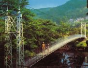
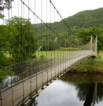
1930: Sappers'
Betws-y-Coed, Wales, United Kingdom - River Conwy
| Bridgemeister ID: | 445 (added before 2003) |
| Year Completed: | 1930 |
| Name: | Sappers' |
| Location: | Betws-y-Coed, Wales, United Kingdom |
| Crossing: | River Conwy |
| Coordinates: | 53.09221 N 3.79928 W |
| Maps: | Acme, GeoHack, Google, OpenStreetMap |
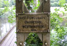
| Principals: | David Rowell & Co. |
| Use: | Footbridge |
| Status: | Closed, December 2021 (last checked: 2023) |
| Main Cables: | Wire (steel) |
| Suspended Spans: | 1 |
Notes:
- 2021, December: Closed due to deteriorating condition. Repairs expected to start in April 2022.
- 2023, February: Still closed. May be replaced.
Annotated Citations:
- Evans, Hari. "Near century old Snowdonia wobbly bridge that's rotting away and may soon be replaced." North Wales Live, 9 Feb. 2023, https://www.dailypost.co.uk/news/north-wales-news/near-century-old-snowdonia-wobbly-26198160.
"The suspension bridge used to be renowned for its wobbly midpoint and was a key shortcut across the River Conwy for locals and tourists. However, structural reviews conducted last year found that virtually the entire bridge would need to be refurbished, with the entire timber deck as well as other parts replaced completely."
External Links:
1930: Slade's
Rockville vicinity, Rhode Island, USA - Yawgoog Pond
| Bridgemeister ID: | 1642 (added 2005-03-14) |
| Year Completed: | 1930 |
| Name: | Slade's |
| Location: | Rockville vicinity, Rhode Island, USA |
| Crossing: | Yawgoog Pond |
| Principals: | Paul W. Slade |
| Use: | Footbridge |
| Status: | Removed, 1948 |
| Main Cables: | Wire |
| Suspended Spans: | 1 |
| Main Span: | 1 x 59.4 meters (195 feet) |
1930: Tsoelike
Lesotho - Orange River
| Bridgemeister ID: | 1994 (added 2005-12-10) |
| Year Completed: | 1930 |
| Name: | Tsoelike |
| Location: | Lesotho |
| Crossing: | Orange River |
| Coordinates: | 30.002343 S 28.662395 E |
| Maps: | Acme, GeoHack, Google, OpenStreetMap |
| Use: | Vehicular (one-lane) |
| Status: | Extant (last checked: 2019) |
| Main Cables: | Wire (steel) |
| Suspended Spans: | 1 |
External Links:
1931: (suspension bridge)
Murchison District, New Zealand - Matiri River
| Bridgemeister ID: | 737 (added 2003-03-08) |
| Year Completed: | 1931 |
| Name: | (suspension bridge) |
| Location: | Murchison District, New Zealand |
| Crossing: | Matiri River |
| References: | GAP |
| Status: | Removed |
Notes:
- GAP: Maybe completed early 1932, no longer in existence.
1931: (suspension bridge)
Wakarara, Tikokino vicinity, New Zealand - Waipawa River
| Bridgemeister ID: | 736 (added 2003-03-08) |
| Year Completed: | 1931 |
| Name: | (suspension bridge) |
| Location: | Wakarara, Tikokino vicinity, New Zealand |
| Crossing: | Waipawa River |
| Principals: | S.T. Silver |
| References: | GAP |
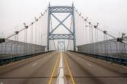
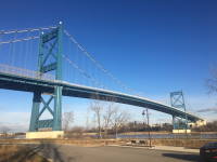
1931: Anthony Wayne
Toledo, Ohio, USA - Maumee River
| Bridgemeister ID: | 168 (added before 2003) |
| Year Completed: | 1931 |
| Name: | Anthony Wayne |
| Location: | Toledo, Ohio, USA |
| Crossing: | Maumee River |
| Coordinates: | 41.64086 N 83.53361 W |
| Maps: | Acme, GeoHack, Google, OpenStreetMap |
| Principals: | Waddell and Hardesty |
| References: | AAJ, SJR, SSS |
| Use: | Vehicular (major highway), with walkway |
| Status: | In use (last checked: 2021) |
| Main Cables: | Wire (steel) |
| Suspended Spans: | 3 |
| Main Span: | 1 x 239.3 meters (785 feet) |
| Side Spans: | 2 x 71.2 meters (233.5 feet) |
| Deck width: | 60 feet |
External Links:

1931: Bemis
Notchland, Hart's Location vicinity, New Hampshire, USA - Saco River
| Bridgemeister ID: | 316 (added before 2003) |
| Year Completed: | 1931 |
| Name: | Bemis |
| Location: | Notchland, Hart's Location vicinity, New Hampshire, USA |
| Crossing: | Saco River |
| At or Near Feature: | Davis Path trail, White Mountain National Park |
| Coordinates: | 44.12047 N 71.35367 W |
| Maps: | Acme, GeoHack, Google, OpenStreetMap |
| References: | PQU |
| Use: | Footbridge |
| Status: | Replaced, c. 2001 |
| Suspended Spans: | 2 |
| Main Span: | 1 x 32.9 meters (108 feet) |
| Side Span: | 1 x 15.2 meters (50 feet) |
Notes:
- Replaced by a small single-towered cable-stayed bridge, circa 2001.
External Links:
1931: Buchanan Dam
Buchanan Dam, Texas, USA - Colorado River
| Bridgemeister ID: | 2514 (added 2009-12-30) |
| Year Completed: | 1931 |
| Name: | Buchanan Dam |
| Location: | Buchanan Dam, Texas, USA |
| Crossing: | Colorado River |
| Use: | Vehicular (one-lane) |
| Status: | Removed |
| Main Cables: | Wire (steel) |
| Suspended Spans: | 1 |
Notes:
- Large one-lane suspension bridge built during the construction of Buchanan Dam.
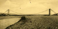
1931: Cavaillon
Cavaillon, Vaucluse and Bouches-du-Rhône, France - Durance River
| Bridgemeister ID: | 1013 (added 2003-11-22) |
| Year Completed: | 1931 |
| Name: | Cavaillon |
| Location: | Cavaillon, Vaucluse and Bouches-du-Rhône, France |
| Crossing: | Durance River |
| Use: | Vehicular |
| Status: | Destroyed, 1944 |
| Main Cables: | Wire |
| Suspended Spans: | 1 |
Notes:
- Destroyed August 24, 1944.
- Replaced 1837 Cavaillon - Cavaillon, Vaucluse and Bouches-du-Rhône, France.
External Links:
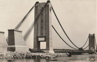
1931: Châtillon-sur-Loire
Châtillon-sur-Loire, Loiret, France - Loire River
| Bridgemeister ID: | 1018 (added 2003-11-22) |
| Year Completed: | 1931 |
| Name: | Châtillon-sur-Loire |
| Location: | Châtillon-sur-Loire, Loiret, France |
| Crossing: | Loire River |
| Coordinates: | 47.598786 N 2.761769 E |
| Maps: | Acme, GeoHack, Google, OpenStreetMap |
| Use: | Vehicular |
| Status: | Destroyed, June, 1940 |
| Main Cables: | Wire (steel) |
| Suspended Spans: | 4 |
| Main Spans: | 4 |
Notes:
- Replaced 1841 Châtillon-sur-Loire - Châtillon-sur-Loire, Loiret, France.
- Replaced by 1951 Châtillon-sur-Loire - Châtillon-sur-Loire, Loiret, France.
External Links:
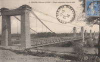
1931: Feneyrols
Feneyrols, Tarn-et-Garonne, France - Aveyron River
| Bridgemeister ID: | 1551 (added 2004-11-13) |
| Year Completed: | 1931 |
| Name: | Feneyrols |
| Location: | Feneyrols, Tarn-et-Garonne, France |
| Crossing: | Aveyron River |
| Coordinates: | 44.129389 N 1.819662 E |
| Maps: | Acme, GeoHack, Google, OpenStreetMap |
| Use: | Vehicular (two-lane) |
| Status: | In use (last checked: 2022) |
| Main Cables: | Wire (steel) |
| Suspended Spans: | 1 |
| Main Span: | 1 x 86 meters (282.2 feet) estimated |
External Links:
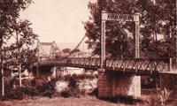
1931: Gamlebrua
Kongsberg, Viken, Norway - Numedalslågen
| Bridgemeister ID: | 536 (added before 2003) |
| Year Completed: | 1931 |
| Name: | Gamlebrua |
| Location: | Kongsberg, Viken, Norway |
| Crossing: | Numedalslågen |
| Coordinates: | 59.662620 N 9.652555 E |
| Maps: | Acme, GeoHack, Google, kart.1881.no, OpenStreetMap |
| Use: | Vehicular (one-lane), with walkway |
| Status: | In use (last checked: 2019) |
| Main Cables: | Wire (steel) |
| Suspended Spans: | 1 |
| Main Span: | 1 x 110 meters (360.9 feet) estimated |
External Links:
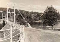
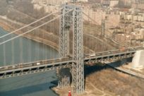
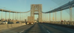
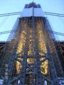
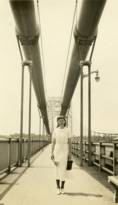
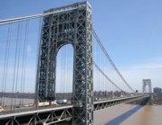
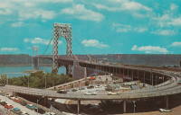
1931: George Washington
New York, New York and Fort Lee, New Jersey, USA - Hudson River
| Bridgemeister ID: | 169 (added before 2003) |
| Year Completed: | 1931 |
| Name: | George Washington |
| Also Known As: | GWB |
| Location: | New York, New York and Fort Lee, New Jersey, USA |
| Crossing: | Hudson River |
| Coordinates: | 40.85333 N 73.955 W |
| Maps: | Acme, GeoHack, Google, OpenStreetMap |
| Principals: | O.H. Ammann, Leon Moisseiff, Dana, Gilbert |
| References: | AAJ, AOB, ARF, BBR, BC3, BFL, BMA, BONJ, BOU, BPL, BRU, COB, CTW, ENR19270811a, ENR19270811b, ENR19290411c, GBD, LAB, LACE, PTS2, SIX, SJR |
| Use: | Vehicular (double-deck), with walkway |
| Status: | In use (last checked: 2022) |
| Main Cables: | Wire (steel) |
| Suspended Spans: | 3 |
| Main Span: | 1 x 1,066.8 meters (3,500 feet) |
| Side Spans: | 2 x 198.1 meters (650 feet) |
| Deck width: | 120 feet |
Notes:
- Became longest suspension bridge by eclipsing 1929 Ambassador - Detroit, Michigan, USA and Windsor, Ontario, Canada.
- Eclipsed by new longest suspension bridge 1937 Golden Gate - San Francisco and Marin County, California, USA.
External Links:


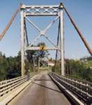
1931: Hagwilget
Hagwilget, British Columbia, Canada - Bulkley River
| Bridgemeister ID: | 170 (added before 2003) |
| Year Completed: | 1931 |
| Name: | Hagwilget |
| Also Known As: | Bulkley Canyon |
| Location: | Hagwilget, British Columbia, Canada |
| Crossing: | Bulkley River |
| At or Near Feature: | Hagwilget Canyon |
| Coordinates: | 55.25740 N 127.60380 W |
| Maps: | Acme, GeoHack, Google, OpenStreetMap |
| Principals: | BC Department of Public Works |
| References: | AAJ |
| Use: | Vehicular (one-lane) |
| Status: | In use (last checked: 2008) |
| Main Cables: | Wire (steel) |
| Suspended Spans: | 1 |
| Main Span: | 1 x 140.2 meters (460 feet) |
| Deck width: | 16 feet |
Notes:
External Links:
1931: Long Shoal
Warsaw vicinity, Missouri, USA - Osage River
| Bridgemeister ID: | 3517 (added 2019-12-24) |
| Year Completed: | 1931 |
| Name: | Long Shoal |
| Location: | Warsaw vicinity, Missouri, USA |
| Crossing: | Osage River |
| Principals: | Joseph A. Dice |
| References: | BOTO |
| Use: | Vehicular |
| Status: | Collapsed, September 21, 1965 |
| Main Cables: | Wire (steel) |
Notes:
- Collapsed, killing three people, September 1965.
1931: Mata River
Makarika, Ruatoria vicinity, New Zealand - Mata River
| Bridgemeister ID: | 735 (added 2003-03-08) |
| Year Completed: | 1931 |
| Name: | Mata River |
| Location: | Makarika, Ruatoria vicinity, New Zealand |
| Crossing: | Mata River |
| References: | GAP |
| Use: | Vehicular (one-lane) |
| Status: | Replaced |
| Main Cables: | Wire (steel) |
| Suspended Spans: | 1 |
| Main Span: | 1 x 151 meters (495.4 feet) |
External Links:
| Bridgemeister ID: | 1560 (added 2004-11-26) |
| Year Completed: | 1931 |
| Name: | Ponkila |
| Location: | Muhos, Finland |
| Crossing: | Muhosjoki |
| Coordinates: | 64.808996 N 26.005233 E |
| Maps: | Acme, GeoHack, Google, OpenStreetMap |
| Principals: | L. Iloniemi |
| Use: | Vehicular (one-lane) |
| Status: | Restricted to foot traffic (last checked: 2004) |
| Main Cables: | Wire (steel) |
1931: Raensbrua
Kråkebumoen vicinity, Kristiansand, Agder, Norway - Tovdalselva
| Bridgemeister ID: | 4314 (added 2020-04-10) |
| Year Completed: | 1931 |
| Name: | Raensbrua |
| Location: | Kråkebumoen vicinity, Kristiansand, Agder, Norway |
| Crossing: | Tovdalselva |
| Coordinates: | 58.277040 N 8.176805 E |
| Maps: | Acme, GeoHack, Google, kart.1881.no, OpenStreetMap |
| Use: | Footbridge |
| Status: | Only towers remain (last checked: 2019) |
| Main Cables: | Wire (steel) |
| Suspended Spans: | 1 |
| Main Span: | 1 x 75 meters (246.1 feet) estimated |
Notes:
- In a derelict state by late 2000s. Only the towers remain by late 2010s.
1931: Rubens
Los Angeles vicinity, Natales, Chile - Rio Rubens
| Bridgemeister ID: | 6917 (added 2022-01-21) |
| Year Completed: | 1931 |
| Name: | Rubens |
| Location: | Los Angeles vicinity, Natales, Chile |
| Crossing: | Rio Rubens |
| Coordinates: | 52.036240 S 71.947632 W |
| Maps: | Acme, GeoHack, Google, OpenStreetMap |
| Use: | Vehicular |
| Status: | Derelict (last checked: 2021) |
| Main Cables: | Wire (steel) |
| Main Span: | 1 x 42 meters (137.8 feet) estimated |
External Links:
- Licitan estudio de ingeniería para la reposición del puente Rubens | La Prensa Austral. "Tender for engineering study for the replacement of the Rubens bridge." Article (2018) discusses replacement of the adjacent highway bridge, but also mentions plans to restore the suspension bridge as tourist attraction.
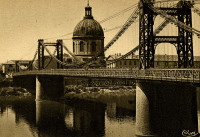
1931: Saint-Pierre
Toulouse, Haute-Garonne, France - Garonne River
| Bridgemeister ID: | 2049 (added 2006-05-21) |
| Year Completed: | 1931 |
| Name: | Saint-Pierre |
| Location: | Toulouse, Haute-Garonne, France |
| Crossing: | Garonne River |
| Coordinates: | 43.602833 N 1.435199 E |
| Maps: | Acme, GeoHack, Google, OpenStreetMap |
| Use: | Vehicular |
| Status: | Demolished, 1986 |
| Main Cables: | Wire |
Notes:
External Links:

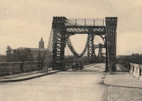
1931: Saint-Sulpice
Saint-Sulpice-la-Pointe, Tarn, France - Agout River
| Bridgemeister ID: | 7489 (added 2022-12-30) |
| Year Completed: | 1931 |
| Name: | Saint-Sulpice |
| Location: | Saint-Sulpice-la-Pointe, Tarn, France |
| Crossing: | Agout River |
| Coordinates: | 43.777048 N 1.686685 E |
| Maps: | Acme, GeoHack, Google, OpenStreetMap |
| Use: | Vehicular, with walkway |
| Status: | In use (last checked: 2022) |
| Main Cables: | Wire (steel) |
| Suspended Spans: | 1 |
Notes:
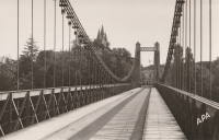
1931: Sidaway
Cleveland, Ohio, USA - Kingsbury Run
| Bridgemeister ID: | 171 (added before 2003) |
| Year Completed: | 1931 |
| Name: | Sidaway |
| Location: | Cleveland, Ohio, USA |
| Crossing: | Kingsbury Run |
| Coordinates: | 41.477805 N 81.642944 W |
| Maps: | Acme, GeoHack, Google, OpenStreetMap |
| Principals: | Wilbur Watson, Fred Plummer. New York, Chicago, and St. Louis Railroad Co. |
| References: | BMC |
| Use: | Footbridge |
| Status: | Derelict, since 1966 (last checked: 2023) |
| Main Cables: | Wire (steel) |
| Suspended Spans: | 3 |
| Main Span: | 1 x 121.9 meters (400 feet) |
| Side Spans: | 2 x 42.7 meters (140 feet) |
| Deck width: | 6 feet |
Notes:
- 2023, February: Given landmark status by the Cleveland City Council so that it is eligible to receive grants for preservation.
- BMC describes a feud between the neighborhoods on either side of the bridge that led to events in July 1966: "someone set fire to the wooden deck and ripped out fifteen feet of the southern portion. The bridge now is considered a nuisance."
- 2022, October: Added to National Register of Historic Places.
External Links:
- Sidaway Bridge once connected Black and white neighborhoods. Now it connects us to the past.. July 22, 2020 news article by News 5 (ABC) Cleveland.
- Structurae - Structure ID 20015438
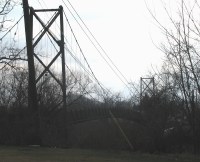
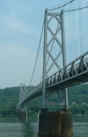
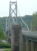
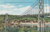
1931: Simon Kenton Memorial
Maysville, Kentucky and Aberdeen, Ohio, USA - Ohio River
| Bridgemeister ID: | 172 (added before 2003) |
| Year Completed: | 1931 |
| Name: | Simon Kenton Memorial |
| Also Known As: | Maysville |
| Location: | Maysville, Kentucky and Aberdeen, Ohio, USA |
| Crossing: | Ohio River |
| Coordinates: | 38.649890 N 83.759670 W |
| Maps: | Acme, GeoHack, Google, OpenStreetMap |
| Principals: | Modjeski, Masters & Chase |
| References: | AAJ, SJR, SSS |
| Use: | Vehicular (two-lane), with walkway |
| Status: | In use (last checked: 2022) |
| Main Cables: | Wire (steel) |
| Suspended Spans: | 3 |
| Main Span: | 1 x 323.1 meters (1,060 feet) |
| Side Spans: | 2 x 141.7 meters (464.9 feet) |
| Deck width: | 28 feet |
Notes:
- 2022, March: USD$23.4 million budgeted for rehabilitation project including suspender cable replacements, steel repairs, and painting.
- 2019: Closed late 2019 due to suspender cable corrosion. Short-term fixes applied to reduce the stress on the suspenders and to prevent rusting.
- 2020, June: Reopened with a 15-ton weight limit after installation of temporary support rods and brackets to reduce the stress on damaged cables.
External Links:
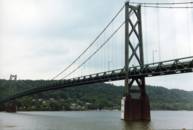
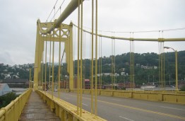
1931: South Tenth Street
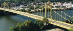
Pittsburgh, Pennsylvania, USA - Monongahela River
| Bridgemeister ID: | 173 (added before 2003) |
| Year Completed: | 1931 |
| Name: | South Tenth Street |
| Also Known As: | South Side, Tenth Street, Philip Murray |
| Location: | Pittsburgh, Pennsylvania, USA |
| Crossing: | Monongahela River |
| Coordinates: | 40.43166 N 79.989 W |
| Maps: | Acme, GeoHack, Google, OpenStreetMap |
| Principals: | Sydney A. Shubin |
| References: | AAJ, BOP, BPL, PBR, SSS, USS |
| Use: | Vehicular (four-lane), with walkway |
| Status: | In use (last checked: 2019) |
| Main Cables: | Wire (steel) |
| Suspended Spans: | 3 |
| Main Span: | 1 x 228.6 meters (750 feet) |
| Side Spans: | 2 x 83.8 meters (275 feet) |
| Deck width: | 54 feet |
External Links:
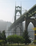
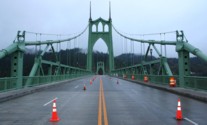
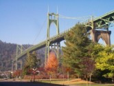
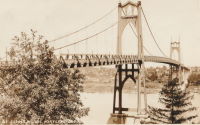
1931: St. Johns
Portland, Oregon, USA - Willamette River
| Bridgemeister ID: | 174 (added before 2003) |
| Year Completed: | 1931 |
| Name: | St. Johns |
| Location: | Portland, Oregon, USA |
| Crossing: | Willamette River |
| Coordinates: | 45.585 N 122.76333 W |
| Maps: | Acme, GeoHack, Google, OpenStreetMap |
| Principals: | Robinson and Steinman |
| References: | AAJ, ADDS, BC3, BCO, BFL, BPL, GBD, LAB, SJR |
| Use: | Vehicular (four-lane), with walkway |
| Status: | In use (last checked: 2022) |
| Main Cables: | Wire (steel) |
| Suspended Spans: | 3 |
| Main Span: | 1 x 367.9 meters (1,207 feet) |
| Side Spans: | 2 x 131.1 meters (430.25 feet) |
| Deck width: | 52 feet |
Notes:
- Substantially rehabilitated, 2003-2005.
External Links:
1931: Star Mine
Rosedale, Drumheller vicinity, Alberta, Canada - Red Deer River
| Bridgemeister ID: | 350 (added before 2003) |
| Year Completed: | 1931 |
| Name: | Star Mine |
| Also Known As: | Rosedale Swinging |
| Location: | Rosedale, Drumheller vicinity, Alberta, Canada |
| Crossing: | Red Deer River |
| Coordinates: | 51.420021 N 112.614473 W |
| Maps: | Acme, GeoHack, Google, OpenStreetMap |
| Principals: | George Lester MacKenzie |
| Use: | Footbridge |
| Status: | Closed, May 2020 (last checked: 2023) |
| Main Cables: | Wire (steel) |
| Suspended Spans: | 1 |
| Main Span: | 1 x 117 meters (383.9 feet) |
Notes:
- 1958: Rebuilt.
- 2020, May: Closed indefinitely due to safety concerns. During an inspection of the bridge "it was determined the northeast timber bridge support was in extremely poor condition."
- 2023, October: Contract to repair bridge awarded. Expected to reopen in April 2024.
Annotated Citations:
- Nairn, Lacie. "Town waiting on province for Rosedale suspension bridge repairs." The Drumheller Mail, 13 Apr. 2022, www.thestar.com/news/canada/2022/04/13/town-waiting-on-province-for-rosedale-suspension-bridge-repairs.html
The bridge is still closed. "The town initially hoped to complete repairs over the winter of 2021. However, as the land on the northern shore of the bridge was privately owned, land transfer negotiations were conducted between the Town, Alberta Transportation, and the landowner."
External Links:

1931: Teil
Le Teil, Ardèche and Montélimar, Drôme, France - Rhône River
| Bridgemeister ID: | 1549 (added 2004-11-13) |
| Year Completed: | 1931 |
| Name: | Teil |
| Location: | Le Teil, Ardèche and Montélimar, Drôme, France |
| Crossing: | Rhône River |
| Coordinates: | 44.5519 N 4.692617 E |
| Maps: | Acme, GeoHack, Google, OpenStreetMap |
| References: | AAJ, BPF |
| Use: | Vehicular (two-lane, heavy vehicles), with walkway |
| Status: | In use (last checked: 2005) |
| Main Cables: | Wire (steel) |
| Suspended Spans: | 1 |
| Main Span: | 1 x 235 meters (771 feet) |
Notes:
- Destroyed, 1944. Rebuilt, 1950.
- Replaced 1839 Teil - Le Teil, Ardèche and Montélimar, Drôme, France.
External Links:
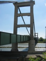
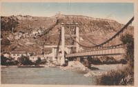
1931: Verdun-sur-Garonne
Verdun-sur-Garonne, Tarn-et-Garonne, France - Garonne River
| Bridgemeister ID: | 2347 (added 2007-08-18) |
| Year Completed: | 1931 |
| Name: | Verdun-sur-Garonne |
| Location: | Verdun-sur-Garonne, Tarn-et-Garonne, France |
| Crossing: | Garonne River |
| Coordinates: | 43.854713 N 1.242315 E |
| Maps: | Acme, GeoHack, Google, OpenStreetMap |
| Use: | Vehicular |
| Status: | Replaced, 2010 |
| Main Cables: | Wire (steel) |
| Suspended Spans: | 1 |
Notes:
- Coordinates are for the 2010 replacement suspension bridge, but construction photos of the newer bridge show the 1931 bridge was extremely close to the 2010 bridge.
- Replaced by 2010 Verdun-sur-Garonne - Verdun-sur-Garonne, Tarn-et-Garonne, France.
- See 1841 Verdun-sur-Garonne - Verdun-sur-Garonne, Tarn-et-Garonne, France. The relationship between the older and current bridges is unclear.
External Links:
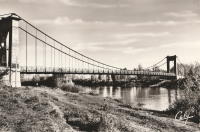
1931: Vicq-sur-Gartempe
Vicq-sur-Gartempe, Vienne, France - Gartempe River
| Bridgemeister ID: | 3997 (added 2020-03-27) |
| Year Completed: | 1931 |
| Name: | Vicq-sur-Gartempe |
| Location: | Vicq-sur-Gartempe, Vienne, France |
| Crossing: | Gartempe River |
| References: | AAJ |
| Use: | Vehicular |
| Status: | Replaced, 1989 |
| Main Cables: | Wire (steel) |
| Suspended Spans: | 1 |
Notes:
- 1989: Replaced and subsequently removed.
- Replaced 1881 Vicq-sur-Gartempe - Vicq-sur-Gartempe, Vienne, France.
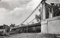
1931: Waldo-Hancock
Verona and Bucksport vicinity, Maine, USA - Penobscot River
| Bridgemeister ID: | 175 (added before 2003) |
| Year Completed: | 1931 |
| Name: | Waldo-Hancock |
| Location: | Verona and Bucksport vicinity, Maine, USA |
| Crossing: | Penobscot River |
| Coordinates: | 44.56 N 68.80333 W |
| Maps: | Acme, GeoHack, Google, OpenStreetMap |
| Principals: | Robinson and Steinman |
| References: | AAJ, ADDS, GBD, SSS, USS |
| Use: | Vehicular (two-lane, heavy vehicles), with walkway |
| Status: | Demolished, 2012 |
| Main Cables: | Wire (steel) |
| Suspended Spans: | 3 |
| Main Span: | 1 x 243.8 meters (800 feet) |
| Side Spans: | 2 x 106.7 meters (350 feet) |
| Deck width: | 27 feet |
Notes:
- Replacement cable-stayed bridge, (the Penobscot Narrows Bridge) completed, late 2006.
External Links:
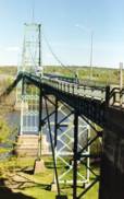
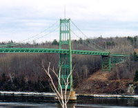
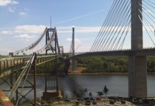
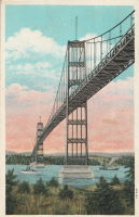
| Bridgemeister ID: | 446 (added before 2003) |
| Year Completed: | 1931 |
| Name: | Yagi-yama |
| Location: | Sendai, Miyagi, Japan |
| Coordinates: | 38.250273 N 140.852256 E |
| Maps: | Acme, GeoHack, Google, OpenStreetMap |
| Principals: | Yagi Kyubei |
| Use: | Vehicular |
| Status: | Replaced, 1965 |
| Main Cables: | Wire |
| Main Span: | 1 x 106.7 meters (350.1 feet) |
| Deck width: | 3.7 meters |
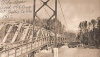
1932: (suspension bridge)
Bella Coola, British Columbia, Canada - Bella Coola River
| Bridgemeister ID: | 1436 (added 2004-07-30) |
| Year Completed: | 1932 |
| Name: | (suspension bridge) |
| Location: | Bella Coola, British Columbia, Canada |
| Crossing: | Bella Coola River |
| Status: | Removed, before 1966 |
| Main Cables: | Wire (steel) |
| Suspended Spans: | 1 |
Notes:
- Later at same location 1957 (footbridge) - Bella Coola, British Columbia, Canada.
1932: (suspension bridge)
Mangaohutu-Retaruke Road, New Zealand - Wanganui River
| Bridgemeister ID: | 738 (added 2003-03-08) |
| Year Completed: | 1932 |
| Name: | (suspension bridge) |
| Location: | Mangaohutu-Retaruke Road, New Zealand |
| Crossing: | Wanganui River |
| References: | GAP |
1932: (suspension bridge)
Placer County and El Dorado County, California, USA - Rubicon River
| Bridgemeister ID: | 5595 (added 2020-12-23) |
| Year Completed: | 1932 |
| Name: | (suspension bridge) |
| Location: | Placer County and El Dorado County, California, USA |
| Crossing: | Rubicon River |
| Coordinates: | 38.984847 N 120.694431 W |
| Maps: | Acme, GeoHack, Google, OpenStreetMap |
| Principals: | John Lawrence, US Forest Service |
| Use: | Vehicular (one-lane) |
| Status: | Derelict, since 1965 (last checked: 2020) |
| Main Cables: | Wire (steel) |
| Suspended Spans: | 1 |
| Main Span: | 1 x 48.8 meters (160 feet) |
Notes:
- Damaged by flood resulting from Hell Hole Dam failure in 1965. Never repaired.
- The September 30, 1932 edition of The Mountain Democrat (of Placerville, California) describes how a high line cable hanging 240 feet above the bridge site to transport people and material to the bridge site since the road (a now abandoned section of the Rubicon Road) had not been built yet: "They have a cable (Mr. Lawrence calls it a high-line") stretched across the Rubicon canyon a distance of more than 1100 feet. The cable has a "sag" of 165 feet, and some 240 feet straight down from the middle of the cable is the site of the 160-foot suspension bridge. And so, when a bridge worker goes to work, he climbs into a wooden cage, which travels out on the high-line until it is directly over the bridge site, and then the cage descends to the bottom of the canyon." About the bridge: "And that was no easy job, for the bridge is of the suspension type, has a 160-foot span, has one traffic lane and is designed to support a fifteen ton load."
External Links:
1932: (suspension bridge)
Rakautangi-Kohara Road, Waimarino County, New Zealand - Rakautangi Stream
| Bridgemeister ID: | 739 (added 2003-03-08) |
| Year Completed: | 1932 |
| Name: | (suspension bridge) |
| Location: | Rakautangi-Kohara Road, Waimarino County, New Zealand |
| Crossing: | Rakautangi Stream |
| References: | GAP |
1932: Bonneuil-Matours
Bonneuil-Matours, Vienne, France - Vienne River
| Bridgemeister ID: | 2356 (added 2007-08-19) |
| Year Completed: | 1932 |
| Name: | Bonneuil-Matours |
| Location: | Bonneuil-Matours, Vienne, France |
| Crossing: | Vienne River |
| Coordinates: | 46.681758 N 0.575535 E |
| Maps: | Acme, GeoHack, Google, OpenStreetMap |
| References: | AAJ |
| Use: | Vehicular (two-lane) |
| Status: | Closed, January 4, 2021 (last checked: 2022) |
| Main Cables: | Wire (steel) |
| Suspended Spans: | 1 |
Notes:
- 2021, January: Closed for replacement of deck and suspension system.
- 2021: While undergoing reconstruction, one of the piers settles abnormally.
- 2022, September: Work expected to be completed in November 2023.
- At former location of Bonneuil-Matours - Bonneuil-Matours, Vienne, France. Unclear if the newer bridge was a direct replacement.
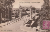
1932: Boyd Park
Eau Claire, Wisconsin, USA - Eau Claire River
| Bridgemeister ID: | 1803 (added 2005-05-18) |
| Year Completed: | 1932 |
| Name: | Boyd Park |
| Also Known As: | Uniroyal |
| Location: | Eau Claire, Wisconsin, USA |
| Crossing: | Eau Claire River |
| Use: | Footbridge |
| Status: | Removed (last checked: 2005) |
| Main Cables: | Wire (steel) |
| Main Span: | 1 |
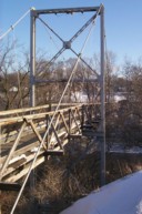
1932: Dawki
Dawki, Meghalaya, India - Dawki River
| Bridgemeister ID: | 3019 (added 2019-10-13) |
| Year Completed: | 1932 |
| Name: | Dawki |
| Location: | Dawki, Meghalaya, India |
| Crossing: | Dawki River |
| Coordinates: | 25.190051 N 92.018947 E |
| Maps: | Acme, GeoHack, Google, OpenStreetMap |
| Use: | Vehicular (one-lane) |
| Status: | In use |
| Main Cables: | Wire (steel) |
External Links:
1932: Dazhuoshui
Nan'ao Township, Yilan County and Xiulin Township, Hualien County, Taiwan - Heping River
| Bridgemeister ID: | 5915 (added 2021-05-23) |
| Year Completed: | 1932 |
| Name: | Dazhuoshui |
| Also Known As: | 大濁水橋 |
| Location: | Nan'ao Township, Yilan County and Xiulin Township, Hualien County, Taiwan |
| Crossing: | Heping River |
| Coordinates: | 24.323766 N 121.742706 E |
| Maps: | Acme, GeoHack, Google, OpenStreetMap |
| Use: | Vehicular |
| Status: | Removed |
| Main Cables: | Wire (steel) |
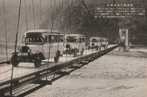
1932: Framnesbrua
Brumunddal, Ringsaker, Innlandet, Norway - Furnesfjorden
| Bridgemeister ID: | 3957 (added 2020-03-22) |
| Year Completed: | 1932 |
| Name: | Framnesbrua |
| Location: | Brumunddal, Ringsaker, Innlandet, Norway |
| Crossing: | Furnesfjorden |
| Coordinates: | 60.88195 N 10.89642 E |
| Maps: | Acme, GeoHack, Google, kart.1881.no, OpenStreetMap |
| Status: | Removed, 1989 |
| Suspended Spans: | 1 |
| Main Span: | 1 x 150 meters (492.1 feet) |
| Deck width: | 4.5 meters |
Notes:
- Deck largely damaged by storm while under construction
External Links:
- DigitaltMuseum - Framnesbrua i Bunnefjorden under bygging, skadet av sterk vind.
- DigitaltMuseum - Framnesbrua i Ringsaker.
- DigitaltMuseum - Framnesbrua under bygging, ødelagt av uvær. Veldre, Brumunddal.
- DigitaltMuseum - Framnesbrua, Brumunddal. Skade på brua under bygging.
- DigitaltMuseum - Framnesbrua, Brumunddal. Skader på brua under bygging før betongdekket er lagt.
- DigitaltMuseum - Framnesbrua, Kvarbergsvika, Nes.
- DigitaltMuseum - Framnesbrua, Ringsaker fra Veldresiden. Krøtter i vegen.
- DigitaltMuseum - Framnesbrua. Hengebru. Brumunddal-Nes over Mjøsa. Åpnet 1932.
- DigitaltMuseum - Skader på Framnesbrua under byggingen, stormkast før det ble lagt betongdekke. Ringsaker.
1932: Gennes
Gennes and Les Rosiers-sur-Loire, Maine-et-Loire, France - Loire River
| Bridgemeister ID: | 1173 (added 2004-01-23) |
| Year Completed: | 1932 |
| Name: | Gennes |
| Location: | Gennes and Les Rosiers-sur-Loire, Maine-et-Loire, France |
| Crossing: | Loire River |
| Coordinates: | 47.345895 N 0.230081 W |
| Maps: | Acme, GeoHack, Google, OpenStreetMap |
| Use: | Vehicular |
| Status: | Destroyed, 1940 |
Notes:
- Replaced 1842 Gennes - Gennes and Les Rosiers-sur-Loire, Maine-et-Loire, France.
- Connects to 1932 Les Rosiers-sur-Loire - Les Rosiers-sur-Loire and Gennes, Maine-et-Loire, France.
- Replaced by 1948 Gennes - Gennes and Les Rosiers-sur-Loire, Maine-et-Loire, France.
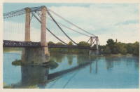
1932: Gué de Senac
Les Peintures and Chamadelle, Gironde, France - Dronne River
| Bridgemeister ID: | 7850 (added 2023-09-09) |
| Year Completed: | 1932 |
| Name: | Gué de Senac |
| Location: | Les Peintures and Chamadelle, Gironde, France |
| Crossing: | Dronne River |
| Coordinates: | 45.078922 N 0.087016 W |
| Maps: | Acme, GeoHack, Google, OpenStreetMap |
| Use: | Vehicular |
| Status: | Demolished, 2011 |
| Main Cables: | Wire (steel) |
| Suspended Spans: | 1 |
| Main Span: | 1 |
Notes:
External Links:
- Art-et-Histoire - Pont de Gué de Senac à Chamadelle - 1845
- Dans le rétro : le pont du Gué de Sénac sur la Dronne. Article about the suspension bridges at this location. Published March 8, 2022.
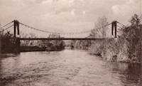
1932: Horse
Milford Sound vicinity, New Zealand - Cleddau River
| Bridgemeister ID: | 741 (added 2003-03-08) |
| Year Completed: | 1932 |
| Name: | Horse |
| Location: | Milford Sound vicinity, New Zealand |
| Crossing: | Cleddau River |
| Coordinates: | 44.703778 S 167.967861 E |
| Maps: | Acme, GeoHack, Google, OpenStreetMap |
| References: | GAP |
| Use: | Pack and Footbridge |
| Status: | In use (last checked: 2022) |
| Main Cables: | Wire (steel) |
| Suspended Spans: | 1 |
| Main Span: | 1 x 36.5 meters (119.8 feet) |
1932: Lacy's
Retaruke, New Zealand - Retaruke River
| Bridgemeister ID: | 740 (added 2003-03-08) |
| Year Completed: | 1932 |
| Name: | Lacy's |
| Location: | Retaruke, New Zealand |
| Crossing: | Retaruke River |
| Coordinates: | 39.108536 S 175.075048 E |
| Maps: | Acme, GeoHack, Google, OpenStreetMap |
| Principals: | Bill Baker |
| References: | GAP |
| Use: | Vehicular (one-lane) |
| Status: | In use (last checked: 2013) |
| Main Cables: | Wire (steel) |
| Suspended Spans: | 1 |
| Main Span: | 1 x 45.7 meters (149.9 feet) |
Notes:
- GAP: Damaged by flood, 1940.
- Replaced 1920 Lacy's - New Zealand.
External Links:
1932: Les Rosiers-sur-Loire
Les Rosiers-sur-Loire and Gennes, Maine-et-Loire, France - Loire River
| Bridgemeister ID: | 6763 (added 2021-10-25) |
| Year Completed: | 1932 |
| Name: | Les Rosiers-sur-Loire |
| Location: | Les Rosiers-sur-Loire and Gennes, Maine-et-Loire, France |
| Crossing: | Loire River |
| Coordinates: | 47.348253 N 0.227990 W |
| Maps: | Acme, GeoHack, Google, OpenStreetMap |
| Use: | Vehicular |
| Status: | Destroyed, 1940 |
| Main Cables: | Wire |
| Main Span: | 1 |
Notes:
- Replaced 1842 Les Rosiers-sur-Loire - Les Rosiers-sur-Loire and Gennes, Maine-et-Loire, France.
- Connects to 1932 Les Rosiers-sur-Loire - Les Rosiers-sur-Loire and Gennes, Maine-et-Loire, France.
- Replaced by 1948 Les Rosiers-sur-Loire - Les Rosiers-sur-Loire and Gennes, Maine-et-Loire, France.
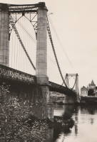
1932: Lewis River
Yale, Washington, USA - Lewis River
| Bridgemeister ID: | 176 (added before 2003) |
| Year Completed: | 1932 |
| Name: | Lewis River |
| Also Known As: | Yale |
| Location: | Yale, Washington, USA |
| Crossing: | Lewis River |
| Coordinates: | 45.96167 N 122.37167 W |
| Maps: | Acme, GeoHack, Google, OpenStreetMap |
| Principals: | Harold H. Gilbert, Gilpin Construction Co. |
| References: | AAJ, SPW, SSS |
| Use: | Vehicular (one-lane) |
| Status: | In use (last checked: 2005) |
| Main Cables: | Wire (steel) |
| Suspended Spans: | 1 |
| Main Span: | 1 x 91.4 meters (300 feet) |
| Deck width: | 17 feet |
Notes:
- Rebuilt 1957, 1958.
External Links:
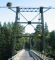
1932: Marmande
Marmande, Lot-et-Garonne, France - Garonne River
| Bridgemeister ID: | 1604 (added 2005-02-06) |
| Year Completed: | 1932 |
| Name: | Marmande |
| Also Known As: | Renaud Jean |
| Location: | Marmande, Lot-et-Garonne, France |
| Crossing: | Garonne River |
| Coordinates: | 44.498957 N 0.155951 E |
| Maps: | Acme, GeoHack, Google, OpenStreetMap |
| Use: | Vehicular (two-lane), with walkway |
| Status: | In use (last checked: 2020) |
| Main Cables: | Wire (steel) |
| Suspended Spans: | 1 |
Notes:
External Links:
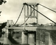
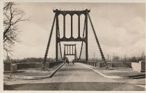
| Bridgemeister ID: | 4546 (added 2020-05-30) |
| Year Completed: | 1932 |
| Name: | Poujol |
| Location: | Le Poujol-sur-Orb, Lamalou-les-Bains vicinity, Hérault, France |
| Crossing: | Orb River |
| Coordinates: | 43.575381 N 3.063561 E |
| Maps: | Acme, GeoHack, Google, OpenStreetMap |
| Use: | Vehicular (one-lane) |
| Status: | In use (last checked: 2019) |
| Main Cables: | Wire (steel) |
| Suspended Spans: | 1 |
| Main Span: | 1 x 114.5 meters (375.7 feet) estimated |
External Links:
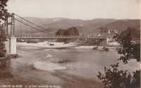
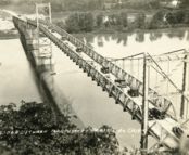
1932: Prairie du Chien
Praire du Chien, Wisconsin and Marquette, Iowa, USA - Mississippi River
| Bridgemeister ID: | 177 (added before 2003) |
| Year Completed: | 1932 |
| Name: | Prairie du Chien |
| Location: | Praire du Chien, Wisconsin and Marquette, Iowa, USA |
| Crossing: | Mississippi River |
| Coordinates: | 43.046 N 91.17 W |
| Maps: | Acme, GeoHack, Google, OpenStreetMap |
| Principals: | Austin Bridge Co. |
| References: | AAJ, AUB, BPL |
| Use: | Vehicular (two-lane) |
| Status: | Removed, 1974 |
| Main Cables: | Wire (steel) |
| Main Span: | 1 x 144.2 meters (473 feet) |
Notes:
- There were two back-to-back suspension bridges at this location.
- Connects to 1932 Prairie du Chien - Praire du Chien, Wisconsin and Marquette, Iowa, USA.
External Links:
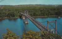
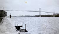
1932: Prairie du Chien
Praire du Chien, Wisconsin and Marquette, Iowa, USA - Mississippi River
| Bridgemeister ID: | 1256 (added before 2003) |
| Year Completed: | 1932 |
| Name: | Prairie du Chien |
| Location: | Praire du Chien, Wisconsin and Marquette, Iowa, USA |
| Crossing: | Mississippi River |
| Coordinates: | 43.05 N 91.162 W |
| Maps: | Acme, GeoHack, Google, OpenStreetMap |
| Principals: | Austin Bridge Co. |
| References: | AAJ, AUB, BPL |
| Use: | Vehicular (two-lane) |
| Status: | Removed, 1974 |
| Main Cables: | Wire (steel) |
| Main Span: | 1 x 144.2 meters (473 feet) |
Notes:
- There were two back-to-back suspension bridges at this location.
- Connects to 1932 Prairie du Chien - Praire du Chien, Wisconsin and Marquette, Iowa, USA.
External Links:


| Bridgemeister ID: | 4343 (added 2020-04-11) |
| Year Completed: | 1932 |
| Name: | Prestefossen |
| Location: | Valle, Agder, Norway |
| Crossing: | Otra |
| Coordinates: | 59.212189 N 7.529565 E |
| Maps: | Acme, GeoHack, Google, kart.1881.no, OpenStreetMap |
| Use: | Footbridge |
| Status: | Replaced, 2016 |
| Main Cables: | Wire |
Notes:
- Replaced by 2016 Prestefossen - Valle, Agder, Norway.
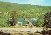
| Bridgemeister ID: | 8455 (added 2024-03-13) |
| Year Completed: | 1932 |
| Name: | Sultan Ismail |
| Also Known As: | Kuala Krai, Gertak Gantung Sungai Nal |
| Location: | Kuala Krai, Kelantan, Myanmar |
| Crossing: | Nal River |
| Coordinates: | 5.602694 N 102.191778 E |
| Maps: | Acme, GeoHack, Google, OpenStreetMap |
| Use: | Vehicular |
| Status: | Derelict (last checked: 2024) |
| Main Cables: | Wire (iron) |
| Suspended Spans: | 3 |
| Main Span: | 1 |
| Side Spans: | 2 |
Notes:
- A monument at the bridge states it was opened in April 1932. Most other sources state it was completed at some point in the 1920s.
External Links:
- Bernama - Over Century-Old British-Era Suspension Bridge on the Verge of Collapse. Article dated March 11, 2024. Concerns are mounting over the imminent collapse of the derelict bridge. It was bypassed in 1986.
- Wikipedia - Kuala Krai Bridge
1932: Villebrumier
Villebrumier, Tarn-et-Garonne, France - Tarn River
| Bridgemeister ID: | 1708 (added 2005-03-30) |
| Year Completed: | 1932 |
| Name: | Villebrumier |
| Location: | Villebrumier, Tarn-et-Garonne, France |
| Crossing: | Tarn River |
| Coordinates: | 43.903905 N 1.453091 E |
| Maps: | Acme, GeoHack, Google, OpenStreetMap |
| Use: | Vehicular (two-lane) |
| Status: | In use (last checked: 2019) |
| Main Cables: | Wire (steel) |
| Suspended Spans: | 1 |
Notes:
External Links:
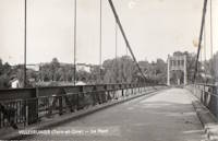
1932: Villemur-sur-Tarn
Villemur-sur-Tarn, Haute-Garonne, France - Tarn River
| Bridgemeister ID: | 1852 (added 2005-07-16) |
| Year Completed: | 1932 |
| Name: | Villemur-sur-Tarn |
| Location: | Villemur-sur-Tarn, Haute-Garonne, France |
| Crossing: | Tarn River |
| Coordinates: | 43.862459 N 1.505214 E |
| Maps: | Acme, GeoHack, Google, OpenStreetMap |
| Use: | Vehicular (two-lane), with walkway |
| Status: | In use (last checked: 2016) |
| Main Cables: | Wire (steel) |
| Suspended Spans: | 1 |
Notes:
External Links:
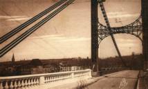
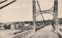
1932: Viterbe
Viterbe, Saint-Paul-Cap-de-Joux vicinity and Brazis, Tarn, France - Agout River
| Bridgemeister ID: | 2312 (added 2007-05-03) |
| Year Completed: | 1932 |
| Name: | Viterbe |
| Location: | Viterbe, Saint-Paul-Cap-de-Joux vicinity and Brazis, Tarn, France |
| Crossing: | Agout River |
| Coordinates: | 43.67635 N 1.93136 E |
| Maps: | Acme, GeoHack, Google, OpenStreetMap |
| Use: | Vehicular (one-lane) |
| Status: | In use (last checked: 2019) |
| Suspended Spans: | 1 |
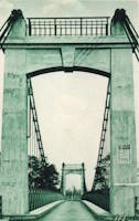
| Bridgemeister ID: | 3904 (added 2020-03-14) |
| Year Completed: | 1932 |
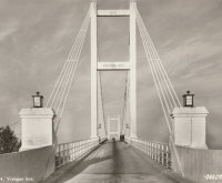
| Name: | Vrengen |
| Location: | Kjøpmannskjær, Nøtterøy and Tjøme, Færder, Vestfold og Telemark, Norway |
| Crossing: | Vrengen |
| Coordinates: | 59.16666 N 10.38559 E |
| Maps: | Acme, GeoHack, Google, kart.1881.no, OpenStreetMap |
| Use: | Vehicular |
| Status: | Removed, 1983 |
| Main Cables: | Wire (steel) |
| Main Span: | 1 x 162 meters (531.5 feet) estimated |
Notes:
- Bypassed, 1981. Removed, 1983.
External Links:
- DigitaltMuseum - Vrengen bru Vestfold 1932
- DigitaltMuseum - Vrengen bru Vestfold åpnet 1932
- DigitaltMuseum - Vrengen bru Vestfold åpnet 1932
1933: (footbridge)
Buhølen, Lindesnes, Agder, Norway - Skarpesvingen
| Bridgemeister ID: | 4392 (added 2020-04-18) |
| Year Completed: | 1933 |
| Name: | (footbridge) |
| Location: | Buhølen, Lindesnes, Agder, Norway |
| Crossing: | Skarpesvingen |
| Coordinates: | 58.118716 N 7.341573 E |
| Maps: | Acme, GeoHack, Google, kart.1881.no, OpenStreetMap |
| Use: | Footbridge |
| Status: | Removed |
| Main Cables: | Wire (steel) |
| Suspended Spans: | 1 |
| Main Span: | 1 x 40 meters (131.2 feet) estimated |
Notes:
- Likely completed in 1933 or soon after. The bridge was built to provide access to a school built in 1933.
- Based on historic aerial images, removed at some point in time frame 1968-2004.
| Bridgemeister ID: | 178 (added before 2003) |
| Year Completed: | 1933 |
| Name: | (footbridge) |
| Location: | Palatka, Florida, USA |
| At or Near Feature: | Ravine Gardens State Park |
| Coordinates: | 29.63481 N 81.64594 W |
| Maps: | Acme, GeoHack, Google, OpenStreetMap |
| Use: | Footbridge |
| Status: | In use (last checked: 2021) |
| Main Cables: | Wire (steel) |
| Suspended Spans: | 1 |
| Main Span: | 1 |
Notes:
- Near 1933 (footbridge) - Palatka, Florida, USA. There are two nearby footbridges in this park. It is not clear if both were constructed in 1933.
| Bridgemeister ID: | 2425 (added before 2003) |
| Year Completed: | 1933 |
| Name: | (footbridge) |
| Location: | Palatka, Florida, USA |
| At or Near Feature: | Ravine Gardens State Park |
| Coordinates: | 29.63343 N 81.64323 W |
| Maps: | Acme, GeoHack, Google, OpenStreetMap |
| Use: | Footbridge |
| Status: | In use (last checked: 2018) |
| Main Cables: | Wire (steel) |
| Suspended Spans: | 1 |
Notes:
- Near 1933 (footbridge) - Palatka, Florida, USA. There are two nearby footbridges in this park. It is not clear if both were constructed in 1933.
1933: (suspension bridge)
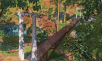
Carluke vicinity, New Zealand - Tunakino River
| Bridgemeister ID: | 746 (added 2003-03-08) |
| Year Completed: | 1933 |
| Name: | (suspension bridge) |
| Location: | Carluke vicinity, New Zealand |
| Crossing: | Tunakino River |
| References: | GAP |
Notes:
- Distinct from other 1933 bridge in same vicinity.
1933: (suspension bridge)
Carluke vicinity, New Zealand - Tunakino River
| Bridgemeister ID: | 747 (added 2003-03-08) |
| Year Completed: | 1933 |
| Name: | (suspension bridge) |
| Location: | Carluke vicinity, New Zealand |
| Crossing: | Tunakino River |
| References: | GAP |
1933: (suspension bridge)
Happy Camp vicinity, California, USA - Klamath River
| Bridgemeister ID: | 1011 (added 2003-11-21) |
| Year Completed: | 1933 |
| Name: | (suspension bridge) |
| Location: | Happy Camp vicinity, California, USA |
| Crossing: | Klamath River |
| Principals: | WPA |
| References: | AAJ |
| Use: | Vehicular (one-lane) |
| Status: | Dismantled |
| Main Cables: | Wire (steel) |
| Suspended Spans: | 1 |
| Main Span: | 1 x 91.4 meters (300 feet) |
Notes:
- Moved to Cassidy - Sierra National Forest, California, USA. The bridge was disassembled, shortened, and relocated in the 1950's to the Ansel Adams Wilderness, Minarets Ranger District, Sierra National Forest, California as the "Cassidy" suspension bridge.
1933: (suspension bridge)
S.J. Butt's property, Marlborough, New Zealand - Rai River
| Bridgemeister ID: | 749 (added 2003-03-08) |
| Year Completed: | 1933 |
| Name: | (suspension bridge) |
| Location: | S.J. Butt's property, Marlborough, New Zealand |
| Crossing: | Rai River |
| References: | GAP |
Notes:
- GAP: completed circa 1933.
1933: (suspension bridge)
Totoro Road, New Zealand - Mokau River
| Bridgemeister ID: | 743 (added 2003-03-08) |
| Year Completed: | 1933 |
| Name: | (suspension bridge) |
| Location: | Totoro Road, New Zealand |
| Crossing: | Mokau River |
| References: | GAP |
Notes:
- GAP: Replaced.
1933: Andervag
Engenes vicinity, Ibestad, Troms og Finnmark, Norway
| Bridgemeister ID: | 2737 (added 2019-06-23) |
| Year Completed: | 1933 |
| Name: | Andervag |
| Location: | Engenes vicinity, Ibestad, Troms og Finnmark, Norway |
| Coordinates: | 68.913494 N 17.188251 E |
| Maps: | Acme, GeoHack, Google, kart.1881.no, OpenStreetMap |
| Use: | Vehicular (one-lane) |
| Status: | Restricted to foot traffic (last checked: 2010) |
| Main Cables: | Wire (steel) |
| Suspended Spans: | 1 |
| Bridgemeister ID: | 7086 (added 2022-05-29) |
| Year Completed: | 1933 |
| Name: | Colonial |
| Location: | Guamo, Tolima, Colombia |
| Crossing: | Rio Luisa |
| Coordinates: | 4.036234 N 74.969426 W |
| Maps: | Acme, GeoHack, Google, OpenStreetMap |
| Status: | In use (last checked: 2022) |
| Main Cables: | Wire (steel) |
| Suspended Spans: | 1 |
| Main Span: | 1 |
External Links:
- Google Maps. Photo of the bridge, November 2021.
- Puente colonial del Guamo, Tolima: un mito en la campaña de Simón Bolívar. States the bridge was built in 1933 and rebuilt after a 1942 collapse.
- YouTube - El Puente de Tabla en el Guamo, patrimonio histórico del Tolima | RTVC Noticias. Television news story about the bridge, posted November 2021.
1933: Dalton's
New Zealand - Pelorus River
| Bridgemeister ID: | 744 (added 2003-03-08) |
| Year Completed: | 1933 |
| Name: | Dalton's |
| Location: | New Zealand |
| Crossing: | Pelorus River |
| References: | GAP |
| Use: | Footbridge |
1933: Denham
Garraway Stream, Mahdia vicinity, Guyana - Potaro River
| Bridgemeister ID: | 2979 (added 2019-10-12) |
| Year Completed: | 1933 |
| Name: | Denham |
| Location: | Garraway Stream, Mahdia vicinity, Guyana |
| Crossing: | Potaro River |
| Coordinates: | 5.380437 N 59.120818 W |
| Maps: | Acme, GeoHack, Google, OpenStreetMap |
| Principals: | John Aldi |
| Use: | Vehicular (one-lane) |
| Status: | In use (last checked: 2020) |
| Main Cables: | Wire (steel) |
| Suspended Spans: | 1 |
Notes:
- Coordinates are suspected location of this bridge, but not confirmed.
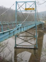
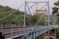
1933: Green's Mill
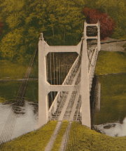
Camden County, Missouri, USA - Little Niangua River
| Bridgemeister ID: | 179 (added before 2003) |
| Year Completed: | 1933 |
| Name: | Green's Mill |
| Also Known As: | Little Niangua, J Road |
| Location: | Camden County, Missouri, USA |
| Crossing: | Little Niangua River |
| Coordinates: | 38.065326 N 92.909309 W |
| Maps: | Acme, GeoHack, Google, OpenStreetMap |
| Principals: | Howard Mullins, Scully Steel Co., American Steel & Wire Co., Clinton Bridge Works |
| References: | AAJ, SSS, USS |
| Use: | Vehicular (two-lane, heavy vehicles) |
| Status: | Bypassed, 2020 (last checked: 2023) |
| Main Cables: | Wire (steel) |
| Suspended Spans: | 3 |
| Main Span: | 1 x 68.6 meters (225 feet) |
| Side Spans: | 1 x 34.3 meters (112.5 feet), 1 x 34.3 meters (112.4 feet) |
| Deck width: | 20 feet |
| Characteristics: | Self-anchored |
Notes:
- Self-anchored.
- 2007, October: Closed for a few weeks for emergency repairs. According to an October 4, 2007 article in the Lake Sun Leader (Missouri): "a routine inspection revealed a problem in the substructure... too much movement was detected at a location underneath the north side of the bridge." Other sources mentioned a faulty "pin."
- 2018: Missouri Department of Transportation (MoDOT) plans to replace the bridge and is seeking groups to take ownership of the bridge and possibly relocate it.
- 2020: A new bridge is completed, bypassing the suspension bridge.
- 2023, March: Ownership transferred from Missouri Department of Transportation to Green's Mill Historic Bridge, Inc. to preserve the since bypassed bridge.
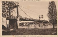
1933: Lamagistère
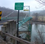
Lamagistère, Tarn-et-Garonne, France - Garonne River
| Bridgemeister ID: | 2963 (added 2019-10-06) |
| Year Completed: | 1933 |
| Name: | Lamagistère |
| Location: | Lamagistère, Tarn-et-Garonne, France |
| Crossing: | Garonne River |
| Coordinates: | 44.123552 N 0.819466 E |
| Maps: | Acme, GeoHack, Google, OpenStreetMap |
| Use: | Vehicular (two-lane) |
| Status: | In use (last checked: 2019) |
| Main Cables: | Wire (steel) |
| Suspended Spans: | 2 |
| Main Spans: | 2 |
Notes:
External Links:
| Bridgemeister ID: | 3935 (added 2020-03-20) |
| Year Completed: | 1933 |
| Name: | Moan |
| Location: | Alvdal, Innlandet, Norway |
| Crossing: | Folla |
| Coordinates: | 62.11163 N 10.61047 E |
| Maps: | Acme, GeoHack, Google, kart.1881.no, OpenStreetMap |
| Use: | Vehicular (one-lane) |
| Status: | Removed, 1983 |
| Main Cables: | Wire (steel) |
| Suspended Spans: | 1 |
| Main Span: | 1 x 93 meters (305.1 feet) estimated |
External Links:
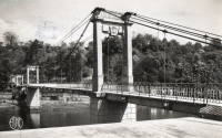
1933: Mont-Olympe
Charleville-Mézières, Ardennes, France - Meuse River
| Bridgemeister ID: | 1052 (added 2003-12-08) |
| Year Completed: | 1933 |
| Name: | Mont-Olympe |
| Location: | Charleville-Mézières, Ardennes, France |
| Crossing: | Meuse River |
| Coordinates: | 49.776650 N 4.722679 E |
| Maps: | Acme, GeoHack, Google, OpenStreetMap |
| Use: | Footbridge |
| Status: | In use (last checked: 2019) |
| Main Cables: | Wire |
| Suspended Spans: | 3 |
| Main Spans: | 2 |
| Side Span: | 1 |
Notes:
- Near former location of Charleville - Charleville-Mézières, Ardennes, France.
External Links:
1933: Pertuiset
Pertuiset, Firminy vicinity, Loire, France - Loire River
| Bridgemeister ID: | 1166 (added 2004-01-19) |
| Year Completed: | 1933 |
| Name: | Pertuiset |
| Location: | Pertuiset, Firminy vicinity, Loire, France |
| Crossing: | Loire River |
| Coordinates: | 45.408785 N 4.248029 E |
| Maps: | Acme, GeoHack, Google, OpenStreetMap |
| Use: | Vehicular (one-lane) |
| Status: | Demolished, 1990 |
| Main Cables: | Wire (steel) |
| Suspended Spans: | 1 |
Notes:
- Bypassed by a cable-stayed bridge, 1989.
- Replaced 1842 Pertuiset - Pertuiset, Firminy vicinity, Loire, France.
External Links:
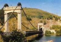
1933: Rutland's
New Zealand - Pelorus River
| Bridgemeister ID: | 745 (added 2003-03-08) |
| Year Completed: | 1933 |
| Name: | Rutland's |
| Location: | New Zealand |
| Crossing: | Pelorus River |
| References: | GAP |
| Use: | Footbridge |
1933: Sablons
Sablons, Isère and Serrières, Ardèche, France - Rhône River
| Bridgemeister ID: | 891 (added 2003-09-06) |
| Year Completed: | 1933 |
| Name: | Sablons |
| Location: | Sablons, Isère and Serrières, Ardèche, France |
| Crossing: | Rhône River |
| Status: | Destroyed, 1944 |
Notes:
- Replaced 1828 Sablons - Sablons, Isère and Serrières, Ardèche, France.
- Replaced by 1951 Sablons - Sablons, Isère and Serrières, Ardèche, France.
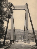
1933: San Rafael
Mao, Dominican Republic - Rio Yakue Del Norte
| Bridgemeister ID: | 447 (added before 2003) |
| Year Completed: | 1933 |
| Name: | San Rafael |
| Location: | Mao, Dominican Republic |
| Crossing: | Rio Yakue Del Norte |
| Principals: | John A. Roebling's Sons Co. |
| References: | AAJ, SJR, SSS |
| Use: | Vehicular (two-lane, heavy vehicles) |
| Main Cables: | Wire (steel) |
| Suspended Spans: | 1 |
| Main Span: | 1 x 137.6 meters (451.5 feet) |
| Deck width: | 18 feet |
1933: Sims
Sims, California, USA - Sacramento River
| Bridgemeister ID: | 650 (added 2003-02-22) |
| Year Completed: | 1933 |
| Name: | Sims |
| Also Known As: | CCC |
| Location: | Sims, California, USA |
| Crossing: | Sacramento River |
| At or Near Feature: | Sims Camp |
| Coordinates: | 41.063433 N 122.360067 W |
| Maps: | Acme, GeoHack, Google, OpenStreetMap |
| Principals: | Raymond Huber, Civilian Conservation Corps |
| References: | AAJ |
| Use: | Vehicular (one-lane) |
| Status: | Restricted to foot traffic (last checked: 2021) |
| Main Cables: | Wire (steel) |
| Suspended Spans: | 1 |
| Main Span: | 1 x 48.8 meters (160 feet) |
Notes:
- CCC is "Civilian Conservation Corps".
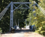
1933: Veurey
Veurey-Voroize, Isère, France - Isère River
| Bridgemeister ID: | 4881 (added 2020-07-18) |
| Year Completed: | 1933 |
| Name: | Veurey |
| Location: | Veurey-Voroize, Isère, France |
| Crossing: | Isère River |
| References: | AAJ |
| Use: | Vehicular |
| Status: | Removed |
| Main Cables: | Wire (steel) |
Notes:
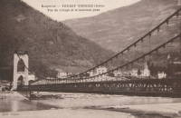
1934: (footbridge)
Green Valley vicinity, California, USA - Bouquet Reservoir
| Bridgemeister ID: | 1890 (added 2005-10-01) |
| Year Completed: | 1934 |
| Name: | (footbridge) |
| Location: | Green Valley vicinity, California, USA |
| Crossing: | Bouquet Reservoir |
| References: | CE193408 |
| Use: | Footbridge |
| Status: | Removed |
| Main Cables: | Wire (steel) |
| Main Span: | 1 x 61 meters (200 feet) |
Notes:
- CE193408: "A bridge 276 ft long, consisting of a 200-ft suspension span and two equal shore spans, connects the [gate control] tower with the shore. The suspended span is supported by two prestressed cable strands and by arc-welded structural steel stiffening trusses." Article includes photo of the bridge and tower.
- Access bridge for the Bouquet Reservoir gate control tower. Likely completed 1933 or 1934.
1934: (footbridge)
Grey Valley, New Zealand - Slaty Creek
| Bridgemeister ID: | 750 (added 2003-03-08) |
| Year Completed: | 1934 |
| Name: | (footbridge) |
| Location: | Grey Valley, New Zealand |
| Crossing: | Slaty Creek |
| Use: | Footbridge |
1934: (footbridge)
Ilkley, England, United Kingdom - River Wharfe
| Bridgemeister ID: | 1261 (added 2004-03-13) |
| Year Completed: | 1934 |
| Name: | (footbridge) |
| Location: | Ilkley, England, United Kingdom |
| Crossing: | River Wharfe |
| Coordinates: | 53.93241 N 1.81483 W |
| Maps: | Acme, GeoHack, Google, OpenStreetMap |
| Principals: | David Rowell & Co. |
| Use: | Footbridge |
| Status: | In use (last checked: 2022) |
| Main Cables: | Wire (steel) |
| Suspended Spans: | 1 |
Notes:
- Refurbished, 2001.
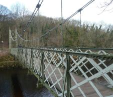
1934: (footbridge)
Rollag, Viken, Norway - Numedalslågen
| Bridgemeister ID: | 4099 (added 2020-04-05) |
| Year Completed: | 1934 |
| Name: | (footbridge) |
| Location: | Rollag, Viken, Norway |
| Crossing: | Numedalslågen |
| Coordinates: | 60.017909 N 9.276293 E |
| Maps: | Acme, GeoHack, Google, kart.1881.no, OpenStreetMap |
| Use: | Footbridge |
| Status: | In use (last checked: 2019) |
| Main Cables: | Wire (steel) |
| Suspended Spans: | 1 |
| Main Span: | 1 x 88 meters (288.7 feet) estimated |
| Deck width: | 1.5 meters |
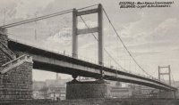
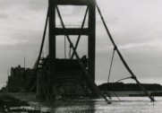
1934: King Alexander I
Belgrade, Serbia - Sava River
| Bridgemeister ID: | 957 (added 2003-11-01) |
| Year Completed: | 1934 |
| Name: | King Alexander I |
| Also Known As: | King Aleksandar |
| Location: | Belgrade, Serbia |
| Crossing: | Sava River |
| Coordinates: | 44.814946 N 20.448665 E |
| Maps: | Acme, GeoHack, Google, OpenStreetMap |
| Principals: | Société de Construction des Batignolles |
| References: | AAJ |
| Use: | Vehicular, with walkway |
| Status: | Destroyed, April 12, 1941 |
| Main Cables: | Wire (steel) |
| Suspended Spans: | 1 |
| Main Span: | 1 x 260.9 meters (856 feet) |
| Deck width: | 72 feet |
| Characteristics: | Rocker towers |
Notes:
- 1941, April 12: Partially demolished in an attempt to slow advancing German troops.
- 1944, April 16: Remainder of the bridge is demolished.
External Links:
1934: Leppiniemi
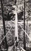
Leppiniemi, Finland
| Bridgemeister ID: | 8080 (added 2023-12-24) |
| Year Completed: | 1934 |
| Name: | Leppiniemi |
| Location: | Leppiniemi, Finland |
| Use: | Footbridge |
| Status: | Demolished, 1947 |
| Main Cables: | Wire (steel) |
| Suspended Spans: | 1 |
External Links:
- WikiMedia Commons - Category:Leppiniemi Bridge. Several images of the bridge.
1934: Rio Higuamo
San Pedro de Macoris vicinity, Dominican Republic - Rio Higuamo
| Bridgemeister ID: | 448 (added before 2003) |
| Year Completed: | 1934 |
| Name: | Rio Higuamo |
| Also Known As: | Ramfis |
| Location: | San Pedro de Macoris vicinity, Dominican Republic |
| Crossing: | Rio Higuamo |
| Coordinates: | 18.503230 N 69.336561 W |
| Maps: | Acme, GeoHack, Google, OpenStreetMap |
| Principals: | John A. Roebling's Sons Co. |
| References: | AAJ, SSS |
| Use: | Vehicular |
| Status: | In use (last checked: 2023) |
| Main Cables: | Wire (steel) |
| Suspended Spans: | 3 |
| Main Span: | 1 x 168.9 meters (554 feet) |
| Side Spans: | 2 x 56.7 meters (186 feet) |
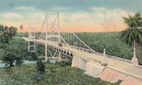
1934: Rugslandsbrua
Svaland, Birkenes, Agder, Norway - Tavdalselva
| Bridgemeister ID: | 4315 (added 2020-04-10) |
| Year Completed: | 1934 |
| Name: | Rugslandsbrua |
| Location: | Svaland, Birkenes, Agder, Norway |
| Crossing: | Tavdalselva |
| Coordinates: | 58.289171 N 8.183323 E |
| Maps: | Acme, GeoHack, Google, kart.1881.no, OpenStreetMap |
| Use: | Vehicular (one-lane) |
| Status: | In use (last checked: 2019) |
| Main Cables: | Wire (steel) |
| Suspended Spans: | 1 |
| Main Span: | 1 x 70 meters (229.7 feet) estimated |
| Deck width: | ~2 meters |
1934: Sifton Boulevard
Calgary, Alberta, Canada - Elbow River
| Bridgemeister ID: | 802 (added 2003-03-29) |
| Year Completed: | 1934 |
| Name: | Sifton Boulevard |
| Also Known As: | Riverdale Avenue, Sifton-Riverdale |
| Location: | Calgary, Alberta, Canada |
| Crossing: | Elbow River |
| Coordinates: | 51.019060 N 114.083178 W |
| Maps: | Acme, GeoHack, Google, OpenStreetMap |
| Use: | Footbridge |
| Status: | Wrecked, 2013 |
| Main Cables: | Wire |
| Suspended Spans: | 1 |
Notes:
- Footbridge with green steel towers. Distinct from the other Elbow River, Calgary footbridges in the inventory, but appeared very similar to the Sandy Beach bridge.
- Wrecked by flood, 2013.
- Similar to 1959 Sandy Beach (River Park, Riverpark) - Calgary, Alberta, Canada.
- Replaced by 2014 Riverdale Avenue - Calgary, Alberta, Canada.
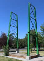
1934: Stewart Park I
Ithaca, New York, USA - Fall Creek arm
| Bridgemeister ID: | 839 (added 2003-06-28) |
| Year Completed: | 1934 |
| Name: | Stewart Park I |
| Location: | Ithaca, New York, USA |
| Crossing: | Fall Creek arm |
| At or Near Feature: | Stewart Park |
| Coordinates: | 42.458961 N 76.505590 W |
| Maps: | Acme, GeoHack, Google, OpenStreetMap |
| Principals: | Civil Works Administration |
| References: | AAJ |
| Use: | Footbridge |
| Status: | In use (last checked: 2014) |
| Main Cables: | Wire (steel) |
| Suspended Spans: | 1 |
| Main Span: | 1 x 25 meters (82 feet) estimated |
Notes:
- There are two suspension footbridges at this park. This one crosses a short run off of Fall Creek just before it enters Cayuga Lake. The other crosses Fall Creek.
- Near 1934 Stewart Park II - Ithaca, New York, USA.
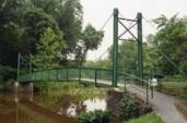
1934: Stewart Park II
Ithaca, New York, USA - Fall Creek
| Bridgemeister ID: | 840 (added 2003-06-28) |
| Year Completed: | 1934 |
| Name: | Stewart Park II |
| Location: | Ithaca, New York, USA |
| Crossing: | Fall Creek |
| At or Near Feature: | Stewart Park |
| Coordinates: | 42.458281 N 76.505359 W |
| Maps: | Acme, GeoHack, Google, OpenStreetMap |
| Principals: | Civil Works Administration |
| References: | AAJ |
| Use: | Footbridge |
| Status: | In use (last checked: 2014) |
| Main Cables: | Wire (steel) |
| Suspended Spans: | 1 |
| Main Span: | 1 x 33.8 meters (111 feet) estimated |
Notes:
- There are two suspension footbridges at this park.
- Near 1934 Stewart Park I - Ithaca, New York, USA.
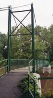
1934: Tonnay-Charente
Tonnay-Charente, Charente-Maritime, France - Charente River
| Bridgemeister ID: | 7338 (added 2022-09-04) |
| Year Completed: | 1934 |
| Name: | Tonnay-Charente |
| Location: | Tonnay-Charente, Charente-Maritime, France |
| Crossing: | Charente River |
| Coordinates: | 45.939992 N 0.886099 W |
| Maps: | Acme, GeoHack, Google, OpenStreetMap |
| Use: | Vehicular |
| Status: | Restricted to foot traffic |
| Main Cables: | Wire (steel) |
| Main Span: | 1 x 90 meters (295.3 feet) |
| Side Spans: | 2 |
Notes:
External Links:
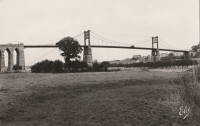
1935: (suspension bridge)
Hector vicinity, Stockton, West Coast, New Zealand - Ngakawau River
| Bridgemeister ID: | 7614 (added 2023-05-26) |
| Year Completed: | 1935 |
| Name: | (suspension bridge) |
| Location: | Hector vicinity, Stockton, West Coast, New Zealand |
| Crossing: | Ngakawau River |
| At or Near Feature: | Mangatini Falls |
| Coordinates: | 41.607568 S 171.912836 E |
| Maps: | Acme, GeoHack, Google, OpenStreetMap |
| Use: | Rail |
| Status: | Removed, c. 1981 |
| Main Cables: | Wire |
| Suspended Spans: | 1 |
Notes:
- Appears to have carried coal cars from nearby coal mine. May have replaced an earlier suspension bridge.
- Later at same location (footbridge) - Hector vicinity, Stockton, West Coast, New Zealand.
External Links:
1935: Capitan Usterez
Villamontes, Tarija, Bolivia - Rio Pilcomayo
| Bridgemeister ID: | 8429 (added 2024-03-09) |
| Year Completed: | 1935 |
| Name: | Capitan Usterez |
| Also Known As: | Usteres |
| Location: | Villamontes, Tarija, Bolivia |
| Crossing: | Rio Pilcomayo |
| Coordinates: | 21.258778 S 63.511528 W |
| Maps: | Acme, GeoHack, Google, OpenStreetMap |
| Use: | Vehicular |
| Status: | Removed |
| Main Cables: | Wire (steel) |
| Main Span: | 1 |
External Links:
- Facebook - Puente Capitan Usterez, Pilcomayo Villamontes, chaco tarijeño. Image and history of the bridge. Posted May 2, 2018.
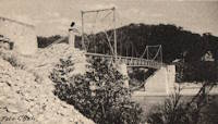
1935: Chaumont-sur-Loire
Chaumont-sur-Loire and Onzain, Loir-et-Cher, France - Loire River
| Bridgemeister ID: | 6719 (added 2021-10-16) |
| Year Completed: | 1935 |
| Name: | Chaumont-sur-Loire |
| Location: | Chaumont-sur-Loire and Onzain, Loir-et-Cher, France |
| Crossing: | Loire River |
| Use: | Vehicular |
| Status: | Destroyed, 1940 |
| Main Cables: | Wire (steel) |
| Main Spans: | 6 |
Notes:
External Links:
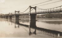
1935: Châteauneuf-sur-Loire
Châteauneuf-sur-Loire, Loiret, France - Loire River
| Bridgemeister ID: | 6790 (added 2021-10-30) |
| Year Completed: | 1935 |
| Name: | Châteauneuf-sur-Loire |
| Location: | Châteauneuf-sur-Loire, Loiret, France |
| Crossing: | Loire River |
| Coordinates: | 47.858608 N 2.223392 E |
| Maps: | Acme, GeoHack, Google, OpenStreetMap |
| Use: | Vehicular |
| Status: | Destroyed, June 17, 1940 |
| Main Cables: | Wire (steel) |
| Suspended Spans: | 5 |
| Main Spans: | 5 |
Notes:
- 1940, June 17: Destroyed to slow advancing German troops.
- Replaced 1841 Châteauneuf-sur-Loire - Châteauneuf-sur-Loire, Loiret, France.
- Replaced by 1946 Châteauneuf-sur-Loire - Châteauneuf-sur-Loire, Loiret, France.
External Links:
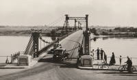
1935: Condrieu
Condrieu, Rhône and Les Roches-de-Condrieu, Isère, France - Rhône River
| Bridgemeister ID: | 1494 (added 2004-09-19) |
| Year Completed: | 1935 |
| Name: | Condrieu |
| Location: | Condrieu, Rhône and Les Roches-de-Condrieu, Isère, France |
| Crossing: | Rhône River |
| Coordinates: | 45.45655 N 4.768722 E |
| Maps: | Acme, GeoHack, Google, OpenStreetMap |
| References: | AAJ |
| Use: | Vehicular (two-lane), with walkway |
| Status: | Destroyed, June 1940 |
| Main Cables: | Wire (steel) |
| Suspended Spans: | 2 |
| Main Spans: | 2 |
Notes:
- Replaced 1831 Condrieu - Condrieu, Rhône and Les Roches-de-Condrieu, Isère, France.
- Replaced by Condrieu - Condrieu, Rhône and Les Roches-de-Condrieu, Isère, France.
External Links:
- Pont de Condrieu - Wikipedia
- Pont entre Condrieu et les Roches detruit le 20 juin 1940 - Wikimedia. Image of the destroyed bridge.
- Structurae - Structure ID 20013233
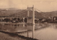
1935: Devèze
Thérondels vicinity, Aveyron and Paulhenc, Cantal, France - Lac de Sarrans
| Bridgemeister ID: | 2321 (added 2007-05-05) |
| Year Completed: | 1935 |
| Name: | Devèze |
| Also Known As: | Laussac |
| Location: | Thérondels vicinity, Aveyron and Paulhenc, Cantal, France |
| Crossing: | Lac de Sarrans |
| At or Near Feature: | Presqu'île De Laussac |
| Coordinates: | 44.861586 N 2.769710 E |
| Maps: | Acme, GeoHack, Google, OpenStreetMap |
| Use: | Vehicular (one-lane) |
| Status: | In use (last checked: 2020) |
| Main Cables: | Wire (steel) |
| Suspended Spans: | 1 |
Notes:
External Links:
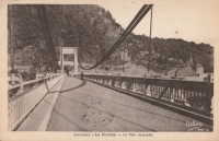
1935: Gaol Ferry
Bristol, England, United Kingdom - River Avon-New Cut
| Bridgemeister ID: | 1917 (added 2005-10-09) |
| Year Completed: | 1935 |
| Name: | Gaol Ferry |
| Also Known As: | Southville, St. Paul's, Coronation Road |
| Location: | Bristol, England, United Kingdom |
| Crossing: | River Avon-New Cut |
| Coordinates: | 51.445871 N 2.599464 W |
| Maps: | Acme, GeoHack, Google, OpenStreetMap |
| Principals: | David Rowell & Co. |
| Use: | Footbridge |
| Status: | Closed, August 2022 (last checked: August 2023) |
| Main Cables: | Wire (steel) |
| Suspended Spans: | 1 |
Notes:
- 2023, September: The bridge is scheduled to reopen following repairs.
Annotated Citations:
- Cork, Tristan. "Key footbridge connecting South Bristol to city centre to close for months." Bristol Post, 9 Dec. 2021, https://www.bristolpost.co.uk/news/bristol-news/key-footbridge-connecting-south-bristol-6326291.
Bridge is undergoing some repairs in late December 2021, but is still open. Expected to be closed January-March 2022 for more extensive repairs.
- Woolerton, Betty. "Gaol Ferry Bridge likely to be closed for another three months." Bristol 24/7, 24 Feb. 2023, https://www.bristol247.com/news-and-features/news/gaol-ferry-bridge-likely-to-be-closed-for-another-three-months/.
"A discovery of 'paper thin' steel work on Gaol Ferry Bridge has been cited as the reason for the extension of its closure by an unprecedented extra three months… Now, the council’s cabinet member for transport has apologised after contractors Griffiths have found 'the bridge is in a worse condition than we had thought.'"
External Links:
- Date for Gaol Ferry bridge closure in Bristol announced - BBC News. The bridge will be closed for 6-9 months from August 2022 for restoration.
- Structurae - Structure ID 20082369
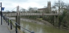
| Bridgemeister ID: | 3789 (added 2020-02-29) |
| Year Completed: | 1935 |
| Name: | Gjølme |
| Location: | Orkanger, Orkland, Trøndelag, Norway |
| Crossing: | Orkla |
| Coordinates: | 63.30211 N 9.83417 E |
| Maps: | Acme, GeoHack, Google, kart.1881.no, OpenStreetMap |
| Use: | Vehicular (one-lane) |
| Status: | Restricted to foot traffic (last checked: 2019) |
| Main Cables: | Wire (steel) |
| Suspended Spans: | 1 |
| Main Span: | 1 x 61 meters (200.1 feet) estimated |
1935: Goyt Valley
Buxton, England, United Kingdom - River Goyt
| Bridgemeister ID: | 520 (added before 2003) |
| Year Completed: | 1935 |
| Name: | Goyt Valley |
| Also Known As: | Buxton |
| Location: | Buxton, England, United Kingdom |
| Crossing: | River Goyt |
| References: | NTB |
| Use: | Footbridge |
| Status: | Removed, 1960s |
| Main Cables: | Wire |
| Suspended Spans: | 1 |
Notes:
- Dismantled during construction of the Errwood Reservoir.
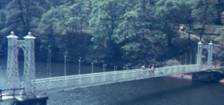
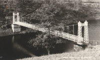
1935: Grand Coulee Dam
Grand Coulee, Washington, USA - Columbia River
| Bridgemeister ID: | 3157 (added 2019-11-03) |
| Year Completed: | 1935 |
| Name: | Grand Coulee Dam |
| Location: | Grand Coulee, Washington, USA |
| Crossing: | Columbia River |
| Use: | Conveyor |
| Status: | Removed |
| Main Cables: | Wire (steel) |
| Main Span: | 1 x 438 meters (1,437 feet) |
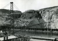
1935: Granite Falls
Granite Falls, Minnesota, USA - Minnesota River
| Bridgemeister ID: | 255 (added before 2003) |
| Year Completed: | 1935 |
| Name: | Granite Falls |
| Location: | Granite Falls, Minnesota, USA |
| Crossing: | Minnesota River |
| Coordinates: | 44.810108 N 95.537316 W |
| Maps: | Acme, GeoHack, Google, OpenStreetMap |
| Principals: | Minneapolis Bridge Company |
| References: | WCT20051125 |
| Use: | Footbridge |
| Status: | In use (last checked: 2019) |
| Main Cables: | Wire (steel) |
| Suspended Spans: | 3 |
| Main Span: | 1 |
| Side Spans: | 2 |
Notes:
- Damaged by floods, 1997 and 2001. Refurbished, 2014-2015.
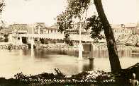
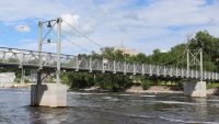
1935: Iowa-Illinois Memorial
Bettendorf, Iowa and Moline, Illinois, USA - Mississippi River
| Bridgemeister ID: | 180 (added before 2003) |
| Year Completed: | 1935 |
| Name: | Iowa-Illinois Memorial |
| Also Known As: | Interstate 74 Bridge, I-74 Bridge |
| Location: | Bettendorf, Iowa and Moline, Illinois, USA |
| Crossing: | Mississippi River |
| Coordinates: | 41.520264 N 90.513034 W |
| Maps: | Acme, GeoHack, Google, OpenStreetMap |
| Principals: | Modjeski, Masters, and Chase |
| References: | AAJ, CMR |
| Use: | Vehicular, with walkway |
| Status: | Bypassed, 2020 (last checked: 2022) |
| Main Cables: | Wire (steel) |
| Suspended Spans: | 3 |
| Main Span: | 1 x 225.6 meters (740 feet) |
| Side Spans: | 2 x 112.8 meters (370 feet) |
| Deck width: | 24.2 feet |
Notes:
- 2017, June 26: Groundbreaking ceremony for a replacement bridge for the twin Iowa-Illinois Memorial bridges. The new bridge is expected to be completed in 2020.
- 2020, November: Replacement span opens (for Iowa-bound traffic previously carried across the older of the two suspension bridges). Suspension bridge expected to be demolished in 2022.
- 2023: Demolition expected to be completed in 2024.
- Next to 1960 Iowa-Illinois Memorial (Interstate 74 Bridge, I-74 Bridge) - Bettendorf, Iowa and Moline, Illinois, USA.
External Links:
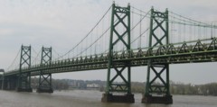
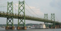
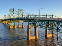
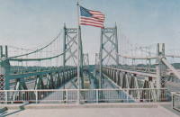
1935: l'Île d'Orléans
Quebec City, Quebec, Canada - St. Lawrence River
| Bridgemeister ID: | 183 (added before 2003) |
| Year Completed: | 1935 |
| Name: | l'Île d'Orléans |
| Also Known As: | Isle of Orleans, Orleans Island, Taschereau |
| Location: | Quebec City, Quebec, Canada |
| Crossing: | St. Lawrence River |
| Coordinates: | 46.880233 N 71.137883 W |
| Maps: | Acme, GeoHack, Google, OpenStreetMap |
| Principals: | Monsarrat and Pratley |
| References: | AAJ |
| Use: | Vehicular (two-lane, heavy vehicles), with walkway |
| Status: | In use (last checked: 2019) |
| Main Cables: | Wire (steel) |
| Suspended Spans: | 3 |
| Main Span: | 1 x 323 meters (1,059.7 feet) |
| Side Spans: | 2 x 127 meters (416.7 feet) |
| Deck width: | 30 feet |
Notes:
- Replacement proposed to start in 2024.
- Near Montmorency Falls - Quebec City vicinity, Quebec, Canada.
External Links:

1935: La Réole
La Réole, Gironde, France - Garonne River
| Bridgemeister ID: | 1769 (added 2005-04-22) |
| Year Completed: | 1935 |
| Name: | La Réole |
| Also Known As: | Rouergue |
| Location: | La Réole, Gironde, France |
| Crossing: | Garonne River |
| Coordinates: | 44.578853 N 0.034028 W |
| Maps: | Acme, GeoHack, Google, OpenStreetMap |
| Use: | Vehicular (two-lane), with walkway |
| Status: | In use (last checked: 2019) |
| Suspended Spans: | 1 |
Notes:
- See 1835 La Réole - La Réole, Gironde, France. Unsure if the newer bridge is at the same location.
External Links:
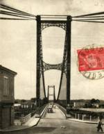
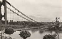
1935: Mælen
Stjørdal, Trøndelag, Norway - Stjørdalselva
| Bridgemeister ID: | 1818 (added 2005-05-21) |
| Year Completed: | 1935 |
| Name: | Mælen |
| Also Known As: | Maelen |
| Location: | Stjørdal, Trøndelag, Norway |
| Crossing: | Stjørdalselva |
| Coordinates: | 63.448367 N 10.992617 E |
| Maps: | Acme, GeoHack, Google, kart.1881.no, OpenStreetMap |
| Use: | Vehicular |
| Status: | In use (last checked: 2005) |
| Main Cables: | Wire (steel) |
| Suspended Spans: | 1 |
1935: Mirabeau
Mirabeau, Vaucluse and Bouches-du-Rhône, France - Durance River
| Bridgemeister ID: | 900 (added 2003-09-07) |
| Year Completed: | 1935 |
| Name: | Mirabeau |
| Location: | Mirabeau, Vaucluse and Bouches-du-Rhône, France |
| Crossing: | Durance River |
| Principals: | Auguste Rey |
| References: | BPF |
| Use: | Vehicular |
| Status: | Replaced, 1991 |
| Suspended Spans: | 1 |
| Main Span: | 1 x 175 meters (574.1 feet) |
| Deck width: | 8 meters |
Notes:
- Dismantled 1991. The towers from the older of the two Mirabeau suspension bridges are visible at the current crossing.
- Replaced 1831 Mirabeau - Mirabeau, Vaucluse and Bouches-du-Rhône, France.
External Links:
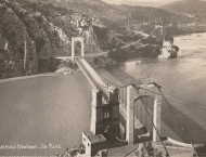
1935: Mirepoix-sur-Tarn
Mirepoix-sur-Tarn, Haute-Garonne, France - Tarn River
| Bridgemeister ID: | 3196 (added 2019-11-10) |
| Year Completed: | 1935 |
| Name: | Mirepoix-sur-Tarn |
| Location: | Mirepoix-sur-Tarn, Haute-Garonne, France |
| Crossing: | Tarn River |
| Coordinates: | 43.811976 N 1.571879 E |
| Maps: | Acme, GeoHack, Google, OpenStreetMap |
| Use: | Vehicular (two-lane) |
| Status: | Collapsed, November 18, 2019 |
| Main Cables: | Wire (steel) |
| Suspended Spans: | 1 |
| Main Span: | 1 x 152 meters (498.7 feet) |
Notes:
- Collapsed November 18, 2019 as an overweight vehicle crossed, killing two people.
- Replaced 1855 Mirepoix-sur-Tarn - Mirepoix-sur-Tarn, Haute-Garonne, France.
External Links:
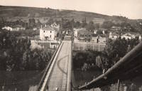
1935: Remoulins
Remoulins, Gard, France - Gardon River
| Bridgemeister ID: | 4910 (added 2020-07-19) |
| Year Completed: | 1935 |
| Name: | Remoulins |
| Location: | Remoulins, Gard, France |
| Crossing: | Gardon River |
| Coordinates: | 43.937978 N 4.556684 E |
| Maps: | Acme, GeoHack, Google, OpenStreetMap |
| Use: | Vehicular |
| Status: | Removed |
| Main Cables: | Wire (steel) |
Notes:
- Remnants of this bridge are preserved in a car park at the eastern end of the present day (2020s) Pont de Remoulins.
- Replaced 1830 Remoulins - Remoulins, Gard, France. The later bridge appears to have been built on an alignment about 175 meters north of the 1830 bridge.
External Links:
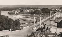
| Bridgemeister ID: | 1103 (added 2004-01-02) |
| Year Completed: | 1935 |
| Name: | Stamser |
| Also Known As: | Kanzler-Dollfuß, Kanzler-Dollfuss |
| Location: | Stams, Austria |
| Crossing: | Inn River |
| Coordinates: | 47.285914 N 10.985192 E |
| Maps: | Acme, GeoHack, Google, OpenStreetMap |
| Principals: | Heinrich Kluibenschädl |
| Use: | Footbridge |
| Status: | In use (last checked: 2019) |
| Main Cables: | Wire (steel) |
Notes:
- Long narrow footbridge with stone towers.
External Links:
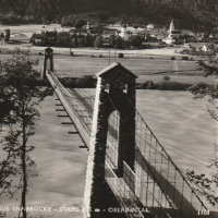
1935: Swinging
Neligh, Nebraska, USA - Elkhorn River
| Bridgemeister ID: | 181 (added before 2003) |
| Year Completed: | 1935 |
| Name: | Swinging |
| Location: | Neligh, Nebraska, USA |
| Crossing: | Elkhorn River |
| Coordinates: | 42.123433 N 98.0277 W |
| Maps: | Acme, GeoHack, Google, OpenStreetMap |
| Principals: | Byron Fuller |
| Use: | Footbridge |
| Status: | Destroyed, June 13, 2010 (last checked: 2010) |
| Main Cables: | Wire |
| Suspended Spans: | 1 |
| Main Span: | 1 x 30.5 meters (100 feet) estimated |
Notes:
- Destroyed by flood.
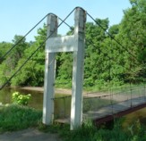
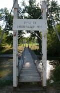
1935: Swinging
Thomson, Minnesota, USA - St. Louis River
| Bridgemeister ID: | 286 (added before 2003) |
| Year Completed: | 1935 |
| Name: | Swinging |
| Location: | Thomson, Minnesota, USA |
| Crossing: | St. Louis River |
| At or Near Feature: | Jay Cooke State Park |
| Coordinates: | 46.653436 N 92.370438 W |
| Maps: | Acme, GeoHack, Google, OpenStreetMap |
| Principals: | Oscar Newstrom, CCC |
| Use: | Footbridge |
| Status: | Destroyed, 1950 |
| Main Cables: | Wire |
| Main Span: | 1 x 38.4 meters (126 feet) |
Notes:
- Deck raised four feet, 1941. Wrecked by flood May, 1950.
- Replaced 1924 Swinging - Thomson, Minnesota, USA.
- Replaced by 1953 Swinging - Thomson, Minnesota, USA.
1935: Tréboul
Thérondels vicinity, Aveyron and Sainte-Marie, Cantal, France - Lac de Sarrans
| Bridgemeister ID: | 1989 (added 2005-12-02) |
| Year Completed: | 1935 |
| Name: | Tréboul |
| Location: | Thérondels vicinity, Aveyron and Sainte-Marie, Cantal, France |
| Crossing: | Lac de Sarrans |
| Coordinates: | 44.872780 N 2.867253 E |
| Maps: | Acme, GeoHack, Google, OpenStreetMap |
| Use: | Vehicular (one-lane) |
| Status: | In use (last checked: 2014) |
| Main Cables: | Wire (steel) |
| Suspended Spans: | 1 |
Notes:
External Links:

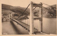
1935: Trews Weir
Exeter, Devon, England, United Kingdom - River Exe
| Bridgemeister ID: | 915 (added 2003-10-11) |
| Year Completed: | 1935 |
| Name: | Trews Weir |
| Also Known As: | New Cricklepit |
| Location: | Exeter, Devon, England, United Kingdom |
| Crossing: | River Exe |
| Coordinates: | 50.71295 N 3.52333 W |
| Maps: | Acme, GeoHack, Google, OpenStreetMap |
| Use: | Footbridge |
| Status: | In use (last checked: 2008) |
| Main Cables: | Wire (steel) |
| Suspended Spans: | 1 |
External Links:
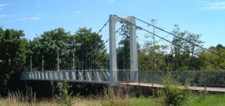
1935: Trude
Trude, Washington, USA - Cedar River
| Bridgemeister ID: | 1956 (added 2005-11-04) |
| Year Completed: | 1935 |
| Name: | Trude |
| Location: | Trude, Washington, USA |
| Crossing: | Cedar River |
| Use: | Vehicular (one-lane) |
| Main Cables: | Wire |
| Suspended Spans: | 1 |
Notes:
- Likely removed.
External Links:
- Seattle Municipal Archives Digital Collections : Image Record : Trude bridge Cedar River [under construction] [50628]. Several other images available in this collection.
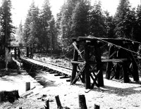
1935: Vizcainos
Arroyo Morote, Spain - Fuensanta Reservoir
| Bridgemeister ID: | 3075 (added 2019-10-26) |
| Year Completed: | 1935 |
| Name: | Vizcainos |
| Location: | Arroyo Morote, Spain |
| Crossing: | Fuensanta Reservoir |
| Coordinates: | 38.415262 N 2.276515 W |
| Maps: | Acme, GeoHack, Google, OpenStreetMap |
| Use: | Footbridge |
| Status: | In use (last checked: 2019) |
| Main Cables: | Wire (steel) |
| Suspended Spans: | 1 |
Notes:
- Companion to 1935 Vizcainos - Yeste, Spain.
1935: Vizcainos
Yeste, Spain - Fuensanta Reservoir
| Bridgemeister ID: | 3074 (added 2019-10-26) |
| Year Completed: | 1935 |
| Name: | Vizcainos |
| Location: | Yeste, Spain |
| Crossing: | Fuensanta Reservoir |
| Coordinates: | 38.346582 N 2.284406 W |
| Maps: | Acme, GeoHack, Google, OpenStreetMap |
| Use: | Footbridge |
| Status: | In use (last checked: 2018) |
| Main Cables: | Wire (steel) |
| Suspended Spans: | 1 |
Notes:
- In use in 2018 for foot traffic, but deck was in very rough shape. May have been redecked in late 2018 or early 2019.
- Companion to 1935 Vizcainos - Arroyo Morote, Spain.
1936: (footbridge)
Gisborne vicinity, New Zealand - Waimata River
| Bridgemeister ID: | 752 (added 2003-03-08) |
| Year Completed: | 1936 |
| Name: | (footbridge) |
| Location: | Gisborne vicinity, New Zealand |
| Crossing: | Waimata River |
| References: | GAP |
| Use: | Footbridge |
1936: (footbridge)
Hillsborough River State Park, Florida, USA - Hillsborough River
| Bridgemeister ID: | 285 (added before 2003) |
| Year Completed: | 1936 |
| Name: | (footbridge) |
| Location: | Hillsborough River State Park, Florida, USA |
| Crossing: | Hillsborough River |
| Coordinates: | 28.1499 N 82.23203 W |
| Maps: | Acme, GeoHack, Google, OpenStreetMap |
| Principals: | CCC |
| Use: | Footbridge |
| Status: | In use (last checked: 2004) |
| Main Cables: | Wire (steel) |
| Main Span: | 1 |
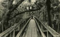
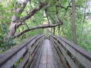
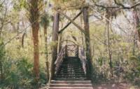
1936: (footbridge)
Motumote, Southland, New Zealand - Waiau River
| Bridgemeister ID: | 754 (added 2003-03-08) |
| Year Completed: | 1936 |
| Name: | (footbridge) |
| Location: | Motumote, Southland, New Zealand |
| Crossing: | Waiau River |
| References: | GAP |
| Use: | Footbridge |
1936: (footbridge)
Tower Lakes, Illinois, USA - Tower Lake
| Bridgemeister ID: | 1306 (added 2004-04-10) |
| Year Completed: | 1936 |
| Name: | (footbridge) |
| Location: | Tower Lakes, Illinois, USA |
| Crossing: | Tower Lake |
| Coordinates: | 42.230815 N 88.154552 W |
| Maps: | Acme, GeoHack, Google, OpenStreetMap |
| Use: | Footbridge |
| Status: | Extant (last checked: 2019) |
| Suspended Spans: | 3 |
| Main Spans: | 3 |
Notes:
- There is at least one other suspension footbridge in the Tower Lakes area, but this 1936 3-span bridge appears to be the largest and the only one with a level deck.
1936: (footbridge)
Waikino, New Zealand - Ohinemuri River
| Bridgemeister ID: | 755 (added 2003-03-08) |
| Year Completed: | 1936 |
| Name: | (footbridge) |
| Location: | Waikino, New Zealand |
| Crossing: | Ohinemuri River |
| Principals: | L.E. Shaw |
| References: | GAP |
| Use: | Footbridge |
| Status: | Destroyed, 1981 |
| Main Cables: | Wire |
| Main Span: | 1 x 42.1 meters (138.1 feet) |
Notes:
- GAP: Damaged by flood, 1964. Repaired. Destroyed by flood, 1981.
External Links:
1936: (suspension bridge)
Black Rock vicinity, Randolph County and Lawrence County, Arkansas, USA - Spring River
| Bridgemeister ID: | 1075 (added 2003-12-27) |
| Year Completed: | 1936 |
| Name: | (suspension bridge) |
| Location: | Black Rock vicinity, Randolph County and Lawrence County, Arkansas, USA |
| Crossing: | Spring River |
| Coordinates: | 36.13987 N 91.08400 W |
| Maps: | Acme, GeoHack, Google, OpenStreetMap |
| Principals: | WPA |
| Use: | Vehicular |
| Status: | Derelict (last checked: 2005) |
| Main Cables: | Wire (steel) |
| Main Span: | 1 x 91.4 meters (300 feet) estimated |
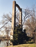
1936: (suspension bridge)
Grave Creek, Oregon, USA - Rogue River
1936: (suspension bridge)
Ohura vicinity, New Zealand - Waikaka Stream
| Bridgemeister ID: | 751 (added 2003-03-08) |
| Year Completed: | 1936 |
| Name: | (suspension bridge) |
| Location: | Ohura vicinity, New Zealand |
| Crossing: | Waikaka Stream |
| References: | GAP |
1936: Androscoggin Pedestrian
Topsham and Brunswick, Maine, USA - Androscoggin River
| Bridgemeister ID: | 182 (added before 2003) |
| Year Completed: | 1936 |
| Name: | Androscoggin Pedestrian |
| Also Known As: | Swinging |
| Location: | Topsham and Brunswick, Maine, USA |
| Crossing: | Androscoggin River |
| Coordinates: | 43.917500 N 69.972520 W |
| Maps: | Acme, GeoHack, Google, OpenStreetMap |
| Principals: | Works Progress Administration |
| References: | PPH19991019, PPH20050801 |
| Use: | Footbridge |
| Status: | In use (last checked: 2020) |
| Main Cables: | Wire (steel) |
| Suspended Spans: | 1 |
| Main Span: | 1 x 101.2 meters (332 feet) |
| Deck width: | 6 feet |
Notes:
- 2004, January: Added to National Register of Historic Places.
- 2006, December: Substantial rehabilitation completed.
- 2011, May: Dedicated as a Maine Historic Civil Engineering Landmark.
- Replaced 1892 Androscoggin Pedestrian (Swinging, Androscoggin Swinging) - Topsham and Brunswick, Maine, USA.
External Links:
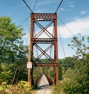
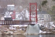
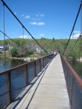
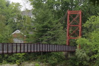
1936: Bitan
HsinTien, New Taipei City, Taiwan - Pitan "Green Lake"
| Bridgemeister ID: | 1680 (added 2005-03-25) |
| Year Completed: | 1936 |
| Name: | Bitan |
| Also Known As: | 碧潭吊橋, Green Lake, Pitan |
| Location: | HsinTien, New Taipei City, Taiwan |
| Crossing: | Pitan "Green Lake" |
| Coordinates: | 24.956483 N 121.53685 E |
| Maps: | Acme, GeoHack, Google, OpenStreetMap |
| Use: | Footbridge |
| Status: | In use (last checked: 2005) |
| Main Cables: | Wire (steel) |
Notes:
- Long, large footbridge. I've seen it spelled "Pitan" and "Bitan." Unclear which is correct.
External Links:
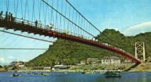
1936: Cross Mound
Tarlton, Ohio, USA - Salt Creek
| Bridgemeister ID: | 1460 (added 2004-08-21) |
| Year Completed: | 1936 |
| Name: | Cross Mound |
| Location: | Tarlton, Ohio, USA |
| Crossing: | Salt Creek |
| At or Near Feature: | Cross Mound Park |
| Coordinates: | 39.563433 N 82.783167 W |
| Maps: | Acme, GeoHack, Google, OpenStreetMap |
| Use: | Footbridge |
| Status: | In use (last checked: 2007) |
| Main Cables: | Wire (steel) |
| Suspended Spans: | 1 |
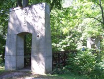
| Bridgemeister ID: | 3926 (added 2020-03-20) |
| Year Completed: | 1936 |
| Name: | Elverum |
| Also Known As: | Nybrua |
| Location: | Elverum, Innlandet, Norway |
| Crossing: | Glomma |
| Coordinates: | 60.88287 N 11.55644 E |
| Maps: | Acme, GeoHack, Google, kart.1881.no, OpenStreetMap |
| Use: | Vehicular (two-lane), with walkway |
| Status: | In use (last checked: 2023) |
| Main Cables: | Wire (steel) |
| Suspended Spans: | 1 |
| Main Span: | 1 x 160 meters (524.9 feet) estimated |
External Links:
- DigitaltMuseum - Bygging av Nybrua 1934.Reising av østre tårn.
- DigitaltMuseum - Bygging av Nybrua 1935.Arbeidere på brua.
- Hamar Dagblad - 80 år som Nybru - og like vakker!
- Structurae - Structure ID 20086232
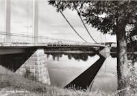
1936: Hinckesman's Access Road
Frasertown vicinity, Hawke's Bay, New Zealand - Mangapoike River
| Bridgemeister ID: | 727 (added 2003-03-08) |
| Year Completed: | 1936 |
| Name: | Hinckesman's Access Road |
| Location: | Frasertown vicinity, Hawke's Bay, New Zealand |
| Crossing: | Mangapoike River |
| Principals: | T. Delaney |
| References: | GAP |
| Use: | Vehicular |
| Status: | Destroyed |
Notes:
- GAP: Destroyed by flood.
- Replaced 1929 Hinckesman's Access Road - Frasertown vicinity, Hawke's Bay, New Zealand.
1936: Kellams
Kellams, New York and Stalker, Pennsylvania, USA - Delaware River
| Bridgemeister ID: | 97 (added before 2003) |
| Year Completed: | 1936 |
| Name: | Kellams |
| Also Known As: | Little Equinunk, Kellams-Stalker, Kellam |
| Location: | Kellams, New York and Stalker, Pennsylvania, USA |
| Crossing: | Delaware River |
| Coordinates: | 41.82333 N 75.11333 W |
| Maps: | Acme, GeoHack, Google, OpenStreetMap |
| References: | BDR, HHP, PTS2 |
| Use: | Vehicular (one-lane) |
| Status: | In use (last checked: 2019) |
| Main Cables: | Wire (steel) |
| Suspended Spans: | 1 |
| Main Span: | 1 x 117 meters (384 feet) |
Notes:
- Damaged by floodwaters June, 2006. Repaired October, 2006.
- Renovation completed, January, 2019.
- Replaced 1890 Kellams (Little Equinunk, Kellams-Stalker, Kellam) - Kellams, New York and Stalker, Pennsylvania, USA.
External Links:
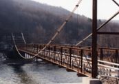
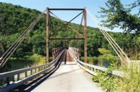
1936: Kindee
Kindee, Ellenborough vicinity, New South Wales, Australia - Hastings River
| Bridgemeister ID: | 1296 (added 2004-03-19) |
| Year Completed: | 1936 |
| Name: | Kindee |
| Location: | Kindee, Ellenborough vicinity, New South Wales, Australia |
| Crossing: | Hastings River |
| Coordinates: | 31.42233 S 152.47044 E |
| Maps: | Acme, GeoHack, Google, OpenStreetMap |
| References: | AAJ |
| Use: | Vehicular (one-lane) |
| Status: | In use (last checked: 2019) |
| Main Cables: | Wire (steel) |
| Suspended Spans: | 3 |
| Main Span: | 1 x 67.1 meters (220 feet) |
| Side Spans: | 2 x 26.8 meters (88 feet) |
| Characteristics: | Braced (trussed) chain/cable, Hinged cables |
Notes:
- Odd timber suspension bridge that has large diagonal stiffening members giving it the appearance of a "braced chain" bridge. AAJ describes it: "the construction in each span is of the three-hinged, trussed cable type or inverted three-hinged arch type. The form of the trussed cable is the Fidler truss."
- Brett Evill transcribed a plaque at the bridge: "This bridge with unusual trussed cables was designed by DMR engineers V Karmalsky and A T Britton. Steelwork was supplied by Morison and Bearby of Newcastle and timber by R McMillan of Long Flat. Sadly, the contractor R B Haydon was killed during construction and work was completed by the Department. Opened on 19 December 1936, the bridge and its approaches cost £5,000.
"Erected to commemorate Australia's bicentenary in 1988 by the Department of Main Roads and the National Roads and Motorists Association (NRMA)" - Similar to 1951 Marias River (Pugsley) - Chester vicinity, Montana, USA.
- Similar to (footbridge) - Sarov (Саров), Nizhny Novgorod Oblast, Russia.
- Similar to Allan - Segenhoe, Scone vicinity, New South Wales, Australia.
- Similar to Ininskiy (Ининский) - Inya (Иня), Altai Republic, Russia.
- Similar to Reku Vel' - Solginskiy (Солгинский), Arkhangelsk Oblast, Russia.
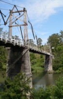
1936: Krefeld-Uerdinger
Uerdingen, Krefeld vicinity and Duisburg, Germany - Rhine River
| Bridgemeister ID: | 959 (added 2003-11-01) |
| Year Completed: | 1936 |
| Name: | Krefeld-Uerdinger |
| Location: | Uerdingen, Krefeld vicinity and Duisburg, Germany |
| Crossing: | Rhine River |
| Coordinates: | 51.349835 N 6.659175 E |
| Maps: | Acme, GeoHack, Google, OpenStreetMap |
| References: | AAJ |
| Use: | Vehicular (two-lane) |
| Status: | In use (last checked: 2020) |
| Main Cables: | Riveted plate |
| Suspended Spans: | 3 |
| Main Span: | 1 x 250 meters (820.25 feet) |
| Side Spans: | 2 |
| Deck width: | 64 feet |
Notes:
- Destroyed 1945, rebuilt 1950.
External Links:
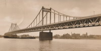
| Bridgemeister ID: | 3919 (added 2020-03-20) |
| Year Completed: | 1936 |
| Name: | Kveberg |
| Location: | Alvdal, Innlandet, Norway |
| Crossing: | Glomma |
| Coordinates: | 62.07803 N 10.69445 E |
| Maps: | Acme, GeoHack, Google, kart.1881.no, OpenStreetMap |
| Use: | Vehicular (one-lane) |
| Status: | In use (last checked: 2019) |
| Main Cables: | Wire (steel) |
| Suspended Spans: | 1 |
| Main Span: | 1 x 90 meters (295.3 feet) estimated |
1936: Memorial
Stockbridge, Massachusetts, USA - Housatonic River
| Bridgemeister ID: | 1572 (added 2004-12-11) |
| Year Completed: | 1936 |
| Name: | Memorial |
| Location: | Stockbridge, Massachusetts, USA |
| Crossing: | Housatonic River |
| Coordinates: | 42.2784 N 73.3073 W |
| Maps: | Acme, GeoHack, Google, OpenStreetMap |
| Use: | Footbridge |
| Status: | In use (last checked: 2019) |
| Main Cables: | Wire (steel) |
| Suspended Spans: | 1 |
1936: Mornay-sur-Allier
Mornay-sur-Allier, Cher and St-Pierre-le-Moûtier, Nièvre, France - Allier River
| Bridgemeister ID: | 1550 (added 2004-11-13) |
| Year Completed: | 1936 |
| Name: | Mornay-sur-Allier |
| Location: | Mornay-sur-Allier, Cher and St-Pierre-le-Moûtier, Nièvre, France |
| Crossing: | Allier River |
| Coordinates: | 46.815265 N 3.043460 E |
| Maps: | Acme, GeoHack, Google, OpenStreetMap |
| References: | BPF |
| Use: | Vehicular |
| Status: | Removed, circa 1970s |
| Main Cables: | Wire (steel) |
| Suspended Spans: | 3 |
| Main Span: | 1 x 80 meters (262.5 feet) |
| Side Spans: | 1 x 67.57 meters (221.7 feet), 1 x 64.27 meters (210.9 feet) |
Notes:
External Links:
- Art-et-Histoire - Nouveau pont de Mornay - St-Pierre-le-Moûtier - 1937
- Structurae - Structure ID 20003000
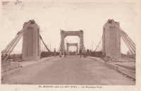
| Bridgemeister ID: | 4445 (added 2020-04-19) |
| Year Completed: | 1936 |
| Name: | Otterstad |
| Location: | Mo, Modalen, Vestland, Norway |
| Crossing: | Moelva |
| Coordinates: | 60.815923 N 5.800875 E |
| Maps: | Acme, GeoHack, Google, kart.1881.no, OpenStreetMap |
| Use: | Vehicular (one-lane) |
| Status: | In use (last checked: 2019) |
| Main Cables: | Wire (steel) |
| Suspended Spans: | 1 |
| Main Span: | 1 x 89 meters (292 feet) estimated |
| Deck width: | ~3 meters |
1936: Pauley
Pikeville, Kentucky, USA - Big Sandy River Levisa Fork
| Bridgemeister ID: | 1068 (added 2003-12-27) |
| Year Completed: | 1936 |
| Name: | Pauley |
| Location: | Pikeville, Kentucky, USA |
| Crossing: | Big Sandy River Levisa Fork |
| Coordinates: | 37.492833 N 82.5355 W |
| Maps: | Acme, GeoHack, Google, OpenStreetMap |
| Principals: | O.S. Batten, WPA |
| Use: | Vehicular (one-lane) |
| Status: | Restricted to foot traffic (last checked: 2021) |
| Main Cables: | Wire (steel) |
| Suspended Spans: | 1 |
| Main Span: | 1 x 115.8 meters (380 feet) estimated |
Notes:
- The National Register of Historic Places registration form is inconsistent regarding the completion year of this bridge stating (in one passage) it was completed in 1940 but also mentioning it was completed "circa 1940" a few times.
- Closed to vehicular traffic, 1991. Closed to all traffic, September 2000. Restored and reopened to pedestrian traffic, 2006.
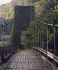
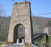
1936: S. Jijisaheb
Ambawade, Maharashtra, India
| Bridgemeister ID: | 3170 (added 2019-11-08) |
| Year Completed: | 1936 |
| Name: | S. Jijisaheb |
| Also Known As: | Ambawade |
| Location: | Ambawade, Maharashtra, India |
| Coordinates: | 18.071836 N 73.791943 E |
| Maps: | Acme, GeoHack, Google, OpenStreetMap |
| Use: | Footbridge |
| Status: | In use (last checked: 2022) |
| Main Cables: | Wire (steel) |
1936: Saint-Didier-sous-Aubenas
Saint-Didier-sous-Aubenas, Ardèche, France - Ardèche River
| Bridgemeister ID: | 2930 (added 2019-09-16) |
| Year Completed: | 1936 |
| Name: | Saint-Didier-sous-Aubenas |
| Location: | Saint-Didier-sous-Aubenas, Ardèche, France |
| Crossing: | Ardèche River |
| Coordinates: | 44.604219 N 4.419136 E |
| Maps: | Acme, GeoHack, Google, OpenStreetMap |
| Use: | Vehicular (two-lane) |
| Status: | Collapsed, 1995 |
| Main Cables: | Wire (steel) |
Notes:
- Collapsed, 1995. One tower remains.
- Replaced Saint-Didier-sous-Aubenas - Saint-Didier-sous-Aubenas, Ardèche, France.
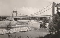
1936: San Francisco-Oakland Bay
Oakland and San Francisco, California, USA - San Francisco Bay
| Bridgemeister ID: | 184 (added before 2003) |
| Year Completed: | 1936 |
| Name: | San Francisco-Oakland Bay |
| Location: | Oakland and San Francisco, California, USA |
| Crossing: | San Francisco Bay |
| Coordinates: | 37.78667 N 122.39 W |
| Maps: | Acme, GeoHack, Google, OpenStreetMap |
| Principals: | C.H. Purcell, Glenn B. Woodruff |
| References: | AAJ, AZB, BAAW, BC3, BPL, GBD, LAB, OBB1, SFOM, USS |
| Use: | Vehicular (double-deck) |
| Status: | In use (last checked: 2022) |
| Main Cables: | Wire (steel) |
| Suspended Spans: | 6 |
| Main Spans: | 1 x 678 meters (2,224.4 feet), 1 x 673.6 meters (2,210 feet) |
| Side Spans: | 4 |
| Deck width: | 66 feet (58 feet roadway) |
Notes:
External Links:

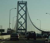
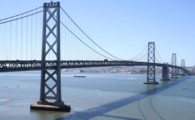
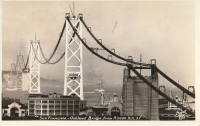
| Bridgemeister ID: | 3719 (added 2020-02-15) |
| Year Completed: | 1936 |
| Name: | Skottleik |
| Location: | Bergsmoen, Grong, Trøndelag, Norway |
| Crossing: | Namsen |
| Coordinates: | 64.461520 N 12.164810 E |
| Maps: | Acme, GeoHack, Google, kart.1881.no, OpenStreetMap |
| Use: | Vehicular (one-lane) |
| Status: | In use (last checked: 2010) |
| Main Cables: | Wire (steel) |
| Suspended Spans: | 1 |
| Main Span: | 1 x 95 meters (311.7 feet) estimated |
1936: Smart's
Marlborough, New Zealand - Rai River
| Bridgemeister ID: | 748 (added 2003-03-08) |
| Year Completed: | 1936 |
| Name: | Smart's |
| Location: | Marlborough, New Zealand |
| Crossing: | Rai River |
| References: | GAP |
| Use: | Footbridge |
| Bridgemeister ID: | 3906 (added 2020-03-14) |
| Year Completed: | 1936 |
| Name: | Støbrua |
| Location: | Røros, Trøndelag, Norway |
| Crossing: | Håelva |
| Coordinates: | 62.56898 N 11.35406 E |
| Maps: | Acme, GeoHack, Google, kart.1881.no, OpenStreetMap |
| Use: | Vehicular (one-lane) |
| Status: | Restricted to foot traffic (last checked: 2019) |
| Main Cables: | Wire (steel) |
| Suspended Spans: | 1 |
External Links:
1936: Swinging
Skowhegan, Maine, USA - Kennebec River
| Bridgemeister ID: | 363 (added before 2003) |
| Year Completed: | 1936 |
| Name: | Swinging |
| Location: | Skowhegan, Maine, USA |
| Crossing: | Kennebec River |
| Coordinates: | 44.76244 N 69.72064 W |
| Maps: | Acme, GeoHack, Google, OpenStreetMap |
| Principals: | Gerald Marble |
| References: | KJ20030410 |
| Use: | Footbridge |
| Status: | In use (last checked: 2006) |
| Main Cables: | Wire (steel) |
| Suspended Spans: | 1 |
| Main Span: | 1 x 67.1 meters (220 feet) |
Notes:
- Connects Skowhegan Island to Alder Street across the south channel of the Kennebec River.
- Repaired, 1995. Rehabilitation completed, 2006.
- Replaced 1902 Swinging - Skowhegan, Maine, USA.
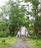
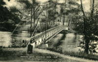
1936: Swinging
Story City, Iowa, USA - Skunk River
| Bridgemeister ID: | 1181 (added 2004-01-24) |
| Year Completed: | 1936 |
| Name: | Swinging |
| Location: | Story City, Iowa, USA |
| Crossing: | Skunk River |
| At or Near Feature: | South Park |
| Coordinates: | 42.186517 N 93.586683 W |
| Maps: | Acme, GeoHack, Google, OpenStreetMap |
| Principals: | WPA |
| Use: | Footbridge |
| Status: | Closed, 2019 (last checked: 2019) |
| Main Cables: | Wire (steel) |
| Suspended Spans: | 1 |
| Main Span: | 1 x 21.6 meters (71 feet) estimated |
Notes:
- Damaged by flood, early 2019. Repairs underway October, 2019, expected to reopen soon.

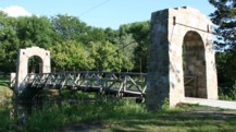
1936: Triborough
New York and Queens, New York, USA - East River
| Bridgemeister ID: | 186 (added before 2003) |
| Year Completed: | 1936 |
| Name: | Triborough |
| Also Known As: | Robert F. Kennedy |
| Location: | New York and Queens, New York, USA |
| Crossing: | East River |
| At or Near Feature: | Randalls-Wards Island |
| Coordinates: | 40.781283 N 73.9273 W |
| Maps: | Acme, GeoHack, Google, OpenStreetMap |
| Principals: | O.H. Ammann, Allston Dana |
| References: | AAJ, GBD, SIX |
| Use: | Vehicular (major highway), with walkway |
| Status: | In use (last checked: 2022) |
| Main Cables: | Wire (steel) |
| Suspended Spans: | 3 |
| Main Span: | 1 x 420.6 meters (1,380 feet) |
| Side Spans: | 2 x 214.8 meters (704.75 feet) |
| Deck width: | 96 feet |
External Links:
1936: Walter Taylor
Indooroopilly and Chelmer, Queensland, Australia - Brisbane River
| Bridgemeister ID: | 449 (added before 2003) |
| Year Completed: | 1936 |
| Name: | Walter Taylor |
| Location: | Indooroopilly and Chelmer, Queensland, Australia |
| Crossing: | Brisbane River |
| Coordinates: | 27.505467 S 152.9737 E |
| Maps: | Acme, GeoHack, Google, OpenStreetMap |
| References: | AAJ, STC |
| Use: | Vehicular |
| Status: | In use (last checked: 2015) |
| Main Cables: | Wire (steel) |
| Suspended Spans: | 1 |
| Main Span: | 1 x 182.9 meters (600.1 feet) |
Notes:
- Hybrid truss-suspension where truss rises up to meet main cables.
- Two-year refurbishment started, late 2007, to replace and strengthen joints along the cables and deck truss.
External Links:
1936: Waterloo
Waterloo, Oregon, USA - South Santiam River
| Bridgemeister ID: | 1980 (added 2005-11-27) |
| Year Completed: | 1936 |
| Name: | Waterloo |
| Location: | Waterloo, Oregon, USA |
| Crossing: | South Santiam River |
| Coordinates: | 44.497549 N 122.820969 W |
| Maps: | Acme, GeoHack, Google, OpenStreetMap |
| Use: | Vehicular |
| Status: | Collapsed, May 1960 |
| Main Cables: | Wire (steel) |
| Suspended Spans: | 1 |
Notes:
- Reconstructed, 1954.
External Links:
1937: (footbridge)
Bruce property, New Zealand - Maruia River
| Bridgemeister ID: | 757 (added 2003-03-08) |
| Year Completed: | 1937 |
| Name: | (footbridge) |
| Location: | Bruce property, New Zealand |
| Crossing: | Maruia River |
| References: | GAP |
| Use: | Footbridge |
1937: (suspension bridge)
Briceburg, California, USA - Merced River
| Bridgemeister ID: | 642 (added 2003-02-16) |
| Year Completed: | 1937 |
| Name: | (suspension bridge) |
| Location: | Briceburg, California, USA |
| Crossing: | Merced River |
| Coordinates: | 37.604833 N 119.9669 W |
| Maps: | Acme, GeoHack, Google, OpenStreetMap |
| Use: | Vehicular (one-lane) |
| Status: | In use (last checked: 2016) |
| Main Cables: | Wire (steel) |
| Suspended Spans: | 1 |
Notes:
- Damaged by flood, 1999, when river level rose to approximately four feet above the bridge deck.

1937: (suspension bridge)
Waitaria Bay, Havelock vicinity, New Zealand
| Bridgemeister ID: | 758 (added 2003-03-08) |
| Year Completed: | 1937 |
| Name: | (suspension bridge) |
| Location: | Waitaria Bay, Havelock vicinity, New Zealand |
| References: | GAP |
| Use: | Stock |
| Main Span: | 1 x 18.3 meters (60 feet) |
1937: Aiguilly
Roanne vicinity and Vougy vicinity, Loire, France - Loire River
| Bridgemeister ID: | 1567 (added 2004-11-28) |
| Year Completed: | 1937 |
| Name: | Aiguilly |
| Location: | Roanne vicinity and Vougy vicinity, Loire, France |
| Crossing: | Loire River |
| References: | AAJ, BPF |
| Use: | Vehicular |
| Status: | Destroyed, 1940 |
| Main Cables: | Wire (steel) |
| Suspended Spans: | 1 |
| Main Span: | 1 x 135 meters (442.9 feet) |
Notes:
- Destroyed to slow advancing German troops, 1940.
- Replaced 1841 Aiguilly - Roanne vicinity and Vougy vicinity, Loire, France.
- Replaced by 1945 Aiguilly - Roanne vicinity and Vougy vicinity, Loire, France.
External Links:
1937: Bryan's Crossing
Warsaw vicinity, Missouri, USA - South Grand River
| Bridgemeister ID: | 1074 (added 2003-12-27) |
| Year Completed: | 1937 |
| Name: | Bryan's Crossing |
| Also Known As: | Downing Bend |
| Location: | Warsaw vicinity, Missouri, USA |
| Crossing: | South Grand River |
| Principals: | Joseph A. Dice? |
| References: | BOTO |
| Use: | Vehicular (one-lane) |
| Status: | Removed |
| Main Cables: | Wire (steel) |
| Suspended Spans: | 1 |
Notes:
- Likely another Joseph A. Dice bridge.
- Location inundated by the Harry S. Truman Reservoir.
External Links:
1937: Chelsea
London, England, United Kingdom - River Thames
| Bridgemeister ID: | 450 (added before 2003) |
| Year Completed: | 1937 |
| Name: | Chelsea |
| Location: | London, England, United Kingdom |
| Crossing: | River Thames |
| Coordinates: | 51.48438 N 0.14984 W |
| Maps: | Acme, GeoHack, Google, OpenStreetMap |
| Principals: | Sir Pierson Frank, Rendel, Tritton and Palmer |
| References: | AAJ, BTH |
| Use: | Vehicular (three or more lanes), with walkway |
| Status: | In use (last checked: 2019) |
| Main Cables: | Wire (steel) |
| Suspended Spans: | 3 |
| Main Span: | 1 x 107.3 meters (352 feet) |
| Side Spans: | 2 x 52.7 meters (173 feet) |
| Deck width: | 64 feet |
Notes:
External Links:
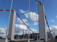
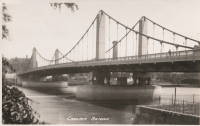
1937: Corbin's
Huntingdon vicinity, Pennsylvania, USA - Raystown Branch Juniata River
| Bridgemeister ID: | 187 (added before 2003) |
| Year Completed: | 1937 |
| Name: | Corbin's |
| Location: | Huntingdon vicinity, Pennsylvania, USA |
| Crossing: | Raystown Branch Juniata River |
| Coordinates: | 40.455 N 77.98333 W |
| Maps: | Acme, GeoHack, Google, OpenStreetMap |
| Use: | Vehicular (one-lane) |
| Status: | In use (last checked: 2021) |
| Main Cables: | Wire (steel) |
| Suspended Spans: | 1 |
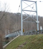
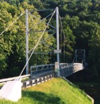
| Bridgemeister ID: | 1041 (added 2003-12-06) |
| Year Completed: | 1937 |
| Name: | Fyksesund |
| Location: | Fykse, Kvam, Hordaland, Norway |
| Crossing: | Fyksesund |
| Coordinates: | 60.400028 N 6.260859 E |
| Maps: | Acme, GeoHack, Google, kart.1881.no, OpenStreetMap |
| Use: | Vehicular (two-lane, heavy vehicles) |
| Status: | In use (last checked: 2019) |
| Main Cables: | Wire (steel) |
| Suspended Spans: | 1 |
| Main Span: | 1 x 230 meters (754.6 feet) |
External Links:
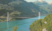
1937: Golden Gate
San Francisco and Marin County, California, USA - San Francisco Bay
| Bridgemeister ID: | 188 (added before 2003) |
| Year Completed: | 1937 |
| Name: | Golden Gate |
| Location: | San Francisco and Marin County, California, USA |
| Crossing: | San Francisco Bay |
| Coordinates: | 37.82 N 122.47667 W |
| Maps: | Acme, GeoHack, Google, OpenStreetMap |
| Principals: | Joseph B. Strauss, Leon Moisseiff, Charles A. Ellis, Irving F. Morrow |
| References: | AAJ, AZB, BAAW, BBR, BC3, BFL, BLD, BMA, BOU, BPL, BRU, COB, CTW, GAT, GBD, GGB, LAB, SPG |
| Use: | Vehicular (major highway), with walkway |
| Status: | In use (last checked: 2022) |
| Main Cables: | Wire (steel) |
| Suspended Spans: | 3 |
| Main Span: | 1 x 1,280.2 meters (4,200 feet) |
| Side Spans: | 2 x 343 meters (1,125.41 feet) |
| Deck width: | 80 feet |
Notes:
- Became longest suspension bridge by eclipsing 1931 George Washington (GWB) - New York, New York and Fort Lee, New Jersey, USA.
- Eclipsed by new longest suspension bridge 1964 Verrazzano Narrows (Verrazano Narrows) - Brooklyn and Staten Island, New York, USA.
External Links:
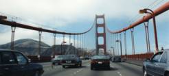
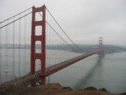

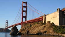
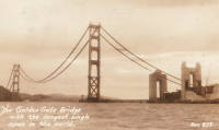
1937: Hodder
Seddon vicinity, Marlborough, New Zealand - Hodder River
| Bridgemeister ID: | 761 (added 2003-03-08) |
| Year Completed: | 1937 |
| Name: | Hodder |
| Location: | Seddon vicinity, Marlborough, New Zealand |
| Crossing: | Hodder River |
| Coordinates: | 41.884739 S 173.641185 E |
| Maps: | Acme, GeoHack, Google, OpenStreetMap |
| References: | GAP |
| Use: | Vehicular (one-lane) |
| Status: | In use (last checked: 2019) |
| Main Cables: | Wire (steel) |
| Suspended Spans: | 1 |
| Main Span: | 1 x 64 meters (210 feet) |
Notes:
- GAP: Refurbished 1982.
- Strengthened, 2015.
External Links:
1937: Hvåra
Hvåra, Larvik, Vestfold Og Telemark, Norway - Numedalslågen
| Bridgemeister ID: | 4086 (added 2020-04-04) |
| Year Completed: | 1937 |
| Name: | Hvåra |
| Location: | Hvåra, Larvik, Vestfold Og Telemark, Norway |
| Crossing: | Numedalslågen |
| Coordinates: | 59.271796 N 9.938096 E |
| Maps: | Acme, GeoHack, Google, kart.1881.no, OpenStreetMap |
| Use: | Vehicular (one-lane) |
| Status: | Dismantled |
| Main Cables: | Wire (steel) |
| Suspended Spans: | 1 |
| Main Span: | 1 x 95 meters (311.7 feet) |
Notes:
1937: Hyde Park Walking
Hyde Park and Leechburg, Pennsylvania, USA - Kiskiminetas River
| Bridgemeister ID: | 5843 (added 2021-05-13) |
| Year Completed: | 1937 |
| Name: | Hyde Park Walking |
| Location: | Hyde Park and Leechburg, Pennsylvania, USA |
| Crossing: | Kiskiminetas River |
| Coordinates: | 40.627834 N 79.596774 W |
| Maps: | Acme, GeoHack, Google, OpenStreetMap |
| Use: | Footbridge |
| Status: | Removed, c. 1948-1950 |
| Main Cables: | Wire (steel) |
| Suspended Spans: | 3 |
| Main Spans: | 3 |
Notes:
- Closed due to poor condition, 1948.
- Replaced 1920 Hyde Park Walking - Hyde Park and Leechburg, Pennsylvania, USA. The replacement was constructed based on the John A. Roebling's Sons plans from the first bridge.
- Replaced by 1950 Hyde Park (Walking) - Hyde Park and Leechburg, Pennsylvania, USA.
| Bridgemeister ID: | 3960 (added 2020-03-22) |
| Year Completed: | 1937 |
| Name: | Kolobrua |
| Also Known As: | Kollobrua |
| Location: | Sjoa, Sel, Innlandet, Norway |
| Crossing: | Lågen |
| Coordinates: | 61.68207 N 9.53778 E |
| Maps: | Acme, GeoHack, Google, kart.1881.no, OpenStreetMap |
| Use: | Vehicular (one-lane) |
| Status: | In use (last checked: 2017) |
| Main Cables: | Wire (steel) |
| Suspended Spans: | 1 |
| Main Span: | 1 x 95 meters (311.7 feet) estimated |
External Links:
1937: Lacq
Lacq and Abidos, Pyrénées-Atlantiques, France - Ousse River
| Bridgemeister ID: | 7968 (added 2023-11-25) |
| Year Completed: | 1937 |
| Name: | Lacq |
| Location: | Lacq and Abidos, Pyrénées-Atlantiques, France |
| Crossing: | Ousse River |
| Coordinates: | 43.404111 N 0.624083 W |
| Maps: | Acme, GeoHack, Google, OpenStreetMap |
| Use: | Vehicular (two-lane) |
| Status: | In use (last checked: 2023) |
| Main Cables: | Wire (steel) |
| Suspended Spans: | 1 |
| Main Span: | 1 x 77 meters (252.6 feet) estimated |
Notes:
- Next to (pipeline bridge) - Lacq and Abidos, Pyrénées-Atlantiques, France.
- Near (pipeline bridge) - Lacq and Abidos, Pyrénées-Atlantiques, France.
1937: Langeais
Langeais, Indre-et-Loire, France - Loire River
| Bridgemeister ID: | 1029 (added 2003-11-30) |
| Year Completed: | 1937 |
| Name: | Langeais |
| Location: | Langeais, Indre-et-Loire, France |
| Crossing: | Loire River |
| Coordinates: | 47.319667 N 0.404217 E |
| Maps: | Acme, GeoHack, Google, OpenStreetMap |
| References: | AAJ, BPF |
| Use: | Vehicular (two-lane), with walkway |
| Status: | In use (last checked: 2021) |
| Main Cables: | Wire (steel) |
| Suspended Spans: | 5 |
| Main Spans: | 3 x 90 meters (295.29 feet) |
| Side Spans: | 2 x 45 meters (147.64 feet) |
Notes:
- 1940: Deck collapsed.
- 1946: Repaired, but carrying just a footbridge.
- 1950: Rebuilt as a vehicular bridge.
- 1983: Reinforced to support heavier traffic.
- Replaced 1849 Langeais - Langeais, Indre-et-Loire, France.
External Links:
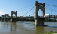
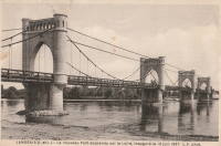
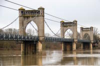
1937: Lenape Park I
Perkasie, Pennsylvania, USA - East Branch Perkiomen Creek
| Bridgemeister ID: | 189 (added before 2003) |
| Year Completed: | 1937 |
| Name: | Lenape Park I |
| Location: | Perkasie, Pennsylvania, USA |
| Crossing: | East Branch Perkiomen Creek |
| Coordinates: | 40.36658 N 75.29908 W |
| Maps: | Acme, GeoHack, Google, OpenStreetMap |
| Principals: | WPA |
| Use: | Footbridge |
| Status: | In use (last checked: 2003) |
| Main Cables: | Wire (steel) |
| Suspended Spans: | 1 |
Notes:
- Connects to 1937 Lenape Park II - Perkasie, Pennsylvania, USA.

1937: Lenape Park II
Perkasie, Pennsylvania, USA - East Branch Perkiomen Creek
| Bridgemeister ID: | 190 (added before 2003) |
| Year Completed: | 1937 |
| Name: | Lenape Park II |
| Location: | Perkasie, Pennsylvania, USA |
| Crossing: | East Branch Perkiomen Creek |
| Coordinates: | 40.36691 N 75.29920 W |
| Maps: | Acme, GeoHack, Google, OpenStreetMap |
| Principals: | WPA |
| Use: | Footbridge |
| Status: | In use (last checked: 2003) |
| Main Cables: | Wire (steel) |
| Suspended Spans: | 1 |
Notes:
- Connects to 1937 Lenape Park I - Perkasie, Pennsylvania, USA.

1937: Lorne
Lorne, Victoria, Australia - Erskine River
| Bridgemeister ID: | 1656 (added 2005-03-19) |
| Year Completed: | 1937 |
| Name: | Lorne |
| Location: | Lorne, Victoria, Australia |
| Crossing: | Erskine River |
| Coordinates: | 38.533600 S 143.977918 E |
| Maps: | Acme, GeoHack, Google, OpenStreetMap |
| Use: | Footbridge |
| Status: | In use (last checked: 2018) |
| Main Cables: | Wire |
| Suspended Spans: | 1 |
1937: Monymusk Farm
Leamington Valley, Cheviot vicinity, New Zealand - Leamington River
| Bridgemeister ID: | 759 (added 2003-03-08) |
| Year Completed: | 1937 |
| Name: | Monymusk Farm |
| Location: | Leamington Valley, Cheviot vicinity, New Zealand |
| Crossing: | Leamington River |
| Principals: | Ellis Upritchard |
| References: | GAP |
| Use: | Vehicular (one-lane) |
| Main Cables: | Wire (steel) |
| Suspended Spans: | 1 |
1937: Redpath's
Waioeka Gorge, Opotiki vicinity, New Zealand - Waioeka River
| Bridgemeister ID: | 756 (added 2003-03-08) |
| Year Completed: | 1937 |
| Name: | Redpath's |
| Location: | Waioeka Gorge, Opotiki vicinity, New Zealand |
| Crossing: | Waioeka River |
| References: | GAP |
1937: Reichsbrücke
Vienna, Austria - Danube River
| Bridgemeister ID: | 4589 (added 2020-06-06) |
| Year Completed: | 1937 |
| Name: | Reichsbrücke |
| Location: | Vienna, Austria |
| Crossing: | Danube River |
| Coordinates: | 48.227267 N 16.407719 E |
| Maps: | Acme, GeoHack, Google, OpenStreetMap |
| References: | AAJ |
| Use: | Vehicular |
| Status: | Collapsed, August 1, 1976 |
| Main Cables: | Eyebar (steel) |
| Suspended Spans: | 1 |
| Main Span: | 1 x 241.2 meters (791.3 feet) |
Notes:
- Renovated 1948-1952.
External Links:
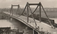
1937: Rio Chiriquí
David, Panama - Rio Chiriquí
| Bridgemeister ID: | 451 (added before 2003) |
| Year Completed: | 1937 |
| Name: | Rio Chiriquí |
| Location: | David, Panama |
| Crossing: | Rio Chiriquí |
| Principals: | Conde B. McCullough |
| References: | AAJ, CBM |
| Use: | Vehicular |
| Main Cables: | Wire (steel) |
| Suspended Spans: | 1 |
| Main Span: | 1 x 121.9 meters (400 feet) |
| Deck width: | 20 feet |
External Links:
1937: Rio Choluteca
Choluteca, Honduras - Rio Choluteca
| Bridgemeister ID: | 452 (added before 2003) |
| Year Completed: | 1937 |
| Name: | Rio Choluteca |
| Location: | Choluteca, Honduras |
| Crossing: | Rio Choluteca |
| Coordinates: | 13.312089 N 87.191631 W |
| Maps: | Acme, GeoHack, Google, OpenStreetMap |
| Principals: | Conde B. McCullough, R. Archibald |
| References: | AAJ, CBM, MSSB |
| Use: | Vehicular (two-lane), with walkway |
| Status: | In use (last checked: 2016) |
| Main Cables: | Wire (steel) |
| Suspended Spans: | 4 |
| Main Spans: | 2 x 100.6 meters (330 feet) |
| Side Spans: | 2 x 33.5 meters (110 feet) |
| Deck width: | 30 feet |
External Links:
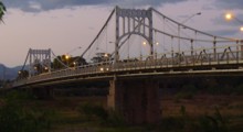
1937: Rio Tamasalupa
Asuncíon Mita, Guatemala - Rio Tamasalupa
| Bridgemeister ID: | 453 (added before 2003) |
| Year Completed: | 1937 |
| Name: | Rio Tamasalupa |
| Location: | Asuncíon Mita, Guatemala |
| Crossing: | Rio Tamasalupa |
| Coordinates: | 14.304190 N 89.717344 W |
| Maps: | Acme, GeoHack, Google, OpenStreetMap |
| Principals: | Conde B. McCullough, R. Archibald |
| References: | AAJ, CBM |
| Use: | Vehicular (two-lane) |
| Status: | In use (last checked: 2019) |
| Main Cables: | Eyebar (steel) |
| Suspended Spans: | 3 |
| Main Span: | 1 x 73.2 meters (240 feet) |
| Side Spans: | 2 x 30.5 meters (100 feet) |
| Deck width: | 20 feet |
External Links:
1937: San Rafael Swinging
San Rafael Bridge Recreation Site, Utah, USA - San Rafael River
| Bridgemeister ID: | 362 (added before 2003) |
| Year Completed: | 1937 |
| Name: | San Rafael Swinging |
| Also Known As: | Buckhorn Wash |
| Location: | San Rafael Bridge Recreation Site, Utah, USA |
| Crossing: | San Rafael River |
| Coordinates: | 39.08112 N 110.66639 W |
| Maps: | Acme, GeoHack, Google, OpenStreetMap |
| Principals: | CCC, Milton P. Greaves |
| Use: | Vehicular |
| Status: | Restricted to foot traffic (last checked: 2020) |
| Main Cables: | Wire (steel) |
| Main Span: | 1 x 48.8 meters (160 feet) |
Notes:
- Restored, c.1994.
- Some web sites state this bridge was destroyed by fire in 2008. This appears to be caused by confusion with Utah's Dewey bridge destroyed by a fire in 2008. The San Rafael bridge was not destroyed and was still in active use as of 2020.
External Links:
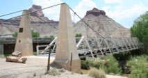
1937: Stoddard Pack
Salmon and North Fork vicinity, Idaho, USA - Salmon River
| Bridgemeister ID: | 641 (added 2003-02-15) |
| Year Completed: | 1937 |
| Name: | Stoddard Pack |
| Location: | Salmon and North Fork vicinity, Idaho, USA |
| Crossing: | Salmon River |
| Coordinates: | 45.29601 N 114.60448 W |
| Maps: | Acme, GeoHack, Google, OpenStreetMap |
| Principals: | CCC (Civilian Conservation Corps) |
| Use: | Pack and Footbridge |
| Status: | Replaced, 2014 |
| Main Cables: | Wire (steel) |
| Suspended Spans: | 1 |
| Main Span: | 1 x 106.7 meters (350 feet) estimated |
Notes:
- Was located about 35-40 miles west of North Fork.
- Replaced by 2014 Stoddard Pack - Salmon and North Fork vicinity, Idaho, USA.
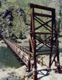
1937: Swinging
Red Hill vicinity, Pennsylvania, USA - Perkiomen Creek
| Bridgemeister ID: | 7367 (added 2022-11-04) |
| Year Completed: | 1937 |
| Name: | Swinging |
| Location: | Red Hill vicinity, Pennsylvania, USA |
| Crossing: | Perkiomen Creek |
| Coordinates: | 40.353622 N 75.503263 W |
| Maps: | Acme, GeoHack, Google, OpenStreetMap |
| Use: | Footbridge |
| Status: | Removed, Early 1950s |
| Main Cables: | Wire (steel) |
| Suspended Spans: | 1 |
Notes:
- Replaced a much less substantial swinging bridge that was destroyed by flood in 1935.
- The site of this bridge was inundated with the creation of the Green Lane Reservoir in the 1950s. The coordinates indicate the approximate location of the bridge which would have been near the current end of Swinging Bridge Rd.
1938: (suspension bridge)
Gerung, West Lombok, West Nusa Tenggara, Indonesia
| Bridgemeister ID: | 3046 (added 2019-10-20) |
| Year Completed: | 1938 |
| Name: | (suspension bridge) |
| Location: | Gerung, West Lombok, West Nusa Tenggara, Indonesia |
| Coordinates: | 8.692476 S 116.108842 E |
| Maps: | Acme, GeoHack, Google, OpenStreetMap |
| Use: | Vehicular |
| Status: | In use (last checked: 2019) |
| Main Cables: | Wire (steel) |
Notes:
- In 2019, appears to be restricted to motorbike and pedestrian traffic.
External Links:
1938: Assat
Assat and Narcastet, Pyrénées-Atlantiques, France - Ousse
| Bridgemeister ID: | 4687 (added 2020-06-20) |
| Year Completed: | 1938 |
| Name: | Assat |
| Location: | Assat and Narcastet, Pyrénées-Atlantiques, France |
| Crossing: | Ousse |
| Coordinates: | 43.244390 N 0.308003 W |
| Maps: | Acme, GeoHack, Google, OpenStreetMap |
| Use: | Vehicular (two-lane) |
| Status: | In use (last checked: 2020) |
| Main Cables: | Wire (steel) |
| Suspended Spans: | 1 |
Notes:
- See Assat - Assat, Pyrénées-Atlantiques, France. The relationship between the two bridges is unclear, but likely the 1938 bridge was a direct replacement.
External Links:
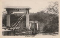
1938: Brae Doune
Brae Doune, Scotland, United Kingdom - River Oykel
| Bridgemeister ID: | 2635 (added 2019-03-02) |
| Year Completed: | 1938 |
| Name: | Brae Doune |
| Also Known As: | Tuitean |
| Location: | Brae Doune, Scotland, United Kingdom |
| Crossing: | River Oykel |
| Coordinates: | 57.974258 N 4.638333 W |
| Maps: | Acme, GeoHack, Google, OpenStreetMap |
| Principals: | John Henderson and Co. (Aberdeen) |
| Use: | Footbridge |
| Status: | Closed (last checked: 2022) |
| Main Cables: | Wire (steel) |
| Suspended Spans: | 1 |
| Main Span: | 1 x 91.4 meters (300 feet) |
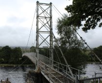
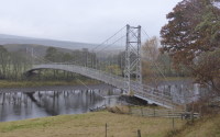
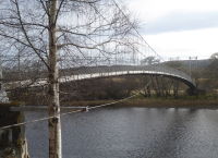
1938: Buker
Scott Bar vicinity, California, USA - Scott River
| Bridgemeister ID: | 581 (added 2003-01-01) |
| Year Completed: | 1938 |
| Name: | Buker |
| Also Known As: | Canyon Creek, Scott River |
| Location: | Scott Bar vicinity, California, USA |
| Crossing: | Scott River |
| At or Near Feature: | Klamath National Forest |
| Coordinates: | 41.63408 N 123.10570 W |
| Maps: | Acme, GeoHack, Google, OpenStreetMap |
| Use: | Vehicular (one-lane) |
| Status: | In use |
| Main Cables: | Wire (steel) |
| Suspended Spans: | 1 |
Notes:
- Restored 1998 (per plaque posted on bridge).
External Links:
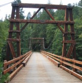
1938: Fox River
Fox Glacier valley, West Coast, New Zealand - Fox River
| Bridgemeister ID: | 763 (added 2003-03-08) |
| Year Completed: | 1938 |
| Name: | Fox River |
| Location: | Fox Glacier valley, West Coast, New Zealand |
| Crossing: | Fox River |
| Coordinates: | 43.477723 S 170.008270 E |
| Maps: | Acme, GeoHack, Google, OpenStreetMap |
| References: | GAP |
| Use: | Vehicular (one-lane) |
| Status: | In use (last checked: 2019) |
| Main Cables: | Wire (steel) |
| Suspended Spans: | 1 |
| Main Span: | 1 x 109.7 meters (359.9 feet) |
External Links:
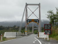
1938: James River
Buchanan, Virginia, USA - James River
| Bridgemeister ID: | 337 (added before 2003) |
| Year Completed: | 1938 |
| Name: | James River |
| Location: | Buchanan, Virginia, USA |
| Crossing: | James River |
| Coordinates: | 37.53038 N 79.67793 W |
| Maps: | Acme, GeoHack, Google, OpenStreetMap |
| Principals: | Virginia State Highway Department (now VDOT) |
| References: | RT20040413 |
| Use: | Footbridge |
| Status: | In use (last checked: 2022) |
| Main Cables: | Wire (steel) |
| Suspended Spans: | 2 |
| Main Span: | 1 |
| Side Span: | 1 |
Notes:
- This oddly-proportioned bridge has a long side-span on one side and no side-span on the other.
- Damaged by storm, November, 2003. Temporarily closed, February, 2004. Repaired and reopened March, 2004.
External Links:
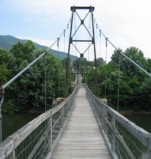
1938: Jerambah
Selindung, Pangkalpinang and Balunijuk, Bangka Regency, Bangka Belitung Islands, Indonesia - Sungai Nielanding
| Bridgemeister ID: | 8174 (added 2024-02-04) |
| Year Completed: | 1938 |
| Name: | Jerambah |
| Location: | Selindung, Pangkalpinang and Balunijuk, Bangka Regency, Bangka Belitung Islands, Indonesia |
| Crossing: | Sungai Nielanding |
| Coordinates: | 2.086800 S 106.093350 E |
| Maps: | Acme, GeoHack, Google, OpenStreetMap |
| Use: | Footbridge |
| Status: | Only towers remain (last checked: 2023) |
| Main Span: | 1 x 54.5 meters (178.8 feet) estimated |
Notes:
- In 2021, a large faux suspension bridge was completed next to the remains of the suspension bridge. Patrick S. O'Donnell writes: "These remnants are overshadowed (physically, but not historically) by the relatively new (2021) concrete highway bridge designed to look like a suspension bridge. Built in homage to the original suspension bridge at this site, this new bridge's suspension elements are all decorative; from the main and suspender cables to the accompanying hardware, and the steel towers that are to their credit at least fixed to the ground and not the bridge itself. The new bridge's construction did have a setback when all the mainspan concrete girders collapsed into the river on October 16, 2020. The new bridge was inaugurated on March 4, 2021."
External Links:
- Google Maps - Jembatan Jerambah Gantung. Image showing the old suspension bridge towers. Dated March 2021.
- Google Maps - Jembatan Jerambah Gantung. Image showing the old suspension bridge towers. Dated March 2021.
- Google Maps - Jembatan Jerambah Gantung. The new bridge with decorative suspension components.
- YouTube - JALAN MENUJU JERAMBAH GANTUNG PANGKAL PINANG || LENGKAP MENUJU LOKASI. Video of the mess after the collapse of the new bridge under construction. The tower of the old suspension bridge is clearly visible starting around the 8:35 mark. Posted November 16, 2020.
1938: Kamui-Ohashi
Asahikawa vicinity, Hokkaido, Japan - Ishikari River
| Bridgemeister ID: | 1877 (added 2005-09-22) |
| Year Completed: | 1938 |
| Name: | Kamui-Ohashi |
| Also Known As: | 神居大橋 |
| Location: | Asahikawa vicinity, Hokkaido, Japan |
| Crossing: | Ishikari River |
| Coordinates: | 43.732417 N 142.200883 E |
| Maps: | Acme, GeoHack, Google, OpenStreetMap |
| Status: | In use (last checked: 2021) |
| Main Cables: | Wire (steel) |
| Suspended Spans: | 3 |
| Main Span: | 1 x 38.8 meters (127.3 feet) estimated |
| Side Spans: | 2 |
1938: Krymsky
Moscow, Russia - Moskva River
| Bridgemeister ID: | 960 (added 2003-11-01) |
| Year Completed: | 1938 |
| Name: | Krymsky |
| Also Known As: | Crimean |
| Location: | Moscow, Russia |
| Crossing: | Moskva River |
| Coordinates: | 55.734082 N 37.598721 E |
| Maps: | Acme, GeoHack, Google, OpenStreetMap |
| Principals: | B. P. Konstantinov, A. V. Vlasov |
| Use: | Vehicular (four or more lanes) |
| Status: | In use (last checked: 2021) |
| Main Cables: | Eyebar (steel) |
| Suspended Spans: | 1 |
External Links:
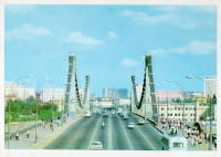
1938: Lake Mathews Outlet Tower
Corona vicinity, California, USA - Lake Mathews
| Bridgemeister ID: | 1891 (added 2005-10-01) |
| Year Completed: | 1938 |
| Name: | Lake Mathews Outlet Tower |
| Location: | Corona vicinity, California, USA |
| Crossing: | Lake Mathews |
| Coordinates: | 33.849279 N 117.455022 W |
| Maps: | Acme, GeoHack, Google, OpenStreetMap |
| References: | CE193806 |
| Use: | Footbridge |
| Status: | Removed |
| Main Cables: | Wire (steel) |
| Suspended Spans: | 1 |
Notes:
- Outlet tower access bridge. Likely completed 1938 with Cajalco (now Lake Matthews) Reservoir construction.
External Links:
- Intake structure of the Colorado River Aqueduct on the Colorado River, June 11, 1941 — Calisphere
- Water and Power Associates - Construction of the Colorado River Aqueduct. Multiple photos of the outlet tower and access bridge.
1938: Manning
Riggins Hot Springs vicinity, Idaho, USA - Salmon River
| Bridgemeister ID: | 1333 (added 2004-05-01) |
| Year Completed: | 1938 |
| Name: | Manning |
| Also Known As: | Crevasse |
| Location: | Riggins Hot Springs vicinity, Idaho, USA |
| Crossing: | Salmon River |
| At or Near Feature: | Manning Crevice |
| Coordinates: | 45.401517 N 116.11682 W |
| Maps: | Acme, GeoHack, Google, OpenStreetMap |
| Principals: | J. P. Martin, E. Myers |
| References: | AAJ |
| Use: | Vehicular (one-lane) |
| Status: | Replaced, 2018 |
| Main Cables: | Wire (steel) |
| Suspended Spans: | 1 |
| Main Span: | 1 x 73.2 meters (240 feet) |
Notes:
- 2018: Replaced by another suspension bridge, removed at some point 2018-2020.
- Replaced by 2018 Manning Crevice - Riggins Hot Springs vicinity, Idaho, USA.
External Links:

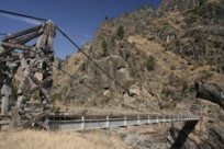
1938: Montjean-sur-Loire
Montjean-sur-Loire, Maine-et-Loire, France - Loire River
| Bridgemeister ID: | 6422 (added 2021-08-09) |
| Year Completed: | 1938 |
| Name: | Montjean-sur-Loire |
| Location: | Montjean-sur-Loire, Maine-et-Loire, France |
| Crossing: | Loire River |
| Coordinates: | 47.392675 N 0.860650 W |
| Maps: | Acme, GeoHack, Google, OpenStreetMap |
| Use: | Vehicular |
| Status: | Destroyed, June, 1940 |
| Main Cables: | Wire (steel) |
| Suspended Spans: | 6 |
| Main Spans: | 4 |
| Side Spans: | 2 |
Notes:
- 1940, June: Intentionally destroyed to slow advancing German troops.
- Replaced 1927 Montjean-sur-Loire - Montjean-sur-Loire, Maine-et-Loire, France.
- Later at same location 1949 Montjean-sur-Loire - Montjean-sur-Loire, Maine-et-Loire, France.
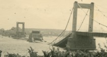
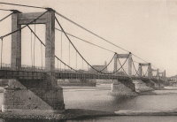
1938: Nengtan
Nengtan (能滩村), Luxi County, Xiangxi, Hunan, China - Nengtan River
| Bridgemeister ID: | 8227 (added 2024-02-07) |
| Year Completed: | 1938 |
| Name: | Nengtan |
| Location: | Nengtan (能滩村), Luxi County, Xiangxi, Hunan, China |
| Crossing: | Nengtan River |
| Coordinates: | 28.233306 N 109.984139 E |
| Maps: | Acme, GeoHack, Google, OpenStreetMap |
| Use: | Vehicular (one-lane) |
| Status: | Closed |
| Main Cables: | Chain |
| Suspended Spans: | 1 |
External Links:
1938: Queanbeyan
Queanbeyan, New South Wales, Australia - Queanbeyan River
| Bridgemeister ID: | 454 (added before 2003) |
| Year Completed: | 1938 |
| Name: | Queanbeyan |
| Location: | Queanbeyan, New South Wales, Australia |
| Crossing: | Queanbeyan River |
| Coordinates: | 35.35567 S 149.23857 E |
| Maps: | Acme, GeoHack, Google, OpenStreetMap |
| Use: | Footbridge |
| Status: | Restricted to foot traffic (last checked: 2021) |
| Main Cables: | Wire (steel) |
| Suspended Spans: | 1 |
Notes:
1938: Roquefort-sur-Garonne
Fourc and Roquefort-sur-Garonne, Haute-Garonne, France - Salat River
| Bridgemeister ID: | 7399 (added 2022-12-03) |
| Year Completed: | 1938 |
| Name: | Roquefort-sur-Garonne |
| Location: | Fourc and Roquefort-sur-Garonne, Haute-Garonne, France |
| Crossing: | Salat River |
| Coordinates: | 43.158060 N 0.968714 E |
| Maps: | Acme, GeoHack, Google, OpenStreetMap |
| Use: | Vehicular (two-lane) |
| Status: | In use (last checked: 2021) |
| Main Cables: | Wire (steel) |
| Suspended Spans: | 1 |
| Main Span: | 1 x 67 meters (219.8 feet) estimated |
Notes:
1938: Saint-Gilles
Saint-Gilles-du-Gard, Gard, France - Petit Rhône River
| Bridgemeister ID: | 6743 (added 2021-10-23) |
| Year Completed: | 1938 |
| Name: | Saint-Gilles |
| Location: | Saint-Gilles-du-Gard, Gard, France |
| Crossing: | Petit Rhône River |
| Coordinates: | 43.665675 N 4.452997 E |
| Maps: | Acme, GeoHack, Google, OpenStreetMap |
| Use: | Vehicular |
| Status: | Replaced, 1985 |
| Main Cables: | Wire (steel) |
| Suspended Spans: | 1 |
| Main Span: | 1 |
Notes:
External Links:
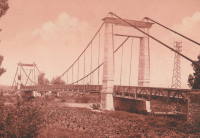
1938: Saula
Lafrançaise, Tarn-et-Garonne, France - Tarn River
| Bridgemeister ID: | 7185 (added 2022-07-02) |
| Year Completed: | 1938 |
| Name: | Saula |
| Location: | Lafrançaise, Tarn-et-Garonne, France |
| Crossing: | Tarn River |
| Coordinates: | 44.113997 N 1.247532 E |
| Maps: | Acme, GeoHack, Google, OpenStreetMap |
| Use: | Vehicular (two-lane) |
| Status: | In use (last checked: 2019) |
| Main Cables: | Wire (steel) |
| Suspended Spans: | 1 |
| Main Span: | 1 x 120 meters (393.7 feet) estimated |
Notes:
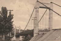
1938: Te Reinga
Wairoa vicinity, New Zealand - Wairoa River
| Bridgemeister ID: | 760 (added 2003-03-08) |
| Year Completed: | 1938 |
| Name: | Te Reinga |
| Location: | Wairoa vicinity, New Zealand |
| Crossing: | Wairoa River |
| References: | GAP |
| Use: | Vehicular (one-lane) |
| Status: | Extant (last checked: 2001) |
| Main Cables: | Wire (steel) |
| Suspended Spans: | 1 |
Notes:
- Scheduled to be demolished, 2003.
External Links:
1938: Thousand Islands International I
Wellesley Island and Collins Landing, New York, USA - St. Lawrence River
| Bridgemeister ID: | 364 (added before 2003) |
| Year Completed: | 1938 |
| Name: | Thousand Islands International I |
| Location: | Wellesley Island and Collins Landing, New York, USA |
| Crossing: | St. Lawrence River |
| At or Near Feature: | American Channel |
| Coordinates: | 44.30333 N 75.98333 W |
| Maps: | Acme, GeoHack, Google, OpenStreetMap |
| Principals: | Robinson and Steinman |
| References: | AAJ, ADDS |
| Use: | Vehicular (two-lane, heavy vehicles), with walkway |
| Status: | In use (last checked: 2022) |
| Main Cables: | Wire (steel) |
| Suspended Spans: | 3 |
| Main Span: | 1 x 243.8 meters (800 feet) |
| Side Spans: | 2 x 106.7 meters (350 feet) |
Notes:
External Links:


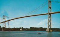
1938: Thousand Islands International II
Georgina Island and Selton, Ontario, Canada - St. Lawrence River
| Bridgemeister ID: | 365 (added before 2003) |
| Year Completed: | 1938 |
| Name: | Thousand Islands International II |
| Location: | Georgina Island and Selton, Ontario, Canada |
| Crossing: | St. Lawrence River |
| Coordinates: | 44.36323 N 75.98271 W |
| Maps: | Acme, GeoHack, Google, OpenStreetMap |
| Principals: | Robinson and Steinman |
| References: | AAJ, ADDS |
| Use: | Vehicular (two-lane, heavy vehicles), with walkway |
| Status: | In use (last checked: 2022) |
| Main Cables: | Wire (steel) |
| Suspended Spans: | 3 |
| Main Span: | 1 x 228.6 meters (750 feet) |
| Side Spans: | 2 x 91.4 meters (300 feet) |
Notes:
- Companion to 1938 Thousand Islands International I - Wellesley Island and Collins Landing, New York, USA.
External Links:
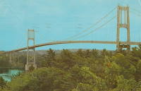
1938: Veenker Golf Course
Ames, Iowa, USA - Squaw Creek
| Bridgemeister ID: | 2690 (added 2019-05-27) |
| Year Completed: | 1938 |
| Name: | Veenker Golf Course |
| Location: | Ames, Iowa, USA |
| Crossing: | Squaw Creek |
| Use: | Golf cart |
| Status: | Failed, November 2014 |
| Main Cables: | Wire (steel) |
| Suspended Spans: | 1 |
1939: (footbridge)
Dannevirke vicinity, New Zealand - Mangatoro Stream
| Bridgemeister ID: | 766 (added 2003-03-08) |
| Year Completed: | 1939 |
| Name: | (footbridge) |
| Location: | Dannevirke vicinity, New Zealand |
| Crossing: | Mangatoro Stream |
| References: | GAP |
| Use: | Footbridge |
1939: (footbridge)
West Bank, New Zealand - Maruia River
| Bridgemeister ID: | 768 (added 2003-03-08) |
| Year Completed: | 1939 |
| Name: | (footbridge) |
| Location: | West Bank, New Zealand |
| Crossing: | Maruia River |
| References: | GAP |
| Use: | Footbridge |
1939: (suspension bridge)
Bend, Texas, USA - Colorado River
| Bridgemeister ID: | 1616 (added 2005-02-26) |
| Year Completed: | 1939 |
| Name: | (suspension bridge) |
| Location: | Bend, Texas, USA |
| Crossing: | Colorado River |
| Principals: | Austin Bridge Co. |
| References: | AUB |
| Use: | Vehicular |
| Status: | Removed |
| Main Cables: | Wire (steel) |
| Suspended Spans: | 3 |
| Main Span: | 1 |
| Side Spans: | 2 |
Notes:
- Similar to 1939 Regency - Regency, Texas, USA. The Bend bridge is pictured in AUB. At first, I thought it was the nearby Regency bridge, but upon closer inspection, the Bend bridge had suspended approach spans. Regency did not. Otherwise, they are very similar in appearance, both having been built in the same year by the same company.
1939: Avalon Dam
Carlsbad vicinity, New Mexico, USA - Headgate Channel
| Bridgemeister ID: | 1960 (added 2005-11-05) |
| Year Completed: | 1939 |
| Name: | Avalon Dam |
| Location: | Carlsbad vicinity, New Mexico, USA |
| Crossing: | Headgate Channel |
| Coordinates: | 32.491492 N 104.251506 W |
| Maps: | Acme, GeoHack, Google, OpenStreetMap |
| Principals: | Civilian Conservation Corps (CCC) |
| References: | HAERNM4B |
| Use: | Footbridge |
| Status: | Extant (last checked: 2019) |
| Main Cables: | Wire |
| Suspended Spans: | 1 |
1939: Black River Harbor
Ottawa National Forest, Michigan, USA - Black River
| Bridgemeister ID: | 1045 (added 2003-12-06) |
| Year Completed: | 1939 |
| Name: | Black River Harbor |
| Location: | Ottawa National Forest, Michigan, USA |
| Crossing: | Black River |
| Coordinates: | 46.66608 N 90.04611 W |
| Maps: | Acme, GeoHack, Google, OpenStreetMap |
| Principals: | 3601st Company CCC (Civilian Conservation Corps) Camp Norrie |
| Use: | Footbridge |
| Status: | In use (last checked: 2019) |
| Main Cables: | Wire (steel) |
| Suspended Spans: | 1 |
| Main Span: | 1 x 58.8 meters (193 feet) |
Notes:
- Reconstructed, 1968, but appears to have retained its original appearance. Improvements made, 2009.
- Tom Haapoja provided information about this bridge. His father worked on its construction: "Built in 1938-39. They had a sawmill on site from which they took 'select' lumber for the bridge and boat docking area. I think the sawmill was located on the present-day parking lot. Each anchor for the suspension cables consisted of 44 tons of concrete. The concrete was transported to the forms via wheelbarrows. The construction of the East anchor was difficult because the wheelbarrows travelled uphill, and each were pushed by one man and pulled by another."
"It was a WPA and CCC effort. The CCC Camp discipline and logistics were provided by the US Army, but the construction supervision was provided by the WPA. About 200 Men from the Norrie CCC camp (Ironwood, Michigan) participated in the construction of the bridge and surrounding park. They worked during the cold of winter and rode to and from Camp Norrie in open trucks. Each trip took 1 1/2 hours. The architect of the bridge was 'Oakey' Johnson. The WPA construction foreman was 'Charlie' Johnson."
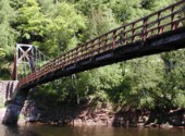
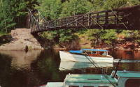
1939: Bronx-Whitestone
The Bronx and Queens, New York, USA - East River
| Bridgemeister ID: | 191 (added before 2003) |
| Year Completed: | 1939 |
| Name: | Bronx-Whitestone |
| Location: | The Bronx and Queens, New York, USA |
| Crossing: | East River |
| Coordinates: | 40.80167 N 73.83 W |
| Maps: | Acme, GeoHack, Google, OpenStreetMap |
| Principals: | O. H. Ammann, Allston Dana |
| References: | AAJ, ARF, BAAW, BBR, BFL, BPL, GBD, SIX |
| Use: | Vehicular (major highway) |
| Status: | In use (last checked: 2022) |
| Main Cables: | Wire (steel) |
| Suspended Spans: | 3 |
| Main Span: | 1 x 701 meters (2,300 feet) |
| Side Spans: | 2 x 224 meters (735 feet) |
Notes:
External Links:

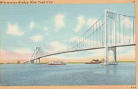
1939: Chute du Brule
Grand-Remous, Quebec, Canada - Gatineau River
| Bridgemeister ID: | 192 (added before 2003) |
| Year Completed: | 1939 |
| Name: | Chute du Brule |
| Location: | Grand-Remous, Quebec, Canada |
| Crossing: | Gatineau River |
| Principals: | Dominion Bridge Co. |
| Use: | Vehicular (two-lane) |
| Status: | Removed |
| Main Cables: | Wire (steel) |
| Suspended Spans: | 1 |
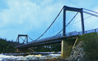
1939: Cook River
West Coast, New Zealand - Cook River
| Bridgemeister ID: | 764 (added 2003-03-08) |
| Year Completed: | 1939 |
| Name: | Cook River |
| Location: | West Coast, New Zealand |
| Crossing: | Cook River |
| Coordinates: | 43.498923 S 169.966063 E |
| Maps: | Acme, GeoHack, Google, OpenStreetMap |
| References: | GAP |
| Use: | Vehicular (one-lane) |
| Status: | In use (last checked: 2019) |
| Main Cables: | Wire (steel) |
| Suspended Spans: | 1 |
| Main Span: | 1 x 80.5 meters (264.1 feet) |
External Links:
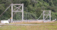
1939: Curran
Littleton, New Hampshire, USA - Ammonoosuc River
| Bridgemeister ID: | 2583 (added 2013-09-22) |
| Year Completed: | 1939 |
| Name: | Curran |
| Location: | Littleton, New Hampshire, USA |
| Crossing: | Ammonoosuc River |
| Coordinates: | 44.306115 N 71.778048 W |
| Maps: | Acme, GeoHack, Google, OpenStreetMap |
| Principals: | Kenneth Curran |
| Use: | Footbridge |
| Status: | In use (last checked: 2019) |
| Main Cables: | Wire (steel) |
| Suspended Spans: | 3 |
| Main Span: | 1 x 74.4 meters (244 feet) estimated |
| Side Spans: | 1 x 15.2 meters (50 feet) estimated, 1 x 7 meters (23 feet) estimated |
Notes:
1939: Deer Isle
Sedgwick, Maine, USA - Eggemoggin Reach
| Bridgemeister ID: | 193 (added before 2003) |
| Year Completed: | 1939 |
| Name: | Deer Isle |
| Location: | Sedgwick, Maine, USA |
| Crossing: | Eggemoggin Reach |
| Coordinates: | 44.290167 N 68.691383 W |
| Maps: | Acme, GeoHack, Google, OpenStreetMap |
| Principals: | Robinson and Steinman |
| References: | AAJ, BBR, IT1999F |
| Use: | Vehicular (two-lane, heavy vehicles), with walkway |
| Status: | In use (last checked: 2022) |
| Main Cables: | Wire (steel) |
| Suspended Spans: | 3 |
| Main Span: | 1 x 329.2 meters (1,080 feet) |
| Side Spans: | 2 x 147.5 meters (484 feet) |
Notes:
- Gained much media attention in July 2018 when a bracket broke loose connecting the maintenance access cables to the main cables even though it had no impact on the structural integrity of the bridge.
External Links:
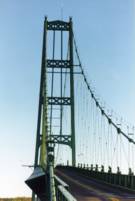

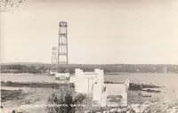
1939: Far Red Hill
Mount Morgan, Queensland, Australia - Dee River
| Bridgemeister ID: | 1748 (added 2005-04-20) |
| Year Completed: | 1939 |
| Name: | Far Red Hill |
| Location: | Mount Morgan, Queensland, Australia |
| Crossing: | Dee River |
| Coordinates: | 23.651006 S 150.376080 E |
| Maps: | Acme, GeoHack, Google, OpenStreetMap |
| Use: | Footbridge |
| Status: | Only towers remain (last checked: 2019) |
| Main Cables: | Wire |
Notes:
External Links:
- Mount Morgan web site (link reported not working). Notes: "At a special meeting of the Mount Morgan Shire Council in February 1939, the Council accepted a tender from Mr. W. Kerrigan to rebuild [the previous Far Red Hill bridge]. The bridge is now neglected and in a very bad state of repair and is unusable."
1939: Lions Gate
Vancouver, British Columbia, Canada - Vancouver Harbor
| Bridgemeister ID: | 194 (added before 2003) |
| Year Completed: | 1939 |
| Name: | Lions Gate |
| Also Known As: | First Narrows |
| Location: | Vancouver, British Columbia, Canada |
| Crossing: | Vancouver Harbor |
| At or Near Feature: | Burrard Inlet |
| Coordinates: | 49.31533 N 123.13846 W |
| Maps: | Acme, GeoHack, Google, OpenStreetMap |
| Principals: | Monsarrat and Pratley |
| References: | AAJ, BAR, BMA |
| Use: | Vehicular (major highway) |
| Status: | In use (last checked: 2019) |
| Main Cables: | Wire (steel) |
| Suspended Spans: | 3 |
| Main Span: | 1 x 472.4 meters (1,550 feet) |
| Side Spans: | 2 x 187.5 meters (615 feet) |
| Deck width: | 39 feet |
External Links:

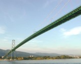
1939: Manosque
Manosque, Alpes-de-Haute-Provence, France - Durance River
| Bridgemeister ID: | 897 (added 2003-09-07) |
| Year Completed: | 1939 |
| Name: | Manosque |
| Location: | Manosque, Alpes-de-Haute-Provence, France |
| Crossing: | Durance River |
| Coordinates: | 43.8047 N 5.8238 E |
| Maps: | Acme, GeoHack, Google, OpenStreetMap |
| Use: | Vehicular (two-lane, heavy vehicles), with walkway |
| Status: | Replaced, 2019 |
| Main Cables: | Wire (steel) |
| Suspended Spans: | 1 |
Notes:
- At former location of 1839 Manosque - Manosque, Alpes-de-Haute-Provence, France.
External Links:
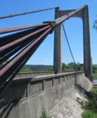
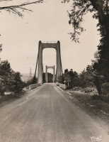
| Bridgemeister ID: | 2733 (added 2019-06-23) |
| Year Completed: | 1939 |
| Name: | Målselv |
| Location: | Målselv, Troms og Finnmark, Norway |
| Crossing: | Målselv |
| Coordinates: | 69.139009 N 18.601639 E |
| Maps: | Acme, GeoHack, Google, kart.1881.no, OpenStreetMap |
| Use: | Vehicular (one-lane) |
| Status: | In use (last checked: 2019) |
| Main Cables: | Wire (steel) |
| Suspended Spans: | 1 |
| Main Span: | 1 x 115 meters (377.3 feet) |
1939: Mosquito Road
Placerville, California, USA - South Fork American River
| Bridgemeister ID: | 346 (added before 2003) |
| Year Completed: | 1939 |
| Name: | Mosquito Road |
| Location: | Placerville, California, USA |
| Crossing: | South Fork American River |
| Coordinates: | 38.77582 N 120.74854 W |
| Maps: | Acme, GeoHack, Google, OpenStreetMap |
| Use: | Vehicular (one-lane) |
| Status: | In use (last checked: 2021) |
| Main Cables: | Wire (steel) |
| Suspended Spans: | 1 |
Notes:
External Links:

1939: Otto Beit
Makuti, Zimbabwe and Chirundu, Zambia - Zambezi River
| Bridgemeister ID: | 937 (added 2003-10-25) |
| Year Completed: | 1939 |
| Name: | Otto Beit |
| Also Known As: | Chirundu |
| Location: | Makuti, Zimbabwe and Chirundu, Zambia |
| Crossing: | Zambezi River |
| Coordinates: | 16.038006 S 28.852322 E |
| Maps: | Acme, GeoHack, Google, OpenStreetMap |
| Principals: | Ralph Freeman, Dorman Long & Co Ltd |
| References: | AAJ, WOT |
| Use: | Vehicular (two-lane, heavy vehicles) |
| Status: | In use (last checked: 2018) |
| Main Cables: | Wire (steel) |
| Main Span: | 1 x 320 meters (1,049.9 feet) |
External Links:
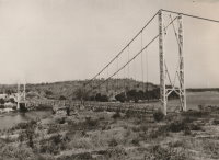
1939: Regency
Regency, Texas, USA - Colorado River
| Bridgemeister ID: | 195 (added before 2003) |
| Year Completed: | 1939 |
| Name: | Regency |
| Location: | Regency, Texas, USA |
| Crossing: | Colorado River |
| Coordinates: | 31.41167 N 98.84667 W |
| Maps: | Acme, GeoHack, Google, OpenStreetMap |
| Principals: | Austin Bridge Co. |
| References: | AUB |
| Use: | Vehicular (one-lane) |
| Status: | In use (last checked: 2008) |
| Main Cables: | Wire (steel) |
| Suspended Spans: | 1 |
| Main Span: | 1 x 103.6 meters (340 feet) |
Notes:
- Similar to 1939 (suspension bridge) - Bend, Texas, USA.
External Links:
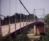
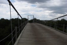
1939: Saint-Jean-de-Blaignac
Saint-Jean-de-Blaignac and Lavagnac, Gironde, France - Dordogne River
| Bridgemeister ID: | 7336 (added 2022-09-03) |
| Year Completed: | 1939 |
| Name: | Saint-Jean-de-Blaignac |
| Location: | Saint-Jean-de-Blaignac and Lavagnac, Gironde, France |
| Crossing: | Dordogne River |
| Use: | Vehicular |
| Status: | Destroyed |
| Suspended Spans: | 3 |
| Main Spans: | 3 |
Notes:
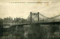
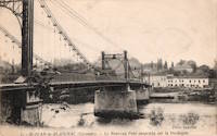
1939: Skoltefoss
Elvenes vicinity, Norway - Pasvikelva
| Bridgemeister ID: | 3953 (added 2020-03-21) |
| Year Completed: | 1939 |
| Name: | Skoltefoss |
| Location: | Elvenes vicinity, Norway |
| Crossing: | Pasvikelva |
| Use: | Vehicular |
| Status: | Destroyed, December 1939 |
| Main Cables: | Wire (steel) |
| Suspended Spans: | 1 |
Notes:
- Opened September 9, 1939 and soon after destroyed in December 1939, bombed by Finland during the Winter War between Russia and Finland.
- Unclear if this bridge, when constructed, was actually in Norway, Finland, or straddling the border between the two as it existed in 1939. It was constructed directly over falls in an area known as Skoltefoss where a dam has since been constructed. The current border at this location has changed as a result of the WWII-era hostilities between Finland and Russia and is now between Norway and Russia.
External Links:
1939: Sullivan-Hutsonville
Hutsonville, Illinois and Sullivan, Indiana, USA - Wabash River
| Bridgemeister ID: | 196 (added before 2003) |
| Year Completed: | 1939 |
| Name: | Sullivan-Hutsonville |
| Location: | Hutsonville, Illinois and Sullivan, Indiana, USA |
| Crossing: | Wabash River |
| Coordinates: | 39.1101 N 87.6551 W |
| Maps: | Acme, GeoHack, Google, OpenStreetMap |
| Principals: | Steinman & Robinson, R.V. Milbank, Wisconsin Bridge & Iron Co., Charles J. Glasgow |
| References: | AAJ, BPL, IMB, SJR19880926 |
| Use: | Vehicular (two-lane), with walkway |
| Status: | Demolished, 1989 |
| Main Cables: | Wire (steel) |
| Suspended Spans: | 3 |
| Main Span: | 1 x 106.7 meters (350 feet) |
| Side Spans: | 2 x 45.7 meters (150 feet) |
| Deck width: | 20 feet |
| Characteristics: | Self-anchored |
Notes:
- Demolished 1989. This bridge was Steinman's attempt at a self-anchored suspension bridge and met a controversial demise in 1989. An article in the September 26, 1988 issue of the Springfield, IL "The State Journal-Register" describes the ongoing controversy. The company to which the $100,000 demolition contract was let offered to turn the money over to save the bridge. The locals agreed, but the company's Chief Engineer Stephen Schneider was quoted, "I think Indiana really wants to tear it down. They've been ... forced to send inspectors out every two weeks. I think they just want the headache gone." Gary Abell, spokesman for the Indiana Dept. Of Highways said its design is "not one of the best. It works in theory, but not in practice. This is like trying to save a mistake." After a lot of back-and-forth, the locals gave up, "We've had it with them. We don't want anything more to do with it. They can tear the damn thing down." Animosity toward this bridge continues 13 years after its demolition. In 2002, in an email to Wayne Grodkiewicz (who provided me with much information about this bridge), an INDOT representative said, "I am not sure why you are interested in that bridge, but from our stand point, it was a very poorly designed bridge that had many many problems from the day that it was completed, until it was brought down."
External Links:
1939: Swinging
Tishomingo State Park, Mississippi, USA - Bear Creek
| Bridgemeister ID: | 850 (added 2003-07-27) |
| Year Completed: | 1939 |
| Name: | Swinging |
| Location: | Tishomingo State Park, Mississippi, USA |
| Crossing: | Bear Creek |
| Coordinates: | 34.605183 N 88.17955 W |
| Maps: | Acme, GeoHack, Google, OpenStreetMap |
| Use: | Footbridge |
| Status: | In use (last checked: 2020) |
| Main Cables: | Wire (steel) |
| Suspended Spans: | 1 |
| Main Span: | 1 x 57.9 meters (190 feet) estimated |
Notes:
- Likely built by the CCC, this bridge has an interesting zig-zag pattern of suspenders. The suspenders are inclined and are continuous across the bridge like a shoelace with one set of eyelets at deck level and the other set of eyelets along the main cables.
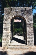
1939: Thames Ditton Island
Thames Ditton, England, United Kingdom - River Thames
| Bridgemeister ID: | 2089 (added 2006-07-02) |
| Year Completed: | 1939 |
| Name: | Thames Ditton Island |
| Location: | Thames Ditton, England, United Kingdom |
| Crossing: | River Thames |
| Coordinates: | 51.39303 N 0.33127 W |
| Maps: | Acme, GeoHack, Google, OpenStreetMap |
| Principals: | David Rowell & Co. |
| Use: | Footbridge |
| Status: | In use (last checked: 2012) |
| Main Cables: | Wire |
| Suspended Spans: | 3 |
| Main Span: | 1 |
| Side Spans: | 2 |
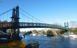
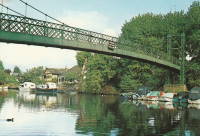
1939: Willowflat Road
Putere, New Zealand - Mohaka River
| Bridgemeister ID: | 767 (added 2003-03-08) |
| Year Completed: | 1939 |
| Name: | Willowflat Road |
| Location: | Putere, New Zealand |
| Crossing: | Mohaka River |
| Coordinates: | 39.004232 S 176.946771 E |
| Maps: | Acme, GeoHack, Google, OpenStreetMap |
| References: | GAP |
| Use: | Vehicular |
| Status: | Removed |
Notes:
- Coordinates are for the current (2019) Willowflat Road crossing of the Mohaka River, likely the same location as the suspension bridge.
(footbridge)
Losby, Viken, Norway - Mønevannet
| Bridgemeister ID: | 4473 (added 2020-04-26) |
| Name: | (footbridge) |
| Location: | Losby, Viken, Norway |
| Crossing: | Mønevannet |
| Coordinates: | 59.875808 N 10.997912 E |
| Maps: | Acme, GeoHack, Google, kart.1881.no, OpenStreetMap |
| Use: | Footbridge |
| Status: | Removed |
| Main Cables: | Wire (steel) |
| Suspended Spans: | 1 |
| Main Span: | 1 x 32 meters (105 feet) estimated |
Notes:
- Built during 1930s. Removed, early 1970s.
External Links:
(footbridge)
Masterton, Wairarapa District, New Zealand - Waipoua River
| Bridgemeister ID: | 742 (added 2003-03-08) |
| Name: | (footbridge) |
| Location: | Masterton, Wairarapa District, New Zealand |
| Crossing: | Waipoua River |
| At or Near Feature: | Queen Elizabeth Park |
| Coordinates: | 40.947982 S 175.669994 E |
| Maps: | Acme, GeoHack, Google, OpenStreetMap |
| References: | GAP |
| Use: | Footbridge |
| Status: | In use (last checked: 2017) |
| Main Cables: | Wire (steel) |
| Suspended Spans: | 3 |
| Main Span: | 1 |
| Side Spans: | 2 |
Notes:
- Completed in the 1930s.
External Links:
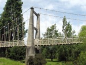
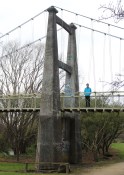
(footbridge)
Niederbuchenau, Rheinland-Pfalz, Germany - Wied River
| Bridgemeister ID: | 2208 (added 2007-02-11) |
| Name: | (footbridge) |
| Location: | Niederbuchenau, Rheinland-Pfalz, Germany |
| Crossing: | Wied River |
| Coordinates: | 50.57682 N 7.40954 E |
| Maps: | Acme, GeoHack, Google, OpenStreetMap |
| Use: | Footbridge |
| Status: | In use (last checked: 2006) |
| Main Cables: | Wire (steel) |
| Suspended Spans: | 1 |
| Main Span: | 1 x 27.2 meters (89.2 feet) |
| Deck width: | 1.1 meters between side rails, 1.3 meters total |
Notes:
- Completed circa 1935. New towers circa 1975. Renovation, 2005.
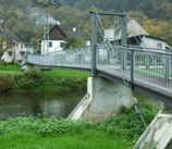
(footbridge)
South Buffalo, New York, USA - Cazenovia Creek
| Bridgemeister ID: | 868 (added 2003-08-30) |
| Name: | (footbridge) |
| Location: | South Buffalo, New York, USA |
| Crossing: | Cazenovia Creek |
| At or Near Feature: | Cazenovia Park |
| Coordinates: | 42.84315 N 78.80165 W |
| Maps: | Acme, GeoHack, Google, OpenStreetMap |
| Principals: | Works Progress Administration |
| Use: | Footbridge |
| Status: | In use (last checked: 2004) |
Notes:
- Constructed by WPA in the 1930s, rebuilt in 1989.
Hamilton Dam
Blufton, Texas, USA - Colorado River
| Bridgemeister ID: | 4949 (added 2020-08-08) |
| Name: | Hamilton Dam |
| Location: | Blufton, Texas, USA |
| Crossing: | Colorado River |
| Status: | Removed |
| Main Cables: | Wire (steel) |
Notes:
- Completed 1930s during construction of the Hamilton (now Buchanan) Dam. Appears to have been a large one-lane bridge. Likely removed during 1930s.
Ishi Pishi
Orleans vicinity, California, USA - Klamath River
| Bridgemeister ID: | 5672 (added 2021-01-30) |
| Name: | Ishi Pishi |
| Location: | Orleans vicinity, California, USA |
| Crossing: | Klamath River |
| Coordinates: | 41.378467 N 123.496315 W |
| Maps: | Acme, GeoHack, Google, OpenStreetMap |
| Use: | Vehicular |
| Status: | Destroyed, December, 1964 |
| Main Cables: | Wire (steel) |
Notes:
- Likely completed in the 1930s.
- 1964, December: Destroyed by flood.
Walcott
Walcott, British Columbia, Canada - Bulkley River
| Bridgemeister ID: | 5920 (added 2021-06-10) |
| Name: | Walcott |
| Location: | Walcott, British Columbia, Canada |
| Crossing: | Bulkley River |
| Coordinates: | 54.517482 N 126.838512 W |
| Maps: | Acme, GeoHack, Google, OpenStreetMap |
| Use: | Footbridge |
| Status: | Replaced |
| Main Cables: | Wire (steel) |
| Main Span: | 1 |
Notes:
- Likely built in 1931 or 1932.
- Replaced by Walcott - Walcott, British Columbia, Canada.
- See 1912 Hagwilget (Bulkley Canyon) - Hagwilget, British Columbia, Canada.
External Links:
- Walcott Suspension Bridge on Bulkley River - Northern BC Archives. Image taken in 1932 stating the bridge was "moved from its original location in the Hagwilget Canyon" implying this is the relocated 1912 Bulkely/Hagwilget Canyon suspension bridge that was replaced in 1931. The two bridges, however, don't appear to resemble each other and the Walcott bridge's main span appears to have been about 50 feet shorter than the 1912 Bulkely Canyon bridge . Perhaps only the cables were reused.
Do you have any information or photos for these bridges that you would like to share? Please email david.denenberg@bridgemeister.com.