Inventory Search Results
183 suspension bridges were found for search criteria: PTS2. All 183 bridges from the search results appear below. Click the Bridgemeister ID number to isolate the bridge on its own page. If you don't see what you were looking for, try an image search with the same criteria: PTS2. This will find the bridge if it is pictured on the site, but is not a catenary suspension bridge.
Related:
1741: Winch
Middleton-in-Teesdale, England, United Kingdom - River Tees
| Bridgemeister ID: | 372 (added before 2003) |
| Year Completed: | 1741 |
| Name: | Winch |
| Also Known As: | Wynch |
| Location: | Middleton-in-Teesdale, England, United Kingdom |
| Crossing: | River Tees |
| At or Near Feature: | Low Force |
| References: | AAJ, BEM, BPL, HBE, PTS2 |
| Use: | Footbridge |
| Main Cables: | Chain (iron) |
| Suspended Spans: | 1 |
| Main Span: | 1 x 21.3 meters (70 feet) |
Notes:
- Varying histories of this catwalk-style bridge exist. Some claim it was built 1704, a cable snapped in 1802 killing three people, and it was then rebuilt in 1830 (the present bridge). Others attribute the bridge to 1741 and have the 1802 incident killing "one or two people".
- Replaced by 1830 Wynch (Winch) - Middleton-in-Teesdale, England, United Kingdom.
External Links:
1784: Chain
Weilburg, Germany - Lahn River
| Bridgemeister ID: | 582 (added 2003-01-01) |
| Year Completed: | 1784 |
| Name: | Chain |
| Location: | Weilburg, Germany |
| Crossing: | Lahn River |
| References: | PTS2 |
| Use: | Pipeline |
| Status: | Replaced, 1888 |
| Main Cables: | Chain (iron) |
| Main Span: | 1 x 35 meters (114.8 feet) |
Notes:
- Carried a water pipeline with eight iron chains.
External Links:
1801: Jacob's Creek
Iron Bridge, Mount Pleasant vicinity, Pennsylvania, USA - Jacob's Creek
| Bridgemeister ID: | 3 (added before 2003) |
| Year Completed: | 1801 |
| Name: | Jacob's Creek |
| Also Known As: | Iron Bridge, Chain Bridge |
| Location: | Iron Bridge, Mount Pleasant vicinity, Pennsylvania, USA |
| Crossing: | Jacob's Creek |
| Coordinates: | 40.112598 N 79.553186 W |
| Maps: | Acme, GeoHack, Google, OpenStreetMap |
| Principals: | Judge James Finley |
| References: | AAJ, ASB, BBR, BOB, BPL, CAB, DSE20000116, HBE, LAB, PTS2 |
| Use: | Vehicular |
| Status: | Removed, 1833 |
| Main Cables: | Chain (iron) |
| Suspended Spans: | 3 |
| Main Span: | 1 x 21.3 meters (70 feet) |
| Deck width: | 12.5 feet |
Notes:
- In an email dated January 16, 2000, Don Sayenga provided information about the location of this bridge. Generally attributed to Uniontown (the seat of Fayette County, PA), Mr. Sayenga offers some clues about the bridge's true location. "[James Finley] stated that he built it near the home of his friend Meason which implies a connection for the iron as Meason was making iron. Meason's home has survived by the way, a beautiful place. Finley stated it was a combination contract with the cost split between two counties, and he stated it was built over Jacob's Creek which is the county boundary. He also makes it clear it was on the road to Greensburg. The only place the old road crossed Jacob's Creek is just south of Mount Pleasant, Pennsylvania. On the geodetic survey maps this spot is marked "Iron Bridge" but there is no town there. The last time I was there I saw a sign that said 'Iron Bridge' on an automobile scrap yard. I found absolutely no trace of the bridge, but it was not very big, so there was no need for a huge abutment."
- First suspension bridge with a rigid level deck, often considered the world's first modern suspension bridge.
- Coordinates are for the likely location of the bridge, where present-day (2020) Pennsylvania route 3105 crosses Jacob's Creek.
External Links:
1807: Chain
Georgetown, District of Columbia and Virginia, USA - Potomac River
| Bridgemeister ID: | 4 (added before 2003) |
| Year Completed: | 1807 |
| Name: | Chain |
| Location: | Georgetown, District of Columbia and Virginia, USA |
| Crossing: | Potomac River |
| Coordinates: | 38.92959 N 77.11627 W |
| Maps: | Acme, GeoHack, Google, OpenStreetMap |
| Principals: | John Templeman |
| References: | AAJ, BBR, BCW, CAB, DSE20000118, HBE, PTS2 |
| Use: | Vehicular |
| Status: | Destroyed, 1812 |
| Main Cables: | Chain (iron) |
| Suspended Spans: | 1 |
| Main Span: | 1 x 39.2 meters (128.5 feet) |
Notes:
- BCW gives completion date of 1810 and says bridge was destroyed by flood two years later.
- Coordinates given are for the current crossing (VA SR123, still known locally as "Chain Bridge Road") which is on (or very close) to the alignment of Chain Bridge. Chain Bridge was the third bridge at this site. The current structure is the eighth and was completed in 1940.
External Links:
1809: Schuylkill Falls
Philadelphia, Pennsylvania, USA - Schuylkill River
| Bridgemeister ID: | 9 (added before 2003) |
| Year Completed: | 1809 |
| Name: | Schuylkill Falls |
| Location: | Philadelphia, Pennsylvania, USA |
| Crossing: | Schuylkill River |
| Principals: | John Templeman |
| References: | AAJ, BBR, BPL, CAB, DSE20000118, HBE, PTS2 |
| Status: | Removed |
| Main Cables: | Chain (iron) |
| Suspended Spans: | 2 |
| Main Spans: | 2 x 46.6 meters (153 feet) |
| Deck width: | 18 feet |
Notes:
- Failed 1811, 1816. HBE notes the 1811 was due to weight of cattle. The 1816 failure was due to weight of ice and snow.
External Links:
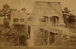
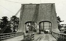
1810: Chain
Newburyport, Massachusetts, USA - Merrimack River
| Bridgemeister ID: | 14 (added before 2003) |
| Year Completed: | 1810 |
| Name: | Chain |
| Also Known As: | Essex-Merrimack |
| Location: | Newburyport, Massachusetts, USA |
| Crossing: | Merrimack River |
| At or Near Feature: | Deer Island |
| Coordinates: | 42.833947 N 70.906811 W |
| Maps: | Acme, GeoHack, Google, OpenStreetMap |
| Principals: | John Templeman |
| References: | AAJ, BBR, CAB, GBD, HBE, POPE, PTS2, RDH |
| Use: | Vehicular (two-lane, light vehicles only) |
| Status: | Replaced, 1909 |
| Main Cables: | Chain (iron) |
| Suspended Spans: | 1 |
| Main Span: | 1 x 74.1 meters (243 feet) |
| Deck width: | 30 feet (2 roadways of 15 feet) |
Notes:
- John Templeman built several bridges (like this one) using James Finley's design.
- Repaired in 1827 after 5 of 10 chains snapped under weight of a team of oxen.
- The complete description from Thomas Pope's 1811 Treatise (POPE):
"The chain Bridge lately thrown over the Merrimack, three miles above Newburyport, in the state of Massachusetts, is now in constant use. This Bridge consists of a single arc, two hundred and forty-four feet span. The abutments are of stone, forty-seven feet long, and thirty-seven high; the uprights, or framed work, which stand on the abutments, are thirty-five feet high, over which are suspended ten distinct chains, the ends of which on both sides of the river are buried deep in pits and secured by large stones: each chain is five hundred and sixteen feet long; and, where they pass over the uprights, they are treble, and made in short links, which is said to be more secure than saddles made of plates of iron. The four middle joists rest on the chains; all the rest are suspended to the main chains to equalize the floor. This Bridge has two passage-ways of fifteen feet in width each, and the floor is so solid as to admit of horses, carriages, etc. to travel at any speed, with very little perceptible motion of the floors. The railing is stout and strong, which adds much firmness to the floor. There are three chains in each range on each side, and four in the middle range: they are calculated to support nearly five hundred tons. From the surface of the water to the middle of the floor is forty feet; and from the top of the abutments to the top of the uprights is thirty-five feet high, making seventy-two feet. The magnitude and power of the abutments, the width and length of the floors, the elevation of the work, the evident powers of the chains, etc. all conspire to make it a wonderful work. Every expense attending it did not amount to twenty-five thousand dollars. The abutment being of stone, the uprights covered, and the chains painted to prevent rust, leaves nothing but the flooring to decay. This Bridge was constructed by John Templeman, Esq. of the district of Columbia, whose talents for the productions of such work, and the various improvements suggested and used by him, have been highly beneficial, and do him great credit."
- Gregory W. Buff sent a transcription of an article describing the 1827 failure. The article was in the Saturday, February 24, 1827 issue (Volume IV, Number 31) of the Canadian Spectator (Montreal, Quebec) newspaper:
"Newburyport, Feb 9. Disastrious [sic] Accident. - On Tuesday morning last, the Essex Merrimack Bridge gave way in the centre, from the parting of the chains that support it. On the Bridge, at the moment, was a loaded team, drawn by six oxen and two horses, driven by two men, Messrs. Garlton [sic] and Jackman, all of whom were precipitated, forty feet, into the river beneath. The teamsters preserved themselves by means of swimming, and the support of fragments of the bridge; the team were all of them except one of the horses, swept beneath the ice a few rods below, and drowned. Five of the ten chains which supported the Bridge, were snapped in different places, and now remain upholding the broken and shattered timber altogether as sad a wreck as we ever witnessed. At the moment of the crash, the light evolved from the friction of the chains resembled the the vivid streaming of a meteor. Various excuses are assigned for the accident, and none, with more probability, than the united effect of the incumbent pressure of the immense body of snow lying upon the bridge, and the frost which had contracted the particles of iron. These produced a tenseness in the chains, which was incapable of resisting the additional pressure of the loaded team, and the whole gave way. The estimated expense of repairing the breach is about 4000 dollars; and the Directors, as we understand, plan to set about it immediately. It will be built up as before. To those who have been losers by this accident the corporation intend to make generous inumeration. The traveling will be uninterrupted, as the solidity of the ice above the bridge forms a safe passage way - and for the conveyance of carriages and heavy baggage the proprietors have promptly provided suitable boats. If any aversion to chain bridges has been produced by this accident, we should be sorry, for ourselves we feel yet unshaken faith in their superior security. The misfortune in this case was no doubt owing to the causes above stated, and not to any defect in the construction of the bridge. Probably hundreds of individuals, including each sex and all ages, have visited the ruins of the bridge. They present a sad and melancholy appearance - crushed and broken timbers suspended by the massy chains, which hang lazily from the pyramidical abutments, while the beholder instinctly shrinks back in terror at the reflection of the situation of the two human beings who were precipitated into the abyss beneath. The preservation of these two men is almost miraculous. Although hurled down 40 feet amid crashing and falling timber, entangled with their cattle, they fell without receiving the least injury, and attained the shore, after being for nearly half an hour, immerse in water chilled to the freezing point. Mr. Jackman is far advanced in years - and suffered somewhat from the exposure to the cold. Mr. Carlton [sic], escaped unhurt. The Chain Bridge has been built for about fifteen years, the span is 220 feet. We believe this was the second or third Chain Bridge built in the United States; and this is probably the first that has met with a similar accident. We understand the proprieters of the Rooks Bridge intend to rebuild theirs as a Chain Bridge."
- Replaced by 1909 Chain - Newburyport, Massachusetts, USA. The 1909 structure was almost entirely new (except for portions of the piers and abutments).
External Links:
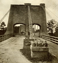
1814: Hamilton Street
Allentown, Pennsylvania, USA - Lehigh River
| Bridgemeister ID: | 19 (added before 2003) |
| Year Completed: | 1814 |
| Name: | Hamilton Street |
| Location: | Allentown, Pennsylvania, USA |
| Crossing: | Lehigh River |
| Principals: | Jacob Blumer |
| References: | AAJ, CAB, DSE20000203, PTS2 |
| Status: | Removed |
| Main Cables: | Chain (iron) |
| Suspended Spans: | 4 |
| Main Spans: | 2 |
| Side Spans: | 2 |
External Links:
1816: Galashiels
Galashiels, Scotland, United Kingdom - Gala Water
| Bridgemeister ID: | 584 (added 2003-01-01) |
| Year Completed: | 1816 |
| Name: | Galashiels |
| Location: | Galashiels, Scotland, United Kingdom |
| Crossing: | Gala Water |
| Principals: | Richard Lees |
| References: | AAJ, BSI, HBE, PTS2 |
| Use: | Footbridge |
| Status: | Destroyed, 1839 |
| Main Cables: | Wire (iron) |
| Suspended Spans: | 1 |
| Main Span: | 1 x 33.8 meters (111 feet) |
| Deck width: | 3 feet |
Notes:
- BSI: Originally erected in the form of a traditional suspension bridge, but soon reinforced with wire stays from much larger towers to reduce unwanted motion. Destroyed by flood, 1839.
1816: Spider
Philadelphia, Pennsylvania, USA - Schuylkill River
| Bridgemeister ID: | 20 (added before 2003) |
| Year Completed: | 1816 |
| Name: | Spider |
| Location: | Philadelphia, Pennsylvania, USA |
| Crossing: | Schuylkill River |
| Principals: | Josiah White, Erskine Hazard |
| References: | AAJ, BOB, BPL, GHD, HBE, LAB, PTS2 |
| Use: | Footbridge |
| Status: | Removed |
| Main Cables: | Wire (iron) |
| Main Span: | 1 x 120 meters (393.75 feet) |
Notes:
- Narrow footbridge. First wire bridge in North America. HBE notes "first wire suspension bridge in any country."
- Often described as having collapsed under the weight of ice and snow, Don Sayenga notes that no contemporary sources confirm this demise. Since the nearby chain bridge did fail under weight of ice and snow, he believes this fate has been misattributed to the White and Hazard footbridge. Don believes the bridge was just dismantled at some point after June, 1816.
- Al Zagofsky also wrote to explain there was no evidence of this bridge collapsing under weight of ice and snow. Al writes: "According to an original source Captain Joshua Rowley Watson, who inspected the bridge on June 15, 1816: '...There was a bridge, but which by the weight of ice and snow, has been carried away.' This refers to the previous bridge that the cable bridge was temporarily replacing. I did not see any cause for failure of the wire rope bridge. My guess is that it was removed when the regular bridge was repaired. The same article shows a sketch that he made, showing the main span to be 407 feet. I am looking at the Canal History and Technology Proceedings Vol 5, March 22, 1986."
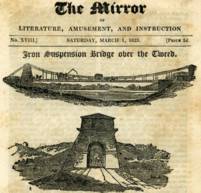
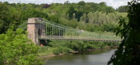
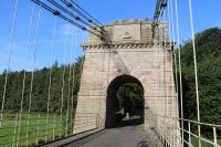
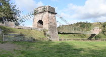
1820: Union
Horncliffe, Berwick-upon-Tweed vicinity, England and Fishwick, Scotland, United Kingdom - River Tweed
| Bridgemeister ID: | 373 (added before 2003) |
| Year Completed: | 1820 |
| Name: | Union |
| Location: | Horncliffe, Berwick-upon-Tweed vicinity, England and Fishwick, Scotland, United Kingdom |
| Crossing: | River Tweed |
| Coordinates: | 55.75256 N 2.10677 W |
| Maps: | Acme, GeoHack, Google, OpenStreetMap |
| Principals: | Sir Samuel Brown |
| References: | AAJ, BBR, BC3, BEM, BOB, HBE, MOS, NTB, PTS2, SBR |
| Use: | Vehicular (one-lane) |
| Status: | In use (last checked: 2023) |
| Main Cables: | Chain (iron) |
| Suspended Spans: | 1 |
| Main Span: | 1 x 136.9 meters (449 feet) |
| Deck width: | 18 feet |
Notes:
- 2007, March: Closed after a hanger snapped in high winds. Repaired and reopened August, 2007.
- 2020, October: Closed for major renovation and conservation project.
- 2023, April: The bridge is reopened.
- Eclipsed by new longest suspension bridge 1826 Menai Strait - Menai Bridge and Bangor vicinity, Wales, United Kingdom.
External Links:
- Conservation - Union Chain Bridge - unionchainbridge.org. Site devoted to the 2020-2023 renovation project. This page lists the highlights of the project.
- Structurae - Structure ID 20000162
1823: Saint Antoine
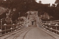
Geneva, Switzerland
| Bridgemeister ID: | 377 (added before 2003) |
| Year Completed: | 1823 |
| Name: | Saint Antoine |
| Location: | Geneva, Switzerland |
| Principals: | Guillame Henri Dufour, Marc Seguin, Marc-Auguste Pictet |
| References: | AAJ, GHD, HBE, LAB, MOS, PTS2 |
| Status: | Removed, c.1864 |
| Main Cables: | Wire (iron) |
| Suspended Spans: | 2 |
| Main Spans: | 2 x 40 meters (131.2 feet) |
| Deck width: | 7.5 feet |
External Links:
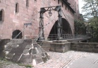
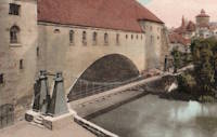
1824: Kettensteg
Nuremberg, Bavaria, Germany - Pegnitz River
| Bridgemeister ID: | 1111 (added 2004-01-04) |
| Year Completed: | 1824 |
| Name: | Kettensteg |
| Also Known As: | Chain |
| Location: | Nuremberg, Bavaria, Germany |
| Crossing: | Pegnitz River |
| Coordinates: | 49.45468 N 11.07076 E |
| Maps: | Acme, GeoHack, Google, OpenStreetMap |
| Principals: | Konrad Georg Kuppler |
| References: | PTS2 |
| Use: | Footbridge |
| Status: | In use (last checked: 2023) |
| Main Cables: | Eyebar (iron) |
| Suspended Spans: | 2 |
| Main Spans: | 1 x 29.6 meters (97.1 feet), 1 x 27.9 meters (91.5 feet) |
Notes:
- Often claimed to be the oldest surviving suspension bridge in continental Europe.
- 1909: Wooden towers are damaged by flood and eventually replaced with steel towers.
- 1930: Bridge deck is stiffened and several intermediate piers are added to support the bridge.
- 2010: Bridge is reconstructed retaining some original components and eliminating the need for the intermediate piers. The bridge is again functioning as a suspension bridge.
External Links:
1824: Strážnice
Strážnice, Czechia - Velicka River
| Bridgemeister ID: | 6183 (added 2021-07-09) |
| Year Completed: | 1824 |
| Name: | Strážnice |
| Also Known As: | Straßnitz, Strassnitz |
| Location: | Strážnice, Czechia |
| Crossing: | Velicka River |
| At or Near Feature: | Chateau Strážnice |
| Principals: | Friedrich Schnirch |
| References: | AAJ, PTS2 |
| Status: | Removed |
| Main Cables: | Chain (iron) |
| Suspended Spans: | 1 |
| Main Span: | 1 x 27.7 meters (90.9 feet) |
| Deck width: | 4.2 meters |
Notes:
- Remains of this very early suspension bridge are supposedly kept on the grounds of Chateau Strážnice
External Links:
1825: Sophienbrücke
Vienna, Austria - Donaukanal
| Bridgemeister ID: | 6181 (added 2021-07-09) |
| Year Completed: | 1825 |
| Name: | Sophienbrücke |
| Also Known As: | Sophia, Sophien, Sophie, Rotundenbrücke, Rotunda |
| Location: | Vienna, Austria |
| Crossing: | Donaukanal |
| Coordinates: | 48.205983 N 16.397243 E |
| Maps: | Acme, GeoHack, Google, OpenStreetMap |
| References: | AAJ, PTS2 |
| Use: | Vehicular |
| Status: | Replaced, 1872 |
| Main Cables: | Chain (iron) |
| Suspended Spans: | 1 |
Notes:
- The earliest of several chain suspension bridges built in Vienna in the 1820s and 1830s.
External Links:
1825: Tain-Tournon
Tournon-sur-Rhône, Ardèche and Tain, Drôme, France - Rhône River
| Bridgemeister ID: | 378 (added before 2003) |
| Year Completed: | 1825 |
| Name: | Tain-Tournon |
| Location: | Tournon-sur-Rhône, Ardèche and Tain, Drôme, France |
| Crossing: | Rhône River |
| Principals: | Marc Seguin |
| References: | AAJ, ASB, BBR, BPF, GHD, LAB, MOS, PTS2, TTSB |
| Use: | Vehicular |
| Status: | Removed, 1965 |
| Main Cables: | Wire (iron) |
| Suspended Spans: | 2 |
| Main Spans: | 2 x 85 meters (278.88 feet) |
| Deck width: | 13.75 feet |
Notes:
- Often credited as being the first large wire suspension bridge in France (and elsewhere). Rebuilt 1847 as a footbridge. Removed 1965.
- Near 1849 Marc Seguin - Tournon-sur-Rhône, Ardèche and Tain-L'Hermitage, Drôme, France.
- Near 1958 Gustave Toursier - Tournon-sur-Rhône, Ardèche and Tain-L'Hermitage, Drôme, France.
External Links:
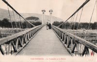
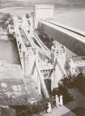
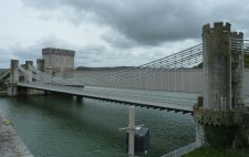
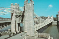
1826: Conwy
Conwy, Wales, United Kingdom - River Conwy
| Bridgemeister ID: | 380 (added before 2003) |
| Year Completed: | 1826 |
| Name: | Conwy |
| Also Known As: | Conway |
| Location: | Conwy, Wales, United Kingdom |
| Crossing: | River Conwy |
| Coordinates: | 53.280476 N 3.823742 W |
| Maps: | Acme, GeoHack, Google, OpenStreetMap |
| Principals: | Thomas Telford |
| References: | AAJ, BBR, BC3, BCO, BEM, HBE, MOS, NTB, PTS2 |
| Use: | Vehicular |
| Status: | Restricted to foot traffic (last checked: 2021) |
| Main Cables: | Chain (iron) |
| Suspended Spans: | 1 |
| Main Span: | 1 x 99.7 meters (327 feet) |
Notes:
- 1904: Major reinforcement and strengthening project.
- 2008, February: Major refurbishment project completed.
- Next to 1904 (footbridge) - Conwy, Wales, United Kingdom.
Annotated Citations:
- "Conway Suspension Bridge." The Engineer, 20 May 1904.
Details regarding the 1904 reinforcement project: "...It was therefore decided to renew all the suspension rods, and pins, and to fix steel cables above the suspension links, to supplement them so that the maximum stress in the links due to any possible travelling load should not exceed 5 tons per square inch. It was also decided to build a stiffening girder coupled to the suspension rod on each side of the bridge, and at the same time to widen the bridge by building a footway 6ft. wide outside the suspenders on the north side of the bridge."
External Links:
1826: Egyptian
St. Petersburg, Russia - Fontanka River
| Bridgemeister ID: | 622 (added 2003-01-20) |
| Year Completed: | 1826 |
| Name: | Egyptian |
| Also Known As: | Египетский |
| Location: | St. Petersburg, Russia |
| Crossing: | Fontanka River |
| Coordinates: | 59.916930 N 30.297185 E |
| Maps: | Acme, GeoHack, Google, OpenStreetMap |
| References: | PTS2 |
| Use: | Vehicular |
| Status: | Collapsed, 1905 |
| Main Cables: | Chain (iron) |
| Suspended Spans: | 1 |
External Links:

1826: Invalides
Paris, France - Seine River
| Bridgemeister ID: | 623 (added 2003-01-20) |
| Year Completed: | 1826 |
| Name: | Invalides |
| Location: | Paris, France |
| Crossing: | Seine River |
| Principals: | Claude Navier |
| References: | AAJ, MOS, PTS2 |
| Use: | Vehicular |
| Status: | Demolished, 1826 |
| Main Span: | 1 x 169.9 meters (557.5 feet) |
Notes:
- Failed when almost complete in 1826. MOS: "On the 6th of September, a water-pipe, which was laid in the ground on the side of the Champs Elysées, and came near the abutments on that side of the river, burst, and, softening the ground about the abutment, it gave way under the strain produced by the weight of the bridge."
- Replaced by 1829 Invalides (l'Allee-d'Antin) - Paris, France.
External Links:
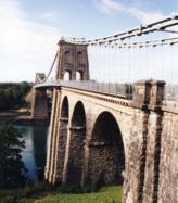
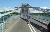
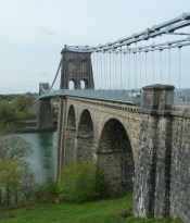
1826: Menai Strait
Menai Bridge and Bangor vicinity, Wales, United Kingdom - Menai Strait
| Bridgemeister ID: | 382 (added before 2003) |
| Year Completed: | 1826 |
| Name: | Menai Strait |
| Location: | Menai Bridge and Bangor vicinity, Wales, United Kingdom |
| Crossing: | Menai Strait |
| Coordinates: | 53.221367 N 4.1646 W |
| Maps: | Acme, GeoHack, Google, OpenStreetMap |
| Principals: | Thomas Telford |
| References: | AAJ, BBR, BC3, BCO, BDU, BEM, BOU, HBE, MOS, NTB, PTS2 |
| Use: | Vehicular (two-lane), with walkway |
| Status: | In use (last checked: 2022) |
| Main Cables: | Chain (iron) |
| Suspended Spans: | 1 |
| Main Span: | 1 x 176.5 meters (579 feet) |
Notes:
- 1839 (or 1840): Restored. Deck strengthened.
- 1893: Original wood deck replaced with a steel deck.
- 1938-1940: Original wrought-iron chains replaced with steel eyebars, deck strengthened.
- 1999: Deck resurfaced and other improvements to strengthen bridge.
- 2020: Major maintenance project planned to start January, 2021.
- 2022, October: Closed due to serious structural concerns. Expected to reopen January 2023 with a weight restriction.
- Became longest suspension bridge by eclipsing 1820 Union - Horncliffe, Berwick-upon-Tweed vicinity, England and Fishwick, Scotland, United Kingdom.
- Eclipsed by new longest suspension bridge 1834 Zaehringen (Grand Pont Suspendu) - Fribourg, Switzerland.
External Links:
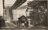
1827: (suspension bridge)
Newburyport, Massachusetts, USA - Merrimack River
| Bridgemeister ID: | 23 (added before 2003) |
| Year Completed: | 1827 |
| Name: | (suspension bridge) |
| Location: | Newburyport, Massachusetts, USA |
| Crossing: | Merrimack River |
| Principals: | Thomas Haven |
| References: | AAJ, BPL, HBE, PTS2 |
| Status: | Replaced, 1840 |
| Main Cables: | Chain (iron) |
| Suspended Spans: | 5 |
| Main Spans: | 3 |
| Side Spans: | 2 |
Notes:
- Multi-span structure distinct from Templeman's 1810 Chain Bridge. Sometimes misidentified as an 1827 replacement to the 1810 Templeman Chain Bridge because of the significant damage to the Templeman bridge in 1827.
External Links:

1827: Hammersmith
London, England, United Kingdom - River Thames
| Bridgemeister ID: | 386 (added before 2003) |
| Year Completed: | 1827 |
| Name: | Hammersmith |
| Location: | London, England, United Kingdom |
| Crossing: | River Thames |
| Principals: | William Tierney Clark |
| References: | AAJ, BEM, BTH, HBE, MOS, NTB, ONF, PTS2 |
| Use: | Vehicular, with walkway |
| Status: | Replaced |
| Main Cables: | Chain |
| Suspended Spans: | 3 |
| Main Span: | 1 x 121.9 meters (400 feet) |
| Side Spans: | 2 x 44.8 meters (147 feet) |
Notes:
- Replaced by 1887 Hammersmith - London, England, United Kingdom.
External Links:
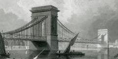
1827: L'île Barbe
Lyon, Métropole de Lyon, France - Saône River
| Bridgemeister ID: | 1535 (added 2004-10-31) |
| Year Completed: | 1827 |
| Name: | L'île Barbe |
| Location: | Lyon, Métropole de Lyon, France |
| Crossing: | Saône River |
| Coordinates: | 45.796883 N 4.83055 E |
| Maps: | Acme, GeoHack, Google, OpenStreetMap |
| Principals: | Favier |
| References: | AAJ, PQL, PTS2 |
| Use: | Vehicular (one-lane) |
| Status: | In use (last checked: 2005) |
| Main Cables: | Chain (iron) |
| Suspended Spans: | 2 |
| Main Spans: | 2 x 10² meters (334.66 feet) |
Notes:
- Originally built with iron chains. Later replaced with iron wire.
- Near 1831 Masaryk (Masarik, Mazarik, de la Gare) - Lyon vicinity, Métropole de Lyon, France.
External Links:
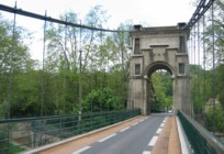
1828: Arcole
Paris, France - Seine River
| Bridgemeister ID: | 625 (added 2003-01-20) |
| Year Completed: | 1828 |
| Name: | Arcole |
| Also Known As: | de la Grève |
| Location: | Paris, France |
| Crossing: | Seine River |
| Principals: | Seguin Brothers |
| References: | AAJ, MOS, PTS2 |
| Status: | Replaced, 1854 |
| Main Cables: | Wire (iron) |
| Suspended Spans: | 2 |
| Main Spans: | 2 x 40.8 meters (133.86 feet) |
| Deck width: | 11.48 feet |
External Links:
1828: Karlskettensteg
Vienna, Austria - Danube Canal
| Bridgemeister ID: | 4594 (added 2020-06-06) |
| Year Completed: | 1828 |
| Name: | Karlskettensteg |
| Also Known As: | Charles, Karls |
| Location: | Vienna, Austria |
| Crossing: | Danube Canal |
| Coordinates: | 48.214324 N 16.374969 E |
| Maps: | Acme, GeoHack, Google, OpenStreetMap |
| References: | AAJ, PTS2 |
| Use: | Vehicular |
| Status: | Demolished, 1870 |
| Main Cables: | Eyebar (iron) |
| Suspended Spans: | 1 |
External Links:
1829: Argentat
Argentat, Corrèze, France - Dordogne River
| Bridgemeister ID: | 627 (added 2003-01-20) |
| Year Completed: | 1829 |
| Name: | Argentat |
| Also Known As: | Marie |
| Location: | Argentat, Corrèze, France |
| Crossing: | Dordogne River |
| Principals: | L. T. Vicat |
| References: | AAJ, MOS, PTS2 |
| Use: | Vehicular, with walkway |
| Status: | Replaced, 1903 |
| Main Cables: | Wire (iron) |
| Suspended Spans: | 1 |
| Main Span: | 1 x 100 meters (328 feet) |
External Links:
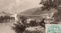
1829: Beaucaire
Beaucaire, Gard and Tarascon, Bouches-du-Rhône, France - Rhône River
| Bridgemeister ID: | 626 (added 2003-01-20) |
| Year Completed: | 1829 |
| Name: | Beaucaire |
| Location: | Beaucaire, Gard and Tarascon, Bouches-du-Rhône, France |
| Crossing: | Rhône River |
| Principals: | Jules Seguin, Joseph Chaley |
| References: | AAJ, ASB, GHD, PTS2 |
| Use: | Vehicular |
| Status: | Destroyed, August 6, 1944 |
| Main Cables: | Wire (iron) |
| Suspended Spans: | 4 |
| Main Spans: | 2 x 120 meters (393.72 feet) |
| Side Spans: | 2 x 93.6 meters (307.1 feet) |
Notes:
- 1887: Flooring failed.
- 1944: Bombed by Allied Forces, August 6.
External Links:
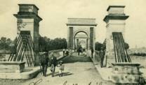
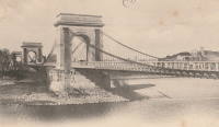
1829: Invalides
Paris, France - Seine River
| Bridgemeister ID: | 633 (added 2003-01-20) |
| Year Completed: | 1829 |
| Name: | Invalides |
| Also Known As: | l'Allee-d'Antin |
| Location: | Paris, France |
| Crossing: | Seine River |
| Principals: | Marie Fortuné de Vergès, Ferdinand Bayard de la Vingtrie |
| References: | AAJ, MOS, PTS2 |
| Use: | Vehicular, with walkway |
| Status: | Replaced, 1855 |
| Main Cables: | Chain (iron) |
| Main Span: | 1 x 72.1 meters (236.5 feet) |
| Deck width: | 25.6 feet |
Notes:
- Replaced 1826 Invalides - Paris, France.
External Links:
1829: Kettenbrücke
Bamberg, Germany - Regnitz River
| Bridgemeister ID: | 632 (added 2003-01-20) |
| Year Completed: | 1829 |
| Name: | Kettenbrücke |
| Also Known As: | Ludwigsbrücke, Chain |
| Location: | Bamberg, Germany |
| Crossing: | Regnitz River |
| Coordinates: | 49.896400 N 10.891386 E |
| Maps: | Acme, GeoHack, Google, OpenStreetMap |
| References: | AAJ, PTS2 |
| Status: | Replaced, c. 1892 |
| Main Cables: | Chain (iron) |
| Main Span: | 1 x 64.26 meters (210.8 feet) |
1829: Montrose
Montrose, Scotland, United Kingdom - South Esk River
| Bridgemeister ID: | 388 (added before 2003) |
| Year Completed: | 1829 |
| Name: | Montrose |
| Location: | Montrose, Scotland, United Kingdom |
| Crossing: | South Esk River |
| Coordinates: | 56.705802 N 2.475390 W |
| Maps: | Acme, GeoHack, Google, OpenStreetMap |
| Principals: | Sir Samuel Brown |
| References: | AAJ, BEM, BOB, HBE, PTS2, SBR |
| Use: | Vehicular |
| Status: | Demolished, 1929 |
| Main Cables: | Chain (iron) |
| Suspended Spans: | 1 |
Notes:
- SBR: March 19, 1830, with a "crowd of people, estimated at 700, ... watching a boat race," a chain broke "plunging most of the people into the river." Repaired.
- 1838: Wrecked by storm. Repaired.
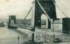

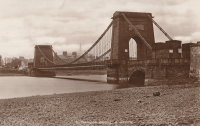
1830: Rudolf
Vienna, Austria - Vienna River
| Bridgemeister ID: | 6180 (added 2021-07-09) |
| Year Completed: | 1830 |
| Name: | Rudolf |
| Also Known As: | Rudolfs, Rudolfsbrücke |
| Location: | Vienna, Austria |
| Crossing: | Vienna River |
| Coordinates: | 48.196985 N 16.359208 E |
| Maps: | Acme, GeoHack, Google, OpenStreetMap |
| References: | PTS2 |
| Status: | Removed, c. 1899 |
| Main Cables: | Chain (iron) |
| Suspended Spans: | 1 |
Notes:
- Was located at the northern end of the current-day Kettenbrückegasse, named for the former Rudolf bridge. The Vienna River has since been covered over at this location.
External Links:
1830: Schikaneder
Vienna, Austria - Vienna River
| Bridgemeister ID: | 6179 (added 2021-07-09) |
| Year Completed: | 1830 |
| Name: | Schikaneder |
| Also Known As: | Schikanederbrücke, Schikanedersteg |
| Location: | Vienna, Austria |
| Crossing: | Vienna River |
| Coordinates: | 48.199949 N 16.365989 E |
| Maps: | Acme, GeoHack, Google, OpenStreetMap |
| References: | PTS2 |
| Status: | Removed, c. 1895 |
| Main Cables: | Chain (iron) |
| Suspended Spans: | 1 |
Notes:
- Was located near the modern day intersection of Getreidemarkt and Friedrichstraße. The Vienna River here has since been covered over at this location.
External Links:
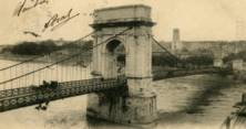
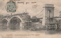
1830: Valence
Valence, Drôme and Guilherand-Granges, Ardèche, France - Rhône River
| Bridgemeister ID: | 631 (added 2003-01-20) |
| Year Completed: | 1830 |
| Name: | Valence |
| Location: | Valence, Drôme and Guilherand-Granges, Ardèche, France |
| Crossing: | Rhône River |
| Coordinates: | 44.932022 N 4.882951 E |
| Maps: | Acme, GeoHack, Google, OpenStreetMap |
| Principals: | Marc Seguin |
| References: | ASB, PTS2 |
| Use: | Vehicular |
| Status: | Removed |
| Main Cables: | Wire (iron) |
| Suspended Spans: | 2 |
| Main Spans: | 2 x 110 meters (360.9 feet) |
| Deck width: | 7 meters |
Notes:
- Two side spans meeting at a single midstream tower.
- Later at same location 1949 (footbridge) - Valence, Drôme and Guilherand-Granges, Ardèche, France.
External Links:
1831: Bry-sur-Marne
Bry-sur-Marne, Val-de-Marne, France - Marne River
| Bridgemeister ID: | 1668 (added 2005-03-20) |
| Year Completed: | 1831 |
| Name: | Bry-sur-Marne |
| Location: | Bry-sur-Marne, Val-de-Marne, France |
| Crossing: | Marne River |
| Principals: | Jules Seguin |
| References: | AAJ, PTS2 |
| Use: | Vehicular |
| Status: | Destroyed, c.1870 |
| Main Cables: | Wire (iron) |
| Suspended Spans: | 1 |
| Main Span: | 1 x 76 meters (249.43 feet) |
External Links:
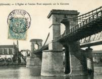
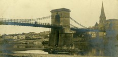
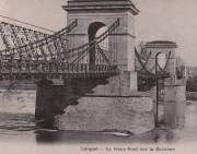
1831: Langon
Langon, Aquitaine, France - Garonne River
| Bridgemeister ID: | 1732 (added 2005-04-06) |
| Year Completed: | 1831 |
| Name: | Langon |
| Location: | Langon, Aquitaine, France |
| Crossing: | Garonne River |
| References: | PTS2 |
| Use: | Vehicular |
| Status: | Removed |
| Main Cables: | Chain (iron) |
| Suspended Spans: | 3 |
| Main Span: | 1 |
| Side Spans: | 2 |
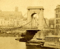
1834: Louis-Philippe
Île St-Louis, Paris, France - Seine River
| Bridgemeister ID: | 983 (added 2003-11-15) |
| Year Completed: | 1834 |
| Name: | Louis-Philippe |
| Also Known As: | de la Reforme |
| Location: | Île St-Louis, Paris, France |
| Crossing: | Seine River |
| Principals: | Marc Seguin |
| References: | AAJ, PTS2 |
| Use: | Vehicular (one-lane), with walkway |
| Status: | Replaced |
| Main Cables: | Wire (iron) |
| Suspended Spans: | 2 |
| Main Spans: | 2 |
| Deck width: | 14.44 feet |
Notes:
- Badly damaged by fire 1848. Replaced 1860 (or soon after).
- Next to 1842 Cité (City, Île de la Cité) - Île de la Cité and Île St-Louis, Paris, France.
External Links:
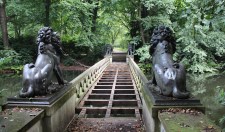
1838: Löwenbrücke
Berlin, Germany
| Bridgemeister ID: | 858 (added 2003-08-09) |
| Year Completed: | 1838 |
| Name: | Löwenbrücke |
| Also Known As: | Lion's Bridge |
| Location: | Berlin, Germany |
| At or Near Feature: | Tiergarten |
| Coordinates: | 52.512383 N 13.345667 E |
| Maps: | Acme, GeoHack, Google, OpenStreetMap |
| Principals: | Ludwig Ferdinand Hesse |
| References: | PTS2 |
| Use: | Footbridge |
| Status: | Closed (last checked: 2013) |
| Main Cables: | Chain |
| Suspended Spans: | 1 |
| Main Span: | 1 x 17.3 meters (56.8 feet) |
| Deck width: | 2 meters |
Notes:
- Now supported by wire cable.
- In the early 2010s, the bridge was closed and the deck was removed (see accompanying 2013 photo set). By 2019 it had been further dismantled awaiting rehabilitation.
External Links:


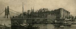
1839: Basse-Chaîne
Angers, Maine-et-Loire, France - Maine River
| Bridgemeister ID: | 993 (added 2003-11-16) |
| Year Completed: | 1839 |
| Name: | Basse-Chaîne |
| Also Known As: | Angers |
| Location: | Angers, Maine-et-Loire, France |
| Crossing: | Maine River |
| Principals: | Joseph Chaley |
| References: | AAJ, GHD, HBE, PTS2 |
| Status: | Collapsed, 1850 |
| Main Cables: | Wire (iron) |
| Suspended Spans: | 1 |
| Main Span: | 1 x 10² meters (334.66 feet) |
| Deck width: | 23.62 feet |
Notes:
- Collapsed under weight of maching troops, April 16, 1850, killing more than 200 soldiers. Collapse precipitated French virtual moratorium on suspension bridge building bringing to a close the prolific era of French wire cable suspension bridges.
External Links:
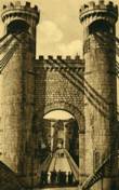
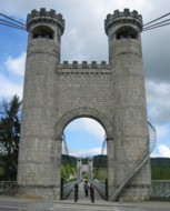
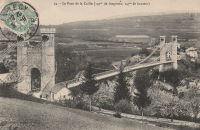
1839: Caille
Allonzier-La-Caille vicinity, Haute-Savoie, France - Usses Torrent
| Bridgemeister ID: | 859 (added 2003-08-09) |
| Year Completed: | 1839 |
| Name: | Caille |
| Also Known As: | Charles-Albert |
| Location: | Allonzier-La-Caille vicinity, Haute-Savoie, France |
| Crossing: | Usses Torrent |
| Coordinates: | 46.0126 N 6.111633 E |
| Maps: | Acme, GeoHack, Google, OpenStreetMap |
| Principals: | E. Belin |
| References: | AAJ, BPF, PTS2 |
| Use: | Vehicular |
| Status: | Restricted to foot traffic (last checked: 2019) |
| Main Cables: | Wire (iron) |
| Suspended Spans: | 1 |
| Main Span: | 1 x 192 meters (629.9 feet) |
External Links:
1839: Hameln
Hameln, Niedersachsen, Germany - Weser River
| Bridgemeister ID: | 2298 (added 2007-04-26) |
| Year Completed: | 1839 |
| Name: | Hameln |
| Location: | Hameln, Niedersachsen, Germany |
| Crossing: | Weser River |
| Coordinates: | 52.101511 N 9.351547 E |
| Maps: | Acme, GeoHack, Google, OpenStreetMap |
| Principals: | Georg Theodor Wendelstadt |
| References: | AAJ, PTS2 |
| Use: | Vehicular |
| Status: | Dismantled, c. 1890s |
| Main Cables: | Chain (iron) |
| Main Spans: | 2 |
Notes:
- Replaced in the 1890s by a (likely) cantilever bridge having the general shape of a suspension bridge.
- AAJ writes: "the first use of triangular bracing between double chain cables" and mentions that it was dismantled and moved to Hessisch Oldendorf 1880-1890 or 1899. Most accounts suggest the bridge was reassembled in the 1898-1899 time frame.
- Moved to 1899 Weserbrücke - Hessisch Oldendorf and Fuhlen, Germany.
External Links:
1839: Roche-Bernard
La Roche-Bernard, Morbihan, France - Vilaine River
| Bridgemeister ID: | 1027 (added 2003-11-22) |
| Year Completed: | 1839 |
| Name: | Roche-Bernard |
| Location: | La Roche-Bernard, Morbihan, France |
| Crossing: | Vilaine River |
| Principals: | P. Leblanc |
| References: | AAJ, HBE, PTS2 |
| Use: | Vehicular |
| Status: | Replaced, 1911 |
| Main Cables: | Wire (iron) |
| Suspended Spans: | 1 |
| Main Span: | 1 x 198 meters (649.6 feet) |
Notes:
- Wrecked by wind 1852, rebuilt, damaged 1866, 1869, 1870, and 1871. After the 1871 repairs, it was restricted to foot traffic. It was replaced in 1911 by an arch. Approaches extant (next to the later suspension bridge), 2004.
- Next to 1960 Roche-Bernard - La Roche-Bernard, Morbihan, France.
External Links:
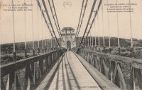
1839: Saint André-de-Cubzac
Saint André-de-Cubzac, Gironde, France - Dordogne River
| Bridgemeister ID: | 550 (added before 2003) |
| Year Completed: | 1839 |
| Name: | Saint André-de-Cubzac |
| Also Known As: | Cubzac |
| Location: | Saint André-de-Cubzac, Gironde, France |
| Crossing: | Dordogne River |
| Coordinates: | 44.962000 N 0.461444 W |
| Maps: | Acme, GeoHack, Google, OpenStreetMap |
| Principals: | Marie Fortuné de Vergès, Emil Martin |
| References: | AAJ, HBE, PTS2 |
| Use: | Vehicular |
| Status: | Destroyed, 1869 |
| Main Cables: | Wire (iron) |
| Suspended Spans: | 5 |
| Main Spans: | 5 x 10⁹ meters (357.6 feet) |
| Deck width: | 23 feet |
Notes:
- This is perhaps one of the most fanciful large suspension bridges ever built.
- Destroyed in a storm, 1869. Its replacement (a truss bridge) was completed in 1883. The approaches and the bottom halves of the suspension bridge towers were strengthened and used for the replacement.
- AAJ citing Engineering News-Record: "Vergès used inclined tie cables running from the top of the tower at one end of a span to a roadway-level connection on the opposite tower."
External Links:
- Structurae - Cubzac Bridge. Photos of the replacement truss structure.
- Structurae - Structure ID 20000898

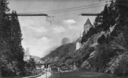
1840: Gotteron
Fribourg, Switzerland - Sarine River
| Bridgemeister ID: | 398 (added before 2003) |
| Year Completed: | 1840 |
| Name: | Gotteron |
| Location: | Fribourg, Switzerland |
| Crossing: | Sarine River |
| Principals: | Joseph Chaley |
| References: | AAJ, GHD, PTS2 |
| Use: | Vehicular |
| Status: | Removed |
| Main Cables: | Wire (iron) |
| Suspended Spans: | 1 |
| Main Span: | 1 x 220 meters (721.8 feet) |
Notes:
- 1919, May 9: An overloaded truck carrying logs causes the failure of several suspenders and collapse of a large section of the deck.
- Near 1834 Zaehringen (Grand Pont Suspendu) - Fribourg, Switzerland.
External Links:
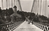
1840: Lézardrieux
Lézardrieux, Côtes-d'Armor, France - Trieux River
| Bridgemeister ID: | 1116 (added 2004-01-05) |
| Year Completed: | 1840 |
| Name: | Lézardrieux |
| Location: | Lézardrieux, Côtes-d'Armor, France |
| Crossing: | Trieux River |
| Coordinates: | 48.780778 N 3.106222 W |
| Maps: | Acme, GeoHack, Google, OpenStreetMap |
| Principals: | Seguin Brothers |
| References: | AAJ, PTS2 |
| Use: | Vehicular (one-lane) |
| Status: | Replaced, 1925 |
| Main Cables: | Wire (iron) |
| Suspended Spans: | 1 |
| Main Span: | 1 x 150 meters (492.1 feet) |
Notes:
- 1925: Replaced by a Gisclard suspension bridge reusing the approach spans and piers of the 1840 suspension bridge.
External Links:
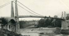
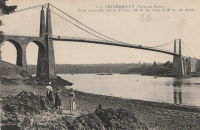
1841: Císaře Františka I
Prague, Czechia - Vltava River
| Bridgemeister ID: | 5941 (added 2021-06-29) |
| Year Completed: | 1841 |
| Name: | Císaře Františka I |
| Also Known As: | Emperor Franz I |
| Location: | Prague, Czechia |
| Crossing: | Vltava River |
| Coordinates: | 50.081354 N 14.410023 E |
| Maps: | Acme, GeoHack, Google, OpenStreetMap |
| Principals: | Friedrich Schnirch |
| References: | AAJ, PTS2 |
| Use: | Vehicular |
| Status: | Removed, c. 1899-1901 |
| Main Cables: | Chain (iron) |
Notes:
- This location is now crossed by the Legion Bridge (Legii Most).
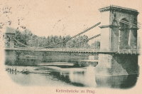
1841: Verdun-sur-Garonne
Verdun-sur-Garonne, Tarn-et-Garonne, France - Garonne River
| Bridgemeister ID: | 2158 (added 2006-12-10) |
| Year Completed: | 1841 |
| Name: | Verdun-sur-Garonne |
| Location: | Verdun-sur-Garonne, Tarn-et-Garonne, France |
| Crossing: | Garonne River |
| References: | AAJ, PTS2 |
| Use: | Vehicular |
| Suspended Spans: | 1 |
| Main Span: | 1 x 151 meters (495.4 feet) |
Notes:
- See 1931 Verdun-sur-Garonne - Verdun-sur-Garonne, Tarn-et-Garonne, France. The relationship between the older and current bridges is unclear.
External Links:
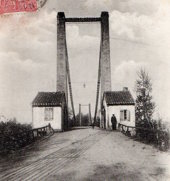
1842: Cité
Île de la Cité and Île St-Louis, Paris, France - Seine River
1842: Fairmount
Philadelphia, Pennsylvania, USA - Schuylkill River
| Bridgemeister ID: | 24 (added before 2003) |
| Year Completed: | 1842 |
| Name: | Fairmount |
| Also Known As: | Callowhill Street, Upper Ferry |
| Location: | Philadelphia, Pennsylvania, USA |
| Crossing: | Schuylkill River |
| Principals: | Charles Ellet |
| References: | BBR, BOB, BPL, HBE, LAB, PTS2, WHSB |
| Use: | Vehicular |
| Status: | Replaced, 1875 |
| Main Cables: | Wire (iron) |
| Suspended Spans: | 1 |
| Main Span: | 1 x 104.2 meters (342 feet) |
Notes:
- BBR and BOB say 1841.
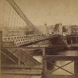
1842: Poděbrady
Poděbrady, Czechia - Elbe River
| Bridgemeister ID: | 6184 (added 2021-07-09) |
| Year Completed: | 1842 |
| Name: | Poděbrady |
| Also Known As: | Podiebrad |
| Location: | Poděbrady, Czechia |
| Crossing: | Elbe River |
| Principals: | Friedrich Schnirch |
| References: | PTS2 |
| Status: | Removed, c. 1890 |
| Main Cables: | Chain (iron) |
| Suspended Spans: | 1 |
1842: Tonnay-Charente
Tonnay-Charente, Charente-Maritime, France - Charente River
| Bridgemeister ID: | 942 (added 2003-10-27) |
| Year Completed: | 1842 |
| Name: | Tonnay-Charente |
| Location: | Tonnay-Charente, Charente-Maritime, France |
| Crossing: | Charente River |
| Coordinates: | 45.940166 N 0.886 W |
| Maps: | Acme, GeoHack, Google, OpenStreetMap |
| References: | BPF, PTS2 |
| Use: | Vehicular |
| Status: | Replaced, 1884 |
| Main Cables: | Wire (iron) |
| Suspended Spans: | 3 |
| Main Span: | 1 x 90 meters (295.3 feet) |
| Side Spans: | 2 |
Notes:
- Deck failed, August 21, 1883, during a load test. Replacement built on the original piers.
- Replaced by 1884 Tonnay-Charente - Tonnay-Charente, Charente-Maritime, France.
External Links:
1842: Řetězový
Strakonice, Czechia - Otava River
| Bridgemeister ID: | 8427 (added 2024-03-08) |
| Year Completed: | 1842 |
| Name: | Řetězový |
| Also Known As: | Chain |
| Location: | Strakonice, Czechia |
| Crossing: | Otava River |
| Coordinates: | 49.258583 N 13.903528 E |
| Maps: | Acme, GeoHack, Google, OpenStreetMap |
| Principals: | Friedrich Schnirch |
| References: | PTS2 |
| Status: | Dismantled, c. 1890-1891 |
| Main Cables: | Chain (iron) |
Notes:
- Submerged during a September 1890 flood. Dismantled soon after and replaced with a truss bridge.
External Links:
1843: Seraing
Seraing, Liège vicinity, Belgium - Meuse River
| Bridgemeister ID: | 6550 (added 2021-08-29) |
| Year Completed: | 1843 |
| Name: | Seraing |
| Location: | Seraing, Liège vicinity, Belgium |
| Crossing: | Meuse River |
| Coordinates: | 50.616960 N 5.509567 E |
| Maps: | Acme, GeoHack, Google, OpenStreetMap |
| Principals: | Hubert Brialmont, John Cockerill & Cie |
| References: | AAJ, IBB, PTS2 |
| Use: | Vehicular |
| Status: | Removed, 1905 |
| Main Cables: | Chain (iron) |
| Suspended Spans: | 1 |
| Main Span: | 1 x 10⁵ meters (344.5 feet) |
External Links:
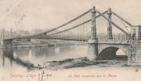
1844: Franzensbrücke
Vienna, Austria - Danube Canal
| Bridgemeister ID: | 4593 (added 2020-06-06) |
| Year Completed: | 1844 |
| Name: | Franzensbrücke |
| Also Known As: | Franz |
| Location: | Vienna, Austria |
| Crossing: | Danube Canal |
| Coordinates: | 48.213151 N 16.391284 E |
| Maps: | Acme, GeoHack, Google, OpenStreetMap |
| References: | PTS2 |
| Use: | Vehicular |
| Status: | Replaced, 1899 |
| Main Cables: | Eyebar (iron) |
| Suspended Spans: | 1 |
| Main Span: | 1 x 83.7 meters (274.6 feet) |
External Links:
1844: Mülheimer
Mülheim an der Ruhr, North Rhine-Westphalia, Germany - Ruhr River
| Bridgemeister ID: | 2297 (added 2007-04-26) |
| Year Completed: | 1844 |
| Name: | Mülheimer |
| Location: | Mülheim an der Ruhr, North Rhine-Westphalia, Germany |
| Crossing: | Ruhr River |
| Principals: | Malberg |
| References: | AAJ, PTS2 |
| Status: | Demolished, 1909 |
| Main Cables: | Chain (iron) |
| Suspended Spans: | 3 |
| Main Span: | 1 x 94.14 meters (308.9 feet) |
| Side Spans: | 2 x 28.25 meters (92.7 feet) |
External Links:
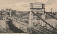
1845: Hungerford
London, England, United Kingdom - River Thames
| Bridgemeister ID: | 400 (added before 2003) |
| Year Completed: | 1845 |
| Name: | Hungerford |
| Location: | London, England, United Kingdom |
| Crossing: | River Thames |
| Principals: | Isambard K. Brunel |
| References: | BBR, BEM, BTH, HBE, PTS2 |
| Use: | Footbridge |
| Status: | Removed |
| Main Cables: | Chain (iron) |
| Suspended Spans: | 3 |
| Main Span: | 1 x 206 meters (676 feet) |
| Side Spans: | 2 x 100.3 meters (329 feet) |
Notes:
- BEM mentions three different years of completion: 1826, 1862, and 1843, all of which are likely incorrect. The bridge was out of service by 1864 as the chain cables were reused for the Clifton Bridge at Bristol, England.
- See 1864 Clifton - Bristol, England, United Kingdom.
External Links:
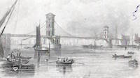
1845: Jaroměř
Jaroměř, Czechia - Elbe River
| Bridgemeister ID: | 6185 (added 2021-07-09) |
| Year Completed: | 1845 |
| Name: | Jaroměř |
| Also Known As: | Jaromierz, Jaromer, Jaromirsch |
| Location: | Jaroměř, Czechia |
| Crossing: | Elbe River |
| Principals: | Friedrich Schnirch |
| References: | PTS2 |
| Status: | Removed |
| Main Cables: | Chain (iron) |
| Suspended Spans: | 1 |
| Main Span: | 1 x 41 meters (134.5 feet) |
1845: Kettenbrücke
Mannheim, Germany - Neckar River
| Bridgemeister ID: | 1112 (added 2004-01-04) |
| Year Completed: | 1845 |
| Name: | Kettenbrücke |
| Also Known As: | Chain, Ketten |
| Location: | Mannheim, Germany |
| Crossing: | Neckar River |
| Coordinates: | 49.494167 N 8.472222 E |
| Maps: | Acme, GeoHack, Google, OpenStreetMap |
| References: | PTS2 |
| Use: | Vehicular |
| Status: | Demolished, 1889 |
| Main Cables: | Chain (iron) |
| Suspended Spans: | 3 |
| Main Span: | 1 x 86 meters (282 feet) |
| Side Spans: | 2 |
Notes:
- Replaced by 1891 Friedrichsbrücke - Mannheim, Germany.
External Links:
- Wikipedia - Kurpfalzbrücke. A history of several bridges at this location.
- Structurae - Structure ID 20010180
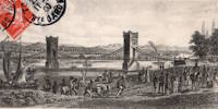
1845: Pittsburgh Aqueduct
Pittsburgh, Pennsylvania, USA - Allegheny River
| Bridgemeister ID: | 27 (added before 2003) |
| Year Completed: | 1845 |
| Name: | Pittsburgh Aqueduct |
| Location: | Pittsburgh, Pennsylvania, USA |
| Crossing: | Allegheny River |
| Principals: | John A. Roebling |
| References: | BOB, BOP, BPL, HBE, ONF, PTS2, RDH, SJR |
| Use: | Aqueduct |
| Status: | Removed, 1861 |
| Main Cables: | Wire (iron) |
| Suspended Spans: | 7 |
| Main Spans: | 7 x 49.4 meters (162 feet) |
Notes:
- In use until 1860.
External Links:
1846: Monongahela
Pittsburgh, Pennsylvania, USA - Monongahela River
| Bridgemeister ID: | 28 (added before 2003) |
| Year Completed: | 1846 |
| Name: | Monongahela |
| Also Known As: | Smithfield Street |
| Location: | Pittsburgh, Pennsylvania, USA |
| Crossing: | Monongahela River |
| Principals: | John A. Roebling |
| References: | BOB, BOP, BPL, HBE, ONF, PBR, PTS2 |
| Use: | Vehicular |
| Status: | Removed, 1882 |
| Main Cables: | Wire (iron) |
| Suspended Spans: | 8 |
| Main Spans: | 8 x 57.3 meters (188 feet) |
| Deck width: | 20 feet |
External Links:
1848: Niagara Suspension
Niagara Falls, New York, USA and Niagara Falls, Ontario, Canada - Niagara River
| Bridgemeister ID: | 29 (added before 2003) |
| Year Completed: | 1848 |
| Name: | Niagara Suspension |
| Location: | Niagara Falls, New York, USA and Niagara Falls, Ontario, Canada |
| Crossing: | Niagara River |
| Principals: | Charles Ellet |
| References: | BOB, BPL, HBE, ONF, PTS2 |
| Use: | Vehicular (one-lane) |
| Status: | Removed |
| Main Cables: | Wire (iron) |
| Suspended Spans: | 1 |
| Main Span: | 1 x 234.7 meters (770 feet) |
| Deck width: | 7.5 feet |
Notes:
1849: Galliéni
Lyon, Métropole de Lyon, France - Rhône River
| Bridgemeister ID: | 1164 (added 2004-01-19) |
| Year Completed: | 1849 |
| Name: | Galliéni |
| Also Known As: | Napoleon |
| Location: | Lyon, Métropole de Lyon, France |
| Crossing: | Rhône River |
| Principals: | Seguin Brothers |
| References: | PQL, PTS2 |
| Use: | Vehicular |
| Status: | Replaced |
| Main Cables: | Wire (iron) |
| Suspended Spans: | 3 |
| Main Span: | 1 x 60 meters (196.9 feet) |
| Side Spans: | 1 x 39 meters (128 feet), 1 x 67 meters (219.8 feet) |
| Deck width: | 7.4 meters |
Notes:
- Replaced by an arch bridge in the early 20th century. Built as part of the same project as the Kitchener-Marchand bridge; they were on the same alignment, with one crossing the Saône and the other the Rhône. Both were originally known as the Napoleon bridges.
- Companion to 1849 Kitchener-Marchand (Napoleon, Kitchener, Midi) - Lyon, Métropole de Lyon, France.
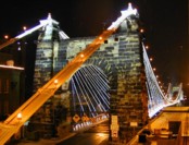
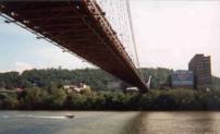
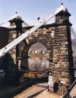
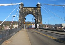
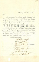
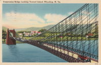
1849: Wheeling
Wheeling, West Virginia, USA - Ohio River
| Bridgemeister ID: | 32 (added before 2003) |
| Year Completed: | 1849 |
| Name: | Wheeling |
| Also Known As: | Wheeling and Belmont |
| Location: | Wheeling, West Virginia, USA |
| Crossing: | Ohio River |
| Coordinates: | 40.07167 N 80.72667 W |
| Maps: | Acme, GeoHack, Google, OpenStreetMap |
| Principals: | Charles Ellet |
| References: | AAJ, BBR, BC3, BOB, BPL, CEJ, COB, GBD, HBE, LAB, LACE, ONF, PTS2, RWS, WCC, WHSB |
| Use: | Vehicular (two-lane, light vehicles only) |
| Status: | Restricted to foot traffic, since September 2019 (last checked: 2020) |
| Main Cables: | Wire (iron) |
| Suspended Spans: | 1 |
| Main Span: | 1 x 307.8 meters (1,010 feet) |
Notes:
- Was still part of Virginia at time of completion.
- 1854: Rebuilt after it was wrecked by a windstorm. Contrary to popular myth, the rebuilding was undertaken by Ellet and his assistant William K. McComas, not by John A. Roebling.
- 1860: Overhauled. Popular myth often attributes this work to the Roeblings. WHSB attributes this work to William K. McComas. After this overhaul, the bridge still does not have the distinctive diagonal cable stays that give it the appearance of a Roebling bridge.
- 1872: Overhauled according to a design by Washington Roebling. John A. Roebling had died in 1869 and was not involved with this work. WHSB notes, "The design essentially Roeblingized the bridge with the diagonal cable stays that are such a prominent feature of the bridge."
- 2019, September: Closed to vehicular traffic indefinitely due to safety concerns after repeated overweight vehicle violations.
- 2020, November: Bids being evaluated for renovation project. Bridge remains closed to vehicular traffic.
- 2021, April: Single bid received was rejected. Bids expected to be resolicited in June. The bridge remains closed to all vehicular traffic.
- 2022, February: $17.9 million renovation project expected to start soon.
- Became longest suspension bridge by eclipsing 1834 Zaehringen (Grand Pont Suspendu) - Fribourg, Switzerland.
- Eclipsed by new longest suspension bridge 1867 John A. Roebling (Cincinnati, Cincinnati and Covington) - Cincinnati, Ohio and Covington, Kentucky, USA.
External Links:
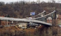
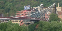
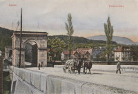
1850: Chain
Aarau, Switzerland - Aare River
| Bridgemeister ID: | 4761 (added 2020-06-28) |
| Year Completed: | 1850 |
| Name: | Chain |
| Also Known As: | Aarau Kettenbrücke |
| Location: | Aarau, Switzerland |
| Crossing: | Aare River |
| Coordinates: | 47.395431 N 8.042028 E |
| Maps: | Acme, GeoHack, Google, OpenStreetMap |
| Principals: | Jean Gaspard Dollfuss |
| References: | AAJ, PTS2 |
| Use: | Vehicular (one-lane) |
| Status: | Replaced, 1949 |
| Main Cables: | Eyebar (iron) |
| Suspended Spans: | 1 |
External Links:
- Kettenbrücke (Aarau) - Wikipedia. Notes bridge was opened for traffic December 28, 1850 and officially inaugurated January 6, 1851.
- Structurae - Structure ID 20043577
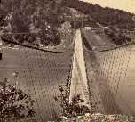
1851: Lewiston-Queenston
Lewiston, New York, USA and Queenston, Ontario, Canada - Niagara River
| Bridgemeister ID: | 35 (added before 2003) |
| Year Completed: | 1851 |
| Name: | Lewiston-Queenston |
| Location: | Lewiston, New York, USA and Queenston, Ontario, Canada |
| Crossing: | Niagara River |
| Principals: | Edward Serrell |
| References: | AAJ, BOB, BPL, HBE, PTS2 |
| Use: | Vehicular |
| Status: | Wrecked, 1864 |
| Main Cables: | Wire (iron) |
| Suspended Spans: | 1 |
| Main Span: | 1 x 258.8 meters (849 feet) |
| Deck width: | 21 feet (AAJ: 19.5 feet) |
Notes:
- Wrecked by wind February 1, 1864. Stay cables beneath the bridge had been disconnected to avoid damage from rising ice. Portions of the cables and deck remained, in a derelict state, as late as 1895. Replacement was not started until the late 1890's.
- The February 3, 1864 edition of Niagara Falls Gazette describes the wind event: "Partial Destruction Of The Lewiston Suspension Bridge -- A portion of the flooring and other wood-work of the Lewiston Suspension Bridge was blown down during the gale Monday forenoon. It seems that the long guys had been cut during the late ice jam to prevent injury to the structure and thus its strength to withstand a gale was much weakened. The wind swept through the gorge on Monday with terrific force and swayed the bridge so that some of the cross timbers, near the centre were loosened from their fastenings, and fell, of course carrying the floor with them. A large portion at each end, remains without material injury. The extent of the damage -- financially -- we have not yet learned, but we judge from what we hear that it may be about $10,000. The bridge was built in 1852 and cost not far from $40,000. It will doubtless soon be repaired and in use."
- Later at same location 1899 Lewiston-Queenston - Lewiston, New York, USA and Queenston, Ontario, Canada.
- See 1849 Wheeling (Wheeling and Belmont) - Wheeling, West Virginia, USA. The 1851 Lewiston-Queenston bridge is sometimes claimed to have become the longest in the world with a main span surpassing the length of the Wheeling suspension bridge. However, Don Sayenga notes the length of the suspended span of the Lewiston-Queenston bridge was only 849 feet, not the 1,043 feet sometimes cited. Don writes: "[1,043 feet] was the distance between the towers built high up on the cliffs above the crossing - because there was no space for them below. The roadway suspended from the towers was only 849 feet span over the water from abutment to abutment." Thus, Roebling's Cincinnati bridge should be considered the first to eclipse Wheeling's record main span.
External Links:
1851: Řetězový
Ostrava, Czechia - Ostravice River
| Bridgemeister ID: | 8428 (added 2024-03-08) |
| Year Completed: | 1851 |
| Name: | Řetězový |
| Also Known As: | Kettenbrücke |
| Location: | Ostrava, Czechia |
| Crossing: | Ostravice River |
| Principals: | Josef Seifert |
| References: | PTS2 |
| Use: | Vehicular |
| Status: | Collapsed, 1886 |
| Main Cables: | Chain (iron) |
| Main Span: | 1 |
External Links:
- Encyklopedie.Ostrava.cz - Zřícení řetězového mostu přes Ostravici v roce 1886. Article about the collapse of the bridge.
- HistorickaOstrava.cz - Kettenbrücke – Řetězový most (1851-1886). History and images of the bridge, including the 1886 collapse.
1852: Charleston
Charleston, West Virginia, USA - Elk River
| Bridgemeister ID: | 38 (added before 2003) |
| Year Completed: | 1852 |
| Name: | Charleston |
| Also Known As: | Lovell Street |
| Location: | Charleston, West Virginia, USA |
| Crossing: | Elk River |
| Principals: | W. O. Buchanan, William Kuhn, Abraham Wright |
| References: | AAJ, EOV, HBE, PTS2 |
| Use: | Vehicular |
| Status: | Collapsed, December 15, 1904 |
| Main Cables: | Wire (iron) |
| Suspended Spans: | 1 |
| Main Span: | 1 x 145.7 meters (478 feet) |
| Deck width: | 17 feet |
Notes:
- Was still part of Virginia at time of completion.
- Damaged during Civil War. An article in the August 2, 1861 issue of the New York Times mentions: "A junction of our forces having now been effected, the army at once moved on to Elk River, which debouches into the Kanawha at Charleston, where the army encamped for the night. We would have crossed the stream at once, and marched through the town the same evening, but for the fact that the rebels had partially destroyed the beautiful suspension bridge which spans Elk River at this spot, rendering it unsafe for passage. Not content with burning a portion of the flooring, they nearly severed the strands which support the structure, and aid their work, too, in the most bungling manner. A more shameless piece of vandalism I never witnessed. While the army slept, a company of sappers and miners repaired the damage, and yesterday the army, nearly five thousand strong, marched through the streets of Charleston."
- Near 1884 (suspension bridge) - Charleston, West Virginia, USA.
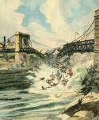
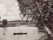
1852: Fairmont and Palatine
Fairmont, West Virginia, USA - Monongahela River
| Bridgemeister ID: | 39 (added before 2003) |
| Year Completed: | 1852 |
| Name: | Fairmont and Palatine |
| Location: | Fairmont, West Virginia, USA |
| Crossing: | Monongahela River |
| Principals: | James L. Randolph |
| References: | EOV, PTS2 |
| Status: | Removed |
| Main Cables: | Wire (iron) |
Notes:
- Was still part of Virginia at time of completion.
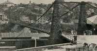
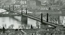
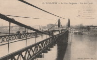
1852: Saint-Pierre
Toulouse, Haute-Garonne, France - Garonne River
| Bridgemeister ID: | 1169 (added 2004-01-23) |
| Year Completed: | 1852 |
| Name: | Saint-Pierre |
| Location: | Toulouse, Haute-Garonne, France |
| Crossing: | Garonne River |
| Coordinates: | 43.602179 N 1.434706 E |
| Maps: | Acme, GeoHack, Google, OpenStreetMap |
| References: | PTS2 |
| Use: | Vehicular |
| Status: | Demolished, 1927 |
| Main Cables: | Wire (iron) |
| Suspended Spans: | 4 |
| Main Spans: | 2 |
| Side Spans: | 2 |
Notes:
- Heavily damaged by flood, 1875. A metal arch bridge, completed 1987, is at this location now.
- Replaced by 1931 Saint-Pierre - Toulouse, Haute-Garonne, France.
External Links:
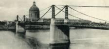
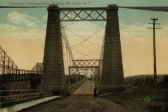
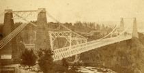
1852: St. John
St. John, New Brunswick, Canada - St. John River
| Bridgemeister ID: | 37 (added before 2003) |
| Year Completed: | 1852 |
| Name: | St. John |
| Location: | St. John, New Brunswick, Canada |
| Crossing: | St. John River |
| Principals: | Edward Serrell |
| References: | AAJ, BPL, HBE, PTS2 |
| Use: | Vehicular (one-lane) |
| Status: | Removed, 1915 |
| Main Cables: | Wire (iron) |
| Suspended Spans: | 1 |
| Main Span: | 1 x 195.1 meters (640 feet) |
Notes:
- Rebuilt 1857.
External Links:
1853: Chain
Ostrov, Pskov Oblast, Russia - Velikaya River
| Bridgemeister ID: | 4644 (added 2020-06-16) |
| Year Completed: | 1853 |
| Name: | Chain |
| Also Known As: | Tsepnyye, Цепные |
| Location: | Ostrov, Pskov Oblast, Russia |
| Crossing: | Velikaya River |
| Coordinates: | 57.340559 N 28.352457 E |
| Maps: | Acme, GeoHack, Google, OpenStreetMap |
| References: | PTS2 |
| Use: | Vehicular |
| Status: | Restricted to foot traffic (last checked: 2016) |
| Main Cables: | Eyebar (iron) |
| Suspended Spans: | 1 |
Notes:
External Links:
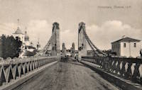
1853: Chain
Ostrov, Pskov Oblast, Russia - Velikaya River
| Bridgemeister ID: | 4645 (added 2020-06-16) |
| Year Completed: | 1853 |
| Name: | Chain |
| Also Known As: | Tsepnyye, Цепные |
| Location: | Ostrov, Pskov Oblast, Russia |
| Crossing: | Velikaya River |
| Coordinates: | 57.338893 N 28.351235 E |
| Maps: | Acme, GeoHack, Google, OpenStreetMap |
| References: | PTS2 |
| Use: | Vehicular |
| Status: | Restricted to foot traffic (last checked: 2016) |
| Main Cables: | Eyebar (iron) |
| Suspended Spans: | 1 |
Notes:
External Links:

1853: Fort Hunter
Tribes Hill and Fort Hunter, New York, USA - Mohawk River
| Bridgemeister ID: | 44 (added before 2003) |
| Year Completed: | 1853 |
| Name: | Fort Hunter |
| Also Known As: | Fonda |
| Location: | Tribes Hill and Fort Hunter, New York, USA |
| Crossing: | Mohawk River |
| Principals: | John W. Murphy, Thomas R. Hulett |
| References: | ONC, PTS2 |
| Use: | Vehicular |
| Status: | Dismantled, 1935 |
| Main Cables: | Wire (iron) |
| Suspended Spans: | 1 |
| Main Span: | 1 x 169.5 meters (556 feet) |
Notes:
- According to ONC: Designed by John W. Murphy (who designed several suspension bridges in the 1850s and 1860s in New York and Pennsylvania). Fort Hunter Suspension Bridge Company incorporated in 1852, but cables were not installed until 1853.
- 1935: Bridge is dismantled (ONC).
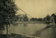
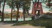
1853: Tsar Nicholas I
Kiev, Ukraine - Dnieper River
| Bridgemeister ID: | 409 (added before 2003) |
| Year Completed: | 1853 |
| Name: | Tsar Nicholas I |
| Location: | Kiev, Ukraine |
| Crossing: | Dnieper River |
| Principals: | Charles Blacker Vignoles |
| References: | AAJ, HBE, IEA, PTS2 |
| Use: | Vehicular |
| Status: | Destroyed, c. 1920 |
| Main Cables: | Chain (iron, flat link) |
| Suspended Spans: | 6 |
| Main Spans: | 4 x 134.1 meters (440 feet) |
| Side Spans: | 2 x 68.6 meters (225 feet) |
External Links:
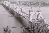
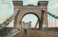
1854: Morgantown
Morgantown, West Virginia, USA - Monongahela River
| Bridgemeister ID: | 49 (added before 2003) |
| Year Completed: | 1854 |
| Name: | Morgantown |
| Location: | Morgantown, West Virginia, USA |
| Crossing: | Monongahela River |
| References: | AAJ, EN19070918, EOV, HBE, PTS2 |
| Use: | Vehicular, with walkway |
| Status: | Removed |
| Main Cables: | Wire (iron) |
| Suspended Spans: | 1 |
| Main Span: | 1 x 185.3 meters (608 feet) |
| Deck width: | 20 feet |
Notes:
- Was still part of Virginia at time of completion.
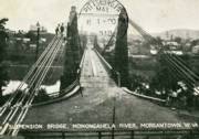
1855: Minneapolis
Minneapolis, Minnesota, USA - Mississippi River
| Bridgemeister ID: | 50 (added before 2003) |
| Year Completed: | 1855 |
| Name: | Minneapolis |
| Also Known As: | St. Anthony's Falls |
| Location: | Minneapolis, Minnesota, USA |
| Crossing: | Mississippi River |
| At or Near Feature: | Nicollet Island |
| Principals: | Thomas M. Griffith |
| References: | AAJ, BPL, HBE, PTS2 |
| Use: | Vehicular |
| Status: | Demolished, 1876 |
| Main Cables: | Wire (iron) |
| Suspended Spans: | 1 |
| Main Span: | 1 x 189 meters (620 feet) |
| Deck width: | 17 feet |
Notes:
- Replaced by 1877 Minneapolis - Minneapolis, Minnesota, USA.
- Later at same location 1990 Hennepin Avenue (Father Louis Hennepin) - Minneapolis, Minnesota, USA.
External Links:
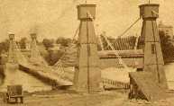
1855: Niagara Suspension
Niagara Falls, New York, USA and Niagara Falls, Ontario, Canada - Niagara River
| Bridgemeister ID: | 51 (added before 2003) |
| Year Completed: | 1855 |
| Name: | Niagara Suspension |
| Location: | Niagara Falls, New York, USA and Niagara Falls, Ontario, Canada |
| Crossing: | Niagara River |
| Principals: | John A. Roebling |
| References: | AAJ, BAAW, BBR, BFL, BMA, BOB, BPL, HBE, LIR, NSB, ONF, PTS2, SA18810716, SJR |
| Use: | Rail (heavy rail) and Vehicular (double-deck), with walkway |
| Status: | Replaced, 1897 |
| Main Cables: | Wire (iron) |
| Suspended Spans: | 1 |
| Main Span: | 1 x 250.3 meters (821.3 feet) |
Notes:
- Cables renovated, 1877. Wooden stiffening trusses replaced, 1880. Towers replaced, c. 1886. Bridge replaced with steel arch, 1897.
- AAJ notes the roadway deck opened in 1854, but the railway deck did not open until 1855.
- Replaced 1848 Niagara Suspension - Niagara Falls, New York, USA and Niagara Falls, Ontario, Canada.
External Links:
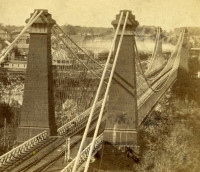
1856: Guyandotte
Guyandotte and Huntington, West Virginia, USA - Guyandotte River
| Bridgemeister ID: | 40 (added before 2003) |
| Year Completed: | 1856 |
| Name: | Guyandotte |
| Location: | Guyandotte and Huntington, West Virginia, USA |
| Crossing: | Guyandotte River |
| Coordinates: | 38.430083 N 82.391694 W |
| Maps: | Acme, GeoHack, Google, OpenStreetMap |
| Principals: | George Wilson Mason |
| References: | AAJ, EOV, PTS2 |
| Use: | Vehicular |
| Status: | Removed, 1907 |
| Main Cables: | Wire (iron) |
| Suspended Spans: | 1 |
| Main Span: | 1 x 137.2 meters (450 feet) |
Notes:
- EOV cites a source claiming the bridge was begun in 1853, but not completed until 1858. AAJ says completed in 1848. Other sources claim it was completed in 1852 and 1856.
- Was still part of Virginia at time of completion.
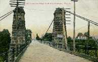
1857: Altenbergsteg
Berne, Switzerland - Aare River
| Bridgemeister ID: | 1475 (added 2004-09-02) |
| Year Completed: | 1857 |
| Name: | Altenbergsteg |
| Location: | Berne, Switzerland |
| Crossing: | Aare River |
| Coordinates: | 46.9503 N 7.4489 E |
| Maps: | Acme, GeoHack, Google, OpenStreetMap |
| References: | PTS2 |
| Use: | Footbridge |
| Status: | In use (last checked: 2019) |
| Main Cables: | Eyebar |
| Suspended Spans: | 1 |
| Main Span: | 1 x 57 meters (187 feet) |
External Links:
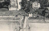
1858: Chelsea
London, England, United Kingdom - River Thames
| Bridgemeister ID: | 410 (added before 2003) |
| Year Completed: | 1858 |
| Name: | Chelsea |
| Also Known As: | Victoria |
| Location: | London, England, United Kingdom |
| Crossing: | River Thames |
| At or Near Feature: | Battersea Park |
| Coordinates: | 51.485061 N 0.149897 W |
| Maps: | Acme, GeoHack, Google, OpenStreetMap |
| Principals: | Thomas Page |
| References: | BTH, HBE, PTS2 |
| Use: | Vehicular |
| Status: | Replaced |
| Main Cables: | Eyebar (iron) |
| Suspended Spans: | 3 |
| Main Span: | 1 x 106.1 meters (348 feet) |
| Side Spans: | 1 x 116.7 meters (383 feet), 1 x 55.8 meters (183 feet) |
Notes:
- Replaced by 1937 Chelsea - London, England, United Kingdom.
External Links:
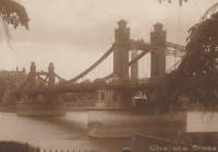
1860: Allegheny River
Pittsburgh, Pennsylvania, USA - Allegheny River
| Bridgemeister ID: | 59 (added before 2003) |
| Year Completed: | 1860 |
| Name: | Allegheny River |
| Also Known As: | Sixth Street, St. Clair |
| Location: | Pittsburgh, Pennsylvania, USA |
| Crossing: | Allegheny River |
| Principals: | John A. Roebling |
| References: | BOB, BOP, BPL, HBE, PBR, PTS2, SJR |
| Use: | Vehicular, with walkway |
| Status: | Replaced, 1892 |
| Main Cables: | Wire (iron) |
| Suspended Spans: | 4 |
| Main Spans: | 2 x 104.9 meters (344 feet) |
| Side Spans: | 2 x 52.1 meters (171 feet) |
| Deck width: | 40 feet |
Notes:
- BPL cites this bridge as the first suspension bridge with metal towers. However, at least two earlier suspension bridges (1857 Watertown, New York and 1856 Bidwell Bar, California) are known to have metal towers and even Roebling's 1846 Smithfield Street Bridge in Pittsburgh had cast iron towers.
- Next to 1884 North Side (Seventh Street) - Pittsburgh, Pennsylvania, USA.
External Links:
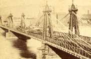
1860: Auburn-Coloma
Auburn and Coloma, California, USA - North Fork American River
| Bridgemeister ID: | 274 (added before 2003) |
| Year Completed: | 1860 |
| Name: | Auburn-Coloma |
| Location: | Auburn and Coloma, California, USA |
| Crossing: | North Fork American River |
| Principals: | John Mollett |
| References: | PTS2 |
| Use: | Vehicular (one-lane) |
| Status: | Removed |
| Main Cables: | Wire (iron) |
| Suspended Spans: | 1 |
Notes:
- 1865 and 1866 are sometimes cited as the year of completion for this bridge.
- Replaced by 1929 Auburn-Coloma - Auburn and Coloma, California, USA.
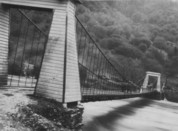
1860: Port Gibson
Grindstone Ford, Port Gibson vicinity, Mississippi, USA - Bayou Pierre
| Bridgemeister ID: | 1659 (added 2005-03-19) |
| Year Completed: | 1860 |
| Name: | Port Gibson |
| Location: | Grindstone Ford, Port Gibson vicinity, Mississippi, USA |
| Crossing: | Bayou Pierre |
| References: | PTS2 |
| Status: | Removed, circa 1920's |
Notes:
- Partially burned by retreating Confederate troops May 2nd, 1863 during the Vicksburg Campaign of the Civil War. Union troops extinquished the fire and quickly repaired the bridge.
- Demolished, circa 1920's. Descriptions for the Vicksburg Campaign imply there may have been another suspension bridge in the Port Gibson area.
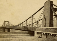
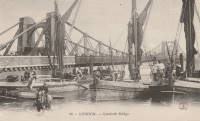
1862: Lambeth
London, England, United Kingdom - River Thames
| Bridgemeister ID: | 829 (added 2003-05-31) |
| Year Completed: | 1862 |
| Name: | Lambeth |
| Location: | London, England, United Kingdom |
| Crossing: | River Thames |
| Principals: | P. W. Barlow |
| References: | BRB, HBE, ONF, PTS2 |
| Use: | Vehicular, with walkway |
| Status: | Replaced, 1932 |
| Suspended Spans: | 3 |
| Main Spans: | 3 x 81.7 meters (268 feet) |
External Links:
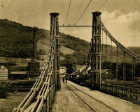
1864: (suspension bridge)
Porta Westfalica, Germany - Weser River
| Bridgemeister ID: | 637 (added 2003-02-13) |
| Year Completed: | 1864 |
| Name: | (suspension bridge) |
| Location: | Porta Westfalica, Germany |
| Crossing: | Weser River |
| References: | BRU, PTS2 |
| Use: | Rail and Vehicular |
| Status: | Destroyed, April 3, 1945 |
| Main Cables: | Eyebar (iron) |
| Suspended Spans: | 1 |
Notes:
- At the time of completion, the bridge connected the villages of Barkhausen and Hausberge, later merged into Porta Westfalica.
1864: Aspern
Vienna, Austria
| Bridgemeister ID: | 3076 (added 2019-10-26) |
| Year Completed: | 1864 |
| Name: | Aspern |
| Location: | Vienna, Austria |
| Coordinates: | 48.211858 N 16.383001 E |
| Maps: | Acme, GeoHack, Google, OpenStreetMap |
| Principals: | Friedrich Schnirch |
| References: | AAJ, PTS2 |
| Use: | Vehicular |
| Status: | Demolished, 1913 |
| Main Cables: | Eyebar (iron) |
| Suspended Spans: | 1 |
| Main Span: | 1 |
External Links:
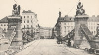
1864: Clifton
Bristol, England, United Kingdom - River Avon
| Bridgemeister ID: | 413 (added before 2003) |
| Year Completed: | 1864 |
| Name: | Clifton |
| Location: | Bristol, England, United Kingdom |
| Crossing: | River Avon |
| Coordinates: | 51.45496 N 2.62781 W |
| Maps: | Acme, GeoHack, Google, OpenStreetMap |
| Principals: | Isambard K. Brunel, P.W. Barlow, Hawkshaw |
| References: | AOB, BBR, BC3, BEM, BMA, BOU, BRB, CTW, HBE, NTB, ONF, PTS2 |
| Use: | Vehicular, with walkway |
| Status: | In use (last checked: 2021) |
| Main Cables: | Eyebar (iron) |
| Suspended Spans: | 1 |
| Main Span: | 1 x 214 meters (702 feet) |
Notes:
- Built with chain cables reused from the Hungerford bridge.
- See 1845 Hungerford - London, England, United Kingdom.
External Links:
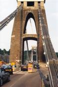

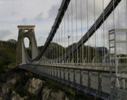
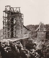
1867: John A. Roebling
Cincinnati, Ohio and Covington, Kentucky, USA - Ohio River
| Bridgemeister ID: | 65 (added before 2003) |
| Year Completed: | 1867 |
| Name: | John A. Roebling |
| Also Known As: | Cincinnati, Cincinnati and Covington |
| Location: | Cincinnati, Ohio and Covington, Kentucky, USA |
| Crossing: | Ohio River |
| Coordinates: | 39.09167 N 84.50833 W |
| Maps: | Acme, GeoHack, Google, OpenStreetMap |
| Principals: | John A. Roebling |
| References: | BAAW, BC3, BOB, BPL, COB, EOV, HBE, LAB, LACE, ONF, PTS2, SJR, TOB |
| Use: | Vehicular (two-lane), with walkway |
| Status: | Closed, February, 2021 (last checked: 2021) |
| Main Cables: | Wire (iron) |
| Suspended Spans: | 3 |
| Main Span: | 1 x 322.2 meters (1,057 feet) |
| Side Spans: | 2 |
Notes:
- 1892: Cable ends restored.
- 1899: Steel cables added to assist original cables.
- 2021, February: Closed to all vehicular traffic for a nine-month restoration project.
- Became longest suspension bridge by eclipsing 1849 Wheeling (Wheeling and Belmont) - Wheeling, West Virginia, USA.
- Eclipsed by new longest suspension bridge 1869 Clifton (Niagara-Clifton, Falls View, First Falls View) - Niagara Falls, New York, USA and Niagara Falls, Ontario, Canada.
External Links:
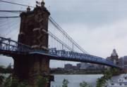
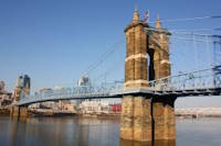
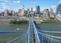
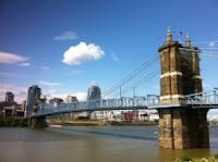
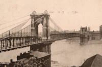
1868: Eiserner Steg
Frankfurt, Germany - Main River
| Bridgemeister ID: | 6429 (added 2021-08-11) |
| Year Completed: | 1868 |
| Name: | Eiserner Steg |
| Also Known As: | Eiserne Steg |
| Location: | Frankfurt, Germany |
| Crossing: | Main River |
| Coordinates: | 50.108108 N 8.682128 E |
| Maps: | Acme, GeoHack, Google, OpenStreetMap |
| Principals: | Peter Schmick |
| References: | AAJ, PTS2 |
| Use: | Footbridge |
| Status: | Replaced, 1912 |
| Suspended Spans: | 3 |
| Main Span: | 1 |
| Side Spans: | 2 |
Notes:
- A "stiffened" braced chain suspension bridge. Like several other similar eastern European bridges constructed in the late 1800s and early 1900s it is somewhat questionable whether this bridge should be included in a list of suspension bridges. It was replaced in 1912 by a cantilever bridge that resembles the shape and lines of the former suspension bridge.
External Links:
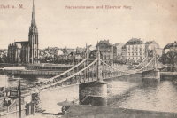
1869: Clifton
Niagara Falls, New York, USA and Niagara Falls, Ontario, Canada - Niagara River
| Bridgemeister ID: | 70 (added before 2003) |
| Year Completed: | 1869 |
| Name: | Clifton |
| Also Known As: | Niagara-Clifton, Falls View, First Falls View |
| Location: | Niagara Falls, New York, USA and Niagara Falls, Ontario, Canada |
| Crossing: | Niagara River |
| Principals: | Samuel Keefer |
| References: | AAJ, BPL, HBE, PTS2 |
| Use: | Vehicular |
| Status: | Replaced, 1889 |
| Main Cables: | Wire (iron) |
| Main Span: | 1 x 386.6 meters (1,268.3 feet) |
| Deck width: | 10 feet |
Notes:
- Opened January 2nd, 1869. Wooden towers replaced with steel towers, 1884. Widened to 17 feet, 1888. Wrecked by wind, January, 1889. Some of the images here may show the replacement bridge.
- Became longest suspension bridge by eclipsing 1867 John A. Roebling (Cincinnati, Cincinnati and Covington) - Cincinnati, Ohio and Covington, Kentucky, USA.
- Eclipsed by new longest suspension bridge 1883 Brooklyn (Great East River) - New York and Brooklyn, New York, USA.
- Replaced by 1889 Second Falls View - Niagara Falls, New York, USA and Niagara Falls, Ontario, Canada.
External Links:
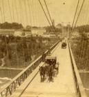
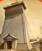
1869: Drahtsteg
Passau, Bavaria, Germany - Danube River
| Bridgemeister ID: | 5560 (added 2020-12-19) |
| Year Completed: | 1869 |
| Name: | Drahtsteg |
| Location: | Passau, Bavaria, Germany |
| Crossing: | Danube River |
| Coordinates: | 48.575501 N 13.472755 E |
| Maps: | Acme, GeoHack, Google, OpenStreetMap |
| References: | PTS2 |
| Use: | Footbridge |
| Status: | Only towers remain, since 1910 (last checked: 2020) |
| Main Cables: | Wire |
| Suspended Spans: | 1 |
Notes:
- Near future location of 1948 Luitpoldbrücke - Passau, Bavaria, Germany.
External Links:
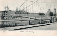
1869: Lordville
Lordville, New York and Equinunk, Pennsylvania, USA - Delaware River
| Bridgemeister ID: | 71 (added before 2003) |
| Year Completed: | 1869 |
| Name: | Lordville |
| Location: | Lordville, New York and Equinunk, Pennsylvania, USA |
| Crossing: | Delaware River |
| Coordinates: | 41.867938 N 75.213785 W |
| Maps: | Acme, GeoHack, Google, OpenStreetMap |
| Principals: | E.F. Farrington |
| References: | BDR, BOL, PTS2 |
| Use: | Vehicular (one-lane) |
| Status: | Destroyed, 1903 |
| Main Cables: | Wire (iron) |
Notes:
- Destroyed by flood 1903.
- Replaced by 1904 Lordville-Equinunk - Lordville, New York and Equinunk, Pennsylvania, USA.
1869: Rudolfova Lávka
Prague, Czechia - Vltava River
| Bridgemeister ID: | 5939 (added 2021-06-29) |
| Year Completed: | 1869 |
| Name: | Rudolfova Lávka |
| Also Known As: | Rudolfsteg, Kettensteg, Železna Lávka |
| Location: | Prague, Czechia |
| Crossing: | Vltava River |
| Coordinates: | 50.090185 N 14.412677 E |
| Maps: | Acme, GeoHack, Google, OpenStreetMap |
| Principals: | Karel Veselý, František Schön, Ruston and Co. |
| References: | AAJ, PTS2 |
| Use: | Footbridge |
| Status: | Removed, c. 1914 |
| Main Cables: | Chain (iron) |
Notes:
- Removed at some point after the adjacent Mánes bridge was opened in 1914.
External Links:
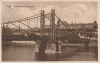
1869: Waco
Waco, Texas, USA - Brazos River
| Bridgemeister ID: | 72 (added before 2003) |
| Year Completed: | 1869 |
| Name: | Waco |
| Location: | Waco, Texas, USA |
| Crossing: | Brazos River |
| Coordinates: | 31.561314 N 97.127063 W |
| Maps: | Acme, GeoHack, Google, OpenStreetMap |
| Principals: | Thomas M. Griffith |
| References: | AAJ, BC3, BPL, BRAZ, GBD, HAERTX98, HBE, PTS2, WSB |
| Use: | Vehicular, with walkway |
| Status: | Restricted to foot traffic (last checked: 2023) |
| Main Cables: | Wire (iron) |
| Suspended Spans: | 1 |
| Main Span: | 1 x 144.8 meters (475 feet) |
| Deck width: | 18 feet |
Notes:
- 1915: Rebuilt.
- 2020, October: Closed for restoration project expecting to last 18-24 months.
- 2021, March: Major restoration project underway, led by Sparks Engineering, Inc.
- 2023, April: The restored bridge is rededicated on April 22. Patrick Sparks of Sparks Engineering reports: . The rededication was held April 22, 2023. "The project involved full rehabilitation including: replacement of the suspension system and anchor rods, strengthening of the anchorages, replacement of the saddle bearings, retrofit strengthening of the east tower, and deck replacement (concrete on the main deck, tropical hardwood on the side walks)."
External Links:
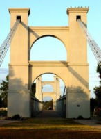
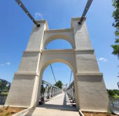
1871: Warren
Warren, Pennsylvania, USA - Allegheny River
| Bridgemeister ID: | 75 (added before 2003) |
| Year Completed: | 1871 |
| Name: | Warren |
| Also Known As: | Hickory Street |
| Location: | Warren, Pennsylvania, USA |
| Crossing: | Allegheny River |
| Principals: | George W. Fishler |
| References: | AAJ, EOV, HAERPA461, HBE, PTS2 |
| Use: | Vehicular, with walkway |
| Status: | Replaced, 1918 |
| Main Cables: | Wire (iron) |
| Suspended Spans: | 1 |
| Main Span: | 1 x 143.3 meters (470 feet) |
| Deck width: | 29 feet |
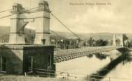
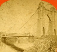
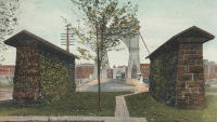
1872: Lower
Turners Falls, Montague, Massachusetts, USA - Connecticut River
| Bridgemeister ID: | 340 (added before 2003) |
| Year Completed: | 1872 |
| Name: | Lower |
| Also Known As: | White |
| Location: | Turners Falls, Montague, Massachusetts, USA |
| Crossing: | Connecticut River |
| Coordinates: | 42.609165 N 72.561433 W |
| Maps: | Acme, GeoHack, Google, OpenStreetMap |
| References: | CCR, PTS2 |
| Use: | Vehicular |
| Status: | Removed, circa 1936 |
| Main Cables: | Wire |
| Suspended Spans: | 1 |
Notes:
- Damaged by flood, 1936 and removed soon after.
- Near 1878 Upper (Red) - Turners Falls, Montague, Massachusetts, USA.
1876: Petroleum Street
Oil City, Pennsylvania, USA - Allegheny River
| Bridgemeister ID: | 83 (added before 2003) |
| Year Completed: | 1876 |
| Name: | Petroleum Street |
| Also Known As: | Oil City |
| Location: | Oil City, Pennsylvania, USA |
| Crossing: | Allegheny River |
| Principals: | Charles Roebling |
| References: | AAJ, HAERPA461, HBE, PTS2, TRS |
| Use: | Vehicular |
| Status: | Removed |
| Main Cables: | Wire |
| Suspended Spans: | 3 |
| Main Span: | 1 x 152.4 meters (500 feet) |
| Side Spans: | 2 |
Notes:
- AAJ: Rebuilt, 1884, 1905.
1876: Point
Pittsburgh, Pennsylvania, USA - Monongahela River
| Bridgemeister ID: | 84 (added before 2003) |
| Year Completed: | 1876 |
| Name: | Point |
| Location: | Pittsburgh, Pennsylvania, USA |
| Crossing: | Monongahela River |
| Principals: | Edward Hemberle |
| References: | AAJ, BOP, BPL, HBE, IEA, ONF, PBR, PTS2, SA19000106 |
| Use: | Vehicular and Rail (streetcar) |
| Status: | Demolished, 1927 |
| Main Cables: | Eyebar |
| Suspended Spans: | 1 |
| Main Span: | 1 x 243.8 meters (800 feet) |
| Deck width: | 34 feet |
Notes:
- Partial floor collapse requiring extensive repairs, December 24, 1903. Repaired, 1904. Demolished 1927.
External Links:
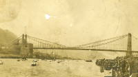
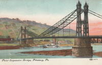
1877: Minneapolis
Minneapolis, Minnesota, USA - Mississippi River
| Bridgemeister ID: | 86 (added before 2003) |
| Year Completed: | 1877 |
| Name: | Minneapolis |
| Location: | Minneapolis, Minnesota, USA |
| Crossing: | Mississippi River |
| At or Near Feature: | Nicollet Island |
| Principals: | Thomas M. Griffith |
| References: | AAJ, BPL, HBE, PTS2 |
| Use: | Vehicular, with walkway |
| Status: | Replaced, 1890 |
| Main Cables: | Wire (iron) |
| Suspended Spans: | 1 |
| Main Span: | 1 x 205.8 meters (675.1 feet) |
| Deck width: | 32 feet |
Notes:
- Replaced 1855 Minneapolis (St. Anthony's Falls) - Minneapolis, Minnesota, USA.
- Later at same location 1990 Hennepin Avenue (Father Louis Hennepin) - Minneapolis, Minnesota, USA.
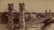
1879: Saint-Ilpize
Saint-Ilpize, Haute-Loire, France - Allier River
| Bridgemeister ID: | 1097 (added 2004-01-02) |
| Year Completed: | 1879 |
| Name: | Saint-Ilpize |
| Location: | Saint-Ilpize, Haute-Loire, France |
| Crossing: | Allier River |
| Coordinates: | 45.198556 N 3.386866 E |
| Maps: | Acme, GeoHack, Google, OpenStreetMap |
| Principals: | Ferdinand Arnodin |
| References: | AAJ, BPF, HBE, PTS2 |
| Use: | Vehicular (one-lane) |
| Status: | In use (last checked: 2020) |
| Main Cables: | Wire |
| Suspended Spans: | 3 |
| Main Span: | 1 x 70.35 meters (230.8 feet) |
| Side Spans: | 2 |
| Deck width: | 18 feet |
Notes:
- The side spans are supported solely by inclined stays, not suspenders from the main cables.
- Closed to all traffic on July 15, 2004 due to damage to the deck, possibly caused by an overloaded truck. Repaired and reopened.
External Links:
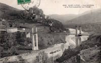
1883: Brooklyn
New York and Brooklyn, New York, USA - East River
| Bridgemeister ID: | 89 (added before 2003) |
| Year Completed: | 1883 |
| Name: | Brooklyn |
| Also Known As: | Great East River |
| Location: | New York and Brooklyn, New York, USA |
| Crossing: | East River |
| Coordinates: | 40.706 N 73.99667 W |
| Maps: | Acme, GeoHack, Google, OpenStreetMap |
| Principals: | John A. Roebling, Washington A. Roebling |
| References: | AAJ, BAAW, BBR, BBTS, BC3, BFL, BLD, BMA, BOB, BOU, BPL, COB, CTW, GB, GBD, HBE, LAB, LACE, NG198305, ONF, PTS2, SJR |
| Use: | Rail (light rail) and Vehicular (major highway), with walkway |
| Status: | In use (last checked: 2022) |
| Main Cables: | Wire (steel) |
| Suspended Spans: | 3 |
| Main Span: | 1 x 486.3 meters (1,595.5 feet) |
| Side Spans: | 2 x 283.5 meters (930 feet) |
| Deck width: | 85 feet |
Notes:
- Became longest suspension bridge by eclipsing 1869 Clifton (Niagara-Clifton, Falls View, First Falls View) - Niagara Falls, New York, USA and Niagara Falls, Ontario, Canada.
- Eclipsed by new longest suspension bridge 1903 Williamsburg - New York and Brooklyn, New York, USA.
- Next to 1909 Manhattan - New York and Brooklyn, New York, USA.
- Near 1903 Williamsburg - New York and Brooklyn, New York, USA.
External Links:
1884: (suspension bridge)
Charleston, West Virginia, USA - Elk River
| Bridgemeister ID: | 1427 (added 2004-07-24) |
| Year Completed: | 1884 |
| Name: | (suspension bridge) |
| Location: | Charleston, West Virginia, USA |
| Crossing: | Elk River |
| References: | AAJ, HBE, PTS2 |
| Use: | Vehicular and Rail (streetcar) |
| Status: | Removed |
| Main Cables: | Wire |
| Main Span: | 1 x 83.2 meters (273 feet) |
Notes:
- AAJ: Repaired by William Hildenbrand a few years after completion.
- Near 1852 Charleston (Lovell Street) - Charleston, West Virginia, USA.
1884: Lamothe
Lamothe and Brioude, Haute-Loire, France - Allier River
| Bridgemeister ID: | 1764 (added 2005-04-22) |
| Year Completed: | 1884 |
| Name: | Lamothe |
| Location: | Lamothe and Brioude, Haute-Loire, France |
| Crossing: | Allier River |
| Coordinates: | 45.302968 N 3.406201 E |
| Maps: | Acme, GeoHack, Google, OpenStreetMap |
| References: | PTS2 |
| Use: | Vehicular |
| Status: | Only towers remain, since 1977 (last checked: 2019) |
| Main Cables: | Wire |
| Suspended Spans: | 1 |
| Main Span: | 1 |
Notes:
- Next to 1834 Lamothe - Lamothe and Brioude, Haute-Loire, France. In 1866, a flood caused a major change in the course of the Allier River such that the main channel no longer flowed under the older bridge. The newer bridge crossed the main channel of the Allier just slightly east of the older bridge.
External Links:
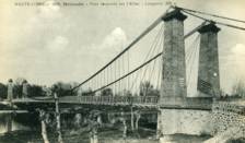
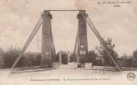
1884: North Side
Pittsburgh, Pennsylvania, USA - Allegheny River
| Bridgemeister ID: | 91 (added before 2003) |
| Year Completed: | 1884 |
| Name: | North Side |
| Also Known As: | Seventh Street |
| Location: | Pittsburgh, Pennsylvania, USA |
| Crossing: | Allegheny River |
| Principals: | Gustav Lindenthal |
| References: | AAJ, BPL, HBE, PBR, PTS2 |
| Use: | Vehicular |
| Status: | Removed, 1924 |
| Main Cables: | Eyebar |
| Suspended Spans: | 4 |
| Main Spans: | 2 x 97.5 meters (320 feet) |
| Side Spans: | 2 x 50.3 meters (165 feet) |
| Deck width: | 42 feet |
Notes:
- Next to 1860 Allegheny River (Sixth Street, St. Clair) - Pittsburgh, Pennsylvania, USA.
- Replaced by 1926 Andy Warhol (Seventh Street) - Pittsburgh, Pennsylvania, USA.
External Links:
1886: (suspension bridge)
Windsor Locks and Warehouse Point, Connecticut, USA - Connecticut River
| Bridgemeister ID: | 306 (added before 2003) |
| Year Completed: | 1886 |
| Name: | (suspension bridge) |
| Location: | Windsor Locks and Warehouse Point, Connecticut, USA |
| Crossing: | Connecticut River |
| Principals: | James Shipman |
| References: | AAJ, PTS2 |
| Use: | Vehicular |
| Status: | Removed |
| Main Cables: | Wire |
| Suspended Spans: | 3 |
| Main Span: | 1 x 167.6 meters (550 feet) |
| Side Spans: | 2 x 91.4 meters (300 feet) |
External Links:
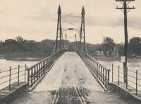
1887: Hammersmith
London, England, United Kingdom - River Thames
| Bridgemeister ID: | 419 (added before 2003) |
| Year Completed: | 1887 |
| Name: | Hammersmith |
| Location: | London, England, United Kingdom |
| Crossing: | River Thames |
| Coordinates: | 51.48845 N 0.23019 W |
| Maps: | Acme, GeoHack, Google, OpenStreetMap |
| Principals: | Sir Joseph Bazalgette |
| References: | BEM, BPL, HBE, NTB, PTS2 |
| Use: | Vehicular (two-lane), with walkway |
| Status: | Restricted to foot traffic, since 2021 (last checked: 2021) |
| Main Cables: | Eyebar |
| Suspended Spans: | 3 |
| Main Span: | 1 |
| Side Spans: | 2 |
Notes:
- 2019, April: Closed to vehicular traffic due to safety concerns after an inspection found fractures in the cast iron casings around the bridge pedestals. Some repair work followed, but was not fully funded or finished (as of mid-2020)
- 2020, August: Fractures found to have worsened during recent heatwave. Bridge is completely closed to all pedestrian and bicycle traffic. Pedestrian walkways under the bridge and all river traffic under the bridge are also prohibited (implying risk of collapse).
- 2020, December: Bridge may reopen to pedestrians and cyclists if deemed safe by maintenance contractor, Mott MacDonald.
- 2021, January: Plan discussed to "thread" a temporary truss along the length of the deck to permit traffic while the suspension bridge undergoes repairs.
- 2021, March: Feasibility study on "double-decker" temporary truss plan determines it is feasible, possibly opening to pedestrian and vehicular traffic by mid-2022.
- 2021, July: Reopened for pedestrian and bicycle use.
- Replaced 1827 Hammersmith - London, England, United Kingdom.
External Links:
- ENR - Engineers Ponder Solutions for Damaged London Bridge. February 22, 2021 Engineering News-Record article discusses proposal to thread a temporary truss between the towers to allow traffic while the larger suspension bridge repairs are completed. Recaps the issue: "Cracks have been found in the cast-iron pedestals that support suspension cable saddles at the abutments. Engineers suspect that roller bearings between the saddles and pedestals seized up at least 30 years ago…"
- Hammersmith Bridge | Temporary ‘double-decker’ proposal deemed technically feasible - New Civil Engineer. March 22, 2021
- The Happy Pontist: London Bridges: 33. Hammersmith Bridge
- Structurae - Structure ID 20008013
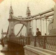
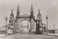
1889: Fiorentini
Rome, Italy - Tiber River
| Bridgemeister ID: | 828 (added 2003-05-31) |
| Year Completed: | 1889 |
| Name: | Fiorentini |
| Also Known As: | Ferro, Soldo, Soldino |
| Location: | Rome, Italy |
| Crossing: | Tiber River |
| Coordinates: | 41.898801 N 12.463689 E |
| Maps: | Acme, GeoHack, Google, OpenStreetMap |
| References: | AAJ, ONF, PTS2 |
| Use: | Vehicular |
| Status: | Demolished, July 15, 1941 |
| Main Cables: | Eyebar |
| Suspended Spans: | 1 |
| Characteristics: | Braced (trussed) chain/cable, Hinged cables |
Notes:
- Jakkula (AAJ) lists this bridge as completed in 1889 based on articles from 1899-1900 discussing braced chain suspension bridges. Various internet sources consistently cite 1863 as the year of completion. The 1889 date is more consistent with several similar braced-chain suspension bridges built in the 1890, but it is unclear which sources are accurate.
- "Braced chain" main cables.
- Similar to 1936 Kindee - Kindee, Ellenborough vicinity, New South Wales, Australia.
- Similar to 1951 Marias River (Pugsley) - Chester vicinity, Montana, USA.
- Similar to (footbridge) - Sarov (Саров), Nizhny Novgorod Oblast, Russia.
- Similar to Allan - Segenhoe, Scone vicinity, New South Wales, Australia.
- Similar to Ininskiy (Ининский) - Inya (Иня), Altai Republic, Russia.
- Similar to Reku Vel' - Solginskiy (Солгинский), Arkhangelsk Oblast, Russia.
External Links:
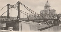
1889: Rivière de l'Est
Sainte Rose, Réunion, France - Rivière de l'Est
| Bridgemeister ID: | 992 (added 2003-11-16) |
| Year Completed: | 1889 |
| Name: | Rivière de l'Est |
| Also Known As: | River of the East |
| Location: | Sainte Rose, Réunion, France |
| Crossing: | Rivière de l'Est |
| Coordinates: | 21.125067 S 55.7484896 E |
| Maps: | Acme, GeoHack, Google, OpenStreetMap |
| Principals: | Ferdinand Arnodin |
| References: | PTS2 |
| Use: | Vehicular (one-lane) |
| Status: | In use (last checked: 2019) |
| Main Cables: | Wire |
| Suspended Spans: | 1 |
External Links:
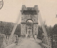
1890: Grand Avenue
St. Louis, Missouri, USA - Mill Creek Valley
| Bridgemeister ID: | 96 (added before 2003) |
| Year Completed: | 1890 |
| Name: | Grand Avenue |
| Also Known As: | Jefferson Avenue |
| Location: | St. Louis, Missouri, USA |
| Crossing: | Mill Creek Valley |
| Principals: | Carl Gayler |
| References: | AAJ, HBE, IEA, ONF, PTS2, SSB |
| Use: | Vehicular, with walkway |
| Status: | Demolished, 1960 |
| Main Cables: | Eyebar |
| Suspended Spans: | 3 |
| Main Span: | 1 x 121.9 meters (400 feet) |
| Side Spans: | 2 x 45.7 meters (150 feet) |
| Deck width: | 60 feet |
| Characteristics: | Braced (trussed) chain/cable |
Notes:
- Braced chain (stiffened-eyebar) design often espoused by Gustav Lindenthal. ONF (an article by Lindenthal) refers to this as the Jefferson Ave. bridge while Fowler's book (IEA) calls it "Grand Avenue". AAJ describes it as "a three-hinged inverted arch with two stiffened chains, one on each side."
External Links:
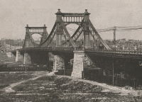
1892: Cammeray
Willoughby, New South Wales, Australia - Long Bay Gully
| Bridgemeister ID: | 421 (added before 2003) |
| Year Completed: | 1892 |
| Name: | Cammeray |
| Also Known As: | North Sydney, Northbridge |
| Location: | Willoughby, New South Wales, Australia |
| Crossing: | Long Bay Gully |
| Coordinates: | 33.816899 S 151.212336 E |
| Maps: | Acme, GeoHack, Google, OpenStreetMap |
| References: | PTS2, STC |
| Use: | Vehicular |
| Status: | Only towers remain, since 1939 (last checked: 2019) |
| Main Cables: | Wire |
| Suspended Spans: | 3 |
| Main Span: | 1 x 152.4 meters (500 feet) |
| Side Spans: | 2 x 38.1 meters (125 feet) |
Notes:
- Replaced with arch in 1939, but original towers retained. STC says replaced 1937.
External Links:
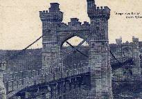
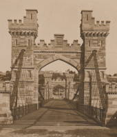
1894: Occidente
Santa Fé de Antioquia, Colombia - Cauca River
| Bridgemeister ID: | 934 (added 2003-10-25) |
| Year Completed: | 1894 |
| Name: | Occidente |
| Also Known As: | Western |
| Location: | Santa Fé de Antioquia, Colombia |
| Crossing: | Cauca River |
| Coordinates: | 6.577965 N 75.798177 W |
| Maps: | Acme, GeoHack, Google, OpenStreetMap |
| Principals: | José María Villa |
| References: | AAJ, HBE, PTS2 |
| Use: | Vehicular (one-lane), with walkway |
| Status: | In use (last checked: 2019) |
| Main Cables: | Wire |
| Main Span: | 1 x 286.5 meters (940 feet) |
External Links:
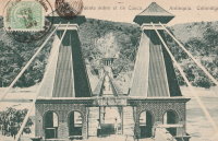
1894: Tower
London, England, United Kingdom - River Thames
| Bridgemeister ID: | 3845 (added 2020-03-07) |
| Year Completed: | 1894 |
| Name: | Tower |
| Location: | London, England, United Kingdom |
| Crossing: | River Thames |
| Coordinates: | 51.505837 N 0.075281 W |
| Maps: | Acme, GeoHack, Google, OpenStreetMap |
| References: | PTS2 |
| Use: | Vehicular |
| Status: | In use (last checked: 2023) |
| Suspended Spans: | 2 |
| Side Spans: | 2 x 82.3 meters (270 feet) |
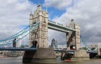
| Bridgemeister ID: | 343 (added before 2003) |
| Year Completed: | 1895 |
| Name: | Mill Creek Park |
| Also Known As: | White, Silver, Old Steel, Cinderella, Fairy Tale |
| Location: | Youngstown vicinity, Ohio, USA |
| At or Near Feature: | Mill Creek Park |
| Coordinates: | 41.07325 N 80.68886 W |
| Maps: | Acme, GeoHack, Google, OpenStreetMap |
| Principals: | Charles Evan Fowler |
| References: | AAJ, HBE, IEA, PTS2 |
| Use: | Vehicular (two-lane) |
| Status: | In use (last checked: 2021) |
| Main Cables: | Eyebar |
| Suspended Spans: | 1 |
| Main Span: | 1 x 27.4 meters (90 feet) |
| Characteristics: | Braced (trussed) chain/cable |
Notes:
- Short stiffened eyebar ("braced chain") of the style that Lindenthal often proposed. A mid-span support was added many years ago.
- Major rehabilitation started, June 2007. Reopened November, 2007.
External Links:
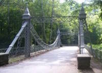
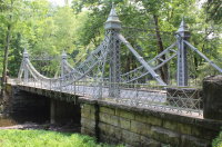
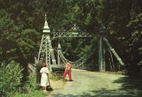
1897: Lincoln Highway
East Liverpool, Ohio and Chester, West Virginia, USA - Ohio River
| Bridgemeister ID: | 105 (added before 2003) |
| Year Completed: | 1897 |
| Name: | Lincoln Highway |
| Also Known As: | Chester |
| Location: | East Liverpool, Ohio and Chester, West Virginia, USA |
| Crossing: | Ohio River |
| Principals: | Hermann Laub, E.S. Fickes |
| References: | AAJ, BPL, HBE, PTS2 |
| Use: | Vehicular, with walkway |
| Status: | Removed, 1970 |
| Main Cables: | Wire (steel) |
| Suspended Spans: | 3 |
| Main Span: | 1 x 214.9 meters (705 feet) |
| Side Spans: | 1 x 109.7 meters (360 feet), 1 x 128 meters (420 feet) |
| Deck width: | 27 feet |
Notes:
- Rebuilt 1939 by David Steinman. Closed and demolished, 1970.
External Links:
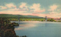
1897: Rochester
Rochester and Monaca, Pennsylvania, USA - Ohio River
| Bridgemeister ID: | 104 (added before 2003) |
| Year Completed: | 1897 |
| Name: | Rochester |
| Location: | Rochester and Monaca, Pennsylvania, USA |
| Crossing: | Ohio River |
| Principals: | Edwin Kirtland Morse |
| References: | AAJ, BPL, HBE, PTS2 |
| Use: | Vehicular, with walkway |
| Status: | Removed |
| Main Cables: | Wire (steel) |
| Suspended Spans: | 3 |
| Main Span: | 1 x 243.8 meters (800 feet) |
| Side Spans: | 1 x 121.9 meters (400 feet), 1 x 126.8 meters (416 feet) |
| Deck width: | 28 feet |
External Links:

1898: Langenargen
Langenargen and Gohren, Kressbronn am Bodensee, Baden-Württemberg, Germany - Argen River
| Bridgemeister ID: | 929 (added 2003-10-24) |
| Year Completed: | 1898 |
| Name: | Langenargen |
| Location: | Langenargen and Gohren, Kressbronn am Bodensee, Baden-Württemberg, Germany |
| Crossing: | Argen River |
| Coordinates: | 47.59622 N 9.56208 E |
| Maps: | Acme, GeoHack, Google, OpenStreetMap |
| Principals: | Kubler, Leibbrand |
| References: | AAJ, HBE, PTS2 |
| Use: | Vehicular, with walkway |
| Status: | Restricted to foot traffic (last checked: 2022) |
| Main Cables: | Wire |
| Suspended Spans: | 1 |
| Main Span: | 1 x 71.9 meters (236 feet) |
Notes:
- Othmar Ammann worked as an intern on this bridge.
External Links:
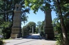
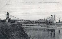
1899: Lewiston-Queenston
Lewiston, New York, USA and Queenston, Ontario, Canada - Niagara River
| Bridgemeister ID: | 108 (added before 2003) |
| Year Completed: | 1899 |
| Name: | Lewiston-Queenston |
| Location: | Lewiston, New York, USA and Queenston, Ontario, Canada |
| Crossing: | Niagara River |
| Principals: | L.L. Buck, R.S. Buck |
| References: | AAJ, BPL, HBE, PTS2 |
| Use: | Vehicular and Rail (streetcar) |
| Status: | Replaced, 1962 |
| Main Cables: | Wire (steel) |
| Suspended Spans: | 1 |
| Main Span: | 1 x 317 meters (1,040 feet) |
| Deck width: | 17 feet |
Notes:
- Reused parts from the recently dismantled Second Falls View Bridge.
- At former location of 1851 Lewiston-Queenston - Lewiston, New York, USA and Queenston, Ontario, Canada.
- See 1889 Second Falls View - Niagara Falls, New York, USA and Niagara Falls, Ontario, Canada.
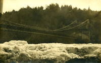
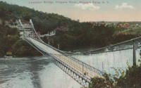
1900: Ojuela
Mapimí, Torreon vicinity, Durango, Mexico
| Bridgemeister ID: | 1043 (added 2003-12-06) |
| Year Completed: | 1900 |
| Name: | Ojuela |
| Also Known As: | Mapimi, Mampimi, Miampimi |
| Location: | Mapimí, Torreon vicinity, Durango, Mexico |
| Coordinates: | 25.791768 N 103.790706 W |
| Maps: | Acme, GeoHack, Google, OpenStreetMap |
| Principals: | Santiago Minguín, William Hildenbrand?, Henry G. Tyrell |
| References: | AAJ, HBE, PTS2 |
| Use: | Vehicular |
| Status: | Restricted to foot traffic (last checked: 2019) |
| Main Cables: | Wire (steel) |
| Suspended Spans: | 1 |
| Main Span: | 1 x 271.5 meters (890.7 feet) estimated |
Notes:
- Misspelled on every long span bridge list I've ever seen, this long narrow footbridge is located at Mapimí, Mexico.
- AAJ notes this bridge as having a 10-foot wide roadway and having been built by William Hildenbrand. The present-day bridge's deck measures only 1.8 meters and is restricted to foot traffic. In HBE, Tyrell takes credit for the design of the bridge and also notes the 10-foot roadway (though, HBE was probably a source for AAJ).
External Links:
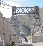
1900: Upper
Easton, Pennsylvania, USA - Lehigh River
| Bridgemeister ID: | 366 (added before 2003) |
| Year Completed: | 1900 |
| Name: | Upper |
| Location: | Easton, Pennsylvania, USA |
| Crossing: | Lehigh River |
| Principals: | Henry G. Tyrell, John McNeal |
| References: | AAJ, DSL20030414, EN19001122, HBE, PTS2, WGE20030513 |
| Use: | Footbridge |
| Status: | Demolished, 1955 |
| Main Cables: | Wire (steel) |
| Suspended Spans: | 3 |
| Main Spans: | 2 x 85 meters (279 feet) |
| Side Span: | 1 x 33.5 meters (110 feet) |
Notes:
- According to Tyrell, "[It] joins Dock Street on the lower side of the river with Glendon Avenue on the upper side, 90 feet above it. To overcome this difference in elevation of the two ends without incurring excessive expense for approach, the bridge floor was made to descend on a grade of 7.2 per cent from the upper bank to meet stairs rising from Dock Street..."

1901: Aramon
Aramon, Gard, France - Rhône River
| Bridgemeister ID: | 6432 (added 2021-08-12) |
| Year Completed: | 1901 |
| Name: | Aramon |
| Location: | Aramon, Gard, France |
| Crossing: | Rhône River |
| References: | PTS2 |
| Use: | Vehicular |
| Status: | Destroyed, August 15, 1944 |
| Main Cables: | Wire (steel) |
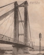
1902: Vernaison
Vernaison, Métropole de Lyon, France - Rhône River
| Bridgemeister ID: | 6431 (added 2021-08-11) |
| Year Completed: | 1902 |
| Name: | Vernaison |
| Location: | Vernaison, Métropole de Lyon, France |
| Crossing: | Rhône River |
| Coordinates: | 45.646369 N 4.815423 E |
| Maps: | Acme, GeoHack, Google, OpenStreetMap |
| Principals: | Ferdinand Arnodin |
| References: | AAJ, PTS2 |
| Use: | Vehicular |
| Status: | Destroyed, June 1940 |
| Main Cables: | Wire (steel) |
Notes:
- Later at same location 1959 Vernaison - Vernaison and Solaize, Métropole de Lyon, France.
External Links:
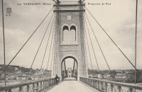
1903: Caperton
Caperton vicinity, West Virginia, USA - New River
| Bridgemeister ID: | 1422 (added 2004-07-17) |
| Year Completed: | 1903 |
| Name: | Caperton |
| Location: | Caperton vicinity, West Virginia, USA |
| Crossing: | New River |
| Coordinates: | 38.021856 N 81.028479 W |
| Maps: | Acme, GeoHack, Google, OpenStreetMap |
| References: | AAJ, HBE, PTS2 |
| Use: | Footbridge |
| Status: | Removed |
| Main Cables: | Wire |
| Suspended Spans: | 1 |
| Main Span: | 1 x 155.4 meters (510 feet) |
Notes:
- Removed by the 1960s, probably earlier.
1903: Elisabeth
Budapest, Hungary - Danube River
| Bridgemeister ID: | 426 (added before 2003) |
| Year Completed: | 1903 |
| Name: | Elisabeth |
| Also Known As: | Elizabeth, Erzsébet |
| Location: | Budapest, Hungary |
| Crossing: | Danube River |
| Principals: | Aurel Czekelius, M. Nagy |
| References: | AAJ, BMA, HBE, PTS2, SA19050909 |
| Use: | Vehicular, with walkway |
| Status: | Destroyed, 1945 |
| Main Cables: | Eyebar |
| Suspended Spans: | 3 |
| Main Span: | 1 x 289.9 meters (951 feet) |
| Side Spans: | 2 x 44.2 meters (145 feet) |
Notes:
- Replaced by 1964 Elisabeth (Erzsébet) - Budapest, Hungary.
External Links:
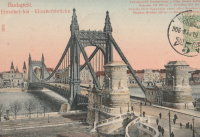
1903: Ticonic
Waterville, Maine, USA - Kennebec River
| Bridgemeister ID: | 110 (added before 2003) |
| Year Completed: | 1903 |
| Name: | Ticonic |
| Also Known As: | Tupenny, Two Cent |
| Location: | Waterville, Maine, USA |
| Crossing: | Kennebec River |
| Coordinates: | 44.55073 N 69.62728 W |
| Maps: | Acme, GeoHack, Google, OpenStreetMap |
| Principals: | Edwin D. Graves |
| References: | AAJ, HBE, PTS2 |
| Use: | Footbridge |
| Status: | In use (last checked: 2009) |
| Main Cables: | Wire |
| Suspended Spans: | 1 |
| Main Span: | 1 x 121.9 meters (400 feet) |
| Deck width: | 6 feet |
External Links:
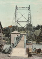
1903: Williamsburg
New York and Brooklyn, New York, USA - East River
| Bridgemeister ID: | 111 (added before 2003) |
| Year Completed: | 1903 |
| Name: | Williamsburg |
| Location: | New York and Brooklyn, New York, USA |
| Crossing: | East River |
| Coordinates: | 40.71355 N 73.97226 W |
| Maps: | Acme, GeoHack, Google, OpenStreetMap |
| Principals: | L.L. Buck |
| References: | AAJ, BAAW, BAR, BBR, BPL, GBD, HBE, PTS2, SJR |
| Use: | Rail (light rail) and Vehicular (major highway), with walkway |
| Status: | In use (last checked: 2022) |
| Main Cables: | Wire (steel) |
| Suspended Spans: | 1 |
| Main Span: | 1 x 487.7 meters (1,600 feet) |
Notes:
- Became longest suspension bridge by eclipsing 1883 Brooklyn (Great East River) - New York and Brooklyn, New York, USA.
- Eclipsed by new longest suspension bridge 1924 Bear Mountain - Anthony's Nose and Bear Mountain, New York, USA.
- Near 1883 Brooklyn (Great East River) - New York and Brooklyn, New York, USA.
- Near 1909 Manhattan - New York and Brooklyn, New York, USA.
External Links:
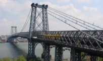
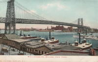
1904: Bonhomme
Kervignac, Morbihan, France - Blavet River
| Bridgemeister ID: | 1115 (added 2004-01-05) |
| Year Completed: | 1904 |
| Name: | Bonhomme |
| Location: | Kervignac, Morbihan, France |
| Crossing: | Blavet River |
| Coordinates: | 47.764878 N 3.302251 W |
| Maps: | Acme, GeoHack, Google, OpenStreetMap |
| Principals: | Ferdinand Arnodin |
| References: | AAJ, BPF, PTS2 |
| Use: | Vehicular |
| Status: | Only towers remain, since 1980 (last checked: 2019) |
| Main Cables: | Wire |
| Suspended Spans: | 3 |
| Main Span: | 1 x 163.1 meters (535 feet) |
| Side Spans: | 2 x 36.9 meters (121 feet) |
Notes:
- Deck and cables removed, 1980.
External Links:
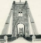
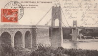
1905: Kelso
Kelso, Washington, USA - Cowlitz River
| Bridgemeister ID: | 1651 (added 2005-03-19) |
| Year Completed: | 1905 |
| Name: | Kelso |
| Location: | Kelso, Washington, USA |
| Crossing: | Cowlitz River |
| References: | AAJ, PTS2 |
| Use: | Vehicular |
| Status: | Collapsed, Jan. 3, 1923 |
| Main Cables: | Wire (steel) |
| Suspended Spans: | 1 |
| Main Span: | 1 x 91.4 meters (300 feet) |
Notes:
- Washed out, 1906. Rebuilt, 1907. Collapsed, 1923, killing "12 to 15 persons" when one of the cables parted with the anchorage.
External Links:
1905: Market Street
Steubenville, Ohio and East Steubenville, West Virginia, USA - Ohio River
| Bridgemeister ID: | 114 (added before 2003) |
| Year Completed: | 1905 |
| Name: | Market Street |
| Location: | Steubenville, Ohio and East Steubenville, West Virginia, USA |
| Crossing: | Ohio River |
| Coordinates: | 40.35833 N 80.61167 W |
| Maps: | Acme, GeoHack, Google, OpenStreetMap |
| Principals: | Hermann Laub |
| References: | AAJ, BPL, PTS2 |
| Use: | Vehicular (two-lane) |
| Status: | Closed, December 2023 |
| Main Cables: | Wire (steel) |
| Suspended Spans: | 3 |
| Main Span: | 1 x 207.3 meters (680 feet) |
| Side Spans: | 2 x 79.2 meters (260 feet) |
Notes:
- 2023, December: Closed by WVDOT because of safety concerns.
- Near 1928 Fort Steuben - Steubenville, Ohio and Weirton, West Virginia, USA.
External Links:
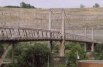
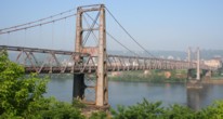
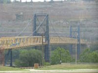
1905: Newell
East Liverpool, Ohio and Newell, West Virginia, USA - Ohio River
| Bridgemeister ID: | 117 (added before 2003) |
| Year Completed: | 1905 |
| Name: | Newell |
| Location: | East Liverpool, Ohio and Newell, West Virginia, USA |
| Crossing: | Ohio River |
| Coordinates: | 40.62167 N 80.595 W |
| Maps: | Acme, GeoHack, Google, OpenStreetMap |
| Principals: | Edwin Kirtland Morse, Dravo Company |
| References: | AAJ, BPL, PTS2 |
| Use: | Vehicular (two-lane), with walkway |
| Status: | In use (last checked: 2022) |
| Main Cables: | Wire (steel) |
| Suspended Spans: | 3 |
| Main Span: | 1 x 228.6 meters (750 feet) |
| Side Spans: | 2 |
Annotated Citations:
- Huba, Stephen. "There’s a new owner for the Newell Bridge." The Weirton Daily Times, 6 May 2022, www.weirtondailytimes.com/news/local-news/2022/05/theres-a-new-owner-for-the-newell-bridge/.
"Frank Six of Six Enterprises in Newell, assumed ownership Wednesday of one of the oldest suspension bridges on the Ohio River for an undisclosed sum from HLC Holdings Inc., parent company of the Fiesta Tableware Co., formerly known as the Homer Laughlin China Co."
- Bobby-Gilbert, Jo-Ann., "Fiesta Tableware Parent Sells Iconic Newell Bridge." The Business Journal, 5 May 2022, businessjournaldaily.com/fiesta-tableware-parent-sells-iconic-newell-bridge/.
"After 116 years of ownership by HLC Holdings Inc., parent company of The Fiesta Tableware Co., the Newell Bridge and Railway Co. changed hands at midnight Wednesday. Officials of Fiesta Tableware, formerly known as Homer Laughlin China Co., announced that the bridge has been purchased by Frank Six, owner of Six Enterprises in Newell."
External Links:

1909: Chain
Newburyport, Massachusetts, USA - Merrimack River
| Bridgemeister ID: | 122 (added before 2003) |
| Year Completed: | 1909 |
| Name: | Chain |
| Location: | Newburyport, Massachusetts, USA |
| Crossing: | Merrimack River |
| Coordinates: | 42.833459 N 70.906674 W |
| Maps: | Acme, GeoHack, Google, OpenStreetMap |
| Principals: | George F. Swain, Robert R. Evans |
| References: | PTS2 |
| Use: | Vehicular (two-lane), with walkway |
| Status: | In use (last checked: 2006) |
| Main Cables: | Wire (steel) |
| Suspended Spans: | 1 |
| Main Span: | 1 x 80.8 meters (265 feet) |
| Deck width: | 35.8 feet |
Notes:
- Deck replaced 1922, 1931, 1938, and 2002.
- Replaced 1810 Chain (Essex-Merrimack) - Newburyport, Massachusetts, USA.
External Links:
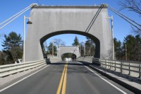
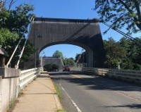
1909: Empire
Empire, Panama Canal Zone - Panama Canal
| Bridgemeister ID: | 525 (added before 2003) |
| Year Completed: | 1909 |
| Name: | Empire |
| Location: | Empire, Panama Canal Zone |
| Crossing: | Panama Canal |
| References: | PTS2 |
| Use: | Vehicular (one-lane) and Pipeline |
| Status: | Removed |
| Main Cables: | Wire (steel) |
| Suspended Spans: | 1 |
| Main Span: | 1 x 182.9 meters (600 feet) |
Notes:
- AAJ: Built to carry water and compressed air pipelines during canal construction, but also had a roadway.
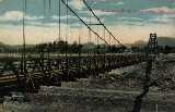
1909: Manhattan
New York and Brooklyn, New York, USA - East River
| Bridgemeister ID: | 123 (added before 2003) |
| Year Completed: | 1909 |
| Name: | Manhattan |
| Location: | New York and Brooklyn, New York, USA |
| Crossing: | East River |
| Coordinates: | 40.70667 N 73.99167 W |
| Maps: | Acme, GeoHack, Google, OpenStreetMap |
| Principals: | O.F. Nichols, Leon Moisseiff |
| References: | AAJ, BAAW, BBR, BC3, BPL, GBD, HBE, LAB, PTS2, SA19050909, SJR |
| Use: | Vehicular (double-deck) |
| Status: | In use (last checked: 2022) |
| Main Cables: | Wire (steel) |
| Suspended Spans: | 3 |
| Main Span: | 1 x 448.1 meters (1,470 feet) |
| Side Spans: | 2 x 221 meters (725 feet) |
Notes:
- Opened December 31, 1909, but not fully completed yet.
- Next to 1883 Brooklyn (Great East River) - New York and Brooklyn, New York, USA.
- Near 1903 Williamsburg - New York and Brooklyn, New York, USA.
External Links:
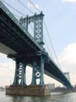

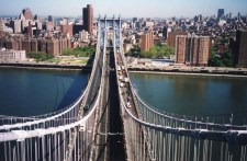
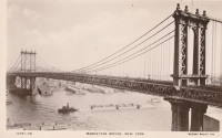
1910: Linn Creek
Linn Creek, Missouri, USA - Osage River
| Bridgemeister ID: | 289 (added before 2003) |
| Year Completed: | 1910 |
| Name: | Linn Creek |
| Location: | Linn Creek, Missouri, USA |
| Crossing: | Osage River |
| Principals: | T.S. Hart |
| References: | AAJ, PTS2 |
| Use: | Vehicular |
| Status: | Removed, 1931 |
| Main Cables: | Wire |
| Suspended Spans: | 1 |
| Main Span: | 1 x 160 meters (525 feet) |
Notes:
- Dismantled 1931 in preparation for inundation that created Lake Of The Ozarks.
External Links:
- www.LakeHistory.info. Michael Gillespie writes: "The supporting cables were cut and the tower was allowed to fall into the Osage River. The entire flood plain was being inundated by the waters of the newly created Lake of the Ozarks. During World War 2, the cables and tower were raised and sold for scrap. The shoreline of today's Lake of the Ozarks is just at the base of the bridge abutment. The toll house, seen in the photo just to the left of the bridge, is long gone, and everything below that has been underwater for 77 years. I have created a map of the road system at that location."
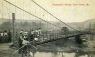
1910: Massena Center
Massena, New York, USA - Grasse River
| Bridgemeister ID: | 124 (added before 2003) |
| Year Completed: | 1910 |
| Name: | Massena Center |
| Location: | Massena, New York, USA |
| Crossing: | Grasse River |
| Coordinates: | 44.959213 N 74.830558 W |
| Maps: | Acme, GeoHack, Google, OpenStreetMap |
| Principals: | Holton D. Robinson |
| References: | AAJ, PTS2 |
| Use: | Vehicular (one-lane) |
| Status: | Closed, 1974 (last checked: 2020) |
| Main Cables: | Wire (steel) |
| Suspended Spans: | 3 |
| Main Span: | 1 x 121.9 meters (400 feet) |
| Side Spans: | 2 x 30.5 meters (100 feet) |
Notes:
- Standing, but closed to all foot and vehicular traffic.
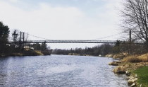
1913: Brilliant
Castlegar vicinity, British Columbia, Canada - Kootenay River
| Bridgemeister ID: | 128 (added before 2003) |
| Year Completed: | 1913 |
| Name: | Brilliant |
| Also Known As: | Doukhobor |
| Location: | Castlegar vicinity, British Columbia, Canada |
| Crossing: | Kootenay River |
| Coordinates: | 49.31793 N 117.63023 W |
| Maps: | Acme, GeoHack, Google, OpenStreetMap |
| Principals: | J. R. Grant |
| References: | AAJ, PTS2 |
| Use: | Vehicular (one-lane) |
| Status: | Restricted to foot traffic (last checked: 2010) |
| Main Cables: | Wire (steel) |
| Suspended Spans: | 1 |
| Main Span: | 1 x 100.9 meters (331 feet) |
| Deck width: | 16 feet |
Notes:
- 2010, May: Bridge is reopened for pedestrian traffic after a restoration project. Bridge had been closed and derelict prior.
- Near 1984 Zuckerberg Island Heritage Park - Castlegar, British Columbia, Canada.
External Links:
| Bridgemeister ID: | 600 (added 2003-01-11) |
| Year Completed: | 1914 |
| Name: | 98th Meridian |
| Also Known As: | Byers |
| Location: | Byers, Texas and Temple, Oklahoma, USA |
| Crossing: | Red River |
| Coordinates: | 34.124507 N 98.214251 W |
| Maps: | Acme, GeoHack, Google, OpenStreetMap |
| Principals: | Mitchell & Pigg |
| References: | AUB, HAERTX98, PTS2 |
| Use: | Vehicular |
| Status: | Destroyed, 1923 |
| Main Cables: | Wire (steel) |
| Suspended Spans: | 4 |
| Main Spans: | 3 x 172.8 meters (567 feet) |
| Side Span: | 1 x 32.6 meters (107 feet) |
Notes:
- Destroyed by tornado, 1923.
- Coordinates are the exact location of one of the remaining (as of 2020) piers of either this bridge or its replacement suspension bridge. Additional piers, south of that location, are also visible in satellite images.
- Replaced by 1923 98th Meridian (Byers) - Byers vicinity, Texas and Temple, Oklahoma, USA.
- See (suspension bridge) - Texas, USA. The 98th Meridian bridge may match this unknown "Red River" bridge photo. AUB describes the Byers bridge, "This bridge, three spans of 567' each, one side span of 107', and a 16' roadway, had originally been built in 1914."
1914: Dresden
Dresden, Ohio, USA - Muskingum River
| Bridgemeister ID: | 132 (added before 2003) |
| Year Completed: | 1914 |
| Name: | Dresden |
| Location: | Dresden, Ohio, USA |
| Crossing: | Muskingum River |
| Coordinates: | 40.12079 N 82.00000 W |
| Maps: | Acme, GeoHack, Google, OpenStreetMap |
| Principals: | Bellefontaine Bridge and Steel Co. |
| References: | GBD, OCEN198202, PTS2 |
| Use: | Vehicular (one-lane) |
| Status: | Closed (last checked: 2022) |
| Main Cables: | Eyebar (steel) |
| Suspended Spans: | 2 |
| Main Span: | 1 x 135 meters (443 feet) |
| Side Span: | 1 |
Notes:
- 2022, January: Ohio Department of Transportation recommends removal of the bridge due to its deteriorating condition.
- Replaced 1853 Dresden - Dresden, Ohio, USA.
Annotated Citations:
- Hannahs, Nichole. "ODOT Recommends Removal of Suspension Bridge." WHIZ News, 25 Jan. 2022, whiznews.com/2022/01/25/odot-recommends-removal-of-suspension-bridge/
"…ODOT recommended the removal of the structure, which would cost between $1-$2 million, which would be funded by the state. Other more costly options include more than $6 million to make it structurally sound for pedestrians to walk on and over $3.5 million to rehab it and then it still couldn’t be used."
External Links:


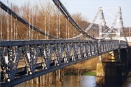
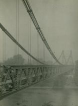
1915: (footbridge)
Chiwaukum vicinity, Washington, USA - Wenatchee River
| Bridgemeister ID: | 1424 (added 2004-07-18) |
| Year Completed: | 1915 |
| Name: | (footbridge) |
| Location: | Chiwaukum vicinity, Washington, USA |
| Crossing: | Wenatchee River |
| Principals: | National Forest Service |
| References: | AAJ, PTS2 |
| Use: | Footbridge |
| Main Cables: | Wire (steel) |
| Suspended Spans: | 1 |
| Main Span: | 1 x 57.9 meters (190 feet) |
1916: Belpre-Parkersburg
Parkersburg, West Virginia and Belpre, Ohio, USA - Ohio River
| Bridgemeister ID: | 134 (added before 2003) |
| Year Completed: | 1916 |
| Name: | Belpre-Parkersburg |
| Location: | Parkersburg, West Virginia and Belpre, Ohio, USA |
| Crossing: | Ohio River |
| Principals: | Hermann Laub |
| References: | AAJ, BPL, PTS2, SJR |
| Use: | Vehicular, with walkway |
| Status: | Demolished, March 16, 1980 |
| Main Cables: | Wire (steel) |
| Suspended Spans: | 3 |
| Main Span: | 1 x 236.2 meters (775 feet) |
| Side Spans: | 1 x 114.3 meters (375 feet), 1 x 83.8 meters (275 feet) |
| Deck width: | 22 feet |
External Links:
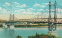
1917: Rio Chiriquí
Panama - Rio Chiriquí
| Bridgemeister ID: | 1425 (added 2004-07-18) |
| Year Completed: | 1917 |
| Name: | Rio Chiriquí |
| Location: | Panama |
| Crossing: | Rio Chiriquí |
| Principals: | A. S. Zinn |
| References: | AAJ, PTS2 |
| Use: | Vehicular |
| Main Cables: | Wire (steel) |
| Suspended Spans: | 1 |
| Main Span: | 1 x 125 meters (410 feet) |
| Deck width: | 7.7 feet |
| Bridgemeister ID: | 595 (added 2003-01-11) |
| Year Completed: | 1917 |
| Name: | Terral-Ringgold |
| Location: | Ringgold, Texas and Terral, Oklahoma, USA |
| Crossing: | Red River |
| Coordinates: | 33.878143 N 97.934776 W |
| Maps: | Acme, GeoHack, Google, OpenStreetMap |
| References: | AUB, PTS2 |
| Use: | Vehicular |
| Status: | Removed |
| Main Cables: | Wire |
| Suspended Spans: | 5 |
| Main Spans: | 3 x 137.2 meters (450 feet) |
| Side Spans: | 2 |
Notes:
- 1931: Replacement opened.
1918: Opiki Toll
Rangitane, New Zealand - Manawatu River
| Bridgemeister ID: | 698 (added 2003-03-08) |
| Year Completed: | 1918 |
| Name: | Opiki Toll |
| Also Known As: | Akers Toll |
| Location: | Rangitane, New Zealand |
| Crossing: | Manawatu River |
| Coordinates: | 40.431841 S 175.468575 E |
| Maps: | Acme, GeoHack, Google, OpenStreetMap |
| Principals: | Joseph Dawson |
| References: | AAJ, GAP, PTS2 |
| Use: | Vehicular |
| Status: | Derelict (last checked: 2024) |
| Main Cables: | Wire (steel) |
| Main Span: | 1 |
Notes:
- 1969: Bypassed.
- 2023, September: After many years of the main cables and suspenders hanging with no deck, one of the main cables collapsed.
- 2024, March: The collapsed main cable is raised back into position. The bridge, however, is still a just derelict monument with no deck.
External Links:
- ‘Iconic’ Ōpiki Bridge partly collapses in Manawatū River - nzherald.co.nz. Article regarding the September 2023 main cable collapse.
1918: Swinging
Old Hickory, Nashville and Goodlettsville, Nashville, Tennessee, USA - Cumberland River
| Bridgemeister ID: | 587 (added 2003-01-05) |
| Year Completed: | 1918 |
| Name: | Swinging |
| Location: | Old Hickory, Nashville and Goodlettsville, Nashville, Tennessee, USA |
| Crossing: | Cumberland River |
| At or Near Feature: | Hadley Bend |
| Coordinates: | 36.289002 N 86.685355 W |
| Maps: | Acme, GeoHack, Google, OpenStreetMap |
| Principals: | William G. Grove, American Bridge Co. |
| References: | AAJ, PTS2 |
| Use: | Vehicular (one-lane) |
| Status: | Removed |
| Main Cables: | Wire (steel) |
| Suspended Spans: | 1 |
| Main Span: | 1 x 164.6 meters (540 feet) |
| Deck width: | 8 feet |
Notes:
- Coordinates provided are approximate based on current-day (2021) location of Swinging Bridge Road.
External Links:
- Bridgehunter.com | Old Hickory Suspension Bridge
- DuPont High School Alumni Association - The Swinging Bridge. According to the description in this article provided by Old Hickory Branch Library this large bridge had a 540-foot main span and was used for vehicular traffic. "The suspension bridge... Was diverted from its original destination in South America because of the urgency of the war effort. It was built for pedestrian traffic and used only for that purpose at first... Upon determination that the bridge was capable of handling light traffic, a flagman was stationed at each end of the bridge on a 24-hour-a-day basis and cars began using the one-lane span." Kris Brummett adds: "The 540 foot span had no supports to prevent sideways movement and literally swayed back and forth. The bridge was used until 1929."
1919: Beebe
Beebe and Chelan, Washington, USA - Columbia River
| Bridgemeister ID: | 1188 (added 2004-01-24) |
| Year Completed: | 1919 |
| Name: | Beebe |
| Location: | Beebe and Chelan, Washington, USA |
| Crossing: | Columbia River |
| Coordinates: | 47.81308 N 119.97245 W |
| Maps: | Acme, GeoHack, Google, OpenStreetMap |
| Principals: | A. Munster, Wenatchee-Beebe Orchard Co. |
| References: | AAJ, PTS2, SPW |
| Use: | Pipeline and Vehicular |
| Status: | Only towers remain, since 1963 (last checked: 2022) |
| Main Cables: | Wire (steel) |
| Suspended Spans: | 1 |
| Main Span: | 1 x 192.6 meters (632 feet) |
| Deck width: | 12 feet |
Notes:
- The towers are still standing next to the current US97 crossing at Beebe.
- AAJ: Private bridge, built primarily to carry water to the owner's orchard, but also carried a roadway.
External Links:
- The Beebe Bridge | Empire Press | wenatcheeworld.com. Article about the history of the bridge.
- Structurae - Structure ID 20052092
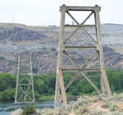
1919: Hansen
Twin Falls vicinity, Idaho, USA - Snake River
| Bridgemeister ID: | 334 (added before 2003) |
| Year Completed: | 1919 |
| Name: | Hansen |
| Location: | Twin Falls vicinity, Idaho, USA |
| Crossing: | Snake River |
| Principals: | Freygang and Trocon |
| References: | AAJ, PTS2 |
| Use: | Vehicular (two-lane) |
| Status: | Replaced, 1966 |
| Main Cables: | Wire (steel) |
| Suspended Spans: | 1 |
| Main Span: | 1 x 185.3 meters (608 feet) |
| Deck width: | 17 feet |
External Links:
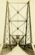
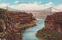
1921: Bridgeport
Bridgeport and Geary, Oklahoma, USA - South Canadian River
| Bridgemeister ID: | 1660 (added 2005-03-19) |
| Year Completed: | 1921 |
| Name: | Bridgeport |
| Also Known As: | Key, Postal |
| Location: | Bridgeport and Geary, Oklahoma, USA |
| Crossing: | South Canadian River |
| Coordinates: | 35.567306 N 98.374731 W |
| Maps: | Acme, GeoHack, Google, OpenStreetMap |
| References: | PTS2 |
| Use: | Vehicular |
| Status: | Removed |
| Main Cables: | Wire (steel) |
Notes:
- Remnants of at least one pier still standing, 2019.
1921: Kingston-Port Ewen
Kingston, New York, USA - Rondout Creek
| Bridgemeister ID: | 138 (added before 2003) |
| Year Completed: | 1921 |
| Name: | Kingston-Port Ewen |
| Also Known As: | Wurts Street, Rondout Creek |
| Location: | Kingston, New York, USA |
| Crossing: | Rondout Creek |
| Coordinates: | 41.916129 N 73.983999 W |
| Maps: | Acme, GeoHack, Google, OpenStreetMap |
| Principals: | Holton D. Robinson, Daniel E. Moran, William Yates |
| References: | AAJ, PTS, PTS2, SJR, SSS |
| Use: | Vehicular (two-lane, heavy vehicles), with walkway |
| Status: | In use, September 2020 (last checked: 2021) |
| Main Cables: | Wire (steel) |
| Suspended Spans: | 3 |
| Main Span: | 1 x 214.9 meters (705 feet) |
| Side Spans: | 2 x 53.7 meters (176.25 feet) |
| Deck width: | 37 feet |
Notes:
- 2008, March: Closed for ten weeks for cable inspection.
- 2018, December: Closed for maintenance. Expected to reopen February, 2019.
- 2019: Major rehabilitation continues to be delayed for several years.
- 2020, September: Closed temporarily. Major renovation project continues to be delayed.
- 2020, December: Closed indefinitely.
- 2021, May: Bids for renovation to be sought in June. Work expected to start in September.
- 2021, October: Groundbreaking ceremony for long-anticipated restoration project. Expected to be completed in 2023 at a cost of US$44.6M
Annotated Citations:
- Kirby, Paul. "Bids for Rondout Creek Bridge overhaul to be sought next month; work expected to start in September." Daily Freeman, 5 May 2021, www.dailyfreeman.com/news/local-news/bids-for-rondout-creek-bridge-overhaul-to-be-sought-next-month-work-expected-to-start/article_612258c4-adce-11eb-8dd6-9f0ac0c85540.html.
"Bids for the planned overhaul of the Rondout Creek Bridge will be sought in June, and the state Department of Transportation expects to award contracts for the work in August, the office of state Assemblyman Kevin Cahill said this week... The rehabilitation of the suspension bridge, which carries Wurts Street over the creek between Kingston and Port Ewen, could cost as much as $37 million, Cahill said previously. The state will pay for the project, which is expected to begin this fall."
External Links:
- Dave Longendyke's website. Several photos of the bridge's construction.
- Structurae - Structure ID 20007345
1922: (footbridge)
Bexley, Ohio, USA - Alum Creek
| Bridgemeister ID: | 819 (added 2003-05-31) |
| Year Completed: | 1922 |
| Name: | (footbridge) |
| Location: | Bexley, Ohio, USA |
| Crossing: | Alum Creek |
| At or Near Feature: | Wolfe Park |
| Coordinates: | 39.963831 N 82.947491 W |
| Maps: | Acme, GeoHack, Google, OpenStreetMap |
| References: | AAJ, PTS2 |
| Use: | Footbridge |
| Status: | In use (last checked: 2016) |
| Main Cables: | Wire (steel) |
| Suspended Spans: | 1 |
| Deck width: | 6.25 feet |
Notes:
- Closed 2013 for major refurbishment including a new deck. Reopened March. 2014.
- April 2015: Two main cables snap, causing a partial collapse of the bridge deck. Repaired and reopened August 5, 2016. Failure speculated to have been caused by the weight of the new deck installed 2013-2014.
1923: McKeown
Tyrola, Ada vicinity and Konawa, Oklahoma, USA - Canadian River
| Bridgemeister ID: | 2146 (added 2006-11-11) |
| Year Completed: | 1923 |
| Name: | McKeown |
| Also Known As: | Ada-Konawa |
| Location: | Tyrola, Ada vicinity and Konawa, Oklahoma, USA |
| Crossing: | Canadian River |
| References: | PTS2 |
| Use: | Vehicular |
| Status: | Removed, 1936 |
| Main Cables: | Wire |
Notes:
- J.W. Pigg (of Mitchell & Pigg, prominent Texas suspension bridge builders of the early 20th century) was reportedly involved in the construction of the bridge. Steinman gives a date of 1922, but newspaper articles from mid-1923 describe the plans as still under consideration. The bridge was likely completed in 1923 or 1924.
- A photograph of the bridge appears in the December 16, 1934 issue of The Daily Oklahoman (Oklahoma City) with caption: "This Old Bridge Is Doomed," sub-caption "Suspension Bridge on Highway 48 North of Ada," and a blurb: "This old bridge, known as the McKeown bridge, across the Canadian River between Ada and Konawa, is being condemned and will be rebuilt. It is a suspension bridge, one of the few in the state, but when the bridge is rebuilt it will be minus its 'suspenders.'"
- The November 12, 1936 edition of The Ada Evening News reports: "The old suspension, bridge across the river north ot Ada is being torn down, but no one knew just where it will be located when and if it is rebuilt. Konawa wants to build it west of the city of Konawa. Mr. Clark [division engineer for the state highway department] did not know if any provisions have yet been made for its erection."
1924: Bear Mountain
Anthony's Nose and Bear Mountain, New York, USA - Hudson River
| Bridgemeister ID: | 141 (added before 2003) |
| Year Completed: | 1924 |
| Name: | Bear Mountain |
| Location: | Anthony's Nose and Bear Mountain, New York, USA |
| Crossing: | Hudson River |
| Coordinates: | 41.32 N 73.985 W |
| Maps: | Acme, GeoHack, Google, OpenStreetMap |
| Principals: | Howard C. Baird |
| References: | AAJ, BAAW, BBR, CPW, PTS2, SJR |
| Use: | Vehicular (two-lane, heavy vehicles), with walkway |
| Status: | In use (last checked: 2022) |
| Main Cables: | Wire (steel) |
| Suspended Spans: | 1 |
| Main Span: | 1 x 497.4 meters (1,632 feet) |
| Deck width: | 48 feet |
Notes:
- Became longest suspension bridge by eclipsing 1903 Williamsburg - New York and Brooklyn, New York, USA.
- Eclipsed by new longest suspension bridge 1926 Benjamin Franklin (Philadelphia-Camden) - Philadelphia, Pennsylvania and Camden, New Jersey, USA.
- Near 2002 Popolopen (William J. Moreau Popolopen) - Fort Montgomery, New York, USA.
External Links:
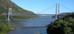
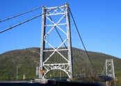
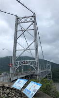
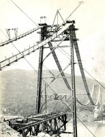
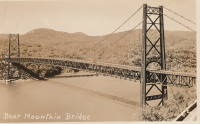
| Bridgemeister ID: | 140 (added before 2003) |
| Year Completed: | 1924 |
| Name: | Nocona |
| Also Known As: | Bluff, Ketchum Bluff, Ketchum's Bluff |
| Location: | Nocona vicinity, Texas and Jefferson County, Oklahoma, USA |
| Crossing: | Red River |
| At or Near Feature: | Ketchum Bluff |
| Coordinates: | 33.93579 N 97.75869 W |
| Maps: | Acme, GeoHack, Google, OpenStreetMap |
| Principals: | Austin Bridge Co. |
| References: | AUB, HAERTX98, PTS2 |
| Use: | Vehicular |
| Status: | Only towers remain (last checked: 2007) |
| Main Cables: | Wire (steel) |
| Main Span: | 1 x 213.4 meters (700 feet) |
Notes:
- Legend has it the bridge was burned during a dispute. This likely occurred before 1955. Some sources suggest it occurred before or during 1950. The road that leads to the Texas side of the former crossing is "Burned Out Bridge Road." Follow the image of the derelict tower to see the remains of the bridge.
- AUB mentions: "In January 1924, a contract was entered into with Nocona Bridge Company for a bridge across Red River, nine miles north of Nocona, connecting Texas and Oklahoma. The plans called for a 700' span, 16' roadway, and the main cables to contain 1,000 No. 9 galvanized wires each. The building of this, [the Austin Bridge Company's] first complete cable bridge, and the experience gained therefrom helped to launch Austin Bridge Company into an interesting and profitable line of work."
External Links:
- Nocona Suspension Bridge at Ketchum Bluff, Texas. University of Texas Arlington Libraries Digital Gallery
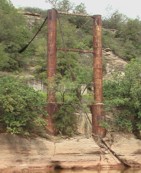
1925: Luzancy
Luzancy, Seine-et-Marne, France - Marne River
| Bridgemeister ID: | 4920 (added 2020-07-26) |
| Year Completed: | 1925 |
| Name: | Luzancy |
| Location: | Luzancy, Seine-et-Marne, France |
| Crossing: | Marne River |
| References: | AAJ, PTS2 |
| Use: | Vehicular |
| Status: | Destroyed |
| Main Cables: | Reinforced Concrete |
| Suspended Spans: | 1 |
Notes:
- Described as a "rigid suspension bridge of reinforced concrete."
- Replaced 1831 Luzancy - Luzancy, Seine-et-Marne, France.
- Similar to 1926 Laon - Laon, Aisne, France.
- Similar to Pommiers - Pommiers, Aisne, France.
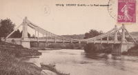
1925: Pandora
Pandora, Limón, Costa Rica - Estrella River
| Bridgemeister ID: | 436 (added before 2003) |
| Year Completed: | 1925 |
| Name: | Pandora |
| Also Known As: | Southeast Passage |
| Location: | Pandora, Limón, Costa Rica |
| Crossing: | Estrella River |
| Coordinates: | 9.736861 N 82.962167 W |
| Maps: | Acme, GeoHack, Google, OpenStreetMap |
| References: | PTS2, USS |
| Use: | Vehicular (one-lane) |
| Status: | Extant (last checked: 2022) |
| Main Cables: | Wire (steel) |
| Suspended Spans: | 1 |
| Main Span: | 1 x 73.2 meters (240 feet) |
Notes:
- Originally built with a set of tram tracks designed for cars hauling bananas.
- Next to (footbridge) - Pandora, Limón, Costa Rica.
1926: Andy Warhol
Pittsburgh, Pennsylvania, USA - Allegheny River
| Bridgemeister ID: | 148 (added before 2003) |
| Year Completed: | 1926 |
| Name: | Andy Warhol |
| Also Known As: | Seventh Street |
| Location: | Pittsburgh, Pennsylvania, USA |
| Crossing: | Allegheny River |
| Coordinates: | 40.44626 N 80.00145 W |
| Maps: | Acme, GeoHack, Google, OpenStreetMap |
| Principals: | Vernon R. Covell, T.J. Wilkerson, A.D. Nutter, H.E. Dodge, Stanley L. Roush |
| References: | AAJ, BOP, BPL, PBR, PTS2, USS |
| Use: | Vehicular (four-lane), with walkway |
| Status: | In use (last checked: 2014) |
| Main Cables: | Eyebar (steel) |
| Suspended Spans: | 3 |
| Main Span: | 1 x 134.7 meters (442 feet) |
| Side Spans: | 2 x 67.4 meters (221 feet) |
| Deck width: | 62 feet |
| Characteristics: | Self-anchored |
Notes:
- Self-anchored.
- Replaced 1884 North Side (Seventh Street) - Pittsburgh, Pennsylvania, USA.
- Next to 1927 Rachel Carson (Ninth Street) - Pittsburgh, Pennsylvania, USA.
- Next to 1928 Roberto Clemente (Sixth Street) - Pittsburgh, Pennsylvania, USA.
External Links:
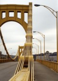
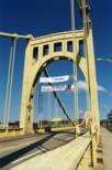
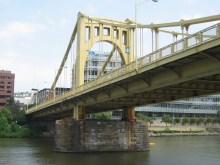
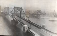
1926: Benjamin Franklin
Philadelphia, Pennsylvania and Camden, New Jersey, USA - Delaware River
| Bridgemeister ID: | 145 (added before 2003) |
| Year Completed: | 1926 |
| Name: | Benjamin Franklin |
| Also Known As: | Philadelphia-Camden |
| Location: | Philadelphia, Pennsylvania and Camden, New Jersey, USA |
| Crossing: | Delaware River |
| Coordinates: | 39.95333 N 75.135 W |
| Maps: | Acme, GeoHack, Google, OpenStreetMap |
| Principals: | Modjeski, Webster, Ball, Moiseff |
| References: | AAJ, BBR, BFL, BONJ, BPL, DRB, GBD, PTL, PTS2, USS |
| Use: | Vehicular (major highway) and Rail (subway), with walkway |
| Status: | In use (last checked: 2007) |
| Main Cables: | Wire (steel) |
| Suspended Spans: | 3 |
| Main Span: | 1 x 533.4 meters (1,750 feet) |
| Side Spans: | 2 x 219.3 meters (719.5 feet) |
| Deck width: | 125.5 feet |
Notes:
- Became longest suspension bridge by eclipsing 1924 Bear Mountain - Anthony's Nose and Bear Mountain, New York, USA.
- Eclipsed by new longest suspension bridge 1929 Ambassador - Detroit, Michigan, USA and Windsor, Ontario, Canada.
- Near 1957 Walt Whitman - Philadelphia, Pennsylvania and Camden, New Jersey, USA.
External Links:
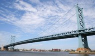
1926: Hercilio Luz
Florianopolis, Santa Catarina, Brazil
| Bridgemeister ID: | 437 (added before 2003) |
| Year Completed: | 1926 |
| Name: | Hercilio Luz |
| Also Known As: | Florianopolis |
| Location: | Florianopolis, Santa Catarina, Brazil |
| Coordinates: | 27.59393 S 48.56619 W |
| Maps: | Acme, GeoHack, Google, OpenStreetMap |
| Principals: | David B. Steinman, Holton D. Robinson |
| References: | AAJ, ADDS, BBR, PTS2, USS |
| Use: | Vehicular (two-lane, heavy vehicles), with walkway |
| Status: | In use (last checked: 2011) |
| Main Cables: | Eyebar (steel) |
| Suspended Spans: | 1 |
| Main Span: | 1 x 339.5 meters (1,113.75 feet) |
| Deck width: | 37 feet |
External Links:
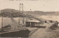
1926: Hidalgo-Reynosa International
Hidalgo, Texas, USA and Reynosa, Tamaulipas, Mexico - Rio Grande
| Bridgemeister ID: | 146 (added before 2003) |
| Year Completed: | 1926 |
| Name: | Hidalgo-Reynosa International |
| Location: | Hidalgo, Texas, USA and Reynosa, Tamaulipas, Mexico |
| Crossing: | Rio Grande |
| Principals: | Austin Bridge Co. |
| References: | AAJ, AUB, HAERTX98, PTS2 |
| Use: | Vehicular |
| Status: | Demolished, 1960's |
| Main Cables: | Wire (steel) |
| Suspended Spans: | 1 |
| Main Span: | 1 x 137.2 meters (450 feet) |
Notes:
- Damaged by flood, 1933. Rebuilt, 1934. Cables failed, 1939. Rebuilt.
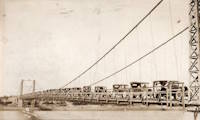
| Bridgemeister ID: | 8219 (added 2024-02-06) |
| Year Completed: | 1926 |
| Name: | Laon |
| Location: | Laon, Aisne, France |
| Coordinates: | 49.571000 N 3.635639 E |
| Maps: | Acme, GeoHack, Google, OpenStreetMap |
| References: | PTS2 |
| Use: | Vehicular |
| Status: | In use (last checked: 2023) |
| Main Cables: | Reinforced Concrete |
| Suspended Spans: | 2 |
| Side Spans: | 2 |
Notes:
- Rigid reinforced concrete suspension bridge.
- Similar to 1925 Luzancy - Luzancy, Seine-et-Marne, France.
- Similar to Pommiers - Pommiers, Aisne, France.
External Links:
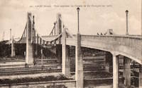
1926: Oriente
Oriente, Jiménez, Cartago, Costa Rica - Pejibaye River
| Bridgemeister ID: | 438 (added before 2003) |
| Year Completed: | 1926 |
| Name: | Oriente |
| Location: | Oriente, Jiménez, Cartago, Costa Rica |
| Crossing: | Pejibaye River |
| Coordinates: | 9.834250 N 83.681556 W |
| Maps: | Acme, GeoHack, Google, OpenStreetMap |
| References: | PTS2, USS |
| Use: | Vehicular |
| Status: | Removed, c. 2002-2015 |
| Main Cables: | Wire (steel) |
| Suspended Spans: | 1 |
| Main Span: | 1 x 45.7 meters (150 feet) |
Notes:
- Built with a set of tram tracks designed for cars hauling fruit.
- Older sources refer to the "Pejivalle" river.
- Removed at some point in the 2002-2015 time frame.
1927: (suspension bridge)
Neals Landing, Donalsonville vicinity, Georgia and Jackson County, Florida, USA - Chattahoochee River
| Bridgemeister ID: | 2145 (added 2006-11-05) |
| Year Completed: | 1927 |
| Name: | (suspension bridge) |
| Location: | Neals Landing, Donalsonville vicinity, Georgia and Jackson County, Florida, USA |
| Crossing: | Chattahoochee River |
| Principals: | Austin Bridge Co. |
| References: | PTS2, RRC |
| Use: | Vehicular |
| Status: | Removed |
| Main Cables: | Wire |
Notes:
- Condemned, 1953, due to sinking foundation.
- Follow the image for more information about this bridge and location.
1927: Bryan-Fannin
Telephone, Bonham vicinity, Fannin County, Texas and Bryan County, Oklahoma, USA - Red River
| Bridgemeister ID: | 602 (added 2003-01-11) |
| Year Completed: | 1927 |
| Name: | Bryan-Fannin |
| Also Known As: | Telephone, Snow's Ferry, Bryant-Fannin |
| Location: | Telephone, Bonham vicinity, Fannin County, Texas and Bryan County, Oklahoma, USA |
| Crossing: | Red River |
| Coordinates: | 33.844484 N 96.011125 W |
| Maps: | Acme, GeoHack, Google, OpenStreetMap |
| Principals: | Austin Bridge Co. |
| References: | AUB, PTS2 |
| Use: | Vehicular |
| Status: | Collapsed, December, 1940 |
| Main Cables: | Wire (steel) |
| Suspended Spans: | 3 |
| Main Span: | 1 |
| Side Spans: | 2 |
Notes:
- Sometimes referenced as "Bryant-Fannin". The bridge unquestionably connected Fannin County to Bryan County, Oklahoma, but according to a www.rootsweb.com article (Fannin County TXGenWeb - Ferry's in Fannin County, from Pat Pryor, by Kathy J. Ellis) it was erected at a site known as "Bryant's Crossing" named for a local, Dave Bryant. The Steinman inventory lists it as "Bryan-Fannin". AUB mentions it as "Bryant-Fannin". The Rootsweb article also mentions it collapsed in 1940 under weight of a truck.
- An article in the December 6, 1940 issue of The Port Arthur News (Texas) titled: "Suspension Bridge Plunges Into Red River" describes the collapse: "Owners of a $75,000 tollbridge which plunged into the Red River Wednesday when a suspension cable anchor pulled loose were undecided today whether it would be rebuilt. The bridge, owned by the Austin Bridge company of Dallas, was near Telephone, Tex., 12 miles north of here, and was several miles from a principal highway. Most of the traffic from the Bonham area toward Oklahoma is across a structure built recently to replace a toll bridge at nearby Sowell's bluff that collapsed in 1930. Mrs. Jim Freeman, toll keeper, said she heard a 'rumble' and looked up to see the 'deadman anchor' pull loose, throwing the entire weight of the 1,300 foot span on the other cable. It snapped, and the flooring and steel framework of the bridge sagged into the water. No one was on the structure when it fell."
- Remains of three piers are still visible, 2019.
1927: Durant-Bonham
Bonham vicinity, Fannin County, Texas and Yuba/Durant vicinity, Oklahoma, USA - Red River
| Bridgemeister ID: | 603 (added 2003-01-11) |
| Year Completed: | 1927 |
| Name: | Durant-Bonham |
| Also Known As: | Sowell's Bluff |
| Location: | Bonham vicinity, Fannin County, Texas and Yuba/Durant vicinity, Oklahoma, USA |
| Crossing: | Red River |
| Principals: | Austin Bridge Co. |
| References: | AUB, PTS2 |
| Use: | Vehicular |
| Status: | Collapsed, 1934 |
| Main Cables: | Wire (steel) |
Notes:
- According to a rootsweb article (Fannin County TXGenWeb - Ferry's in Fannin County, from Pat Pryor, by Kathy J. Ellis), "when in 1932 this bridge fell, many people said that acid had been put on the cables to break them so that people from Oklahoma could not cross to Bonham." However, the true date of collapse may have been in 1934. The February 2, 1934 issue of The Daily Oklahoman has a front-page article with a photo of the bridge with collapsed deck. The photo is captioned: "The Red River Bridge on Highway 22 Near Durant After the Midnight Crash," and the article reads: "Here Is the debris of a $60,000 investment made by the states of Oklahoma and Texas eight months ago when they purchased the Bonham-Durant bridge across the Red river on highway 22. Three of the five spans of the 1,500-foot suspension bridge turned upside down and dropped into the river bed when a four-Inch wire cable rusted and broke in two about 15 feet from the ground on the Texas side. A lull in the usual heavy traffic across the bridge prevented accidents. The crash came at midnight, and one motorist had barely reached the Texas side when the cable gave away. Other motorists stopped their cars just in time to witness the spans of the bridge crash 40 feet into the stream. The bridge was built in 1926 and was operated as a toll bridge until 1933 when the two states bought it and made it a free crossing."
- In the October 1989 edition of the Oklahoma Water News an article (excerpted from an article in The Chronicles of Oklahoma by Dr. Bernice N. Crockett) states: "On January 15, 1934, a norther of terrific force came up which cause the Sowell's Bluff Bridge to fall. At 1 a.m. the wire cables on the Fannin side of the river became twisted, then snapped, broken in half, and the entire massive structure fell into the river below -- a complete wreck."
1927: General U.S. Grant
Portsmouth, Ohio and Fullerton, Kentucky, USA - Ohio River
| Bridgemeister ID: | 151 (added before 2003) |
| Year Completed: | 1927 |
| Name: | General U.S. Grant |
| Location: | Portsmouth, Ohio and Fullerton, Kentucky, USA |
| Crossing: | Ohio River |
| Coordinates: | 38.725 N 82.99833 W |
| Maps: | Acme, GeoHack, Google, OpenStreetMap |
| Principals: | Robinson and Steinman, J.E. Greiner, Dravo Co. |
| References: | AAJ, PTS2, SSS |
| Use: | Vehicular (two-lane, heavy vehicles) |
| Status: | Demolished, July 2001 |
| Main Cables: | Wire (steel) |
| Suspended Spans: | 3 |
| Main Span: | 1 x 213.4 meters (700 feet) |
| Side Spans: | 2 x 106.7 meters (350 feet) |
| Deck width: | 28.5 feet |
Notes:
- AAJ: "Recabled" in 1939.
External Links:
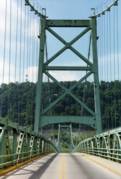
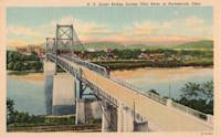
1927: Hugo Preuss
Berlin, Germany - Berlin-Spandau Ship Canal
| Bridgemeister ID: | 2090 (added 2006-07-02) |
| Year Completed: | 1927 |
| Name: | Hugo Preuss |
| Also Known As: | Hugo Preuß, Humboldthafen, Admiral Scheer |
| Location: | Berlin, Germany |
| Crossing: | Berlin-Spandau Ship Canal |
| Coordinates: | 52.523580 N 13.372238 E |
| Maps: | Acme, GeoHack, Google, OpenStreetMap |
| References: | AAJ, PTS2 |
| Use: | Vehicular |
| Status: | Destroyed, 1945 |
| Main Cables: | Eyebar |
| Suspended Spans: | 3 |
| Main Span: | 1 |
| Side Spans: | 2 |
| Characteristics: | Self-anchored |
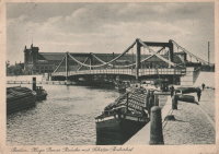
1927: Mediacanoa
Buga, Colombia - Cauca River
| Bridgemeister ID: | 2010 (added 2006-01-04) |
| Year Completed: | 1927 |
| Name: | Mediacanoa |
| Location: | Buga, Colombia |
| Crossing: | Cauca River |
| References: | PTS2 |
| Use: | Vehicular |
| Status: | Replaced |
| Main Cables: | Wire (steel) |
| Suspended Spans: | 1 |
| Main Span: | 1 x 110 meters (360.9 feet) |
1927: Montjean-sur-Loire
Montjean-sur-Loire, Maine-et-Loire, France - Loire River
| Bridgemeister ID: | 1602 (added 2005-02-06) |
| Year Completed: | 1927 |
| Name: | Montjean-sur-Loire |
| Location: | Montjean-sur-Loire, Maine-et-Loire, France |
| Crossing: | Loire River |
| Coordinates: | 47.395958 N 0.858340 W |
| Maps: | Acme, GeoHack, Google, OpenStreetMap |
| References: | AAJ, PTS2 |
| Use: | Vehicular |
| Status: | Destroyed, 1936 |
| Main Cables: | Wire |
| Suspended Spans: | 6 |
| Main Spans: | 4 |
| Side Spans: | 2 |
Notes:
- 1935: One of the towers fails in a windstorm causing part of the bridge to collapse.
- 1936: The remainder of the derelict bridge is wrecked by a flood.
- Replaced 1840 Montjean-sur-Loire - Montjean-sur-Loire, Maine-et-Loire, France.
- Replaced by 1938 Montjean-sur-Loire - Montjean-sur-Loire, Maine-et-Loire, France.
External Links:
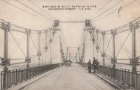
1927: Port à l'Anglais
Alfortville and Vitry-sur-Seine, Val-de-Marne, France - Seine River
| Bridgemeister ID: | 1114 (added 2004-01-05) |
| Year Completed: | 1927 |
| Name: | Port à l'Anglais |
| Location: | Alfortville and Vitry-sur-Seine, Val-de-Marne, France |
| Crossing: | Seine River |
| Coordinates: | 48.797333 N 2.41875 E |
| Maps: | Acme, GeoHack, Google, OpenStreetMap |
| References: | AAJ, BC3, BPF, PTS2 |
| Use: | Vehicular (three-lane), with walkway |
| Status: | In use (last checked: 2021) |
| Main Cables: | Wire |
| Suspended Spans: | 3 |
| Main Span: | 1 x 124 meters (406.8 feet) |
| Side Spans: | 1 x 54 meters (177.2 feet), 1 x 52 meters (170.6 feet) |
| Deck width: | 40 feet |
Notes:
- This bridge was originally built with the Gisclard suspension system. Such bridges are not included in the Bridgemeister suspension bridge inventory. However, at some point the suspension system was modified to be more similar to a standard suspension bridge. It isn't clear when this modification occurred.
- Near Créteil (Saint-Maur) - Créteil-sur-Marne and Saint-Maur-des-Fossés, Val-de-Marne, France.
External Links:
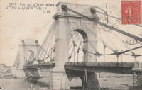
1927: Rachel Carson
Pittsburgh, Pennsylvania, USA - Allegheny River
| Bridgemeister ID: | 150 (added before 2003) |
| Year Completed: | 1927 |
| Name: | Rachel Carson |
| Also Known As: | Ninth Street |
| Location: | Pittsburgh, Pennsylvania, USA |
| Crossing: | Allegheny River |
| Coordinates: | 40.44669 N 79.99980 W |
| Maps: | Acme, GeoHack, Google, OpenStreetMap |
| Principals: | Vernon R. Covell, T.J. Wilkerson, A.D. Nutter, H.E. Dodge, Stanley L. Roush |
| References: | AAJ, BOP, BPL, PBR, PTS2, USS |
| Use: | Vehicular (four-lane), with walkway |
| Status: | In use (last checked: 2014) |
| Main Cables: | Eyebar (steel) |
| Suspended Spans: | 3 |
| Main Span: | 1 x 131.1 meters (430 feet) |
| Side Spans: | 2 x 65.5 meters (215 feet) |
| Characteristics: | Self-anchored |
Notes:
- Self-anchored.
- Next to 1926 Andy Warhol (Seventh Street) - Pittsburgh, Pennsylvania, USA.
- Next to 1928 Roberto Clemente (Sixth Street) - Pittsburgh, Pennsylvania, USA.
External Links:


1927: Saint Jo
Illinois Bend, Saint Jo vicinity, Texas and Wilson vicinity, Oklahoma, USA - Red River
| Bridgemeister ID: | 601 (added 2003-01-11) |
| Year Completed: | 1927 |
| Name: | Saint Jo |
| Also Known As: | Airline, Air-Line |
| Location: | Illinois Bend, Saint Jo vicinity, Texas and Wilson vicinity, Oklahoma, USA |
| Crossing: | Red River |
| Coordinates: | 33.917051 N 97.486010 W |
| Maps: | Acme, GeoHack, Google, OpenStreetMap |
| Principals: | Austin Bridge Co. |
| References: | AUB, PTS2 |
| Use: | Vehicular (one-lane) |
| Status: | Removed |
| Main Cables: | Wire (steel) |
| Suspended Spans: | 1 |
| Main Span: | 1 x 213.4 meters (700 feet) |
External Links:
- St Jo "Airline" Suspension Bridge over the Red River Texas - Facebook. Coordinates provided here are based on the research presented in this Bridgehunting Texas Facebook group post.
1928: (suspension bridge)
Rio Rico, Mexico and Mercedes, Texas, USA - Rio Grande
1928: Des Arc
Des Arc, Arkansas, USA - White River
| Bridgemeister ID: | 152 (added before 2003) |
| Year Completed: | 1928 |
| Name: | Des Arc |
| Also Known As: | Swinging |
| Location: | Des Arc, Arkansas, USA |
| Crossing: | White River |
| Coordinates: | 34.974811 N 91.487684 W |
| Maps: | Acme, GeoHack, Google, OpenStreetMap |
| Principals: | Austin Bridge Co |
| References: | AUB, PTS2 |
| Use: | Vehicular |
| Status: | Demolished, August 1970 |
| Main Cables: | Wire (steel) |
| Suspended Spans: | 3 |
| Main Span: | 1 x 198.1 meters (650 feet) |
| Side Spans: | 2 x 97.5 meters (320 feet) |
Notes:
- The coordinates provided here indicate the approximate alignment of the bridge, about 0.5 miles southeast of the current (2020s) Des Arc White River crossing. The bridge delivered traffic near the east end of East Chester Street in Des Arc.
External Links:
1928: Fort Steuben
Steubenville, Ohio and Weirton, West Virginia, USA - Ohio River
| Bridgemeister ID: | 154 (added before 2003) |
| Year Completed: | 1928 |
| Name: | Fort Steuben |
| Location: | Steubenville, Ohio and Weirton, West Virginia, USA |
| Crossing: | Ohio River |
| Coordinates: | 40.37833 N 80.615 W |
| Maps: | Acme, GeoHack, Google, OpenStreetMap |
| Principals: | Dravo Co. |
| References: | AAJ, PTS2 |
| Use: | Vehicular (two-lane, heavy vehicles), with walkway |
| Status: | Demolished, February 2012 (last checked: 2012) |
| Main Cables: | Wire (steel) |
| Suspended Spans: | 3 |
| Main Span: | 1 x 209.9 meters (688.75 feet) |
| Side Spans: | 2 x 86.3 meters (283 feet) |
| Deck width: | 20.25 feet |
Notes:
- January 2009: Closed indefinitely following inspections revealing major deterioration. Demolished in 2012.
- Near 1905 Market Street - Steubenville, Ohio and East Steubenville, West Virginia, USA.
External Links:
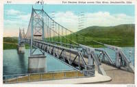
1928: Kiyosu
Chuo City, Tokyo, Japan - Sumida River
| Bridgemeister ID: | 440 (added before 2003) |
| Year Completed: | 1928 |
| Name: | Kiyosu |
| Also Known As: | 清洲橋 |
| Location: | Chuo City, Tokyo, Japan |
| Crossing: | Sumida River |
| Coordinates: | 35.682395 N 139.792022 E |
| Maps: | Acme, GeoHack, Google, OpenStreetMap |
| Principals: | Yutaka Tanaka |
| References: | AAJ, BAAW, PTS2, SSS |
| Use: | Vehicular (four-lane), with walkway |
| Status: | In use (last checked: 2022) |
| Main Cables: | Eyebar (steel) |
| Suspended Spans: | 3 |
| Main Span: | 1 x 91.4 meters (299.9 feet) |
| Side Spans: | 2 |
| Deck width: | 85 feet |
| Characteristics: | Self-anchored |
Notes:
- Self-anchored.
- 2019: Major rehabilitation in progress.
External Links:
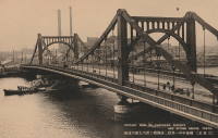
1928: Point Pleasant
Point Pleasant, West Virginia and Kanauga, Gallipolis vicinity, Ohio, USA - Ohio River
| Bridgemeister ID: | 156 (added before 2003) |
| Year Completed: | 1928 |
| Name: | Point Pleasant |
| Also Known As: | Silver |
| Location: | Point Pleasant, West Virginia and Kanauga, Gallipolis vicinity, Ohio, USA |
| Crossing: | Ohio River |
| Coordinates: | 38.845 N 82.141111 W |
| Maps: | Acme, GeoHack, Google, OpenStreetMap |
| Principals: | J.E. Greiner Co. |
| References: | AAJ, BDO, ENR19290620a, ENR19290620b, GBD, LAB, PTS2, SSS |
| Use: | Vehicular, with walkway |
| Status: | Collapsed, 1967 |
| Main Cables: | Eyebar (steel) |
| Suspended Spans: | 3 |
| Main Span: | 1 x 213.4 meters (700 feet) |
| Side Spans: | 2 x 115.8 meters (380 feet) |
| Deck width: | 27 feet |
Notes:
- Hybrid truss, suspension bridge. Collapsed December 15, 1967 while full with traffic. 46 people died.
- Companion to 1928 Saint Marys (Hi Carpenter, Short Route) - Saint Marys, West Virginia and Newport, Ohio, USA.
External Links:

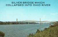
1928: Roberto Clemente
Pittsburgh, Pennsylvania, USA - Allegheny River
| Bridgemeister ID: | 158 (added before 2003) |
| Year Completed: | 1928 |
| Name: | Roberto Clemente |
| Also Known As: | Sixth Street |
| Location: | Pittsburgh, Pennsylvania, USA |
| Crossing: | Allegheny River |
| Coordinates: | 40.44558 N 80.00332 W |
| Maps: | Acme, GeoHack, Google, OpenStreetMap |
| Principals: | Vernon R. Covell, T.J. Wilkerson, A.D. Nutter, H.E. Dodge, Stanley L. Roush |
| References: | AAJ, BOP, BPL, PBR, PTS2, SSS, USS |
| Use: | Vehicular (four-lane), with walkway |
| Status: | In use (last checked: 2014) |
| Main Cables: | Eyebar (steel) |
| Suspended Spans: | 3 |
| Main Span: | 1 x 131.1 meters (430 feet) |
| Side Spans: | 2 x 65.5 meters (215 feet) |
| Characteristics: | Self-anchored |
Notes:
- Self-anchored.
- Next to 1926 Andy Warhol (Seventh Street) - Pittsburgh, Pennsylvania, USA.
- Next to 1927 Rachel Carson (Ninth Street) - Pittsburgh, Pennsylvania, USA.
External Links:

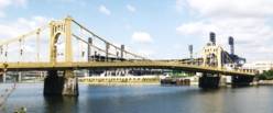
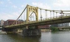
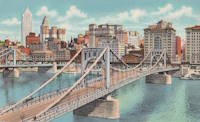
1928: Roma-Miguel Alemán International
Roma, Texas, USA and Ciudad Miguel Alemán, Mexico - Rio Grande
| Bridgemeister ID: | 157 (added before 2003) |
| Year Completed: | 1928 |
| Name: | Roma-Miguel Alemán International |
| Also Known As: | Roma-San Pedro International |
| Location: | Roma, Texas, USA and Ciudad Miguel Alemán, Mexico |
| Crossing: | Rio Grande |
| Coordinates: | 26.403821 N 99.018856 W |
| Maps: | Acme, GeoHack, Google, OpenStreetMap |
| Principals: | George Cole, Starr County Bridge Co., Compañía del Puente de San Pedro de Roma |
| References: | HAERTX98, PTS2 |
| Use: | Vehicular |
| Status: | Closed, 1979 (last checked: 2023) |
| Main Cables: | Wire (steel) |
| Suspended Spans: | 1 |
| Main Span: | 1 x 192 meters (629.9 feet) |
| Deck width: | 6.9 meters |
Notes:
- Closed. Scheduled to be restored as pedestrian crossing.
External Links:
1928: Saint Marys
Saint Marys, West Virginia and Newport, Ohio, USA - Ohio River
| Bridgemeister ID: | 159 (added before 2003) |
| Year Completed: | 1928 |
| Name: | Saint Marys |
| Also Known As: | Hi Carpenter, Short Route |
| Location: | Saint Marys, West Virginia and Newport, Ohio, USA |
| Crossing: | Ohio River |
| Principals: | J.E. Greiner Co. |
| References: | BPL, GBD, PTS2 |
| Use: | Vehicular |
| Status: | Demolished, 1971 |
| Main Cables: | Eyebar (steel) |
| Suspended Spans: | 3 |
| Main Span: | 1 x 213.4 meters (700 feet) |
| Side Spans: | 2 |
Notes:
- Same design as the Silver Bridge that famously collapsed in 1967. Demolished 1971 as a precautionary measure because the engineers decided they could not tell if it suffered from the same flaw as the Silver Bridge without dismantling the eyebars.
- Companion to 1928 Point Pleasant (Silver) - Point Pleasant, West Virginia and Kanauga, Gallipolis vicinity, Ohio, USA.
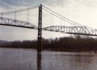
1928: Zapata
Zapata, Texas, USA and Ciudad Guerrero, Mexico - Rio Grande
| Bridgemeister ID: | 1445 (added 2004-07-31) |
| Year Completed: | 1928 |
| Name: | Zapata |
| Location: | Zapata, Texas, USA and Ciudad Guerrero, Mexico |
| Crossing: | Rio Grande |
| References: | HAERTX98, PTS2 |
| Use: | Vehicular |
| Status: | Inundated, 1953 |
| Main Cables: | Wire (steel) |
| Suspended Spans: | 3 |
| Main Span: | 1 x 165 meters (541.3 feet) |
| Side Spans: | 2 |
Notes:
- Inundated during creation of Falcon Reservoir.
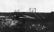
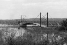
1929: Ambassador
Detroit, Michigan, USA and Windsor, Ontario, Canada - Detroit River
| Bridgemeister ID: | 160 (added before 2003) |
| Year Completed: | 1929 |
| Name: | Ambassador |
| Location: | Detroit, Michigan, USA and Windsor, Ontario, Canada |
| Crossing: | Detroit River |
| Coordinates: | 42.31210 N 83.07402 W |
| Maps: | Acme, GeoHack, Google, OpenStreetMap |
| Principals: | Jonathan Jones, McClintic-Marshall |
| References: | AAJ, AMB, GBD, PTS2 |
| Use: | Vehicular (major highway) |
| Status: | In use (last checked: 2022) |
| Main Cables: | Wire (steel) |
| Suspended Spans: | 1 |
| Main Span: | 1 x 563.9 meters (1,850 feet) |
| Deck width: | 55 feet |
Notes:
- Became longest suspension bridge by eclipsing 1926 Benjamin Franklin (Philadelphia-Camden) - Philadelphia, Pennsylvania and Camden, New Jersey, USA.
- Eclipsed by new longest suspension bridge 1931 George Washington (GWB) - New York, New York and Fort Lee, New Jersey, USA.
External Links:

1929: Grand Mère
Grand-Mère, Quebec, Canada - St. Maurice River
| Bridgemeister ID: | 162 (added before 2003) |
| Year Completed: | 1929 |
| Name: | Grand Mère |
| Location: | Grand-Mère, Quebec, Canada |
| Crossing: | St. Maurice River |
| Coordinates: | 46.620117 N 72.6794 W |
| Maps: | Acme, GeoHack, Google, OpenStreetMap |
| Principals: | Robinson and Steinman |
| References: | AAJ, BC3, BPL, PTS2, SJR |
| Use: | Vehicular (two-lane, heavy vehicles), with walkway |
| Status: | In use (last checked: 2019) |
| Main Cables: | Wire (steel) |
| Suspended Spans: | 1 |
| Main Span: | 1 x 289.2 meters (948.8 feet) |
| Deck width: | 26 feet |
External Links:
1929: Mount Hope
Bristol and Portsmouth, Rhode Island, USA - Mount Hope Bay
| Bridgemeister ID: | 163 (added before 2003) |
| Year Completed: | 1929 |
| Name: | Mount Hope |
| Location: | Bristol and Portsmouth, Rhode Island, USA |
| Crossing: | Mount Hope Bay |
| Coordinates: | 41.64 N 71.25833 W |
| Maps: | Acme, GeoHack, Google, OpenStreetMap |
| Principals: | Robinson and Steinman |
| References: | AAJ, ADDS, ENR19290411a, ENR19290411b, ENR19290411c, GBD, PTS2 |
| Use: | Vehicular (two-lane, heavy vehicles), with walkway |
| Status: | In use (last checked: 2022) |
| Main Cables: | Wire (steel) |
| Suspended Spans: | 3 |
| Main Span: | 1 x 365.8 meters (1,200 feet) |
| Side Spans: | 2 x 153.6 meters (504 feet) |
| Deck width: | 34 feet |
Annotated Citations:
- Flynn, Sean. "Mount Hope Bridge's support cables are corroding. It'll take $35 million to save them.." Newport Daily News, 13 Dec. 2021, www.newportri.com/story/news/local/2021/12/13/dehumidification-system-needed-save-mount-hope-bridge-ri-cables-corrosion/6456270001/
"'According to a 2016 inspection of the cables at the Mount Hope Bridge, there is significant breakage of the hundreds of wires that make up each of the cables,' RITBA Executive Director Lori Caron Silveira wrote to the Rhode Island House Finance Committee on Dec. 7"
- "Potential Exposure $1B — RI’s Mount Hope Bridge Is in Critical Need of Repair, Says Bridge Authority." GoLocalProv, 9 Dec. 2021, www.golocalprov.com/news/potential-exposure-1b-ris-mount-hope-bridge-is-in-critical-need-of-repair-s
"...Lori Caron Silveira, Executive Director of the [Rhode Island Turnpike and Bridge Authority] warns, 'The cables and anchorages of the 92-year-old Mount Hope Bridge urgently need dehumidification if the Mount Hope is to remain structurally safe and able to continue serving the East Bay and interstate commerce.'"
- Barrett, Scott. "'The bridge is safe': But time is of the essence for Mount Hope Bridge cable repair plan." Newport Daily News, 30 Mar. 2022, www.newportri.com/story/news/local/2022/03/30/mount-hope-bridge-cable-repair-plan-advances-payment-plan-unknown/7207276001/
"The process to preserve the deteriorating cables on the Mount Hope Bridge is underway, though how it will be paid for remains a question mark… the [Rhode Island Turnpike and Bridge Authority] has put out a request for proposals for a dehumidification system for the two large supporting cables on the 93-year-old suspension bridge."
External Links:

1930: Mid-Hudson
Poughkeepsie and Highland, New York, USA - Hudson River
| Bridgemeister ID: | 166 (added before 2003) |
| Year Completed: | 1930 |
| Name: | Mid-Hudson |
| Also Known As: | Franklin Delano Roosevelt Mid-Hudson |
| Location: | Poughkeepsie and Highland, New York, USA |
| Crossing: | Hudson River |
| Coordinates: | 41.702933 N 73.946683 W |
| Maps: | Acme, GeoHack, Google, OpenStreetMap |
| Principals: | Ralph Modjeski |
| References: | AAJ, BPL, PTS2, SJR, USS |
| Use: | Vehicular (two-lane, heavy vehicles), with walkway |
| Status: | In use (last checked: 2019) |
| Main Cables: | Wire (steel) |
| Suspended Spans: | 3 |
| Main Span: | 1 x 457.2 meters (1,500 feet) |
| Side Spans: | 2 x 228.6 meters (750 feet) |
| Deck width: | 39 feet |
Notes:
- Although the length of the main span of the bridge is officially 1,500 feet, the actual length is 1,495 feet. During construction one of the caissons slid and tilted from its intended location. While efforts were made to move the caisson back, it was ultimately fixed in a position that left the main span five feet short of 1,500. Not wanting to lose the claim of having a 1,500-foot bridge, the shortfall has been kept out of official records since.
External Links:
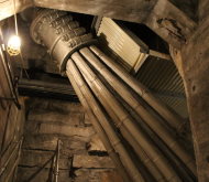
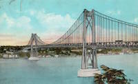
1931: George Washington
New York, New York and Fort Lee, New Jersey, USA - Hudson River
| Bridgemeister ID: | 169 (added before 2003) |
| Year Completed: | 1931 |
| Name: | George Washington |
| Also Known As: | GWB |
| Location: | New York, New York and Fort Lee, New Jersey, USA |
| Crossing: | Hudson River |
| Coordinates: | 40.85333 N 73.955 W |
| Maps: | Acme, GeoHack, Google, OpenStreetMap |
| Principals: | O.H. Ammann, Leon Moisseiff, Dana, Gilbert |
| References: | AAJ, AOB, ARF, BBR, BC3, BFL, BMA, BONJ, BOU, BPL, BRU, COB, CTW, ENR19270811a, ENR19270811b, ENR19290411c, GBD, LAB, LACE, PTS2, SIX, SJR |
| Use: | Vehicular (double-deck), with walkway |
| Status: | In use (last checked: 2022) |
| Main Cables: | Wire (steel) |
| Suspended Spans: | 3 |
| Main Span: | 1 x 1,066.8 meters (3,500 feet) |
| Side Spans: | 2 x 198.1 meters (650 feet) |
| Deck width: | 120 feet |
Notes:
- Became longest suspension bridge by eclipsing 1929 Ambassador - Detroit, Michigan, USA and Windsor, Ontario, Canada.
- Eclipsed by new longest suspension bridge 1937 Golden Gate - San Francisco and Marin County, California, USA.
External Links:
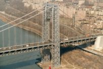
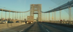
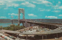
1936: Kellams
Kellams, New York and Stalker, Pennsylvania, USA - Delaware River
| Bridgemeister ID: | 97 (added before 2003) |
| Year Completed: | 1936 |
| Name: | Kellams |
| Also Known As: | Little Equinunk, Kellams-Stalker, Kellam |
| Location: | Kellams, New York and Stalker, Pennsylvania, USA |
| Crossing: | Delaware River |
| Coordinates: | 41.82333 N 75.11333 W |
| Maps: | Acme, GeoHack, Google, OpenStreetMap |
| References: | BDR, HHP, PTS2 |
| Use: | Vehicular (one-lane) |
| Status: | In use (last checked: 2019) |
| Main Cables: | Wire (steel) |
| Suspended Spans: | 1 |
| Main Span: | 1 x 117 meters (384 feet) |
Notes:
- Damaged by floodwaters June, 2006. Repaired October, 2006.
- Renovation completed, January, 2019.
- Replaced 1890 Kellams (Little Equinunk, Kellams-Stalker, Kellam) - Kellams, New York and Stalker, Pennsylvania, USA.
External Links:
