Suspension Bridges of USA (1-100 of 1,468)
This is a list of bridges 1 through 100 (of 1,468 total) from the suspension bridge inventory for the country USA. Wherever you see a Bridgemeister ID number click it to isolate the bridge on its own page.
Related Lists:
1801: Jacob's Creek
Iron Bridge, Mount Pleasant vicinity, Pennsylvania, USA - Jacob's Creek
| Bridgemeister ID: | 3 (added before 2003) |
| Year Completed: | 1801 |
| Name: | Jacob's Creek |
| Also Known As: | Iron Bridge, Chain Bridge |
| Location: | Iron Bridge, Mount Pleasant vicinity, Pennsylvania, USA |
| Crossing: | Jacob's Creek |
| Coordinates: | 40.112598 N 79.553186 W |
| Maps: | Acme, GeoHack, Google, OpenStreetMap |
| Principals: | Judge James Finley |
| References: | AAJ, ASB, BBR, BOB, BPL, CAB, DSE20000116, HBE, LAB, PTS2 |
| Use: | Vehicular |
| Status: | Removed, 1833 |
| Main Cables: | Chain (iron) |
| Suspended Spans: | 3 |
| Main Span: | 1 x 21.3 meters (70 feet) |
| Deck width: | 12.5 feet |
Notes:
- In an email dated January 16, 2000, Don Sayenga provided information about the location of this bridge. Generally attributed to Uniontown (the seat of Fayette County, PA), Mr. Sayenga offers some clues about the bridge's true location. "[James Finley] stated that he built it near the home of his friend Meason which implies a connection for the iron as Meason was making iron. Meason's home has survived by the way, a beautiful place. Finley stated it was a combination contract with the cost split between two counties, and he stated it was built over Jacob's Creek which is the county boundary. He also makes it clear it was on the road to Greensburg. The only place the old road crossed Jacob's Creek is just south of Mount Pleasant, Pennsylvania. On the geodetic survey maps this spot is marked "Iron Bridge" but there is no town there. The last time I was there I saw a sign that said 'Iron Bridge' on an automobile scrap yard. I found absolutely no trace of the bridge, but it was not very big, so there was no need for a huge abutment."
- First suspension bridge with a rigid level deck, often considered the world's first modern suspension bridge.
- Coordinates are for the likely location of the bridge, where present-day (2020) Pennsylvania route 3105 crosses Jacob's Creek.
External Links:
1807: Chain
Georgetown, District of Columbia and Virginia, USA - Potomac River
| Bridgemeister ID: | 4 (added before 2003) |
| Year Completed: | 1807 |
| Name: | Chain |
| Location: | Georgetown, District of Columbia and Virginia, USA |
| Crossing: | Potomac River |
| Coordinates: | 38.92959 N 77.11627 W |
| Maps: | Acme, GeoHack, Google, OpenStreetMap |
| Principals: | John Templeman |
| References: | AAJ, BBR, BCW, CAB, DSE20000118, HBE, PTS2 |
| Use: | Vehicular |
| Status: | Destroyed, 1812 |
| Main Cables: | Chain (iron) |
| Suspended Spans: | 1 |
| Main Span: | 1 x 39.2 meters (128.5 feet) |
Notes:
- BCW gives completion date of 1810 and says bridge was destroyed by flood two years later.
- Coordinates given are for the current crossing (VA SR123, still known locally as "Chain Bridge Road") which is on (or very close) to the alignment of Chain Bridge. Chain Bridge was the third bridge at this site. The current structure is the eighth and was completed in 1940.
External Links:
1807: Wills Creek
Cumberland, Maryland, USA - Wills Creek
| Bridgemeister ID: | 5 (added before 2003) |
| Year Completed: | 1807 |
| Name: | Wills Creek |
| Location: | Cumberland, Maryland, USA |
| Crossing: | Wills Creek |
| Principals: | John Templeman |
| References: | AAJ, BCW, CAB, DSE20000203, HBE |
| Status: | Destroyed, 1810 |
| Main Cables: | Chain (iron) |
| Main Span: | 1 x 42.4 meters (139 feet) |
Notes:
- Destroyed by flood, 1810.
- Later at same location 1820 Wills Creek - Cumberland, Maryland, USA.
- All past and present bridges at this location.
1809: (suspension bridge)
Brownsville vicinity, Pennsylvania, USA
| Bridgemeister ID: | 8 (added before 2003) |
| Year Completed: | 1809 |
| Name: | (suspension bridge) |
| Location: | Brownsville vicinity, Pennsylvania, USA |
| References: | AAJ, CAB, DSE20000203, HBE |
| Status: | Removed |
| Main Cables: | Chain (iron) |
1809: (suspension bridge)
Brownsville, Pennsylvania, USA - Dunlap's Creek
| Bridgemeister ID: | 7 (added before 2003) |
| Year Completed: | 1809 |
| Name: | (suspension bridge) |
| Location: | Brownsville, Pennsylvania, USA |
| Crossing: | Dunlap's Creek |
| Principals: | John Templeman |
| References: | AAJ, BCW, CAB, DSE20000118, DSE20000203, HBE |
| Use: | Vehicular |
| Status: | Removed |
| Main Cables: | Chain (iron) |
External Links:
- Dunlap's Creek Bridge (link reported not working). "The first recorded bridge across Dunlap's Creek was a wooden structure constructed prior to 1774. It was repaired in 1801, but was destroyed during a spring storm in 1808. A chain-link suspension bridge was built on the site in 1809; it collapsed under the weight of snow and a heavily laden wagon in 1820. A third bridge, another wooden structure, built in 1821 also failed. The present bridge is thus the fourth bridge at the site."
- Structurae - Structure ID 20008055
1809: Schuylkill Falls
Philadelphia, Pennsylvania, USA - Schuylkill River
| Bridgemeister ID: | 9 (added before 2003) |
| Year Completed: | 1809 |
| Name: | Schuylkill Falls |
| Location: | Philadelphia, Pennsylvania, USA |
| Crossing: | Schuylkill River |
| Principals: | John Templeman |
| References: | AAJ, BBR, BPL, CAB, DSE20000118, HBE, PTS2 |
| Status: | Removed |
| Main Cables: | Chain (iron) |
| Suspended Spans: | 2 |
| Main Spans: | 2 x 46.6 meters (153 feet) |
| Deck width: | 18 feet |
Notes:
- Failed 1811, 1816. HBE notes the 1811 was due to weight of cattle. The 1816 failure was due to weight of ice and snow.
External Links:
1810: (suspension bridge)
Frankfort, Kentucky, USA - Kentucky River
1810: (suspension bridge)
Paulings Ford, Pennsylvania, USA - Schuylkill River
| Bridgemeister ID: | 11 (added before 2003) |
| Year Completed: | 1810 |
| Name: | (suspension bridge) |
| Location: | Paulings Ford, Pennsylvania, USA |
| Crossing: | Schuylkill River |
| References: | CAB |
| Status: | Removed |
| Main Cables: | Chain (iron) |
External Links:
1810: (suspension bridge)
Reading, Pennsylvania, USA - Schuykill River
| Bridgemeister ID: | 12 (added before 2003) |
| Year Completed: | 1810 |
| Name: | (suspension bridge) |
| Location: | Reading, Pennsylvania, USA |
| Crossing: | Schuykill River |
| Principals: | Ulrich Kissinger |
| References: | CAB |
| Status: | Removed |
| Main Cables: | Chain (iron) |
External Links:
1810: (suspension bridge)
Wilmington, Delaware, USA - Brandywine Creek
| Bridgemeister ID: | 6 (added before 2003) |
| Year Completed: | 1810 |
| Name: | (suspension bridge) |
| Location: | Wilmington, Delaware, USA |
| Crossing: | Brandywine Creek |
| References: | AAJ, BCW, CAB, DSE20000203, HBE |
| Status: | Destroyed, 1822 |
| Main Cables: | Chain (iron) |
| Suspended Spans: | 1 |
| Main Span: | 1 x 44.2 meters (145 feet) |
| Deck width: | 30 feet |
Notes:
- Destroyed by flood, 1822.
External Links:
1810: (suspension bridge)
Wrightstown, Pennsylvania, USA - Neshaminy River
| Bridgemeister ID: | 13 (added before 2003) |
| Year Completed: | 1810 |
| Name: | (suspension bridge) |
| Location: | Wrightstown, Pennsylvania, USA |
| Crossing: | Neshaminy River |
| Principals: | John Parker |
| References: | AAJ, CAB, DSE20000403 |
| Use: | Vehicular |
| Status: | Removed |
| Main Cables: | Chain (iron) |
| Main Spans: | 2 x 30.5 meters (100 feet) |
External Links:
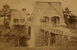
1810: Chain
Newburyport, Massachusetts, USA - Merrimack River
| Bridgemeister ID: | 14 (added before 2003) |
| Year Completed: | 1810 |
| Name: | Chain |
| Also Known As: | Essex-Merrimack |
| Location: | Newburyport, Massachusetts, USA |
| Crossing: | Merrimack River |
| At or Near Feature: | Deer Island |
| Coordinates: | 42.833947 N 70.906811 W |
| Maps: | Acme, GeoHack, Google, OpenStreetMap |
| Principals: | John Templeman |
| References: | AAJ, BBR, CAB, GBD, HBE, POPE, PTS2, RDH |
| Use: | Vehicular (two-lane, light vehicles only) |
| Status: | Replaced, 1909 |
| Main Cables: | Chain (iron) |
| Suspended Spans: | 1 |
| Main Span: | 1 x 74.1 meters (243 feet) |
| Deck width: | 30 feet (2 roadways of 15 feet) |
Notes:
- John Templeman built several bridges (like this one) using James Finley's design.
- Repaired in 1827 after 5 of 10 chains snapped under weight of a team of oxen.
- The complete description from Thomas Pope's 1811 Treatise (POPE):
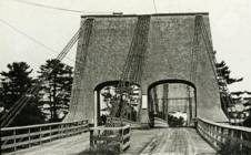
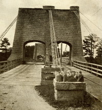
"The chain Bridge lately thrown over the Merrimack, three miles above Newburyport, in the state of Massachusetts, is now in constant use. This Bridge consists of a single arc, two hundred and forty-four feet span. The abutments are of stone, forty-seven feet long, and thirty-seven high; the uprights, or framed work, which stand on the abutments, are thirty-five feet high, over which are suspended ten distinct chains, the ends of which on both sides of the river are buried deep in pits and secured by large stones: each chain is five hundred and sixteen feet long; and, where they pass over the uprights, they are treble, and made in short links, which is said to be more secure than saddles made of plates of iron. The four middle joists rest on the chains; all the rest are suspended to the main chains to equalize the floor. This Bridge has two passage-ways of fifteen feet in width each, and the floor is so solid as to admit of horses, carriages, etc. to travel at any speed, with very little perceptible motion of the floors. The railing is stout and strong, which adds much firmness to the floor. There are three chains in each range on each side, and four in the middle range: they are calculated to support nearly five hundred tons. From the surface of the water to the middle of the floor is forty feet; and from the top of the abutments to the top of the uprights is thirty-five feet high, making seventy-two feet. The magnitude and power of the abutments, the width and length of the floors, the elevation of the work, the evident powers of the chains, etc. all conspire to make it a wonderful work. Every expense attending it did not amount to twenty-five thousand dollars. The abutment being of stone, the uprights covered, and the chains painted to prevent rust, leaves nothing but the flooring to decay. This Bridge was constructed by John Templeman, Esq. of the district of Columbia, whose talents for the productions of such work, and the various improvements suggested and used by him, have been highly beneficial, and do him great credit."
- Gregory W. Buff sent a transcription of an article describing the 1827 failure. The article was in the Saturday, February 24, 1827 issue (Volume IV, Number 31) of the Canadian Spectator (Montreal, Quebec) newspaper:
"Newburyport, Feb 9. Disastrious [sic] Accident. - On Tuesday morning last, the Essex Merrimack Bridge gave way in the centre, from the parting of the chains that support it. On the Bridge, at the moment, was a loaded team, drawn by six oxen and two horses, driven by two men, Messrs. Garlton [sic] and Jackman, all of whom were precipitated, forty feet, into the river beneath. The teamsters preserved themselves by means of swimming, and the support of fragments of the bridge; the team were all of them except one of the horses, swept beneath the ice a few rods below, and drowned. Five of the ten chains which supported the Bridge, were snapped in different places, and now remain upholding the broken and shattered timber altogether as sad a wreck as we ever witnessed. At the moment of the crash, the light evolved from the friction of the chains resembled the the vivid streaming of a meteor. Various excuses are assigned for the accident, and none, with more probability, than the united effect of the incumbent pressure of the immense body of snow lying upon the bridge, and the frost which had contracted the particles of iron. These produced a tenseness in the chains, which was incapable of resisting the additional pressure of the loaded team, and the whole gave way. The estimated expense of repairing the breach is about 4000 dollars; and the Directors, as we understand, plan to set about it immediately. It will be built up as before. To those who have been losers by this accident the corporation intend to make generous inumeration. The traveling will be uninterrupted, as the solidity of the ice above the bridge forms a safe passage way - and for the conveyance of carriages and heavy baggage the proprietors have promptly provided suitable boats. If any aversion to chain bridges has been produced by this accident, we should be sorry, for ourselves we feel yet unshaken faith in their superior security. The misfortune in this case was no doubt owing to the causes above stated, and not to any defect in the construction of the bridge. Probably hundreds of individuals, including each sex and all ages, have visited the ruins of the bridge. They present a sad and melancholy appearance - crushed and broken timbers suspended by the massy chains, which hang lazily from the pyramidical abutments, while the beholder instinctly shrinks back in terror at the reflection of the situation of the two human beings who were precipitated into the abyss beneath. The preservation of these two men is almost miraculous. Although hurled down 40 feet amid crashing and falling timber, entangled with their cattle, they fell without receiving the least injury, and attained the shore, after being for nearly half an hour, immerse in water chilled to the freezing point. Mr. Jackman is far advanced in years - and suffered somewhat from the exposure to the cold. Mr. Carlton [sic], escaped unhurt. The Chain Bridge has been built for about fifteen years, the span is 220 feet. We believe this was the second or third Chain Bridge built in the United States; and this is probably the first that has met with a similar accident. We understand the proprieters of the Rooks Bridge intend to rebuild theirs as a Chain Bridge."
- Replaced by 1909 Chain - Newburyport, Massachusetts, USA. The 1909 structure was almost entirely new (except for portions of the piers and abutments).
- All past and present bridges at this location.
External Links:
Image Sets:
1811: (suspension bridge)
Juniata Crossing, Pennsylvania, USA - Juniata River
| Bridgemeister ID: | 15 (added before 2003) |
| Year Completed: | 1811 |
| Name: | (suspension bridge) |
| Location: | Juniata Crossing, Pennsylvania, USA |
| Crossing: | Juniata River |
| References: | CAB, DSE20000403 |
| Use: | Vehicular |
| Status: | Removed |
| Main Cables: | Chain (iron) |
External Links:
1811: Third Street
Easton, Pennsylvania, USA - Lehigh River
| Bridgemeister ID: | 18 (added before 2003) |
| Year Completed: | 1811 |
| Name: | Third Street |
| Location: | Easton, Pennsylvania, USA |
| Crossing: | Lehigh River |
| Principals: | Jacob Blumer (?) |
| References: | CAB, DSE20000203 |
| Use: | Vehicular |
| Status: | Removed |
| Main Cables: | Chain (iron) |
External Links:
1814: Hamilton Street
Allentown, Pennsylvania, USA - Lehigh River
| Bridgemeister ID: | 19 (added before 2003) |
| Year Completed: | 1814 |
| Name: | Hamilton Street |
| Location: | Allentown, Pennsylvania, USA |
| Crossing: | Lehigh River |
| Principals: | Jacob Blumer |
| References: | AAJ, CAB, DSE20000203, PTS2 |
| Status: | Removed |
| Main Cables: | Chain (iron) |
| Suspended Spans: | 4 |
| Main Spans: | 2 |
| Side Spans: | 2 |
External Links:
1816: Spider
Philadelphia, Pennsylvania, USA - Schuylkill River
| Bridgemeister ID: | 20 (added before 2003) |
| Year Completed: | 1816 |
| Name: | Spider |
| Location: | Philadelphia, Pennsylvania, USA |
| Crossing: | Schuylkill River |
| Principals: | Josiah White, Erskine Hazard |
| References: | AAJ, BOB, BPL, GHD, HBE, LAB, PTS2 |
| Use: | Footbridge |
| Status: | Removed |
| Main Cables: | Wire (iron) |
| Main Span: | 1 x 120 meters (393.75 feet) |
Notes:
- Narrow footbridge. First wire bridge in North America. HBE notes "first wire suspension bridge in any country."
- Often described as having collapsed under the weight of ice and snow, Don Sayenga notes that no contemporary sources confirm this demise. Since the nearby chain bridge did fail under weight of ice and snow, he believes this fate has been misattributed to the White and Hazard footbridge. Don believes the bridge was just dismantled at some point after June, 1816.
- Al Zagofsky also wrote to explain there was no evidence of this bridge collapsing under weight of ice and snow. Al writes: "According to an original source Captain Joshua Rowley Watson, who inspected the bridge on June 15, 1816: '...There was a bridge, but which by the weight of ice and snow, has been carried away.' This refers to the previous bridge that the cable bridge was temporarily replacing. I did not see any cause for failure of the wire rope bridge. My guess is that it was removed when the regular bridge was repaired. The same article shows a sketch that he made, showing the main span to be 407 feet. I am looking at the Canal History and Technology Proceedings Vol 5, March 22, 1986."
1820: Wills Creek
Cumberland, Maryland, USA - Wills Creek
| Bridgemeister ID: | 1149 (added 2004-01-17) |
| Year Completed: | 1820 |
| Name: | Wills Creek |
| Location: | Cumberland, Maryland, USA |
| Crossing: | Wills Creek |
| Principals: | Valentine Shockey |
| References: | CAB |
| Status: | Destroyed, 1838 |
| Main Cables: | Chain (iron) |
| Main Span: | 1 x 46.2 meters (151.5 feet) |
Notes:
- Destroyed 1838 when one abutment collapsed.
- At former location of 1807 Wills Creek - Cumberland, Maryland, USA.
- All past and present bridges at this location.
1824: Biery's
Biery's Port (Catasauqua), Pennsylvania, USA - Lehigh River
| Bridgemeister ID: | 21 (added before 2003) |
| Year Completed: | 1824 |
| Name: | Biery's |
| Location: | Biery's Port (Catasauqua), Pennsylvania, USA |
| Crossing: | Lehigh River |
| Principals: | Jacob Blumer, George Deily (?) |
| References: | CAB, DSE20000203 |
| Status: | Removed |
| Main Cables: | Chain (iron) |
1824: Lehigh Gap
Lehigh Gap, Pennsylvania, USA - Lehigh River
| Bridgemeister ID: | 22 (added before 2003) |
| Year Completed: | 1824 |
| Name: | Lehigh Gap |
| Also Known As: | Palmerton |
| Location: | Lehigh Gap, Pennsylvania, USA |
| Crossing: | Lehigh River |
| Principals: | Jacob Blumer |
| References: | AAJ, CAB, DSE20000203, WHSB |
| Use: | Vehicular |
| Status: | Replaced, 1933 |
| Main Cables: | Chain (iron) |
| Suspended Spans: | 3 |
Notes:
- Finley patent bridge.
External Links:
Image Sets:

1827: (suspension bridge)
Newburyport, Massachusetts, USA - Merrimack River
| Bridgemeister ID: | 23 (added before 2003) |
| Year Completed: | 1827 |
| Name: | (suspension bridge) |
| Location: | Newburyport, Massachusetts, USA |
| Crossing: | Merrimack River |
| Principals: | Thomas Haven |
| References: | AAJ, BPL, HBE, PTS2 |
| Status: | Replaced, 1840 |
| Main Cables: | Chain (iron) |
| Suspended Spans: | 5 |
| Main Spans: | 3 |
| Side Spans: | 2 |
Notes:
- Multi-span structure distinct from Templeman's 1810 Chain Bridge. Sometimes misidentified as an 1827 replacement to the 1810 Templeman Chain Bridge because of the significant damage to the Templeman bridge in 1827.
External Links:
Image Sets:

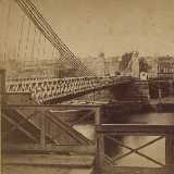
1842: Fairmount
Philadelphia, Pennsylvania, USA - Schuylkill River
| Bridgemeister ID: | 24 (added before 2003) |
| Year Completed: | 1842 |
| Name: | Fairmount |
| Also Known As: | Callowhill Street, Upper Ferry |
| Location: | Philadelphia, Pennsylvania, USA |
| Crossing: | Schuylkill River |
| Principals: | Charles Ellet |
| References: | BBR, BOB, BPL, HBE, LAB, PTS2, WHSB |
| Use: | Vehicular |
| Status: | Replaced, 1875 |
| Main Cables: | Wire (iron) |
| Suspended Spans: | 1 |
| Main Span: | 1 x 104.2 meters (342 feet) |
Notes:
- BBR and BOB say the bridge was completed in 1841.
Image Sets:
1843: Miami and Erie Canal
Cincinnati, Ohio, USA - Miami and Erie Canal
| Bridgemeister ID: | 25 (added before 2003) |
| Year Completed: | 1843 |
| Name: | Miami and Erie Canal |
| Location: | Cincinnati, Ohio, USA |
| Crossing: | Miami and Erie Canal |
| Coordinates: | 39.106916 N 84.516135 W |
| Maps: | Acme, GeoHack, Google, OpenStreetMap |
| References: | BOB |
| Status: | Removed |
| Suspended Spans: | 3 |
Notes:
- Located where Race Street intersected the Miami and Erie Canal. The canal no longer exists. West Central Parkway runs follows the former alignment of the canal at this location.
1845: Pittsburgh Aqueduct
Pittsburgh, Pennsylvania, USA - Allegheny River
| Bridgemeister ID: | 27 (added before 2003) |
| Year Completed: | 1845 |
| Name: | Pittsburgh Aqueduct |
| Location: | Pittsburgh, Pennsylvania, USA |
| Crossing: | Allegheny River |
| Principals: | John A. Roebling |
| References: | BOB, BOP, BPL, HBE, ONF, PTS2, RDH, SJR |
| Use: | Aqueduct |
| Status: | Removed, 1861 |
| Main Cables: | Wire (iron) |
| Suspended Spans: | 7 |
| Main Spans: | 7 x 49.4 meters (162 feet) |
Notes:
- In use until 1860.
External Links:
1846: Monongahela
Pittsburgh, Pennsylvania, USA - Monongahela River
| Bridgemeister ID: | 28 (added before 2003) |
| Year Completed: | 1846 |
| Name: | Monongahela |
| Also Known As: | Smithfield Street |
| Location: | Pittsburgh, Pennsylvania, USA |
| Crossing: | Monongahela River |
| Coordinates: | 40.435444 N 80.001778 W |
| Maps: | Acme, GeoHack, Google, OpenStreetMap |
| Principals: | John A. Roebling |
| References: | BOB, BOP, BPL, HBE, ONF, PBR, PTS2 |
| Use: | Vehicular |
| Status: | Removed, 1882 |
| Main Cables: | Wire (iron) |
| Suspended Spans: | 8 |
| Main Spans: | 8 x 57.3 meters (188 feet) |
| Deck width: | 20 feet |
External Links:
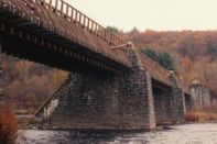
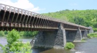
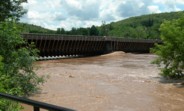
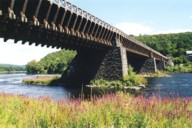
1848: Delaware Aqueduct
Lackawaxen, Pennsylvania and Minisink Ford, New York, USA - Delaware River
| Bridgemeister ID: | 30 (added before 2003) |
| Year Completed: | 1848 |
| Name: | Delaware Aqueduct |
| Also Known As: | Roebling Aqueduct |
| Location: | Lackawaxen, Pennsylvania and Minisink Ford, New York, USA |
| Crossing: | Delaware River |
| Coordinates: | 41.48262 N 74.98461 W |
| Maps: | Acme, GeoHack, Google, OpenStreetMap |
| Principals: | John A. Roebling |
| References: | AAJ, BDR, BOB, BPL, GBD, LAB, LACE, RDH, SJR |
| Use: | Aqueduct and Vehicular (one-lane), with walkway |
| Status: | In use (last checked: 2006) |
| Main Cables: | Wire (iron) |
| Suspended Spans: | 4 |
| Main Spans: | 1 x 43.3 meters (142 feet), 3 x 39.9 meters (131 feet) |
Notes:
- BPL: Completed 1848. RDH/BDR: Completed 1848, not used until 1849.
- Originally constructed to carry the Delaware and Hudson Canal. Converted to a one-lane vehicular bridge soon after the canal closed in 1898. Substantially restored in 1980's and 1990's, but retains original cables.
- Built as part of same project as 1849 Lackawaxen Aqueduct - Lackawaxen, Pennsylvania, USA.
- Built as part of same project as 1851 High Falls Aqueduct - High Falls, New York, USA.
- Built as part of same project as 1851 Neversink Aqueduct - Cuddebackville, New York, USA.
- Near 1849 Lackawaxen Aqueduct - Lackawaxen, Pennsylvania, USA.
External Links:
Image Sets:
1848: Niagara Suspension
Niagara Falls, New York, USA and Niagara Falls, Ontario, Canada - Niagara River
| Bridgemeister ID: | 29 (added before 2003) |
| Year Completed: | 1848 |
| Name: | Niagara Suspension |
| Location: | Niagara Falls, New York, USA and Niagara Falls, Ontario, Canada |
| Crossing: | Niagara River |
| Principals: | Charles Ellet |
| References: | BOB, BPL, HBE, ONF, PTS2 |
| Use: | Vehicular (one-lane) |
| Status: | Removed |
| Main Cables: | Wire (iron) |
| Suspended Spans: | 1 |
| Main Span: | 1 x 234.7 meters (770 feet) |
| Deck width: | 7.5 feet |
Notes:
1849: Lackawaxen Aqueduct
Lackawaxen, Pennsylvania, USA - Lackawaxen River
| Bridgemeister ID: | 31 (added before 2003) |
| Year Completed: | 1849 |
| Name: | Lackawaxen Aqueduct |
| Location: | Lackawaxen, Pennsylvania, USA |
| Crossing: | Lackawaxen River |
| Coordinates: | 41.485528 N 74.995250 W |
| Maps: | Acme, GeoHack, Google, OpenStreetMap |
| Principals: | John A. Roebling |
| References: | AAJ, BOB, BPL, RDH, SJR |
| Use: | Aqueduct |
| Status: | Removed |
| Main Cables: | Wire (iron) |
| Suspended Spans: | 2 |
| Main Spans: | 2 x 34.9 meters (114.37 feet) |
Notes:
- BPL says 1848, RDH says same, but not used until 1849.
- Built as part of same project as 1848 Delaware Aqueduct (Roebling Aqueduct) - Lackawaxen, Pennsylvania and Minisink Ford, New York, USA.
- Built as part of same project as 1851 High Falls Aqueduct - High Falls, New York, USA.
- Built as part of same project as 1851 Neversink Aqueduct - Cuddebackville, New York, USA.
- Near 1848 Delaware Aqueduct (Roebling Aqueduct) - Lackawaxen, Pennsylvania and Minisink Ford, New York, USA.
External Links:
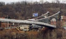
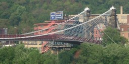
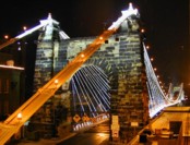
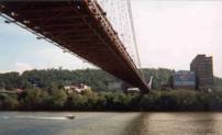
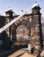
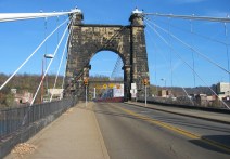
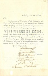
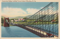
1849: Wheeling
Wheeling, West Virginia, USA - Ohio River
| Bridgemeister ID: | 32 (added before 2003) |
| Year Completed: | 1849 |
| Name: | Wheeling |
| Also Known As: | Wheeling and Belmont |
| Location: | Wheeling, West Virginia, USA |
| Crossing: | Ohio River |
| Coordinates: | 40.07167 N 80.72667 W |
| Maps: | Acme, GeoHack, Google, OpenStreetMap |
| Principals: | Charles Ellet |
| References: | AAJ, BBR, BC3, BOB, BPL, CEJ, COB, GBD, HBE, LAB, LACE, ONF, PTS2, RWS, WCC, WHSB |
| Use: | Vehicular (two-lane, light vehicles only) |
| Status: | Restricted to foot traffic, since September 2019 (last checked: 2020) |
| Main Cables: | Wire (iron) |
| Suspended Spans: | 1 |
| Main Span: | 1 x 307.8 meters (1,010 feet) |
Notes:
- Was still part of Virginia at time of completion.
- 1854: Rebuilt after it was wrecked by a windstorm. Contrary to popular myth, the rebuilding was undertaken by Ellet and his assistant William K. McComas, not by John A. Roebling.
- 1860: Overhauled. Popular myth often attributes this work to the Roeblings. WHSB attributes this work to William K. McComas. After this overhaul, the bridge still does not have the distinctive diagonal cable stays that give it the appearance of a Roebling bridge.
- 1872: Overhauled according to a design by Washington Roebling. John A. Roebling had died in 1869 and was not involved with this work. WHSB notes, "The design essentially Roeblingized the bridge with the diagonal cable stays that are such a prominent feature of the bridge."
- 2019, September: Closed to vehicular traffic indefinitely due to safety concerns after repeated overweight vehicle violations.
- 2020, November: Bids being evaluated for renovation project. Bridge remains closed to vehicular traffic.
- 2021, April: Single bid received was rejected. Bids expected to be resolicited in June. The bridge remains closed to all vehicular traffic.
- 2022, February: $17.9 million renovation project expected to start soon.
- Became longest suspension bridge by eclipsing 1834 Zaehringen (Grand Pont Suspendu) - Fribourg, Switzerland.
- Eclipsed by new longest suspension bridge 1867 John A. Roebling (Cincinnati, Cincinnati and Covington) - Cincinnati, Ohio and Covington, Kentucky, USA.
External Links:
Image Sets:
1850: Woodland Street
Nashville and Edgefield, Tennessee, USA - Cumberland River
| Bridgemeister ID: | 33 (added before 2003) |
| Year Completed: | 1850 |
| Name: | Woodland Street |
| Location: | Nashville and Edgefield, Tennessee, USA |
| Crossing: | Cumberland River |
| Coordinates: | 36.167833 N 86.775444 W |
| Maps: | Acme, GeoHack, Google, OpenStreetMap |
| Principals: | Adolphus Heiman, Mathew Dickinson Field |
| References: | AAJ |
| Use: | Vehicular |
| Status: | Destroyed, 1862 |
| Main Cables: | Wire (iron) |
| Main Span: | 1 x 164 meters (538 feet) |
Notes:
- Collapsed 1855, rebuilt, destroyed 1862 (possibly 1863). Was at site of present-day Woodland Street Bridge.
- Replaced by 1866 Woodland Street - Nashville and Edgefield, Tennessee, USA.
- All past and present bridges at this location.
External Links:
Image Sets:
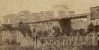
1851: High Falls Aqueduct
High Falls, New York, USA - Rondout Creek
| Bridgemeister ID: | 34 (added before 2003) |
| Year Completed: | 1851 |
| Name: | High Falls Aqueduct |
| Location: | High Falls, New York, USA |
| Crossing: | Rondout Creek |
| Coordinates: | 41.828889 N 74.126583 W |
| Maps: | Acme, GeoHack, Google, OpenStreetMap |
| Principals: | John A. Roebling |
| References: | AAJ, BOB, BPL, RDH, SJR |
| Use: | Aqueduct |
| Status: | Removed, August, 1921 |
| Main Cables: | Wire (iron) |
| Suspended Spans: | 1 |
| Main Span: | 1 x 44.2 meters (145 feet) |
Notes:
- BPL, AAJ say completed 1848, RDH says not used until 1851 canal season.
- Heavy damaged by fire, 1921.
- Built as part of same project as 1848 Delaware Aqueduct (Roebling Aqueduct) - Lackawaxen, Pennsylvania and Minisink Ford, New York, USA.
- Built as part of same project as 1849 Lackawaxen Aqueduct - Lackawaxen, Pennsylvania, USA.
- Built as part of same project as 1851 Neversink Aqueduct - Cuddebackville, New York, USA.
External Links:
1851: Lewiston-Queenston
Lewiston, New York, USA and Queenston, Ontario, Canada - Niagara River
| Bridgemeister ID: | 35 (added before 2003) |
| Year Completed: | 1851 |
| Name: | Lewiston-Queenston |
| Location: | Lewiston, New York, USA and Queenston, Ontario, Canada |
| Crossing: | Niagara River |
| Principals: | Edward Serrell |
| References: | AAJ, BOB, BPL, HBE, PTS2 |
| Use: | Vehicular |
| Status: | Wrecked, 1864 |
| Main Cables: | Wire (iron) |
| Suspended Spans: | 1 |
| Main Span: | 1 x 258.8 meters (849 feet) |
| Deck width: | 21 feet (AAJ: 19.5 feet) |
Notes:
- Wrecked by wind February 1, 1864. Stay cables beneath the bridge had been disconnected to avoid damage from rising ice. Portions of the cables and deck remained, in a derelict state, as late as 1895. Replacement was not started until the late 1890's.
- The February 3, 1864 edition of Niagara Falls Gazette describes the wind event: "Partial Destruction Of The Lewiston Suspension Bridge -- A portion of the flooring and other wood-work of the Lewiston Suspension Bridge was blown down during the gale Monday forenoon. It seems that the long guys had been cut during the late ice jam to prevent injury to the structure and thus its strength to withstand a gale was much weakened. The wind swept through the gorge on Monday with terrific force and swayed the bridge so that some of the cross timbers, near the centre were loosened from their fastenings, and fell, of course carrying the floor with them. A large portion at each end, remains without material injury. The extent of the damage -- financially -- we have not yet learned, but we judge from what we hear that it may be about $10,000. The bridge was built in 1852 and cost not far from $40,000. It will doubtless soon be repaired and in use."
- Later at same location 1899 Lewiston-Queenston - Lewiston, New York, USA and Queenston, Ontario, Canada.
- See 1849 Wheeling (Wheeling and Belmont) - Wheeling, West Virginia, USA. The 1851 Lewiston-Queenston bridge is sometimes claimed to have become the longest in the world with a main span surpassing the length of the Wheeling suspension bridge. However, Don Sayenga notes the length of the suspended span of the Lewiston-Queenston bridge was only 849 feet, not the 1,043 feet sometimes cited. Don writes: "[1,043 feet] was the distance between the towers built high up on the cliffs above the crossing - because there was no space for them below. The roadway suspended from the towers was only 849 feet span over the water from abutment to abutment." Thus, Roebling's Cincinnati bridge should be considered the first to eclipse Wheeling's record main span.
- All past and present bridges at this location.
External Links:
Image Sets:
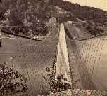
1851: Neversink Aqueduct
Cuddebackville, New York, USA - Neversink River
| Bridgemeister ID: | 36 (added before 2003) |
| Year Completed: | 1851 |
| Name: | Neversink Aqueduct |
| Location: | Cuddebackville, New York, USA |
| Crossing: | Neversink River |
| Coordinates: | 41.459806 N 74.604889 W |
| Maps: | Acme, GeoHack, Google, OpenStreetMap |
| Principals: | John A. Roebling |
| References: | AAJ, BOB, RDH, SJR |
| Use: | Aqueduct |
| Status: | Removed |
| Main Cables: | Wire (iron) |
| Suspended Spans: | 1 |
| Main Span: | 1 x 51.8 meters (170 feet) |
Notes:
- BPL says 1849, RDH says not used until 1851 canal season.
- Built as part of same project as 1848 Delaware Aqueduct (Roebling Aqueduct) - Lackawaxen, Pennsylvania and Minisink Ford, New York, USA.
- Built as part of same project as 1849 Lackawaxen Aqueduct - Lackawaxen, Pennsylvania, USA.
- Built as part of same project as 1851 High Falls Aqueduct - High Falls, New York, USA.
External Links:
1852: (suspension bridge)
Frankfort, Kentucky, USA - Kentucky River
| Bridgemeister ID: | 1714 (added 2005-04-03) |
| Year Completed: | 1852 |
| Name: | (suspension bridge) |
| Location: | Frankfort, Kentucky, USA |
| Crossing: | Kentucky River |
| Coordinates: | 38.201998 N 84.881934 W |
| Maps: | Acme, GeoHack, Google, OpenStreetMap |
| Principals: | Mathew Dickinson Field |
| References: | AAJ, ENG18570605, HBE, HOF |
| Use: | Rail |
| Status: | Removed |
| Main Cables: | Wire (iron) |
| Suspended Spans: | 2 |
| Main Spans: | 1 x 61 meters (200 feet) estimated, 1 x 91.4 meters (300 feet) estimated |
Notes:
- An early attempt at a railroad suspension bridge, it was significantly reconstructed (because of excessive vibrations and increasing loads) by Julius W. Adams in 1857 to have three spans of 120, 163, and 163 feet. It is unclear whether the new structure was also a suspension bridge.
- HOF describes the location as "between the foot of Broadway and the neck of land near the mouth of Benson Creek." The coordinates provided here are for the later rail crossing at that general location, likely at or very close to the site of the suspension bridge.
1852: Charleston
Charleston, West Virginia, USA - Elk River
| Bridgemeister ID: | 38 (added before 2003) |
| Year Completed: | 1852 |
| Name: | Charleston |
| Also Known As: | Lovell Street |
| Location: | Charleston, West Virginia, USA |
| Crossing: | Elk River |
| Coordinates: | 38.358222 N 81.639861 W |
| Maps: | Acme, GeoHack, Google, OpenStreetMap |
| Principals: | W. O. Buchanan, William Kuhn, Abraham Wright |
| References: | AAJ, EOV, HBE, PTS2 |
| Use: | Vehicular |
| Status: | Collapsed, December 15, 1904 |
| Main Cables: | Wire (iron) |
| Suspended Spans: | 1 |
| Main Span: | 1 x 145.7 meters (478 feet) |
| Deck width: | 17 feet |
Notes:
- Was still part of Virginia at time of completion. The bridge was located on (or close to) the alignment of Washington Street. East Charleston's Lovell Street eventually became East Washington Street.
- Damaged during Civil War. An article in the August 2, 1861 issue of the New York Times mentions: "A junction of our forces having now been effected, the army at once moved on to Elk River, which debouches into the Kanawha at Charleston, where the army encamped for the night. We would have crossed the stream at once, and marched through the town the same evening, but for the fact that the rebels had partially destroyed the beautiful suspension bridge which spans Elk River at this spot, rendering it unsafe for passage. Not content with burning a portion of the flooring, they nearly severed the strands which support the structure, and aid their work, too, in the most bungling manner. A more shameless piece of vandalism I never witnessed. While the army slept, a company of sappers and miners repaired the damage, and yesterday the army, nearly five thousand strong, marched through the streets of Charleston."
- Near 1884 Spring Street (Virginia Street) - Charleston, West Virginia, USA.
External Links:
Image Sets:
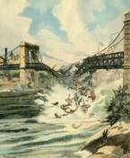
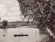
1852: Fairmont and Palatine
Fairmont, West Virginia, USA - Monongahela River
| Bridgemeister ID: | 39 (added before 2003) |
| Year Completed: | 1852 |
| Name: | Fairmont and Palatine |
| Location: | Fairmont, West Virginia, USA |
| Crossing: | Monongahela River |
| Coordinates: | 39.482944 N 80.139611 W |
| Maps: | Acme, GeoHack, Google, OpenStreetMap |
| Principals: | James L. Randolph |
| References: | EOV, PTS2 |
| Use: | Vehicular |
| Status: | Removed, 1908 |
| Main Cables: | Wire (iron) |
| Suspended Spans: | 1 |
Notes:
- Was still part of Virginia at time of completion.
Image Sets:
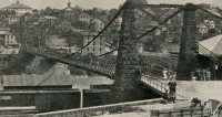
1852: Huse
Yeomet, California, USA - Cosumnes River
| Bridgemeister ID: | 1088 (added 2004-01-01) |
| Year Completed: | 1852 |
| Name: | Huse |
| Location: | Yeomet, California, USA |
| Crossing: | Cosumnes River |
| Coordinates: | 38.55323 N 120.84755 W |
| Maps: | Acme, GeoHack, Google, OpenStreetMap |
| Principals: | E.P. Bowman |
| Use: | Vehicular |
| Status: | Removed |
| Main Cables: | Wire (iron) |
Notes:
- Yeomet was located near the present day California Route 49 crossing of the Cosumnes River by the confluence of the North Fork and Middle Fork of the Cosumnes River. Yeomet was once known as "Forks of the Cosumnes." The location coordinates provided here are only to show the approximate location of the confluence and should not be considered the exact location of the bridge. This inventory entry represents the suspension bridge for which a photograph exists in the Lawrence & Houseworth collection titled "Suspension Bridge over the Cosumnes River, At Yeomet, El Dorado County". This image exists in several online archives.
- Barry Parr, consulting Erwin Gudde's California Gold Camps (University of California Press), writes that Gudde notes the bridge is located "at Yeomet and says it was marked on the County Map in 1866, and was owned by S.E. Huse for a decade. Of Yeomet, Gudde writes: 'Amador County. At the junction of the forks of Cosumnes River, formerly in El Dorado County'. Gudde says the camp developed in 1849 or 1850 and prospered for a number of years, but says nothing further about the bridge." Barry also notes that some sources cite Yeomet as located in Calaveras County, but this is because Amador County was created in 1854 from Calaveras County. Barry continues: "The California Division of Mines Bulletin 141, Geological Guidebook along Highway 49, mentions the Highway 49 bridge across the Cosumnes as also known as the Huse Bridge."
- The October 14, 1976 edition of The Mountain Democrat Times (Placerville, California) has an article about the Huse Bridge (from the Heritage Association of El Dorado) describing Huse's Bridge:
"E.P. Bowman, an early motel keeper in Yeomet had a ferry across the Cosumnes and by 1852 had built a bridge there (J.M. Watrous had a ferry there also). Traffic was heavy and... [the tolls were] as much a 'gold mine' as most of the nearby river claims which ran for miles above and below the town. (Yeomet falls was below the bridge). The famous Mother Lode crossed the river in the vicinity of the town. Samuel Huse bought the bridge at Yeomet in about 1862 and owned it until his death. His widow Laura sold the wire suspension bridge and the exclusive right to collect tolls to John Ballard and W.H. Martin in 1883. William Miller purchased the property in 1887."
It is unclear if the 1852 E.P. Bowman bridge was the same structure as the suspension bridge purchased by Huse ten years later, but it has been assumed here pending additional details. - An obituary for in the August 28, 1949 edition of the Oakland Tribune for Lilian Williams presents a stronger tie between E.P. Bowman and S.E. Huse: "With her foster parents, the E. P. Bowmans, Mrs. Williams spent her childhood in Oakland, San Francisco and Yeomet, between Plymouth and Placerville. Bowman and her foster uncle, S.E. Huse, owned a hotel at Yeomet. They also built and operated a toll bridge there on the Cosumnes River, over which most of the heavy machinery and mining equipment was transported to the old Mother Lode mines."
- See 1852 Wilson's - Cosumne, California, USA.
- See 1863 Lamb's - Latrobe vicinity and Plymouth vicinity, California, USA.
External Links:
1852: Wilson's
Cosumne, California, USA - Cosumnes River
| Bridgemeister ID: | 2116 (added 2006-09-10) |
| Year Completed: | 1852 |
| Name: | Wilson's |
| Location: | Cosumne, California, USA |
| Crossing: | Cosumnes River |
| Coordinates: | 38.49229 N 121.17183 W |
| Maps: | Acme, GeoHack, Google, OpenStreetMap |
| Principals: | W. D. Wilson |
| References: | DSL200106 |
| Use: | Vehicular |
| Status: | Removed |
| Main Cables: | Wire |
| Main Span: | 1 x 45.7 meters (150 feet) |
| Deck width: | 12 feet |
Notes:
- The location of this bridge was near the present day location of Cosumne in Sacramento County, just east of Sloughhouse. The location coordinates provided here are only to show the approximate location of present-day Cosumne and should not be considered the exact location of the bridge. Don Sayenga writes: "The exact location was at the intersection of [present-day] Dillard Road and State Route 16 a very short distance east of Sloughhouse, Sacramento County, California... The whole area at that time was known as Daylor's Ranch."
- Don Sayenga notes an F.W. Panhorst (of the California Highway Department) citation:
"Alta California July 27, 1852 reprinting an article from Sacramento Union mentions a wire suspension bridge built in Sacramento County across the Cosumnes. The span is described as 150 feet with a roadway width of 12 feet. One W.D. Wilson is mentioned as owner and designer. This structure, according to our best information, was the first suspension bridge in California."
- A January 14, 1862 Sacramento Bee article notes:
"The quartz mill and house of the brothers Wiley, just beyond Butte City, were carried away by the torrent. At Ione City, William's brick stable had fallen, and several other houses had met with a like fate. On Sutter creek, the loss and damage had been terrific - bridges and houses being carried off like chaff. Mr. Haywood, proprietor of a quartz mill on Sutter creek, had been a loser to the amount of at least $75,000. We have it from good authority that in the counties of Calaveras and Amador not a bridge is left standing. Below Ione City, it is thought that there has been loss of life."
which seems to imply a relationship between the Ione Valley, the Cosumnes River, and the bridge at Wilson's Exchange, but this may have just been coincidental that both "Ione Valley" and Wilson's Exchange were mentioned in the same paragraph; they are nearby. Present-day Ione is in Amador County a few miles east of Sacramento County. The Cosumnes River forms the northern border of Amador County several miles to the north of present-day Ione. Barry Parr notes that the Cosumnes River does not flow through the "Ione Valley," but Barry writes: "Recalling Daylor’s name in Historic Spots of California: 'Daylor established himself as a trader and hotel-keeper on the Cosumnes River about a mile east of Slough House. This place, which was at first known as Daylor’s Ranch, later became the Cosumnes post office.' (p. 290) The site of Cosumnes post office is about five miles downstream from Bridge House, and both are on the Sacramento-Ione Road.
"Last Saturday night, the reports of minute guns were heard, as if signals of distress, coming from the direction of a house where lived Mr. Martin and his family. The whole of Ione Valley was many feet under water. No boats were to be had, so that assistance might be rendered those in danger and distress. In a short time a heavy crash was heard, the signals of distress ceased, and our informant tells us that when he left the general impression was that Martin and his family had lost their lives. The wire suspension bridge over the Cosumnes river had disappeared - the house known as Wilson’s Exchange has also been washed away, and Daylor’s adobe house is flat with the ground. These facts go to show that throughout the mountain districts, as well as in the valleys, the destruction of property and loss of human life exceed the worst that was anticipated, and we shall hear repetitions of such tales of distress as the avenues for communication are gradually opened to us." - See 1852 Huse - Yeomet, California, USA.
- See 1863 Lamb's - Latrobe vicinity and Plymouth vicinity, California, USA.
External Links:
- Oliver Plummer. Transcription by Debbie Walke Gramlick of passage from An Illustrated History of Sacramento County, California. (by Hon. Win. J. Davis, Lewis Publishing Company, 1890, Pages 435-436) which sheds more light on W.D. Wilson.
"Mr. Wilson and part of the company concluded to seek the land of gold, while others kept to the original design of going to Oregon. On his arrival Mr. Wilson mined for a short time on Mormon Island and then moved to Hangtown, now Placerville, where in the winter of 1848-49 he built the first house erected in that place. The family then comprised six children; five more were born in California; nine grew to maturity and seven are living in 1889. In the spring of 1850 he moved down on the Cosumnes and purchased 6,000 acres of the Hartnell Grant, and built a tavern, long known as Wilson’s Exchange, across the river from what is now the Cosumnes post office. He was postmaster from the establishment of that office until 1868. He was by trade a millwright and built the first suspension bridge on the Cosumnes."
1853: (suspension bridge)
Delaware, Ohio, USA - Olentangy River
| Bridgemeister ID: | 774 (added 2003-03-14) |
| Year Completed: | 1853 |
| Name: | (suspension bridge) |
| Location: | Delaware, Ohio, USA |
| Crossing: | Olentangy River |
| At or Near Feature: | Winter Street |
| Principals: | John Gray |
| References: | SME20030311 |
| Use: | Footbridge |
| Status: | Destroyed, February 1883 |
| Main Cables: | Wire (iron) |
| Main Span: | 1 x 61 meters (200 feet) estimated |
Notes:
- SME20030311: Intended only for foot traffic, destroyed by ice jam February 1883.
1853: Dresden
Dresden, Ohio, USA - Muskingum River
| Bridgemeister ID: | 43 (added before 2003) |
| Year Completed: | 1853 |
| Name: | Dresden |
| Location: | Dresden, Ohio, USA |
| Crossing: | Muskingum River |
| Coordinates: | 40.120889 N 81.999917 W |
| Maps: | Acme, GeoHack, Google, OpenStreetMap |
| Principals: | George Copland |
| References: | EOV, GBD, OCEN198202 |
| Use: | Vehicular |
| Status: | Destroyed, 1913 |
| Main Cables: | Wire (iron) |
| Suspended Spans: | 1 |
Notes:
- Destroyed by flood 1913.
- Replaced by 1914 Dresden - Dresden, Ohio, USA.
- All past and present bridges at this location.
External Links:
Image Sets:
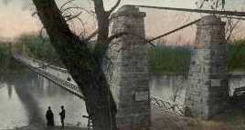
1853: Falmouth
Falmouth, Kentucky, USA - Licking River
| Bridgemeister ID: | 42 (added before 2003) |
| Year Completed: | 1853 |
| Name: | Falmouth |
| Location: | Falmouth, Kentucky, USA |
| Crossing: | Licking River |
| Coordinates: | 38.678056 N 84.328222 W |
| Maps: | Acme, GeoHack, Google, OpenStreetMap |
| Principals: | D. Griffith Smith |
| References: | AAJ, EOV |
| Use: | Vehicular |
| Status: | Collapsed, 1868 |
| Main Cables: | Wire (iron) |
| Main Span: | 1 x 98.5 meters (323 feet) |
Notes:
- 1854: A brief article in March 22, 1854 Louisville Daily Courier states the bridge was destroyed ("rendering the whole structure useless… it cannot even be repaired") in the early 1854 flood that destroyed other Licking River bridges. However, other sources indicate the Falmouth bridge survived the flood. Unclear if it was completely destroyed and rebuilt or just damaged and repaired.
- Coordinates provided here indicate the likely location of the bridge over the main branch of the Licking River.
External Links:
- New Licking Bridge Stands On The Foundation of Its Predecessors - Rootsweb.com. Several anecdotes and snippets of history about the bridge. Indicates the bridge survived the January 1854 Licking River flood and survived until 1868.
1853: Fort Hunter
Tribes Hill and Fort Hunter, New York, USA - Mohawk River
| Bridgemeister ID: | 44 (added before 2003) |
| Year Completed: | 1853 |
| Name: | Fort Hunter |
| Also Known As: | Fonda |
| Location: | Tribes Hill and Fort Hunter, New York, USA |
| Crossing: | Mohawk River |
| Coordinates: | 42.945500 N 74.287028 W |
| Maps: | Acme, GeoHack, Google, OpenStreetMap |
| Principals: | John W. Murphy, Thomas R. Hulett |
| References: | ONC, PTS2 |
| Use: | Vehicular |
| Status: | Dismantled, 1935 |
| Main Cables: | Wire (iron) |
| Suspended Spans: | 1 |
| Main Span: | 1 x 169.5 meters (556 feet) |
Notes:
- According to ONC: Designed by John W. Murphy (who designed several suspension bridges in the 1850s and 1860s in New York and Pennsylvania). Fort Hunter Suspension Bridge Company incorporated in 1852, but cables were not installed until 1853.
- Crossed the Mohawk River on the old alignment of Main Street, east of the current Main Street bridge, at the ends of the streets now known as Brown Place in Fort Hunter and Locust Avenue in Tribes Hill.
- 1935: Bridge is dismantled (ONC).
Image Sets:
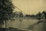
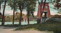
1853: Mill Pond
Kingfield, Maine, USA - Carrabasset River
| Bridgemeister ID: | 45 (added before 2003) |
| Year Completed: | 1853 |
| Name: | Mill Pond |
| Location: | Kingfield, Maine, USA |
| Crossing: | Carrabasset River |
| Principals: | Daniel Beedy |
| References: | AAJ, BPL |
| Use: | Vehicular (one-lane), with walkway |
| Status: | Replaced, 1916 |
| Main Cables: | Chain (iron) |
| Main Span: | 1 x 57.9 meters (190 feet) |
| Deck width: | 15 feet |
Notes:
- Similar to 1856 Strong - Strong, Maine, USA.
Image Sets:
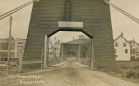
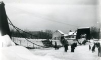
1853: O'Byrne's
Copperopolis vicinity, California, USA - Stanislaus River
| Bridgemeister ID: | 2324 (added 2007-05-06) |
| Year Completed: | 1853 |
| Name: | O'Byrne's |
| Location: | Copperopolis vicinity, California, USA |
| Crossing: | Stanislaus River |
| Use: | Vehicular |
| Status: | Destroyed, 1862 |
Notes:
- Different accounts describe this as a chain and wire suspension bridge. Collapsed November, 1853 under weight of oxen team. Rebuilt, but destroyed by flood, 1862. Replaced by a multi-span covered bridge.
- Name "O'Byrne's" appears to have originated with a "Patrick O. Byrne" who operated a ferry at this location prior to construction of the suspension bridge. After time, it became known as O'Byrne's Ferry.
1853: Tiffin
Tiffin, Ohio, USA - Sandusky River
| Bridgemeister ID: | 46 (added before 2003) |
| Year Completed: | 1853 |
| Name: | Tiffin |
| Location: | Tiffin, Ohio, USA |
| Crossing: | Sandusky River |
| Principals: | John Gray |
| References: | EOV |
| Status: | Removed |
| Main Cables: | Wire (iron) |
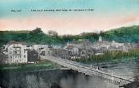
1854: Elk River
Sutton, West Virginia, USA - Elk River
| Bridgemeister ID: | 554 (added before 2003) |
| Year Completed: | 1854 |
| Name: | Elk River |
| Location: | Sutton, West Virginia, USA |
| Crossing: | Elk River |
| Principals: | Ira Hart |
| References: | EOV |
| Use: | Vehicular, with walkway |
| Status: | Removed, 1930 |
| Main Cables: | Wire (iron) |
| Main Span: | 1 x 140.2 meters (460 feet) |
Image Sets:
1854: Licking River I
Covington and Newport, Kentucky, USA - Licking River
| Bridgemeister ID: | 47 (added before 2003) |
| Year Completed: | 1854 |
| Name: | Licking River I |
| Location: | Covington and Newport, Kentucky, USA |
| Crossing: | Licking River |
| Principals: | John Gray, George C. Tarvin |
| References: | BOB, BPL, EOV |
| Status: | Collapsed, 1854 |
Notes:
- BPL: Collapsed under weight of cattle 1853. BOB: Indicates year of completion and collapse as 1854. EOV: Appears more authoritative on the matter, "Although the bridge was not quite finished, Tarvin and the mayor of Covington rode the first vehicle across it on December 28, 1853. Less than two weeks later... the bridge collapsed."
- The January 18, 1854 edition of The New York Times has a small article with a January 16, 1854 byline reporting the collapse of the bridge: "The... bridge... gave way this evening, while two men and eighteen cattle were crossing it... The keys which held the wire cable to the anchors gave way."
- Replaced by 1854 Licking River II - Covington and Newport, Kentucky, USA.
- All past and present bridges at this location.
1854: Licking River II
Covington and Newport, Kentucky, USA - Licking River
| Bridgemeister ID: | 48 (added before 2003) |
| Year Completed: | 1854 |
| Name: | Licking River II |
| Location: | Covington and Newport, Kentucky, USA |
| Crossing: | Licking River |
| Principals: | John Gray |
| References: | EOV |
| Status: | Removed |
Notes:
- Replaced 1854 Licking River I - Covington and Newport, Kentucky, USA which collapsed in January of 1854.
- All past and present bridges at this location.
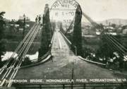
1854: Morgantown
Morgantown and Westover, West Virginia, USA - Monongahela River
| Bridgemeister ID: | 49 (added before 2003) |
| Year Completed: | 1854 |
| Name: | Morgantown |
| Also Known As: | Westover |
| Location: | Morgantown and Westover, West Virginia, USA |
| Crossing: | Monongahela River |
| Coordinates: | 39.630806 N 79.960000 W |
| Maps: | Acme, GeoHack, Google, OpenStreetMap |
| References: | AAJ, EN19070918, EOV, HBE, PTS2 |
| Use: | Vehicular, with walkway |
| Status: | Replaced, 1909 |
| Main Cables: | Wire (iron) |
| Suspended Spans: | 1 |
| Main Span: | 1 x 185.3 meters (608 feet) |
| Deck width: | 20 feet |
Notes:
- Was still part of Virginia at time of completion.
Image Sets:
1855: Minneapolis
Minneapolis, Minnesota, USA - Mississippi River
| Bridgemeister ID: | 50 (added before 2003) |
| Year Completed: | 1855 |
| Name: | Minneapolis |
| Also Known As: | St. Anthony's Falls |
| Location: | Minneapolis, Minnesota, USA |
| Crossing: | Mississippi River |
| At or Near Feature: | Nicollet Island |
| Coordinates: | 44.985556 N 93.263389 W |
| Maps: | Acme, GeoHack, Google, OpenStreetMap |
| Principals: | Thomas M. Griffith |
| References: | AAJ, BPL, HBE, PTS2 |
| Use: | Vehicular |
| Status: | Demolished, 1876 |
| Main Cables: | Wire (iron) |
| Suspended Spans: | 1 |
| Main Span: | 1 x 189 meters (620 feet) |
| Deck width: | 17 feet |
Notes:
- Replaced by 1877 Minneapolis - Minneapolis, Minnesota, USA.
- Later at same location 1990 Hennepin Avenue (Father Louis Hennepin) - Minneapolis, Minnesota, USA.
- All past and present bridges at this location.
External Links:
Image Sets:
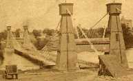
1855: Niagara Suspension
Niagara Falls, New York, USA and Niagara Falls, Ontario, Canada - Niagara River
| Bridgemeister ID: | 51 (added before 2003) |
| Year Completed: | 1855 |
| Name: | Niagara Suspension |
| Location: | Niagara Falls, New York, USA and Niagara Falls, Ontario, Canada |
| Crossing: | Niagara River |
| Principals: | John A. Roebling |
| References: | AAJ, BAAW, BBR, BFL, BMA, BOB, BPL, HBE, LIR, NSB, ONF, PTS2, SA18810716, SJR |
| Use: | Rail (heavy rail) and Vehicular (double-deck), with walkway |
| Status: | Replaced, 1897 |
| Main Cables: | Wire (iron) |
| Suspended Spans: | 1 |
| Main Span: | 1 x 250.3 meters (821.3 feet) |
Notes:
- Cables renovated, 1877. Wooden stiffening trusses replaced, 1880. Towers replaced, c. 1886. Bridge replaced with steel arch, 1897.
- AAJ notes the roadway deck opened in 1854, but the railway deck did not open until 1855.
- Replaced 1848 Niagara Suspension - Niagara Falls, New York, USA and Niagara Falls, Ontario, Canada.
- All past and present bridges at this location.
External Links:
Image Sets:
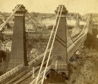
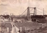
1855: Shohola
Barryville, New York and Shohola, Pennsylvania, USA - Delaware River
| Bridgemeister ID: | 41 (added before 2003) |
| Year Completed: | 1855 |
| Name: | Shohola |
| Also Known As: | Barryville-Shohola, Shohola-Barryville |
| Location: | Barryville, New York and Shohola, Pennsylvania, USA |
| Crossing: | Delaware River |
| Coordinates: | 41.477000 N 74.919000 W |
| Maps: | Acme, GeoHack, Google, OpenStreetMap |
| Principals: | Chauncy Thomas, John A. Roebling |
| References: | BDR, SHO |
| Use: | Vehicular |
| Status: | Dismantled, 1941 |
| Main Cables: | Wire (iron) |
| Suspended Spans: | 1 |
Notes:
- BDR: Built 1856, severely damaged 1859, rebuilt, collapsed Jan. 1st 1865, rebuilt 1866. Dale writes: "A respected historian, John Willard Johnston, who knew Chauncey Thomas personally and visited the area during his ownership of the toll bridge, insisted that Thomas, as the builder, was grossly incompetent."
- Originally constructed with one main span, the center pier was added during the 1866 reconstruction.
- Don Sayenga's research leads him to conclude the bridge was completed in the fall of 1855. He notes an article from the Pike County Democrat (June 21, 1872) stating the bridge was completed in 1855. The article also notes the 1859 collapse occurred on July 2, 1859. Don's interest in this bridge is piqued by the connection to John Roebling, "...this bridge seems to be the only John Roebling bridge that failed in service..." Roebling prepared plans, for the original bridge, for Chauncy Thomas (who, by Dale's account was inexperienced).
Image Sets:
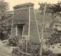
1855: Whiskey Bar
El Dorado County, California, USA - American River
| Bridgemeister ID: | 3357 (added 2019-12-15) |
| Year Completed: | 1855 |
| Name: | Whiskey Bar |
| Also Known As: | Pioneer, Whisky |
| Location: | El Dorado County, California, USA |
| Crossing: | American River |
| Use: | Vehicular |
| Status: | Destroyed, 1862 |
| Main Cables: | Wire (iron) |
Notes:
- Destroyed by flood, 1862. Cables supposedly reused for the Rattlesnake Bar bridge.
- See 1862 Rattlesnake Bar - Folsom vicinity, California, USA.
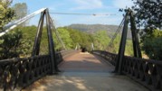
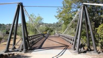
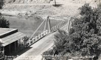
1856: Bidwell Bar
Oroville, California, USA - Feather River
| Bridgemeister ID: | 52 (added before 2003) |
| Year Completed: | 1856 |
| Name: | Bidwell Bar |
| Location: | Oroville, California, USA |
| Crossing: | Feather River |
| Coordinates: | 39.537483 N 121.45415 W |
| Maps: | Acme, GeoHack, Google, OpenStreetMap |
| Principals: | Bidwell Bridge Co. |
| References: | BPL, DSL200106, LACE |
| Use: | Vehicular (one-lane) |
| Status: | Restricted to foot traffic (last checked: 2020) |
| Main Cables: | Wire (iron) |
| Suspended Spans: | 1 |
| Main Span: | 1 x 67.1 meters (220 feet) estimated |
Notes:
- Dismantled before completion of Oroville Dam and replaced by the 1965 high-level Bidwell Bar suspension bridge. The 1856 structure was later reassembled about 1.5 miles south of the new Bidwell Bar bridge. Coordinates provided here are for the current location of the bridge at Kelly Ridge.
- Replaced by 1965 Bidwell Bar - Oroville, California, USA.
- All past and present bridges at this location.
External Links:
Image Sets:
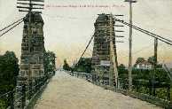
1856: Genesee
Carthage and Rochester, New York, USA - Genesee River
| Bridgemeister ID: | 54 (added before 2003) |
| Year Completed: | 1856 |
| Name: | Genesee |
| Also Known As: | Bridge of Sighs |
| Location: | Carthage and Rochester, New York, USA |
| Crossing: | Genesee River |
| Coordinates: | 43.161861 N 77.613472 W |
| Maps: | Acme, GeoHack, Google, OpenStreetMap |
| Principals: | Josiah Bissell, Jr. |
| Use: | Vehicular |
| Status: | Collapsed, 1857 |
| Main Cables: | Wire (iron) |
Notes:
- From May 2, 1857 edition of Scientific American: "Fall of a Suspension Bridge. The iron suspension bridge which spans the Genesee River at Rochester, fell on the 21st ult. from the weight of snow on it. The bridge was only finished last summer, and cost over $28,000. It was constructed between iron towers standing on the banks. They were built of cast iron cylinders, bolted together, and standing on high banks, 235 feet above the water. The road-way was 200 feet above the water, and proceeded in almost a straight line from the top of the high bank on one side, to the other. The cables were 780 feet long, and the entire length of the bridge was over 700 feet. It was calculated to sustain a weight of 2.000 tuns [sic]. It spanned the Genesee river below the Falls. The metal, it is stated, appears to be defective. The load that was on it when it fell did not amount to 100 tuns [sic]."
1856: Guyandotte
Guyandotte and Huntington, West Virginia, USA - Guyandotte River
| Bridgemeister ID: | 40 (added before 2003) |
| Year Completed: | 1856 |
| Name: | Guyandotte |
| Location: | Guyandotte and Huntington, West Virginia, USA |
| Crossing: | Guyandotte River |
| Coordinates: | 38.430083 N 82.391694 W |
| Maps: | Acme, GeoHack, Google, OpenStreetMap |
| Principals: | George Wilson Mason |
| References: | AAJ, EOV, PTS2 |
| Use: | Vehicular |
| Status: | Removed, 1907 |
| Main Cables: | Wire (iron) |
| Suspended Spans: | 1 |
| Main Span: | 1 x 137.2 meters (450 feet) |
Notes:
- EOV cites a source claiming the bridge was begun in 1853, but not completed until 1858. AAJ says completed in 1848. Other sources claim it was completed in 1852 and 1856.
- Was still part of Virginia at time of completion.
Image Sets:
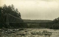
1856: Strong
Strong, Maine, USA - Sandy River
| Bridgemeister ID: | 53 (added before 2003) |
| Year Completed: | 1856 |
| Name: | Strong |
| Location: | Strong, Maine, USA |
| Crossing: | Sandy River |
| Principals: | Daniel Beedy |
| References: | BPL |
| Use: | Vehicular (one-lane) |
| Status: | Replaced, 1922 |
| Main Cables: | Wire (iron) |
| Suspended Spans: | 1 |
| Main Span: | 1 x 77.4 meters (254 feet) |
| Deck width: | 13 feet |
Notes:
- Similar to 1853 Mill Pond - Kingfield, Maine, USA.
Image Sets:
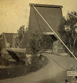
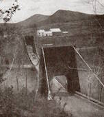
1856: Westmoreland's
Lancha Plana, California, USA - Mokelumne River
| Bridgemeister ID: | 1089 (added 2004-01-01) |
| Year Completed: | 1856 |
| Name: | Westmoreland's |
| Location: | Lancha Plana, California, USA |
| Crossing: | Mokelumne River |
| References: | DSL200106 |
| Status: | Inundated |
| Main Cables: | Wire (iron) |
Notes:
- Towers and cables were still standing in the 1940s. The location, including the entire former settlement of Lancha Plana, was inundated by the creation of the Camanche Reservoir in 1963. Unclear if remnants are still present (as is the case for some other inundated 19th-century California suspension bridges).
1857: Black River
Watertown, New York, USA - Black River
| Bridgemeister ID: | 55 (added before 2003) |
| Year Completed: | 1857 |
| Name: | Black River |
| Also Known As: | Bradford, Mill Street |
| Location: | Watertown, New York, USA |
| Crossing: | Black River |
| Coordinates: | 43.977000 N 75.906528 W |
| Maps: | Acme, GeoHack, Google, OpenStreetMap |
| Principals: | Gilbert Bradford |
| References: | AAJ, HBE, ONC |
| Use: | Vehicular |
| Status: | Removed, 1890s |
| Main Cables: | Wire (iron) |
| Suspended Spans: | 1 |
| Main Span: | 1 x 53 meters (173.9 feet) |
| Deck width: | 18 feet |
Notes:
- Replaced in 1890's (ONC).
Image Sets:
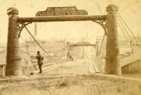
1857: Change
Glendon, Pennsylvania, USA - Lehigh River
| Bridgemeister ID: | 56 (added before 2003) |
| Year Completed: | 1857 |
| Name: | Change |
| Also Known As: | Chain, Lehigh Canal Swinging, Wire Towing Path at Pool No. 8 |
| Location: | Glendon, Pennsylvania, USA |
| Crossing: | Lehigh River |
| Coordinates: | 40.65382 N 75.24774 W |
| Maps: | Acme, GeoHack, Google, OpenStreetMap |
| Principals: | Lehigh Coal and Navigation Co., E.A. Douglas |
| References: | HAERPA461, HBP |
| Use: | Footbridge and Change |
| Status: | Derelict (last checked: 2007) |
| Main Cables: | Wire (iron) |
| Suspended Spans: | 2 |
| Main Spans: | 2 |
Notes:
- Often mistakenly called a "chain" bridge, this is a "change" bridge.
External Links:
- Aldrich Change Bridge. Dale Oswald explains (in the context of the Aldrich Change Bridge, a non-suspension bridge in Palmyra, New York): "A change bridge is one with low railings and an underpass that allowed draft teams to move from one side of the canal to the other without unhitching, cloverleaf-style."
Image Sets:
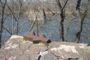
1858: Portsmouth
Portsmouth, Ohio, USA - Scioto River
| Bridgemeister ID: | 57 (added before 2003) |
| Year Completed: | 1858 |
| Name: | Portsmouth |
| Location: | Portsmouth, Ohio, USA |
| Crossing: | Scioto River |
| Principals: | E.B. Gray |
| References: | EOV |
| Status: | Collapsed, 1859 |
Notes:
1859: General Dean
Carlyle, Illinois, USA - Kaskaskia River
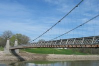
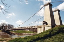
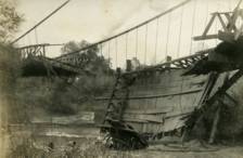
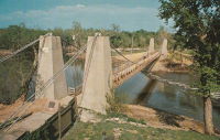
| Bridgemeister ID: | 58 (added before 2003) |
| Year Completed: | 1859 |
| Name: | General Dean |
| Also Known As: | Carlyle |
| Location: | Carlyle, Illinois, USA |
| Crossing: | Kaskaskia River |
| Coordinates: | 38.611125 N 89.357476 W |
| Maps: | Acme, GeoHack, Google, OpenStreetMap |
| Principals: | D. Griffith Smith |
| References: | BPL, GBD |
| Use: | Vehicular (one-lane) |
| Status: | Restricted to foot traffic (last checked: 2021) |
| Main Cables: | Wire (iron) |
| Suspended Spans: | 1 |
| Main Span: | 1 x 80.5 meters (264 feet) |
Notes:
- Rebuilt 1920s, 1970s. Restored, 1950s, for use as a footbridge.
- Bypassed, 1924.
External Links:
Image Sets:
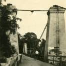
1860: Allegheny River
Pittsburgh, Pennsylvania, USA - Allegheny River
| Bridgemeister ID: | 59 (added before 2003) |
| Year Completed: | 1860 |
| Name: | Allegheny River |
| Also Known As: | Sixth Street, St. Clair |
| Location: | Pittsburgh, Pennsylvania, USA |
| Crossing: | Allegheny River |
| Coordinates: | 40.445028 N 80.003028 W |
| Maps: | Acme, GeoHack, Google, OpenStreetMap |
| Principals: | John A. Roebling |
| References: | BOB, BOP, BPL, HBE, PBR, PTS2, SJR |
| Use: | Vehicular, with walkway |
| Status: | Replaced, 1892 |
| Main Cables: | Wire (iron) |
| Suspended Spans: | 4 |
| Main Spans: | 2 x 104.9 meters (344 feet) |
| Side Spans: | 2 x 52.1 meters (171 feet) |
| Deck width: | 40 feet |
Notes:
- BPL cites this bridge as the first suspension bridge with metal towers. However, at least two earlier suspension bridges (1857 Watertown, New York and 1856 Bidwell Bar, California) are known to have metal towers and even Roebling's 1846 Smithfield Street Bridge in Pittsburgh had cast iron towers.
- Next to 1884 North Side (Seventh Street) - Pittsburgh, Pennsylvania, USA.
- Later at same location 1928 Roberto Clemente (Sixth Street) - Pittsburgh, Pennsylvania, USA.
- All past and present bridges at this location.
External Links:
Image Sets:
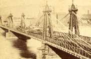
1860: Auburn-Coloma
Auburn and Coloma, California, USA - North Fork American River
| Bridgemeister ID: | 274 (added before 2003) |
| Year Completed: | 1860 |
| Name: | Auburn-Coloma |
| Location: | Auburn and Coloma, California, USA |
| Crossing: | North Fork American River |
| Principals: | John Mollett |
| References: | PTS2 |
| Use: | Vehicular (one-lane) |
| Status: | Removed |
| Main Cables: | Wire (iron) |
| Suspended Spans: | 1 |
Notes:
- 1865 and 1866 are sometimes cited as the year of completion for this bridge.
- Replaced by 1929 Auburn-Coloma - Auburn and Coloma, California, USA.
- All past and present bridges at this location.
Image Sets:
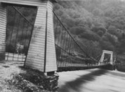
1860: Port Gibson
Grindstone Ford, Port Gibson vicinity, Mississippi, USA - Bayou Pierre
| Bridgemeister ID: | 1659 (added 2005-03-19) |
| Year Completed: | 1860 |
| Name: | Port Gibson |
| Location: | Grindstone Ford, Port Gibson vicinity, Mississippi, USA |
| Crossing: | Bayou Pierre |
| References: | PTS2 |
| Status: | Removed, circa 1920's |
Notes:
- Partially burned by retreating Confederate troops May 2nd, 1863 during the Vicksburg Campaign of the Civil War. Union troops extinquished the fire and quickly repaired the bridge.
- Demolished, circa 1920's. Descriptions for the Vicksburg Campaign imply there may have been another suspension bridge in the Port Gibson area.
1861: Connellsville
Connellsville and New Haven, Pennsylvania, USA - Youghiogheny River
| Bridgemeister ID: | 278 (added before 2003) |
| Year Completed: | 1861 |
| Name: | Connellsville |
| Location: | Connellsville and New Haven, Pennsylvania, USA |
| Crossing: | Youghiogheny River |
| Coordinates: | 40.017528 N 79.592722 W |
| Maps: | Acme, GeoHack, Google, OpenStreetMap |
| Use: | Vehicular (one-lane) |
| Status: | Replaced, 1898 |
| Main Cables: | Wire |
| Suspended Spans: | 1 |
Image Sets:
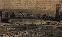
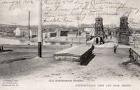
1861: Gauley River
Gauley Bridge, West Virginia, USA - Gauley River
| Bridgemeister ID: | 2123 (added 2006-09-17) |
| Year Completed: | 1861 |
| Name: | Gauley River |
| Location: | Gauley Bridge, West Virginia, USA |
| Crossing: | Gauley River |
| Principals: | John W. Murphy |
| References: | AAJ |
| Use: | Vehicular |
| Status: | Destroyed, 1862 |
| Main Cables: | Wire (iron) |
Notes:
- Don Sayenga writes:
"It was built in great haste out of military necessity utilizing abutments and piers of an earlier wooden bridge that had been burnt by a unit of the Confederate Army commanded by Gen. John B. Floyd. This occurred just after the fight known as the Battle of Carnifex Ferry on September 10, 1861. Later the Confederate Army recaptured the bridge location and burnt the new one also. The designer/builder was John W. Murphy (1828-1874) who was working as an engineer in Alabama when the war began in 1861. He held a Civil Engineer degree from Rensselaer. Murphy's concept involved multiple factory-made wire ropes as main cables combined with wooden bracing. The exact location of the bridge seems to have been called the New River Cliffs but I haven't found this on a map. Photos of the bridge came into the possession of Prof. George Plympton, an associate of Murphy's in the latter part of his career. Plympton presented a paper about bridges in 1894 reported by The Railroad Gazette August 24. The photos were given to the Gazette - one of their artists converted the photos to pen-and-ink drawings for publication in the issue of November 9, 1894, p. 773."
Don transcribed the following:
The Railroad Gazette, August 24, 1894, Page 579."Prof. Plympton then related two reminiscences of bridge building between 1852 and 1861...The other instance was the building of a military suspension bridge over the Gauley River in 1861. The government called for a bridge of sufficient strength to permit the passage of General Rosecrans corps, allowing twenty-four days' time. The abutments and piers of the former bridge remained in good condition. Murphy submitted an original plan, which was accepted. The plans were drawn up by Mr. Murphy on the cars, while he was traveling to Washington to submit his ideas to the United States army en gineers. The plans were accepted and Murphy at once went to work. Four one-inch wire ropes, laid side by side, formed his cables. A pyramidal tower was constructed of heavy timbers, and in place of suspending rods a loosely-formed truss was hung upon the cable without fastening. This truss, connected with the floor of the bridge, was finished on the 22nd day after receiving the order to build."
Proceedings of the Franklin Institute, October 21, 1874, Page 306."It was a suspension bridge 520 feet in length, 10 feet roadway, consisting of three spans, supported by eight cables. There was some doubt in the mind of the commanding officer that it would answer the purpose...To test it ...he asked that a battalion be ordered to make a charge over it, which was done, to the satisfaction of the General in command...it afterwards passed and repassed the whole command as long as they occupied that portion of the country. A change of base put it into the possession of the Confederates who burnt it down."
- An article in the July 15, 1951 edition of The Charleston Daily Mail describes the bridge and its demise:
"After the Confederate forces had retreated and burned the old covered bridge, the Federal engineers constructed a make-shift bridge across the Gauley. There are pictures in existence showing this light, cable bridge erected on the old piers of the original bridge. This structure was cut down Sept. 11, 1862, when the Federals retreated from an attack by Confederate Gen. W. W. Loring, who routed the Unionists from the valley for a brief time."
- Jakkula has an 1862 entry for "Gauley River Bridge" with little information, citing the American Railroad Journal, Vol. 37, No. 1472, July 2, 1864, p.651: "A suspension bridge built over the Gauley River, Virginia, by the Government in 1862." It is unclear if this reference is for the same bridge.
1861: Portsmouth
Portsmouth, Ohio, USA - Scioto River
| Bridgemeister ID: | 61 (added before 2003) |
| Year Completed: | 1861 |
| Name: | Portsmouth |
| Location: | Portsmouth, Ohio, USA |
| Crossing: | Scioto River |
| Principals: | Max J. Becker |
| References: | EOV |
| Status: | Removed |
Notes:
- Reconstruction of the 1858 Portsmouth bridge. A completion year of 1861 is assumed given information provided in EOV. Failed 1884.
- Replaced 1858 Portsmouth - Portsmouth, Ohio, USA.
- All past and present bridges at this location.
1861: Weitchpec
Weitchpec, California, USA - Klamath River
| Bridgemeister ID: | 1090 (added 2004-01-01) |
| Year Completed: | 1861 |
| Name: | Weitchpec |
| Location: | Weitchpec, California, USA |
| Crossing: | Klamath River |
| Principals: | Andrew S. Hallidie |
| References: | DSL200106 |
| Use: | Vehicular |
| Status: | Removed |
| Main Cables: | Wire (iron) |
| Suspended Spans: | 1 |
Notes:
1862: (suspension bridge)
California, USA - Trinity River
| Bridgemeister ID: | 1093 (added 2004-01-01) |
| Year Completed: | 1862 |
| Name: | (suspension bridge) |
| Location: | California, USA |
| Crossing: | Trinity River |
| Principals: | Andrew S. Hallidie |
| References: | DSL200106 |
| Status: | Removed |
| Main Cables: | Wire (iron) |
1862: (suspension bridge)
California, USA - Stanislaus River
| Bridgemeister ID: | 1094 (added 2004-01-01) |
| Year Completed: | 1862 |
| Name: | (suspension bridge) |
| Location: | California, USA |
| Crossing: | Stanislaus River |
| Principals: | Andrew S. Hallidie |
| References: | DSL200106 |
| Status: | Removed |
| Main Cables: | Wire (iron) |
1862: (suspension bridge)
California, USA - Tuolumne River
| Bridgemeister ID: | 1095 (added 2004-01-01) |
| Year Completed: | 1862 |
| Name: | (suspension bridge) |
| Location: | California, USA |
| Crossing: | Tuolumne River |
| Principals: | Andrew S. Hallidie |
| References: | DSL200106 |
| Status: | Removed |
| Main Cables: | Wire |
1862: (suspension bridge)
McCourtney's Crossing, California, USA - Bear River
| Bridgemeister ID: | 1092 (added 2004-01-01) |
| Year Completed: | 1862 |
| Name: | (suspension bridge) |
| Location: | McCourtney's Crossing, California, USA |
| Crossing: | Bear River |
| Principals: | Andrew S. Hallidie |
| References: | DSL200106 |
| Status: | Removed |
| Main Cables: | Wire (iron) |
1862: Chatham
Fredericksburg, Virginia, USA - Rappahannock River
| Bridgemeister ID: | 271 (added before 2003) |
| Year Completed: | 1862 |
| Name: | Chatham |
| Location: | Fredericksburg, Virginia, USA |
| Crossing: | Rappahannock River |
| Coordinates: | 38.304981 N 77.456280 W |
| Maps: | Acme, GeoHack, Google, OpenStreetMap |
| Principals: | Washington A. Roebling |
| References: | GB |
| Status: | Destroyed |
| Main Cables: | Wire |
Notes:
- After several attempts by the Union Army to restore Rappahannock River bridges near Fredericksburg with pontoon bridges during the Civil War, Washington Roebling built a temporary wire suspension bridge on the piers of the former Chatham Bridge. The suspension bridge may have had twelve or more suspended spans (the former Chatham Bridge supposedly had 13 piers). Started July 1 and completed July 18, it survived less than two months, destroyed on September 1, 1862 by an evacuating Union Army.
External Links:
1862: Ecklon Toll
Folsom, California, USA - American River
| Bridgemeister ID: | 1552 (added 2004-11-14) |
| Year Completed: | 1862 |
| Name: | Ecklon Toll |
| Location: | Folsom, California, USA |
| Crossing: | American River |
| Coordinates: | 38.682343 N 121.175714 W |
| Maps: | Acme, GeoHack, Google, OpenStreetMap |
| References: | IHS |
| Use: | Vehicular (one-lane) |
| Status: | Collapsed, 1892 |
| Main Cables: | Wire (iron) |
| Suspended Spans: | 1 |
Notes:
- IHS: Bridge is purchased by Christian L. Ecklon (a local butcher) in 1872 from "Kinsey & Whitely."
- Some sources indicate the 1862 Ecklon bridge replaced an 1861 suspension bridge that collapsed in 1862.
Image Sets:
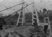
1862: Pine Street
Nevada City, California, USA - Deer Creek
| Bridgemeister ID: | 62 (added before 2003) |
| Year Completed: | 1862 |
| Name: | Pine Street |
| Location: | Nevada City, California, USA |
| Crossing: | Deer Creek |
| Coordinates: | 39.260861 N 121.019333 W |
| Maps: | Acme, GeoHack, Google, OpenStreetMap |
| Principals: | Andrew S. Hallidie |
| References: | DSL200106 |
| Use: | Vehicular (one-lane) |
| Status: | Replaced, 1903 |
| Main Cables: | Wire (iron) |
| Suspended Spans: | 1 |
Image Sets:
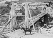
1862: Rattlesnake Bar
Folsom vicinity, California, USA - American River
| Bridgemeister ID: | 1091 (added 2004-01-01) |
| Year Completed: | 1862 |
| Name: | Rattlesnake Bar |
| Location: | Folsom vicinity, California, USA |
| Crossing: | American River |
| At or Near Feature: | Rattlesnake Bar |
| Coordinates: | 38.814397 N 121.091726 W |
| Maps: | Acme, GeoHack, Google, OpenStreetMap |
| Principals: | Andrew S. Hallidie |
| References: | DSL200106 |
| Use: | Vehicular (one-lane) |
| Status: | Collapsed, December 21, 1954 |
| Main Cables: | Wire (iron) |
| Suspended Spans: | 1 |
Notes:
- The location of Rattlesnake Bar is closer to present-day Auburn than Folsom, near the location of Goose Flat marked on modern topographical maps of the region. The area was inundated during the creation of Folsom Lake, but the piers and abutments of the Rattlesnake Bar bridge are visible when the water level is low.
- Rodi Lee writes: "[The bridge] collapsed in 1954 when an overweight truck filled with manure crossed it. The driver was unhurt. There are newspaper articles about the incident (Auburn Journal, Auburn). There are some photos in the article as well. The bridge abutments show when the the lake water is low. The bridge was upstream of Wild Goose Flats."
- See 1855 Whiskey Bar (Pioneer, Whisky) - El Dorado County, California, USA. The cables of the Rattlesnake Bar bridge were reportedly reused from the damaged Whiskey Bar bridge.
External Links:
- 1057. The Suspension Bridge over the American River at Rattlesnake Bar, Placer County - Calisphere.org
- Rattlesnake Bridge - Christine's Blog. Several images of the remnants of the bridge.
Image Sets:
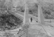
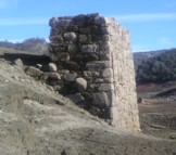
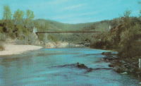
1863: Lamb's
Latrobe vicinity and Plymouth vicinity, California, USA - Cosumnes River
| Bridgemeister ID: | 2117 (added 2006-09-10) |
| Year Completed: | 1863 |
| Name: | Lamb's |
| Location: | Latrobe vicinity and Plymouth vicinity, California, USA |
| Crossing: | Cosumnes River |
| Coordinates: | 38.52222 N 120.95587 W |
| Maps: | Acme, GeoHack, Google, OpenStreetMap |
| Use: | Vehicular (one-lane) |
| Status: | Derelict (last checked: 2020) |
| Main Cables: | Wire (iron) |
| Suspended Spans: | 1 |
Notes:
- The location coordinates provided here are the approximate location of this bridge, crossing the Cosumnes between present day El Dorado and Amador counties at Michigan Bar (as named on USGS topographical maps) on current Latrobe Road where Clark Creek meets the Cosumnes River. Note that USGS topographical maps show another, more prominently marked, "Michigan Bar" a few miles west in Sacramento County.
- A California Highways and Public Works article (unsure of exact citation but it may be the article on the history of California bridges that appeared in the 1941 June issue and was reprinted in the 1950 September/October issue) says "there were four [suspension bridges] on the Cosumnes River, one of which (Lamb's Bridge on the Latrobe-Plymouth Road) killed one man and seven horses when it fell in 1869."
- The October 14, 1976 edition of The Mountain Democrat Times (Placerville, California) has an article about the nearby Huse Bridge (from the Heritage Association of El Dorado) which mentions Lamb's Bridge: "...Lamb's Bridge, several miles downriver, was reconstructed in 1872 and was also a wire bridge of the same type [as Huse's]."
- The Statutes of California passed at the Fourteenth Session of the Legislature, 1863 records: "Chapter XLI. An Act to grant to Larkin Lamb and his Associates the right to construct and maintain a Toll Bridge across the Cosumnes River, in the Counties of Amador and El Dorado. Approved March 6, 1863. The People of the State of California, represented in Senate and Assembly, do enact as follows: Section 1. Larkin Lamb, and those he may associate with him, their heirs and assigns, shall have full power to build, erect, construct, and maintain a public toll bridge across the Cosumnes River, at a point about eighty (80) rods below Dutch Hill;..."
- A November 12, 2017 article in Ledger Dispatch (of Amador and Calaveras counties) titled "Vestiges of Amador-Communities Along the Cosumnes, Part VI: The Lower Reaches - Michigan Bar to Wisconsin Bar" by Deborah Coleen Cook gives a more complete history of Lamb's bridge citing the enactment (February 9, 1863) of the bill to permit construction, construction completing six months later, failure of one of the cables in 1869 under the weight of a large freight wagon, and another cable/anchorage failure in 1872 while the bridge was undergoing major repairs.
- See 1852 Huse - Yeomet, California, USA.
- See 1852 Wilson's - Cosumne, California, USA.
Image Sets:
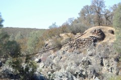
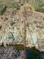
1864: Franklin
Franklin, Pennsylvania, USA - Allegheny River
| Bridgemeister ID: | 3186 (added 2019-11-09) |
| Year Completed: | 1864 |
| Name: | Franklin |
| Location: | Franklin, Pennsylvania, USA |
| Crossing: | Allegheny River |
| Principals: | John Murphy |
| References: | AAJ |
| Status: | Destroyed, 1870 |
Notes:
- 1870: Cable ends caught fire precipitating collapse, killing two.
1865: Market Street
Williamsport, Pennsylvania, USA - Susquehanna River
| Bridgemeister ID: | 64 (added before 2003) |
| Year Completed: | 1865 |
| Name: | Market Street |
| Location: | Williamsport, Pennsylvania, USA |
| Crossing: | Susquehanna River |
| Coordinates: | 41.237556 N 76.997861 W |
| Maps: | Acme, GeoHack, Google, OpenStreetMap |
| Principals: | Alfred P. Boller |
| References: | AAJ, JFI186604 |
| Use: | Vehicular |
| Status: | Destroyed, June 1, 1889 |
| Main Cables: | Wire (iron) |
| Suspended Spans: | 5 |
| Main Spans: | 5 x 61 meters (200 feet) |
Notes:
- JFI186604 (in which Boller mentions about the bridge's "peculiar system of trussing": "This general arrangement for suspension bridges was first practised by John Murphy, Esq., C.E., over the Gauley, in West Virginia, and also at Franklin, Pennsylvania.")
- Destroyed by flood June 1, 1889.
- Near 1878 Maynard Street - Williamsport, Pennsylvania, USA.
- Replaced by 1889 Market Street - Williamsport, Pennsylvania, USA.
- All past and present bridges at this location.
Image Sets:
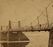
1866: Woodland Street
Nashville and Edgefield, Tennessee, USA - Cumberland River
| Bridgemeister ID: | 1965 (added 2005-11-20) |
| Year Completed: | 1866 |
| Name: | Woodland Street |
| Location: | Nashville and Edgefield, Tennessee, USA |
| Crossing: | Cumberland River |
| Coordinates: | 36.167528 N 86.776083 W |
| Maps: | Acme, GeoHack, Google, OpenStreetMap |
| References: | AAJ |
| Use: | Vehicular |
| Status: | Removed, 1884 |
| Main Cables: | Wire |
Notes:
1867: (suspension bridge)
Albuquerque, New Mexico, USA - Rio Grande
| Bridgemeister ID: | 5559 (added 2020-12-18) |
| Year Completed: | 1867 |
| Name: | (suspension bridge) |
| Location: | Albuquerque, New Mexico, USA |
| Crossing: | Rio Grande |
| Use: | Vehicular |
| Status: | Removed |
| Main Cables: | Wire |
Notes:
- Likely completed 1867.
External Links:
1867: John A. Roebling
Cincinnati, Ohio and Covington, Kentucky, USA - Ohio River
| Bridgemeister ID: | 65 (added before 2003) |
| Year Completed: | 1867 |
| Name: | John A. Roebling |
| Also Known As: | Cincinnati, Cincinnati and Covington |
| Location: | Cincinnati, Ohio and Covington, Kentucky, USA |
| Crossing: | Ohio River |
| Coordinates: | 39.09167 N 84.50833 W |
| Maps: | Acme, GeoHack, Google, OpenStreetMap |
| Principals: | John A. Roebling |
| References: | BAAW, BC3, BOB, BPL, COB, EOV, HBE, LAB, LACE, ONF, PTS2, SJR, TOB |
| Use: | Vehicular (two-lane), with walkway |
| Status: | Closed, February, 2021 (last checked: 2021) |
| Main Cables: | Wire (iron) |
| Suspended Spans: | 3 |
| Main Span: | 1 x 322.2 meters (1,057 feet) |
| Side Spans: | 2 |
Notes:
- 1892: Cable ends restored.
- 1899: Steel cables added to assist original cables.
- 2021, February: Closed to all vehicular traffic for a nine-month restoration project.
- Became longest suspension bridge by eclipsing 1849 Wheeling (Wheeling and Belmont) - Wheeling, West Virginia, USA.
- Eclipsed by new longest suspension bridge 1869 Clifton (Upper, Niagara-Clifton, Falls View, First Falls View) - Niagara Falls, New York, USA and Niagara Falls, Ontario, Canada.
External Links:
Image Sets:
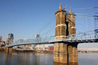
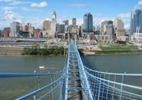
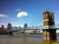
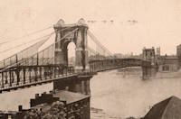
1867: Mosquito Road
Placerville, California, USA - South Fork American River
| Bridgemeister ID: | 2323 (added 2007-05-06) |
| Year Completed: | 1867 |
| Name: | Mosquito Road |
| Location: | Placerville, California, USA |
| Crossing: | South Fork American River |
| Coordinates: | 38.775791 N 120.748441 W |
| Maps: | Acme, GeoHack, Google, OpenStreetMap |
| Use: | Vehicular |
| Status: | Replaced |
| Main Cables: | Wire |
Notes:
- The February 23, 1995 edition of the Mountain Democrat (Placerville, California) has an article about the Mosquito crossing that mentions: "According to the El Dorado County History of 1883 by Paolo Sioli, 'Mosquito is connected to Placerville by a good wagon-road and a suspension bridge across the South Fork of the American River, a trail is running in the direction of Kelsey, the township center... The original bridge was constructed in 1867, and according to Orval Beckett, as quoted in the booklet, Mosquito Memories, 'This original bridge had no banisters on the sides. It was a suspension cable with No. 9 telephone wires strung between the supports. When you drove onto the bridge, it would 'swing and sway' much like we have seen in the movies. When one end went down the other went up, etc. Imagine the thrill!'"
- Replaced by 1939 Mosquito Road - Placerville, California, USA.
- All past and present bridges at this location.
External Links:
- Calisphere.org - Cable supports of suspension bridge across south fork of American River. Photo dated 1923, likely of the original Mosquito Road bridge.
1867: Public Garden
Boston, Massachusetts, USA - Public Garden lagoon
| Bridgemeister ID: | 245 (added before 2003) |
| Year Completed: | 1867 |
| Name: | Public Garden |
| Location: | Boston, Massachusetts, USA |
| Crossing: | Public Garden lagoon |
| Coordinates: | 42.354119 N 71.069920 W |
| Maps: | Acme, GeoHack, Google, OpenStreetMap |
| Principals: | William Gibbons Preston, Clemens Herschel |
| References: | HBE |
| Use: | Footbridge |
| Status: | In use (last checked: 2019) |
| Main Cables: | Eyebar (iron) |
| Suspended Spans: | 3 |
| Main Span: | 1 x 15.2 meters (50 feet) estimated |
| Side Spans: | 2 |
Notes:
- Often claimed to have been the shortest "functioning" suspension bridge up until 1921 when a steel girder was added as the primary means of support. However this was not true. There were shorter suspension bridges, some of which are still in existence. For example, see Schaukelbrücke Ilmpark completed in 1833, still in use as of the 2010s, and only 48.6 feet long. Likely the shortest functioning suspension bridge ever built was at Castle Bergedorf in Hamburg, Germany with a main span of 22.6 feet (6.9 meters).
External Links:
Image Sets:

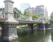
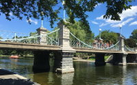
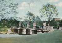
1868: Afton
Afton, New York, USA - Susquehanna River
| Bridgemeister ID: | 66 (added before 2003) |
| Year Completed: | 1868 |
| Name: | Afton |
| Location: | Afton, New York, USA |
| Crossing: | Susquehanna River |
| Coordinates: | 42.227167 N 75.524222 W |
| Maps: | Acme, GeoHack, Google, OpenStreetMap |
| Principals: | G. W. & J. V. V. Fishler, James Crowell |
| Use: | Vehicular |
| Status: | Removed |
| Main Cables: | Wire (iron) |
| Suspended Spans: | 1 |
| Main Span: | 1 x 110.3 meters (362 feet) |
| Deck width: | 16 feet |
Image Sets:
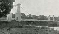
1868: Blue Lick Springs
Kentucky, USA - Licking River
| Bridgemeister ID: | 2659 (added 2019-03-09) |
| Year Completed: | 1868 |
| Name: | Blue Lick Springs |
| Location: | Kentucky, USA |
| Crossing: | Licking River |
| Coordinates: | 38.422314 N 83.999076 W |
| Maps: | Acme, GeoHack, Google, OpenStreetMap |
| Use: | Vehicular (one-lane) |
| Status: | Removed |
| Main Cables: | Wire |
| Suspended Spans: | 1 |
Notes:
- 1897: Replaced by two-span truss bridge that is still (as of 2019) at the same location. The truss bridge was built between the main suspension bridge cables and, apparently, the suspension bridge remained standing for several years.
1868: Calloway's Ford
Elizabethtown vicinity, Hamilton County, Ohio, USA - Whitewater River
| Bridgemeister ID: | 68 (added before 2003) |
| Year Completed: | 1868 |
| Name: | Calloway's Ford |
| Also Known As: | Whitewater, Harrison's |
| Location: | Elizabethtown vicinity, Hamilton County, Ohio, USA |
| Crossing: | Whitewater River |
| Coordinates: | 39.183116 N 84.792638 W |
| Maps: | Acme, GeoHack, Google, OpenStreetMap |
| Principals: | John Gray, Morse, Young |
| References: | EOV |
| Use: | Vehicular |
| Status: | Removed, 1920 |
| Main Cables: | Wire (iron) |
| Main Span: | 1 x 144.8 meters (475 feet) |
| Deck width: | 22 feet |
Notes:
- This bridge was located where present-day Suspension Bridge Road crosses the Whitewater River next to I-275 and north of US50. According to information provided by Sharon Lutz from Marjorie Byrnside Burress, this bridge was renamed "Harrison's Suspension Bridge" in 1891. This should not be confused with the nearby suspension bridge at Harrison.
- According to the information provided by Sharon Lutz from Marjorie Byrnside Burress, "Crossing this bridge was the main thoroughfare from Indiana into Ohio for many years (US 50 was not completed by then). [In 1920] it was decided that the Suspension Bridge had become obsolete and could no longer safely withstand the weight of vehicles. [On May 19, 1920] the cables were severed by means of an oxygen flame, the weight of the cables pulled down some towers. Other towers were weakened by dynamite at their bases and later they were pulled down by the weight of the cables severed at one end with an oxygen flame."
- See 1873 Harrison - Harrison, Ohio and Dearborn County, Indiana, USA.
Image Sets:
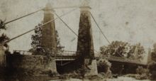
1868: Carpenter's Point
Port Jervis and Tristates, New York, USA - Neversink River
| Bridgemeister ID: | 2251 (added 2007-03-31) |
| Year Completed: | 1868 |
| Name: | Carpenter's Point |
| Also Known As: | Tristates |
| Location: | Port Jervis and Tristates, New York, USA |
| Crossing: | Neversink River |
| Coordinates: | 41.361194 N 74.685194 W |
| Maps: | Acme, GeoHack, Google, OpenStreetMap |
| Use: | Vehicular (one-lane) |
| Status: | Destroyed, 1904 |
| Main Cables: | Wire |
| Suspended Spans: | 1 |
1868: High Street
Hamilton, Ohio, USA - Great Miami River
| Bridgemeister ID: | 67 (added before 2003) |
| Year Completed: | 1868 |
| Name: | High Street |
| Also Known As: | Hamilton |
| Location: | Hamilton, Ohio, USA |
| Crossing: | Great Miami River |
| Coordinates: | 39.401444 N 84.565389 W |
| Maps: | Acme, GeoHack, Google, OpenStreetMap |
| Principals: | John Gray |
| References: | EOV |
| Use: | Vehicular |
| Status: | Removed |
| Main Cables: | Wire |
| Suspended Spans: | 1 |
External Links:
- Butler County Engineer's Office (BCOE). Mentions this bridge stood from 1866 through 1895.
1868: Wire
New Portland, Maine, USA - Carrabasset River
| Bridgemeister ID: | 69 (added before 2003) |
| Year Completed: | 1868 |
| Name: | Wire |
| Location: | New Portland, Maine, USA |
| Crossing: | Carrabasset River |
| Coordinates: | 44.890783 N 70.0925 W |
| Maps: | Acme, GeoHack, Google, OpenStreetMap |
| References: | BC3, BPL, GBD, LAB, RDH |
| Use: | Vehicular (one-lane) |
| Status: | In use (last checked: 2023) |
| Main Cables: | Wire (iron) |
| Suspended Spans: | 1 |
| Main Span: | 1 x 60.5 meters (198.4 feet) |
Notes:
- BPL says c. 1866. Historic landmark plaque at bridge also says 1866.
- Extensive repairs, 1960.
External Links:
Image Sets:
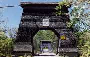
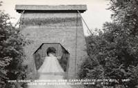
1869: (footbridge)
Salado, Texas, USA - Salado Creek
| Bridgemeister ID: | 920 (added 2003-10-18) |
| Year Completed: | 1869 |
| Name: | (footbridge) |
| Location: | Salado, Texas, USA |
| Crossing: | Salado Creek |
| At or Near Feature: | Salado College |
| Use: | Footbridge |
| Status: | Destroyed, 1913 |
| Main Cables: | Wire (iron) |
Notes:
- Destroyed by flood, 1913.
1869: Clifton
Niagara Falls, New York, USA and Niagara Falls, Ontario, Canada - Niagara River
| Bridgemeister ID: | 70 (added before 2003) |
| Year Completed: | 1869 |
| Name: | Clifton |
| Also Known As: | Upper, Niagara-Clifton, Falls View, First Falls View |
| Location: | Niagara Falls, New York, USA and Niagara Falls, Ontario, Canada |
| Crossing: | Niagara River |
| Coordinates: | 43.089722 N 79.069694 W |
| Maps: | Acme, GeoHack, Google, OpenStreetMap |
| Principals: | Samuel Keefer |
| References: | AAJ, BPL, HBE, PTS2 |
| Use: | Vehicular |
| Status: | Replaced, 1889 |
| Main Cables: | Wire (iron) |
| Main Span: | 1 x 386.6 meters (1,268.3 feet) |
| Deck width: | 10 feet |
Notes:
- Opened January 2nd, 1869. Wooden towers replaced with steel towers, 1884. Widened to 17 feet, 1888. Wrecked by wind, January, 1889. Some of the images here may show the replacement bridge.
- Became longest suspension bridge by eclipsing 1867 John A. Roebling (Cincinnati, Cincinnati and Covington) - Cincinnati, Ohio and Covington, Kentucky, USA.
- Eclipsed by new longest suspension bridge 1883 Brooklyn (Great East River) - New York and Brooklyn, New York, USA.
- Replaced by 1889 Second Falls View (Upper) - Niagara Falls, New York, USA and Niagara Falls, Ontario, Canada.
- All past and present bridges at this location.
External Links:
Image Sets:
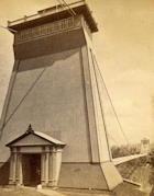
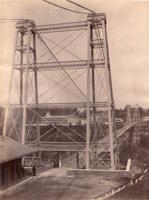
1869: Lordville
Lordville, New York and Equinunk, Pennsylvania, USA - Delaware River
| Bridgemeister ID: | 71 (added before 2003) |
| Year Completed: | 1869 |
| Name: | Lordville |
| Location: | Lordville, New York and Equinunk, Pennsylvania, USA |
| Crossing: | Delaware River |
| Coordinates: | 41.867938 N 75.213785 W |
| Maps: | Acme, GeoHack, Google, OpenStreetMap |
| Principals: | E.F. Farrington |
| References: | BDR, BOL, PTS2 |
| Use: | Vehicular (one-lane) |
| Status: | Destroyed, 1903 |
| Main Cables: | Wire (iron) |
Notes:
- Destroyed by flood 1903.
- Replaced by 1904 Lordville-Equinunk - Lordville, New York and Equinunk, Pennsylvania, USA.
- All past and present bridges at this location.
Image Sets:
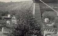
1869: Swinging
Warren and Glade, Pennsylvania, USA - Conewango Creek
| Bridgemeister ID: | 1623 (added 2005-02-27) |
| Year Completed: | 1869 |
| Name: | Swinging |
| Location: | Warren and Glade, Pennsylvania, USA |
| Crossing: | Conewango Creek |
| Coordinates: | 41.847389 N 79.141000 W |
| Maps: | Acme, GeoHack, Google, OpenStreetMap |
| Use: | Footbridge |
| Status: | Replaced, 1904 |
| Main Cables: | Wire (iron) |
Notes:
- Coordinates indicate approximate original location of the bridge.
- Destroyed by storm soon after completion and rebuilt.
- Images of America: Warren by Jodi L. Brandon shows an image of this bridge with a caption stating the bridge was moved to Kelletville (in Forest County, Pennsylvania) in 1906.
Image Sets:
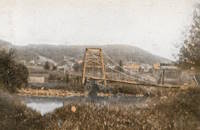
1869: Waco
Waco, Texas, USA - Brazos River
| Bridgemeister ID: | 72 (added before 2003) |
| Year Completed: | 1869 |
| Name: | Waco |
| Location: | Waco, Texas, USA |
| Crossing: | Brazos River |
| Coordinates: | 31.561314 N 97.127063 W |
| Maps: | Acme, GeoHack, Google, OpenStreetMap |
| Principals: | Thomas M. Griffith |
| References: | AAJ, BC3, BPL, BRAZ, GBD, HAERTX98, HBE, PTS2, WSB |
| Use: | Vehicular, with walkway |
| Status: | Restricted to foot traffic (last checked: 2023) |
| Main Cables: | Wire (iron) |
| Suspended Spans: | 1 |
| Main Span: | 1 x 144.8 meters (475 feet) |
| Deck width: | 18 feet |
Notes:
- 1915: Rebuilt.
- 2020, October: Closed for restoration project expecting to last 18-24 months.
- 2021, March: Major restoration project underway, led by Sparks Engineering, Inc.
- 2023, April: The restored bridge is rededicated on April 22. Patrick Sparks of Sparks Engineering reports: . The rededication was held April 22, 2023. "The project involved full rehabilitation including: replacement of the suspension system and anchor rods, strengthening of the anchorages, replacement of the saddle bearings, retrofit strengthening of the east tower, and deck replacement (concrete on the main deck, tropical hardwood on the side walks)."
External Links:
Image Sets:
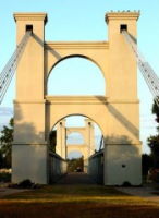
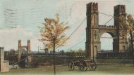
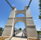
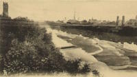
1870: (footbridge)
Rockford, Illinois, USA - Kent Creek
| Bridgemeister ID: | 594 (added 2003-01-11) |
| Year Completed: | 1870 |
| Name: | (footbridge) |
| Location: | Rockford, Illinois, USA |
| Crossing: | Kent Creek |
| At or Near Feature: | Tinker Swiss Cottage Museum |
| Principals: | Robert Tinker |
| Use: | Footbridge |
| Status: | Removed, 1976 |
Notes:
- Ground broken on replacement, October 6, 2004.
- Later at same location 2005 (footbridge) - Rockford, Illinois, USA.
- All past and present bridges at this location.
1870: Chehocton
Hancock, New York and Wayne County, Pennsylvania, USA - East Branch Delaware River
| Bridgemeister ID: | 284 (added before 2003) |
| Year Completed: | 1870 |
| Name: | Chehocton |
| Location: | Hancock, New York and Wayne County, Pennsylvania, USA |
| Crossing: | East Branch Delaware River |
| Coordinates: | 41.952583 N 75.278167 W |
| Maps: | Acme, GeoHack, Google, OpenStreetMap |
| Principals: | E.F. Farrington, John A. Roebling's Sons Co. |
| Use: | Vehicular |
| Status: | Removed, 1937 |
| Main Cables: | Wire (iron) |
| Suspended Spans: | 1 |
| Main Span: | 1 x 144.8 meters (475 feet) estimated |
Notes:
- Crossed the East Branch Delaware River on an alignment indicated by the current Old Bridge Street, between the rail crossing and the current (2020s) Stockport Road bridge.
- Replaced 1937.
Image Sets:
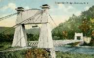
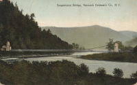
Do you have any information or photos for these bridges that you would like to share? Please email david.denenberg@bridgemeister.com.
Mail | Facebook | X (Twitter) | Bluesky