Suspension Bridges of USA (401-500 of 1,437)
This is a list of bridges 401 through 500 (of 1,437 total) from the suspension bridge inventory for the country USA. Wherever you see a Bridgemeister ID number click it to isolate the bridge on its own page.
Related Lists:
1939: Mosquito Road
Placerville, California, USA - South Fork American River
| Bridgemeister ID: | 346 (added before 2003) |
| Year Completed: | 1939 |
| Name: | Mosquito Road |
| Location: | Placerville, California, USA |
| Crossing: | South Fork American River |
| Coordinates: | 38.77582 N 120.74854 W |
| Maps: | Acme, GeoHack, Google, OpenStreetMap |
| Use: | Vehicular (one-lane) |
| Status: | In use (last checked: 2021) |
| Main Cables: | Wire (steel) |
| Suspended Spans: | 1 |
Notes:
External Links:

1939: Regency
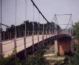
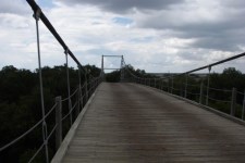
Regency, Texas, USA - Colorado River
| Bridgemeister ID: | 195 (added before 2003) |
| Year Completed: | 1939 |
| Name: | Regency |
| Location: | Regency, Texas, USA |
| Crossing: | Colorado River |
| Coordinates: | 31.41167 N 98.84667 W |
| Maps: | Acme, GeoHack, Google, OpenStreetMap |
| Principals: | Austin Bridge Co. |
| References: | AUB |
| Use: | Vehicular (one-lane) |
| Status: | In use (last checked: 2008) |
| Main Cables: | Wire (steel) |
| Suspended Spans: | 1 |
| Main Span: | 1 x 103.6 meters (340 feet) |
Notes:
- Similar to 1939 (suspension bridge) - Bend, Texas, USA.
External Links:
1939: Sullivan-Hutsonville
Hutsonville, Illinois and Sullivan, Indiana, USA - Wabash River
| Bridgemeister ID: | 196 (added before 2003) |
| Year Completed: | 1939 |
| Name: | Sullivan-Hutsonville |
| Location: | Hutsonville, Illinois and Sullivan, Indiana, USA |
| Crossing: | Wabash River |
| Coordinates: | 39.1101 N 87.6551 W |
| Maps: | Acme, GeoHack, Google, OpenStreetMap |
| Principals: | Steinman & Robinson, R.V. Milbank, Wisconsin Bridge & Iron Co., Charles J. Glasgow |
| References: | AAJ, BPL, IMB, SJR19880926 |
| Use: | Vehicular (two-lane), with walkway |
| Status: | Demolished, 1989 |
| Main Cables: | Wire (steel) |
| Suspended Spans: | 3 |
| Main Span: | 1 x 106.7 meters (350 feet) |
| Side Spans: | 2 x 45.7 meters (150 feet) |
| Deck width: | 20 feet |
| Characteristics: | Self-anchored |
Notes:
- Demolished 1989. This bridge was Steinman's attempt at a self-anchored suspension bridge and met a controversial demise in 1989. An article in the September 26, 1988 issue of the Springfield, IL "The State Journal-Register" describes the ongoing controversy. The company to which the $100,000 demolition contract was let offered to turn the money over to save the bridge. The locals agreed, but the company's Chief Engineer Stephen Schneider was quoted, "I think Indiana really wants to tear it down. They've been ... forced to send inspectors out every two weeks. I think they just want the headache gone." Gary Abell, spokesman for the Indiana Dept. Of Highways said its design is "not one of the best. It works in theory, but not in practice. This is like trying to save a mistake." After a lot of back-and-forth, the locals gave up, "We've had it with them. We don't want anything more to do with it. They can tear the damn thing down." Animosity toward this bridge continues 13 years after its demolition. In 2002, in an email to Wayne Grodkiewicz (who provided me with much information about this bridge), an INDOT representative said, "I am not sure why you are interested in that bridge, but from our stand point, it was a very poorly designed bridge that had many many problems from the day that it was completed, until it was brought down."
External Links:
1939: Swinging
Tishomingo State Park, Mississippi, USA - Bear Creek
| Bridgemeister ID: | 850 (added 2003-07-27) |
| Year Completed: | 1939 |
| Name: | Swinging |
| Location: | Tishomingo State Park, Mississippi, USA |
| Crossing: | Bear Creek |
| Coordinates: | 34.605183 N 88.17955 W |
| Maps: | Acme, GeoHack, Google, OpenStreetMap |
| Use: | Footbridge |
| Status: | In use (last checked: 2020) |
| Main Cables: | Wire (steel) |
| Suspended Spans: | 1 |
| Main Span: | 1 x 57.9 meters (190 feet) estimated |
Notes:
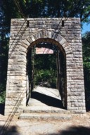
- Likely built by the CCC, this bridge has an interesting zig-zag pattern of suspenders. The suspenders are inclined and are continuous across the bridge like a shoelace with one set of eyelets at deck level and the other set of eyelets along the main cables.
1940: (pipeline bridge)
Sioux City, Iowa and Dakota City vicinity, Nebraska, USA - Missouri River
| Bridgemeister ID: | 2252 (added 2007-03-31) |
| Year Completed: | 1940 |
| Name: | (pipeline bridge) |
| Location: | Sioux City, Iowa and Dakota City vicinity, Nebraska, USA |
| Crossing: | Missouri River |
| Coordinates: | 42.43842 N 96.38387 W |
| Maps: | Acme, GeoHack, Google, OpenStreetMap |
| References: | AAJ |
| Use: | Pipeline |
| Status: | Removed, 2005 |
| Main Cables: | Wire (steel) |
| Main Span: | 1 x 404 meters (1,325.5 feet) estimated |
Notes:
- Large pipeline suspension bridge located near the Big Soo terminal.
External Links:
1940: Clear Creek Swinging
Pyatt vicinity, Arkansas, USA - Clear Creek
| Bridgemeister ID: | 1954 (added 2005-11-04) |
| Year Completed: | 1940 |
| Name: | Clear Creek Swinging |
| Location: | Pyatt vicinity, Arkansas, USA |
| Crossing: | Clear Creek |
| Coordinates: | 36.2098 N 92.8598 W |
| Maps: | Acme, GeoHack, Google, OpenStreetMap |
| Principals: | WPA |
| Use: | Vehicular |
| Status: | Replaced, 1975 |
| Main Cables: | Wire (steel) |
| Suspended Spans: | 1 |
External Links:
1940: H. Wallace Caldwell Memorial
Riverside, Illinois, USA - Des Plaines River
| Bridgemeister ID: | 775 (added 2003-03-14) |
| Year Completed: | 1940 |
| Name: | H. Wallace Caldwell Memorial |
| Also Known As: | Swinging |
| Location: | Riverside, Illinois, USA |
| Crossing: | Des Plaines River |
| Coordinates: | 41.826083 N 87.8176 W |
| Maps: | Acme, GeoHack, Google, OpenStreetMap |
| Use: | Footbridge |
| Status: | In use (last checked: 2021) |
| Main Cables: | Wire (steel) |
| Suspended Spans: | 1 |
| Main Span: | 1 x 64 meters (210 feet) estimated |
Notes:
- 2002, August 26-27: Deck replaced.
- 2023, March: Project to repaint the bridge expected to start, correcting issues with prior repainting efforts.
- Replaced 1905 Swinging - Riverside, Illinois, USA.
Annotated Citations:
- Uphues, Bob. "Riverside Township confounded in effort to repaint bridge." Riverside-Brookfield Landmark, 19 October 2021, https://www.rblandmark.com/2021/10/19/riverside-township-confounded-in-effort-to-repaint-bridge/
"What was thought to be a pretty straightforward project to refurbish the 210-foot long H. Wallace Caldwell Memorial Bridge – known to local residents as the Swinging Bridge – has turned into something of a nightmare for the Riverside Township Board of Trustees… It turns out that not only was the $75,000 earmarked in the 2021-22 budget far below what it’s going to take to do the job, the township board has had trouble getting companies to even submit bids."
- Uphues, Bob. "Riverside Township confounded in effort to repaint bridge." Riverside-Brookfield Landmark, 21 March 2023, https://www.rblandmark.com/2023/03/21/swinging-bridge-overhaul-set-to-start-in-late-march/
"A long-awaited project to overhaul the painted surfaces of the Swinging Bridge will start March 27 after Riverside Township trustees voted 4-0 on March 14 to approve an ordinance announcing their intention to issue up to $500,000 in alternate revenue bonds to fund the work…"

1940: Hawkins Bar
Trinity Village and Hawkins Bar, California, USA - Trinity River
| Bridgemeister ID: | 2343 (added 2007-08-12) |
| Year Completed: | 1940 |
| Name: | Hawkins Bar |
| Location: | Trinity Village and Hawkins Bar, California, USA |
| Crossing: | Trinity River |
| Use: | Vehicular |
| Status: | Removed |
| Main Cables: | Wire |
Notes:
- Deck destroyed by fire 1954. Repaired and reopened, 1956. Bypassed late 1970s or 1980.
- May have been the site of a previous suspension bridge completed 1904.
- See (suspension bridge) - Salyer and Willow Creek, California, USA.
- See (suspension bridge) - Willow Creek vicinity, California, USA.
1940: Nolan Toll
Nolan, West Virginia and Pike County, Kentucky, USA - Tug Fork River
| Bridgemeister ID: | 2239 (added 2007-03-27) |
| Year Completed: | 1940 |
| Name: | Nolan Toll |
| Location: | Nolan, West Virginia and Pike County, Kentucky, USA |
| Crossing: | Tug Fork River |
| Coordinates: | 37.73986 N 82.33125 W |
| Maps: | Acme, GeoHack, Google, OpenStreetMap |
| Use: | Vehicular |
| Status: | Only towers remain (last checked: 2009) |
Notes:
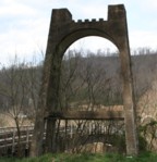
- The suspension bridge, and later the current adjacent beam and girder bridge, are privately owned and were previously operated as toll bridges. The current bridge was closed by West Virginia in late 2007.
- Ron Thompson, a member of the family who owns these structures (the suspension bridge formerly, and now the current crossing) writes: "This was a private toll bridge constructed beginning in 1939 by the Big Creek Bridge Company, a privately held corporation headquartered first in Nolan, then in Williamson. The replacement bridge next to it was constructed by the same entity. My father, along with other relatives, inherited most of the corporate stock, and for the last several years he has owned it in its entirety... My grandfather built the original suspension bridge primarily to provide a way to get coal from the surrounding hills in Pike and Martin County, Kentucky to tipples and markets in West Virginia."
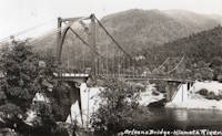
1940: Orleans
Orleans, California, USA - Klamath River
| Bridgemeister ID: | 197 (added before 2003) |
| Year Completed: | 1940 |
| Name: | Orleans |
| Location: | Orleans, California, USA |
| Crossing: | Klamath River |
| Principals: | C.H. Purcell, Murphy Pacific Co. |
| References: | BPL, WOT |
| Status: | Destroyed, 1965 |
Notes:
- BPL: Washed away during 1965 floods. An article in the September 13, 1966 edition of the Humboldt Standard says it was destroyed by flood in 1964.
- Replaced 1912 Orleans - Orleans, California, USA.
- Replaced by 1967 Orleans - Orleans, California, USA.
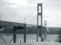
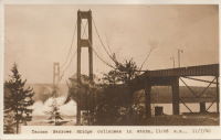
1940: Tacoma Narrows
Tacoma and Gig Harbor, Washington, USA - Puget Sound
| Bridgemeister ID: | 198 (added before 2003) |
| Year Completed: | 1940 |
| Name: | Tacoma Narrows |
| Also Known As: | Galloping Gertie |
| Location: | Tacoma and Gig Harbor, Washington, USA |
| Crossing: | Puget Sound |
| Coordinates: | 47.267015 N 122.548462 W |
| Maps: | Acme, GeoHack, Google, OpenStreetMap |
| Principals: | Leon Moisseiff |
| References: | AAJ, BAR, BBR, BFL, BMA, BPL, COB, CTT, GBD, IT1999F, SPW |
| Use: | Vehicular (two-lane, heavy vehicles), with walkway |
| Status: | Collapsed, 1940 |
| Main Cables: | Wire (steel) |
| Suspended Spans: | 3 |
| Main Span: | 1 x 853.4 meters (2,800 feet) |
| Side Spans: | 2 x 335.3 meters (1,100 feet) |
| Deck width: | 39 feet |
Notes:
- Famously destroyed by wind, November 7, 1940.
- Replaced by 1950 Tacoma Narrows (Sturdy Gertie, Second Tacoma Narrows) - Tacoma and Gig Harbor, Washington, USA.
- See 1944 Liard River - Liard River Hot Springs vicinity, British Columbia, Canada. According to CTT, "Two sections from the Tacoma bridge's east approach were [re]used in the Liard span."
External Links:



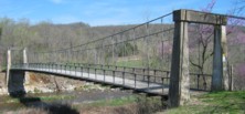
1941: Haggard Ford
Harrison vicinity, Arkansas, USA - Bear Creek
| Bridgemeister ID: | 199 (added before 2003) |
| Year Completed: | 1941 |
| Name: | Haggard Ford |
| Location: | Harrison vicinity, Arkansas, USA |
| Crossing: | Bear Creek |
| Coordinates: | 36.3458 N 93.1305 W |
| Maps: | Acme, GeoHack, Google, OpenStreetMap |
| Principals: | WPA, Jess Chaney |
| Use: | Vehicular (one-lane) |
| Status: | Restricted to foot traffic (last checked: 2007) |
| Main Cables: | Wire (steel) |
| Suspended Spans: | 1 |
| Main Span: | 1 x 48.8 meters (160 feet) |
Notes:
- Located about eight miles north of Harrison. According to plaque at bridge, restored 1977.
- Gene McCluney writes: "I visited this bridge [in the Summer of 2007] and talked to an adjacent landowner a couple weeks ago. It seems this bridge was closed in 1962 due to instability in one of the piers, and the crossing reverted to a ford or low water crossing until about four years ago when the new vehicular bridge was built. So, there was a suspension bridge in-use there for 20 years, then 40 years of "low water" type crossing, then just recently a new vehicle bridge."
- Similar to (suspension bridge) - Leslie vicinity, Arkansas, USA.
External Links:
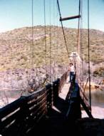
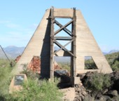
1943: Sheep
Sheep Crossing (Cave Creek vicinity), Arizona, USA - Verde River
| Bridgemeister ID: | 201 (added before 2003) |
| Year Completed: | 1943 |
| Name: | Sheep |
| Also Known As: | Red Point Sheep, Verde River Sheep |
| Location: | Sheep Crossing (Cave Creek vicinity), Arizona, USA |
| Crossing: | Verde River |
| Coordinates: | 34.077674 N 111.707743 W |
| Maps: | Acme, GeoHack, Google, OpenStreetMap |
| Principals: | Flagstaff Sheep Co., Cyril O. Gilliam, Frank Auza, George W. Smith. |
| References: | HAERAZ10 |
| Use: | Footbridge and Stock |
| Status: | Replaced, 1988 |
| Main Cables: | Wire |
| Main Span: | 1 x 145.1 meters (476 feet) |
| Deck width: | 3 feet |
Notes:
- From a sign at the site: "The Old Verde River Sheep Bridge. The original Verde River Sheep Bridge, also known as the Red Point Sheep Bridge, was constructed at this location in 1943 by Flagstaff Sheep Company, which had been grazing sheep in the area under a Forest Service permit since 1926....
"Erected with hand tools and a few mules during World War II, the bridge was constructed largely with salvaged materials. Overall length of the structure from cable anchorage to cable anchorage was 691 feet, and the distance between the towers was 568 feet. The walkway was 476 feet long and three feet wide. The towers originally were constructed with wood, as was the walkway. Soon after the bridge was completed, the wooden towers were reinforced with concrete buttresses. Each main suspension cable consisted of a pair of... lock-coil, spiral strands, which were obtained from an abandoned tramway that carted copper ore.... Only the towers of the old bridge remain.
"Although several other bridges of this type previously had been built in Arizona, Verde River Sheep Bridge was the last of its kind in the Southwest when it was entered into the National Register of Historic Places in 1978. In 1988, weakened by years of service and floods, the bridge was disassembled. In 1989 the bridge found here today was erected. Reminiscent of the original structure, the new bridge recalls the ingenuity of the pioneer sheepmen and a way of ranching that has virtually disappeared from the Arizona scene." - Many remnants from this bridge are still visible at the site.
- Replaced by 1989 Sheep - Sheep Crossing (Cave Creek vicinity), Arizona, USA.
1943: Swinging
Allison, Arkansas, USA - South Sylamore Creek
| Bridgemeister ID: | 5857 (added 2021-05-15) |
| Year Completed: | 1943 |
| Name: | Swinging |
| Location: | Allison, Arkansas, USA |
| Crossing: | South Sylamore Creek |
| Coordinates: | 35.935874 N 92.121329 W |
| Maps: | Acme, GeoHack, Google, OpenStreetMap |
| Use: | Vehicular (one-lane) |
| Status: | Destroyed, December 3, 1982 |
| Main Cables: | Wire (steel) |
| Suspended Spans: | 1 |
Notes:
- 1982, December 3: Mostly destroyed by flood.
- Replaced 1914 Swinging - Allison, Arkansas, USA.
- Replaced by 1985 Sylamore Creek (Swinging) - Allison, Arkansas, USA.
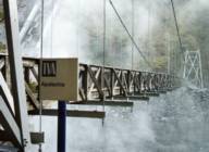
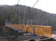
1945: TVA Apalachia
Reliance vicinity, Tennessee, USA - Hiwassee River
| Bridgemeister ID: | 790 (added 2003-03-22) |
| Year Completed: | 1945 |
| Name: | TVA Apalachia |
| Location: | Reliance vicinity, Tennessee, USA |
| Crossing: | Hiwassee River |
| Coordinates: | 35.18269 N 84.43894 W |
| Maps: | Acme, GeoHack, Google, OpenStreetMap |
| Use: | Footbridge |
| Status: | In use (last checked: 2022) |
| Main Cables: | Wire (steel) |
| Suspended Spans: | 1 |
| Main Span: | 1 x 120.4 meters (395 feet) |
Notes:
- Patrick S. O'Donnell notes this footbridge is large, "its main span is 395 feet with 455 feet between the towers, as [one] tower is set back from the end of the deck."
- Rebuilt 1975 and again in 2008.
External Links:
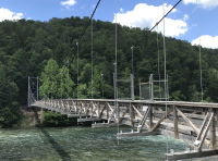
1947: Hal Adams
Mayo vicinity and Luraville, Florida, USA - Suwannee River
| Bridgemeister ID: | 203 (added before 2003) |
| Year Completed: | 1947 |
| Name: | Hal Adams |
| Location: | Mayo vicinity and Luraville, Florida, USA |
| Crossing: | Suwannee River |
| Coordinates: | 30.099 N 83.1715 W |
| Maps: | Acme, GeoHack, Google, OpenStreetMap |
| Principals: | Florida DOT |
| Use: | Vehicular |
| Status: | In use (last checked: 2021) |
| Main Cables: | Wire (steel) |
| Suspended Spans: | 1 |
| Main Span: | 1 x 128 meters (420 feet) |
External Links:
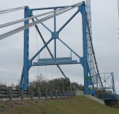
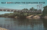
1947: Lumberville-Raven Rock
Lumberville, Pennsylvania and Bulls Island State Park, New Jersey, USA - Delaware River
| Bridgemeister ID: | 204 (added before 2003) |
| Year Completed: | 1947 |
| Name: | Lumberville-Raven Rock |
| Also Known As: | Bulls Island |
| Location: | Lumberville, Pennsylvania and Bulls Island State Park, New Jersey, USA |
| Crossing: | Delaware River |
| Coordinates: | 40.407017 N 75.038183 W |
| Maps: | Acme, GeoHack, Google, OpenStreetMap |
| Principals: | John A. Roebling's Sons Co. |
| References: | BDR, BONJ, SSB |
| Use: | Footbridge |
| Status: | In use (last checked: 2007) |
| Main Cables: | Wire (steel) |
| Suspended Spans: | 5 |
| Main Spans: | 5 |
| Characteristics: | Braced (trussed) chain/cable, Hinged cables |
Notes:
- SSB has an old picture of the bridge from a "Roebling publication". The original caption inside the picture says: "Practical application of Roebling Bridge research is the Lumberville footbridge which spans the Delaware River about twenty miles above Trenton. Pictured below, it utilizes four slabs of Roebling prestressed concrete and the Roebling-developed cable stiffening principle for the first time in the Western Hemisphere." and the authors of SSB go on to describe it asa "two-hinged braced cable suspension footbridge."
External Links:
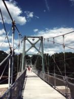
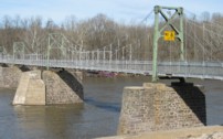
1947: Mitchell County Bridge 223
Red Hill vicinity, North Carolina, USA - Big Rock Creek
| Bridgemeister ID: | 788 (added 2003-03-22) |
| Year Completed: | 1947 |
| Name: | Mitchell County Bridge 223 |
| Location: | Red Hill vicinity, North Carolina, USA |
| Crossing: | Big Rock Creek |
| Coordinates: | 36.04363 N 82.22528 W |
| Maps: | Acme, GeoHack, Google, OpenStreetMap |
| Principals: | North Carolina Bridge Maintenance Unit |
| Use: | Footbridge |
| Status: | In use (last checked: 2018) |
| Main Cables: | Wire (steel) |
| Suspended Spans: | 1 |
| Main Span: | 1 x 28.2 meters (92.5 feet) |
Notes:
- From the NCDOT page about this bridge: "According to state records, the western deadman was replaced in 2002 along with several hangers. The anchor cable at the deadman was replaced in 1974, but otherwise records do not identify any major repairs to or rebuilding of the structure."
External Links:
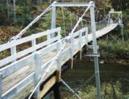
1948: (footbridge)
Chattanooga, Tennessee, USA - South Chickamauga Creek
| Bridgemeister ID: | 248 (added before 2003) |
| Year Completed: | 1948 |
| Name: | (footbridge) |
| Location: | Chattanooga, Tennessee, USA |
| Crossing: | South Chickamauga Creek |
| At or Near Feature: | Elise Chapin Wildlife Sanctuary |
| Coordinates: | 34.99694 N 85.18442 W |
| Maps: | Acme, GeoHack, Google, OpenStreetMap |
| Use: | Footbridge |
| Status: | Destroyed, July 16, 2000 |
Notes:
- Destroyed by falling tree, July 16, 2000.
- Replaced by 2001 (footbridge) - Chattanooga, Tennessee, USA.
1948: Kapaia
Kapaia, Hawaii, USA - Hanamaulu Stream
| Bridgemeister ID: | 2470 (added 2008-12-20) |
| Year Completed: | 1948 |
| Name: | Kapaia |
| Location: | Kapaia, Hawaii, USA |
| Crossing: | Hanamaulu Stream |
| Coordinates: | 21.990740 N 159.364568 W |
| Maps: | Acme, GeoHack, Google, OpenStreetMap |
| Use: | Footbridge |
| Status: | Replaced, 2018 |
| Main Cables: | Wire |
| Suspended Spans: | 1 |
Notes:
- Replaced in 2018 with a replica structure after having been derelict and falling into increasing disrepair since 2006.
- Replaced by 2018 Kapaia - Kapaia, Hawaii, USA.
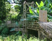
| Bridgemeister ID: | 2087 (added 2006-06-24) |
| Year Completed: | 1949 |
| Name: | (footbridge) |
| Location: | Minneapolis, Minnesota, USA |
| At or Near Feature: | University of Minnesota |
| Principals: | Joseph A. Wise, Mid-West Engineering Inc. |
| Use: | Footbridge |
| Status: | Dismantled |
| Main Cables: | Wire |
| Suspended Spans: | 1 |
Notes:
- Crossed railroad tracks near Bierman Field on University of Minnesota campus.
- Moved to Dinkytown ("M" Bridge) - Minneapolis, Minnesota, USA. The bridge was moved to another location on the University of Minnesota campus.
1949: (pipeline bridge)
Purcell vicinity, Oklahoma, USA - Canadian River
| Bridgemeister ID: | 1447 (added 2004-07-31) |
| Year Completed: | 1949 |
| Name: | (pipeline bridge) |
| Location: | Purcell vicinity, Oklahoma, USA |
| Crossing: | Canadian River |
| Principals: | Austin Bridge Co. |
| References: | AUB |
| Use: | Pipeline |
| Main Cables: | Wire (steel) |
Notes:
- Unusual for a pipeline suspension bridge, this bridge has at least two main spans.
1949: Beaver
Beaver, Arkansas, USA - White River
| Bridgemeister ID: | 200 (added before 2003) |
| Year Completed: | 1949 |
| Name: | Beaver |
| Location: | Beaver, Arkansas, USA |
| Crossing: | White River |
| At or Near Feature: | Table Rock Reservoir |
| Coordinates: | 36.4708 N 93.76856 W |
| Maps: | Acme, GeoHack, Google, OpenStreetMap |
| Principals: | Pioneer Construction Co., Arkansas State Highway Department |
| Use: | Vehicular (one-lane) |
| Status: | Closed, October, 2021 (last checked: 2021) |
| Main Cables: | Wire (steel) |
| Suspended Spans: | 3 |
| Main Span: | 1 x 95.1 meters (312 feet) |
| Side Spans: | 2 x 32 meters (105 feet) |
| Deck width: | 11.1 feet |
Notes:
- 1981: Deck replaced.
- 1990: Added to National Register of Historic Places
- 2002: Deck replaced.
- 2020: Timber deck and railings replaced, September.
- 2021, October: Closed again for repairs.
External Links:
- Historic Bridges of the United States - Beaver Bridge - Carroll County, Arkansas. States bridge was completed in 1949.
- Structurae - Structure ID 20012249
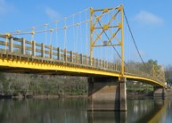
1949: Higden
Higden vicinity, Arkansas, USA - Little Red River
| Bridgemeister ID: | 1821 (added 2005-05-21) |
| Year Completed: | 1949 |
| Name: | Higden |
| Location: | Higden vicinity, Arkansas, USA |
| Crossing: | Little Red River |
| Use: | Vehicular |
| Status: | Removed |
| Main Cables: | Wire (steel) |
| Suspended Spans: | 1 |
Notes:
- The Arkansas History Commission's image archive contains an image of this bridge. The abstract mentions the bridge "is a temporary 'low-water' bridge built when the old suspension bridge nearby was declared unsafe"
1950: (footbridge)
Ellamore, West Virginia, USA - Middle Fork River
| Bridgemeister ID: | 1186 (added 2004-01-24) |
| Year Completed: | 1950 |
| Name: | (footbridge) |
| Location: | Ellamore, West Virginia, USA |
| Crossing: | Middle Fork River |
| At or Near Feature: | Boy Scout Camp Mahonegon |
| Coordinates: | 38.950796 N 80.073675 W |
| Maps: | Acme, GeoHack, Google, OpenStreetMap |
| Use: | Footbridge |
| Status: | In use (last checked: 2007) |
| Main Cables: | Wire |
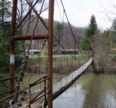
1950: (pipeline bridge)
Clanton vicinity, Alabama, USA - Coosa River
| Bridgemeister ID: | 1446 (added 2004-07-31) |
| Year Completed: | 1950 |
| Name: | (pipeline bridge) |
| Location: | Clanton vicinity, Alabama, USA |
| Crossing: | Coosa River |
| Coordinates: | 32.794583 N 86.429267 W |
| Maps: | Acme, GeoHack, Google, OpenStreetMap |
| Principals: | Austin Bridge Co. |
| References: | AUB |
| Use: | Pipeline |
| Status: | Extant (last checked: 2005) |
| Main Cables: | Wire (steel) |
| Suspended Spans: | 1 |
| Main Span: | 1 x 213.4 meters (700 feet) |
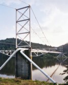
1950: Hyde Park
Hyde Park and Leechburg, Pennsylvania, USA - Kiskiminetas River
| Bridgemeister ID: | 776 (added 2003-03-15) |
| Year Completed: | 1950 |
| Name: | Hyde Park |
| Also Known As: | Walking |
| Location: | Hyde Park and Leechburg, Pennsylvania, USA |
| Crossing: | Kiskiminetas River |
| Coordinates: | 40.627633 N 79.59835 W |
| Maps: | Acme, GeoHack, Google, OpenStreetMap |
| References: | VND20050116 |
| Use: | Footbridge |
| Status: | In use (last checked: 2021) |
| Main Cables: | Wire (steel) |
| Suspended Spans: | 3 |
| Main Spans: | 1 x 47.5 meters (156 feet) estimated, 1 x 48.8 meters (160 feet) estimated, 1 x 47.9 meters (157 feet) estimated |
Notes:
- 2005-2008: Rehabilitation project improves access, approaches and adds a lighting system.
- Replaced 1937 Hyde Park Walking - Hyde Park and Leechburg, Pennsylvania, USA.
External Links:
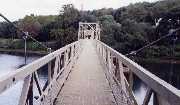
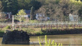
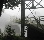
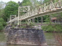
1950: Tacoma Narrows
Tacoma and Gig Harbor, Washington, USA - Puget Sound
| Bridgemeister ID: | 206 (added before 2003) |
| Year Completed: | 1950 |
| Name: | Tacoma Narrows |
| Also Known As: | Sturdy Gertie, Second Tacoma Narrows |
| Location: | Tacoma and Gig Harbor, Washington, USA |
| Crossing: | Puget Sound |
| Coordinates: | 47.270540 N 122.552895 W |
| Maps: | Acme, GeoHack, Google, OpenStreetMap |
| Principals: | Dexter R. Smith |
| References: | BBR, BC3, BCO, BFL, COB, CTT, SPW |
| Use: | Vehicular (major highway), with walkway |
| Status: | In use (last checked: 2022) |
| Main Cables: | Wire (steel) |
| Suspended Spans: | 3 |
| Main Span: | 1 x 853.4 meters (2,800 feet) |
| Side Spans: | 2 x 335.3 meters (1,100 feet) |
| Deck width: | 46f 8in |
Notes:
- Retrofit scheduled for completion, spring 2008.
- Replaced 1940 Tacoma Narrows (Galloping Gertie) - Tacoma and Gig Harbor, Washington, USA.
- Next to 2007 Third Tacoma Narrows - Tacoma and Gig Harbor, Washington, USA.
External Links:
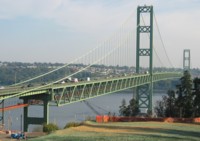

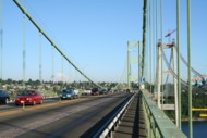
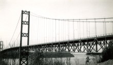
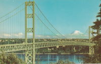
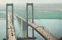
1951: Delaware Memorial I
New Castle, Delaware and Pennsville, New Jersey, USA - Delaware River
| Bridgemeister ID: | 207 (added before 2003) |
| Year Completed: | 1951 |
| Name: | Delaware Memorial I |
| Location: | New Castle, Delaware and Pennsville, New Jersey, USA |
| Crossing: | Delaware River |
| Coordinates: | 39.689227 N 75.520800 W |
| Maps: | Acme, GeoHack, Google, OpenStreetMap |
| Principals: | Homer R. Seely, Enoch R. Needles, Othmar Ammann, et. al. |
| References: | BONJ, BPL, CTD, GBD |
| Use: | Vehicular (major highway) |
| Status: | In use (last checked: 2022) |
| Main Cables: | Wire (steel) |
| Suspended Spans: | 3 |
| Main Span: | 1 x 655.3 meters (2,150 feet) |
| Side Spans: | 2 x 228.6 meters (750 feet) |
| Deck width: | 59.1 feet |
Notes:
External Links:
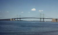
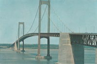
1951: Marias River
Chester vicinity, Montana, USA - Marias River
| Bridgemeister ID: | 6486 (added 2021-08-15) |
| Year Completed: | 1951 |
| Name: | Marias River |
| Also Known As: | Pugsley |
| Location: | Chester vicinity, Montana, USA |
| Crossing: | Marias River |
| Coordinates: | 48.291043 N 111.046520 W |
| Maps: | Acme, GeoHack, Google, OpenStreetMap |
| Use: | Vehicular |
| Status: | In use (last checked: 2021) |
| Main Cables: | Wire (steel) |
| Suspended Spans: | 1 |
| Main Span: | 1 x 88.4 meters (290 feet) |
| Characteristics: | Hinged cables |
Notes:
- Unconventional hinged suspension system with asymmetric cables.
- Similar to 1889 Fiorentini (Ferro, Soldo, Soldino) - Rome, Italy.
- Similar to 1936 Kindee - Kindee, Ellenborough vicinity, New South Wales, Australia.
- Similar to (footbridge) - Sarov (Саров), Nizhny Novgorod Oblast, Russia.
- Similar to Allan - Segenhoe, Scone vicinity, New South Wales, Australia.
- Similar to Ininskiy (Ининский) - Inya (Иня), Altai Republic, Russia.
- Similar to Reku Vel' - Solginskiy (Солгинский), Arkhangelsk Oblast, Russia.
External Links:
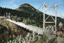
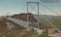
1952: Mile High Swinging
Grandfather Mountain, Linville, North Carolina, USA
| Bridgemeister ID: | 341 (added before 2003) |
| Year Completed: | 1952 |
| Name: | Mile High Swinging |
| Location: | Grandfather Mountain, Linville, North Carolina, USA |
| Coordinates: | 36.095054 N 81.832238 W |
| Maps: | Acme, GeoHack, Google, OpenStreetMap |
| Principals: | Charles Hartman, Jr. |
| References: | PQU, WSJ20060128 |
| Use: | Footbridge |
| Status: | In use (last checked: 2022) |
| Main Cables: | Wire (steel) |
| Suspended Spans: | 1 |
| Main Span: | 1 x 69.5 meters (228 feet) |
Notes:
- Major refurbishing, 1999, but soon after was wrecked by winds. WSJ20060128: "...winds blew it off its moorings. It might have been blown down the mountain if it hadn't wedged against the steel-frame supports." Reopened April 2000 with 21 new stabilizer cables on each side. Survived 200+ mph wind gust, January 2006.
External Links:
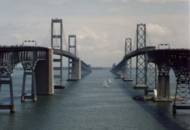
1952: William Preston Lane, Jr. Memorial I
Sandy Point, Maryland, USA - Chesapeake Bay
| Bridgemeister ID: | 208 (added before 2003) |
| Year Completed: | 1952 |
| Name: | William Preston Lane, Jr. Memorial I |
| Also Known As: | Chesapeake Bay |
| Location: | Sandy Point, Maryland, USA |
| Crossing: | Chesapeake Bay |
| Coordinates: | 38.993267 N 76.382312 W |
| Maps: | Acme, GeoHack, Google, OpenStreetMap |
| Principals: | J. E. Greiner |
| References: | GBD |
| Use: | Vehicular (major highway) |
| Status: | In use (last checked: 2022) |
| Main Cables: | Wire (steel) |
| Suspended Spans: | 3 |
| Main Span: | 1 x 487.7 meters (1,600 feet) |
| Side Spans: | 2 |
Notes:
External Links:
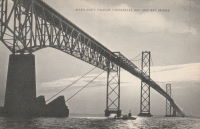
1953: (footbridge)
Richland Center, Wisconsin, USA - Pine Creek
| Bridgemeister ID: | 263 (added before 2003) |
| Year Completed: | 1953 |
| Name: | (footbridge) |
| Location: | Richland Center, Wisconsin, USA |
| Crossing: | Pine Creek |
| Coordinates: | 43.33931 N 90.39205 W |
| Maps: | Acme, GeoHack, Google, OpenStreetMap |
| Use: | Footbridge |
| Status: | In use (last checked: 2020) |
| Main Cables: | Wire (steel) |
| Suspended Spans: | 10 |
| Main Spans: | 8 x 22.9 meters (75 feet) estimated |
| Side Spans: | 1 x 9.8 meters (32 feet), 1 x 10.4 meters (34 feet) |
Notes:
- Long low-level footbridge across marshy Pine Creek. Larry Beranek writes: "A flood in Spring 1951, just after I was born, washed out the original bridge. The [current bridge pictured here] was built in 1953. The dam [mentioned here] is gone now so the river remains a trickle til heavy rains or snow melt beef it up as happened in September of [2007]. The water was up to the stringer which supports the walking surface and the police had it taped off so no one would go on it."
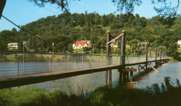
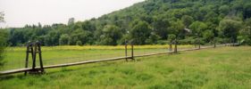
1953: Baring
Baring, Washington, USA - Skykomish River
| Bridgemeister ID: | 894 (added 2003-09-07) |
| Year Completed: | 1953 |
| Name: | Baring |
| Location: | Baring, Washington, USA |
| Crossing: | Skykomish River |
| Coordinates: | 47.765158 N 121.480893 W |
| Maps: | Acme, GeoHack, Google, OpenStreetMap |
| References: | SPW |
| Use: | Vehicular (one-lane) |
| Status: | In use (last checked: 2003) |
| Main Cables: | Wire (steel) |
| Suspended Spans: | 1 |
| Main Span: | 1 x 106.7 meters (350 feet) |
Notes:
- Towers replaced, 1958. Substantially rehabilitated 1978, 1993.
- Replaced 1899 Baring - Baring, Washington, USA.
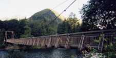
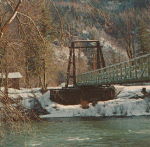
1953: Paseo
Kansas City, Missouri, USA - Missouri River
| Bridgemeister ID: | 636 (added 2003-02-02) |
| Year Completed: | 1953 |
| Name: | Paseo |
| Location: | Kansas City, Missouri, USA |
| Crossing: | Missouri River |
| Coordinates: | 39.122783 N 94.5661 W |
| Maps: | Acme, GeoHack, Google, OpenStreetMap |
| Use: | Vehicular (major highway) |
| Status: | Demolished, July, 2011 |
| Main Cables: | Wire (steel) |
| Suspended Spans: | 3 |
| Main Span: | 1 x 188.4 meters (618 feet) |
| Side Spans: | 2 |
| Characteristics: | Self-anchored |
Notes:
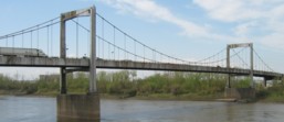
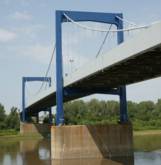
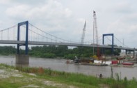
- Self-anchored. Carried I-29, I-35, and US71 across the Missouri River. Closed for several months in 2005 for major refurbishment. Reopened, September, 2005. Closed November, 2010. Demolished, July, 2011.
External Links:

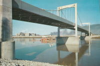
1953: Swinging
Thomson, Minnesota, USA - St. Louis River
| Bridgemeister ID: | 2104 (added 2006-08-19) |
| Year Completed: | 1953 |
| Name: | Swinging |
| Location: | Thomson, Minnesota, USA |
| Crossing: | St. Louis River |
| At or Near Feature: | Jay Cooke State Park |
| Coordinates: | 46.653842 N 92.370471 W |
| Maps: | Acme, GeoHack, Google, OpenStreetMap |
| Use: | Footbridge |
| Status: | Destroyed, June 20, 2012 |
| Main Cables: | Wire (steel) |
Notes:
- Destroyed by flood, June 20, 2012
- Replaced 1935 Swinging - Thomson, Minnesota, USA.
- Replaced by 2013 Swinging - Thomson, Minnesota, USA.
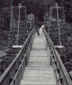
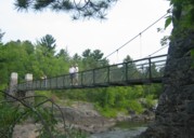
1954: Point Bonita Lighthouse
Golden Gate National Recreation Area, Marin County, California, USA
| Bridgemeister ID: | 882 (added 2003-09-06) |
| Year Completed: | 1954 |
| Name: | Point Bonita Lighthouse |
| Location: | Golden Gate National Recreation Area, Marin County, California, USA |
| Coordinates: | 37.815980 N 122.528878 W |
| Maps: | Acme, GeoHack, Google, OpenStreetMap |
| Use: | Footbridge |
| Status: | Removed |
| Main Cables: | Wire (steel) |
| Suspended Spans: | 1 |
Notes:
- Closed to the public, January 6, 2010. Subsequently removed and replaced.
- Replaced by 2012 Point Bonita Lighthouse - Golden Gate National Recreation Area, Marin County, California, USA.
External Links:
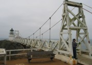
1955: (footbridge)
Jersey Shore vicinity, Pennsylvania, USA - Pine Creek
| Bridgemeister ID: | 591 (added 2003-01-05) |
| Year Completed: | 1955 |
| Name: | (footbridge) |
| Location: | Jersey Shore vicinity, Pennsylvania, USA |
| Crossing: | Pine Creek |
| At or Near Feature: | Boy Scouts Camp Kline |
| Coordinates: | 41.273683 N 77.323883 W |
| Maps: | Acme, GeoHack, Google, OpenStreetMap |
| Principals: | Williamsport Technical Institute students |
| Use: | Footbridge |
| Status: | Destroyed, 1972 |
| Main Cables: | Wire |
Notes:
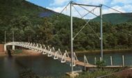
- The postcard (postmarked 1961) showing the bridge says, "The largest foot-suspension bridge in the East crosses Pine Creek at the Boy Scouts' Camp Kline, north of Jersey Shore, Pa. Built in 1955 by Williamsport Technical Institute students with materials donated by area industries. Valued over $25,000, the 409-foot span has concrete anchors and a 14-ton capacity. For 35 years previous, boats were used to reach the popular 360-acre camp-site, donated to the Scouts in 1920 by James N. Kline, a Williamsport merchant." It's doubtful this was anywhere close to being a 409-foot bridge.
- The message written on the postcard is amusing (though unrelated to the bridge): "Hi Mom and Dad, I had a fine time up here. I went on a boat trip Monday around the island. We got half way around and Tiny tiped [sic] his boat then we tiped ours. I didn't get to sleep until 2:00 Monday night. I am going to try to swim a mile today. I don't do nothing but lay in my bunk and listen to records. Ken."
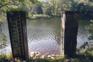
- Patrick O'Donnell is familiar with this area and notes that the bridge is gone, but the concrete footings are still visible. He suspects 1972's Hurricane Agnes brought down this bridge. Denny Keller confirms Patrick's suspicion with a firsthand account of Hurricane Agnes' impact on this bridge: "21 June 1972 is a date that I will never forget. I along with 340+ kids and adults were at Camp Kline during our yearly 4-H camp. I was the very last (along with the National Guard that performed the rescue) to leave and walk across the bridge that once stood at 11PM on the evening of June 21st. I along with two other senior 4-H counselors. I can remember the last trip across the bridge while mobile homes, trees, and all type of debris were floating down the creek and hitting the bridge underneath."
1955: (pipeline bridge)
Grand Tower, Illinois and Wittenberg vicinity, Missouri, USA - Mississippi River
| Bridgemeister ID: | 1028 (added 2003-11-30) |
| Year Completed: | 1955 |
| Name: | (pipeline bridge) |
| Location: | Grand Tower, Illinois and Wittenberg vicinity, Missouri, USA |
| Crossing: | Mississippi River |
| Coordinates: | 37.6417 N 89.513217 W |
| Maps: | Acme, GeoHack, Google, OpenStreetMap |
| Use: | Pipeline |
| Status: | In use (last checked: 2005) |
| Main Cables: | Wire (steel) |
| Suspended Spans: | 1 |
| Main Span: | 1 x 658.8 meters (2,161.5 feet) |
Notes:
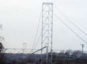
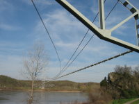
- Large pipeline bridge, sometimes claimed to be "world's largest pipeline suspension bridge".
External Links:
1955: Camp Saukenauk
Tioga vicinity, Adams County, Illinois, USA - Camp Saukenauk Lake
| Bridgemeister ID: | 5593 (added 2020-12-23) |
| Year Completed: | 1955 |
| Name: | Camp Saukenauk |
| Location: | Tioga vicinity, Adams County, Illinois, USA |
| Crossing: | Camp Saukenauk Lake |
| Coordinates: | 40.183546 N 91.319748 W |
| Maps: | Acme, GeoHack, Google, OpenStreetMap |
| Principals: | W.H. Klingner & Associates, Rose Construction Co. |
| Use: | Footbridge |
| Status: | In use (last checked: 2012) |
| Main Cables: | Wire (steel) |
| Suspended Spans: | 3 |
| Main Span: | 1 |
| Side Spans: | 2 |
External Links:
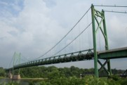
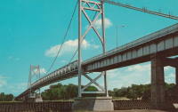
1955: Gateway
Clinton, Iowa and East Clinton, Illinois, USA - Mississippi River
| Bridgemeister ID: | 331 (added before 2003) |
| Year Completed: | 1955 |
| Name: | Gateway |
| Location: | Clinton, Iowa and East Clinton, Illinois, USA |
| Crossing: | Mississippi River |
| Coordinates: | 41.83785 N 90.18455 W |
| Maps: | Acme, GeoHack, Google, OpenStreetMap |
| References: | CMR |
| Use: | Vehicular (two-lane, heavy vehicles) |
| Status: | In use (last checked: 2019) |
| Main Cables: | Wire (steel) |
| Suspended Spans: | 1 |
| Main Span: | 1 x 196.3 meters (644 feet) |
External Links:
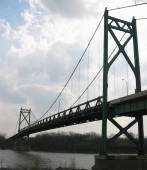
1956: Frances Zaunmiller Memorial
Campbell's Ferry, Idaho, USA - Salmon River
| Bridgemeister ID: | 2379 (added 2007-11-03) |
| Year Completed: | 1956 |
| Name: | Frances Zaunmiller Memorial |
| Also Known As: | Campbell's Ferry |
| Location: | Campbell's Ferry, Idaho, USA |
| Crossing: | Salmon River |
| At or Near Feature: | Frank Church-River of No Return Wilderness |
| Coordinates: | 45.48638 N 115.33467 W |
| Maps: | Acme, GeoHack, Google, OpenStreetMap |
| Use: | Pack and Footbridge |
| Status: | In use (last checked: 2007) |
| Main Cables: | Wire (steel) |
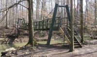
1956: Pete Mauthe
Poland, Ohio, USA - Yellow Creek
| Bridgemeister ID: | 2359 (added 2007-09-08) |
| Year Completed: | 1956 |
| Name: | Pete Mauthe |
| Location: | Poland, Ohio, USA |
| Crossing: | Yellow Creek |
| At or Near Feature: | Poland Village Park |
| Coordinates: | 41.01190 N 80.61908 W |
| Maps: | Acme, GeoHack, Google, OpenStreetMap |
| Use: | Footbridge |
| Status: | Closed (last checked: 2020) |
| Main Cables: | Wire (steel) |
| Suspended Spans: | 1 |
Notes:
- Closed in 2019 for "safety reasons". Repairs scheduled for March 2020.
1957: Bernard Pack
Frank Church-River Of No Return Wilderness Area, Idaho, USA - Salmon River Middle Fork
| Bridgemeister ID: | 640 (added 2003-02-15) |
| Year Completed: | 1957 |
| Name: | Bernard Pack |
| Location: | Frank Church-River Of No Return Wilderness Area, Idaho, USA |
| Crossing: | Salmon River Middle Fork |
| Coordinates: | 44.95800 N 114.73427 W |
| Maps: | Acme, GeoHack, Google, OpenStreetMap |
| Use: | Pack and Footbridge |
| Status: | In use (last checked: 2017) |
| Main Cables: | Wire (steel) |
| Suspended Spans: | 1 |
| Main Span: | 1 x 82.3 meters (270 feet) estimated |
Notes:
- Substantial repairs by Sahale, LLC in 2001 following fire damage.
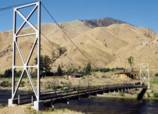
1957: Glen Canyon
Glen Canyon Dam, Arizona, USA - Colorado River
| Bridgemeister ID: | 1191 (added 2004-01-25) |
| Year Completed: | 1957 |
| Name: | Glen Canyon |
| Location: | Glen Canyon Dam, Arizona, USA |
| Crossing: | Colorado River |
| Principals: | Kiewit-Judson Pacific Murphy Co. |
| Use: | Footbridge |
| Status: | Removed |
| Main Cables: | Wire (steel) |
| Suspended Spans: | 1 |
| Main Span: | 1 x 390.1 meters (1,280 feet) |
Notes:
- Very long, very high footbridge spanning the canyon. Originally built for bridge workers building the Glen Canyon Bridge (the large deck arch next to the dam). Survived at least until 1959.
- From a Roebling ad in the July 1958 issue of Civil Engineering: "The bridge was completed in sixty days and features a steel mesh deck, to reduce wind resistance. Construction was started by lowering two 5/8 in. cables to the bottom of the west side of the gorge, transporting them across the river by boat and raising them on the east side by block and tackle. The six main suspension cables are 1 3/4 in. diameter prestretched galvanized bridge strands. From them are hung sixty-four 5/8 in. suspenders, attached to 7 ft-wide floor beams. The wire mesh floor is laid on eight 1 in. diameter deck cables. These in turn are supported every twenty feet by the floor beams. For safety, four handrail cables are attached to the suspenders. To add stability in strong winds, two 1 3/4 in. bridge strand wind brace cables run below the deck on either side for its length."
External Links:
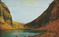
1957: Little Kern River
Golden Trout Wilderness, California, USA - Little Kern River
| Bridgemeister ID: | 2337 (added 2007-08-11) |
| Year Completed: | 1957 |
| Name: | Little Kern River |
| Location: | Golden Trout Wilderness, California, USA |
| Crossing: | Little Kern River |
| Coordinates: | 36.203814 N 118.457612 W |
| Maps: | Acme, GeoHack, Google, OpenStreetMap |
| Use: | Footbridge and Pack |
| Status: | In use (last checked: 2017) |
| Main Cables: | Wire (steel) |
| Suspended Spans: | 1 |
| Main Span: | 1 x 45.7 meters (150 feet) |
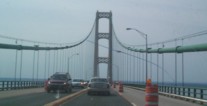
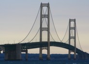
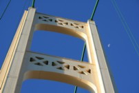
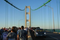
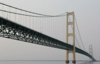
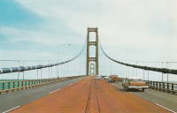
1957: Mackinac
St. Ignace and Mackinaw City, Michigan, USA - Straits of Mackinac
| Bridgemeister ID: | 210 (added before 2003) |
| Year Completed: | 1957 |
| Name: | Mackinac |
| Also Known As: | Mighty Mac |
| Location: | St. Ignace and Mackinaw City, Michigan, USA |
| Crossing: | Straits of Mackinac |
| Coordinates: | 45.820533 N 84.727667 W |
| Maps: | Acme, GeoHack, Google, OpenStreetMap |
| Principals: | David B. Steinman |
| References: | ADDS, BBR, BC3, BFL, BLD, BMA, COB, GBD, LAB, MACB, MM, WOT |
| Use: | Vehicular (four-lane) |
| Status: | In use (last checked: 2022) |
| Main Cables: | Wire (steel) |
| Suspended Spans: | 3 |
| Main Span: | 1 x 1,158.2 meters (3,800 feet) |
| Side Spans: | 2 x 548.6 meters (1,800 feet) |
External Links:

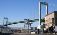
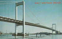
1957: Walt Whitman
Philadelphia, Pennsylvania and Camden, New Jersey, USA - Delaware River
| Bridgemeister ID: | 211 (added before 2003) |
| Year Completed: | 1957 |
| Name: | Walt Whitman |
| Location: | Philadelphia, Pennsylvania and Camden, New Jersey, USA |
| Crossing: | Delaware River |
| Coordinates: | 39.905 N 75.13 W |
| Maps: | Acme, GeoHack, Google, OpenStreetMap |
| Principals: | Othmar Ammann |
| References: | BFL |
| Use: | Vehicular (major highway) |
| Status: | In use (last checked: 2022) |
| Main Cables: | Wire (steel) |
| Suspended Spans: | 3 |
| Main Span: | 1 x 610 meters (2,001.3 feet) |
| Side Spans: | 2 x 234.7 meters (770 feet) |
| Deck width: | 83 feet |
Notes:
External Links:
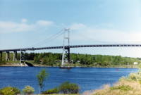
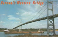
1958: Three Nations Crossing
Cornwall, Ontario, Canada and Massena, New York, USA - St. Lawrence River
| Bridgemeister ID: | 325 (added before 2003) |
| Year Completed: | 1958 |
| Name: | Three Nations Crossing |
| Also Known As: | Cornwall-Massena International, Seaway International |
| Location: | Cornwall, Ontario, Canada and Massena, New York, USA |
| Crossing: | St. Lawrence River |
| Coordinates: | 44.989962 N 74.739913 W |
| Maps: | Acme, GeoHack, Google, OpenStreetMap |
| References: | STL |
| Use: | Vehicular |
| Status: | In use (last checked: 2019) |
| Main Cables: | Wire (steel) |
| Suspended Spans: | 3 |
| Main Span: | 1 |
| Side Spans: | 2 |
Notes:
- Renamed "Three Nations Crossing" effective January 1, 2000 in recognition of the Mohawks of Akwesasne
External Links:
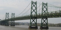
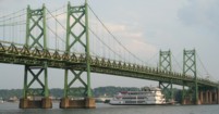
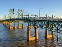
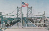
1960: Iowa-Illinois Memorial
Bettendorf, Iowa and Moline, Illinois, USA - Mississippi River
| Bridgemeister ID: | 213 (added before 2003) |
| Year Completed: | 1960 |
| Name: | Iowa-Illinois Memorial |
| Also Known As: | Interstate 74 Bridge, I-74 Bridge |
| Location: | Bettendorf, Iowa and Moline, Illinois, USA |
| Crossing: | Mississippi River |
| Coordinates: | 41.519372 N 90.513259 W |
| Maps: | Acme, GeoHack, Google, OpenStreetMap |
| References: | CMR |
| Use: | Vehicular |
| Status: | Bypassed, December 2021 (last checked: 2022) |
| Main Cables: | Wire (steel) |
| Suspended Spans: | 3 |
| Main Span: | 1 |
| Side Spans: | 2 |
Notes:
- 2017, June 26: Groundbreaking ceremony for a replacement bridge for the twin Iowa-Illinois Memorial bridges. The new bridge is expected to be completed in 2020.
- 2021, December: Replacement span opens. Suspension bridge expected to be demolished in 2022.
- 2023: Demolition expected to be completed in 2024.
- Next to 1935 Iowa-Illinois Memorial (Interstate 74 Bridge, I-74 Bridge) - Bettendorf, Iowa and Moline, Illinois, USA.
External Links:
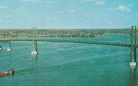
1960: Ogdensburg-Prescott International
Ogdensburg, New York, USA and Prescott, Ontario, Canada - St. Lawrence River
| Bridgemeister ID: | 214 (added before 2003) |
| Year Completed: | 1960 |
| Name: | Ogdensburg-Prescott International |
| Also Known As: | Seaway Skyway |
| Location: | Ogdensburg, New York, USA and Prescott, Ontario, Canada |
| Crossing: | St. Lawrence River |
| Coordinates: | 44.73 N 75.45667 W |
| Maps: | Acme, GeoHack, Google, OpenStreetMap |
| Principals: | Modjeski & Masters |
| Use: | Vehicular (major highway) |
| Status: | In use (last checked: 2019) |
| Main Cables: | Wire (steel) |
| Suspended Spans: | 3 |
| Main Span: | 1 x 350.75 meters (1,150.8 feet) |
| Side Spans: | 2 |
External Links:
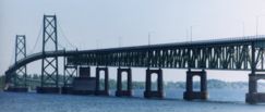
1960: Swinging
Selma vicinity, Oregon, USA - Illinois River
| Bridgemeister ID: | 266 (added before 2003) |
| Year Completed: | 1960 |
| Name: | Swinging |
| Location: | Selma vicinity, Oregon, USA |
| Crossing: | Illinois River |
| Coordinates: | 42.30253 N 123.77958 W |
| Maps: | Acme, GeoHack, Google, OpenStreetMap |
| Use: | Footbridge |
| Status: | Closed, July, 2021 |
| Main Cables: | Wire (steel) |
| Suspended Spans: | 1 |
Notes:
- Sometimes cited as completed in 1963.
- 2002: Unclear if this bridge was damaged or destroyed by the "Biscuit Fire" that devastated this area in August. The suspension bridge occupying this location in the early 2020s appears to be the same bridge as observed before the fire.
- 2021, July: Closed due to a "massive hole" in the deck, pending repairs. Photographs of the damage show one floorboard with a hole. Other repairs will be made while the bridge is closed.
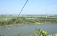
1961: (pipeline bridge)
Jefferson vicinity, South Dakota and Ponca State Park, Nebraska, USA - Missouri River
| Bridgemeister ID: | 3809 (added 2020-03-01) |
| Year Completed: | 1961 |
| Name: | (pipeline bridge) |
| Location: | Jefferson vicinity, South Dakota and Ponca State Park, Nebraska, USA |
| Crossing: | Missouri River |
| Coordinates: | 42.593000 N 96.698267 W |
| Maps: | Acme, GeoHack, Google, OpenStreetMap |
| Use: | Pipeline |
| Status: | Removed, 2006 or 2007 |
| Main Cables: | Wire (steel) |
| Main Span: | 1 x 823 meters (2,700 feet) estimated |
Notes:
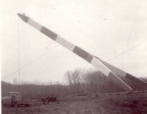
- Completed in 1961 or 1962. Removed in late 2006 or 2007.
- Replaced (pipeline bridge) - Jefferson vicinity, South Dakota and Ponca State Park, Nebraska, USA.
1961: Lunday
Lunday and Kona, North Carolina, USA - North Toe River
| Bridgemeister ID: | 2273 (added 2007-04-21) |
| Year Completed: | 1961 |
| Name: | Lunday |
| Also Known As: | Mitchell County Bridge 225 |
| Location: | Lunday and Kona, North Carolina, USA |
| Crossing: | North Toe River |
| Coordinates: | 35.95493 N 82.19544 W |
| Maps: | Acme, GeoHack, Google, OpenStreetMap |
| Principals: | North Carolina Bridge Maintenance Unit |
| Use: | Footbridge |
| Status: | In use (last checked: 2018) |
| Main Cables: | Wire (steel) |
| Suspended Spans: | 1 |
| Main Span: | 1 x 58.5 meters (192 feet) estimated |
Notes:
- Deck and floorbeams replaced, 1988.
External Links:
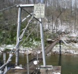
1961: Throgs Neck
The Bronx and Queens, New York, USA - East River
| Bridgemeister ID: | 215 (added before 2003) |
| Year Completed: | 1961 |
| Name: | Throgs Neck |
| Location: | The Bronx and Queens, New York, USA |
| Crossing: | East River |
| Coordinates: | 40.8 N 73.795 W |
| Maps: | Acme, GeoHack, Google, OpenStreetMap |
| Principals: | O. H. Ammann |
| References: | ARF, BCO, SIX, VNB |
| Use: | Vehicular (major highway) |
| Status: | In use (last checked: 2022) |
| Main Cables: | Wire (steel) |
| Suspended Spans: | 3 |
| Main Span: | 1 x 548.6 meters (1,800 feet) |
| Side Spans: | 2 |
Notes:
External Links:
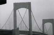
1961: Triphammer
Ithaca, New York, USA - Fall Creek Gorge
| Bridgemeister ID: | 356 (added before 2003) |
| Year Completed: | 1961 |
| Name: | Triphammer |
| Also Known As: | Fall Creek |
| Location: | Ithaca, New York, USA |
| Crossing: | Fall Creek Gorge |
| At or Near Feature: | Cornell University campus |
| Coordinates: | 42.452017 N 76.486083 W |
| Maps: | Acme, GeoHack, Google, OpenStreetMap |
| Principals: | S.C. Hollister, William McGuire |
| Use: | Footbridge |
| Status: | In use (last checked: 2007) |
| Main Cables: | Wire (steel) |
| Suspended Spans: | 1 |
| Main Span: | 1 x 82.3 meters (270 feet) estimated |
Notes:
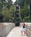
1962: (pipeline bridge)
Flaming Gorge National Recreation Area, Wyoming, USA - Green River
| Bridgemeister ID: | 1309 (added 2004-04-10) |
| Year Completed: | 1962 |
| Name: | (pipeline bridge) |
| Location: | Flaming Gorge National Recreation Area, Wyoming, USA |
| Crossing: | Green River |
| At or Near Feature: | Flaming Gorge Reservoir |
| Coordinates: | 41.03215 N 109.55519 W |
| Maps: | Acme, GeoHack, Google, OpenStreetMap |
| Use: | Pipeline |
| Status: | In use (last checked: 2019) |
| Main Cables: | Wire (steel) |
| Suspended Spans: | 1 |
| Main Span: | 1 x 584.9 meters (1,919 feet) |
Notes:
- Located two miles north of the Utah-Wyoming border.
External Links:
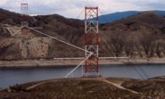
1962: (pipeline bridge)
Grays Branch, Greenup vicinity, Kentucky and Franklin Furnace, Ohio, USA - Ohio River
| Bridgemeister ID: | 880 (added 2003-09-01) |
| Year Completed: | 1962 |
| Name: | (pipeline bridge) |
| Location: | Grays Branch, Greenup vicinity, Kentucky and Franklin Furnace, Ohio, USA |
| Crossing: | Ohio River |
| Coordinates: | 38.66058 N 82.85889 W |
| Maps: | Acme, GeoHack, Google, OpenStreetMap |
| Principals: | Weldon F. Appelt, P.E., Clear Span Engineering, Inc |
| Use: | Pipeline |
| Status: | Extant (last checked: 2021) |
| Main Cables: | Wire (steel) |
| Main Span: | 1 x 609.6 meters (2,000 feet) |
Notes:
- Just downstream of Greenup Dam. Built for Tennessee Gas Pipeline Co. Carries two 30" gas pipelines.
External Links:
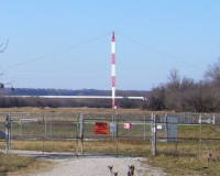
| Bridgemeister ID: | 2626 (added 2018-12-31) |
| Year Completed: | 1962 |
| Name: | Elk Run Heights |
| Location: | Elk Run Heights and Evansdale, Iowa, USA |
| Crossing: | Elk Run |
| Coordinates: | 42.46863 N 92.264234 W |
| Maps: | Acme, GeoHack, Google, OpenStreetMap |
| Use: | Footbridge |
| Status: | In use (last checked: 2018) |
| Main Cables: | Wire (steel) |
| Suspended Spans: | 1 |
1963: Crooked River
Opal Springs vicinity, Oregon, USA - Crooked River at Lake Billy Chinook
| Bridgemeister ID: | 216 (added before 2003) |
| Year Completed: | 1963 |
| Name: | Crooked River |
| Location: | Opal Springs vicinity, Oregon, USA |
| Crossing: | Crooked River at Lake Billy Chinook |
| Coordinates: | 44.528882 N 121.264512 W |
| Maps: | Acme, GeoHack, Google, OpenStreetMap |
| References: | GBD, WOT |
| Use: | Vehicular (two-lane, heavy vehicles) |
| Status: | In use (last checked: 2017) |
| Main Cables: | Wire (steel) |
| Suspended Spans: | 1 |
| Main Span: | 1 x 141.4 meters (464 feet) |
Notes:
External Links:
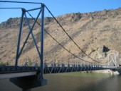
1963: Deschutes River
Opal Springs vicinity, Oregon, USA - Deschutes River at Lake Billy Chinook
| Bridgemeister ID: | 338 (added before 2003) |
| Year Completed: | 1963 |
| Name: | Deschutes River |
| Location: | Opal Springs vicinity, Oregon, USA |
| Crossing: | Deschutes River at Lake Billy Chinook |
| Coordinates: | 44.525672 N 121.299591 W |
| Maps: | Acme, GeoHack, Google, OpenStreetMap |
| References: | BCO, WOT |
| Use: | Vehicular (one-lane) |
| Status: | In use (last checked: 2017) |
| Main Cables: | Wire (steel) |
| Suspended Spans: | 1 |
| Main Span: | 1 x 111 meters (364.17 feet) |
Notes:
External Links:
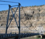

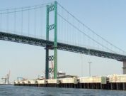
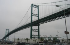
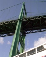
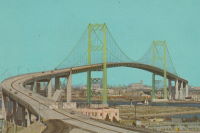
1963: Vincent Thomas
San Pedro, California, USA - Los Angeles Harbor
| Bridgemeister ID: | 217 (added before 2003) |
| Year Completed: | 1963 |
| Name: | Vincent Thomas |
| Also Known As: | San Pedro-Terminal Island |
| Location: | San Pedro, California, USA |
| Crossing: | Los Angeles Harbor |
| Coordinates: | 33.75 N 118.27 W |
| Maps: | Acme, GeoHack, Google, OpenStreetMap |
| Use: | Vehicular (four-lane) |
| Status: | In use (last checked: 2023) |
| Main Cables: | Wire (steel) |
| Suspended Spans: | 3 |
| Main Span: | 1 x 457.2 meters (1,500 feet) |
| Side Spans: | 2 x 154.4 meters (506.5 feet) |
Notes:
- 2023: US$706 million project to replace the bridge's deck expected to start in 2025 and complete in 2027.
External Links:

1964: (footbridge)
Wilmot vicinity and Dillsboro vicinity, North Carolina, USA - Tuckaseigee River
| Bridgemeister ID: | 218 (added before 2003) |
| Year Completed: | 1964 |
| Name: | (footbridge) |
| Location: | Wilmot vicinity and Dillsboro vicinity, North Carolina, USA |
| Crossing: | Tuckaseigee River |
| Coordinates: | 35.40421 N 83.29348 W |
| Maps: | Acme, GeoHack, Google, OpenStreetMap |
| Principals: | Roanoke Bridge Co. |
| Use: | Footbridge |
| Status: | In use (last checked: 2002) |
| Main Cables: | Wire (steel) |
| Suspended Spans: | 2 |
| Main Spans: | 1 x 42.4 meters (139 feet), 1 x 41.8 meters (137 feet) |
Notes:
- A 4/4/2002 article in The Sylva Herald And Ruralite ("Repairing Last Swinging Bridge") notes this bridge was completed 1964, but Patrick S. O'Donnell sent me a photo of a 1906 Roanoke Bridge Co. builder's plate attached to one of the towers.
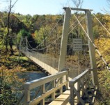
| Bridgemeister ID: | 2544 (added 2011-12-31) |
| Year Completed: | 1964 |
| Name: | Citizens Bank |
| Location: | East Alton, Illinois, USA |
| At or Near Feature: | Citizens Bank building |
| Coordinates: | 38.884986 N 90.099109 W |
| Maps: | Acme, GeoHack, Google, OpenStreetMap |
| Use: | Footbridge |
| Status: | Extant (last checked: 2018) |
| Main Cables: | Wire (steel) |
| Suspended Spans: | 1 |
Notes:
- Small footbridge at the entrance to the circular Citizens Bank building in East Alton.
- Demolition of bridge and building slated for 2016 halted following public outcry. Bridge still standing in 2018.
1964: Gates Park Pack
Augusta vicinity, Montana, USA - North Fork of the Sun River
| Bridgemeister ID: | 6349 (added 2021-07-25) |
| Year Completed: | 1964 |
| Name: | Gates Park Pack |
| Location: | Augusta vicinity, Montana, USA |
| Crossing: | North Fork of the Sun River |
| At or Near Feature: | Bob Marshall Wilderness |
| Coordinates: | 47.553636 N 112.944389 W |
| Maps: | Acme, GeoHack, Google, OpenStreetMap |
| Use: | Pack and Footbridge |
| Status: | Replaced, 2011 |
| Main Cables: | Wire (steel) |
| Suspended Spans: | 1 |
| Main Span: | 1 x 39 meters (128 feet) |
Notes:
- May have replaced another suspension bridge dating to 1948.
- Replaced by 2011 Gates Park Pack - Augusta vicinity, Montana, USA.
External Links:
1964: Medicine Springs Pack
Augusta vicinity, Montana, USA - North Fork Sun River
| Bridgemeister ID: | 6347 (added 2021-07-25) |
| Year Completed: | 1964 |
| Name: | Medicine Springs Pack |
| Location: | Augusta vicinity, Montana, USA |
| Crossing: | North Fork Sun River |
| At or Near Feature: | Bob Marshall Wilderness |
| Coordinates: | 47.632222 N 112.857444 W |
| Maps: | Acme, GeoHack, Google, OpenStreetMap |
| Use: | Pack and Footbridge |
| Status: | Replaced, 2016 |
| Main Cables: | Wire (steel) |
| Suspended Spans: | 1 |
| Main Span: | 1 x 35.1 meters (115 feet) estimated |
Notes:
- May have replaced another suspension bridge.
- Replaced by 2016 Medicine Springs Pack - Augusta vicinity, Montana, USA.
External Links:
- Remote pack bridge near Bob gets a face-lift; materials flown in. "A 52-year-old pack bridge leading into the Bob Marshall Wilderness is being replaced, with tons of material needed in the replacement flown in by helicopter."
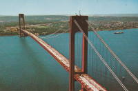
1964: Verrazzano Narrows
Brooklyn and Staten Island, New York, USA - Verrazano Narrows
| Bridgemeister ID: | 219 (added before 2003) |
| Year Completed: | 1964 |
| Name: | Verrazzano Narrows |
| Also Known As: | Verrazano Narrows |
| Location: | Brooklyn and Staten Island, New York, USA |
| Crossing: | Verrazano Narrows |
| Coordinates: | 40.60667 N 74.045 W |
| Maps: | Acme, GeoHack, Google, OpenStreetMap |
| Principals: | Othmar H. Ammann, Whitney |
| References: | BBR, BC3, BFL, BOU, COB, CTW, GBD, LAB, SIX, VNB |
| Use: | Vehicular (double-deck) |
| Status: | In use (last checked: 2022) |
| Main Cables: | Wire (steel) |
| Suspended Spans: | 3 |
| Main Span: | 1 x 1,298.4 meters (4,260 feet) |
| Side Spans: | 2 |
Notes:
- 2017: Long known as the "Verrazano" bridge, efforts to fix the spelling of the bridge's name to "Verrazzano" (such as Giovanni da Verrazzano) pick up momentum with New York state legislature and senate.
- Became longest suspension bridge by eclipsing 1937 Golden Gate - San Francisco and Marin County, California, USA.
- Eclipsed by new longest suspension bridge 1981 Humber - Hull, Humberside, England, United Kingdom.
External Links:


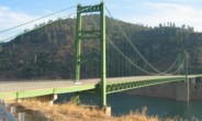
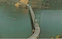
1965: Bidwell Bar
Oroville, California, USA - Feather River
| Bridgemeister ID: | 220 (added before 2003) |
| Year Completed: | 1965 |
| Name: | Bidwell Bar |
| Location: | Oroville, California, USA |
| Crossing: | Feather River |
| At or Near Feature: | Oroville Reservoir |
| Coordinates: | 39.54816 N 121.43006 W |
| Maps: | Acme, GeoHack, Google, OpenStreetMap |
| Principals: | California Department of Water Resources |
| Use: | Vehicular (two-lane, heavy vehicles), with walkway |
| Status: | In use (last checked: 2021) |
| Main Cables: | Wire (steel) |
| Suspended Spans: | 1 |
Notes:
External Links:
1965: Currin
Cottage Grove, Oregon, USA - Willamette River Coast Fork
| Bridgemeister ID: | 801 (added 2003-03-29) |
| Year Completed: | 1965 |
| Name: | Currin |
| Also Known As: | Swinging |
| Location: | Cottage Grove, Oregon, USA |
| Crossing: | Willamette River Coast Fork |
| At or Near Feature: | Prospector Park |
| Coordinates: | 43.79385 N 123.06935 W |
| Maps: | Acme, GeoHack, Google, OpenStreetMap |
| Use: | Footbridge |
| Status: | Removed, c. 2019 (last checked: 2020) |
| Main Cables: | Wire (steel) |
| Suspended Spans: | 3 |
| Main Span: | 1 x 30.5 meters (100 feet) estimated |
| Side Spans: | 2 x 7.6 meters (25 feet) estimated |
Notes:
- 2016: Deemed unsafe and closed. Removed by 2019.
- Replaced by 2019 J. Polk Currin Swinging - Cottage Grove, Oregon, USA.
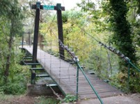
1965: Guy West
Sacramento, California, USA - American River
| Bridgemeister ID: | 221 (added before 2003) |
| Year Completed: | 1965 |
| Name: | Guy West |
| Location: | Sacramento, California, USA |
| Crossing: | American River |
| Coordinates: | 38.562367 N 121.42017 W |
| Maps: | Acme, GeoHack, Google, OpenStreetMap |
| References: | WOT |
| Use: | Footbridge |
| Status: | In use (last checked: 2022) |
| Main Cables: | Wire (steel) |
| Suspended Spans: | 1 |
| Main Span: | 1 x 183 meters (600.4 feet) |
Notes:
- WOT says completed 1968.
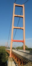
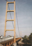
1966: (footbridge)
Indiana Beach, Indiana, USA - Lake Shafer
| Bridgemeister ID: | 879 (added 2003-09-01) |
| Year Completed: | 1966 |
| Name: | (footbridge) |
| Location: | Indiana Beach, Indiana, USA |
| Crossing: | Lake Shafer |
| Coordinates: | 40.787346 N 86.770724 W |
| Maps: | Acme, GeoHack, Google, OpenStreetMap |
| Use: | Footbridge |
| Status: | Extant (last checked: 2019) |
| Main Cables: | Wire (steel) |
Notes:
- Large multi-span footbridge that serves as entrance to Indiana Beach amusement park.
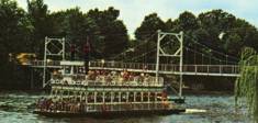
1967: Orleans
Orleans, California, USA - Klamath River
| Bridgemeister ID: | 223 (added before 2003) |
| Year Completed: | 1967 |
| Name: | Orleans |
| Location: | Orleans, California, USA |
| Crossing: | Klamath River |
| Coordinates: | 41.30167 N 123.53333 W |
| Maps: | Acme, GeoHack, Google, OpenStreetMap |
| Principals: | Ostap Bender, A.P. Bezzone, Jr. |
| References: | BCO, BPL, WOT |
| Use: | Vehicular (two-lane, heavy vehicles), with walkway |
| Status: | In use (last checked: 2021) |
| Main Cables: | Wire (steel) |
| Suspended Spans: | 3 |
| Main Span: | 1 x 131.1 meters (430 feet) |
| Side Spans: | 2 |
Notes:
- Replaced 1940 Orleans - Orleans, California, USA.
External Links:
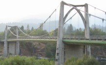
1968: Delaware Memorial II
New Castle, Delaware and Pennsville, New Jersey, USA - Delaware River
| Bridgemeister ID: | 224 (added before 2003) |
| Year Completed: | 1968 |
| Name: | Delaware Memorial II |
| Location: | New Castle, Delaware and Pennsville, New Jersey, USA |
| Crossing: | Delaware River |
| Coordinates: | 39.688633 N 75.516272 W |
| Maps: | Acme, GeoHack, Google, OpenStreetMap |
| References: | BONJ, CTD, GBD |
| Use: | Vehicular (major highway) |
| Status: | In use (last checked: 2022) |
| Main Cables: | Wire (steel) |
| Suspended Spans: | 3 |
| Main Span: | 1 x 655.3 meters (2,150 feet) |
| Side Spans: | 2 x 228.6 meters (750 feet) |
| Deck width: | 58.7 feet |
Notes:
External Links:


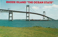
1969: Claiborne Pell
Newport and Jamestown, Rhode Island, USA - Narragansett Bay
| Bridgemeister ID: | 226 (added before 2003) |
| Year Completed: | 1969 |
| Name: | Claiborne Pell |
| Also Known As: | Newport, Newport-Pell |
| Location: | Newport and Jamestown, Rhode Island, USA |
| Crossing: | Narragansett Bay |
| Coordinates: | 41.505 N 71.34166 W |
| Maps: | Acme, GeoHack, Google, OpenStreetMap |
| Principals: | Parsons, Brinkerhoff, Quade, Douglas |
| References: | BPL |
| Use: | Vehicular (four-lane) |
| Status: | In use (last checked: 2022) |
| Main Cables: | Wire (steel) |
| Suspended Spans: | 3 |
| Main Span: | 1 x 487.7 meters (1,600 feet) |
| Side Spans: | 2 x 209.4 meters (687 feet) |
Notes:
- 2022, November: USD$82.5M grant awarded to fund improvements to deck and suspension system intended to extend the life of the bridge by 50-75 years.
External Links:

1969: Gorge Inn
Newhalem, Washington, USA - Skagit River
| Bridgemeister ID: | 225 (added before 2003) |
| Year Completed: | 1969 |
| Name: | Gorge Inn |
| Location: | Newhalem, Washington, USA |
| Crossing: | Skagit River |
| At or Near Feature: | Trail of the Cedars |
| Coordinates: | 48.672167 N 121.246333 W |
| Maps: | Acme, GeoHack, Google, OpenStreetMap |
| Principals: | Seattle City Light |
| Use: | Footbridge |
| Status: | In use (last checked: 2009) |
| Main Cables: | Wire (steel) |
| Suspended Spans: | 1 |
| Main Span: | 1 x 76.2 meters (250 feet) |
Notes:
- Tower collapsed October, 2000 under weight of thirty pedestrians and the entire bridge buckled. Repaired by Sahale, 2001.
- Near (footbridge) - Newhalem, Washington, USA.
External Links:

1971: Bjarne Ness Memorial
Fort Ransom, North Dakota, USA - Sheyenne River
| Bridgemeister ID: | 1367 (added 2004-07-03) |
| Year Completed: | 1971 |
| Name: | Bjarne Ness Memorial |
| Location: | Fort Ransom, North Dakota, USA |
| Crossing: | Sheyenne River |
| Coordinates: | 46.51907 N 97.92599 W |
| Maps: | Acme, GeoHack, Google, OpenStreetMap |
| Principals: | Lisbon National Guard |
| Use: | Footbridge |
| Status: | In use (last checked: 2003) |
| Main Cables: | Wire (steel) |
| Suspended Spans: | 1 |
| Main Span: | 1 x 44.2 meters (145 feet) estimated |

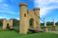
1971: Castle
Ida Grove, Iowa, USA - Odebolt Creek
| Bridgemeister ID: | 2982 (added 2019-10-12) |
| Year Completed: | 1971 |
| Name: | Castle |
| Location: | Ida Grove, Iowa, USA |
| Crossing: | Odebolt Creek |
| At or Near Feature: | Ida Grove Golf and Country Club |
| Coordinates: | 42.343539 N 95.458580 W |
| Maps: | Acme, GeoHack, Google, OpenStreetMap |
| Use: | Golf cart and Footbridge |
| Status: | In use (last checked: 2022) |
| Suspended Spans: | 1 |
1971: Dent
Orofino vicinity, Idaho, USA - Dworshak Reservoir
| Bridgemeister ID: | 229 (added before 2003) |
| Year Completed: | 1971 |
| Name: | Dent |
| Location: | Orofino vicinity, Idaho, USA |
| Crossing: | Dworshak Reservoir |
| Coordinates: | 46.605 N 116.179 W |
| Maps: | Acme, GeoHack, Google, OpenStreetMap |
| Principals: | Army Corps of Engineers |
| Use: | Vehicular (two-lane, heavy vehicles), with walkway |
| Status: | In use (last checked: 2004) |
| Main Cables: | Wire (steel) |
| Suspended Spans: | 3 |
| Main Span: | 1 x 320 meters (1,050 feet) |
| Side Spans: | 2 |
Notes:
- Reservoir formed by damming of the North Fork of the Clearwater River.
External Links:

1973: (footbridge)
Lincoln, Illinois, USA - Kickapoo Creek
| Bridgemeister ID: | 909 (added 2003-10-11) |
| Year Completed: | 1973 |
| Name: | (footbridge) |
| Location: | Lincoln, Illinois, USA |
| Crossing: | Kickapoo Creek |
| At or Near Feature: | Kickapoo Creek County Park |
| Coordinates: | 40.17338 N 89.37623 W |
| Maps: | Acme, GeoHack, Google, OpenStreetMap |
| Use: | Footbridge |
| Status: | In use (last checked: 2005) |
| Main Cables: | Wire |
| Suspended Spans: | 1 |
| Main Span: | 1 |
1973: William Preston Lane, Jr. Memorial II
Sandy Point, Maryland, USA - Chesapeake Bay
| Bridgemeister ID: | 230 (added before 2003) |
| Year Completed: | 1973 |
| Name: | William Preston Lane, Jr. Memorial II |
| Also Known As: | Chesapeake Bay |
| Location: | Sandy Point, Maryland, USA |
| Crossing: | Chesapeake Bay |
| Coordinates: | 38.994433 N 76.381929 W |
| Maps: | Acme, GeoHack, Google, OpenStreetMap |
| References: | GBD |
| Use: | Vehicular (major highway) |
| Status: | In use (last checked: 2022) |
| Main Cables: | Wire (steel) |
| Suspended Spans: | 3 |
| Main Span: | 1 x 487.7 meters (1,600 feet) |
| Side Spans: | 2 |
Notes:
External Links:

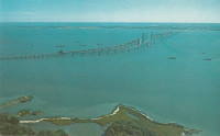
1974: (footbridge)
Hayfork, California, USA - Hayfork Creek
| Bridgemeister ID: | 6707 (added 2021-10-05) |
| Year Completed: | 1974 |
| Name: | (footbridge) |
| Location: | Hayfork, California, USA |
| Crossing: | Hayfork Creek |
| At or Near Feature: | Bar 717 Ranch |
| Coordinates: | 40.628631 N 123.371112 W |
| Maps: | Acme, GeoHack, Google, OpenStreetMap |
| Principals: | Paul Wills, Willy Wills, Ed Clark |
| Use: | Footbridge |
| Status: | In use (last checked: 2021) |
| Main Cables: | Wire (steel) |
| Main Span: | 1 |
1974: Slattum-Hewett
Fort Ransom vicinity, North Dakota, USA - Sheyenne River
| Bridgemeister ID: | 1366 (added 2004-07-03) |
| Year Completed: | 1974 |
| Name: | Slattum-Hewett |
| Location: | Fort Ransom vicinity, North Dakota, USA |
| Crossing: | Sheyenne River |
| Coordinates: | 46.56435 N 97.90429 W |
| Maps: | Acme, GeoHack, Google, OpenStreetMap |
| Use: | Footbridge |
| Status: | In use (last checked: 2003) |
| Main Cables: | Wire (steel) |
| Suspended Spans: | 1 |
| Main Span: | 1 x 38.1 meters (125 feet) estimated |
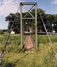
1975: (pipeline bridge)
Calumet vicinity, Louisiana, USA - Wax Lake Outlet
| Bridgemeister ID: | 1807 (added 2005-05-19) |
| Year Completed: | 1975 |
| Name: | (pipeline bridge) |
| Location: | Calumet vicinity, Louisiana, USA |
| Crossing: | Wax Lake Outlet |
| Coordinates: | 29.693867 N 91.374017 W |
| Maps: | Acme, GeoHack, Google, OpenStreetMap |
| Principals: | Clear Span Engineering |
| Use: | Pipeline |
| Status: | Extant (last checked: 1990) |
| Main Cables: | Wire (steel) |
| Suspended Spans: | 1 |
| Main Span: | 1 x 243.8 meters (800 feet) |
Notes:
- Carries a 22" oil line.
- Near 1976 (pipeline bridge) - Calumet vicinity, Louisiana, USA.
- Near 1976 (pipeline bridge) - Calumet vicinity, Louisiana, USA.
- Near 1980 (pipeline bridge) - Calumet vicinity, Louisiana, USA.
- Near 1980 (pipeline bridge) - Calumet vicinity, Louisiana, USA.
- Near 1980 (pipeline bridge) - Calumet vicinity, Louisiana, USA.
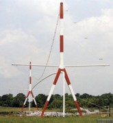
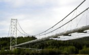
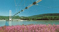
1975: Tanana River
Big Delta vicinity, Alaska, USA - Tanana River
| Bridgemeister ID: | 652 (added 2003-02-24) |
| Year Completed: | 1975 |
| Name: | Tanana River |
| Location: | Big Delta vicinity, Alaska, USA |
| Crossing: | Tanana River |
| Coordinates: | 64.15766 N 145.84964 W |
| Maps: | Acme, GeoHack, Google, OpenStreetMap |
| Use: | Pipeline |
| Status: | In use (last checked: 2024) |
| Main Cables: | Wire (steel) |
| Suspended Spans: | 1 |
| Main Span: | 1 x 365.8 meters (1,200 feet) |
Notes:
- Large pipeline bridge carrying the Trans-Alaska pipeline.
External Links:
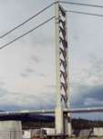
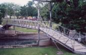
1976: (footbridge)
Lampasas, Texas, USA - Sulphur Creek
| Bridgemeister ID: | 1258 (added 2004-03-06) |
| Year Completed: | 1976 |
| Name: | (footbridge) |
| Location: | Lampasas, Texas, USA |
| Crossing: | Sulphur Creek |
| Coordinates: | 31.05598 N 98.18108 W |
| Maps: | Acme, GeoHack, Google, OpenStreetMap |
| Use: | Footbridge |
| Status: | In use (last checked: 2004) |
| Main Cables: | Rod |
| Suspended Spans: | 1 |
| Main Span: | 1 x 19.8 meters (65 feet) |
Notes:
- It is doubtful that this is a true suspension bridge. Follow the picture for more on this observation.
1976: (pipeline bridge)
Calumet vicinity, Louisiana, USA - Wax Lake Outlet
| Bridgemeister ID: | 1808 (added 2005-05-19) |
| Year Completed: | 1976 |
| Name: | (pipeline bridge) |
| Location: | Calumet vicinity, Louisiana, USA |
| Crossing: | Wax Lake Outlet |
| Coordinates: | 29.693233 N 91.3743 W |
| Maps: | Acme, GeoHack, Google, OpenStreetMap |
| Principals: | Clear Span Engineering |
| Use: | Pipeline |
| Status: | Extant (last checked: 1990) |
| Main Cables: | Wire (steel) |
| Suspended Spans: | 1 |
| Main Span: | 1 x 243.8 meters (800 feet) |
Notes:
- Carries a 30" natural gas line.
- Near 1975 (pipeline bridge) - Calumet vicinity, Louisiana, USA.
- Near 1976 (pipeline bridge) - Calumet vicinity, Louisiana, USA.
- Near 1980 (pipeline bridge) - Calumet vicinity, Louisiana, USA.
- Near 1980 (pipeline bridge) - Calumet vicinity, Louisiana, USA.
- Near 1980 (pipeline bridge) - Calumet vicinity, Louisiana, USA.
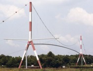
1976: (pipeline bridge)
Calumet vicinity, Louisiana, USA - Wax Lake Outlet
| Bridgemeister ID: | 1809 (added 2005-05-19) |
| Year Completed: | 1976 |
| Name: | (pipeline bridge) |
| Location: | Calumet vicinity, Louisiana, USA |
| Crossing: | Wax Lake Outlet |
| Coordinates: | 29.691483 N 91.37495 W |
| Maps: | Acme, GeoHack, Google, OpenStreetMap |
| Principals: | Clear Span Engineering |
| Use: | Pipeline |
| Status: | Extant (last checked: 1990) |
| Main Cables: | Wire (steel) |
| Suspended Spans: | 1 |
| Main Span: | 1 x 243.8 meters (800 feet) |
Notes:
- Carries three natural gas lines.
- Near 1975 (pipeline bridge) - Calumet vicinity, Louisiana, USA.
- Near 1976 (pipeline bridge) - Calumet vicinity, Louisiana, USA.
- Near 1980 (pipeline bridge) - Calumet vicinity, Louisiana, USA.
- Near 1980 (pipeline bridge) - Calumet vicinity, Louisiana, USA.
- Near 1980 (pipeline bridge) - Calumet vicinity, Louisiana, USA.
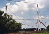
1976: Kiwanis Club Bicentennial
Sulphur, Oklahoma, USA - Rock Creek
| Bridgemeister ID: | 5588 (added 2020-12-22) |
| Year Completed: | 1976 |
| Name: | Kiwanis Club Bicentennial |
| Location: | Sulphur, Oklahoma, USA |
| Crossing: | Rock Creek |
| Coordinates: | 34.508043 N 96.974723 W |
| Maps: | Acme, GeoHack, Google, OpenStreetMap |
| Use: | Footbridge |
| Status: | Removed |
Notes:
- The November 28, 1976 edition of The Ada Sunday News ran an article titled "Sulphur Foot Bridge Dedication Scheduled": "SULPHUR — The Kiwanis Club Bicentennial Bridge, a swinging foot bridge across Rock Creek, will be dedicated at 12:30 p.m. Tuesday... The suspension bridge, which was built across Rock Creek near the south end of Bulldog Stadium, has been open since late October. It provides easy access to the school grounds for students coming from east Sulphur. Designed by Supt. Calvin Agee and elementary Principal DeLannom, the bridge was built as the bicentennial project of the Sulphur Kiwanis Club. Club members and students from Sulphur's vocational training classes performed the work on the structure…"
- The Ada Sunday Newsarticle description leads one to believe this was not a very substantial structure and no trace of it appears to remain (in 2020). Coordinates provided here are, approximate, based on the location description in the article.
1977: Dry River
Bretton Woods vicinity, New Hampshire, USA - Dry River
| Bridgemeister ID: | 2477 (added 2008-12-20) |
| Year Completed: | 1977 |
| Name: | Dry River |
| Location: | Bretton Woods vicinity, New Hampshire, USA |
| Crossing: | Dry River |
| At or Near Feature: | Dry River Trail, Dry River Wilderness |
| Coordinates: | 44.177914 N 71.351531 W |
| Maps: | Acme, GeoHack, Google, OpenStreetMap |
| Use: | Footbridge |
| Status: | Replaced, 2009 |
| Main Cables: | Wire (steel) |
| Suspended Spans: | 1 |
| Main Span: | 1 x 30.5 meters (100 feet) |
Notes:
- Damaged by flood and permanently closed, 2005.
- Replaced by 2009 Dry River - Hart's Location vicinity, New Hampshire, USA.
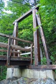
1977: Toccoa River
Dahlonega vicinity, Georgia, USA - Toccoa River
| Bridgemeister ID: | 250 (added before 2003) |
| Year Completed: | 1977 |
| Name: | Toccoa River |
| Also Known As: | Swinging |
| Location: | Dahlonega vicinity, Georgia, USA |
| Crossing: | Toccoa River |
| At or Near Feature: | Benton MacKaye Trail |
| Coordinates: | 34.736857 N 84.167320 W |
| Maps: | Acme, GeoHack, Google, OpenStreetMap |
| Use: | Footbridge |
| Status: | In use (last checked: 2018) |
| Main Cables: | Wire (steel) |
| Main Span: | 1 x 80.8 meters (265 feet) |
1978: (footbridge)
Pontiac, Illinois, USA - Vermilion River
| Bridgemeister ID: | 1710 (added 2005-04-02) |
| Year Completed: | 1978 |
| Name: | (footbridge) |
| Location: | Pontiac, Illinois, USA |
| Crossing: | Vermilion River |
| At or Near Feature: | Humiston Riverside Park |
| Coordinates: | 40.876867 N 88.63325 W |
| Maps: | Acme, GeoHack, Google, OpenStreetMap |
| Use: | Footbridge |
| Status: | In use (last checked: 2005) |
| Main Cables: | Wire (steel) |
| Suspended Spans: | 3 |
| Main Span: | 1 |
| Side Spans: | 2 |
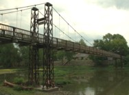
1980: (pipeline bridge)
Calumet vicinity, Louisiana, USA - Wax Lake Outlet
| Bridgemeister ID: | 1810 (added 2005-05-19) |
| Year Completed: | 1980 |
| Name: | (pipeline bridge) |
| Location: | Calumet vicinity, Louisiana, USA |
| Crossing: | Wax Lake Outlet |
| Coordinates: | 29.69095 N 91.374967 W |
| Maps: | Acme, GeoHack, Google, OpenStreetMap |
| Principals: | Clear Span Engineering |
| Use: | Pipeline |
| Status: | Extant (last checked: 1990) |
| Main Cables: | Wire (steel) |
| Suspended Spans: | 1 |
| Main Span: | 1 x 259.1 meters (850 feet) |
Notes:
- Carries a 30" natural gas line.
- Near 1975 (pipeline bridge) - Calumet vicinity, Louisiana, USA.
- Near 1976 (pipeline bridge) - Calumet vicinity, Louisiana, USA.
- Near 1976 (pipeline bridge) - Calumet vicinity, Louisiana, USA.
- Near 1980 (pipeline bridge) - Calumet vicinity, Louisiana, USA.
- Near 1980 (pipeline bridge) - Calumet vicinity, Louisiana, USA.
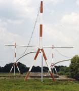
1980: (pipeline bridge)
Calumet vicinity, Louisiana, USA - Wax Lake Outlet
| Bridgemeister ID: | 1811 (added 2005-05-19) |
| Year Completed: | 1980 |
| Name: | (pipeline bridge) |
| Location: | Calumet vicinity, Louisiana, USA |
| Crossing: | Wax Lake Outlet |
| Coordinates: | 29.710683 N 91.3673 W |
| Maps: | Acme, GeoHack, Google, OpenStreetMap |
| Principals: | Clear Span Engineering |
| Use: | Pipeline |
| Status: | Extant (last checked: 2005) |
| Main Cables: | Wire (steel) |
| Suspended Spans: | 1 |
| Main Span: | 1 x 304.8 meters (1,000 feet) |
Notes:
- Carries a 24-inch natural gas line.
- Near 1975 (pipeline bridge) - Calumet vicinity, Louisiana, USA.
- Near 1976 (pipeline bridge) - Calumet vicinity, Louisiana, USA.
- Near 1976 (pipeline bridge) - Calumet vicinity, Louisiana, USA.
- Near 1980 (pipeline bridge) - Calumet vicinity, Louisiana, USA.
- Near 1980 (pipeline bridge) - Calumet vicinity, Louisiana, USA.
1980: (pipeline bridge)
Calumet vicinity, Louisiana, USA - Wax Lake Outlet
| Bridgemeister ID: | 1812 (added 2005-05-19) |
| Year Completed: | 1980 |
| Name: | (pipeline bridge) |
| Location: | Calumet vicinity, Louisiana, USA |
| Crossing: | Wax Lake Outlet |
| Coordinates: | 29.68845 N 91.375933 W |
| Maps: | Acme, GeoHack, Google, OpenStreetMap |
| Principals: | Clear Span Engineering |
| Use: | Pipeline |
| Status: | Extant (last checked: 1990) |
| Main Cables: | Wire (steel) |
| Suspended Spans: | 1 |
| Main Span: | 1 x 266.7 meters (875 feet) |
Notes:
- Carries a 36-inch natural gas line.
- Near 1975 (pipeline bridge) - Calumet vicinity, Louisiana, USA.
- Near 1976 (pipeline bridge) - Calumet vicinity, Louisiana, USA.
- Near 1976 (pipeline bridge) - Calumet vicinity, Louisiana, USA.
- Near 1980 (pipeline bridge) - Calumet vicinity, Louisiana, USA.
- Near 1980 (pipeline bridge) - Calumet vicinity, Louisiana, USA.
1982: (pipeline bridge)
Idaho Falls, Idaho, USA - Snake River
| Bridgemeister ID: | 1513 (added 2004-10-09) |
| Year Completed: | 1982 |
| Name: | (pipeline bridge) |
| Location: | Idaho Falls, Idaho, USA |
| Crossing: | Snake River |
| Coordinates: | 43.46399 N 112.07037 W |
| Maps: | Acme, GeoHack, Google, OpenStreetMap |
| Principals: | Clear Span Engineering, Inc. |
| Use: | Pipeline |
| Status: | Extant (last checked: 2019) |
| Main Cables: | Wire (steel) |
| Suspended Spans: | 1 |
| Main Span: | 1 x 167.6 meters (550 feet) |
Notes:
- Carries a 24-inch sewer pipe.
| Bridgemeister ID: | 1866 (added 2005-08-02) |
| Year Completed: | 1984 |
| Name: | (footbridge) |
| Location: | Martensdale vicinity, Iowa, USA |
| At or Near Feature: | Zo-El Annett Woods |
| Coordinates: | 41.395367 N 93.698733 W |
| Maps: | Acme, GeoHack, Google, OpenStreetMap |
| Principals: | Iowa Youth Conservation Corp |
| Use: | Footbridge |
| Status: | In use (last checked: 2007) |
| Main Cables: | Wire (steel) |
| Suspended Spans: | 1 |
| Main Span: | 1 x 36.6 meters (120 feet) estimated |
Notes:
- Lisa Youngblut writes: "My husband and his summer crew, the Iowa Youth Conservation Corp, built this bridge in the summer 1984. They used spades, shovels, hammers and nails, a handsaw and a brace and bit. Half of the materials, including 4 yards of concrete, were shipped to the other side of the ravine on a zip line. The cement was bucket brigaded from the zip line to the piling and the anchors."
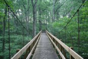
1984: Margaret Baker Memorial
Phoenixville, Pennsylvania, USA - Pickering Creek
| Bridgemeister ID: | 7371 (added 2022-11-06) |
| Year Completed: | 1984 |
| Name: | Margaret Baker Memorial |
| Location: | Phoenixville, Pennsylvania, USA |
| Crossing: | Pickering Creek |
| At or Near Feature: | Phoenixville YMCA |
| Coordinates: | 40.108065 N 75.519473 W |
| Maps: | Acme, GeoHack, Google, OpenStreetMap |
| Use: | Footbridge |
| Status: | Derelict, since September, 2021 |
| Main Cables: | Chain (steel) |
| Suspended Spans: | 1 |
Notes:
- 2021, September: Damaged by Hurricane Ida.
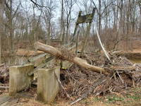
1985: (footbridge)
Salina, Kansas, USA - Smoky Hill River
| Bridgemeister ID: | 1847 (added 2005-07-16) |
| Year Completed: | 1985 |
| Name: | (footbridge) |
| Location: | Salina, Kansas, USA |
| Crossing: | Smoky Hill River |
| At or Near Feature: | Oakdale Park |
| Coordinates: | 38.833167 N 97.6041 W |
| Maps: | Acme, GeoHack, Google, OpenStreetMap |
| Principals: | Frank R. Weinhold |
| Use: | Footbridge |
| Status: | In use (last checked: 2010) |
| Main Cables: | Wire |
| Suspended Spans: | 3 |
| Main Span: | 1 x 27.4 meters (90 feet) estimated |
| Side Spans: | 2 x 13.7 meters (45 feet) estimated |
1985: Sylamore Creek
Allison, Arkansas, USA - South Sylamore Creek
| Bridgemeister ID: | 202 (added before 2003) |
| Year Completed: | 1985 |
| Name: | Sylamore Creek |
| Also Known As: | Swinging |
| Location: | Allison, Arkansas, USA |
| Crossing: | South Sylamore Creek |
| Coordinates: | 35.936067 N 92.121528 W |
| Maps: | Acme, GeoHack, Google, OpenStreetMap |
| Use: | Vehicular (one-lane) |
| Status: | In use (last checked: 2021) |
| Main Cables: | Wire (steel) |
| Suspended Spans: | 1 |
| Main Span: | 1 x 61 meters (200 feet) |
Notes:
- Some references locate this bridge over North Sylamore Creek and most have it "north of Mountain View". The bridge is located over South Sylamore Creek about one-half mile due west of Allison, Arkansas on what is now Stone County route 283 and appropriately named Swinging Bridge Road.
- Replaced 1943 Swinging - Allison, Arkansas, USA.
External Links:
- Historic Bridges of the United States - Sylamore Creek Swinging Bridge - Stone County, Arkansas
- Structurae - Structure ID 20008201
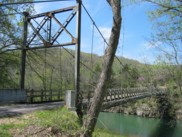
1986: (pipeline bridge)
Summit Bridge, Delaware, USA - Chesapeake and Delaware Canal
| Bridgemeister ID: | 1515 (added 2004-10-10) |
| Year Completed: | 1986 |
| Name: | (pipeline bridge) |
| Location: | Summit Bridge, Delaware, USA |
| Crossing: | Chesapeake and Delaware Canal |
| Coordinates: | 39.54241 N 75.72397 W |
| Maps: | Acme, GeoHack, Google, OpenStreetMap |
| Principals: | Clear Span Engineering, Inc., Trinity Steel Co. |
| Use: | Pipeline |
| Status: | In use (last checked: 2019) |
| Main Cables: | Wire (steel) |
| Main Span: | 1 x 371.9 meters (1,220 feet) |
Notes:
- Carries a 12-inch natural gas line.
Do you have any information or photos for these bridges that you would like to share? Please email david.denenberg@bridgemeister.com.