Suspension Bridges Crossing Delaware River
This is a list of all 14 bridges from the suspension bridge inventory crossing Delaware River. Please note that different rivers with the same name will be grouped together. For example, selecting 'Bear Creek' shows bridges across several different Bear Creeks. Also, similarly named rivers are grouped separately. For example, 'River Dee' (UK) bridges are grouped separately from 'Dee River' (Australia) bridges. Wherever you see a Bridgemeister ID number click it to isolate the bridge on its own page.
Related Lists:
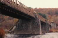
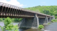
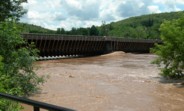
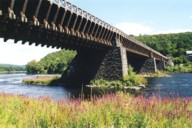
1848: Delaware Aqueduct
Lackawaxen, Pennsylvania and Minisink Ford, New York, USA - Delaware River
| Bridgemeister ID: | 30 (added before 2003) |
| Year Completed: | 1848 |
| Name: | Delaware Aqueduct |
| Also Known As: | Roebling Aqueduct |
| Location: | Lackawaxen, Pennsylvania and Minisink Ford, New York, USA |
| Crossing: | Delaware River |
| Coordinates: | 41.48262 N 74.98461 W |
| Maps: | Acme, GeoHack, Google, OpenStreetMap |
| Principals: | John A. Roebling |
| References: | AAJ, BDR, BOB, BPL, GBD, LAB, LACE, RDH, SJR |
| Use: | Aqueduct and Vehicular (one-lane), with walkway |
| Status: | In use (last checked: 2006) |
| Main Cables: | Wire (iron) |
| Suspended Spans: | 4 |
| Main Spans: | 1 x 43.3 meters (142 feet), 3 x 39.9 meters (131 feet) |
Notes:
- BPL: Completed 1848. RDH/BDR: Completed 1848, not used until 1849.
- Originally constructed to carry the Delaware and Hudson Canal. Converted to a one-lane vehicular bridge soon after the canal closed in 1898. Substantially restored in 1980's and 1990's, but retains original cables.
- Built as part of same project as 1849 Lackawaxen Aqueduct - Lackawaxen, Pennsylvania, USA.
- Built as part of same project as 1851 High Falls Aqueduct - High Falls, New York, USA.
- Built as part of same project as 1851 Neversink Aqueduct - Cuddebackville, New York, USA.
- Near 1849 Lackawaxen Aqueduct - Lackawaxen, Pennsylvania, USA.
External Links:
Image Sets:
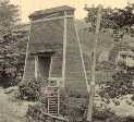
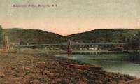
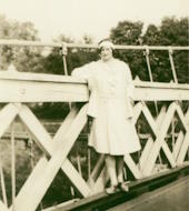
1855: Shohola
Barryville, New York and Shohola, Pennsylvania, USA - Delaware River
| Bridgemeister ID: | 41 (added before 2003) |
| Year Completed: | 1855 |
| Name: | Shohola |
| Also Known As: | Barryville-Shohola, Shohola-Barryville |
| Location: | Barryville, New York and Shohola, Pennsylvania, USA |
| Crossing: | Delaware River |
| Coordinates: | 41.477000 N 74.919000 W |
| Maps: | Acme, GeoHack, Google, OpenStreetMap |
| Principals: | Chauncy Thomas, John A. Roebling |
| References: | BDR, SHO |
| Use: | Vehicular |
| Status: | Dismantled, 1941 |
| Main Cables: | Wire (iron) |
| Suspended Spans: | 1 |
Notes:
- BDR: Built 1856, severely damaged 1859, rebuilt, collapsed Jan. 1st 1865, rebuilt 1866. Dale writes: "A respected historian, John Willard Johnston, who knew Chauncey Thomas personally and visited the area during his ownership of the toll bridge, insisted that Thomas, as the builder, was grossly incompetent."
- Originally constructed with one main span, the center pier was added during the 1866 reconstruction.
- Don Sayenga's research leads him to conclude the bridge was completed in the fall of 1855. He notes an article from the Pike County Democrat (June 21, 1872) stating the bridge was completed in 1855. The article also notes the 1859 collapse occurred on July 2, 1859. Don's interest in this bridge is piqued by the connection to John Roebling, "...this bridge seems to be the only John Roebling bridge that failed in service..." Roebling prepared plans, for the original bridge, for Chauncy Thomas (who, by Dale's account was inexperienced).
External Links:
Image Sets:
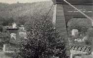
1869: Lordville
Lordville, New York and Equinunk, Pennsylvania, USA - Delaware River
| Bridgemeister ID: | 71 (added before 2003) |
| Year Completed: | 1869 |
| Name: | Lordville |
| Location: | Lordville, New York and Equinunk, Pennsylvania, USA |
| Crossing: | Delaware River |
| Coordinates: | 41.867938 N 75.213785 W |
| Maps: | Acme, GeoHack, Google, OpenStreetMap |
| Principals: | E.F. Farrington |
| References: | BDR, BOL, PTS2 |
| Use: | Vehicular (one-lane) |
| Status: | Destroyed, 1903 |
| Main Cables: | Wire (iron) |
Notes:
- Destroyed by flood 1903.
- Replaced by 1904 Lordville-Equinunk - Lordville, New York and Equinunk, Pennsylvania, USA.
- All past and present bridges at this location.
Image Sets:
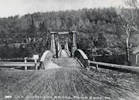
1870: Pond Eddy-Lumberland
Pond Eddy and Lumberland, New York, USA - Delaware River
| Bridgemeister ID: | 297 (added before 2003) |
| Year Completed: | 1870 |
| Name: | Pond Eddy-Lumberland |
| Also Known As: | Decker's |
| Location: | Pond Eddy and Lumberland, New York, USA |
| Crossing: | Delaware River |
| Coordinates: | 41.439349 N 74.819723 W |
| Maps: | Acme, GeoHack, Google, OpenStreetMap |
| Principals: | James D. Decker |
| References: | BDR |
| Use: | Vehicular |
| Status: | Destroyed, October 9, 1903 |
| Main Cables: | Wire (iron) |
| Suspended Spans: | 2 |
| Main Spans: | 2 |
| Deck width: | 12 feet |
Notes:
- Destroyed by flood.
- Coordinates are for the replacement bridge. The suspension bridge would have been extremely close, if not on the same alignment as the replacement.
External Links:
Image Sets:
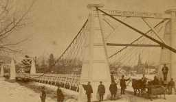
1872: Barrett
Port Jervis, New York and Matamoras, Pennsylvania, USA - Delaware River
| Bridgemeister ID: | 76 (added before 2003) |
| Year Completed: | 1872 |
| Name: | Barrett |
| Location: | Port Jervis, New York and Matamoras, Pennsylvania, USA |
| Crossing: | Delaware River |
| Coordinates: | 41.371917 N 74.697000 W |
| Maps: | Acme, GeoHack, Google, OpenStreetMap |
| References: | BDR |
| Use: | Vehicular |
| Status: | Destroyed, October 11, 1903 |
| Main Cables: | Wire (iron) |
| Suspended Spans: | 2 |
| Main Spans: | 2 |
Notes:
- BDR: Destroyed by ice March 17, 1875, rebuilt, destroyed by flood October 11, 1903.
External Links:
Image Sets:
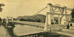
1890: Kellams
Kellams, New York and Stalker, Pennsylvania, USA - Delaware River
| Bridgemeister ID: | 7595 (added 2023-05-07) |
| Year Completed: | 1890 |
| Name: | Kellams |
| Also Known As: | Little Equinunk, Kellams-Stalker, Kellam |
| Location: | Kellams, New York and Stalker, Pennsylvania, USA |
| Crossing: | Delaware River |
| Coordinates: | 41.823641 N 75.113282 W |
| Maps: | Acme, GeoHack, Google, OpenStreetMap |
| Principals: | David Kellam |
| Use: | Vehicular |
| Status: | Replaced |
| Main Cables: | Wire |
| Main Span: | 1 |
Notes:
- Replaced by 1936 Kellams (Little Equinunk, Kellams-Stalker, Kellam) - Kellams, New York and Stalker, Pennsylvania, USA.
- All past and present bridges at this location.
Image Sets:
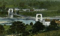
1904: Lordville-Equinunk
Lordville, New York and Equinunk, Pennsylvania, USA - Delaware River
| Bridgemeister ID: | 112 (added before 2003) |
| Year Completed: | 1904 |
| Name: | Lordville-Equinunk |
| Location: | Lordville, New York and Equinunk, Pennsylvania, USA |
| Crossing: | Delaware River |
| Coordinates: | 41.867745 N 75.213789 W |
| Maps: | Acme, GeoHack, Google, OpenStreetMap |
| Principals: | Owego Bridge Company |
| References: | BDR, BOL, BPL, HHP |
| Use: | Vehicular (one-lane) |
| Status: | Demolished, 1986 |
| Main Cables: | Eyebar (steel) |
| Suspended Spans: | 2 |
| Main Span: | 1 x 105.8 meters (347 feet) |
| Side Span: | 1 x 17.1 meters (56 feet) |
Notes:
- Eyebar suspension bridge.
- Replaced 1869 Lordville - Lordville, New York and Equinunk, Pennsylvania, USA.
- All past and present bridges at this location.
External Links:
Image Sets:
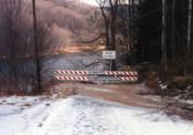
1904: Riegelsville
Riegelsville, Pennsylvania and Riegelsville, New Jersey, USA - Delaware River
| Bridgemeister ID: | 113 (added before 2003) |
| Year Completed: | 1904 |
| Name: | Riegelsville |
| Location: | Riegelsville, Pennsylvania and Riegelsville, New Jersey, USA |
| Crossing: | Delaware River |
| Coordinates: | 40.59427 N 75.19062 W |
| Maps: | Acme, GeoHack, Google, OpenStreetMap |
| Principals: | John A. Roebling's Sons Co., S. A. Cooney |
| References: | BDR, BPL, SSS |
| Use: | Vehicular (two-lane), with walkway |
| Status: | In use (last checked: 2024) |
| Main Cables: | Wire (steel) |
| Suspended Spans: | 3 |
| Main Spans: | 3 x 58 meters (190.3 feet) estimated |
External Links:
Image Sets:
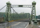
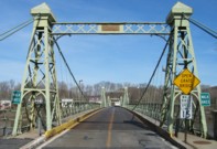
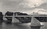
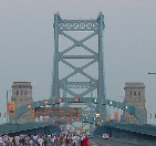
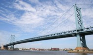
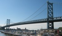
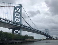
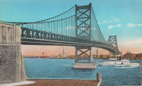
1926: Benjamin Franklin
Philadelphia, Pennsylvania and Camden, New Jersey, USA - Delaware River
| Bridgemeister ID: | 145 (added before 2003) |
| Year Completed: | 1926 |
| Name: | Benjamin Franklin |
| Also Known As: | Philadelphia-Camden |
| Location: | Philadelphia, Pennsylvania and Camden, New Jersey, USA |
| Crossing: | Delaware River |
| Coordinates: | 39.95333 N 75.135 W |
| Maps: | Acme, GeoHack, Google, OpenStreetMap |
| Principals: | Modjeski, Webster, Ball, Moiseff |
| References: | AAJ, BBR, BFL, BONJ, BPL, DRB, GBD, PTL, PTS2, USS |
| Use: | Vehicular (major highway) and Rail (subway), with walkway |
| Status: | In use (last checked: 2007) |
| Main Cables: | Wire (steel) |
| Suspended Spans: | 3 |
| Main Span: | 1 x 533.4 meters (1,750 feet) |
| Side Spans: | 2 x 219.3 meters (719.5 feet) |
| Deck width: | 125.5 feet |
Notes:
- Became longest suspension bridge by eclipsing 1924 Bear Mountain - Anthony's Nose and Bear Mountain, New York, USA.
- Eclipsed by new longest suspension bridge 1929 Ambassador - Detroit, Michigan, USA and Windsor, Ontario, Canada.
- Near 1957 Walt Whitman - Philadelphia, Pennsylvania and Camden, New Jersey, USA.
External Links:
Image Sets:
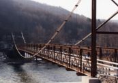
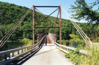
1936: Kellams
Kellams, New York and Stalker, Pennsylvania, USA - Delaware River
| Bridgemeister ID: | 97 (added before 2003) |
| Year Completed: | 1936 |
| Name: | Kellams |
| Also Known As: | Little Equinunk, Kellams-Stalker, Kellam |
| Location: | Kellams, New York and Stalker, Pennsylvania, USA |
| Crossing: | Delaware River |
| Coordinates: | 41.82333 N 75.11333 W |
| Maps: | Acme, GeoHack, Google, OpenStreetMap |
| References: | BDR, HHP, PTS2 |
| Use: | Vehicular (one-lane) |
| Status: | In use (last checked: 2019) |
| Main Cables: | Wire (steel) |
| Suspended Spans: | 1 |
| Main Span: | 1 x 117 meters (384 feet) |
| Characteristics: | Partially underspanned |
Notes:
- Damaged by floodwaters June, 2006. Repaired October, 2006.
- Renovation completed, January, 2019.
- Replaced 1890 Kellams (Little Equinunk, Kellams-Stalker, Kellam) - Kellams, New York and Stalker, Pennsylvania, USA.
- All past and present bridges at this location.
External Links:
Image Sets:
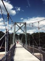
1947: Lumberville-Raven Rock
Lumberville, Pennsylvania and Bulls Island State Park, New Jersey, USA - Delaware River
| Bridgemeister ID: | 204 (added before 2003) |
| Year Completed: | 1947 |
| Name: | Lumberville-Raven Rock |
| Also Known As: | Bulls Island |
| Location: | Lumberville, Pennsylvania and Bulls Island State Park, New Jersey, USA |
| Crossing: | Delaware River |
| Coordinates: | 40.407017 N 75.038183 W |
| Maps: | Acme, GeoHack, Google, OpenStreetMap |
| Principals: | John A. Roebling's Sons Co. |
| References: | BDR, BONJ, SSB |
| Use: | Footbridge |
| Status: | In use (last checked: 2007) |
| Main Cables: | Wire (steel) |
| Suspended Spans: | 5 |
| Main Spans: | 5 |
| Characteristics: | Braced (trussed) chain/cable, Hinged cables |
Notes:
- SSB has an old picture of the bridge from a "Roebling publication". The original caption inside the picture says: "Practical application of Roebling Bridge research is the Lumberville footbridge which spans the Delaware River about twenty miles above Trenton. Pictured below, it utilizes four slabs of Roebling prestressed concrete and the Roebling-developed cable stiffening principle for the first time in the Western Hemisphere." and the authors of SSB go on to describe it as a "two-hinged braced cable suspension footbridge."
External Links:
Image Sets:
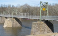
1951: Delaware Memorial I
New Castle, Delaware and Pennsville, New Jersey, USA - Delaware River
| Bridgemeister ID: | 207 (added before 2003) |
| Year Completed: | 1951 |
| Name: | Delaware Memorial I |
| Location: | New Castle, Delaware and Pennsville, New Jersey, USA |
| Crossing: | Delaware River |
| Coordinates: | 39.689227 N 75.520800 W |
| Maps: | Acme, GeoHack, Google, OpenStreetMap |
| Principals: | Homer R. Seely, Enoch R. Needles, Othmar Ammann, et. al. |
| References: | BONJ, BPL, CTD, GBD |
| Use: | Vehicular (major highway) |
| Status: | In use (last checked: 2022) |
| Main Cables: | Wire (steel) |
| Suspended Spans: | 3 |
| Main Span: | 1 x 655.3 meters (2,150 feet) |
| Side Spans: | 2 x 228.6 meters (750 feet) |
| Deck width: | 59.1 feet |
Notes:
- Next to 1968 Delaware Memorial II - New Castle, Delaware and Pennsville, New Jersey, USA.
- All past and present bridges at this location.
External Links:
Image Sets:
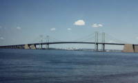
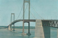
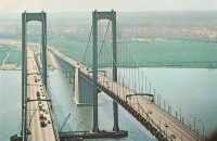
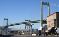
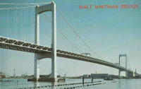
1957: Walt Whitman
Philadelphia, Pennsylvania and Camden, New Jersey, USA - Delaware River
| Bridgemeister ID: | 211 (added before 2003) |
| Year Completed: | 1957 |
| Name: | Walt Whitman |
| Location: | Philadelphia, Pennsylvania and Camden, New Jersey, USA |
| Crossing: | Delaware River |
| Coordinates: | 39.905 N 75.13 W |
| Maps: | Acme, GeoHack, Google, OpenStreetMap |
| Principals: | Othmar Ammann |
| References: | BFL |
| Use: | Vehicular (major highway) |
| Status: | In use (last checked: 2022) |
| Main Cables: | Wire (steel) |
| Suspended Spans: | 3 |
| Main Span: | 1 x 610 meters (2,001.3 feet) |
| Side Spans: | 2 x 234.7 meters (770 feet) |
| Deck width: | 83 feet |
Notes:
External Links:
Image Sets:
1968: Delaware Memorial II
New Castle, Delaware and Pennsville, New Jersey, USA - Delaware River
| Bridgemeister ID: | 224 (added before 2003) |
| Year Completed: | 1968 |
| Name: | Delaware Memorial II |
| Location: | New Castle, Delaware and Pennsville, New Jersey, USA |
| Crossing: | Delaware River |
| Coordinates: | 39.688633 N 75.516272 W |
| Maps: | Acme, GeoHack, Google, OpenStreetMap |
| References: | BONJ, CTD, GBD |
| Use: | Vehicular (major highway) |
| Status: | In use (last checked: 2022) |
| Main Cables: | Wire (steel) |
| Suspended Spans: | 3 |
| Main Span: | 1 x 655.3 meters (2,150 feet) |
| Side Spans: | 2 x 228.6 meters (750 feet) |
| Deck width: | 58.7 feet |
Notes:
- Next to 1951 Delaware Memorial I - New Castle, Delaware and Pennsville, New Jersey, USA.
- All past and present bridges at this location.
External Links:
Image Sets:


Do you have any information or photos for these bridges that you would like to share? Please email david.denenberg@bridgemeister.com.
Mail | Facebook | X (Twitter) | Bluesky