Suspension Bridges 1850-1883
This is a list of all 258 bridges in the suspension bridge inventory completed from 1850 through 1883, the year the Brooklyn Bridge was completed. Wherever you see a Bridgemeister ID number click it to isolate the bridge on its own page.
Related Lists:
1850: (footbridge)
Brahesborg Estate, Assens, Denmark
1850: (suspension bridge)
Nashville and Edgefield, Tennessee, USA - Cumberland River
| Bridgemeister ID: | 33 (added before 2003) |
| Year Completed: | 1850 |
| Name: | (suspension bridge) |
| Location: | Nashville and Edgefield, Tennessee, USA |
| Crossing: | Cumberland River |
| Principals: | Adolphus Heiman, Mathew Dickinson Field |
| References: | AAJ |
| Use: | Vehicular |
| Status: | Destroyed, 1862 |
| Main Cables: | Wire (iron) |
| Main Span: | 1 x 164 meters (538 feet) |
Notes:
- Collapsed 1855, rebuilt, destroyed 1862 (possibly 1863). Was at site of present-day Woodland Street Bridge.
- Replaced by 1866 (suspension bridge) - Nashville and Edgefield, Tennessee, USA.
External Links:
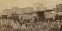
1850: Basteyroux
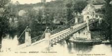
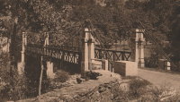
Argentat, Corrèze, France - Maronne River
| Bridgemeister ID: | 1985 (added 2005-12-02) |
| Year Completed: | 1850 |
| Name: | Basteyroux |
| Location: | Argentat, Corrèze, France |
| Crossing: | Maronne River |
| Coordinates: | 45.082660 N 1.947985 E |
| Maps: | Acme, GeoHack, Google, OpenStreetMap |
| Use: | Vehicular (one-lane) |
| Status: | Restricted to foot traffic (last checked: 2019) |
| Main Cables: | Wire (iron) |
| Suspended Spans: | 2 |
| Main Spans: | 2 |
External Links:
1850: Brivezac
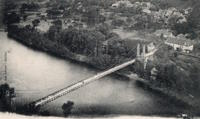
Brivezac, Corrèze, France - Dordogne River
| Bridgemeister ID: | 1974 (added 2005-11-27) |
| Year Completed: | 1850 |
| Name: | Brivezac |
| Location: | Brivezac, Corrèze, France |
| Crossing: | Dordogne River |
| Status: | Removed |
| Suspended Spans: | 1 |
External Links:
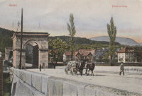
1850: Chain
Aarau, Switzerland - Aare River
| Bridgemeister ID: | 4761 (added 2020-06-28) |
| Year Completed: | 1850 |
| Name: | Chain |
| Also Known As: | Aarau Kettenbrücke |
| Location: | Aarau, Switzerland |
| Crossing: | Aare River |
| Coordinates: | 47.395431 N 8.042028 E |
| Maps: | Acme, GeoHack, Google, OpenStreetMap |
| Principals: | Jean Gaspard Dollfuss |
| References: | AAJ, PTS2 |
| Use: | Vehicular (one-lane) |
| Status: | Replaced, 1949 |
| Main Cables: | Eyebar (iron) |
| Suspended Spans: | 1 |
External Links:
- Kettenbrücke (Aarau) - Wikipedia. Notes bridge was opened for traffic December 28, 1850 and officially inaugurated January 6, 1851.
- Structurae - Structure ID 20043577
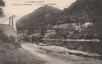
1850: Chambon
Saint-Merd-de-Lapleau, Auriac vicinity, Corrèze, France - Dordogne River
| Bridgemeister ID: | 7029 (added 2022-05-21) |
| Year Completed: | 1850 |
| Name: | Chambon |
| Location: | Saint-Merd-de-Lapleau, Auriac vicinity, Corrèze, France |
| Crossing: | Dordogne River |
| Use: | Vehicular (one-lane) |
| Status: | Removed |
| Main Cables: | Wire |
| Main Span: | 1 |
Notes:
- Later at same location Auriac (Chambon) - Saint-Merd-de-Lapleau, Auriac vicinity, Corrèze, France.
External Links:
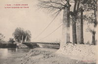
1850: Fleury-d'Aude
Fleury-d'Aude and Salles-d'Aude, Aude, France - Aude River
| Bridgemeister ID: | 1976 (added 2005-11-27) |
| Year Completed: | 1850 |
| Name: | Fleury-d'Aude |
| Also Known As: | Salles-d'Aude |
| Location: | Fleury-d'Aude and Salles-d'Aude, Aude, France |
| Crossing: | Aude River |
| Use: | Vehicular |
| Status: | Removed |
| Main Cables: | Wire |
| Suspended Spans: | 1 |
1850: Greffier
Le Mans, Sarthe, France - Sarthe River
| Bridgemeister ID: | 4916 (added 2020-07-19) |
| Year Completed: | 1850 |
| Name: | Greffier |
| Also Known As: | Clerk's, Wire |
| Location: | Le Mans, Sarthe, France |
| Crossing: | Sarthe River |
| Coordinates: | 48.001128 N 0.189991 E |
| Maps: | Acme, GeoHack, Google, OpenStreetMap |
| References: | AAJ |
| Use: | Vehicular |
| Status: | Destroyed |
| Main Cables: | Wire (iron) |
Notes:
- Destroyed, 1871, to slow the advancing Prussian army.
External Links:
1850: Lamagistère
Lamagistère, Tarn-et-Garonne, France - Garonne River
| Bridgemeister ID: | 7174 (added 2022-07-01) |
| Year Completed: | 1850 |
| Name: | Lamagistère |
| Location: | Lamagistère, Tarn-et-Garonne, France |
| Crossing: | Garonne River |
| Coordinates: | 44.123345 N 0.819394 E |
| Maps: | Acme, GeoHack, Google, OpenStreetMap |
| Use: | Vehicular |
| Status: | Destroyed, 1875 |
| Main Cables: | Wire |
| Suspended Spans: | 2 |
| Main Spans: | 2 |
Notes:
- 1875: Wrecked by flood
- Replaced by 1876 Lamagistère - Lamagistère, Tarn-et-Garonne, France.
External Links:
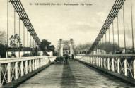
1850: Le Boulou
Le Boulou, Pyrénées-Orientales, France - Tech River
| Bridgemeister ID: | 1704 (added 2005-03-29) |
| Year Completed: | 1850 |
| Name: | Le Boulou |
| Location: | Le Boulou, Pyrénées-Orientales, France |
| Crossing: | Tech River |
| Use: | Vehicular |
| Status: | Demolished, 1962 |
| Main Cables: | Wire (iron) |
| Suspended Spans: | 1 |
| Main Span: | 1 x 120 meters (393.7 feet) |
| Deck width: | 5.74 meters |
External Links:
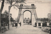
1850: Retournac
Retournac, Haute-Loire, France - Loire River
| Bridgemeister ID: | 4066 (added 2020-03-31) |
| Year Completed: | 1850 |
| Name: | Retournac |
| Location: | Retournac, Haute-Loire, France |
| Crossing: | Loire River |
| Use: | Vehicular |
| Status: | Destroyed, 1866 |
Notes:
- Destroyed by flood, 1866
- Replaced Retournac - Retournac, Haute-Loire, France.
1851: Chadrac
Chadrac, Haute-Loire, France - Loire River
| Bridgemeister ID: | 7864 (added 2023-09-15) |
| Year Completed: | 1851 |
| Name: | Chadrac |
| Location: | Chadrac, Haute-Loire, France |
| Crossing: | Loire River |
| Use: | Vehicular |
| Status: | Removed |
| Main Cables: | Wire (iron) |
| Suspended Spans: | 1 |
External Links:
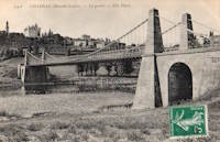
1851: High Falls Aqueduct
High Falls, New York, USA - Rondout Creek
| Bridgemeister ID: | 34 (added before 2003) |
| Year Completed: | 1851 |
| Name: | High Falls Aqueduct |
| Location: | High Falls, New York, USA |
| Crossing: | Rondout Creek |
| Principals: | John A. Roebling |
| References: | AAJ, BOB, BPL, RDH, SJR |
| Use: | Aqueduct |
| Status: | Removed, August, 1921 |
| Main Cables: | Wire (iron) |
| Suspended Spans: | 1 |
| Main Span: | 1 x 44.2 meters (145 feet) |
Notes:
- BPL, AAJ say completed 1848, RDH says not used until 1851 canal season.
- Heavy damaged by fire, 1921.
- Built as part of same project as 1848 Delaware Aqueduct (Roebling Aqueduct) - Lackawaxen, Pennsylvania and Minisink Ford, New York, USA.
- Built as part of same project as 1849 Lackawaxen Aqueduct - Lackawaxen, Pennsylvania, USA.
- Built as part of same project as 1851 Neversink Aqueduct - Cuddebackville, New York, USA.
External Links:
1851: Lewiston-Queenston
Lewiston, New York, USA and Queenston, Ontario, Canada - Niagara River
| Bridgemeister ID: | 35 (added before 2003) |
| Year Completed: | 1851 |
| Name: | Lewiston-Queenston |
| Location: | Lewiston, New York, USA and Queenston, Ontario, Canada |
| Crossing: | Niagara River |
| Principals: | Edward Serrell |
| References: | AAJ, BOB, BPL, HBE, PTS2 |
| Use: | Vehicular |
| Status: | Wrecked, 1864 |
| Main Cables: | Wire (iron) |
| Suspended Spans: | 1 |
| Main Span: | 1 x 258.8 meters (849 feet) |
| Deck width: | 21 feet (AAJ: 19.5 feet) |
Notes:
- Wrecked by wind February 1, 1864. Stay cables beneath the bridge had been disconnected to avoid damage from rising ice. Portions of the cables and deck remained, in a derelict state, as late as 1895. Replacement was not started until the late 1890's.
- The February 3, 1864 edition of Niagara Falls Gazette describes the wind event: "Partial Destruction Of The Lewiston Suspension Bridge -- A portion of the flooring and other wood-work of the Lewiston Suspension Bridge was blown down during the gale Monday forenoon. It seems that the long guys had been cut during the late ice jam to prevent injury to the structure and thus its strength to withstand a gale was much weakened. The wind swept through the gorge on Monday with terrific force and swayed the bridge so that some of the cross timbers, near the centre were loosened from their fastenings, and fell, of course carrying the floor with them. A large portion at each end, remains without material injury. The extent of the damage -- financially -- we have not yet learned, but we judge from what we hear that it may be about $10,000. The bridge was built in 1852 and cost not far from $40,000. It will doubtless soon be repaired and in use."
- Later at same location 1899 Lewiston-Queenston - Lewiston, New York, USA and Queenston, Ontario, Canada.
- See 1849 Wheeling (Wheeling and Belmont) - Wheeling, West Virginia, USA. The 1851 Lewiston-Queenston bridge is sometimes claimed to have become the longest in the world with a main span surpassing the length of the Wheeling suspension bridge. However, Don Sayenga notes the length of the suspended span of the Lewiston-Queenston bridge was only 849 feet, not the 1,043 feet sometimes cited. Don writes: "[1,043 feet] was the distance between the towers built high up on the cliffs above the crossing - because there was no space for them below. The roadway suspended from the towers was only 849 feet span over the water from abutment to abutment." Thus, Roebling's Cincinnati bridge should be considered the first to eclipse Wheeling's record main span.
External Links:
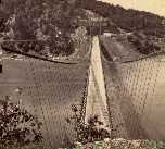
1851: Neversink Aqueduct
Cuddebackville, New York, USA - Neversink River
| Bridgemeister ID: | 36 (added before 2003) |
| Year Completed: | 1851 |
| Name: | Neversink Aqueduct |
| Location: | Cuddebackville, New York, USA |
| Crossing: | Neversink River |
| Principals: | John A. Roebling |
| References: | AAJ, BOB, RDH, SJR |
| Use: | Aqueduct |
| Status: | Removed |
| Main Cables: | Wire (iron) |
| Suspended Spans: | 1 |
| Main Span: | 1 x 51.8 meters (170 feet) |
Notes:
- BPL says 1849, RDH says not used until 1851 canal season.
- Built as part of same project as 1848 Delaware Aqueduct (Roebling Aqueduct) - Lackawaxen, Pennsylvania and Minisink Ford, New York, USA.
- Built as part of same project as 1849 Lackawaxen Aqueduct - Lackawaxen, Pennsylvania, USA.
- Built as part of same project as 1851 High Falls Aqueduct - High Falls, New York, USA.
External Links:
1851: Saint-Just-sur-Loire
Saint-Just-sur-Loire and Saint-Just-Saint-Rambert, Loire, France - Loire River
| Bridgemeister ID: | 2052 (added 2006-06-02) |
| Year Completed: | 1851 |
| Name: | Saint-Just-sur-Loire |
| Location: | Saint-Just-sur-Loire and Saint-Just-Saint-Rambert, Loire, France |
| Crossing: | Loire River |
| Use: | Vehicular |
| Status: | Removed, c. 1931 |
| Main Cables: | Wire (iron) |
| Suspended Spans: | 1 |
Notes:
- 1926: Part of the deck fails under a heavily loaded truck. A replacement is completed in 1931.
- Near 1831 Andrézieux - Andrézieux, Loire, France.
External Links:
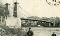
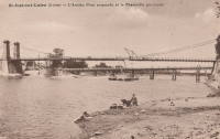
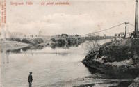
| Bridgemeister ID: | 2076 (added 2006-06-10) |
| Year Completed: | 1851 |
| Name: | Sérignan |
| Location: | Sérignan, Béziers vicinity, Hérault, France |
| Crossing: | Orb River |
| Coordinates: | 43.285011 N 3.281313 E |
| Maps: | Acme, GeoHack, Google, OpenStreetMap |
| Use: | Vehicular |
| Status: | Replaced, c. 1909 |
| Suspended Spans: | 1 |
Notes:
- Near future location of 2016 Sérignan - Sérignan, Béziers, Hérault, France.
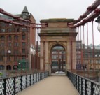
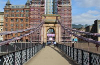
1851: South Portland
Glasgow, Scotland, United Kingdom - River Clyde
| Bridgemeister ID: | 404 (added before 2003) |
| Year Completed: | 1851 |
| Name: | South Portland |
| Also Known As: | Carlton |
| Location: | Glasgow, Scotland, United Kingdom |
| Crossing: | River Clyde |
| Coordinates: | 55.85433 N 4.25618 W |
| Maps: | Acme, GeoHack, Google, OpenStreetMap |
| Principals: | Alexander Kirkland, George Martin |
| References: | BEM, NTB |
| Use: | Footbridge |
| Status: | In use (last checked: 2019) |
| Main Cables: | Eyebar (iron) |
| Suspended Spans: | 1 |
Notes:
- 1853 sometimes cited as the year it opened.
External Links:
1851: Trévoux
Trévoux, Ain and Quincieux, Métropole de Lyon, France - Saône River
| Bridgemeister ID: | 1625 (added 2005-02-27) |
| Year Completed: | 1851 |
| Name: | Trévoux |
| Location: | Trévoux, Ain and Quincieux, Métropole de Lyon, France |
| Crossing: | Saône River |
| Coordinates: | 45.93945 N 4.772417 E |
| Maps: | Acme, GeoHack, Google, OpenStreetMap |
| Use: | Vehicular (one-lane) |
| Status: | Restricted to foot traffic (last checked: 2020) |
| Main Cables: | Wire (iron) |
| Suspended Spans: | 2 |
| Main Spans: | 2 |
Notes:
- Partially dismantled, 1982. Restored as a footbridge, 1985.
External Links:
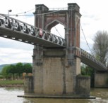
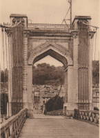
1851: Řetězový
Ostrava, Czechia - Ostravice River
| Bridgemeister ID: | 8428 (added 2024-03-08) |
| Year Completed: | 1851 |
| Name: | Řetězový |
| Also Known As: | Kettenbrücke |
| Location: | Ostrava, Czechia |
| Crossing: | Ostravice River |
| Principals: | Josef Seifert |
| References: | PTS2 |
| Use: | Vehicular |
| Status: | Collapsed, 1886 |
| Main Cables: | Chain (iron) |
| Main Span: | 1 |
External Links:
- Encyklopedie.Ostrava.cz - Zřícení řetězového mostu přes Ostravici v roce 1886. Article about the collapse of the bridge.
- HistorickaOstrava.cz - Kettenbrücke – Řetězový most (1851-1886). History and images of the bridge, including the 1886 collapse.
1852: (suspension bridge)
Frankfort, Kentucky, USA - Kentucky River
| Bridgemeister ID: | 1714 (added 2005-04-03) |
| Year Completed: | 1852 |
| Name: | (suspension bridge) |
| Location: | Frankfort, Kentucky, USA |
| Crossing: | Kentucky River |
| Coordinates: | 38.201998 N 84.881934 W |
| Maps: | Acme, GeoHack, Google, OpenStreetMap |
| Principals: | Mathew Dickinson Field |
| References: | AAJ, ENG18570605, HBE, HOF |
| Use: | Rail |
| Status: | Removed |
| Main Cables: | Wire (iron) |
| Suspended Spans: | 2 |
| Main Spans: | 1 x 61 meters (200 feet) estimated, 1 x 91.4 meters (300 feet) estimated |
Notes:
- An early attempt at a railroad suspension bridge, it was significantly reconstructed (because of excessive vibrations and increasing loads) by Julius W. Adams in 1857 to have three spans of 120, 163, and 163 feet. It is unclear whether the new structure was also a suspension bridge.
- HOF describes the location as "between the foot of Broadway and the neck of land near the mouth of Benson Creek." The coordinates provided here are for the later rail crossing at that general location, likely at or very close to the site of the suspension bridge.
1852: Aamodt
Åmot, Modum, Viken, Norway - Drammenselva
| Bridgemeister ID: | 969 (added 2003-11-01) |
| Year Completed: | 1852 |
| Name: | Aamodt |
| Also Known As: | Åmot, Aamot |
| Location: | Åmot, Modum, Viken, Norway |
| Crossing: | Drammenselva |
| Coordinates: | 59.895203 N 9.913852 E |
| Maps: | Acme, GeoHack, Google, kart.1881.no, OpenStreetMap |
| Use: | Vehicular (one-lane) |
| Status: | Dismantled (last checked: 2018) |
| Main Cables: | Eyebar |
| Suspended Spans: | 1 |
| Main Span: | 1 x 53 meters (173.9 feet) |
Notes:
- Moved to 1958 Aamodt (Åmot, Aamot) - Oslo, Norway.
External Links:
- DigitaltMuseum - Aamodt hengebru over Drammenselva i Åmot, Modum. Oppført 1851-52
- DigitaltMuseum - Ved Kongsfoss Åmot bro ble bygget i 1853
- DigitaltMuseum - Åmot bru (Aamodt bro)
- DigitaltMuseum - Åmot bru (Aamodt bro)
- Structurae - Structure ID 20072046
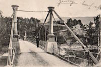
1852: Charleston
Charleston, West Virginia, USA - Elk River
| Bridgemeister ID: | 38 (added before 2003) |
| Year Completed: | 1852 |
| Name: | Charleston |
| Also Known As: | Lovell Street |
| Location: | Charleston, West Virginia, USA |
| Crossing: | Elk River |
| Principals: | W. O. Buchanan, William Kuhn, Abraham Wright |
| References: | AAJ, EOV, HBE, PTS2 |
| Use: | Vehicular |
| Status: | Collapsed, December 15, 1904 |
| Main Cables: | Wire (iron) |
| Suspended Spans: | 1 |
| Main Span: | 1 x 145.7 meters (478 feet) |
| Deck width: | 17 feet |
Notes:
- Was still part of Virginia at time of completion.
- Damaged during Civil War. An article in the August 2, 1861 issue of the New York Times mentions: "A junction of our forces having now been effected, the army at once moved on to Elk River, which debouches into the Kanawha at Charleston, where the army encamped for the night. We would have crossed the stream at once, and marched through the town the same evening, but for the fact that the rebels had partially destroyed the beautiful suspension bridge which spans Elk River at this spot, rendering it unsafe for passage. Not content with burning a portion of the flooring, they nearly severed the strands which support the structure, and aid their work, too, in the most bungling manner. A more shameless piece of vandalism I never witnessed. While the army slept, a company of sappers and miners repaired the damage, and yesterday the army, nearly five thousand strong, marched through the streets of Charleston."
- Near 1884 (suspension bridge) - Charleston, West Virginia, USA.
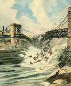
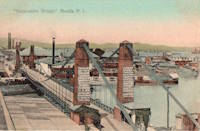
1852: Colgante de Manila
Manila, Philippines - Pasig River
| Bridgemeister ID: | 2112 (added 2006-09-03) |
| Year Completed: | 1852 |
| Name: | Colgante de Manila |
| Also Known As: | Claveria |
| Location: | Manila, Philippines |
| Crossing: | Pasig River |
| Use: | Vehicular |
| Status: | Replaced, 1940 |
| Suspended Spans: | 1 |
| Main Span: | 1 x 110 meters (360.9 feet) |
| Deck width: | 7 meters |
Notes:
- Rene Sumodobila writes: "It had a single lane in each travel way to allow passage of horse-drawn carriages and a pedestrian island in the middle. The Puente Colgante is said to be first suspension bridge in the Far East. The bridge materials were imported from England by Matia Menchacatorre y Cia, a Spanish company, in joint venture with Ayala y Cia, a local company. The contruction was supervised by M. Gabaud, a French engineer. Inaugurated in January 4, 1852, it went into service until 1940 in order to give way to the modern-day Quezon Bridge"
External Links:

1852: Fairmont and Palatine
Fairmont, West Virginia, USA - Monongahela River
| Bridgemeister ID: | 39 (added before 2003) |
| Year Completed: | 1852 |
| Name: | Fairmont and Palatine |
| Location: | Fairmont, West Virginia, USA |
| Crossing: | Monongahela River |
| Principals: | James L. Randolph |
| References: | EOV, PTS2 |
| Status: | Removed |
| Main Cables: | Wire (iron) |
Notes:
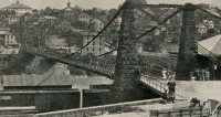
- Was still part of Virginia at time of completion.
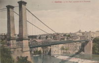
1852: Gaillac
Gaillac, Tarn, France - Tarn River
| Bridgemeister ID: | 1646 (added 2005-03-18) |
| Year Completed: | 1852 |
| Name: | Gaillac |
| Location: | Gaillac, Tarn, France |
| Crossing: | Tarn River |
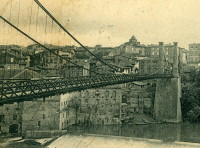
| At or Near Feature: | Abbaye Saint-Michel |
| Coordinates: | 43.897361 N 1.894751 E |
| Maps: | Acme, GeoHack, Google, OpenStreetMap |
| Use: | Vehicular |
| Status: | Removed |
| Main Cables: | Wire (iron) |
| Suspended Spans: | 1 |
1852: Huse
Yeomet, California, USA - Cosumnes River
| Bridgemeister ID: | 1088 (added 2004-01-01) |
| Year Completed: | 1852 |
| Name: | Huse |
| Location: | Yeomet, California, USA |
| Crossing: | Cosumnes River |
| Coordinates: | 38.55323 N 120.84755 W |
| Maps: | Acme, GeoHack, Google, OpenStreetMap |
| Principals: | E.P. Bowman |
| Use: | Vehicular |
| Status: | Removed |
| Main Cables: | Wire (iron) |
Notes:
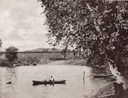
- Yeomet was located near the present day California Route 49 crossing of the Cosumnes River by the confluence of the North Fork and Middle Fork of the Cosumnes River. Yeomet was once known as "Forks of the Cosumnes." The location coordinates provided here are only to show the approximate location of the confluence and should not be considered the exact location of the bridge. This inventory entry represents the suspension bridge for which a photograph exists in the Lawrence & Houseworth collection titled "Suspension Bridge over the Cosumnes River, At Yeomet, El Dorado County". This image exists in several online archives.
- Barry Parr, consulting Erwin Gudde's California Gold Camps (University of California Press), writes that Gudde notes the bridge is located "at Yeomet and says it was marked on the County Map in 1866, and was owned by S.E. Huse for a decade. Of Yeomet, Gudde writes: 'Amador County. At the junction of the forks of Cosumnes River, formerly in El Dorado County'. Gudde says the camp developed in 1849 or 1850 and prospered for a number of years, but says nothing further about the bridge." Barry also notes that some sources cite Yeomet as located in Calaveras County, but this is because Amador County was created in 1854 from Calaveras County. Barry continues: "The California Division of Mines Bulletin 141, Geological Guidebook along Highway 49, mentions the Highway 49 bridge across the Cosumnes as also known as the Huse Bridge."
- The October 14, 1976 edition of The Mountain Democrat Times (Placerville, California) has an article about the Huse Bridge (from the Heritage Association of El Dorado) describing Huse's Bridge:
"E.P. Bowman, an early motel keeper in Yeomet had a ferry across the Cosumnes and by 1852 had built a bridge there (J.M. Watrous had a ferry there also). Traffic was heavy and... [the tolls were] as much a 'gold mine' as most of the nearby river claims which ran for miles above and below the town. (Yeomet falls was below the bridge). The famous Mother Lode crossed the river in the vicinity of the town. Samuel Huse bought the bridge at Yeomet in about 1862 and owned it until his death. His widow Laura sold the wire suspension bridge and the exclusive right to collect tolls to John Ballard and W.H. Martin in 1883. William Miller purchased the property in 1887."
It is unclear if the 1852 E.P. Bowman bridge was the same structure as the suspension bridge purchased by Huse ten years later, but it has been assumed here pending additional details. - An obituary for in the August 28, 1949 edition of the Oakland Tribune for Lilian Williams presents a stronger tie between E.P. Bowman and S.E. Huse: "With her foster parents, the E. P. Bowmans, Mrs. Williams spent her childhood in Oakland, San Francisco and Yeomet, between Plymouth and Placerville. Bowman and her foster uncle, S.E. Huse, owned a hotel at Yeomet. They also built and operated a toll bridge there on the Cosumnes River, over which most of the heavy machinery and mining equipment was transported to the old Mother Lode mines."
- See 1852 Wilson's - Cosumne, California, USA.
- See 1863 Lamb's - Latrobe vicinity and Plymouth vicinity, California, USA.
External Links:
1852: Mazères-sur-Salat
Mazères-sur-Salat, Haute-Garonne, France - Salat River
| Bridgemeister ID: | 7201 (added 2022-07-04) |
| Year Completed: | 1852 |
| Name: | Mazères-sur-Salat |
| Location: | Mazères-sur-Salat, Haute-Garonne, France |
| Crossing: | Salat River |
| Coordinates: | 43.132556 N 0.975981 E |
| Maps: | Acme, GeoHack, Google, OpenStreetMap |
| Use: | Vehicular (one-lane) |
| Status: | Removed |
| Main Cables: | Wire (iron) |
Notes:
- Later at same location Mazères-sur-Salat - Mazères-sur-Salat, Haute-Garonne, France. Unclear if the later bridge was a direct replacement.
External Links:
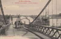
1852: Merle
Merle, Corrèze, France - Maronne River
| Bridgemeister ID: | 3030 (added 2019-10-13) |
| Year Completed: | 1852 |
| Name: | Merle |
| Location: | Merle, Corrèze, France |
| Crossing: | Maronne River |
| Coordinates: | 45.061779 N 2.080386 E |
| Maps: | Acme, GeoHack, Google, OpenStreetMap |
| Use: | Vehicular (one-lane) |
| Status: | Replaced, 1999 |
| Main Cables: | Wire (iron) |
| Suspended Spans: | 1 |
Notes:
- As of 2019, piers still present beyond the ends of its replacement bridge.
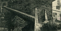
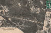
1852: Pey
Blantyre, Scotland, United Kingdom - River Clyde
| Bridgemeister ID: | 2633 (added 2019-02-24) |
| Year Completed: | 1852 |
| Name: | Pey |
| Also Known As: | Mill, Toll, Swing |
| Location: | Blantyre, Scotland, United Kingdom |
| Crossing: | River Clyde |
| Coordinates: | 55.801972 N 4.081433 W |
| Maps: | Acme, GeoHack, Google, OpenStreetMap |
| Principals: | Henry Monteith & Co |
| Use: | Footbridge |
| Status: | Removed (last checked: 1949) |
| Main Cables: | Rod (iron) |
| Suspended Spans: | 3 |
| Main Span: | 1 |
| Side Spans: | 2 |
Notes:
- Dredge patent bridge.
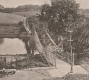
1852: Queens Park
Chester and Handbridge, England, United Kingdom - River Dee
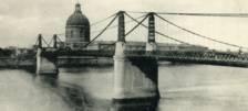
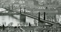
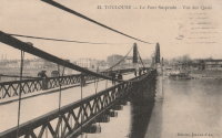
1852: Saint-Pierre
Toulouse, Haute-Garonne, France - Garonne River
| Bridgemeister ID: | 1169 (added 2004-01-23) |
| Year Completed: | 1852 |
| Name: | Saint-Pierre |
| Location: | Toulouse, Haute-Garonne, France |
| Crossing: | Garonne River |
| Coordinates: | 43.602179 N 1.434706 E |
| Maps: | Acme, GeoHack, Google, OpenStreetMap |
| References: | PTS2 |
| Use: | Vehicular |
| Status: | Demolished, 1927 |
| Main Cables: | Wire (iron) |
| Suspended Spans: | 4 |
| Main Spans: | 2 |
| Side Spans: | 2 |
Notes:
- Heavily damaged by flood, 1875. A metal arch bridge, completed 1987, is at this location now.
- Replaced by 1931 Saint-Pierre - Toulouse, Haute-Garonne, France.
External Links:
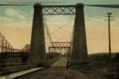
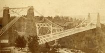
1852: St. John
St. John, New Brunswick, Canada - St. John River
| Bridgemeister ID: | 37 (added before 2003) |
| Year Completed: | 1852 |
| Name: | St. John |
| Location: | St. John, New Brunswick, Canada |
| Crossing: | St. John River |
| Principals: | Edward Serrell |
| References: | AAJ, BPL, HBE, PTS2 |
| Use: | Vehicular (one-lane) |
| Status: | Removed, 1915 |
| Main Cables: | Wire (iron) |
| Suspended Spans: | 1 |
| Main Span: | 1 x 195.1 meters (640 feet) |
Notes:
- Rebuilt 1857.
External Links:
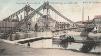
1852: Vennes
Liège, Belgium - Meuse Dérivation
| Bridgemeister ID: | 2319 (added 2007-05-05) |
| Year Completed: | 1852 |
| Name: | Vennes |
| Also Known As: | Boverie, Englebert |
| Location: | Liège, Belgium |
| Crossing: | Meuse Dérivation |
| Coordinates: | 50.62959 N 5.57801 E |
| Maps: | Acme, GeoHack, Google, OpenStreetMap |
| References: | IBB |
| Use: | Vehicular |
| Status: | Removed, 1905 or 1906 |
| Main Cables: | Chain (iron) |
| Suspended Spans: | 1 |
Notes:
- Adjacent replacement completed in 1903. The suspension bridge was still standing at the time of the world's fair (Exposition Universelle et Internationale de Liège) held in Liège in 1905.
- IBB: Precise construction date unknown, but was in time frame 1852-1864. Other sources cite 1852.
- Coordinates refer to the current Vennes Bridge. This is the approximate location of the removed suspension bridge.
External Links:
- Le Pont Suspendu de la Boverie sur la Dérivation de la Meuse à Liège. Main page: Les ponts metalliques historiques belges.
- Pont des Vennes — Wikipédia
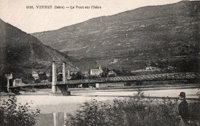
1852: Veurey
Veurey-Voroize, Isère, France - Isère River
| Bridgemeister ID: | 4880 (added 2020-07-18) |
| Year Completed: | 1852 |
| Name: | Veurey |
| Location: | Veurey-Voroize, Isère, France |
| Crossing: | Isère River |
| Coordinates: | 45.271117 N 5.621434 E |
| Maps: | Acme, GeoHack, Google, OpenStreetMap |
| References: | AAJ |
| Use: | Vehicular |
| Status: | Destroyed, 1928 |
| Main Cables: | Wire (iron) |
Notes:
- 1928: Destroyed by flood.
- Replaced by 1933 Veurey - Veurey-Voroize, Isère, France.
1852: Wilson's
Cosumne, California, USA - Cosumnes River
| Bridgemeister ID: | 2116 (added 2006-09-10) |
| Year Completed: | 1852 |
| Name: | Wilson's |
| Location: | Cosumne, California, USA |
| Crossing: | Cosumnes River |
| Coordinates: | 38.49229 N 121.17183 W |
| Maps: | Acme, GeoHack, Google, OpenStreetMap |
| Principals: | W. D. Wilson |
| References: | DSL200106 |
| Use: | Vehicular |
| Status: | Removed |
| Main Cables: | Wire |
| Main Span: | 1 x 45.7 meters (150 feet) |
| Deck width: | 12 feet |
Notes:
- The location of this bridge was near the present day location of Cosumne in Sacramento County, just east of Sloughhouse. The location coordinates provided here are only to show the approximate location of present-day Cosumne and should not be considered the exact location of the bridge. Don Sayenga writes: "The exact location was at the intersection of [present-day] Dillard Road and State Route 16 a very short distance east of Sloughhouse, Sacramento County, California... The whole area at that time was known as Daylor's Ranch."
- Don Sayenga notes an F.W. Panhorst (of the California Highway Department) citation:
"Alta California July 27, 1852 reprinting an article from Sacramento Union mentions a wire suspension bridge built in Sacramento County across the Cosumnes. The span is described as 150 feet with a roadway width of 12 feet. One W.D. Wilson is mentioned as owner and designer. This structure, according to our best information, was the first suspension bridge in California."
- A January 14, 1862 Sacramento Bee article notes:
"The quartz mill and house of the brothers Wiley, just beyond Butte City, were carried away by the torrent. At Ione City, William's brick stable had fallen, and several other houses had met with a like fate. On Sutter creek, the loss and damage had been terrific - bridges and houses being carried off like chaff. Mr. Haywood, proprietor of a quartz mill on Sutter creek, had been a loser to the amount of at least $75,000. We have it from good authority that in the counties of Calaveras and Amador not a bridge is left standing. Below Ione City, it is thought that there has been loss of life."
which seems to imply a relationship between the Ione Valley, the Cosumnes River, and the bridge at Wilson's Exchange, but this may have just been coincidental that both "Ione Valley" and Wilson's Exchange were mentioned in the same paragraph; they are nearby. Present-day Ione is in Amador County a few miles east of Sacramento County. The Cosumnes River forms the northern border of Amador County several miles to the north of present-day Ione. Barry Parr notes that the Cosumnes River does not flow through the "Ione Valley," but Barry writes: "Recalling Daylor’s name in Historic Spots of California: 'Daylor established himself as a trader and hotel-keeper on the Cosumnes River about a mile east of Slough House. This place, which was at first known as Daylor’s Ranch, later became the Cosumnes post office.' (p. 290) The site of Cosumnes post office is about five miles downstream from Bridge House, and both are on the Sacramento-Ione Road.
"Last Saturday night, the reports of minute guns were heard, as if signals of distress, coming from the direction of a house where lived Mr. Martin and his family. The whole of Ione Valley was many feet under water. No boats were to be had, so that assistance might be rendered those in danger and distress. In a short time a heavy crash was heard, the signals of distress ceased, and our informant tells us that when he left the general impression was that Martin and his family had lost their lives. The wire suspension bridge over the Cosumnes river had disappeared - the house known as Wilson’s Exchange has also been washed away, and Daylor’s adobe house is flat with the ground. These facts go to show that throughout the mountain districts, as well as in the valleys, the destruction of property and loss of human life exceed the worst that was anticipated, and we shall hear repetitions of such tales of distress as the avenues for communication are gradually opened to us." - See 1852 Huse - Yeomet, California, USA.
- See 1863 Lamb's - Latrobe vicinity and Plymouth vicinity, California, USA.
External Links:
- Oliver Plummer. Transcription by Debbie Walke Gramlick of passage from An Illustrated History of Sacramento County, California. (by Hon. Win. J. Davis, Lewis Publishing Company, 1890, Pages 435-436) which sheds more light on W.D. Wilson.
"Mr. Wilson and part of the company concluded to seek the land of gold, while others kept to the original design of going to Oregon. On his arrival Mr. Wilson mined for a short time on Mormon Island and then moved to Hangtown, now Placerville, where in the winter of 1848-49 he built the first house erected in that place. The family then comprised six children; five more were born in California; nine grew to maturity and seven are living in 1889. In the spring of 1850 he moved down on the Cosumnes and purchased 6,000 acres of the Hartnell Grant, and built a tavern, long known as Wilson’s Exchange, across the river from what is now the Cosumnes post office. He was postmaster from the establishment of that office until 1868. He was by trade a millwright and built the first suspension bridge on the Cosumnes."
1853: (suspension bridge)
Delaware, Ohio, USA - Olentangy River
| Bridgemeister ID: | 774 (added 2003-03-14) |
| Year Completed: | 1853 |
| Name: | (suspension bridge) |
| Location: | Delaware, Ohio, USA |
| Crossing: | Olentangy River |
| At or Near Feature: | Winter Street |
| Principals: | John Gray |
| References: | SME20030311 |
| Use: | Footbridge |
| Status: | Destroyed, February 1883 |
| Main Cables: | Wire (iron) |
| Main Span: | 1 x 61 meters (200 feet) estimated |
Notes:
- SME20030311: Intended only for foot traffic, destroyed by ice jam February 1883.
1853: Chain
Ostrov, Pskov Oblast, Russia - Velikaya River
| Bridgemeister ID: | 4644 (added 2020-06-16) |
| Year Completed: | 1853 |
| Name: | Chain |
| Also Known As: | Tsepnyye, Цепные |
| Location: | Ostrov, Pskov Oblast, Russia |
| Crossing: | Velikaya River |
| Coordinates: | 57.340559 N 28.352457 E |
| Maps: | Acme, GeoHack, Google, OpenStreetMap |
| References: | PTS2 |
| Use: | Vehicular |
| Status: | Restricted to foot traffic (last checked: 2016) |
| Main Cables: | Eyebar (iron) |
| Suspended Spans: | 1 |
Notes:
External Links:
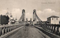
1853: Chain
Ostrov, Pskov Oblast, Russia - Velikaya River
| Bridgemeister ID: | 4645 (added 2020-06-16) |
| Year Completed: | 1853 |
| Name: | Chain |
| Also Known As: | Tsepnyye, Цепные |
| Location: | Ostrov, Pskov Oblast, Russia |
| Crossing: | Velikaya River |
| Coordinates: | 57.338893 N 28.351235 E |
| Maps: | Acme, GeoHack, Google, OpenStreetMap |
| References: | PTS2 |
| Use: | Vehicular |
| Status: | Restricted to foot traffic (last checked: 2016) |
| Main Cables: | Eyebar (iron) |
| Suspended Spans: | 1 |
Notes:
External Links:

1853: Dresden
Dresden, Ohio, USA - Muskingum River
| Bridgemeister ID: | 43 (added before 2003) |
| Year Completed: | 1853 |
| Name: | Dresden |
| Location: | Dresden, Ohio, USA |
| Crossing: | Muskingum River |
| Principals: | George Copland |
| References: | EOV, GBD, OCEN198202 |
| Use: | Vehicular |
| Status: | Destroyed, 1913 |
| Main Cables: | Wire (iron) |
| Suspended Spans: | 1 |
Notes:
- Destroyed by flood 1913.
- Replaced by 1914 Dresden - Dresden, Ohio, USA.
External Links:
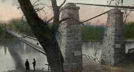
1853: Falmouth
Falmouth, Kentucky, USA - Licking River
| Bridgemeister ID: | 42 (added before 2003) |
| Year Completed: | 1853 |
| Name: | Falmouth |
| Location: | Falmouth, Kentucky, USA |
| Crossing: | Licking River |
| Coordinates: | 38.678056 N 84.328222 W |
| Maps: | Acme, GeoHack, Google, OpenStreetMap |
| Principals: | D. Griffith Smith |
| References: | AAJ, EOV |
| Use: | Vehicular |
| Status: | Collapsed, 1868 |
| Main Cables: | Wire (iron) |
| Main Span: | 1 x 98.5 meters (323 feet) |
Notes:
- 1854: A brief article in March 22, 1854 Louisville Daily Courier states the bridge was destroyed ("rendering the whole structure useless… it cannot even be repaired") in the early 1854 flood that destroyed other Licking River bridges. However, other sources indicate the Falmouth bridge survived the flood. Unclear if it was completely destroyed and rebuilt or just damaged and repaired.
- Coordinates provided here indicate the likely location of the bridge over the main branch of the Licking River.
External Links:
- New Licking Bridge Stands On The Foundation of Its Predecessors - Rootsweb.com. Several anecdotes and snippets of history about the bridge. Indicates the bridge survived the January 1854 Licking River flood and survived until 1868.
1853: Fort Hunter
Tribes Hill and Fort Hunter, New York, USA - Mohawk River
| Bridgemeister ID: | 44 (added before 2003) |
| Year Completed: | 1853 |
| Name: | Fort Hunter |
| Also Known As: | Fonda |
| Location: | Tribes Hill and Fort Hunter, New York, USA |
| Crossing: | Mohawk River |
| Principals: | John W. Murphy, Thomas R. Hulett |
| References: | ONC, PTS2 |
| Use: | Vehicular |
| Status: | Dismantled, 1935 |
| Main Cables: | Wire (iron) |
| Suspended Spans: | 1 |
| Main Span: | 1 x 169.5 meters (556 feet) |
Notes:
- According to ONC: Designed by John W. Murphy (who designed several suspension bridges in the 1850s and 1860s in New York and Pennsylvania). Fort Hunter Suspension Bridge Company incorporated in 1852, but cables were not installed until 1853.
- 1935: Bridge is dismantled (ONC).
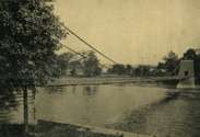
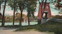
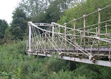
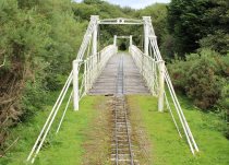
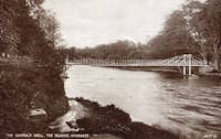
1853: General's Well
Inverness, Scotland, United Kingdom - River Ness
| Bridgemeister ID: | 406 (added before 2003) |
| Year Completed: | 1853 |
| Name: | General's Well |
| Location: | Inverness, Scotland, United Kingdom |
| Crossing: | River Ness |
| At or Near Feature: | Ness Islands |
| Coordinates: | 57.460944 N 4.237166 W |
| Maps: | Acme, GeoHack, Google, OpenStreetMap |
| Principals: | James Dredge |
| References: | HBR |
| Use: | Footbridge |
| Status: | In use (last checked: 2014) |
| Main Cables: | Rod (iron) |
| Suspended Spans: | 3 |
| Main Span: | 1 |
| Side Spans: | 2 |
Notes:
- Relocated to a nearby park (Whin Park) where it carries a miniature railway, 1988. The coordinates listed here are for that later (miniature railway park) location.
- Companion to 1853 Island Bank Road - Inverness, Scotland, United Kingdom.
- See 1988 (footbridge) - Inverness, Scotland, United Kingdom.
- See 1988 (footbridge) - Inverness, Scotland, United Kingdom.
External Links:

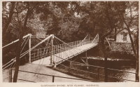
1853: Island Bank Road
Inverness, Scotland, United Kingdom - River Ness
| Bridgemeister ID: | 904 (added 2003-10-11) |
| Year Completed: | 1853 |
| Name: | Island Bank Road |
| Location: | Inverness, Scotland, United Kingdom |
| Crossing: | River Ness |
| At or Near Feature: | Ness Islands |
| Principals: | James Dredge |
| References: | HBR |
| Use: | Footbridge |
| Status: | Removed |
Notes:
- Companion to 1853 General's Well - Inverness, Scotland, United Kingdom.
- See 1988 (footbridge) - Inverness, Scotland, United Kingdom.
- See 1988 (footbridge) - Inverness, Scotland, United Kingdom.
1853: Mill Pond
Kingfield, Maine, USA - Carrabasset River
| Bridgemeister ID: | 45 (added before 2003) |
| Year Completed: | 1853 |
| Name: | Mill Pond |
| Location: | Kingfield, Maine, USA |
| Crossing: | Carrabasset River |
| Principals: | Daniel Beedy |
| References: | AAJ, BPL |
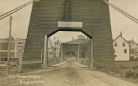
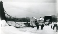
| Use: | Vehicular (one-lane), with walkway |
| Status: | Replaced, 1916 |
| Main Cables: | Chain (iron) |
| Main Span: | 1 x 57.9 meters (190 feet) |
| Deck width: | 15 feet |
Notes:
- Similar to 1856 Strong - Strong, Maine, USA.
1853: O'Byrne's
Copperopolis vicinity, California, USA - Stanislaus River
| Bridgemeister ID: | 2324 (added 2007-05-06) |
| Year Completed: | 1853 |
| Name: | O'Byrne's |
| Location: | Copperopolis vicinity, California, USA |
| Crossing: | Stanislaus River |
| Use: | Vehicular |
| Status: | Destroyed, 1862 |
Notes:
- Different accounts describe this as a chain and wire suspension bridge. Collapsed November, 1853 under weight of oxen team. Rebuilt, but destroyed by flood, 1862. Replaced by a multi-span covered bridge.
- Name "O'Byrne's" appears to have originated with a "Patrick O. Byrne" who operated a ferry at this location prior to construction of the suspension bridge. After time, it became known as O'Byrne's Ferry.
1853: Parcey
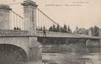
Parcey, Jura, France - Loue River
| Bridgemeister ID: | 2073 (added 2006-06-09) |
| Year Completed: | 1853 |
| Name: | Parcey |
| Location: | Parcey, Jura, France |
| Crossing: | Loue River |
| Use: | Vehicular |
| Status: | Removed |
| Main Cables: | Wire |
| Suspended Spans: | 1 |
External Links:
1853: Peney
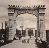
Peney, Satigny vicinity, Geneva, Switzerland - Rhône River
| Bridgemeister ID: | 1827 (added 2005-05-30) |
| Year Completed: | 1853 |
| Name: | Peney |
| Location: | Peney, Satigny vicinity, Geneva, Switzerland |
| Crossing: | Rhône River |
| Principals: | Hug |
| References: | AAJ, GHD |
| Use: | Vehicular |
| Status: | Collapsed, May 24, 1853 |
| Main Cables: | Wire (iron) |
| Suspended Spans: | 1 |
| Main Span: | 1 x 100 meters (328.1 feet) |
Notes:
- GHD describes how Dufour designed the bridge but was replaced (for political reasons) by a novice engineer, Mr. Hug who produced his own design. The bridge collapsed under test loading.
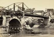
1853: Rotto
Rome, Italy - Tiber River
| Bridgemeister ID: | 6833 (added 2021-12-31) |
| Year Completed: | 1853 |
| Name: | Rotto |
| Location: | Rome, Italy |
| Crossing: | Tiber River |
| Coordinates: | 41.889321 N 12.479023 E |
| Maps: | Acme, GeoHack, Google, OpenStreetMap |
| Principals: | Pietro Lanciani |
| Status: | Removed, 1887 |
| Suspended Spans: | 1 |
| Characteristics: | Braced (trussed) chain/cable |
Notes:
- This was a somewhat temporary suspension bridge built on the piers of the ancient Ponte Rotto (Broken Bridge). It appears to have had a braced chain suspension cable design.
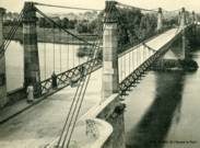
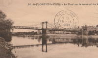
1853: Saint-Florent-le-Vieil
Saint-Florent-le-Vieil, Maine-et-Loire and Varades, Loire-Atlantique, France - Loire River
| Bridgemeister ID: | 1596 (added 2005-02-06) |
| Year Completed: | 1853 |
| Name: | Saint-Florent-le-Vieil |
| Location: | Saint-Florent-le-Vieil, Maine-et-Loire and Varades, Loire-Atlantique, France |
| Crossing: | Loire River |
| References: | AAJ |
| Use: | Vehicular (one-lane) |
| Status: | Removed |
| Main Cables: | Wire |
Notes:
- Multispan 19th-century suspension bridge distinct from the two 1965 cable-stayed and catenary suspension bridges connecting Varades and Saint-Florent-le-Vieil.
- Connects to 1853 Varades - Varades, Loire-Atlantique and Saint-Florent-le-Vieil, Maine-et-Loire, France.
- Later at same location 1954 Varades - Varades, Loire-Atlantique and Saint-Florent-le-Vieil, Maine-et-Loire, France.
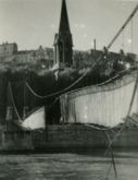
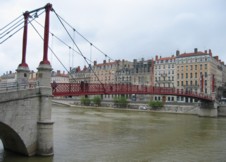
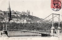
1853: Saint-Georges
Lyon, Métropole de Lyon, France - Saône River
| Bridgemeister ID: | 552 (added before 2003) |
| Year Completed: | 1853 |
| Name: | Saint-Georges |
| Also Known As: | Sala |
| Location: | Lyon, Métropole de Lyon, France |
| Crossing: | Saône River |
| Coordinates: | 45.757117 N 4.82615 E |
| Maps: | Acme, GeoHack, Google, OpenStreetMap |
| References: | AAJ, BPF, PQL |
| Use: | Footbridge |
| Status: | In use (last checked: 2022) |
| Main Cables: | Wire (iron) |
| Suspended Spans: | 1 |
| Main Span: | 1 x 75 meters (246.1 feet) |
Notes:
- Destroyed 1944, rebuilt same year. Reconstructed 1999.
External Links:
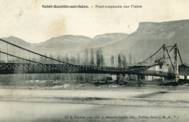
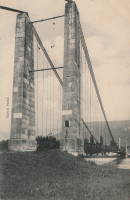
1853: Saint-Quentin-sur-Isère
Saint-Quentin-sur-Isère, Isère, France - Isère River
| Bridgemeister ID: | 2131 (added 2006-10-22) |
| Year Completed: | 1853 |
| Name: | Saint-Quentin-sur-Isère |
| Location: | Saint-Quentin-sur-Isère, Isère, France |
| Crossing: | Isère River |
| Use: | Vehicular |
| Status: | Removed |
| Main Cables: | Wire |
| Suspended Spans: | 1 |
External Links:
1853: San Ferdinando
Florence, Italy - Arno River
| Bridgemeister ID: | 7935 (added 2023-10-28) |
| Year Completed: | 1853 |
| Name: | San Ferdinando |
| Location: | Florence, Italy |
| Crossing: | Arno River |
| Coordinates: | 43.764617 N 11.270966 E |
| Maps: | Acme, GeoHack, Google, OpenStreetMap |
| Use: | Vehicular |
| Status: | Replaced, 1890 |
| Main Cables: | Wire (iron) |
| Suspended Spans: | 1 |
Notes:
- Replaced 1837 San Ferdinando - Florence, Italy.

1853: Tiffin
Tiffin, Ohio, USA - Sandusky River
| Bridgemeister ID: | 46 (added before 2003) |
| Year Completed: | 1853 |
| Name: | Tiffin |
| Location: | Tiffin, Ohio, USA |
| Crossing: | Sandusky River |
| Principals: | John Gray |
| References: | EOV |
| Status: | Removed |
| Main Cables: | Wire (iron) |
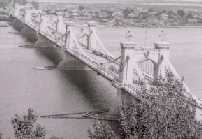
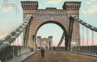
1853: Tsar Nicholas I
Kiev, Ukraine - Dnieper River
| Bridgemeister ID: | 409 (added before 2003) |
| Year Completed: | 1853 |
| Name: | Tsar Nicholas I |
| Location: | Kiev, Ukraine |
| Crossing: | Dnieper River |
| Principals: | Charles Blacker Vignoles |
| References: | AAJ, HBE, IEA, PTS2 |
| Use: | Vehicular |
| Status: | Destroyed, c. 1920 |
| Main Cables: | Chain (iron, flat link) |
| Suspended Spans: | 6 |
| Main Spans: | 4 x 134.1 meters (440 feet) |
| Side Spans: | 2 x 68.6 meters (225 feet) |
External Links:
1853: Varades
Varades, Loire-Atlantique and Saint-Florent-le-Vieil, Maine-et-Loire, France - Loire River
| Bridgemeister ID: | 1962 (added 2005-11-06) |
| Year Completed: | 1853 |
| Name: | Varades |
| Location: | Varades, Loire-Atlantique and Saint-Florent-le-Vieil, Maine-et-Loire, France |
| Crossing: | Loire River |
| References: | AAJ |
| Status: | Removed |
Notes:
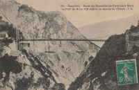
1854: Brion
Roissard and Lavars, Isère, France - Ebron River
| Bridgemeister ID: | 6998 (added 2022-04-24) |
| Year Completed: | 1854 |
| Name: | Brion |
| Location: | Roissard and Lavars, Isère, France |
| Crossing: | Ebron River |
| Coordinates: | 44.868078 N 5.671040 E |
| Maps: | Acme, GeoHack, Google, OpenStreetMap |
| Use: | Vehicular |
| Status: | Replaced, 1951 |
| Main Cables: | Wire |
| Suspended Spans: | 1 |
Notes:
- Replaced by 1951 Brion - Roissard and Lavars, Isère, France.
External Links:
1854: Caerhowel
Caerhowel, Wales, United Kingdom - River Severn
| Bridgemeister ID: | 407 (added before 2003) |
| Year Completed: | 1854 |
| Name: | Caerhowel |
| Location: | Caerhowel, Wales, United Kingdom |
| Crossing: | River Severn |
| Status: | Collapsed, 1858 |
Notes:
- Based on Dredge's patent.
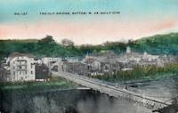
1854: Elk River
Sutton, West Virginia, USA - Elk River
| Bridgemeister ID: | 554 (added before 2003) |
| Year Completed: | 1854 |
| Name: | Elk River |
| Location: | Sutton, West Virginia, USA |
| Crossing: | Elk River |
| Principals: | Ira Hart |
| References: | EOV |
| Use: | Vehicular, with walkway |
| Status: | Removed, 1930 |
| Main Cables: | Wire (iron) |
| Main Span: | 1 x 140.2 meters (460 feet) |
1854: Licking River I
Covington and Newport, Kentucky, USA - Licking River
| Bridgemeister ID: | 47 (added before 2003) |
| Year Completed: | 1854 |
| Name: | Licking River I |
| Location: | Covington and Newport, Kentucky, USA |
| Crossing: | Licking River |
| Principals: | John Gray, George C. Tarvin |
| References: | BOB, BPL, EOV |
| Status: | Collapsed, 1854 |
Notes:
- BPL: Collapsed under weight of cattle 1853. BOB: Indicates year of completion and collapse as 1854. EOV: Appears more authoritative on the matter, "Although the bridge was not quite finished, Tarvin and the mayor of Covington rode the first vehicle across it on December 28, 1853. Less than two weeks later... the bridge collapsed."
- The January 18, 1854 edition of The New York Times has a small article with a January 16, 1854 byline reporting the collapse of the bridge: "The... bridge... gave way this evening, while two men and eighteen cattle were crossing it... The keys which held the wire cable to the anchors gave way."
- Replaced by 1854 Licking River II - Covington and Newport, Kentucky, USA.
1854: Licking River II
Covington and Newport, Kentucky, USA - Licking River
| Bridgemeister ID: | 48 (added before 2003) |
| Year Completed: | 1854 |
| Name: | Licking River II |
| Location: | Covington and Newport, Kentucky, USA |
| Crossing: | Licking River |
| Principals: | John Gray |
| References: | EOV |
| Status: | Removed |
Notes:
- Replaced 1854 Licking River I - Covington and Newport, Kentucky, USA which collapsed in January of 1854.
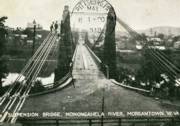
1854: Morgantown
Morgantown, West Virginia, USA - Monongahela River
| Bridgemeister ID: | 49 (added before 2003) |
| Year Completed: | 1854 |
| Name: | Morgantown |
| Location: | Morgantown, West Virginia, USA |
| Crossing: | Monongahela River |
| References: | AAJ, EN19070918, EOV, HBE, PTS2 |
| Use: | Vehicular, with walkway |
| Status: | Removed |
| Main Cables: | Wire (iron) |
| Suspended Spans: | 1 |
| Main Span: | 1 x 185.3 meters (608 feet) |
| Deck width: | 20 feet |
Notes:
- Was still part of Virginia at time of completion.
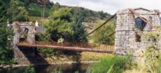
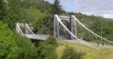
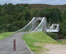
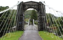
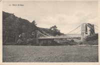
1854: Oich
Invergarry vicinity, Scotland, United Kingdom - River Oich
| Bridgemeister ID: | 403 (added before 2003) |
| Year Completed: | 1854 |
| Name: | Oich |
| Also Known As: | Aberchalder |
| Location: | Invergarry vicinity, Scotland, United Kingdom |
| Crossing: | River Oich |
| Coordinates: | 57.093377 N 4.745271 W |
| Maps: | Acme, GeoHack, Google, OpenStreetMap |
| Principals: | James Dredge |
| References: | BC3, HBR |
| Use: | Vehicular (one-lane) |
| Status: | Restricted to foot traffic (last checked: 2014) |
| Main Cables: | Rod (iron) |
| Suspended Spans: | 1 |
Notes:
- Restored and re-opened, late 1990's.
External Links:
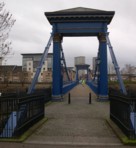
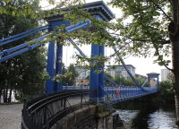
1854: Saint Andrew's
Glasgow, Scotland, United Kingdom - River Clyde
| Bridgemeister ID: | 408 (added before 2003) |
| Year Completed: | 1854 |
| Name: | Saint Andrew's |
| Location: | Glasgow, Scotland, United Kingdom |
| Crossing: | River Clyde |
| Coordinates: | 55.84883 N 4.23835 W |
| Maps: | Acme, GeoHack, Google, OpenStreetMap |
| Principals: | Neil Robson |
| References: | NTB |
| Use: | Footbridge |
| Status: | In use (last checked: 2019) |
| Main Cables: | Eyebar |
| Suspended Spans: | 1 |
| Main Span: | 1 x 67.1 meters (220 feet) |
| Deck width: | 13 feet |
Notes:
- Also sometimes attributed to Neil "Robinson" and completed 1853. May have originally been a narrow vehicular bridge.
External Links:
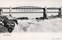
| Bridgemeister ID: | 4502 (added 2020-05-02) |
| Year Completed: | 1854 |
| Name: | Sarp |
| Also Known As: | Sarpsbro, Sarpsbrua |
| Location: | Sarpsborg, Viken, Norway |
| Crossing: | Glomma |
| At or Near Feature: | Sarpefossen |
| Coordinates: | 59.276684 N 11.132073 E |
| Maps: | Acme, GeoHack, Google, kart.1881.no, OpenStreetMap |
| Use: | Vehicular |
| Status: | Removed |
| Main Cables: | Eyebar (iron) |
| Suspended Spans: | 3 |
| Main Span: | 1 x 47 meters (154.2 feet) |
| Side Spans: | 1 x 23 meters (75.5 feet), 1 x 15 meters (49.2 feet) |
Notes:
- Originally constructed as a typical eyebar suspension bridge. Reconstructed in 1879 to support a three-span lenticular rail bridge on top of the suspension bridge towers, creating an upper deck for rail traffic. The original deck was suspended from the lower chord of the lenticular trusses.
- See Tamaris-les-Forges - Alès vicinity, Gard, France. Another interesting hybrid rail and suspension bridge.
External Links:
- DigitaltMuseum - Bru over Glomma ved Sarpsfossen
- DigitaltMuseum - Bru over Glomma ved Sarpsfossen, sett fra kjørebanen ved østre hovedpillar
- DigitaltMuseum - Damplokomotiv, trolig type 9a, med godstog på Sarpsfossen bru
- DigitaltMuseum - Sarpsfossen og Sarpsbrua
- DigitaltMuseum - Sarpsfossen og Sarpsbrua, bygd i 1854
- DigitaltMuseum - Tegning til Sarpsbrua i Sarpsborg
- Wikipedia - Sarp Bridge
- Wikiwand - Sarp Bridge
1855: Bessières
Bessières, Haute-Garonne, France - Tarn River
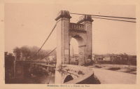
| Bridgemeister ID: | 7157 (added 2022-06-25) |
| Year Completed: | 1855 |
| Name: | Bessières |
| Location: | Bessières, Haute-Garonne, France |
| Crossing: | Tarn River |
| Coordinates: | 43.802017 N 1.609680 E |
| Maps: | Acme, GeoHack, Google, OpenStreetMap |
| Use: | Vehicular |
| Status: | Removed |
| Main Cables: | Wire |
| Suspended Spans: | 1 |
Notes:
- Later at same location 1955 Bessières - Bessières, Haute-Garonne, France.
External Links:
1855: Coudes
Coudes, Montpeyroux vicinity and Parent, Puy-de-Dôme, France - Allier River
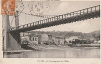
| Bridgemeister ID: | 1942 (added 2005-10-29) |
| Year Completed: | 1855 |
| Name: | Coudes |
| Location: | Coudes, Montpeyroux vicinity and Parent, Puy-de-Dôme, France |
| Crossing: | Allier River |
| Coordinates: | 45.615255 N 3.211817 E |
| Maps: | Acme, GeoHack, Google, OpenStreetMap |
| Use: | Vehicular |
| Status: | Removed |
| Main Cables: | Wire |
| Suspended Spans: | 1 |
Notes:
- Later at same location Coudes - Coudes, Montpeyroux vicinity and Parent, Puy-de-Dôme, France.
1855: Ferro
Pomarance vicinity, Italy - Cecina River
| Bridgemeister ID: | 7602 (added 2023-05-16) |
| Year Completed: | 1855 |
| Name: | Ferro |
| Also Known As: | Iron |
| Location: | Pomarance vicinity, Italy |
| Crossing: | Cecina River |
| Status: | Demolished, 1922 |
Notes:
External Links:
- IL PONTE DI FERRO - I Risoluti - La Storia Continua. Detailed history of the first suspension bridge and its 1855 reconstruction.
1855: Kaiserin-Elisabeth
Děčín (Tetschen), Czechia - Elbe River
| Bridgemeister ID: | 5940 (added 2021-06-29) |
| Year Completed: | 1855 |
| Name: | Kaiserin-Elisabeth |
| Also Known As: | Empress Elisabeth, Kettenbrücke |
| Location: | Děčín (Tetschen), Czechia |
| Crossing: | Elbe River |
| Use: | Vehicular |
| Status: | Removed, c. 1930s |
| Main Cables: | Chain (iron) |
| Suspended Spans: | 3 |
| Main Span: | 1 |
| Side Spans: | 2 |
External Links:
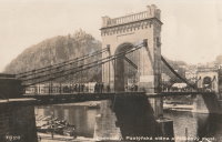
1855: Minneapolis
Minneapolis, Minnesota, USA - Mississippi River
| Bridgemeister ID: | 50 (added before 2003) |
| Year Completed: | 1855 |
| Name: | Minneapolis |
| Also Known As: | St. Anthony's Falls |
| Location: | Minneapolis, Minnesota, USA |
| Crossing: | Mississippi River |
| At or Near Feature: | Nicollet Island |
| Principals: | Thomas M. Griffith |
| References: | AAJ, BPL, HBE, PTS2 |
| Use: | Vehicular |
| Status: | Demolished, 1876 |
| Main Cables: | Wire (iron) |
| Suspended Spans: | 1 |
| Main Span: | 1 x 189 meters (620 feet) |
| Deck width: | 17 feet |
Notes:
- Replaced by 1877 Minneapolis - Minneapolis, Minnesota, USA.
- Later at same location 1990 Hennepin Avenue (Father Louis Hennepin) - Minneapolis, Minnesota, USA.
External Links:
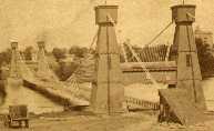
1855: Mirepoix-sur-Tarn
Mirepoix-sur-Tarn, Haute-Garonne, France - Tarn River
| Bridgemeister ID: | 7843 (added 2023-09-04) |
| Year Completed: | 1855 |
| Name: | Mirepoix-sur-Tarn |
| Location: | Mirepoix-sur-Tarn, Haute-Garonne, France |
| Crossing: | Tarn River |
| Coordinates: | 43.811766 N 1.571793 E |
| Maps: | Acme, GeoHack, Google, OpenStreetMap |
| Use: | Vehicular |
| Status: | Destroyed, 1930 |
| Main Cables: | Wire |
| Suspended Spans: | 1 |
| Main Span: | 1 |
Notes:
- 1930, March: Destroyed by flood.
- Replaced by 1935 Mirepoix-sur-Tarn - Mirepoix-sur-Tarn, Haute-Garonne, France.
External Links:
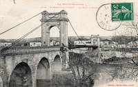
1855: Ness
Inverness, Scotland, United Kingdom - River Ness
| Bridgemeister ID: | 526 (added before 2003) |
| Year Completed: | 1855 |
| Name: | Ness |
| Location: | Inverness, Scotland, United Kingdom |
| Crossing: | River Ness |
| Use: | Vehicular |
| Status: | Demolished, 1961 |
| Main Cables: | Eyebar (iron) |
| Suspended Spans: | 1 |
Notes:
- Near 1881 Greig Street (Wobbly) - Inverness, Scotland, United Kingdom. In some photos, the two bridges are visible within a few hundred yards of each other.
External Links:

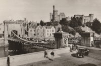
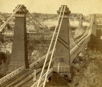
1855: Niagara Suspension
Niagara Falls, New York, USA and Niagara Falls, Ontario, Canada - Niagara River
| Bridgemeister ID: | 51 (added before 2003) |
| Year Completed: | 1855 |
| Name: | Niagara Suspension |
| Location: | Niagara Falls, New York, USA and Niagara Falls, Ontario, Canada |
| Crossing: | Niagara River |
| Principals: | John A. Roebling |
| References: | AAJ, BAAW, BBR, BFL, BMA, BOB, BPL, HBE, LIR, NSB, ONF, PTS2, SA18810716, SJR |
| Use: | Rail (heavy rail) and Vehicular (double-deck), with walkway |
| Status: | Replaced, 1897 |
| Main Cables: | Wire (iron) |
| Suspended Spans: | 1 |
| Main Span: | 1 x 250.3 meters (821.3 feet) |
Notes:
- Cables renovated, 1877. Wooden stiffening trusses replaced, 1880. Towers replaced, c. 1886. Bridge replaced with steel arch, 1897.
- AAJ notes the roadway deck opened in 1854, but the railway deck did not open until 1855.
- Replaced 1848 Niagara Suspension - Niagara Falls, New York, USA and Niagara Falls, Ontario, Canada.
External Links:
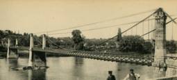
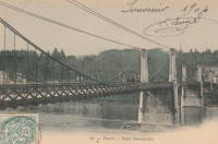
1855: Saint-Cyr
Tours and Saint-Cyr, Indre-et-Loire, France - Loire River
| Bridgemeister ID: | 1645 (added 2005-03-18) |
| Year Completed: | 1855 |
| Name: | Saint-Cyr |
| Also Known As: | Napoleon, Bonaparte |
| Location: | Tours and Saint-Cyr, Indre-et-Loire, France |
| Crossing: | Loire River |
| Principals: | Escarraguel Brothers |
| Use: | Vehicular |
| Status: | Demolished, 1943 |
| Main Cables: | Wire (iron) |
External Links:
1855: Shohola
Barryville, New York and Shohola, Pennsylvania, USA - Delaware River
| Bridgemeister ID: | 41 (added before 2003) |
| Year Completed: | 1855 |
| Name: | Shohola |
| Also Known As: | Barryville-Shohola, Shohola-Barryville |
| Location: | Barryville, New York and Shohola, Pennsylvania, USA |
| Crossing: | Delaware River |
| Principals: | Chauncy Thomas, John A. Roebling |
| References: | BDR, SHO |
| Use: | Vehicular |
| Status: | Dismantled, 1941 |
| Main Cables: | Wire (iron) |
| Suspended Spans: | 1 |
Notes:
- BDR: Built 1856, severely damaged 1859, rebuilt, collapsed Jan. 1st 1865, rebuilt 1866. Dale writes: "A respected historian, John Willard Johnston, who knew Chauncey Thomas personally and visited the area during his ownership of the toll bridge, insisted that Thomas, as the builder, was grossly incompetent."
- Originally constructed with one main span, the center pier was added during the 1866 reconstruction.
- Don Sayenga's research leads him to conclude the bridge was completed in the fall of 1855. He notes an article from the Pike County Democrat (June 21, 1872) stating the bridge was completed in 1855. The article also notes the 1859 collapse occurred on July 2, 1859. Don's interest in this bridge is piqued by the connection to John Roebling, "...this bridge seems to be the only John Roebling bridge that failed in service..." Roebling prepared plans, for the original bridge, for Chauncy Thomas (who, by Dale's account was inexperienced).
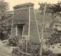
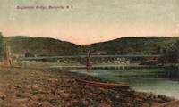
1855: Whiskey Bar
El Dorado County, California, USA - American River
| Bridgemeister ID: | 3357 (added 2019-12-15) |
| Year Completed: | 1855 |
| Name: | Whiskey Bar |
| Also Known As: | Pioneer, Whisky |
| Location: | El Dorado County, California, USA |
| Crossing: | American River |
| Use: | Vehicular |
| Status: | Destroyed, 1862 |
| Main Cables: | Wire (iron) |
Notes:
- Destroyed by flood, 1862. Cables supposedly reused for the Rattlesnake Bar bridge.
- See 1862 Rattlesnake Bar - Folsom vicinity, California, USA.
1856: Bidwell Bar
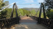
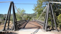
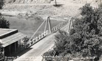
Oroville, California, USA - Feather River
| Bridgemeister ID: | 52 (added before 2003) |
| Year Completed: | 1856 |
| Name: | Bidwell Bar |
| Location: | Oroville, California, USA |
| Crossing: | Feather River |
| Coordinates: | 39.537483 N 121.45415 W |
| Maps: | Acme, GeoHack, Google, OpenStreetMap |
| Principals: | Bidwell Bridge Co. |
| References: | BPL, DSL200106, LACE |
| Use: | Vehicular (one-lane) |
| Status: | Restricted to foot traffic (last checked: 2020) |
| Main Cables: | Wire (iron) |
| Suspended Spans: | 1 |
| Main Span: | 1 x 67.1 meters (220 feet) estimated |
Notes:
- Dismantled before completion of Oroville Dam and replaced by the 1965 high-level Bidwell Bar suspension bridge. The 1856 structure was later reassembled about 1.5 miles south of the new Bidwell Bar bridge. Coordinates provided here are for the current location of the bridge at Kelly Ridge.
- Replaced by 1965 Bidwell Bar - Oroville, California, USA.
External Links:
1856: Boutiron
Creuzier-les-Vieux, Allier, France - Allier River
| Bridgemeister ID: | 6951 (added 2022-02-06) |
| Year Completed: | 1856 |
| Name: | Boutiron |
| Location: | Creuzier-les-Vieux, Allier, France |
| Crossing: | Allier River |
| Coordinates: | 46.153816 N 3.410014 E |
| Maps: | Acme, GeoHack, Google, OpenStreetMap |
| Use: | Vehicular |
| Status: | Replaced, 1911 |
| Main Cables: | Wire |
| Main Spans: | 3 |
External Links:
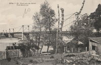
1856: Bridge of Sighs
Carthage and Rochester, New York, USA - Genesee River
| Bridgemeister ID: | 54 (added before 2003) |
| Year Completed: | 1856 |
| Name: | Bridge of Sighs |
| Location: | Carthage and Rochester, New York, USA |
| Crossing: | Genesee River |
| Principals: | Josiah Bissell, Jr. |
| Use: | Vehicular |
| Status: | Collapsed, 1857 |
| Main Cables: | Wire (iron) |
Notes:
- From May 2, 1857 edition of Scientific American: "Fall of a Suspension Bridge. The iron suspension bridge which spans the Genesee River at Rochester, fell on the 21st ult. from the weight of snow on it. The bridge was only finished last summer, and cost over $28,000. It was constructed between iron towers standing on the banks. They were built of cast iron cylinders, bolted together, and standing on high banks, 235 feet above the water. The road-way was 200 feet above the water, and proceeded in almost a straight line from the top of the high bank on one side, to the other. The cables were 780 feet long, and the entire length of the bridge was over 700 feet. It was calculated to sustain a weight of 2.000 tuns. It spanned the Genesee river below the Falls. The metal, it is stated, appears to be defective. The load that was on it when it fell did not amount to 100 tuns."
1856: Briord
Briord, Ain and Isère, France - Rhône River
| Bridgemeister ID: | 6997 (added 2022-04-24) |
| Year Completed: | 1856 |
| Name: | Briord |
| Location: | Briord, Ain and Isère, France |
| Crossing: | Rhône River |
| Use: | Vehicular |
| Status: | Removed |
| Main Cables: | Wire |
External Links:
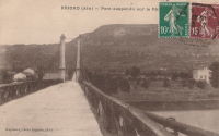
1856: Carbonne
Carbonne, Haute-Garonne, France - Garonne River
| Bridgemeister ID: | 1157 (added 2004-01-18) |
| Year Completed: | 1856 |
| Name: | Carbonne |
| Location: | Carbonne, Haute-Garonne, France |
| Crossing: | Garonne River |
| Coordinates: | 43.294537 N 1.228567 E |
| Maps: | Acme, GeoHack, Google, OpenStreetMap |
| Status: | Replaced, 1975 |
| Main Cables: | Wire (iron) |
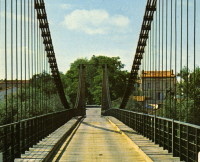
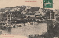
1856: Guyandotte
Guyandotte and Huntington, West Virginia, USA - Guyandotte River
| Bridgemeister ID: | 40 (added before 2003) |
| Year Completed: | 1856 |
| Name: | Guyandotte |
| Location: | Guyandotte and Huntington, West Virginia, USA |
| Crossing: | Guyandotte River |
| Coordinates: | 38.430083 N 82.391694 W |
| Maps: | Acme, GeoHack, Google, OpenStreetMap |
| Principals: | George Wilson Mason |
| References: | AAJ, EOV, PTS2 |
| Use: | Vehicular |
| Status: | Removed, 1907 |
| Main Cables: | Wire (iron) |
| Suspended Spans: | 1 |
| Main Span: | 1 x 137.2 meters (450 feet) |
Notes:
- EOV cites a source claiming the bridge was begun in 1853, but not completed until 1858. AAJ says completed in 1848. Other sources claim it was completed in 1852 and 1856.
- Was still part of Virginia at time of completion.
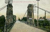
1856: Les Mées
Les Mées, Alpes-de-Haute-Provence, France - Durance River
| Bridgemeister ID: | 1522 (added 2004-10-10) |
| Year Completed: | 1856 |
| Name: | Les Mées |
| Location: | Les Mées, Alpes-de-Haute-Provence, France |
| Crossing: | Durance River |
| Use: | Vehicular |
| Status: | Replaced |
| Main Cables: | Wire (iron) |
| Suspended Spans: | 2 |
| Main Spans: | 2 |
Notes:
External Links:
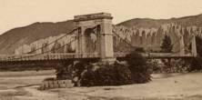
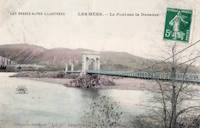
1856: Ollières
Les Ollières-sur-Eyrieux, Ardèche, France - Eyrieux River
| Bridgemeister ID: | 4882 (added 2020-07-18) |
| Year Completed: | 1856 |
| Name: | Ollières |
| Location: | Les Ollières-sur-Eyrieux, Ardèche, France |
| Crossing: | Eyrieux River |
| Coordinates: | 44.804655 N 4.614687 E |
| Maps: | Acme, GeoHack, Google, OpenStreetMap |
| References: | AAJ |
| Use: | Vehicular |
| Status: | Removed |
Notes:
- AAJ assumes completion in 1856 based on an 18-month contract let in August 1854. Appears to have been a quite dramatic bridge, with very large castellated towers, on an alignment adjacent to the current twin-arch bridge.
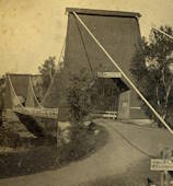
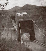
1856: Strong
Strong, Maine, USA - Sandy River
| Bridgemeister ID: | 53 (added before 2003) |
| Year Completed: | 1856 |
| Name: | Strong |
| Location: | Strong, Maine, USA |
| Crossing: | Sandy River |
| Principals: | Daniel Beedy |
| References: | BPL |
| Use: | Vehicular (one-lane) |
| Status: | Replaced (last checked: 1922) |
| Main Cables: | Wire (iron) |
| Suspended Spans: | 1 |
| Main Span: | 1 x 77.4 meters (254 feet) |
| Deck width: | 13 feet |
Notes:
- Similar to 1853 Mill Pond - Kingfield, Maine, USA.
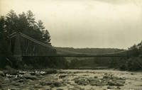
1856: Westmoreland's
Lancha Plana, California, USA - Mokelumne River
| Bridgemeister ID: | 1089 (added 2004-01-01) |
| Year Completed: | 1856 |
| Name: | Westmoreland's |
| Location: | Lancha Plana, California, USA |
| Crossing: | Mokelumne River |
| References: | DSL200106 |
| Status: | Inundated |
| Main Cables: | Wire (iron) |
Notes:
- Towers and cables were still standing in the 1940s. The location, including the entire former settlement of Lancha Plana, was inundated by the creation of the Camanche Reservoir in 1963. Unclear if remnants are still present (as is the case for some other inundated 19th-century California suspension bridges).
1857: Altenbergsteg
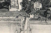
Berne, Switzerland - Aare River
| Bridgemeister ID: | 1475 (added 2004-09-02) |
| Year Completed: | 1857 |
| Name: | Altenbergsteg |
| Location: | Berne, Switzerland |
| Crossing: | Aare River |
| Coordinates: | 46.9503 N 7.4489 E |
| Maps: | Acme, GeoHack, Google, OpenStreetMap |
| References: | PTS2 |
| Use: | Footbridge |
| Status: | In use (last checked: 2019) |
| Main Cables: | Eyebar |
| Suspended Spans: | 1 |
| Main Span: | 1 x 57 meters (187 feet) |
External Links:
1857: Black River
Watertown, New York, USA - Black River
| Bridgemeister ID: | 55 (added before 2003) |
| Year Completed: | 1857 |
| Name: | Black River |
| Also Known As: | Bradford, Mill Street |
| Location: | Watertown, New York, USA |
| Crossing: | Black River |
| Principals: | Gilbert Bradford |
| References: | AAJ, HBE, ONC |
| Use: | Vehicular |
| Status: | Removed, 1890's |
| Main Cables: | Wire (iron) |
| Suspended Spans: | 1 |
| Main Span: | 1 x 53 meters (173.9 feet) |
| Deck width: | 18 feet |
Notes:
- Replaced in 1890's (ONC).
1857: Change
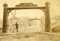
Glendon, Pennsylvania, USA - Lehigh River
| Bridgemeister ID: | 56 (added before 2003) |
| Year Completed: | 1857 |
| Name: | Change |
| Also Known As: | Chain, Lehigh Canal Swinging, Wire Towing Path at Pool No. 8 |
| Location: | Glendon, Pennsylvania, USA |
| Crossing: | Lehigh River |
| Coordinates: | 40.65382 N 75.24774 W |
| Maps: | Acme, GeoHack, Google, OpenStreetMap |
| Principals: | Lehigh Coal and Navigation Co., E.A. Douglas |
| References: | HAERPA461, HBP |
| Use: | Footbridge and Change |
| Status: | Derelict (last checked: 2007) |
| Main Cables: | Wire (iron) |
| Suspended Spans: | 2 |
| Main Spans: | 2 |
Notes:
- Often mistakenly called a "chain" bridge, this is a "change" bridge.
External Links:
- Aldrich Change Bridge. Dale Oswald explains (in the context of the Aldrich Change Bridge, a non-suspension bridge in Palmyra, New York): "A change bridge is one with low railings and an underpass that allowed draft teams to move from one side of the canal to the other without unhitching, cloverleaf-style."
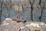
1857: Izeron
Izeron and Saint-Sauveur, Isère, France - Isère River
| Bridgemeister ID: | 7159 (added 2022-06-25) |
| Year Completed: | 1857 |
| Name: | Izeron |
| Location: | Izeron and Saint-Sauveur, Isère, France |
| Crossing: | Isère River |
| Coordinates: | 45.154651 N 5.363855 E |
| Maps: | Acme, GeoHack, Google, OpenStreetMap |
| Use: | Vehicular |
| Status: | Removed |
| Main Cables: | Wire (iron) |
| Suspended Spans: | 1 |
Notes:
External Links:
- Art-et-Histoire.com - Pont suspendu d'Izeron sur l'Isère - 1857. Art-et-Histoire also mentions a possible earlier suspension bridge that opened in 1849 and collapsed soon after due to a landslide.
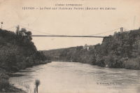
1857: Longues
Longues, Vic-le-Comte and Les Martres-de-Veyre, Puy-de-Dôme, France - Allier River
| Bridgemeister ID: | 7589 (added 2023-05-06) |
| Year Completed: | 1857 |
| Name: | Longues |
| Location: | Longues, Vic-le-Comte and Les Martres-de-Veyre, Puy-de-Dôme, France |
| Crossing: | Allier River |
| Use: | Vehicular |
| Status: | Replaced |
| Main Cables: | Chain (iron) |
| Main Span: | 1 |
Notes:
- Replaced 1833 Longues - Longues, Vic-le-Comte and Les Martres-de-Veyre, Puy-de-Dôme, France.
- Replaced by Longues - Longues, Vic-le-Comte and Les Martres-de-Veyre, Puy-de-Dôme, France.
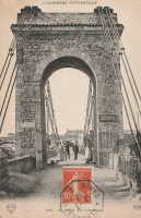
1857: Saint James's Park
London, England, United Kingdom
| Bridgemeister ID: | 6831 (added 2021-12-31) |
| Year Completed: | 1857 |
| Name: | Saint James's Park |
| Location: | London, England, United Kingdom |
| At or Near Feature: | Saint James's Park |
| References: | AAJ |
| Use: | Footbridge |
| Status: | Replaced, 1957 |
| Main Cables: | Eyebar (iron) |
| Suspended Spans: | 1 |
Notes:
- Reviews of this bridge were not favorable. Jakkula (AAJ) sites several contemporary sources (1857) objecting to the bridge obstructing the view of the scenery. One citation is summarized: "Regards the bridge as a hideous structure".
External Links:
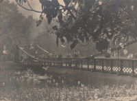
1857: Saint-Lattier
Saint-Lattier, Isère and Eymeux, Drôme, France - Isère River
| Bridgemeister ID: | 7385 (added 2022-11-24) |
| Year Completed: | 1857 |
| Name: | Saint-Lattier |
| Location: | Saint-Lattier, Isère and Eymeux, Drôme, France |
| Crossing: | Isère River |
| Use: | Vehicular |
| Status: | Replaced |
| Main Cables: | Wire |
| Suspended Spans: | 1 |
Notes:
- Later at same location Saint-Lattier (Eymeux) - Saint-Lattier, Isère and Eymeux, Drôme, France. Unclear if the newer bridge was a direct replacement for the older bridge.
External Links:
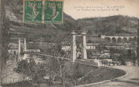
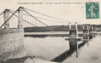
1858: Chaumont-sur-Loire
Chaumont-sur-Loire and Onzain, Loir-et-Cher, France - Loire River
| Bridgemeister ID: | 1703 (added 2005-03-29) |
| Year Completed: | 1858 |
| Name: | Chaumont-sur-Loire |
| Location: | Chaumont-sur-Loire and Onzain, Loir-et-Cher, France |
| Crossing: | Loire River |
| Use: | Vehicular |
| Status: | Replaced |
| Main Cables: | Wire (iron) |
| Main Spans: | 6 |
Notes:
- Damaged by troops, 1870. Repaired.
- Replaced by 1935 Chaumont-sur-Loire - Chaumont-sur-Loire and Onzain, Loir-et-Cher, France.
External Links:
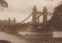
1858: Chelsea
London, England, United Kingdom - River Thames
| Bridgemeister ID: | 410 (added before 2003) |
| Year Completed: | 1858 |
| Name: | Chelsea |
| Also Known As: | Victoria |
| Location: | London, England, United Kingdom |
| Crossing: | River Thames |
| At or Near Feature: | Battersea Park |
| Coordinates: | 51.485061 N 0.149897 W |
| Maps: | Acme, GeoHack, Google, OpenStreetMap |
| Principals: | Thomas Page |
| References: | BTH, HBE, PTS2 |
| Use: | Vehicular |
| Status: | Replaced |
| Main Cables: | Eyebar (iron) |
| Suspended Spans: | 3 |
| Main Span: | 1 x 106.1 meters (348 feet) |
| Side Spans: | 1 x 116.7 meters (383 feet), 1 x 55.8 meters (183 feet) |
Notes:
- Replaced by 1937 Chelsea - London, England, United Kingdom.
External Links:
1858: Portsmouth
Portsmouth, Ohio, USA - Scioto River
| Bridgemeister ID: | 57 (added before 2003) |
| Year Completed: | 1858 |
| Name: | Portsmouth |
| Location: | Portsmouth, Ohio, USA |
| Crossing: | Scioto River |
| Principals: | E.B. Gray |
| References: | EOV |
| Status: | Collapsed, 1859 |
Notes:
- Replaced by 1861 Portsmouth - Portsmouth, Ohio, USA.
| Bridgemeister ID: | 1990 (added 2005-12-02) |
| Year Completed: | 1858 |
| Name: | Thoirette |
| Location: | Thoirette, Jura and Ain, France |
| Crossing: | Ain River |
| Coordinates: | 46.268464 N 5.536318 E |
| Maps: | Acme, GeoHack, Google, OpenStreetMap |
| References: | AGP |
| Use: | Vehicular (one-lane) |
| Status: | Replaced, 1922 |
| Main Cables: | Wire |
| Suspended Spans: | 1 |
Notes:
- One end of this bridge appears to have led directly into a building aptly named Hôtel Du Pont with the roadway possibly passing through the building. Remnants of the bridge are still present (as of 2022) on both sides of the river.
- Replaced 1829 Thoirette - Thoirette, Jura and Ain, France.
External Links:
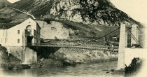
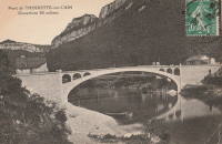
| Bridgemeister ID: | 5665 (added 2021-01-03) |
| Year Completed: | 1858 |
| Name: | Trofa |
| Also Known As: | Barca |
| Location: | Trofa and Ribeirão, Portugal |
| Crossing: | Ave River |
| Coordinates: | 41.345251 N 8.556376 W |
| Maps: | Acme, GeoHack, Google, OpenStreetMap |
| References: | AAJ |
| Use: | Vehicular |
| Status: | Removed, 1935 |
| Main Cables: | Wire (iron) |
| Suspended Spans: | 1 |
| Main Span: | 1 x 82 meters (269 feet) |
Notes:
- Coordinates are for the current Ave River crossing at Trofa. The Ponte Pênsil da Trofa may have been located here or slightly west of here.
External Links:
1859: Doux
St Jean de Muzols and Tournon-sur-Rhône, Ardèche, France - Doux River
| Bridgemeister ID: | 5661 (added 2021-01-01) |
| Year Completed: | 1859 |
| Name: | Doux |
| Location: | St Jean de Muzols and Tournon-sur-Rhône, Ardèche, France |
| Crossing: | Doux River |
| Coordinates: | 45.074919 N 4.816389 E |
| Maps: | Acme, GeoHack, Google, OpenStreetMap |
| References: | AAJ |
| Use: | Vehicular |
| Status: | Removed |
| Main Cables: | Wire |
| Suspended Spans: | 1 |
Notes:
External Links:
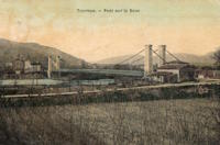
1859: General Dean
Carlyle, Illinois, USA - Kaskaskia River
| Bridgemeister ID: | 58 (added before 2003) |
| Year Completed: | 1859 |
| Name: | General Dean |
| Also Known As: | Carlyle |
| Location: | Carlyle, Illinois, USA |
| Crossing: | Kaskaskia River |
| Coordinates: | 38.611125 N 89.357476 W |
| Maps: | Acme, GeoHack, Google, OpenStreetMap |
| Principals: | D. Griffith Smith |
| References: | BPL, GBD |
| Use: | Vehicular (one-lane) |
| Status: | Restricted to foot traffic (last checked: 2021) |
| Main Cables: | Wire (iron) |
| Suspended Spans: | 1 |
| Main Span: | 1 x 80.5 meters (264 feet) |
Notes:
- Rebuilt 1920s, 1970s. Restored, 1950's, for use as a footbridge.
- Bypassed, 1924.
External Links:
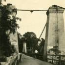
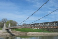
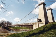
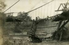
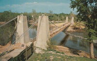
1859: Sully-sur-Loire
Sully-sur-Loire and Saint-Père-sur-Loire, Loiret, France - Loire River
| Bridgemeister ID: | 1709 (added 2005-03-30) |
| Year Completed: | 1859 |
| Name: | Sully-sur-Loire |
| Location: | Sully-sur-Loire and Saint-Père-sur-Loire, Loiret, France |
| Crossing: | Loire River |
| Use: | Vehicular |
| Status: | Collapsed, 1985 |
| Main Cables: | Chain (iron) |
| Main Spans: | 3 |
| Side Spans: | 2 |
Notes:
- 1859: The former three-span Sully-sur-Loire suspension bridge, heavily damaged by flood in 1856, is replaced with a suspension bridge having at least five suspended spans.
- 1933: Refurbished.
- 1940, June 18: Destroyed to slow advancing German troops.
- 1943: Repaired.
- 1944: Bombed by allied forces.
- 1947: Rebuilt.
- 1985, January 16: Collapsed.
- Replaced 1836 Sully-sur-Loire - Sully-sur-Loire and Saint-Père-sur-Loire, Loiret, France.
External Links:
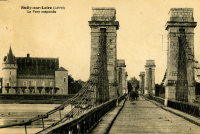
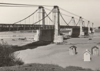
1859: Verdon
Gréoux-les-Bains, Alpes-de-Haute-Provence, France - Verdon River
| Bridgemeister ID: | 3215 (added 2019-11-11) |
| Year Completed: | 1859 |
| Name: | Verdon |
| Location: | Gréoux-les-Bains, Alpes-de-Haute-Provence, France |
| Crossing: | Verdon River |
| Use: | Vehicular |
| Status: | Destroyed, August, 1944 |
| Main Cables: | Wire |
| Suspended Spans: | 1 |
| Main Span: | 1 |
External Links:
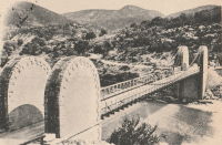
1860: Allegheny River
Pittsburgh, Pennsylvania, USA - Allegheny River
| Bridgemeister ID: | 59 (added before 2003) |
| Year Completed: | 1860 |
| Name: | Allegheny River |
| Also Known As: | Sixth Street, St. Clair |
| Location: | Pittsburgh, Pennsylvania, USA |
| Crossing: | Allegheny River |
| Principals: | John A. Roebling |
| References: | BOB, BOP, BPL, HBE, PBR, PTS2, SJR |
| Use: | Vehicular, with walkway |
| Status: | Replaced, 1892 |
| Main Cables: | Wire (iron) |
| Suspended Spans: | 4 |
| Main Spans: | 2 x 104.9 meters (344 feet) |
| Side Spans: | 2 x 52.1 meters (171 feet) |
| Deck width: | 40 feet |
Notes:
- BPL cites this bridge as the first suspension bridge with metal towers. However, at least two earlier suspension bridges (1857 Watertown, New York and 1856 Bidwell Bar, California) are known to have metal towers and even Roebling's 1846 Smithfield Street Bridge in Pittsburgh had cast iron towers.
- Next to 1884 North Side (Seventh Street) - Pittsburgh, Pennsylvania, USA.
External Links:
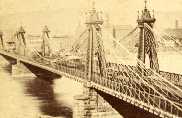
1860: Auburn-Coloma
Auburn and Coloma, California, USA - North Fork American River
| Bridgemeister ID: | 274 (added before 2003) |
| Year Completed: | 1860 |
| Name: | Auburn-Coloma |
| Location: | Auburn and Coloma, California, USA |
| Crossing: | North Fork American River |
| Principals: | John Mollett |
| References: | PTS2 |
| Use: | Vehicular (one-lane) |
| Status: | Removed |
| Main Cables: | Wire (iron) |
| Suspended Spans: | 1 |
Notes:
- 1865 and 1866 are sometimes cited as the year of completion for this bridge.
- Replaced by 1929 Auburn-Coloma - Auburn and Coloma, California, USA.
1860: Grand Falls
Grand Falls, New Brunswick, Canada - St. John River
| Bridgemeister ID: | 60 (added before 2003) |
| Year Completed: | 1860 |
| Name: | Grand Falls |
| Location: | Grand Falls, New Brunswick, Canada |
| Crossing: | St. John River |
| Principals: | James Tomlinson |
| References: | AAJ |
| Use: | Vehicular (two-lane) |
| Status: | Replaced, 1915 |
| Main Cables: | Wire (iron) |
| Suspended Spans: | 1 |
| Main Span: | 1 x 63.9 meters (209.75 feet) |
| Deck width: | 16 feet |
Notes:
- Out of use, 1912.

1860: Lascellas
Lascellas, Huesca, Spain - Rio Alcanadre
| Bridgemeister ID: | 4718 (added 2020-06-26) |
| Year Completed: | 1860 |
| Name: | Lascellas |
| Location: | Lascellas, Huesca, Spain |
| Crossing: | Rio Alcanadre |
| Coordinates: | 42.096776 N 0.107794 W |
| Maps: | Acme, GeoHack, Google, OpenStreetMap |
| Use: | Vehicular |
| Status: | Removed |
| Main Cables: | Wire |
| Suspended Spans: | 1 |
Notes:
- Deck wrecked circa 1939. Bridge appears to have been replaced soon after.
External Links:
1860: Ponte delle Catene
Fornoli, Bagni di Lucca and Chifenti, Italy - Lima River
| Bridgemeister ID: | 411 (added before 2003) |
| Year Completed: | 1860 |
| Name: | Ponte delle Catene |
| Also Known As: | Catena, Bridge of Chains |
| Location: | Fornoli, Bagni di Lucca and Chifenti, Italy |
| Crossing: | Lima River |
| Coordinates: | 44.006048 N 10.562356 E |
| Maps: | Acme, GeoHack, Google, OpenStreetMap |
| Principals: | Lorenzo Nottolini, Bettino Ricasoli |
| References: | BC2, BC3 |
| Use: | Vehicular |
| Status: | Restricted to foot traffic (last checked: 2019) |
| Main Cables: | Chain (iron) |
| Suspended Spans: | 1 |
Notes:
- Damaged during WWII, rebuilt 1953.
External Links:
1860: Port Gibson
Grindstone Ford, Port Gibson vicinity, Mississippi, USA - Bayou Pierre
| Bridgemeister ID: | 1659 (added 2005-03-19) |
| Year Completed: | 1860 |
| Name: | Port Gibson |
| Location: | Grindstone Ford, Port Gibson vicinity, Mississippi, USA |
| Crossing: | Bayou Pierre |
| References: | PTS2 |
| Status: | Removed, circa 1920's |
Notes:
- Partially burned by retreating Confederate troops May 2nd, 1863 during the Vicksburg Campaign of the Civil War. Union troops extinquished the fire and quickly repaired the bridge.
- Demolished, circa 1920's. Descriptions for the Vicksburg Campaign imply there may have been another suspension bridge in the Port Gibson area.
1861: Connellsville
Connellsville and New Haven, Pennsylvania, USA - Youghiogheny River
| Bridgemeister ID: | 278 (added before 2003) |
| Year Completed: | 1861 |
| Name: | Connellsville |
| Location: | Connellsville and New Haven, Pennsylvania, USA |
| Crossing: | Youghiogheny River |
| Use: | Vehicular (one-lane) |
| Status: | Removed |
| Main Cables: | Wire |
| Suspended Spans: | 1 |
1861: Gauley River
Gauley Bridge, West Virginia, USA - Gauley River
| Bridgemeister ID: | 2123 (added 2006-09-17) |
| Year Completed: | 1861 |
| Name: | Gauley River |
| Location: | Gauley Bridge, West Virginia, USA |
| Crossing: | Gauley River |
| Principals: | John W. Murphy |
| References: | AAJ |
| Use: | Vehicular |
| Status: | Destroyed, 1862 |
| Main Cables: | Wire (iron) |
Notes:
- Don Sayenga writes:
"It was built in great haste out of military necessity utilizing abutments and piers of an earlier wooden bridge that had been burnt by a unit of the Confederate Army commanded by Gen. John B. Floyd. This occurred just after the fight known as the Battle of Carnifex Ferry on September 10, 1861. Later the Confederate Army recaptured the bridge location and burnt the new one also. The designer/builder was John W. Murphy (1828-1874) who was working as an engineer in Alabama when the war began in 1861. He held a Civil Engineer degree from Rensselaer. Murphy's concept involved multiple factory-made wire ropes as main cables combined with wooden bracing. The exact location of the bridge seems to have been called the New River Cliffs but I haven't found this on a map. Photos of the bridge came into the possession of Prof. George Plympton, an associate of Murphy's in the latter part of his career. Plympton presented a paper about bridges in 1894 reported by The Railroad Gazette August 24. The photos were given to the Gazette - one of their artists converted the photos to pen-and-ink drawings for publication in the issue of November 9, 1894, p. 773."
Don transcribed the following:
The Railroad Gazette, August 24, 1894, Page 579."Prof. Plympton then related two reminiscences of bridge building between 1852 and 1861...The other instance was the building of a military suspension bridge over the Gauley River in 1861. The government called for a bridge of sufficient strength to permit the passage of General Rosecrans corps, allowing twenty-four days' time. The abutments and piers of the former bridge remained in good condition. Murphy submitted an original plan, which was accepted. The plans were drawn up by Mr. Murphy on the cars, while he was traveling to Washington to submit his ideas to the United States army en gineers. The plans were accepted and Murphy at once went to work. Four one-inch wire ropes, laid side by side, formed his cables. A pyramidal tower was constructed of heavy timbers, and in place of suspending rods a loosely-formed truss was hung upon the cable without fastening. This truss, connected with the floor of the bridge, was finished on the 22nd day after receiving the order to build."
Proceedings of the Franklin Institute, October 21, 1874, Page 306."It was a suspension bridge 520 feet in length, 10 feet roadway, consisting of three spans, supported by eight cables. There was some doubt in the mind of the commanding officer that it would answer the purpose...To test it ...he asked that a battalion be ordered to make a charge over it, which was done, to the satisfaction of the General in command...it afterwards passed and repassed the whole command as long as they occupied that portion of the country. A change of base put it into the possession of the Confederates who burnt it down."
- An article in the July 15, 1951 edition of The Charleston Daily Mail describes the bridge and its demise:
"After the Confederate forces had retreated and burned the old covered bridge, the Federal engineers constructed a make-shift bridge across the Gauley. There are pictures in existence showing this light, cable bridge erected on the old piers of the original bridge. This structure was cut down Sept. 11, 1862, when the Federals retreated from an attack by Confederate Gen. W. W. Loring, who routed the Unionists from the valley for a brief time."
- Jakkula has an 1862 entry for "Gauley River Bridge" with little information, citing the American Railroad Journal, Vol. 37, No. 1472, July 2, 1864, p.651: "A suspension bridge built over the Gauley River, Virginia, by the Government in 1862." It is unclear if this reference is for the same bridge.
1861: Gray
Gray, Haute-Saône, France - Saône River
| Bridgemeister ID: | 1127 (added 2004-01-14) |
| Year Completed: | 1861 |
| Name: | Gray |
| Location: | Gray, Haute-Saône, France |
| Crossing: | Saône River |
| Use: | Vehicular |
| Status: | Removed |
| Main Cables: | Wire (iron) |
| Suspended Spans: | 1 |

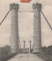
1861: Portsmouth
Portsmouth, Ohio, USA - Scioto River
| Bridgemeister ID: | 61 (added before 2003) |
| Year Completed: | 1861 |
| Name: | Portsmouth |
| Location: | Portsmouth, Ohio, USA |
| Crossing: | Scioto River |
| Principals: | Max J. Becker |
| References: | EOV |
| Status: | Removed |
Notes:
- Reconstruction of the 1858 Portsmouth bridge. A completion year of 1861 is assumed given information provided in EOV. Failed 1884.
- Replaced 1858 Portsmouth - Portsmouth, Ohio, USA.
1861: Weitchpec
Weitchpec, California, USA - Klamath River
| Bridgemeister ID: | 1090 (added 2004-01-01) |
| Year Completed: | 1861 |
| Name: | Weitchpec |
| Location: | Weitchpec, California, USA |
| Crossing: | Klamath River |
| Principals: | Andrew S. Hallidie |
| References: | DSL200106 |
| Use: | Vehicular |
| Status: | Removed |
| Main Cables: | Wire (iron) |
| Suspended Spans: | 1 |
Notes:
1862: (footbridge)
Greystead, England, United Kingdom - River North Tyne
| Bridgemeister ID: | 1252 (added 2004-02-21) |
| Year Completed: | 1862 |
| Name: | (footbridge) |
| Location: | Greystead, England, United Kingdom |
| Crossing: | River North Tyne |
| Coordinates: | 55.169017 N 2.353408 W |
| Maps: | Acme, GeoHack, Google, OpenStreetMap |
| Use: | Footbridge |
| Status: | Extant (last checked: 2019) |
| Main Cables: | Chain |
| Suspended Spans: | 1 |
Notes:
- Footbridge with large stone towers. Near Tarset Burn.
- Several sources suggest this bridge was completed in 1862.
- Similar to 1878 Sedgwick (Low Park Woods, New Sedgwick) - Sedgwick and Sizergh, England, United Kingdom.
External Links:
- Bridges on the Tyne. "Built to connect with Thorneyburn station on the Border Counties Railway."
1862: (suspension bridge)
California, USA - Trinity River
| Bridgemeister ID: | 1093 (added 2004-01-01) |
| Year Completed: | 1862 |
| Name: | (suspension bridge) |
| Location: | California, USA |
| Crossing: | Trinity River |
| Principals: | Andrew S. Hallidie |
| References: | DSL200106 |
| Status: | Removed |
| Main Cables: | Wire (iron) |
1862: (suspension bridge)
California, USA - Stanislaus River
| Bridgemeister ID: | 1094 (added 2004-01-01) |
| Year Completed: | 1862 |
| Name: | (suspension bridge) |
| Location: | California, USA |
| Crossing: | Stanislaus River |
| Principals: | Andrew S. Hallidie |
| References: | DSL200106 |
| Status: | Removed |
| Main Cables: | Wire (iron) |
1862: (suspension bridge)
California, USA - Tuolumne River
| Bridgemeister ID: | 1095 (added 2004-01-01) |
| Year Completed: | 1862 |
| Name: | (suspension bridge) |
| Location: | California, USA |
| Crossing: | Tuolumne River |
| Principals: | Andrew S. Hallidie |
| References: | DSL200106 |
| Status: | Removed |
| Main Cables: | Wire |
1862: (suspension bridge)
McCourtney's Crossing, California, USA - Bear River
| Bridgemeister ID: | 1092 (added 2004-01-01) |
| Year Completed: | 1862 |
| Name: | (suspension bridge) |
| Location: | McCourtney's Crossing, California, USA |
| Crossing: | Bear River |
| Principals: | Andrew S. Hallidie |
| References: | DSL200106 |
| Status: | Removed |
| Main Cables: | Wire (iron) |
1862: Bessan
Bessan, Hérault, France - Hérault River
| Bridgemeister ID: | 1938 (added 2005-10-29) |
| Year Completed: | 1862 |
| Name: | Bessan |
| Location: | Bessan, Hérault, France |
| Crossing: | Hérault River |
| Status: | Removed |
| Main Cables: | Wire |
| Suspended Spans: | 1 |
External Links:
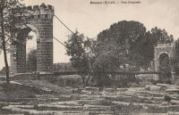
1862: Chatham
Fredericksburg, Virginia, USA - Rappahannock River
| Bridgemeister ID: | 271 (added before 2003) |
| Year Completed: | 1862 |
| Name: | Chatham |
| Location: | Fredericksburg, Virginia, USA |
| Crossing: | Rappahannock River |
| Coordinates: | 38.304981 N 77.456280 W |
| Maps: | Acme, GeoHack, Google, OpenStreetMap |
| Principals: | Washington A. Roebling |
| References: | GB |
| Status: | Destroyed |
| Main Cables: | Wire |
Notes:
- After several attempts by the Union Army to restore Rappahannock River bridges near Fredericksburg with pontoon bridges during the Civil War, Washington Roebling built a temporary wire suspension bridge on the piers of the former Chatham Bridge. The suspension bridge may have had twelve or more suspended spans (the former Chatham Bridge supposedly had 13 piers). Started July 1 and completed July 18, it survived less than two months, destroyed on September 1, 1862 by an evacuating Union Army.
External Links:
1862: Gloucester Street
Christchurch, New Zealand - Avon River
| Bridgemeister ID: | 655 (added 2003-03-08) |
| Year Completed: | 1862 |
| Name: | Gloucester Street |
| Location: | Christchurch, New Zealand |
| Crossing: | Avon River |
| References: | GAP |
1862: Lambeth
London, England, United Kingdom - River Thames
| Bridgemeister ID: | 829 (added 2003-05-31) |
| Year Completed: | 1862 |
| Name: | Lambeth |
| Location: | London, England, United Kingdom |
| Crossing: | River Thames |
| Principals: | P. W. Barlow |
| References: | BRB, HBE, ONF, PTS2 |
| Use: | Vehicular, with walkway |
| Status: | Replaced, 1932 |
| Suspended Spans: | 3 |
| Main Spans: | 3 x 81.7 meters (268 feet) |
External Links:
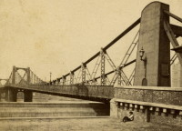
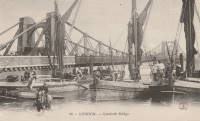
1862: Pine Street
Nevada City, California, USA - Deer Creek
| Bridgemeister ID: | 62 (added before 2003) |
| Year Completed: | 1862 |
| Name: | Pine Street |
| Location: | Nevada City, California, USA |
| Crossing: | Deer Creek |
| Principals: | Andrew S. Hallidie |
| References: | DSL200106 |
| Use: | Vehicular (one-lane) |
| Status: | Removed |
| Main Cables: | Wire (iron) |
| Suspended Spans: | 1 |
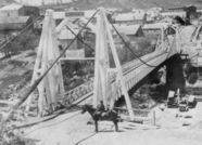
1862: Rattlesnake Bar
Folsom vicinity, California, USA - American River
| Bridgemeister ID: | 1091 (added 2004-01-01) |
| Year Completed: | 1862 |
| Name: | Rattlesnake Bar |
| Location: | Folsom vicinity, California, USA |
| Crossing: | American River |
| At or Near Feature: | Rattlesnake Bar |
| Coordinates: | 38.814397 N 121.091726 W |
| Maps: | Acme, GeoHack, Google, OpenStreetMap |
| Principals: | Andrew S. Hallidie |
| References: | DSL200106 |
| Use: | Vehicular (one-lane) |
| Status: | Collapsed, December 21, 1954 |
| Main Cables: | Wire (iron) |
| Suspended Spans: | 1 |
Notes:
- The location of Rattlesnake Bar is closer to present-day Auburn than Folsom, near the location of Goose Flat marked on modern topographical maps of the region. The area was inundated during the creation of Folsom Lake, but the piers and abutments of the Rattlesnake Bar bridge are visible when the water level is low.
- Rodi Lee writes: "[The bridge] collapsed in 1954 when an overweight truck filled with manure crossed it. The driver was unhurt. There are newspaper articles about the incident (Auburn Journal, Auburn). There are some photos in the article as well. The bridge abutments show when the the lake water is low. The bridge was upstream of Wild Goose Flats."
- See 1855 Whiskey Bar (Pioneer, Whisky) - El Dorado County, California, USA. The cables of the Rattlesnake Bar bridge were reportedly reused from the damaged Whiskey Bar bridge.
External Links:
- 1057. The Suspension Bridge over the American River at Rattlesnake Bar, Placer County - Calisphere.org
- Rattlesnake Bridge - Christine's Blog. Several images of the remnants of the bridge.
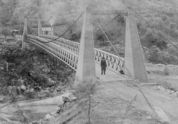
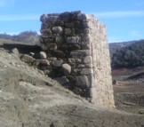
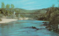
1863: Alexandra
Spuzzum, British Columbia, Canada - Fraser River
| Bridgemeister ID: | 63 (added before 2003) |
| Year Completed: | 1863 |
| Name: | Alexandra |
| Also Known As: | Trutch's |
| Location: | Spuzzum, British Columbia, Canada |
| Crossing: | Fraser River |
| Principals: | Andrew S. Hallidie, Joseph W. Trutch |
| Use: | Vehicular |
| Status: | Removed, 1912 |
| Main Cables: | Wire (iron) |
| Main Span: | 1 x 82 meters (269 feet) |
Notes:
- Fell into disuse, 1884. Damaged by flood 1904. Dismantled 1912. Some sources indicate the flood damage occurred in 1894.
- Replaced by 1926 Second Alexandra - Spuzzum, British Columbia, Canada.

1863: Confolent
Confolent, Beauzac vicinity and Saint-Marice-de-Lignon, Haute-Loire, France - Loire River
| Bridgemeister ID: | 412 (added before 2003) |
| Year Completed: | 1863 |
| Name: | Confolent |
| Also Known As: | Lignon |
| Location: | Confolent, Beauzac vicinity and Saint-Marice-de-Lignon, Haute-Loire, France |
| Crossing: | Loire River |
| Coordinates: | 45.258031 N 4.144228 E |
| Maps: | Acme, GeoHack, Google, OpenStreetMap |
| Principals: | Adolphe Boulland |
| References: | BPF |
| Use: | Vehicular (one-lane), with walkway |
| Status: | In use (last checked: 2019) |
| Main Cables: | Wire (iron) |
| Suspended Spans: | 1 |
Notes:
- Cables damaged 1913, 1921. Refurbished 1922.
External Links:
1863: Lamb's
Latrobe vicinity and Plymouth vicinity, California, USA - Cosumnes River
| Bridgemeister ID: | 2117 (added 2006-09-10) |
| Year Completed: | 1863 |
| Name: | Lamb's |
| Location: | Latrobe vicinity and Plymouth vicinity, California, USA |
| Crossing: | Cosumnes River |
| Coordinates: | 38.52222 N 120.95587 W |
| Maps: | Acme, GeoHack, Google, OpenStreetMap |
| Use: | Vehicular (one-lane) |
| Status: | Derelict (last checked: 2020) |
| Main Cables: | Wire (iron) |
| Suspended Spans: | 1 |
Notes:
- The location coordinates provided here are the approximate location of this bridge, crossing the Cosumnes between present day El Dorado and Amador counties at Michigan Bar (as named on USGS topographical maps) on current Latrobe Road where Clark Creek meets the Cosumnes River. Note that USGS topographical maps show another, more prominently marked, "Michigan Bar" a few miles west in Sacramento County.
- A California Highways and Public Works article (unsure of exact citation but it may be the article on the history of California bridges that appeared in the 1941 June issue and was reprinted in the 1950 September/October issue) says "there were four [suspension bridges] on the Cosumnes River, one of which (Lamb's Bridge on the Latrobe-Plymouth Road) killed one man and seven horses when it fell in 1869."
- The October 14, 1976 edition of The Mountain Democrat Times (Placerville, California) has an article about the nearby Huse Bridge (from the Heritage Association of El Dorado) which mentions Lamb's Bridge: "...Lamb's Bridge, several miles downriver, was reconstructed in 1872 and was also a wire bridge of the same type [as Huse's]."
- The Statutes of California passed at the Fourteenth Session of the Legislature, 1863 records: "Chapter XLI. An Act to grant to Larkin Lamb and his Associates the right to construct and maintain a Toll Bridge across the Cosumnes River, in the Counties of Amador and El Dorado. Approved March 6, 1863. The People of the State of California, represented in Senate and Assembly, do enact as follows: Section 1. Larkin Lamb, and those he may associate with him, their heirs and assigns, shall have full power to build, erect, construct, and maintain a public toll bridge across the Cosumnes River, at a point about eighty (80) rods below Dutch Hill;..."
- A November 12, 2017 article in Ledger Dispatch (of Amador and Calaveras counties) titled "Vestiges of Amador-Communities Along the Cosumnes, Part VI: The Lower Reaches - Michigan Bar to Wisconsin Bar" by Deborah Coleen Cook gives a more complete history of Lamb's bridge citing the enactment (February 9, 1863) of the bill to permit construction, construction completing six months later, failure of one of the cables in 1869 under the weight of a large freight wagon, and another cable/anchorage failure in 1872 while the bridge was undergoing major repairs.
- See 1852 Huse - Yeomet, California, USA.
- See 1852 Wilson's - Cosumne, California, USA.
1863: Ponsonnas
Ponsonnas, Isère, France - Drac River
| Bridgemeister ID: | 1079 (added 2003-12-29) |
| Year Completed: | 1863 |
| Name: | Ponsonnas |
| Location: | Ponsonnas, Isère, France |
| Crossing: | Drac River |
| Use: | Vehicular |
| Status: | Replaced, 1941 |
| Suspended Spans: | 1 |
| Main Span: | 1 x 123 meters (403.5 feet) |
Notes:
- Replaced by a 1941 arch bridge that is popular with bungee jumpers.
External Links:
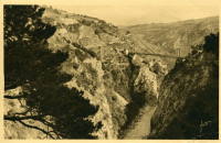
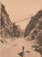
1863: Rousset
Rousset, Curbans vicinity, Alpes-de-Haute-Provence and Hautes-Alpes, France - Durance River
| Bridgemeister ID: | 2063 (added 2006-06-06) |
| Year Completed: | 1863 |
| Name: | Rousset |
| Location: | Rousset, Curbans vicinity, Alpes-de-Haute-Provence and Hautes-Alpes, France |
| Crossing: | Durance River |
| Use: | Vehicular |
| Status: | Removed |
| Main Cables: | Wire |
| Suspended Spans: | 1 |
External Links:
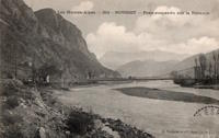
1864: (suspension bridge)
Porta Westfalica, Germany - Weser River
| Bridgemeister ID: | 637 (added 2003-02-13) |
| Year Completed: | 1864 |
| Name: | (suspension bridge) |
| Location: | Porta Westfalica, Germany |
| Crossing: | Weser River |
| References: | BRU, PTS2 |
| Use: | Rail and Vehicular |
| Status: | Destroyed, April 3, 1945 |
| Main Cables: | Eyebar (iron) |
| Suspended Spans: | 1 |
Notes:
- At the time of completion, the bridge connected the villages of Barkhausen and Hausberge, later merged into Porta Westfalica.
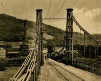
1864: Archidiacre
Venterol, Alpes-de-Haute-Provence and Valserres, Hautes-Alpes, France - Durance River
| Bridgemeister ID: | 4690 (added 2020-06-20) |
| Year Completed: | 1864 |
| Name: | Archidiacre |
| Also Known As: | Venterol |
| Location: | Venterol, Alpes-de-Haute-Provence and Valserres, Hautes-Alpes, France |
| Crossing: | Durance River |
| Coordinates: | 44.475805 N 6.111924 E |
| Maps: | Acme, GeoHack, Google, OpenStreetMap |
| Use: | Vehicular (one-lane) |
| Status: | Demolished, 2010 |
| Main Cables: | Wire |
| Suspended Spans: | 1 |
External Links:
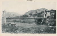
1864: Aspern
Vienna, Austria
| Bridgemeister ID: | 3076 (added 2019-10-26) |
| Year Completed: | 1864 |
| Name: | Aspern |
| Location: | Vienna, Austria |
| Coordinates: | 48.211858 N 16.383001 E |
| Maps: | Acme, GeoHack, Google, OpenStreetMap |
| Principals: | Friedrich Schnirch |
| References: | AAJ, PTS2 |
| Use: | Vehicular |
| Status: | Demolished, 1913 |
| Main Cables: | Eyebar (iron) |
| Suspended Spans: | 1 |
| Main Span: | 1 |
External Links:
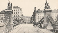
1864: Clifton
Bristol, England, United Kingdom - River Avon
| Bridgemeister ID: | 413 (added before 2003) |
| Year Completed: | 1864 |
| Name: | Clifton |
| Location: | Bristol, England, United Kingdom |
| Crossing: | River Avon |
| Coordinates: | 51.45496 N 2.62781 W |
| Maps: | Acme, GeoHack, Google, OpenStreetMap |
| Principals: | Isambard K. Brunel, P.W. Barlow, Hawkshaw |
| References: | AOB, BBR, BC3, BEM, BMA, BOU, BRB, CTW, HBE, NTB, ONF, PTS2 |
| Use: | Vehicular, with walkway |
| Status: | In use (last checked: 2021) |
| Main Cables: | Eyebar (iron) |
| Suspended Spans: | 1 |
| Main Span: | 1 x 214 meters (702 feet) |
Notes:
- Built with chain cables reused from the Hungerford bridge.
- See 1845 Hungerford - London, England, United Kingdom.
External Links:
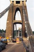

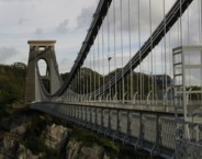
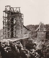
1864: Franklin
Franklin, Pennsylvania, USA - Allegheny River
| Bridgemeister ID: | 3186 (added 2019-11-09) |
| Year Completed: | 1864 |
| Name: | Franklin |
| Location: | Franklin, Pennsylvania, USA |
| Crossing: | Allegheny River |
| Principals: | John Murphy |
| References: | AAJ |
| Status: | Destroyed, 1870 |
Notes:
- 1870: Cable ends caught fire precipitating collapse, killing two.
1864: Taieri River
Outram, New Zealand - Taieri River
| Bridgemeister ID: | 656 (added 2003-03-08) |
| Year Completed: | 1864 |
| Name: | Taieri River |
| Also Known As: | West Taieri |
| Location: | Outram, New Zealand |
| Crossing: | Taieri River |
| Principals: | John Turnbull Thomson |
| References: | GAP |
| Use: | Vehicular |
| Status: | Replaced, 1966 |
| Main Cables: | Eyebar (iron) |
| Suspended Spans: | 4 |
| Main Spans: | 2 |
| Side Spans: | 2 |
External Links:
1865: Market Street
Williamsport, Pennsylvania, USA - Susquehanna River
| Bridgemeister ID: | 64 (added before 2003) |
| Year Completed: | 1865 |
| Name: | Market Street |
| Location: | Williamsport, Pennsylvania, USA |
| Crossing: | Susquehanna River |
| Principals: | Alfred P. Boller |
| References: | AAJ, JFI186604 |
| Use: | Vehicular |
| Status: | Destroyed, June 1, 1889 |
| Main Cables: | Wire (iron) |
| Suspended Spans: | 5 |
| Main Spans: | 5 x 61 meters (200 feet) |
Notes:
- JFI186604 (in which Boller mentions about the bridge's "peculiar system of trussing": "This general arrangement for suspension bridges was first practised by John Murphy, Esq., C.E., over the Gauley, in West Virginia, and also at Franklin, Pennsylvania.")
- Destroyed by flood June 1, 1889.
- Near 1878 Maynard Street - Williamsport, Pennsylvania, USA.
- Replaced by 1889 Market Street - Williamsport, Pennsylvania, USA.
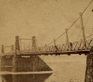
1865: Moulin
Vernosc-lès-Annonay, Ardèche, France - Cance River
| Bridgemeister ID: | 4553 (added 2020-05-31) |
| Year Completed: | 1865 |
| Name: | Moulin |
| Location: | Vernosc-lès-Annonay, Ardèche, France |
| Crossing: | Cance River |
| Coordinates: | 45.210908 N 4.703327 E |
| Maps: | Acme, GeoHack, Google, OpenStreetMap |
| Status: | Removed |
| Main Cables: | Wire (iron) |
| Suspended Spans: | 1 |
Notes:
- Structurae equates this bridge (which was replaced in 2012-2013) to the famous Seguin Brothers test structure at Annonay. Other sources suggest the derelict bridge replaced in 2012-2013 only dated to the 1860s. The detailed description and depiction of the Seguin's Annonay bridge in Tom F. Peters book on early 19th-century suspension bridges definitely does not resemble the 19th-century Moulin bridge. Peters describes the 1822-1823 Seguin bridge as a very narrow, very light, catwalk-style bridge. Peters additionally describes the main cables: "It had a single continuous parallel wire cable made of eight 1.23mm (no. 8 gauge) wires."
- Replaced by 2013 Moulin - Vernosc-lès-Annonay, Ardèche, France.
- See 1822 (footbridge) - Annonay, Ardèche, France.
External Links:
1866: (suspension bridge)
Nashville and Edgefield, Tennessee, USA - Cumberland River
| Bridgemeister ID: | 1965 (added 2005-11-20) |
| Year Completed: | 1866 |
| Name: | (suspension bridge) |
| Location: | Nashville and Edgefield, Tennessee, USA |
| Crossing: | Cumberland River |
| References: | AAJ |
| Use: | Vehicular |
| Status: | Removed, 1884 |
| Main Cables: | Wire |
Notes:
| Bridgemeister ID: | 7460 (added 2022-12-24) |
| Year Completed: | 1866 |
| Name: | Cessenon-sur-Orb |
| Location: | Cessenon-sur-Orb, Hérault, France |
| Crossing: | Orb River |
| Coordinates: | 43.451360 N 3.046595 E |
| Maps: | Acme, GeoHack, Google, OpenStreetMap |
| Use: | Vehicular (one-lane) |
| Status: | Replaced |
| Main Cables: | Wire |
| Suspended Spans: | 1 |
Notes:
- Replaced by Cessenon-sur-Orb - Cessenon-sur-Orb, Hérault, France.
External Links:
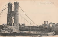
1867: (suspension bridge)
Albuquerque, New Mexico, USA - Rio Grande
| Bridgemeister ID: | 5559 (added 2020-12-18) |
| Year Completed: | 1867 |
| Name: | (suspension bridge) |
| Location: | Albuquerque, New Mexico, USA |
| Crossing: | Rio Grande |
| Use: | Vehicular |
| Status: | Removed |
| Main Cables: | Wire |
Notes:
- Likely completed 1867.
External Links:
1867: (suspension bridge)
Mataura, New Zealand
| Bridgemeister ID: | 657 (added 2003-03-08) |
| Year Completed: | 1867 |
| Name: | (suspension bridge) |
| Location: | Mataura, New Zealand |
| Principals: | John Turnbull Thomson |
| References: | GAP |
1867: Corrieshalloch
Braemore, Scotland, United Kingdom - Corrieshalloch Gorge
| Bridgemeister ID: | 1308 (added 2004-04-10) |
| Year Completed: | 1867 |
| Name: | Corrieshalloch |
| Location: | Braemore, Scotland, United Kingdom |
| Crossing: | Corrieshalloch Gorge |
| At or Near Feature: | Falls of Measach |
| Coordinates: | 57.755753 N 5.021048 W |
| Maps: | Acme, GeoHack, Google, OpenStreetMap |
| Principals: | John Fowler |
| References: | AAJ, HBR |
| Use: | Footbridge |
| Status: | In use (last checked: 2022) |
| Main Cables: | Wire |
| Suspended Spans: | 1 |
| Main Span: | 1 x 25.1 meters (82.5 feet) |
Notes:
- 2022, May: Closed again for maintenance and inspection, reopened by month's end.
- AAJ lists the bridge at "Corry Halloch" bridge completed in 1875. Other sources mention 1867, and 1874.
- 1977: Anchorages replaced (HBR).
- 2021: Closed September 10 due to safety concerns. Repaired and re-opened in October.
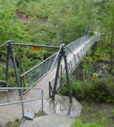
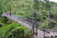
1867: Doldowlod
Doldowlod, Llandrindod Wells, Wales, United Kingdom - River Wye
| Bridgemeister ID: | 5085 (added 2020-09-04) |
| Year Completed: | 1867 |
| Name: | Doldowlod |
| Also Known As: | Llanwrthyl, Ystrad |
| Location: | Doldowlod, Llandrindod Wells, Wales, United Kingdom |
| Crossing: | River Wye |
| Coordinates: | 52.244210 N 3.462324 W |
| Maps: | Acme, GeoHack, Google, OpenStreetMap |
| Principals: | William Dredge |
| Use: | Footbridge |
| Status: | In use (last checked: 2018) |
| Main Cables: | Rod (iron) |
| Suspended Spans: | 1 |
Notes:
- Dredge patent bridge, possibly completed by his son William Dredge.
External Links:
- The Happy Pontist: Welsh Bridges: 10. Doldowlod Bridge. Photos and discussion of its history and uncertainty about the year it was completed.
1867: John A. Roebling
Cincinnati, Ohio and Covington, Kentucky, USA - Ohio River
| Bridgemeister ID: | 65 (added before 2003) |
| Year Completed: | 1867 |
| Name: | John A. Roebling |
| Also Known As: | Cincinnati, Cincinnati and Covington |
| Location: | Cincinnati, Ohio and Covington, Kentucky, USA |
| Crossing: | Ohio River |
| Coordinates: | 39.09167 N 84.50833 W |
| Maps: | Acme, GeoHack, Google, OpenStreetMap |
| Principals: | John A. Roebling |
| References: | BAAW, BC3, BOB, BPL, COB, EOV, HBE, LAB, LACE, ONF, PTS2, SJR, TOB |
| Use: | Vehicular (two-lane), with walkway |
| Status: | Closed, February, 2021 (last checked: 2021) |
| Main Cables: | Wire (iron) |
| Suspended Spans: | 3 |
| Main Span: | 1 x 322.2 meters (1,057 feet) |
| Side Spans: | 2 |
Notes:
- 1892: Cable ends restored.
- 1899: Steel cables added to assist original cables.
- 2021, February: Closed to all vehicular traffic for a nine-month restoration project.
- Became longest suspension bridge by eclipsing 1849 Wheeling (Wheeling and Belmont) - Wheeling, West Virginia, USA.
- Eclipsed by new longest suspension bridge 1869 Clifton (Niagara-Clifton, Falls View, First Falls View) - Niagara Falls, New York, USA and Niagara Falls, Ontario, Canada.
External Links:
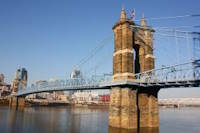
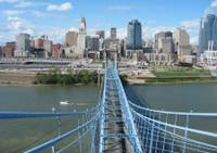
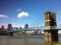
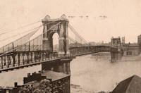
1867: Mosquito Road
Placerville, California, USA - South Fork American River
| Bridgemeister ID: | 2323 (added 2007-05-06) |
| Year Completed: | 1867 |
| Name: | Mosquito Road |
| Location: | Placerville, California, USA |
| Crossing: | South Fork American River |
| Coordinates: | 38.775791 N 120.748441 W |
| Maps: | Acme, GeoHack, Google, OpenStreetMap |
| Use: | Vehicular |
| Status: | Replaced |
| Main Cables: | Wire |
Notes:
- The February 23, 1995 edition of the Mountain Democrat (Placerville, California) has an article about the Mosquito crossing that mentions: "According to the El Dorado County History of 1883 by Paolo Sioli, 'Mosquito is connected to Placerville by a good wagon-road and a suspension bridge across the South Fork of the American River, a trail is running in the direction of Kelsey, the township center... The original bridge was constructed in 1867, and according to Orval Beckett, as quoted in the booklet, Mosquito Memories, 'This original bridge had no banisters on the sides. It was a suspension cable with No. 9 telephone wires strung between the supports. When you drove onto the bridge, it would 'swing and sway' much like we have seen in the movies. When one end went down the other went up, etc. Imagine the thrill!'"
- Replaced by 1939 Mosquito Road - Placerville, California, USA.
| Bridgemeister ID: | 516 (added before 2003) |
| Year Completed: | 1867 |
| Name: | Parc des Buttes-Chaumont |
| Location: | Paris, France |
| At or Near Feature: | Parc des Buttes-Chaumont |
| Coordinates: | 48.880933 N 2.381533 E |
| Maps: | Acme, GeoHack, Google, OpenStreetMap |
| References: | AAJ |
| Use: | Footbridge |
| Status: | In use (last checked: 2021) |
| Main Cables: | Wire |
| Suspended Spans: | 1 |
| Main Span: | 1 x 61 meters (200 feet) |
External Links:
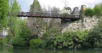
1867: Public Garden
Boston, Massachusetts, USA - Public Garden lagoon
| Bridgemeister ID: | 245 (added before 2003) |
| Year Completed: | 1867 |
| Name: | Public Garden |
| Location: | Boston, Massachusetts, USA |
| Crossing: | Public Garden lagoon |
| Coordinates: | 42.354119 N 71.069920 W |
| Maps: | Acme, GeoHack, Google, OpenStreetMap |
| Principals: | William Gibbons Preston, Clemens Herschel |
| References: | HBE |
| Use: | Footbridge |
| Status: | In use (last checked: 2019) |
| Main Cables: | Eyebar (iron) |
| Suspended Spans: | 3 |
| Main Span: | 1 |
| Side Spans: | 2 |
External Links:

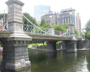
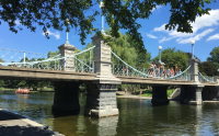
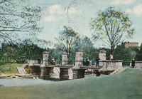
1868: (suspension bridge)
Afton, New York, USA - Susquehanna River
| Bridgemeister ID: | 66 (added before 2003) |
| Year Completed: | 1868 |
| Name: | (suspension bridge) |
| Location: | Afton, New York, USA |
| Crossing: | Susquehanna River |
| Principals: | G. W. & J. V. V. Fishler, James Crowell |
| Use: | Vehicular |
| Status: | Removed |
| Main Cables: | Wire (iron) |
| Suspended Spans: | 1 |
| Main Span: | 1 x 110.3 meters (362 feet) |
| Deck width: | 16 feet |
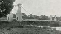
1868: Blue Lick Springs
Kentucky, USA - Licking River
| Bridgemeister ID: | 2659 (added 2019-03-09) |
| Year Completed: | 1868 |
| Name: | Blue Lick Springs |
| Location: | Kentucky, USA |
| Crossing: | Licking River |
| Coordinates: | 38.422314 N 83.999076 W |
| Maps: | Acme, GeoHack, Google, OpenStreetMap |
| Use: | Vehicular (one-lane) |
| Status: | Removed |
| Main Cables: | Wire |
| Suspended Spans: | 1 |
Notes:
- 1897: Replaced by two-span truss bridge that is still (as of 2019) at the same location. The truss bridge was built between the main suspension bridge cables and, apparently, the suspension bridge remained standing for several years.
1868: Calloway's Ford
Elizabethtown vicinity, Hamilton County, Ohio, USA - Whitewater River
| Bridgemeister ID: | 68 (added before 2003) |
| Year Completed: | 1868 |
| Name: | Calloway's Ford |
| Also Known As: | Whitewater, Harrison's |
| Location: | Elizabethtown vicinity, Hamilton County, Ohio, USA |
| Crossing: | Whitewater River |
| Coordinates: | 39.183116 N 84.792638 W |
| Maps: | Acme, GeoHack, Google, OpenStreetMap |
| Principals: | John Gray, Morse, Young |
| References: | EOV |
| Use: | Vehicular |
| Status: | Removed, 1920 |
| Main Cables: | Wire (iron) |
| Main Span: | 1 x 144.8 meters (475 feet) |
| Deck width: | 22 feet |
Notes:
- This bridge was located where present-day Suspension Bridge Road crosses the Whitewater River next to I-275 and north of US50. According to information provided by Sharon Lutz from Marjorie Byrnside Burress, this bridge was renamed "Harrison's Suspension Bridge" in 1891. This should not be confused with the nearby suspension bridge at Harrison.
- According to the information provided by Sharon Lutz from Marjorie Byrnside Burress, "Crossing this bridge was the main thoroughfare from Indiana into Ohio for many years (US 50 was not completed by then). [In 1920] it was decided that the Suspension Bridge had become obsolete and could no longer safely withstand the weight of vehicles. [On May 19, 1920] the cables were severed by means of an oxygen flame, the weight of the cables pulled down some towers. Other towers were weakened by dynamite at their bases and later they were pulled down by the weight of the cables severed at one end with an oxygen flame."
- See 1873 Harrison - Harrison, Ohio and Dearborn County, Indiana, USA.
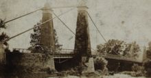

1868: Carpenter's Point
Port Jervis, New Jersey, USA - Neversink River
| Bridgemeister ID: | 2251 (added 2007-03-31) |
| Year Completed: | 1868 |
| Name: | Carpenter's Point |
| Location: | Port Jervis, New Jersey, USA |
| Crossing: | Neversink River |
| Use: | Vehicular (one-lane) |
| Status: | Replaced, 1929 |
| Main Cables: | Wire |
| Suspended Spans: | 1 |
Notes:
- Was at location of current Tri-States Bridge.
1868: Eiserner Steg
Frankfurt, Germany - Main River
| Bridgemeister ID: | 6429 (added 2021-08-11) |
| Year Completed: | 1868 |
| Name: | Eiserner Steg |
| Also Known As: | Eiserne Steg |
| Location: | Frankfurt, Germany |
| Crossing: | Main River |
| Coordinates: | 50.108108 N 8.682128 E |
| Maps: | Acme, GeoHack, Google, OpenStreetMap |
| Principals: | Peter Schmick |
| References: | AAJ, PTS2 |
| Use: | Footbridge |
| Status: | Replaced, 1912 |
| Suspended Spans: | 3 |
| Main Span: | 1 |
| Side Spans: | 2 |
Notes:
- A "stiffened" braced chain suspension bridge. Like several other similar eastern European bridges constructed in the late 1800s and early 1900s it is somewhat questionable whether this bridge should be included in a list of suspension bridges. It was replaced in 1912 by a cantilever bridge that resembles the shape and lines of the former suspension bridge.
External Links:
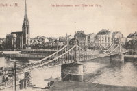
1868: High Street
Hamilton, Ohio, USA - Great Miami River
| Bridgemeister ID: | 67 (added before 2003) |
| Year Completed: | 1868 |
| Name: | High Street |
| Also Known As: | Hamilton |
| Location: | Hamilton, Ohio, USA |
| Crossing: | Great Miami River |
| Principals: | John Gray |
| References: | EOV |
| Use: | Vehicular |
| Status: | Removed |
| Main Cables: | Wire |
| Suspended Spans: | 1 |
External Links:
- Butler County Engineer's Office (BCOE). Mentions this bridge stood from 1866 through 1895.
1868: Skippers Canyon
Maori Point vicinity, New Zealand - Shotover River
| Bridgemeister ID: | 658 (added 2003-03-08) |
| Year Completed: | 1868 |
| Name: | Skippers Canyon |
| Location: | Maori Point vicinity, New Zealand |
| Crossing: | Shotover River |
| At or Near Feature: | Skippers Canyon |
| Principals: | John Turnbull Thomson |
| References: | GAP |
| Use: | Footbridge |
| Status: | Removed |
| Main Cables: | Wire |
Notes:
- Replaced by 1901 Skippers - Maori Point vicinity, New Zealand at a nearby location.
1868: Wire
New Portland, Maine, USA - Carrabasset River
| Bridgemeister ID: | 69 (added before 2003) |
| Year Completed: | 1868 |
| Name: | Wire |
| Location: | New Portland, Maine, USA |
| Crossing: | Carrabasset River |
| Coordinates: | 44.890783 N 70.0925 W |
| Maps: | Acme, GeoHack, Google, OpenStreetMap |
| References: | BC3, BPL, GBD, LAB, RDH |
| Use: | Vehicular (one-lane) |
| Status: | In use (last checked: 2023) |
| Main Cables: | Wire (iron) |
| Suspended Spans: | 1 |
| Main Span: | 1 x 60.5 meters (198.4 feet) |
Notes:
- BPL says c. 1866. Historic landmark plaque at bridge also says 1866.
- Extensive repairs, 1960.
External Links:
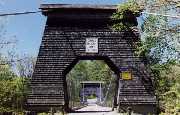
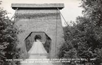
1869: (footbridge)
Salado, Texas, USA - Salado Creek
| Bridgemeister ID: | 920 (added 2003-10-18) |
| Year Completed: | 1869 |
| Name: | (footbridge) |
| Location: | Salado, Texas, USA |
| Crossing: | Salado Creek |
| At or Near Feature: | Salado College |
| Use: | Footbridge |
| Status: | Destroyed, 1913 |
| Main Cables: | Wire (iron) |
Notes:
- Destroyed by flood, 1913.
1869: Chavanay
Chavanay, Loire and Isère, France - Rhône River
| Bridgemeister ID: | 1702 (added 2005-03-29) |
| Year Completed: | 1869 |
| Name: | Chavanay |
| Location: | Chavanay, Loire and Isère, France |
| Crossing: | Rhône River |
| Coordinates: | 45.417327 N 4.740458 E |
| Maps: | Acme, GeoHack, Google, OpenStreetMap |
| Use: | Vehicular |
| Status: | Only towers remain (last checked: 2019) |
| Main Cables: | Wire (iron) |
| Suspended Spans: | 1 |
Notes:
- In 2019, one pair of pylons were still standing on the west bank of the Rhône.
1869: Clifton
Niagara Falls, New York, USA and Niagara Falls, Ontario, Canada - Niagara River
| Bridgemeister ID: | 70 (added before 2003) |
| Year Completed: | 1869 |
| Name: | Clifton |
| Also Known As: | Niagara-Clifton, Falls View, First Falls View |
| Location: | Niagara Falls, New York, USA and Niagara Falls, Ontario, Canada |
| Crossing: | Niagara River |
| Principals: | Samuel Keefer |
| References: | AAJ, BPL, HBE, PTS2 |
| Use: | Vehicular |
| Status: | Replaced, 1889 |
| Main Cables: | Wire (iron) |
| Main Span: | 1 x 386.6 meters (1,268.3 feet) |
| Deck width: | 10 feet |
Notes:
- Opened January 2nd, 1869. Wooden towers replaced with steel towers, 1884. Widened to 17 feet, 1888. Wrecked by wind, January, 1889. Some of the images here may show the replacement bridge.
- Became longest suspension bridge by eclipsing 1867 John A. Roebling (Cincinnati, Cincinnati and Covington) - Cincinnati, Ohio and Covington, Kentucky, USA.
- Eclipsed by new longest suspension bridge 1883 Brooklyn (Great East River) - New York and Brooklyn, New York, USA.
- Replaced by 1889 Second Falls View - Niagara Falls, New York, USA and Niagara Falls, Ontario, Canada.
External Links:
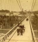
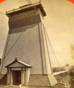
1869: Drahtsteg
Passau, Bavaria, Germany - Danube River
| Bridgemeister ID: | 5560 (added 2020-12-19) |
| Year Completed: | 1869 |
| Name: | Drahtsteg |
| Location: | Passau, Bavaria, Germany |
| Crossing: | Danube River |
| Coordinates: | 48.575501 N 13.472755 E |
| Maps: | Acme, GeoHack, Google, OpenStreetMap |
| References: | PTS2 |
| Use: | Footbridge |
| Status: | Only towers remain, since 1910 (last checked: 2020) |
| Main Cables: | Wire |
| Suspended Spans: | 1 |
Notes:
- Near future location of 1948 Luitpoldbrücke - Passau, Bavaria, Germany.
External Links:
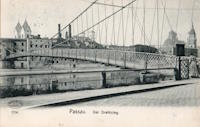
1869: Lordville
Lordville, New York and Equinunk, Pennsylvania, USA - Delaware River
| Bridgemeister ID: | 71 (added before 2003) |
| Year Completed: | 1869 |
| Name: | Lordville |
| Location: | Lordville, New York and Equinunk, Pennsylvania, USA |
| Crossing: | Delaware River |
| Coordinates: | 41.867938 N 75.213785 W |
| Maps: | Acme, GeoHack, Google, OpenStreetMap |
| Principals: | E.F. Farrington |
| References: | BDR, BOL, PTS2 |
| Use: | Vehicular (one-lane) |
| Status: | Destroyed, 1903 |
| Main Cables: | Wire (iron) |
Notes:
- Destroyed by flood 1903.
- Replaced by 1904 Lordville-Equinunk - Lordville, New York and Equinunk, Pennsylvania, USA.
1869: Rudolfova Lávka
Prague, Czechia - Vltava River
| Bridgemeister ID: | 5939 (added 2021-06-29) |
| Year Completed: | 1869 |
| Name: | Rudolfova Lávka |
| Also Known As: | Rudolfsteg, Kettensteg, Železna Lávka |
| Location: | Prague, Czechia |
| Crossing: | Vltava River |
| Coordinates: | 50.090185 N 14.412677 E |
| Maps: | Acme, GeoHack, Google, OpenStreetMap |
| Principals: | Karel Veselý, František Schön, Ruston and Co. |
| References: | AAJ, PTS2 |
| Use: | Footbridge |
| Status: | Removed, c. 1914 |
| Main Cables: | Chain (iron) |
Notes:
- Removed at some point after the adjacent Mánes bridge was opened in 1914.
External Links:
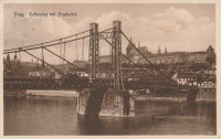
1869: San Francisco
Bilbao, Spain
1869: Stadspark
Antwerp, Belgium
| Bridgemeister ID: | 2078 (added 2006-06-10) |
| Year Completed: | 1869 |
| Name: | Stadspark |
| Also Known As: | City Park |
| Location: | Antwerp, Belgium |
| Coordinates: | 51.211054 N 4.414975 E |
| Maps: | Acme, GeoHack, Google, OpenStreetMap |
| Principals: | Cail et Halot |
| References: | ISFF |
| Use: | Footbridge |
| Status: | In use (last checked: 2019) |
| Main Cables: | Chain (iron) |
| Main Span: | 1 x 27.5 meters (90.2 feet) |
| Deck width: | 3.5 |
Notes:
- Cables and deck replaced, 1976.
External Links:
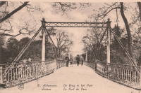
1869: Swinging
Warren and Glade, Pennsylvania, USA - Conewango Creek
| Bridgemeister ID: | 1623 (added 2005-02-27) |
| Year Completed: | 1869 |
| Name: | Swinging |
| Location: | Warren and Glade, Pennsylvania, USA |
| Crossing: | Conewango Creek |
| Coordinates: | 41.847389 N 79.141000 W |
| Maps: | Acme, GeoHack, Google, OpenStreetMap |
| Use: | Footbridge |
| Status: | Replaced, 1904 |
| Main Cables: | Wire (iron) |
Notes:
- Coordinates indicate approximate original location of the bridge.
- Destroyed by storm soon after completion and rebuilt.
- Images of America: Warren by Jodi L. Brandon shows an image of this bridge with a caption stating the bridge was moved to Kelletville (in Forest County, Pennsylvania) in 1906.
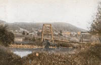
1869: Waco
Waco, Texas, USA - Brazos River
| Bridgemeister ID: | 72 (added before 2003) |
| Year Completed: | 1869 |
| Name: | Waco |
| Location: | Waco, Texas, USA |
| Crossing: | Brazos River |
| Coordinates: | 31.561314 N 97.127063 W |
| Maps: | Acme, GeoHack, Google, OpenStreetMap |
| Principals: | Thomas M. Griffith |
| References: | AAJ, BC3, BPL, BRAZ, GBD, HAERTX98, HBE, PTS2, WSB |
| Use: | Vehicular, with walkway |
| Status: | Restricted to foot traffic (last checked: 2023) |
| Main Cables: | Wire (iron) |
| Suspended Spans: | 1 |
| Main Span: | 1 x 144.8 meters (475 feet) |
| Deck width: | 18 feet |
Notes:
- 1915: Rebuilt.
- 2020, October: Closed for restoration project expecting to last 18-24 months.
- 2021, March: Major restoration project underway, led by Sparks Engineering, Inc.
- 2023, April: The restored bridge is rededicated on April 22. Patrick Sparks of Sparks Engineering reports: . The rededication was held April 22, 2023. "The project involved full rehabilitation including: replacement of the suspension system and anchor rods, strengthening of the anchorages, replacement of the saddle bearings, retrofit strengthening of the east tower, and deck replacement (concrete on the main deck, tropical hardwood on the side walks)."
External Links:
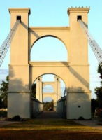
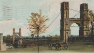
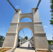
1870: (footbridge)
Rockford, Illinois, USA - Kent Creek
| Bridgemeister ID: | 594 (added 2003-01-11) |
| Year Completed: | 1870 |
| Name: | (footbridge) |
| Location: | Rockford, Illinois, USA |
| Crossing: | Kent Creek |
| At or Near Feature: | Tinker Swiss Cottage Museum |
| Principals: | Robert Tinker |
| Use: | Footbridge |
| Status: | Removed, 1976 |
Notes:
- Ground broken on replacement, October 6, 2004.
- Later at same location 2005 (footbridge) - Rockford, Illinois, USA.
1870: Auzon
Auzon, Haute-Loire, France - Allier River
| Bridgemeister ID: | 6936 (added 2022-01-22) |
| Year Completed: | 1870 |
| Name: | Auzon |
| Location: | Auzon, Haute-Loire, France |
| Crossing: | Allier River |
| Coordinates: | 45.385908 N 3.357088 E |
| Maps: | Acme, GeoHack, Google, OpenStreetMap |
| Use: | Vehicular (one-lane) |
| Status: | Removed, c. 1934 |
| Main Cables: | Wire |
| Main Span: | 1 |
Notes:
- Replaced by an arch bridge in 1934.
- Replaced 1847 Auzon - Auzon, Haute-Loire, France.
External Links:
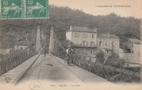
1870: Chehocton
Hancock, New York and Wayne County, Pennsylvania, USA - Delaware River
| Bridgemeister ID: | 284 (added before 2003) |
| Year Completed: | 1870 |
| Name: | Chehocton |
| Location: | Hancock, New York and Wayne County, Pennsylvania, USA |
| Crossing: | Delaware River |
| Principals: | E.F. Farrington, John A. Roebling's Sons Co. |
| Use: | Vehicular |
| Status: | Removed, 1937 |
| Main Cables: | Wire (iron) |
| Suspended Spans: | 1 |
| Main Span: | 1 x 144.8 meters (475 feet) estimated |
Notes:
- Replaced 1937.
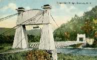
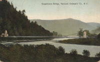
1870: Draht
Kassel, Hessen, Germany - Fulda River
| Bridgemeister ID: | 7753 (added 2023-07-22) |
| Year Completed: | 1870 |
| Name: | Draht |
| Also Known As: | Wire |
| Location: | Kassel, Hessen, Germany |
| Crossing: | Fulda River |
| Coordinates: | 51.312209 N 9.504177 E |
| Maps: | Acme, GeoHack, Google, OpenStreetMap |
| Status: | Destroyed, 1940 |
| Main Cables: | Wire |
| Suspended Spans: | 1 |
Notes:
- 1940: Destroyed by ice.
- Replaced by 1940 Draht (Wire) - Kassel, Hessen, Germany.
External Links:
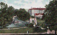
1870: Finck's
Little Falls, New York, USA - Mohawk River
| Bridgemeister ID: | 328 (added before 2003) |
| Year Completed: | 1870 |
| Name: | Finck's |
| Also Known As: | Fink's |
| Location: | Little Falls, New York, USA |
| Crossing: | Mohawk River |
| Coordinates: | 43.034102 N 74.830185 W |
| Maps: | Acme, GeoHack, Google, OpenStreetMap |
| References: | ONC |
| Use: | Vehicular |
| Status: | Destroyed, 1917 |
| Main Cables: | Wire |
Notes:
- Heavily damaged by fire, 1917.
- Coordinates reflect where modern Fincks Basin Road meets the Mohawk River, likely approximate location of this bridge.
1870: Pond Eddy-Lumberland
Pond Eddy and Lumberland, New York, USA - Delaware River
| Bridgemeister ID: | 297 (added before 2003) |
| Year Completed: | 1870 |
| Name: | Pond Eddy-Lumberland |
| Also Known As: | Decker's |
| Location: | Pond Eddy and Lumberland, New York, USA |
| Crossing: | Delaware River |
| Coordinates: | 41.439349 N 74.819723 W |
| Maps: | Acme, GeoHack, Google, OpenStreetMap |
| Principals: | James D. Decker |
| References: | BDR |
| Use: | Vehicular |
| Status: | Destroyed, October 9, 1903 |
| Main Cables: | Wire (iron) |
| Suspended Spans: | 2 |
| Main Spans: | 2 |
| Deck width: | 12 feet |
Notes:
- Destroyed by flood.
- Coordinates are for the replacement bridge. The suspension bridge would have been extremely close, if not on the same alignment as the replacement.
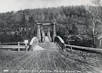
| Bridgemeister ID: | 7962 (added 2023-11-23) |
| Year Completed: | 1870 |
| Name: | Touzac |
| Location: | Touzac, Lot, France |
| Crossing: | Lot River |
| Coordinates: | 44.496083 N 1.049472 E |
| Maps: | Acme, GeoHack, Google, OpenStreetMap |
| Use: | Vehicular (one-lane) |
| Status: | Closed, January 2022 (last checked: 2023) |
| Main Cables: | Wire |
| Suspended Spans: | 1 |
| Main Span: | 1 x 110 meters (360.9 feet) estimated |
Notes:
- 2022, January 21: Bridge is severely damaged by a 40-ton truck attempting to cross. The bridge had a weight restriction of 16 tons since 1932. The long truck was also unable to negotiate the turn at the far end of the bridge and damaged the pylons attempting to reverse.
- 2023, June: Repair work is expected to start in September 2023 and complete in late 2024.
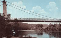
1871: (suspension bridge)
Washburn's Eddy, New York, USA - Hudson River
| Bridgemeister ID: | 74 (added before 2003) |
| Year Completed: | 1871 |
| Name: | (suspension bridge) |
| Location: | Washburn's Eddy, New York, USA |
| Crossing: | Hudson River |
| Principals: | Robert Gilchrist |
| References: | ABC |
| Status: | Removed |
Notes:
- This bridge was a few miles south of the more widely-known Hudson crossing at Riparius.
- Near 1872 Fulsom Landing (Riverside, Folsom Landing, Riparius) - Riparius, New York, USA.
1871: Aboyne
Waterside, Aboyne vicinity, Scotland, United Kingdom - River Dee
| Bridgemeister ID: | 2202 (added 2007-01-28) |
| Year Completed: | 1871 |
| Name: | Aboyne |
| Location: | Waterside, Aboyne vicinity, Scotland, United Kingdom |
| Crossing: | River Dee |
| Principals: | Harper & Co. |
| References: | HARPER |
| Use: | Footbridge |
| Status: | Removed |
| Main Cables: | Wire |
| Main Span: | 1 x 91.4 meters (300 feet) |
Notes:
- HARPER: Likely destroyed by one of these major Dee River flood events: May 1913, December 1914, October 1920.
External Links:
1871: Boatford
Langholm, Borders, Scotland, United Kingdom - River Esk
| Bridgemeister ID: | 1428 (added 2004-07-24) |
| Year Completed: | 1871 |
| Name: | Boatford |
| Location: | Langholm, Borders, Scotland, United Kingdom |
| Crossing: | River Esk |
| References: | AAJ |
| Status: | Collapsed |
Notes:
- Collapsed soon after it was completed under weight of 200 spectators.
- Replaced by 1873 Boatford - Langholm, Borders, Scotland, United Kingdom.
1871: Coubon
Coubon and Volhac, Haute-Loire, France - Loire River
| Bridgemeister ID: | 1724 (added 2005-04-05) |
| Year Completed: | 1871 |
| Name: | Coubon |
| Location: | Coubon and Volhac, Haute-Loire, France |
| Crossing: | Loire River |
| Use: | Vehicular |
| Status: | Destroyed, 1930 |
| Main Cables: | Wire |
| Suspended Spans: | 1 |
Notes:
External Links:
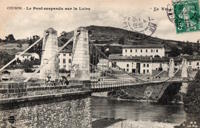
1871: Ferry Street
Binghamton, New York, USA - Chenango River
| Bridgemeister ID: | 276 (added before 2003) |
| Year Completed: | 1871 |
| Name: | Ferry Street |
| Location: | Binghamton, New York, USA |
| Crossing: | Chenango River |
| Principals: | John A. Roebling's Sons, Co. |
| Use: | Vehicular (one-lane) |
| Status: | Removed, 1897 |
| Main Cables: | Wire |
| Suspended Spans: | 1 |
| Main Span: | 1 x 109.7 meters (360 feet) |
Notes:
- This bridge was close to the alignment of Binghamton's present Clinton Street bridge. It replaced a bridge that was destroyed by flood in 1865. It was condemned in 1896 and removed in 1897. History Of Broome County indicates an act was passed March 13th, 1871 authorizing the bridge with the contract let to "W.A. Roebling & Son" each cable consisting of seven steel wire ropes, each two inches in diameter.
- An article from the Binghamton Democrat, July 20, 1871: "The Suspension Bridge -- The work on the west abutment of the suspension bridge has been commenced and will be rapidly as advisable pushed forward to completion, and soon thereafter the wire cables will be placed in position, the stays, supports and girders made fast, and ready for the flooring. In the course of six or eight weeks it is hoped that the bridge will be completed, and our people given another way of passing from the 1st to the 2nd wards, and the old-pleasant driveway re-opened, of which we have been debarred since the flood of St-Patrick's Day in the morning in [1865]. Upon the completion of this enterprise, surely no one will ever regret having voted in favor of the free suspension bridge."
- An article from the Binghamton Democrat, Nov. 30, 1871: "The New Bridge -- Its Cost -- For the suspenssion [sic] bridge, the tax-payers voted $28,000. It is finished, and in the Common Council last evening it was asserted that it cost over $30,000 and still all the claims are not satisfied. Mr. Jas. Fanning, contractor for building abutments, seeks relief for $1,000 or upwards which he is out no account of his contract. His petition was after considerable skirmishing finally referred to a committee. We hold that this is wrong, the Common Council has nothing to do with this matter. Mayor Dwight published a card binding himself to pay all over $28,000 that the bridge would cost. The people voted that amount and their representatives have nothing to do with any further cost or expense arrising [sic] from that source."
- Internet searches for this bridge often lead to an image on page 32 of the book "Binghamton", from the "Images of America" series, by Ed Aswad and Suzanne M. Meredith. However, that image is of the Warren Pensylvania suspension bridge and is erroneously captioned as the Binghamton Ferry Street bridge. The bridges may be sometimes confused because of similar surroundings and similar towers. Both are often depicted with a large warehouse building on the far side of the bridge, to the right. Both had "walk-through" towers where the pedestrian walkway passed through portals in the towers. Closer comparisons reveal the Warren towers are substantially larger than the Ferry Street towers. This is not surprising given the Warren bridge was substantially longer than the Ferry Street bridge. All this being said, there are different images purporting to be the Ferry Street bridge that show different towers. The stereoview image linked here appears to show the original towers. Later photos appear to show either replaced towers or, perhaps, the original towers clad in protective housing.
- See 1871 Warren (Hickory Street) - Warren, Pennsylvania, USA. The two bridges are sometimes confused despite the significant size difference.
1871: Hunting
Shocklach Green vicinity, England, United Kingdom - River Dee
| Bridgemeister ID: | 2191 (added 2007-01-26) |
| Year Completed: | 1871 |
| Name: | Hunting |
| Location: | Shocklach Green vicinity, England, United Kingdom |
| Crossing: | River Dee |
| Principals: | Harper & Co. |
| References: | HARPER |
| Use: | Footbridge |
| Status: | Removed, 1935 |
| Main Cables: | Wire |
| Suspended Spans: | 1 |
| Main Span: | 1 x 48.8 meters (160 feet) |
External Links:
1871: Tanarmouth
Glen Tanar, Aboyne vicinity, Scotland, United Kingdom - Water of Tanar
| Bridgemeister ID: | 7972 (added 2023-11-26) |
| Year Completed: | 1871 |
| Name: | Tanarmouth |
| Location: | Glen Tanar, Aboyne vicinity, Scotland, United Kingdom |
| Crossing: | Water of Tanar |
| Coordinates: | 57.066833 N 2.805167 W |
| Maps: | Acme, GeoHack, Google, OpenStreetMap |
| Principals: | Harper & Co. |
| Use: | Footbridge |
| Status: | Removed, 1950 |
| Main Cables: | Wire |
| Main Span: | 1 x 30.5 meters (100 feet) |
External Links:
1871: Warren
Warren, Pennsylvania, USA - Allegheny River
| Bridgemeister ID: | 75 (added before 2003) |
| Year Completed: | 1871 |
| Name: | Warren |
| Also Known As: | Hickory Street |
| Location: | Warren, Pennsylvania, USA |
| Crossing: | Allegheny River |
| Principals: | George W. Fishler |
| References: | AAJ, EOV, HAERPA461, HBE, PTS2 |
| Use: | Vehicular, with walkway |
| Status: | Replaced, 1918 |
| Main Cables: | Wire (iron) |
| Suspended Spans: | 1 |
| Main Span: | 1 x 143.3 meters (470 feet) |
| Deck width: | 29 feet |
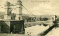
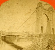
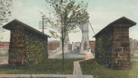
1872: Barrett
Port Jervis, New York and Matamoras, Pennsylvania, USA - Delaware River
| Bridgemeister ID: | 76 (added before 2003) |
| Year Completed: | 1872 |
| Name: | Barrett |
| Location: | Port Jervis, New York and Matamoras, Pennsylvania, USA |
| Crossing: | Delaware River |
| References: | BDR |
| Use: | Vehicular |
| Status: | Destroyed, October 11, 1903 |
| Main Cables: | Wire (iron) |
| Suspended Spans: | 2 |
| Main Spans: | 2 |
Notes:
- BDR: Destroyed by ice March 17, 1875, rebuilt, destroyed by flood October 11, 1903.
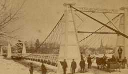
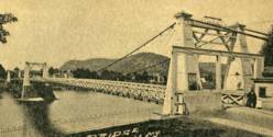
1872: Branch Hill
Branch Hill and Symmes, Ohio, USA - Little Miami River
| Bridgemeister ID: | 77 (added before 2003) |
| Year Completed: | 1872 |
| Name: | Branch Hill |
| Location: | Branch Hill and Symmes, Ohio, USA |
| Crossing: | Little Miami River |
| Principals: | John Gray |
| References: | EOV |
| Use: | Vehicular (one-lane) |
| Status: | Removed |
| Main Cables: | Wire |
Notes:
- Based on correspondence between "Gray's firm" and Washington Roebling, EOV suggests there may be a chance this early bridge contained steel cables.
1872: Chemung
Chemung, New York, USA - Chemung River
| Bridgemeister ID: | 78 (added before 2003) |
| Year Completed: | 1872 |
| Name: | Chemung |
| Location: | Chemung, New York, USA |
| Crossing: | Chemung River |
| Principals: | J.V. Fishler, J.R. Crowell |
| Use: | Vehicular |
| Status: | Removed |
| Main Cables: | Wire (iron) |

1872: Dryburgh Abbey
Dryburgh and St. Boswells, Scotland, United Kingdom - River Tweed
| Bridgemeister ID: | 1439 (added 2004-07-31) |
| Year Completed: | 1872 |
| Name: | Dryburgh Abbey |
| Location: | Dryburgh and St. Boswells, Scotland, United Kingdom |
| Crossing: | River Tweed |
| Coordinates: | 55.580771 N 2.654251 W |
| Maps: | Acme, GeoHack, Google, OpenStreetMap |
| Use: | Footbridge |
| Status: | Replaced, 1911 |
| Main Cables: | Wire |
| Suspended Spans: | 1 |
Notes:
- At former location of 1818 Dryburgh Abbey - Dryburgh and St. Boswells, Scotland, United Kingdom.
- Near Mertoun Estate - Mertoun, Scotland, United Kingdom.
- Replaced by 1911 Dryburgh Abbey - Dryburgh and St. Boswells, Scotland, United Kingdom.
External Links:
1872: Fulsom Landing
Riparius, New York, USA - Hudson River
| Bridgemeister ID: | 330 (added before 2003) |
| Year Completed: | 1872 |
| Name: | Fulsom Landing |
| Also Known As: | Riverside, Folsom Landing, Riparius |
| Location: | Riparius, New York, USA |
| Crossing: | Hudson River |
| Coordinates: | 43.661963 N 73.898194 W |
| Maps: | Acme, GeoHack, Google, OpenStreetMap |
| Use: | Vehicular (one-lane) |
| Status: | Removed |
| Main Cables: | Wire |
| Suspended Spans: | 1 |
| Main Span: | 1 |
Notes:
- The location of this bridge was originally known as "Folsom Landing" and later became known as "Riverside." In 1886 the name was changed to "Riparius" to avoid confusion with another New York "Riverside" location. The suspension bridge is sometimes referenced by each of these names. To make matters even more confusing, the bridge was known as the "Fulsom Landing" bridge (instead of Folsom).
- Removed at some point after 1919.
- Near 1871 (suspension bridge) - Washburn's Eddy, New York, USA.
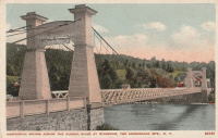
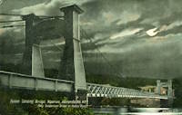
1872: Gilead
Gilead, Maine, USA - Androscoggin River
| Bridgemeister ID: | 2157 (added 2006-12-10) |
| Year Completed: | 1872 |
| Name: | Gilead |
| Location: | Gilead, Maine, USA |
| Crossing: | Androscoggin River |
| Use: | Vehicular |
| Status: | Replaced, 1923 |
| Main Cables: | Wire |
| Main Span: | 1 x 58.5 meters (192 feet) |
1872: Lower
Turners Falls, Montague, Massachusetts, USA - Connecticut River
| Bridgemeister ID: | 340 (added before 2003) |
| Year Completed: | 1872 |
| Name: | Lower |
| Also Known As: | White |
| Location: | Turners Falls, Montague, Massachusetts, USA |
| Crossing: | Connecticut River |
| Coordinates: | 42.609165 N 72.561433 W |
| Maps: | Acme, GeoHack, Google, OpenStreetMap |
| References: | CCR, PTS2 |
| Use: | Vehicular |
| Status: | Removed, circa 1936 |
| Main Cables: | Wire |
| Suspended Spans: | 1 |
Notes:
- Damaged by flood, 1936 and removed soon after.
- Near 1878 Upper (Red) - Turners Falls, Montague, Massachusetts, USA.
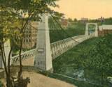
1872: Ravenscraig
Dundee, Scotland, United Kingdom - Caledonian Railway
| Bridgemeister ID: | 5078 (added 2020-08-30) |
| Year Completed: | 1872 |
| Name: | Ravenscraig |
| Location: | Dundee, Scotland, United Kingdom |
| Crossing: | Caledonian Railway |
| Coordinates: | 56.468350 N 2.901061 W |
| Maps: | Acme, GeoHack, Google, OpenStreetMap |
| Principals: | Harper & Co. |
| References: | HARPER |
| Use: | Footbridge |
| Status: | Removed |
| Main Cables: | Wire |
| Suspended Spans: | 1 |
| Main Span: | 1 x 16.8 meters (55.1 feet) |
Notes:
- Coordinates are approximate location of the bridge based on the description in HARPER noting the bridge crossed the railway at the estate of a Colonel Sandeman at Ravenscraig which is the location of the present day (2020) Ravenscraig Gardens in Dundee.
External Links:
| Bridgemeister ID: | 79 (added before 2003) |
| Year Completed: | 1872 |
| Name: | Trinity Cemetery |
| Location: | New York, New York, USA |
| Crossing: | Broadway |
| Principals: | Calvert Vaux |
| References: | CVA |
| Status: | Removed |
| Main Cables: | Wire |
| Suspended Spans: | 1 |
Notes:
- Connected Trinity Cemetery across Broadway. Demolished 1911. Appears to have been wide enough to handle vehicles.
- Eric K. Washington contacted me in 2011 wondering if the Trinity Cemetery bridge was the first suspension bridge constructed in New York City. While it seems unlikely that New York City (even just Manhattan) did not have, at least, other minor suspension bridges constructed before 1872, I have never encountered mention of one.
1873: Boatford
Langholm, Borders, Scotland, United Kingdom - River Esk
| Bridgemeister ID: | 534 (added before 2003) |
| Year Completed: | 1873 |
| Name: | Boatford |
| Location: | Langholm, Borders, Scotland, United Kingdom |
| Crossing: | River Esk |
| Coordinates: | 55.15098 N 3.00273 W |
| Maps: | Acme, GeoHack, Google, OpenStreetMap |
| References: | AAJ |
| Use: | Footbridge |
| Status: | In use (last checked: 2004) |
| Main Span: | 1 x 53.3 meters (175 feet) |
Notes:
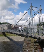
1873: Franklin
Franklin, Ohio, USA - Great Miami River
| Bridgemeister ID: | 80 (added before 2003) |
| Year Completed: | 1873 |
| Name: | Franklin |
| Location: | Franklin, Ohio, USA |
| Crossing: | Great Miami River |
| Principals: | J. W. Shipman & Co., John A. Roebling's Sons Co. |
| References: | EOV, HWCO |
| Use: | Vehicular (one-lane) |
| Status: | Replaced, 1933 |
| Main Cables: | Wire |
| Suspended Spans: | 1 |
Notes:
- Traffic restricted to foot traffic, 1931. Closed, 1933, after the bridge sagged significantly.
- From HWCO: "The towers are thirty-eight feet high, and each consists of four columns, of Phoenix column iron. The cables are of steel wire and each is composed of 343 strands, the whole cable having a diameter of seven inches. The masonry is constructed of Dayton stone, and is of a very substantial character... The wire and iron work was done in the summer of 1873 under the superintendence of Roebling & Sons, of Trenton, N. J. The bridge is stayed by strong wire cables and stiffened by an iron truss. The whole cost was $43,900."
1873: Harrison
Harrison, Ohio and Dearborn County, Indiana, USA - Whitewater River
| Bridgemeister ID: | 81 (added before 2003) |
| Year Completed: | 1873 |
| Name: | Harrison |
| Location: | Harrison, Ohio and Dearborn County, Indiana, USA |
| Crossing: | Whitewater River |
| Principals: | James W. Shipman and Co. |
| References: | EOV |
| Use: | Vehicular (one-lane) |
| Status: | Destroyed, 1913, by flood |
| Main Cables: | Wire |
Notes:
- See 1868 Calloway's Ford (Whitewater, Harrison's) - Elizabethtown vicinity, Hamilton County, Ohio, USA.
1873: South Street
Wilkes-Barre, Pennsylvania, USA - Lehigh Valley Railroad and North Branch Canal
| Bridgemeister ID: | 353 (added before 2003) |
| Year Completed: | 1873 |
| Name: | South Street |
| Also Known As: | Wire |
| Location: | Wilkes-Barre, Pennsylvania, USA |
| Crossing: | Lehigh Valley Railroad and North Branch Canal |
| Coordinates: | 41.239328 N 75.884643 W |
| Maps: | Acme, GeoHack, Google, OpenStreetMap |
| Use: | Vehicular |
| Status: | Removed, c. 1925 |
| Main Cables: | Wire |
Notes:
- In use until 1910, possibly longer. Replacement opened 1925.
1874: (suspension bridge)
Bannockburn, New Zealand - Kawarau River
| Bridgemeister ID: | 660 (added 2003-03-08) |
| Year Completed: | 1874 |
| Name: | (suspension bridge) |
| Location: | Bannockburn, New Zealand |
| Crossing: | Kawarau River |
| References: | GAP |
| Status: | Replaced |
Notes:
- GAP: Destroyed by flood 1878. Rebuilt 1879 by Jeremiah Drummey. Damaged by neglect, fire.
- Replaced by 1897 Macandrew - Bannockburn, New Zealand.
1874: Canet
Canet and Le Pouget, Hérault, France - Hérault River
| Bridgemeister ID: | 7491 (added 2022-12-30) |
| Year Completed: | 1874 |
| Name: | Canet |
| Location: | Canet and Le Pouget, Hérault, France |
| Crossing: | Hérault River |
| Coordinates: | 43.597444 N 3.493061 E |
| Maps: | Acme, GeoHack, Google, OpenStreetMap |
| Use: | Vehicular |
| Status: | Replaced |
| Main Cables: | Wire (iron) |
| Suspended Spans: | 1 |
Notes:
- Replaced 1845 Canet - Canet and Le Pouget, Hérault, France.
- Replaced by Canet - Canet and Le Pouget, Hérault, France.
External Links:
1874: Châtel-de-Neuvre
Châtel-de-Neuvre and La Ferté-Hauterive, Allier, France - Allier River
| Bridgemeister ID: | 4905 (added 2020-07-18) |
| Year Completed: | 1874 |
| Name: | Châtel-de-Neuvre |
| Location: | Châtel-de-Neuvre and La Ferté-Hauterive, Allier, France |
| Crossing: | Allier River |
| Coordinates: | 46.402296 N 3.317844 E |
| Maps: | Acme, GeoHack, Google, OpenStreetMap |
| References: | AAJ |
| Use: | Vehicular |
| Status: | Replaced, 1923 |
| Main Cables: | Wire |
| Suspended Spans: | 2 |
| Main Spans: | 2 |
External Links:
| Bridgemeister ID: | 1232 (added 2004-02-15) |
| Year Completed: | 1874 |
| Name: | Huitong |
| Location: | Longling, Yunnan, China |
| Crossing: | Nujiang |
| Coordinates: | 24.734810 N 98.966987 E |
| Maps: | Acme, GeoHack, Google, OpenStreetMap |
| References: | BCG, BYU |
| Use: | Vehicular (one-lane) |
| Status: | Closed, 1971 (last checked: 2019) |
| Main Cables: | Chain (iron) |
| Suspended Spans: | 1 |
| Main Span: | 1 x 94.3 meters (309.4 feet) |
Notes:
- Originally built with iron chains, modified to steel wire cables, 1935.
1874: Isidora
Lota, Chile
| Bridgemeister ID: | 7930 (added 2023-10-22) |
| Year Completed: | 1874 |
| Name: | Isidora |
| Location: | Lota, Chile |
| At or Near Feature: | Parque Isidora Cousiño De Lota |
| Status: | Only towers remain (last checked: 2023) |
External Links:
- Google Maps - Fuerte de Lota. Image of a suriving bridge tower, December 2022.
1874: Palmengarten
Frankfurt, Germany
1875: (footbridge)
Castle Bergedorf, Bergedorf, Hamburg, Germany - castle moat
| Bridgemeister ID: | 799 (added 2003-03-29) |
| Year Completed: | 1875 |
| Name: | (footbridge) |
| Location: | Castle Bergedorf, Bergedorf, Hamburg, Germany |
| Crossing: | castle moat |
| Coordinates: | 53.489417 N 10.212 E |
| Maps: | Acme, GeoHack, Google, OpenStreetMap |
| Use: | Footbridge |
| Status: | In use (last checked: 2005) |
| Main Cables: | Wire |
| Suspended Spans: | 1 |
| Main Span: | 1 x 6.9 meters (22.6 feet) |
| Deck width: | 2 meters |
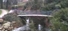
1875: (suspension bridge)
Clyde, New Zealand - Clutha River
| Bridgemeister ID: | 662 (added 2003-03-08) |
| Year Completed: | 1875 |
| Name: | (suspension bridge) |
| Location: | Clyde, New Zealand |
| Crossing: | Clutha River |
| Coordinates: | 45.190381 S 169.315298 E |
| Maps: | Acme, GeoHack, Google, OpenStreetMap |
| Principals: | L.D. Macgeorge, William Grant |
| References: | GAP |
| Status: | Destroyed, 1878 |
Notes:
- GAP: Destroyed by flood 1878.
- Replaced by 1881 Clyde - Clyde, New Zealand.
1875: Nith
Dumfries, Scotland, United Kingdom - River Nith
| Bridgemeister ID: | 524 (added before 2003) |
| Year Completed: | 1875 |
| Name: | Nith |
| Also Known As: | Biddall's |
| Location: | Dumfries, Scotland, United Kingdom |
| Crossing: | River Nith |
| Coordinates: | 55.065120 N 3.610292 W |
| Maps: | Acme, GeoHack, Google, OpenStreetMap |
| Principals: | J. Willett |
| Use: | Footbridge |
| Status: | In use (last checked: 2022) |
| Main Cables: | Chain (iron) |
| Suspended Spans: | 1 |
| Main Span: | 1 |
External Links:

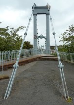
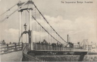
1875: Saint-Nazaire
Saint-Nazaire-en-Royans, Drôme and Saint-Hilaire-du-Rosier, Isère, France - Isère River
| Bridgemeister ID: | 7328 (added 2022-09-02) |
| Year Completed: | 1875 |
| Name: | Saint-Nazaire |
| Location: | Saint-Nazaire-en-Royans, Drôme and Saint-Hilaire-du-Rosier, Isère, France |
| Crossing: | Isère River |
| Coordinates: | 45.067313 N 5.243247 E |
| Maps: | Acme, GeoHack, Google, OpenStreetMap |
| Use: | Vehicular |
| Status: | Removed |
| Main Cables: | Wire |
| Suspended Spans: | 1 |
External Links:
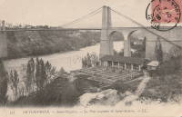
1875: Swinging
Arroyo Grande, California, USA - Arroyo Grande Creek
| Bridgemeister ID: | 307 (added before 2003) |
| Year Completed: | 1875 |
| Name: | Swinging |
| Location: | Arroyo Grande, California, USA |
| Crossing: | Arroyo Grande Creek |
| Coordinates: | 35.12336 N 120.57703 W |
| Maps: | Acme, GeoHack, Google, OpenStreetMap |
| Principals: | Newton Short |
| Use: | Footbridge |
| Status: | In use (last checked: 2007) |
| Main Cables: | Wire |
| Suspended Spans: | 1 |
| Main Span: | 1 x 52.1 meters (171 feet) |
Notes:
- A rotary club plaque at the bridge reads, "To connect his properties, Newton Short built this swinging bridge without sides about 1875. Sides were added after 1902. The bridge was given to the City of Arroyo Grande on July 14, 1911,... Due to severe storm damage, the bridge was rebuilt in 1995."
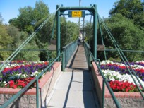
1875: Swinging
Frederick, Maryland, USA - Carroll Creek
| Bridgemeister ID: | 253 (added before 2003) |
| Year Completed: | 1875 |
| Name: | Swinging |
| Location: | Frederick, Maryland, USA |
| Crossing: | Carroll Creek |
| At or Near Feature: | Baker Park |
| Coordinates: | 39.415033 N 77.4208 W |
| Maps: | Acme, GeoHack, Google, OpenStreetMap |
| Use: | Footbridge |
| Status: | In use (last checked: 2022) |
| Main Cables: | Wire |
| Suspended Spans: | 1 |
Notes:
- The black and white photo shows the same bridge at its original location on Bentz Street (then Mill Alley). It was later moved to Baker Park, and then moved again (in 1927, 1928, or 1930 according to various sources) to its present location, another location in Baker Park.
- Local legend states this bridge was used by Stonewall Jackson and his troops when they entered Frederick on September 10, 1862.
- Closed March, 2008 due to safety concerns. Eventually reopened.
- Near 2006 William O. Lee (Carroll Creek Park) - Frederick, Maryland, USA.
External Links:
- Baker Park - Maryland Historic District. States bridge was built in 1875.
- Structurae - Structure ID 20011117
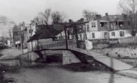
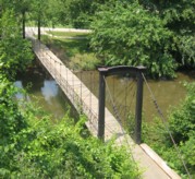
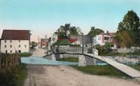
1876: Brunner
Brunner, New Zealand - Grey River / Māwheranui
| Bridgemeister ID: | 414 (added before 2003) |
| Year Completed: | 1876 |
| Name: | Brunner |
| Location: | Brunner, New Zealand |
| Crossing: | Grey River / Māwheranui |
| Coordinates: | 42.433068 S 171.324420 E |
| Maps: | Acme, GeoHack, Google, OpenStreetMap |
| Principals: | John Carruthers |
| References: | GAP |
| Use: | Vehicular and Rail |
| Status: | Restricted to foot traffic (last checked: 2017) |
| Main Cables: | Wire |
| Suspended Spans: | 1 |
Notes:
- GAP: Collapsed just before opening due to anchor plate failure, rebuilt. Rebuilt again 1925-1926. Towers replaced 1963-1964.

1876: Laissey
Laissey, Doubs, France - Doubs River
| Bridgemeister ID: | 2171 (added 2007-01-13) |
| Year Completed: | 1876 |
| Name: | Laissey |
| Location: | Laissey, Doubs, France |
| Crossing: | Doubs River |
| Coordinates: | 47.298411 N 6.236290 E |
| Maps: | Acme, GeoHack, Google, OpenStreetMap |
| Use: | Vehicular |
| Status: | Removed |
External Links:
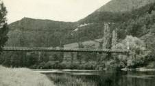
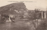
1876: Lamagistère
Lamagistère, Tarn-et-Garonne, France - Garonne River
| Bridgemeister ID: | 7175 (added 2022-07-01) |
| Year Completed: | 1876 |
| Name: | Lamagistère |
| Location: | Lamagistère, Tarn-et-Garonne, France |
| Crossing: | Garonne River |
| Coordinates: | 44.122921 N 0.819276 E |
| Maps: | Acme, GeoHack, Google, OpenStreetMap |
| Use: | Vehicular |
| Status: | Destroyed, 1930 |
| Main Cables: | Wire |
| Suspended Spans: | 2 |
| Main Spans: | 2 |
Notes:
- 1930: Destroyed by flood.
- Replaced 1850 Lamagistère - Lamagistère, Tarn-et-Garonne, France.
- Replaced by 1933 Lamagistère - Lamagistère, Tarn-et-Garonne, France.
External Links:
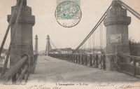
1876: Linwood
Linwood, Ohio, USA - Little Miami River
| Bridgemeister ID: | 82 (added before 2003) |
| Year Completed: | 1876 |
| Name: | Linwood |
| Location: | Linwood, Ohio, USA |
| Crossing: | Little Miami River |
| Principals: | Cincinnati Bridge Co. |
| References: | EOV |
| Status: | Removed |
Notes:
- Replaced after 1913 flood damage.
1876: Nile River
Charleston, New Zealand - Nile (Waitakere) River
| Bridgemeister ID: | 659 (added 2003-03-08) |
| Year Completed: | 1876 |
| Name: | Nile River |
| Location: | Charleston, New Zealand |
| Crossing: | Nile (Waitakere) River |
| Coordinates: | 41.899278 S 171.443694 E |
| Maps: | Acme, GeoHack, Google, OpenStreetMap |
| Principals: | Arthur Dudley Dobson |
| References: | GAP |
| Use: | Vehicular |
| Status: | Removed |
| Suspended Spans: | 1 |
Notes:
- A new suspension bridge was installed on the same piers in the 2020-2021 time frame.
- Later at same location 2021 Waitakere/Nile River - Charleston, New Zealand.
External Links:
1876: Petroleum Street
Oil City, Pennsylvania, USA - Allegheny River
| Bridgemeister ID: | 83 (added before 2003) |
| Year Completed: | 1876 |
| Name: | Petroleum Street |
| Also Known As: | Oil City |
| Location: | Oil City, Pennsylvania, USA |
| Crossing: | Allegheny River |
| Principals: | Charles Roebling |
| References: | AAJ, HAERPA461, HBE, PTS2, TRS |
| Use: | Vehicular |
| Status: | Removed |
| Main Cables: | Wire |
| Suspended Spans: | 3 |
| Main Span: | 1 x 152.4 meters (500 feet) |
| Side Spans: | 2 |
Notes:
- AAJ: Rebuilt, 1884, 1905.
1876: Point
Pittsburgh, Pennsylvania, USA - Monongahela River
| Bridgemeister ID: | 84 (added before 2003) |
| Year Completed: | 1876 |
| Name: | Point |
| Location: | Pittsburgh, Pennsylvania, USA |
| Crossing: | Monongahela River |
| Principals: | Edward Hemberle |
| References: | AAJ, BOP, BPL, HBE, IEA, ONF, PBR, PTS2, SA19000106 |
| Use: | Vehicular and Rail (streetcar) |
| Status: | Demolished, 1927 |
| Main Cables: | Eyebar |
| Suspended Spans: | 1 |
| Main Span: | 1 x 243.8 meters (800 feet) |
| Deck width: | 34 feet |
Notes:
- Partial floor collapse requiring extensive repairs, December 24, 1903. Repaired, 1904. Demolished 1927.
External Links:
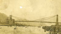
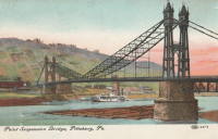
1876: Zoar
Stevenson vicinity, Connecticut, USA - Housatonic River
| Bridgemeister ID: | 85 (added before 2003) |
| Year Completed: | 1876 |
| Name: | Zoar |
| Location: | Stevenson vicinity, Connecticut, USA |
| Crossing: | Housatonic River |
| Use: | Vehicular (one-lane) |
| Status: | Demolished, 1919 |
| Main Cables: | Wire |
| Suspended Spans: | 1 |
Notes:
- Located on the road connecting Monroe to Oxford, until 1919 when the Stevenson Dam was built.
- May have been significantly widened, c. 1910.

1877: (suspension bridge)
Kent, Ohio, USA - Cuyahoga River
| Bridgemeister ID: | 1979 (added 2005-11-27) |
| Year Completed: | 1877 |
| Name: | (suspension bridge) |
| Location: | Kent, Ohio, USA |
| Crossing: | Cuyahoga River |
| Status: | Removed |
| Main Cables: | Wire (iron) |
1877: Canet
Ventenac-en-Minervois and Canet, Aude, France - Aude River
| Bridgemeister ID: | 5658 (added 2021-01-01) |
| Year Completed: | 1877 |
| Name: | Canet |
| Location: | Ventenac-en-Minervois and Canet, Aude, France |
| Crossing: | Aude River |
| Coordinates: | 43.240039 N 2.855134 E |
| Maps: | Acme, GeoHack, Google, OpenStreetMap |
| References: | AAJ |
| Use: | Vehicular |
| Status: | Removed |
| Main Cables: | Wire |
| Suspended Spans: | 1 |
Notes:
- Piers are still present (in 2020) next to the current Aude River crossing at this location.
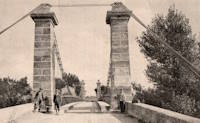
1877: Cottaneva
Cottaneva Creek, Rockport, California, USA - Rockport Bay, Pacific Ocean
| Bridgemeister ID: | 1152 (added 2004-01-18) |
| Year Completed: | 1877 |
| Name: | Cottaneva |
| Location: | Cottaneva Creek, Rockport, California, USA |
| Crossing: | Rockport Bay, Pacific Ocean |
| Coordinates: | 39.736703 N 123.832585 W |
| Maps: | Acme, GeoHack, Google, OpenStreetMap |
| Principals: | Pacific Bridge Co. |
| References: | AAJ |
| Use: | Vehicular (one-lane) |
| Status: | Removed |
| Main Cables: | Wire (iron) |
| Suspended Spans: | 1 |
| Main Span: | 1 x 82.3 meters (270 feet) |
Notes:
- This bridge was part of the Rockport lumber mill (Mendocino County). The bridge stretched over ocean to a large rock in the bay.
- Jakkula cites two sources describing the cables as steel.
- Don Sayenga transcribed one of Jakkula's references, The Iron Age Volume XX , No. 3 (August 2, 1877) Page 1: "A Steel Wire Suspension Bridge In California"
The Pacific Bridge Company are building in Mendocino county, California at Cottoneva, a suspension bridge which is described as follows "The distance from center to center of the saddles on the towers is 270 feet. The deflection or fall of the cable is 23 feet 6 inches. The cables are built in the same manner as those of the Clifton bridge at Niagara. The steel wire is about No. 11 Birmingham gauge, and is protected against rust by immersing in a bath which it a fine coat of zinc. There are eleven wires in each strand, seven strands in each rope, and seven ropes in each cable. The ropes are not twisted together to form the cable but gathered up every six feet by the suspender bands. Each rope is warranted to bear a strain of 60 tons. It is made fast to an independent anchor bar, 1 by 3 inches in diameter, and forming links 18 feet long, until connection is made with the anchors. The anchors are of cast iron, 3-1/2 by 3 feet in surface, weigh 1000 pounds each, and are placed 14 feet below the surface of the rock. Great care was taken in securing the anchors in place by means of cross I beams which run under the rock on either side. The lower part of each pit was enlarged to so as to form a hemispherical chamber, and the rock work, set in Portland cement, which is built upon the anchor, is so constructed that the upward strain is transmitted to the sides. The towers are of red wood. There are four posts 10 x 10 inches and two 10 x 12 inches, giving an effective area of 640 inches to withstand the strain of the cables on the tower. The wooden truss to prevent vertical vibration is 8 feet high and of the Howe truss pattern. The 270 feet of the bridge is divided into 45 pannels. The longest suspenders, 44 in number are of 7/8 inch steel wire, the 42 shorter ones are of 1-1/8 inch solid iron. The estimated dead load of the bridge is 1000 pounds per linear foot; live load, one ton per linear foot; in all, one and one half tons, or one fifth of actual breaking load. The bridge will be completed in about 30 days and promises to be a structure which the builders may well be proud of."
Don writes: "[In] Jakkula's last citation, he is saying that this is factory-made wire rope... The construction of the wire rope (7 by 11) used in the main cables is not common for the USA as of 1877; in fact it is extremely uncommon. The wire ropes used at Clifton/Niagara were made in England -- it wouldn't surprise me if these were made in England too."
1877: Jhulaghat
Juluaghat, Dasharathchanda, Nepal and Jhulaghat, Uttarakhand, India - Sharda River
| Bridgemeister ID: | 4344 (added 2020-04-11) |
| Year Completed: | 1877 |
| Name: | Jhulaghat |
| Also Known As: | झुलाघाट |
| Location: | Juluaghat, Dasharathchanda, Nepal and Jhulaghat, Uttarakhand, India |
| Crossing: | Sharda River |
| Coordinates: | 29.571577 N 80.382849 E |
| Maps: | Acme, GeoHack, Google, OpenStreetMap |
| Use: | Vehicular (one-lane) |
| Status: | Restricted to foot traffic (last checked: 2023) |
| Main Cables: | Eyebar |
| Suspended Spans: | 1 |
Notes:
- 2022-2023: Damaged during 2022 monsoon season. Reopened October 2023.
External Links:
1877: Lead Mine
Gorham, New Hampshire, USA
| Bridgemeister ID: | 1198 (added 2004-01-28) |
| Year Completed: | 1877 |
| Name: | Lead Mine |
| Also Known As: | Hutchinson |
| Location: | Gorham, New Hampshire, USA |
| Principals: | Timothy H. Hutchinson |
| Use: | Vehicular (one-lane) |
| Status: | Collapsed, 1921 |
| Main Cables: | Wire |
| Suspended Spans: | 1 |
Notes:
- Provided access to Mascot Mine. Collapsed, 1921.
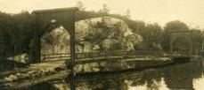
1877: Minneapolis
Minneapolis, Minnesota, USA - Mississippi River
| Bridgemeister ID: | 86 (added before 2003) |
| Year Completed: | 1877 |
| Name: | Minneapolis |
| Location: | Minneapolis, Minnesota, USA |
| Crossing: | Mississippi River |
| At or Near Feature: | Nicollet Island |
| Principals: | Thomas M. Griffith |
| References: | AAJ, BPL, HBE, PTS2 |
| Use: | Vehicular, with walkway |
| Status: | Replaced, 1890 |
| Main Cables: | Wire (iron) |
| Suspended Spans: | 1 |
| Main Span: | 1 x 205.8 meters (675.1 feet) |
| Deck width: | 32 feet |
Notes:
- Replaced 1855 Minneapolis (St. Anthony's Falls) - Minneapolis, Minnesota, USA.
- Later at same location 1990 Hennepin Avenue (Father Louis Hennepin) - Minneapolis, Minnesota, USA.
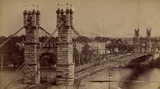
1877: Netherby
Kirksandrew-upon-Esk, Longtown vicinity, Cumbria and Netherby, England, United Kingdom - River Esk
| Bridgemeister ID: | 2369 (added 2007-09-28) |
| Year Completed: | 1877 |
| Name: | Netherby |
| Location: | Kirksandrew-upon-Esk, Longtown vicinity, Cumbria and Netherby, England, United Kingdom |
| Crossing: | River Esk |
| Coordinates: | 55.03855 N 2.95261 W |
| Maps: | Acme, GeoHack, Google, OpenStreetMap |
| Use: | Footbridge |
| Status: | In use (last checked: 2012) |
| Main Cables: | Wire |
| Suspended Spans: | 1 |
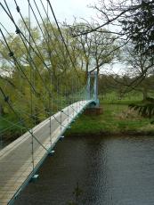
1877: Punalur
Punalur, Kerala, India - Kallada River
| Bridgemeister ID: | 415 (added before 2003) |
| Year Completed: | 1877 |
| Name: | Punalur |
| Location: | Punalur, Kerala, India |
| Crossing: | Kallada River |
| Coordinates: | 9.018114 N 76.927620 E |
| Maps: | Acme, GeoHack, Google, OpenStreetMap |
| Principals: | Albert Henry |
| Use: | Vehicular (one-lane) |
| Status: | Restricted to foot traffic (last checked: 2019) |
| Main Cables: | Eyebar |
| Suspended Spans: | 3 |
| Main Span: | 1 |
| Side Spans: | 2 |
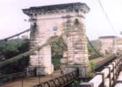
1877: Victoria
Mandi, Himachal Pradesh, India - Beas River
| Bridgemeister ID: | 2750 (added 2019-06-23) |
| Year Completed: | 1877 |
| Name: | Victoria |
| Location: | Mandi, Himachal Pradesh, India |
| Crossing: | Beas River |
| Coordinates: | 31.712668 N 76.933310 E |
| Maps: | Acme, GeoHack, Google, OpenStreetMap |
| Use: | Vehicular (one-lane) |
| Status: | In use (last checked: 2019) |
| Main Cables: | Wire |
| Suspended Spans: | 1 |
External Links:
1878: (suspension bridge)
New Zealand - Hawea River
| Bridgemeister ID: | 664 (added 2003-03-08) |
| Year Completed: | 1878 |
| Name: | (suspension bridge) |
| Location: | New Zealand |
| Crossing: | Hawea River |
| Principals: | William Grant, McKellar |
| References: | GAP |
1878: Maynard Street
Williamsport, Pennsylvania, USA - Susquehanna River
| Bridgemeister ID: | 2140 (added 2006-10-31) |
| Year Completed: | 1878 |
| Name: | Maynard Street |
| Location: | Williamsport, Pennsylvania, USA |
| Crossing: | Susquehanna River |
| Use: | Vehicular |
| Status: | Removed |
| Main Cables: | Wire |
Notes:
- Damaged by flood, June 1, 1889. Rebuilt, but unclear if rebuilt as a suspension bridge. May have been rebuilt as a truss bridge.
- Near 1865 Market Street - Williamsport, Pennsylvania, USA.
1878: Sedgwick
Sedgwick and Sizergh, England, United Kingdom - River Kent
| Bridgemeister ID: | 1313 (added 2004-04-16) |
| Year Completed: | 1878 |
| Name: | Sedgwick |
| Also Known As: | Low Park Woods, New Sedgwick |
| Location: | Sedgwick and Sizergh, England, United Kingdom |
| Crossing: | River Kent |
| Coordinates: | 54.281 N 2.7564 W |
| Maps: | Acme, GeoHack, Google, OpenStreetMap |
| Principals: | Francis James Willacy |
| Use: | Footbridge |
| Status: | In use (last checked: 2010) |
| Suspended Spans: | 1 |
Notes:
- 1988-1989: Restoration project completed
- 2022, August-September: Bridge closed for repairs. Reopened.
- Similar to 1862 (footbridge) - Greystead, England, United Kingdom.
External Links:
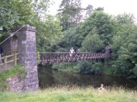
1878: Spider
Crewe, England, United Kingdom
| Bridgemeister ID: | 1843 (added 2005-07-15) |
| Year Completed: | 1878 |
| Name: | Spider |
| Also Known As: | Midge |
| Location: | Crewe, England, United Kingdom |
| Use: | Rail |
| Status: | Demolished, 1939 |
| Main Cables: | Wire |
Notes:
- Carried a narrow gauge rail line over several tracks at the Crewe Locomotive Works. Used as a footbridge, 1929-1939.
1878: Upper
Turners Falls, Montague, Massachusetts, USA - Connecticut River
| Bridgemeister ID: | 87 (added before 2003) |
| Year Completed: | 1878 |
| Name: | Upper |
| Also Known As: | Red |
| Location: | Turners Falls, Montague, Massachusetts, USA |
| Crossing: | Connecticut River |
| Principals: | J.W. Shipman |
| References: | CCR |
| Use: | Vehicular |
| Status: | Dismantled, 1942 |
| Main Cables: | Wire |
Notes:
External Links:
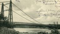
1879: Azuqueca
Azuqueca de Henares, Guadalajara, Spain - Henares River
| Bridgemeister ID: | 7625 (added 2023-05-27) |
| Year Completed: | 1879 |
| Name: | Azuqueca |
| Location: | Azuqueca de Henares, Guadalajara, Spain |
| Crossing: | Henares River |
| Coordinates: | 40.555941 N 3.246655 W |
| Maps: | Acme, GeoHack, Google, OpenStreetMap |
| Use: | Footbridge |
| Status: | Derelict (last checked: 2022) |
| Suspended Spans: | 1 |
External Links:
- Azuqueca: SOS Save "The Hanging Bridge". Blog devoted to saving the bridge. Includes many photos.
- Maneti Lugares qUe Disfrutar: Puente Colgante Rio Henares Azuqueca De Henares (Guadalajara)
1879: Infirmary
Inverness, Scotland, United Kingdom - River Ness
| Bridgemeister ID: | 539 (added before 2003) |
| Year Completed: | 1879 |
| Name: | Infirmary |
| Location: | Inverness, Scotland, United Kingdom |
| Crossing: | River Ness |
| Coordinates: | 57.471653 N 4.228844 W |
| Maps: | Acme, GeoHack, Google, OpenStreetMap |
| Principals: | C. R. Manners |
| References: | HBR |
| Use: | Footbridge |
| Status: | In use (last checked: 2021) |
| Main Cables: | Wire |
| Suspended Spans: | 3 |
| Main Span: | 1 x 61 meters (200 feet) |
| Side Spans: | 2 x 12.8 meters (42 feet) |
Notes:
- 2020, November: Highland Council likely to close bridge if funding for urgent repairs cannot be raised.
- 2021, July: Reopened after interim repairs completed. Future major refurbishment expected.
- Companion to 1881 Greig Street (Wobbly) - Inverness, Scotland, United Kingdom.
Annotated Citations:
- Glen, Louise. “Closure Fears for Iconic Inverness Bridge Facing Huge Repair Bill.” Inverness Courier, 21 Apr. 2021, www.inverness-courier.co.uk/news/closure-fears-for-iconic-inverness-bridge-facing-huge-repair-235713/.
"Fears have been raised that decades of under investment in an iconic city bridge could see it closed permanently. Members of Ballifeary Community Council believe the cost of fixing and upgrading the Infirmary Bridge to bring it up to modern standards may be more than £1 million..."
- Duncan, Ian. "The future of Infirmary Bridge secured into the 2040s as Highland Council's Economy and Infrastructure Committee today agrees up to £550,000 in funding for repairs." Inverness Courier, 05 May 2021, www.inverness-courier.co.uk/news/the-future-of-infirmary-bridge-secured-into-the-2040s-237340/.
"Highland Council's Economy and Infrastructure Committee agreed today to include up to £550,000 for repairs for Infirmary Bridge… 'It will be 2022 before the repairs are completed, but once done the bridge's life will be extended for a further 20 to 25 years.'"
External Links:

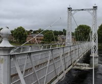
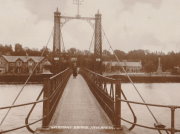
1879: Saint-Ilpize
Saint-Ilpize, Haute-Loire, France - Allier River
| Bridgemeister ID: | 1097 (added 2004-01-02) |
| Year Completed: | 1879 |
| Name: | Saint-Ilpize |
| Location: | Saint-Ilpize, Haute-Loire, France |
| Crossing: | Allier River |
| Coordinates: | 45.198556 N 3.386866 E |
| Maps: | Acme, GeoHack, Google, OpenStreetMap |
| Principals: | Ferdinand Arnodin |
| References: | AAJ, BPF, HBE, PTS2 |
| Use: | Vehicular (one-lane) |
| Status: | In use (last checked: 2020) |
| Main Cables: | Wire |
| Suspended Spans: | 3 |
| Main Span: | 1 x 70.35 meters (230.8 feet) |
| Side Spans: | 2 |
| Deck width: | 18 feet |
Notes:
- The side spans are supported solely by inclined stays, not suspenders from the main cables.
- Closed to all traffic on July 15, 2004 due to damage to the deck, possibly caused by an overloaded truck. Repaired and reopened.
External Links:
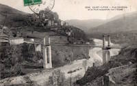
1879: Shaky
Alexandra, New Zealand - Manuherikia River
| Bridgemeister ID: | 665 (added 2003-03-08) |
| Year Completed: | 1879 |
| Name: | Shaky |
| Also Known As: | Manuherikia |
| Location: | Alexandra, New Zealand |
| Crossing: | Manuherikia River |
| Coordinates: | 45.253846 S 169.398651 E |
| Maps: | Acme, GeoHack, Google, OpenStreetMap |
| Principals: | L.D. Macgeorge, William Grant, McKellar |
| References: | GAP |
| Use: | Vehicular (one-lane) |
| Status: | Restricted to foot traffic (last checked: 2017) |
| Main Cables: | Wire |
| Suspended Spans: | 1 |
Notes:
- Restored as a pedestrian-only bridge, 1952. Refurbished, 2009.
- Near 1882 Alexandra - Alexandra, New Zealand.
1879: Swing
Monymusk, Scotland, United Kingdom - River Don
| Bridgemeister ID: | 2192 (added 2007-01-26) |
| Year Completed: | 1879 |
| Name: | Swing |
| Location: | Monymusk, Scotland, United Kingdom |
| Crossing: | River Don |
| Principals: | Harper & Co. |
| References: | HARPER |
| Use: | Footbridge |
| Status: | Demolished, c. 2005 |
| Main Cables: | Wire |
| Suspended Spans: | 1 |
| Main Span: | 1 x 32.6 meters (107 feet) |
External Links:
1879: Viljandi
Viljandi, Estonia
| Bridgemeister ID: | 2654 (added 2019-03-03) |
| Year Completed: | 1879 |
| Name: | Viljandi |
| Location: | Viljandi, Estonia |
| At or Near Feature: | Viljandi Castle Park |
| Coordinates: | 58.358912 N 25.594293 E |
| Maps: | Acme, GeoHack, Google, OpenStreetMap |
| Principals: | Felser and Co. |
| Use: | Footbridge |
| Status: | In use (last checked: 2018) |
| Suspended Spans: | 1 |
Notes:
- 1931: Relocated from original location at Tarvastu Manor. Coordinates provided here represent the new location of the bridge.
- 1995: Reconstructed.
1880: Birkhall
Birkhall, Ballater, Scotland, United Kingdom - River Muick
| Bridgemeister ID: | 2193 (added 2007-01-26) |
| Year Completed: | 1880 |
| Name: | Birkhall |
| Location: | Birkhall, Ballater, Scotland, United Kingdom |
| Crossing: | River Muick |
| Coordinates: | 57.028215 N 3.072693 W |
| Maps: | Acme, GeoHack, Google, OpenStreetMap |
| Principals: | Harper & Co. |
| References: | HARPER |
| Use: | Footbridge |
| Status: | Destroyed, December, 2015 |
| Main Cables: | Wire |
| Suspended Spans: | 1 |
| Main Span: | 1 x 18.3 meters (60 feet) |
Notes:
- 2015, December: Destroyed by flooding during Storm Frank.
- Replaced by Birkhall - Birkhall, Ballater, Scotland, United Kingdom.
External Links:
1880: Burnhervie
Burnhervie, Inverurie vicinity, Scotland, United Kingdom - River Don
| Bridgemeister ID: | 2174 (added 2007-01-13) |
| Year Completed: | 1880 |
| Name: | Burnhervie |
| Location: | Burnhervie, Inverurie vicinity, Scotland, United Kingdom |
| Crossing: | River Don |
| Coordinates: | 57.261024 N 2.440063 W |
| Maps: | Acme, GeoHack, Google, OpenStreetMap |
| Principals: | Harper & Co. |
| References: | HARPER |
| Use: | Footbridge |
| Status: | Collapsed, 1979 |
| Main Cables: | Wire |
| Main Span: | 1 x 30.5 meters (100 feet) |
Notes:
- Completed c. 1880. Douglas Harper writes: "The original bridge was built by Harper & Co, Aberdeen, around 1880 and its timber pylons were replaced with cast iron ones. In 1979 when overloaded during a raft race a bank stay cable failed and a major rebuild was undertaken by the local authority. This version was similar to its predecessor but was repalced in 2005 by a cable stayed bridge."
- Replaced by 1980 Shakin - Burnhervie, Inverurie vicinity, Scotland, United Kingdom.
External Links:
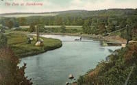
1880: Daniel O'Connell
Ophir, New Zealand - Manuherikia River
| Bridgemeister ID: | 666 (added 2003-03-08) |
| Year Completed: | 1880 |
| Name: | Daniel O'Connell |
| Location: | Ophir, New Zealand |
| Crossing: | Manuherikia River |
| Coordinates: | 45.110783 S 169.590268 E |
| Maps: | Acme, GeoHack, Google, OpenStreetMap |
| Principals: | L.D. Macgeorge, J.S. Derby, R. Edgar |
| References: | GAP |
| Use: | Vehicular (one-lane) |
| Status: | In use (last checked: 2018) |
| Main Cables: | Wire |
| Suspended Spans: | 1 |
| Main Span: | 1 x 65.5 meters (214.9 feet) |
External Links:
1880: Fitzroy
Rockhampton, Queensland, Australia - Fitzroy River
| Bridgemeister ID: | 416 (added before 2003) |
| Year Completed: | 1880 |
| Name: | Fitzroy |
| Location: | Rockhampton, Queensland, Australia |
| Crossing: | Fitzroy River |
| Principals: | F. J. Byerley, Owen Jones |
| References: | AAJ, STC |
| Use: | Vehicular |
| Status: | Demolished, 1956 |
| Main Cables: | Chain (iron) |
| Suspended Spans: | 6 |
| Main Spans: | 4 x 70.7 meters (232 feet) |
| Side Spans: | 2 x 26.5 meters (86.9 feet) |
| Deck width: | 21 feet |
Notes:
- Damaged during flood, 1890. Repaired, 1891.
External Links:
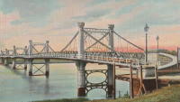
1880: Kawarau Gorge
Kawarau Gorge, Central Otago, New Zealand - Kawarau River Gorge
| Bridgemeister ID: | 667 (added 2003-03-08) |
| Year Completed: | 1880 |
| Name: | Kawarau Gorge |
| Location: | Kawarau Gorge, Central Otago, New Zealand |
| Crossing: | Kawarau River Gorge |
| Coordinates: | 45.008882 S 168.899938 E |
| Maps: | Acme, GeoHack, Google, OpenStreetMap |
| Principals: | H.P. Higginson, A.R.W Fulton, W.C. Edwards |
| References: | AAJ, GAP |
| Use: | Vehicular (one-lane) |
| Status: | Restricted to foot traffic (last checked: 2017) |
| Main Cables: | Wire (iron) |
| Suspended Spans: | 1 |
| Main Span: | 1 x 91.4 meters (300 feet) |
Notes:
- Appears to now be used solely as a bungee-jumping platform.
External Links:
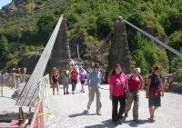
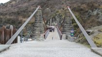
1880: Rosentalbrücke
Braunschweig, Niedersachsen, Germany - Westlicher Umflutgraben, Oker River
| Bridgemeister ID: | 1409 (added 2004-07-04) |
| Year Completed: | 1880 |
| Name: | Rosentalbrücke |
| Location: | Braunschweig, Niedersachsen, Germany |
| Crossing: | Westlicher Umflutgraben, Oker River |
| At or Near Feature: | Inselwall |
| Coordinates: | 52.2686 N 10.5143 E |
| Maps: | Acme, GeoHack, Google, OpenStreetMap |
| Use: | Footbridge |
| Status: | In use (last checked: 2006) |
| Suspended Spans: | 1 |
| Main Span: | 1 x 36 meters (118.1 feet) |
| Deck width: | 1.7 meters |
Notes:
- Eckhard Bernstorff notes: "Suspended with connections from 'chains' to towers, gravity anchored in the ground (backstays), but 'hangers' not adjustable (like truss)."
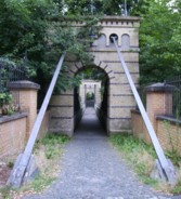
1880: Suspension Pier
Seaview, Isle of Wight, England, United Kingdom
| Bridgemeister ID: | 2409 (added 2007-12-24) |
| Year Completed: | 1880 |
| Name: | Suspension Pier |
| Location: | Seaview, Isle of Wight, England, United Kingdom |
| References: | AAJ |
| Use: | Footbridge |
| Status: | Destroyed, December, 1950 |
| Main Spans: | 3 |
1881: Clyde
Clyde, New Zealand - Clutha River
| Bridgemeister ID: | 663 (added 2003-03-08) |
| Year Completed: | 1881 |
| Name: | Clyde |
| Location: | Clyde, New Zealand |
| Crossing: | Clutha River |
| Coordinates: | 45.190387 S 169.315977 E |
| Maps: | Acme, GeoHack, Google, OpenStreetMap |
| Principals: | William Grant, McKellar |
| References: | GAP |
| Use: | Vehicular (one-lane) |
| Status: | Replaced, 1936 |
| Main Cables: | Wire |
| Suspended Spans: | 3 |
| Main Span: | 1 |
| Side Spans: | 2 |
Notes:
- Replaced by a large single-span truss bridge that sits on the suspension bridge piers.
- Replaced 1875 (suspension bridge) - Clyde, New Zealand.
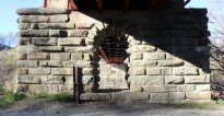
1881: Cromdale
Cromdale, Scotland, United Kingdom - River Spey
| Bridgemeister ID: | 2194 (added 2007-01-26) |
| Year Completed: | 1881 |
| Name: | Cromdale |
| Location: | Cromdale, Scotland, United Kingdom |
| Crossing: | River Spey |
| Coordinates: | 57.341944 N 3.553111 W |
| Maps: | Acme, GeoHack, Google, OpenStreetMap |
| Principals: | Harper & Co. |
| References: | HARPER |
| Use: | Footbridge |
| Status: | Collapsed, 1892 |
| Main Cables: | Wire |
| Main Span: | 1 x 59.4 meters (195 feet) |
Notes:
- Replaced by 1894 Cromdale - Cromdale, Scotland, United Kingdom.
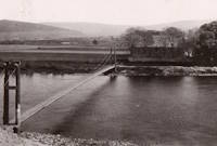
1881: Greig Street
Inverness, Scotland, United Kingdom - River Ness
| Bridgemeister ID: | 538 (added before 2003) |
| Year Completed: | 1881 |
| Name: | Greig Street |
| Also Known As: | Wobbly |
| Location: | Inverness, Scotland, United Kingdom |
| Crossing: | River Ness |
| Coordinates: | 57.479111 N 4.229796 W |
| Maps: | Acme, GeoHack, Google, OpenStreetMap |
| References: | HBR |
| Use: | Footbridge |
| Status: | In use (last checked: 2021) |
| Main Cables: | Wire |
| Suspended Spans: | 3 |
| Main Span: | 1 |
| Side Spans: | 2 |
Notes:
- Companion to 1879 Infirmary - Inverness, Scotland, United Kingdom.
- Near 1855 Ness - Inverness, Scotland, United Kingdom. In some photos, the two bridges are visible within a few hundred yards of each other.
External Links:
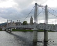
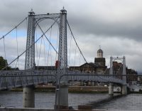
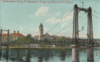
1881: Kettenbrücke
Leipzig, Germany
1881: Vicq-sur-Gartempe
Vicq-sur-Gartempe, Vienne, France - Gartempe River
| Bridgemeister ID: | 3996 (added 2020-03-27) |
| Year Completed: | 1881 |
| Name: | Vicq-sur-Gartempe |
| Location: | Vicq-sur-Gartempe, Vienne, France |
| Crossing: | Gartempe River |
| Use: | Vehicular |
| Status: | Removed |
| Main Cables: | Wire |
Notes:
- Replaced 1840 Vicq-sur-Gartempe - Vicq-sur-Gartempe and Champagne, Vienne, France.
- Replaced by 1931 Vicq-sur-Gartempe - Vicq-sur-Gartempe, Vienne, France.
1882: Alexandra
Alexandra, New Zealand - Clutha River
| Bridgemeister ID: | 668 (added 2003-03-08) |
| Year Completed: | 1882 |
| Name: | Alexandra |
| Location: | Alexandra, New Zealand |
| Crossing: | Clutha River |
| Coordinates: | 45.258245 S 169.391270 E |
| Maps: | Acme, GeoHack, Google, OpenStreetMap |
| Principals: | L.D. Macgeorge, Jeremiah Drummey, Robert Hay |
| References: | GAP |
| Use: | Vehicular (one-lane) |
| Status: | Only towers remain (last checked: 2017) |
| Main Cables: | Wire |
| Main Span: | 1 x 79.9 meters (262.1 feet) |
Notes:
- Bypassed, 1958, at which point the bridge deck and cables were removed leaving only the towers.
- Near 1879 Shaky (Manuherikia) - Alexandra, New Zealand.
External Links:
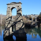
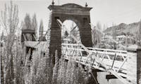
1882: Fitch's
Elmira, New York, USA - Chemung River
| Bridgemeister ID: | 88 (added before 2003) |
| Year Completed: | 1882 |
| Name: | Fitch's |
| Also Known As: | Fitches, Fisches, Lumbermens |
| Location: | Elmira, New York, USA |
| Crossing: | Chemung River |
| Coordinates: | 42.082409 N 76.866470 W |
| Maps: | Acme, GeoHack, Google, OpenStreetMap |
| Use: | Vehicular (one-lane) |
| Status: | Removed |
| Main Cables: | Wire |
| Main Span: | 1 |
External Links:
- Fitch Family History and Genealogy. Although this bridge is known by a variety of names (and misspellings), this Fitch family site states Daniel Hollenbeck Fitch contributed $10,000 to the construction of the bridge and refer to it as "Fitch's Bridge".
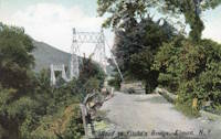
1882: Long Creek
Melvern vicinity, Kansas, USA - Long Creek
| Bridgemeister ID: | 2062 (added 2006-06-03) |
| Year Completed: | 1882 |
| Name: | Long Creek |
| Location: | Melvern vicinity, Kansas, USA |
| Crossing: | Long Creek |
| At or Near Feature: | Francis Crossing |
| Principals: | Wilden Bridge Company |
| Use: | Vehicular (one-lane) |
| Status: | Removed, c. 1970 |
Notes:
- In the June 18, 1970 edition of the Daily Tribune newspaper (Great Bend, Kansas) an article titled "Last Suspension Bridge to Fall" describes this bridge: "The suspension bridge appears to be going the way of the old covered bridge in Kansas. At least, the particular type of suspension span represented by Osage County Bridge No. 18 may be gone when this structure is replaced within two years. L.D. Pierce, Osage County engineer, said he believes this 'homemade' suspension bridge probably is the last of its kind in this state. He said it was built in 1882 from a pencil-drawn plan that probably was prepared by asurveyor or a millwright. He said it was constructed with materials that could be found in any hardware store and lumber yard. For example, cables are No. 9 gauge wire, bound together. Pierce said at one time there were five or six of these bridges in Osage County. The 100-foot span over Long Creek has been closed to traffic since 1967."
- See Long Creek - Melvern, Kansas, USA.
1883: Brooklyn
New York and Brooklyn, New York, USA - East River
| Bridgemeister ID: | 89 (added before 2003) |
| Year Completed: | 1883 |
| Name: | Brooklyn |
| Also Known As: | Great East River |
| Location: | New York and Brooklyn, New York, USA |
| Crossing: | East River |
| Coordinates: | 40.706 N 73.99667 W |
| Maps: | Acme, GeoHack, Google, OpenStreetMap |
| Principals: | John A. Roebling, Washington A. Roebling |
| References: | AAJ, BAAW, BBR, BBTS, BC3, BFL, BLD, BMA, BOB, BOU, BPL, COB, CTW, GB, GBD, HBE, LAB, LACE, NG198305, ONF, PTS2, SJR |
| Use: | Rail (light rail) and Vehicular (major highway), with walkway |
| Status: | In use (last checked: 2022) |
| Main Cables: | Wire (steel) |
| Suspended Spans: | 3 |
| Main Span: | 1 x 486.3 meters (1,595.5 feet) |
| Side Spans: | 2 x 283.5 meters (930 feet) |
| Deck width: | 85 feet |
Notes:
- Became longest suspension bridge by eclipsing 1869 Clifton (Niagara-Clifton, Falls View, First Falls View) - Niagara Falls, New York, USA and Niagara Falls, Ontario, Canada.
- Eclipsed by new longest suspension bridge 1903 Williamsburg - New York and Brooklyn, New York, USA.
- Next to 1909 Manhattan - New York and Brooklyn, New York, USA.
- Near 1903 Williamsburg - New York and Brooklyn, New York, USA.
External Links:

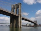
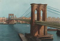
1883: Chilhac
Chilhac, Haute-Loire, France - Allier River
| Bridgemeister ID: | 1131 (added 2004-01-15) |
| Year Completed: | 1883 |
| Name: | Chilhac |
| Location: | Chilhac, Haute-Loire, France |
| Crossing: | Allier River |
| Coordinates: | 45.154731 N 3.437122 E |
| Maps: | Acme, GeoHack, Google, OpenStreetMap |
| Use: | Vehicular (one-lane) |
| Status: | In use (last checked: 2019) |
| Main Cables: | Wire |
| Suspended Spans: | 1 |
External Links:
1883: Swinging
Skowhegan, Maine, USA - Kennebec River
| Bridgemeister ID: | 1575 (added 2004-12-19) |
| Year Completed: | 1883 |
| Name: | Swinging |
| Location: | Skowhegan, Maine, USA |
| Crossing: | Kennebec River |
| References: | KJ20030410 |
| Use: | Footbridge |
| Status: | Collapsed, 1888 |
| Main Cables: | Wire (steel) |
Notes:
- KJ20030410: "[The] span collapsed in 1888: it turned out the steel cables were not all steel, they had a core of hemp, according to the history 'Skowhegan on the Kennebec'."
- Replaced by 1888 Swinging - Skowhegan, Maine, USA.
1883: Turrian
Château-d'Oex, Switzerland - Sarine River
| Bridgemeister ID: | 2878 (added 2019-09-13) |
| Year Completed: | 1883 |
| Name: | Turrian |
| Location: | Château-d'Oex, Switzerland |
| Crossing: | Sarine River |
| Coordinates: | 46.468703 N 7.135172 E |
| Maps: | Acme, GeoHack, Google, OpenStreetMap |
| Use: | Footbridge |
| Status: | In use (last checked: 2019) |
| Main Cables: | Wire (steel) |
| Suspended Spans: | 1 |
External Links:
1883: Yenne
Yenne, Savoie and Ain, France - Rhône River
| Bridgemeister ID: | 1968 (added 2005-11-26) |
| Year Completed: | 1883 |
| Name: | Yenne |
| Location: | Yenne, Savoie and Ain, France |
| Crossing: | Rhône River |
| Coordinates: | 45.706294 N 5.751086 E |
| Maps: | Acme, GeoHack, Google, OpenStreetMap |
| References: | AGP |
| Use: | Vehicular (one-lane) |
| Status: | Destroyed, 1940 |
| Main Cables: | Wire |
| Suspended Spans: | 1 |
Notes:
- 1940: Destroyed during WWII.
- Later at same location 1951 Yenne - Yenne, Savoie and Ain, France.
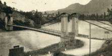
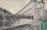
Do you have any information or photos for these bridges that you would like to share? Please email david.denenberg@bridgemeister.com.
