Suspension Bridges 1700-1834 (1-173 of 174)
This is a list of bridges 1 through 173 (of 174 total) in the suspension bridge inventory completed from 1700 through 1834, the year the Grand Pont Suspendu was completed. Wherever you see a Bridgemeister ID number click it to isolate the bridge on its own page.
Related Lists:
1734: (suspension bridge)
Gliwice vicinity, Upper Silesia, Poland - Oder River
| Bridgemeister ID: | 371 (added before 2003) |
| Year Completed: | 1734 |
| Name: | (suspension bridge) |
| Location: | Gliwice vicinity, Upper Silesia, Poland |
| Crossing: | Oder River |
| Principals: | Army of the Palatinate of Saxony |
| References: | AAJ, BPL |
| Main Cables: | Chain (iron) |
Notes:
- Often claimed to be the first use of metal in a suspension structure in the Western world.
- Location always cited as "across the Oder near Glorywitz, Prussia" however the name "Glorywitz" only ever appears in citations of this bridge. Likely it was near the modern city of Gliwice in Poland, also known as Gleiwitz (German) and Glywicy (Silesian)
1741: Winch
Middleton-in-Teesdale, England, United Kingdom - River Tees
| Bridgemeister ID: | 372 (added before 2003) |
| Year Completed: | 1741 |
| Name: | Winch |
| Also Known As: | Wynch |
| Location: | Middleton-in-Teesdale, England, United Kingdom |
| Crossing: | River Tees |
| At or Near Feature: | Low Force |
| References: | AAJ, BEM, BPL, HBE, PTS2 |
| Use: | Footbridge |
| Main Cables: | Chain (iron) |
| Suspended Spans: | 1 |
| Main Span: | 1 x 21.3 meters (70 feet) |
Notes:
- Varying histories of this catwalk-style bridge exist. Some claim it was built 1704, a cable snapped in 1802 killing three people, and it was then rebuilt in 1830 (the present bridge). Others attribute the bridge to 1741 and have the 1802 incident killing "one or two people".
- Replaced by 1830 Wynch (Winch) - Middleton-in-Teesdale, England, United Kingdom.
External Links:
1784: Chain
Weilburg, Germany - Lahn River
| Bridgemeister ID: | 582 (added 2003-01-01) |
| Year Completed: | 1784 |
| Name: | Chain |
| Location: | Weilburg, Germany |
| Crossing: | Lahn River |
| References: | PTS2 |
| Use: | Pipeline |
| Status: | Replaced, 1888 |
| Main Cables: | Chain (iron) |
| Main Span: | 1 x 35 meters (114.8 feet) |
Notes:
- Carried a water pipeline with eight iron chains.
External Links:
1801: Jacob's Creek
Iron Bridge, Mount Pleasant vicinity, Pennsylvania, USA - Jacob's Creek
| Bridgemeister ID: | 3 (added before 2003) |
| Year Completed: | 1801 |
| Name: | Jacob's Creek |
| Also Known As: | Iron Bridge, Chain Bridge |
| Location: | Iron Bridge, Mount Pleasant vicinity, Pennsylvania, USA |
| Crossing: | Jacob's Creek |
| Coordinates: | 40.112598 N 79.553186 W |
| Maps: | Acme, GeoHack, Google, OpenStreetMap |
| Principals: | Judge James Finley |
| References: | AAJ, ASB, BBR, BOB, BPL, CAB, DSE20000116, HBE, LAB, PTS2 |
| Use: | Vehicular |
| Status: | Removed, 1833 |
| Main Cables: | Chain (iron) |
| Suspended Spans: | 3 |
| Main Span: | 1 x 21.3 meters (70 feet) |
| Deck width: | 12.5 feet |
Notes:
- In an email dated January 16, 2000, Don Sayenga provided information about the location of this bridge. Generally attributed to Uniontown (the seat of Fayette County, PA), Mr. Sayenga offers some clues about the bridge's true location. "[James Finley] stated that he built it near the home of his friend Meason which implies a connection for the iron as Meason was making iron. Meason's home has survived by the way, a beautiful place. Finley stated it was a combination contract with the cost split between two counties, and he stated it was built over Jacob's Creek which is the county boundary. He also makes it clear it was on the road to Greensburg. The only place the old road crossed Jacob's Creek is just south of Mount Pleasant, Pennsylvania. On the geodetic survey maps this spot is marked "Iron Bridge" but there is no town there. The last time I was there I saw a sign that said 'Iron Bridge' on an automobile scrap yard. I found absolutely no trace of the bridge, but it was not very big, so there was no need for a huge abutment."
- First suspension bridge with a rigid level deck, often considered the world's first modern suspension bridge.
- Coordinates are for the likely location of the bridge, where present-day (2020) Pennsylvania route 3105 crosses Jacob's Creek.
External Links:
1807: Chain
Georgetown, District of Columbia and Virginia, USA - Potomac River
| Bridgemeister ID: | 4 (added before 2003) |
| Year Completed: | 1807 |
| Name: | Chain |
| Location: | Georgetown, District of Columbia and Virginia, USA |
| Crossing: | Potomac River |
| Coordinates: | 38.92959 N 77.11627 W |
| Maps: | Acme, GeoHack, Google, OpenStreetMap |
| Principals: | John Templeman |
| References: | AAJ, BBR, BCW, CAB, DSE20000118, HBE, PTS2 |
| Use: | Vehicular |
| Status: | Destroyed, 1812 |
| Main Cables: | Chain (iron) |
| Suspended Spans: | 1 |
| Main Span: | 1 x 39.2 meters (128.5 feet) |
Notes:
- BCW gives completion date of 1810 and says bridge was destroyed by flood two years later.
- Coordinates given are for the current crossing (VA SR123, still known locally as "Chain Bridge Road") which is on (or very close) to the alignment of Chain Bridge. Chain Bridge was the third bridge at this site. The current structure is the eighth and was completed in 1940.
External Links:
1807: Wills Creek
Cumberland, Maryland, USA - Wills Creek
| Bridgemeister ID: | 5 (added before 2003) |
| Year Completed: | 1807 |
| Name: | Wills Creek |
| Location: | Cumberland, Maryland, USA |
| Crossing: | Wills Creek |
| Principals: | John Templeman |
| References: | AAJ, BCW, CAB, DSE20000203, HBE |
| Status: | Destroyed, 1810 |
| Main Cables: | Chain (iron) |
| Main Span: | 1 x 42.4 meters (139 feet) |
Notes:
- Destroyed by flood, 1810.
- Later at same location 1820 Wills Creek - Cumberland, Maryland, USA.
1809: (suspension bridge)
Brownsville vicinity, Pennsylvania, USA
| Bridgemeister ID: | 8 (added before 2003) |
| Year Completed: | 1809 |
| Name: | (suspension bridge) |
| Location: | Brownsville vicinity, Pennsylvania, USA |
| References: | AAJ, CAB, DSE20000203, HBE |
| Status: | Removed |
| Main Cables: | Chain (iron) |
1809: (suspension bridge)
Brownsville, Pennsylvania, USA - Dunlap's Creek
| Bridgemeister ID: | 7 (added before 2003) |
| Year Completed: | 1809 |
| Name: | (suspension bridge) |
| Location: | Brownsville, Pennsylvania, USA |
| Crossing: | Dunlap's Creek |
| Principals: | John Templeman |
| References: | AAJ, BCW, CAB, DSE20000118, DSE20000203, HBE |
| Use: | Vehicular |
| Status: | Removed |
| Main Cables: | Chain (iron) |
External Links:
- Dunlap's Creek Bridge (link reported not working). "The first recorded bridge across Dunlap's Creek was a wooden structure constructed prior to 1774. It was repaired in 1801, but was destroyed during a spring storm in 1808. A chain-link suspension bridge was built on the site in 1809; it collapsed under the weight of snow and a heavily laden wagon in 1820. A third bridge, another wooden structure, built in 1821 also failed. The present bridge is thus the fourth bridge at the site."
- Structurae - Structure ID 20008055
1809: Schuylkill Falls
Philadelphia, Pennsylvania, USA - Schuylkill River
| Bridgemeister ID: | 9 (added before 2003) |
| Year Completed: | 1809 |
| Name: | Schuylkill Falls |
| Location: | Philadelphia, Pennsylvania, USA |
| Crossing: | Schuylkill River |
| Principals: | John Templeman |
| References: | AAJ, BBR, BPL, CAB, DSE20000118, HBE, PTS2 |
| Status: | Removed |
| Main Cables: | Chain (iron) |
| Suspended Spans: | 2 |
| Main Spans: | 2 x 46.6 meters (153 feet) |
| Deck width: | 18 feet |
Notes:
- Failed 1811, 1816. HBE notes the 1811 was due to weight of cattle. The 1816 failure was due to weight of ice and snow.
External Links:
1810: (suspension bridge)
Frankfort, Kentucky, USA - Kentucky River
1810: (suspension bridge)
Paulings Ford, Pennsylvania, USA - Schuylkill River
| Bridgemeister ID: | 11 (added before 2003) |
| Year Completed: | 1810 |
| Name: | (suspension bridge) |
| Location: | Paulings Ford, Pennsylvania, USA |
| Crossing: | Schuylkill River |
| References: | CAB |
| Status: | Removed |
| Main Cables: | Chain (iron) |
External Links:
1810: (suspension bridge)
Reading, Pennsylvania, USA - Schuykill River
| Bridgemeister ID: | 12 (added before 2003) |
| Year Completed: | 1810 |
| Name: | (suspension bridge) |
| Location: | Reading, Pennsylvania, USA |
| Crossing: | Schuykill River |
| Principals: | Ulrich Kissinger |
| References: | CAB |
| Status: | Removed |
| Main Cables: | Chain (iron) |
External Links:
1810: (suspension bridge)
Wilmington, Delaware, USA - Brandywine Creek
| Bridgemeister ID: | 6 (added before 2003) |
| Year Completed: | 1810 |
| Name: | (suspension bridge) |
| Location: | Wilmington, Delaware, USA |
| Crossing: | Brandywine Creek |
| References: | AAJ, BCW, CAB, DSE20000203, HBE |
| Status: | Destroyed, 1822 |
| Main Cables: | Chain (iron) |
| Suspended Spans: | 1 |
| Main Span: | 1 x 44.2 meters (145 feet) |
| Deck width: | 30 feet |
Notes:
- Destroyed by flood, 1822.
External Links:
1810: (suspension bridge)
Wrightstown, Pennsylvania, USA - Neshaminy River
| Bridgemeister ID: | 13 (added before 2003) |
| Year Completed: | 1810 |
| Name: | (suspension bridge) |
| Location: | Wrightstown, Pennsylvania, USA |
| Crossing: | Neshaminy River |
| Principals: | John Parker |
| References: | AAJ, CAB, DSE20000403 |
| Use: | Vehicular |
| Status: | Removed |
| Main Cables: | Chain (iron) |
| Main Spans: | 2 x 30.5 meters (100 feet) |
External Links:
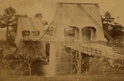
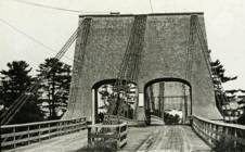
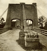
1810: Chain
Newburyport, Massachusetts, USA - Merrimack River
| Bridgemeister ID: | 14 (added before 2003) |
| Year Completed: | 1810 |
| Name: | Chain |
| Also Known As: | Essex-Merrimack |
| Location: | Newburyport, Massachusetts, USA |
| Crossing: | Merrimack River |
| At or Near Feature: | Deer Island |
| Coordinates: | 42.833947 N 70.906811 W |
| Maps: | Acme, GeoHack, Google, OpenStreetMap |
| Principals: | John Templeman |
| References: | AAJ, BBR, CAB, GBD, HBE, POPE, PTS2, RDH |
| Use: | Vehicular (two-lane, light vehicles only) |
| Status: | Replaced, 1909 |
| Main Cables: | Chain (iron) |
| Suspended Spans: | 1 |
| Main Span: | 1 x 74.1 meters (243 feet) |
| Deck width: | 30 feet (2 roadways of 15 feet) |
Notes:
- John Templeman built several bridges (like this one) using James Finley's design.
- Repaired in 1827 after 5 of 10 chains snapped under weight of a team of oxen.
- The complete description from Thomas Pope's 1811 Treatise (POPE):
"The chain Bridge lately thrown over the Merrimack, three miles above Newburyport, in the state of Massachusetts, is now in constant use. This Bridge consists of a single arc, two hundred and forty-four feet span. The abutments are of stone, forty-seven feet long, and thirty-seven high; the uprights, or framed work, which stand on the abutments, are thirty-five feet high, over which are suspended ten distinct chains, the ends of which on both sides of the river are buried deep in pits and secured by large stones: each chain is five hundred and sixteen feet long; and, where they pass over the uprights, they are treble, and made in short links, which is said to be more secure than saddles made of plates of iron. The four middle joists rest on the chains; all the rest are suspended to the main chains to equalize the floor. This Bridge has two passage-ways of fifteen feet in width each, and the floor is so solid as to admit of horses, carriages, etc. to travel at any speed, with very little perceptible motion of the floors. The railing is stout and strong, which adds much firmness to the floor. There are three chains in each range on each side, and four in the middle range: they are calculated to support nearly five hundred tons. From the surface of the water to the middle of the floor is forty feet; and from the top of the abutments to the top of the uprights is thirty-five feet high, making seventy-two feet. The magnitude and power of the abutments, the width and length of the floors, the elevation of the work, the evident powers of the chains, etc. all conspire to make it a wonderful work. Every expense attending it did not amount to twenty-five thousand dollars. The abutment being of stone, the uprights covered, and the chains painted to prevent rust, leaves nothing but the flooring to decay. This Bridge was constructed by John Templeman, Esq. of the district of Columbia, whose talents for the productions of such work, and the various improvements suggested and used by him, have been highly beneficial, and do him great credit."
- Gregory W. Buff sent a transcription of an article describing the 1827 failure. The article was in the Saturday, February 24, 1827 issue (Volume IV, Number 31) of the Canadian Spectator (Montreal, Quebec) newspaper:
"Newburyport, Feb 9. Disastrious [sic] Accident. - On Tuesday morning last, the Essex Merrimack Bridge gave way in the centre, from the parting of the chains that support it. On the Bridge, at the moment, was a loaded team, drawn by six oxen and two horses, driven by two men, Messrs. Garlton [sic] and Jackman, all of whom were precipitated, forty feet, into the river beneath. The teamsters preserved themselves by means of swimming, and the support of fragments of the bridge; the team were all of them except one of the horses, swept beneath the ice a few rods below, and drowned. Five of the ten chains which supported the Bridge, were snapped in different places, and now remain upholding the broken and shattered timber altogether as sad a wreck as we ever witnessed. At the moment of the crash, the light evolved from the friction of the chains resembled the the vivid streaming of a meteor. Various excuses are assigned for the accident, and none, with more probability, than the united effect of the incumbent pressure of the immense body of snow lying upon the bridge, and the frost which had contracted the particles of iron. These produced a tenseness in the chains, which was incapable of resisting the additional pressure of the loaded team, and the whole gave way. The estimated expense of repairing the breach is about 4000 dollars; and the Directors, as we understand, plan to set about it immediately. It will be built up as before. To those who have been losers by this accident the corporation intend to make generous inumeration. The traveling will be uninterrupted, as the solidity of the ice above the bridge forms a safe passage way - and for the conveyance of carriages and heavy baggage the proprietors have promptly provided suitable boats. If any aversion to chain bridges has been produced by this accident, we should be sorry, for ourselves we feel yet unshaken faith in their superior security. The misfortune in this case was no doubt owing to the causes above stated, and not to any defect in the construction of the bridge. Probably hundreds of individuals, including each sex and all ages, have visited the ruins of the bridge. They present a sad and melancholy appearance - crushed and broken timbers suspended by the massy chains, which hang lazily from the pyramidical abutments, while the beholder instinctly shrinks back in terror at the reflection of the situation of the two human beings who were precipitated into the abyss beneath. The preservation of these two men is almost miraculous. Although hurled down 40 feet amid crashing and falling timber, entangled with their cattle, they fell without receiving the least injury, and attained the shore, after being for nearly half an hour, immerse in water chilled to the freezing point. Mr. Jackman is far advanced in years - and suffered somewhat from the exposure to the cold. Mr. Carlton [sic], escaped unhurt. The Chain Bridge has been built for about fifteen years, the span is 220 feet. We believe this was the second or third Chain Bridge built in the United States; and this is probably the first that has met with a similar accident. We understand the proprieters of the Rooks Bridge intend to rebuild theirs as a Chain Bridge."
- Replaced by 1909 Chain - Newburyport, Massachusetts, USA. The 1909 structure was almost entirely new (except for portions of the piers and abutments).
External Links:
1811: (suspension bridge)
Juniata Crossing, Pennsylvania, USA - Juniata River
| Bridgemeister ID: | 15 (added before 2003) |
| Year Completed: | 1811 |
| Name: | (suspension bridge) |
| Location: | Juniata Crossing, Pennsylvania, USA |
| Crossing: | Juniata River |
| References: | CAB, DSE20000403 |
| Use: | Vehicular |
| Status: | Removed |
| Main Cables: | Chain (iron) |
External Links:
1811: Third Street
Easton, Pennsylvania, USA - Lehigh River
| Bridgemeister ID: | 18 (added before 2003) |
| Year Completed: | 1811 |
| Name: | Third Street |
| Location: | Easton, Pennsylvania, USA |
| Crossing: | Lehigh River |
| Principals: | Jacob Blumer (?) |
| References: | CAB, DSE20000203 |
| Use: | Vehicular |
| Status: | Removed |
| Main Cables: | Chain (iron) |
External Links:
1814: Hamilton Street
Allentown, Pennsylvania, USA - Lehigh River
| Bridgemeister ID: | 19 (added before 2003) |
| Year Completed: | 1814 |
| Name: | Hamilton Street |
| Location: | Allentown, Pennsylvania, USA |
| Crossing: | Lehigh River |
| Principals: | Jacob Blumer |
| References: | AAJ, CAB, DSE20000203, PTS2 |
| Status: | Removed |
| Main Cables: | Chain (iron) |
| Suspended Spans: | 4 |
| Main Spans: | 2 |
| Side Spans: | 2 |
External Links:
1816: Galashiels
Galashiels, Scotland, United Kingdom - Gala Water
| Bridgemeister ID: | 584 (added 2003-01-01) |
| Year Completed: | 1816 |
| Name: | Galashiels |
| Location: | Galashiels, Scotland, United Kingdom |
| Crossing: | Gala Water |
| Principals: | Richard Lees |
| References: | AAJ, BSI, HBE, PTS2 |
| Use: | Footbridge |
| Status: | Destroyed, 1839 |
| Main Cables: | Wire (iron) |
| Suspended Spans: | 1 |
| Main Span: | 1 x 33.8 meters (111 feet) |
| Deck width: | 3 feet |
Notes:
- BSI: Originally erected in the form of a traditional suspension bridge, but soon reinforced with wire stays from much larger towers to reduce unwanted motion. Destroyed by flood, 1839.
1816: Spider
Philadelphia, Pennsylvania, USA - Schuylkill River
| Bridgemeister ID: | 20 (added before 2003) |
| Year Completed: | 1816 |
| Name: | Spider |
| Location: | Philadelphia, Pennsylvania, USA |
| Crossing: | Schuylkill River |
| Principals: | Josiah White, Erskine Hazard |
| References: | AAJ, BOB, BPL, GHD, HBE, LAB, PTS2 |
| Use: | Footbridge |
| Status: | Removed |
| Main Cables: | Wire (iron) |
| Main Span: | 1 x 120 meters (393.75 feet) |
Notes:
- Narrow footbridge. First wire bridge in North America. HBE notes "first wire suspension bridge in any country."
- Often described as having collapsed under the weight of ice and snow, Don Sayenga notes that no contemporary sources confirm this demise. Since the nearby chain bridge did fail under weight of ice and snow, he believes this fate has been misattributed to the White and Hazard footbridge. Don believes the bridge was just dismantled at some point after June, 1816.
- Al Zagofsky also wrote to explain there was no evidence of this bridge collapsing under weight of ice and snow. Al writes: "According to an original source Captain Joshua Rowley Watson, who inspected the bridge on June 15, 1816: '...There was a bridge, but which by the weight of ice and snow, has been carried away.' This refers to the previous bridge that the cable bridge was temporarily replacing. I did not see any cause for failure of the wire rope bridge. My guess is that it was removed when the regular bridge was repaired. The same article shows a sketch that he made, showing the main span to be 407 feet. I am looking at the Canal History and Technology Proceedings Vol 5, March 22, 1986."
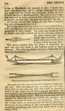
1818: Dryburgh Abbey
Dryburgh and St. Boswells, Scotland, United Kingdom - River Tweed
| Bridgemeister ID: | 1440 (added 2004-07-31) |
| Year Completed: | 1818 |
| Name: | Dryburgh Abbey |
| Location: | Dryburgh and St. Boswells, Scotland, United Kingdom |
| Crossing: | River Tweed |
| References: | AAJ, BEM, MOS |
| Use: | Footbridge |
| Status: | Collapsed, 1838 |
| Main Cables: | Chain (iron) |
| Suspended Spans: | 1 |
| Main Span: | 1 x 79.2 meters (260 feet) |
| Deck width: | 4.5 feet |
Notes:
- May have been rebuilt around 1850. History of the bridge is unclear between the 1838 collapse and replacement in 1872.
- This 1818 bridge was a replacement for the 1817 Dryburgh Abbey suspension bridge which appears to have been primarily a cable-stayed structure and is not included in the inventory. The 1817 bridge failed due to wind in early 1818.
- Later at same location 1872 Dryburgh Abbey - Dryburgh and St. Boswells, Scotland, United Kingdom.
External Links:

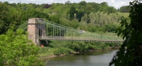
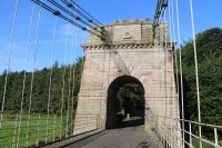
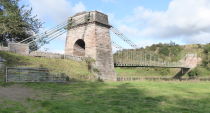
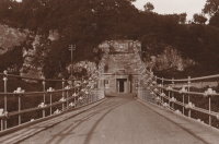
1820: Union
Horncliffe, Berwick-upon-Tweed vicinity, England and Fishwick, Scotland, United Kingdom - River Tweed
| Bridgemeister ID: | 373 (added before 2003) |
| Year Completed: | 1820 |
| Name: | Union |
| Location: | Horncliffe, Berwick-upon-Tweed vicinity, England and Fishwick, Scotland, United Kingdom |
| Crossing: | River Tweed |
| Coordinates: | 55.75256 N 2.10677 W |
| Maps: | Acme, GeoHack, Google, OpenStreetMap |
| Principals: | Sir Samuel Brown |
| References: | AAJ, BBR, BC3, BEM, BOB, HBE, MOS, NTB, PTS2, SBR |
| Use: | Vehicular (one-lane) |
| Status: | In use (last checked: 2023) |
| Main Cables: | Chain (iron) |
| Suspended Spans: | 1 |
| Main Span: | 1 x 136.9 meters (449 feet) |
| Deck width: | 18 feet |
Notes:
- 2007, March: Closed after a hanger snapped in high winds. Repaired and reopened August, 2007.
- 2020, October: Closed for major renovation and conservation project.
- 2023, April: The bridge is reopened.
- Eclipsed by new longest suspension bridge 1826 Menai Strait - Menai Bridge and Bangor vicinity, Wales, United Kingdom.
External Links:
- Conservation - Union Chain Bridge - unionchainbridge.org. Site devoted to the 2020-2023 renovation project. This page lists the highlights of the project.
- Structurae - Structure ID 20000162

1820: Wills Creek
Cumberland, Maryland, USA - Wills Creek
| Bridgemeister ID: | 1149 (added 2004-01-17) |
| Year Completed: | 1820 |
| Name: | Wills Creek |
| Location: | Cumberland, Maryland, USA |
| Crossing: | Wills Creek |
| Principals: | Valentine Shockey |
| References: | CAB |
| Status: | Destroyed, 1838 |
| Main Cables: | Chain (iron) |
| Main Span: | 1 x 46.2 meters (151.5 feet) |
Notes:
- Destroyed 1838 when one abutment collapsed.
- At former location of 1807 Wills Creek - Cumberland, Maryland, USA.
1821: Trinity Pier
Trinity, Edinburgh vicinity, Scotland, United Kingdom - River Forth
| Bridgemeister ID: | 374 (added before 2003) |
| Year Completed: | 1821 |
| Name: | Trinity Pier |
| Also Known As: | Newhaven Pier |
| Location: | Trinity, Edinburgh vicinity, Scotland, United Kingdom |
| Crossing: | River Forth |
| Principals: | Sir Samuel Brown |
| References: | AAJ, MOS, SBR |
| Use: | Footbridge |
| Status: | Destroyed, 1898 |
| Main Cables: | Chain (iron) |
| Main Spans: | 3 x 63.7 meters (209 feet) |
| Deck width: | 4 feet |
Notes:
- SBR: Chain pier extending into 700 feet into the Forth, with three main spans each of 209 feet. Wrecked by storm, 1898.
External Links:
1822: (footbridge)
Annonay, Ardèche, France - Cance River
| Bridgemeister ID: | 375 (added before 2003) |
| Year Completed: | 1822 |
| Name: | (footbridge) |
| Location: | Annonay, Ardèche, France |
| Crossing: | Cance River |
| Principals: | Marc Seguin, Camille Seguin, Jules Seguin, Paul Seguin, Charles Seguin |
| References: | AAJ, BBR, GHD, LAB, TTSB |
| Use: | Footbridge |
| Status: | Removed |
| Main Cables: | Wire (iron) |
| Suspended Spans: | 1 |
| Main Span: | 1 x 18 meters (59.1 feet) |
Notes:
- Test structure, but recognized as first wire bridge in France.
- See 1865 Moulin - Vernosc-lès-Annonay, Ardèche, France.
External Links:
1822: Kalighat
Kolkata, West Bengal, India - Tolly's Nullah (Adi Ganga)
| Bridgemeister ID: | 3552 (added 2019-12-26) |
| Year Completed: | 1822 |
| Name: | Kalighat |
| Also Known As: | Khallee Ghat, Kalee Ghat |
| Location: | Kolkata, West Bengal, India |
| Crossing: | Tolly's Nullah (Adi Ganga) |
| Principals: | Major John Augustus Schalch |
| References: | ISB |
| Use: | Footbridge |
| Status: | Removed |
| Main Cables: | Chain (iron) |
Notes:
- Sometimes cited as completed in 1823.
1823: (suspension bridge)
Réunion, France - Sainte-Suzanne River
| Bridgemeister ID: | 1541 (added 2004-11-03) |
| Year Completed: | 1823 |
| Name: | (suspension bridge) |
| Location: | Réunion, France |
| Crossing: | Sainte-Suzanne River |
| Principals: | Marc Brunel |
| References: | AAJ, ASB, CAB |
| Use: | Vehicular (two-lane) |
| Main Cables: | Chain (iron) |
| Suspended Spans: | 2 |
| Main Spans: | 2 x 40.2 meters (131.75 feet) |
Notes:
- Réunion was known as "Isle of Bourbon" at this time.
- Built as part of same project as 1823 (suspension bridge) - Réunion, France.
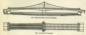
| Bridgemeister ID: | 1542 (added 2004-11-03) |
| Year Completed: | 1823 |
| Name: | (suspension bridge) |
| Location: | Réunion, France |
| Crossing: | Mat River |
| Principals: | Marc Brunel |
| References: | AAJ, ASB, CAB, MOS |
| Use: | Vehicular (two-lane) |
| Main Cables: | Chain (iron) |
| Suspended Spans: | 1 |
| Main Span: | 1 x 40.2 meters (131.75 feet) |
Notes:
- Réunion was known as "Isle of Bourbon" at this time.
- MOS: "These bridges were designed by Mr. Brunel, and executed in England, near Sheffield, where they were put together in January, 1823, before being sent out to the Isle de Bourbon."
- Built as part of same project as 1823 (suspension bridge) - Réunion, France.
1823: Brighton Pier
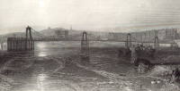
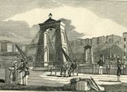
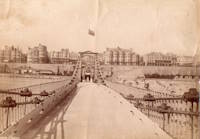
Brighton, East Sussex, England, United Kingdom
| Bridgemeister ID: | 376 (added before 2003) |
| Year Completed: | 1823 |
| Name: | Brighton Pier |
| Location: | Brighton, East Sussex, England, United Kingdom |
| Principals: | Sir Samuel Brown |
| References: | AAJ, BEM, BOB, HBE, MOS, SBR |
| Use: | Footbridge |
| Status: | Destroyed, 1896 |
| Main Cables: | Chain (iron) |
| Suspended Spans: | 4 |
| Main Spans: | 4 x 77.7 meters (255 feet) |
Notes:
- SBR: Severely damaged 1833, 1836. Destroyed by storm 1896.
External Links:
1823: Saint Antoine
Geneva, Switzerland
| Bridgemeister ID: | 377 (added before 2003) |
| Year Completed: | 1823 |
| Name: | Saint Antoine |
| Location: | Geneva, Switzerland |
| Principals: | Guillame Henri Dufour, Marc Seguin, Marc-Auguste Pictet |
| References: | AAJ, GHD, HBE, LAB, MOS, PTS2 |
| Status: | Removed, c.1864 |
| Main Cables: | Wire (iron) |
| Suspended Spans: | 2 |
| Main Spans: | 2 x 40 meters (131.2 feet) |
| Deck width: | 7.5 feet |
External Links:
1824: Biery's
Biery's Port (Catasauqua), Pennsylvania, USA - Lehigh River
| Bridgemeister ID: | 21 (added before 2003) |
| Year Completed: | 1824 |
| Name: | Biery's |
| Location: | Biery's Port (Catasauqua), Pennsylvania, USA |
| Crossing: | Lehigh River |
| Principals: | Jacob Blumer, George Deily (?) |
| References: | CAB, DSE20000203 |
| Status: | Removed |
| Main Cables: | Chain (iron) |
| Bridgemeister ID: | 3250 (added 2019-11-16) |
| Year Completed: | 1824 |
| Name: | Delessert |
| Location: | Passy, Paris, France |
| Principals: | Benjamin Delessert |
| References: | GHD |
| Status: | Removed |
| Suspended Spans: | 1 |
| Main Span: | 1 x 52 meters (170.6 feet) |
Notes:
- GHD describes the interesting hybrid chain and cable suspension system of this bridge. GHD also notes the commonly available lithograph image of the Delessert bridge is factually inaccurate showing a cable system similar to the 1823 Saint Antoine bridge, not resembing the actual cable system of the Delessert bridge.
External Links:
1824: Galaure
Saint-Vallier, Drôme, France - Galaure River
| Bridgemeister ID: | 1824 (added 2005-05-30) |
| Year Completed: | 1824 |
| Name: | Galaure |
| Location: | Saint-Vallier, Drôme, France |
| Crossing: | Galaure River |
| Principals: | Seguin Brothers |
| References: | GHD, MOS |
| Status: | Collapsed, 1844 |
| Main Cables: | Wire (iron) |
| Suspended Spans: | 1 |
| Main Span: | 1 x 30 meters (98.4 feet) |
Notes:
- GHD: Built as an experimental bridge in preparation for the Tain-Tournon Bridge. Collapsed 1844.
- Sometimes "Galore".
- See 1825 Tain-Tournon - Tournon-sur-Rhône, Ardèche and Tain, Drôme, France.
External Links:
1824: Kettensteg
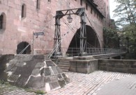
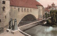
Nuremberg, Bavaria, Germany - Pegnitz River
| Bridgemeister ID: | 1111 (added 2004-01-04) |
| Year Completed: | 1824 |
| Name: | Kettensteg |
| Also Known As: | Chain |
| Location: | Nuremberg, Bavaria, Germany |
| Crossing: | Pegnitz River |
| Coordinates: | 49.45468 N 11.07076 E |
| Maps: | Acme, GeoHack, Google, OpenStreetMap |
| Principals: | Konrad Georg Kuppler |
| References: | PTS2 |
| Use: | Footbridge |
| Status: | In use (last checked: 2023) |
| Main Cables: | Eyebar (iron) |
| Suspended Spans: | 2 |
| Main Spans: | 1 x 29.6 meters (97.1 feet), 1 x 27.9 meters (91.5 feet) |
Notes:
- Often claimed to be the oldest surviving suspension bridge in continental Europe.
- 1909: Wooden towers are damaged by flood and eventually replaced with steel towers.
- 1930: Bridge deck is stiffened and several intermediate piers are added to support the bridge.
- 2010: Bridge is reconstructed retaining some original components and eliminating the need for the intermediate piers. The bridge is again functioning as a suspension bridge.
External Links:
1824: Lehigh Gap
Lehigh Gap, Pennsylvania, USA - Lehigh River
| Bridgemeister ID: | 22 (added before 2003) |
| Year Completed: | 1824 |
| Name: | Lehigh Gap |
| Also Known As: | Palmerton |
| Location: | Lehigh Gap, Pennsylvania, USA |
| Crossing: | Lehigh River |
| Principals: | Jacob Blumer |
| References: | AAJ, CAB, DSE20000203, WHSB |
| Use: | Vehicular |
| Status: | Replaced, 1933 |
| Main Cables: | Chain (iron) |
| Suspended Spans: | 3 |
Notes:
- Finley patent bridge.
External Links:

1824: Panteleimonovsky
St. Petersburg, Russia - Fontanka River
| Bridgemeister ID: | 3039 (added 2019-10-13) |
| Year Completed: | 1824 |
| Name: | Panteleimonovsky |
| Location: | St. Petersburg, Russia |
| Crossing: | Fontanka River |
| Coordinates: | 59.942160 N 30.338434 E |
| Maps: | Acme, GeoHack, Google, OpenStreetMap |
| Principals: | Wilhelm von Traitteur |
| Use: | Vehicular (two-lane), with walkway |
| Status: | Replaced, 1914 |
| Main Cables: | Chain (iron) |
| Suspended Spans: | 1 |
External Links:
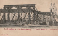
1824: Pochtamptsky
St. Petersburg, Russia
| Bridgemeister ID: | 972 (added 2003-11-13) |
| Year Completed: | 1824 |
| Name: | Pochtamptsky |
| Also Known As: | Pochamsky, Post Office, Pochtamtskiy |
| Location: | St. Petersburg, Russia |
| Coordinates: | 59.930532 N 30.300750 E |
| Maps: | Acme, GeoHack, Google, OpenStreetMap |
| Principals: | Wilhelm von Traitteur |
| References: | WIT |
| Use: | Footbridge |
| Status: | In use (last checked: 2019) |
| Main Cables: | Chain (iron) |
| Suspended Spans: | 1 |
External Links:
1824: Strážnice
Strážnice, Czechia - Velicka River
| Bridgemeister ID: | 6183 (added 2021-07-09) |
| Year Completed: | 1824 |
| Name: | Strážnice |
| Also Known As: | Straßnitz, Strassnitz |
| Location: | Strážnice, Czechia |
| Crossing: | Velicka River |
| At or Near Feature: | Chateau Strážnice |
| Principals: | Friedrich Schnirch |
| References: | AAJ, PTS2 |
| Status: | Removed |
| Main Cables: | Chain (iron) |
| Suspended Spans: | 1 |
| Main Span: | 1 x 27.7 meters (90.9 feet) |
| Deck width: | 4.2 meters |
Notes:
- Remains of this very early suspension bridge are supposedly kept on the grounds of Chateau Strážnice
External Links:
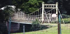
1824: Wissekerke
Bazel, Belgium
| Bridgemeister ID: | 1681 (added 2005-03-26) |
| Year Completed: | 1824 |
| Name: | Wissekerke |
| Location: | Bazel, Belgium |
| At or Near Feature: | Wissekerke Castle |
| Coordinates: | 51.145383 N 4.302667 E |
| Maps: | Acme, GeoHack, Google, OpenStreetMap |
| Principals: | Jean-Baptiste Vifquain |
| References: | IBB, ISFF |
| Status: | Closed, 1990 |
| Main Cables: | Eyebar (iron) |
| Suspended Spans: | 1 |
| Main Span: | 1 x 23.11 meters (75.8 feet) |
| Deck width: | 1.9 |
External Links:
1825: Burceña
Barakaldo and Bilbao, Spain
| Bridgemeister ID: | 5690 (added 2021-04-01) |
| Year Completed: | 1825 |
| Name: | Burceña |
| Location: | Barakaldo and Bilbao, Spain |
| Use: | Vehicular |
| Status: | Removed, c. 1870 |
| Main Cables: | Chain |
| Suspended Spans: | 1 |
Notes:
- May have been completed earlier, in 1824.
- 1835: Damaged during First Carlist War. Later rebuilt.
- c. 1870: Bridge collapses due to fire damage.
External Links:
1825: Pâquis
Geneva, Switzerland
| Bridgemeister ID: | 1825 (added 2005-05-30) |
| Year Completed: | 1825 |
| Name: | Pâquis |
| Location: | Geneva, Switzerland |
| Principals: | Guillame Henri Dufour |
| References: | AAJ, GHD |
| Status: | Demolished, early 1850's |
| Main Cables: | Wire (iron) |
| Suspended Spans: | 2 |
| Main Spans: | 2 x 41 meters (134.5 feet) |
1825: Sophienbrücke
Vienna, Austria - Donaukanal
| Bridgemeister ID: | 6181 (added 2021-07-09) |
| Year Completed: | 1825 |
| Name: | Sophienbrücke |
| Also Known As: | Sophia, Sophien, Sophie, Rotundenbrücke, Rotunda |
| Location: | Vienna, Austria |
| Crossing: | Donaukanal |
| Coordinates: | 48.205983 N 16.397243 E |
| Maps: | Acme, GeoHack, Google, OpenStreetMap |
| References: | AAJ, PTS2 |
| Use: | Vehicular |
| Status: | Replaced, 1872 |
| Main Cables: | Chain (iron) |
| Suspended Spans: | 1 |
Notes:
- The earliest of several chain suspension bridges built in Vienna in the 1820s and 1830s.
External Links:
1825: Tain-Tournon
Tournon-sur-Rhône, Ardèche and Tain, Drôme, France - Rhône River
| Bridgemeister ID: | 378 (added before 2003) |
| Year Completed: | 1825 |
| Name: | Tain-Tournon |
| Location: | Tournon-sur-Rhône, Ardèche and Tain, Drôme, France |
| Crossing: | Rhône River |
| Principals: | Marc Seguin |
| References: | AAJ, ASB, BBR, BPF, GHD, LAB, MOS, PTS2, TTSB |
| Use: | Vehicular |
| Status: | Removed, 1965 |
| Main Cables: | Wire (iron) |
| Suspended Spans: | 2 |
| Main Spans: | 2 x 85 meters (278.88 feet) |
| Deck width: | 13.75 feet |
Notes:
- Often credited as being the first large wire suspension bridge in France (and elsewhere). Rebuilt 1847 as a footbridge. Removed 1965.
- Near 1849 Marc Seguin - Tournon-sur-Rhône, Ardèche and Tain-L'Hermitage, Drôme, France.
- Near 1958 Gustave Toursier - Tournon-sur-Rhône, Ardèche and Tain-L'Hermitage, Drôme, France.
External Links:
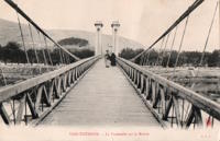
1826: (footbridge)
Milford, England, United Kingdom - River Derwent
| Bridgemeister ID: | 5550 (added 2020-12-14) |
| Year Completed: | 1826 |
| Name: | (footbridge) |
| Location: | Milford, England, United Kingdom |
| Crossing: | River Derwent |
| Coordinates: | 53.000982 N 1.479285 W |
| Maps: | Acme, GeoHack, Google, OpenStreetMap |
| Principals: | William Strutt |
| Use: | Footbridge |
| Status: | Removed, 1946 |
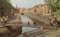
1826: Bankovsky
St. Petersburg, Russia - Griboedov Canal
| Bridgemeister ID: | 974 (added 2003-11-13) |
| Year Completed: | 1826 |
| Name: | Bankovsky |
| Also Known As: | Bank |
| Location: | St. Petersburg, Russia |
| Crossing: | Griboedov Canal |
| Coordinates: | 59.932193 N 30.325009 E |
| Maps: | Acme, GeoHack, Google, OpenStreetMap |
| Principals: | Wilhelm von Traitteur |
| References: | WIT |
| Use: | Footbridge |
| Status: | In use (last checked: 2019) |
| Main Cables: | Chain (iron) |
| Suspended Spans: | 1 |
| Deck width: | 1.85 meters |
Notes:
- Cable ends"swallowed" by four cast-iron decorative griffins.
External Links:
1826: Broughton
Lancashire, England, United Kingdom - River Irwell
| Bridgemeister ID: | 379 (added before 2003) |
| Year Completed: | 1826 |
| Name: | Broughton |
| Also Known As: | Gerald Road |
| Location: | Lancashire, England, United Kingdom |
| Crossing: | River Irwell |
| References: | AAJ, BOB, HBE, MOS, SBR |
| Use: | Vehicular |
| Status: | Replaced, 1914 |
| Main Cables: | Chain (iron) |
| Main Span: | 1 x 44.3 meters (145.5 feet) |
| Deck width: | 18.25 feet |
Notes:
- Famously collapsed under weight of marching troops April 12, 1831. Was rebuilt and strengthened and eventually replaced in 1914.
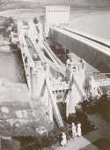
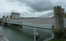
1826: Conwy
Conwy, Wales, United Kingdom - River Conwy
| Bridgemeister ID: | 380 (added before 2003) |
| Year Completed: | 1826 |
| Name: | Conwy |
| Also Known As: | Conway |
| Location: | Conwy, Wales, United Kingdom |
| Crossing: | River Conwy |
| Coordinates: | 53.280476 N 3.823742 W |
| Maps: | Acme, GeoHack, Google, OpenStreetMap |
| Principals: | Thomas Telford |
| References: | AAJ, BBR, BC3, BCO, BEM, HBE, MOS, NTB, PTS2 |
| Use: | Vehicular |
| Status: | Restricted to foot traffic (last checked: 2021) |
| Main Cables: | Chain (iron) |
| Suspended Spans: | 1 |
| Main Span: | 1 x 99.7 meters (327 feet) |
Notes:
- 1904: Major reinforcement and strengthening project.
- 2008, February: Major refurbishment project completed.
- Next to 1904 (footbridge) - Conwy, Wales, United Kingdom.
Annotated Citations:
- "Conway Suspension Bridge." The Engineer, 20 May 1904.
Details regarding the 1904 reinforcement project: "...It was therefore decided to renew all the suspension rods, and pins, and to fix steel cables above the suspension links, to supplement them so that the maximum stress in the links due to any possible travelling load should not exceed 5 tons per square inch. It was also decided to build a stiffening girder coupled to the suspension rod on each side of the bridge, and at the same time to widen the bridge by building a footway 6ft. wide outside the suspenders on the north side of the bridge."
External Links:
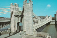
1826: Egyptian
St. Petersburg, Russia - Fontanka River
| Bridgemeister ID: | 622 (added 2003-01-20) |
| Year Completed: | 1826 |
| Name: | Egyptian |
| Also Known As: | Египетский |
| Location: | St. Petersburg, Russia |
| Crossing: | Fontanka River |
| Coordinates: | 59.916930 N 30.297185 E |
| Maps: | Acme, GeoHack, Google, OpenStreetMap |
| References: | PTS2 |
| Use: | Vehicular |
| Status: | Collapsed, 1905 |
| Main Cables: | Chain (iron) |
| Suspended Spans: | 1 |
External Links:

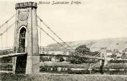
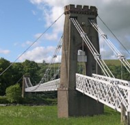
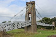
1826: Gattonside
Melrose, Scotland, United Kingdom - River Tweed
| Bridgemeister ID: | 381 (added before 2003) |
| Year Completed: | 1826 |
| Name: | Gattonside |
| Also Known As: | Melrose |
| Location: | Melrose, Scotland, United Kingdom |
| Crossing: | River Tweed |
| Coordinates: | 55.602830 N 2.723349 W |
| Maps: | Acme, GeoHack, Google, OpenStreetMap |
| Principals: | Redpath and Brown |
| References: | BC2, BSI, NTB |
| Use: | Footbridge |
| Status: | In use (last checked: 2014) |
| Main Cables: | Chain (iron) |
| Suspended Spans: | 3 |
| Main Span: | 1 x 91.4 meters (300 feet) |
| Side Spans: | 2 |
| Deck width: | 4 feet 4 inches |
Notes:
- Steel cables added, 1992.
External Links:
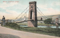
1826: Invalides
Paris, France - Seine River
| Bridgemeister ID: | 623 (added 2003-01-20) |
| Year Completed: | 1826 |
| Name: | Invalides |
| Location: | Paris, France |
| Crossing: | Seine River |
| Principals: | Claude Navier |
| References: | AAJ, MOS, PTS2 |
| Use: | Vehicular |
| Status: | Demolished, 1826 |
| Main Span: | 1 x 169.9 meters (557.5 feet) |
Notes:
- Failed when almost complete in 1826. MOS: "On the 6th of September, a water-pipe, which was laid in the ground on the side of the Champs Elysées, and came near the abutments on that side of the river, burst, and, softening the ground about the abutment, it gave way under the strain produced by the weight of the bridge."
- Replaced by 1829 Invalides (l'Allee-d'Antin) - Paris, France.
External Links:
1826: Jarnac
Jarnac, Charente, France - Charente River
| Bridgemeister ID: | 1729 (added 2005-04-06) |
| Year Completed: | 1826 |
| Name: | Jarnac |
| Location: | Jarnac, Charente, France |
| Crossing: | Charente River |
| Principals: | J. P. Quénot |
| References: | MOS |
| Use: | Vehicular |
| Status: | Removed |
| Main Cables: | Chain (iron) |
| Suspended Spans: | 1 |
| Main Span: | 1 x 70 meters (229.7 feet) |
| Deck width: | 7.75 meters |
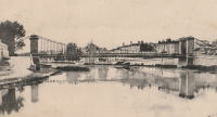
1826: Kidderpore
Khidirpur, Kolkata, West Bengal, India - Tolly's Nullah (Adi Ganga)
| Bridgemeister ID: | 3548 (added 2019-12-25) |
| Year Completed: | 1826 |
| Name: | Kidderpore |
| Also Known As: | Kyderpoor |
| Location: | Khidirpur, Kolkata, West Bengal, India |
| Crossing: | Tolly's Nullah (Adi Ganga) |
| Principals: | Captain Hugh Baker |
| References: | HJC, ISB |
| Use: | Vehicular |
| Status: | Removed |
| Main Cables: | Chain (iron) |
| Suspended Spans: | 1 |
| Main Span: | 1 x 42.7 meters (140 feet) |
| Deck width: | 22 feet |
1826: Lviny
St. Petersburg, Russia - Griboedov Canal
| Bridgemeister ID: | 973 (added 2003-11-13) |
| Year Completed: | 1826 |
| Name: | Lviny |
| Also Known As: | Lions |
| Location: | St. Petersburg, Russia |
| Crossing: | Griboedov Canal |
| Coordinates: | 59.926918 N 30.301404 E |
| Maps: | Acme, GeoHack, Google, OpenStreetMap |
| Principals: | Wilhem von Traitteur |
| References: | WIT |
| Use: | Footbridge |
| Status: | In use (last checked: 2019) |
| Main Cables: | Chain (iron) |
| Suspended Spans: | 1 |
| Main Span: | 1 x 22.4 meters (73.5 feet) |
| Deck width: | 2.26 meters |
Notes:
- Cable ends "swallowed" by four cast-iron decorative lions at each end.
External Links:
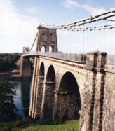
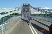
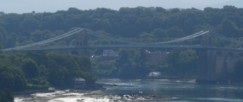
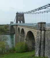
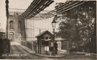
1826: Menai Strait
Menai Bridge and Bangor vicinity, Wales, United Kingdom - Menai Strait
| Bridgemeister ID: | 382 (added before 2003) |
| Year Completed: | 1826 |
| Name: | Menai Strait |
| Location: | Menai Bridge and Bangor vicinity, Wales, United Kingdom |
| Crossing: | Menai Strait |
| Coordinates: | 53.221367 N 4.1646 W |
| Maps: | Acme, GeoHack, Google, OpenStreetMap |
| Principals: | Thomas Telford |
| References: | AAJ, BBR, BC3, BCO, BDU, BEM, BOU, HBE, MOS, NTB, PTS2 |
| Use: | Vehicular (two-lane), with walkway |
| Status: | In use (last checked: 2022) |
| Main Cables: | Chain (iron) |
| Suspended Spans: | 1 |
| Main Span: | 1 x 176.5 meters (579 feet) |
Notes:
- 1839 (or 1840): Restored. Deck strengthened.
- 1893: Original wood deck replaced with a steel deck.
- 1938-1940: Original wrought-iron chains replaced with steel eyebars, deck strengthened.
- 1999: Deck resurfaced and other improvements to strengthen bridge.
- 2020: Major maintenance project planned to start January, 2021.
- 2022, October: Closed due to serious structural concerns. Expected to reopen January 2023 with a weight restriction.
- Became longest suspension bridge by eclipsing 1820 Union - Horncliffe, Berwick-upon-Tweed vicinity, England and Fishwick, Scotland, United Kingdom.
- Eclipsed by new longest suspension bridge 1834 Zaehringen (Grand Pont Suspendu) - Fribourg, Switzerland.
External Links:
1826: Vermontois
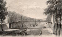
Péruwelz, Belgium - Pommerœul-Antoing Canal
| Bridgemeister ID: | 6629 (added 2021-09-07) |
| Year Completed: | 1826 |
| Name: | Vermontois |
| Location: | Péruwelz, Belgium |
| Crossing: | Pommerœul-Antoing Canal |
| Principals: | Pierre Simons |
| References: | IBB |
| Status: | Replaced, 1866 |
| Suspended Spans: | 1 |
| Main Span: | 1 x 36.7 meters (120.4 feet) estimated |
Notes:
- IBB: Replaced in 1866. Multiple figures exist for main span length: 36.4, 36.7, and 40 meters.
1826: Warden
Northumberland, England, United Kingdom - South Tyne River
| Bridgemeister ID: | 383 (added before 2003) |
| Year Completed: | 1826 |
| Name: | Warden |
| Also Known As: | Hexham, West Boat |
| Location: | Northumberland, England, United Kingdom |
| Crossing: | South Tyne River |
| Coordinates: | 54.988277 N 2.141917 W |
| Maps: | Acme, GeoHack, Google, OpenStreetMap |
| Principals: | Sir Samuel Brown |
| References: | SBR |
| Use: | Vehicular (one-lane) |
| Status: | Replaced, 1903 |
| Main Cables: | Chain (iron) |
| Suspended Spans: | 1 |
Notes:
- SBR: Replaced, 1903.
External Links:
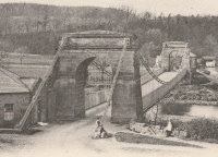
1826: Welney
Welney, England, United Kingdom - Hundred Foot River
| Bridgemeister ID: | 384 (added before 2003) |
| Year Completed: | 1826 |
| Name: | Welney |
| Location: | Welney, England, United Kingdom |
| Crossing: | Hundred Foot River |
| Principals: | Sir Samuel Brown |
| References: | SBR |
| Use: | Vehicular |
| Status: | Replaced, c. 1926 |
| Main Cables: | Chain (iron) |
Notes:
- Likely replaced 1926. SBR: Replaced "1926 or 1927". Design by Brown.
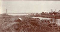
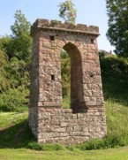
1827: (footbridge)
Denholm, Scotland, United Kingdom - River Teviot
| Bridgemeister ID: | 1555 (added 2004-11-24) |
| Year Completed: | 1827 |
| Name: | (footbridge) |
| Location: | Denholm, Scotland, United Kingdom |
| Crossing: | River Teviot |
| Coordinates: | 55.460001 N 2.686394 W |
| Maps: | Acme, GeoHack, Google, OpenStreetMap |
| Use: | Footbridge |
| Status: | Only towers remain, since 1875 (last checked: 2009) |
| Main Cables: | Chain (iron) |
1827: (suspension bridge)
Newburyport, Massachusetts, USA - Merrimack River
| Bridgemeister ID: | 23 (added before 2003) |
| Year Completed: | 1827 |
| Name: | (suspension bridge) |
| Location: | Newburyport, Massachusetts, USA |
| Crossing: | Merrimack River |
| Principals: | Thomas Haven |
| References: | AAJ, BPL, HBE, PTS2 |
| Status: | Replaced, 1840 |
| Main Cables: | Chain (iron) |
| Suspended Spans: | 5 |
| Main Spans: | 3 |
| Side Spans: | 2 |
Notes:
- Multi-span structure distinct from Templeman's 1810 Chain Bridge. Sometimes misidentified as an 1827 replacement to the 1810 Templeman Chain Bridge because of the significant damage to the Templeman bridge in 1827.
External Links:

1827: Andance
Andance, Ardèche and Andancette, Drôme, France - Rhône River
| Bridgemeister ID: | 976 (added 2003-11-14) |
| Year Completed: | 1827 |
| Name: | Andance |
| Location: | Andance, Ardèche and Andancette, Drôme, France |
| Crossing: | Rhône River |
| Coordinates: | 45.242194 N 4.801638 E |
| Maps: | Acme, GeoHack, Google, OpenStreetMap |
| Principals: | Marc Seguin |
| References: | AAJ, ASB |
| Use: | Vehicular (one-lane) |
| Status: | In use (last checked: 2009) |
| Main Cables: | Wire (iron) |
| Suspended Spans: | 2 |
| Main Spans: | 2 |
Notes:
- Destroyed August 30, 1944. Rebuilt 1946.
External Links:
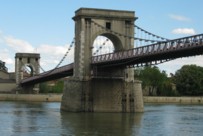
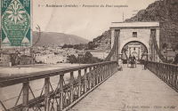
1827: Hammersmith
London, England, United Kingdom - River Thames
| Bridgemeister ID: | 386 (added before 2003) |
| Year Completed: | 1827 |
| Name: | Hammersmith |
| Location: | London, England, United Kingdom |
| Crossing: | River Thames |
| Principals: | William Tierney Clark |
| References: | AAJ, BEM, BTH, HBE, MOS, NTB, ONF, PTS2 |
| Use: | Vehicular, with walkway |
| Status: | Replaced |
| Main Cables: | Chain |
| Suspended Spans: | 3 |
| Main Span: | 1 x 121.9 meters (400 feet) |
| Side Spans: | 2 x 44.8 meters (147 feet) |
Notes:
- Replaced by 1887 Hammersmith - London, England, United Kingdom.
External Links:
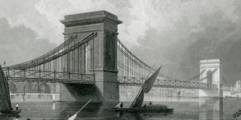
1827: Kettenbrücke
Žatec, Czechia - Ohre River
| Bridgemeister ID: | 6182 (added 2021-07-09) |
| Year Completed: | 1827 |
| Name: | Kettenbrücke |
| Also Known As: | Saaz |
| Location: | Žatec, Czechia |
| Crossing: | Ohre River |
| Principals: | Friedrich Schnirch |
| Use: | Vehicular |
| Status: | Removed, c. 1891 |
| Main Cables: | Chain (iron) |
| Suspended Spans: | 1 |
| Main Span: | 1 x 59.7 meters (195.9 feet) |
| Deck width: | 5.5 meters |
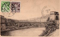
1827: L'île Barbe
Lyon, Métropole de Lyon, France - Saône River
| Bridgemeister ID: | 1535 (added 2004-10-31) |
| Year Completed: | 1827 |
| Name: | L'île Barbe |
| Location: | Lyon, Métropole de Lyon, France |
| Crossing: | Saône River |
| Coordinates: | 45.796883 N 4.83055 E |
| Maps: | Acme, GeoHack, Google, OpenStreetMap |
| Principals: | Favier |
| References: | AAJ, PQL, PTS2 |
| Use: | Vehicular (one-lane) |
| Status: | In use (last checked: 2005) |
| Main Cables: | Chain (iron) |
| Suspended Spans: | 2 |
| Main Spans: | 2 x 10² meters (334.66 feet) |
Notes:
- Originally built with iron chains. Later replaced with iron wire.
- Near 1831 Masaryk (Masarik, Mazarik, de la Gare) - Lyon vicinity, Métropole de Lyon, France.
External Links:
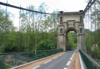
1827: Malapane
Ozimek, Lower Silesia, Poland - Mała Panew
| Bridgemeister ID: | 385 (added before 2003) |
| Year Completed: | 1827 |
| Name: | Malapane |
| Also Known As: | Malapana |
| Location: | Ozimek, Lower Silesia, Poland |
| Crossing: | Mała Panew |
| Coordinates: | 50.676403 N 18.212243 E |
| Maps: | Acme, GeoHack, Google, OpenStreetMap |
| References: | AAJ |
| Use: | Vehicular (one-lane) |
| Status: | Restricted to foot traffic (last checked: 2019) |
| Main Cables: | Chain (iron) |
| Suspended Spans: | 1 |
Notes:
- The country of this bridge's location has changed several times. It is currently located in Poland where the river is known as "Mala Panew". AAJ records this bridge as serving the "Malapana mill" across the "Malapane River". "Malapane" is the German name for the Mała Panew river.
External Links:
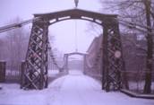
1827: Tollygunge
Tollygunge, Kolkata, West Bengal, India - Tolly's Nullah (Adi Ganga)
| Bridgemeister ID: | 3553 (added 2019-12-26) |
| Year Completed: | 1827 |
| Name: | Tollygunge |
| Also Known As: | Tollygunj |
| Location: | Tollygunge, Kolkata, West Bengal, India |
| Crossing: | Tolly's Nullah (Adi Ganga) |
| Principals: | Captain Hugh Baker |
| References: | ISB |
| Use: | Vehicular |
| Status: | Removed |
| Main Cables: | Chain (iron) |
| Suspended Spans: | 1 |
| Main Span: | 1 x 34 meters (111.5 feet) |
| Deck width: | 14 feet |
1828: Arcole
Paris, France - Seine River
| Bridgemeister ID: | 625 (added 2003-01-20) |
| Year Completed: | 1828 |
| Name: | Arcole |
| Also Known As: | de la Grève |
| Location: | Paris, France |
| Crossing: | Seine River |
| Principals: | Seguin Brothers |
| References: | AAJ, MOS, PTS2 |
| Status: | Replaced, 1854 |
| Main Cables: | Wire (iron) |
| Suspended Spans: | 2 |
| Main Spans: | 2 x 40.8 meters (133.86 feet) |
| Deck width: | 11.48 feet |
External Links:
1828: Auvers
Auvers-sur-Oise and Méry-sur-Oise, Val-d'Oise, France - Oise River
| Bridgemeister ID: | 1717 (added 2005-04-05) |
| Year Completed: | 1828 |
| Name: | Auvers |
| Location: | Auvers-sur-Oise and Méry-sur-Oise, Val-d'Oise, France |
| Crossing: | Oise River |
| Status: | Failed, 1887 |
Notes:
- Destroyed 1870. Rebuilt 1873.
External Links:
1828: Doux
St Jean de Muzols and Tournon-sur-Rhône, Ardèche, France - Doux River
| Bridgemeister ID: | 1984 (added 2005-12-02) |
| Year Completed: | 1828 |
| Name: | Doux |
| Location: | St Jean de Muzols and Tournon-sur-Rhône, Ardèche, France |
| Crossing: | Doux River |
| Coordinates: | 45.074384 N 4.816741 E |
| Maps: | Acme, GeoHack, Google, OpenStreetMap |
| Status: | Removed, 1857 |
Notes:
External Links:
1828: Guriah Hath
Kolkata, West Bengal, India - Tolly's Nulla (Adi Ganga)
| Bridgemeister ID: | 3554 (added 2019-12-26) |
| Year Completed: | 1828 |
| Name: | Guriah Hath |
| Location: | Kolkata, West Bengal, India |
| Crossing: | Tolly's Nulla (Adi Ganga) |
| Principals: | Captain Hugh Baker |
| References: | ISB |
| Use: | Vehicular |
| Status: | Removed |
| Main Cables: | Chain (iron) |
| Suspended Spans: | 1 |
| Main Span: | 1 x 34.7 meters (114 feet) |
| Deck width: | 14 feet |
1828: Karlskettensteg
Vienna, Austria - Danube Canal
| Bridgemeister ID: | 4594 (added 2020-06-06) |
| Year Completed: | 1828 |
| Name: | Karlskettensteg |
| Also Known As: | Charles, Karls |
| Location: | Vienna, Austria |
| Crossing: | Danube Canal |
| Coordinates: | 48.214324 N 16.374969 E |
| Maps: | Acme, GeoHack, Google, OpenStreetMap |
| References: | AAJ, PTS2 |
| Use: | Vehicular |
| Status: | Demolished, 1870 |
| Main Cables: | Eyebar (iron) |
| Suspended Spans: | 1 |
External Links:
1828: Sablons
Sablons, Isère and Serrières, Ardèche, France - Rhône River
| Bridgemeister ID: | 890 (added 2003-09-06) |
| Year Completed: | 1828 |
| Name: | Sablons |
| Location: | Sablons, Isère and Serrières, Ardèche, France |
| Crossing: | Rhône River |
| Principals: | Marc Seguin |
| References: | AAJ, ASB |
| Use: | Vehicular |
| Status: | Replaced, 1933 |
| Main Cables: | Wire (iron) |
| Main Spans: | 2 x 101 meters (331.38 feet) |
| Deck width: | 13.12 feet |
Notes:
External Links:
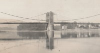
1828: San Benedetto
Padua, Padua, Italy - Bacchiglione River
| Bridgemeister ID: | 7940 (added 2023-10-29) |
| Year Completed: | 1828 |
| Name: | San Benedetto |
| Location: | Padua, Padua, Italy |
| Crossing: | Bacchiglione River |
| Coordinates: | 45.408364 N 11.868094 E |
| Maps: | Acme, GeoHack, Google, OpenStreetMap |
| Use: | Footbridge |
| Status: | Replaced, 1881 |
| Main Cables: | Chain (iron) |
| Suspended Spans: | 1 |
Notes:
- Strong resemblance to what Ted Ruddock has referred to as "blacksmith suspension bridges" of the early 19th century.
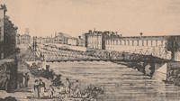
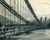
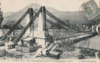
1828: Sassenage
Sassenage and Grenoble, Isère, France - Drac River
| Bridgemeister ID: | 1728 (added 2005-04-06) |
| Year Completed: | 1828 |
| Name: | Sassenage |
| Location: | Sassenage and Grenoble, Isère, France |
| Crossing: | Drac River |
| Use: | Vehicular |
| Status: | Replaced, 1938 |
| Main Cables: | Chain (iron) |
| Suspended Spans: | 1 |
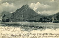
1828: South Stack
Holyhead, Wales, United Kingdom
| Bridgemeister ID: | 1212 (added 2004-02-08) |
| Year Completed: | 1828 |
| Name: | South Stack |
| Location: | Holyhead, Wales, United Kingdom |
| At or Near Feature: | Goleudy Ynys Lawd (Ynys Lawd Lighthouse) |
| Coordinates: | 53.306972 N 4.696822 W |
| Maps: | Acme, GeoHack, Google, OpenStreetMap |
| Use: | Footbridge |
| Status: | Only towers remain |
| Main Cables: | Chain |
| Suspended Spans: | 1 |
| Main Span: | 1 x 37 meters (121.4 feet) estimated |
Notes:
- Provided access to the lighthouse at South Stack. Iron chain suspension system replaced in 1964, surviving until until 1983, but unclear if it was still functioning as a suspension bridge. Towers are now used as abutments for a pedestrian truss bridge.


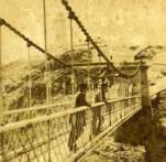
1829: Argentat
Argentat, Corrèze, France - Dordogne River
| Bridgemeister ID: | 627 (added 2003-01-20) |
| Year Completed: | 1829 |
| Name: | Argentat |
| Also Known As: | Marie |
| Location: | Argentat, Corrèze, France |
| Crossing: | Dordogne River |
| Principals: | L. T. Vicat |
| References: | AAJ, MOS, PTS2 |
| Use: | Vehicular, with walkway |
| Status: | Replaced, 1903 |
| Main Cables: | Wire (iron) |
| Suspended Spans: | 1 |
| Main Span: | 1 x 100 meters (328 feet) |
External Links:
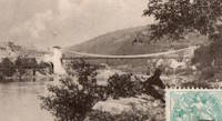
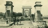
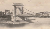
1829: Beaucaire
Beaucaire, Gard and Tarascon, Bouches-du-Rhône, France - Rhône River
| Bridgemeister ID: | 626 (added 2003-01-20) |
| Year Completed: | 1829 |
| Name: | Beaucaire |
| Location: | Beaucaire, Gard and Tarascon, Bouches-du-Rhône, France |
| Crossing: | Rhône River |
| Principals: | Jules Seguin, Joseph Chaley |
| References: | AAJ, ASB, GHD, PTS2 |
| Use: | Vehicular |
| Status: | Destroyed, August 6, 1944 |
| Main Cables: | Wire (iron) |
| Suspended Spans: | 4 |
| Main Spans: | 2 x 120 meters (393.72 feet) |
| Side Spans: | 2 x 93.6 meters (307.1 feet) |
Notes:
- 1887: Flooring failed.
- 1944: Bombed by Allied Forces, August 6.
External Links:
1829: Chain
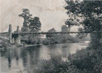
Kemeys Commander, Wales, United Kingdom - River Usk
| Bridgemeister ID: | 7961 (added 2023-11-22) |
| Year Completed: | 1829 |
| Name: | Chain |
| Location: | Kemeys Commander, Wales, United Kingdom |
| Crossing: | River Usk |
| Coordinates: | 51.745000 N 2.948227 W |
| Maps: | Acme, GeoHack, Google, OpenStreetMap |
| Use: | Vehicular |
| Status: | Replaced, 1906 |
| Main Cables: | Chain (iron) |
| Suspended Spans: | 1 |
Notes:
- 1906: Replaced by a non-suspension bridge still referred to as "Chainbridge".
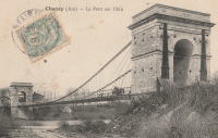
| Bridgemeister ID: | 3217 (added 2019-11-11) |
| Year Completed: | 1829 |
| Name: | Chazey |
| Location: | Chazey-sur-Ain, Ain, France |
| Crossing: | Ain River |
| Principals: | Joseph Chaley, Jules Seguin, Marc Seguin |
| Use: | Vehicular |
| Status: | Destroyed, December, 1944 |
| Main Cables: | Wire (iron) |
| Suspended Spans: | 1 |
| Main Span: | 1 x 125 meters (410.1 feet) |
External Links:
1829: Invalides
Paris, France - Seine River
| Bridgemeister ID: | 633 (added 2003-01-20) |
| Year Completed: | 1829 |
| Name: | Invalides |
| Also Known As: | l'Allee-d'Antin |
| Location: | Paris, France |
| Crossing: | Seine River |
| Principals: | Marie Fortuné de Vergès, Ferdinand Bayard de la Vingtrie |
| References: | AAJ, MOS, PTS2 |
| Use: | Vehicular, with walkway |
| Status: | Replaced, 1855 |
| Main Cables: | Chain (iron) |
| Main Span: | 1 x 72.1 meters (236.5 feet) |
| Deck width: | 25.6 feet |
Notes:
- Replaced 1826 Invalides - Paris, France.
External Links:
1829: Kettenbrücke
Bamberg, Germany - Regnitz River
| Bridgemeister ID: | 632 (added 2003-01-20) |
| Year Completed: | 1829 |
| Name: | Kettenbrücke |
| Also Known As: | Ludwigsbrücke, Chain |
| Location: | Bamberg, Germany |
| Crossing: | Regnitz River |
| Coordinates: | 49.896400 N 10.891386 E |
| Maps: | Acme, GeoHack, Google, OpenStreetMap |
| References: | AAJ, PTS2 |
| Status: | Replaced, c. 1892 |
| Main Cables: | Chain (iron) |
| Main Span: | 1 x 64.26 meters (210.8 feet) |
1829: Middleham
Middleham and Leyburn, England, United Kingdom - River Ure
| Bridgemeister ID: | 387 (added before 2003) |
| Year Completed: | 1829 |
| Name: | Middleham |
| Location: | Middleham and Leyburn, England, United Kingdom |
| Crossing: | River Ure |
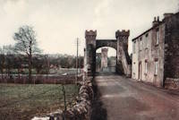
| Coordinates: | 54.294316 N 1.818643 W |
| Maps: | Acme, GeoHack, Google, OpenStreetMap |
| Principals: | Edward Welch, Joseph Hansom |
| References: | NTB |
| Use: | Vehicular |
| Status: | Only towers remain (last checked: 2023) |
| Suspended Spans: | 1 |
Notes:
- 1830: Said to have collapsed under weight of cattle in 1830. At some point it was rebuilt as a non-suspension bridge with the original suspension bridge towers intact. The current (in the 2020s and for many years before) main span is steel plate girder.
1829: Montrose
Montrose, Scotland, United Kingdom - South Esk River
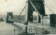
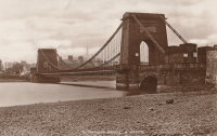
| Bridgemeister ID: | 388 (added before 2003) |
| Year Completed: | 1829 |
| Name: | Montrose |
| Location: | Montrose, Scotland, United Kingdom |
| Crossing: | South Esk River |
| Coordinates: | 56.705802 N 2.475390 W |
| Maps: | Acme, GeoHack, Google, OpenStreetMap |
| Principals: | Sir Samuel Brown |
| References: | AAJ, BEM, BOB, HBE, PTS2, SBR |
| Use: | Vehicular |
| Status: | Demolished, 1929 |
| Main Cables: | Chain (iron) |
| Suspended Spans: | 1 |
Notes:
- SBR: March 19, 1830, with a "crowd of people, estimated at 700, ... watching a boat race," a chain broke "plunging most of the people into the river." Repaired.
- 1838: Wrecked by storm. Repaired.

1829: Palais de Justice
Lyon, Métropole de Lyon, France - Saône River
| Bridgemeister ID: | 546 (added before 2003) |
| Year Completed: | 1829 |
| Name: | Palais de Justice |
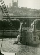
| Location: | Lyon, Métropole de Lyon, France |
| Crossing: | Saône River |
| Principals: | Seguin Brothers |
| References: | PQL |
| Use: | Vehicular |
| Status: | Replaced, 1972 |
| Main Cables: | Wire (iron) |
Notes:
- Damaged by flood, 1840. Rebuilt. Bombed, 1944. Repaired, 1945. Location now occupied by a cable-stayed footbridge, completed 1986.
External Links:
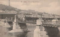
1829: Port-Sainte-Foy
Port-Sainte-Foy-et-Ponchapt, Dordogne and Sainte-Foy-la-Grande, Gironde, France - Dordogne River
| Bridgemeister ID: | 7351 (added 2022-10-22) |
| Year Completed: | 1829 |
| Name: | Port-Sainte-Foy |
| Location: | Port-Sainte-Foy-et-Ponchapt, Dordogne and Sainte-Foy-la-Grande, Gironde, France |
| Crossing: | Dordogne River |
| Coordinates: | 44.842132 N 0.211552 E |
| Maps: | Acme, GeoHack, Google, OpenStreetMap |
| Use: | Vehicular (one-lane) |
| Status: | Replaced |
| Main Cables: | Wire |
| Suspended Spans: | 2 |
| Main Spans: | 2 |
Notes:
- Replaced by 1897 Port-Sainte-Foy - Port-Sainte-Foy-et-Ponchapt, Dordogne and Sainte-Foy-la-Grande, Gironde, France.
External Links:
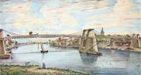
| Bridgemeister ID: | 7574 (added 2023-04-21) |
| Year Completed: | 1829 |
| Name: | Thoirette |
| Location: | Thoirette, Jura and Ain, France |
| Crossing: | Ain River |
| Coordinates: | 46.268283 N 5.536277 E |
| Maps: | Acme, GeoHack, Google, OpenStreetMap |
| References: | AGP |
| Status: | Replaced |
| Suspended Spans: | 1 |
Notes:
- Replaced by 1858 Thoirette - Thoirette, Jura and Ain, France.
External Links:
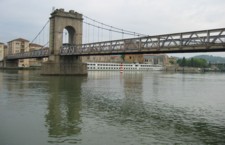
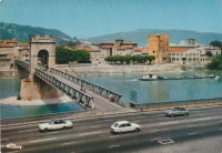
1829: Vienne
Vienne, Isère and Sainte-Colombe, Rhône, France - Rhône River
| Bridgemeister ID: | 977 (added 2003-11-15) |
| Year Completed: | 1829 |
| Name: | Vienne |
| Location: | Vienne, Isère and Sainte-Colombe, Rhône, France |
| Crossing: | Rhône River |
| Coordinates: | 45.524867 N 4.87035 E |
| Maps: | Acme, GeoHack, Google, OpenStreetMap |
| Principals: | Marc Seguin |
| References: | AAJ, ASB |
| Use: | Vehicular (one-lane) |
| Status: | Restricted to foot traffic (last checked: 2005) |
| Main Cables: | Wire (iron) |
| Suspended Spans: | 2 |
| Main Spans: | 2 |
Notes:
- Damaged by flood in 1840. Rebuilt.
External Links:
1830: (suspension bridge)
Nassau, Germany - Lahn River
| Bridgemeister ID: | 1667 (added 2005-03-20) |
| Year Completed: | 1830 |
| Name: | (suspension bridge) |
| Location: | Nassau, Germany |
| Crossing: | Lahn River |
| Coordinates: | 50.311559 N 7.796206 E |
| Maps: | Acme, GeoHack, Google, OpenStreetMap |
| Principals: | Lossen and Wolf |
| References: | AAJ |
| Use: | Vehicular |
| Status: | Replaced, 1926 |
| Main Cables: | Chain (iron) |
| Suspended Spans: | 3 |
| Main Span: | 1 x 74.8 meters (245.56 feet) |
| Side Spans: | 2 x 11.9 meters (38.88 feet) |
Notes:
- Replaced by 1926 Nassau - Nassau, Rheinland-Pfalz, Germany.
External Links:
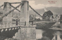
1830: Barrackpore
Kolkata, West Bengal, India - Circular Canal
| Bridgemeister ID: | 3560 (added 2019-12-26) |
| Year Completed: | 1830 |
| Name: | Barrackpore |
| Also Known As: | Barrackpoor, Shambazar |
| Location: | Kolkata, West Bengal, India |
| Crossing: | Circular Canal |
| Principals: | James Prinsep, Captain Hugh Baker |
| References: | ISB |
| Use: | Vehicular (three-lane) |
| Status: | Removed |
| Main Cables: | Chain (iron) |
| Suspended Spans: | 1 |
| Main Span: | 1 x 30.5 meters (100 feet) |
| Deck width: | 30 feet |
Notes:
- ISB describes its location: "...is situated half a mile from the mouth of the Circular Canal on the great road to Barrackpoor."
1830: Beose
Sagar, Madhya Pradesh, India
| Bridgemeister ID: | 3282 (added 2019-11-23) |
| Year Completed: | 1830 |
| Name: | Beose |
| Also Known As: | Presgrave's |
| Location: | Sagar, Madhya Pradesh, India |
| Principals: | Duncan Presgrave |
| References: | AAJ, ISB |
| Use: | Vehicular |
| Main Cables: | Eyebar (iron) |
| Main Span: | 1 x 61 meters (200 feet) |
Notes:
- Described as crossing the "Beose River" but the only references to a river by that name come from contemporary descriptions of this bridge.
1830: Boharm
Boat o' Brig, Fochabers, Scotland, United Kingdom - River Spey
| Bridgemeister ID: | 4844 (added 2020-07-11) |
| Year Completed: | 1830 |
| Name: | Boharm |
| Also Known As: | Boat of Bridge, Boat o' Brig, New, Delfur |
| Location: | Boat o' Brig, Fochabers, Scotland, United Kingdom |
| Crossing: | River Spey |
| Coordinates: | 57.550528 N 3.140743 W |
| Maps: | Acme, GeoHack, Google, OpenStreetMap |
| Principals: | Sir Samuel Brown |
| Use: | Vehicular (one-lane) |
| Status: | Replaced, 1956 |
| Main Cables: | Chain (iron) |
| Suspended Spans: | 1 |
Notes:
- Completed 1830 or 1832.
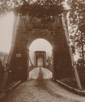
1830: Boitakhana
Kolkata, West Bengal, India - Circular Canal
| Bridgemeister ID: | 3565 (added 2019-12-26) |
| Year Completed: | 1830 |
| Name: | Boitakhana |
| Also Known As: | Baliaghata |
| Location: | Kolkata, West Bengal, India |
| Crossing: | Circular Canal |
| Principals: | James Prinsep |
| References: | ISB |
| Use: | Vehicular |
| Status: | Removed |
| Main Cables: | Chain (iron) |
| Suspended Spans: | 1 |
| Main Span: | 1 x 30.5 meters (100 feet) |
| Deck width: | 18 feet |
Notes:
- ISB describes its location: "is the last or most southerly [of the chain suspension bridges] on the Circular Canal, being distant 3-1/2 miles from its mouth and a quarter of a mile from its junction with the Baliaghata and Circular Canals. It forms the principal line of communication between Calcutta (by the Lall-Bazar, Bow-Bazar and Boitakhana Streets,) Sealda, Soora and Baliaghata."
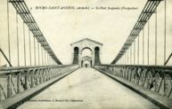
1830: Bourg-Saint-Andéol
Bourg-Saint-Andéol, Ardèche, France - Rhône River
| Bridgemeister ID: | 1719 (added 2005-04-05) |
| Year Completed: | 1830 |
| Name: | Bourg-Saint-Andéol |
| Location: | Bourg-Saint-Andéol, Ardèche, France |
| Crossing: | Rhône River |
| References: | AAJ |
| Use: | Vehicular |
| Status: | Replaced, 1971 |
| Main Cables: | Wire (iron) |
| Suspended Spans: | 3 |
| Main Spans: | 1 x 88.9 meters (291.7 feet), 1 x 85.7 meters (281.2 feet), 1 x 87 meters (285.4 feet) |
Notes:
- 1944: Heavily damaged.
- 1945: Repaired and reopened.
- Similar to Saint-Vallier - Saint-Vallier, Drôme, France.
External Links:
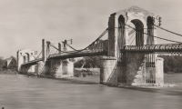
1830: Feurs
Feurs, Loire, France - Loire River
| Bridgemeister ID: | 1543 (added 2004-11-03) |
| Year Completed: | 1830 |
| Name: | Feurs |
| Location: | Feurs, Loire, France |
| Crossing: | Loire River |
| Principals: | Jules Seguin |
| References: | GHD |
| Use: | Vehicular |
| Status: | Demolished, 1925 |
| Main Cables: | Wire (iron) |
| Suspended Spans: | 2 |
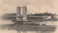
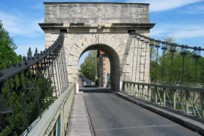
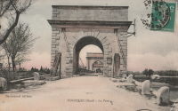
1830: Fourques
Fourques, Gard and Arles, Bouches-du-Rhône, France - Petit Rhône River
| Bridgemeister ID: | 1040 (added 2003-12-06) |
| Year Completed: | 1830 |
| Name: | Fourques |
| Location: | Fourques, Gard and Arles, Bouches-du-Rhône, France |
| Crossing: | Petit Rhône River |
| Coordinates: | 43.688722 N 4.613472 E |
| Maps: | Acme, GeoHack, Google, OpenStreetMap |
| Principals: | Seguin Brothers |
| References: | BPF |
| Use: | Vehicular (one-lane) |
| Status: | In use (last checked: 2020) |
| Main Cables: | Wire (iron) |
| Suspended Spans: | 2 |
| Main Spans: | 2 |
External Links:
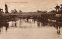
1830: Grosvenor
Bath, England, United Kingdom - River Avon
| Bridgemeister ID: | 389 (added before 2003) |
| Year Completed: | 1830 |
| Name: | Grosvenor |
| Location: | Bath, England, United Kingdom |
| Crossing: | River Avon |
| Coordinates: | 51.393597 N 2.342445 W |
| Maps: | Acme, GeoHack, Google, OpenStreetMap |
| Principals: | T. Shaw |
| References: | AAJ, MOS, SBR |
| Use: | Footbridge |
| Status: | Replaced, 1929 |
| Main Cables: | Chain (iron) |
| Suspended Spans: | 1 |
| Main Span: | 1 x 36 meters (118 feet) |
Notes:
- Suspension bridge abutments retained for 1929 non-suspension bridge replacement.
1830: Guîtres
Guîtres, Gironde, France - Isle River
| Bridgemeister ID: | 2072 (added 2006-06-07) |
| Year Completed: | 1830 |
| Name: | Guîtres |
| Location: | Guîtres, Gironde, France |
| Crossing: | Isle River |
| Use: | Vehicular |
| Status: | Removed |
| Main Cables: | Wire (iron) |
| Suspended Spans: | 2 |
| Main Spans: | 2 |
External Links:
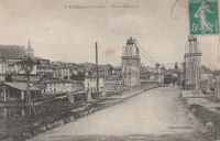
| Bridgemeister ID: | 8507 (added 2024-03-23) |
| Year Completed: | 1830 |
| Name: | La Madeleine |
| Location: | La Madeleine, Faycelles, Lot and Causse-et-Diège, Aveyron, France |
| Crossing: | Lot River |
| Coordinates: | 44.557528 N 2.026278 E |
| Maps: | Acme, GeoHack, Google, OpenStreetMap |
| Use: | Vehicular |
| Status: | Removed |
| Main Cables: | Wire (iron) |
| Suspended Spans: | 2 |
| Main Spans: | 2 |
External Links:
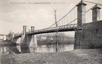
1830: Maniktola
Kolkata, West Bengal, India - Circular Canal
| Bridgemeister ID: | 3563 (added 2019-12-26) |
| Year Completed: | 1830 |
| Name: | Maniktola |
| Location: | Kolkata, West Bengal, India |
| Crossing: | Circular Canal |
| Principals: | Captain Thomas Prinsep |
| References: | ISB |
| Use: | Vehicular |
| Status: | Removed |
| Main Cables: | Chain (iron) |
| Suspended Spans: | 1 |
| Main Span: | 1 x 30.5 meters (100 feet) |
| Deck width: | 18 feet |
Notes:
- ISB describes its location: "is situated 2-1/4 miles from the mouth of the Circular Canal, and is three quarters of a mile due east of the new Church in Cornwallis Square."
1830: Narkooldunga
Kolkata, West Bengal, India - Circular Canal
| Bridgemeister ID: | 3564 (added 2019-12-26) |
| Year Completed: | 1830 |
| Name: | Narkooldunga |
| Location: | Kolkata, West Bengal, India |
| Crossing: | Circular Canal |
| Principals: | Captain Thomas Prinsep |
| Use: | Vehicular |
| Status: | Removed |
| Main Cables: | Chain (iron) |
| Suspended Spans: | 1 |
| Main Span: | 1 x 30.5 meters (100 feet) |
| Deck width: | 18 feet |
Notes:
- ISB describes its location: "situated 2-3/4 miles from the mouth of the Circular Canal, and forming a most useful line of communication due eastward from the New Mint and the Raja or Burdwan's Bazar, by Cotton Street and Muchooa Bazar Street, in a direct line by Raja Ramlochun's Road toward the western shores of the Saltwater lake."
1830: Parentignat
Parentignat and Issoire, Puy-de-Dôme, France - Allier River
| Bridgemeister ID: | 1568 (added 2004-11-28) |
| Year Completed: | 1830 |
| Name: | Parentignat |
| Also Known As: | Orbeil |
| Location: | Parentignat and Issoire, Puy-de-Dôme, France |
| Crossing: | Allier River |
| Coordinates: | 45.543960 N 3.276289 E |
| Maps: | Acme, GeoHack, Google, OpenStreetMap |
| References: | AAJ, BPF |
| Use: | Vehicular (one-lane) |
| Status: | Closed (last checked: 2019) |
| Main Cables: | Wire (iron) |
| Suspended Spans: | 1 |
| Main Span: | 1 x 98.4 meters (322.8 feet) |
Notes:
- Bypassed, 1973.
External Links:
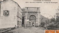
1830: Remoulins
Remoulins, Gard, France - Gardon River
| Bridgemeister ID: | 946 (added 2003-10-30) |
| Year Completed: | 1830 |
| Name: | Remoulins |
| Location: | Remoulins, Gard, France |
| Crossing: | Gardon River |
| Coordinates: | 43.936944 N 4.557333 E |
| Maps: | Acme, GeoHack, Google, OpenStreetMap |
| Principals: | Marc Seguin |
| References: | BPF |
| Use: | Vehicular |
| Status: | Only towers remain, since 1938 (last checked: 2002) |
| Main Cables: | Wire (iron) |
| Suspended Spans: | 1 |
| Main Span: | 1 x 120 meters (393.7 feet) |
Notes:
- Demolished, 1938. Only towers remain.
- Replaced by 1935 Remoulins - Remoulins, Gard, France.
External Links:
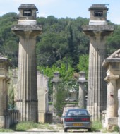
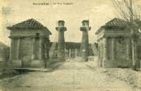
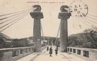
1830: Rudolf
Vienna, Austria - Vienna River
| Bridgemeister ID: | 6180 (added 2021-07-09) |
| Year Completed: | 1830 |
| Name: | Rudolf |
| Also Known As: | Rudolfs, Rudolfsbrücke |
| Location: | Vienna, Austria |
| Crossing: | Vienna River |
| Coordinates: | 48.196985 N 16.359208 E |
| Maps: | Acme, GeoHack, Google, OpenStreetMap |
| References: | PTS2 |
| Status: | Removed, c. 1899 |
| Main Cables: | Chain (iron) |
| Suspended Spans: | 1 |
Notes:
- Was located at the northern end of the current-day Kettenbrückegasse, named for the former Rudolf bridge. The Vienna River has since been covered over at this location.
External Links:
1830: Schikaneder
Vienna, Austria - Vienna River
| Bridgemeister ID: | 6179 (added 2021-07-09) |
| Year Completed: | 1830 |
| Name: | Schikaneder |
| Also Known As: | Schikanederbrücke, Schikanedersteg |
| Location: | Vienna, Austria |
| Crossing: | Vienna River |
| Coordinates: | 48.199949 N 16.365989 E |
| Maps: | Acme, GeoHack, Google, OpenStreetMap |
| References: | PTS2 |
| Status: | Removed, c. 1895 |
| Main Cables: | Chain (iron) |
| Suspended Spans: | 1 |
Notes:
- Was located near the modern day intersection of Getreidemarkt and Friedrichstraße. The Vienna River here has since been covered over at this location.
External Links:
1830: Stockton Railway
Stockton on Tees, England, United Kingdom - River Tees
| Bridgemeister ID: | 390 (added before 2003) |
| Year Completed: | 1830 |
| Name: | Stockton Railway |
| Location: | Stockton on Tees, England, United Kingdom |
| Crossing: | River Tees |
| Principals: | Sir Samuel Brown |
| References: | AAJ, BEM, HBE, SBR |
| Use: | Rail |
| Status: | Replaced, 1842 |
| Main Cables: | Chain (iron) |
| Suspended Spans: | 1 |
| Main Span: | 1 x 85.6 meters (281 feet) |
Notes:
- First railway suspension bridge.
External Links:
1830: Valence
Valence, Drôme and Guilherand-Granges, Ardèche, France - Rhône River
| Bridgemeister ID: | 631 (added 2003-01-20) |
| Year Completed: | 1830 |
| Name: | Valence |
| Location: | Valence, Drôme and Guilherand-Granges, Ardèche, France |
| Crossing: | Rhône River |
| Coordinates: | 44.932022 N 4.882951 E |
| Maps: | Acme, GeoHack, Google, OpenStreetMap |
| Principals: | Marc Seguin |
| References: | ASB, PTS2 |
| Use: | Vehicular |
| Status: | Removed |
| Main Cables: | Wire (iron) |
| Suspended Spans: | 2 |
| Main Spans: | 2 x 110 meters (360.9 feet) |
| Deck width: | 7 meters |
Notes:
- Two side spans meeting at a single midstream tower.
- Later at same location 1949 (footbridge) - Valence, Drôme and Guilherand-Granges, Ardèche, France.
External Links:
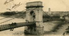
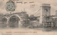
1830: Vic-sur-Aisne
Vic-sur-Aisne, Aisne, France - Aisne River
| Bridgemeister ID: | 7368 (added 2022-11-05) |
| Year Completed: | 1830 |
| Name: | Vic-sur-Aisne |
| Location: | Vic-sur-Aisne, Aisne, France |
| Crossing: | Aisne River |
| Status: | Removed, 1898 |
| Suspended Spans: | 1 |
External Links:
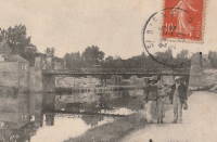
1830: Walters
Dhaka, Bangladesh
| Bridgemeister ID: | 2662 (added 2019-03-09) |
| Year Completed: | 1830 |
| Name: | Walters |
| Location: | Dhaka, Bangladesh |
| References: | AAJ |
| Main Cables: | Eyebar (iron) |
| Suspended Spans: | 1 |
Notes:
- At time of completion, the city was known as Dacca as part of India.
1830: Wynch
Middleton-in-Teesdale, England, United Kingdom - River Tees
| Bridgemeister ID: | 2465 (added 2008-10-04) |
| Year Completed: | 1830 |
| Name: | Wynch |
| Also Known As: | Winch |
| Location: | Middleton-in-Teesdale, England, United Kingdom |
| Crossing: | River Tees |
| Coordinates: | 54.646132 N 2.150488 W |
| Maps: | Acme, GeoHack, Google, OpenStreetMap |
| Use: | Footbridge |
| Status: | In use (last checked: 2019) |
| Main Cables: | Eyebar (iron) |
| Suspended Spans: | 1 |
Notes:
- Steel cables added, 2000.
- Replaced 1741 Winch (Wynch) - Middleton-in-Teesdale, England, United Kingdom.
External Links:
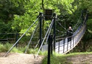
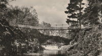
1831: Aguado
Ris-Orangis, Essonne, France - Seine River
| Bridgemeister ID: | 4925 (added 2020-07-27) |
| Year Completed: | 1831 |
| Name: | Aguado |
| Location: | Ris-Orangis, Essonne, France |
| Crossing: | Seine River |
| References: | AAJ |
| Status: | Destroyed, 1870 |
| Main Cables: | Chain (iron) |
| Suspended Spans: | 1 |
Notes:
- Destroyed to slow advancing Prussian troops during the Franco-Prussian war.
1831: Andrézieux
Andrézieux, Loire, France - Loire River
| Bridgemeister ID: | 978 (added 2003-11-15) |
| Year Completed: | 1831 |
| Name: | Andrézieux |
| Location: | Andrézieux, Loire, France |
| Crossing: | Loire River |
| Principals: | Seguin Brothers |
| Use: | Vehicular |
| Status: | Destroyed, October 17, 1907 |
| Main Cables: | Wire (iron) |
Notes:
- Badly wrecked by flood, October 17, 1907. Replaced, 1910.
- Near 1851 Saint-Just-sur-Loire - Saint-Just-sur-Loire and Saint-Just-Saint-Rambert, Loire, France.
External Links:
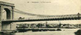
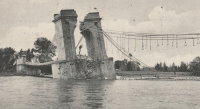
1831: Beauregard
Beauregard, Ain, France - Saône River
| Bridgemeister ID: | 1713 (added 2005-04-03) |
| Year Completed: | 1831 |
| Name: | Beauregard |
| Location: | Beauregard, Ain, France |
| Crossing: | Saône River |
| Coordinates: | 46.002033 N 4.749783 E |
| Maps: | Acme, GeoHack, Google, OpenStreetMap |
| Use: | Vehicular (one-lane) |
| Status: | Restricted to foot traffic (last checked: 2017) |
| Main Cables: | Wire (iron) |
| Suspended Spans: | 2 |
| Main Spans: | 2 |
External Links:
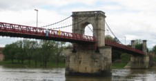
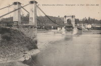
1831: Belleville
Belleville, Rhône and Ain, France - Saône River
| Bridgemeister ID: | 979 (added 2003-11-15) |
| Year Completed: | 1831 |
| Name: | Belleville |
| Also Known As: | Belleville-sur-Saône |
| Location: | Belleville, Rhône and Ain, France |
| Crossing: | Saône River |
| Use: | Vehicular |
| Suspended Spans: | 2 |
| Main Spans: | 2 |

1831: Bry-sur-Marne
Bry-sur-Marne, Val-de-Marne, France - Marne River
| Bridgemeister ID: | 1668 (added 2005-03-20) |
| Year Completed: | 1831 |
| Name: | Bry-sur-Marne |
| Location: | Bry-sur-Marne, Val-de-Marne, France |
| Crossing: | Marne River |
| Principals: | Jules Seguin |
| References: | AAJ, PTS2 |
| Use: | Vehicular |
| Status: | Destroyed, c.1870 |
| Main Cables: | Wire (iron) |
| Suspended Spans: | 1 |
| Main Span: | 1 x 76 meters (249.43 feet) |
External Links:
1831: Condrieu
Condrieu, Rhône and Les Roches-de-Condrieu, Isère, France - Rhône River
| Bridgemeister ID: | 981 (added 2003-11-15) |
| Year Completed: | 1831 |
| Name: | Condrieu |
| Location: | Condrieu, Rhône and Les Roches-de-Condrieu, Isère, France |
| Crossing: | Rhône River |
| Coordinates: | 45.457394 N 4.768694 E |
| Maps: | Acme, GeoHack, Google, OpenStreetMap |
| Use: | Vehicular |
| Status: | Replaced, 1935 |
| Main Cables: | Wire (iron) |
| Suspended Spans: | 2 |
| Main Spans: | 1 x 96 meters (315 feet), 1 x 96.8 meters (317.6 feet) |
Notes:
- Appears to have been replaced with another suspension bridge of similar proportions.
- Single midstream tower.
- Replaced by 1935 Condrieu - Condrieu, Rhône and Les Roches-de-Condrieu, Isère, France.
External Links:
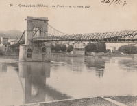
1831: Decize
Decize, Nièvre, France - Loire River
| Bridgemeister ID: | 1725 (added 2005-04-05) |
| Year Completed: | 1831 |
| Name: | Decize |
| Location: | Decize, Nièvre, France |
| Crossing: | Loire River |
| Use: | Vehicular |
| Status: | Replaced, 1904 |
| Main Cables: | Wire (iron) |
| Suspended Spans: | 2 |
| Main Spans: | 2 |
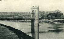

1831: Dumdum
Kolkata, West Bengal, India - Circular Canal
| Bridgemeister ID: | 3561 (added 2019-12-26) |
| Year Completed: | 1831 |
| Name: | Dumdum |
| Location: | Kolkata, West Bengal, India |
| Crossing: | Circular Canal |
| Principals: | J. Prinsep, Captain John Thomson |
| References: | ISB |
| Use: | Vehicular |
| Status: | Removed |
| Main Cables: | Chain (iron) |
| Suspended Spans: | 1 |
| Main Span: | 1 x 30.5 meters (100 feet) |
| Deck width: | 23 feet |
Notes:
- ISB describes its location: "is situated three quarters of a mile from [Circular Canal's] mouth."
1831: Findhorn
Forres, Scotland, United Kingdom - River Findhorn
| Bridgemeister ID: | 391 (added before 2003) |
| Year Completed: | 1831 |
| Name: | Findhorn |
| Location: | Forres, Scotland, United Kingdom |
| Crossing: | River Findhorn |
| Coordinates: | 57.6018 N 3.6557 W |
| Maps: | Acme, GeoHack, Google, OpenStreetMap |
| Principals: | Sir Samuel Brown |
| References: | AAJ, MOS, SBR |
| Use: | Vehicular |
| Status: | Removed, 1938 |
| Main Cables: | Chain (iron) |
| Suspended Spans: | 1 |
Notes:
- Was still standing in 1938 when it was bypassed, but was likely demolished some time in 1938.
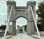
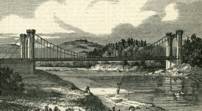
1831: La Feuillée
Lyon, Métropole de Lyon, France - Saône River
| Bridgemeister ID: | 1520 (added 2004-10-10) |
| Year Completed: | 1831 |
| Name: | La Feuillée |
| Location: | Lyon, Métropole de Lyon, France |
| Crossing: | Saône River |
| Coordinates: | 45.766642 N 4.829746 E |
| Maps: | Acme, GeoHack, Google, OpenStreetMap |
| References: | PQL |
| Use: | Vehicular, with walkway |
| Status: | Demolished, 1910 |
| Main Cables: | Wire (iron) |
| Suspended Spans: | 1 |
| Main Span: | 1 x 67 meters (219.8 feet) estimated |
| Deck width: | 7 meters |
Notes:
- Damaged by flood 1840, repaired 1841.
- Near 1832 Saint-Vincent - Lyon, Métropole de Lyon, France.
- Replaced by 1910 La Feuillée - Lyon, Métropole de Lyon, France.
External Links:
1831: Langon
Langon, Aquitaine, France - Garonne River
| Bridgemeister ID: | 1732 (added 2005-04-06) |
| Year Completed: | 1831 |
| Name: | Langon |
| Location: | Langon, Aquitaine, France |
| Crossing: | Garonne River |
| References: | PTS2 |
| Use: | Vehicular |
| Status: | Removed |
| Main Cables: | Chain (iron) |
| Suspended Spans: | 3 |
| Main Span: | 1 |
| Side Spans: | 2 |
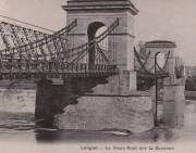
1831: Luzancy
Luzancy, Seine-et-Marne, France - Marne River
| Bridgemeister ID: | 4919 (added 2020-07-26) |
| Year Completed: | 1831 |
| Name: | Luzancy |
| Location: | Luzancy, Seine-et-Marne, France |
| Crossing: | Marne River |
| References: | AAJ |
| Use: | Vehicular |
| Status: | Replaced, 1925 |
| Main Cables: | Rod (iron) |
| Main Span: | 1 x 55 meters (180.4 feet) |
Notes:
- Original iron rod cables replaced by an Arnodin cable system, 1891. Replaced in 1925 with a "rigid suspension bridge of reinforced concrete".
- Replaced by 1925 Luzancy - Luzancy, Seine-et-Marne, France.
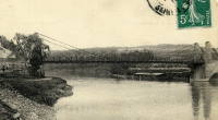
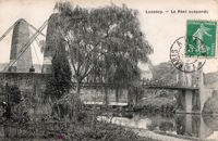
1831: Masaryk
Lyon vicinity, Métropole de Lyon, France - Saône River
| Bridgemeister ID: | 543 (added before 2003) |
| Year Completed: | 1831 |
| Name: | Masaryk |
| Also Known As: | Masarik, Mazarik, de la Gare |
| Location: | Lyon vicinity, Métropole de Lyon, France |
| Crossing: | Saône River |
| Coordinates: | 45.778267 N 4.809017 E |
| Maps: | Acme, GeoHack, Google, OpenStreetMap |
| References: | PQL |
| Use: | Vehicular (one-lane), with walkway |
| Status: | Restricted to foot traffic (last checked: 2022) |
| Main Cables: | Wire (iron) |
| Suspended Spans: | 2 |
| Main Spans: | 2 x 85.2 meters (279.5 feet) |
| Deck width: | 6.5 meters |
Notes:
- Bombed, 1944. Reopened 1945, but not fully restored until 1946.
- This bridge has been referenced by many spellings of "Masaryk", but the sign posted at the actual bridge reads "Masaryk".
- Next to 1844 Mouton - Lyon, Métropole de Lyon, France.
- Near 1827 L'île Barbe - Lyon, Métropole de Lyon, France.
External Links:
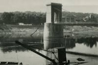
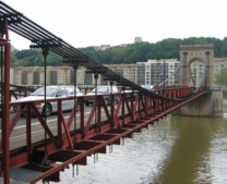
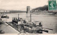
1831: Mirabeau
Mirabeau, Vaucluse and Bouches-du-Rhône, France - Durance River
| Bridgemeister ID: | 982 (added 2003-11-15) |
| Year Completed: | 1831 |
| Name: | Mirabeau |
| Location: | Mirabeau, Vaucluse and Bouches-du-Rhône, France |
| Crossing: | Durance River |
| Coordinates: | 43.68945 N 5.668267 E |
| Maps: | Acme, GeoHack, Google, OpenStreetMap |
| Principals: | Jean-François-Theophilus Sauzet |
| References: | AAJ, BPF |
| Use: | Vehicular |
| Status: | Only towers remain (last checked: 2005) |
| Suspended Spans: | 1 |
| Main Span: | 1 x 150 meters (492.1 feet) |
| Deck width: | 5.5 meters |
Notes:
- The towers from the older of the two Mirabeau suspension bridges are visible alongside the current crossing.
- Damaged by flood, 1843. Rebuilt.
- Replaced by 1935 Mirabeau - Mirabeau, Vaucluse and Bouches-du-Rhône, France. Unsure if this was an immediate replacement.
External Links:
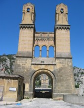
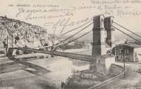
1831: Scotswood
Newcastle-upon-Tyne, England, United Kingdom - River Tyne
| Bridgemeister ID: | 392 (added before 2003) |
| Year Completed: | 1831 |
| Name: | Scotswood |
| Also Known As: | Chine |
| Location: | Newcastle-upon-Tyne, England, United Kingdom |
| Crossing: | River Tyne |
| Principals: | John Green |
| References: | AAJ, BRB, NTB |
| Use: | Vehicular (two-lane), with walkway |
| Status: | Demolished, 1967 |
| Main Cables: | Chain (iron) |
| Suspended Spans: | 3 |
| Main Span: | 1 x 112.2 meters (368 feet) |
| Side Spans: | 2 x 39.9 meters (131 feet) |
| Deck width: | 16 feet 10 inch roadway, 3 feet 3 inch footway |
Notes:
- "Chine" is the spelling/pronounciation of "Chain" in Geordie a dialect spoken in Tyneside.
- Widened (19ft 6in roadway, two 6ft walkways), iron chains replaced with steel cables 1931. Bypassed, 1967. Since demolished.
External Links:
- Scotswood Suspension Bridge (1831 - 1967) | Co-Curate. Several images of the bridge.
- Structurae - Structure ID 20013208
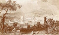
1831: Wellington
Aberdeen, Scotland, United Kingdom - River Dee
| Bridgemeister ID: | 393 (added before 2003) |
| Year Completed: | 1831 |
| Name: | Wellington |
| Also Known As: | Craiglug |
| Location: | Aberdeen, Scotland, United Kingdom |
| Crossing: | River Dee |
| Coordinates: | 57.13559 N 2.09560 W |
| Maps: | Acme, GeoHack, Google, OpenStreetMap |
| Principals: | Sir Samuel Brown |
| References: | SBR |
| Use: | Vehicular (one-lane) |
| Status: | Restricted to foot traffic (last checked: 2014) |
| Main Cables: | Chain (iron) |
| Suspended Spans: | 1 |
Notes:
- Reconstructed, 1930. Closed to vehicular traffic, 1984. Closed to all traffic 2002. Underwent extensive refurbishment, 2008.
External Links:


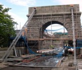
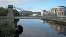
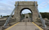
1831: Whorlton
Whorlton, Barnard Castle, England, United Kingdom - River Tees
| Bridgemeister ID: | 1250 (added 2004-02-21) |
| Year Completed: | 1831 |
| Name: | Whorlton |
| Location: | Whorlton, Barnard Castle, England, United Kingdom |
| Crossing: | River Tees |
| Coordinates: | 54.526243 N 1.836740 W |
| Maps: | Acme, GeoHack, Google, OpenStreetMap |
| Principals: | John Green, Benjamin Green |
| Use: | Vehicular (one-lane) |
| Status: | Closed, July 2019 (last checked: October 2023) |
| Main Cables: | Chain (iron) |
| Suspended Spans: | 1 |
| Main Span: | 1 x 53 meters (173.9 feet) estimated |
Notes:
- 2003-2004: Refurbished.
- 2019, July: Closed following failure of a deck suspender.
- 2020, September: Remained closed, indefinitely, with no firm plan for repairs.
- 2020, December: Fears escalate over catastrophic failure.
- 2022, February: Repairs delayed, not expected to be completed until May 2023.
- 2023, October: New plans announced. The bridge will be fully dismantled and restored.
Annotated Citations:
- "Plans to strengthen Whorlton bridge – but there's no quick fix." Teesdale Mercury, 16 Jan 2021, https://www.teesdalemercury.co.uk/news/plans-to-strengthen-whorlton-bridge-but-theres-no-quick-fix.
Reports plans are being prepared to strengthen the bridge, but the work won't be completed into 2022, followed by a review to determine if the bridge can be reopened to automobiles.
External Links:
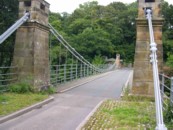
1832: Aboyne
Aboyne, Scotland, United Kingdom - River Dee
| Bridgemeister ID: | 2203 (added 2007-01-28) |
| Year Completed: | 1832 |
| Name: | Aboyne |
| Location: | Aboyne, Scotland, United Kingdom |
| Crossing: | River Dee |
| Use: | Vehicular |
| Status: | Removed |
1832: Bercy
Paris, France - Seine River
| Bridgemeister ID: | 1738 (added 2005-04-19) |
| Year Completed: | 1832 |
| Name: | Bercy |
| Location: | Paris, France |
| Crossing: | Seine River |
| Principals: | Marie Fortuné de Vergès |
| References: | AAJ |
| Use: | Vehicular, with walkway |
| Status: | Replaced, 1860's |
| Main Cables: | Eyebar (iron) |
| Suspended Spans: | 3 |
| Main Span: | 1 x 44 meters (144.36 feet) |
| Side Spans: | 2 x 45 meters (147.64 feet) |
| Deck width: | 26.25 feet |
External Links:
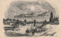
1832: Ferdinando
Minturno vicinity, Italy - Garigliano River
| Bridgemeister ID: | 2014 (added 2006-01-14) |
| Year Completed: | 1832 |
| Name: | Ferdinando |
| Location: | Minturno vicinity, Italy |
| Crossing: | Garigliano River |
| Coordinates: | 41.242015 N 13.771914 E |
| Maps: | Acme, GeoHack, Google, OpenStreetMap |
| Principals: | Luigi Giura |
| Use: | Vehicular |
| Status: | Extant (last checked: 2018) |
| Main Cables: | Chain (iron) |
| Suspended Spans: | 1 |
| Main Span: | 1 x 80.4 meters (263.8 feet) |
Notes:
- Destroyed, 1943. Reconstructed, 1998.
External Links:
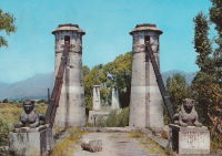
1832: L'Ile-Bouchard
Saint Maurice, L'Île-Bouchard and Saint-Gilles, L'Île-Bouchard, Indre-et-Loire, France - Vienne River
| Bridgemeister ID: | 1605 (added 2005-02-06) |
| Year Completed: | 1832 |
| Name: | L'Ile-Bouchard |
| Location: | Saint Maurice, L'Île-Bouchard and Saint-Gilles, L'Île-Bouchard, Indre-et-Loire, France |
| Crossing: | Vienne River |
| Coordinates: | 47.119399 N 0.424522 E |
| Maps: | Acme, GeoHack, Google, OpenStreetMap |
| References: | AAJ |
| Use: | Vehicular (one-lane), with walkway |
| Status: | Destroyed, 1944 |
| Main Cables: | Wire (iron) |
| Suspended Spans: | 2 |
| Main Span: | 1 x 80 meters (262.48 feet) |
| Deck width: | 13.12 feet |
Notes:
- One of two bridges separated by a short distance across an island.
- Connects to 1832 L'Ile-Bouchard - Saint Maurice, L'Île-Bouchard and Saint-Gilles, L'Île-Bouchard, Indre-et-Loire, France.
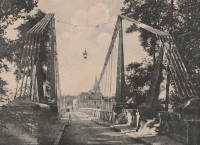
1832: L'Ile-Bouchard
Saint Maurice, L'Île-Bouchard and Saint-Gilles, L'Île-Bouchard, Indre-et-Loire, France - Vienne River
| Bridgemeister ID: | 6609 (added 2021-09-05) |
| Year Completed: | 1832 |
| Name: | L'Ile-Bouchard |
| Location: | Saint Maurice, L'Île-Bouchard and Saint-Gilles, L'Île-Bouchard, Indre-et-Loire, France |
| Crossing: | Vienne River |
| Coordinates: | 47.120994 N 0.425181 E |
| Maps: | Acme, GeoHack, Google, OpenStreetMap |
| References: | AAJ |
| Use: | Vehicular (one-lane), with walkway |
| Status: | Destroyed, 1944 |
| Main Cables: | Wire (iron) |
| Suspended Spans: | 1 |
| Main Span: | 1 x 85 meters (278.89 feet) |
| Deck width: | 13.12 feet |
Notes:
- One of two bridges separated by a short distance across an island.
- Connects to 1832 L'Ile-Bouchard - Saint Maurice, L'Île-Bouchard and Saint-Gilles, L'Île-Bouchard, Indre-et-Loire, France.
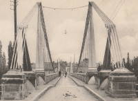
1832: La Roche-Posay
La Roche-Posay, Vienne and Indre-et-Loire, France - Creuse River
| Bridgemeister ID: | 1601 (added 2005-02-06) |
| Year Completed: | 1832 |
| Name: | La Roche-Posay |
| Also Known As: | La Roche-Posay-les-Bains |
| Location: | La Roche-Posay, Vienne and Indre-et-Loire, France |
| Crossing: | Creuse River |
| Use: | Vehicular |
| Status: | Replaced, 1937 |
| Main Cables: | Wire (iron) |
| Suspended Spans: | 1 |
Notes:

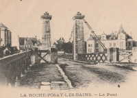
1832: Les Vans
Les Vans and Les Assions, Ardèche, France - Chassezac River
| Bridgemeister ID: | 2415 (added 2007-12-31) |
| Year Completed: | 1832 |
| Name: | Les Vans |
| Location: | Les Vans and Les Assions, Ardèche, France |
| Crossing: | Chassezac River |
| Coordinates: | 44.416248 N 4.155727 E |
| Maps: | Acme, GeoHack, Google, OpenStreetMap |
| Use: | Vehicular |
| Status: | Removed |
| Suspended Spans: | 1 |
External Links:

1832: Marlow
Marlow, England, United Kingdom - River Thames
| Bridgemeister ID: | 394 (added before 2003) |
| Year Completed: | 1832 |
| Name: | Marlow |
| Location: | Marlow, England, United Kingdom |
| Crossing: | River Thames |
| Coordinates: | 51.56735 N 0.773567 W |
| Maps: | Acme, GeoHack, Google, OpenStreetMap |
| Principals: | William Tierney Clark |
| References: | AAJ, BEM, BRB, BTH, MOS, NTB |
| Use: | Vehicular, with walkway |
| Status: | In use (last checked: 2019) |
| Main Cables: | Chain (iron) |
| Suspended Spans: | 3 |
| Main Span: | 1 |
| Side Spans: | 2 |
| Deck width: | 30 feet |
Annotated Citations:
- Butler, Rory. "Marlow Bridge repairs will take almost a year." BuckinghamshireLive, 1 October 2021, https://www.buckinghamshirelive.com/news/buckinghamshire-news/repairs-mould-covered-marlow-bridge-5994064
"A complete renovation of the road and foot bridge, currently covered in mould and rust, could take up to 40 weeks… The plans outline ‘refurbishment to the bridge, including works to the carriageway, footway, towers, lighting, drainage, parapet posts and timber rails’."
External Links:
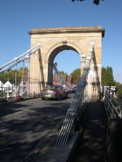
1832: Neuville-sur-Saône
Neuville-sur-Saône and Albigny-sur-Saône, Métropole de Lyon, France - Saône River
| Bridgemeister ID: | 1737 (added 2005-04-19) |
| Year Completed: | 1832 |
| Name: | Neuville-sur-Saône |
| Location: | Neuville-sur-Saône and Albigny-sur-Saône, Métropole de Lyon, France |
| Crossing: | Saône River |
| Coordinates: | 45.876840 N 4.836934 E |
| Maps: | Acme, GeoHack, Google, OpenStreetMap |
| Use: | Vehicular |
| Status: | Removed, 1934 |
| Suspended Spans: | 2 |
| Main Spans: | 2 |
External Links:
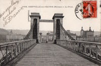
1832: Saint-Vincent
Lyon, Métropole de Lyon, France - Saône River
| Bridgemeister ID: | 1098 (added 2004-01-02) |
| Year Completed: | 1832 |
| Name: | Saint-Vincent |
| Location: | Lyon, Métropole de Lyon, France |
| Crossing: | Saône River |
| Coordinates: | 45.767583 N 4.827983 E |
| Maps: | Acme, GeoHack, Google, OpenStreetMap |
| References: | PQL |
| Use: | Footbridge |
| Status: | In use (last checked: 2022) |
| Main Cables: | Wire (iron) |
| Suspended Spans: | 1 |
Notes:
- Damaged by flood, 1840.
- Bridge appears to currently be suspended from a combination of wire rope and rigid rods.
- Near 1831 La Feuillée - Lyon, Métropole de Lyon, France.
External Links:
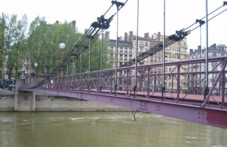
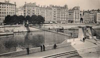
1832: Vailly-sur-Aisne
Vailly-sur-Aisne, Aisne, France - Aisne River
| Bridgemeister ID: | 6614 (added 2021-09-05) |
| Year Completed: | 1832 |
| Name: | Vailly-sur-Aisne |
| Location: | Vailly-sur-Aisne, Aisne, France |
| Crossing: | Aisne River |
| Use: | Vehicular |
| Status: | Destroyed, 1870 |
| Suspended Spans: | 1 |
Notes:
- 1870; Destroyed to slow advancing troops during the Franco-Prussian war.
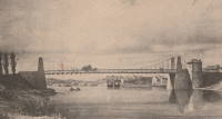
1832: Vals-les-bains
Vals-les-bains and Labégude, Ardèche, France - Ardèche River
| Bridgemeister ID: | 1761 (added 2005-04-22) |
| Year Completed: | 1832 |
| Name: | Vals-les-bains |
| Location: | Vals-les-bains and Labégude, Ardèche, France |
| Crossing: | Ardèche River |
| References: | AAJ |
| Use: | Vehicular |
| Main Cables: | Wire (iron) |
Notes:
- AAJ notes the contract was let in late 1831 and guesses at 1833 as the year of completion. 1832 is more likely given the rate at which these early iron wire French bridges were constructed.
1832: Yarmouth
Great Yarmouth, England, United Kingdom - River Bure
| Bridgemeister ID: | 2381 (added 2007-11-04) |
| Year Completed: | 1832 |
| Name: | Yarmouth |
| Location: | Great Yarmouth, England, United Kingdom |
| Crossing: | River Bure |
| References: | AAJ |
| Status: | Collapsed, 1845 |
Notes:
- Possibly completed in 1829.
- 1845, May 2: Collapsed under weight of large crowd that had gathered to watch a famous clown sail down the River Bure in a washtub pulled by swans.
External Links:
1833: Alipore
Kolkata, West Bengal, India - Tolly's Nullah (Adi Ganga)
| Bridgemeister ID: | 3550 (added 2019-12-25) |
| Year Completed: | 1833 |
| Name: | Alipore |
| Location: | Kolkata, West Bengal, India |
| Crossing: | Tolly's Nullah (Adi Ganga) |
| Principals: | Captain John Thomson |
| References: | HJC, ISB |
| Use: | Vehicular |
| Status: | Removed |
| Main Cables: | Chain (iron) |
| Main Span: | 1 x 27.1 meters (89 feet) |
| Deck width: | 24 feet |
1833: Chauvigny
Chauvigny, Vienne, France - Vienne River
1833: Collias
Collias, Gard, France - Gardon River
| Bridgemeister ID: | 1721 (added 2005-04-05) |
| Year Completed: | 1833 |
| Name: | Collias |
| Also Known As: | Louis-Philippe |
| Location: | Collias, Gard, France |
| Crossing: | Gardon River |
| Coordinates: | 43.953224 N 4.482269 E |
| Maps: | Acme, GeoHack, Google, OpenStreetMap |
| Use: | Vehicular |
| Status: | Removed |
| Main Cables: | Wire |
| Suspended Spans: | 1 |
| Main Span: | 1 |
External Links:
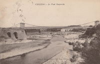
1833: Cosne-sur-Loire
Cosne-sur-Loire, Nièvre and Boulleret, Cher, France - Loire River
| Bridgemeister ID: | 1595 (added 2005-02-06) |
| Year Completed: | 1833 |
| Name: | Cosne-sur-Loire |
| Location: | Cosne-sur-Loire, Nièvre and Boulleret, Cher, France |
| Crossing: | Loire River |
| Coordinates: | 47.411396 N 2.918450 E |
| Maps: | Acme, GeoHack, Google, OpenStreetMap |
| References: | AAJ |
| Use: | Vehicular |
| Status: | Replaced, 1928 |
| Main Cables: | Chain (iron) |
Notes:
- The longer of two suspension bridges separated by a short distance, one over the large branch of the Loire and one over the small branch of the Loire where the river flows around an island.
- Similar to 1846 Mallemort - Mallemort, Bouches-du-Rhône and Mérindol, Vaucluse, France.
- Near 1833 Petit - Cosne-sur-Loire, Nièvre and Boulleret, Cher, France.
- Later at same location 1959 Cosne-sur-Loire - Cosne-Cours-sur-Loire, Nièvre and Cher, France.
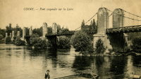
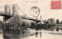
1833: Coubon
Coubon and Volhac, Haute-Loire, France - Loire River
| Bridgemeister ID: | 1723 (added 2005-04-05) |
| Year Completed: | 1833 |
| Name: | Coubon |
| Location: | Coubon and Volhac, Haute-Loire, France |
| Crossing: | Loire River |
| Use: | Vehicular |
| Status: | Destroyed, 1866 |
| Main Cables: | Wire (iron) |
| Suspended Spans: | 1 |
Notes:
- Destroyed by flood, 1866.
- Replaced by 1871 Coubon - Coubon and Volhac, Haute-Loire, France.
1833: Hasting's
Kolkata, West Bengal, India - Tolly's Nullah (Adi Ganga)
| Bridgemeister ID: | 3549 (added 2019-12-25) |
| Year Completed: | 1833 |
| Name: | Hasting's |
| Location: | Kolkata, West Bengal, India |
| Crossing: | Tolly's Nullah (Adi Ganga) |
| Principals: | Captain Fitzgerald, Captain J. Thomson |
| References: | HJC, ISB |
| Status: | Collapsed, 1874 |
| Main Cables: | Chain (iron) |
| Suspended Spans: | 3 |
| Main Span: | 1 x 53.6 meters (176 feet) |
| Side Spans: | 2 x 26.8 meters (88 feet) |
| Deck width: | 24 feet |
1833: La Sône
La Sône, Isère, France - Isère River
| Bridgemeister ID: | 1730 (added 2005-04-06) |
| Year Completed: | 1833 |
| Name: | La Sône |
| Location: | La Sône, Isère, France |
| Crossing: | Isère River |
| Coordinates: | 45.109403 N 5.276853 E |
| Maps: | Acme, GeoHack, Google, OpenStreetMap |
| References: | AAJ |
| Use: | Vehicular, with walkway |
| Status: | Derelict (last checked: 2020) |
| Main Cables: | Wire (iron) |
| Suspended Spans: | 1 |
| Main Span: | 1 x 92 meters (301.85 feet) |
| Deck width: | 14.76 feet |
Notes:
- Towers and cables remain (as of 2020), though possibly from a replacement structure built later in the 1800s.
- Near La Sône - La Sône, Isère, France.
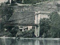
1833: Le Veurdre
Le Veurdre, Allier and Saint-Pierre-le-Moutier, Nièvre, France - Allier River
| Bridgemeister ID: | 2031 (added 2006-04-22) |
| Year Completed: | 1833 |
| Name: | Le Veurdre |
| Location: | Le Veurdre, Allier and Saint-Pierre-le-Moutier, Nièvre, France |
| Crossing: | Allier River |
| Coordinates: | 46.758333 N 3.049167 E |
| Maps: | Acme, GeoHack, Google, OpenStreetMap |
| Use: | Vehicular |
| Status: | Removed |
| Main Cables: | Wire (iron) |
| Suspended Spans: | 3 |
| Main Spans: | 3 |
Notes:
- Sometimes confused with the Allier River suspension bridges closer to Mornay-sur-Allier, the Pont du Veurdre was located at (or near) the alignment indicated by the coordinates here.
- See 1840 Mornay-sur-Allier - Mornay-sur-Allier, Cher and St-Pierre-le-Moûtier, Nièvre, France.
External Links:
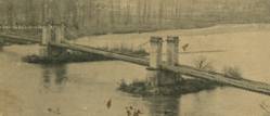
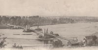
1833: Leopoldus II
Poggio a Cajano, Florence vicinity, Tuscany, Italy - Ombrone River
| Bridgemeister ID: | 1030 (added 2003-11-30) |
| Year Completed: | 1833 |
| Name: | Leopoldus II |
| Location: | Poggio a Cajano, Florence vicinity, Tuscany, Italy |
| Crossing: | Ombrone River |
| Coordinates: | 43.824854 N 11.047510 E |
| Maps: | Acme, GeoHack, Google, OpenStreetMap |
| Principals: | Alessandro Manetti |
| References: | RLE |
| Use: | Vehicular |
| Status: | Only towers remain, since September, 1944 (last checked: 2019) |
| Main Cables: | Wire (iron) |
| Main Span: | 1 x 34.89 meters (114.5 feet) |
Notes:
- Destroyed September, 1944. Towers extant, 2003.
- RLE: "probably very first wire suspension bridge in Italy."
- A modern footbridge was installed on the original piers, likely in the 2010s.
External Links:
1833: Longues
Longues, Vic-le-Comte and Les Martres-de-Veyre, Puy-de-Dôme, France - Allier River
| Bridgemeister ID: | 1759 (added 2005-04-22) |
| Year Completed: | 1833 |
| Name: | Longues |
| Location: | Longues, Vic-le-Comte and Les Martres-de-Veyre, Puy-de-Dôme, France |
| Crossing: | Allier River |
| References: | AAJ |
| Use: | Vehicular |
| Status: | Replaced |
| Main Cables: | Chain (iron) |
| Suspended Spans: | 1 |
| Main Span: | 1 x 100 meters (328.1 feet) |
| Deck width: | 14.11 feet |
Notes:
- AAJ notes that this bridge collapsed during load testing, 1832. Another accident occurred when a hanger failed, December 6, 1832. The bridge opened February 1, 1833.
- Replaced by 1857 Longues - Longues, Vic-le-Comte and Les Martres-de-Veyre, Puy-de-Dôme, France.
1833: Norfolk
Shoreham, England, United Kingdom - River Adur
| Bridgemeister ID: | 604 (added 2003-01-12) |
| Year Completed: | 1833 |
| Name: | Norfolk |
| Location: | Shoreham, England, United Kingdom |
| Crossing: | River Adur |
| Principals: | William Tierney Clark |
| References: | AAJ, MOS |
| Use: | Vehicular, with walkway |
| Status: | Replaced, 1923 |
| Main Cables: | Chain (iron) |
| Suspended Spans: | 3 |
| Main Span: | 1 x 86.6 meters (284 feet) |
| Side Spans: | 2 |
Notes:
- According to MOS, the 284 foot measurement given for this bridge is for the "chord line" of the chains, not the pier-to-pier deck length.
External Links:
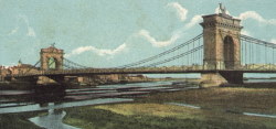
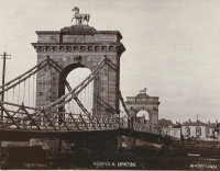
1833: Petit
Cosne-sur-Loire, Nièvre and Boulleret, Cher, France - Loire River
| Bridgemeister ID: | 7156 (added 2022-06-25) |
| Year Completed: | 1833 |
| Name: | Petit |
| Location: | Cosne-sur-Loire, Nièvre and Boulleret, Cher, France |
| Crossing: | Loire River |
| Coordinates: | 47.411173 N 2.908176 E |
| Maps: | Acme, GeoHack, Google, OpenStreetMap |
| Use: | Vehicular |
| Status: | Removed |
| Main Cables: | Chain (iron) |
| Suspended Spans: | 2 |
| Main Spans: | 2 |
Notes:
- Known as the "Petit Pont", crossed a small arm of the Loire just west of the much longer Cosne-sur-Loire suspension bridge across the main channel of the Loire.
- Near 1833 Cosne-sur-Loire - Cosne-sur-Loire, Nièvre and Boulleret, Cher, France.
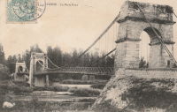
| Bridgemeister ID: | 2161 (added 2006-12-16) |
| Year Completed: | 1833 |
| Name: | Schaukelbrücke Ilmpark |
| Location: | Weimar, Thüringen, Germany |
| Crossing: | Ilm River |
| Coordinates: | 50.96722 N 11.33971 E |
| Maps: | Acme, GeoHack, Google, OpenStreetMap |
| Use: | Footbridge |
| Status: | In use (last checked: 2017) |
| Main Cables: | Eyebar (iron) |
| Suspended Spans: | 1 |
| Main Span: | 1 x 14.8 meters (48.6 feet) |
| Deck width: | 2.04 meters between side rails, 2.16 meters total |
Notes:
- Eckhard Bernstorff notes: "Oldest fully functional suspension bridge in Germany; 2 x 3 chains; 2 different sags; Located in the park of Johann Wolfgang von Goethe's garden house."
External Links:
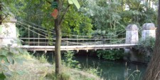
1833: Tonneins
Tonneins, Lot-et-Garonne, France - Garonne River
| Bridgemeister ID: | 1760 (added 2005-04-22) |
| Year Completed: | 1833 |
| Name: | Tonneins |
| Location: | Tonneins, Lot-et-Garonne, France |
| Crossing: | Garonne River |
| References: | AAJ |
| Use: | Vehicular (one-lane) |
| Status: | Removed |
| Main Cables: | Wire (iron) |
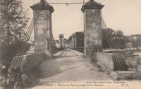
1833: Vichy
Vichy and Bellerive-sur-Allier, Allier, France - Allier River
| Bridgemeister ID: | 1762 (added 2005-04-22) |
| Year Completed: | 1833 |
| Name: | Vichy |
| Location: | Vichy and Bellerive-sur-Allier, Allier, France |
| Crossing: | Allier River |
| References: | AAJ |
| Use: | Vehicular |
| Status: | Replaced, 1870 |
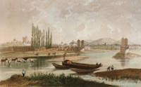
1834: Aranjuez
Aranjuez, Spain - Tagus River
| Bridgemeister ID: | 5111 (added 2020-09-05) |
| Year Completed: | 1834 |
| Name: | Aranjuez |
| Also Known As: | Barcas |
| Location: | Aranjuez, Spain |
| Crossing: | Tagus River |
| Principals: | Pedro Miranda |
| Use: | Vehicular |
| Status: | Removed, 1930 |
| Main Cables: | Eyebar (iron) |
| Suspended Spans: | 1 |
Notes:
- Sometimes claimed to be built in the 1820s, it appears to have been started in 1829 and completed in 1834. The bridge is attributed to Pedro Miranda who was born in 1808.
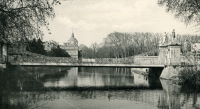
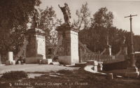
1834: Bretenoux
Bretenoux and Biars-sur-Cère, Lot, France - Cère River
| Bridgemeister ID: | 4756 (added 2020-06-27) |
| Year Completed: | 1834 |
| Name: | Bretenoux |
| Location: | Bretenoux and Biars-sur-Cère, Lot, France |
| Crossing: | Cère River |
| Coordinates: | 44.916349 N 1.838218 E |
| Maps: | Acme, GeoHack, Google, OpenStreetMap |
| References: | AAJ |
| Use: | Vehicular (one-lane) |
| Status: | Removed |
| Main Cables: | Wire |
| Suspended Spans: | 1 |
External Links:
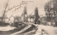
1834: Canada
Tréguier and Trédarzec, Côtes-d'Armor, France - Jaudy River
| Bridgemeister ID: | 1120 (added 2004-01-09) |
| Year Completed: | 1834 |
| Name: | Canada |
| Location: | Tréguier and Trédarzec, Côtes-d'Armor, France |
| Crossing: | Jaudy River |
| Coordinates: | 48.785102 N 3.220630 W |
| Maps: | Acme, GeoHack, Google, OpenStreetMap |
| Use: | Vehicular |
| Status: | Demolished, 1886 |
| Main Cables: | Wire (iron) |
| Suspended Spans: | 1 |
| Main Span: | 1 x 100 meters (328.1 feet) |
External Links:
1834: Chitpur
Kolkata, West Bengal, India - Circular Canal
| Bridgemeister ID: | 3559 (added 2019-12-26) |
| Year Completed: | 1834 |
| Name: | Chitpur |
| Also Known As: | Cheetpoor, Baghbazar |
| Location: | Kolkata, West Bengal, India |
| Crossing: | Circular Canal |
| Principals: | Captain John Thomson |
| References: | ISB |
| Use: | Vehicular |
| Status: | Removed |
| Main Cables: | Chain (iron) |
| Suspended Spans: | 1 |
| Main Span: | 1 x 30.2 meters (99 feet) |
| Deck width: | 22 feet |
Notes:
- ISB describes its location: "...is situated at the upper end of the Circular Canal, close to the east bank of the River Hooghly, and in the main road leading direct from Calcutta to Cheetpoor and Kaseepoor."
1834: Clairac
Clairac, Lot-et-Garonne, France - Lot River
| Bridgemeister ID: | 7049 (added 2022-05-26) |
| Year Completed: | 1834 |
| Name: | Clairac |
| Location: | Clairac, Lot-et-Garonne, France |
| Crossing: | Lot River |
| Coordinates: | 44.358260 N 0.381738 E |
| Maps: | Acme, GeoHack, Google, OpenStreetMap |
| Use: | Vehicular |
| Status: | Removed |
| Suspended Spans: | 3 |
| Main Span: | 1 |
| Side Spans: | 2 |
Notes:
- Coordinates are for present-day (2022) crossing at Clairac. The suspension bridge was likely at this location.
- Near Roussanes (Clairac) - Roussanes, Clairac vicinity, Lot-et-Garonne, France.
External Links:
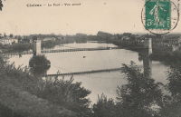
1834: Crathie
Crathie vicinity, Scotland, United Kingdom - River Dee
| Bridgemeister ID: | 1084 (added 2004-01-01) |
| Year Completed: | 1834 |
| Name: | Crathie |
| Location: | Crathie vicinity, Scotland, United Kingdom |
| Crossing: | River Dee |
| Coordinates: | 57.0335 N 3.211 W |
| Maps: | Acme, GeoHack, Google, OpenStreetMap |
| Principals: | Justice Junior and Co. |
| References: | AAJ, BSI, HBR |
| Use: | Vehicular (one-lane) |
| Status: | Closed, December 2015 (last checked: 2015) |
| Main Cables: | Eyebar (iron) |
| Suspended Spans: | 1 |
| Main Span: | 1 x 42.1 meters (138 feet) |
| Deck width: | 14 feet |
Notes:
- Small iron chain suspension bridge.
- BSI: Reported to have been "almost entirely renewed", 1885. Ruddock also suggests the bridge was originally constructed with just diagonal stays (as other Justice bridges) and the catenary chains were added during the renewal.
External Links:
- The Happy Pontist: Scottish Bridges: 56. Crathie Suspension Bridge (after the flood)
- Structurae - Structure ID 20070665
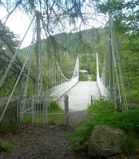
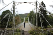
1834: Digoin
Digoin, Saône-et-Loire and Allier, France - Loire River
| Bridgemeister ID: | 1156 (added 2004-01-18) |
| Year Completed: | 1834 |
| Name: | Digoin |
| Location: | Digoin, Saône-et-Loire and Allier, France |
| Crossing: | Loire River |
| Coordinates: | 46.479272 N 3.969957 E |
| Maps: | Acme, GeoHack, Google, OpenStreetMap |
| References: | AAJ |
| Use: | Vehicular |
| Status: | Replaced, 1907 |
| Main Cables: | Wire (iron) |
| Main Spans: | 3 |
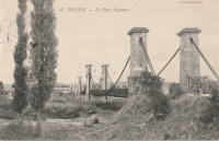
1834: Ile aux Barques
Ile aux Barques, Geneva, Switzerland
| Bridgemeister ID: | 1826 (added 2005-05-30) |
| Year Completed: | 1834 |
| Name: | Ile aux Barques |
| Also Known As: | Bergues |
| Location: | Ile aux Barques, Geneva, Switzerland |
| Principals: | Guillame Henri Dufour |
| References: | AAJ, GHD |
| Use: | Footbridge |
| Status: | Removed, 1881 |
| Main Cables: | Wire (iron) |
| Suspended Spans: | 1 |
| Main Span: | 1 x 33.5 meters (109.9 feet) |
Notes:
- GHD: "...asymmetrical bridge supported by a single pier."
- Ile aux Barques is now known as Ile Jean-Jacques Rousseau.
- This location is better known for the large underspanned suspension bridge completed in 1834 by Dufour (documented in great detail in reference GHD). The underspanned bridge is omitted from the Bridgemeister inventory. This entry is for the small footbridge that connected to the larger underspanned bridge. Follow the image link for more information.
External Links:
1834: Jargeau
Jargeau and Saint-Denis-de-l'Hôtel, Loiret, France - Loire River
| Bridgemeister ID: | 1042 (added 2003-12-06) |
| Year Completed: | 1834 |
| Name: | Jargeau |
| Also Known As: | Saint-Denis-de-l'Hôtel |
| Location: | Jargeau and Saint-Denis-de-l'Hôtel, Loiret, France |
| Crossing: | Loire River |
| Coordinates: | 47.869886 N 2.124662 E |
| Maps: | Acme, GeoHack, Google, OpenStreetMap |
| Use: | Vehicular |
| Status: | Replaced, 1927 |
| Main Cables: | Chain (iron) |
| Main Spans: | 5 x 54 meters (177.2 feet) |
Notes:
- 1847: Partially reconstructed.
- 1870: Partially destroyed during Franco-Prussian War.
- 1872: Repairs completed and bridge reopened.
- Replaced by 1927 Jargeau (Saint-Denis-de-l'Hôtel) - Jargeau and Saint-Denis-de-l'Hôtel, Loiret, France.
External Links:
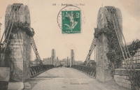
1834: Lamothe
Lamothe and Brioude, Haute-Loire, France - Allier River
| Bridgemeister ID: | 1763 (added 2005-04-22) |
| Year Completed: | 1834 |
| Name: | Lamothe |
| Location: | Lamothe and Brioude, Haute-Loire, France |
| Crossing: | Allier River |
| Coordinates: | 45.302910 N 3.403816 E |
| Maps: | Acme, GeoHack, Google, OpenStreetMap |
| References: | AAJ |
| Use: | Vehicular |
| Status: | Only towers remain (last checked: 2011) |
| Main Cables: | Wire (iron) |
| Suspended Spans: | 2 |
| Main Spans: | 2 |
Notes:
- 1866: A flood causes a major change in the course of the Allier River such that the main channel no longer flows under the bridge. The bridge, however, is not destroyed. A new suspension bridge is built in the 1880s over the main channel of the Allier just slightly east of the older bridge.
- All three pairs of pylons were still standing in the 2010s.
- Similar to 1833 Cosne-sur-Loire - Cosne-sur-Loire, Nièvre and Boulleret, Cher, France in appearance of towers.
- Similar to 1834 Jargeau (Saint-Denis-de-l'Hôtel) - Jargeau and Saint-Denis-de-l'Hôtel, Loiret, France in appearance of towers.
- Near 1884 Lamothe - Lamothe and Brioude, Haute-Loire, France.
External Links:
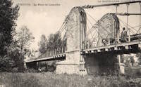
1834: Loubéjac
Loubéjac and Lamothe-Capdeville, Tarn-et-Garonne, France - Aveyron River
| Bridgemeister ID: | 2189 (added 2007-01-25) |
| Year Completed: | 1834 |
| Name: | Loubéjac |
| Location: | Loubéjac and Lamothe-Capdeville, Tarn-et-Garonne, France |
| Crossing: | Aveyron River |
| References: | AAJ |
1834: Louis-Philippe
Île St-Louis, Paris, France - Seine River
| Bridgemeister ID: | 983 (added 2003-11-15) |
| Year Completed: | 1834 |
| Name: | Louis-Philippe |
| Also Known As: | de la Reforme |
| Location: | Île St-Louis, Paris, France |
| Crossing: | Seine River |
| Principals: | Marc Seguin |
| References: | AAJ, PTS2 |
| Use: | Vehicular (one-lane), with walkway |
| Status: | Replaced |
| Main Cables: | Wire (iron) |
| Suspended Spans: | 2 |
| Main Spans: | 2 |
| Deck width: | 14.44 feet |
Notes:
- Badly damaged by fire 1848. Replaced 1860 (or soon after).
- Next to 1842 Cité (City, Île de la Cité) - Île de la Cité and Île St-Louis, Paris, France.
External Links:
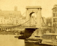
1834: Lussac-les-Châteaux
Lussac-les-Châteaux, Vienne, France - Vienne River
| Bridgemeister ID: | 4926 (added 2020-07-27) |
| Year Completed: | 1834 |
| Name: | Lussac-les-Châteaux |
| Location: | Lussac-les-Châteaux, Vienne, France |
| Crossing: | Vienne River |
| References: | AAJ |
| Status: | Removed |
| Main Cables: | Chain (iron) |
| Suspended Spans: | 1 |
Notes:
- Likely completed in 1834 based on contract let in 1832.
1834: Pontoise
Pontoise, Val-d'Oise, France - Oise River
| Bridgemeister ID: | 1770 (added 2005-04-22) |
| Year Completed: | 1834 |
| Name: | Pontoise |
| Location: | Pontoise, Val-d'Oise, France |
| Crossing: | Oise River |
| References: | AAJ |
| Use: | Vehicular (one-lane), with walkway |
| Suspended Spans: | 1 |
| Main Span: | 1 x 50 meters (164.05 feet) |
| Deck width: | 14.44 feet |
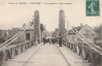
1834: Port-Sainte-Marie
Port-Sainte-Marie and Saint-Laurent, Lot-et-Garonne, France - Garonne River
| Bridgemeister ID: | 1765 (added 2005-04-22) |
| Year Completed: | 1834 |
| Name: | Port-Sainte-Marie |
| Location: | Port-Sainte-Marie and Saint-Laurent, Lot-et-Garonne, France |
| Crossing: | Garonne River |
| References: | AAJ |
| Use: | Vehicular |
| Status: | Replaced, 1899 |
| Suspended Spans: | 1 |
| Main Span: | 1 x 200 meters (656.2 feet) |
| Deck width: | 14.44 feet |
Notes:
- Failed, January 8, 1835. Rebuilt.
- Replaced by 1899 Port-Sainte-Marie - Port-Sainte-Marie and Saint-Laurent, Lot-et-Garonne, France.
1834: Saint Francois
Tréguier and Plouguiel, Côtes-d'Armor, France - Guindy River
| Bridgemeister ID: | 1122 (added 2004-01-09) |
| Year Completed: | 1834 |
| Name: | Saint Francois |
| Location: | Tréguier and Plouguiel, Côtes-d'Armor, France |
| Crossing: | Guindy River |
| Coordinates: | 48.789737 N 3.236838 W |
| Maps: | Acme, GeoHack, Google, OpenStreetMap |
| Use: | Footbridge |
| Status: | In use (last checked: 2019) |
| Main Cables: | Wire (iron) |
| Suspended Spans: | 1 |
| Main Span: | 1 x 71.2 meters (233.6 feet) |
External Links:
1834: Saint-Marcel-sur-Aude
Saint-Marcel-sur-Aude and Marcorignan, Aude, France - Aude River
| Bridgemeister ID: | 4927 (added 2020-07-27) |
| Year Completed: | 1834 |
| Name: | Saint-Marcel-sur-Aude |
| Location: | Saint-Marcel-sur-Aude and Marcorignan, Aude, France |
| Crossing: | Aude River |
| Coordinates: | 43.234368 N 2.926676 E |
| Maps: | Acme, GeoHack, Google, OpenStreetMap |
| References: | AAJ |
| Use: | Vehicular |
| Status: | Replaced, 1929 |
| Main Cables: | Wire (iron) |
| Main Span: | 1 |
Notes:
- AAJ supposes bridge was completed in 1834 based on a contract let in 1832 for a construction period of two years.
- Later at same location Saint-Marcel-sur-Aude - Saint-Marcel-sur-Aude and Marcorignan, Aude, France.
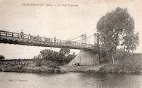
1834: Saint-Thibault
Saint-Thibault, Saint-Satur vicinity, Cher and Nièvre, France - Loire River
| Bridgemeister ID: | 1650 (added 2005-03-19) |
| Year Completed: | 1834 |
| Name: | Saint-Thibault |
| Location: | Saint-Thibault, Saint-Satur vicinity, Cher and Nièvre, France |
| Crossing: | Loire River |
| Coordinates: | 47.338358 N 2.868882 E |
| Maps: | Acme, GeoHack, Google, OpenStreetMap |
| References: | AAJ |
| Use: | Vehicular (one-lane) |
| Status: | Replaced, 1934 |
| Main Cables: | Chain (iron) |
| Suspended Spans: | 5 |
| Main Spans: | 5 |
| Deck width: | 14.44 feet |
External Links:
Do you have any information or photos for these bridges that you would like to share? Please email david.denenberg@bridgemeister.com.