Suspension Bridges Completed 1930-1939 (201-250 of 250)
This is a list of bridges 201 through 250 (of 250 total) from the suspension bridge inventory completed in the decade 1930-1939. Wherever you see a Bridgemeister ID number click it to isolate the bridge on its own page.
Related Lists:
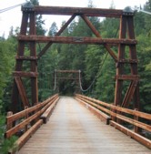
1938: Buker
Scott Bar vicinity, California, USA - Scott River
| Bridgemeister ID: | 581 (added 2003-01-01) |
| Year Completed: | 1938 |
| Name: | Buker |
| Also Known As: | Canyon Creek, Scott River |
| Location: | Scott Bar vicinity, California, USA |
| Crossing: | Scott River |
| At or Near Feature: | Klamath National Forest |
| Coordinates: | 41.63408 N 123.10570 W |
| Maps: | Acme, GeoHack, Google, OpenStreetMap |
| Use: | Vehicular (one-lane) |
| Status: | In use |
| Main Cables: | Wire (steel) |
| Suspended Spans: | 1 |
Notes:
- Restored 1998 (per plaque posted on bridge).
External Links:
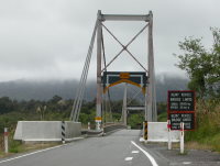
1938: Fox River
Fox Glacier valley, West Coast, New Zealand - Fox River
| Bridgemeister ID: | 763 (added 2003-03-08) |
| Year Completed: | 1938 |
| Name: | Fox River |
| Location: | Fox Glacier valley, West Coast, New Zealand |
| Crossing: | Fox River |
| Coordinates: | 43.477723 S 170.008270 E |
| Maps: | Acme, GeoHack, Google, OpenStreetMap |
| References: | GAP |
| Use: | Vehicular (one-lane) |
| Status: | In use (last checked: 2019) |
| Main Cables: | Wire (steel) |
| Suspended Spans: | 1 |
| Main Span: | 1 x 109.7 meters (359.9 feet) |
External Links:
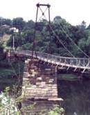
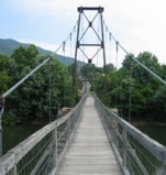
1938: James River
Buchanan, Virginia, USA - James River
| Bridgemeister ID: | 337 (added before 2003) |
| Year Completed: | 1938 |
| Name: | James River |
| Location: | Buchanan, Virginia, USA |
| Crossing: | James River |
| Coordinates: | 37.53038 N 79.67793 W |
| Maps: | Acme, GeoHack, Google, OpenStreetMap |
| Principals: | Virginia State Highway Department (now VDOT) |
| References: | RT20040413 |
| Use: | Footbridge |
| Status: | In use (last checked: 2022) |
| Main Cables: | Wire (steel) |
| Suspended Spans: | 2 |
| Main Span: | 1 |
| Side Span: | 1 |
Notes:
- This oddly-proportioned bridge has a long side-span on one side and no side-span on the other.
- Damaged by storm, November, 2003. Temporarily closed, February, 2004. Repaired and reopened March, 2004.
External Links:
1938: Jerambah
Selindung, Pangkalpinang and Balunijuk, Bangka Regency, Bangka Belitung Islands, Indonesia - Sungai Nielanding
| Bridgemeister ID: | 8174 (added 2024-02-04) |
| Year Completed: | 1938 |
| Name: | Jerambah |
| Location: | Selindung, Pangkalpinang and Balunijuk, Bangka Regency, Bangka Belitung Islands, Indonesia |
| Crossing: | Sungai Nielanding |
| Coordinates: | 2.086800 S 106.093350 E |
| Maps: | Acme, GeoHack, Google, OpenStreetMap |
| Use: | Footbridge |
| Status: | Only towers remain (last checked: 2023) |
| Main Span: | 1 x 54.5 meters (178.8 feet) estimated |
Notes:
- In 2021, a large faux suspension bridge was completed next to the remains of the suspension bridge. Patrick S. O'Donnell writes: "These remnants are overshadowed (physically, but not historically) by the relatively new (2021) concrete highway bridge designed to look like a suspension bridge. Built in homage to the original suspension bridge at this site, this new bridge's suspension elements are all decorative; from the main and suspender cables to the accompanying hardware, and the steel towers that are to their credit at least fixed to the ground and not the bridge itself. The new bridge's construction did have a setback when all the mainspan concrete girders collapsed into the river on October 16, 2020. The new bridge was inaugurated on March 4, 2021."
External Links:
- Google Maps - Jembatan Jerambah Gantung. Image showing the old suspension bridge towers. Dated March 2021.
- Google Maps - Jembatan Jerambah Gantung. Image showing the old suspension bridge towers. Dated March 2021.
- Google Maps - Jembatan Jerambah Gantung. The new bridge with decorative suspension components.
- YouTube - JALAN MENUJU JERAMBAH GANTUNG PANGKAL PINANG || LENGKAP MENUJU LOKASI. Video of the mess after the collapse of the new bridge under construction. The tower of the old suspension bridge is clearly visible starting around the 8:35 mark. Posted November 16, 2020.
1938: Kamui-Ohashi
Asahikawa vicinity, Hokkaido, Japan - Ishikari River
| Bridgemeister ID: | 1877 (added 2005-09-22) |
| Year Completed: | 1938 |
| Name: | Kamui-Ohashi |
| Also Known As: | 神居大橋 |
| Location: | Asahikawa vicinity, Hokkaido, Japan |
| Crossing: | Ishikari River |
| Coordinates: | 43.732417 N 142.200883 E |
| Maps: | Acme, GeoHack, Google, OpenStreetMap |
| Status: | In use (last checked: 2021) |
| Main Cables: | Wire (steel) |
| Suspended Spans: | 3 |
| Main Span: | 1 x 38.8 meters (127.3 feet) estimated |
| Side Spans: | 2 |
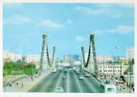
1938: Krymsky
Moscow, Russia - Moskva River
| Bridgemeister ID: | 960 (added 2003-11-01) |
| Year Completed: | 1938 |
| Name: | Krymsky |
| Also Known As: | Crimean |
| Location: | Moscow, Russia |
| Crossing: | Moskva River |
| Coordinates: | 55.734082 N 37.598721 E |
| Maps: | Acme, GeoHack, Google, OpenStreetMap |
| Principals: | B. P. Konstantinov, A. V. Vlasov |
| Use: | Vehicular (four or more lanes) |
| Status: | In use (last checked: 2021) |
| Main Cables: | Eyebar (steel) |
| Suspended Spans: | 1 |
External Links:
1938: Lake Mathews Outlet Tower
Corona vicinity, California, USA - Lake Mathews
| Bridgemeister ID: | 1891 (added 2005-10-01) |
| Year Completed: | 1938 |
| Name: | Lake Mathews Outlet Tower |
| Location: | Corona vicinity, California, USA |
| Crossing: | Lake Mathews |
| Coordinates: | 33.849279 N 117.455022 W |
| Maps: | Acme, GeoHack, Google, OpenStreetMap |
| References: | CE193806 |
| Use: | Footbridge |
| Status: | Removed |
| Main Cables: | Wire (steel) |
| Suspended Spans: | 1 |
Notes:
- Outlet tower access bridge. Likely completed 1938 with Cajalco (now Lake Matthews) Reservoir construction.
External Links:
- Intake structure of the Colorado River Aqueduct on the Colorado River, June 11, 1941 — Calisphere
- Water and Power Associates - Construction of the Colorado River Aqueduct. Multiple photos of the outlet tower and access bridge.
1938: Manning
Riggins Hot Springs vicinity, Idaho, USA - Salmon River
| Bridgemeister ID: | 1333 (added 2004-05-01) |
| Year Completed: | 1938 |
| Name: | Manning |
| Also Known As: | Crevasse |
| Location: | Riggins Hot Springs vicinity, Idaho, USA |
| Crossing: | Salmon River |
| At or Near Feature: | Manning Crevice |
| Coordinates: | 45.401517 N 116.11682 W |
| Maps: | Acme, GeoHack, Google, OpenStreetMap |
| Principals: | J. P. Martin, E. Myers |
| References: | AAJ |
| Use: | Vehicular (one-lane) |
| Status: | Replaced, 2018 |
| Main Cables: | Wire (steel) |
| Suspended Spans: | 1 |
| Main Span: | 1 x 73.2 meters (240 feet) |
Notes:
- 2018: Replaced by another suspension bridge, removed at some point 2018-2020.
- Replaced by 2018 Manning Crevice - Riggins Hot Springs vicinity, Idaho, USA.
External Links:

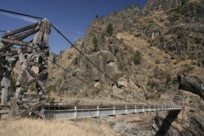
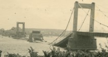
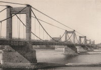
1938: Montjean-sur-Loire
Montjean-sur-Loire, Maine-et-Loire, France - Loire River
| Bridgemeister ID: | 6422 (added 2021-08-09) |
| Year Completed: | 1938 |
| Name: | Montjean-sur-Loire |
| Location: | Montjean-sur-Loire, Maine-et-Loire, France |
| Crossing: | Loire River |
| Coordinates: | 47.392675 N 0.860650 W |
| Maps: | Acme, GeoHack, Google, OpenStreetMap |
| Use: | Vehicular |
| Status: | Destroyed, June, 1940 |
| Main Cables: | Wire (steel) |
| Suspended Spans: | 6 |
| Main Spans: | 4 |
| Side Spans: | 2 |
Notes:
- 1940, June: Intentionally destroyed to slow advancing German troops.
- Replaced 1927 Montjean-sur-Loire - Montjean-sur-Loire, Maine-et-Loire, France.
- Later at same location 1949 Montjean-sur-Loire - Montjean-sur-Loire, Maine-et-Loire, France.
1938: Nengtan
Nengtan (能滩村), Luxi County, Xiangxi, Hunan, China - Nengtan River
| Bridgemeister ID: | 8227 (added 2024-02-07) |
| Year Completed: | 1938 |
| Name: | Nengtan |
| Location: | Nengtan (能滩村), Luxi County, Xiangxi, Hunan, China |
| Crossing: | Nengtan River |
| Coordinates: | 28.233306 N 109.984139 E |
| Maps: | Acme, GeoHack, Google, OpenStreetMap |
| Use: | Vehicular (one-lane) |
| Status: | Closed |
| Main Cables: | Chain |
| Suspended Spans: | 1 |
External Links:
1938: Queanbeyan
Queanbeyan, New South Wales, Australia - Queanbeyan River
| Bridgemeister ID: | 454 (added before 2003) |
| Year Completed: | 1938 |
| Name: | Queanbeyan |
| Location: | Queanbeyan, New South Wales, Australia |
| Crossing: | Queanbeyan River |
| Coordinates: | 35.35567 S 149.23857 E |
| Maps: | Acme, GeoHack, Google, OpenStreetMap |
| Use: | Footbridge |
| Status: | Restricted to foot traffic (last checked: 2021) |
| Main Cables: | Wire (steel) |
| Suspended Spans: | 1 |
Notes:
1938: Roquefort-sur-Garonne
Fourc and Roquefort-sur-Garonne, Haute-Garonne, France - Salat River
| Bridgemeister ID: | 7399 (added 2022-12-03) |
| Year Completed: | 1938 |
| Name: | Roquefort-sur-Garonne |
| Location: | Fourc and Roquefort-sur-Garonne, Haute-Garonne, France |
| Crossing: | Salat River |
| Coordinates: | 43.158060 N 0.968714 E |
| Maps: | Acme, GeoHack, Google, OpenStreetMap |
| Use: | Vehicular (two-lane) |
| Status: | In use (last checked: 2021) |
| Main Cables: | Wire (steel) |
| Suspended Spans: | 1 |
| Main Span: | 1 x 67 meters (219.8 feet) estimated |
Notes:
1938: Saint-Gilles
Saint-Gilles-du-Gard, Gard, France - Petit Rhône River
| Bridgemeister ID: | 6743 (added 2021-10-23) |
| Year Completed: | 1938 |
| Name: | Saint-Gilles |
| Location: | Saint-Gilles-du-Gard, Gard, France |
| Crossing: | Petit Rhône River |
| Coordinates: | 43.665675 N 4.452997 E |
| Maps: | Acme, GeoHack, Google, OpenStreetMap |
| Use: | Vehicular |
| Status: | Replaced, 1985 |
| Main Cables: | Wire (steel) |
| Suspended Spans: | 1 |
| Main Span: | 1 |
Notes:
External Links:
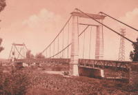
1938: Saula
Lafrançaise, Tarn-et-Garonne, France - Tarn River
| Bridgemeister ID: | 7185 (added 2022-07-02) |
| Year Completed: | 1938 |
| Name: | Saula |
| Location: | Lafrançaise, Tarn-et-Garonne, France |
| Crossing: | Tarn River |
| Coordinates: | 44.113997 N 1.247532 E |
| Maps: | Acme, GeoHack, Google, OpenStreetMap |
| Use: | Vehicular (two-lane) |
| Status: | In use (last checked: 2019) |
| Main Cables: | Wire (steel) |
| Suspended Spans: | 1 |
| Main Span: | 1 x 120 meters (393.7 feet) estimated |
Notes:
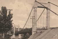
1938: Te Reinga
Wairoa vicinity, New Zealand - Wairoa River
| Bridgemeister ID: | 760 (added 2003-03-08) |
| Year Completed: | 1938 |
| Name: | Te Reinga |
| Location: | Wairoa vicinity, New Zealand |
| Crossing: | Wairoa River |
| References: | GAP |
| Use: | Vehicular (one-lane) |
| Status: | Extant (last checked: 2001) |
| Main Cables: | Wire (steel) |
| Suspended Spans: | 1 |
Notes:
- Scheduled to be demolished, 2003.
External Links:
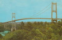
1938: Thousand Islands International I
Wellesley Island and Collins Landing, New York, USA - St. Lawrence River
| Bridgemeister ID: | 364 (added before 2003) |
| Year Completed: | 1938 |
| Name: | Thousand Islands International I |
| Location: | Wellesley Island and Collins Landing, New York, USA |
| Crossing: | St. Lawrence River |
| At or Near Feature: | American Channel |
| Coordinates: | 44.30333 N 75.98333 W |
| Maps: | Acme, GeoHack, Google, OpenStreetMap |
| Principals: | Robinson and Steinman |
| References: | AAJ, ADDS |
| Use: | Vehicular (two-lane, heavy vehicles), with walkway |
| Status: | In use (last checked: 2022) |
| Main Cables: | Wire (steel) |
| Suspended Spans: | 3 |
| Main Span: | 1 x 243.8 meters (800 feet) |
| Side Spans: | 2 x 106.7 meters (350 feet) |
Notes:
External Links:


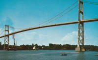
1938: Thousand Islands International II
Georgina Island and Selton, Ontario, Canada - St. Lawrence River
| Bridgemeister ID: | 365 (added before 2003) |
| Year Completed: | 1938 |
| Name: | Thousand Islands International II |
| Location: | Georgina Island and Selton, Ontario, Canada |
| Crossing: | St. Lawrence River |
| Coordinates: | 44.36323 N 75.98271 W |
| Maps: | Acme, GeoHack, Google, OpenStreetMap |
| Principals: | Robinson and Steinman |
| References: | AAJ, ADDS |
| Use: | Vehicular (two-lane, heavy vehicles), with walkway |
| Status: | In use (last checked: 2022) |
| Main Cables: | Wire (steel) |
| Suspended Spans: | 3 |
| Main Span: | 1 x 228.6 meters (750 feet) |
| Side Spans: | 2 x 91.4 meters (300 feet) |
Notes:
- Companion to 1938 Thousand Islands International I - Wellesley Island and Collins Landing, New York, USA.
External Links:
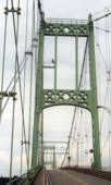
1938: Veenker Golf Course
Ames, Iowa, USA - Squaw Creek
| Bridgemeister ID: | 2690 (added 2019-05-27) |
| Year Completed: | 1938 |
| Name: | Veenker Golf Course |
| Location: | Ames, Iowa, USA |
| Crossing: | Squaw Creek |
| Use: | Golf cart |
| Status: | Failed, November 2014 |
| Main Cables: | Wire (steel) |
| Suspended Spans: | 1 |
1939: (footbridge)
Dannevirke vicinity, New Zealand - Mangatoro Stream
| Bridgemeister ID: | 766 (added 2003-03-08) |
| Year Completed: | 1939 |
| Name: | (footbridge) |
| Location: | Dannevirke vicinity, New Zealand |
| Crossing: | Mangatoro Stream |
| References: | GAP |
| Use: | Footbridge |
1939: (footbridge)
West Bank, New Zealand - Maruia River
| Bridgemeister ID: | 768 (added 2003-03-08) |
| Year Completed: | 1939 |
| Name: | (footbridge) |
| Location: | West Bank, New Zealand |
| Crossing: | Maruia River |
| References: | GAP |
| Use: | Footbridge |
1939: (suspension bridge)
Bend, Texas, USA - Colorado River
| Bridgemeister ID: | 1616 (added 2005-02-26) |
| Year Completed: | 1939 |
| Name: | (suspension bridge) |
| Location: | Bend, Texas, USA |
| Crossing: | Colorado River |
| Principals: | Austin Bridge Co. |
| References: | AUB |
| Use: | Vehicular |
| Status: | Removed |
| Main Cables: | Wire (steel) |
| Suspended Spans: | 3 |
| Main Span: | 1 |
| Side Spans: | 2 |
Notes:
- Similar to 1939 Regency - Regency, Texas, USA. The Bend bridge is pictured in AUB. At first, I thought it was the nearby Regency bridge, but upon closer inspection, the Bend bridge had suspended approach spans. Regency did not. Otherwise, they are very similar in appearance, both having been built in the same year by the same company.
1939: Avalon Dam
Carlsbad vicinity, New Mexico, USA - Headgate Channel
| Bridgemeister ID: | 1960 (added 2005-11-05) |
| Year Completed: | 1939 |
| Name: | Avalon Dam |
| Location: | Carlsbad vicinity, New Mexico, USA |
| Crossing: | Headgate Channel |
| Coordinates: | 32.491492 N 104.251506 W |
| Maps: | Acme, GeoHack, Google, OpenStreetMap |
| Principals: | Civilian Conservation Corps (CCC) |
| References: | HAERNM4B |
| Use: | Footbridge |
| Status: | Extant (last checked: 2019) |
| Main Cables: | Wire |
| Suspended Spans: | 1 |
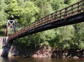
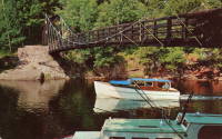
1939: Black River Harbor
Ottawa National Forest, Michigan, USA - Black River
| Bridgemeister ID: | 1045 (added 2003-12-06) |
| Year Completed: | 1939 |
| Name: | Black River Harbor |
| Location: | Ottawa National Forest, Michigan, USA |
| Crossing: | Black River |
| Coordinates: | 46.66608 N 90.04611 W |
| Maps: | Acme, GeoHack, Google, OpenStreetMap |
| Principals: | 3601st Company CCC (Civilian Conservation Corps) Camp Norrie |
| Use: | Footbridge |
| Status: | In use (last checked: 2019) |
| Main Cables: | Wire (steel) |
| Suspended Spans: | 1 |
| Main Span: | 1 x 58.8 meters (193 feet) |
Notes:
- Reconstructed, 1968, but appears to have retained its original appearance. Improvements made, 2009.
- Tom Haapoja provided information about this bridge. His father worked on its construction: "Built in 1938-39. They had a sawmill on site from which they took 'select' lumber for the bridge and boat docking area. I think the sawmill was located on the present-day parking lot. Each anchor for the suspension cables consisted of 44 tons of concrete. The concrete was transported to the forms via wheelbarrows. The construction of the East anchor was difficult because the wheelbarrows travelled uphill, and each were pushed by one man and pulled by another."
"It was a WPA and CCC effort. The CCC Camp discipline and logistics were provided by the US Army, but the construction supervision was provided by the WPA. About 200 Men from the Norrie CCC camp (Ironwood, Michigan) participated in the construction of the bridge and surrounding park. They worked during the cold of winter and rode to and from Camp Norrie in open trucks. Each trip took 1 1/2 hours. The architect of the bridge was 'Oakey' Johnson. The WPA construction foreman was 'Charlie' Johnson."
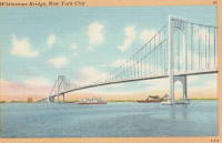
1939: Bronx-Whitestone
The Bronx and Queens, New York, USA - East River
| Bridgemeister ID: | 191 (added before 2003) |
| Year Completed: | 1939 |
| Name: | Bronx-Whitestone |
| Location: | The Bronx and Queens, New York, USA |
| Crossing: | East River |
| Coordinates: | 40.80167 N 73.83 W |
| Maps: | Acme, GeoHack, Google, OpenStreetMap |
| Principals: | O. H. Ammann, Allston Dana |
| References: | AAJ, ARF, BAAW, BBR, BFL, BPL, GBD, SIX |
| Use: | Vehicular (major highway) |
| Status: | In use (last checked: 2022) |
| Main Cables: | Wire (steel) |
| Suspended Spans: | 3 |
| Main Span: | 1 x 701 meters (2,300 feet) |
| Side Spans: | 2 x 224 meters (735 feet) |
Notes:
External Links:

1939: Chute du Brule
Grand-Remous, Quebec, Canada - Gatineau River
| Bridgemeister ID: | 192 (added before 2003) |
| Year Completed: | 1939 |
| Name: | Chute du Brule |
| Location: | Grand-Remous, Quebec, Canada |
| Crossing: | Gatineau River |
| Principals: | Dominion Bridge Co. |
| Use: | Vehicular (two-lane) |
| Status: | Removed |
| Main Cables: | Wire (steel) |
| Suspended Spans: | 1 |
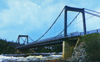
1939: Cook River
West Coast, New Zealand - Cook River
| Bridgemeister ID: | 764 (added 2003-03-08) |
| Year Completed: | 1939 |
| Name: | Cook River |
| Location: | West Coast, New Zealand |
| Crossing: | Cook River |
| Coordinates: | 43.498923 S 169.966063 E |
| Maps: | Acme, GeoHack, Google, OpenStreetMap |
| References: | GAP |
| Use: | Vehicular (one-lane) |
| Status: | In use (last checked: 2019) |
| Main Cables: | Wire (steel) |
| Suspended Spans: | 1 |
| Main Span: | 1 x 80.5 meters (264.1 feet) |
External Links:
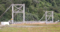
1939: Curran
Littleton, New Hampshire, USA - Ammonoosuc River
| Bridgemeister ID: | 2583 (added 2013-09-22) |
| Year Completed: | 1939 |
| Name: | Curran |
| Location: | Littleton, New Hampshire, USA |
| Crossing: | Ammonoosuc River |
| Coordinates: | 44.306115 N 71.778048 W |
| Maps: | Acme, GeoHack, Google, OpenStreetMap |
| Principals: | Kenneth Curran |
| Use: | Footbridge |
| Status: | In use (last checked: 2019) |
| Main Cables: | Wire (steel) |
| Suspended Spans: | 3 |
| Main Span: | 1 x 74.4 meters (244 feet) estimated |
| Side Spans: | 1 x 15.2 meters (50 feet) estimated, 1 x 7 meters (23 feet) estimated |
Notes:
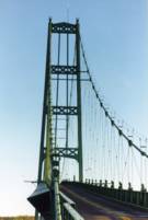
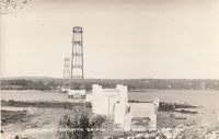
1939: Deer Isle
Sedgwick, Maine, USA - Eggemoggin Reach
| Bridgemeister ID: | 193 (added before 2003) |
| Year Completed: | 1939 |
| Name: | Deer Isle |
| Location: | Sedgwick, Maine, USA |
| Crossing: | Eggemoggin Reach |
| Coordinates: | 44.290167 N 68.691383 W |
| Maps: | Acme, GeoHack, Google, OpenStreetMap |
| Principals: | Robinson and Steinman |
| References: | AAJ, BBR, IT1999F |
| Use: | Vehicular (two-lane, heavy vehicles), with walkway |
| Status: | In use (last checked: 2022) |
| Main Cables: | Wire (steel) |
| Suspended Spans: | 3 |
| Main Span: | 1 x 329.2 meters (1,080 feet) |
| Side Spans: | 2 x 147.5 meters (484 feet) |
Notes:
- Gained much media attention in July 2018 when a bracket broke loose connecting the maintenance access cables to the main cables even though it had no impact on the structural integrity of the bridge.
External Links:

1939: Far Red Hill
Mount Morgan, Queensland, Australia - Dee River
| Bridgemeister ID: | 1748 (added 2005-04-20) |
| Year Completed: | 1939 |
| Name: | Far Red Hill |
| Location: | Mount Morgan, Queensland, Australia |
| Crossing: | Dee River |
| Coordinates: | 23.651006 S 150.376080 E |
| Maps: | Acme, GeoHack, Google, OpenStreetMap |
| Use: | Footbridge |
| Status: | Only towers remain (last checked: 2019) |
| Main Cables: | Wire |
Notes:
External Links:
- Mount Morgan web site (link reported not working). Notes: "At a special meeting of the Mount Morgan Shire Council in February 1939, the Council accepted a tender from Mr. W. Kerrigan to rebuild [the previous Far Red Hill bridge]. The bridge is now neglected and in a very bad state of repair and is unusable."
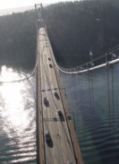
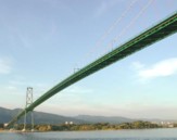
1939: Lions Gate
Vancouver, British Columbia, Canada - Vancouver Harbor
| Bridgemeister ID: | 194 (added before 2003) |
| Year Completed: | 1939 |
| Name: | Lions Gate |
| Also Known As: | First Narrows |
| Location: | Vancouver, British Columbia, Canada |
| Crossing: | Vancouver Harbor |
| At or Near Feature: | Burrard Inlet |
| Coordinates: | 49.31533 N 123.13846 W |
| Maps: | Acme, GeoHack, Google, OpenStreetMap |
| Principals: | Monsarrat and Pratley |
| References: | AAJ, BAR, BMA |
| Use: | Vehicular (major highway) |
| Status: | In use (last checked: 2019) |
| Main Cables: | Wire (steel) |
| Suspended Spans: | 3 |
| Main Span: | 1 x 472.4 meters (1,550 feet) |
| Side Spans: | 2 x 187.5 meters (615 feet) |
| Deck width: | 39 feet |
External Links:

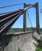
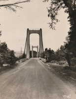
1939: Manosque
Manosque, Alpes-de-Haute-Provence, France - Durance River
| Bridgemeister ID: | 897 (added 2003-09-07) |
| Year Completed: | 1939 |
| Name: | Manosque |
| Location: | Manosque, Alpes-de-Haute-Provence, France |
| Crossing: | Durance River |
| Coordinates: | 43.8047 N 5.8238 E |
| Maps: | Acme, GeoHack, Google, OpenStreetMap |
| Use: | Vehicular (two-lane, heavy vehicles), with walkway |
| Status: | Replaced, 2019 |
| Main Cables: | Wire (steel) |
| Suspended Spans: | 1 |
Notes:
- At former location of 1839 Manosque - Manosque, Alpes-de-Haute-Provence, France.
External Links:
| Bridgemeister ID: | 2733 (added 2019-06-23) |
| Year Completed: | 1939 |
| Name: | Målselv |
| Location: | Målselv, Troms og Finnmark, Norway |
| Crossing: | Målselv |
| Coordinates: | 69.139009 N 18.601639 E |
| Maps: | Acme, GeoHack, Google, kart.1881.no, OpenStreetMap |
| Use: | Vehicular (one-lane) |
| Status: | In use (last checked: 2019) |
| Main Cables: | Wire (steel) |
| Suspended Spans: | 1 |
| Main Span: | 1 x 115 meters (377.3 feet) |
1939: Mosquito Road
Placerville, California, USA - South Fork American River
| Bridgemeister ID: | 346 (added before 2003) |
| Year Completed: | 1939 |
| Name: | Mosquito Road |
| Location: | Placerville, California, USA |
| Crossing: | South Fork American River |
| Coordinates: | 38.77582 N 120.74854 W |
| Maps: | Acme, GeoHack, Google, OpenStreetMap |
| Use: | Vehicular (one-lane) |
| Status: | In use (last checked: 2021) |
| Main Cables: | Wire (steel) |
| Suspended Spans: | 1 |
Notes:
External Links:

1939: Otto Beit
Makuti, Zimbabwe and Chirundu, Zambia - Zambezi River
| Bridgemeister ID: | 937 (added 2003-10-25) |
| Year Completed: | 1939 |
| Name: | Otto Beit |
| Also Known As: | Chirundu |
| Location: | Makuti, Zimbabwe and Chirundu, Zambia |
| Crossing: | Zambezi River |
| Coordinates: | 16.038006 S 28.852322 E |
| Maps: | Acme, GeoHack, Google, OpenStreetMap |
| Principals: | Ralph Freeman, Dorman Long & Co Ltd |
| References: | AAJ, WOT |
| Use: | Vehicular (two-lane, heavy vehicles) |
| Status: | In use (last checked: 2018) |
| Main Cables: | Wire (steel) |
| Main Span: | 1 x 320 meters (1,049.9 feet) |
External Links:
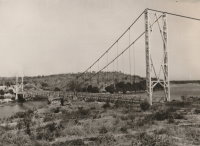
1939: Regency
Regency, Texas, USA - Colorado River
| Bridgemeister ID: | 195 (added before 2003) |
| Year Completed: | 1939 |
| Name: | Regency |
| Location: | Regency, Texas, USA |
| Crossing: | Colorado River |
| Coordinates: | 31.41167 N 98.84667 W |
| Maps: | Acme, GeoHack, Google, OpenStreetMap |
| Principals: | Austin Bridge Co. |
| References: | AUB |
| Use: | Vehicular (one-lane) |
| Status: | In use (last checked: 2008) |
| Main Cables: | Wire (steel) |
| Suspended Spans: | 1 |
| Main Span: | 1 x 103.6 meters (340 feet) |
Notes:
- Similar to 1939 (suspension bridge) - Bend, Texas, USA.
External Links:
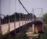
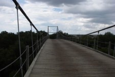
1939: Saint-Jean-de-Blaignac
Saint-Jean-de-Blaignac and Lavagnac, Gironde, France - Dordogne River
| Bridgemeister ID: | 7336 (added 2022-09-03) |
| Year Completed: | 1939 |
| Name: | Saint-Jean-de-Blaignac |
| Location: | Saint-Jean-de-Blaignac and Lavagnac, Gironde, France |
| Crossing: | Dordogne River |
| Use: | Vehicular |
| Status: | Destroyed |
| Suspended Spans: | 3 |
| Main Spans: | 3 |
Notes:
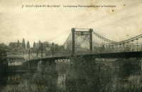
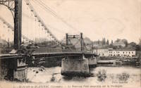
1939: Skoltefoss
Elvenes vicinity, Norway - Pasvikelva
| Bridgemeister ID: | 3953 (added 2020-03-21) |
| Year Completed: | 1939 |
| Name: | Skoltefoss |
| Location: | Elvenes vicinity, Norway |
| Crossing: | Pasvikelva |
| Use: | Vehicular |
| Status: | Destroyed, December 1939 |
| Main Cables: | Wire (steel) |
| Suspended Spans: | 1 |
Notes:
- Opened September 9, 1939 and soon after destroyed in December 1939, bombed by Finland during the Winter War between Russia and Finland.
- Unclear if this bridge, when constructed, was actually in Norway, Finland, or straddling the border between the two as it existed in 1939. It was constructed directly over falls in an area known as Skoltefoss where a dam has since been constructed. The current border at this location has changed as a result of the WWII-era hostilities between Finland and Russia and is now between Norway and Russia.
External Links:
1939: Sullivan-Hutsonville
Hutsonville, Illinois and Sullivan, Indiana, USA - Wabash River
| Bridgemeister ID: | 196 (added before 2003) |
| Year Completed: | 1939 |
| Name: | Sullivan-Hutsonville |
| Location: | Hutsonville, Illinois and Sullivan, Indiana, USA |
| Crossing: | Wabash River |
| Coordinates: | 39.1101 N 87.6551 W |
| Maps: | Acme, GeoHack, Google, OpenStreetMap |
| Principals: | Steinman & Robinson, R.V. Milbank, Wisconsin Bridge & Iron Co., Charles J. Glasgow |
| References: | AAJ, BPL, IMB, SJR19880926 |
| Use: | Vehicular (two-lane), with walkway |
| Status: | Demolished, 1989 |
| Main Cables: | Wire (steel) |
| Suspended Spans: | 3 |
| Main Span: | 1 x 106.7 meters (350 feet) |
| Side Spans: | 2 x 45.7 meters (150 feet) |
| Deck width: | 20 feet |
| Characteristics: | Self-anchored |
Notes:
- Demolished 1989. This bridge was Steinman's attempt at a self-anchored suspension bridge and met a controversial demise in 1989. An article in the September 26, 1988 issue of the Springfield, IL "The State Journal-Register" describes the ongoing controversy. The company to which the $100,000 demolition contract was let offered to turn the money over to save the bridge. The locals agreed, but the company's Chief Engineer Stephen Schneider was quoted, "I think Indiana really wants to tear it down. They've been ... forced to send inspectors out every two weeks. I think they just want the headache gone." Gary Abell, spokesman for the Indiana Dept. Of Highways said its design is "not one of the best. It works in theory, but not in practice. This is like trying to save a mistake." After a lot of back-and-forth, the locals gave up, "We've had it with them. We don't want anything more to do with it. They can tear the damn thing down." Animosity toward this bridge continues 13 years after its demolition. In 2002, in an email to Wayne Grodkiewicz (who provided me with much information about this bridge), an INDOT representative said, "I am not sure why you are interested in that bridge, but from our stand point, it was a very poorly designed bridge that had many many problems from the day that it was completed, until it was brought down."
External Links:
1939: Swinging
Tishomingo State Park, Mississippi, USA - Bear Creek
| Bridgemeister ID: | 850 (added 2003-07-27) |
| Year Completed: | 1939 |
| Name: | Swinging |
| Location: | Tishomingo State Park, Mississippi, USA |
| Crossing: | Bear Creek |
| Coordinates: | 34.605183 N 88.17955 W |
| Maps: | Acme, GeoHack, Google, OpenStreetMap |
| Use: | Footbridge |
| Status: | In use (last checked: 2020) |
| Main Cables: | Wire (steel) |
| Suspended Spans: | 1 |
| Main Span: | 1 x 57.9 meters (190 feet) estimated |
Notes:
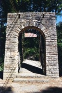
- Likely built by the CCC, this bridge has an interesting zig-zag pattern of suspenders. The suspenders are inclined and are continuous across the bridge like a shoelace with one set of eyelets at deck level and the other set of eyelets along the main cables.
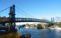
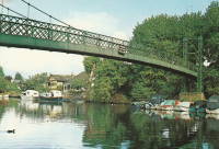
1939: Thames Ditton Island
Thames Ditton, England, United Kingdom - River Thames
| Bridgemeister ID: | 2089 (added 2006-07-02) |
| Year Completed: | 1939 |
| Name: | Thames Ditton Island |
| Location: | Thames Ditton, England, United Kingdom |
| Crossing: | River Thames |
| Coordinates: | 51.39303 N 0.33127 W |
| Maps: | Acme, GeoHack, Google, OpenStreetMap |
| Principals: | David Rowell & Co. |
| Use: | Footbridge |
| Status: | In use (last checked: 2012) |
| Main Cables: | Wire |
| Suspended Spans: | 3 |
| Main Span: | 1 |
| Side Spans: | 2 |
1939: Willowflat Road
Putere, New Zealand - Mohaka River
| Bridgemeister ID: | 767 (added 2003-03-08) |
| Year Completed: | 1939 |
| Name: | Willowflat Road |
| Location: | Putere, New Zealand |
| Crossing: | Mohaka River |
| Coordinates: | 39.004232 S 176.946771 E |
| Maps: | Acme, GeoHack, Google, OpenStreetMap |
| References: | GAP |
| Use: | Vehicular |
| Status: | Removed |
Notes:
- Coordinates are for the current (2019) Willowflat Road crossing of the Mohaka River, likely the same location as the suspension bridge.
(footbridge)
Losby, Viken, Norway - Mønevannet
| Bridgemeister ID: | 4473 (added 2020-04-26) |
| Name: | (footbridge) |
| Location: | Losby, Viken, Norway |
| Crossing: | Mønevannet |
| Coordinates: | 59.875808 N 10.997912 E |
| Maps: | Acme, GeoHack, Google, kart.1881.no, OpenStreetMap |
| Use: | Footbridge |
| Status: | Removed |
| Main Cables: | Wire (steel) |
| Suspended Spans: | 1 |
| Main Span: | 1 x 32 meters (105 feet) estimated |
Notes:
- Built during 1930s. Removed, early 1970s.
External Links:
(footbridge)
Masterton, Wairarapa District, New Zealand - Waipoua River
| Bridgemeister ID: | 742 (added 2003-03-08) |
| Name: | (footbridge) |
| Location: | Masterton, Wairarapa District, New Zealand |
| Crossing: | Waipoua River |
| At or Near Feature: | Queen Elizabeth Park |
| Coordinates: | 40.947982 S 175.669994 E |
| Maps: | Acme, GeoHack, Google, OpenStreetMap |
| References: | GAP |
| Use: | Footbridge |
| Status: | In use (last checked: 2017) |
| Main Cables: | Wire (steel) |
| Suspended Spans: | 3 |
| Main Span: | 1 |
| Side Spans: | 2 |
Notes:
- Completed in the 1930s.
External Links:
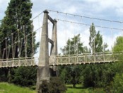
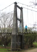
(footbridge)
Niederbuchenau, Rheinland-Pfalz, Germany - Wied River
| Bridgemeister ID: | 2208 (added 2007-02-11) |
| Name: | (footbridge) |
| Location: | Niederbuchenau, Rheinland-Pfalz, Germany |
| Crossing: | Wied River |
| Coordinates: | 50.57682 N 7.40954 E |
| Maps: | Acme, GeoHack, Google, OpenStreetMap |
| Use: | Footbridge |
| Status: | In use (last checked: 2006) |
| Main Cables: | Wire (steel) |
| Suspended Spans: | 1 |
| Main Span: | 1 x 27.2 meters (89.2 feet) |
| Deck width: | 1.1 meters between side rails, 1.3 meters total |
Notes:
- Completed circa 1935. New towers circa 1975. Renovation, 2005.
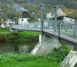
(footbridge)
South Buffalo, New York, USA - Cazenovia Creek
| Bridgemeister ID: | 868 (added 2003-08-30) |
| Name: | (footbridge) |
| Location: | South Buffalo, New York, USA |
| Crossing: | Cazenovia Creek |
| At or Near Feature: | Cazenovia Park |
| Coordinates: | 42.84315 N 78.80165 W |
| Maps: | Acme, GeoHack, Google, OpenStreetMap |
| Principals: | Works Progress Administration |
| Use: | Footbridge |
| Status: | In use (last checked: 2004) |
Notes:
- Constructed by WPA in the 1930s, rebuilt in 1989.
Hamilton Dam
Blufton, Texas, USA - Colorado River
| Bridgemeister ID: | 4949 (added 2020-08-08) |
| Name: | Hamilton Dam |
| Location: | Blufton, Texas, USA |
| Crossing: | Colorado River |
| Status: | Removed |
| Main Cables: | Wire (steel) |
Notes:
- Completed 1930s during construction of the Hamilton (now Buchanan) Dam. Appears to have been a large one-lane bridge. Likely removed during 1930s.
Ishi Pishi
Orleans vicinity, California, USA - Klamath River
| Bridgemeister ID: | 5672 (added 2021-01-30) |
| Name: | Ishi Pishi |
| Location: | Orleans vicinity, California, USA |
| Crossing: | Klamath River |
| Coordinates: | 41.378467 N 123.496315 W |
| Maps: | Acme, GeoHack, Google, OpenStreetMap |
| Use: | Vehicular |
| Status: | Destroyed, December, 1964 |
| Main Cables: | Wire (steel) |
Notes:
- Likely completed in the 1930s.
- 1964, December: Destroyed by flood.
Walcott
Walcott, British Columbia, Canada - Bulkley River
| Bridgemeister ID: | 5920 (added 2021-06-10) |
| Name: | Walcott |
| Location: | Walcott, British Columbia, Canada |
| Crossing: | Bulkley River |
| Coordinates: | 54.517482 N 126.838512 W |
| Maps: | Acme, GeoHack, Google, OpenStreetMap |
| Use: | Footbridge |
| Status: | Replaced |
| Main Cables: | Wire (steel) |
| Main Span: | 1 |
Notes:
- Likely built in 1931 or 1932.
- Replaced by Walcott - Walcott, British Columbia, Canada.
- See 1912 Hagwilget (Bulkley Canyon) - Hagwilget, British Columbia, Canada.
External Links:
- Walcott Suspension Bridge on Bulkley River - Northern BC Archives. Image taken in 1932 stating the bridge was "moved from its original location in the Hagwilget Canyon" implying this is the relocated 1912 Bulkely/Hagwilget Canyon suspension bridge that was replaced in 1931. The two bridges, however, don't appear to resemble each other and the Walcott bridge's main span appears to have been about 50 feet shorter than the 1912 Bulkely Canyon bridge . Perhaps only the cables were reused.
Do you have any information or photos for these bridges that you would like to share? Please email david.denenberg@bridgemeister.com.