Suspension Bridges of USA (501-600 of 1,437)
This is a list of bridges 501 through 600 (of 1,437 total) from the suspension bridge inventory for the country USA . Wherever you see a Bridgemeister ID number click it to isolate the bridge on its own page.
Related Lists:
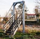
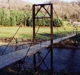
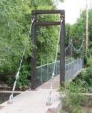
Bridgemeister ID: 1331 (added 2004-04-30)Year Completed: 1987 Name: (footbridge) Location: Criglersville, Virginia , USA Crossing: Robinson River Coordinates: 38.4633 N 78.309933 W Maps: Acme , GeoHack , Google , OpenStreetMap Principals: VDOT Use: Footbridge Status: In use (last checked: 2021) Main Cables: Wire (steel) Suspended Spans: 1 Main Span: 1 x 36.6 meters (120 feet) estimated
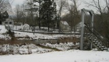
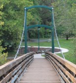
Bridgemeister ID: 1802 (added 2005-05-18)Year Completed: 1987 Name: Swing Location: Sheboygan Falls, Wisconsin , USA Crossing: Sheboygan River At or Near Feature: River Park Coordinates: 43.72765 N 87.81647 W Maps: Acme , GeoHack , Google , OpenStreetMap Principals: Donohue & Associates, Pheifer Brothers Construction Co. Use: Footbridge Status: In use (last checked: 2005) Main Cables: Wire (steel) Suspended Spans: 1 Main Span: 1 x 45.7 meters (150 feet) estimated
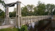
Bridgemeister ID: 2307 (added 2007-04-30)Year Completed: 1988 Name: (footbridge) Location: Richmond, Indiana , USA Crossing: Whitewater River At or Near Feature: Whitewater Gorge Coordinates: 39.83331 N 84.89902 W Maps: Acme , GeoHack , Google , OpenStreetMap Use: Footbridge Status: In use (last checked: 2007) Main Cables: Wire (steel)
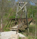
Bridgemeister ID: 1319 (added 2004-04-25)Year Completed: 1988 Name: (footbridge) Location: Sanger vicinity, North Dakota , USA At or Near Feature: Cross Ranch State Park Coordinates: 47.198983 N 100.99675 W Maps: Acme , GeoHack , Google , OpenStreetMap Principals: North Dakota National Guard Use: Footbridge Status: In use (last checked: 2004) Main Cables: Wire Suspended Spans: 1
Short footbridge with simple tubular metal towers. Crosses a small river just upstream of where the river flows into the Missouri. Bridgemeister ID: 3325 (added 2019-12-01)Year Completed: 1988 Name: (pipeline bridge) Location: Cody, Wyoming , USA Crossing: Sulphur Creek Coordinates: 44.523354 N 109.084426 W Maps: Acme , GeoHack , Google , OpenStreetMap Principals: Clear Span Engineering Use: Pipeline Status: Extant (last checked: 2019) Main Cables: Wire (steel) Main Span: 1 x 137.2 meters (450 feet)
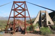
Carries a 16-inch sewer line. Bridgemeister ID: 235 (added before 2003)Year Completed: 1989 Name: Sheep Location: Sheep Crossing (Cave Creek vicinity), Arizona , USA Crossing: Verde River Coordinates: 34.077578 N 111.707317 W Maps: Acme , GeoHack , Google , OpenStreetMap Use: Footbridge and Stock Status: In use (last checked: 2007) Main Cables: Wire (steel) Suspended Spans: 1 Main Span: 1 x 152.4 meters (500 feet) estimated
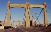
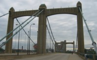
Bridgemeister ID: 336 (added before 2003)Year Completed: 1990 Name: Hennepin Avenue Also Known As: Father Louis Hennepin Location: Minneapolis, Minnesota , USA Crossing: Mississippi River Coordinates: 44.985 N 93.26333 W Maps: Acme , GeoHack , Google , OpenStreetMap Principals: Henn. Co. Pub. Wrks., HNTB Corp Use: Vehicular (four or more lanes), with walkway Status: In use (last checked: 2006) Main Cables: Wire (steel) Suspended Spans: 1 Main Span: 1 x 190.5 meters (625 feet)
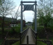
Bridgemeister ID: 1190 (added 2004-01-25)Year Completed: 1990 Name: Vinton Swinging Location: Vinton, Ohio , USA Crossing: Raccoon Creek At or Near Feature: Vinton Community Park Coordinates: 38.977952 N 82.339157 W Maps: Acme , GeoHack , Google , OpenStreetMap Principals: James Baird, Carl DeWitt, Tony Werry, Mark Beaver, Kermit Brown Use: Footbridge Status: In use (last checked: 2005) Main Cables: Wire Suspended Spans: 1
Bridgemeister ID: 1711 (added 2005-04-02)Year Completed: 1991 Name: Hauser Location: Washington vicinity, Connecticut , USA Crossing: Shepaug River At or Near Feature: Steep Rock State Park, The Clamshell Coordinates: 41.604933 N 73.333617 W Maps: Acme , GeoHack , Google , OpenStreetMap Use: Footbridge Status: In use (last checked: 2005) Main Cables: Wire Suspended Spans: 1
Crosses the river at the "bottom" of an interesting geological formation known as "The Clamshell." Bridgemeister ID: 2576 (added 2013-02-03)Year Completed: 1991 Name: Richardson Golden Gate Location: Mulvane, Kansas , USA Crossing: Cowskin Creek Coordinates: 37.46457 N 97.30021 W Maps: Acme , GeoHack , Google , OpenStreetMap Principals: Larry Richardson Use: Footbridge Status: In use (last checked: 2010) Main Cables: Wire (steel) Suspended Spans: 3 Main Span: 1 x 30.5 meters (100 feet) Side Spans: 1 x 5.5 meters (18 feet),
Bridgemeister ID: 1400 (added 2004-07-04)Year Completed: 1991 Name: Stokes Crossing Location: Defiance, Ohio , USA Crossing: Powell Creek At or Near Feature: Boy Scout Camp Coordinates: 41.25265 N 84.375983 W Maps: Acme , GeoHack , Google , OpenStreetMap Use: Footbridge Status: In use (last checked: 2009) Main Cables: Wire
Located in a scout camp along Powell Creek. Bridgemeister ID: 1514 (added 2004-10-10)Year Completed: 1992 Name: (pipeline bridge) Location: Watson, Oklahoma , USA Crossing: Mountain Fork River Coordinates: 34.461641 N 94.554642 W Maps: Acme , GeoHack , Google , OpenStreetMap Principals: Clear Span Engineering, Inc. Use: Pipeline Status: Extant (last checked: 2019) Main Cables: Wire (steel) Main Span: 1 x 236.2 meters (775 feet)
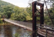
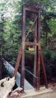
Carries a 48-inch gas pipeline. Bridgemeister ID: 236 (added before 2003)Year Completed: 1992 Name: Cowpasture River Location: Williamsville vicinity, Virginia , USA Crossing: Cowpasture River At or Near Feature: George Washington National Forest Coordinates: 38.16573 N 79.57665 W Maps: Acme , GeoHack , Google , OpenStreetMap Principals: Sahale, LLC Use: Footbridge Status: In use (last checked: 2005) Main Cables: Wire (steel) Suspended Spans: 1 Main Span: 1 x 45.7 meters (150 feet)
Bridgemeister ID: 1669 (added 2005-03-21)Year Completed: 1992 Name: Jordan Location: Jordan, Arlington vicinity, Washington , USA Crossing: Stillaguamish River South Fork At or Near Feature: Jordan Bridge County Park Coordinates: 48.147583 N 122.0382 W Maps: Acme , GeoHack , Google , OpenStreetMap Use: Footbridge Status: In use (last checked: 2006) Main Cables: Wire (steel) Suspended Spans: 1 Main Span: 1 x 78.6 meters (258 feet) estimated
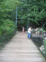
Bridgemeister ID: 237 (added before 2003)Year Completed: 1992 Name: Kimberling Creek Location: Mechanicsburg vicinity, Virginia , USA Crossing: Kimberling Creek At or Near Feature: Appalachian Trail Coordinates: 37.1708 N 80.9032 W Maps: Acme , GeoHack , Google , OpenStreetMap Principals: Sahale, LLC References: PQU Use: Footbridge Status: In use (last checked: 2020) Main Cables: Wire (steel) Suspended Spans: 1 Main Span: 1 x 45.7 meters (150 feet) Deck width: 3 feet
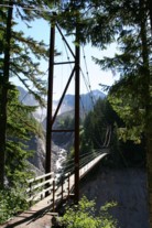
Bridgemeister ID: 895 (added 2003-09-07)Year Completed: 1993 Name: Lava Canyon Location: Mt. St. Helens National Volcanic Monument, Washington , USA Crossing: Muddy River At or Near Feature: Lava Canyon Falls Coordinates: 46.169267 N 122.0832 W Maps: Acme , GeoHack , Google , OpenStreetMap Principals: Sahale, LLC Use: Footbridge Status: Closed, 2019 (last checked: 2019) Main Cables: Wire (steel) Suspended Spans: 1 Main Span: 1 x 30.5 meters (100 feet) Deck width: 3 feet
Closed in 2019 (or perhaps soon before) after a cable snapped. Cause of the damage is unclear. Bridgemeister ID: 352 (added before 2003)Year Completed: 1993 Name: Smokey's Dream Location: Hartland, Maine , USA Crossing: Sebasticook River Coordinates: 44.88943 N 69.46198 W Maps: Acme , GeoHack , Google , OpenStreetMap References: PQU Use: Snowmobile Status: In use (last checked: 2003) Main Cables: Wire (steel) Suspended Spans: 1 Main Span: 1 x 57.9 meters (190 feet)
Bridgemeister ID: 244 (added before 2003)Year Completed: 1994 Name: Green Mountain Roamers Gateway Also Known As: Winooski Wonder Location: North Duxbury, Vermont , USA Crossing: Winooski River Coordinates: 44.3603 N 72.8032 W Maps: Acme , GeoHack , Google , OpenStreetMap Use: Snowmobile Status: In use (last checked: 2008) Main Cables: Wire Suspended Spans: 1 Main Span: 1 x 82.3 meters (270 feet) estimated
Bridgemeister ID: 238 (added before 2003)Year Completed: 1994 Name: Greenbrier Location: Hosterman, West Virginia , USA Crossing: Greenbrier River Coordinates: 38.46898 N 79.86879 W Maps: Acme , GeoHack , Google , OpenStreetMap Principals: Sahale, LLC Use: Footbridge Status: In use (last checked: 2004) Main Cables: Wire (steel) Suspended Spans: 1 Main Span: 1 x 45.7 meters (150 feet)
Bridgemeister ID: 2533 (added 2011-12-25)Year Completed: 1995 Name: (footbridge) Location: Pittsburgh, Pennsylvania , USA At or Near Feature: Pittsburgh Zoo Coordinates: 40.481856 N 79.919181 W Maps: Acme , GeoHack , Google , OpenStreetMap Principals: American Bridge Co. Use: Footbridge Status: In use (last checked: 2010) Suspended Spans: 1 Main Span: 1
Bridgemeister ID: 1433 (added 2004-07-30)Year Completed: 1995 Name: Tahoma Creek Location: Mt. Rainier National Park, Washington , USA Crossing: Tahoma Creek At or Near Feature: Wonderland Trail Coordinates: 46.80479 N 121.84812 W Maps: Acme , GeoHack , Google , OpenStreetMap Use: Footbridge Status: In use (last checked: 2006) Main Cables: Wire (steel) Suspended Spans: 1 Main Span: 1 x 61.9 meters (203 feet) estimated
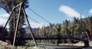
Damaged by flooding, November 2006. From a News Tribune (Tacoma, Washington) article on June 11, 2007: "Trail crews last week discovered that supporting cables at one end of the suspension bridge may have been weakened by flooding last November." Replaced a drooping catwalk-style suspension bridge that was anchored on different foundations still present at the bridge site. Both bridges appear to have coexisted for some time around 1995. Bridgemeister ID: 240 (added before 2003)Year Completed: 1995 Name: Tawlks-Foster Location: Mazama vicinity, Washington , USA Crossing: Methow River Coordinates: 48.570617 N 120.369183 W Maps: Acme , GeoHack , Google , OpenStreetMap Principals: Sahale, LLC Use: Footbridge and Pack Status: In use (last checked: 2015) Main Cables: Wire (steel) Suspended Spans: 1 Main Span: 1 x 85.3 meters (280 feet) Deck width: 11 feet
Sahale, LLC . The Sahale site shows the bridge being load tested with a Chevy Suburban, so the deck is wide enough for vehicular traffic, but the bridge appears to be restricted to foot and hoof traffic.Structurae - Structure ID 20008196 Bridgemeister ID: 1302 (added 2004-04-03)Year Completed: 1996 Name: (footbridge) Location: Hooversville, Pennsylvania , USA Crossing: Stony Creek Coordinates: 40.147959 N 78.914295 W Maps: Acme , GeoHack , Google , OpenStreetMap Use: Footbridge Status: In use (last checked: 2020) Main Cables: Wire (steel) Suspended Spans: 1 Main Span: 1 x 42.1 meters (138 feet) estimated
Bridgemeister ID: 239 (added before 2003)Year Completed: 1996 Name: Pochuck Quagmire Location: Vernon Valley, New Jersey , USA Crossing: Pochuck Creek At or Near Feature: Appalachian Trail Coordinates: 41.2353 N 74.472083 W Maps: Acme , GeoHack , Google , OpenStreetMap Principals: Tibor Latincsics References: BONJ , PQU Use: Footbridge Status: In use (last checked: 2008) Main Cables: Wire (steel) Main Span: 1 x 33.5 meters (110 feet)
Bridgemeister ID: 1533 (added 2004-10-30)Year Completed: 1996 Name: Swinging Location: Millersburg, Pennsylvania , USA Crossing: Wiconisco Creek Coordinates: 40.53588 N 76.96490 W Maps: Acme , GeoHack , Google , OpenStreetMap Use: Footbridge Status: In use (last checked: 2014) Main Cables: Wire (steel) Suspended Spans: 1 Main Span: 1 x 56.7 meters (186 feet) estimated
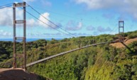
Bridgemeister ID: 643 (added 2003-02-16)Year Completed: 1996 Name: Waimea Swinging Location: Waimea, Hawaii , USA Crossing: Waimea River Coordinates: 21.96979 N 159.65652 W Maps: Acme , GeoHack , Google , OpenStreetMap Use: Footbridge Status: In use (last checked: 2022) Main Cables: Wire (steel) Suspended Spans: 1 Main Span: 1 x 76.2 meters (250 feet)
Replaced a suspension bridge destroyed by Hurricane Iniki in 1992. 2022, January: Closed due to mudslide that occurred at one end of the bridge destroying the road next to the bridge and possibly damaging part of the bridge. 2022, February: Project started to repair the bridge and provide temporary pedestrian access. Bridgemeister ID: 241 (added before 2003)Year Completed: 1997 Name: Drift Creek Falls Location: Lincoln City vicinity, Oregon , USA Crossing: Drift Creek At or Near Feature: Siuslaw National Forest Coordinates: 44.93320 N 123.85038 W Maps: Acme , GeoHack , Google , OpenStreetMap Principals: U.S. Forest Service, Sahale, LLC Use: Footbridge Status: In use (last checked: 2007) Main Cables: Wire (steel) Suspended Spans: 1 Main Span: 1 x 73.2 meters (240 feet) Deck width: 3 feet
Bridgemeister ID: 335 (added before 2003)Year Completed: 1997 Name: Hastings Trail Location: Hastings, Maine , USA Crossing: Wild River Coordinates: 44.35558 N 70.9923 W Maps: Acme , GeoHack , Google , OpenStreetMap References: PQU Use: Footbridge Status: Removed Main Span: 1 x 54.9 meters (180 feet)
Bridgemeister ID: 242 (added before 2003)Year Completed: 1997 Name: Wentzell's Crossing Location: Dixfield and Mexico, Maine , USA Crossing: Webb River Coordinates: 44.556269 N 70.462605 W Maps: Acme , GeoHack , Google , OpenStreetMap Principals: Mexico Trailblazers, Poodunck Snowmobile Club Use: Snowmobile Status: Extant (last checked: 2020) Main Cables: Wire
Bridgemeister ID: 2400 (added 2007-12-02)Year Completed: 1998 Name: Lyman Run Location: Galeton vicinity, Pennsylvania , USA Crossing: Lyman Run At or Near Feature: Lyman Run State Park Coordinates: 41.72169 N 77.78674 W Maps: Acme , GeoHack , Google , OpenStreetMap Principals: Susquehannock Trail Club Use: Footbridge Status: In use (last checked: 2002) Main Cables: Wire (steel) Suspended Spans: 1
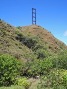
Bridgemeister ID: 835 (added 2003-06-28)Year Completed: 1998 Name: Terry Riley Location: Portland, Oregon , USA At or Near Feature: Lewis and Clark Trail, Tryon Creek State Park Coordinates: 45.444556 N 122.682212 W Maps: Acme , GeoHack , Google , OpenStreetMap Use: Footbridge Status: Only towers remain, since c. 2020 Main Cables: Wire (steel) Suspended Spans: 1 Main Span: 1 x 14.6 meters (48 feet) estimated
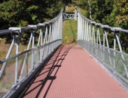
2020, July: Closed due to safety concerns. Removed at some point in the 2020-2023 time frame. One steel tower remains. Bridgemeister ID: 329 (added before 2003)Year Completed: 1999 Name: Forrest and Maxie Preston Memorial Pedestrian Location: River, Johnson County, Kentucky , USA Crossing: Big Sandy River Levisa Fork Coordinates: 37.86015 N 82.726117 W Maps: Acme , GeoHack , Google , OpenStreetMap Principals: Bush and Burchett Inc., Bocook Engineering, S.E.A. Engineers Inc., Issam Harik References: UKODF99 Use: Footbridge Status: In use (last checked: 2005) Main Cables: Wire (steel) Suspended Spans: 3 Main Span: 1 x 96.3 meters (316 feet) estimated Side Spans: 2 x 14.3 meters (47 feet) estimated
From an old Kentucky Transportation Cabinet web page: "Interested in seeing the world's longest plastic bridge? Visit Johnson County, where the 410-ft-long Forest and Maxie Preston Memorial Pedestrian Bridge recently opened. The bridge was built from a high performance composite material - glass fiber that is reinforced with plastic resins." A University of Kentucky web page refers to the deck material as "glass fiber-reinforced polymer composites." Bridgemeister ID: 573 (added 2002-12-31)Year Completed: 1999 Name: Peter DeFazio Also Known As: Ferry Street Location: Eugene, Oregon , USA Crossing: Willamette River Coordinates: 44.056083 N 123.084533 W Maps: Acme , GeoHack , Google , OpenStreetMap Principals: Jiri Strasky, OBEC Consulting Engineers, Mowat Construction Company References: BBU Use: Footbridge Status: In use (last checked: 2005) Main Cables: Wire (steel) Suspended Spans: 3 Main Span: 1 x 10³ meters (337.9 feet) Side Spans: 2 x 23 meters (75.5 feet) Deck width: 6.5 meters
Bridgemeister ID: 2518 (added 2009-12-30)Year Completed: 2000 Name: (footbridge) Location: Bramwell, West Virginia , USA Crossing: Bluestone River Coordinates: 37.32488 N 81.31427 W Maps: Acme , GeoHack , Google , OpenStreetMap Use: Footbridge Status: In use (last checked: 2008) Main Cables: Wire (steel) Suspended Spans: 1 Main Span: 1 x 20.4 meters (67 feet)
Bridgemeister ID: 7024 (added 2022-05-15)Year Completed: 2000 Name: Debbie's Dream Catcher Location: Owensboro vicinity, Kentucky , USA Crossing: Panther Creek At or Near Feature: Panther Creek Park Coordinates: 37.716219 N 87.222361 W Maps: Acme , GeoHack , Google , OpenStreetMap Use: Footbridge Status: In use (last checked: 2022) Main Cables: Wire (steel) Suspended Spans: 3 Main Span: 1 Side Spans: 2
Bridgemeister ID: 2513 (added 2009-12-30)Year Completed: 2001 Name: (footbridge) Location: Chattanooga, Tennessee , USA Crossing: South Chickamauga Creek At or Near Feature: Elise Chapin Sanctuary at Audobon Acres Coordinates: 34.996926 N 85.184675 W Maps: Acme , GeoHack , Google , OpenStreetMap Principals: S & R Construction Use: Footbridge Status: In use (last checked: 2019) Main Cables: Wire (steel) Suspended Spans: 1 Main Span: 1 x 38.1 meters (125 feet)
Bridgemeister ID: 967 (added 2003-11-01)Year Completed: 2001 Name: (footbridge) Location: Houston, Texas , USA Crossing: ravine along Lake Carter Coordinates: 29.77431 N 95.47557 W Maps: Acme , GeoHack , Google , OpenStreetMap Principals: Sahale, LLC. Use: Footbridge Status: In use Main Cables: Wire (steel) Suspended Spans: 1 Main Span: 1 x 20.1 meters (66 feet) Deck width: 4 feet
This bridge is located on private property. Bridgemeister ID: 2401 (added 2007-12-08)Year Completed: 2001 Name: Cross Fork Location: Cross Fork vicinity, Pennsylvania , USA Crossing: Cross Fork Creek Coordinates: 41.57235 N 77.78174 W Maps: Acme , GeoHack , Google , OpenStreetMap Principals: Potter County Trailblazers, Dept. of Conservation and Natural Resources Use: Footbridge Status: In use (last checked: 2002) Main Cables: Wire (steel) Suspended Spans: 1
Bridgemeister ID: 866 (added 2003-08-23)Year Completed: 2001 Name: Skevington Crossing Location: Rogue River, Oregon , USA Crossing: Evans Creek At or Near Feature: Palmerton Park Coordinates: 42.439917 N 123.172683 W Maps: Acme , GeoHack , Google , OpenStreetMap Use: Footbridge Status: In use (last checked: 2003) Main Cables: Wire (steel) Suspended Spans: 1
Bridgemeister ID: 826 (added 2003-05-31)Year Completed: 2002 Name: (suspension bridge) Location: Magee property, Blackwell vicinity, Virginia , USA Crossing: North Fork Holston River Coordinates: 36.83143 N 81.90466 W Maps: Acme , GeoHack , Google , OpenStreetMap Status: In use Main Cables: Wire Suspended Spans: 3 Main Span: 1 x 59.4 meters (195 feet) Side Spans: 1 x 15.2 meters (50 feet),
Patrick S. O'Donnell notes this private residential bridge is wide enough (6 feet) for the owner to drive his golf cart across. Bridgemeister ID: 854 (added 2003-08-07)Year Completed: 2002 Name: Islandwood Location: Islandwood, Port Blakely, Washington , USA Coordinates: 47.60382 N 122.52683 W Maps: Acme , GeoHack , Google , OpenStreetMap Principals: Sahale, LLC Use: Footbridge Status: In use (last checked: 2007) Main Cables: Wire (steel) Suspended Spans: 1 Main Span: 1 x 57.9 meters (190 feet) Deck width: 4 feet
Bridgemeister ID: 951 (added 2003-10-31)Year Completed: 2002 Name: Popolopen Also Known As: William J. Moreau Popolopen Location: Fort Montgomery, New York , USA Crossing: Popolopen Creek At or Near Feature: Bear Mountain Park, Appalachian Trail Coordinates: 41.323017 N 73.989017 W Maps: Acme , GeoHack , Google , OpenStreetMap Principals: Cleveland Bridge USA, Dorman Long Technology, Creative Pultrusions Inc. Use: Footbridge Status: In use (last checked: 2020) Main Cables: Wire (steel) Suspended Spans: 1 Main Span: 1 x 102.4 meters (336 feet) Deck width: 11 feet
Bridgemeister ID: 2226 (added 2007-03-18)Year Completed: 2002 Name: Swinging Location: Basalt, Colorado , USA Crossing: Frying Pan River Coordinates: 39.36828 N 107.03178 W Maps: Acme , GeoHack , Google , OpenStreetMap Principals: Sahale, LLC Use: Footbridge Status: In use (last checked: 2006) Main Cables: Wire (steel) Suspended Spans: 1 Main Span: 1 x 19.8 meters (65 feet) estimated
A display at the bridge indicates this bridge was a replacement for another suspension bridge. Completion year of 2002 is taken from the dedication date, January 11, 2002. Bridge may have been completed earlier (in late 2001). Bridgemeister ID: 605 (added 2003-01-14)Year Completed: 2002 Name: Tallulah Gorge Location: Tallulah Gorge State Park, Georgia , USA Crossing: Tallulah River At or Near Feature: Hurricane Falls Coordinates: 34.7387 N 83.391467 W Maps: Acme , GeoHack , Google , OpenStreetMap Use: Footbridge Status: In use (last checked: 2007) Main Cables: Wire (steel) Main Span: 1 x 76.2 meters (250 feet) estimated
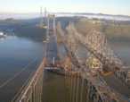
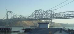
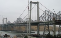
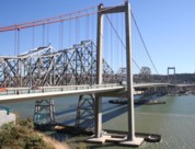
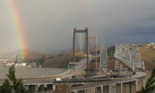
Bridgemeister ID: 878 (added 2003-09-01)Year Completed: 2003 Name: Al Zampa Memorial Location: Crockett and Vallejo, California , USA Crossing: Carquinez Strait Coordinates: 38.06097 N 122.22639 W Maps: Acme , GeoHack , Google , OpenStreetMap References: AZB , BAR Use: Vehicular (major highway), with walkway Status: In use (last checked: 2018) Main Cables: Wire (steel) Suspended Spans: 3 Main Span: 1 x 728 meters (2,388.5 feet) Side Spans: 1 x 181 meters (593.8 feet),
Bridgemeister ID: 2697 (added 2019-05-27)Year Completed: 2003 Name: Bob Mac's Crossing Location: Athens, Texas , USA At or Near Feature: East Texas Arboretum Coordinates: 32.207487 N 95.878114 W Maps: Acme , GeoHack , Google , OpenStreetMap Principals: Bob McDonald, San Jacinto Engineering Use: Footbridge Status: In use (last checked: 2019) Main Cables: Wire (steel)
Bridgemeister ID: 2147 (added 2006-11-18)Year Completed: 2003 Name: McKenzie River Location: Eugene vicinity, Oregon , USA Crossing: McKenzie River Coordinates: 44.11687 N 123.08218 W Maps: Acme , GeoHack , Google , OpenStreetMap Principals: OBEC Consulting Engineers, Jiri Strasky Use: Footbridge Status: In use (last checked: 2006) Main Cables: Wire (steel) Suspended Spans: 3 Main Span: 1 x 131 meters (429.8 feet) Side Spans: 2 x 37 meters (121.4 feet)
Bridgemeister ID: 2391 (added 2007-11-20)Year Completed: 2003 Name: Potwisha Location: Three Rivers vicinity, California , USA Crossing: Middle Fork Kaweah River At or Near Feature: Sequioa National Park Coordinates: 36.512310 N 118.800187 W Maps: Acme , GeoHack , Google , OpenStreetMap Principals: MCS Construction, Blair, Church & Flynn Consulting Engineers Use: Footbridge Status: In use (last checked: 2019) Main Cables: Wire (steel) Suspended Spans: 1
Bridgemeister ID: 1516 (added 2004-10-10)Year Completed: 2004 Name: (footbridge) Location: Conner vicinity and Darby vicinity, Montana , USA Crossing: Bitterroot River Coordinates: 45.95001 N 114.13475 W Maps: Acme , GeoHack , Google , OpenStreetMap Principals: Sahale, LLC Use: Footbridge Status: In use (last checked: 2007) Main Cables: Wire (steel) Suspended Spans: 1 Main Span: 1 x 61 meters (200 feet) Deck width: 5 feet
Bridgemeister ID: 2443 (added 2008-04-23)Year Completed: 2004 Name: Berber Location: Superior, Arizona , USA Crossing: Queen Creek At or Near Feature: Boyce Arboretum Coordinates: 33.277250 N 111.153117 W Maps: Acme , GeoHack , Google , OpenStreetMap Use: Footbridge Status: In use (last checked: 2017) Main Cables: Wire (steel) Suspended Spans: 1
Bridgemeister ID: 1785 (added 2005-05-17)Year Completed: 2004 Name: Riley Location: Delphi, Indiana , USA Crossing: Deer Creek At or Near Feature: Riley Park Coordinates: 40.585167 N 86.669383 W Maps: Acme , GeoHack , Google , OpenStreetMap Use: Footbridge Status: In use (last checked: 2006) Main Cables: Wire (steel) Suspended Spans: 1
This is (at least) the third suspension bridge at this site. The previous bridges were built in 1911, 1988, and 1998. All three were destroyed by flood. It is unclear if the previous suspension bridges qualify for the Bridgemeister inventory. Bridgemeister ID: 2306 (added 2007-04-30)Year Completed: 2005 Name: (footbridge) Location: Cambridge City, Indiana , USA Crossing: Whitewater River At or Near Feature: Creitz Park Coordinates: 39.81527 N 85.16978 W Maps: Acme , GeoHack , Google , OpenStreetMap Principals: Milestone Construction Co., Jim Sweet Use: Footbridge Status: In use (last checked: 2008) Main Cables: Wire (steel) Suspended Spans: 1
Replaced a 1928 suspension bridge at the same location which had been destroyed by heavy snow and debris, December 2004. This predecessor appears to have been a drooping bridge. Bridgemeister ID: 2462 (added 2008-09-27)Year Completed: 2005 Name: (footbridge) Location: Gainesville, Georgia , USA Crossing: Walnut Creek At or Near Feature: Elachee Nature Center Coordinates: 34.233920 N 83.831655 W Maps: Acme , GeoHack , Google , OpenStreetMap Use: Footbridge Status: In use (last checked: 2018) Main Cables: Wire (steel) Main Span: 1
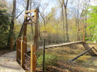
Bridgemeister ID: 1966 (added 2005-11-26)Year Completed: 2005 Name: (footbridge) Location: Ithiel Falls, Vermont , USA Crossing: Lamoille River At or Near Feature: Long Trail Coordinates: 44.651508 N 72.728753 W Maps: Acme , GeoHack , Google , OpenStreetMap Use: Footbridge Status: In use (last checked: 2015) Main Cables: Wire (steel) Main Span: 1 x 41.5 meters (136 feet)
Bridgemeister ID: 1839 (added 2005-07-03)Year Completed: 2005 Name: (footbridge) Location: Rockford, Illinois , USA Crossing: Kent Creek At or Near Feature: Tinker Swiss Cottage Museum Coordinates: 42.2645 N 89.101667 W Maps: Acme , GeoHack , Google , OpenStreetMap Use: Footbridge Status: In use (last checked: 2014) Main Cables: Wire (steel) Suspended Spans: 2 Main Span: 1 Side Span: 1
Bridgemeister ID: 2482 (added 2008-12-21)Year Completed: 2005 Name: Elizabeth Furnace Location: Elizabeth Furnace Campground, Dilbeck vicinity, Virginia , USA Crossing: Passage Creek Coordinates: 38.921 N 78.3308 W Maps: Acme , GeoHack , Google , OpenStreetMap Principals: Tri-State Company (Huntington, West Virginia) Use: Footbridge Status: In use (last checked: 2017) Main Cables: Wire (steel) Suspended Spans: 1 Main Span: 1 x 33.5 meters (110 feet)
Bridgemeister ID: 4831 (added 2020-07-05)Year Completed: 2006 Name: (footbridge) Location: Green Lane, Pennsylvania , USA Crossing: Unami Creek Coordinates: 40.340001 N 75.438839 W Maps: Acme , GeoHack , Google , OpenStreetMap Principals: Frank Neeld, Hart Mechanical Use: Footbridge Status: In use (last checked: 2023) Main Cables: Wire (steel) Suspended Spans: 1
Bridgemeister ID: 2222 (added 2007-03-15)Year Completed: 2006 Name: (footbridge) Location: Mount Hermon, California , USA Crossing: Zayante Creek At or Near Feature: Mount Hermon Christian Conference Center Coordinates: 37.05149 N 122.06182 W Maps: Acme , GeoHack , Google , OpenStreetMap Principals: Sahale, LLC Use: Footbridge Status: In use (last checked: 2007) Main Cables: Wire (steel) Suspended Spans: 1
Bridgemeister ID: 2030 (added 2006-04-22)Year Completed: 2006 Name: Rattlesnake Creek Location: Missoula, Montana , USA Crossing: Rattlesnake Creek Coordinates: 46.90980 N 113.96633 W Maps: Acme , GeoHack , Google , OpenStreetMap Principals: HDR Inc. Use: Footbridge and Pack Status: In use (last checked: 2006) Main Cables: Wire (steel) Suspended Spans: 1 Main Span: 1 x 27.4 meters (90 feet)
Bridgemeister ID: 2088 (added 2006-07-01)Year Completed: 2006 Name: William O. Lee Also Known As: Carroll Creek Park Location: Frederick, Maryland , USA Crossing: Carroll Creek Coordinates: 39.412783 N 77.409267 W Maps: Acme , GeoHack , Google , OpenStreetMap Principals: HNTB Corp. Use: Footbridge Status: In use (last checked: 2019) Main Cables: Wire (steel) Suspended Spans: 2 Side Spans: 2 x 18.11 meters (59.4 feet)
Bridgemeister ID: 2543 (added 2011-12-31)Year Completed: 2007 Name: Aroostook Riders ATV Club Location: Houlton, Maine , USA Crossing: Meduxnekeag River Coordinates: 46.143899 N 67.822960 W Maps: Acme , GeoHack , Google , OpenStreetMap Use: Snowmobile Status: Extant (last checked: 2022) Main Cables: Wire (steel) Main Span: 1
Intended for ATV and snowmobile traffic. Likely completed in 2007, possibly 2008. Bridgemeister ID: 2382 (added 2007-11-07)Year Completed: 2007 Name: Caguitas River Location: Caguas, Puerto Rico , USA Crossing: Caguitas River At or Near Feature: Jardin Botanico y Cultural Coordinates: 18.23840 N 66.06245 W Maps: Acme , GeoHack , Google , OpenStreetMap Principals: Sahale, LLC Use: Footbridge Status: In use (last checked: 2007) Main Cables: Wire (steel) Suspended Spans: 1 Main Span: 1 x 53.3 meters (175 feet) Deck width: 5 feet
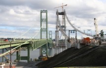
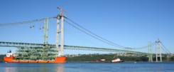
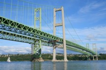
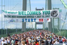
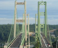
Bridgemeister ID: 1952 (added 2005-11-04)Year Completed: 2007 Name: Third Tacoma Narrows Location: Tacoma and Gig Harbor, Washington , USA Crossing: Puget Sound Coordinates: 47.26803 N 122.55121 W Maps: Acme , GeoHack , Google , OpenStreetMap References: CTT Use: Vehicular (major highway) Status: In use (last checked: 2020) Main Cables: Wire (steel) Suspended Spans: 3 Main Span: 1 x 853.4 meters (2,800 feet) Side Spans: 1 x 365.8 meters (1,200 feet), Deck width: 78 feet
Bridgemeister ID: 2451 (added 2008-07-13)Year Completed: 2008 Name: Kapalua Location: Kapalua Resort, Maui, Hawaii , USA Crossing: Kaopala Gulch Coordinates: 20.96236 N 156.63227 W Maps: Acme , GeoHack , Google , OpenStreetMap Principals: Sahale, LLC (including Patrick S. O'Donnell) Use: Footbridge Status: In use (last checked: 2009) Main Cables: Wire (steel) Suspended Spans: 1 Main Span: 1 x 109.7 meters (360 feet)
Bridgemeister ID: 2452 (added 2008-08-11)Year Completed: 2008 Name: Lullwater Preserve Location: Decatur, Georgia , USA Crossing: Peachtree Creek At or Near Feature: Emory University Coordinates: 33.80195 N 84.31518 W Maps: Acme , GeoHack , Google , OpenStreetMap Principals: Sahale, LLC Use: Footbridge Status: In use (last checked: 2008) Main Cables: Wire (steel) Main Span: 1 x 64 meters (210 feet)
Bridgemeister ID: 2665 (added 2008-04-12)Year Completed: 2008 Name: Needleton Location: Needleton vicinity, Colorado , USA Crossing: Animas River At or Near Feature: Chicago Basin Trail Coordinates: 37.633320 N 107.692475 W Maps: Acme , GeoHack , Google , OpenStreetMap Principals: Sahale LLC Use: Footbridge Status: In use (last checked: 2008) Main Cables: Wire (steel) Suspended Spans: 1 Main Span: 1 x 32 meters (105 feet)
Hybrid cable-stayed and suspension bridge, Bridgemeister ID: 2667 (added 2019-03-15)Year Completed: 2009 Name: Dry River Location: Hart's Location vicinity, New Hampshire , USA Crossing: Dry River At or Near Feature: Dry River Trail, Dry River Wilderness Coordinates: 44.177890 N 71.351410 W Maps: Acme , GeoHack , Google , OpenStreetMap Principals: Sahale LLC Use: Footbridge Status: In use (last checked: 2009) Main Cables: Wire (steel) Suspended Spans: 1 Main Span: 1 x 33.5 meters (110 feet)
Bridgemeister ID: 2521 (added 2009-12-31)Year Completed: 2009 Name: Keystone Gorge Location: Telluride, Colorado , USA Crossing: San Miguel River At or Near Feature: Keystone Gorge Coordinates: 37.945772 N 107.893521 W Maps: Acme , GeoHack , Google , OpenStreetMap Principals: Chris Haaland Use: Footbridge Status: In use (last checked: 2021) Main Cables: Wire (steel) Suspended Spans: 1 Main Span: 1 x 27.4 meters (90 feet)
Bridgemeister ID: 2666 (added 2019-03-15)Year Completed: 2009 Name: Rock Springs Location: Lawrenceville, Georgia , USA At or Near Feature: Rock Springs Park Principals: Sahale LLC Use: Footbridge Status: In use (last checked: 2009) Main Cables: Wire (steel) Suspended Spans: 1 Main Span: 1 x 30.5 meters (100 feet)
Bridgemeister ID: 2612 (added 2014-04-15)Year Completed: 2010 Name: (footbridge) Location: Lake City, Colorado , USA Crossing: Lake San Cristobal Coordinates: 37.96624 N 107.29273 W Maps: Acme , GeoHack , Google , OpenStreetMap Principals: Chris Haaland Use: Footbridge Status: In use (last checked: 2010) Main Cables: Wire (steel) Suspended Spans: 1 Main Span: 1 x 67.1 meters (220 feet)
Bridgemeister ID: 2608 (added 2014-04-15)Year Completed: 2010 Name: Big Branch Location: Mount Tabor, Danby vicinity, Vermont , USA Crossing: Big Branch of Otter Creek At or Near Feature: Appalachian/Long Trails - Big Branch Wilderness Coordinates: 43.363047 N 72.944433 W Maps: Acme , GeoHack , Google , OpenStreetMap Use: Footbridge Status: In use (last checked: 2014) Main Cables: Wire (steel) Suspended Spans: 1 Main Span: 1 x 30.5 meters (100 feet) Deck width: 3 feet
Matthew Wels notes the 2010 bridge replaced a 1968 suspension bridge. Bridgemeister ID: 2542 (added 2011-12-31)Year Completed: 2010 Name: Mousam River Crossing Location: Sanford, Maine , USA Crossing: Mousam River Use: Snowmobile Status: In use (last checked: 2010) Main Cables: Wire (steel) Main Span: 1 x 31.7 meters (104 feet)
Bridgemeister ID: 6350 (added 2021-07-25)Year Completed: 2011 Name: Gates Park Pack Location: Augusta vicinity, Montana , USA Crossing: North Fork of the Sun River At or Near Feature: Continental Divide Trail, Bob Marshall Wilderness Coordinates: 47.553624 N 112.944214 W Maps: Acme , GeoHack , Google , OpenStreetMap Use: Pack and Footbridge Status: In use (last checked: 2011) Main Cables: Wire (steel) Suspended Spans: 1 Main Span: 1 x 39 meters (128 feet)
Bridgemeister ID: 3252 (added 2019-11-16)Year Completed: 2011 Name: Harbor Drive Location: San Diego, California , USA Coordinates: 32.705049 N 117.156972 W Maps: Acme , GeoHack , Google , OpenStreetMap Use: Footbridge Status: In use (last checked: 2019) Main Cables: Wire (steel)
Bridgemeister ID: 2668 (added 2019-03-15)Year Completed: 2012 Name: Bellevue Botanical Garden Location: Bellevue, Washington , USA At or Near Feature: Ravine Experience Trail Coordinates: 47.606556 N 122.176972 W Maps: Acme , GeoHack , Google , OpenStreetMap Principals: Seattle Bridge LLC Use: Footbridge Status: In use (last checked: 2018) Main Cables: Wire (steel) Main Span: 1 x 46.3 meters (152 feet)
Bridgemeister ID: 4550 (added 2020-05-30)Year Completed: 2012 Name: Point Bonita Lighthouse Location: Golden Gate National Recreation Area, Marin County, California , USA Coordinates: 37.815823 N 122.529254 W Maps: Acme , GeoHack , Google , OpenStreetMap Principals: Flatiron Construction Use: Footbridge Status: In use (last checked: 2020) Main Cables: Wire (steel) Suspended Spans: 1
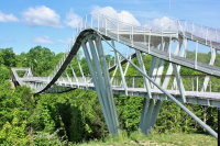
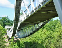
Bridgemeister ID: 6139 (added 2021-07-06)Year Completed: 2013 Name: CONSOL Energy Wing Tip Also Known As: Wingtip Location: Glen Jean, Oak Hill vicinity, West Virginia , USA Crossing: Turley Branch At or Near Feature: Summit Bechtel National Scout Reserve Coordinates: 37.917343 N 81.119230 W Maps: Acme , GeoHack , Google , OpenStreetMap Principals: Hatch Mott MacDonald, Schlaich Bergermann Partner, Freyssinet Use: Footbridge Status: In use (last checked: 2021) Main Cables: Wire (steel) Suspended Spans: 3 Main Span: 1 x 177.4 meters (582 feet) Side Spans: 2 x 31.1 meters (102 feet) estimated
Large, unconventional suspension bridge with a large underspanned section, walkways running along the tops of the main cables, and rigid suspenders. CONSOL Energy Wing Tip Bridge - Mott MacDonald . "Each end of the bridge passes through a V-shaped structure made of six steel masts, raked outward at the top. Between the masts and abutments, the cables are splayed to provide extra stability against lateral motion. The resemblance of the slanting masts to the wing tip feathers of a flying eagle inspired the name Wing Tip Bridge… A unique feature of the bridge is that pedestrians can cross in one of two ways: on a traditional level deck or on secondary walkways that follow the cables and pass above and then below the deck, sometimes at an angle of up to 10 degrees."Consol Energy Wingtip Bridge (Boy Scouts Bridge) - schlaich bergermann partner . "The design of the bridge was to be adventurous and the crossing of the bridge was to be an experience in itself. To that end, the scouts are able to walk not only on the bridge deck but also along the cables of the bridge on a steel walkway. The cables pass over the tops of the masts and below the main deck of the bridge allowing the scouts to see the bridge from multiple perspectives. The masts are spread to form a V in section which evokes the tips of eagle’s wings, the symbol of the Boy Scouts."Structurae - Structure ID 20066259 Bridgemeister ID: 6144 (added 2021-07-07)Year Completed: 2013 Name: Fleish Location: Fleish, Mystic vicinity, California , USA Crossing: Truckee River At or Near Feature: Tahoe-Pyramid Trail Coordinates: 39.452421 N 120.005687 W Maps: Acme , GeoHack , Google , OpenStreetMap Use: Footbridge Status: In use (last checked: 2021) Main Cables: Wire (steel) Suspended Spans: 1
Bridgemeister ID: 2691 (added 2019-05-27)Year Completed: 2013 Name: Neuse River Greenway Location: Raleigh, North Carolina , USA Crossing: Neuse River At or Near Feature: Neuse River Greenway Trail Coordinates: 35.817608 N 78.539325 W Maps: Acme , GeoHack , Google , OpenStreetMap Use: Footbridge Status: In use (last checked: 2019) Main Cables: Wire (steel) Suspended Spans: 1
Bridgemeister ID: 2692 (added 2019-05-27)Year Completed: 2013 Name: Neuse River Greenway Location: Raleigh, North Carolina , USA Crossing: Neuse River At or Near Feature: Neuse River Greenway Trail Coordinates: 35.884492 N 78.528419 W Maps: Acme , GeoHack , Google , OpenStreetMap Use: Footbridge Status: In use (last checked: 2019) Main Cables: Wire (steel) Suspended Spans: 1
Bridgemeister ID: 3991 (added 2020-03-22)Year Completed: 2013 Name: North Fork Skokomish River Trail Also Known As: Staircase Rapids Trail Location: Olympic National Park, Washington , USA Crossing: North Fork Skokomish River At or Near Feature: Skokomish River Trail Coordinates: 47.524521 N 123.341875 W Maps: Acme , GeoHack , Google , OpenStreetMap Principals: MACNAK Construction Use: Footbridge Status: In use (last checked: 2020) Main Cables: Wire (steel) Main Span: 1 x 64 meters (210 feet) estimated
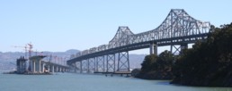
Bridgemeister ID: 2695 (added 2019-05-27)Year Completed: 2013 Name: San Francisco-Oakland Bay Eastern Span Location: Oakland and Yerba Buena Island, California , USA Crossing: San Francisco Bay Coordinates: 37.816217 N 122.356859 W Maps: Acme , GeoHack , Google , OpenStreetMap Use: Vehicular (major highway) Status: In use (last checked: 2024) Main Cables: Wire (steel) Characteristics: Self-anchored
Bridgemeister ID: 3338 (added 2019-12-14)Year Completed: 2013 Name: Swinging Location: Thomson, Minnesota , USA Crossing: St. Louis River At or Near Feature: Jay Cooke State Park Coordinates: 46.653997 N 92.370472 W Maps: Acme , GeoHack , Google , OpenStreetMap Use: Footbridge Status: In use (last checked: 2019) Main Cables: Wire (steel)
Bridgemeister ID: 3693 (added 2020-02-08)Year Completed: 2014 Name: (footbridge) Location: Fort Belvoir, Virginia , USA Crossing: Accotink Creek At or Near Feature: Accotink Bay Wildlife Refuge Principals: Western Wood Structures Use: Footbridge Status: In use (last checked: 2020) Main Cables: Wire (steel)
Bridgemeister ID: 5841 (added 2021-05-13)Year Completed: 2014 Name: King Mill Tailrace Location: Augusta, Georgia , USA Crossing: King Mill Tailrace At or Near Feature: River Levee Trail Coordinates: 33.486881 N 81.988253 W Maps: Acme , GeoHack , Google , OpenStreetMap Use: Footbridge Status: In use (last checked: 2021) Main Cables: Wire (steel) Suspended Spans: 1 Main Span: 1 x 57.9 meters (190 feet)
Bridgemeister ID: 2628 (added 2018-12-31)Year Completed: 2014 Name: Pioneer Crossing Location: West Valley City, Utah , USA Crossing: Jordan River At or Near Feature: Jordan River Parkway Trail Coordinates: 40.703250 N 111.927649 W Maps: Acme , GeoHack , Google , OpenStreetMap Use: Footbridge Status: In use (last checked: 2018) Main Cables: Wire (steel) Suspended Spans: 1
Bridgemeister ID: 7028 (added 2022-05-15)Year Completed: 2014 Name: Stoddard Pack Location: Salmon and North Fork vicinity, Idaho , USA Crossing: Salmon River Coordinates: 45.296224 N 114.604197 W Maps: Acme , GeoHack , Google , OpenStreetMap Use: Pack and Footbridge Status: Destroyed, March 15, 2017 Main Cables: Wire (steel) Suspended Spans: 1 Main Span: 1 x 103.6 meters (340 feet) estimated
Bridgemeister ID: 5558 (added 2020-12-18)Year Completed: 2015 Name: Aux Arc Wilderness Location: Marshall, Arkansas , USA Crossing: Rush Creek Use: Vehicular (one-lane) Status: In use, 2019 Main Cables: Wire (steel) Suspended Spans: 1 Main Span: 1 x 28.7 meters (94 feet)
Bridgemeister ID: 2926 (added 2019-09-15)Year Completed: 2015 Name: Bear Canyon Location: Draper, Utah , USA Coordinates: 40.524024 N 111.826085 W Maps: Acme , GeoHack , Google , OpenStreetMap Principals: Ralph L. Wadsworth Construction Co. Inc. Use: Footbridge Status: In use (last checked: 2019) Main Cables: Wire (steel) Suspended Spans: 1 Main Span: 1 x 56.4 meters (185 feet)
Bridgemeister ID: 2669 (added 2019-03-15)Year Completed: 2015 Name: Henry David Thoreau Location: Washington, Connecticut , USA Crossing: Shepaug River At or Near Feature: Hidden Valley Preserve Coordinates: 41.656833 N 73.316306 W Maps: Acme , GeoHack , Google , OpenStreetMap Principals: Seattle Bridge LLC Use: Footbridge Status: In use (last checked: 2018) Main Cables: Wire (steel) Main Span: 1 x 40.8 meters (134 feet)
2020, February: Destroyed by flood. 2020, July: Grant funds received for replacement. Bridgemeister ID: 3058 (added 2019-10-26)Year Completed: 2016 Name: 35th Street Location: Chicago, Illinois , USA Coordinates: 41.831468 N 87.606227 W Maps: Acme , GeoHack , Google , OpenStreetMap Use: Footbridge Status: In use (last checked: 2019) Main Cables: Wire (steel) Suspended Spans: 2 Side Spans: 2
Bridgemeister ID: 6348 (added 2021-07-25)Year Completed: 2016 Name: Medicine Springs Pack Location: Augusta vicinity, Montana , USA Crossing: North Fork Sun River At or Near Feature: Bob Marshall Wilderness Coordinates: 47.632292 N 112.857250 W Maps: Acme , GeoHack , Google , OpenStreetMap Use: Pack and Footbridge Status: In use (last checked: 2016) Main Cables: Wire (steel) Suspended Spans: 1 Main Span: 1 x 35.1 meters (115 feet) estimated
Do you have any information or photos for these bridges that you would like to share? Please email david.denenberg@bridgemeister.com .
Mail | Facebook | Twitter
