Suspension Bridges of Minnesota
This is a list of all 18 bridges from the suspension bridge inventory for Minnesota in USA. Wherever you see a Bridgemeister ID number click it to isolate the bridge on its own page.
Related Lists:
1855: Minneapolis
Minneapolis, Minnesota, USA - Mississippi River
| Bridgemeister ID: | 50 (added before 2003) |
| Year Completed: | 1855 |
| Name: | Minneapolis |
| Also Known As: | St. Anthony's Falls |
| Location: | Minneapolis, Minnesota, USA |
| Crossing: | Mississippi River |
| At or Near Feature: | Nicollet Island |
| Coordinates: | 44.985556 N 93.263389 W |
| Maps: | Acme, GeoHack, Google, OpenStreetMap |
| Principals: | Thomas M. Griffith |
| References: | AAJ, BPL, HBE, PTS2 |
| Use: | Vehicular |
| Status: | Demolished, 1876 |
| Main Cables: | Wire (iron) |
| Suspended Spans: | 1 |
| Main Span: | 1 x 189 meters (620 feet) |
| Deck width: | 17 feet |
Notes:
- Replaced by 1877 Minneapolis - Minneapolis, Minnesota, USA.
- Later at same location 1990 Hennepin Avenue (Father Louis Hennepin) - Minneapolis, Minnesota, USA.
- All past and present bridges at this location.
External Links:
Image Sets:
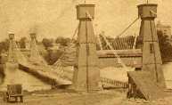
1877: Minneapolis
Minneapolis, Minnesota, USA - Mississippi River
| Bridgemeister ID: | 86 (added before 2003) |
| Year Completed: | 1877 |
| Name: | Minneapolis |
| Location: | Minneapolis, Minnesota, USA |
| Crossing: | Mississippi River |
| At or Near Feature: | Nicollet Island |
| Coordinates: | 44.985028 N 93.264556 W |
| Maps: | Acme, GeoHack, Google, OpenStreetMap |
| Principals: | Thomas M. Griffith |
| References: | AAJ, BPL, HBE, PTS2 |
| Use: | Vehicular, with walkway |
| Status: | Replaced, 1890 |
| Main Cables: | Wire (iron) |
| Suspended Spans: | 1 |
| Main Span: | 1 x 205.8 meters (675.1 feet) |
| Deck width: | 32 feet |
Notes:
- Replaced 1855 Minneapolis (St. Anthony's Falls) - Minneapolis, Minnesota, USA.
- Later at same location 1990 Hennepin Avenue (Father Louis Hennepin) - Minneapolis, Minnesota, USA.
- All past and present bridges at this location.
Image Sets:
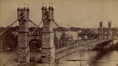
1924: Swinging
Thomson, Minnesota, USA - St. Louis River
| Bridgemeister ID: | 2103 (added 2006-08-19) |
| Year Completed: | 1924 |
| Name: | Swinging |
| Location: | Thomson, Minnesota, USA |
| Crossing: | St. Louis River |
| At or Near Feature: | Jay Cooke State Park |
| Coordinates: | 46.653649 N 92.370458 W |
| Maps: | Acme, GeoHack, Google, OpenStreetMap |
| Principals: | U.S. Forest Service |
| Use: | Footbridge |
| Status: | Replaced, 1935 |
| Main Cables: | Wire |
Notes:
Image Sets:
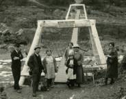
1935: Granite Falls
Granite Falls, Minnesota, USA - Minnesota River
| Bridgemeister ID: | 255 (added before 2003) |
| Year Completed: | 1935 |
| Name: | Granite Falls |
| Location: | Granite Falls, Minnesota, USA |
| Crossing: | Minnesota River |
| Coordinates: | 44.810108 N 95.537316 W |
| Maps: | Acme, GeoHack, Google, OpenStreetMap |
| Principals: | Minneapolis Bridge Company |
| References: | WCT20051125 |
| Use: | Footbridge |
| Status: | In use (last checked: 2019) |
| Main Cables: | Wire (steel) |
| Suspended Spans: | 3 |
| Main Span: | 1 |
| Side Spans: | 2 |
Notes:
- Damaged by floods, 1997 and 2001. Refurbished, 2014-2015.
Image Sets:
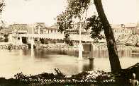
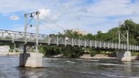
1935: Swinging
Thomson, Minnesota, USA - St. Louis River
| Bridgemeister ID: | 286 (added before 2003) |
| Year Completed: | 1935 |
| Name: | Swinging |
| Location: | Thomson, Minnesota, USA |
| Crossing: | St. Louis River |
| At or Near Feature: | Jay Cooke State Park |
| Coordinates: | 46.653436 N 92.370438 W |
| Maps: | Acme, GeoHack, Google, OpenStreetMap |
| Principals: | Oscar Newstrom, CCC |
| Use: | Footbridge |
| Status: | Destroyed, 1950 |
| Main Cables: | Wire |
| Main Span: | 1 x 38.4 meters (126 feet) |
Notes:
- Deck raised four feet, 1941. Wrecked by flood May, 1950.
- Replaced 1924 Swinging - Thomson, Minnesota, USA.
- Replaced by 1953 Swinging - Thomson, Minnesota, USA.
- All past and present bridges at this location.
Image Sets:

| Bridgemeister ID: | 2087 (added 2006-06-24) |
| Year Completed: | 1949 |
| Name: | (footbridge) |
| Location: | Minneapolis, Minnesota, USA |
| At or Near Feature: | University of Minnesota |
| Principals: | Joseph A. Wise, Mid-West Engineering Inc. |
| Use: | Footbridge |
| Status: | Dismantled |
| Main Cables: | Wire |
| Suspended Spans: | 1 |
Notes:
- Crossed railroad tracks near Bierman Field on University of Minnesota campus.
- Moved to Dinkytown (M Bridge) - Minneapolis, Minnesota, USA. The bridge was moved to another location on the University of Minnesota campus.
1953: Swinging
Thomson, Minnesota, USA - St. Louis River
| Bridgemeister ID: | 2104 (added 2006-08-19) |
| Year Completed: | 1953 |
| Name: | Swinging |
| Location: | Thomson, Minnesota, USA |
| Crossing: | St. Louis River |
| At or Near Feature: | Jay Cooke State Park |
| Coordinates: | 46.653842 N 92.370471 W |
| Maps: | Acme, GeoHack, Google, OpenStreetMap |
| Use: | Footbridge |
| Status: | Destroyed, June 20, 2012 |
| Main Cables: | Wire (steel) |
Notes:
- Destroyed by flood, June 20, 2012
- Replaced 1935 Swinging - Thomson, Minnesota, USA.
- Replaced by 2013 Swinging - Thomson, Minnesota, USA.
- All past and present bridges at this location.
Image Sets:
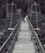
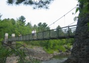

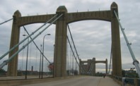
1990: Hennepin Avenue
Minneapolis, Minnesota, USA - Mississippi River
| Bridgemeister ID: | 336 (added before 2003) |
| Year Completed: | 1990 |
| Name: | Hennepin Avenue |
| Also Known As: | Father Louis Hennepin |
| Location: | Minneapolis, Minnesota, USA |
| Crossing: | Mississippi River |
| Coordinates: | 44.985 N 93.26333 W |
| Maps: | Acme, GeoHack, Google, OpenStreetMap |
| Principals: | Henn. Co. Pub. Wrks., HNTB Corp |
| Use: | Vehicular (four or more lanes), with walkway |
| Status: | In use (last checked: 2006) |
| Main Cables: | Wire (steel) |
| Suspended Spans: | 1 |
| Main Span: | 1 x 190.5 meters (625 feet) |
Notes:
- At former location of 1855 Minneapolis (St. Anthony's Falls) - Minneapolis, Minnesota, USA.
- At former location of 1877 Minneapolis - Minneapolis, Minnesota, USA.
- All past and present bridges at this location.
External Links:
Image Sets:
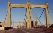
2013: Swinging
Thomson, Minnesota, USA - St. Louis River
| Bridgemeister ID: | 3338 (added 2019-12-14) |
| Year Completed: | 2013 |
| Name: | Swinging |
| Location: | Thomson, Minnesota, USA |
| Crossing: | St. Louis River |
| At or Near Feature: | Jay Cooke State Park |
| Coordinates: | 46.653997 N 92.370472 W |
| Maps: | Acme, GeoHack, Google, OpenStreetMap |
| Use: | Footbridge |
| Status: | In use (last checked: 2019) |
| Main Cables: | Wire (steel) |
Notes:
(footbridge)
Eagle Lake vicinity, Minnesota, USA - LeSueur River
| Bridgemeister ID: | 1894 (added 2005-10-01) |
| Name: | (footbridge) |
| Location: | Eagle Lake vicinity, Minnesota, USA |
| Crossing: | LeSueur River |
| At or Near Feature: | Wildwood County Park |
| Coordinates: | 44.12445 N 93.864117 W |
| Maps: | Acme, GeoHack, Google, OpenStreetMap |
| Use: | Footbridge |
| Status: | In use (last checked: 2005) |
| Main Cables: | Wire (steel) |
| Main Span: | 1 x 42.7 meters (140 feet) |
(footbridge)
Fishhook Island, West Cook, Minnesota, USA - Sea Gull Lake
| Bridgemeister ID: | 6852 (added 2022-01-02) |
| Name: | (footbridge) |
| Location: | Fishhook Island, West Cook, Minnesota, USA |
| Crossing: | Sea Gull Lake |
| Coordinates: | 48.145055 N 90.888263 W |
| Maps: | Acme, GeoHack, Google, OpenStreetMap |
| Use: | Footbridge |
| Status: | In use (last checked: 2018) |
| Main Span: | 1 |
External Links:
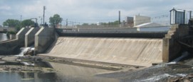
(footbridge)
Little Falls, Minnesota, USA - Mississippi River
| Bridgemeister ID: | 2102 (added 2006-08-19) |
| Name: | (footbridge) |
| Location: | Little Falls, Minnesota, USA |
| Crossing: | Mississippi River |
| At or Near Feature: | Little Falls Hydro Electric Station |
| Coordinates: | 45.976983 N 94.369717 W |
| Maps: | Acme, GeoHack, Google, OpenStreetMap |
| Use: | Footbridge |
| Status: | In use (last checked: 2006) |
| Main Cables: | Wire |
| Suspended Spans: | 1 |
Image Sets:
(footbridge)
Pelican Rapids, Minnesota, USA - Pelican River
| Bridgemeister ID: | 1459 (added 2004-08-21) |
| Name: | (footbridge) |
| Location: | Pelican Rapids, Minnesota, USA |
| Crossing: | Pelican River |
| Coordinates: | 46.569583 N 96.082 W |
| Maps: | Acme, GeoHack, Google, OpenStreetMap |
| Use: | Footbridge |
| Status: | In use (last checked: 2019) |
| Main Cables: | Wire |
| Suspended Spans: | 3 |
| Main Span: | 1 |
| Side Spans: | 2 |
(footbridge)
Tettegouche State Park, Minnesota, USA - Baptism River
| Bridgemeister ID: | 2135 (added 2006-10-28) |
| Name: | (footbridge) |
| Location: | Tettegouche State Park, Minnesota, USA |
| Crossing: | Baptism River |
| Coordinates: | 47.351708 N 91.210297 W |
| Maps: | Acme, GeoHack, Google, OpenStreetMap |
| Use: | Footbridge |
| Status: | In use (last checked: 2018) |
| Main Cables: | Wire (steel) |
| Characteristics: | Monocable |
Notes:
- Monocable suspension bridge.
- 2022: Closed due to flood damage, but still intact.
- 2024, June: Destroyed by flood. The bridge had not been repaired since the 2022 flood damage.
Image Sets:

Beaver Creek
Caledonia vicinity, Minnesota, USA - Beaver Creek East
| Bridgemeister ID: | 2629 (added 2019-01-01) |
| Name: | Beaver Creek |
| Location: | Caledonia vicinity, Minnesota, USA |
| Crossing: | Beaver Creek East |
| At or Near Feature: | Beaver Creek Valley State Park |
| Coordinates: | 43.642983 N 91.581983 W |
| Maps: | Acme, GeoHack, Google, OpenStreetMap |
| Use: | Footbridge |
| Status: | In use (last checked: 2016) |
| Main Cables: | Wire (steel) |
| Suspended Spans: | 1 |
| Bridgemeister ID: | 2086 (added 2006-06-24) |
| Name: | Dinkytown |
| Also Known As: | M Bridge |
| Location: | Minneapolis, Minnesota, USA |
| At or Near Feature: | University of Minnesota |
| Coordinates: | 44.98 N 93.238267 W |
| Maps: | Acme, GeoHack, Google, OpenStreetMap |
| Use: | Footbridge |
| Status: | Demolished, c. 2018-2019 |
| Main Cables: | Wire (steel) |
| Suspended Spans: | 1 |
Notes:
- Connected University of Minnesota campus to Dinkytown neighborhood.
- 2008, March: Closed due to fear some heavily rusted plates could fail. Restored and reopened by early 2009, possibly sooner.
- 2018, June: Closed due to "structural deterioration". Expected to be demolished in 2019.
- Moved from 1949 (footbridge) - Minneapolis, Minnesota, USA. The bridge was moved to this location from the Bierman Field area of the same campus.
Image Sets:
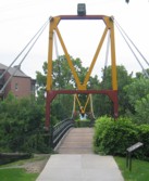
Swinging
Little Falls vicinity, Minnesota, USA - Pike Creek
| Bridgemeister ID: | 607 (added 2003-01-14) |
| Name: | Swinging |
| Location: | Little Falls vicinity, Minnesota, USA |
| Crossing: | Pike Creek |
| At or Near Feature: | Lindbergh State Park |
| Use: | Footbridge |
| Status: | Removed |
| Main Cables: | Wire |
Image Sets:

Do you have any information or photos for these bridges that you would like to share? Please email david.denenberg@bridgemeister.com.
Mail | Facebook | X (Twitter) | Bluesky
