Inventory Search Results (1-100 of 497)
497 suspension bridges were found for search criteria: county. Bridges 1 through 100 (of 497 total) appear below. Click the Bridgemeister ID number to isolate the bridge on its own page. If you don't see what you were looking for, try an image search with the same criteria: county. This will find the bridge if it is pictured on the site, but is not a catenary suspension bridge.
Related:
1801: Jacob's Creek
Iron Bridge, Mount Pleasant vicinity, Pennsylvania, USA - Jacob's Creek
| Bridgemeister ID: | 3 (added before 2003) |
| Year Completed: | 1801 |
| Name: | Jacob's Creek |
| Also Known As: | Iron Bridge, Chain Bridge |
| Location: | Iron Bridge, Mount Pleasant vicinity, Pennsylvania, USA |
| Crossing: | Jacob's Creek |
| Coordinates: | 40.112598 N 79.553186 W |
| Maps: | Acme, GeoHack, Google, OpenStreetMap |
| Principals: | Judge James Finley |
| References: | AAJ, ASB, BBR, BOB, BPL, CAB, DSE20000116, HBE, LAB, PTS2 |
| Use: | Vehicular |
| Status: | Removed, 1833 |
| Main Cables: | Chain (iron) |
| Suspended Spans: | 3 |
| Main Span: | 1 x 21.3 meters (70 feet) |
| Deck width: | 12.5 feet |
Notes:
- In an email dated January 16, 2000, Don Sayenga provided information about the location of this bridge. Generally attributed to Uniontown (the seat of Fayette County, PA), Mr. Sayenga offers some clues about the bridge's true location. "[James Finley] stated that he built it near the home of his friend Meason which implies a connection for the iron as Meason was making iron. Meason's home has survived by the way, a beautiful place. Finley stated it was a combination contract with the cost split between two counties, and he stated it was built over Jacob's Creek which is the county boundary. He also makes it clear it was on the road to Greensburg. The only place the old road crossed Jacob's Creek is just south of Mount Pleasant, Pennsylvania. On the geodetic survey maps this spot is marked "Iron Bridge" but there is no town there. The last time I was there I saw a sign that said 'Iron Bridge' on an automobile scrap yard. I found absolutely no trace of the bridge, but it was not very big, so there was no need for a huge abutment."
- First suspension bridge with a rigid level deck, often considered the world's first modern suspension bridge.
- Coordinates are for the likely location of the bridge, where present-day (2020) Pennsylvania route 3105 crosses Jacob's Creek.
External Links:
1845: (footbridge)
Caledon, County Tyrone, Northern Ireland, United Kingdom - River Blackwater
| Bridgemeister ID: | 2424 (added 2008-03-12) |
| Year Completed: | 1845 |
| Name: | (footbridge) |
| Location: | Caledon, County Tyrone, Northern Ireland, United Kingdom |
| Crossing: | River Blackwater |
| Coordinates: | 54.34608 N 6.83276 W |
| Maps: | Acme, GeoHack, Google, OpenStreetMap |
| Principals: | James Dredge |
| References: | AAJ |
| Use: | Footbridge |
| Status: | Extant (last checked: 2021) |
| Main Cables: | Rod (iron) |
| Suspended Spans: | 1 |
| Main Span: | 1 x 22.6 meters (74 feet) |
Notes:
- This distinctly Dredge bridge is currently sitting atop modern concrete piers.
External Links:
1852: Huse
Yeomet, California, USA - Cosumnes River
| Bridgemeister ID: | 1088 (added 2004-01-01) |
| Year Completed: | 1852 |
| Name: | Huse |
| Location: | Yeomet, California, USA |
| Crossing: | Cosumnes River |
| Coordinates: | 38.55323 N 120.84755 W |
| Maps: | Acme, GeoHack, Google, OpenStreetMap |
| Principals: | E.P. Bowman |
| Use: | Vehicular |
| Status: | Removed |
| Main Cables: | Wire (iron) |
Notes:
- Yeomet was located near the present day California Route 49 crossing of the Cosumnes River by the confluence of the North Fork and Middle Fork of the Cosumnes River. Yeomet was once known as "Forks of the Cosumnes." The location coordinates provided here are only to show the approximate location of the confluence and should not be considered the exact location of the bridge. This inventory entry represents the suspension bridge for which a photograph exists in the Lawrence & Houseworth collection titled "Suspension Bridge over the Cosumnes River, At Yeomet, El Dorado County". This image exists in several online archives.
- Barry Parr, consulting Erwin Gudde's California Gold Camps (University of California Press), writes that Gudde notes the bridge is located "at Yeomet and says it was marked on the County Map in 1866, and was owned by S.E. Huse for a decade. Of Yeomet, Gudde writes: 'Amador County. At the junction of the forks of Cosumnes River, formerly in El Dorado County'. Gudde says the camp developed in 1849 or 1850 and prospered for a number of years, but says nothing further about the bridge." Barry also notes that some sources cite Yeomet as located in Calaveras County, but this is because Amador County was created in 1854 from Calaveras County. Barry continues: "The California Division of Mines Bulletin 141, Geological Guidebook along Highway 49, mentions the Highway 49 bridge across the Cosumnes as also known as the Huse Bridge."
- The October 14, 1976 edition of The Mountain Democrat Times (Placerville, California) has an article about the Huse Bridge (from the Heritage Association of El Dorado) describing Huse's Bridge:
"E.P. Bowman, an early motel keeper in Yeomet had a ferry across the Cosumnes and by 1852 had built a bridge there (J.M. Watrous had a ferry there also). Traffic was heavy and... [the tolls were] as much a 'gold mine' as most of the nearby river claims which ran for miles above and below the town. (Yeomet falls was below the bridge). The famous Mother Lode crossed the river in the vicinity of the town. Samuel Huse bought the bridge at Yeomet in about 1862 and owned it until his death. His widow Laura sold the wire suspension bridge and the exclusive right to collect tolls to John Ballard and W.H. Martin in 1883. William Miller purchased the property in 1887."
It is unclear if the 1852 E.P. Bowman bridge was the same structure as the suspension bridge purchased by Huse ten years later, but it has been assumed here pending additional details. - An obituary for in the August 28, 1949 edition of the Oakland Tribune for Lilian Williams presents a stronger tie between E.P. Bowman and S.E. Huse: "With her foster parents, the E. P. Bowmans, Mrs. Williams spent her childhood in Oakland, San Francisco and Yeomet, between Plymouth and Placerville. Bowman and her foster uncle, S.E. Huse, owned a hotel at Yeomet. They also built and operated a toll bridge there on the Cosumnes River, over which most of the heavy machinery and mining equipment was transported to the old Mother Lode mines."
- See 1852 Wilson's - Cosumne, California, USA.
- See 1863 Lamb's - Latrobe vicinity and Plymouth vicinity, California, USA.
External Links:
1852: Wilson's
Cosumne, California, USA - Cosumnes River
| Bridgemeister ID: | 2116 (added 2006-09-10) |
| Year Completed: | 1852 |
| Name: | Wilson's |
| Location: | Cosumne, California, USA |
| Crossing: | Cosumnes River |
| Coordinates: | 38.49229 N 121.17183 W |
| Maps: | Acme, GeoHack, Google, OpenStreetMap |
| Principals: | W. D. Wilson |
| References: | DSL200106 |
| Use: | Vehicular |
| Status: | Removed |
| Main Cables: | Wire |
| Main Span: | 1 x 45.7 meters (150 feet) |
| Deck width: | 12 feet |
Notes:
- The location of this bridge was near the present day location of Cosumne in Sacramento County, just east of Sloughhouse. The location coordinates provided here are only to show the approximate location of present-day Cosumne and should not be considered the exact location of the bridge. Don Sayenga writes: "The exact location was at the intersection of [present-day] Dillard Road and State Route 16 a very short distance east of Sloughhouse, Sacramento County, California... The whole area at that time was known as Daylor's Ranch."
- Don Sayenga notes an F.W. Panhorst (of the California Highway Department) citation:
"Alta California July 27, 1852 reprinting an article from Sacramento Union mentions a wire suspension bridge built in Sacramento County across the Cosumnes. The span is described as 150 feet with a roadway width of 12 feet. One W.D. Wilson is mentioned as owner and designer. This structure, according to our best information, was the first suspension bridge in California."
- A January 14, 1862 Sacramento Bee article notes:
"The quartz mill and house of the brothers Wiley, just beyond Butte City, were carried away by the torrent. At Ione City, William's brick stable had fallen, and several other houses had met with a like fate. On Sutter creek, the loss and damage had been terrific - bridges and houses being carried off like chaff. Mr. Haywood, proprietor of a quartz mill on Sutter creek, had been a loser to the amount of at least $75,000. We have it from good authority that in the counties of Calaveras and Amador not a bridge is left standing. Below Ione City, it is thought that there has been loss of life."
which seems to imply a relationship between the Ione Valley, the Cosumnes River, and the bridge at Wilson's Exchange, but this may have just been coincidental that both "Ione Valley" and Wilson's Exchange were mentioned in the same paragraph; they are nearby. Present-day Ione is in Amador County a few miles east of Sacramento County. The Cosumnes River forms the northern border of Amador County several miles to the north of present-day Ione. Barry Parr notes that the Cosumnes River does not flow through the "Ione Valley," but Barry writes: "Recalling Daylor’s name in Historic Spots of California: 'Daylor established himself as a trader and hotel-keeper on the Cosumnes River about a mile east of Slough House. This place, which was at first known as Daylor’s Ranch, later became the Cosumnes post office.' (p. 290) The site of Cosumnes post office is about five miles downstream from Bridge House, and both are on the Sacramento-Ione Road.
"Last Saturday night, the reports of minute guns were heard, as if signals of distress, coming from the direction of a house where lived Mr. Martin and his family. The whole of Ione Valley was many feet under water. No boats were to be had, so that assistance might be rendered those in danger and distress. In a short time a heavy crash was heard, the signals of distress ceased, and our informant tells us that when he left the general impression was that Martin and his family had lost their lives. The wire suspension bridge over the Cosumnes river had disappeared - the house known as Wilson’s Exchange has also been washed away, and Daylor’s adobe house is flat with the ground. These facts go to show that throughout the mountain districts, as well as in the valleys, the destruction of property and loss of human life exceed the worst that was anticipated, and we shall hear repetitions of such tales of distress as the avenues for communication are gradually opened to us." - See 1852 Huse - Yeomet, California, USA.
- See 1863 Lamb's - Latrobe vicinity and Plymouth vicinity, California, USA.
External Links:
- Oliver Plummer. Transcription by Debbie Walke Gramlick of passage from An Illustrated History of Sacramento County, California. (by Hon. Win. J. Davis, Lewis Publishing Company, 1890, Pages 435-436) which sheds more light on W.D. Wilson.
"Mr. Wilson and part of the company concluded to seek the land of gold, while others kept to the original design of going to Oregon. On his arrival Mr. Wilson mined for a short time on Mormon Island and then moved to Hangtown, now Placerville, where in the winter of 1848-49 he built the first house erected in that place. The family then comprised six children; five more were born in California; nine grew to maturity and seven are living in 1889. In the spring of 1850 he moved down on the Cosumnes and purchased 6,000 acres of the Hartnell Grant, and built a tavern, long known as Wilson’s Exchange, across the river from what is now the Cosumnes post office. He was postmaster from the establishment of that office until 1868. He was by trade a millwright and built the first suspension bridge on the Cosumnes."
1855: Shohola
Barryville, New York and Shohola, Pennsylvania, USA - Delaware River
| Bridgemeister ID: | 41 (added before 2003) |
| Year Completed: | 1855 |
| Name: | Shohola |
| Also Known As: | Barryville-Shohola, Shohola-Barryville |
| Location: | Barryville, New York and Shohola, Pennsylvania, USA |
| Crossing: | Delaware River |
| Coordinates: | 41.477000 N 74.919000 W |
| Maps: | Acme, GeoHack, Google, OpenStreetMap |
| Principals: | Chauncy Thomas, John A. Roebling |
| References: | BDR, SHO |
| Use: | Vehicular |
| Status: | Dismantled, 1941 |
| Main Cables: | Wire (iron) |
| Suspended Spans: | 1 |
Notes:
- BDR: Built 1856, severely damaged 1859, rebuilt, collapsed Jan. 1st 1865, rebuilt 1866. Dale writes: "A respected historian, John Willard Johnston, who knew Chauncey Thomas personally and visited the area during his ownership of the toll bridge, insisted that Thomas, as the builder, was grossly incompetent."
- Originally constructed with one main span, the center pier was added during the 1866 reconstruction.
- Don Sayenga's research leads him to conclude the bridge was completed in the fall of 1855. He notes an article from the Pike County Democrat (June 21, 1872) stating the bridge was completed in 1855. The article also notes the 1859 collapse occurred on July 2, 1859. Don's interest in this bridge is piqued by the connection to John Roebling, "...this bridge seems to be the only John Roebling bridge that failed in service..." Roebling prepared plans, for the original bridge, for Chauncy Thomas (who, by Dale's account was inexperienced).
Image Sets:
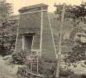
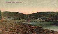
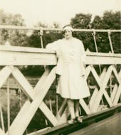
1855: Whiskey Bar
El Dorado County, California, USA - American River
| Bridgemeister ID: | 3357 (added 2019-12-15) |
| Year Completed: | 1855 |
| Name: | Whiskey Bar |
| Also Known As: | Pioneer, Whisky |
| Location: | El Dorado County, California, USA |
| Crossing: | American River |
| Use: | Vehicular |
| Status: | Destroyed, 1862 |
| Main Cables: | Wire (iron) |
Notes:
- Destroyed by flood, 1862. Cables supposedly reused for the Rattlesnake Bar bridge.
- See 1862 Rattlesnake Bar - Folsom vicinity, California, USA.
1862: Rattlesnake Bar
Folsom vicinity, California, USA - American River
| Bridgemeister ID: | 1091 (added 2004-01-01) |
| Year Completed: | 1862 |
| Name: | Rattlesnake Bar |
| Location: | Folsom vicinity, California, USA |
| Crossing: | American River |
| At or Near Feature: | Rattlesnake Bar |
| Coordinates: | 38.814397 N 121.091726 W |
| Maps: | Acme, GeoHack, Google, OpenStreetMap |
| Principals: | Andrew S. Hallidie |
| References: | DSL200106 |
| Use: | Vehicular (one-lane) |
| Status: | Collapsed, December 21, 1954 |
| Main Cables: | Wire (iron) |
| Suspended Spans: | 1 |
Notes:
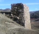
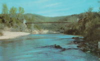
- The location of Rattlesnake Bar is closer to present-day Auburn than Folsom, near the location of Goose Flat marked on modern topographical maps of the region. The area was inundated during the creation of Folsom Lake, but the piers and abutments of the Rattlesnake Bar bridge are visible when the water level is low.
- Rodi Lee writes: "[The bridge] collapsed in 1954 when an overweight truck filled with manure crossed it. The driver was unhurt. There are newspaper articles about the incident (Auburn Journal, Auburn). There are some photos in the article as well. The bridge abutments show when the the lake water is low. The bridge was upstream of Wild Goose Flats."
- See 1855 Whiskey Bar (Pioneer, Whisky) - El Dorado County, California, USA. The cables of the Rattlesnake Bar bridge were reportedly reused from the damaged Whiskey Bar bridge.
External Links:
- 1057. The Suspension Bridge over the American River at Rattlesnake Bar, Placer County - Calisphere.org
- Rattlesnake Bridge - Christine's Blog. Several images of the remnants of the bridge.
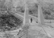
Image Sets:
1863: Lamb's
Latrobe vicinity and Plymouth vicinity, California, USA - Cosumnes River
| Bridgemeister ID: | 2117 (added 2006-09-10) |
| Year Completed: | 1863 |
| Name: | Lamb's |
| Location: | Latrobe vicinity and Plymouth vicinity, California, USA |
| Crossing: | Cosumnes River |
| Coordinates: | 38.52222 N 120.95587 W |
| Maps: | Acme, GeoHack, Google, OpenStreetMap |
| Use: | Vehicular (one-lane) |
| Status: | Derelict (last checked: 2020) |
| Main Cables: | Wire (iron) |
| Suspended Spans: | 1 |
Notes:
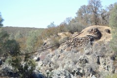
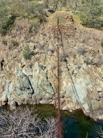
- The location coordinates provided here are the approximate location of this bridge, crossing the Cosumnes between present day El Dorado and Amador counties at Michigan Bar (as named on USGS topographical maps) on current Latrobe Road where Clark Creek meets the Cosumnes River. Note that USGS topographical maps show another, more prominently marked, "Michigan Bar" a few miles west in Sacramento County.
- A California Highways and Public Works article (unsure of exact citation but it may be the article on the history of California bridges that appeared in the 1941 June issue and was reprinted in the 1950 September/October issue) says "there were four [suspension bridges] on the Cosumnes River, one of which (Lamb's Bridge on the Latrobe-Plymouth Road) killed one man and seven horses when it fell in 1869."
- The October 14, 1976 edition of The Mountain Democrat Times (Placerville, California) has an article about the nearby Huse Bridge (from the Heritage Association of El Dorado) which mentions Lamb's Bridge: "...Lamb's Bridge, several miles downriver, was reconstructed in 1872 and was also a wire bridge of the same type [as Huse's]."
- The Statutes of California passed at the Fourteenth Session of the Legislature, 1863 records: "Chapter XLI. An Act to grant to Larkin Lamb and his Associates the right to construct and maintain a Toll Bridge across the Cosumnes River, in the Counties of Amador and El Dorado. Approved March 6, 1863. The People of the State of California, represented in Senate and Assembly, do enact as follows: Section 1. Larkin Lamb, and those he may associate with him, their heirs and assigns, shall have full power to build, erect, construct, and maintain a public toll bridge across the Cosumnes River, at a point about eighty (80) rods below Dutch Hill;..."
- A November 12, 2017 article in Ledger Dispatch (of Amador and Calaveras counties) titled "Vestiges of Amador-Communities Along the Cosumnes, Part VI: The Lower Reaches - Michigan Bar to Wisconsin Bar" by Deborah Coleen Cook gives a more complete history of Lamb's bridge citing the enactment (February 9, 1863) of the bill to permit construction, construction completing six months later, failure of one of the cables in 1869 under the weight of a large freight wagon, and another cable/anchorage failure in 1872 while the bridge was undergoing major repairs.
- See 1852 Huse - Yeomet, California, USA.
- See 1852 Wilson's - Cosumne, California, USA.
Image Sets:
1867: Mosquito Road
Placerville, California, USA - South Fork American River
| Bridgemeister ID: | 2323 (added 2007-05-06) |
| Year Completed: | 1867 |
| Name: | Mosquito Road |
| Location: | Placerville, California, USA |
| Crossing: | South Fork American River |
| Coordinates: | 38.775791 N 120.748441 W |
| Maps: | Acme, GeoHack, Google, OpenStreetMap |
| Use: | Vehicular |
| Status: | Replaced |
| Main Cables: | Wire |
Notes:
- The February 23, 1995 edition of the Mountain Democrat (Placerville, California) has an article about the Mosquito crossing that mentions: "According to the El Dorado County History of 1883 by Paolo Sioli, 'Mosquito is connected to Placerville by a good wagon-road and a suspension bridge across the South Fork of the American River, a trail is running in the direction of Kelsey, the township center... The original bridge was constructed in 1867, and according to Orval Beckett, as quoted in the booklet, Mosquito Memories, 'This original bridge had no banisters on the sides. It was a suspension cable with No. 9 telephone wires strung between the supports. When you drove onto the bridge, it would 'swing and sway' much like we have seen in the movies. When one end went down the other went up, etc. Imagine the thrill!'"
- Replaced by 1939 Mosquito Road - Placerville, California, USA.
- All past and present bridges at this location.
External Links:
- Calisphere.org - Cable supports of suspension bridge across south fork of American River. Photo dated 1923, likely of the original Mosquito Road bridge.
1868: Calloway's Ford
Elizabethtown vicinity, Hamilton County, Ohio, USA - Whitewater River
| Bridgemeister ID: | 68 (added before 2003) |
| Year Completed: | 1868 |
| Name: | Calloway's Ford |
| Also Known As: | Whitewater, Harrison's |
| Location: | Elizabethtown vicinity, Hamilton County, Ohio, USA |
| Crossing: | Whitewater River |
| Coordinates: | 39.183116 N 84.792638 W |
| Maps: | Acme, GeoHack, Google, OpenStreetMap |
| Principals: | John Gray, Morse, Young |
| References: | EOV |
| Use: | Vehicular |
| Status: | Removed, 1920 |
| Main Cables: | Wire (iron) |
| Main Span: | 1 x 144.8 meters (475 feet) |
| Deck width: | 22 feet |
Notes:
- This bridge was located where present-day Suspension Bridge Road crosses the Whitewater River next to I-275 and north of US50. According to information provided by Sharon Lutz from Marjorie Byrnside Burress, this bridge was renamed "Harrison's Suspension Bridge" in 1891. This should not be confused with the nearby suspension bridge at Harrison.
- According to the information provided by Sharon Lutz from Marjorie Byrnside Burress, "Crossing this bridge was the main thoroughfare from Indiana into Ohio for many years (US 50 was not completed by then). [In 1920] it was decided that the Suspension Bridge had become obsolete and could no longer safely withstand the weight of vehicles. [On May 19, 1920] the cables were severed by means of an oxygen flame, the weight of the cables pulled down some towers. Other towers were weakened by dynamite at their bases and later they were pulled down by the weight of the cables severed at one end with an oxygen flame."
- See 1873 Harrison - Harrison, Ohio and Dearborn County, Indiana, USA.
Image Sets:
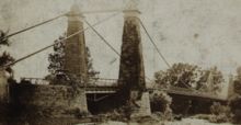

1868: High Street
Hamilton, Ohio, USA - Great Miami River
| Bridgemeister ID: | 67 (added before 2003) |
| Year Completed: | 1868 |
| Name: | High Street |
| Also Known As: | Hamilton |
| Location: | Hamilton, Ohio, USA |
| Crossing: | Great Miami River |
| Coordinates: | 39.401444 N 84.565389 W |
| Maps: | Acme, GeoHack, Google, OpenStreetMap |
| Principals: | John Gray |
| References: | EOV |
| Use: | Vehicular |
| Status: | Removed |
| Main Cables: | Wire |
| Suspended Spans: | 1 |
External Links:
- Butler County Engineer's Office (BCOE). Mentions this bridge stood from 1866 through 1895.
1869: Swinging
Warren and Glade, Pennsylvania, USA - Conewango Creek
| Bridgemeister ID: | 1623 (added 2005-02-27) |
| Year Completed: | 1869 |
| Name: | Swinging |
| Location: | Warren and Glade, Pennsylvania, USA |
| Crossing: | Conewango Creek |
| Coordinates: | 41.847389 N 79.141000 W |
| Maps: | Acme, GeoHack, Google, OpenStreetMap |
| Use: | Footbridge |
| Status: | Replaced, 1904 |
| Main Cables: | Wire (iron) |
Notes:
- Coordinates indicate approximate original location of the bridge.
- Destroyed by storm soon after completion and rebuilt.
- Images of America: Warren by Jodi L. Brandon shows an image of this bridge with a caption stating the bridge was moved to Kelletville (in Forest County, Pennsylvania) in 1906.
Image Sets:
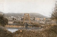
1870: Chehocton
Hancock, New York and Wayne County, Pennsylvania, USA - East Branch Delaware River
| Bridgemeister ID: | 284 (added before 2003) |
| Year Completed: | 1870 |
| Name: | Chehocton |
| Location: | Hancock, New York and Wayne County, Pennsylvania, USA |
| Crossing: | East Branch Delaware River |
| Coordinates: | 41.952583 N 75.278167 W |
| Maps: | Acme, GeoHack, Google, OpenStreetMap |
| Principals: | E.F. Farrington, John A. Roebling's Sons Co. |
| Use: | Vehicular |
| Status: | Removed, 1937 |
| Main Cables: | Wire (iron) |
| Suspended Spans: | 1 |
| Main Span: | 1 x 144.8 meters (475 feet) estimated |
Notes:
- Crossed the East Branch Delaware River on an alignment indicated by the current Old Bridge Street, between the rail crossing and the current (2020s) Stockport Road bridge.
- Replaced 1937.
Image Sets:
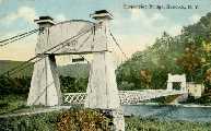
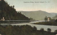
1871: Ferry Street
Binghamton, New York, USA - Chenango River
| Bridgemeister ID: | 276 (added before 2003) |
| Year Completed: | 1871 |
| Name: | Ferry Street |
| Location: | Binghamton, New York, USA |
| Crossing: | Chenango River |
| Coordinates: | 42.103139 N 75.914917 W |
| Maps: | Acme, GeoHack, Google, OpenStreetMap |
| Principals: | John A. Roebling's Sons, Co. |
| Use: | Vehicular (one-lane) |
| Status: | Removed, 1897 |
| Main Cables: | Wire |
| Suspended Spans: | 1 |
| Main Span: | 1 x 109.7 meters (360 feet) |
Notes:
- This bridge was close to the alignment of Binghamton's present E. Clinton Street bridge. It replaced a bridge that was destroyed by flood in 1865. It was condemned in 1896 and removed in 1897. History Of Broome County indicates an act was passed March 13th, 1871 authorizing the bridge with the contract let to "W.A. Roebling & Son" each cable consisting of seven steel wire ropes, each two inches in diameter.
- An article from the Binghamton Democrat, July 20, 1871: "The Suspension Bridge -- The work on the west abutment of the suspension bridge has been commenced and will be rapidly as advisable pushed forward to completion, and soon thereafter the wire cables will be placed in position, the stays, supports and girders made fast, and ready for the flooring. In the course of six or eight weeks it is hoped that the bridge will be completed, and our people given another way of passing from the 1st to the 2nd wards, and the old-pleasant driveway re-opened, of which we have been debarred since the flood of St-Patrick's Day in the morning in [1865]. Upon the completion of this enterprise, surely no one will ever regret having voted in favor of the free suspension bridge."
- An article from the Binghamton Democrat, Nov. 30, 1871: "The New Bridge -- Its Cost -- For the suspenssion [sic] bridge, the tax-payers voted $28,000. It is finished, and in the Common Council last evening it was asserted that it cost over $30,000 and still all the claims are not satisfied. Mr. Jas. Fanning, contractor for building abutments, seeks relief for $1,000 or upwards which he is out no account of his contract. His petition was after considerable skirmishing finally referred to a committee. We hold that this is wrong, the Common Council has nothing to do with this matter. Mayor Dwight published a card binding himself to pay all over $28,000 that the bridge would cost. The people voted that amount and their representatives have nothing to do with any further cost or expense arrising [sic] from that source."
- Internet searches for this bridge often lead to an image on page 32 of the book "Binghamton", from the "Images of America" series, by Ed Aswad and Suzanne M. Meredith. However, that image is of the Warren Pensylvania suspension bridge and is erroneously captioned as the Binghamton Ferry Street bridge. The bridges may be sometimes confused because of similar surroundings and similar towers. Both are often depicted with a large warehouse building on the far side of the bridge, to the right. Both had "walk-through" towers where the pedestrian walkway passed through portals in the towers. Closer comparisons reveal the Warren towers are substantially larger than the Ferry Street towers. This is not surprising given the Warren bridge was substantially longer than the Ferry Street bridge. All this being said, there are different images purporting to be the Ferry Street bridge that show different towers. The stereoview image linked here appears to show the original towers. Later photos appear to show either replaced towers or, perhaps, the original towers clad in protective housing.
- See 1871 Warren (Hickory Street) - Warren, Pennsylvania, USA. The two bridges are sometimes confused despite the significant size difference.
Image Sets:
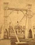
1873: Harrison
Harrison, Ohio and Dearborn County, Indiana, USA - Whitewater River
| Bridgemeister ID: | 81 (added before 2003) |
| Year Completed: | 1873 |
| Name: | Harrison |
| Location: | Harrison, Ohio and Dearborn County, Indiana, USA |
| Crossing: | Whitewater River |
| Principals: | James W. Shipman and Co. |
| References: | EOV |
| Use: | Vehicular (one-lane) |
| Status: | Destroyed, 1913, by flood |
| Main Cables: | Wire |
Notes:
- See 1868 Calloway's Ford (Whitewater, Harrison's) - Elizabethtown vicinity, Hamilton County, Ohio, USA.
Image Sets:
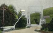
1874: Huitong
Lamengxiang (腊勐乡), Longling County (龙陵县), Baoshan (保山市) and Shidian County (施甸县), Baoshan (保山市), Yunnan, China - Nujiang
| Bridgemeister ID: | 1232 (added 2004-02-15) |
| Year Completed: | 1874 |
| Name: | Huitong |
| Location: | Lamengxiang (腊勐乡), Longling County (龙陵县), Baoshan (保山市) and Shidian County (施甸县), Baoshan (保山市), Yunnan, China |
| Crossing: | Nujiang |
| Coordinates: | 24.734810 N 98.966987 E |
| Maps: | Acme, GeoHack, Google, OpenStreetMap |
| References: | BCG, BYU |
| Use: | Vehicular (one-lane) |
| Status: | Closed, 1971 (last checked: 2019) |
| Main Cables: | Chain (iron) |
| Suspended Spans: | 1 |
| Main Span: | 1 x 94.3 meters (309.4 feet) |
Notes:
- Originally built with iron chains, modified to steel wire cables, 1935.
External Links:
1877: Cottaneva
Cottaneva Creek, Rockport, California, USA - Rockport Bay, Pacific Ocean
| Bridgemeister ID: | 1152 (added 2004-01-18) |
| Year Completed: | 1877 |
| Name: | Cottaneva |
| Location: | Cottaneva Creek, Rockport, California, USA |
| Crossing: | Rockport Bay, Pacific Ocean |
| Coordinates: | 39.736703 N 123.832585 W |
| Maps: | Acme, GeoHack, Google, OpenStreetMap |
| Principals: | Pacific Bridge Co. |
| References: | AAJ |
| Use: | Vehicular (one-lane) |
| Status: | Removed |
| Main Cables: | Wire (iron) |
| Suspended Spans: | 1 |
| Main Span: | 1 x 82.3 meters (270 feet) |
Notes:
- This bridge was part of the Rockport lumber mill (Mendocino County). The bridge stretched over ocean to a large rock in the bay.
- Jakkula cites two sources describing the cables as steel.
- Don Sayenga transcribed one of Jakkula's references, The Iron Age Volume XX , No. 3 (August 2, 1877) Page 1: "A Steel Wire Suspension Bridge In California"
The Pacific Bridge Company are building in Mendocino county, California at Cottoneva, a suspension bridge which is described as follows "The distance from center to center of the saddles on the towers is 270 feet. The deflection or fall of the cable is 23 feet 6 inches. The cables are built in the same manner as those of the Clifton bridge at Niagara. The steel wire is about No. 11 Birmingham gauge, and is protected against rust by immersing in a bath which it a fine coat of zinc. There are eleven wires in each strand, seven strands in each rope, and seven ropes in each cable. The ropes are not twisted together to form the cable but gathered up every six feet by the suspender bands. Each rope is warranted to bear a strain of 60 tons. It is made fast to an independent anchor bar, 1 by 3 inches in diameter, and forming links 18 feet long, until connection is made with the anchors. The anchors are of cast iron, 3-1/2 by 3 feet in surface, weigh 1000 pounds each, and are placed 14 feet below the surface of the rock. Great care was taken in securing the anchors in place by means of cross I beams which run under the rock on either side. The lower part of each pit was enlarged to so as to form a hemispherical chamber, and the rock work, set in Portland cement, which is built upon the anchor, is so constructed that the upward strain is transmitted to the sides. The towers are of red wood. There are four posts 10 x 10 inches and two 10 x 12 inches, giving an effective area of 640 inches to withstand the strain of the cables on the tower. The wooden truss to prevent vertical vibration is 8 feet high and of the Howe truss pattern. The 270 feet of the bridge is divided into 45 pannels. The longest suspenders, 44 in number are of 7/8 inch steel wire, the 42 shorter ones are of 1-1/8 inch solid iron. The estimated dead load of the bridge is 1000 pounds per linear foot; live load, one ton per linear foot; in all, one and one half tons, or one fifth of actual breaking load. The bridge will be completed in about 30 days and promises to be a structure which the builders may well be proud of."
Don writes: "[In] Jakkula's last citation, he is saying that this is factory-made wire rope... The construction of the wire rope (7 by 11) used in the main cables is not common for the USA as of 1877; in fact it is extremely uncommon. The wire ropes used at Clifton/Niagara were made in England -- it wouldn't surprise me if these were made in England too."
1882: Long Creek
Melvern vicinity, Kansas, USA - Long Creek
| Bridgemeister ID: | 2062 (added 2006-06-03) |
| Year Completed: | 1882 |
| Name: | Long Creek |
| Location: | Melvern vicinity, Kansas, USA |
| Crossing: | Long Creek |
| At or Near Feature: | Francis Crossing |
| Principals: | Wilden Bridge Company |
| Use: | Vehicular (one-lane) |
| Status: | Removed, c. 1970 |
Notes:
- In the June 18, 1970 edition of the Daily Tribune newspaper (Great Bend, Kansas) an article titled "Last Suspension Bridge to Fall" describes this bridge: "The suspension bridge appears to be going the way of the old covered bridge in Kansas. At least, the particular type of suspension span represented by Osage County Bridge No. 18 may be gone when this structure is replaced within two years. L.D. Pierce, Osage County engineer, said he believes this 'homemade' suspension bridge probably is the last of its kind in this state. He said it was built in 1882 from a pencil-drawn plan that probably was prepared by asurveyor or a millwright. He said it was constructed with materials that could be found in any hardware store and lumber yard. For example, cables are No. 9 gauge wire, bound together. Pierce said at one time there were five or six of these bridges in Osage County. The 100-foot span over Long Creek has been closed to traffic since 1967."
- See Long Creek - Melvern, Kansas, USA.
1888: Swing
Keeseville, New York, USA - Ausable River
| Bridgemeister ID: | 93 (added before 2003) |
| Year Completed: | 1888 |
| Name: | Swing |
| Location: | Keeseville, New York, USA |
| Crossing: | Ausable River |
| Coordinates: | 44.503653 N 73.482490 W |
| Maps: | Acme, GeoHack, Google, OpenStreetMap |
| Principals: | Berlin Iron Bridge Co. |
| References: | ONC |
| Use: | Footbridge |
| Status: | In use (last checked: 2023) |
| Main Cables: | Wire (steel) |
| Suspended Spans: | 1 |
| Main Span: | 1 x 73.2 meters (240 feet) |
Notes:
- 2024, June: New York State announces US$1,948,000 awarded to to the Clinton County Planning Department for rehabilitation and refurbishment of the Keeseville Swing Bridge.
- At (or near) former location of Swing - Keeseville, New York, USA.
- All past and present bridges at this location.
External Links:
1896: Clear Fork Of The Brazos
Woodson vicinity, Shackelford County, Texas, USA - Clear Fork Brazos River
| Bridgemeister ID: | 103 (added before 2003) |
| Year Completed: | 1896 |
| Name: | Clear Fork Of The Brazos |
| Location: | Woodson vicinity, Shackelford County, Texas, USA |
| Crossing: | Clear Fork Brazos River |
| Coordinates: | 32.921611 N 99.167944 W |
| Maps: | Acme, GeoHack, Google, OpenStreetMap |
| Principals: | Flinn-Moyer Co. |
| References: | BRAZ, HAERTX64, HAERTX98 |
| Use: | Vehicular |
| Status: | Extant (last checked: 2019) |
| Main Cables: | Wire |
| Suspended Spans: | 1 |
External Links:
Image Sets:

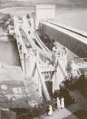
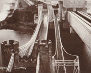
1904: (footbridge)
Conwy, Wales, United Kingdom - River Conwy
| Bridgemeister ID: | 512 (added before 2003) |
| Year Completed: | 1904 |
| Name: | (footbridge) |
| Location: | Conwy, Wales, United Kingdom |
| Crossing: | River Conwy |
| Coordinates: | 53.280346 N 3.823733 W |
| Maps: | Acme, GeoHack, Google, OpenStreetMap |
| Principals: | Alfred Thorne |
| Use: | Footbridge |
| Status: | Removed |
| Main Cables: | Wire (steel) |
| Suspended Spans: | 1 |
Notes:
- This entry refers to the steel suspension footbridge nestled between Telford's suspension bridge and Stephenson's rail bridge. Click the photo to get a better view of this bridge. According to Susan Ellis, Senior Archivist of the Conwy County Borough Council, the bridge was built on the recommendation of John J. Webster who was hired to inspect Telford's suspension bridge in 1902 "following fears about the safety of its condition. He reported back making various recommendation for strengthening the bridge, including that a separate footbridge be constructed."
- This footbridge was in existence until at least 1957.
- Next to 1826 Conwy (Conway) - Conwy, Wales, United Kingdom.
- All past and present bridges at this location.
Annotated Citations:
- "Conway Suspension Bridge." The Engineer, 20 May 1904.
This detailed account of the 1904 reinforcement of Telford's adjacent bridge does not mention the existence of, or building of, an additional footbridge. It does describe adding a cantilevered walkway to one side of Telford's bridge. This walkway was, indeed, built, and can be seen in the linked image on the left side of the older bridge. Thus, it is not entirely clear whether this bridge was actually constructed in 1904 and the work of Alfred Thorne (who was very much associated with the Telford bridge reinforcement project)
Image Sets:
1904: Moline Swinging
Moline, Kansas, USA - Wildcat Creek
| Bridgemeister ID: | 294 (added before 2003) |
| Year Completed: | 1904 |
| Name: | Moline Swinging |
| Location: | Moline, Kansas, USA |
| Crossing: | Wildcat Creek |
| Coordinates: | 37.36578 N 96.30433 W |
| Maps: | Acme, GeoHack, Google, OpenStreetMap |
| Use: | Footbridge |
| Status: | In use (last checked: 2010) |
| Main Cables: | Wire |
| Main Span: | 1 x 31.4 meters (103 feet) estimated |
| Side Spans: | 1 x 10.4 meters (34 feet) estimated, 1 x 10.7 meters (35 feet) estimated |
External Links:
1905: Pangburn
Pangburn, Arkansas, USA - Little Red River
| Bridgemeister ID: | 7785 (added 2023-08-18) |
| Year Completed: | 1905 |
| Name: | Pangburn |
| Location: | Pangburn, Arkansas, USA |
| Crossing: | Little Red River |
| Coordinates: | 35.437946 N 91.845140 W |
| Maps: | Acme, GeoHack, Google, OpenStreetMap |
| Use: | Vehicular |
| Status: | Removed, 1958 |
| Main Cables: | Wire |
| Main Span: | 1 |
| Side Spans: | 2 |
External Links:
1905: Tuscumbia
Tuscumbia, Missouri, USA - Osage River
| Bridgemeister ID: | 1977 (added 2005-11-27) |
| Year Completed: | 1905 |
| Name: | Tuscumbia |
| Location: | Tuscumbia, Missouri, USA |
| Crossing: | Osage River |
| Coordinates: | 38.23526 N 92.44763 W |
| Maps: | Acme, GeoHack, Google, OpenStreetMap |
| Principals: | Joseph Dice |
| References: | BOTO |
| Use: | Vehicular (one-lane) |
| Status: | Replaced, 1933 |
| Main Cables: | Wire |
| Main Span: | 1 |
| Side Spans: | 2 |
Notes:
- Some remains still visible at site, 2007.
- Near (suspension bridge) - Tuscumbia vicinity, Missouri, USA.
External Links:
Image Sets:
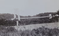
1906: Brannon's Crossing
Weatherford vicinity, Parker County, Texas, USA - Brazos River
| Bridgemeister ID: | 1298 (added 2004-03-28) |
| Year Completed: | 1906 |
| Name: | Brannon's Crossing |
| Location: | Weatherford vicinity, Parker County, Texas, USA |
| Crossing: | Brazos River |
| Coordinates: | 32.66256 N 98.03288 W |
| Maps: | Acme, GeoHack, Google, OpenStreetMap |
| Principals: | Mitchell & Pigg |
| References: | HAERTX98 |
| Use: | Vehicular |
| Status: | Replaced, 1934 |
| Main Cables: | Wire (steel) |
| Main Span: | 1 x 134.1 meters (440 feet) |
Notes:
- Tony King believes he found the former location of this bridge a few hundred yards south of the I-20 Brazos River crossing west of Weatherford. This location is near a road named "Brannon Bridge Circle." Tony writes: "Just downstream from the modern Interstate 20 bridge in western Parker County, I've noticed a concrete and iron structure, and happened to take a photo of it recently. I've noticed the structure a couple of times in the past (most recently in May of 2007) while hiking a well-worn foot/ATV path that parallels the west bank of the river as it flows almost due south from the Interstate to Meeks Bend." The structure in Tony's photo appears to be a pier or support footing. The coordinates given here are Tony's approximation of the location of the structure.
- Built as part of the same contract as the Tin Top bridge.
- Similar to 1906 Tin Top (Hightower Valley) - Tin Top, Texas, USA.
Image Sets:
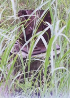
1906: Tin Top
Tin Top, Texas, USA - Brazos River
| Bridgemeister ID: | 119 (added before 2003) |
| Year Completed: | 1906 |
| Name: | Tin Top |
| Also Known As: | Hightower Valley |
| Location: | Tin Top, Texas, USA |
| Crossing: | Brazos River |
| Coordinates: | 32.575956 N 97.822697 W |
| Maps: | Acme, GeoHack, Google, OpenStreetMap |
| Principals: | Mitchell & Pigg |
| References: | BRAZ, HAERTX98 |
| Use: | Vehicular |
| Status: | Collapsed, Jan. 31, 1982 under weight of snow |
| Main Cables: | Wire (steel) |
| Main Span: | 1 x 121.9 meters (400 feet) |
Notes:
- Some internet resources suggest the "Tin Top" and "Hightower" suspension bridges were separate nearby structures, however, this does not appear to have been the case. Both names were used to describe the same structure and USGS topographical maps from the 1950s label the bridge due south of Tin Top as "Hightower". Mitchell and Pigg did build a similar structure, at Brannon's Crossing. The 2015 National Register of Historic Places Registration Form for "Historic Road Infrastructure of Texas, 1866-1965", the Texas Department of Transportation writes: "In 1905 [Mitchell and Pigg] constructed the practically identical Brannon's Crossing and Hightower Valley Bridges across the Brazos in Parker County. The former was a 440-foot clear span while the later, also known as Tin Top, was 400 feet."
- The coordinates appear to be the exact location of a pier remaining (as of 2020) from this bridge. The alignment indicated by the pier appears to exactly match the location of this bridge as indicated by 1958 USGS topographical map of the area.
- Similar to 1906 Brannon's Crossing - Weatherford vicinity, Parker County, Texas, USA.
Image Sets:
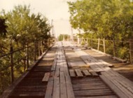
1907: Vulcan
Vulcan, West Virginia and Pike County, Kentucky, USA - Tug Fork Big Sandy River
| Bridgemeister ID: | 2141 (added 2006-11-02) |
| Year Completed: | 1907 |
| Name: | Vulcan |
| Location: | Vulcan, West Virginia and Pike County, Kentucky, USA |
| Crossing: | Tug Fork Big Sandy River |
| References: | AAJ |
| Use: | Footbridge |
| Status: | Removed |
| Main Cables: | Wire |
| Main Span: | 1 x 121.9 meters (400 feet) |
Notes:
- On Page 13 of the December 27, 1967 edition of West Virginia's The Charleston Gazette newspaper, there is a photograph of this footbridge with a Jeep driving across. The caption reads: "Pedestrian bridge at Vulcan... is used by vehicles because it provides a route over the Tug River to Kentucky. A citizen's group has complained that the bridge is not strong enough to support cars." The photograph accompanies an article "Road Reform Call Urged" that says the bridge is "regularly used by Jeeps and small cars." Note the date of the article, December 27, 1967 is 12 days after the Silver Bridge disaster at Point Pleasant, West Virginia.
- Near (footbridge) - Vulcan, West Virginia and Pike County, Kentucky, USA. Although similar in appearance, these appear to have been different bridges.
1908: Sagrada
Sagrada, Missouri, USA - Osage River
| Bridgemeister ID: | 2304 (added 2007-04-26) |
| Year Completed: | 1908 |
| Name: | Sagrada |
| Location: | Sagrada, Missouri, USA |
| Crossing: | Osage River |
| Principals: | J.S. Kidwell |
| References: | BOTO |
| Status: | Removed, 1931 |
| Main Cables: | Wire |
External Links:
1910: Swinging
Spelter, West Virginia, USA - West Fork River
| Bridgemeister ID: | 1983 (added 2005-12-02) |
| Year Completed: | 1910 |
| Name: | Swinging |
| Location: | Spelter, West Virginia, USA |
| Crossing: | West Fork River |
| Use: | Footbridge |
| Status: | Dismantled, 1951 |
| Main Cables: | Wire |
Notes:
- The book "Harrison County" in the "Images of America" series by Robert F. Stealey shows an image of this bridge stating it was "replaced by a new concrete span in the early 1960s".
External Links:
- Asturian-American Migration Forum :: Lleendu tema - History of Spelter, an American Asturian Community. Mentions: "The [Grasselli Company] built a swinging footbridge across the West Fork River in 1910 to connect the town of Spelter with the Fairmont-Clarksburg interurban trolley line. The trolley stop was called 'Ziesing'. Wagons forded the river to bring supplies not carried into the town by the B.&O. Railroad. A school house was built on the hill… DuPont sold the townsite in 1950, including the swinging bridge, to John J. Moschetta who immediately sold the houses to the employees occupying them at the time. Mr. Moschetta dismantled the swinging bridge in 1951… In 1962 a new cement bridge was constructed north of the old vehicular bridge."
1911: Treyz
Cooks Falls, New York, USA - Beaver Kill
| Bridgemeister ID: | 6776 (added 2021-10-27) |
| Year Completed: | 1911 |
| Name: | Treyz |
| Also Known As: | George I. Treyz |
| Location: | Cooks Falls, New York, USA |
| Crossing: | Beaver Kill |
| Coordinates: | 41.956829 N 74.992559 W |
| Maps: | Acme, GeoHack, Google, OpenStreetMap |
| Principals: | John A. Roebling's Sons |
| Use: | Tramway |
| Status: | Only towers remain (last checked: 2016) |
| Main Cables: | Wire (steel) |
| Main Span: | 1 x 70 meters (229.7 feet) estimated |
| Side Spans: | 2 |
Notes:
- Facility served by the bridge closed in 1925 at which time the bridge was likely abandoned. Towers appear to still be standing (in late 2010s).
External Links:
- A Delaware County Primer complied by Sue Hudson. "West of Cooks Falls and east of Horton, on the O&W. Acid plant built here by Eugene King burned in June 1888, was rebuilt, and was later bought by local entrepreneur, George I. Treyz. Railroad suspension bridge constructed in 1911 by John A. Roebling's Sons Company of Trenton, NJ to connect Treyz's acid factory, saw mill, and planing mill on Russell Brook to the O&W, which ran on the other side of the Beaver Kill."
- Cooks Falls - Colchester Historical Society. "Arthur Leighton and George I. Treyz developed the acid factory industries in Cook's Falls... Treyz had a close relationship with the O&W Railroad, which helped both to prosper. Treyz installed a Roebling suspension bridge between his plant and the O&W Railroad. This siding was known as the Grove Switch. A narrow gauge railway was constructed and ran up Russell Brook to the Russell School. This line carried logs and sawed lumber down to the Treyz plant and the O&W Railroad."
1912: Branstetter
Warsaw vicinity, Missouri, USA - Osage River
| Bridgemeister ID: | 2042 (added 2006-05-07) |
| Year Completed: | 1912 |
| Name: | Branstetter |
| Also Known As: | Peal Bend |
| Location: | Warsaw vicinity, Missouri, USA |
| Crossing: | Osage River |
| Principals: | Joseph A. Dice |
| References: | BOTO |
| Use: | Vehicular (one-lane) |
| Status: | Removed |
| Main Cables: | Wire (steel) |
| Main Span: | 1 x 182.9 meters (600 feet) |
Notes:
- Heavily damaged by wind, 1924. Rebuilt.
- Location inundated by the Harry S. Truman Reservoir.
External Links:
1912: County Line
Henry County and St. Clair County, Missouri, USA - Osage River
| Bridgemeister ID: | 3518 (added 2019-12-24) |
| Year Completed: | 1912 |
| Name: | County Line |
| Also Known As: | Gilbert-Harris |
| Location: | Henry County and St. Clair County, Missouri, USA |
| Crossing: | Osage River |
| Principals: | Joseph A. Dice |
| References: | BOTO |
| Use: | Vehicular (one-lane) |
| Status: | Removed |
| Main Cables: | Wire (steel) |
Notes:
- Location inundated by the Harry S. Truman Reservoir.
External Links:
- Bridgehunter - County Line Bridge. Robert Hayden (BOTO) describes the County Line bridge briefly as being the first steel-towered Joe Dice bridge but the image at shows large timber towers like other pre-steel towered Dice bridges.
1912: Miller
Miller, Cleburne County, Arkansas, USA - Little Red River
| Bridgemeister ID: | 1073 (added 2003-12-27) |
| Year Completed: | 1912 |
| Name: | Miller |
| Location: | Miller, Cleburne County, Arkansas, USA |
| Crossing: | Little Red River |
| At or Near Feature: | Millers Point |
| Coordinates: | 35.514000 N 92.127000 W |
| Maps: | Acme, GeoHack, Google, OpenStreetMap |
| Principals: | Henry Churchill |
| Use: | Vehicular (one-lane) |
| Status: | Inundated |
| Main Cables: | Wire (steel) |
| Suspended Spans: | 1 |
| Main Span: | 1 x 114.3 meters (375 feet) estimated |
| Deck width: | ~10 feet |
Notes:
- Built as part of same contract as nearby 1912 Winkley bridge.
- Inundated by Greer's Ferry Lake upon completion of Greer's Ferry Dam, early 1960's.
- Companion to 1912 Tumbling Shoals - Tumbling Shoals, Arkansas, USA.
- Companion to 1912 Winkley (Swinging) - Heber Springs, Arkansas, USA.
External Links:
1912: Tumbling Shoals
Tumbling Shoals, Arkansas, USA - Little Red River
| Bridgemeister ID: | 1072 (added 2003-12-27) |
| Year Completed: | 1912 |
| Name: | Tumbling Shoals |
| Location: | Tumbling Shoals, Arkansas, USA |
| Crossing: | Little Red River |
| Principals: | Henry Churchill |
| Use: | Vehicular |
| Status: | Removed |
| Main Cables: | Wire |
| Suspended Spans: | 1 |
| Main Span: | 1 x 134.1 meters (440 feet) estimated |
Notes:
- Built as part of same contract as nearby 1912 Winkley bridge.
- Inundated by Greer's Ferry Lake upon completion of Greer's Ferry Dam, early 1960's.
- Companion to 1912 Miller - Miller, Cleburne County, Arkansas, USA.
- Companion to 1912 Winkley (Swinging) - Heber Springs, Arkansas, USA.
External Links:
1912: Winkley
Heber Springs, Arkansas, USA - Little Red River
| Bridgemeister ID: | 127 (added before 2003) |
| Year Completed: | 1912 |
| Name: | Winkley |
| Also Known As: | Swinging |
| Location: | Heber Springs, Arkansas, USA |
| Crossing: | Little Red River |
| Coordinates: | 35.489833 N 91.973918 W |
| Maps: | Acme, GeoHack, Google, OpenStreetMap |
| Principals: | Henry Churchill |
| References: | GBD |
| Use: | Vehicular (one-lane) |
| Status: | Collapsed, 1989 |
| Main Cables: | Wire |
| Main Span: | 1 x 167.6 meters (550 feet) |
Notes:
- 1949: Wooden towers replaced by steel towers.
- 1972: Restricted to pedestrians.
- 1989, October 28: Collapsed killing 5 people and injuring 18 others.
- Location also known as "Winkley Ford" and "Turner's Ferry".
- Companion to 1912 Miller - Miller, Cleburne County, Arkansas, USA.
- Companion to 1912 Tumbling Shoals - Tumbling Shoals, Arkansas, USA.
External Links:
- Historic Bridges of the United States - Winkley Bridge - Cleburne County, Arkansas
- Structurae - Structure ID 20001341
Image Sets:
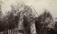
1913: Middle
Warsaw, Missouri, USA - Osage River
| Bridgemeister ID: | 149 (added before 2003) |
| Year Completed: | 1913 |
| Name: | Middle |
| Location: | Warsaw, Missouri, USA |
| Crossing: | Osage River |
| Principals: | J.S. Kidwell, C.F. Bibb |
| References: | BOTO |
| Use: | Vehicular (one-lane) |
| Status: | Demolished |
| Main Cables: | Wire |
| Suspended Spans: | 2 |
| Main Span: | 1 x 140.8 meters (462 feet) |
| Side Span: | 1 x 36.6 meters (120 feet) |
| Deck width: | 12 feet |
Notes:
- Repaired 1927, repaired 1936, damaged by flood 1943. Closed, 1975.
- Replaced 1895 Drake - Warsaw, Missouri, USA.
- All past and present bridges at this location.
External Links:
- Historic Bridges of the United States - Warsaw Middle Bridge - Benton County, Missouri
- Structurae - Structure ID 20011002
Image Sets:
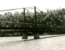
1913: South Fork Mule
Hyampom vicinity, California, USA - South Fork Trinity River
| Bridgemeister ID: | 1993 (added 2005-12-10) |
| Year Completed: | 1913 |
| Name: | South Fork Mule |
| Also Known As: | Limestairs |
| Location: | Hyampom vicinity, California, USA |
| Crossing: | South Fork Trinity River |
| At or Near Feature: | Six Rivers National Forest |
| Coordinates: | 40.719083 N 123.523217 W |
| Maps: | Acme, GeoHack, Google, OpenStreetMap |
| Use: | Footbridge |
| Status: | In use (last checked: 2013) |
| Main Cables: | Wire (steel) |
| Suspended Spans: | 1 |
Notes:
- 2006: The bridge is closed. Marilyn Renaker of the "Committee to Save the Mule Bridge" writes in late August, 2006: "Trinity County and the Forest Service would like to abandon the Mule Bridge. Hyampom had a town meeting about this and everyone was opposed to the removal of the bridge which has been a part of our community since 1913."
- 2010: Multi-year repair and reconstruction project started.
- 2013: Bridge is reopened.
Image Sets:
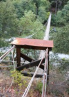
1913: Swinging
Tishomingo, Oklahoma, USA - Pennington Creek
| Bridgemeister ID: | 129 (added before 2003) |
| Year Completed: | 1913 |
| Name: | Swinging |
| Location: | Tishomingo, Oklahoma, USA |
| Crossing: | Pennington Creek |
| Coordinates: | 34.234639 N 96.682861 W |
| Maps: | Acme, GeoHack, Google, OpenStreetMap |
| Principals: | Western Bridge Company |
| Use: | Vehicular |
| Status: | Destroyed |
Notes:
- The description on the back of a postcard reads: "The only remaining swinging bridge in the state of Oklahoma crossable by automobile spans beautiful Pennington Creek in Tishomingo. The guaranteed strength of the bridge is 164 tons and is located 3 blocks south of the old Chickasaw Capitol on South Capitol Avenue. The bridge was built by Western Bridge Company of Sherman, Texas and was dedicated November 28, 1913."
- Destroyed by flood.
- An article in the April 7, 1964 issue of The Ada Evening News (Oklahoma) titled "Tishomingo Acts To Save Famed Bridge": "Tishomingo's Swinging Bridge, a landmark since Territorial days, may yet be saved from the junk man. Indeed, with a little luck, it may be put back into service to carry traffic across Pennington Creek as it did in its heyday. Some 25 persons attended a regular city council meeting Monday night to urge that the bridge be repaired; and the council appointed a committee to look into the cost of such a project. "It looks favorable," Mayor Lee butler said Tuesday. "It looks like we might get it repaired." The old suspension bridge has been closed to traffic for several years. Floor planks have rotted and fallen away, and the whole structure was condemned as unsafe. The problem of financing has held the city back from repairing the ancient structure. However, Butler said the county commissioners have offered to help, and quite a few individual citizens have promised donations to assist the project. When the committee reports back on the cost, Butler said, the council will be ready to take action."
- The bridge must have been repaired in the mid-1960's and reopened. An article in the July 9, 1978 issue of The Ada Evening News (Oklahoma) titled "Repair of Tishomingo's Suspension Bridge Slated": "Work is expected to begin in the near future on the renovation of the suspension bridge here which spans Pennington Creek. The landmark structure and last swinging bridge in the state open to vehicular traffic was closed last May when city officials deemed it was 'too dangerous' to keep open due to its deteriorated state. In an effort to reopen the bridge as soon as possible, the Tishomingo City Council acted last week to approve funding for materials necessary to repair the 65-year-old structure and has arranged for participants in the Young Adult Conservation Corps camp at Sulphur to provide the manpower needed for the work. Frank Glover, head of the Tishomingo street department, said the Johnston County commissioners have also promised to aid in the repair of the bridge. Glover said he hopes the renovation will be completed this summer. He estimated materials for the work will cost the city about $5,000- $6,000. The bridge will have to be renovated from the bottom up, including the replacement of the entire wooden floor, Glover said. He said city officials are still looking for someone knowledgeable about the construction of suspension bridges to aid in the repair of the structure."
Image Sets:
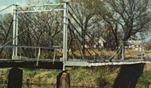
1914: Mountain Moon
Xiulin Township, Hualien County, Taiwan - Liwu River
| Bridgemeister ID: | 4931 (added 2020-07-31) |
| Year Completed: | 1914 |
| Name: | Mountain Moon |
| Also Known As: | 山月吊橋, Yamatsuki |
| Location: | Xiulin Township, Hualien County, Taiwan |
| Crossing: | Liwu River |
| At or Near Feature: | Taroko Gorge at Buluowan Terraces |
| Status: | Demolished, 1940-1941 |
Notes:
1915: Brown's Ford
Brown's Ford and Lowry City vicinity, Missouri, USA - Osage River
| Bridgemeister ID: | 2325 (added 2007-05-06) |
| Year Completed: | 1915 |
| Name: | Brown's Ford |
| Location: | Brown's Ford and Lowry City vicinity, Missouri, USA |
| Crossing: | Osage River |
| References: | AAJ |
| Status: | Removed |
| Main Cables: | Wire |
Notes:
- The June 22, 1940 edition of The Chillicothe Constitution-Tribune (Chillicothe, Missouri) has an article titled "Three Killed in Bridge Collapse, Workmen were repairing the structure near Lowry City, Mo." describing a fatal collapse of the bridge: "Three men were killed, three injured critically and an 8-year old boy believed drowned when cribbing on a wooden suspension bridge across the Osage River six miles east of Lowry City collapsed about 4 o'clock yesterday afternoon. The bridge, on a farm-to-market road in St. Clair County, was being remodeled. Of the ten men working and bystanders on and near the structure when it fell, only one escaped without injury. All those killed or injured lived in St. Clair County. On the west side of the bridge a framework of heavy timbers had been inserted between one of the suspension cables and an old wooden pier, which originally had supported the cable. The workmen were attempting to slide a steel pier under the cable, to replace the wooden pier. The cribbing suddenly gave way, and the pressure from the cable hurled the wood supports in all directions. The bridge floor dropped into the river, except for a small section near the east end."
1917: Rock Church
Tolar vicinity, Hood County, Texas, USA - Paluxy River
| Bridgemeister ID: | 136 (added before 2003) |
| Year Completed: | 1917 |
| Name: | Rock Church |
| Location: | Tolar vicinity, Hood County, Texas, USA |
| Crossing: | Paluxy River |
| Coordinates: | 32.301402 N 97.957657 W |
| Maps: | Acme, GeoHack, Google, OpenStreetMap |
| References: | HAERTX98 |
| Use: | Vehicular (one-lane) |
| Status: | Extant (last checked: 2018) |
| Main Cables: | Wire |
| Suspended Spans: | 1 |
External Links:
Image Sets:
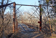
1918: Turkey Run State Park
Parke County, Indiana, USA - Sugar Creek
| Bridgemeister ID: | 269 (added before 2003) |
| Year Completed: | 1918 |
| Name: | Turkey Run State Park |
| Location: | Parke County, Indiana, USA |
| Crossing: | Sugar Creek |
| At or Near Feature: | Turkey Run State Park |
| Coordinates: | 39.88926 N 87.19948 W |
| Maps: | Acme, GeoHack, Google, OpenStreetMap |
| References: | IMB |
| Use: | Footbridge |
| Status: | In use (last checked: 2021) |
| Main Cables: | Wire (steel) |
| Suspended Spans: | 1 |
| Main Span: | 1 x 58.5 meters (192 feet) estimated |
Notes:
- IMB states, "The original bridge collapsed into Sugar Creek in 1917... the state's Department of Natural Resources promptly replaced the old with current structure."
- James Rader writes in 2008: "Three years ago flooding came up high enough to allow a couple of uprooted Sycamore trees to hit the bridge ripping out a large section of the wood railing and flooring from the middle of the bridge. Bridge was immediately closed. Structural analysis was completed and repairs were made including all new floor planks. Bridge is in great condition and should serve for many many more years to come."
External Links:
Image Sets:
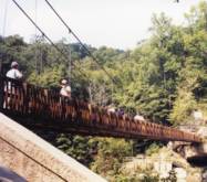
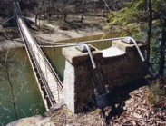
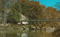
1919: Coon Box Fork
Lorman, Fayette vicinity, Mississippi, USA - Shankstown Creek
| Bridgemeister ID: | 6426 (added 2021-08-10) |
| Year Completed: | 1919 |
| Name: | Coon Box Fork |
| Location: | Lorman, Fayette vicinity, Mississippi, USA |
| Crossing: | Shankstown Creek |
| Coordinates: | 31.789613 N 91.068857 W |
| Maps: | Acme, GeoHack, Google, OpenStreetMap |
| Principals: | Schuster and Jacob, Robert Taylor |
| Use: | Vehicular (one-lane) |
| Status: | Destroyed, 1990 |
| Main Cables: | Wire (steel) |
| Suspended Spans: | 3 |
| Main Span: | 1 |
| Side Spans: | 2 |
Notes:
- Some sources suggest the bridge survived until 2010, but this appears to be unlikely. Coordinates provided are for the current Shankstown Creek crossing of Coon Box Road. The suspension bridge may have been on a slightly different alignment.
- 1927: Repaired by W.H. Groome and Son incorporating an improved anchoring system.
External Links:
- MDAH Historic Resources Inventory Fact Sheet - Coon Box Fork Suspension Bridge. Photographs available here suggest remnants of the bridge are visible in the creek.
- NPGallery Asset Detail - Coon Box Fork Bridge. National Register of Historic Places site survey. Presents a brief history of the bridge, but perhaps confuses the matter of its location. States: "Swinging suspension bridge and county road right-of-way along Coon Box Road where the said bridge crosses North Fork Coles Creek." Current-day (2021) Coon Box Road crosses Shankstown Creek near North Fork Coles Creek, but never crosses North Fork Coles Creek. Historic maps of the area place the mid-1900s Shankstown Creek crossing of Coon Box Fork at roughly the same location as the current crossing (the coordinates provided in this record). Looking at historic satellite images of the location, the suspension bridge was probably on an alignment no more than 100 feet north of the current Coon Box Road Shankstown Creek bridge.
1922: Dodge
Sweetwater County, Wyoming, USA - Green River
| Bridgemeister ID: | 5557 (added 2020-12-18) |
| Year Completed: | 1922 |
| Name: | Dodge |
| Location: | Sweetwater County, Wyoming, USA |
| Crossing: | Green River |
| Principals: | Harold H. Dodge |
| Use: | Stock |
| Status: | Removed |
| Main Cables: | Wire (steel) |
| Main Span: | 1 |
Notes:
- This bridge was located northwest of the present-day Seedskadee National Wildlife Refuge before Fontenelle. Appears to have been primarily a "sheep" bridge.
1922: Glaize
Brumley vicinity, Missouri, USA - Grand Glaize Creek
| Bridgemeister ID: | 332 (added before 2003) |
| Year Completed: | 1922 |
| Name: | Glaize |
| Also Known As: | Auglaize, Grand Glaize, Grand Auglaize |
| Location: | Brumley vicinity, Missouri, USA |
| Crossing: | Grand Glaize Creek |
| Coordinates: | 38.077098 N 92.526488 W |
| Maps: | Acme, GeoHack, Google, OpenStreetMap |
| Principals: | Joseph A. Dice |
| References: | BOTO |
| Use: | Vehicular (one-lane) |
| Status: | Closed, January 6, 2021 (last checked: 2021) |
| Main Cables: | Wire (steel) |
| Suspended Spans: | 2 |
| Main Span: | 1 x 126.2 meters (414 feet) estimated |
| Side Span: | 1 |
| Deck width: | 12 feet |
Notes:
- 2020, October 8: Added to National Register of Historic Places.
- 2021, January 6: Closed due to structural issues with the bridge's anchors.
- 2021, February 6: New inspection of the current issue ("loose cables"). Bridge is still closed.
- Near 1925 Mill Creek - Brumley vicinity, Missouri, USA.
External Links:
Image Sets:
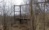
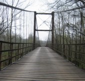
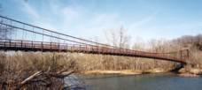
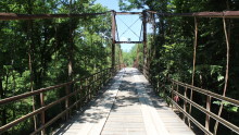
1924: Kemna
St. Elizabeth, Missouri, USA - Tavern Creek
| Bridgemeister ID: | 611 (added 2003-01-14) |
| Year Completed: | 1924 |
| Name: | Kemna |
| Location: | St. Elizabeth, Missouri, USA |
| Crossing: | Tavern Creek |
| Coordinates: | 38.247265 N 92.245431 W |
| Maps: | Acme, GeoHack, Google, OpenStreetMap |
| Principals: | Joseph A. Dice |
| References: | BOTO |
| Use: | Vehicular (one-lane) |
| Status: | In use (last checked: 2019) |
| Main Cables: | Wire (steel) |
| Suspended Spans: | 1 |
| Main Span: | 1 x 50.9 meters (167 feet) |
| Deck width: | 11.1 feet |
Notes:
- Original timber towers replaced, 1978.
- Similar to 1925 Mill Creek - Brumley vicinity, Missouri, USA.
- Near 1925 Kliethermes (Brumley) - St. Anthony vicinity, Missouri, USA.
External Links:
Image Sets:
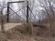
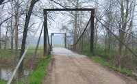
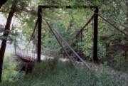
| Bridgemeister ID: | 140 (added before 2003) |
| Year Completed: | 1924 |
| Name: | Nocona |
| Also Known As: | Bluff, Ketchum Bluff, Ketchum's Bluff |
| Location: | Nocona vicinity, Texas and Jefferson County, Oklahoma, USA |
| Crossing: | Red River |
| At or Near Feature: | Ketchum Bluff |
| Coordinates: | 33.93579 N 97.75869 W |
| Maps: | Acme, GeoHack, Google, OpenStreetMap |
| Principals: | Austin Bridge Co. |
| References: | AUB, HAERTX98, PTS2 |
| Use: | Vehicular |
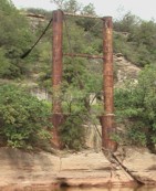
| Status: | Only towers remain (last checked: 2007) |
| Main Cables: | Wire (steel) |
| Main Span: | 1 x 213.4 meters (700 feet) |
Notes:
- Legend has it the bridge was burned during a dispute. This likely occurred before 1955. Some sources suggest it occurred before or during 1950. The road that leads to the Texas side of the former crossing is "Burned Out Bridge Road." Follow the image of the derelict tower to see the remains of the bridge.
- AUB mentions: "In January 1924, a contract was entered into with Nocona Bridge Company for a bridge across Red River, nine miles north of Nocona, connecting Texas and Oklahoma. The plans called for a 700' span, 16' roadway, and the main cables to contain 1,000 No. 9 galvanized wires each. The building of this, [the Austin Bridge Company's] first complete cable bridge, and the experience gained therefrom helped to launch Austin Bridge Company into an interesting and profitable line of work."
External Links:
- Nocona Suspension Bridge at Ketchum Bluff, Texas. University of Texas Arlington Libraries Digital Gallery
Image Sets:
1925: Blair Grove
Miranda vicinity, California, USA - South Fok Eel River
| Bridgemeister ID: | 5667 (added 2021-01-30) |
| Year Completed: | 1925 |
| Name: | Blair Grove |
| Location: | Miranda vicinity, California, USA |
| Crossing: | South Fok Eel River |
| Coordinates: | 40.258954 N 123.841625 W |
| Maps: | Acme, GeoHack, Google, OpenStreetMap |
| Use: | Vehicular (one-lane) |
| Status: | Removed |
| Main Cables: | Wire (steel) |
| Main Span: | 1 |
Notes:
- May have been completed 1923-1924. Coordinates represent the suspected former location of this bridge.
- See 1925 A.A. Hadley (Mattole River, Lindley) - Honeydew vicinity, California, USA. The towers of the Blair Grove and Hadley bridges appear identical.
External Links:
1925: Buechter
St. Anthony vicinity, Missouri, USA - Tavern Creek
| Bridgemeister ID: | 610 (added 2003-01-14) |
| Year Completed: | 1925 |
| Name: | Buechter |
| Location: | St. Anthony vicinity, Missouri, USA |
| Crossing: | Tavern Creek |
| Coordinates: | 38.141573 N 92.297910 W |
| Maps: | Acme, GeoHack, Google, OpenStreetMap |
| Principals: | Joseph A. Dice |
| References: | BOTO |
| Use: | Vehicular (one-lane) |
| Status: | Demolished, 2011 |
| Main Cables: | Wire (steel) |
| Suspended Spans: | 1 |
| Main Span: | 1 x 42.7 meters (140 feet) |
| Deck width: | 12.1 feet |
Notes:
- Completed circa 1925.
- Sometimes spelled Buetcher. The road the bridge carried is named with the "Buechter" spelling.
- Renovated 1986.
- Similar to 1925 Kliethermes (Brumley) - St. Anthony vicinity, Missouri, USA.
External Links:
- Historic Bridges of the United States - Buechter Bridge - Miller County, Missouri
- Structurae - Structure ID 20014258
Image Sets:
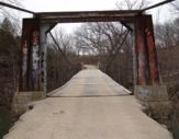
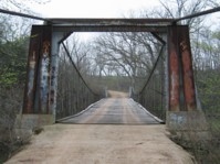
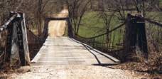
1925: Kliethermes
St. Anthony vicinity, Missouri, USA - Tavern Creek
| Bridgemeister ID: | 609 (added 2003-01-14) |
| Year Completed: | 1925 |
| Name: | Kliethermes |
| Also Known As: | Brumley |
| Location: | St. Anthony vicinity, Missouri, USA |
| Crossing: | Tavern Creek |
| Coordinates: | 38.178223 N 92.322981 W |
| Maps: | Acme, GeoHack, Google, OpenStreetMap |
| Principals: | Joseph A. Dice |
| References: | BOTO |
| Use: | Vehicular (one-lane) |
| Status: | Removed, March, 2008 |
| Main Cables: | Wire (steel) |
| Suspended Spans: | 1 |
| Main Span: | 1 x 65.8 meters (215.8 feet) |
| Deck width: | 10.8 feet |
Notes:
- Renovated, 1988. Closed, Spring 2006. Subsequently demolished in 2008.
- Completed circa 1925.
- Similar to 1925 Buechter - St. Anthony vicinity, Missouri, USA.
External Links:
Image Sets:
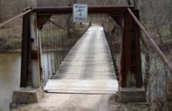
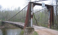
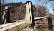
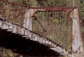
1925: Mill Creek
Brumley vicinity, Missouri, USA - Mill Creek
| Bridgemeister ID: | 342 (added before 2003) |
| Year Completed: | 1925 |
| Name: | Mill Creek |
| Location: | Brumley vicinity, Missouri, USA |
| Crossing: | Mill Creek |
| Coordinates: | 38.078408 N 92.524264 W |
| Maps: | Acme, GeoHack, Google, OpenStreetMap |
| Principals: | Joseph A. Dice |
| References: | BOTO |
| Use: | Vehicular (one-lane) |
| Status: | In use (last checked: 2020) |
| Main Cables: | Wire (steel) |
| Suspended Spans: | 2 |
| Main Span: | 1 x 29.3 meters (96 feet) estimated |
| Side Span: | 1 |
| Deck width: | 11.1 feet |
Notes:
- Original cables now assisted by additional steel cables.
- Similar to 1924 Kemna - St. Elizabeth, Missouri, USA.
- Near 1922 Glaize (Auglaize, Grand Glaize, Grand Auglaize) - Brumley vicinity, Missouri, USA. The bridges are less than half a mile apart.
External Links:
Image Sets:

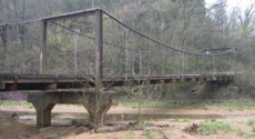
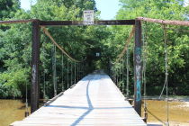
1925: Powhatan
Powhatan, Arkansas, USA - Black River
| Bridgemeister ID: | 144 (added before 2003) |
| Year Completed: | 1925 |
| Name: | Powhatan |
| Location: | Powhatan, Arkansas, USA |
| Crossing: | Black River |
| Coordinates: | 36.081556 N 91.116222 W |
| Maps: | Acme, GeoHack, Google, OpenStreetMap |
| Principals: | Austin Bridge Co. |
| References: | AAJ, AUB |
| Use: | Vehicular |
| Status: | Removed |
| Main Cables: | Wire (steel) |
| Suspended Spans: | 1 |
| Main Span: | 1 x 116.4 meters (382 feet) |
External Links:
1927: Bryan-Fannin
Telephone, Bonham vicinity, Fannin County, Texas and Bryan County, Oklahoma, USA - Red River
| Bridgemeister ID: | 602 (added 2003-01-11) |
| Year Completed: | 1927 |
| Name: | Bryan-Fannin |
| Also Known As: | Telephone, Snow's Ferry, Bryant-Fannin |
| Location: | Telephone, Bonham vicinity, Fannin County, Texas and Bryan County, Oklahoma, USA |
| Crossing: | Red River |
| Coordinates: | 33.844484 N 96.011125 W |
| Maps: | Acme, GeoHack, Google, OpenStreetMap |
| Principals: | Austin Bridge Co. |
| References: | AUB, PTS2 |
| Use: | Vehicular |
| Status: | Collapsed, December, 1940 |
| Main Cables: | Wire (steel) |
| Suspended Spans: | 3 |
| Main Span: | 1 |
| Side Spans: | 2 |
Notes:
- Sometimes referenced as "Bryant-Fannin". The bridge unquestionably connected Fannin County to Bryan County, Oklahoma, but according to a www.rootsweb.com article (Fannin County TXGenWeb - Ferry's in Fannin County, from Pat Pryor, by Kathy J. Ellis) it was erected at a site known as "Bryant's Crossing" named for a local, Dave Bryant. The Steinman inventory lists it as "Bryan-Fannin". AUB mentions it as "Bryant-Fannin". The Rootsweb article also mentions it collapsed in 1940 under weight of a truck.
- An article in the December 6, 1940 issue of The Port Arthur News (Texas) titled: "Suspension Bridge Plunges Into Red River" describes the collapse: "Owners of a $75,000 tollbridge which plunged into the Red River Wednesday when a suspension cable anchor pulled loose were undecided today whether it would be rebuilt. The bridge, owned by the Austin Bridge company of Dallas, was near Telephone, Tex., 12 miles north of here, and was several miles from a principal highway. Most of the traffic from the Bonham area toward Oklahoma is across a structure built recently to replace a toll bridge at nearby Sowell's bluff that collapsed in 1930. Mrs. Jim Freeman, toll keeper, said she heard a 'rumble' and looked up to see the 'deadman anchor' pull loose, throwing the entire weight of the 1,300 foot span on the other cable. It snapped, and the flooring and steel framework of the bridge sagged into the water. No one was on the structure when it fell."
- Remains of three piers are still visible, 2019.
1927: Durant-Bonham
Bonham vicinity, Fannin County, Texas and Yuba/Durant vicinity, Oklahoma, USA - Red River
| Bridgemeister ID: | 603 (added 2003-01-11) |
| Year Completed: | 1927 |
| Name: | Durant-Bonham |
| Also Known As: | Sowell's Bluff |
| Location: | Bonham vicinity, Fannin County, Texas and Yuba/Durant vicinity, Oklahoma, USA |
| Crossing: | Red River |
| Principals: | Austin Bridge Co. |
| References: | AUB, PTS2 |
| Use: | Vehicular |
| Status: | Collapsed, 1934 |
| Main Cables: | Wire (steel) |
Notes:
- According to a rootsweb article (Fannin County TXGenWeb - Ferry's in Fannin County, from Pat Pryor, by Kathy J. Ellis), "when in 1932 this bridge fell, many people said that acid had been put on the cables to break them so that people from Oklahoma could not cross to Bonham." However, the true date of collapse may have been in 1934. The February 2, 1934 issue of The Daily Oklahoman has a front-page article with a photo of the bridge with collapsed deck. The photo is captioned: "The Red River Bridge on Highway 22 Near Durant After the Midnight Crash," and the article reads: "Here Is the debris of a $60,000 investment made by the states of Oklahoma and Texas eight months ago when they purchased the Bonham-Durant bridge across the Red river on highway 22. Three of the five spans of the 1,500-foot suspension bridge turned upside down and dropped into the river bed when a four-Inch wire cable rusted and broke in two about 15 feet from the ground on the Texas side. A lull in the usual heavy traffic across the bridge prevented accidents. The crash came at midnight, and one motorist had barely reached the Texas side when the cable gave away. Other motorists stopped their cars just in time to witness the spans of the bridge crash 40 feet into the stream. The bridge was built in 1926 and was operated as a toll bridge until 1933 when the two states bought it and made it a free crossing."
- In the October 1989 edition of the Oklahoma Water News an article (excerpted from an article in The Chronicles of Oklahoma by Dr. Bernice N. Crockett) states: "On January 15, 1934, a norther of terrific force came up which cause the Sowell's Bluff Bridge to fall. At 1 a.m. the wire cables on the Fannin side of the river became twisted, then snapped, broken in half, and the entire massive structure fell into the river below -- a complete wreck."
1927: Neals Landing
Neals Landing, Donalsonville vicinity, Georgia and Jackson County, Florida, USA - Chattahoochee River
| Bridgemeister ID: | 2145 (added 2006-11-05) |
| Year Completed: | 1927 |
| Name: | Neals Landing |
| Location: | Neals Landing, Donalsonville vicinity, Georgia and Jackson County, Florida, USA |
| Crossing: | Chattahoochee River |
| Coordinates: | 30.977306 N 85.006000 W |
| Maps: | Acme, GeoHack, Google, OpenStreetMap |
| Principals: | Austin Bridge Co. |
| References: | PTS2, RRC |
| Use: | Vehicular |
| Status: | Removed, c. 1954 |
| Main Cables: | Wire (steel) |
| Suspended Spans: | 3 |
| Main Span: | 1 |
| Side Spans: | 2 |
Notes:
- Condemned, 1953, due to sinking foundation.
- Follow the image for more information about this bridge and location.
Image Sets:
1927: Upper
Warsaw, Missouri, USA - Osage River
| Bridgemeister ID: | 1070 (added 2003-12-27) |
| Year Completed: | 1927 |
| Name: | Upper |
| Also Known As: | Swinging |
| Location: | Warsaw, Missouri, USA |
| Crossing: | Osage River |
| Coordinates: | 38.244110 N 93.388767 W |
| Maps: | Acme, GeoHack, Google, OpenStreetMap |
| Principals: | Joseph A. Dice |
| References: | BOTO |
| Use: | Vehicular (one-lane) |
| Status: | Restricted to foot traffic (last checked: 2020) |
| Main Cables: | Wire (steel) |
| Suspended Spans: | 2 |
| Main Span: | 1 x 152.4 meters (500 feet) estimated |
| Side Span: | 1 x 29 meters (95 feet) estimated |
Notes:
- Joseph Dice supervised the construction of this bridge to replace the 1904 structure destroyed in a tornado in 1924. A postcard of this bridge reads: "built in 1927 by the Benton County Court and by popular subscription of citizens to replace a similar bridge destroyed by a windstorm two years earlier. Structure swings on two wire cables imbedded and anchored in concrete and stone. The towers and floor beams are of steel while the floor is of wood. A state highway crosses this bridge."
- Reopened for pedestrians, 2007, after being closed for several years.
- Replaced 1904 Upper (Swinging) - Warsaw, Missouri, USA.
- All past and present bridges at this location.
External Links:
Image Sets:
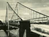
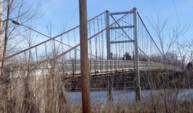
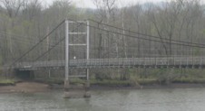
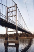
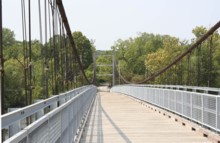
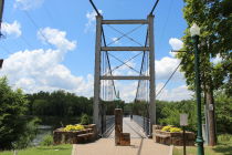
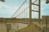
1928: Des Arc
Des Arc, Arkansas, USA - White River
| Bridgemeister ID: | 152 (added before 2003) |
| Year Completed: | 1928 |
| Name: | Des Arc |
| Also Known As: | Swinging |
| Location: | Des Arc, Arkansas, USA |
| Crossing: | White River |
| Coordinates: | 34.974811 N 91.487684 W |
| Maps: | Acme, GeoHack, Google, OpenStreetMap |
| Principals: | Austin Bridge Co |
| References: | AUB, PTS2 |
| Use: | Vehicular |
| Status: | Demolished, August 1970 |
| Main Cables: | Wire (steel) |
| Suspended Spans: | 3 |
| Main Span: | 1 x 198.1 meters (650 feet) |
| Side Spans: | 2 x 97.5 meters (320 feet) |
Notes:
- The coordinates provided here indicate the approximate alignment of the bridge, about 0.5 miles southeast of the current (2020s) Des Arc White River crossing. The bridge delivered traffic near the east end of East Chester Street in Des Arc.
External Links:
1928: Roma-Miguel Alemán International
Roma, Texas, USA and Ciudad Miguel Alemán, Mexico - Rio Grande
| Bridgemeister ID: | 157 (added before 2003) |
| Year Completed: | 1928 |
| Name: | Roma-Miguel Alemán International |
| Also Known As: | Roma-San Pedro International |
| Location: | Roma, Texas, USA and Ciudad Miguel Alemán, Mexico |
| Crossing: | Rio Grande |
| Coordinates: | 26.403821 N 99.018856 W |
| Maps: | Acme, GeoHack, Google, OpenStreetMap |
| Principals: | George Cole, Starr County Bridge Co., Compañía del Puente de San Pedro de Roma |
| References: | HAERTX98, PTS2 |
| Use: | Vehicular |
| Status: | Closed, 1979 (last checked: 2024) |
| Main Cables: | Wire (steel) |
| Suspended Spans: | 1 |
| Main Span: | 1 x 192 meters (629.9 feet) |
| Deck width: | 6.9 meters |
Notes:
- 2024, April: Funds secured to restore the bridge.
External Links:
- Funds secured to restore historic international suspension bridge in South Texas | WGNO.com. Article dated April 24, 2024 regarding funds secured for the bridge's restoration: "Final plans for the bridge’s renovation aren’t clear, but there is talk that the old suspension bridge could become a pedestrian bridge, since it is located next to the current vehicular international bridge"
- Structurae - Structure ID 20005556
1929: Creighton's
Inangahua County, New Zealand - Maruia River
| Bridgemeister ID: | 724 (added 2003-03-08) |
| Year Completed: | 1929 |
| Name: | Creighton's |
| Location: | Inangahua County, New Zealand |
| Crossing: | Maruia River |
| References: | GAP |
1930: Colfax-Foresthill
Yankee Jims, Colfax vicinity, California, USA - North Fork American River
| Bridgemeister ID: | 165 (added before 2003) |
| Year Completed: | 1930 |
| Name: | Colfax-Foresthill |
| Also Known As: | Yankee Jims |
| Location: | Yankee Jims, Colfax vicinity, California, USA |
| Crossing: | North Fork American River |
| Coordinates: | 39.040306 N 120.902667 W |
| Maps: | Acme, GeoHack, Google, OpenStreetMap |
| Use: | Vehicular (one-lane) |
| Status: | In use (last checked: 2023) |
| Main Cables: | Wire (steel) |
| Suspended Spans: | 1 |
| Main Span: | 1 x 53 meters (173.9 feet) estimated |
Notes:
- 2023: Replacement announced. The suspension bridge will be preserved and remain in place.
- Companion to 1928 Colfax-Iowa Hill - Colfax vicinity, California, USA.
External Links:
- Facebook - Placer County Government. Video discussing the history of the bridge and planned replacement project.
- Structurae - Structure ID 20011089
Image Sets:
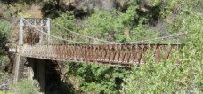
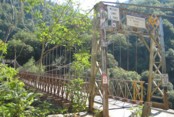
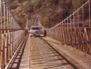
1932: (suspension bridge)
Placer County and El Dorado County, California, USA - Rubicon River
| Bridgemeister ID: | 5595 (added 2020-12-23) |
| Year Completed: | 1932 |
| Name: | (suspension bridge) |
| Location: | Placer County and El Dorado County, California, USA |
| Crossing: | Rubicon River |
| Coordinates: | 38.984847 N 120.694431 W |
| Maps: | Acme, GeoHack, Google, OpenStreetMap |
| Principals: | John Lawrence, US Forest Service |
| Use: | Vehicular (one-lane) |
| Status: | Derelict, since 1965 (last checked: 2020) |
| Main Cables: | Wire (steel) |
| Suspended Spans: | 1 |
| Main Span: | 1 x 48.8 meters (160 feet) |
Notes:
- Damaged by flood resulting from Hell Hole Dam failure in 1965. Never repaired.
- The September 30, 1932 edition of The Mountain Democrat (of Placerville, California) describes how a high line cable hanging 240 feet above the bridge site to transport people and material to the bridge site since the road (a now abandoned section of the Rubicon Road) had not been built yet: "They have a cable (Mr. Lawrence calls it a high-line") stretched across the Rubicon canyon a distance of more than 1100 feet. The cable has a "sag" of 165 feet, and some 240 feet straight down from the middle of the cable is the site of the 160-foot suspension bridge. And so, when a bridge worker goes to work, he climbs into a wooden cage, which travels out on the high-line until it is directly over the bridge site, and then the cage descends to the bottom of the canyon." About the bridge: "And that was no easy job, for the bridge is of the suspension type, has a 160-foot span, has one traffic lane and is designed to support a fifteen ton load."
External Links:
1932: (suspension bridge)
Rakautangi-Kohara Road, Waimarino County, New Zealand - Rakautangi Stream
| Bridgemeister ID: | 739 (added 2003-03-08) |
| Year Completed: | 1932 |
| Name: | (suspension bridge) |
| Location: | Rakautangi-Kohara Road, Waimarino County, New Zealand |
| Crossing: | Rakautangi Stream |
| References: | GAP |
1932: Dazhuoshui
Nan'ao Township, Yilan County and Xiulin Township, Hualien County, Taiwan - Heping River
| Bridgemeister ID: | 5915 (added 2021-05-23) |
| Year Completed: | 1932 |
| Name: | Dazhuoshui |
| Also Known As: | 大濁水橋 |
| Location: | Nan'ao Township, Yilan County and Xiulin Township, Hualien County, Taiwan |
| Crossing: | Heping River |
| Coordinates: | 24.323766 N 121.742706 E |
| Maps: | Acme, GeoHack, Google, OpenStreetMap |
| Use: | Vehicular |
| Status: | Removed |
| Main Cables: | Wire (steel) |
Image Sets:
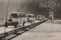
1933: Green's Mill
Camden County, Missouri, USA - Little Niangua River
| Bridgemeister ID: | 179 (added before 2003) |
| Year Completed: | 1933 |
| Name: | Green's Mill |
| Also Known As: | Little Niangua, J Road |
| Location: | Camden County, Missouri, USA |
| Crossing: | Little Niangua River |
| Coordinates: | 38.065326 N 92.909309 W |
| Maps: | Acme, GeoHack, Google, OpenStreetMap |
| Principals: | Howard Mullins, Scully Steel Co., American Steel & Wire Co., Clinton Bridge Works |
| References: | AAJ, SSS, USS |
| Use: | Vehicular (two-lane, heavy vehicles) |
| Status: | Bypassed, 2020 (last checked: 2023) |
| Main Cables: | Wire (steel) |
| Suspended Spans: | 3 |
| Main Span: | 1 x 68.6 meters (225 feet) |
| Side Spans: | 1 x 34.3 meters (112.5 feet), 1 x 34.3 meters (112.4 feet) |
| Deck width: | 20 feet |
| Characteristics: | Self-anchored |
Notes:
- Self-anchored.
- 2007, October: Closed for a few weeks for emergency repairs. According to an October 4, 2007 article in the Lake Sun Leader (Missouri): "a routine inspection revealed a problem in the substructure... too much movement was detected at a location underneath the north side of the bridge." Other sources mentioned a faulty "pin."
- 2018: Missouri Department of Transportation (MoDOT) plans to replace the bridge and is seeking groups to take ownership of the bridge and possibly relocate it.
- 2020: A new bridge is completed, bypassing the suspension bridge.
- 2023, March: Ownership transferred from Missouri Department of Transportation to Green's Mill Historic Bridge, Inc. to preserve the since bypassed bridge.
Image Sets:
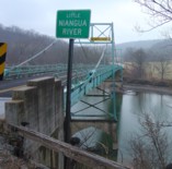
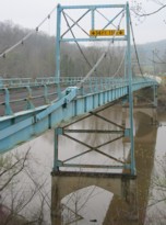
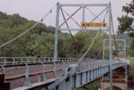
1936: (suspension bridge)
Black Rock vicinity, Randolph County and Lawrence County, Arkansas, USA - Spring River
| Bridgemeister ID: | 1075 (added 2003-12-27) |
| Year Completed: | 1936 |
| Name: | (suspension bridge) |
| Location: | Black Rock vicinity, Randolph County and Lawrence County, Arkansas, USA |
| Crossing: | Spring River |
| Coordinates: | 36.13987 N 91.08400 W |
| Maps: | Acme, GeoHack, Google, OpenStreetMap |
| Principals: | WPA |
| Use: | Vehicular |
| Status: | Derelict (last checked: 2005) |
| Main Cables: | Wire (steel) |
| Main Span: | 1 x 91.4 meters (300 feet) estimated |
Image Sets:
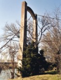
1937: Bryan's Crossing
Warsaw vicinity, Missouri, USA - South Grand River
| Bridgemeister ID: | 1074 (added 2003-12-27) |
| Year Completed: | 1937 |
| Name: | Bryan's Crossing |
| Also Known As: | Downing Bend |
| Location: | Warsaw vicinity, Missouri, USA |
| Crossing: | South Grand River |
| Principals: | Joseph A. Dice? |
| References: | BOTO |
| Use: | Vehicular (one-lane) |
| Status: | Removed |
| Main Cables: | Wire (steel) |
| Suspended Spans: | 1 |
Notes:
- Likely another Joseph A. Dice bridge.
- Location inundated by the Harry S. Truman Reservoir.
External Links:
1937: Golden Gate
San Francisco and Marin County, California, USA - San Francisco Bay
| Bridgemeister ID: | 188 (added before 2003) |
| Year Completed: | 1937 |
| Name: | Golden Gate |
| Location: | San Francisco and Marin County, California, USA |
| Crossing: | San Francisco Bay |
| Coordinates: | 37.82 N 122.47667 W |
| Maps: | Acme, GeoHack, Google, OpenStreetMap |
| Principals: | Joseph B. Strauss, Leon Moisseiff, Charles A. Ellis, Irving F. Morrow |
| References: | AAJ, AZB, BAAW, BBR, BC3, BFL, BLD, BMA, BOU, BPL, BRU, COB, CTW, GAT, GBD, GGB, LAB, SPG |
| Use: | Vehicular (major highway), with walkway |
| Status: | In use (last checked: 2022) |
| Main Cables: | Wire (steel) |
| Suspended Spans: | 3 |
| Main Span: | 1 x 1,280.2 meters (4,200 feet) |
| Side Spans: | 2 x 343 meters (1,125.41 feet) |
| Deck width: | 80 feet |
Notes:
- Became longest suspension bridge by eclipsing 1931 George Washington (GWB) - New York, New York and Fort Lee, New Jersey, USA.
- Eclipsed by new longest suspension bridge 1964 Verrazzano Narrows (Verrazano Narrows) - Brooklyn and Staten Island, New York, USA.
External Links:
Image Sets:


1938: Nengtan
Nengtan (能滩村), Luxi County, Xiangxi, Hunan, China - Nengtan River
| Bridgemeister ID: | 8227 (added 2024-02-07) |
| Year Completed: | 1938 |
| Name: | Nengtan |
| Location: | Nengtan (能滩村), Luxi County, Xiangxi, Hunan, China |
| Crossing: | Nengtan River |
| Coordinates: | 28.233306 N 109.984139 E |
| Maps: | Acme, GeoHack, Google, OpenStreetMap |
| Use: | Vehicular (one-lane) |
| Status: | Closed |
| Main Cables: | Chain |
| Suspended Spans: | 1 |
External Links:
1939: Sullivan-Hutsonville
Hutsonville, Illinois and Sullivan, Indiana, USA - Wabash River
| Bridgemeister ID: | 196 (added before 2003) |
| Year Completed: | 1939 |
| Name: | Sullivan-Hutsonville |
| Location: | Hutsonville, Illinois and Sullivan, Indiana, USA |
| Crossing: | Wabash River |
| Coordinates: | 39.1101 N 87.6551 W |
| Maps: | Acme, GeoHack, Google, OpenStreetMap |
| Principals: | Steinman & Robinson, R.V. Milbank, Wisconsin Bridge & Iron Co., Charles J. Glasgow |
| References: | AAJ, BPL, IMB, SJR19880926 |
| Use: | Vehicular (two-lane), with walkway |
| Status: | Demolished, 1989 |
| Main Cables: | Wire (steel) |
| Suspended Spans: | 3 |
| Main Span: | 1 x 106.7 meters (350 feet) |
| Side Spans: | 2 x 45.7 meters (150 feet) |
| Deck width: | 20 feet |
| Characteristics: | Self-anchored |
Notes:
- Demolished 1989. This bridge was Steinman's attempt at a self-anchored suspension bridge and met a controversial demise in 1989. An article in the September 26, 1988 issue of the Springfield, IL "The State Journal-Register" describes the ongoing controversy. The company to which the $100,000 demolition contract was let offered to turn the money over to save the bridge. The locals agreed, but the company's Chief Engineer Stephen Schneider was quoted, "I think Indiana really wants to tear it down. They've been ... forced to send inspectors out every two weeks. I think they just want the headache gone." Gary Abell, spokesman for the Indiana Dept. Of Highways said its design is "not one of the best. It works in theory, but not in practice. This is like trying to save a mistake." After a lot of back-and-forth, the locals gave up, "We've had it with them. We don't want anything more to do with it. They can tear the damn thing down." Animosity toward this bridge continues 13 years after its demolition. In 2002, in an email to Wayne Grodkiewicz (who provided me with much information about this bridge), an INDOT representative said, "I am not sure why you are interested in that bridge, but from our stand point, it was a very poorly designed bridge that had many many problems from the day that it was completed, until it was brought down."
External Links:
1940: Clear Creek Swinging
Pyatt vicinity, Arkansas, USA - Clear Creek
| Bridgemeister ID: | 1954 (added 2005-11-04) |
| Year Completed: | 1940 |
| Name: | Clear Creek Swinging |
| Location: | Pyatt vicinity, Arkansas, USA |
| Crossing: | Clear Creek |
| Coordinates: | 36.2098 N 92.8598 W |
| Maps: | Acme, GeoHack, Google, OpenStreetMap |
| Principals: | WPA |
| Use: | Vehicular |
| Status: | Replaced, 1975 |
| Main Cables: | Wire (steel) |
| Suspended Spans: | 1 |
External Links:
1940: Nolan Toll
Nolan, West Virginia and Pike County, Kentucky, USA - Tug Fork River
| Bridgemeister ID: | 2239 (added 2007-03-27) |
| Year Completed: | 1940 |
| Name: | Nolan Toll |
| Location: | Nolan, West Virginia and Pike County, Kentucky, USA |
| Crossing: | Tug Fork River |
| Coordinates: | 37.73986 N 82.33125 W |
| Maps: | Acme, GeoHack, Google, OpenStreetMap |
| Use: | Vehicular |
| Status: | Only towers remain (last checked: 2009) |
Notes:
- The suspension bridge, and later the current adjacent beam and girder bridge, are privately owned and were previously operated as toll bridges. The current bridge was closed by West Virginia in late 2007.
- Ron Thompson, a member of the family who owns these structures (the suspension bridge formerly, and now the current crossing) writes: "This was a private toll bridge constructed beginning in 1939 by the Big Creek Bridge Company, a privately held corporation headquartered first in Nolan, then in Williamson. The replacement bridge next to it was constructed by the same entity. My father, along with other relatives, inherited most of the corporate stock, and for the last several years he has owned it in its entirety... My grandfather built the original suspension bridge primarily to provide a way to get coal from the surrounding hills in Pike and Martin County, Kentucky to tipples and markets in West Virginia."
Image Sets:
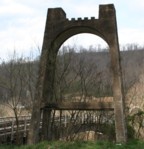
1941: Haggard Ford
Harrison vicinity, Arkansas, USA - Bear Creek
| Bridgemeister ID: | 199 (added before 2003) |
| Year Completed: | 1941 |
| Name: | Haggard Ford |
| Also Known As: | Bear Creek |
| Location: | Harrison vicinity, Arkansas, USA |
| Crossing: | Bear Creek |
| Coordinates: | 36.3458 N 93.1305 W |
| Maps: | Acme, GeoHack, Google, OpenStreetMap |
| Principals: | WPA, Jess Chaney |
| Use: | Vehicular (one-lane) |
| Status: | Restricted to foot traffic (last checked: 2007) |
| Main Cables: | Wire (steel) |
| Suspended Spans: | 1 |
| Main Span: | 1 x 48.8 meters (160 feet) |
Notes:
- Located about eight miles north of Harrison. According to plaque at bridge, restored 1977.
- Gene McCluney writes: "I visited this bridge [in the Summer of 2007] and talked to an adjacent landowner a couple weeks ago. It seems this bridge was closed in 1962 due to instability in one of the piers, and the crossing reverted to a ford or low water crossing until about four years ago when the new vehicular bridge was built. So, there was a suspension bridge in-use there for 20 years, then 40 years of "low water" type crossing, then just recently a new vehicle bridge."
- Similar to (suspension bridge) - Leslie vicinity, Arkansas, USA.
External Links:
Image Sets:
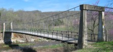
1942: Shimian
Shimian County (石棉县), Ya'an (雅安市), Sichuan, China - Dadu River
| Bridgemeister ID: | 1290 (added 2004-03-16) |
| Year Completed: | 1942 |
| Name: | Shimian |
| Location: | Shimian County (石棉县), Ya'an (雅安市), Sichuan, China |
| Crossing: | Dadu River |
| Coordinates: | 29.241472 N 102.356167 E |
| Maps: | Acme, GeoHack, Google, OpenStreetMap |
| References: | BCG |
| Use: | Vehicular |
| Status: | Extant (last checked: 2021) |
| Main Cables: | Wire (steel) |
| Suspended Spans: | 1 |
| Main Span: | 1 x 10⁵ meters (344.5 feet) |
Notes:
- Rebuilt 1952, 1964.
1947: Mitchell County Bridge 223
Red Hill vicinity, North Carolina, USA - Big Rock Creek
| Bridgemeister ID: | 788 (added 2003-03-22) |
| Year Completed: | 1947 |
| Name: | Mitchell County Bridge 223 |
| Location: | Red Hill vicinity, North Carolina, USA |
| Crossing: | Big Rock Creek |
| Coordinates: | 36.04363 N 82.22528 W |
| Maps: | Acme, GeoHack, Google, OpenStreetMap |
| Principals: | North Carolina Bridge Maintenance Unit |
| Use: | Footbridge |
| Status: | Closed, c. 2018-2021 (last checked: 2024) |
| Main Cables: | Wire (steel) |
| Suspended Spans: | 1 |
| Main Span: | 1 x 28.2 meters (92.5 feet) |
Notes:
- From the NCDOT page about this bridge: "According to state records, the western deadman was replaced in 2002 along with several hangers. The anchor cable at the deadman was replaced in 1974, but otherwise records do not identify any major repairs to or rebuilding of the structure."
- Closed at some point in the 2018-2021 time frame.
External Links:
Image Sets:
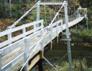
1949: Beaver
Beaver, Arkansas, USA - White River
| Bridgemeister ID: | 200 (added before 2003) |
| Year Completed: | 1949 |
| Name: | Beaver |
| Location: | Beaver, Arkansas, USA |
| Crossing: | White River |
| At or Near Feature: | Table Rock Reservoir |
| Coordinates: | 36.4708 N 93.76856 W |
| Maps: | Acme, GeoHack, Google, OpenStreetMap |
| Principals: | Pioneer Construction Co., Arkansas State Highway Department |
| Use: | Vehicular (one-lane) |
| Status: | Closed, October, 2021 (last checked: 2021) |
| Main Cables: | Wire (steel) |
| Suspended Spans: | 3 |
| Main Span: | 1 x 95.1 meters (312 feet) |
| Side Spans: | 2 x 32 meters (105 feet) |
| Deck width: | 11.1 feet |
Notes:
- 1981: Deck replaced.
- 1990: Added to National Register of Historic Places
- 2002: Deck replaced.
- 2020: Timber deck and railings replaced, September.
- 2021, October: Closed again for repairs.
External Links:
- Historic Bridges of the United States - Beaver Bridge - Carroll County, Arkansas. States bridge was completed in 1949.
- Structurae - Structure ID 20012249
Image Sets:
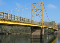
1954: Point Bonita Lighthouse
Golden Gate National Recreation Area, Marin County, California, USA
| Bridgemeister ID: | 882 (added 2003-09-06) |
| Year Completed: | 1954 |
| Name: | Point Bonita Lighthouse |
| Location: | Golden Gate National Recreation Area, Marin County, California, USA |
| Coordinates: | 37.815980 N 122.528878 W |
| Maps: | Acme, GeoHack, Google, OpenStreetMap |
| Use: | Footbridge |
| Status: | Removed |
| Main Cables: | Wire (steel) |
| Suspended Spans: | 1 |
Notes:
- Closed to the public, January 6, 2010. Subsequently removed and replaced.
- Replaced by 2012 Point Bonita Lighthouse - Golden Gate National Recreation Area, Marin County, California, USA.
- All past and present bridges at this location.
External Links:
Image Sets:
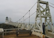
1955: Camp Saukenauk
Tioga vicinity, Adams County, Illinois, USA - Camp Saukenauk Lake
| Bridgemeister ID: | 5593 (added 2020-12-23) |
| Year Completed: | 1955 |
| Name: | Camp Saukenauk |
| Location: | Tioga vicinity, Adams County, Illinois, USA |
| Crossing: | Camp Saukenauk Lake |
| Coordinates: | 40.183546 N 91.319748 W |
| Maps: | Acme, GeoHack, Google, OpenStreetMap |
| Principals: | W.H. Klingner & Associates, Rose Construction Co. |
| Use: | Footbridge |
| Status: | In use (last checked: 2012) |
| Main Cables: | Wire (steel) |
| Suspended Spans: | 3 |
| Main Span: | 1 |
| Side Spans: | 2 |
External Links:
1961: Lunday
Lunday and Kona, North Carolina, USA - North Toe River
| Bridgemeister ID: | 2273 (added 2007-04-21) |
| Year Completed: | 1961 |
| Name: | Lunday |
| Also Known As: | Mitchell County Bridge 225 |
| Location: | Lunday and Kona, North Carolina, USA |
| Crossing: | North Toe River |
| Coordinates: | 35.95493 N 82.19544 W |
| Maps: | Acme, GeoHack, Google, OpenStreetMap |
| Principals: | North Carolina Bridge Maintenance Unit |
| Use: | Footbridge |
| Status: | In use (last checked: 2018) |
| Main Cables: | Wire (steel) |
| Suspended Spans: | 1 |
| Main Span: | 1 x 58.5 meters (192 feet) estimated |
Notes:
- Deck and floorbeams replaced, 1988.
External Links:
Image Sets:
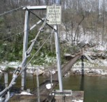
1971: Shichuan
Shichuanzhen (什川镇), Gaolan County (皋兰县), Lanzhou (兰州市), Gansu, China - Yellow River
| Bridgemeister ID: | 8134 (added 2024-01-13) |
| Year Completed: | 1971 |
| Name: | Shichuan |
| Location: | Shichuanzhen (什川镇), Gaolan County (皋兰县), Lanzhou (兰州市), Gansu, China |
| Crossing: | Yellow River |
| Coordinates: | 36.151222 N 103.993583 E |
| Maps: | Acme, GeoHack, Google, OpenStreetMap |
| References: | BCG |
| Use: | Vehicular |
| Status: | In use (last checked: 2022) |
| Main Cables: | Wire (steel) |
| Main Span: | 1 x 124 meters (406.8 feet) |
1973: (footbridge)
Lincoln, Illinois, USA - Kickapoo Creek
| Bridgemeister ID: | 909 (added 2003-10-11) |
| Year Completed: | 1973 |
| Name: | (footbridge) |
| Location: | Lincoln, Illinois, USA |
| Crossing: | Kickapoo Creek |
| At or Near Feature: | Kickapoo Creek County Park |
| Coordinates: | 40.17338 N 89.37623 W |
| Maps: | Acme, GeoHack, Google, OpenStreetMap |
| Use: | Footbridge |
| Status: | In use (last checked: 2005) |
| Main Cables: | Wire |
| Suspended Spans: | 1 |
| Main Span: | 1 |
1983: Jiake
Jiakedixiang (架科底乡), Fugong County (福贡县), Nujiang Lisu (怒江傈僳族自治州), Yunnan, China - Nujiang
| Bridgemeister ID: | 1241 (added 2004-02-15) |
| Year Completed: | 1983 |
| Name: | Jiake |
| Location: | Jiakedixiang (架科底乡), Fugong County (福贡县), Nujiang Lisu (怒江傈僳族自治州), Yunnan, China |
| Crossing: | Nujiang |
| Coordinates: | 26.765472 N 98.889738 E |
| Maps: | Acme, GeoHack, Google, OpenStreetMap |
| References: | BYU |
| Use: | Vehicular |
| Status: | Extant (last checked: 2019) |
| Main Cables: | Wire (steel) |
| Suspended Spans: | 1 |
| Main Span: | 1 x 118 meters (387.1 feet) |
1983: Manjiedu
Fengqing County, Yunnan, China - Lancang River
| Bridgemeister ID: | 1225 (added 2004-02-15) |
| Year Completed: | 1983 |
| Name: | Manjiedu |
| Location: | Fengqing County, Yunnan, China |
| Crossing: | Lancang River |
| References: | BYU |
| Use: | Vehicular |
| Main Cables: | Wire (steel) |
| Suspended Spans: | 1 |
| Main Span: | 1 x 10⁶ meters (347.8 feet) |
1985: Ka Latamu
Ka Latamu (喀拉塔木), Ghulja, Ili, Xinjiang, China - Yili River
| Bridgemeister ID: | 6869 (added 2022-01-02) |
| Year Completed: | 1985 |
| Name: | Ka Latamu |
| Also Known As: | Kalatamu |
| Location: | Ka Latamu (喀拉塔木), Ghulja, Ili, Xinjiang, China |
| Crossing: | Yili River |
| Coordinates: | 43.649432 N 81.689586 E |
| Maps: | Acme, GeoHack, Google, OpenStreetMap |
| Use: | Vehicular (one-lane) |
| Status: | Extant (last checked: 2021) |
| Main Cables: | Wire (steel) |
| Suspended Spans: | 1 |
| Main Span: | 1 x 126 meters (413.4 feet) estimated |
External Links:
1985: Sylamore Creek
Allison, Arkansas, USA - South Sylamore Creek
| Bridgemeister ID: | 202 (added before 2003) |
| Year Completed: | 1985 |
| Name: | Sylamore Creek |
| Also Known As: | Swinging |
| Location: | Allison, Arkansas, USA |
| Crossing: | South Sylamore Creek |
| Coordinates: | 35.936067 N 92.121528 W |
| Maps: | Acme, GeoHack, Google, OpenStreetMap |
| Use: | Vehicular (one-lane) |
| Status: | In use (last checked: 2021) |
| Main Cables: | Wire (steel) |
| Suspended Spans: | 1 |
| Main Span: | 1 x 61 meters (200 feet) |
Notes:
- Some references locate this bridge over North Sylamore Creek and most have it "north of Mountain View". The bridge is located over South Sylamore Creek about one-half mile due west of Allison, Arkansas on what is now Stone County route 283 and appropriately named Swinging Bridge Road.
- Replaced 1943 Swinging - Allison, Arkansas, USA.
- All past and present bridges at this location.
External Links:
- Historic Bridges of the United States - Sylamore Creek Swinging Bridge - Stone County, Arkansas
- Structurae - Structure ID 20008201
Image Sets:
1987: (footbridge)
Criglersville, Virginia, USA - Robinson River
| Bridgemeister ID: | 1331 (added 2004-04-30) |
| Year Completed: | 1987 |
| Name: | (footbridge) |
| Location: | Criglersville, Virginia, USA |
| Crossing: | Robinson River |
| Coordinates: | 38.4633 N 78.309933 W |
| Maps: | Acme, GeoHack, Google, OpenStreetMap |
| Principals: | VDOT |
| Use: | Footbridge |
| Status: | In use (last checked: 2021) |
| Main Cables: | Wire (steel) |
| Suspended Spans: | 1 |
| Main Span: | 1 x 36.6 meters (120 feet) estimated |
Notes:
- There are two suspension footbridges across the Robinson River at Criglersville. This one is visible from county road 670 just west of Criglersville.
- Near Lindsay Lane - Criglersville, Virginia, USA.
Image Sets:
1987: Xiluodu
Sichuan and Yongshan County, Yunnan, China - Jinsha River
| Bridgemeister ID: | 1242 (added 2004-02-15) |
| Year Completed: | 1988 |
| Name: | Bangjie |
| Location: | Lianghe County, Yunnan, China |
| Crossing: | Longjiang |
| References: | BYU |
| Use: | Vehicular |
| Status: | In use |
| Main Cables: | Wire (steel) |
| Suspended Spans: | 4 |
| Main Spans: | 2 x 60 meters (196.9 feet) |
| Side Spans: | 2 x 24 meters (78.7 feet) |
Notes:
- Multi-span vehicular bridge.
1988: Dunmanu Samba
Luoxuzhen (洛须镇), Sêrxü County (石渠县), Garzê (甘孜藏族自治州) and Dengkexiang (邓柯乡), Jomda County (江达县), Sichuan, China - Jinsha River
| Bridgemeister ID: | 8505 (added 2024-03-23) |
| Year Completed: | 1988 |
| Name: | Dunmanu Samba |
| Also Known As: | 邓玛奴桑巴桥, Luoxu Jinsha River, Dengmanu Samba, |
| Location: | Luoxuzhen (洛须镇), Sêrxü County (石渠县), Garzê (甘孜藏族自治州) and Dengkexiang (邓柯乡), Jomda County (江达县), Sichuan, China |
| Crossing: | Jinsha River |
| Coordinates: | 32.461111 N 97.996222 E |
| Maps: | Acme, GeoHack, Google, OpenStreetMap |
| Use: | Vehicular (one-lane) |
| Status: | Extant (last checked: 2021) |
| Main Cables: | Wire (steel) |
| Suspended Spans: | 1 |
| Main Span: | 1 x 150 meters (492.1 feet) |
External Links:
1989: Baji
Deqin County, Yunnan, China - Lancang River
| Bridgemeister ID: | 1239 (added 2004-02-15) |
| Year Completed: | 1989 |
| Name: | Baji |
| Location: | Deqin County, Yunnan, China |
| Crossing: | Lancang River |
| References: | BYU |
| Use: | Footbridge |
| Main Cables: | Wire (steel) |
| Suspended Spans: | 1 |
| Main Span: | 1 x 74 meters (242.8 feet) |
1990: Shangpa
Shangpazhen (上帕镇), Fugong County (福贡县), Nujiang Lisu (怒江傈僳族自治州), Yunnan, China - Nujiang
| Bridgemeister ID: | 1237 (added 2004-02-15) |
| Year Completed: | 1990 |
| Name: | Shangpa |
| Location: | Shangpazhen (上帕镇), Fugong County (福贡县), Nujiang Lisu (怒江傈僳族自治州), Yunnan, China |
| Crossing: | Nujiang |
| Coordinates: | 26.903846 N 98.865043 E |
| Maps: | Acme, GeoHack, Google, OpenStreetMap |
| References: | BYU |
| Use: | Vehicular |
| Status: | In use (last checked: 2019) |
| Main Cables: | Wire (steel) |
| Suspended Spans: | 1 |
| Main Span: | 1 x 160 meters (524.9 feet) |
Notes:
1992: Jordan
Jordan, Arlington vicinity, Washington, USA - Stillaguamish River South Fork
| Bridgemeister ID: | 1669 (added 2005-03-21) |
| Year Completed: | 1992 |
| Name: | Jordan |
| Location: | Jordan, Arlington vicinity, Washington, USA |
| Crossing: | Stillaguamish River South Fork |
| At or Near Feature: | Jordan Bridge County Park |
| Coordinates: | 48.147583 N 122.0382 W |
| Maps: | Acme, GeoHack, Google, OpenStreetMap |
| Use: | Footbridge |
| Status: | In use (last checked: 2006) |
| Main Cables: | Wire (steel) |
| Suspended Spans: | 1 |
| Main Span: | 1 x 78.6 meters (258 feet) estimated |
Image Sets:
1996: Waimea Swinging
Waimea, Hawaii, USA - Waimea River
| Bridgemeister ID: | 643 (added 2003-02-16) |
| Year Completed: | 1996 |
| Name: | Waimea Swinging |
| Location: | Waimea, Hawaii, USA |
| Crossing: | Waimea River |
| Coordinates: | 21.96979 N 159.65652 W |
| Maps: | Acme, GeoHack, Google, OpenStreetMap |
| Use: | Footbridge |
| Status: | In use (last checked: 2022) |
| Main Cables: | Wire (steel) |
| Suspended Spans: | 1 |
| Main Span: | 1 x 76.2 meters (250 feet) |
Notes:
- Replaced a suspension bridge destroyed by Hurricane Iniki in 1992.
- 2022, January: Closed due to mudslide that occurred at one end of the bridge destroying the road next to the bridge and possibly damaging part of the bridge.
- 2022, February: Project started to repair the bridge and provide temporary pedestrian access.
Annotated Citations:
- KITV Web Staff. "Repair work beginning for temporary pedestrian access to Waimea Swinging Bridge." KITV Island Television, 14 Feb. 2022, www.kitv.com/news/local/repair-work-beginning-for-temporary-pedestrian-access-to-waimea-swinging-bridge/article_692c5d5e-8ddd-11ec-bcb1-87a6464d51be.html
"Kauai County's contractor will begin repairs for temporary pedestrian access to the Waimea Swinging Bridge… the scope of work includes restoring the section of the bridge’s pedestrian walkway, landing platform, and stairs damaged by the rockfall."
Image Sets:
1997: Fengdu
Fengdu County (丰都县), Chongqing, China - Yangtze River
| Bridgemeister ID: | 1288 (added 2004-03-16) |
| Year Completed: | 1997 |
| Name: | Fengdu |
| Location: | Fengdu County (丰都县), Chongqing, China |
| Crossing: | Yangtze River |
| Coordinates: | 29.855915 N 107.670045 E |
| Maps: | Acme, GeoHack, Google, OpenStreetMap |
| References: | BCG |
| Use: | Vehicular |
| Status: | In use (last checked: 2019) |
| Main Cables: | Wire (steel) |
| Main Span: | 1 x 450 meters (1,476.4 feet) |
External Links:
1998: Bingsu
Shangjiangzhen (上江镇), Lushui (泸水市), Nujiang Lisu (怒江傈僳族自治州) and Yunlong County (云龙县), Dali (大理州), Yunnan, China - Nujiang
| Bridgemeister ID: | 1226 (added 2004-02-15) |
| Year Completed: | 1998 |
| Name: | Bingsu |
| Location: | Shangjiangzhen (上江镇), Lushui (泸水市), Nujiang Lisu (怒江傈僳族自治州) and Yunlong County (云龙县), Dali (大理州), Yunnan, China |
| Crossing: | Nujiang |
| Coordinates: | 25.691134 N 98.872903 E |
| Maps: | Acme, GeoHack, Google, OpenStreetMap |
| References: | BYU |
| Use: | Vehicular (one-lane) |
| Status: | Extant (last checked: 2021) |
| Main Cables: | Wire (steel) |
| Suspended Spans: | 1 |
| Main Span: | 1 x 145 meters (475.7 feet) |
1999: Forrest and Maxie Preston Memorial Pedestrian
River, Johnson County, Kentucky, USA - Big Sandy River Levisa Fork
| Bridgemeister ID: | 329 (added before 2003) |
| Year Completed: | 1999 |
| Name: | Forrest and Maxie Preston Memorial Pedestrian |
| Location: | River, Johnson County, Kentucky, USA |
| Crossing: | Big Sandy River Levisa Fork |
| Coordinates: | 37.86015 N 82.726117 W |
| Maps: | Acme, GeoHack, Google, OpenStreetMap |
| Principals: | Bush and Burchett Inc., Bocook Engineering, S.E.A. Engineers Inc., Issam Harik |
| References: | UKODF99 |
| Use: | Footbridge |
| Status: | In use (last checked: 2005) |
| Main Cables: | Wire (steel) |
| Suspended Spans: | 3 |
| Main Span: | 1 x 96.3 meters (316 feet) estimated |
| Side Spans: | 2 x 14.3 meters (47 feet) estimated |
Notes:
- From an old Kentucky Transportation Cabinet web page: "Interested in seeing the world's longest plastic bridge? Visit Johnson County, where the 410-ft-long Forest and Maxie Preston Memorial Pedestrian Bridge recently opened. The bridge was built from a high performance composite material - glass fiber that is reinforced with plastic resins."
- A University of Kentucky web page refers to the deck material as "glass fiber-reinforced polymer composites."
External Links:
Image Sets:
2001: Cross Fork
Cross Fork vicinity, Pennsylvania, USA - Cross Fork Creek
| Bridgemeister ID: | 2401 (added 2007-12-08) |
| Year Completed: | 2001 |
| Name: | Cross Fork |
| Location: | Cross Fork vicinity, Pennsylvania, USA |
| Crossing: | Cross Fork Creek |
| Coordinates: | 41.57235 N 77.78174 W |
| Maps: | Acme, GeoHack, Google, OpenStreetMap |
| Principals: | Potter County Trailblazers, Dept. of Conservation and Natural Resources |
| Use: | Footbridge |
| Status: | In use (last checked: 2002) |
| Main Cables: | Wire (steel) |
| Suspended Spans: | 1 |
Image Sets:
2001: Luojiaohe
Shuangshanzhen (双山镇), Dafang (大方县), Bijie (毕节市), Guizhou, China - Luojiao River
| Bridgemeister ID: | 4695 (added 2020-06-20) |
| Year Completed: | 2001 |
| Name: | Luojiaohe |
| Also Known As: | 贵毕公路落脚河大桥 |
| Location: | Shuangshanzhen (双山镇), Dafang (大方县), Bijie (毕节市), Guizhou, China |
| Crossing: | Luojiao River |
| Coordinates: | 27.207948 N 105.531504 E |
| Maps: | Acme, GeoHack, Google, OpenStreetMap |
| Use: | Vehicular (two-lane, heavy vehicles) |
| Status: | In use (last checked: 2023) |
| Main Cables: | Wire (steel) |
| Suspended Spans: | 1 |
| Main Span: | 1 x 268 meters (879.3 feet) |
External Links:
2001: Xixihe
Qianxi (黔西市), Bijie (毕节市) and Dafang (大方县), Bijie (毕节市), Guizhou, China - Xixi River
| Bridgemeister ID: | 4566 (added 2020-06-02) |
| Year Completed: | 2001 |
| Name: | Xixihe |
| Also Known As: | Xi Xi, Xixi, 贵毕公路西溪河大桥 |
| Location: | Qianxi (黔西市), Bijie (毕节市) and Dafang (大方县), Bijie (毕节市), Guizhou, China |
| Crossing: | Xixi River |
| Coordinates: | 27.030944 N 105.807306 E |
| Maps: | Acme, GeoHack, Google, OpenStreetMap |
| Use: | Vehicular (two-lane, heavy vehicles) |
| Status: | In use (last checked: 2023) |
| Main Cables: | Wire (steel) |
| Suspended Spans: | 1 |
| Main Span: | 1 x 338 meters (1,108.9 feet) |
External Links:
Mail | Facebook | X (Twitter) | Bluesky