Inventory Search Results (1,201-1,300 of 3,191)
3,191 suspension bridges were found for search criteria: *. Bridges 1,201 through 1,300 (of 3,191 total) appear below. Click the Bridgemeister ID number to isolate the bridge on its own page. If you don't see what you were looking for, try an image search with the same criteria: *. This will find the bridge if it is pictured on the site, but is not a catenary suspension bridge.
Related:
| Bridgemeister ID: | 553 (added before 2003) |
| Year Completed: | 1927 |
| Name: | Shaky |
| Also Known As: | Shakey, Daly's |
| Location: | Cork, Ireland |
| Crossing: | River Lee |
| At or Near Feature: | Sunday's Well, Fitzgerald's Park |
| Coordinates: | 51.896585 N 8.499218 W |
| Maps: | Acme, GeoHack, Google, OpenStreetMap |
| Principals: | David Rowell & Co. |
| Use: | Footbridge |
| Status: | In use (last checked: 2020) |
| Main Cables: | Wire (steel) |
| Suspended Spans: | 1 |
Notes:
- 2019, September: Dismantled for refurbishment, expected to be completed in early 2020.
- 2020, September: Refurbishment stalled during contract negotiations with contract. Bridge has been reassembled with new cables but work is not completed.
- 2020, October: Completion of refurbishment still on hold as two companies involved in the project go into examinership.
- 2020, December: Restored bridge reopens.
External Links:


1927: Upper
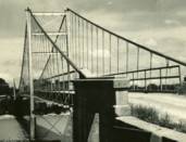
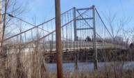
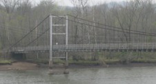
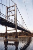
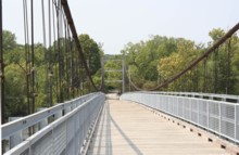
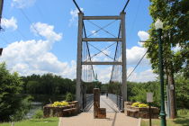
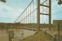
Warsaw, Missouri, USA - Osage River
| Bridgemeister ID: | 1070 (added 2003-12-27) |
| Year Completed: | 1927 |
| Name: | Upper |
| Also Known As: | Swinging |
| Location: | Warsaw, Missouri, USA |
| Crossing: | Osage River |
| Coordinates: | 38.244110 N 93.388767 W |
| Maps: | Acme, GeoHack, Google, OpenStreetMap |
| Principals: | Joseph A. Dice |
| References: | BOTO |
| Use: | Vehicular (one-lane) |
| Status: | Restricted to foot traffic (last checked: 2020) |
| Main Cables: | Wire (steel) |
| Suspended Spans: | 2 |
| Main Span: | 1 x 152.4 meters (500 feet) estimated |
| Side Span: | 1 x 29 meters (95 feet) estimated |
Notes:
- Joseph Dice supervised the construction of this bridge to replace the 1904 structure destroyed in a tornado in 1924. A postcard of this bridge reads: "built in 1927 by the Benton County Court and by popular subscription of citizens to replace a similar bridge destroyed by a windstorm two years earlier. Structure swings on two wire cables imbedded and anchored in concrete and stone. The towers and floor beams are of steel while the floor is of wood. A state highway crosses this bridge."
- Reopened for pedestrians, 2007, after being closed for several years.
- Replaced 1904 Upper (Swinging) - Warsaw, Missouri, USA.
External Links:
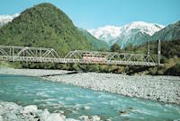
1927: Waiho Gorge
Franz Josef Glacier vicinity, New Zealand - Waiho River
| Bridgemeister ID: | 721 (added 2003-03-08) |
| Year Completed: | 1927 |
| Name: | Waiho Gorge |
| Location: | Franz Josef Glacier vicinity, New Zealand |
| Crossing: | Waiho River |
| Coordinates: | 43.393202 S 170.180682 E |
| Maps: | Acme, GeoHack, Google, OpenStreetMap |
| References: | GAP |
| Use: | Vehicular |
| Status: | Removed, c. 1990 |
| Main Cables: | Wire (steel) |
| Suspended Spans: | 1 |
| Main Span: | 1 x 91.4 meters (300 feet) |
External Links:
1927: White Star
Dayhoit, Kentucky, USA - Cumberland River
| Bridgemeister ID: | 2556 (added 2012-01-01) |
| Year Completed: | 1927 |
| Name: | White Star |
| Location: | Dayhoit, Kentucky, USA |
| Crossing: | Cumberland River |
| Coordinates: | 36.841500 N 83.377194 W |
| Maps: | Acme, GeoHack, Google, OpenStreetMap |
| Use: | Vehicular (one-lane) |
| Status: | Removed |
| Main Cables: | Wire |
Notes:
- The town of Dayhoit has also been known as Day, White Star, and Wilhoit.
External Links:
1928: (suspension bridge)
Galesburg, Illinois, USA - Lake Bracken
| Bridgemeister ID: | 280 (added before 2003) |
| Year Completed: | 1928 |
| Name: | (suspension bridge) |
| Location: | Galesburg, Illinois, USA |
| Crossing: | Lake Bracken |
| At or Near Feature: | Lake Bracken Country Club Boat Harbor |
| Coordinates: | 40.861999 N 90.350571 W |
| Maps: | Acme, GeoHack, Google, OpenStreetMap |
| Use: | Footbridge |
| Status: | In use (last checked: 2021) |
| Main Cables: | Wire |
| Suspended Spans: | 1 |
1928: (suspension bridge)
Rio Rico, Mexico and Mercedes, Texas, USA - Rio Grande
| Bridgemeister ID: | 3914 (added 2020-03-20) |
| Year Completed: | 1928 |
| Name: | Åbrua |
| Also Known As: | Aaen |
| Location: | Tynset, Innlandet, Norway |
| Crossing: | Glomma |
| Coordinates: | 62.288617 N 10.823438 E |
| Maps: | Acme, GeoHack, Google, kart.1881.no, OpenStreetMap |
| Use: | Vehicular (one-lane) |
| Status: | Replaced, 1980 |
| Main Cables: | Wire (steel) |
| Suspended Spans: | 1 |
| Main Span: | 1 x 10⁹ meters (357.6 feet) estimated |
Notes:
- Heavily damaged by flood, likely prior to 1969. Appears to have been repaired before being replaced with another suspension bridge in 1980.
- Replaced by 1980 Åbrua (Aaen) - Tynset, Innlandet, Norway.
External Links:
1928: Bernardo Arango
La Virginia vicinity and Cerritos vicinity, Colombia - Cauca River
| Bridgemeister ID: | 2016 (added 2006-01-14) |
| Year Completed: | 1928 |
| Name: | Bernardo Arango |
| Location: | La Virginia vicinity and Cerritos vicinity, Colombia |
| Crossing: | Cauca River |
| Coordinates: | 4.891980 N 75.882927 W |
| Maps: | Acme, GeoHack, Google, OpenStreetMap |
| Use: | Vehicular (one-lane) |
| Status: | In use (last checked: 2019) |
| Main Cables: | Wire (steel) |
| Suspended Spans: | 1 |
| Main Span: | 1 x 190 meters (623.4 feet) |
1928: Colfax-Iowa Hill
Colfax vicinity, California, USA - North Fork American River
| Bridgemeister ID: | 588 (added 2003-01-05) |
| Year Completed: | 1928 |
| Name: | Colfax-Iowa Hill |
| Location: | Colfax vicinity, California, USA |
| Crossing: | North Fork American River |
| Coordinates: | 39.09993 N 120.92480 W |
| Maps: | Acme, GeoHack, Google, OpenStreetMap |
| Use: | Vehicular (one-lane) |
| Status: | Restricted to foot traffic (last checked: 2021) |
| Main Cables: | Wire (steel) |
| Suspended Spans: | 1 |
Notes:
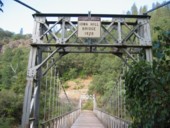
1928: Des Arc
Des Arc, Arkansas, USA - White River
| Bridgemeister ID: | 152 (added before 2003) |
| Year Completed: | 1928 |
| Name: | Des Arc |
| Also Known As: | Swinging |
| Location: | Des Arc, Arkansas, USA |
| Crossing: | White River |
| Coordinates: | 34.974811 N 91.487684 W |
| Maps: | Acme, GeoHack, Google, OpenStreetMap |
| Principals: | Austin Bridge Co |
| References: | AUB, PTS2 |
| Use: | Vehicular |
| Status: | Demolished, August 1970 |
| Main Cables: | Wire (steel) |
| Suspended Spans: | 3 |
| Main Span: | 1 x 198.1 meters (650 feet) |
| Side Spans: | 2 x 97.5 meters (320 feet) |
Notes:
- The coordinates provided here indicate the approximate alignment of the bridge, about 0.5 miles southeast of the current (2020s) Des Arc White River crossing. The bridge delivered traffic near the east end of East Chester Street in Des Arc.
External Links:
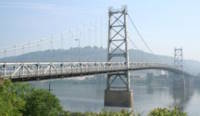
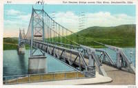
1928: Fort Steuben
Steubenville, Ohio and Weirton, West Virginia, USA - Ohio River
| Bridgemeister ID: | 154 (added before 2003) |
| Year Completed: | 1928 |
| Name: | Fort Steuben |
| Location: | Steubenville, Ohio and Weirton, West Virginia, USA |
| Crossing: | Ohio River |
| Coordinates: | 40.37833 N 80.615 W |
| Maps: | Acme, GeoHack, Google, OpenStreetMap |
| Principals: | Dravo Co. |
| References: | AAJ, PTS2 |
| Use: | Vehicular (two-lane, heavy vehicles), with walkway |
| Status: | Demolished, February 2012 (last checked: 2012) |
| Main Cables: | Wire (steel) |
| Suspended Spans: | 3 |
| Main Span: | 1 x 209.9 meters (688.75 feet) |
| Side Spans: | 2 x 86.3 meters (283 feet) |
| Deck width: | 20.25 feet |
Notes:
- January 2009: Closed indefinitely following inspections revealing major deterioration. Demolished in 2012.
- Near 1905 Market Street - Steubenville, Ohio and East Steubenville, West Virginia, USA.
External Links:
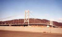
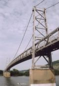
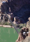
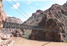
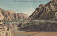
1928: Kaibab Trail
Bright Angel Campground vicinity, Arizona, USA - Colorado River
| Bridgemeister ID: | 155 (added before 2003) |
| Year Completed: | 1928 |
| Name: | Kaibab Trail |
| Also Known As: | Black, South Kaibab |
| Location: | Bright Angel Campground vicinity, Arizona, USA |
| Crossing: | Colorado River |
| At or Near Feature: | Grand Canyon National Park |
| Coordinates: | 36.10076 N 112.08918 W |
| Maps: | Acme, GeoHack, Google, OpenStreetMap |
| Principals: | Ward P. Webber, John H. Lawrence |
| Use: | Footbridge |
| Status: | In use (last checked: 2007) |
| Main Cables: | Wire (steel) |
| Suspended Spans: | 1 |
| Main Span: | 1 x 126.8 meters (416 feet) estimated |
| Deck width: | 5 feet |
Notes:
- Replaced 1920 Kaibab Trail - Grand Canyon National Park, Arizona, USA.
- Near Silver - Bright Angel Campground vicinity, Arizona, USA.
External Links:
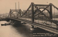
1928: Kiyosu
Chuo City, Tokyo, Japan - Sumida River
| Bridgemeister ID: | 440 (added before 2003) |
| Year Completed: | 1928 |
| Name: | Kiyosu |
| Also Known As: | 清洲橋 |
| Location: | Chuo City, Tokyo, Japan |
| Crossing: | Sumida River |
| Coordinates: | 35.682395 N 139.792022 E |
| Maps: | Acme, GeoHack, Google, OpenStreetMap |
| Principals: | Yutaka Tanaka |
| References: | AAJ, BAAW, PTS2, SSS |
| Use: | Vehicular (four-lane), with walkway |
| Status: | In use (last checked: 2022) |
| Main Cables: | Eyebar (steel) |
| Suspended Spans: | 3 |
| Main Span: | 1 x 91.4 meters (299.9 feet) |
| Side Spans: | 2 |
| Deck width: | 85 feet |
| Characteristics: | Self-anchored |
Notes:
- Self-anchored.
- 2019: Major rehabilitation in progress.
External Links:
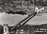
1928: Morca
Morca and Balangera, Italy - Sesia River
| Bridgemeister ID: | 2677 (added 2019-03-30) |
| Year Completed: | 1928 |
| Name: | Morca |
| Location: | Morca and Balangera, Italy |
| Crossing: | Sesia River |
| Coordinates: | 45.821768 N 8.214935 E |
| Maps: | Acme, GeoHack, Google, OpenStreetMap |
| Principals: | Giuseppe Magistrini |
| Use: | Vehicular (one-lane) |
| Status: | In use (last checked: 2022) |
| Main Cables: | Wire (steel) |
| Suspended Spans: | 1 |
| Main Span: | 1 x 93 meters (305.1 feet) estimated |
External Links:
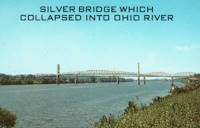
1928: Point Pleasant
Point Pleasant, West Virginia and Kanauga, Gallipolis vicinity, Ohio, USA - Ohio River
| Bridgemeister ID: | 156 (added before 2003) |
| Year Completed: | 1928 |
| Name: | Point Pleasant |
| Also Known As: | Silver |
| Location: | Point Pleasant, West Virginia and Kanauga, Gallipolis vicinity, Ohio, USA |
| Crossing: | Ohio River |
| Coordinates: | 38.845 N 82.141111 W |
| Maps: | Acme, GeoHack, Google, OpenStreetMap |
| Principals: | J.E. Greiner Co. |
| References: | AAJ, BDO, ENR19290620a, ENR19290620b, GBD, LAB, PTS2, SSS |
| Use: | Vehicular, with walkway |
| Status: | Collapsed, 1967 |
| Main Cables: | Eyebar (steel) |
| Suspended Spans: | 3 |
| Main Span: | 1 x 213.4 meters (700 feet) |
| Side Spans: | 2 x 115.8 meters (380 feet) |
| Deck width: | 27 feet |
Notes:
- Hybrid truss, suspension bridge. Collapsed December 15, 1967 while full with traffic. 46 people died.
- Companion to 1928 Saint Marys (Hi Carpenter, Short Route) - Saint Marys, West Virginia and Newport, Ohio, USA.
External Links:

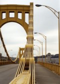
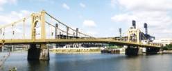
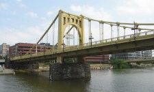
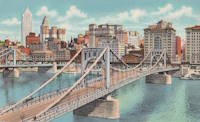
1928: Roberto Clemente
Pittsburgh, Pennsylvania, USA - Allegheny River
| Bridgemeister ID: | 158 (added before 2003) |
| Year Completed: | 1928 |
| Name: | Roberto Clemente |
| Also Known As: | Sixth Street |
| Location: | Pittsburgh, Pennsylvania, USA |
| Crossing: | Allegheny River |
| Coordinates: | 40.44558 N 80.00332 W |
| Maps: | Acme, GeoHack, Google, OpenStreetMap |
| Principals: | Vernon R. Covell, T.J. Wilkerson, A.D. Nutter, H.E. Dodge, Stanley L. Roush |
| References: | AAJ, BOP, BPL, PBR, PTS2, SSS, USS |
| Use: | Vehicular (four-lane), with walkway |
| Status: | In use (last checked: 2014) |
| Main Cables: | Eyebar (steel) |
| Suspended Spans: | 3 |
| Main Span: | 1 x 131.1 meters (430 feet) |
| Side Spans: | 2 x 65.5 meters (215 feet) |
| Characteristics: | Self-anchored |
Notes:
- Self-anchored.
- Next to 1926 Andy Warhol (Seventh Street) - Pittsburgh, Pennsylvania, USA.
- Next to 1927 Rachel Carson (Ninth Street) - Pittsburgh, Pennsylvania, USA.
External Links:
1928: Roma-Miguel Alemán International
Roma, Texas, USA and Ciudad Miguel Alemán, Mexico - Rio Grande
| Bridgemeister ID: | 157 (added before 2003) |
| Year Completed: | 1928 |
| Name: | Roma-Miguel Alemán International |
| Also Known As: | Roma-San Pedro International |
| Location: | Roma, Texas, USA and Ciudad Miguel Alemán, Mexico |
| Crossing: | Rio Grande |
| Coordinates: | 26.403821 N 99.018856 W |
| Maps: | Acme, GeoHack, Google, OpenStreetMap |
| Principals: | George Cole, Starr County Bridge Co., Compañía del Puente de San Pedro de Roma |
| References: | HAERTX98, PTS2 |
| Use: | Vehicular |
| Status: | Closed, 1979 (last checked: 2023) |
| Main Cables: | Wire (steel) |
| Suspended Spans: | 1 |
| Main Span: | 1 x 192 meters (629.9 feet) |
| Deck width: | 6.9 meters |
Notes:
- Closed. Scheduled to be restored as pedestrian crossing.
External Links:
1928: Saint Marys
Saint Marys, West Virginia and Newport, Ohio, USA - Ohio River
| Bridgemeister ID: | 159 (added before 2003) |
| Year Completed: | 1928 |
| Name: | Saint Marys |
| Also Known As: | Hi Carpenter, Short Route |
| Location: | Saint Marys, West Virginia and Newport, Ohio, USA |
| Crossing: | Ohio River |
| Principals: | J.E. Greiner Co. |
| References: | BPL, GBD, PTS2 |
| Use: | Vehicular |
| Status: | Demolished, 1971 |
| Main Cables: | Eyebar (steel) |
| Suspended Spans: | 3 |
| Main Span: | 1 x 213.4 meters (700 feet) |
| Side Spans: | 2 |
Notes:
- Same design as the Silver Bridge that famously collapsed in 1967. Demolished 1971 as a precautionary measure because the engineers decided they could not tell if it suffered from the same flaw as the Silver Bridge without dismantling the eyebars.
- Companion to 1928 Point Pleasant (Silver) - Point Pleasant, West Virginia and Kanauga, Gallipolis vicinity, Ohio, USA.
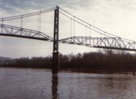
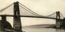
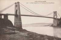
1928: Saint-Hubert
Port Saint-Hubert, Plouër-sur-Rance vicinity and La Ville-es-Nonais, Côtes-d'Armor, France - Rance River
| Bridgemeister ID: | 1492 (added 2004-09-19) |
| Year Completed: | 1928 |
| Name: | Saint-Hubert |
| Location: | Port Saint-Hubert, Plouër-sur-Rance vicinity and La Ville-es-Nonais, Côtes-d'Armor, France |
| Crossing: | Rance River |
| Use: | Vehicular |
| Status: | Destroyed, 1944 |
| Main Cables: | Wire |
| Suspended Spans: | 1 |
Notes:
- Replaced by 1959 Saint-Hubert - Port Saint-Hubert, Plouër-sur-Rance vicinity and La Ville-es-Nonais, Côtes-d'Armor, France.
External Links:
1928: Senumstad
Væting, Birkenes, Agder, Norway - Tovdalselva
| Bridgemeister ID: | 4320 (added 2020-04-10) |
| Year Completed: | 1928 |
| Name: | Senumstad |
| Location: | Væting, Birkenes, Agder, Norway |
| Crossing: | Tovdalselva |
| Coordinates: | 58.417324 N 8.291204 E |
| Maps: | Acme, GeoHack, Google, kart.1881.no, OpenStreetMap |
| Use: | Footbridge |
| Status: | Replaced, 1957 |
Notes:
- Replaced by 1957 Senumstad - Væting, Birkenes, Agder, Norway.
1928: Tamate
Kashiwara, Osaka, Japan - Ishi River
| Bridgemeister ID: | 4651 (added 2020-06-17) |
| Year Completed: | 1928 |
| Name: | Tamate |
| Also Known As: | 玉手橋 |
| Location: | Kashiwara, Osaka, Japan |
| Crossing: | Ishi River |
| Coordinates: | 34.566634 N 135.621691 E |
| Maps: | Acme, GeoHack, Google, OpenStreetMap |
| Status: | Restricted to foot traffic (last checked: 2019) |
| Main Cables: | Wire (steel) |
| Suspended Spans: | 5 |
| Main Spans: | 3 |
| Side Spans: | 2 |
External Links:
| Bridgemeister ID: | 1449 (added 2004-07-31) |
| Year Completed: | 1928 |
| Name: | Tarassac |
| Location: | St. Martin-de-l'Arcon vicinity, Hérault, France |
| Crossing: | Orb River |
| Coordinates: | 43.564766 N 2.974529 E |
| Maps: | Acme, GeoHack, Google, OpenStreetMap |
| References: | BC3 |
| Use: | Vehicular (one-lane) |
| Status: | In use (last checked: 2019) |
| Main Cables: | Wire (steel) |
| Suspended Spans: | 1 |
| Main Span: | 1 x 104.2 meters (342 feet) |
Notes:
External Links:
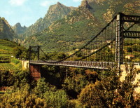
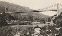
| Bridgemeister ID: | 2731 (added 2019-06-22) |
| Year Completed: | 1928 |
| Name: | Ulvøya |
| Also Known As: | Ulvøybrua |
| Location: | Oslo, Norway |
| Crossing: | Ulvøysund |
| Coordinates: | 59.872686 N 10.777882 E |
| Maps: | Acme, GeoHack, Google, kart.1881.no, OpenStreetMap |
| Use: | Vehicular (one-lane) |
| Status: | In use (last checked: 2019) |
| Main Cables: | Wire (steel) |
| Suspended Spans: | 1 |
| Main Span: | 1 x 143 meters (469.2 feet) |
External Links:
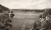
1928: Volonne
Volonne, Alpes-de-Haute-Provence, France - Durance River
| Bridgemeister ID: | 2004 (added 2005-12-26) |
| Year Completed: | 1928 |
| Name: | Volonne |
| Location: | Volonne, Alpes-de-Haute-Provence, France |
| Crossing: | Durance River |
| Use: | Vehicular |
| Status: | Destroyed, 1944 |
Notes:
- Replaced 1845 Volonne - Volonne, Alpes-de-Haute-Provence, France.
- Replaced by 1949 Volonne - Volonne, Alpes-de-Haute-Provence, France.
External Links:
1928: Zapata
Zapata, Texas, USA and Ciudad Guerrero, Mexico - Rio Grande
| Bridgemeister ID: | 1445 (added 2004-07-31) |
| Year Completed: | 1928 |
| Name: | Zapata |
| Location: | Zapata, Texas, USA and Ciudad Guerrero, Mexico |
| Crossing: | Rio Grande |
| Coordinates: | 26.878472 N 99.326563 W |
| Maps: | Acme, GeoHack, Google, OpenStreetMap |
| References: | HAERTX98, PTS2 |
| Use: | Vehicular |
| Status: | Inundated, 1953 |
| Main Cables: | Wire (steel) |
| Suspended Spans: | 3 |
| Main Span: | 1 x 165 meters (541.3 feet) |
| Side Spans: | 2 |
Notes:
- Inundated during creation of Falcon Reservoir.
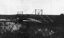
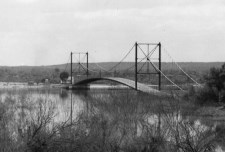
| Bridgemeister ID: | 4463 (added 2020-04-26) |
| Year Completed: | 1929 |
| Name: | (suspension bridge) |
| Location: | Gol, Viken, Norway |
| Crossing: | Vesleåne |
| Coordinates: | 60.698535 N 8.951871 E |
| Maps: | Acme, GeoHack, Google, kart.1881.no, OpenStreetMap |
| Status: | Removed |
| Main Cables: | Wire |
| Suspended Spans: | 1 |
| Main Span: | 1 x 26 meters (85.3 feet) estimated |
Notes:
- Removed at some point between 1972 and 2006.
External Links:
1929: (suspension bridge)
Ngapakira, New Zealand - Ruakituri River
| Bridgemeister ID: | 725 (added 2003-03-08) |
| Year Completed: | 1929 |
| Name: | (suspension bridge) |
| Location: | Ngapakira, New Zealand |
| Crossing: | Ruakituri River |
1929: (suspension bridge)
Waimata Valley, Gisborne vicinity, New Zealand - Waimata River
| Bridgemeister ID: | 728 (added 2003-03-08) |
| Year Completed: | 1929 |
| Name: | (suspension bridge) |
| Location: | Waimata Valley, Gisborne vicinity, New Zealand |
| Crossing: | Waimata River |
| References: | GAP |
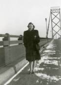
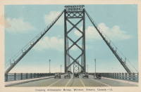
1929: Ambassador
Detroit, Michigan, USA and Windsor, Ontario, Canada - Detroit River
| Bridgemeister ID: | 160 (added before 2003) |
| Year Completed: | 1929 |
| Name: | Ambassador |
| Location: | Detroit, Michigan, USA and Windsor, Ontario, Canada |
| Crossing: | Detroit River |
| Coordinates: | 42.31210 N 83.07402 W |
| Maps: | Acme, GeoHack, Google, OpenStreetMap |
| Principals: | Jonathan Jones, McClintic-Marshall |
| References: | AAJ, AMB, GBD, PTS2 |
| Use: | Vehicular (major highway) |
| Status: | In use (last checked: 2022) |
| Main Cables: | Wire (steel) |
| Suspended Spans: | 1 |
| Main Span: | 1 x 563.9 meters (1,850 feet) |
| Deck width: | 55 feet |
Notes:
- Became longest suspension bridge by eclipsing 1926 Benjamin Franklin (Philadelphia-Camden) - Philadelphia, Pennsylvania and Camden, New Jersey, USA.
- Eclipsed by new longest suspension bridge 1931 George Washington (GWB) - New York, New York and Fort Lee, New Jersey, USA.
External Links:

1929: Auburn-Coloma
Auburn and Coloma, California, USA - North Fork American River
| Bridgemeister ID: | 1624 (added 2005-02-27) |
| Year Completed: | 1929 |
| Name: | Auburn-Coloma |
| Location: | Auburn and Coloma, California, USA |
| Crossing: | North Fork American River |
| Principals: | Smith Brothers |
| Use: | Vehicular (one-lane) |
| Status: | Replaced, 1948 |
| Main Cables: | Wire |
| Suspended Spans: | 1 |
Notes:

| Bridgemeister ID: | 4017 (added 2020-03-28) |
| Year Completed: | 1929 |
| Name: | Borglund |
| Location: | Borglund, Veme, Ringerike, Viken, Norway |
| Crossing: | Sogna |
| Coordinates: | 60.20807 N 10.05918 E |
| Maps: | Acme, GeoHack, Google, kart.1881.no, OpenStreetMap |
| Use: | Footbridge |
| Status: | In use (last checked: 2020) |
| Main Cables: | Wire (steel) |
| Suspended Spans: | 1 |
| Main Span: | 1 x 65.5 meters (214.9 feet) estimated |
| Deck width: | ~2 meters |
Notes:
- Major rehabilitation completed, 2017, including complete replacement of towers.
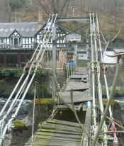
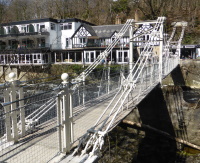
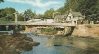
1929: Chainbridge
Berwyn, Llangollen, Wales, United Kingdom - River Dee
| Bridgemeister ID: | 1303 (added 2004-04-09) |
| Year Completed: | 1929 |
| Name: | Chainbridge |
| Also Known As: | Chain |
| Location: | Berwyn, Llangollen, Wales, United Kingdom |
| Crossing: | River Dee |
| Coordinates: | 52.98025 N 3.1946 W |
| Maps: | Acme, GeoHack, Google, OpenStreetMap |
| Principals: | Sir Henry Robertson |
| Use: | Footbridge |
| Status: | In use (last checked: 2019) |
| Main Cables: | Chain |
| Suspended Spans: | 1 |
| Main Span: | 1 |
Notes:
- Crosses both River Dee and Llangollen Canal
- A thorough report on these bridges was published in 2010 by the Royal Commission on the Ancient and Historical Monuments of Wales (RCAHMW), Chain Bridge, Llantysilio, Denbighshire. The Pickering bridge (built 1817, according to the report) was contructed with the deck laid on the chains. This bridge was removed in 1870 but appears not to have been replaced until at least 1876. The new bridge, not simply refurbished, was constructed with the deck supported by the chains underneath, but in an "underspanned" fashion with small pillars resting on the chains, supporting a level deck. This bridge was destroyed by flood on Feb. 16, 1928. The report also investigates whether the chains of the current (1929) bridge are the original chains from the 1817 Pickering bridge and concludes there is evidence "supporting the hypothesis that the chains we see on the bridge today are same as those put on the bridge in 1817" and adds "If the present chains are the originals, there is little reason to doubt that they are the oldest suspension bridge chains in the western world."
- 2015: Underwent major restoration and reopened.
External Links:
- Chainbridge Hotel. The bridge is situated next to the hotel. Their web site notes the original "chain bridge" at this location was built in 1814 by Exuperious Pickering and was refurbished in 1870 and rebuilt in 1929.
- Structurae - Structure ID 20074318
1929: Creighton's
Inangahua County, New Zealand - Maruia River
| Bridgemeister ID: | 724 (added 2003-03-08) |
| Year Completed: | 1929 |
| Name: | Creighton's |
| Location: | Inangahua County, New Zealand |
| Crossing: | Maruia River |
| References: | GAP |
1929: Fox River
Fox Glacier, New Zealand - Fox River
| Bridgemeister ID: | 729 (added 2003-03-08) |
| Year Completed: | 1929 |
| Name: | Fox River |
| Location: | Fox Glacier, New Zealand |
| Crossing: | Fox River |
| Coordinates: | 43.487188 S 170.029302 E |
| Maps: | Acme, GeoHack, Google, OpenStreetMap |
| References: | GAP |
| Use: | Footbridge |
| Status: | In use (last checked: 2014) |
| Main Cables: | Wire (steel) |
| Suspended Spans: | 1 |
| Main Span: | 1 x 70 meters (229.7 feet) |
External Links:
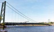
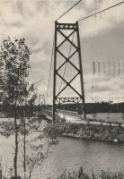
1929: Grand Mère
Grand-Mère, Quebec, Canada - St. Maurice River
| Bridgemeister ID: | 162 (added before 2003) |
| Year Completed: | 1929 |
| Name: | Grand Mère |
| Location: | Grand-Mère, Quebec, Canada |
| Crossing: | St. Maurice River |
| Coordinates: | 46.620117 N 72.6794 W |
| Maps: | Acme, GeoHack, Google, OpenStreetMap |
| Principals: | Robinson and Steinman |
| References: | AAJ, BC3, BPL, PTS2, SJR |
| Use: | Vehicular (two-lane, heavy vehicles), with walkway |
| Status: | In use (last checked: 2019) |
| Main Cables: | Wire (steel) |
| Suspended Spans: | 1 |
| Main Span: | 1 x 289.2 meters (948.8 feet) |
| Deck width: | 26 feet |
External Links:
1929: Hinckesman's Access Road
Frasertown vicinity, Hawke's Bay, New Zealand - Mangapoike River
| Bridgemeister ID: | 726 (added 2003-03-08) |
| Year Completed: | 1929 |
| Name: | Hinckesman's Access Road |
| Location: | Frasertown vicinity, Hawke's Bay, New Zealand |
| Crossing: | Mangapoike River |
| Principals: | T. Delaney |
| References: | GAP |
| Use: | Vehicular |
| Status: | Destroyed, 1935 |
Notes:
- GAP: Destroyed by flood, 1935.
- Replaced by 1936 Hinckesman's Access Road - Frasertown vicinity, Hawke's Bay, New Zealand.
1929: Hipólito Yrigoyen
Necochea and Quequén, Argentina - Rio Quequén
| Bridgemeister ID: | 441 (added before 2003) |
| Year Completed: | 1929 |
| Name: | Hipólito Yrigoyen |
| Also Known As: | Rio Quequén |
| Location: | Necochea and Quequén, Argentina |
| Crossing: | Rio Quequén |
| Coordinates: | 38.552048 S 58.725680 W |
| Maps: | Acme, GeoHack, Google, OpenStreetMap |
| Principals: | P. Palazzo |
| References: | AAJ, SSS |
| Use: | Vehicular (two-lane), with walkway |
| Status: | In use (last checked: 2019) |
| Main Cables: | Wire (steel) |
| Suspended Spans: | 3 |
| Main Span: | 1 x 150 meters (492 feet) |
| Side Spans: | 2 x 59.7 meters (196 feet) |
External Links:
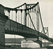
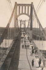
| Bridgemeister ID: | 2378 (added 2007-10-21) |
| Year Completed: | 1929 |
| Name: | Idabel-Clarksville |
| Location: | Idabel vicinity, Oklahoma and Clarksville vicinity, Texas, USA |
| Crossing: | Red River |
| Principals: | Austin Bridge Co. |
| References: | AUB |
| Use: | Vehicular |
| Status: | Destroyed, 1933 |
| Main Cables: | Wire (steel) |
| Suspended Spans: | 3 |
| Main Span: | 1 x 213.4 meters (700 feet) |
| Side Spans: | 2 x 76.2 meters (250 feet) |
| Deck width: | 16 feet |
Notes:
- The November 1933 issue of The Wisconsin Engineer (a publication of the University of Wisconsin) has an article by C.W.P. Walter about research that was being performed by the University of Wisconsin's Engineering Department: "The particular hardware laden contrivance [in the Engineering Building] is a half-model of the Red River Bridge which carried light highway traffic between Clarksville, Texas, and Idabel, Oklahoma. In the early part of this year movement of the Red River as a result of flood waters washed away one of the intermediate piers supporting the end spans, and cause the cable to drop and be subjected to impact loading. It was contended by the company owning the bridge that the cable was overstressed and injured to such an extent that it would be necessary for the insurance company to replace the cable as well as the pier. A committee... was appointed to investigate the questions involved. While the investigation proceeded the Red River continued to scour away the foundation of the existing piers, ultimately causing the bridge to collapse completely."
- AUB mentions this bridge very briefly: "In 1928, [Jim Diamond] was employed by Austin Bridge Company as a consultant on the super-structure and cable work for the White River bridge at Des Arc. Later in the same year, he represented the owners as job engineer on the bridge built by the Company across Red River above Clarksville, Texas."
- Apparently this bridge was damaged by flood the same week it was supposed to open. In the October 1989 edition of the Oklahoma Water News an article (excerpted from an article in The Chronicles of Oklahoma by Dr. Bernice N. Crockett) writes: "The Austin Bridge Company completed the bridge May 19, 1929, but on May 23, when more than 400 people went to see the new bridge opened, an estimated 40 feet of the Red River bank had caved in near the bridge. Heavy rains continued to hinder road construction. A resident near the bridge recalled the night of May 19, 1929, as the night the river changed its course, and by morning had moved the entire structure into Oklahoma." The bridge eventually opened on June 20.
- The Friday December 30, 1932 edition of The Port Arthur News ran an article "Red River Bridge Damaged By Water". Texarkana, Dec. 30 (1932).: "High stages in Red River, that earlier this week demolished the Texas side approach to the privately owned suspension bridge [?] miles north of Clarksville on highway 37 to Idabel have been in recession since Wednesday but indicated continued heavy rains such as last night are expected to bring additional high water with probably further damage to the bridge. More than 50 feet of the approach is gone and the ground piers have crumpled, leaving the anchor cables alone holding the bridge in place."
- It appears the final end to this short-lived bridge didn't come until late May, 1933 when it was completely destroyed by flood.
External Links:
- Historic Suspension Bridges: Advent of the State Highway Department. This Texas Department of Transportation page mentions: "Five of the eleven suspension bridges built by [Austin Bridge Company] were toll bridges over the Red River. The Red River is notorious for its volatile, melting, red clay banks. The bridge between Clarksville, Texas, and Idabel, Oklahoma, was built by ABC in 1928, and washed out during flooding in 1932."
1929: Kane's
Melbourne, Victoria, Australia - Yarra River
| Bridgemeister ID: | 443 (added before 2003) |
| Year Completed: | 1929 |
| Name: | Kane's |
| Location: | Melbourne, Victoria, Australia |
| Crossing: | Yarra River |
| At or Near Feature: | Yarra Bend Park, Studley Park |
| Coordinates: | 37.80006 S 145.00966 E |
| Maps: | Acme, GeoHack, Google, OpenStreetMap |
| Use: | Footbridge |
| Status: | In use (last checked: 2022) |
| Main Cables: | Wire (steel) |
| Suspended Spans: | 1 |
| Main Span: | 1 x 64 meters (210 feet) estimated |
Notes:
- Rebuilt 1935.
1929: Köln-Mülheim
Köln (Cologne) and Mülheim, North Rhine-Westphalia, Germany - Rhine River
| Bridgemeister ID: | 1426 (added 2004-07-18) |
| Year Completed: | 1929 |
| Name: | Köln-Mülheim |
| Location: | Köln (Cologne) and Mülheim, North Rhine-Westphalia, Germany |
| Crossing: | Rhine River |
| Coordinates: | 50.963968 N 6.996659 E |
| Maps: | Acme, GeoHack, Google, OpenStreetMap |
| Principals: | Adolf Abel |
| References: | AAJ |
| Use: | Vehicular, with walkway |
| Status: | Destroyed, 1944 |
| Main Cables: | Wire (steel) |
| Suspended Spans: | 3 |
| Main Span: | 1 x 317 meters (1,040 feet) |
| Side Spans: | 2 x 91.4 meters (300 feet) |
| Deck width: | 91.5 feet |
| Characteristics: | Self-anchored |
Notes:
External Links:
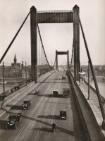
1929: Lakshman Jhula
Rishikesh, Uttarakhand, India - Ganges River
| Bridgemeister ID: | 442 (added before 2003) |
| Year Completed: | 1929 |
| Name: | Lakshman Jhula |
| Location: | Rishikesh, Uttarakhand, India |
| Crossing: | Ganges River |
| Coordinates: | 30.126454 N 78.329753 E |
| Maps: | Acme, GeoHack, Google, OpenStreetMap |
| Principals: | P.H. Tillard |
| Use: | Footbridge |
| Status: | In use (last checked: 2019) |
| Main Cables: | Wire (steel) |
| Suspended Spans: | 1 |
External Links:

1929: McPhaul
Yuma, Arizona, USA - Gila River
| Bridgemeister ID: | 161 (added before 2003) |
| Year Completed: | 1929 |
| Name: | McPhaul |
| Also Known As: | Dome, Gila River |
| Location: | Yuma, Arizona, USA |
| Crossing: | Gila River |
| Coordinates: | 32.75969 N 114.42158 W |
| Maps: | Acme, GeoHack, Google, OpenStreetMap |
| Principals: | Levy Construction Company |
| References: | AAJ, SJR, YS20041217 |
| Use: | Vehicular (one-lane) |
| Status: | Closed (last checked: 2008) |
| Main Cables: | Wire (steel) |
| Suspended Spans: | 1 |
| Main Span: | 1 x 283.5 meters (930.1 feet) |
| Deck width: | 16 feet |
Notes:
- YS20041217: Renamed McPhaul Bridge in honor of Henry Harrison "Harry" McPhaul, "the only Yuma resident who ever became an Arizona Ranger." Bypassed, 1968. 150 feet of deck damaged by fire, 1990.
External Links:
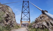
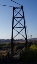
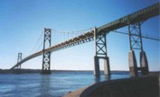
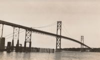
1929: Mount Hope
Bristol and Portsmouth, Rhode Island, USA - Mount Hope Bay
| Bridgemeister ID: | 163 (added before 2003) |
| Year Completed: | 1929 |
| Name: | Mount Hope |
| Location: | Bristol and Portsmouth, Rhode Island, USA |
| Crossing: | Mount Hope Bay |
| Coordinates: | 41.64 N 71.25833 W |
| Maps: | Acme, GeoHack, Google, OpenStreetMap |
| Principals: | Robinson and Steinman |
| References: | AAJ, ADDS, ENR19290411a, ENR19290411b, ENR19290411c, GBD, PTS2 |
| Use: | Vehicular (two-lane, heavy vehicles), with walkway |
| Status: | In use (last checked: 2022) |
| Main Cables: | Wire (steel) |
| Suspended Spans: | 3 |
| Main Span: | 1 x 365.8 meters (1,200 feet) |
| Side Spans: | 2 x 153.6 meters (504 feet) |
| Deck width: | 34 feet |
Annotated Citations:
- Flynn, Sean. "Mount Hope Bridge's support cables are corroding. It'll take $35 million to save them.." Newport Daily News, 13 Dec. 2021, www.newportri.com/story/news/local/2021/12/13/dehumidification-system-needed-save-mount-hope-bridge-ri-cables-corrosion/6456270001/
"'According to a 2016 inspection of the cables at the Mount Hope Bridge, there is significant breakage of the hundreds of wires that make up each of the cables,' RITBA Executive Director Lori Caron Silveira wrote to the Rhode Island House Finance Committee on Dec. 7"
- "Potential Exposure $1B — RI’s Mount Hope Bridge Is in Critical Need of Repair, Says Bridge Authority." GoLocalProv, 9 Dec. 2021, www.golocalprov.com/news/potential-exposure-1b-ris-mount-hope-bridge-is-in-critical-need-of-repair-s
"...Lori Caron Silveira, Executive Director of the [Rhode Island Turnpike and Bridge Authority] warns, 'The cables and anchorages of the 92-year-old Mount Hope Bridge urgently need dehumidification if the Mount Hope is to remain structurally safe and able to continue serving the East Bay and interstate commerce.'"
- Barrett, Scott. "'The bridge is safe': But time is of the essence for Mount Hope Bridge cable repair plan." Newport Daily News, 30 Mar. 2022, www.newportri.com/story/news/local/2022/03/30/mount-hope-bridge-cable-repair-plan-advances-payment-plan-unknown/7207276001/
"The process to preserve the deteriorating cables on the Mount Hope Bridge is underway, though how it will be paid for remains a question mark… the [Rhode Island Turnpike and Bridge Authority] has put out a request for proposals for a dehumidification system for the two large supporting cables on the 93-year-old suspension bridge."
External Links:

| Bridgemeister ID: | 1657 (added 2005-03-19) |
| Year Completed: | 1929 |
| Name: | Ogden Park |
| Location: | Chicago, Illinois, USA |
| At or Near Feature: | Ogden Park |
| Principals: | Linn White, C.R. Hoyt, George T. Donahue |
| References: | AAJ, ENR19290808 |
| Use: | Footbridge |
| Status: | Removed |
| Main Cables: | Wire |
| Suspended Spans: | 1 |
| Main Span: | 1 x 36 meters (118 feet) |
| Deck width: | 8.5 feet |
Notes:
- Looking at a picture of this bridge spanning about 150 feet of water, and looking at present-day maps and images of Ogden Park, it can be confusing trying to reconcile the location of this bridge as present-day Ogden Park has no waterways. The Chicago Park District web site explains, "Additionally, each [of several city parks] had a beautiful landscape with a meandering waterway near a meadow of ballfields. Ogden Park's waterway was drained and filled in 1940."
1929: Roberto Delgado
Anacaro, Ansermanuevo vicinity and Cartago vicinity, Colombia - Cauca River
| Bridgemeister ID: | 2015 (added 2006-01-14) |
| Year Completed: | 1929 |
| Name: | Roberto Delgado |
| Also Known As: | Anacaro |
| Location: | Anacaro, Ansermanuevo vicinity and Cartago vicinity, Colombia |
| Crossing: | Cauca River |
| Coordinates: | 4.784574 N 75.968443 W |
| Maps: | Acme, GeoHack, Google, OpenStreetMap |
| Use: | Vehicular |
| Status: | Derelict (last checked: 2015) |
| Main Cables: | Wire (steel) |
| Suspended Spans: | 1 |
| Main Span: | 1 x 120 meters (393.7 feet) |
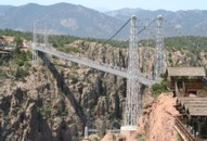
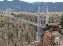
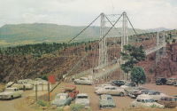
1929: Royal Gorge
Canon City, Colorado, USA - Arkansas River
| Bridgemeister ID: | 164 (added before 2003) |
| Year Completed: | 1929 |
| Name: | Royal Gorge |
| Location: | Canon City, Colorado, USA |
| Crossing: | Arkansas River |
| Coordinates: | 38.46129 N 105.32541 W |
| Maps: | Acme, GeoHack, Google, OpenStreetMap |
| Principals: | George F. Cole, O.K. Peck |
| References: | AAJ, BC3, BMA, GBD |
| Use: | Vehicular (two-lane) |
| Status: | In use (last checked: 2020) |
| Main Cables: | Wire (steel) |
| Suspended Spans: | 3 |
| Main Span: | 1 x 268.2 meters (880 feet) |
| Side Spans: | 2 |
| Deck width: | 18 feet |
Notes:
- This bridge was built solely as a tourist attraction.
External Links:
1929: Springbank
London, Ontario, Canada - River Thames
| Bridgemeister ID: | 290 (added before 2003) |
| Year Completed: | 1929 |
| Name: | Springbank |
| Location: | London, Ontario, Canada |
| Crossing: | River Thames |
| At or Near Feature: | Springbank Park |
| Principals: | J. R. Rostron |
| References: | AAJ |
| Use: | Footbridge |
| Status: | Replaced, 2002 |
| Main Cables: | Wire (steel) |
| Suspended Spans: | 1 |
| Main Span: | 1 x 71.6 meters (235 feet) |
| Deck width: | 5 feet |
Notes:
- Replaced by truss, 2002.
1930: (footbridge)
Grey Valley, Slaty Creek vicinity, New Zealand - Big River
| Bridgemeister ID: | 734 (added 2003-03-08) |
| Year Completed: | 1930 |
| Name: | (footbridge) |
| Location: | Grey Valley, Slaty Creek vicinity, New Zealand |
| Crossing: | Big River |
| References: | GAP |
| Use: | Footbridge |
1930: (footbridge)
Hartola, Finland - Tainionvirta
| Bridgemeister ID: | 5544 (added 2020-12-13) |
| Year Completed: | 1930 |
| Name: | (footbridge) |
| Location: | Hartola, Finland |
| Crossing: | Tainionvirta |
| Coordinates: | 61.568078 N 26.019536 E |
| Maps: | Acme, GeoHack, Google, OpenStreetMap |
| Use: | Footbridge |
| Status: | In use (last checked: 2020) |
| Main Cables: | Wire (steel) |
| Suspended Spans: | 1 |
1930: (pipeline bridge)
Hollenberg, Kansas, USA - Little Blue River
| Bridgemeister ID: | 167 (added before 2003) |
| Year Completed: | 1930 |
| Name: | (pipeline bridge) |
| Location: | Hollenberg, Kansas, USA |
| Crossing: | Little Blue River |
| Principals: | Matthews & Kenan |
| References: | USS |
| Use: | Pipeline |
| Main Cables: | Wire (steel) |
| Suspended Spans: | 3 |
| Main Span: | 1 x 152.4 meters (500 feet) |
| Side Spans: | 2 x 70.1 meters (230 feet) |
1930: (suspension bridge)
Anderson's farm, New Zealand - Tangarakau River
| Bridgemeister ID: | 733 (added 2003-03-08) |
| Year Completed: | 1930 |
| Name: | (suspension bridge) |
| Location: | Anderson's farm, New Zealand |
| Crossing: | Tangarakau River |
| References: | GAP |
1930: (suspension bridge)
Te Araroa vicinity, New Zealand - Kopuapounamu River
| Bridgemeister ID: | 730 (added 2003-03-08) |
| Year Completed: | 1930 |
| Name: | (suspension bridge) |
| Location: | Te Araroa vicinity, New Zealand |
| Crossing: | Kopuapounamu River |
| References: | GAP |
1930: (suspension bridge)
Whangaehu Valley, Kakatahi, New Zealand - Whangaehu River
| Bridgemeister ID: | 731 (added 2003-03-08) |
| Year Completed: | 1930 |
| Name: | (suspension bridge) |
| Location: | Whangaehu Valley, Kakatahi, New Zealand |
| Crossing: | Whangaehu River |
| At or Near Feature: | Field's Track |
| Coordinates: | 39.621392 S 175.422532 E |
| Maps: | Acme, GeoHack, Google, OpenStreetMap |
| References: | GAP |
| Status: | Removed |
| Main Span: | 1 x 53.5 meters (175.5 feet) |
Notes:
- GAP: "On Field's Track, which links the Parapara (Wanganui-Raethi) Road at Kakatahi with the Whangaehu Valley."
- Coordinates are for the current (2020) Field's Track crossing of the Whangaehu River.
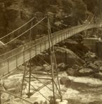
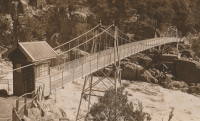
1930: Alexandra
Launceston, Tasmania, Australia - South Esk River
| Bridgemeister ID: | 444 (added before 2003) |
| Year Completed: | 1930 |
| Name: | Alexandra |
| Also Known As: | Basin |
| Location: | Launceston, Tasmania, Australia |
| Crossing: | South Esk River |
| At or Near Feature: | First Basin Water, Cataract Gorge Reserve |
| Coordinates: | 41.44681 S 147.11813 E |
| Maps: | Acme, GeoHack, Google, OpenStreetMap |
| References: | STC |
| Use: | Footbridge |
| Status: | In use (last checked: 2019) |
| Main Cables: | Wire (steel) |
| Suspended Spans: | 3 |
| Main Span: | 1 x 45.7 meters (149.9 feet) |
| Side Spans: | 1 x 16.8 meters (55.1 feet), 1 x 10.7 meters (35.1 feet) |
Notes:
- 2004: Refurbished, including replacement of cables which supposedly dated to the first Alexandra bridge.
- 2020, October: Maintenance project started focused on corrosion prevention including stripping paint and repainting.
- Replaced 1904 Alexandra (Basin) - Launceston, Tasmania, Australia.
- Near 1939 Duck Reach - Launceston, Tasmania, Australia.
- Near 1995 Duck Reach - Launceston, Tasmania, Australia.
External Links:
1930: Bolko
Opole, Poland - Oder River
| Bridgemeister ID: | 7903 (added 2023-10-15) |
| Year Completed: | 1930 |
| Name: | Bolko |
| Also Known As: | Bolkobrücke |
| Location: | Opole, Poland |
| Crossing: | Oder River |
| Coordinates: | 50.658406 N 17.921887 E |
| Maps: | Acme, GeoHack, Google, OpenStreetMap |
| Status: | Destroyed, 1945 |
| Suspended Spans: | 2 |
| Characteristics: | Self-anchored |
External Links:
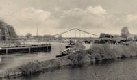
1930: Capens
Capens, Haute-Garonne, France - Garonne River
| Bridgemeister ID: | 6742 (added 2021-10-23) |
| Year Completed: | 1930 |
| Name: | Capens |
| Location: | Capens, Haute-Garonne, France |
| Crossing: | Garonne River |
| Use: | Vehicular |
| Status: | Removed |
| Main Cables: | Wire (steel) |
| Main Span: | 1 |
Notes:
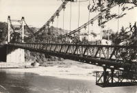
1930: Colfax-Foresthill
Yankee Jims, Colfax vicinity, California, USA - North Fork American River
| Bridgemeister ID: | 165 (added before 2003) |
| Year Completed: | 1930 |
| Name: | Colfax-Foresthill |
| Also Known As: | Yankee Jims |
| Location: | Yankee Jims, Colfax vicinity, California, USA |
| Crossing: | North Fork American River |
| Coordinates: | 39.040306 N 120.902667 W |
| Maps: | Acme, GeoHack, Google, OpenStreetMap |
| Use: | Vehicular (one-lane) |
| Status: | In use (last checked: 2023) |
| Main Cables: | Wire (steel) |
| Suspended Spans: | 1 |
| Main Span: | 1 x 53 meters (173.9 feet) estimated |
Notes:
- 2023: Replacement announced. The suspension bridge will be preserved and remain in place.
- Companion to 1928 Colfax-Iowa Hill - Colfax vicinity, California, USA.
External Links:
- Facebook - Placer County Government. Video discussing the history of the bridge and planned replacement project.
- Structurae - Structure ID 20011089
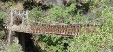
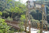
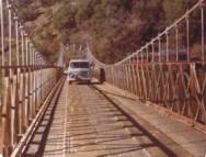
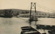
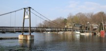
1930: Cranberry Lake
Cranberry Lake, Byram, New Jersey, USA - Cranberry Lake
| Bridgemeister ID: | 153 (added before 2003) |
| Year Completed: | 1930 |
| Name: | Cranberry Lake |
| Location: | Cranberry Lake, Byram, New Jersey, USA |
| Crossing: | Cranberry Lake |
| Coordinates: | 40.95401 N 74.73714 W |
| Maps: | Acme, GeoHack, Google, OpenStreetMap |
| References: | BONJ, PQU |
| Use: | Footbridge |
| Status: | Closed, 2019 (last checked: 2020) |
| Main Cables: | Wire (steel) |
| Suspended Spans: | 3 |
| Main Span: | 1 x 61.5 meters (201.7 feet) estimated |
| Side Spans: | 2 x 21.8 meters (71.5 feet) estimated |
Notes:
- 1928 and 1931 also sometimes cited as years of completion. Construction appears to have completed in December 1930, possibly opening in early 1931.
- 2019: Closed pending repairs and rehabilitation.
External Links:
- Save Our Bridge. "Dedicated to restoring and preserving the historic Cranberry Lake footbridge - one of the oldest pedestrian footbridges in the state of New Jersey."
1930: Diffloo Hanging
Panbari N.C., Assam, India - Diffloo River
| Bridgemeister ID: | 7422 (added 2022-12-09) |
| Year Completed: | 1930 |
| Name: | Diffloo Hanging |
| Also Known As: | ডিফলু হ্যাংগিং ব্রিজ |
| Location: | Panbari N.C., Assam, India |
| Crossing: | Diffloo River |
| Coordinates: | 26.605922 N 93.581004 E |
| Maps: | Acme, GeoHack, Google, OpenStreetMap |
| Status: | In use (last checked: 2022) |
| Main Cables: | Wire (steel) |
| Suspended Spans: | 1 |
1930: General Juan Vicente Gómez
El Dorado, Bolívar, Venezuela - Rio Cuyuní
| Bridgemeister ID: | 4772 (added 2020-07-03) |
| Year Completed: | 1930 |
| Name: | General Juan Vicente Gómez |
| Location: | El Dorado, Bolívar, Venezuela |
| Crossing: | Rio Cuyuní |
| Coordinates: | 6.715560 N 61.610438 W |
| Maps: | Acme, GeoHack, Google, OpenStreetMap |
| Use: | Vehicular (one-lane) |
| Status: | Restricted to foot traffic (last checked: 2018) |
| Main Cables: | Wire (steel) |
| Suspended Spans: | 1 |
External Links:
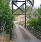
1930: Horse Creek
Horse Creek, California, USA - Klamath River
| Bridgemeister ID: | 586 (added 2003-01-05) |
| Year Completed: | 1930 |
| Name: | Horse Creek |
| Location: | Horse Creek, California, USA |
| Crossing: | Klamath River |
| Coordinates: | 41.824678 N 122.997667 W |
| Maps: | Acme, GeoHack, Google, OpenStreetMap |
| Use: | Vehicular (one-lane) |
| Status: | In use (last checked: 2012) |
| Main Cables: | Wire (steel) |
| Suspended Spans: | 1 |
Notes:
External Links:
1930: Kamoro
Antanambazaha, Madagascar - Mahajamba River
| Bridgemeister ID: | 4750 (added 2020-06-27) |
| Year Completed: | 1930 |
| Name: | Kamoro |
| Location: | Antanambazaha, Madagascar |
| Crossing: | Mahajamba River |
| Coordinates: | 16.460751 S 47.168838 E |
| Maps: | Acme, GeoHack, Google, OpenStreetMap |
| Principals: | Gaston Leinekugel Le Cocq |
| References: | KSBM |
| Use: | Vehicular (one-lane) |
| Status: | Restricted to foot traffic (last checked: 2017) |
| Main Cables: | Wire (steel) |
| Suspended Spans: | 2 |
| Main Span: | 1 x 206.5 meters (677.5 feet) |
| Side Span: | 1 x 54 meters (177.2 feet) |
| Deck width: | 4 meters |
Notes:
External Links:
1930: Klenklen
Pilot Grove vicinity, Missouri, USA - Lamine River
| Bridgemeister ID: | 1570 (added 2004-12-05) |
| Year Completed: | 1930 |
| Name: | Klenklen |
| Location: | Pilot Grove vicinity, Missouri, USA |
| Crossing: | Lamine River |
| Coordinates: | 38.828284 N 93.034299 W |
| Maps: | Acme, GeoHack, Google, OpenStreetMap |
| Principals: | Joseph A. Dice |
| References: | HAERMO91 |
| Use: | Vehicular (one-lane) |
| Status: | Removed, c. 1996 |
| Main Cables: | Wire (steel) |
| Suspended Spans: | 2 |
| Main Span: | 1 x 61 meters (200 feet) |
| Side Span: | 1 x 9.1 meters (30 feet) |
Notes:
- Partially collapsed. Closed and replaced 1994, demolished c. 1996.
- Coordinates are approximate, showing location of replacement.
- Sometimes spelled as "Klenken."
- Sometimes cited as having been completed in 1929, HAER MO-91 (reference HAERMO91) states construction began September 1929 and completed in April 1930.
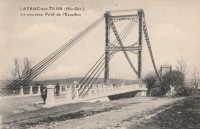
1930: Layrac-sur-Tarn
Layrac-sur-Tarn, Haute-Garonne, France - Tarn River
| Bridgemeister ID: | 7184 (added 2022-07-02) |
| Year Completed: | 1930 |
| Name: | Layrac-sur-Tarn |
| Location: | Layrac-sur-Tarn, Haute-Garonne, France |
| Crossing: | Tarn River |
| Use: | Vehicular |
| Status: | Removed |
| Main Cables: | Wire (steel) |
| Suspended Spans: | 1 |
| Main Span: | 1 |
Notes:
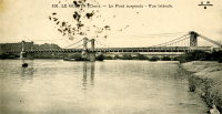
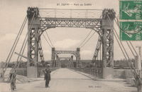
1930: Le Guétin
Le Guétin, Cuffy vicinity, Cher and Gimouille, Nièvre, France - Allier River
| Bridgemeister ID: | 2844 (added 2005-03-19) |
| Year Completed: | 1930 |
| Name: | Le Guétin |
| Location: | Le Guétin, Cuffy vicinity, Cher and Gimouille, Nièvre, France |
| Crossing: | Allier River |
| Coordinates: | 46.947881 N 3.073013 E |
| Maps: | Acme, GeoHack, Google, OpenStreetMap |
| References: | AAJ |
| Use: | Vehicular |
| Status: | Replaced |
| Main Cables: | Wire (steel) |
| Suspended Spans: | 5 |
| Main Spans: | 5 |
Notes:
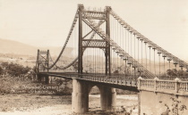
1930: Libertador
San Cristobal and Táriba, Táchira, Venezuela - Rio Torbes
| Bridgemeister ID: | 4580 (added 2020-06-05) |
| Year Completed: | 1930 |
| Name: | Libertador |
| Location: | San Cristobal and Táriba, Táchira, Venezuela |
| Crossing: | Rio Torbes |
| Coordinates: | 7.810055 N 72.232265 W |
| Maps: | Acme, GeoHack, Google, OpenStreetMap |
| Use: | Vehicular |
| Status: | In use (last checked: 2019) |
| Main Cables: | Wire (steel) |
| Suspended Spans: | 3 |
| Main Span: | 1 |
| Side Spans: | 2 |
External Links:
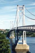
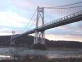
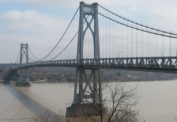
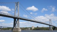
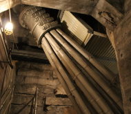
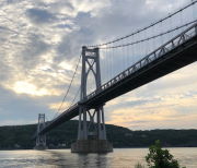
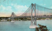
1930: Mid-Hudson
Poughkeepsie and Highland, New York, USA - Hudson River
| Bridgemeister ID: | 166 (added before 2003) |
| Year Completed: | 1930 |
| Name: | Mid-Hudson |
| Also Known As: | Franklin Delano Roosevelt Mid-Hudson |
| Location: | Poughkeepsie and Highland, New York, USA |
| Crossing: | Hudson River |
| Coordinates: | 41.702933 N 73.946683 W |
| Maps: | Acme, GeoHack, Google, OpenStreetMap |
| Principals: | Ralph Modjeski |
| References: | AAJ, BPL, PTS2, SJR, USS |
| Use: | Vehicular (two-lane, heavy vehicles), with walkway |
| Status: | In use (last checked: 2019) |
| Main Cables: | Wire (steel) |
| Suspended Spans: | 3 |
| Main Span: | 1 x 457.2 meters (1,500 feet) |
| Side Spans: | 2 x 228.6 meters (750 feet) |
| Deck width: | 39 feet |
Notes:
- Although the length of the main span of the bridge is officially 1,500 feet, the actual length is 1,495 feet. During construction one of the caissons slid and tilted from its intended location. While efforts were made to move the caisson back, it was ultimately fixed in a position that left the main span five feet short of 1,500. Not wanting to lose the claim of having a 1,500-foot bridge, the shortfall has been kept out of official records since.
External Links:
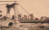
1930: Riscle
Riscle, Gers, France - Adour River
| Bridgemeister ID: | 7316 (added 2022-08-28) |
| Year Completed: | 1930 |
| Name: | Riscle |
| Location: | Riscle, Gers, France |
| Crossing: | Adour River |
| Coordinates: | 43.663878 N 0.081895 W |
| Maps: | Acme, GeoHack, Google, OpenStreetMap |
| Use: | Vehicular |
| Status: | Destroyed, 1944 |
| Main Cables: | Wire (steel) |
| Main Span: | 1 |
Notes:
- Replaced by 1955 Riscle - Riscle, Gers, France.
External Links:
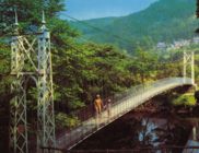
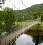
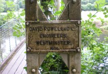
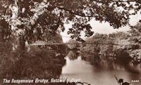
1930: Sappers'
Betws-y-Coed, Wales, United Kingdom - River Conwy
| Bridgemeister ID: | 445 (added before 2003) |
| Year Completed: | 1930 |
| Name: | Sappers' |
| Location: | Betws-y-Coed, Wales, United Kingdom |
| Crossing: | River Conwy |
| Coordinates: | 53.09221 N 3.79928 W |
| Maps: | Acme, GeoHack, Google, OpenStreetMap |
| Principals: | David Rowell & Co. |
| Use: | Footbridge |
| Status: | Closed, December 2021 (last checked: 2023) |
| Main Cables: | Wire (steel) |
| Suspended Spans: | 1 |
Notes:
- 2021, December: Closed due to deteriorating condition. Repairs expected to start in April 2022.
- 2023, February: Still closed. May be replaced.
Annotated Citations:
- Evans, Hari. "Near century old Snowdonia wobbly bridge that's rotting away and may soon be replaced." North Wales Live, 9 Feb. 2023, https://www.dailypost.co.uk/news/north-wales-news/near-century-old-snowdonia-wobbly-26198160.
"The suspension bridge used to be renowned for its wobbly midpoint and was a key shortcut across the River Conwy for locals and tourists. However, structural reviews conducted last year found that virtually the entire bridge would need to be refurbished, with the entire timber deck as well as other parts replaced completely."
External Links:
1930: Slade's
Rockville vicinity, Rhode Island, USA - Yawgoog Pond
| Bridgemeister ID: | 1642 (added 2005-03-14) |
| Year Completed: | 1930 |
| Name: | Slade's |
| Location: | Rockville vicinity, Rhode Island, USA |
| Crossing: | Yawgoog Pond |
| Principals: | Paul W. Slade |
| Use: | Footbridge |
| Status: | Removed, 1948 |
| Main Cables: | Wire |
| Suspended Spans: | 1 |
| Main Span: | 1 x 59.4 meters (195 feet) |
1930: Tsoelike
Lesotho - Orange River
| Bridgemeister ID: | 1994 (added 2005-12-10) |
| Year Completed: | 1930 |
| Name: | Tsoelike |
| Location: | Lesotho |
| Crossing: | Orange River |
| Coordinates: | 30.002343 S 28.662395 E |
| Maps: | Acme, GeoHack, Google, OpenStreetMap |
| Use: | Vehicular (one-lane) |
| Status: | Extant (last checked: 2019) |
| Main Cables: | Wire (steel) |
| Suspended Spans: | 1 |
External Links:
1931: (suspension bridge)
Murchison District, New Zealand - Matiri River
| Bridgemeister ID: | 737 (added 2003-03-08) |
| Year Completed: | 1931 |
| Name: | (suspension bridge) |
| Location: | Murchison District, New Zealand |
| Crossing: | Matiri River |
| References: | GAP |
| Status: | Removed |
Notes:
- GAP: Maybe completed early 1932, no longer in existence.
1931: (suspension bridge)
Wakarara, Tikokino vicinity, New Zealand - Waipawa River
| Bridgemeister ID: | 736 (added 2003-03-08) |
| Year Completed: | 1931 |
| Name: | (suspension bridge) |
| Location: | Wakarara, Tikokino vicinity, New Zealand |
| Crossing: | Waipawa River |
| Principals: | S.T. Silver |
| References: | GAP |
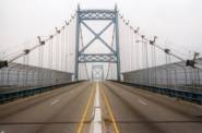
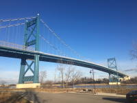
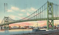
1931: Anthony Wayne
Toledo, Ohio, USA - Maumee River
| Bridgemeister ID: | 168 (added before 2003) |
| Year Completed: | 1931 |
| Name: | Anthony Wayne |
| Location: | Toledo, Ohio, USA |
| Crossing: | Maumee River |
| Coordinates: | 41.64086 N 83.53361 W |
| Maps: | Acme, GeoHack, Google, OpenStreetMap |
| Principals: | Waddell and Hardesty |
| References: | AAJ, SJR, SSS |
| Use: | Vehicular (major highway), with walkway |
| Status: | In use (last checked: 2021) |
| Main Cables: | Wire (steel) |
| Suspended Spans: | 3 |
| Main Span: | 1 x 239.3 meters (785 feet) |
| Side Spans: | 2 x 71.2 meters (233.5 feet) |
| Deck width: | 60 feet |
External Links:
1931: Bemis
Notchland, Hart's Location vicinity, New Hampshire, USA - Saco River
| Bridgemeister ID: | 316 (added before 2003) |
| Year Completed: | 1931 |
| Name: | Bemis |
| Location: | Notchland, Hart's Location vicinity, New Hampshire, USA |
| Crossing: | Saco River |
| At or Near Feature: | Davis Path trail, White Mountain National Park |
| Coordinates: | 44.12047 N 71.35367 W |
| Maps: | Acme, GeoHack, Google, OpenStreetMap |
| References: | PQU |
| Use: | Footbridge |
| Status: | Replaced, c. 2001 |
| Suspended Spans: | 2 |
| Main Span: | 1 x 32.9 meters (108 feet) |
| Side Span: | 1 x 15.2 meters (50 feet) |
Notes:
- Replaced by a small single-towered cable-stayed bridge, circa 2001.
External Links:
1931: Buchanan Dam
Buchanan Dam, Texas, USA - Colorado River
| Bridgemeister ID: | 2514 (added 2009-12-30) |
| Year Completed: | 1931 |
| Name: | Buchanan Dam |
| Location: | Buchanan Dam, Texas, USA |
| Crossing: | Colorado River |
| Use: | Vehicular (one-lane) |
| Status: | Removed |
| Main Cables: | Wire (steel) |
| Suspended Spans: | 1 |
Notes:
- Large one-lane suspension bridge built during the construction of Buchanan Dam.
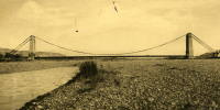
1931: Cavaillon
Cavaillon, Vaucluse and Bouches-du-Rhône, France - Durance River
| Bridgemeister ID: | 1013 (added 2003-11-22) |
| Year Completed: | 1931 |
| Name: | Cavaillon |
| Location: | Cavaillon, Vaucluse and Bouches-du-Rhône, France |
| Crossing: | Durance River |
| Use: | Vehicular |
| Status: | Destroyed, 1944 |
| Main Cables: | Wire |
| Suspended Spans: | 1 |
Notes:
- Destroyed August 24, 1944.
- Replaced 1837 Cavaillon - Cavaillon, Vaucluse and Bouches-du-Rhône, France.
External Links:
1931: Châtillon-sur-Loire
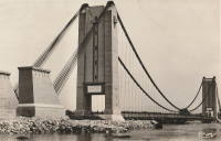
Châtillon-sur-Loire, Loiret, France - Loire River
| Bridgemeister ID: | 1018 (added 2003-11-22) |
| Year Completed: | 1931 |
| Name: | Châtillon-sur-Loire |
| Location: | Châtillon-sur-Loire, Loiret, France |
| Crossing: | Loire River |
| Coordinates: | 47.598786 N 2.761769 E |
| Maps: | Acme, GeoHack, Google, OpenStreetMap |
| Use: | Vehicular |
| Status: | Destroyed, June, 1940 |
| Main Cables: | Wire (steel) |
| Suspended Spans: | 4 |
| Main Spans: | 4 |
Notes:
- Replaced 1841 Châtillon-sur-Loire - Châtillon-sur-Loire, Loiret, France.
- Replaced by 1951 Châtillon-sur-Loire - Châtillon-sur-Loire, Loiret, France.
External Links:
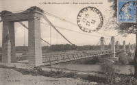
1931: Feneyrols
Feneyrols, Tarn-et-Garonne, France - Aveyron River
| Bridgemeister ID: | 1551 (added 2004-11-13) |
| Year Completed: | 1931 |
| Name: | Feneyrols |
| Location: | Feneyrols, Tarn-et-Garonne, France |
| Crossing: | Aveyron River |
| Coordinates: | 44.129389 N 1.819662 E |
| Maps: | Acme, GeoHack, Google, OpenStreetMap |
| Use: | Vehicular (two-lane) |
| Status: | In use (last checked: 2022) |
| Main Cables: | Wire (steel) |
| Suspended Spans: | 1 |
| Main Span: | 1 x 86 meters (282.2 feet) estimated |
External Links:
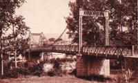
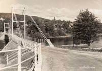
1931: Gamlebrua
Kongsberg, Viken, Norway - Numedalslågen
| Bridgemeister ID: | 536 (added before 2003) |
| Year Completed: | 1931 |
| Name: | Gamlebrua |
| Location: | Kongsberg, Viken, Norway |
| Crossing: | Numedalslågen |
| Coordinates: | 59.662620 N 9.652555 E |
| Maps: | Acme, GeoHack, Google, kart.1881.no, OpenStreetMap |
| Use: | Vehicular (one-lane), with walkway |
| Status: | In use (last checked: 2019) |
| Main Cables: | Wire (steel) |
| Suspended Spans: | 1 |
| Main Span: | 1 x 110 meters (360.9 feet) estimated |
External Links:
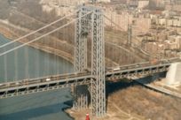
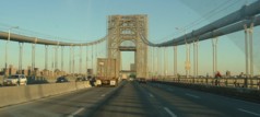
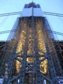
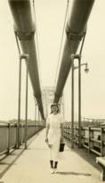
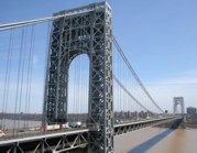
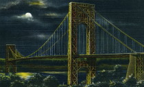
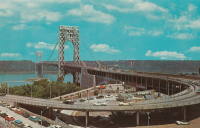
1931: George Washington
New York, New York and Fort Lee, New Jersey, USA - Hudson River
| Bridgemeister ID: | 169 (added before 2003) |
| Year Completed: | 1931 |
| Name: | George Washington |
| Also Known As: | GWB |
| Location: | New York, New York and Fort Lee, New Jersey, USA |
| Crossing: | Hudson River |
| Coordinates: | 40.85333 N 73.955 W |
| Maps: | Acme, GeoHack, Google, OpenStreetMap |
| Principals: | O.H. Ammann, Leon Moisseiff, Dana, Gilbert |
| References: | AAJ, AOB, ARF, BBR, BC3, BFL, BMA, BONJ, BOU, BPL, BRU, COB, CTW, ENR19270811a, ENR19270811b, ENR19290411c, GBD, LAB, LACE, PTS2, SIX, SJR |
| Use: | Vehicular (double-deck), with walkway |
| Status: | In use (last checked: 2022) |
| Main Cables: | Wire (steel) |
| Suspended Spans: | 3 |
| Main Span: | 1 x 1,066.8 meters (3,500 feet) |
| Side Spans: | 2 x 198.1 meters (650 feet) |
| Deck width: | 120 feet |
Notes:
- Became longest suspension bridge by eclipsing 1929 Ambassador - Detroit, Michigan, USA and Windsor, Ontario, Canada.
- Eclipsed by new longest suspension bridge 1937 Golden Gate - San Francisco and Marin County, California, USA.
External Links:
1931: Hagwilget
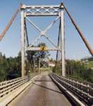
Hagwilget, British Columbia, Canada - Bulkley River
| Bridgemeister ID: | 170 (added before 2003) |
| Year Completed: | 1931 |
| Name: | Hagwilget |
| Also Known As: | Bulkley Canyon |
| Location: | Hagwilget, British Columbia, Canada |
| Crossing: | Bulkley River |
| At or Near Feature: | Hagwilget Canyon |
| Coordinates: | 55.25740 N 127.60380 W |
| Maps: | Acme, GeoHack, Google, OpenStreetMap |
| Principals: | BC Department of Public Works |
| References: | AAJ |
| Use: | Vehicular (one-lane) |
| Status: | In use (last checked: 2008) |
| Main Cables: | Wire (steel) |
| Suspended Spans: | 1 |
| Main Span: | 1 x 140.2 meters (460 feet) |
| Deck width: | 16 feet |
Notes:
External Links:
1931: Long Shoal
Warsaw vicinity, Missouri, USA - Osage River
| Bridgemeister ID: | 3517 (added 2019-12-24) |
| Year Completed: | 1931 |
| Name: | Long Shoal |
| Location: | Warsaw vicinity, Missouri, USA |
| Crossing: | Osage River |
| Principals: | Joseph A. Dice |
| References: | BOTO |
| Use: | Vehicular |
| Status: | Collapsed, September 21, 1965 |
| Main Cables: | Wire (steel) |
Notes:
- Collapsed, killing three people, September 1965.
1931: Mata River
Makarika, Ruatoria vicinity, New Zealand - Mata River
| Bridgemeister ID: | 735 (added 2003-03-08) |
| Year Completed: | 1931 |
| Name: | Mata River |
| Location: | Makarika, Ruatoria vicinity, New Zealand |
| Crossing: | Mata River |
| References: | GAP |
| Use: | Vehicular (one-lane) |
| Status: | Replaced |
| Main Cables: | Wire (steel) |
| Suspended Spans: | 1 |
| Main Span: | 1 x 151 meters (495.4 feet) |
External Links:
| Bridgemeister ID: | 1560 (added 2004-11-26) |
| Year Completed: | 1931 |
| Name: | Ponkila |
| Location: | Muhos, Finland |
| Crossing: | Muhosjoki |
| Coordinates: | 64.808996 N 26.005233 E |
| Maps: | Acme, GeoHack, Google, OpenStreetMap |
| Principals: | L. Iloniemi |
| Use: | Vehicular (one-lane) |
| Status: | Restricted to foot traffic (last checked: 2004) |
| Main Cables: | Wire (steel) |
1931: Raensbrua
Kråkebumoen vicinity, Kristiansand, Agder, Norway - Tovdalselva
| Bridgemeister ID: | 4314 (added 2020-04-10) |
| Year Completed: | 1931 |
| Name: | Raensbrua |
| Location: | Kråkebumoen vicinity, Kristiansand, Agder, Norway |
| Crossing: | Tovdalselva |
| Coordinates: | 58.277040 N 8.176805 E |
| Maps: | Acme, GeoHack, Google, kart.1881.no, OpenStreetMap |
| Use: | Footbridge |
| Status: | Only towers remain (last checked: 2019) |
| Main Cables: | Wire (steel) |
| Suspended Spans: | 1 |
| Main Span: | 1 x 75 meters (246.1 feet) estimated |
Notes:
- In a derelict state by late 2000s. Only the towers remain by late 2010s.
1931: Rubens
Los Angeles vicinity, Natales, Chile - Rio Rubens
| Bridgemeister ID: | 6917 (added 2022-01-21) |
| Year Completed: | 1931 |
| Name: | Rubens |
| Location: | Los Angeles vicinity, Natales, Chile |
| Crossing: | Rio Rubens |
| Coordinates: | 52.036240 S 71.947632 W |
| Maps: | Acme, GeoHack, Google, OpenStreetMap |
| Use: | Vehicular |
| Status: | Derelict (last checked: 2021) |
| Main Cables: | Wire (steel) |
| Main Span: | 1 x 42 meters (137.8 feet) estimated |
External Links:
- Licitan estudio de ingeniería para la reposición del puente Rubens | La Prensa Austral. "Tender for engineering study for the replacement of the Rubens bridge." Article (2018) discusses replacement of the adjacent highway bridge, but also mentions plans to restore the suspension bridge as tourist attraction.
1931: Saint-Pierre
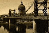
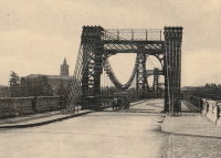
Toulouse, Haute-Garonne, France - Garonne River
| Bridgemeister ID: | 2049 (added 2006-05-21) |
| Year Completed: | 1931 |
| Name: | Saint-Pierre |
| Location: | Toulouse, Haute-Garonne, France |
| Crossing: | Garonne River |
| Coordinates: | 43.602833 N 1.435199 E |
| Maps: | Acme, GeoHack, Google, OpenStreetMap |
| Use: | Vehicular |
| Status: | Demolished, 1986 |
| Main Cables: | Wire |
Notes:
External Links:

1931: Saint-Sulpice
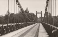
Saint-Sulpice-la-Pointe, Tarn, France - Agout River
| Bridgemeister ID: | 7489 (added 2022-12-30) |
| Year Completed: | 1931 |
| Name: | Saint-Sulpice |
| Location: | Saint-Sulpice-la-Pointe, Tarn, France |
| Crossing: | Agout River |
| Coordinates: | 43.777048 N 1.686685 E |
| Maps: | Acme, GeoHack, Google, OpenStreetMap |
| Use: | Vehicular, with walkway |
| Status: | In use (last checked: 2022) |
| Main Cables: | Wire (steel) |
| Suspended Spans: | 1 |
Notes:
1931: Sidaway
Cleveland, Ohio, USA - Kingsbury Run
| Bridgemeister ID: | 171 (added before 2003) |
| Year Completed: | 1931 |
| Name: | Sidaway |
| Location: | Cleveland, Ohio, USA |
| Crossing: | Kingsbury Run |
| Coordinates: | 41.477805 N 81.642944 W |
| Maps: | Acme, GeoHack, Google, OpenStreetMap |
| Principals: | Wilbur Watson, Fred Plummer. New York, Chicago, and St. Louis Railroad Co. |
| References: | BMC |
| Use: | Footbridge |
| Status: | Derelict, since 1966 (last checked: 2023) |
| Main Cables: | Wire (steel) |
| Suspended Spans: | 3 |
| Main Span: | 1 x 121.9 meters (400 feet) |
| Side Spans: | 2 x 42.7 meters (140 feet) |
| Deck width: | 6 feet |
Notes:
- 2023, February: Given landmark status by the Cleveland City Council so that it is eligible to receive grants for preservation.
- BMC describes a feud between the neighborhoods on either side of the bridge that led to events in July 1966: "someone set fire to the wooden deck and ripped out fifteen feet of the southern portion. The bridge now is considered a nuisance."
- 2022, October: Added to National Register of Historic Places.
External Links:
- Sidaway Bridge once connected Black and white neighborhoods. Now it connects us to the past.. July 22, 2020 news article by News 5 (ABC) Cleveland.
- Structurae - Structure ID 20015438
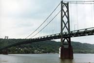
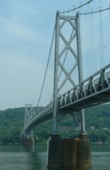
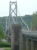
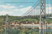
1931: Simon Kenton Memorial
Maysville, Kentucky and Aberdeen, Ohio, USA - Ohio River
| Bridgemeister ID: | 172 (added before 2003) |
| Year Completed: | 1931 |
| Name: | Simon Kenton Memorial |
| Also Known As: | Maysville |
| Location: | Maysville, Kentucky and Aberdeen, Ohio, USA |
| Crossing: | Ohio River |
| Coordinates: | 38.649890 N 83.759670 W |
| Maps: | Acme, GeoHack, Google, OpenStreetMap |
| Principals: | Modjeski, Masters & Chase |
| References: | AAJ, SJR, SSS |
| Use: | Vehicular (two-lane), with walkway |
| Status: | In use (last checked: 2022) |
| Main Cables: | Wire (steel) |
| Suspended Spans: | 3 |
| Main Span: | 1 x 323.1 meters (1,060 feet) |
| Side Spans: | 2 x 141.7 meters (464.9 feet) |
| Deck width: | 28 feet |
Notes:
- 2022, March: USD$23.4 million budgeted for rehabilitation project including suspender cable replacements, steel repairs, and painting.
- 2019: Closed late 2019 due to suspender cable corrosion. Short-term fixes applied to reduce the stress on the suspenders and to prevent rusting.
- 2020, June: Reopened with a 15-ton weight limit after installation of temporary support rods and brackets to reduce the stress on damaged cables.
External Links:
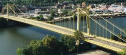
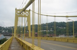
1931: South Tenth Street
Pittsburgh, Pennsylvania, USA - Monongahela River
| Bridgemeister ID: | 173 (added before 2003) |
| Year Completed: | 1931 |
| Name: | South Tenth Street |
| Also Known As: | South Side, Tenth Street, Philip Murray |
| Location: | Pittsburgh, Pennsylvania, USA |
| Crossing: | Monongahela River |
| Coordinates: | 40.43166 N 79.989 W |
| Maps: | Acme, GeoHack, Google, OpenStreetMap |
| Principals: | Sydney A. Shubin |
| References: | AAJ, BOP, BPL, PBR, SSS, USS |
| Use: | Vehicular (four-lane), with walkway |
| Status: | In use (last checked: 2019) |
| Main Cables: | Wire (steel) |
| Suspended Spans: | 3 |
| Main Span: | 1 x 228.6 meters (750 feet) |
| Side Spans: | 2 x 83.8 meters (275 feet) |
| Deck width: | 54 feet |
External Links:
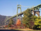
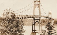
1931: St. Johns
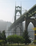
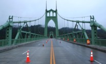
Portland, Oregon, USA - Willamette River
| Bridgemeister ID: | 174 (added before 2003) |
| Year Completed: | 1931 |
| Name: | St. Johns |
| Location: | Portland, Oregon, USA |
| Crossing: | Willamette River |
| Coordinates: | 45.585 N 122.76333 W |
| Maps: | Acme, GeoHack, Google, OpenStreetMap |
| Principals: | Robinson and Steinman |
| References: | AAJ, ADDS, BC3, BCO, BFL, BPL, GBD, LAB, SJR |
| Use: | Vehicular (four-lane), with walkway |
| Status: | In use (last checked: 2022) |
| Main Cables: | Wire (steel) |
| Suspended Spans: | 3 |
| Main Span: | 1 x 367.9 meters (1,207 feet) |
| Side Spans: | 2 x 131.1 meters (430.25 feet) |
| Deck width: | 52 feet |
Notes:
- Substantially rehabilitated, 2003-2005.
External Links:
1931: Star Mine
Rosedale, Drumheller vicinity, Alberta, Canada - Red Deer River
| Bridgemeister ID: | 350 (added before 2003) |
| Year Completed: | 1931 |
| Name: | Star Mine |
| Also Known As: | Rosedale Swinging |
| Location: | Rosedale, Drumheller vicinity, Alberta, Canada |
| Crossing: | Red Deer River |
| Coordinates: | 51.420021 N 112.614473 W |
| Maps: | Acme, GeoHack, Google, OpenStreetMap |
| Principals: | George Lester MacKenzie |
| Use: | Footbridge |
| Status: | In use (last checked: 2024) |
| Main Cables: | Wire (steel) |
| Suspended Spans: | 1 |
| Main Span: | 1 x 117 meters (383.9 feet) |
Notes:
- 1958: Rebuilt.
- 2020, May: Closed indefinitely due to safety concerns. During an inspection of the bridge "it was determined the northeast timber bridge support was in extremely poor condition."
- 2023, October: Contract to repair bridge awarded. Expected to reopen in April 2024.
Annotated Citations:
- Nairn, Lacie. "Town waiting on province for Rosedale suspension bridge repairs." The Drumheller Mail, 13 Apr. 2022, www.thestar.com/news/canada/2022/04/13/town-waiting-on-province-for-rosedale-suspension-bridge-repairs.html
The bridge is still closed. "The town initially hoped to complete repairs over the winter of 2021. However, as the land on the northern shore of the bridge was privately owned, land transfer negotiations were conducted between the Town, Alberta Transportation, and the landowner."
External Links:

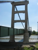
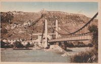
1931: Teil
Le Teil, Ardèche and Montélimar, Drôme, France - Rhône River
| Bridgemeister ID: | 1549 (added 2004-11-13) |
| Year Completed: | 1931 |
| Name: | Teil |
| Location: | Le Teil, Ardèche and Montélimar, Drôme, France |
| Crossing: | Rhône River |
| Coordinates: | 44.5519 N 4.692617 E |
| Maps: | Acme, GeoHack, Google, OpenStreetMap |
| References: | AAJ, BPF |
| Use: | Vehicular (two-lane, heavy vehicles), with walkway |
| Status: | In use (last checked: 2005) |
| Main Cables: | Wire (steel) |
| Suspended Spans: | 1 |
| Main Span: | 1 x 235 meters (771 feet) |
Notes:
- Destroyed, 1944. Rebuilt, 1950.
- Replaced 1839 Teil - Le Teil, Ardèche and Montélimar, Drôme, France.
External Links:
- Pont routier du Teil - Inventaire Général du Patrimoine Culturel. Detailed history and many images of the suspension bridges at Le Teil.
- Structurae - Structure ID 20001106
1931: Verdun-sur-Garonne
Verdun-sur-Garonne, Tarn-et-Garonne, France - Garonne River
| Bridgemeister ID: | 2347 (added 2007-08-18) |
| Year Completed: | 1931 |
| Name: | Verdun-sur-Garonne |
| Location: | Verdun-sur-Garonne, Tarn-et-Garonne, France |
| Crossing: | Garonne River |
| Coordinates: | 43.854713 N 1.242315 E |
| Maps: | Acme, GeoHack, Google, OpenStreetMap |
| Use: | Vehicular |
| Status: | Replaced, 2010 |
| Main Cables: | Wire (steel) |
| Suspended Spans: | 1 |
Notes:
- Coordinates are for the 2010 replacement suspension bridge, but construction photos of the newer bridge show the 1931 bridge was extremely close to the 2010 bridge.
- Replaced by 2010 Verdun-sur-Garonne - Verdun-sur-Garonne, Tarn-et-Garonne, France.
- See 1841 Verdun-sur-Garonne - Verdun-sur-Garonne, Tarn-et-Garonne, France. The relationship between the older and current bridges is unclear.
External Links:
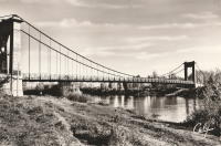
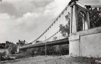
1931: Vicq-sur-Gartempe
Vicq-sur-Gartempe, Vienne, France - Gartempe River
| Bridgemeister ID: | 3997 (added 2020-03-27) |
| Year Completed: | 1931 |
| Name: | Vicq-sur-Gartempe |
| Location: | Vicq-sur-Gartempe, Vienne, France |
| Crossing: | Gartempe River |
| References: | AAJ |
| Use: | Vehicular |
| Status: | Replaced, 1989 |
| Main Cables: | Wire (steel) |
| Suspended Spans: | 1 |
Notes:
- 1989: Replaced and subsequently removed.
- Replaced 1881 Vicq-sur-Gartempe - Vicq-sur-Gartempe, Vienne, France.
1931: Waldo-Hancock
Verona and Bucksport vicinity, Maine, USA - Penobscot River
| Bridgemeister ID: | 175 (added before 2003) |
| Year Completed: | 1931 |
| Name: | Waldo-Hancock |
| Location: | Verona and Bucksport vicinity, Maine, USA |
| Crossing: | Penobscot River |
| Coordinates: | 44.56 N 68.80333 W |
| Maps: | Acme, GeoHack, Google, OpenStreetMap |
| Principals: | Robinson and Steinman |
| References: | AAJ, ADDS, GBD, SSS, USS |
| Use: | Vehicular (two-lane, heavy vehicles), with walkway |
| Status: | Demolished, 2012 |
| Main Cables: | Wire (steel) |
| Suspended Spans: | 3 |
| Main Span: | 1 x 243.8 meters (800 feet) |
| Side Spans: | 2 x 106.7 meters (350 feet) |
| Deck width: | 27 feet |
Notes:
- Replacement cable-stayed bridge, (the Penobscot Narrows Bridge) completed, late 2006.
External Links:
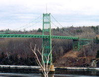
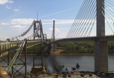
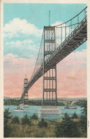
| Bridgemeister ID: | 446 (added before 2003) |
| Year Completed: | 1931 |
| Name: | Yagi-yama |
| Location: | Sendai, Miyagi, Japan |
| Coordinates: | 38.250273 N 140.852256 E |
| Maps: | Acme, GeoHack, Google, OpenStreetMap |
| Principals: | Yagi Kyubei |
| Use: | Vehicular |
| Status: | Replaced, 1965 |
| Main Cables: | Wire |
| Main Span: | 1 x 106.7 meters (350.1 feet) |
| Deck width: | 3.7 meters |
1932: (suspension bridge)
Bella Coola, British Columbia, Canada - Bella Coola River
| Bridgemeister ID: | 1436 (added 2004-07-30) |
| Year Completed: | 1932 |
| Name: | (suspension bridge) |
| Location: | Bella Coola, British Columbia, Canada |
| Crossing: | Bella Coola River |
| Status: | Removed, before 1966 |
| Main Cables: | Wire (steel) |
| Suspended Spans: | 1 |
Notes:
- Later at same location 1957 (footbridge) - Bella Coola, British Columbia, Canada.
