Inventory Search Results (1,001-1,100 of 3,327)
3,327 suspension bridges were found for search criteria: *. Bridges 1,001 through 1,100 (of 3,327 total) appear below. Click the Bridgemeister ID number to isolate the bridge on its own page. If you don't see what you were looking for, try an image search with the same criteria: *. This will find the bridge if it is pictured on the site, but is not a catenary suspension bridge.
Related:
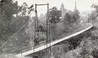
1913: Flakkebrua
Flakk, Birkenes, Agder, Norway - Tovdalselva
| Bridgemeister ID: | 4316 (added 2020-04-10) |
| Year Completed: | 1913 |
| Name: | Flakkebrua |
| Location: | Flakk, Birkenes, Agder, Norway |
| Crossing: | Tovdalselva |
| Coordinates: | 58.338842 N 8.220412 E |
| Maps: | Acme, GeoHack, Google, kart.1881.no, OpenStreetMap |
| Use: | Vehicular (one-lane) |
| Status: | Replaced, 2001 |
| Main Cables: | Wire (steel) |
| Suspended Spans: | 1 |
| Main Span: | 1 x 59 meters (193.6 feet) estimated |
| Deck width: | ~2 meters |
Notes:
- Translated from Norwegian: "The bridge came in 1913. It soon became clear that the bridge was built of poor materials. It was too late, so the logs could tear it down in flood times. It was therefore reinforced with new cables... In 1935, a major improvement was made to the bridge. It got plank deck so it could be run by horse and carriage over it. At the same time, a new road was worked up through the Tollenesholta from Flakkebrua to Osen. The bridge was also used by smaller private cars until the 1960s. Then it was closed to all motorized traffic. It was still used as a walking and cycling route."
- Replaced by 2001 Flakkebrua - Flakk, Birkenes, Agder, Norway.
- All past and present bridges at this location.
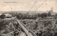
1913: Grängesberg
Grängesberg, Sweden - Skärningen Grängesberg
| Bridgemeister ID: | 8152 (added 2024-02-03) |
| Year Completed: | 1913 |
| Name: | Grängesberg |
| Location: | Grängesberg, Sweden |
| Crossing: | Skärningen Grängesberg |
| Coordinates: | 60.082389 N 14.998528 E |
| Maps: | Acme, GeoHack, Google, OpenStreetMap |
| Use: | Footbridge |
| Status: | Dismantled, 1925 |
| Main Cables: | Wire (steel) |
| Main Span: | 1 |
Notes:
- Coordinates indicate approximate location of the bridge over the large mine cut (Skärningen) at Grängesberg. The bridge was dismantled in 1925 so that the cut could be widened. It was reassembled at Vansbro.
- Moved to Vansbro (Saltviksbro) - Vansbro, Sweden.
Image Sets:
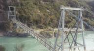
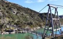
1913: Horseshoe Bend
Horseshoe Bend, Millers Flat vicinity, New Zealand - Clutha River
| Bridgemeister ID: | 695 (added 2003-03-08) |
| Year Completed: | 1913 |
| Name: | Horseshoe Bend |
| Location: | Horseshoe Bend, Millers Flat vicinity, New Zealand |
| Crossing: | Clutha River |
| Coordinates: | 45.722574 S 169.471335 E |
| Maps: | Acme, GeoHack, Google, OpenStreetMap |
| Principals: | John Edie, Jimmy Doake |
| References: | GAP |
| Use: | Footbridge |
| Status: | In use (last checked: 2017) |
| Main Cables: | Wire |
| Suspended Spans: | 1 |
Image Sets:
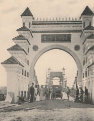
1913: Kerman
Ksar el-Kebir (Alcazarquivir), Morocco - Oued Loukos
| Bridgemeister ID: | 5847 (added 2021-05-13) |
| Year Completed: | 1913 |
| Name: | Kerman |
| Location: | Ksar el-Kebir (Alcazarquivir), Morocco |
| Crossing: | Oued Loukos |
| Use: | Vehicular |
| Status: | Removed |
Image Sets:
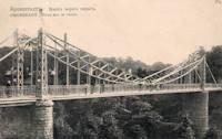
1913: Makarovskiy
Kronstadt (Кронштадт), Kotlin Island, St. Petersburg, Russia - Петровского дока
| Bridgemeister ID: | 7121 (added 2022-06-13) |
| Year Completed: | 1913 |
| Name: | Makarovskiy |
| Also Known As: | Макаровский, Makarov |
| Location: | Kronstadt (Кронштадт), Kotlin Island, St. Petersburg, Russia |
| Crossing: | Петровского дока |
| At or Near Feature: | Ravine Park (Овражный парк) |
| Coordinates: | 59.990911 N 29.775796 E |
| Maps: | Acme, GeoHack, Google, OpenStreetMap |
| Use: | Footbridge |
| Status: | In use (last checked: 2022) |
| Main Cables: | Eyebar (steel) |
| Suspended Spans: | 1 |
| Characteristics: | Braced (trussed) chain/cable |
Notes:
- Braced chain suspension system.
External Links:
Image Sets:
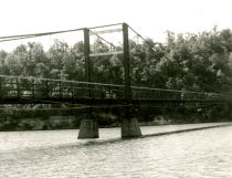
1913: Middle
Warsaw, Missouri, USA - Osage River
| Bridgemeister ID: | 149 (added before 2003) |
| Year Completed: | 1913 |
| Name: | Middle |
| Location: | Warsaw, Missouri, USA |
| Crossing: | Osage River |
| Principals: | J.S. Kidwell, C.F. Bibb |
| References: | BOTO |
| Use: | Vehicular (one-lane) |
| Status: | Demolished |
| Main Cables: | Wire |
| Suspended Spans: | 2 |
| Main Span: | 1 x 140.8 meters (462 feet) |
| Side Span: | 1 x 36.6 meters (120 feet) |
| Deck width: | 12 feet |
Notes:
- Repaired 1927, repaired 1936, damaged by flood 1943. Closed, 1975.
- Replaced 1895 Drake - Warsaw, Missouri, USA.
- All past and present bridges at this location.
External Links:
Image Sets:
1913: Peninsula
Ngatimoti, New Zealand - Motueka River
| Bridgemeister ID: | 694 (added 2003-03-08) |
| Year Completed: | 1913 |
| Name: | Peninsula |
| Location: | Ngatimoti, New Zealand |
| Crossing: | Motueka River |
| Principals: | D.F. Whiteside |
| References: | GAP |
| Use: | Vehicular |
| Main Cables: | Wire (steel) |
| Suspended Spans: | 3 |
| Main Span: | 1 x 58.5 meters (191.9 feet) |
Notes:
- GAP: Reconstructed, 1938.
External Links:
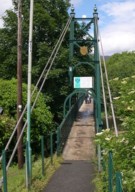
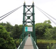
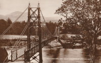
1913: Port-na-Craig
Pitlochry and Port-na Craig, Scotland, United Kingdom - River Tummel
| Bridgemeister ID: | 547 (added before 2003) |
| Year Completed: | 1913 |
| Name: | Port-na-Craig |
| Location: | Pitlochry and Port-na Craig, Scotland, United Kingdom |
| Crossing: | River Tummel |
| Coordinates: | 56.698167 N 3.733017 W |
| Maps: | Acme, GeoHack, Google, OpenStreetMap |
| Use: | Footbridge |
| Status: | In use (last checked: 2014) |
| Main Cables: | Wire (steel) |
| Suspended Spans: | 1 |
Image Sets:
1913: South Fork Mule
Hyampom vicinity, California, USA - South Fork Trinity River
| Bridgemeister ID: | 1993 (added 2005-12-10) |
| Year Completed: | 1913 |
| Name: | South Fork Mule |
| Also Known As: | Limestairs |
| Location: | Hyampom vicinity, California, USA |
| Crossing: | South Fork Trinity River |
| At or Near Feature: | Six Rivers National Forest |
| Coordinates: | 40.719083 N 123.523217 W |
| Maps: | Acme, GeoHack, Google, OpenStreetMap |
| Use: | Footbridge |
| Status: | In use (last checked: 2013) |
| Main Cables: | Wire (steel) |
| Suspended Spans: | 1 |
Notes:
- 2006: The bridge is closed. Marilyn Renaker of the "Committee to Save the Mule Bridge" writes in late August, 2006: "Trinity County and the Forest Service would like to abandon the Mule Bridge. Hyampom had a town meeting about this and everyone was opposed to the removal of the bridge which has been a part of our community since 1913."
- 2010: Multi-year repair and reconstruction project started.
- 2013: Bridge is reopened.
Image Sets:
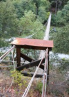
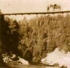
1913: Swing
Sheboygan Falls, Wisconsin, USA - Sheboygan River
| Bridgemeister ID: | 314 (added before 2003) |
| Year Completed: | 1913 |
| Name: | Swing |
| Also Known As: | Swinging |
| Location: | Sheboygan Falls, Wisconsin, USA |
| Crossing: | Sheboygan River |
| At or Near Feature: | River Park |
| Coordinates: | 43.727528 N 87.816472 W |
| Maps: | Acme, GeoHack, Google, OpenStreetMap |
| Use: | Footbridge |
| Status: | Replaced, 1987 |
| Main Cables: | Wire (steel) |
| Suspended Spans: | 1 |
| Main Span: | 1 x 45.7 meters (150 feet) estimated |
Notes:
- Jim Lucht writes that this bridge was "Damaged beyond repair when a vehicle struck the timber tower."
- Replaced by 1987 Swing - Sheboygan Falls, Wisconsin, USA.
- All past and present bridges at this location.
Image Sets:
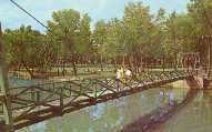
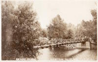
1913: Swinging
Tishomingo, Oklahoma, USA - Pennington Creek
| Bridgemeister ID: | 129 (added before 2003) |
| Year Completed: | 1913 |
| Name: | Swinging |
| Location: | Tishomingo, Oklahoma, USA |
| Crossing: | Pennington Creek |
| Coordinates: | 34.234639 N 96.682861 W |
| Maps: | Acme, GeoHack, Google, OpenStreetMap |
| Principals: | Western Bridge Company |
| Use: | Vehicular |
| Status: | Destroyed |
Notes:
- The description on the back of a postcard reads: "The only remaining swinging bridge in the state of Oklahoma crossable by automobile spans beautiful Pennington Creek in Tishomingo. The guaranteed strength of the bridge is 164 tons and is located 3 blocks south of the old Chickasaw Capitol on South Capitol Avenue. The bridge was built by Western Bridge Company of Sherman, Texas and was dedicated November 28, 1913."
- Destroyed by flood.
- An article in the April 7, 1964 issue of The Ada Evening News (Oklahoma) titled "Tishomingo Acts To Save Famed Bridge": "Tishomingo's Swinging Bridge, a landmark since Territorial days, may yet be saved from the junk man. Indeed, with a little luck, it may be put back into service to carry traffic across Pennington Creek as it did in its heyday. Some 25 persons attended a regular city council meeting Monday night to urge that the bridge be repaired; and the council appointed a committee to look into the cost of such a project. "It looks favorable," Mayor Lee butler said Tuesday. "It looks like we might get it repaired." The old suspension bridge has been closed to traffic for several years. Floor planks have rotted and fallen away, and the whole structure was condemned as unsafe. The problem of financing has held the city back from repairing the ancient structure. However, Butler said the county commissioners have offered to help, and quite a few individual citizens have promised donations to assist the project. When the committee reports back on the cost, Butler said, the council will be ready to take action."
- The bridge must have been repaired in the mid-1960's and reopened. An article in the July 9, 1978 issue of The Ada Evening News (Oklahoma) titled "Repair of Tishomingo's Suspension Bridge Slated": "Work is expected to begin in the near future on the renovation of the suspension bridge here which spans Pennington Creek. The landmark structure and last swinging bridge in the state open to vehicular traffic was closed last May when city officials deemed it was 'too dangerous' to keep open due to its deteriorated state. In an effort to reopen the bridge as soon as possible, the Tishomingo City Council acted last week to approve funding for materials necessary to repair the 65-year-old structure and has arranged for participants in the Young Adult Conservation Corps camp at Sulphur to provide the manpower needed for the work. Frank Glover, head of the Tishomingo street department, said the Johnston County commissioners have also promised to aid in the repair of the bridge. Glover said he hopes the renovation will be completed this summer. He estimated materials for the work will cost the city about $5,000- $6,000. The bridge will have to be renovated from the bottom up, including the replacement of the entire wooden floor, Glover said. He said city officials are still looking for someone knowledgeable about the construction of suspension bridges to aid in the repair of the structure."
Image Sets:
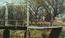
1913: Whitesville
Whitesville, West Virginia, USA - Coal River
| Bridgemeister ID: | 2142 (added 2006-11-04) |
| Year Completed: | 1913 |
| Name: | Whitesville |
| Location: | Whitesville, West Virginia, USA |
| Crossing: | Coal River |
| References: | AAJ |
| Use: | Footbridge |
| Status: | Collapsed, July 24, 1926 |
| Main Cables: | Wire |
| Main Span: | 1 x 65.2 meters (214 feet) |
| Deck width: | 5 feet |
Notes:
- Collapsed July 24, 1926 while overloaded with people watching a carnival performance. The July 25, 1926 edition of The Charleston Gazette reports the incident in an article with headline "Half Hundred Hurt When Crowded Bridge Collapses at Whitesville, Five Dead, Three More May Die" and sub-headline "Span Fall Under Weight of Hundreds Assembled to Watch Fire Fighting Event on River Bank in Connection with Carnival Celebration; Governor Gore Accompanies Physicians and Nurses on Special Relief Train from Here."
- AAJ cites an Engineering News-Record article from July 29, 1926: "Failure of the bridge was caused by the parting of the turnbuckle on the north end of the east cable. The bridge was built in 1913 and repaired in 1925."
1913: Wind River
Carson, Washington, USA - Wind River
| Bridgemeister ID: | 1005 (added 2003-11-21) |
| Year Completed: | 1913 |
| Name: | Wind River |
| Location: | Carson, Washington, USA |
| Crossing: | Wind River |
| Coordinates: | 45.758472 N 121.837306 W |
| Maps: | Acme, GeoHack, Google, OpenStreetMap |
| References: | SPW |
| Use: | Vehicular (one-lane) |
| Status: | Replaced |
| Main Cables: | Wire |
| Suspended Spans: | 1 |
Notes:
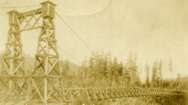
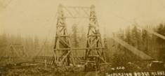
- The bridge appears identical in the two photos except for the tops of the towers. In one of the photos, it appears some protective housing has been added to cover the cable saddles and an extra brace has been added across the tower.
- Replaced by 1925 Wind River - Carson, Washington, USA.
- All past and present bridges at this location.
Image Sets:
1914: (suspension bridge)
Mangaweka vicinity, New Zealand - Rangitikei River
| Bridgemeister ID: | 697 (added 2003-03-08) |
| Year Completed: | 1914 |
| Name: | (suspension bridge) |
| Location: | Mangaweka vicinity, New Zealand |
| Crossing: | Rangitikei River |
| At or Near Feature: | 'Meeting of the Waters' |
| Coordinates: | 39.754594 S 175.835543 E |
| Maps: | Acme, GeoHack, Google, OpenStreetMap |
| Principals: | S.A.R. Mair |
| References: | GAP |
| Use: | Vehicular (one-lane) |
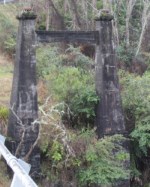
| Status: | Only towers remain, since 1961 (last checked: 2017) |
| Main Cables: | Wire |
| Suspended Spans: | 1 |
Notes:
- GAP: Located at junction of Rangitikei and Hautapu rivers. Replaced, 1961, but original towers remain at the site as of 2017.
Image Sets:
| Bridgemeister ID: | 600 (added 2003-01-11) |
| Year Completed: | 1914 |
| Name: | 98th Meridian |
| Also Known As: | Byers |
| Location: | Byers, Texas and Temple, Oklahoma, USA |
| Crossing: | Red River |
| Coordinates: | 34.124507 N 98.214251 W |
| Maps: | Acme, GeoHack, Google, OpenStreetMap |
| Principals: | Mitchell & Pigg |
| References: | AUB, HAERTX98, PTS2 |
| Use: | Vehicular |
| Status: | Destroyed, 1923 |
| Main Cables: | Wire (steel) |
| Suspended Spans: | 4 |
| Main Spans: | 3 x 172.8 meters (567 feet) |
| Side Span: | 1 x 32.6 meters (107 feet) |
Notes:
- Destroyed by tornado, 1923.
- Coordinates are the exact location of one of the remaining (as of 2020) piers of either this bridge or its replacement suspension bridge. Additional piers, south of that location, are also visible in satellite images.
- Replaced by 1923 98th Meridian (Byers) - Byers vicinity, Texas and Temple, Oklahoma, USA.
- See (suspension bridge) - Texas, USA. The 98th Meridian bridge may match this unknown "Red River" bridge photo. AUB describes the Byers bridge, "This bridge, three spans of 567' each, one side span of 107', and a 16' roadway, had originally been built in 1914."
- All past and present bridges at this location.
1914: Baron
Baling (巴陵), Fuxing District, Taoyuan City, Taiwan
| Bridgemeister ID: | 9056 (added 2025-02-16) |
| Year Completed: | 1914 |
| Name: | Baron |
| Also Known As: | Baling, Balang, Balong |
| Location: | Baling (巴陵), Fuxing District, Taoyuan City, Taiwan |
| Coordinates: | 24.680972 N 121.378028 E |
| Maps: | Acme, GeoHack, Google, OpenStreetMap |
| Status: | Demolished, 1966 |
| Main Cables: | Wire |
| Suspended Spans: | 1 |
Notes:
- Often identified as the "Baron Tessen" or "Baron" bridge.
- Replaced by Baling (老巴陵橋) - Baling (巴陵), Fuxing District, Taoyuan City, Taiwan.
- All past and present bridges at this location.
External Links:
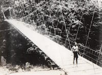
- 巴陵的鐵線橋|國家文化記憶庫 2.0 (Iron Wire Bridge in Baling | National Cultural Memory Bank 2.0). Translated from this page: "'Baron' is the old Japanese name of Baling, which is translated into Chinese as 'Balong' or 'Balong', and means "giant tree" in Atayal language. The Balang Iron Wire Bridge was built in October 1914 and was a suspension bridge on the Jiaobanshan Sanxing Guard Road during the Japanese era. In 1966, due to the construction of the Northern Cross-Island Highway, the original iron wire bridge was demolished and rebuilt into the 'Baling Bridge'.
Image Sets:
1914: Bergheim
Bergheim, Bromma, Viken, Norway - Hallingdalselva
| Bridgemeister ID: | 4044 (added 2020-03-29) |
| Year Completed: | 1914 |
| Name: | Bergheim |
| Location: | Bergheim, Bromma, Viken, Norway |
| Crossing: | Hallingdalselva |
| Coordinates: | 60.47212 N 9.23048 E |
| Maps: | Acme, GeoHack, Google, kart.1881.no, OpenStreetMap |
| Use: | Vehicular (one-lane) |
| Status: | Replaced, 1975 |
| Main Cables: | Wire (steel) |
| Suspended Spans: | 1 |
| Main Span: | 1 x 62.5 meters (205.1 feet) estimated |
External Links:
1914: Churn Creek
Gang Ranch, British Columbia, Canada - Fraser River
| Bridgemeister ID: | 131 (added before 2003) |
| Year Completed: | 1914 |
| Name: | Churn Creek |
| Location: | Gang Ranch, British Columbia, Canada |
| Crossing: | Fraser River |
| Coordinates: | 51.527494 N 122.285082 W |
| Maps: | Acme, GeoHack, Google, OpenStreetMap |
| Principals: | Waddell & Harrington |
| References: | BPL |
| Use: | Vehicular (one-lane) |
| Status: | In use (last checked: 2018) |
| Main Cables: | Wire (steel) |
| Suspended Spans: | 1 |
Image Sets:
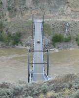
1914: Dresden
Dresden, Ohio, USA - Muskingum River
| Bridgemeister ID: | 132 (added before 2003) |
| Year Completed: | 1914 |
| Name: | Dresden |
| Location: | Dresden, Ohio, USA |
| Crossing: | Muskingum River |
| Coordinates: | 40.12079 N 82.00000 W |
| Maps: | Acme, GeoHack, Google, OpenStreetMap |
| Principals: | Bellefontaine Bridge and Steel Co. |
| References: | GBD, OCEN198202, PTS2 |
| Use: | Vehicular (one-lane) |
| Status: | Closed (last checked: 2022) |
| Main Cables: | Eyebar (steel) |
| Suspended Spans: | 2 |
| Main Span: | 1 x 135 meters (443 feet) |
| Side Span: | 1 |
Notes:
- 2022, January: Ohio Department of Transportation recommends removal of the bridge due to its deteriorating condition.
- Replaced 1853 Dresden - Dresden, Ohio, USA.
- All past and present bridges at this location.
Annotated Citations:
- Hannahs, Nichole. "ODOT Recommends Removal of Suspension Bridge." WHIZ News, 25 Jan. 2022, whiznews.com/2022/01/25/odot-recommends-removal-of-suspension-bridge/
"…ODOT recommended the removal of the structure, which would cost between $1-$2 million, which would be funded by the state. Other more costly options include more than $6 million to make it structurally sound for pedestrians to walk on and over $3.5 million to rehab it and then it still couldn’t be used."
External Links:
Image Sets:


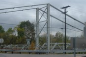
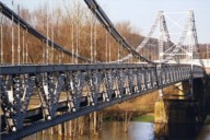
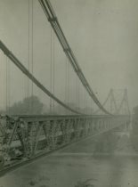
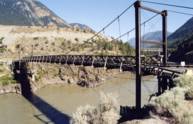
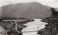
1914: Lillooet
Lillooet, British Columbia, Canada - Fraser River
| Bridgemeister ID: | 130 (added before 2003) |
| Year Completed: | 1914 |
| Name: | Lillooet |
| Also Known As: | Old |
| Location: | Lillooet, British Columbia, Canada |
| Crossing: | Fraser River |
| Coordinates: | 50.711493 N 121.911333 W |
| Maps: | Acme, GeoHack, Google, OpenStreetMap |
| Principals: | Waddell & Harrington |
| References: | BPL |
| Use: | Vehicular (one-lane) |
| Status: | Restricted to foot traffic (last checked: 2015) |
| Main Cables: | Wire (steel) |
| Suspended Spans: | 1 |
| Main Span: | 1 x 121.9 meters (400 feet) estimated |
Notes:
- Known locally as "The Old Bridge."
Image Sets:
1914: Mokai
Taoroa Junction, New Zealand - Rangitikei River
| Bridgemeister ID: | 696 (added 2003-03-08) |
| Year Completed: | 1914 |
| Name: | Mokai |
| Location: | Taoroa Junction, New Zealand |
| Crossing: | Rangitikei River |
| Principals: | Joseph Dawson |
| References: | GAP |
| Use: | Vehicular (one-lane) |
| Status: | Replaced, 1963 |
| Main Cables: | Wire |
| Suspended Spans: | 1 |
| Main Span: | 1 x 77 meters (252.6 feet) |
Notes:
- GAP: Replaced, 1963, after overloaded sheep truck fell through deck.
External Links:
1914: Mountain Moon
Xiulin Township, Hualien County, Taiwan - Liwu River
| Bridgemeister ID: | 4931 (added 2020-07-31) |
| Year Completed: | 1914 |
| Name: | Mountain Moon |
| Also Known As: | 山月吊橋, Yamatsuki |
| Location: | Xiulin Township, Hualien County, Taiwan |
| Crossing: | Liwu River |
| At or Near Feature: | Taroko Gorge at Buluowan Terraces |
| Status: | Demolished, 1940-1941 |
Notes:
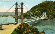
1914: Pênsil
São Vicente, Brazil
| Bridgemeister ID: | 902 (added 2003-10-11) |
| Year Completed: | 1914 |
| Name: | Pênsil |
| Also Known As: | Pensil |
| Location: | São Vicente, Brazil |
| Coordinates: | 23.974960 S 46.388756 W |
| Maps: | Acme, GeoHack, Google, OpenStreetMap |
| Use: | Vehicular (one-lane) |
| Status: | In use (last checked: 2017) |
| Main Cables: | Wire (steel) |
| Suspended Spans: | 1 |
| Main Span: | 1 x 180 meters (590.6 feet) |
External Links:
Image Sets:
1914: Scotia-Rio Dell
Scotia and Rio Dell, California, USA - Eel River
| Bridgemeister ID: | 1150 (added 2004-01-18) |
| Year Completed: | 1914 |
| Name: | Scotia-Rio Dell |
| Location: | Scotia and Rio Dell, California, USA |
| Crossing: | Eel River |
| Use: | Vehicular (one-lane) |
| Status: | Destroyed, 1915 |
| Main Cables: | Wire |
| Suspended Spans: | 1 |
| Main Span: | 1 |
Notes:
- 1915: Destroyed by flood.
1914: Swing
Oudtshoorn, South Africa - Grobbelaarsriver
| Bridgemeister ID: | 4715 (added 2020-06-26) |
| Year Completed: | 1914 |
| Name: | Swing |
| Location: | Oudtshoorn, South Africa |
| Crossing: | Grobbelaarsriver |
| Coordinates: | 33.588007 S 22.200611 E |
| Maps: | Acme, GeoHack, Google, OpenStreetMap |
| Use: | Footbridge |
| Status: | In use (last checked: 2020) |
| Main Cables: | Wire (steel) |
| Suspended Spans: | 1 |
Image Sets:
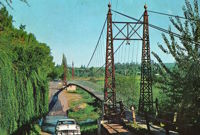
1914: Swinging
Allison, Arkansas, USA - South Sylamore Creek
| Bridgemeister ID: | 5856 (added 2021-05-15) |
| Year Completed: | 1914 |
| Name: | Swinging |
| Location: | Allison, Arkansas, USA |
| Crossing: | South Sylamore Creek |
| Coordinates: | 35.935672 N 92.121123 W |
| Maps: | Acme, GeoHack, Google, OpenStreetMap |
| Use: | Vehicular |
| Status: | Replaced, 1943 |
| Main Cables: | Wire (steel) |
| Suspended Spans: | 1 |
Notes:
- The bridge was heavily "reworked" in 1943 retaining the original main cables.
- Replaced by 1943 Swinging - Allison, Arkansas, USA.
- All past and present bridges at this location.
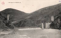
1914: Verdalle
Verdalle, Ayssenes vicinity, Aveyron, France - Tarn River
| Bridgemeister ID: | 3164 (added 2019-11-03) |
| Year Completed: | 1914 |
| Name: | Verdalle |
| Location: | Verdalle, Ayssenes vicinity, Aveyron, France |
| Crossing: | Tarn River |
| Coordinates: | 44.058557 N 2.788122 E |
| Maps: | Acme, GeoHack, Google, OpenStreetMap |
| Use: | Vehicular (one-lane) |
| Status: | In use (last checked: 2023) |
| Main Cables: | Wire |
| Suspended Spans: | 1 |
| Main Span: | 1 x 101 meters (331.4 feet) estimated |
External Links:
Image Sets:
1915: (footbridge)
Chiwaukum vicinity, Washington, USA - Wenatchee River
| Bridgemeister ID: | 1424 (added 2004-07-18) |
| Year Completed: | 1915 |
| Name: | (footbridge) |
| Location: | Chiwaukum vicinity, Washington, USA |
| Crossing: | Wenatchee River |
| Principals: | National Forest Service |
| References: | AAJ, PTS2 |
| Use: | Footbridge |
| Main Cables: | Wire (steel) |
| Suspended Spans: | 1 |
| Main Span: | 1 x 57.9 meters (190 feet) |
1915: (suspension bridge)
Esbly and Isles-lès-Villenoy, Seine-et-Marne, France - Marne River
| Bridgemeister ID: | 8086 (added 2023-12-25) |
| Year Completed: | 1915 |
| Name: | (suspension bridge) |
| Location: | Esbly and Isles-lès-Villenoy, Seine-et-Marne, France |
| Crossing: | Marne River |
| Coordinates: | 48.911917 N 2.815222 E |
| Maps: | Acme, GeoHack, Google, OpenStreetMap |
| Status: | Removed |
| Main Cables: | Wire |
| Suspended Spans: | 1 |
Notes:
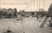
- Temporary footbridge or pipeline bridge (or both) built after the destruction of the vehicular bridge at this location during WWI in 1914. Likely in service until a replacement bridge was completed in 1922.
Image Sets:
1915: (suspension bridge)
Landquart vicinity, Switzerland
| Bridgemeister ID: | 5675 (added 2021-02-27) |
| Year Completed: | 1915 |
| Name: | (suspension bridge) |
| Location: | Landquart vicinity, Switzerland |
| Main Cables: | Wire |
| Suspended Spans: | 1 |
External Links:
1915: Alexandrino de Alencar
Rio de Janeiro, Brazil
1915: Brown's Ford
Brown's Ford and Lowry City vicinity, Missouri, USA - Osage River
| Bridgemeister ID: | 2325 (added 2007-05-06) |
| Year Completed: | 1915 |
| Name: | Brown's Ford |
| Location: | Brown's Ford and Lowry City vicinity, Missouri, USA |
| Crossing: | Osage River |
| References: | AAJ |
| Status: | Removed |
| Main Cables: | Wire |
Notes:
- The June 22, 1940 edition of The Chillicothe Constitution-Tribune (Chillicothe, Missouri) has an article titled "Three Killed in Bridge Collapse, Workmen were repairing the structure near Lowry City, Mo." describing a fatal collapse of the bridge: "Three men were killed, three injured critically and an 8-year old boy believed drowned when cribbing on a wooden suspension bridge across the Osage River six miles east of Lowry City collapsed about 4 o'clock yesterday afternoon. The bridge, on a farm-to-market road in St. Clair County, was being remodeled. Of the ten men working and bystanders on and near the structure when it fell, only one escaped without injury. All those killed or injured lived in St. Clair County. On the west side of the bridge a framework of heavy timbers had been inserted between one of the suspension cables and an old wooden pier, which originally had supported the cable. The workmen were attempting to slide a steel pier under the cable, to replace the wooden pier. The cribbing suddenly gave way, and the pressure from the cable hurled the wood supports in all directions. The bridge floor dropped into the river, except for a small section near the east end."
External Links:
1915: Deutz
Köln (Cologne), Germany - Rhine River
| Bridgemeister ID: | 432 (added before 2003) |
| Year Completed: | 1915 |
| Name: | Deutz |
| Also Known As: | Deutzer, Hindenburg |
| Location: | Köln (Cologne), Germany |
| Crossing: | Rhine River |
| References: | AAJ, BRU |
| Use: | Vehicular |
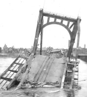
| Status: | Collapsed, 1945 |
| Main Cables: | Chain (steel) |
| Suspended Spans: | 3 |
| Main Span: | 1 x 184.4 meters (605 feet) |
| Side Spans: | 2 x 92.2 meters (302.5 feet) |
| Deck width: | 59.6 feet |
| Characteristics: | Self-anchored |
Notes:
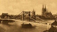
- First long-span self-anchored suspension bridge.
External Links:
Image Sets:
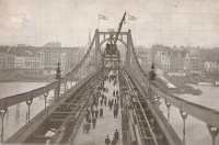
1915: Saint-Jean
Saint-Jean-les-Deux-Jumeaux and Changis-sur-Marne, Seine-et-Marne, France - Marne River
| Bridgemeister ID: | 8545 (added 2024-03-31) |
| Year Completed: | 1915 |
| Name: | Saint-Jean |
| Location: | Saint-Jean-les-Deux-Jumeaux and Changis-sur-Marne, Seine-et-Marne, France |
| Crossing: | Marne River |
| Status: | Removed |
| Main Cables: | Wire (steel) |
| Suspended Spans: | 2 |
| Main Spans: | 2 |
Notes:
- This temporary bridge pictured here at "Saint-Jean" in Seine-et-Marne was presumably located at present-day Saint-Jean-les-Deux-Jumeaux.
Image Sets:
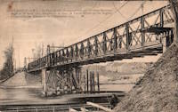
| Bridgemeister ID: | 4111 (added 2020-04-06) |
| Year Completed: | 1916 |
| Name: | (suspension bridge) |
| Location: | Tørdal, Drangedal, Vestfold Og Telemark, Norway |
| Crossing: | Loneelva |
| Coordinates: | 59.188715 N 8.802022 E |
| Maps: | Acme, GeoHack, Google, kart.1881.no, OpenStreetMap |
| Use: | Vehicular |
| Status: | Replaced, 1965 |
| Main Cables: | Wire |
| Suspended Spans: | 1 |
1916: Belpre-Parkersburg
Parkersburg, West Virginia and Belpre, Ohio, USA - Ohio River
| Bridgemeister ID: | 134 (added before 2003) |
| Year Completed: | 1916 |
| Name: | Belpre-Parkersburg |
| Location: | Parkersburg, West Virginia and Belpre, Ohio, USA |
| Crossing: | Ohio River |
| Coordinates: | 39.270500 N 81.566528 W |
| Maps: | Acme, GeoHack, Google, OpenStreetMap |
| Principals: | Hermann Laub |
| References: | AAJ, BPL, PTS2, SJR |
| Use: | Vehicular, with walkway |
| Status: | Demolished, March 16, 1980 |
| Main Cables: | Wire (steel) |
| Suspended Spans: | 3 |
| Main Span: | 1 x 236.2 meters (775 feet) |
| Side Spans: | 1 x 114.3 meters (375 feet), 1 x 83.8 meters (275 feet) |
| Deck width: | 22 feet |
External Links:
Image Sets:
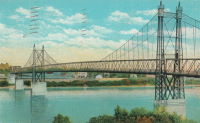
1916: Dewey
Moab vicinity, Utah, USA - Colorado River
| Bridgemeister ID: | 135 (added before 2003) |
| Year Completed: | 1916 |
| Name: | Dewey |
| Location: | Moab vicinity, Utah, USA |
| Crossing: | Colorado River |
| Coordinates: | 38.81187 N 109.30333 W |
| Maps: | Acme, GeoHack, Google, OpenStreetMap |
| Use: | Vehicular (one-lane) |
| Status: | Derelict, since April, 2008 (last checked: 2008) |
| Main Cables: | Wire (steel) |
| Suspended Spans: | 1 |
| Main Span: | 1 x 151.2 meters (496 feet) estimated |
Notes:
- Restored as footbridge, 2000.
- Deck destroyed by fire April 6, 2008. News reports stated a nearby brush fire (started by a young boy playing with matches) ignited the bridge.
External Links:
Image Sets:
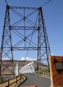
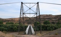
| Bridgemeister ID: | 4575 (added 2020-06-03) |
| Year Completed: | 1916 |
| Name: | Innsteg |
| Also Known As: | Hindenburg, Fünferlsteg |
| Location: | Passau, Germany |
| Crossing: | Inn River |
| Coordinates: | 48.569943 N 13.459694 E |
| Maps: | Acme, GeoHack, Google, OpenStreetMap |
| Use: | Footbridge |
| Status: | In use (last checked: 2019) |
| Main Cables: | Riveted plate |
| Suspended Spans: | 3 |
| Main Span: | 1 x 75.25 meters (246.9 feet) estimated |
| Side Spans: | 2 |
External Links:
Image Sets:
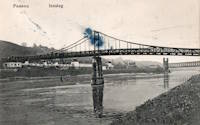
1916: Katsuyama
Japan
1916: Mino
Mino, Gifu, Japan - Nagara River
| Bridgemeister ID: | 7908 (added 2023-10-21) |
| Year Completed: | 1916 |
| Name: | Mino |
| Also Known As: | 美濃橋 |
| Location: | Mino, Gifu, Japan |
| Crossing: | Nagara River |
| Coordinates: | 35.552417 N 136.910267 E |
| Maps: | Acme, GeoHack, Google, OpenStreetMap |
| Use: | Vehicular (one-lane) |
| Status: | Restricted to foot traffic, since c. 1960s (last checked: 2023) |
| Main Cables: | Wire (steel) |
| Suspended Spans: | 1 |
External Links:
1916: Swinging
Thermopolis, Wyoming, USA - Big Horn River
| Bridgemeister ID: | 301 (added before 2003) |
| Year Completed: | 1916 |
| Name: | Swinging |
| Location: | Thermopolis, Wyoming, USA |
| Crossing: | Big Horn River |
| At or Near Feature: | Hot Springs State Park |
| Coordinates: | 43.654733 N 108.196167 W |
| Maps: | Acme, GeoHack, Google, OpenStreetMap |
| Use: | Footbridge |
| Status: | In use (last checked: 2024) |
| Main Cables: | Wire (steel) |
| Suspended Spans: | 2 |
| Main Span: | 1 x 58.8 meters (193 feet) estimated |
| Side Span: | 1 x 10.7 meters (35 feet) estimated |
Notes:
- According to sign at the bridge: condemned 1984, removed 1991, restored 1992.
External Links:
Image Sets:
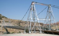

1916: Te Koura
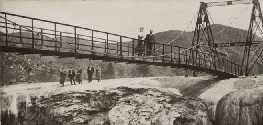
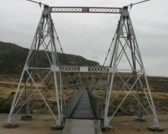
Okahukura vicinity, New Zealand - Ongarue River
| Bridgemeister ID: | 718 (added 2003-03-08) |
| Year Completed: | 1916 |
| Name: | Te Koura |
| Location: | Okahukura vicinity, New Zealand |
| Crossing: | Ongarue River |
| References: | GAP |
| Use: | Footbridge |
| Status: | Derelict |
| Main Cables: | Wire |
| Suspended Spans: | 1 |
External Links:
1917: (suspension bridge)
Skhirat, Rabat vicinity, Morocco - Oued Cherrat
| Bridgemeister ID: | 529 (added before 2003) |
| Year Completed: | 1917 |
| Name: | (suspension bridge) |
| Location: | Skhirat, Rabat vicinity, Morocco |
| Crossing: | Oued Cherrat |
| Coordinates: | 33.814930 N 7.110061 W |
| Maps: | Acme, GeoHack, Google, OpenStreetMap |
| References: | BC3 |
| Use: | Vehicular |
| Status: | In use (last checked: 2019) |
| Main Cables: | Wire |
| Suspended Spans: | 1 |
| Main Span: | 1 x 102.4 meters (336 feet) |
External Links:
1917: Alderpoint
Alderpoint, California, USA - North Fork Eel River
| Bridgemeister ID: | 2232 (added 2007-03-19) |
| Year Completed: | 1917 |
| Name: | Alderpoint |
| Location: | Alderpoint, California, USA |
| Crossing: | North Fork Eel River |
| Coordinates: | 40.173364 N 123.603832 W |
| Maps: | Acme, GeoHack, Google, OpenStreetMap |
| Use: | Vehicular (one-lane) |
| Status: | Demolished, November, 1972 |
| Main Cables: | Wire (steel) |
| Suspended Spans: | 1 |
Notes:
- The Sunday November 5, 1972 edition of The Times Standard (Eureka, California) has three photos of the bridge collapsing. The caption is "Old Alderpoint Bridge Crashes into River." It continues: "Cables, securing the old Alderpoint Bridge across the North Fork of the Eel River, were cut Friday to send the structure splashing to the feet of the new concrete span that is replacing it. The $1-million new bridge was dedicated Saturday. The old suspension bridge was constructed in 1917."
- Coordinates are for the present-day (2021) bridge at this location. The suspension bridge was immediately adjacent.
1917: Bolombolo
Bolombolo, Colombia - Cauca River
| Bridgemeister ID: | 433 (added before 2003) |
| Year Completed: | 1917 |
| Name: | Bolombolo |
| Location: | Bolombolo, Colombia |
| Crossing: | Cauca River |
| Coordinates: | 5.967033 N 75.843217 W |
| Maps: | Acme, GeoHack, Google, OpenStreetMap |
| References: | USS |
| Use: | Vehicular (two-lane) |
| Status: | In use (last checked: 2015) |
| Main Cables: | Wire (steel) |
| Suspended Spans: | 1 |
| Main Span: | 1 x 118.9 meters (390 feet) |
| Deck width: | 10 feet |
External Links:
1917: Maoribank
Maoribank, Upper Hutt, New Zealand - Te Awa Kairangi / Hutt River
| Bridgemeister ID: | 699 (added 2003-03-08) |
| Year Completed: | 1917 |
| Name: | Maoribank |
| Also Known As: | Whiteman's |
| Location: | Maoribank, Upper Hutt, New Zealand |
| Crossing: | Te Awa Kairangi / Hutt River |
| Principals: | Joseph Dawson |
| References: | GAP |
| Use: | Vehicular (one-lane) |
| Status: | Collapsed, September 14, 1988 |
| Main Cables: | Wire (steel) |
| Suspended Spans: | 1 |
Notes:
- 1988, September 14: Collapsed due to flood.
External Links:
1917: Morrison
Morrison vicinity, Oklahoma, USA - Black Bear Creek
| Bridgemeister ID: | 2238 (added 2007-03-24) |
| Year Completed: | 1917 |
| Name: | Morrison |
| Location: | Morrison vicinity, Oklahoma, USA |
| Crossing: | Black Bear Creek |
| Coordinates: | 36.30811 N 96.95164 W |
| Maps: | Acme, GeoHack, Google, OpenStreetMap |
| Principals: | N.H. Sturgis |
| Use: | Vehicular (one-lane) |
| Status: | Removed |
| Main Cables: | Wire |
External Links:
1917: Rio Chiriquí
Panama - Rio Chiriquí
| Bridgemeister ID: | 1425 (added 2004-07-18) |
| Year Completed: | 1917 |
| Name: | Rio Chiriquí |
| Location: | Panama |
| Crossing: | Rio Chiriquí |
| Principals: | A. S. Zinn |
| References: | AAJ, PTS2 |
| Use: | Vehicular |
| Main Cables: | Wire (steel) |
| Suspended Spans: | 1 |
| Main Span: | 1 x 125 meters (410 feet) |
| Deck width: | 7.7 feet |
1917: Rock Church
Tolar vicinity, Hood County, Texas, USA - Paluxy River
| Bridgemeister ID: | 136 (added before 2003) |
| Year Completed: | 1917 |
| Name: | Rock Church |
| Location: | Tolar vicinity, Hood County, Texas, USA |
| Crossing: | Paluxy River |
| Coordinates: | 32.301402 N 97.957657 W |
| Maps: | Acme, GeoHack, Google, OpenStreetMap |
| References: | HAERTX98 |
| Use: | Vehicular (one-lane) |
| Status: | Extant (last checked: 2018) |
| Main Cables: | Wire |
| Suspended Spans: | 1 |
External Links:
Image Sets:
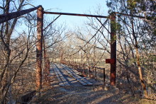
1917: Schulweg
Hamm, North Rhine-Westphalia, Germany - Datteln-Hamm Canal
| Bridgemeister ID: | 1948 (added 2005-11-04) |
| Year Completed: | 1917 |
| Name: | Schulweg |
| Location: | Hamm, North Rhine-Westphalia, Germany |
| Crossing: | Datteln-Hamm Canal |
| Coordinates: | 51.694985 N 7.870143 E |
| Maps: | Acme, GeoHack, Google, OpenStreetMap |
| Use: | Footbridge |
| Status: | In use (last checked: 2018) |
| Main Cables: | Wire |
| Suspended Spans: | 3 |
| Main Span: | 1 |
| Side Spans: | 2 |
External Links:
| Bridgemeister ID: | 595 (added 2003-01-11) |
| Year Completed: | 1917 |
| Name: | Terral-Ringgold |
| Location: | Ringgold, Texas and Terral, Oklahoma, USA |
| Crossing: | Red River |
| Coordinates: | 33.878143 N 97.934776 W |
| Maps: | Acme, GeoHack, Google, OpenStreetMap |
| References: | AUB, PTS2 |
| Use: | Vehicular |
| Status: | Removed |
| Main Cables: | Wire |
| Suspended Spans: | 5 |
| Main Spans: | 3 x 137.2 meters (450 feet) |
| Side Spans: | 2 |
Notes:
- 1931: Replacement opened.
1917: Thusis
Thusis, Switzerland - Hinterrhein River
| Bridgemeister ID: | 3634 (added 2020-01-01) |
| Year Completed: | 1917 |
| Name: | Thusis |
| Location: | Thusis, Switzerland |
| Crossing: | Hinterrhein River |
| Coordinates: | 46.701886 N 9.446884 E |
| Maps: | Acme, GeoHack, Google, OpenStreetMap |
| Use: | Footbridge |
| Status: | In use (last checked: 2022) |
| Main Cables: | Wire |
| Suspended Spans: | 1 |
| Main Span: | 1 |
External Links:
1918: (footbridge)
Wakefield vicinity, New Zealand - Dove River
| Bridgemeister ID: | 700 (added 2003-03-08) |
| Year Completed: | 1918 |
| Name: | (footbridge) |
| Location: | Wakefield vicinity, New Zealand |
| Crossing: | Dove River |
| References: | GAP |
| Use: | Footbridge |
1918: Camp Sherman
Chillicothe, Ohio, USA - Scioto River
| Bridgemeister ID: | 4956 (added 2020-08-08) |
| Year Completed: | 1918 |
| Name: | Camp Sherman |
| Location: | Chillicothe, Ohio, USA |
| Crossing: | Scioto River |
| Principals: | U.S. Army |
| Status: | Removed |
| Main Cables: | Wire (steel) |
| Suspended Spans: | 1 |
| Main Span: | 1 |
Notes:
- Provided access to the Camp Sherman rifle range which sat across the Scioto River from the main part of the campl.
- From an article "Came the False Armistice but Weary Soldiers Unaware” in the September 7, 1968 edition of the Xenia Daily Gazette: "The firing range at old Camp Sherman during World War 1 was a long march from camp to the base of historic Mt. Logan. It was reached by way of a narrow suspension bridge which swayed sickeningly to the measured tempo of the marching soldiers and was an experience in itself."
External Links:
Image Sets:
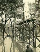
1918: Ookui
Yamaura, Komoro City, Nagano, Japan - Chikuma River
| Bridgemeister ID: | 6958 (added 2022-02-19) |
| Year Completed: | 1918 |
| Name: | Ookui |
| Also Known As: | Ookui-bashi, 大杭橋 |
| Location: | Yamaura, Komoro City, Nagano, Japan |
| Crossing: | Chikuma River |
| Coordinates: | 36.302159 N 138.422041 E |
| Maps: | Acme, GeoHack, Google, OpenStreetMap |
| Use: | Vehicular |
| Status: | Derelict (last checked: 2022) |
| Main Cables: | Wire (steel) |
| Suspended Spans: | 1 |
| Main Span: | 1 x 50 meters (164 feet) estimated |
Notes:
- 2019: Heavily damaged by typhoon. Appears to have already been closed to all traffic prior.
1918: Opiki Toll
Rangitane, New Zealand - Manawatu River
| Bridgemeister ID: | 698 (added 2003-03-08) |
| Year Completed: | 1918 |
| Name: | Opiki Toll |
| Also Known As: | Akers Toll |
| Location: | Rangitane, New Zealand |
| Crossing: | Manawatu River |
| Coordinates: | 40.431841 S 175.468575 E |
| Maps: | Acme, GeoHack, Google, OpenStreetMap |
| Principals: | Joseph Dawson |
| References: | AAJ, GAP, PTS2 |
| Use: | Vehicular |
| Status: | Derelict (last checked: 2024) |
| Main Cables: | Wire (steel) |
| Main Span: | 1 |
Notes:
- 1969: Bypassed.
- 2023, September: After many years of the main cables and suspenders hanging with no deck, one of the main cables collapsed.
- 2024, March: The collapsed main cable is raised back into position. The bridge, however, is still a just derelict monument with no deck.
External Links:
- ‘Iconic’ Ōpiki Bridge partly collapses in Manawatū River - nzherald.co.nz. Article regarding the September 2023 main cable collapse.
| Bridgemeister ID: | 4084 (added 2020-04-04) |
| Year Completed: | 1918 |
| Name: | Rånåsfoss |
| Location: | Rånåsfoss, Viken, Norway |
| Crossing: | Glomma |
| Coordinates: | 60.030429 N 11.329303 E |
| Maps: | Acme, GeoHack, Google, kart.1881.no, OpenStreetMap |
| Use: | Vehicular (one-lane) |
| Status: | Replaced |
| Main Cables: | Wire (steel) |
| Main Span: | 1 x 184 meters (603.7 feet) estimated |
Notes:
- Patrick S. O'Donnell notes: "This bridge was built in 1918 as a provisional suspension bridge to facilitate the construction of the dam a little less than a half kilometer downstream. Then it was built over and transformed into the 1927 Rånåsfoss bridge. It appears everything of the original bridge was replaced or new, except the lattice towers which in effect became rebar and are now encased in concrete. New anchorage pits were dug and new anchor eyebars placed within to accept the new main cables."
- Replaced by 1927 Rånåsfoss - Rånåsfoss, Viken, Norway.
- All past and present bridges at this location.
External Links:
1918: Swinging
Old Hickory, Nashville and Goodlettsville, Nashville, Tennessee, USA - Cumberland River
| Bridgemeister ID: | 587 (added 2003-01-05) |
| Year Completed: | 1918 |
| Name: | Swinging |
| Location: | Old Hickory, Nashville and Goodlettsville, Nashville, Tennessee, USA |
| Crossing: | Cumberland River |
| At or Near Feature: | Hadley Bend |
| Coordinates: | 36.289002 N 86.685355 W |
| Maps: | Acme, GeoHack, Google, OpenStreetMap |
| Principals: | William G. Grove, American Bridge Co. |
| References: | AAJ, PTS2 |
| Use: | Vehicular (one-lane) |
| Status: | Dismantled, 1928 |
| Main Cables: | Wire (steel) |
| Suspended Spans: | 1 |
| Main Span: | 1 x 164.6 meters (540 feet) |
| Deck width: | 8 feet |
Notes:
- Coordinates provided are approximate based on current-day (2021) location of Swinging Bridge Road.
External Links:
- DuPont High School Alumni Association - The Swinging Bridge. According to the description in this article provided by Old Hickory Branch Library this large bridge had a 540-foot main span and was used for vehicular traffic. "The suspension bridge... Was diverted from its original destination in South America because of the urgency of the war effort. It was built for pedestrian traffic and used only for that purpose at first... Upon determination that the bridge was capable of handling light traffic, a flagman was stationed at each end of the bridge on a 24-hour-a-day basis and cars began using the one-lane span." Kris Brummett adds: "The 540 foot span had no supports to prevent sideways movement and literally swayed back and forth. The bridge was used until 1929." Other sources say the bridge was dismantled in 1928.
- Photograph of the Old Hickory Swinging Bridge - Tennessee Virtual Archive. High resolution image of the bridge.
- Bridgehunter.com - BH61258
Image Sets:
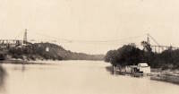
1918: Turkey Run State Park
Parke County, Indiana, USA - Sugar Creek
| Bridgemeister ID: | 269 (added before 2003) |
| Year Completed: | 1918 |
| Name: | Turkey Run State Park |
| Location: | Parke County, Indiana, USA |
| Crossing: | Sugar Creek |
| At or Near Feature: | Turkey Run State Park |
| Coordinates: | 39.88926 N 87.19948 W |
| Maps: | Acme, GeoHack, Google, OpenStreetMap |
| References: | IMB |
| Use: | Footbridge |
| Status: | In use (last checked: 2021) |
| Main Cables: | Wire (steel) |
| Suspended Spans: | 1 |
| Main Span: | 1 x 58.5 meters (192 feet) estimated |
Notes:
- IMB states, "The original bridge collapsed into Sugar Creek in 1917... the state's Department of Natural Resources promptly replaced the old with current structure."
- James Rader writes in 2008: "Three years ago flooding came up high enough to allow a couple of uprooted Sycamore trees to hit the bridge ripping out a large section of the wood railing and flooring from the middle of the bridge. Bridge was immediately closed. Structural analysis was completed and repairs were made including all new floor planks. Bridge is in great condition and should serve for many many more years to come."
External Links:
Image Sets:
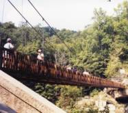
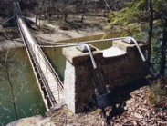
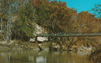
1919: Beebe
Beebe and Chelan, Washington, USA - Columbia River
| Bridgemeister ID: | 1188 (added 2004-01-24) |
| Year Completed: | 1919 |
| Name: | Beebe |
| Location: | Beebe and Chelan, Washington, USA |
| Crossing: | Columbia River |
| Coordinates: | 47.81308 N 119.97245 W |
| Maps: | Acme, GeoHack, Google, OpenStreetMap |
| Principals: | A. Munster, Wenatchee-Beebe Orchard Co. |
| References: | AAJ, PTS2, SPW |
| Use: | Pipeline and Vehicular |
| Status: | Only towers remain, since 1963 (last checked: 2022) |
| Main Cables: | Wire (steel) |
| Suspended Spans: | 1 |
| Main Span: | 1 x 192.6 meters (632 feet) |
| Deck width: | 12 feet |
Notes:
- The towers are still standing next to the current US97 crossing at Beebe.
- AAJ: Private bridge, built primarily to carry water to the owner's orchard, but also carried a roadway.
External Links:
- The Beebe Bridge | Empire Press | wenatcheeworld.com. Article about the history of the bridge.
- Bridgehunter.com - BH54894
- Structurae - Structure ID 20052092
Image Sets:
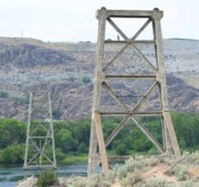
1919: Boyacá
Irra, Colombia - Cauca River
| Bridgemeister ID: | 2019 (added 2006-01-14) |
| Year Completed: | 1919 |
| Name: | Boyacá |
| Also Known As: | Irra |
| Location: | Irra, Colombia |
| Crossing: | Cauca River |
| Status: | Removed |
| Suspended Spans: | 1 |
| Main Span: | 1 x 120 meters (393.7 feet) |
1919: Coon Box Fork
Lorman, Fayette vicinity, Mississippi, USA - Shankstown Creek
| Bridgemeister ID: | 6426 (added 2021-08-10) |
| Year Completed: | 1919 |
| Name: | Coon Box Fork |
| Location: | Lorman, Fayette vicinity, Mississippi, USA |
| Crossing: | Shankstown Creek |
| Coordinates: | 31.789613 N 91.068857 W |
| Maps: | Acme, GeoHack, Google, OpenStreetMap |
| Principals: | Schuster and Jacob, Robert Taylor |
| Use: | Vehicular (one-lane) |
| Status: | Destroyed, 1990 |
| Main Cables: | Wire (steel) |
| Suspended Spans: | 3 |
| Main Span: | 1 |
| Side Spans: | 2 |
Notes:
- Some sources suggest the bridge survived until 2010, but this appears to be unlikely. Coordinates provided are for the current Shankstown Creek crossing of Coon Box Road. The suspension bridge may have been on a slightly different alignment.
- 1927: Repaired by W.H. Groome and Son incorporating an improved anchoring system.
External Links:
- MDAH Historic Resources Inventory Fact Sheet - Coon Box Fork Suspension Bridge. Photographs available here suggest remnants of the bridge are visible in the creek.
- NPGallery Asset Detail - Coon Box Fork Bridge. National Register of Historic Places site survey. Presents a brief history of the bridge, but perhaps confuses the matter of its location. States: "Swinging suspension bridge and county road right-of-way along Coon Box Road where the said bridge crosses North Fork Coles Creek." Current-day (2021) Coon Box Road crosses Shankstown Creek near North Fork Coles Creek, but never crosses North Fork Coles Creek. Historic maps of the area place the mid-1900s Shankstown Creek crossing of Coon Box Fork at roughly the same location as the current crossing (the coordinates provided in this record). Looking at historic satellite images of the location, the suspension bridge was probably on an alignment no more than 100 feet north of the current Coon Box Road Shankstown Creek bridge.
- Bridgehunter.com - BH46941
1919: Gordon
Gordon, New South Wales, Australia - Stony Creek
| Bridgemeister ID: | 8163 (added 2024-02-03) |
| Year Completed: | 1919 |
| Name: | Gordon |
| Location: | Gordon, New South Wales, Australia |
| Crossing: | Stony Creek |
| Coordinates: | 33.750472 S 151.156917 E |
| Maps: | Acme, GeoHack, Google, OpenStreetMap |
| Use: | Footbridge |
| Status: | Removed |
| Main Cables: | Wire |
| Main Span: | 1 x 67.1 meters (220 feet) |
External Links:
- 23 Jun 1919 - GORDON SUSPENSION BRIDGE. - Trove. Article from The Sydney Morning Herald dated Monday June 23 1919 titled "Gordon Suspension Bridge" regarding the grand opening of the bridge. The article indicates the bridge was on the alignment of Rosedale Road over Stony Creek.
Image Sets:

1919: Hansen
Twin Falls vicinity, Idaho, USA - Snake River
| Bridgemeister ID: | 334 (added before 2003) |
| Year Completed: | 1919 |
| Name: | Hansen |
| Location: | Twin Falls vicinity, Idaho, USA |
| Crossing: | Snake River |
| Coordinates: | 42.566667 N 114.299722 W |
| Maps: | Acme, GeoHack, Google, OpenStreetMap |
| Principals: | Freygang and Trocon |
| References: | AAJ, PTS2 |
| Use: | Vehicular (two-lane) |
| Status: | Replaced, 1966 |
| Main Cables: | Wire (steel) |
| Suspended Spans: | 1 |
| Main Span: | 1 x 185.3 meters (608 feet) |
| Deck width: | 17 feet |
External Links:
Image Sets:
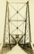
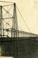
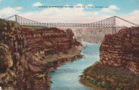
1919: Morgan's
Parinui, Manawatu-Wanganui, New Zealand - Mangapurua Stream
| Bridgemeister ID: | 7655 (added 2023-06-10) |
| Year Completed: | 1919 |
| Name: | Morgan's |
| Location: | Parinui, Manawatu-Wanganui, New Zealand |
| Crossing: | Mangapurua Stream |
| At or Near Feature: | Bridge to Nowhere Walk |
| Coordinates: | 39.270940 S 174.972349 E |
| Maps: | Acme, GeoHack, Google, OpenStreetMap |
| Status: | Derelict, since c. 1930s |
| Main Cables: | Wire |
| Main Span: | 1 |
Notes:
- 2022: Remnants are still visible adjacent to its replacement concrete deck arch bridge (1936) known as the "Bridge to Nowhere".
External Links:
1919: Parys
Parys, South Africa - Vaal River
| Bridgemeister ID: | 2900 (added 2019-09-13) |
| Year Completed: | 1919 |
| Name: | Parys |
| Location: | Parys, South Africa |
| Crossing: | Vaal River |
| Coordinates: | 26.894181 S 27.457217 E |
| Maps: | Acme, GeoHack, Google, OpenStreetMap |
| Use: | Footbridge |
| Status: | In use (last checked: 2019) |
| Main Cables: | Wire (steel) |
| Suspended Spans: | 3 |
| Main Span: | 1 |
| Side Spans: | 2 |
Image Sets:
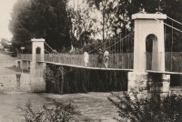
1920: (footbridge)
Follebu, Innlandet, Norway
| Bridgemeister ID: | 1564 (added 2004-11-27) |
| Year Completed: | 1920 |
| Name: | (footbridge) |
| Location: | Follebu, Innlandet, Norway |
| Coordinates: | 61.2153 N 10.269267 E |
| Maps: | Acme, GeoHack, Google, kart.1881.no, OpenStreetMap |
| Use: | Footbridge |
| Status: | In use (last checked: 2004) |
| Main Cables: | Wire |
Notes:
- Restored, 1977 and 1995.
1920: (suspension bridge)
Petrolia vicinity, California, USA - Mattole River
| Bridgemeister ID: | 4932 (added 2020-08-01) |
| Year Completed: | 1920 |
| Name: | (suspension bridge) |
| Location: | Petrolia vicinity, California, USA |
| Crossing: | Mattole River |
| Coordinates: | 40.276827 N 124.242913 W |
| Maps: | Acme, GeoHack, Google, OpenStreetMap |
| Use: | Vehicular |
| Status: | Replaced, 1974 |
| Main Cables: | Wire (steel) |
Notes:
- The June 29, 1974 edition of The Times-Standard of Eureka, California ran an article "Petrolia plans dedication" describing a new bridge dedicated to Elwyn "Ole" Lindley located 4.6 miles east of Petrolia: "the new re-enforced concrete girder with four bays replaced an old cable suspension bridge built in 1920." There is no other mention of the suspension bridge in the article. The location indicated by the coordinates given here is the location of the present day (2020) Lindley bridge crossing the Mattole River. It is unclear if this was the same Petrolia-area suspension bridge dismantled in 1962.
- See (suspension bridge) - Petrolia, California, USA. This entry may represent the same bridge.
1920: Alves Lima
Irapé, Chavantes, São Paulo and Ribeirão Claro, Paraná, Brazil - Paranapanema River
| Bridgemeister ID: | 3887 (added 2020-03-13) |
| Year Completed: | 1920 |
| Name: | Alves Lima |
| Also Known As: | Pênsil |
| Location: | Irapé, Chavantes, São Paulo and Ribeirão Claro, Paraná, Brazil |
| Crossing: | Paranapanema River |
| Coordinates: | 23.098928 S 49.742944 W |
| Maps: | Acme, GeoHack, Google, OpenStreetMap |
| Status: | Closed, c. November 2020 (last checked: 2021) |
| Main Cables: | Wire (steel) |
| Suspended Spans: | 1 |
Notes:
- 2020, November: Heavily damaged by fire. Closed indefinitely.
1920: Bridge of Smiles
Marlborough Township, Pennsylvania, USA - Unami Creek
| Bridgemeister ID: | 8794 (added 2024-09-14) |
| Year Completed: | 1920 |
| Name: | Bridge of Smiles |
| Location: | Marlborough Township, Pennsylvania, USA |
| Crossing: | Unami Creek |
| At or Near Feature: | Camp Delmont, Musser Scout Reservation |
| Use: | Footbridge |
| Suspended Spans: | 1 |
Notes:
- Located on the grounds of Camp Delmont which is now part of the Musser Scout Reservation. Presumably no longer in existence.
External Links:
- Facebook. Image and history of the bridge.
1920: Colgante
Rio Grande, Tierra del Fuego, Argentina - Rio Grande
| Bridgemeister ID: | 3366 (added 2019-12-21) |
| Year Completed: | 1920 |
| Name: | Colgante |
| Location: | Rio Grande, Tierra del Fuego, Argentina |
| Crossing: | Rio Grande |
| Coordinates: | 53.835799 S 67.792507 W |
| Maps: | Acme, GeoHack, Google, OpenStreetMap |
| Use: | Vehicular (one-lane) |
| Status: | Derelict, since December 13, 2010 (last checked: 2023) |
| Main Cables: | Wire (steel) |
| Suspended Spans: | 1 |
Notes:
- 2010, December 13: Wrecked by wind.
External Links:
- Hoy se cumplen 11 años de la caída del histórico puente colgante - Río Grande | Minuto Fueguino - Noticias de Tierra del Fuego AIAS. Detailed history of the bridge with many photos.
Image Sets:

1920: Double
Forks of Coal, Alum Creek vicinity, West Virginia, USA - Little Coal River
| Bridgemeister ID: | 2121 (added 2006-09-17) |
| Year Completed: | 1920 |
| Name: | Double |
| Location: | Forks of Coal, Alum Creek vicinity, West Virginia, USA |
| Crossing: | Little Coal River |
| Coordinates: | 38.27243 N 81.80020 W |
| Maps: | Acme, GeoHack, Google, OpenStreetMap |
| Principals: | Oregonia Bridge Co. |
| Use: | Footbridge |
| Status: | Closed, c. 2008-2011 (last checked: 2017) |
| Main Cables: | Wire (steel) |
| Main Span: | 1 x 45.7 meters (150 feet) estimated |
| Side Spans: | 1 x 15.5 meters (51 feet) estimated, 1 x 17.7 meters (58 feet) estimated |
Notes:
- The two Double Forks of Coal bridges were found to be barricaded in February 2011.
- Connects to 1920 Double - Forks of Coal, Alum Creek vicinity, West Virginia, USA. There are two bridges at this location, known collectively as "Double Bridges," spanning each fork of the Coal River at Forks of Coal.
- All past and present bridges at this location.
External Links:
- Cliffside - Double Bridges over the Forks of Coal Rive. Several images and information about the two bridges.
- Old Bridge at The Forks of Coal River | Home Economics. Blog post about the bridges. Dated February 25, 2017.
- Bridgehunter.com - BH42461
Image Sets:
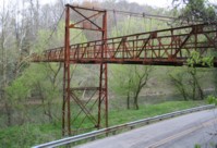
1920: Double
Forks of Coal, Alum Creek vicinity, West Virginia, USA - Big Coal River
| Bridgemeister ID: | 2122 (added 2006-09-17) |
| Year Completed: | 1920 |
| Name: | Double |
| Location: | Forks of Coal, Alum Creek vicinity, West Virginia, USA |
| Crossing: | Big Coal River |
| Coordinates: | 38.27248 N 81.79935 W |
| Maps: | Acme, GeoHack, Google, OpenStreetMap |
| Principals: | Oregonia Bridge Co. |
| Use: | Footbridge |
| Status: | Closed, c. 2008-2011 (last checked: 2017) |
| Main Cables: | Wire (steel) |
| Suspended Spans: | 3 |
| Main Span: | 1 x 61 meters (200 feet) estimated |
| Side Spans: | 1 x 27.7 meters (91 feet), 1 x 21.3 meters (70 feet) |
Notes:
- The two Double Forks of Coal bridges were found to be barricaded in February 2011.
- Connects to 1920 Double - Forks of Coal, Alum Creek vicinity, West Virginia, USA. There are two bridges at this location, known collectively as "Double Bridges," spanning each fork of the Coal River at Forks of Coal.
- All past and present bridges at this location.
External Links:
- Cliffside - Double Bridges over the Forks of Coal Rive. Several images and information about the two bridges.
- Old Bridge at The Forks of Coal River | Home Economics. Blog post about the bridges. Dated February 25, 2017.
- Bridgehunter.com - BH42463
Image Sets:
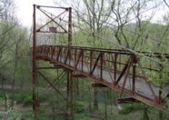
1920: Fort Seward
Fort Seward, California, USA - Eel River
| Bridgemeister ID: | 5671 (added 2021-01-30) |
| Year Completed: | 1920 |
| Name: | Fort Seward |
| Location: | Fort Seward, California, USA |
| Crossing: | Eel River |
| Coordinates: | 40.227599 N 123.646996 W |
| Maps: | Acme, GeoHack, Google, OpenStreetMap |
| Use: | Vehicular (one-lane) |
| Status: | Removed |
| Main Cables: | Wire (steel) |
External Links:
1920: Hayakawa
Osozawa (遅沢), Minobu (身延町), Minamikoma District and Awagura (粟倉), Minobu (身延町), Minamikoma District, Yamanashi, Japan - Haya River
| Bridgemeister ID: | 9050 (added 2025-02-09) |
| Year Completed: | 1920 |
| Name: | Hayakawa |
| Location: | Osozawa (遅沢), Minobu (身延町), Minamikoma District and Awagura (粟倉), Minobu (身延町), Minamikoma District, Yamanashi, Japan |
| Crossing: | Haya River |
| Coordinates: | 35.433806 N 138.422139 E |
| Maps: | Acme, GeoHack, Google, OpenStreetMap |
| Use: | Vehicular |
| Status: | Replaced |
| Main Cables: | Wire |
Notes:
- Coordinates provided here appear to be the approximate location of the bridge.
External Links:
- Old National Route 52, Hayakawa Bridge (旧国道52号線・早川橋). Details about some of the bridges at and near this location.
Image Sets:
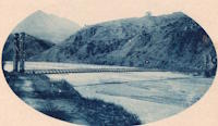
1920: Hyde Park Walking
Hyde Park and Leechburg, Pennsylvania, USA - Kiskiminetas River
| Bridgemeister ID: | 5842 (added 2021-05-13) |
| Year Completed: | 1920 |
| Name: | Hyde Park Walking |
| Location: | Hyde Park and Leechburg, Pennsylvania, USA |
| Crossing: | Kiskiminetas River |
| Coordinates: | 40.627771 N 79.597369 W |
| Maps: | Acme, GeoHack, Google, OpenStreetMap |
| Principals: | John A. Roebling's Sons |
| Use: | Footbridge |
| Status: | Destroyed, March 17, 1936 |
| Main Cables: | Wire (steel) |
| Suspended Spans: | 3 |
| Main Spans: | 3 |
Notes:
- Destroyed by flood, March 17, 1936.
- Replaced by 1937 Hyde Park Walking - Hyde Park and Leechburg, Pennsylvania, USA. The replacement was constructed based on the John A. Roebling's Sons plans from the first bridge.
- All past and present bridges at this location.
1920: Jøssundbrua
Jøssund, Ørland, Trøndelag, Norway - Jøssundstraumen
| Bridgemeister ID: | 4466 (added 2020-04-26) |
| Year Completed: | 1920 |
| Name: | Jøssundbrua |
| Location: | Jøssund, Ørland, Trøndelag, Norway |
| Crossing: | Jøssundstraumen |
| Coordinates: | 63.842912 N 9.811104 E |
| Maps: | Acme, GeoHack, Google, kart.1881.no, OpenStreetMap |
| Use: | Vehicular (one-lane) |
| Status: | Removed |
| Main Cables: | Wire |
| Suspended Spans: | 1 |
| Main Span: | 1 x 44 meters (144.4 feet) estimated |
External Links:
1920: Kaibab Trail
Grand Canyon National Park, Arizona, USA - Colorado River
| Bridgemeister ID: | 2186 (added 2007-01-15) |
| Year Completed: | 1920 |
| Name: | Kaibab Trail |
| Location: | Grand Canyon National Park, Arizona, USA |
| Crossing: | Colorado River |
| Principals: | George C. Goodwin |
| References: | AAJ |
| Use: | Footbridge |
| Status: | Replaced, 1928 |
| Main Cables: | Wire |
| Suspended Spans: | 1 |
Notes:
- Replaced by 1928 Kaibab Trail (Black, South Kaibab) - Bright Angel Campground vicinity, Arizona, USA.
- All past and present bridges at this location.
External Links:
1920: Lacy's
New Zealand - Retaruke River
| Bridgemeister ID: | 701 (added 2003-03-08) |
| Year Completed: | 1920 |
| Name: | Lacy's |
| Location: | New Zealand |
| Crossing: | Retaruke River |
| References: | GAP |
| Use: | Footbridge |
| Status: | Replaced |
Notes:
- GAP: Possibly completed 1915-1916.
- Replaced by 1932 Lacy's - Retaruke, New Zealand.
- All past and present bridges at this location.
1920: Les Andelys
Les Andelys, Eure, France - Seine River
| Bridgemeister ID: | 1597 (added 2005-02-06) |
| Year Completed: | 1920 |
| Name: | Les Andelys |
| Location: | Les Andelys, Eure, France |
| Crossing: | Seine River |
| Coordinates: | 49.236737 N 1.399657 E |
| Maps: | Acme, GeoHack, Google, OpenStreetMap |
| Principals: | Ferdinand Arnodin |
| Use: | Vehicular |
| Status: | Demolished, June 9, 1940 |
| Main Cables: | Wire (steel) |
| Suspended Spans: | 1 |
Notes:
- Completed in 1914 but not opened until 1920.
- The present-day Les Andelys bridge appears to have been constructed on the same piers as this predecessor.
- Demolished in June 1940 by the French army to slow advancing German troops during WWII.
- At former location of 1838 Les Andelys - Les Andelys, Eure, France. The 1920 bridge was not an immediate replacement. A stone arch bridge replaced the 1838 suspension bridge destroyed in 1870. The arch bridge was replaced by this (1920) suspension bridge.
- Replaced by 1947 Les Andelys - Les Andelys, Eure, France.
- All past and present bridges at this location.
Image Sets:


1920: Old Hill Place
Fayette vicinity, Mississippi, USA - Coles Creek South Fork
| Bridgemeister ID: | 137 (added before 2003) |
| Year Completed: | 1920 |
| Name: | Old Hill Place |
| Location: | Fayette vicinity, Mississippi, USA |
| Crossing: | Coles Creek South Fork |
| Coordinates: | 31.669433 N 91.180917 W |
| Maps: | Acme, GeoHack, Google, OpenStreetMap |
| References: | GBD |
| Use: | Vehicular (one-lane) |
| Status: | Derelict (last checked: 2005) |
| Main Cables: | Wire (steel) |
External Links:
Image Sets:
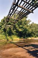
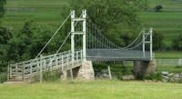
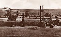
1920: Reeth Swing
Reeth vicinity, Swaledale, England, United Kingdom - River Swale
| Bridgemeister ID: | 807 (added 2003-03-30) |
| Year Completed: | 1920 |
| Name: | Reeth Swing |
| Location: | Reeth vicinity, Swaledale, England, United Kingdom |
| Crossing: | River Swale |
| Coordinates: | 54.385673 N 1.952474 W |
| Maps: | Acme, GeoHack, Google, OpenStreetMap |
| Principals: | J. Hird |
| Use: | Footbridge |
| Status: | In use (last checked: 2014) |
| Main Cables: | Wire |
| Suspended Spans: | 1 |
Notes:
- Destroyed by flood, rebuilt in 2002.
External Links:
Image Sets:
1920: Swinging
Millersburg, Pennsylvania, USA - Wiconisco Creek
| Bridgemeister ID: | 1924 (added 2005-10-23) |
| Year Completed: | 1920 |
| Name: | Swinging |
| Location: | Millersburg, Pennsylvania, USA |
| Crossing: | Wiconisco Creek |
| Use: | Footbridge |
| Status: | Destroyed, 1972 |
Notes:
- Destroyed by Hurricane Agnes, June 22, 1972.
- Replaced by 1996 Swinging - Millersburg, Pennsylvania, USA.
- All past and present bridges at this location.
1921: (footbridge)
Oregon City and West Linn, Oregon, USA - Willamette River
| Bridgemeister ID: | 4954 (added 2020-08-08) |
| Year Completed: | 1921 |
| Name: | (footbridge) |
| Location: | Oregon City and West Linn, Oregon, USA |
| Crossing: | Willamette River |
| Use: | Footbridge |
| Status: | Removed, 1922 |
| Main Cables: | Wire (steel) |
Notes:
- See 1888 Oregon City - Oregon City and West Linn, Oregon, USA. The 1921 structure appears to have been a temporary, but large, footbridge constructed during the construction of the replacement of the older Oregon City suspension bridge.
External Links:
1921: Amposta
Amposta, Spain - Ebro River
| Bridgemeister ID: | 935 (added 2003-10-25) |
| Year Completed: | 1921 |
| Name: | Amposta |
| Also Known As: | Penjant |
| Location: | Amposta, Spain |
| Crossing: | Ebro River |
| Coordinates: | 40.714866 N 0.581695 E |
| Maps: | Acme, GeoHack, Google, OpenStreetMap |
| Principals: | José Eugenio Ribera |
| Use: | Vehicular (two-lane) |
| Status: | In use (last checked: 2019) |
| Main Cables: | Wire (steel) |
| Suspended Spans: | 1 |
Notes:
- Damaged during Spanish Civil War, restored 1941.
External Links:
Image Sets:


1921: Bagni di Lucca
Bagni di Lucca, Italy - Torrente Luna
| Bridgemeister ID: | 1473 (added 2004-09-02) |
| Year Completed: | 1921 |
| Name: | Bagni di Lucca |
| Location: | Bagni di Lucca, Italy |
| Crossing: | Torrente Luna |
| Coordinates: | 44.0092 N 10.5908 E |
| Maps: | Acme, GeoHack, Google, OpenStreetMap |
| Use: | Footbridge |
| Status: | In use (last checked: 2023) |
| Main Cables: | Wire (steel) |
| Suspended Spans: | 1 |
Image Sets:

1921: Bridgeport
Bridgeport and Geary, Oklahoma, USA - South Canadian River
| Bridgemeister ID: | 1660 (added 2005-03-19) |
| Year Completed: | 1921 |
| Name: | Bridgeport |
| Also Known As: | Key, Postal |
| Location: | Bridgeport and Geary, Oklahoma, USA |
| Crossing: | South Canadian River |
| Coordinates: | 35.567306 N 98.374731 W |
| Maps: | Acme, GeoHack, Google, OpenStreetMap |
| References: | PTS2 |
| Use: | Vehicular |
| Status: | Removed |
| Main Cables: | Wire (steel) |
Notes:
- Remnants of at least one pier still standing, 2019.
| Bridgemeister ID: | 3908 (added 2020-03-15) |
| Year Completed: | 1921 |
| Name: | Høistad |
| Location: | Høistad, Norway |
| Crossing: | Glomma |
| Coordinates: | 62.50644 N 11.26111 E |
| Maps: | Acme, GeoHack, Google, kart.1881.no, OpenStreetMap |
| Use: | Vehicular (one-lane) |
| Status: | Removed |
| Main Cables: | Wire |
| Main Span: | 1 x 36 meters (118.1 feet) estimated |
Notes:
- Based on historic aerial images, removed 1953-1963.
External Links:
- DigitaltMuseum - Den gamle Høistad bru, med Røstfossen kraftverk i bakgrunnen. The 1818 - 1921 bridge that existed prior with the Røstefossen Kraftverk (Dam) just beyond.
- DigitaltMuseum - Kabelbru. Showing the northwest tower of the suspension bridge being constructed (~1920) on the far side of the river alongside of the 1818 bridge. One of the struts (topped with snow) extending out from the nearside tower is visible half way up the left edge.
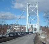
1921: Kingston-Port Ewen
Kingston, New York, USA - Rondout Creek
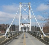
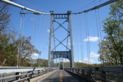
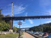
| Bridgemeister ID: | 138 (added before 2003) |
| Year Completed: | 1921 |
| Name: | Kingston-Port Ewen |
| Also Known As: | Wurts Street, Rondout Creek |
| Location: | Kingston, New York, USA |
| Crossing: | Rondout Creek |
| Coordinates: | 41.916129 N 73.983999 W |
| Maps: | Acme, GeoHack, Google, OpenStreetMap |
| Principals: | Holton D. Robinson, Daniel E. Moran, William Yates |
| References: | AAJ, PTS, PTS2, SJR, SSS |
| Use: | Vehicular (two-lane, heavy vehicles), with walkway |
| Status: | In use (last checked: 2024) |
| Main Cables: | Wire (steel) |
| Suspended Spans: | 3 |
| Main Span: | 1 x 214.9 meters (705 feet) |
| Side Spans: | 2 x 53.7 meters (176.25 feet) |
| Deck width: | 37 feet |
Notes:
- 2008, March: Closed for ten weeks for cable inspection.
- 2018, December: Closed for maintenance. Expected to reopen February, 2019.
- 2019: Major rehabilitation continues to be delayed for several years.
- 2020, September: Closed temporarily. Major renovation project continues to be delayed.
- 2020, December: Closed indefinitely.
- 2021, May: Bids for renovation to be sought in June. Work expected to start in September.
- 2021, October: Groundbreaking ceremony for long-anticipated restoration project. Expected to be completed in 2023 at a cost of US$44.6M
- 2024, July: The bridge reopens following the completion of the multi-year restoration project.
Annotated Citations:
- Kirby, Paul. "Bids for Rondout Creek Bridge overhaul to be sought next month; work expected to start in September." Daily Freeman, 5 May 2021, Bids for Rondout Creek Bridge overhaul to be sought next month; work expected to start in September.
"Bids for the planned overhaul of the Rondout Creek Bridge will be sought in June, and the state Department of Transportation expects to award contracts for the work in August, the office of state Assemblyman Kevin Cahill said this week... The rehabilitation of the suspension bridge, which carries Wurts Street over the creek between Kingston and Port Ewen, could cost as much as $37 million, Cahill said previously. The state will pay for the project, which is expected to begin this fall."
External Links:
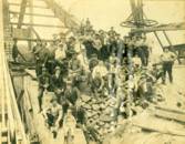
- Dave Longendyke's website. Several photos of the bridge's construction.
- HudsonValleyOne.com - State and local officials reopen the Wurts Street suspension bridge. Article covering the reopening of the restored bridge, published July 2, 2024.
- Bridgehunter.com - BH27009
- Structurae - Structure ID 20007345
Image Sets:
1921: Monowai
Monowai, New Zealand - Waiau River
| Bridgemeister ID: | 7593 (added 2023-05-07) |
| Year Completed: | 1921 |
| Name: | Monowai |
| Location: | Monowai, New Zealand |
| Crossing: | Waiau River |
| Use: | Vehicular |
| Status: | Destroyed, 1959 |
| Main Cables: | Wire (steel) |
| Main Span: | 1 |
Notes:
- 1959: Destroyed by nearby scrub fire.
- Near Lake Monowai Road - Monowai and Blackmount, New Zealand.
External Links:
1921: Niyodo
Japan
1921: St. Marien
St. Marien, Budelière vicinity, Évaux-les-Bains and Budelière, Creuse, France - Tardes River
| Bridgemeister ID: | 1159 (added 2004-01-18) |
| Year Completed: | 1921 |
| Name: | St. Marien |
| Location: | St. Marien, Budelière vicinity, Évaux-les-Bains and Budelière, Creuse, France |
| Crossing: | Tardes River |
| Coordinates: | 46.233320 N 2.508124 E |
| Maps: | Acme, GeoHack, Google, OpenStreetMap |
| Use: | Vehicular (one-lane) |
| Status: | In use (last checked: 2017) |
| Suspended Spans: | 1 |
Notes:
- Located just before the Tardes flows into the Cher. Sometimes noted as near Evaux-les-Bains.
Image Sets:


1922: (footbridge)
Bexley, Ohio, USA - Alum Creek
| Bridgemeister ID: | 819 (added 2003-05-31) |
| Year Completed: | 1922 |
| Name: | (footbridge) |
| Location: | Bexley, Ohio, USA |
| Crossing: | Alum Creek |
| At or Near Feature: | Wolfe Park |
| Coordinates: | 39.963831 N 82.947491 W |
| Maps: | Acme, GeoHack, Google, OpenStreetMap |
| References: | AAJ, PTS2 |
| Use: | Footbridge |
| Status: | In use (last checked: 2016) |
| Main Cables: | Wire (steel) |
| Suspended Spans: | 1 |
| Deck width: | 6.25 feet |
Notes:
- Closed 2013 for major refurbishment including a new deck. Reopened March. 2014.
- April 2015: Two main cables snap, causing a partial collapse of the bridge deck. Repaired and reopened August 5, 2016. Failure speculated to have been caused by the weight of the new deck installed 2013-2014.
External Links:
Image Sets:
1922: Arauca
Arauca, Colombia - Cauca River
| Bridgemeister ID: | 2017 (added 2006-01-14) |
| Year Completed: | 1922 |
| Name: | Arauca |
| Location: | Arauca, Colombia |
| Crossing: | Cauca River |
| Use: | Vehicular |
| Status: | Replaced, 1957 |
| Main Cables: | Wire (steel) |
| Suspended Spans: | 1 |
| Main Span: | 1 x 10² meters (334.6 feet) |
Notes:
1922: Carlos Holguín
Juanchito, Cali vicinity and Candelaria vicinity, Colombia - Cauca River
| Bridgemeister ID: | 2007 (added 2006-01-04) |
| Year Completed: | 1922 |
| Name: | Carlos Holguín |
| Location: | Juanchito, Cali vicinity and Candelaria vicinity, Colombia |
| Crossing: | Cauca River |
| Use: | Vehicular |
| Status: | Dismantled, 1956 |
| Main Cables: | Wire (steel) |
| Suspended Spans: | 1 |
| Main Span: | 1 x 120 meters (393.7 feet) |
Notes:
- Replaced by 1957 Carlos Holguín - Juanchito, Cali vicinity and Candelaria vicinity, Colombia.
- All past and present bridges at this location.
Image Sets:
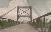
1922: Cortazar
Cortazar, Guanajuato, Mexico - Laja River
| Bridgemeister ID: | 6930 (added 2022-01-22) |
| Year Completed: | 1922 |
| Name: | Cortazar |
| Also Known As: | Arquitecto Ernesto Brunel |
| Location: | Cortazar, Guanajuato, Mexico |
| Crossing: | Laja River |
| Coordinates: | 20.491846 N 100.962915 W |
| Maps: | Acme, GeoHack, Google, OpenStreetMap |
| Use: | Vehicular (one-lane) |
| Status: | Restricted to foot traffic (last checked: 2021) |
| Main Cables: | Wire (steel) |
| Suspended Spans: | 1 |
Notes:
- 1922: During inauguration event, one end of the bridge dipped 1-2 feet, possibly due to the weight of the crowd. The bridge was repaired and entered into service.
- 2020-2021: Disassembled, rehabilitated, reassembled and reopened
1922: Dodge
Fontenelle vicinity, Sweetwater County, Wyoming, USA - Green River
| Bridgemeister ID: | 5557 (added 2020-12-18) |
| Year Completed: | 1922 |
| Name: | Dodge |
| Location: | Fontenelle vicinity, Sweetwater County, Wyoming, USA |
| Crossing: | Green River |
| Coordinates: | 41.960083 N 109.967750 W |
| Maps: | Acme, GeoHack, Google, OpenStreetMap |
| Principals: | Harold H. Dodge |
| Use: | Stock |
| Status: | Removed |
| Main Cables: | Wire (steel) |
| Main Span: | 1 |
Notes:
- This bridge was located northwest of the present-day Seedskadee National Wildlife Refuge before Fontenelle somewhere near the current McCullen Bluff boat launch but downstream from the bluff. Coordinates provided here may be the former location of the bridge. Appears to have been primarily a "sheep" bridge.
External Links:
- Museum Shares History of 3 Bridges Across the Green River - SweetwaterNOW. Images of the bridge.
1922: Duck Run
Truebada, Glenville vicinity, West Virginia, USA - Little Kanawha River
| Bridgemeister ID: | 139 (added before 2003) |
| Year Completed: | 1922 |
| Name: | Duck Run |
| Also Known As: | Truebada Swinging |
| Location: | Truebada, Glenville vicinity, West Virginia, USA |
| Crossing: | Little Kanawha River |
| Coordinates: | 38.92830 N 80.78731 W |
| Maps: | Acme, GeoHack, Google, OpenStreetMap |
| Principals: | William M. Moss, Fred Lewis |
| Use: | Vehicular (one-lane) |
| Status: | Closed (last checked: 2007) |
| Main Cables: | Wire |
| Suspended Spans: | 3 |
| Main Span: | 1 x 62.5 meters (205 feet) estimated |
| Side Spans: | 1 x 20.1 meters (66 feet) estimated, 1 x 23.5 meters (77 feet) estimated |
Notes:
- Bypassed, 1991.
External Links:
Image Sets:
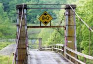
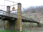
1922: Foy
Foy, Ross-on-Wye, England, United Kingdom - River Wye
| Bridgemeister ID: | 1209 (added 2004-02-07) |
| Year Completed: | 1922 |
| Name: | Foy |
| Location: | Foy, Ross-on-Wye, England, United Kingdom |
| Crossing: | River Wye |
| Coordinates: | 51.952822 N 2.576809 W |
| Maps: | Acme, GeoHack, Google, OpenStreetMap |
| Principals: | David Rowell & Co. |
| References: | BRW |
| Use: | Footbridge |
| Status: | In use (last checked: 2022) |
| Main Cables: | Wire (steel) |
| Suspended Spans: | 1 |
| Main Span: | 1 x 43.2 meters (141.7 feet) |
Notes:
- BRW: Replaced a bridge that was likely a similar suspension bridge built in 1876 and destroyed by flood in 1919.
Image Sets:
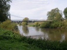
Mail | Facebook | X (Twitter) | Bluesky
