Suspension Bridges 1884-1909 (201-266 of 266)
This is a list of bridges 201 through 266 (of 266 total) in the suspension bridge inventory completed from 1884 through 1909, the year the Manhattan Bridge was completed. Wherever you see a Bridgemeister ID number click it to isolate the bridge on its own page.
Related Lists:
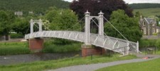
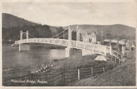
1905: Priorsford
Peebles, Scotland, United Kingdom - River Tweed
| Bridgemeister ID: | 1441 (added 2004-07-31) |
| Year Completed: | 1905 |
| Name: | Priorsford |
| Location: | Peebles, Scotland, United Kingdom |
| Crossing: | River Tweed |
| Coordinates: | 55.649532 N 3.187578 W |
| Maps: | Acme, GeoHack, Google, OpenStreetMap |
| Principals: | Robert Inglis |
| References: | BC3 |
| Use: | Footbridge |
| Status: | In use (last checked: 2014) |
| Main Cables: | Wire (steel) |
| Main Span: | 1 x 29.6 meters (97 feet) |
External Links:

1905: Quimiri
Quimiri, Peru - Rio Chanchamayo
| Bridgemeister ID: | 6020 (added 2021-07-02) |
| Year Completed: | 1905 |
| Name: | Quimiri |
| Also Known As: | Kimiri |
| Location: | Quimiri, Peru |
| Crossing: | Rio Chanchamayo |
| Coordinates: | 11.033115 S 75.316588 W |
| Maps: | Acme, GeoHack, Google, OpenStreetMap |
| Use: | Vehicular |
| Status: | In use (last checked: 2021) |
| Main Cables: | Wire (steel) |
| Suspended Spans: | 1 |
| Main Span: | 1 |
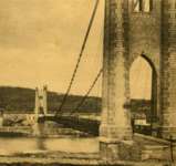
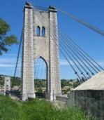
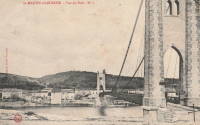
1905: Saint-Martin
Saint-Martin-d'Ardèche, Ardèche and Aiguèze, Gard, France - Ardèche River
| Bridgemeister ID: | 1523 (added 2004-10-10) |
| Year Completed: | 1905 |
| Name: | Saint-Martin |
| Location: | Saint-Martin-d'Ardèche, Ardèche and Aiguèze, Gard, France |
| Crossing: | Ardèche River |
| Coordinates: | 44.3007 N 4.567283 E |
| Maps: | Acme, GeoHack, Google, OpenStreetMap |
| Use: | Vehicular (one-lane) |
| Status: | In use (last checked: 2005) |
| Main Cables: | Wire |
| Suspended Spans: | 1 |
External Links:
1905: Swinging
Riverside, Illinois, USA - Des Plaines River
| Bridgemeister ID: | 2617 (added 2018-12-30) |
| Year Completed: | 1905 |
| Name: | Swinging |
| Location: | Riverside, Illinois, USA |
| Crossing: | Des Plaines River |
| Coordinates: | 41.825603 N 87.817864 W |
| Maps: | Acme, GeoHack, Google, OpenStreetMap |
| Use: | Footbridge |
| Status: | Replaced, 1940 |
| Main Cables: | Wire |
| Suspended Spans: | 1 |
Notes:
- This replacement bridge appears to have been problematic. Most available images show some combination of mid-span supports assisting the suspension cables and failing deck.
- Replaced 1893 Watson's - Riverside, Illinois, USA.
- Replaced by 1940 H. Wallace Caldwell Memorial (Swinging) - Riverside, Illinois, USA.
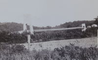
1905: Tuscumbia
Tuscumbia, Missouri, USA - Osage River
| Bridgemeister ID: | 1977 (added 2005-11-27) |
| Year Completed: | 1905 |
| Name: | Tuscumbia |
| Location: | Tuscumbia, Missouri, USA |
| Crossing: | Osage River |
| Coordinates: | 38.23526 N 92.44763 W |
| Maps: | Acme, GeoHack, Google, OpenStreetMap |
| Principals: | Joseph Dice |
| References: | BOTO |
| Use: | Vehicular (one-lane) |
| Status: | Replaced, 1933 |
| Main Cables: | Wire |
| Main Span: | 1 |
| Side Spans: | 2 |
Notes:
- Some remains still visible at site, 2007.
- Near (suspension bridge) - Tuscumbia vicinity, Missouri, USA.
External Links:
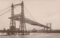
1905: Widnes-Runcorn Transporter
Runcorn, England, United Kingdom - River Mersey, Manchester Ship Canal
| Bridgemeister ID: | 954 (added 2003-10-31) |
| Year Completed: | 1905 |
| Name: | Widnes-Runcorn Transporter |
| Location: | Runcorn, England, United Kingdom |
| Crossing: | River Mersey, Manchester Ship Canal |
| Principals: | J.J. Webster, J.T. Wood, Charles Smith |
| References: | AAJ, BRB, HBE |
| Use: | Transporter |
| Status: | Removed |
| Main Cables: | Wire (steel) |
| Suspended Spans: | 1 |
| Main Span: | 1 x 304.8 meters (1,000 feet) |
External Links:
1905: Zhalantun
Xinghua (兴华), Zhalantun (扎兰屯市), Hulunbuir (呼伦贝尔市), Inner Mongolia, China
| Bridgemeister ID: | 8448 (added 2024-03-10) |
| Year Completed: | 1905 |
| Name: | Zhalantun |
| Location: | Xinghua (兴华), Zhalantun (扎兰屯市), Hulunbuir (呼伦贝尔市), Inner Mongolia, China |
| At or Near Feature: | 呼伦贝尔市扎兰屯吊桥公园 - Hulunbuir Suspension Bridge Park |
| Coordinates: | 48.019111 N 122.727806 E |
| Maps: | Acme, GeoHack, Google, OpenStreetMap |
| Use: | Footbridge |
| Status: | In use (last checked: 2023) |
| Main Cables: | Chain |
| Suspended Spans: | 1 |
External Links:
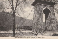
1906: (suspension bridge)
Cuorgnè vicinity, Turin, Italy - Orco River
| Bridgemeister ID: | 6832 (added 2021-12-31) |
| Year Completed: | 1906 |
| Name: | (suspension bridge) |
| Location: | Cuorgnè vicinity, Turin, Italy |
| Crossing: | Orco River |
| Main Cables: | Wire |
| Main Span: | 1 |
Notes:
- Exact location unclear, but likely removed.
| Bridgemeister ID: | 3917 (added 2020-03-20) |
| Year Completed: | 1906 |
| Name: | Auma |
| Location: | Auma, Tynset, Innlandet, Norway |
| Crossing: | Glomma |
| Coordinates: | 62.21952 N 10.65307 E |
| Maps: | Acme, GeoHack, Google, kart.1881.no, OpenStreetMap |
| Use: | Vehicular (one-lane) |
| Status: | Removed |
| Main Cables: | Wire (steel) |
| Suspended Spans: | 1 |
| Main Span: | 1 x 67 meters (219.8 feet) estimated |
Notes:
- Removed prior to replacement by a truss bridge constructed on the same piers in 1961.
External Links:
1906: Baton
Baton River valley vicinity, New Zealand - Motueka River
| Bridgemeister ID: | 689 (added 2003-03-08) |
| Year Completed: | 1906 |
| Name: | Baton |
| Location: | Baton River valley vicinity, New Zealand |
| Crossing: | Motueka River |
| References: | GAP |
| Use: | Footbridge and Stock |
| Status: | Replaced, 1961 |
| Main Cables: | Wire |
| Suspended Spans: | 1 |
| Main Span: | 1 x 91.4 meters (299.9 feet) |
Notes:
- GAP: Replaced 1961.
External Links:
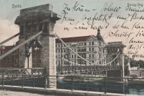
1906: Borsigsteg
Berlin, Germany - Spree River
| Bridgemeister ID: | 5692 (added 2021-04-01) |
| Year Completed: | 1906 |
| Name: | Borsigsteg |
| Also Known As: | Borsig |
| Location: | Berlin, Germany |
| Crossing: | Spree River |
| Coordinates: | 52.520874 N 13.339195 E |
| Maps: | Acme, GeoHack, Google, OpenStreetMap |
| Use: | Footbridge |
| Status: | Destroyed, April 1945 |
| Main Cables: | Eyebar (steel) |
| Suspended Spans: | 1 |
Notes:
- Abutments are still present (as of 2021).
- 1915: Damaged and rebuilt.
1906: Brannon's Crossing
Weatherford vicinity, Parker County, Texas, USA - Brazos River
| Bridgemeister ID: | 1298 (added 2004-03-28) |
| Year Completed: | 1906 |
| Name: | Brannon's Crossing |
| Location: | Weatherford vicinity, Parker County, Texas, USA |
| Crossing: | Brazos River |
| Coordinates: | 32.66256 N 98.03288 W |
| Maps: | Acme, GeoHack, Google, OpenStreetMap |
| Principals: | Mitchell & Pigg |
| References: | HAERTX98 |
| Use: | Vehicular |
| Status: | Replaced, 1934 |
| Main Cables: | Wire (steel) |
| Main Span: | 1 x 134.1 meters (440 feet) |
Notes:
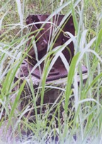
- Tony King believes he found the former location of this bridge a few hundred yards south of the I-20 Brazos River crossing west of Weatherford. This location is near a road named "Brannon Bridge Circle." Tony writes: "Just downstream from the modern Interstate 20 bridge in western Parker County, I've noticed a concrete and iron structure, and happened to take a photo of it recently. I've noticed the structure a couple of times in the past (most recently in May of 2007) while hiking a well-worn foot/ATV path that parallels the west bank of the river as it flows almost due south from the Interstate to Meeks Bend." The structure in Tony's photo appears to be a pier or support footing. The coordinates given here are Tony's approximation of the location of the structure.
- Built as part of the same contract as the Tin Top bridge.
- Similar to 1906 Tin Top (Hightower Valley) - Tin Top, Texas, USA.
| Bridgemeister ID: | 3936 (added 2020-03-21) |
| Year Completed: | 1906 |
| Name: | Dølplass |
| Location: | Straalsjöaasen, Alvdal, Innlandet, Norway |
| Crossing: | Folla |
| Coordinates: | 62.19207 N 10.45023 E |
| Maps: | Acme, GeoHack, Google, kart.1881.no, OpenStreetMap |
| Use: | Vehicular (one-lane) |
| Status: | Removed |
| Main Cables: | Wire |
| Suspended Spans: | 1 |
| Main Span: | 1 x 40 meters (131.2 feet) estimated |
Notes:
- Rebuilt 1940. Unclear if the bridge was completely replaced at this point.
- Based on historic aerial images, removed between 1969 and 2004.
External Links:
1906: Forsæt
Forset, Brandvoll, Troms og Finnmark, Norway - Salangselva
| Bridgemeister ID: | 4077 (added 2020-04-04) |
| Year Completed: | 1906 |
| Name: | Forsæt |
| Location: | Forset, Brandvoll, Troms og Finnmark, Norway |
| Crossing: | Salangselva |
| Coordinates: | 68.774663 N 18.165802 E |
| Maps: | Acme, GeoHack, Google, kart.1881.no, OpenStreetMap |
| Use: | Vehicular (one-lane) |
| Status: | Removed |
| Main Cables: | Wire (steel) |
| Suspended Spans: | 1 |
| Main Span: | 1 x 27 meters (88.6 feet) |
External Links:
1906: Gulsvik
Gulsvik, Granheim, Flå, Viken, Norway - Hallingdalselva
| Bridgemeister ID: | 2864 (added 2019-09-08) |
| Year Completed: | 1906 |
| Name: | Gulsvik |
| Location: | Gulsvik, Granheim, Flå, Viken, Norway |
| Crossing: | Hallingdalselva |
| Coordinates: | 60.386333 N 9.578184 E |
| Maps: | Acme, GeoHack, Google, kart.1881.no, OpenStreetMap |
| Use: | Vehicular (one-lane) |
| Status: | Restricted to foot traffic (last checked: 2019) |
| Main Cables: | Wire (steel) |
| Suspended Spans: | 1 |
| Main Span: | 1 x 97 meters (318.2 feet) |
Notes:
- Upon completion claimed to be Scandinavia's longest suspension bridge.
- Bypassed 1971.
- Near 1940 (suspension bridge) - Gulsvik, Granheim, Flå, Viken, Norway.
External Links:
- DigitaltMuseum - Gamle Gulsvik hengebru i Flå
- DigitaltMuseum - Gamle Gulsvik hengebru under bygging 1903-1906
- DigitaltMuseum - Gamle Gulsvik hengebru under bygging 1903-1906
- DigitaltMuseum - Gamle Gulsvik hengebru under bygging 1903-1906
- DigitaltMuseum - Gamle Gulsvik hengebru under bygging 1903-1906
- DigitaltMuseum - Gamle Gulsvik hengebru under bygging 1903-1906
- DigitaltMuseum - Gamle Gulsvik hengebru under bygging 1903-1906
- DigitaltMuseum - Gamle Gulsvik hengebru under bygging 1903-1906
- DigitaltMuseum - Gulsvik bru på Hallingdalsvegen åpnet i 1906 og var i sin tid Skandinavias lengste hengebru
- DigitaltMuseum - Gulsvik hengebru ferdigbygd i 1905.når den vart bygd var den skandinavias lengste hengebru 92 m. Vart forsøkt sprengt av norske pionerstyrker 25 april 1940
- Structurae - Structure ID 20087388
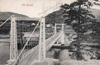
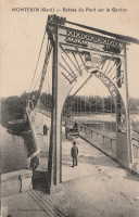
1906: Montfrin
Montfrin, Gard, France - Gardon River
| Bridgemeister ID: | 7275 (added 2022-07-22) |
| Year Completed: | 1906 |
| Name: | Montfrin |
| Location: | Montfrin, Gard, France |
| Crossing: | Gardon River |
| Use: | Vehicular |
| Status: | Removed |
| Main Cables: | Wire |
| Main Spans: | 2 |
Notes:
- Replaced 1838 Montfrin - Montfrin, Gard, France.
External Links:
- Art-et-Histoire - Nouveau pont suspendu de Montfrin - 1907. Suspects the bridge opened in 1907. The year 1906 is seen very prominently on the bridge tower, but the bridge may not have opened in 1906.
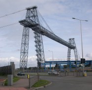
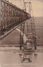
1906: Newport Transporter
Newport, Wales, United Kingdom - River Usk
| Bridgemeister ID: | 939 (added 2003-10-25) |
| Year Completed: | 1906 |
| Name: | Newport Transporter |
| Location: | Newport, Wales, United Kingdom |
| Crossing: | River Usk |
| Coordinates: | 51.570642 N 2.985246 W |
| Maps: | Acme, GeoHack, Google, OpenStreetMap |
| Principals: | Ferdinand Arnodin |
| References: | AAJ, NTB |
| Use: | Transporter |
| Status: | In use (last checked: 2011) |
| Main Cables: | Wire (steel) |
| Suspended Spans: | 1 |
| Main Span: | 1 x 196.6 meters (645 feet) |
External Links:
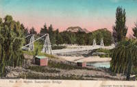
1906: Puketapu-Moteo
Puketapu, Hawke's Bay, New Zealand - Tutaekuri River
| Bridgemeister ID: | 688 (added 2003-03-08) |
| Year Completed: | 1906 |
| Name: | Puketapu-Moteo |
| Also Known As: | Puketapu Swing |
| Location: | Puketapu, Hawke's Bay, New Zealand |
| Crossing: | Tutaekuri River |
| References: | GAP |
| Use: | Vehicular |
| Status: | Replaced, 1963 |
| Main Cables: | Wire (steel) |
| Main Span: | 1 x 129 meters (423.2 feet) |
Annotated Citations:
- Fowler, Michael. "Historic HB: After much ado the swing bridge was finally built." Hawke's Bay Today, 5 May 2022, www.nzherald.co.nz/hawkes-bay-today/news/historic-hb-after-much-ado-the-swing-bridge-was-finally-built/ZHUL7ZJHBPX3OML74PN6PUGJ6I/
"The swing bridge, at 494 feet (150m) in length was believed to have been the longest single-span structure of its type in the North Island. There was ten 700 feet (213m) supporting cables of plough steel (high quality steel containing carbon, used to make wire ropes) imported from England."
External Links:
1906: Schönausteg
Berne, Switzerland - Aare River
| Bridgemeister ID: | 1396 (added 2004-07-04) |
| Year Completed: | 1906 |
| Name: | Schönausteg |
| Location: | Berne, Switzerland |
| Crossing: | Aare River |
| Coordinates: | 46.934417 N 7.445883 E |
| Maps: | Acme, GeoHack, Google, OpenStreetMap |
| References: | AAJ |
| Use: | Footbridge |
| Status: | In use (last checked: 2017) |
| Main Cables: | Eyebar (steel) |
| Suspended Spans: | 1 |
| Main Span: | 1 x 53.3 meters (174.88 feet) |
| Deck width: | 8.2 feet |
External Links:
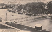
1906: Swinging
Charles City, Iowa, USA - Cedar River
| Bridgemeister ID: | 118 (added before 2003) |
| Year Completed: | 1906 |
| Name: | Swinging |
| Also Known As: | Charles City, Clark Street |
| Location: | Charles City, Iowa, USA |
| Crossing: | Cedar River |
| Coordinates: | 43.070433 N 92.685517 W |
| Maps: | Acme, GeoHack, Google, OpenStreetMap |
| Principals: | Charles Hart, O.B. Zimmerman |
| Use: | Footbridge |
| Status: | Destroyed (last checked: 2008) |
| Main Cables: | Wire |
| Suspended Spans: | 3 |
| Main Span: | 1 x 90.8 meters (298 feet) estimated |
| Side Spans: | 1 x 41.5 meters (136 feet) estimated, 1 x 9.1 meters (30 feet) estimated |
Notes:
- Bids accepted for refurbishment, expected to be completed October, 2007.
- Destroyed by floodwaters June 8, 2008.
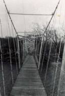
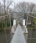
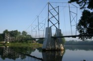
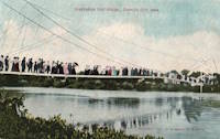
1906: Tin Top
Tin Top, Texas, USA - Brazos River
| Bridgemeister ID: | 119 (added before 2003) |
| Year Completed: | 1906 |
| Name: | Tin Top |
| Also Known As: | Hightower Valley |
| Location: | Tin Top, Texas, USA |
| Crossing: | Brazos River |
| Coordinates: | 32.575956 N 97.822697 W |
| Maps: | Acme, GeoHack, Google, OpenStreetMap |
| Principals: | Mitchell & Pigg |
| References: | BRAZ, HAERTX98 |
| Use: | Vehicular |
| Status: | Collapsed, Jan. 31, 1982 under weight of snow |
| Main Cables: | Wire (steel) |
| Main Span: | 1 x 121.9 meters (400 feet) |
Notes:
- Some internet resources suggest the "Tin Top" and "Hightower" suspension bridges were separate nearby structures, however, this does not appear to have been the case. Both names were used to describe the same structure and USGS topographical maps from the 1950s label the bridge due south of Tin Top as "Hightower". Mitchell and Pigg did build a similar structure, at Brannon's Crossing. The 2015 National Register of Historic Places Registration Form for "Historic Road Infrastructure of Texas, 1866-1965", the Texas Department of Transportation writes: "In 1905 [Mitchell and Pigg] constructed the practically identical Brannon's Crossing and Hightower Valley Bridges across the Brazos in Parker County. The former was a 440-foot clear span while the later, also known as Tin Top, was 400 feet."
- The coordinates appear to be the exact location of a pier remaining (as of 2020) from this bridge. The alignment indicated by the pier appears to exactly match the location of this bridge as indicated by 1958 USGS topographical map of the area.
- Similar to 1906 Brannon's Crossing - Weatherford vicinity, Parker County, Texas, USA.
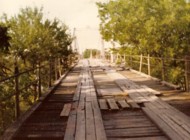
1906: Trellins
Vinay vicinity, Isère, France - Isère River
| Bridgemeister ID: | 1423 (added 2004-07-17) |
| Year Completed: | 1906 |
| Name: | Trellins |
| Location: | Vinay vicinity, Isère, France |
| Crossing: | Isère River |
| Coordinates: | 45.19536 N 5.42482 E |
| Maps: | Acme, GeoHack, Google, OpenStreetMap |
| References: | AAJ |
| Use: | Vehicular |
| Status: | Derelict (last checked: 2009) |
| Main Cables: | Wire |
| Suspended Spans: | 3 |
| Main Span: | 1 x 146.6 meters (481 feet) |
| Side Spans: | 2 x 25.3 meters (83 feet) |
Notes:
- 2022: Still standing, but suspenders and deck have been removed.
External Links:
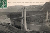
1906: Wilford
West Bridgford, Nottingham, England, United Kingdom - River Trent
| Bridgemeister ID: | 1087 (added 2004-01-01) |
| Year Completed: | 1906 |
| Name: | Wilford |
| Also Known As: | Nottingham, Meadows, Welbeck |
| Location: | West Bridgford, Nottingham, England, United Kingdom |
| Crossing: | River Trent |
| Coordinates: | 52.933167 N 1.137967 W |
| Maps: | Acme, GeoHack, Google, OpenStreetMap |
| Use: | Pipeline and Footbridge |
| Status: | In use (last checked: 2017) |
| Main Cables: | Wire |
| Suspended Spans: | 1 |
| Main Span: | 1 x 68.6 meters (225 feet) |
| Deck width: | 12 feet |
Notes:
- Designed primarily to carry water and gas mains, but also carries a wide footpath.
- Closed, July 2008, after reports of falling debris. In December 2008, Severn Trent Water announced plans to refurbish the bridge in 2009. Bridge was reopened February 12, 2010.
External Links:

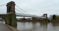
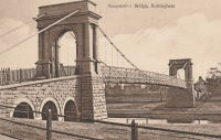
1907: (footbridge)
Hooversville, Pennsylvania, USA - Stony Creek
| Bridgemeister ID: | 1569 (added 2004-12-05) |
| Year Completed: | 1907 |
| Name: | (footbridge) |
| Location: | Hooversville, Pennsylvania, USA |
| Crossing: | Stony Creek |
| Coordinates: | 40.147818 N 78.913939 W |
| Maps: | Acme, GeoHack, Google, OpenStreetMap |
| Use: | Footbridge |
| Status: | Destroyed, 1996 |
| Main Cables: | Wire |
Notes:
- According to plaque on bridge, destroyed by flood on January 19, 1996.
- Replaced by 1996 (footbridge) - Hooversville, Pennsylvania, USA.
1907: Douglas
Franz Josef Glacier vicinity, New Zealand - Waiho River
| Bridgemeister ID: | 770 (added 2003-03-13) |
| Year Completed: | 1907 |
| Name: | Douglas |
| Location: | Franz Josef Glacier vicinity, New Zealand |
| Crossing: | Waiho River |
| Coordinates: | 43.418226 S 170.180737 E |
| Maps: | Acme, GeoHack, Google, OpenStreetMap |
| Use: | Footbridge |
| Status: | In use (last checked: 2019) |
| Main Cables: | Wire (steel) |
| Suspended Spans: | 1 |
External Links:
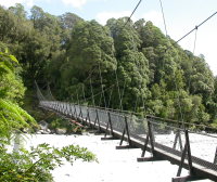
1907: Gokak Falls
Gokak, Karnataka, India - Ghataprabha River
| Bridgemeister ID: | 2219 (added 2007-03-04) |
| Year Completed: | 1907 |
| Name: | Gokak Falls |
| Location: | Gokak, Karnataka, India |
| Crossing: | Ghataprabha River |
| At or Near Feature: | Gokak Falls |
| Coordinates: | 16.191958 N 74.776933 E |
| Maps: | Acme, GeoHack, Google, OpenStreetMap |
| Use: | Footbridge |
| Status: | In use (last checked: 2019) |
| Main Cables: | Wire |
| Suspended Spans: | 4 |
| Main Spans: | 2 |
| Side Spans: | 2 |
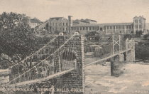
1907: Mangaltar
Mangaltar Bazar (मंगलटार बजार) vicinity, Nepal - Roshi Khola
| Bridgemeister ID: | 6434 (added 2021-08-12) |
| Year Completed: | 1907 |
| Name: | Mangaltar |
| Location: | Mangaltar Bazar (मंगलटार बजार) vicinity, Nepal |
| Crossing: | Roshi Khola |
| Coordinates: | 27.493573 N 85.730552 E |
| Maps: | Acme, GeoHack, Google, OpenStreetMap |
| Principals: | Louis Harper, Harpers Limited |
| Use: | Footbridge |
| Status: | In use (last checked: 2021) |
| Main Cables: | Wire (steel) |
| Suspended Spans: | 1 |
External Links:
1907: Romney
Kendal, England, United Kingdom - River Kent
| Bridgemeister ID: | 2426 (added 2008-03-12) |
| Year Completed: | 1907 |
| Name: | Romney |
| Also Known As: | Dockwray |
| Location: | Kendal, England, United Kingdom |
| Crossing: | River Kent |
| Coordinates: | 54.33595 N 2.74507 W |
| Maps: | Acme, GeoHack, Google, OpenStreetMap |
| Use: | Footbridge |
| Status: | In use (last checked: 2010) |
| Main Cables: | Wire |
Notes:
- Coordinates are for the current location of the bridge. It was moved there (from its original location where Romney Road meets the River Kent in Kendal) in the 1990s. A sign at the current (2011) bridge says: "The bridge was erected in 1993 on the initiative of Kendal Civic Society. It incorporates part of the structure of the former Romeny Footbridge erected in 1907..."
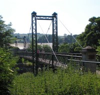
| Bridgemeister ID: | 3970 (added 2020-03-22) |
| Year Completed: | 1907 |
| Name: | Sand |
| Location: | Malangen, Troms og Finnmark, Norway |
| Crossing: | Sandselva |
| Coordinates: | 69.396363 N 18.604359 E |
| Maps: | Acme, GeoHack, Google, kart.1881.no, OpenStreetMap |
| Use: | Vehicular (one-lane) |
| Status: | Removed |
| Main Cables: | Wire (steel) |
| Suspended Spans: | 1 |
| Main Span: | 1 x 30 meters (98.4 feet) estimated |
External Links:
1907: Sandy Creek
Mackay, Queensland, Australia - Sandy Creek
| Bridgemeister ID: | 527 (added before 2003) |
| Year Completed: | 1907 |
| Name: | Sandy Creek |
| Location: | Mackay, Queensland, Australia |
| Crossing: | Sandy Creek |
| Coordinates: | 21.267726 S 149.138815 E |
| Maps: | Acme, GeoHack, Google, OpenStreetMap |
| References: | STC |
| Use: | Vehicular (one-lane) |
| Status: | Removed |
| Main Cables: | Wire |
| Suspended Spans: | 1 |
Notes:
- Damaged in 1957 and 1958 by overweight vehicles. Bridge was repaired each time. Structure was still standing when a replacement was completed in 1966.
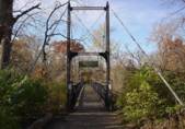
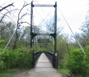
1907: Swinging
Kansas City, Missouri, USA - Blue River
| Bridgemeister ID: | 120 (added before 2003) |
| Year Completed: | 1907 |
| Name: | Swinging |
| Location: | Kansas City, Missouri, USA |
| Crossing: | Blue River |
| At or Near Feature: | Swope Park, Kansas City Zoo |
| Coordinates: | 39.00165 N 94.5244 W |
| Maps: | Acme, GeoHack, Google, OpenStreetMap |
| Principals: | Midland Bridge Co. |
| Use: | Footbridge |
| Status: | In use (last checked: 2020) |
| Main Cables: | Wire (steel) |
| Suspended Spans: | 1 |
| Main Span: | 1 x 69.2 meters (227 feet) |
| Deck width: | 8 feet |
1907: Vulcan
Vulcan, West Virginia and Pike County, Kentucky, USA - Tug Fork Big Sandy River
| Bridgemeister ID: | 2141 (added 2006-11-02) |
| Year Completed: | 1907 |
| Name: | Vulcan |
| Location: | Vulcan, West Virginia and Pike County, Kentucky, USA |
| Crossing: | Tug Fork Big Sandy River |
| References: | AAJ |
| Use: | Footbridge |
| Status: | Removed |
| Main Cables: | Wire |
| Main Span: | 1 x 121.9 meters (400 feet) |
Notes:
- On Page 13 of the December 27, 1967 edition of West Virginia's The Charleston Gazette newspaper, there is a photograph of this footbridge with a Jeep driving across. The caption reads: "Pedestrian bridge at Vulcan... is used by vehicles because it provides a route over the Tug River to Kentucky. A citizen's group has complained that the bridge is not strong enough to support cars." The photograph accompanies an article "Road Reform Call Urged" that says the bridge is "regularly used by Jeeps and small cars." Note the date of the article, December 27, 1967 is 12 days after the Silver Bridge disaster at Point Pleasant, West Virginia.
- Near (footbridge) - Vulcan, West Virginia and Pike County, Kentucky, USA. Although similar in appearance, these appear to have been different bridges.
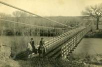
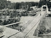
1908: (suspension bridge)
Aztec, New Mexico, USA - Las Animas River
| Bridgemeister ID: | 2505 (added 2009-03-07) |
| Year Completed: | 1908 |
| Name: | (suspension bridge) |
| Location: | Aztec, New Mexico, USA |
| Crossing: | Las Animas River |
| Principals: | Thurston and Co. |
| Use: | Vehicular (one-lane) |
| Status: | Removed |
| Main Cables: | Wire |
| Suspended Spans: | 1 |
1908: (suspension bridge)
Isokylä, Ylistaro vicinity, Finland
| Bridgemeister ID: | 2969 (added 2019-10-12) |
| Year Completed: | 1908 |
| Name: | (suspension bridge) |
| Location: | Isokylä, Ylistaro vicinity, Finland |
| Coordinates: | 62.950875 N 22.451695 E |
| Maps: | Acme, GeoHack, Google, OpenStreetMap |
| Use: | Vehicular (one-lane) |
| Status: | In use (last checked: 2009) |
| Main Cables: | Wire (steel) |
| Suspended Spans: | 1 |
1908: Bailey
Warsaw vicinity, Missouri, USA - Osage River
| Bridgemeister ID: | 3516 (added 2019-12-24) |
| Year Completed: | 1908 |
| Name: | Bailey |
| Location: | Warsaw vicinity, Missouri, USA |
| Crossing: | Osage River |
| Principals: | Joseph A. Dice |
| References: | BOTO |
| Use: | Vehicular |
| Status: | Removed |
| Main Cables: | Wire (steel) |
Notes:
- Location inundated by the Harry S. Truman Reservoir.
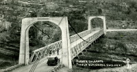
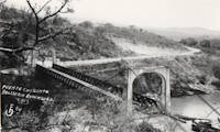
1908: Belisario Domínguez
Tuxtla Gutiérrez, Chiapas, Mexico - Rio Grijalva
| Bridgemeister ID: | 3219 (added 2019-11-11) |
| Year Completed: | 1908 |
| Name: | Belisario Domínguez |
| Also Known As: | Porfirio Díaz |
| Location: | Tuxtla Gutiérrez, Chiapas, Mexico |
| Crossing: | Rio Grijalva |
| Coordinates: | 16.742344 N 93.034593 W |
| Maps: | Acme, GeoHack, Google, OpenStreetMap |
| Use: | Vehicular (two-lane) |
| Status: | Only towers remain (last checked: 2021) |
| Main Cables: | Wire (steel) |
| Suspended Spans: | 1 |
Notes:
- 1955: Failed due to a truck colliding with part of the bridge. Adjacent replacement was already under construction.
- 2021: Towers are still present and one set of suspension cables is carrying a small pipeline. Unclear how long the bridge has been in this state.
External Links:
- Puente Belisario Domínguez en Chiapa de Corzo, que atravesaba el Río Grijalva alrededor de 1955. - Facebook
- Puente Belisario Domínguez, Chiapas, México - YouTube
| Bridgemeister ID: | 3911 (added 2020-03-15) |
| Year Completed: | 1908 |
| Name: | Erlinesset |
| Location: | Tolga, Østerdalen, Innlandet, Norway |
| Crossing: | Glomma |
| Coordinates: | 62.42619 N 11.09129 E |
| Maps: | Acme, GeoHack, Google, kart.1881.no, OpenStreetMap |
| Use: | Vehicular (one-lane) |
| Status: | In use (last checked: 2019) |
| Main Cables: | Wire (steel) |
| Suspended Spans: | 2 |
| Main Spans: | 2 x 42.5 meters (139.4 feet) estimated |
Notes:
- Restored 1951 and 1999.
External Links:
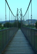
1908: Eutersdorfer Schaukelbrücke
Großeutersdorf and Kleineutersdorf, Thüringen, Germany - Saale River
| Bridgemeister ID: | 1450 (added 2004-08-01) |
| Year Completed: | 1908 |
| Name: | Eutersdorfer Schaukelbrücke |
| Location: | Großeutersdorf and Kleineutersdorf, Thüringen, Germany |
| Crossing: | Saale River |
| Coordinates: | 50.78555 N 11.56694 E |
| Maps: | Acme, GeoHack, Google, OpenStreetMap |
| Principals: | Paul Moser |
| Use: | Footbridge |
| Status: | In use (last checked: 2022) |
| Main Cables: | Wire |
| Suspended Spans: | 1 |
| Main Span: | 1 x 56 meters (183.7 feet) |
| Deck width: | 1.5 meters |
Notes:
- Reconstructed 1965, and 1993.
External Links:
1908: Heath Ford
Warsaw vicinity, Missouri, USA - Osage River
| Bridgemeister ID: | 3515 (added 2019-12-24) |
| Year Completed: | 1908 |
| Name: | Heath Ford |
| Location: | Warsaw vicinity, Missouri, USA |
| Crossing: | Osage River |
| Principals: | Joseph A. Dice |
| References: | BOTO |
| Use: | Vehicular |
| Status: | Removed |
| Main Cables: | Wire (iron) |
| Main Span: | 1 x 157.6 meters (517 feet) |
Notes:
- Damaged by wind, 1932. Replaced, 1937
- Location inundated by the Harry S. Truman Reservoir.
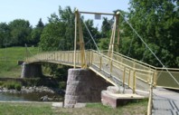
1908: Kockisch-Liebenhain
Kockisch, Mittweida and Rossau, Saxony, Germany - Zschopau River
| Bridgemeister ID: | 2164 (added 2007-01-12) |
| Year Completed: | 1908 |
| Name: | Kockisch-Liebenhain |
| Location: | Kockisch, Mittweida and Rossau, Saxony, Germany |
| Crossing: | Zschopau River |
| Coordinates: | 50.99595 N 13.00630 E |
| Maps: | Acme, GeoHack, Google, OpenStreetMap |
| Use: | Footbridge |
| Status: | In use (last checked: 2023) |
| Main Cables: | Wire (steel) |
| Suspended Spans: | 3 |
| Main Span: | 1 x 51 meters (167.3 feet) |
| Side Spans: | 1 x 7 meters (23 feet), 1 x 8 meters (26.2 feet) |
| Deck width: | 1.3 meters between side rails, 1.7 meters total |
Notes:
- Reconstructed 1996, and after damaged by flood, 2003.
External Links:
1908: Narva
Narva, Estonia - Narva River
| Bridgemeister ID: | 2177 (added 2007-01-13) |
| Year Completed: | 1908 |
| Name: | Narva |
| Location: | Narva, Estonia |
| Crossing: | Narva River |
| Coordinates: | 59.358667 N 28.195417 E |
| Maps: | Acme, GeoHack, Google, OpenStreetMap |
| Principals: | Louis Harper, Harpers Limited |
| Use: | Footbridge |
| Status: | Removed |
| Main Cables: | Wire |
| Suspended Spans: | 1 |
| Main Span: | 1 x 79.2 meters (260 feet) |
| Deck width: | 6 feet |
External Links:
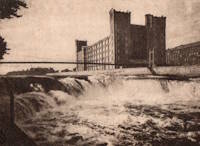
1908: Newcastle
Newcastle, Texas, USA - Brazos River
| Bridgemeister ID: | 1299 (added 2004-03-28) |
| Year Completed: | 1908 |
| Name: | Newcastle |
| Location: | Newcastle, Texas, USA |
| Crossing: | Brazos River |
| Principals: | Mitchell & Pigg |
| References: | HAERTX98 |
| Use: | Vehicular |
| Status: | Collapsed, 1930 |
| Main Cables: | Wire (steel) |
| Suspended Spans: | 3 |
| Main Span: | 1 x 213.4 meters (700 feet) |
| Side Spans: | 2 |
Notes:
- Collapsed during flood, 1930.
1908: Sagrada
Sagrada, Missouri, USA - Osage River
| Bridgemeister ID: | 2304 (added 2007-04-26) |
| Year Completed: | 1908 |
| Name: | Sagrada |
| Location: | Sagrada, Missouri, USA |
| Crossing: | Osage River |
| Principals: | J.S. Kidwell |
| References: | BOTO |
| Status: | Removed, 1931 |
| Main Cables: | Wire |
External Links:
1908: South Bend
South Bend, Texas, USA - Brazos River
| Bridgemeister ID: | 1858 (added 2005-07-17) |
| Year Completed: | 1908 |
| Name: | South Bend |
| Location: | South Bend, Texas, USA |
| Crossing: | Brazos River |
| Principals: | Mitchell & Pigg |
| References: | HAERTX98 |
| Use: | Vehicular |
| Status: | Removed |
| Main Cables: | Wire |
| Main Span: | 1 x 121.9 meters (400 feet) |
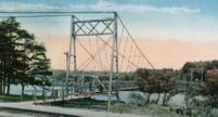
1908: Tyngs Island
Lowell vicinity, Massachusetts, USA - Merrimack River
| Bridgemeister ID: | 844 (added 2003-06-28) |
| Year Completed: | 1908 |
| Name: | Tyngs Island |
| Location: | Lowell vicinity, Massachusetts, USA |
| Crossing: | Merrimack River |
| At or Near Feature: | Vesper Country Club |
| Coordinates: | 42.65574 N 71.39971 W |
| Maps: | Acme, GeoHack, Google, OpenStreetMap |
| Principals: | Westinghouse, Church, Kerr, and Co., J.R. Worcester |
| References: | AAJ, HBE |
| Use: | Footbridge |
| Status: | Destroyed, 1936 |
| Main Cables: | Wire (steel) |
| Suspended Spans: | 1 |
| Main Span: | 1 x 167.6 meters (550 feet) |
| Deck width: | 4.5 feet |
Notes:
- Destroyed by flood, 1936.
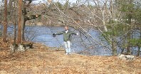
1908: Wardown Park
Luton, Bedfordshire, England, United Kingdom - River Lea
| Bridgemeister ID: | 784 (added 2003-03-16) |
| Year Completed: | 1908 |
| Name: | Wardown Park |
| Location: | Luton, Bedfordshire, England, United Kingdom |
| Crossing: | River Lea |
| At or Near Feature: | Wardown Park |
| Coordinates: | 51.89201 N 0.418833 W |
| Maps: | Acme, GeoHack, Google, OpenStreetMap |
| Use: | Footbridge |
| Status: | In use (last checked: 2015) |
| Main Cables: | Wire |
| Suspended Spans: | 1 |
Notes:
- 2015: Refurbished and reopened after having been closed for several years.
External Links:

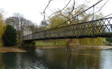
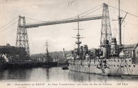
| Bridgemeister ID: | 996 (added 2003-11-16) |
| Year Completed: | 1909 |
| Name: | Brest Transporter |
| Location: | Brest, Finistère, France |
| Use: | Transporter |
| Status: | Removed, 1947 |
| Main Cables: | Wire (steel) |
| Suspended Spans: | 1 |
| Main Span: | 1 x 10⁹ meters (357.6 feet) |
Notes:
- Moved from 1898 Bizerte Transporter (Bizerta) - Bizerte, Tunisia. The bridge was dismantled and reassembled at Brest.
External Links:
1909: Chain
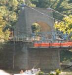
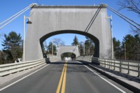
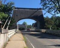
Newburyport, Massachusetts, USA - Merrimack River
| Bridgemeister ID: | 122 (added before 2003) |
| Year Completed: | 1909 |
| Name: | Chain |
| Location: | Newburyport, Massachusetts, USA |
| Crossing: | Merrimack River |
| Coordinates: | 42.833459 N 70.906674 W |
| Maps: | Acme, GeoHack, Google, OpenStreetMap |
| Principals: | George F. Swain, Robert R. Evans |
| References: | PTS2 |
| Use: | Vehicular (two-lane), with walkway |
| Status: | In use (last checked: 2006) |
| Main Cables: | Wire (steel) |
| Suspended Spans: | 1 |
| Main Span: | 1 x 80.8 meters (265 feet) |
| Deck width: | 35.8 feet |
Notes:
- Deck replaced 1922, 1931, 1938, and 2002.
- Replaced 1810 Chain (Essex-Merrimack) - Newburyport, Massachusetts, USA.
External Links:
1909: Charchare
Tinau (तिनाउ), Palpa, Masyam (मस्याम) vicinity and Koldada (कोलडाँडा) vicinity, Nepal - Tinau Khola
| Bridgemeister ID: | 6803 (added 2021-10-31) |
| Year Completed: | 1909 |
| Name: | Charchare |
| Location: | Tinau (तिनाउ), Palpa, Masyam (मस्याम) vicinity and Koldada (कोलडाँडा) vicinity, Nepal |
| Crossing: | Tinau Khola |
| Coordinates: | 27.793304 N 83.550138 E |
| Maps: | Acme, GeoHack, Google, OpenStreetMap |
| Principals: | Louis Harper, Harpers Limited |
| Use: | Footbridge |
| Status: | Extant (last checked: 2021) |
| Main Cables: | Wire |
| Suspended Spans: | 1 |
| Main Span: | 1 x 71 meters (232.9 feet) |
| Deck width: | 1.2m |
External Links:
- Charchare | Harper Bridges. Images and history of the bridge. The coordinates given on this page are incorrect.
1909: Cowwarr
Cowwarr, Victoria, Australia - Thompson River
| Bridgemeister ID: | 430 (added before 2003) |
| Year Completed: | 1909 |
| Name: | Cowwarr |
| Location: | Cowwarr, Victoria, Australia |
| Crossing: | Thompson River |
| Use: | Footbridge |
| Status: | Destroyed, 1934 |
| Main Cables: | Wire |
Notes:
- 1934: Destroyed by flood
External Links:
- Facebook - COWWARR SUSPENSION BRIDGE. Images and history of the bridge, posted March 31, 2017.
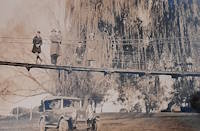
1909: Empire
Empire, Panama Canal Zone - Panama Canal
| Bridgemeister ID: | 525 (added before 2003) |
| Year Completed: | 1909 |
| Name: | Empire |
| Location: | Empire, Panama Canal Zone |
| Crossing: | Panama Canal |
| References: | PTS2 |
| Use: | Vehicular (one-lane) and Pipeline |
| Status: | Removed |
| Main Cables: | Wire (steel) |
| Suspended Spans: | 1 |
| Main Span: | 1 x 182.9 meters (600 feet) |
Notes:
- AAJ: Built to carry water and compressed air pipelines during canal construction, but also had a roadway.
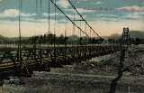
1909: Geithus
Geithus, Modum, Viken, Norway - Drammenselva
| Bridgemeister ID: | 4055 (added 2020-03-29) |
| Year Completed: | 1909 |
| Name: | Geithus |
| Location: | Geithus, Modum, Viken, Norway |
| Crossing: | Drammenselva |
| Coordinates: | 59.92837 N 9.96840 E |
| Maps: | Acme, GeoHack, Google, kart.1881.no, OpenStreetMap |
| Use: | Vehicular (one-lane) |
| Status: | In use (last checked: 2019) |
| Main Cables: | Wire (steel) |
| Suspended Spans: | 1 |
| Main Span: | 1 x 90 meters (295.3 feet) estimated |
Notes:
- Suspenders and deck destroyed to slow German advance during WWII, 1940. Later repaired.
External Links:
- DigitaltMuseum - Geithus bru i Modum bygget i 1909
- DigitaltMuseum - Geithus bru over Drammenselva ble åpnet 1909
- DigitaltMuseum - Geithus bru over Drammenselva åpnet november 1909
- DigitaltMuseum - Geithus bru, hengebru åpnet i 1909. For å sinke tysk framrykking i 1940 ble henge-stenger kuttet og brubanen falt i vannet
- Wikipedia - Geithus bru
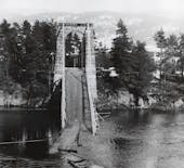
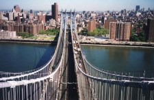
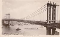
1909: Manhattan
New York and Brooklyn, New York, USA - East River
| Bridgemeister ID: | 123 (added before 2003) |
| Year Completed: | 1909 |
| Name: | Manhattan |
| Location: | New York and Brooklyn, New York, USA |
| Crossing: | East River |
| Coordinates: | 40.70667 N 73.99167 W |
| Maps: | Acme, GeoHack, Google, OpenStreetMap |
| Principals: | O.F. Nichols, Leon Moisseiff |
| References: | AAJ, BAAW, BBR, BC3, BPL, GBD, HBE, LAB, PTS2, SA19050909, SJR |
| Use: | Vehicular (double-deck) |
| Status: | In use (last checked: 2022) |
| Main Cables: | Wire (steel) |
| Suspended Spans: | 3 |
| Main Span: | 1 x 448.1 meters (1,470 feet) |
| Side Spans: | 2 x 221 meters (725 feet) |
Notes:
- Opened December 31, 1909, but not fully completed yet.
- Next to 1883 Brooklyn (Great East River) - New York and Brooklyn, New York, USA.
- Near 1903 Williamsburg - New York and Brooklyn, New York, USA.
External Links:
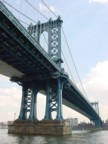

1909: Melling
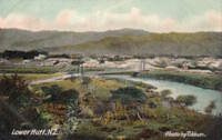
Lower Hutt, New Zealand - Te Awa Kairangi / Hutt River
| Bridgemeister ID: | 690 (added 2003-03-08) |
| Year Completed: | 1909 |
| Name: | Melling |
| Location: | Lower Hutt, New Zealand |
| Crossing: | Te Awa Kairangi / Hutt River |
| Principals: | Joseph Dawson |
| References: | GAP |
| Use: | Vehicular (one-lane) |
| Status: | Replaced |
| Main Cables: | Wire (steel) |
| Suspended Spans: | 1 |
| Main Span: | 1 x 91.4 meters (299.9 feet) |
External Links:
1909: Pease River
Vernon, Texas, USA - Pease River
| Bridgemeister ID: | 597 (added 2003-01-11) |
| Year Completed: | 1909 |
| Name: | Pease River |
| Location: | Vernon, Texas, USA |
| Crossing: | Pease River |
| Coordinates: | 34.179636 N 99.324038 W |
| Maps: | Acme, GeoHack, Google, OpenStreetMap |
| Principals: | Mitchell & Pigg |
| References: | AUB |
| Use: | Vehicular |
| Status: | Only towers remain |
| Main Cables: | Wire |
| Suspended Spans: | 4 |
| Main Spans: | 2 |
| Side Spans: | 2 |
Notes:
- In September 2006, Howard Laker writes: "The bridge is no longer there, but one tower is still standing. It is located adjacent to US 287 and can be easily seen."
- 1927: Collapsed under weight of convoy of trucks.
- Replaced 1897 Pease River - Vernon, Texas, USA.
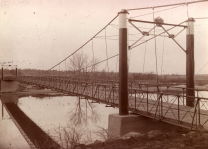
1909: Ripley
Ripley, Oklahoma, USA - Cimarron River
| Bridgemeister ID: | 298 (added before 2003) |
| Year Completed: | 1909 |
| Name: | Ripley |
| Location: | Ripley, Oklahoma, USA |
| Crossing: | Cimarron River |
| Principals: | Mitchell & Pigg |
| Use: | Vehicular (one-lane) |
| Status: | Wrecked, 1912 |
| Main Cables: | Wire (steel) |
| Suspended Spans: | 3 |
| Main Span: | 1 |
| Side Spans: | 2 |
Notes:
- The photo linked here is dated March 2, 1909. Part of the builders plate is legible. The first line appears to be: "Wfd Mch & Fo... Co." (the portion between the Fo and Co is obscured) for Weatherford Machine and Foundry Company. The next two lines are clear: "BUILDERS 1908" and "WEATHERFORD TEXAS". The last line is largely obscurred but it appears to say "MITCHELL & PIGG PAT'D 1..." with a year at the end. Mitchell & Pigg was a well-known builder of suspension bridges in Texas. Most sources cite 1909 as the year of completion.
- South tower washed out, 1912.
- Replaced by Ripley - Ripley, Oklahoma, USA.
1909: Swinging
Wilmington, Delaware, USA - Brandywine Creek
| Bridgemeister ID: | 270 (added before 2003) |
| Year Completed: | 1909 |
| Name: | Swinging |
| Location: | Wilmington, Delaware, USA |
| Crossing: | Brandywine Creek |
| At or Near Feature: | Brandywine Park |
| Coordinates: | 39.76043 N 75.5564 W |
| Maps: | Acme, GeoHack, Google, OpenStreetMap |
| References: | FOWP1999S |
| Use: | Footbridge |
| Status: | In use (last checked: 2005) |
| Main Cables: | Wire (steel) |
| Suspended Spans: | 1 |
Notes:
- Replaced a nearby 1879 suspension footbridge.
External Links:
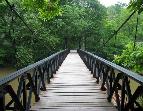
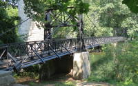
Bharyang Bhurung
Samari (समारी), Nepal - Bharyang Bhurung
| Bridgemeister ID: | 7973 (added 2023-11-26) |
| Name: | Bharyang Bhurung |
| Location: | Samari (समारी), Nepal |
| Crossing: | Bharyang Bhurung |
| Coordinates: | 27.953556 N 85.009806 E |
| Maps: | Acme, GeoHack, Google, OpenStreetMap |
| Principals: | Louis Harper, Harpers Limited |
| Use: | Footbridge |
| Status: | In use (last checked: 2019) |
| Main Cables: | Wire |
| Suspended Spans: | 1 |
| Main Span: | 1 x 50.7 meters (166.3 feet) |
| Deck width: | 1.2 meters |
Notes:
- Completed at some point in the 1900-1909 time frame.
External Links:
Eagle Falls
Great Falls, Montana, USA - Missouri River
| Bridgemeister ID: | 6358 (added 2021-07-26) |
| Name: | Eagle Falls |
| Location: | Great Falls, Montana, USA |
| Crossing: | Missouri River |
| At or Near Feature: | Eagle Falls, Black Eagle Dam |
| Coordinates: | 47.519905 N 111.262229 W |
| Maps: | Acme, GeoHack, Google, OpenStreetMap |
| Use: | Footbridge |
| Status: | Destroyed, June 6, 1908 |
| Main Cables: | Wire (steel) |
| Main Span: | 1 |
| Side Span: | 1 |
Notes:
- Completed early 1890s.
- 1908, June: Destroyed by flood.
External Links:
- Black Eagle Dam - Wikipedia. From the article (retrieved 2021): "A 200-foot-long (61 m), 10-foot-wide (3.0 m) pedestrian suspension bridge ran from the bluffs above each powerhouse over the river." However, historic images of the bridge show it wa significantly longer with main and side spans of roughly 400 and 200 feet respectively.
- Bridgehunter.com | Eagle Falls Suspension Bridge
East Street
Mount Morgan, Queensland, Australia - Dee River
| Bridgemeister ID: | 1744 (added 2005-04-20) |
| Name: | East Street |
| Location: | Mount Morgan, Queensland, Australia |
| Crossing: | Dee River |
| Coordinates: | 23.642281 S 150.389351 E |
| Maps: | Acme, GeoHack, Google, OpenStreetMap |
| Status: | Dismantled, 1904 |
| Main Cables: | Wire |
Notes:
- Completed circa 1891. According to a sign at one of the remaining Mount Morgan suspension bridges, "East Street bridge crossed from Byrnes Parade to near the junction of Cornes and Bridge Street. Built around 1891, it was dismantled in 1904 after the East Street Bridge, now demolished, was erected."
- Later at same location 2001 East Street (Private Victor Stanley Jones) - Mount Morgan, Queensland, Australia.
Far Red Hill
Mount Morgan, Queensland, Australia - Dee River
| Bridgemeister ID: | 1747 (added 2005-04-20) |
| Name: | Far Red Hill |
| Location: | Mount Morgan, Queensland, Australia |
| Crossing: | Dee River |
| Status: | Destroyed, 1928, by flood. |
| Main Cables: | Wire |
Notes:
- Completed circa 1890s.
- Replaced by 1939 Far Red Hill - Mount Morgan, Queensland, Australia.
External Links:
- Mount Morgan (link reported not working). Notes that this bridge was destroyed by flood in 1928 and later replaced. A sign at one of the remaining Mount Morgan suspension bridges says this bridge "spanned the river on the far side of Red Hill, from Baldwin Street on the south to School Street on the west."
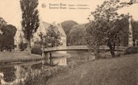
Kasteel Cortewalle
Cortewalle Castle, Beveren, Belgium
| Bridgemeister ID: | 1819 (added 2005-05-21) |
| Name: | Kasteel Cortewalle |
| Location: | Cortewalle Castle, Beveren, Belgium |
| Coordinates: | 51.21435 N 4.2651 E |
| Maps: | Acme, GeoHack, Google, OpenStreetMap |
| References: | ISFF |
| Use: | Footbridge |
| Status: | In use (last checked: 2019) |
| Main Cables: | Wire |
| Suspended Spans: | 1 |
| Main Span: | 1 x 26.37 meters (86.5 feet) |
| Deck width: | 2.4 meters |
Notes:
- ISFF: Completed in time frame 1900-1905. Renovated, 1970, and again in 1991.
External Links:
Merri
Warrnambool, Victoria, Australia - Merri River
| Bridgemeister ID: | 8551 (added 2024-04-06) |
| Name: | Merri |
| Location: | Warrnambool, Victoria, Australia |
| Crossing: | Merri River |
| Coordinates: | 38.399972 S 142.471694 E |
| Maps: | Acme, GeoHack, Google, OpenStreetMap |
| Use: | Footbridge |
| Status: | Collapsed, 1920 |
Notes:
- Completed at some point in the 1890s. Was replaced by the current (as of the 2020s) Merri Bridge.

Savignac-de-l'Isle
Savignac-de-l'Isle, Gironde, France - Isle River
| Bridgemeister ID: | 7846 (added 2023-09-04) |
| Name: | Savignac-de-l'Isle |
| Location: | Savignac-de-l'Isle, Gironde, France |
| Crossing: | Isle River |
| Coordinates: | 44.987175 N 0.233164 W |
| Maps: | Acme, GeoHack, Google, OpenStreetMap |
| Use: | Vehicular |
| Status: | Removed |
| Suspended Spans: | 1 |
Notes:
- Completed in the 1890s. It likely replaced another suspension bridge completed in 1840.
External Links:
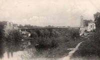
Upper Dee
Mount Morgan, Queensland, Australia - Dee River
| Bridgemeister ID: | 1743 (added 2005-04-20) |
| Name: | Upper Dee |
| Location: | Mount Morgan, Queensland, Australia |
| Crossing: | Dee River |
| Use: | Footbridge |
| Status: | Replaced |
| Main Cables: | Wire |
Notes:
- Completed 1890s. According to a sign at one of the remaining Mount Morgan suspension bridges, "Upper Dee suspension bridge spanned from Byrnes Parade to River Street but was washed away during fierce flooding on 21 April 1928."
External Links:
- Mount Morgan (link reported not working). Mentions that the bridge had already been "converted to a pile-supported bridge" by the time it was destroyed in 1928.
Do you have any information or photos for these bridges that you would like to share? Please email david.denenberg@bridgemeister.com.
