Suspension Bridges 1884-1909 (101-200 of 266)
This is a list of bridges 101 through 200 (of 266 total) in the suspension bridge inventory completed from 1884 through 1909, the year the Manhattan Bridge was completed. Wherever you see a Bridgemeister ID number click it to isolate the bridge on its own page.
Related Lists:
1897: Hackberry
Warsaw, Missouri, USA - Osage River
| Bridgemeister ID: | 2538 (added 2011-12-28) |
| Year Completed: | 1897 |
| Name: | Hackberry |
| Also Known As: | Lower |
| Location: | Warsaw, Missouri, USA |
| Crossing: | Osage River |
| Principals: | Joseph A. Dice, Dr. Daniel M. Eddy |
| References: | BOTO |
| Use: | Vehicular |
| Status: | Destroyed, 1926 |
| Main Cables: | Wire |
| Main Span: | 1 x 158.5 meters (520 feet) |
Notes:
- Destroyed by fire, 1926.
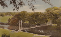
1897: Jubilee
Annan, Scotland, United Kingdom - River Annan
| Bridgemeister ID: | 6206 (added 2021-07-15) |
| Year Completed: | 1897 |
| Name: | Jubilee |
| Location: | Annan, Scotland, United Kingdom |
| Crossing: | River Annan |
| Coordinates: | 55.005848 N 3.265549 W |
| Maps: | Acme, GeoHack, Google, OpenStreetMap |
| Use: | Footbridge |
| Status: | Destroyed, October 28, 2021 |
| Main Cables: | Wire (steel) |
| Suspended Spans: | 1 |
Notes:
- 2021, October 28: Destroyed by flood.
1897: Lincoln Highway
East Liverpool, Ohio and Chester, West Virginia, USA - Ohio River
| Bridgemeister ID: | 105 (added before 2003) |
| Year Completed: | 1897 |
| Name: | Lincoln Highway |
| Also Known As: | Chester |
| Location: | East Liverpool, Ohio and Chester, West Virginia, USA |
| Crossing: | Ohio River |
| Principals: | Hermann Laub, E.S. Fickes |
| References: | AAJ, BPL, HBE, PTS2 |
| Use: | Vehicular, with walkway |
| Status: | Removed, 1970 |
| Main Cables: | Wire (steel) |
| Suspended Spans: | 3 |
| Main Span: | 1 x 214.9 meters (705 feet) |
| Side Spans: | 1 x 109.7 meters (360 feet), 1 x 128 meters (420 feet) |
| Deck width: | 27 feet |
Notes:
- Rebuilt 1939 by David Steinman. Closed and demolished, 1970.
External Links:

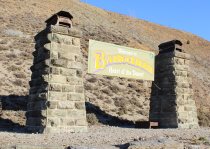
1897: Macandrew
Bannockburn, New Zealand - Kawarau River
| Bridgemeister ID: | 661 (added 2003-03-08) |
| Year Completed: | 1897 |
| Name: | Macandrew |
| Location: | Bannockburn, New Zealand |
| Crossing: | Kawarau River |
| References: | GAP |
| Use: | Vehicular (one-lane) |
| Status: | Replaced, 1964 |
| Main Cables: | Wire |
| Suspended Spans: | 1 |
Notes:
- One tower remains preserved near the former site of the bridge.
- Replaced 1874 (suspension bridge) - Bannockburn, New Zealand.
1897: Newey
Grahamstown and Qonce (King William's Town), South Africa - Keiskamma River
| Bridgemeister ID: | 5850 (added 2021-05-14) |
| Year Completed: | 1897 |
| Name: | Newey |
| Location: | Grahamstown and Qonce (King William's Town), South Africa |
| Crossing: | Keiskamma River |
| Use: | Vehicular |
| Status: | Removed |
| Main Cables: | Wire (steel) |
| Suspended Spans: | 3 |
| Main Span: | 1 x 61 meters (200 feet) |
| Side Spans: | 2 x 30.5 meters (100 feet) |
Notes:
- Described as being on the road between Grahamstown and King William's Town which possibly would have been located near the present-day Keiskamma road crossing at Kalana.
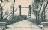
1897: Pailhès
Pézenas and Castelnau-de-Guers, Hérault, France - Hérault River
| Bridgemeister ID: | 4689 (added 2020-06-20) |
| Year Completed: | 1897 |
| Name: | Pailhès |
| Also Known As: | Castelnau |
| Location: | Pézenas and Castelnau-de-Guers, Hérault, France |
| Crossing: | Hérault River |
| Coordinates: | 43.449256 N 3.436369 E |
| Maps: | Acme, GeoHack, Google, OpenStreetMap |
| Use: | Vehicular |
| Status: | Demolished (last checked: 2009) |
| Main Cables: | Wire (steel) |
| Suspended Spans: | 1 |
| Main Span: | 1 x 101.47 meters (332.9 feet) |
Notes:
- Likely replaced an older suspension bridge.
External Links:
1897: Pease River
Vernon, Texas, USA - Pease River
| Bridgemeister ID: | 5585 (added 2020-12-22) |
| Year Completed: | 1897 |
| Name: | Pease River |
| Location: | Vernon, Texas, USA |
| Crossing: | Pease River |
| Coordinates: | 34.179209 N 99.323843 W |
| Maps: | Acme, GeoHack, Google, OpenStreetMap |
| Use: | Vehicular (one-lane) |
| Status: | Destroyed, 1907 |
| Main Cables: | Wire |
Notes:
- Sometimes cited as completed 1897, 1899, or "around 1899".
- Sometimes attributed to Mitchell and Pigg, but that would have been several years before the earliest bridges typically attributed to Mitchell and Pigg. Mitchell and Pigg are more clearly associated with the 1909 replacement of this Pease River bridge. Texas suspension bridge dominant builder history generally evolved from Flinn/Moyer (1890s, early 1900s) to Mitchell/Pigg (mid-1900s thru early 1910s) to Austin Bridge (1910s onward) with design similarities (and employees) shared through that evolution.
- Destroyed by tornado, 1907. Coordinates are for the replacement suspension bridge, assumed to be on the same alignment or very close.
- Replaced by 1909 Pease River - Vernon, Texas, USA.
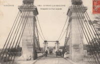
1897: Port-Sainte-Foy
Port-Sainte-Foy-et-Ponchapt, Dordogne and Sainte-Foy-la-Grande, Gironde, France - Dordogne River
| Bridgemeister ID: | 1594 (added 2005-02-06) |
| Year Completed: | 1897 |
| Name: | Port-Sainte-Foy |
| Location: | Port-Sainte-Foy-et-Ponchapt, Dordogne and Sainte-Foy-la-Grande, Gironde, France |
| Crossing: | Dordogne River |
| Coordinates: | 44.842400 N 0.211233 E |
| Maps: | Acme, GeoHack, Google, OpenStreetMap |
| Use: | Vehicular (two-lane) |
| Status: | Only towers remain (last checked: 2019) |
| Main Cables: | Wire |
| Suspended Spans: | 2 |
| Main Spans: | 2 |
Notes:
- Replaced by a nearby suspension bridge, but the end pylons are still present at the ends of the replacement span as of 2019.
- Replaced 1829 Port-Sainte-Foy - Port-Sainte-Foy-et-Ponchapt, Dordogne and Sainte-Foy-la-Grande, Gironde, France.
- Near future location of 1961 Saint-Foy-la-Grande - Saint-Foy-la-Grande, Gironde and Port-Sainte-Foy-et-Ponchapt, Dordogne, France.
External Links:
1897: Rochester
Rochester and Monaca, Pennsylvania, USA - Ohio River
| Bridgemeister ID: | 104 (added before 2003) |
| Year Completed: | 1897 |
| Name: | Rochester |
| Location: | Rochester and Monaca, Pennsylvania, USA |
| Crossing: | Ohio River |
| Principals: | Edwin Kirtland Morse |
| References: | AAJ, BPL, HBE, PTS2 |
| Use: | Vehicular, with walkway |
| Status: | Removed |
| Main Cables: | Wire (steel) |
| Suspended Spans: | 3 |
| Main Span: | 1 x 243.8 meters (800 feet) |
| Side Spans: | 1 x 121.9 meters (400 feet), 1 x 126.8 meters (416 feet) |
| Deck width: | 28 feet |
External Links:

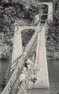
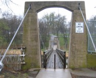
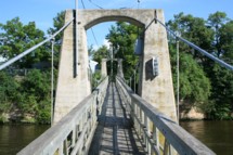
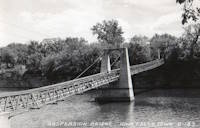
1897: Swinging
Iowa Falls, Iowa, USA - Iowa River
| Bridgemeister ID: | 106 (added before 2003) |
| Year Completed: | 1897 |
| Name: | Swinging |
| Location: | Iowa Falls, Iowa, USA |
| Crossing: | Iowa River |
| At or Near Feature: | Assembly Park |
| Coordinates: | 42.5215 N 93.2708 W |
| Maps: | Acme, GeoHack, Google, OpenStreetMap |
| Principals: | Commodore C.C. Bartlett, J.M. Eddy |
| Use: | Footbridge |
| Status: | In use (last checked: 2006) |
| Main Cables: | Wire |
| Suspended Spans: | 2 |
| Main Span: | 1 x 39 meters (128 feet) estimated |
| Side Span: | 1 x 20.7 meters (68 feet) estimated |
Notes:
- According to plaque at bridge, rebuilt 1909, 1925, 1956, 1989.
1897: Vapor Nou
Rubí, Barcelona, Spain - Riera de Rubí
| Bridgemeister ID: | 8197 (added 2024-02-05) |
| Year Completed: | 1897 |
| Name: | Vapor Nou |
| Location: | Rubí, Barcelona, Spain |
| Crossing: | Riera de Rubí |
| Coordinates: | 41.491722 N 2.028167 E |
| Maps: | Acme, GeoHack, Google, OpenStreetMap |
| Principals: | Ribas Brothers |
| Use: | Footbridge |
| Status: | Destroyed, 1962 |
| Main Cables: | Wire |
| Suspended Spans: | 1 |
Notes:
- Destroyed by flood, 1962.
External Links:
- El Vapor Nou i el seu pont penjant - TOTRubí.cat. Article about the bridge. Dated August 7, 2023
- Facebook - EL DESAPAREGUT PONT PENJANT DEL VAPOR NOU. Image and history of the bridge.
- Facebook - EL PONT PENJANT DEL VAPOR NOU. Image and history of the bridge.
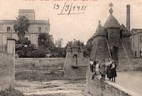
| Bridgemeister ID: | 3922 (added 2020-03-20) |
| Year Completed: | 1897 |
| Name: | Vollan |
| Location: | Yset, Tynset, Innlandet, Norway |
| Crossing: | Orkla |
| Coordinates: | 62.569644 N 10.307843 E |
| Maps: | Acme, GeoHack, Google, kart.1881.no, OpenStreetMap |
| Principals: | Johannes Sand |
| Use: | Vehicular (one-lane) |
| Status: | Removed, 2008 |
| Main Cables: | Wire |
| Suspended Spans: | 1 |
Notes:
- Closed to traffic in 1970s. Dismantled in 2008 and the wood used as fuel for a Sankthans bonfire that year.
- Replaced by 2009 Vollan - Yset, Tynset, Innlandet, Norway.
External Links:
1898: (footbridge)
Pontiac, Illinois, USA - Vermilion River
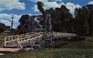
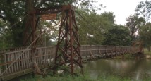
| Bridgemeister ID: | 312 (added before 2003) |
| Year Completed: | 1898 |
| Name: | (footbridge) |
| Location: | Pontiac, Illinois, USA |
| Crossing: | Vermilion River |
| At or Near Feature: | Chautauqua Park |
| Coordinates: | 40.87696 N 88.62358 W |
| Maps: | Acme, GeoHack, Google, OpenStreetMap |
| Principals: | Joliet Bridge and Iron Co. |
| Use: | Footbridge |
| Status: | In use (last checked: 2005) |
| Main Cables: | Wire |
| Suspended Spans: | 2 |
| Main Span: | 1 |
| Side Span: | 1 |
Notes:
1898: (footbridge)
Pontiac, Illinois, USA - Vermilion River
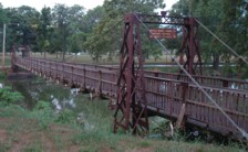
| Bridgemeister ID: | 1862 (added 2005-07-31) |
| Year Completed: | 1898 |
| Name: | (footbridge) |
| Location: | Pontiac, Illinois, USA |
| Crossing: | Vermilion River |
| At or Near Feature: | Chautauqua Park |
| Coordinates: | 40.87554 N 88.62279 W |
| Maps: | Acme, GeoHack, Google, OpenStreetMap |
| Principals: | Joliet Bridge and Iron Co. |
| Use: | Footbridge |
| Status: | In use (last checked: 2005) |
| Main Cables: | Wire |
| Main Span: | 1 |
| Side Span: | 1 |
Notes:
1898: (suspension bridge)
Noble, Oklahoma, USA - South Canadian River
| Bridgemeister ID: | 107 (added before 2003) |
| Year Completed: | 1898 |
| Name: | (suspension bridge) |
| Location: | Noble, Oklahoma, USA |
| Crossing: | South Canadian River |
| Principals: | Ed Garee |
| Use: | Vehicular (one-lane) |
| Status: | Destroyed, by flood, 1904 |
| Main Cables: | Wire |
| Suspended Spans: | 3 |
| Main Span: | 1 x 80.8 meters (265 feet) |
| Side Spans: | 2 |
| Deck width: | 14 feet |
Notes:
- Wrecked by flood October 3rd or 4th, 1904.
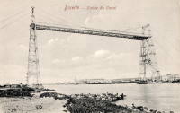
1898: Bizerte Transporter
Bizerte, Tunisia
| Bridgemeister ID: | 995 (added 2003-11-16) |
| Year Completed: | 1898 |
| Name: | Bizerte Transporter |
| Also Known As: | Bizerta |
| Location: | Bizerte, Tunisia |
| Principals: | Ferdinand Arnodin |
| Use: | Transporter |
| Status: | Dismantled, 1904 |
| Main Cables: | Wire (steel) |
| Suspended Spans: | 1 |
Notes:
- Moved to 1909 Brest Transporter - Brest, Finistère, France. The bridge was dismantled in 1904 and reassembled in Brest, France.
External Links:
1898: Brinkburn
Morpeth, England, United Kingdom - River Coquet
| Bridgemeister ID: | 4657 (added 2020-06-18) |
| Year Completed: | 1898 |
| Name: | Brinkburn |
| Location: | Morpeth, England, United Kingdom |
| Crossing: | River Coquet |
| Coordinates: | 55.279751 N 1.819533 W |
| Maps: | Acme, GeoHack, Google, OpenStreetMap |
| Use: | Footbridge |
| Status: | Extant (last checked: 2016) |
| Main Cables: | Wire |
| Suspended Spans: | 1 |
External Links:
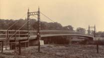
1898: Doveridge
Doveridge, England, United Kingdom - River Dove
| Bridgemeister ID: | 2151 (added 2006-11-18) |
| Year Completed: | 1898 |
| Name: | Doveridge |
| Location: | Doveridge, England, United Kingdom |
| Crossing: | River Dove |
| Coordinates: | 52.903130 N 1.836442 W |
| Maps: | Acme, GeoHack, Google, OpenStreetMap |
| Principals: | Louis Harper |
| References: | HARPER |
| Use: | Footbridge |
| Status: | Collapsed, 1946 |
| Main Cables: | Wire |
| Suspended Spans: | 1 |
Notes:
- Replaced by 1946 Doveridge - Doveridge, England, United Kingdom.
External Links:

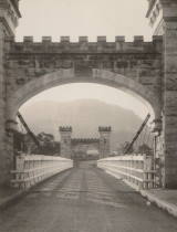
1898: Hampden
Kangaroo Valley, New South Wales, Australia - Kangaroo River
| Bridgemeister ID: | 423 (added before 2003) |
| Year Completed: | 1898 |
| Name: | Hampden |
| Location: | Kangaroo Valley, New South Wales, Australia |
| Crossing: | Kangaroo River |
| Coordinates: | 34.727454 S 150.520910 E |
| Maps: | Acme, GeoHack, Google, OpenStreetMap |
| Principals: | E.M. de Burgh |
| References: | AAJ, STC |
| Use: | Vehicular (one-lane) |
| Status: | In use (last checked: 2023) |
| Main Cables: | Wire (steel) |
| Suspended Spans: | 1 |
| Main Span: | 1 x 77.1 meters (253 feet) |
External Links:
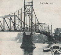
1898: Kaisersteg
Niederschöneweide, Berlin and Oberschöneweide, Berlin, Germany - Spree River
| Bridgemeister ID: | 5691 (added 2021-04-01) |
| Year Completed: | 1898 |
| Name: | Kaisersteg |
| Location: | Niederschöneweide, Berlin and Oberschöneweide, Berlin, Germany |
| Crossing: | Spree River |
| Coordinates: | 52.458179 N 13.519810 E |
| Maps: | Acme, GeoHack, Google, OpenStreetMap |
| Principals: | Heinrich Müller-Breslau, Karl Bernhard |
| Use: | Footbridge |
| Status: | Destroyed, April 22, 1945 |
| Main Cables: | Riveted plate |
| Suspended Spans: | 3 |
| Main Span: | 1 |
| Side Spans: | 2 |
Notes:
- Large hybrid truss/suspension bridge. While often classified as a suspension bridge, it is unclear if this bridge functioned as more of a cantilevered truss than a suspension bridge.
External Links:
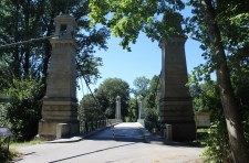
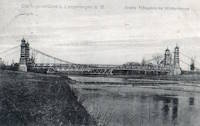
1898: Langenargen
Langenargen and Gohren, Kressbronn am Bodensee, Baden-Württemberg, Germany - Argen River
| Bridgemeister ID: | 929 (added 2003-10-24) |
| Year Completed: | 1898 |
| Name: | Langenargen |
| Location: | Langenargen and Gohren, Kressbronn am Bodensee, Baden-Württemberg, Germany |
| Crossing: | Argen River |
| Coordinates: | 47.59622 N 9.56208 E |
| Maps: | Acme, GeoHack, Google, OpenStreetMap |
| Principals: | Kubler, Leibbrand |
| References: | AAJ, HBE, PTS2 |
| Use: | Vehicular, with walkway |
| Status: | Restricted to foot traffic (last checked: 2022) |
| Main Cables: | Wire |
| Suspended Spans: | 1 |
| Main Span: | 1 x 71.9 meters (236 feet) |
Notes:
- Othmar Ammann worked as an intern on this bridge.
External Links:
1898: Levey
Tsomo, South Africa
| Bridgemeister ID: | 2178 (added 2007-01-13) |
| Year Completed: | 1898 |
| Name: | Levey |
| Location: | Tsomo, South Africa |
| Principals: | Louis Harper |
| References: | HARPER |
| Status: | Dismantled, c. 1960s |
| Main Cables: | Wire |
| Suspended Spans: | 1 |
Notes:
- Denis Beukman writes: "The Levey bridge at Tsomo was damaged (timber work only) by a tree washed down the river during a flood some time in 1958 or 1959. In the mid 1960's it was either sold or donated to a church group which dismantled it and moved it lower down the river."
External Links:
1898: Lowther
Keswick, England, United Kingdom - River Greta
| Bridgemeister ID: | 2180 (added 2007-01-13) |
| Year Completed: | 1898 |
| Name: | Lowther |
| Also Known As: | Keswick |
| Location: | Keswick, England, United Kingdom |
| Crossing: | River Greta |
| Principals: | Louis Harper |
| References: | HARPER |
| Use: | Footbridge |
| Status: | Demolished, 1979 |
| Main Cables: | Wire |
| Suspended Spans: | 1 |
| Main Span: | 1 x 27.4 meters (90 feet) |
External Links:
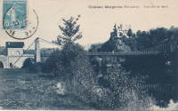
1898: Margeaix
Beaulieu and Saint-Vincent, Haute-Loire, France - Loire River
| Bridgemeister ID: | 1539 (added 2004-10-31) |
| Year Completed: | 1898 |
| Name: | Margeaix |
| Also Known As: | Marjeaix, Margeix |
| Location: | Beaulieu and Saint-Vincent, Haute-Loire, France |
| Crossing: | Loire River |
| Coordinates: | 45.15324 N 3.924896 E |
| Maps: | Acme, GeoHack, Google, OpenStreetMap |
| References: | BPF |
| Use: | Vehicular (one-lane) |
| Status: | In use (last checked: 2019) |
| Main Cables: | Wire |
| Suspended Spans: | 1 |
| Main Span: | 1 x 66 meters (216.5 feet) |
Notes:
- Repaired, 1935 and 1975.
External Links:
1898: Münden
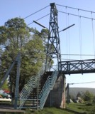
Hannoversch Münden, Niedersachsen, Germany - Fulda River
| Bridgemeister ID: | 1204 (added 2004-02-02) |
| Year Completed: | 1898 |
| Name: | Münden |
| Location: | Hannoversch Münden, Niedersachsen, Germany |
| Crossing: | Fulda River |
| Coordinates: | 51.419667 N 9.6475 E |
| Maps: | Acme, GeoHack, Google, OpenStreetMap |
| Use: | Footbridge |
| Status: | In use (last checked: 2006) |
| Main Cables: | Wire |
| Suspended Spans: | 1 |
| Main Span: | 1 x 70.4 meters (231 feet) |
| Deck width: | 1.2 meters |
Notes:
- Long footbridge.
External Links:
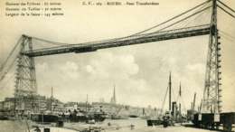
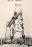
1898: Rouen Transporter
Rouen, Seine-Maritime, France
| Bridgemeister ID: | 953 (added 2003-10-31) |
| Year Completed: | 1898 |
| Name: | Rouen Transporter |
| Location: | Rouen, Seine-Maritime, France |
| Principals: | Ferdinand Arnodin |
| Use: | Transporter |
| Status: | Destroyed, 1940 |
| Suspended Spans: | 1 |
External Links:
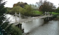
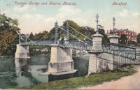
1898: Victoria
Hereford, England, United Kingdom - River Wye
| Bridgemeister ID: | 424 (added before 2003) |
| Year Completed: | 1898 |
| Name: | Victoria |
| Location: | Hereford, England, United Kingdom |
| Crossing: | River Wye |
| Coordinates: | 52.051075 N 2.712197 W |
| Maps: | Acme, GeoHack, Google, OpenStreetMap |
| Principals: | Alexander Findlay and Co. |
| References: | NTB |
| Use: | Footbridge |
| Status: | In use (last checked: 2018) |
| Main Cables: | Eyebar |
| Suspended Spans: | 3 |
| Main Span: | 1 x 24.4 meters (80 feet) |
| Side Spans: | 2 |

1899: (footbridge)
Bhiri (भीरी), Uttarakhand, India - Mandakini River
| Bridgemeister ID: | 7004 (added 2022-05-14) |
| Year Completed: | 1899 |
| Name: | (footbridge) |
| Location: | Bhiri (भीरी), Uttarakhand, India |
| Crossing: | Mandakini River |
| Coordinates: | 30.468578 N 79.074367 E |
| Maps: | Acme, GeoHack, Google, OpenStreetMap |
| Status: | In use (last checked: 2016) |
| Main Cables: | Wire (steel) |
| Main Span: | 1 |
External Links:
- Bridge over Mandakini near Bhiri a risk to lives - The Tribune India. Residents of Bhiri town in Rudprayag district are irked over the dilapidated condition of a footbridge over the Mandakini, which is on the verge of collapse. "The British constructed the bridge in1889 on the old Kedaranth trek route, near Bhiri, in Rudraprayag district."
1899: Baring
Baring, Washington, USA - Skykomish River
| Bridgemeister ID: | 1902 (added 2005-10-07) |
| Year Completed: | 1899 |
| Name: | Baring |
| Location: | Baring, Washington, USA |
| Crossing: | Skykomish River |
| Coordinates: | 47.765407 N 121.480206 W |
| Maps: | Acme, GeoHack, Google, OpenStreetMap |
| References: | SPW |
| Use: | Vehicular |
| Status: | Collapsed, 1952 |
Notes:
- Replaced by 1953 Baring - Baring, Washington, USA.
1899: Clifden
Clifden, Southland, New Zealand - Waiau River
| Bridgemeister ID: | 678 (added 2003-03-08) |
| Year Completed: | 1899 |
| Name: | Clifden |
| Location: | Clifden, Southland, New Zealand |
| Crossing: | Waiau River |
| Coordinates: | 46.029752 S 167.715139 E |
| Maps: | Acme, GeoHack, Google, OpenStreetMap |
| Principals: | C.H. Howorth, W. Baird, E.R. Ussher |
| References: | GAP |
| Use: | Vehicular (one-lane) |
| Status: | Restricted to foot traffic, since 1978 (last checked: 2016) |
| Main Cables: | Wire |
| Suspended Spans: | 1 |
| Main Span: | 1 x 111.5 meters (365.8 feet) |
External Links:
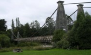
1899: Hanssenspark
Vilvoorde, Belgium
| Bridgemeister ID: | 2079 (added 2006-06-10) |
| Year Completed: | 1899 |
| Name: | Hanssenspark |
| Location: | Vilvoorde, Belgium |
| Coordinates: | 50.924332 N 4.428762 E |
| Maps: | Acme, GeoHack, Google, OpenStreetMap |
| References: | ISFF |
| Use: | Footbridge |
| Status: | In use (last checked: 2019) |
| Main Cables: | Wire |
| Main Span: | 1 x 17.55 meters (57.6 feet) |
| Deck width: | 3.08 meters |
Notes:
- ISFF: Renovated in 1970s and again in 2000.
External Links:
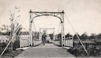
1899: Lance Mitan
Moruga, Victoria, Trinidad and Tobago - Moruga River
| Bridgemeister ID: | 542 (added before 2003) |
| Year Completed: | 1899 |
| Name: | Lance Mitan |
| Location: | Moruga, Victoria, Trinidad and Tobago |
| Crossing: | Moruga River |
| Coordinates: | 10.091576 N 61.256689 W |
| Maps: | Acme, GeoHack, Google, OpenStreetMap |
| Principals: | Walsh Wrightson |
| Use: | Vehicular (one-lane) |
| Status: | Extant (last checked: 2018) |
| Main Cables: | Wire |
| Suspended Spans: | 1 |
Notes:
- Failed February 28, 1998. Repaired.
- As of 2018 deck was in very poor shape and the bridge has been bypassed.
External Links:
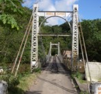
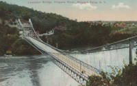
1899: Lewiston-Queenston
Lewiston, New York, USA and Queenston, Ontario, Canada - Niagara River
| Bridgemeister ID: | 108 (added before 2003) |
| Year Completed: | 1899 |
| Name: | Lewiston-Queenston |
| Location: | Lewiston, New York, USA and Queenston, Ontario, Canada |
| Crossing: | Niagara River |
| Principals: | L.L. Buck, R.S. Buck |
| References: | AAJ, BPL, HBE, PTS2 |
| Use: | Vehicular and Rail (streetcar) |
| Status: | Replaced, 1962 |
| Main Cables: | Wire (steel) |
| Suspended Spans: | 1 |
| Main Span: | 1 x 317 meters (1,040 feet) |
| Deck width: | 17 feet |
Notes:
- Reused parts from the recently dismantled Second Falls View Bridge.
- At former location of 1851 Lewiston-Queenston - Lewiston, New York, USA and Queenston, Ontario, Canada.
- See 1889 Second Falls View - Niagara Falls, New York, USA and Niagara Falls, Ontario, Canada.
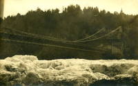
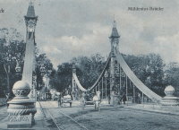
1899: Mühlentor
Lübeck, Germany - Elbe-Lübeck Canal
| Bridgemeister ID: | 4574 (added 2020-06-03) |
| Year Completed: | 1899 |
| Name: | Mühlentor |
| Location: | Lübeck, Germany |
| Crossing: | Elbe-Lübeck Canal |
| Coordinates: | 53.859130 N 10.691012 E |
| Maps: | Acme, GeoHack, Google, OpenStreetMap |
| References: | AAJ |
| Use: | Vehicular |
| Status: | In use (last checked: 2019) |
| Main Cables: | Eyebar (steel) |
| Suspended Spans: | 3 |
| Main Span: | 1 |
| Side Spans: | 2 |
External Links:
1899: Peißnitz
Halle, Saxony-Anhalt, Germany - Saale River
| Bridgemeister ID: | 8087 (added 2023-12-25) |
| Year Completed: | 1899 |
| Name: | Peißnitz |
| Also Known As: | Peissnitz, Peißnitzbrücke |
| Location: | Halle, Saxony-Anhalt, Germany |
| Crossing: | Saale River |
| Coordinates: | 51.493306 N 11.950111 E |
| Maps: | Acme, GeoHack, Google, OpenStreetMap |
| Use: | Footbridge |
| Status: | In use (last checked: 2023) |
| Main Cables: | Riveted plate |
| Suspended Spans: | 3 |
| Main Span: | 1 x 70 meters (229.7 feet) |
| Side Spans: | 2 |
Notes:
- Like several similar eastern European bridges constructed in the late 1800s and early 1900s it is questionable whether this rigid trussed bridge functions more like a cantilever bridge than a suspension bridge.
- Near Schwanenbrücke - Halle, Sachsen-Anhalt, Germany.
External Links:
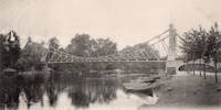
1899: Port-Sainte-Marie
Port-Sainte-Marie and Saint-Laurent, Lot-et-Garonne, France - Garonne River
| Bridgemeister ID: | 1781 (added 2005-04-23) |
| Year Completed: | 1899 |
| Name: | Port-Sainte-Marie |
| Location: | Port-Sainte-Marie and Saint-Laurent, Lot-et-Garonne, France |
| Crossing: | Garonne River |
| Use: | Vehicular |
| Status: | Removed |
| Main Cables: | Wire |
| Suspended Spans: | 1 |
| Main Span: | 1 x 180 meters (590.6 feet) |
Notes:
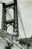
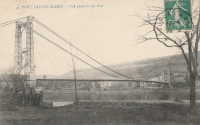
1899: Weserbrücke
Hessisch Oldendorf and Fuhlen, Germany - Weser River
| Bridgemeister ID: | 8162 (added 2024-02-03) |
| Year Completed: | 1899 |
| Name: | Weserbrücke |
| Location: | Hessisch Oldendorf and Fuhlen, Germany |
| Crossing: | Weser River |
| Use: | Vehicular |
| Status: | Destroyed, 1945 |
| Main Cables: | Chain (iron) |
Notes:
- Moved from 1839 Hameln - Hameln, Niedersachsen, Germany and reassembled in the 1898-1899 timeframe likely opening in 1899.
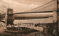
1900: Dunes
Bighouse, Melvich Bay vicinity, Scotland, United Kingdom - Halladale River
| Bridgemeister ID: | 2567 (added 2012-02-05) |
| Year Completed: | 1900 |
| Name: | Dunes |
| Location: | Bighouse, Melvich Bay vicinity, Scotland, United Kingdom |
| Crossing: | Halladale River |
| Coordinates: | 58.55716 N 3.91118 W |
| Maps: | Acme, GeoHack, Google, OpenStreetMap |
| References: | HBR |
| Use: | Footbridge |
| Status: | Removed |
| Main Cables: | Wire |
1900: Mafeking
Raven Quay, New Zealand - Kaiapoi River
| Bridgemeister ID: | 680 (added 2003-03-08) |
| Year Completed: | 1900 |
| Name: | Mafeking |
| Also Known As: | Revell's |
| Location: | Raven Quay, New Zealand |
| Crossing: | Kaiapoi River |
| Coordinates: | 43.377701 S 172.651679 E |
| Maps: | Acme, GeoHack, Google, OpenStreetMap |
| Principals: | Thompson and Murphy |
| References: | GAP |
| Use: | Footbridge |
| Status: | Modified, 1973 |
Notes:
- GAP: Modified 1973, suspension elements removed.
- Coordinates are for the current (2020) crossing known as the Mafeking footbridge, but unclear if this structure is related to the suspension bridge. Revell street intersects the Kaiapoi River 900 feet east of this location and may be another possible location of the former suspension bridge.
- Similar to 1893 Mandeville (Swing) - Kaiapoi, New Zealand.
- Similar to Butcher's Ford (Durrell's Ford, Hassall's Ford, Butchers) - Kaiapoi, New Zealand.
1900: New River
Nuttallburg and South Nuttall, West Virginia, USA - New River
| Bridgemeister ID: | 347 (added before 2003) |
| Year Completed: | 1900 |
| Name: | New River |
| Also Known As: | Swinging |
| Location: | Nuttallburg and South Nuttall, West Virginia, USA |
| Crossing: | New River |
| Coordinates: | 38.047482 N 81.035972 W |
| Maps: | Acme, GeoHack, Google, OpenStreetMap |
| References: | AAJ, HBE |
| Use: | Footbridge |
| Status: | Only towers remain (last checked: 2006) |
| Main Cables: | Wire |
| Suspended Spans: | 1 |
| Main Span: | 1 x 103.6 meters (340 feet) |
| Deck width: | 6 feet |
Notes:
- At least one of the towers is still standing, as of 2006.
- Coordinates are for likely location of the bridge, based on historical maps.
1900: Newquay
Newquay, Cornwall, England, United Kingdom
| Bridgemeister ID: | 800 (added 2003-03-29) |
| Year Completed: | 1900 |
| Name: | Newquay |
| Location: | Newquay, Cornwall, England, United Kingdom |
| Coordinates: | 50.415743 N 5.082486 W |
| Maps: | Acme, GeoHack, Google, OpenStreetMap |
| Principals: | Louis Harper |
| References: | HARPER |
| Use: | Footbridge |
| Status: | In use (last checked: 2019) |
| Main Cables: | Wire |
| Suspended Spans: | 1 |
| Main Span: | 1 x 30.5 meters (100 feet) estimated |
| Deck width: | 4 feet |
Notes:
- Douglas Harper notes: "The pylons have been swathed in concrete, presumably for protection against the elements."
External Links:
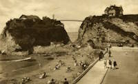
1900: Ojuela
Mapimí, Torreon vicinity, Durango, Mexico
| Bridgemeister ID: | 1043 (added 2003-12-06) |
| Year Completed: | 1900 |
| Name: | Ojuela |
| Also Known As: | Mapimi, Mampimi, Miampimi |
| Location: | Mapimí, Torreon vicinity, Durango, Mexico |
| Coordinates: | 25.791768 N 103.790706 W |
| Maps: | Acme, GeoHack, Google, OpenStreetMap |
| Principals: | Santiago Minguín, William Hildenbrand?, Henry G. Tyrell |
| References: | AAJ, HBE, PTS2 |
| Use: | Vehicular |
| Status: | Restricted to foot traffic (last checked: 2019) |
| Main Cables: | Wire (steel) |
| Suspended Spans: | 1 |
| Main Span: | 1 x 271.5 meters (890.7 feet) estimated |
Notes:
- Misspelled on every long span bridge list I've ever seen, this long narrow footbridge is located at Mapimí, Mexico.
- AAJ notes this bridge as having a 10-foot wide roadway and having been built by William Hildenbrand. The present-day bridge's deck measures only 1.8 meters and is restricted to foot traffic. In HBE, Tyrell takes credit for the design of the bridge and also notes the 10-foot roadway (though, HBE was probably a source for AAJ).
External Links:
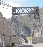
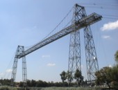
1900: Rochefort-Martrou Transporter
Rochefort, Charente-Maritime, France - Charente River
| Bridgemeister ID: | 949 (added 2003-10-30) |
| Year Completed: | 1900 |
| Name: | Rochefort-Martrou Transporter |
| Also Known As: | Matrou Transporter |
| Location: | Rochefort, Charente-Maritime, France |
| Crossing: | Charente River |
| Coordinates: | 45.91613 N 0.960638 W |
| Maps: | Acme, GeoHack, Google, OpenStreetMap |
| Principals: | Ferdinand Arnodin |
| References: | AAJ, BPF |
| Use: | Transporter |
| Status: | In use (last checked: 2022) |
| Main Cables: | Wire (steel) |
| Suspended Spans: | 1 |
| Main Span: | 1 x 129 meters (423.2 feet) |
Notes:
- Eckhard Bernstorff notes (data from the information table at the machinery building, where the motor to pull the platform is installed): Main Span 129 m (the high truss towers have a wide basis, the length from saddle to saddle is 139.75 m, and the length of the whole "tableau" including side parts is 175.5m), width between rails 8m. The Rochefort Transporter is well in use [2005], in the summer on all days people can use the "ferry" which is attached to the rails under the bridge.
External Links:
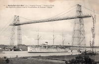
1900: Upper
Easton, Pennsylvania, USA - Lehigh River
| Bridgemeister ID: | 366 (added before 2003) |
| Year Completed: | 1900 |
| Name: | Upper |
| Location: | Easton, Pennsylvania, USA |
| Crossing: | Lehigh River |
| Principals: | Henry G. Tyrell, John McNeal |
| References: | AAJ, DSL20030414, EN19001122, HBE, PTS2, WGE20030513 |
| Use: | Footbridge |
| Status: | Demolished, 1955 |
| Main Cables: | Wire (steel) |
| Suspended Spans: | 3 |
| Main Spans: | 2 x 85 meters (279 feet) |
| Side Span: | 1 x 33.5 meters (110 feet) |
Notes:
- According to Tyrell, "[It] joins Dock Street on the lower side of the river with Glendon Avenue on the upper side, 90 feet above it. To overcome this difference in elevation of the two ends without incurring excessive expense for approach, the bridge floor was made to descend on a grade of 7.2 per cent from the upper bank to meet stairs rising from Dock Street..."

1900: Youngblood
Union Church, Mississippi, USA - Fifteenmile Creek
| Bridgemeister ID: | 6427 (added 2021-08-10) |
| Year Completed: | 1900 |
| Name: | Youngblood |
| Location: | Union Church, Mississippi, USA |
| Crossing: | Fifteenmile Creek |
| Coordinates: | 31.633587 N 90.814317 W |
| Maps: | Acme, GeoHack, Google, OpenStreetMap |
| Principals: | J.K. Gallbreath |
| Use: | Vehicular (one-lane) |
| Status: | Collapsed, 2016 |
| Main Cables: | Wire (steel) |
Notes:
- As of the late 2010s, it appears that the pylons and cables are still present.
- 1915: Repaired by W.H. Groome and Son incorporating an improved anchoring system.
External Links:
- MDAH Historic Resources Inventory Fact Sheet - Youngblood Suspension Bridge. Several photos of the remnants of the bridge and a few pre-collapse photos.
- NPGallery Asset Detail - Youngblood Bridge. National Register of Historic Places site survey.
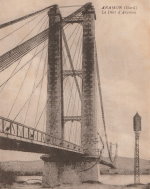
1901: Aramon
Aramon, Gard, France - Rhône River
| Bridgemeister ID: | 6432 (added 2021-08-12) |
| Year Completed: | 1901 |
| Name: | Aramon |
| Location: | Aramon, Gard, France |
| Crossing: | Rhône River |
| References: | PTS2 |
| Use: | Vehicular |
| Status: | Destroyed, August 15, 1944 |
| Main Cables: | Wire (steel) |
1901: Drahtsteg
Lingenau and Egg, Austria - Subersach River
| Bridgemeister ID: | 1408 (added 2004-07-04) |
| Year Completed: | 1901 |
| Name: | Drahtsteg |
| Location: | Lingenau and Egg, Austria |
| Crossing: | Subersach River |
| Coordinates: | 47.441867 N 9.9117 E |
| Maps: | Acme, GeoHack, Google, OpenStreetMap |
| Use: | Footbridge |
| Status: | In use (last checked: 2004) |
| Main Cables: | Wire |
| Suspended Spans: | 1 |
1901: Queanbeyan
Queanbeyan, New South Wales, Australia - Queanbeyan River
| Bridgemeister ID: | 425 (added before 2003) |
| Year Completed: | 1901 |
| Name: | Queanbeyan |
| Location: | Queanbeyan, New South Wales, Australia |
| Crossing: | Queanbeyan River |
| Status: | Destroyed, 1925 |
| Main Span: | 1 |
Notes:
- Destroyed by flood 1925.
- Replaced by 1938 Queanbeyan - Queanbeyan, New South Wales, Australia.
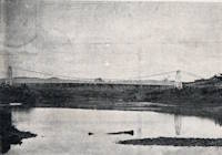
1901: Skippers
Maori Point vicinity, New Zealand - Upper Shotover River
| Bridgemeister ID: | 679 (added 2003-03-08) |
| Year Completed: | 1901 |
| Name: | Skippers |
| Location: | Maori Point vicinity, New Zealand |
| Crossing: | Upper Shotover River |
| At or Near Feature: | Skippers Canyon |
| Coordinates: | 44.844355 S 168.686769 E |
| Maps: | Acme, GeoHack, Google, OpenStreetMap |
| Principals: | John Black, A.J. Fraser Co. |
| References: | GAP |
| Use: | Vehicular (one-lane) |
| Status: | In use (last checked: 2017) |
| Main Cables: | Wire (steel) |
| Suspended Spans: | 1 |
| Main Span: | 1 x 96.3 meters (315.9 feet) |
Notes:
- Replaced 1868 Skippers Canyon - Maori Point vicinity, New Zealand at a nearby location.
External Links:
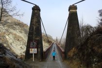
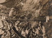
1901: VCSU Footbridge
Valley City, North Dakota, USA - Sheyenne River
| Bridgemeister ID: | 592 (added 2003-01-05) |
| Year Completed: | 1901 |
| Name: | VCSU Footbridge |
| Location: | Valley City, North Dakota, USA |
| Crossing: | Sheyenne River |
| At or Near Feature: | Valley City State Univ. |
| Coordinates: | 46.92000 N 98.00288 W |
| Maps: | Acme, GeoHack, Google, OpenStreetMap |
| Principals: | Dibley and Robinson Bridge Co. |
| Use: | Footbridge |
| Status: | In use (last checked: 2021) |
| Main Cables: | Wire |
| Suspended Spans: | 3 |
| Main Span: | 1 x 27.4 meters (90 feet) |
| Side Spans: | 2 x 9.1 meters (30 feet) |
Notes:
- Rebuilt 1994.
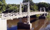
1902: (footbridge)
Littleton, New Hampshire, USA - Ammonoosuc River
| Bridgemeister ID: | 2917 (added 2019-09-15) |
| Year Completed: | 1902 |
| Name: | (footbridge) |
| Location: | Littleton, New Hampshire, USA |
| Crossing: | Ammonoosuc River |
| Status: | Destroyed, 1938 |
| Main Cables: | Wire |
| Suspended Spans: | 1 |
Notes:
- Destroyed during the Great New England Hurricane, 1938.
- Replaced by 1939 Curran - Littleton, New Hampshire, USA.
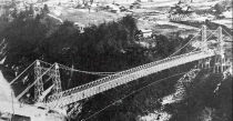
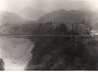
1902: (suspension bridge)
Chichibu, Saitama, Japan - Arakawa River
| Bridgemeister ID: | 5051 (added 2020-08-28) |
| Year Completed: | 1902 |
| Name: | (suspension bridge) |
| Location: | Chichibu, Saitama, Japan |
| Crossing: | Arakawa River |
| Coordinates: | 35.961412 N 138.975878 E |
| Maps: | Acme, GeoHack, Google, OpenStreetMap |
| Status: | Dismantled, 1980 |
| Main Cables: | Wire (steel) |
| Suspended Spans: | 1 |
Notes:
- Another suspension bridge was built on its piers (c. 2020) as part of the Gravity Park attraction.
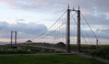
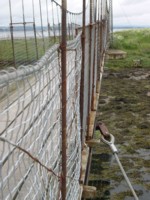
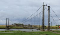
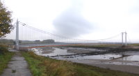
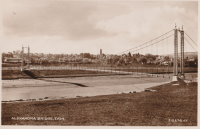
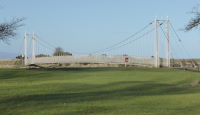
1902: Alexandra
Tain, Ross-Shire, Scotland, United Kingdom - River Tain
| Bridgemeister ID: | 2350 (added 2007-08-18) |
| Year Completed: | 1902 |
| Name: | Alexandra |
| Location: | Tain, Ross-Shire, Scotland, United Kingdom |
| Crossing: | River Tain |
| Coordinates: | 57.81496 N 4.04622 W |
| Maps: | Acme, GeoHack, Google, OpenStreetMap |
| Principals: | Rose Street Foundry (Inverness) |
| Use: | Footbridge |
| Status: | In use (last checked: 2018) |
| Main Cables: | Wire (steel) |
| Suspended Spans: | 1 |
| Main Span: | 1 x 43 meters (141 feet) |
Notes:
- Closed, 2011. Sign posted at the bridge in 2011 stated "No pedestrians beyond this point. Footbridge Closed. Imminent Danger of Collapse."
- Most news stories on the bridge's condition state it was closed continuously, due to deteriorating conditions, from 2011 through 2015, but this was not entirely accurate. The bridge was open in August 2014, but restricted to two people at a time (see accompanying photo sets). Closed again, sometime soon after. Contract awarded for refurbishment, April 2015.
1902: Bonny-sur-Loire
Bonny-sur-Loire and Beaulieu-sur-Loire, Loiret, France - Loire River
| Bridgemeister ID: | 1178 (added 2004-01-24) |
| Year Completed: | 1902 |
| Name: | Bonny-sur-Loire |
| Location: | Bonny-sur-Loire and Beaulieu-sur-Loire, Loiret, France |
| Crossing: | Loire River |
| Use: | Vehicular |
| Status: | Replaced |
| Main Cables: | Wire |
| Suspended Spans: | 3 |
| Main Spans: | 3 |
Notes:
External Links:

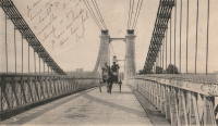
1902: Gobbins
Whitehead vicinity, Northern Ireland, United Kingdom
| Bridgemeister ID: | 1357 (added 2004-05-15) |
| Year Completed: | 1902 |
| Name: | Gobbins |
| Location: | Whitehead vicinity, Northern Ireland, United Kingdom |
| At or Near Feature: | Gobbins Cliff Path |
| Coordinates: | 54.808223 N 5.691737 W |
| Maps: | Acme, GeoHack, Google, OpenStreetMap |
| Use: | Footbridge |
| Status: | Replaced, 2015 |
| Main Cables: | Wire |
| Suspended Spans: | 1 |
Notes:
- 2014-2015: Gobbins Cliff Path restored to its original condition, including replacement of the suspension bridge.
- Replaced by 2015 Gobbins - Whitehead vicinity, Northern Ireland, United Kingdom.

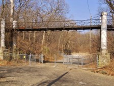
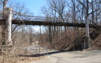
| Bridgemeister ID: | 2535 (added 2011-12-27) |
| Year Completed: | 1902 |
| Name: | Iron |
| Location: | Peoria, Illinois, USA |
| At or Near Feature: | Glen Oak Park |
| Coordinates: | 40.716042 N 89.573082 W |
| Maps: | Acme, GeoHack, Google, OpenStreetMap |
| Use: | Footbridge |
| Status: | Closed, 2003 (last checked: 2016) |
| Main Cables: | Wire |
| Suspended Spans: | 3 |
| Main Span: | 1 x 15.2 meters (50 feet) |
| Side Spans: | 2 x 7.6 meters (25 feet) |
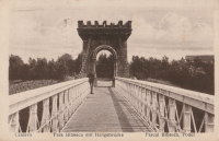
1902: Parcul Bibescu
Craiova, Romania
| Bridgemeister ID: | 523 (added before 2003) |
| Year Completed: | 1902 |
| Name: | Parcul Bibescu |
| Location: | Craiova, Romania |
| At or Near Feature: | Romanescu Park |
| Coordinates: | 44.300091 N 23.810388 E |
| Maps: | Acme, GeoHack, Google, OpenStreetMap |
| Use: | Footbridge |
| Status: | In use (last checked: 2020) |
| Main Cables: | Wire (steel) |
| Suspended Spans: | 1 |
Notes:
- Major renovation completed, October 2020.
External Links:
1902: Salisbury's
Golden Bay, New Zealand - Aorere River
| Bridgemeister ID: | 683 (added 2003-03-08) |
| Year Completed: | 1902 |
| Name: | Salisbury's |
| Location: | Golden Bay, New Zealand |
| Crossing: | Aorere River |
| References: | GAP |
| Use: | Footbridge |
| Status: | Destroyed, December 28, 2010 |
| Main Cables: | Wire |
| Suspended Spans: | 1 |
| Main Span: | 1 x 37.2 meters (122 feet) |
Notes:
- Destroyed by flood.
External Links:
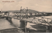
1902: Salzach
Laufen, Germany and Oberndorf, Austria - Salzach River
| Bridgemeister ID: | 933 (added 2003-10-25) |
| Year Completed: | 1902 |
| Name: | Salzach |
| Location: | Laufen, Germany and Oberndorf, Austria |
| Crossing: | Salzach River |
| Coordinates: | 47.939727 N 12.938722 E |
| Maps: | Acme, GeoHack, Google, OpenStreetMap |
| Use: | Vehicular (two-lane), with walkway |
| Status: | In use (last checked: 2019) |
| Main Cables: | Riveted plate |
| Suspended Spans: | 3 |
| Main Span: | 1 |
| Side Spans: | 2 |
Notes:
- Hybrid truss/suspension bridge where truss comes up to meet the cables for much of the main span. The "cables" appear to be riveted plates.
- Similar to Great Volkhov - Novgorod, Novgorod Oblast, Russia.
External Links:
1902: Swinging
Skowhegan, Maine, USA - Kennebec River
| Bridgemeister ID: | 1577 (added 2004-12-19) |
| Year Completed: | 1902 |
| Name: | Swinging |
| Location: | Skowhegan, Maine, USA |
| Crossing: | Kennebec River |
| References: | KJ20030410 |
| Use: | Footbridge |
| Status: | Demolished, 1936 |
| Main Cables: | Wire |
Notes:
- Destroyed by flood, 1936.
- Replaced 1888 Swinging - Skowhegan, Maine, USA.
- Replaced by 1936 Swinging - Skowhegan, Maine, USA.
1902: Tursoli
Tursoli, Nepal
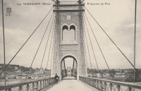
1902: Vernaison
Vernaison, Métropole de Lyon, France - Rhône River
| Bridgemeister ID: | 6431 (added 2021-08-11) |
| Year Completed: | 1902 |
| Name: | Vernaison |
| Location: | Vernaison, Métropole de Lyon, France |
| Crossing: | Rhône River |
| Coordinates: | 45.646369 N 4.815423 E |
| Maps: | Acme, GeoHack, Google, OpenStreetMap |
| Principals: | Ferdinand Arnodin |
| References: | AAJ, PTS2 |
| Use: | Vehicular |
| Status: | Destroyed, June 1940 |
| Main Cables: | Wire (steel) |
Notes:
- Later at same location 1959 Vernaison - Vernaison and Solaize, Métropole de Lyon, France.
External Links:
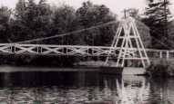
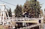
1902: Wanakena
Wanakena, New York, USA - Oswegatchie River
| Bridgemeister ID: | 109 (added before 2003) |
| Year Completed: | 1902 |
| Name: | Wanakena |
| Location: | Wanakena, New York, USA |
| Crossing: | Oswegatchie River |
| Coordinates: | 44.133217 N 74.921317 W |
| Maps: | Acme, GeoHack, Google, OpenStreetMap |
| Principals: | Rich Lumber Co. |
| Use: | Footbridge |
| Status: | Removed, 2014 |
| Main Cables: | Wire |
| Suspended Spans: | 1 |
| Main Span: | 1 x 52.1 meters (171 feet) |
Notes:
- Heavily damaged by ice jam, January 2014. Later dismantled.
- Near (footbridge) - Fine, Wanakena vicinity, New York, USA.
- Replaced by 2017 Wanakena - Wanakena, New York, USA.
External Links:
1903: Caperton
Caperton vicinity, West Virginia, USA - New River
| Bridgemeister ID: | 1422 (added 2004-07-17) |
| Year Completed: | 1903 |
| Name: | Caperton |
| Location: | Caperton vicinity, West Virginia, USA |
| Crossing: | New River |
| Coordinates: | 38.021856 N 81.028479 W |
| Maps: | Acme, GeoHack, Google, OpenStreetMap |
| References: | AAJ, HBE, PTS2 |
| Use: | Footbridge |
| Status: | Removed |
| Main Cables: | Wire |
| Suspended Spans: | 1 |
| Main Span: | 1 x 155.4 meters (510 feet) |
Notes:
- Removed by the 1960s, probably earlier.
1903: Chobhar
Kathmandu vicinity, Nepal - Bagmati River
| Bridgemeister ID: | 2175 (added 2007-01-13) |
| Year Completed: | 1903 |
| Name: | Chobhar |
| Also Known As: | Chobar, Chundra |
| Location: | Kathmandu vicinity, Nepal |
| Crossing: | Bagmati River |
| At or Near Feature: | Chobhar Gorge |
| Coordinates: | 27.658921 N 85.293695 E |
| Maps: | Acme, GeoHack, Google, OpenStreetMap |
| Principals: | Louis Harper, Harpers Limited |
| References: | HARPER |
| Use: | Footbridge |
| Status: | In use (last checked: 2019) |
| Main Cables: | Wire |
| Suspended Spans: | 1 |
| Main Span: | 1 x 39.6 meters (130 feet) |
| Deck width: | 4 feet |
External Links:
1903: Elisabeth
Budapest, Hungary - Danube River
| Bridgemeister ID: | 426 (added before 2003) |
| Year Completed: | 1903 |
| Name: | Elisabeth |
| Also Known As: | Elizabeth, Erzsébet |
| Location: | Budapest, Hungary |
| Crossing: | Danube River |
| Principals: | Aurel Czekelius, M. Nagy |
| References: | AAJ, BMA, HBE, PTS2, SA19050909 |
| Use: | Vehicular, with walkway |
| Status: | Destroyed, 1945 |
| Main Cables: | Eyebar |
| Suspended Spans: | 3 |
| Main Span: | 1 x 289.9 meters (951 feet) |
| Side Spans: | 2 x 44.2 meters (145 feet) |
Notes:
- Replaced by 1964 Elisabeth (Erzsébet) - Budapest, Hungary.
External Links:

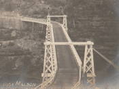
1903: Maldon
Picton vicinity, New South Wales, Australia - Nepean River
| Bridgemeister ID: | 427 (added before 2003) |
| Year Completed: | 1903 |
| Name: | Maldon |
| Location: | Picton vicinity, New South Wales, Australia |
| Crossing: | Nepean River |
| Coordinates: | 34.202104 S 150.632321 E |
| Maps: | Acme, GeoHack, Google, OpenStreetMap |
| Principals: | E.M. de Burgh |
| References: | STC |
| Use: | Vehicular (one-lane) |
| Status: | Derelict (last checked: 2020) |
| Main Cables: | Wire (steel) |
| Suspended Spans: | 1 |
| Main Span: | 1 x 68.9 meters (226 feet) |
Notes:
- Timber towers damaged by fire, replaced with steel towers 1939.
External Links:
- Maldon Suspension Bridge, Jan 28th 2020 - YouTube. Close-up drone footage of the derelict bridge.
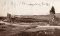
1903: Passera de la Riera de Torrelles
Sant Vicenç dels Horts, Spain - Riera de Torrelles
| Bridgemeister ID: | 8164 (added 2024-02-03) |
| Year Completed: | 1903 |
| Name: | Passera de la Riera de Torrelles |
| Location: | Sant Vicenç dels Horts, Spain |
| Crossing: | Riera de Torrelles |
| Coordinates: | 41.386417 N 2.015944 E |
| Maps: | Acme, GeoHack, Google, OpenStreetMap |
| Use: | Footbridge |
| Status: | Demolished, 1967 |
| Suspended Spans: | 1 |
Notes:
- The pillars from one of the towers has been preserved as a monument at the coordinates provided here. Unclear if this was the exact location of the bridge.
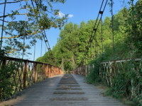
1903: Pickhill
Pickhill, Wales, United Kingdom - River Dee
| Bridgemeister ID: | 4562 (added 2020-06-01) |
| Year Completed: | 1903 |
| Name: | Pickhill |
| Also Known As: | Pickhill Meadows |
| Location: | Pickhill, Wales, United Kingdom |
| Crossing: | River Dee |
| Coordinates: | 53.017265 N 2.884666 W |
| Maps: | Acme, GeoHack, Google, OpenStreetMap |
| Principals: | David Rowell & Co. |
| Use: | Vehicular (one-lane) |
| Status: | Restricted to foot traffic (last checked: 2020) |
| Main Cables: | Wire (steel) |
| Suspended Spans: | 1 |
| Main Span: | 1 x 41 meters (134.5 feet) |
| Deck width: | 3 meters |
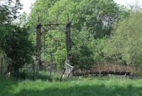
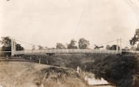
1903: Sands
Swalwell, England, United Kingdom - River Derwent
| Bridgemeister ID: | 1251 (added 2004-02-21) |
| Year Completed: | 1903 |
| Name: | Sands |
| Also Known As: | Hikey |
| Location: | Swalwell, England, United Kingdom |
| Crossing: | River Derwent |
| Coordinates: | 54.956267 N 1.6877 W |
| Maps: | Acme, GeoHack, Google, OpenStreetMap |
| Principals: | David Rowell & Co. |
| Use: | Footbridge |
| Status: | In use (last checked: 2007) |
| Main Cables: | Wire |
| Suspended Spans: | 1 |


| Bridgemeister ID: | 3881 (added 2020-03-08) |
| Year Completed: | 1903 |
| Name: | Teigen |
| Also Known As: | Vikvar |
| Location: | Mebonden, Selbu, Trøndelag, Norway |
| Crossing: | Nea |
| Coordinates: | 63.221980 N 11.013930 E |
| Maps: | Acme, GeoHack, Google, kart.1881.no, OpenStreetMap |
| Status: | Dismantled, 1924 |
| Suspended Spans: | 1 |
| Main Span: | 1 x 60 meters (196.9 feet) estimated |
Notes:
- Replaced by an adjacent suspension bridge and subsequently dismantled and reerected at another location.
- Moved to 1926 Henmo - Østeraunet, Aunet, Tydal and Henmo, Aunet, Tydal, Trøndelag, Norway.
- Replaced by 1922 Teigen (Vikvar) - Mebonden, Selbu, Trøndelag, Norway.
1903: Ticonic
Waterville, Maine, USA - Kennebec River
| Bridgemeister ID: | 110 (added before 2003) |
| Year Completed: | 1903 |
| Name: | Ticonic |
| Also Known As: | Tupenny, Two Cent |
| Location: | Waterville, Maine, USA |
| Crossing: | Kennebec River |
| Coordinates: | 44.55073 N 69.62728 W |
| Maps: | Acme, GeoHack, Google, OpenStreetMap |
| Principals: | Edwin D. Graves |
| References: | AAJ, HBE, PTS2 |
| Use: | Footbridge |
| Status: | In use (last checked: 2009) |
| Main Cables: | Wire |
| Suspended Spans: | 1 |
| Main Span: | 1 x 121.9 meters (400 feet) |
| Deck width: | 6 feet |
External Links:
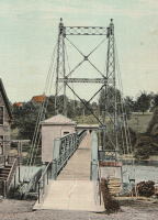
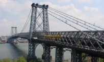
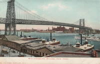
1903: Williamsburg
New York and Brooklyn, New York, USA - East River
| Bridgemeister ID: | 111 (added before 2003) |
| Year Completed: | 1903 |
| Name: | Williamsburg |
| Location: | New York and Brooklyn, New York, USA |
| Crossing: | East River |
| Coordinates: | 40.71355 N 73.97226 W |
| Maps: | Acme, GeoHack, Google, OpenStreetMap |
| Principals: | L.L. Buck |
| References: | AAJ, BAAW, BAR, BBR, BPL, GBD, HBE, PTS2, SJR |
| Use: | Rail (light rail) and Vehicular (major highway), with walkway |
| Status: | In use (last checked: 2022) |
| Main Cables: | Wire (steel) |
| Suspended Spans: | 1 |
| Main Span: | 1 x 487.7 meters (1,600 feet) |
Notes:
- Became longest suspension bridge by eclipsing 1883 Brooklyn (Great East River) - New York and Brooklyn, New York, USA.
- Eclipsed by new longest suspension bridge 1924 Bear Mountain - Anthony's Nose and Bear Mountain, New York, USA.
- Near 1883 Brooklyn (Great East River) - New York and Brooklyn, New York, USA.
- Near 1909 Manhattan - New York and Brooklyn, New York, USA.
External Links:
1904: (footbridge)
Conwy, Wales, United Kingdom - River Conwy
| Bridgemeister ID: | 512 (added before 2003) |
| Year Completed: | 1904 |
| Name: | (footbridge) |
| Location: | Conwy, Wales, United Kingdom |
| Crossing: | River Conwy |
| Coordinates: | 53.280346 N 3.823733 W |
| Maps: | Acme, GeoHack, Google, OpenStreetMap |
| Principals: | Alfred Thorne |
| Use: | Footbridge |
| Status: | Removed |
| Main Cables: | Wire (steel) |
| Suspended Spans: | 1 |
Notes:
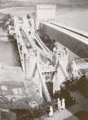
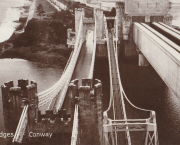
- This entry refers to the steel suspension footbridge nestled between Telford's suspension bridge and Stephenson's rail bridge. Click the photo to get a better view of this bridge. According to Susan Ellis, Senior Archivist of the Conwy County Borough Council, the bridge was built on the recommendation of John J. Webster who was hired to inspect Telford's suspension bridge in 1902 "following fears about the safety of its condition. He reported back making various recommendation for strengthening the bridge, including that a separate footbridge be constructed."
- This footbridge was in existence until at least 1957.
- Next to 1826 Conwy (Conway) - Conwy, Wales, United Kingdom.
Annotated Citations:
- "Conway Suspension Bridge." The Engineer, 20 May 1904.
This detailed account of the 1904 reinforcement of Telford's adjacent bridge does not mention the existence of, or building of, an additional footbridge. It does describe adding a cantilevered walkway to one side of Telford's bridge. This walkway was, indeed, built, and can be seen in the linked image on the left side of the older bridge. Thus, it is not entirely clear whether this bridge was actually constructed in 1904 and the work of Alfred Thorne (who was very much associated with the Telford bridge reinforcement project)
1904: (suspension bridge)
Mt. Bruce, New Zealand - Ruamahanga River
| Bridgemeister ID: | 686 (added 2003-03-08) |
| Year Completed: | 1904 |
| Name: | (suspension bridge) |
| Location: | Mt. Bruce, New Zealand |
| Crossing: | Ruamahanga River |
| Principals: | Joseph Dawson |
| References: | GAP |
1904: Alexandra
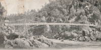
Launceston, Tasmania, Australia - South Esk River
| Bridgemeister ID: | 428 (added before 2003) |
| Year Completed: | 1904 |
| Name: | Alexandra |
| Also Known As: | Basin |
| Location: | Launceston, Tasmania, Australia |
| Crossing: | South Esk River |
| At or Near Feature: | First Basin Water, Cataract Gorge Reserve |
| Principals: | C. St John David, Salisbury's Foundry Co. |
| References: | STC |
| Use: | Footbridge |
| Status: | Destroyed, 1929 |
| Main Cables: | Wire |
| Suspended Spans: | 3 |
| Main Span: | 1 x 45.7 meters (149.9 feet) |
| Side Spans: | 2 x 10.7 meters (35.1 feet) |
Notes:
- Washed away by flood, 1929.
- Near 1895 Duck Reach - Launceston, Tasmania, Australia.
- Replaced by 1930 Alexandra (Basin) - Launceston, Tasmania, Australia of similar construction.
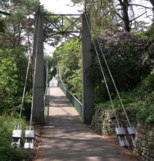
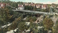
1904: Alum Chine
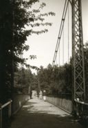
Bournemouth, England, United Kingdom - Alum Chine
| Bridgemeister ID: | 785 (added 2003-03-16) |
| Year Completed: | 1904 |
| Name: | Alum Chine |
| Location: | Bournemouth, England, United Kingdom |
| Crossing: | Alum Chine |
| Coordinates: | 50.7143 N 1.90058 W |
| Maps: | Acme, GeoHack, Google, OpenStreetMap |
| Principals: | David Rowell & Co. |
| Use: | Footbridge |
| Status: | In use (last checked: 2020) |
| Main Cables: | Wire |
| Suspended Spans: | 1 |
Notes:
- Renovated, 1973. Refurbished, 2004.
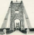
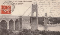
1904: Bonhomme
Kervignac, Morbihan, France - Blavet River
| Bridgemeister ID: | 1115 (added 2004-01-05) |
| Year Completed: | 1904 |
| Name: | Bonhomme |
| Location: | Kervignac, Morbihan, France |
| Crossing: | Blavet River |
| Coordinates: | 47.764878 N 3.302251 W |
| Maps: | Acme, GeoHack, Google, OpenStreetMap |
| Principals: | Ferdinand Arnodin |
| References: | AAJ, BPF, PTS2 |
| Use: | Vehicular |
| Status: | Only towers remain, since 1980 (last checked: 2019) |
| Main Cables: | Wire |
| Suspended Spans: | 3 |
| Main Span: | 1 x 163.1 meters (535 feet) |
| Side Spans: | 2 x 36.9 meters (121 feet) |
Notes:
- Deck and cables removed, 1980.
External Links:
1904: Brazos
Brazos, Texas, USA - Brazos River
| Bridgemeister ID: | 1857 (added 2005-07-17) |
| Year Completed: | 1904 |
| Name: | Brazos |
| Location: | Brazos, Texas, USA |
| Crossing: | Brazos River |
| Principals: | William Flinn |
| References: | HAERTX98 |
| Use: | Vehicular |
| Status: | Removed |
| Main Cables: | Wire |
| Suspended Spans: | 3 |
| Main Span: | 1 x 91.4 meters (300 feet) |
| Side Spans: | 2 x 45.7 meters (150 feet) |
1904: Chimney Creek
Williams Lake vicinity, British Columbia, Canada - Fraser River
| Bridgemeister ID: | 1641 (added 2005-03-14) |
| Year Completed: | 1904 |
| Name: | Chimney Creek |
| Also Known As: | Chilcotin, Sheep Creek, Fraser River |
| Location: | Williams Lake vicinity, British Columbia, Canada |
| Crossing: | Fraser River |
| Coordinates: | 51.982898 N 122.275076 W |
| Maps: | Acme, GeoHack, Google, OpenStreetMap |
| Use: | Vehicular (one-lane) |
| Status: | Removed, c. 1962 |
| Main Cables: | Wire (steel) |
| Suspended Spans: | 1 |
| Main Span: | 1 |
Notes:
- Crossed the Fraser southwest of Williams Lake next to the present route 20 crossing. Some of the stone piers are still visible next to the present arch bridge. For some time, the two bridges were standing side-by-side (perhaps 100 yards apart). The "stone piers" very much look like pylons from an older suspension bridge but there doesn't appear to be evidence of a prior suspension bridge.
- Some sources say completed in 1905.
- Replacement opened in 1962. Suspension bridge possibly removed in 1961 or 1962.
External Links:
- Chimney Creek Archives - ARCHIVOS. Images of the bridge among several Fraser River bridge images.
- File:Chimney Creek bridge under construction.jpg - Wikimedia Commons. Image of the bridge. Dated c. 1904.
- LISTEN: A Haphazard History of the Fraser River Bridge - The Williams Lake Tribune. Article detailing the history of bridges at this location.
1904: Dark Valley
Graford and Palo Pinto, Texas, USA - Brazos River
| Bridgemeister ID: | 921 (added 2003-10-18) |
| Year Completed: | 1904 |
| Name: | Dark Valley |
| Location: | Graford and Palo Pinto, Texas, USA |
| Crossing: | Brazos River |
| Principals: | William Flinn |
| References: | BRAZ, HAERTX98 |
| Use: | Vehicular |
| Status: | Demolished, 1958 |
| Main Cables: | Wire (steel) |
| Suspended Spans: | 5 |
| Main Spans: | 2 x 76.2 meters (250 feet) |
| Side Spans: | 1 x 24.4 meters (80 feet), 2 x 38.1 meters (125 feet) |
| Deck width: | 16 feet |
Notes:
- The TxDOT Bridge Division website shows an image of this bridge with caption "The Dark Valley Bridge is shown here before its demolition in 1958," but BRAZ describes it as being destroyed by a flood on October 31, 1981. The TxDOT information is likely correct.
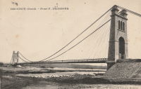
1904: Desmons
Brignon, Gard, France - Gardon River
| Bridgemeister ID: | 6982 (added 2022-04-03) |
| Year Completed: | 1904 |
| Name: | Desmons |
| Location: | Brignon, Gard, France |
| Crossing: | Gardon River |
| Use: | Vehicular |
| Status: | Destroyed, October, 1907 |
| Main Cables: | Wire |
| Suspended Spans: | 1 |
| Main Span: | 1 |
Notes:
- 1907, October: Destroyed by flood.
- Replaced by 1913 Desmons - Brignon, Gard, France.
External Links:
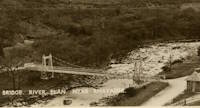
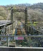
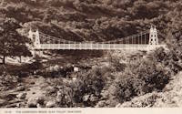
1904: Elan Village
Elan, Rhayader, Wales, United Kingdom - River Elan
| Bridgemeister ID: | 1255 (added 2004-02-28) |
| Year Completed: | 1904 |
| Name: | Elan Village |
| Location: | Elan, Rhayader, Wales, United Kingdom |
| Crossing: | River Elan |
| Coordinates: | 52.27099 N 3.56900 W |
| Maps: | Acme, GeoHack, Google, OpenStreetMap |
| Principals: | Birmingham Water Corporation |
| Status: | Closed, 1988 (last checked: 2013) |
| Suspended Spans: | 1 |
Notes:
- Rebuilt twice.
External Links:
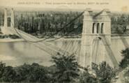
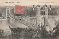
1904: Jons-Niévroz
Jons, Rhône and Niévroz, Ain, France - Rhône River
| Bridgemeister ID: | 2033 (added 2006-04-23) |
| Year Completed: | 1904 |
| Name: | Jons-Niévroz |
| Location: | Jons, Rhône and Niévroz, Ain, France |
| Crossing: | Rhône River |
| References: | AAJ |
| Use: | Vehicular |
| Status: | Destroyed, 1940 |
| Suspended Spans: | 1 |
| Main Span: | 1 x 200 meters (656.2 feet) |
Notes:
- Destroyed, 1940, during WWII.
- Similar to 1912 Groslée - Groslée, Ain and Brangues, Isère, France.
1904: Lordville-Equinunk
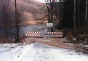
Lordville, New York and Equinunk, Pennsylvania, USA - Delaware River
| Bridgemeister ID: | 112 (added before 2003) |
| Year Completed: | 1904 |
| Name: | Lordville-Equinunk |
| Location: | Lordville, New York and Equinunk, Pennsylvania, USA |
| Crossing: | Delaware River |
| Coordinates: | 41.867745 N 75.213789 W |
| Maps: | Acme, GeoHack, Google, OpenStreetMap |
| Principals: | Owego Bridge Company |
| References: | BDR, BOL, BPL, HHP |
| Use: | Vehicular (one-lane) |
| Status: | Demolished, 1986 |
| Main Cables: | Eyebar (steel) |
| Suspended Spans: | 2 |
| Main Span: | 1 x 105.8 meters (347 feet) |
| Side Span: | 1 x 17.1 meters (56 feet) |
Notes:
- Eyebar suspension bridge.
- Replaced 1869 Lordville - Lordville, New York and Equinunk, Pennsylvania, USA.
External Links:
1904: Lugard
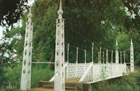
Zungeru, Nigeria
| Bridgemeister ID: | 8149 (added 2024-02-03) |
| Year Completed: | 1904 |
| Name: | Lugard |
| Location: | Zungeru, Nigeria |
| Coordinates: | 10.505250 N 7.453500 E |
| Maps: | Acme, GeoHack, Google, OpenStreetMap |
| Use: | Footbridge |
| Status: | In use (last checked: 2020) |
| Suspended Spans: | 1 |
Notes:
- Originally constructed in Zungeru, this bridge has been relocated twice. The coordinates provided here are the current location of the bridge in Kaduna.
External Links:
1904: Moline Swinging
Moline, Kansas, USA - Wildcat Creek
| Bridgemeister ID: | 294 (added before 2003) |
| Year Completed: | 1904 |
| Name: | Moline Swinging |
| Location: | Moline, Kansas, USA |
| Crossing: | Wildcat Creek |
| Coordinates: | 37.36578 N 96.30433 W |
| Maps: | Acme, GeoHack, Google, OpenStreetMap |
| Use: | Footbridge |
| Status: | In use (last checked: 2010) |
| Main Cables: | Wire |
| Main Span: | 1 x 31.4 meters (103 feet) estimated |
| Side Spans: | 1 x 10.4 meters (34 feet) estimated, 1 x 10.7 meters (35 feet) estimated |
External Links:
1904: Pomeroy's
Bainham, Golden Bay, New Zealand - Aorere River
| Bridgemeister ID: | 684 (added 2003-03-08) |
| Year Completed: | 1904 |
| Name: | Pomeroy's |
| Also Known As: | James's |
| Location: | Bainham, Golden Bay, New Zealand |
| Crossing: | Aorere River |
| References: | GAP |
Notes:
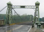
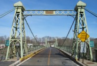
1904: Riegelsville
Riegelsville, Pennsylvania and Riegelsville, New Jersey, USA - Delaware River
| Bridgemeister ID: | 113 (added before 2003) |
| Year Completed: | 1904 |
| Name: | Riegelsville |
| Location: | Riegelsville, Pennsylvania and Riegelsville, New Jersey, USA |
| Crossing: | Delaware River |
| Coordinates: | 40.59427 N 75.19062 W |
| Maps: | Acme, GeoHack, Google, OpenStreetMap |
| Principals: | John A. Roebling's Sons Co., S. A. Cooney |
| References: | BDR, BPL, SSS |
| Use: | Vehicular (two-lane, heavy vehicles), with walkway |
| Status: | In use (last checked: 2007) |
| Main Cables: | Wire (steel) |
| Suspended Spans: | 3 |
| Main Spans: | 3 |
External Links:
1904: Upper
Warsaw, Missouri, USA - Osage River
| Bridgemeister ID: | 2537 (added 2011-12-28) |
| Year Completed: | 1904 |
| Name: | Upper |
| Also Known As: | Swinging |
| Location: | Warsaw, Missouri, USA |
| Crossing: | Osage River |
| Coordinates: | 38.244449 N 93.387608 W |
| Maps: | Acme, GeoHack, Google, OpenStreetMap |
| Principals: | Joseph A. Dice, Dr. Daniel M. Eddy |
| References: | BOTO |
| Use: | Vehicular |
| Status: | Destroyed, 1924 |
| Main Cables: | Wire |
Notes:
- Destroyed by a tornado.
- Replaced by 1927 Upper (Swinging) - Warsaw, Missouri, USA.
1905: (footbridge)
Peradeniya, Sri Lanka - Mahaweli Ganga
| Bridgemeister ID: | 2446 (added 2008-04-23) |
| Year Completed: | 1905 |
| Name: | (footbridge) |
| Location: | Peradeniya, Sri Lanka |
| Crossing: | Mahaweli Ganga |
| At or Near Feature: | Royal Botanical Gardens |
| Coordinates: | 7.276585 N 80.593782 E |
| Maps: | Acme, GeoHack, Google, OpenStreetMap |
| Use: | Footbridge |
| Status: | In use (last checked: 2022) |
| Main Cables: | Wire (steel) |
| Suspended Spans: | 3 |
| Main Span: | 1 |
| Side Spans: | 2 |
External Links:
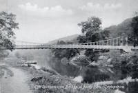
1905: Apley
Apley Park, England, United Kingdom - River Severn
| Bridgemeister ID: | 769 (added 2003-03-13) |
| Year Completed: | 1905 |
| Name: | Apley |
| Also Known As: | Linley |
| Location: | Apley Park, England, United Kingdom |
| Crossing: | River Severn |
| Coordinates: | 52.581949 N 2.434328 W |
| Maps: | Acme, GeoHack, Google, OpenStreetMap |
| Principals: | David Rowell & Co. |
| Use: | Vehicular (one-lane) |
| Status: | In use (last checked: 2011) |
| Main Cables: | Wire (steel) |
| Main Span: | 1 |
Notes:
- Capable of carrying light vehicular traffic.
External Links:

1905: Byram
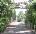
Byram, Mississippi, USA - Pearl River
| Bridgemeister ID: | 115 (added before 2003) |
| Year Completed: | 1905 |
| Name: | Byram |
| Location: | Byram, Mississippi, USA |
| Crossing: | Pearl River |
| Coordinates: | 32.176683 N 90.243467 W |
| Maps: | Acme, GeoHack, Google, OpenStreetMap |
| References: | GBD |
| Use: | Vehicular |
| Status: | Restricted to foot traffic, since early 1987 (last checked: 2021) |
| Main Cables: | Wire (steel) |
| Suspended Spans: | 3 |
| Main Span: | 1 x 61 meters (200 feet) |
| Side Spans: | 2 x 24.4 meters (80 feet) |
Notes:
- 1987: Closed to vehicular traffic.
- 2006: Vandalized. In December of 2006 after several reports of vandalism, George Britt writes: "I walked the bridge December 24, 2006. It is in rough shape but you can still walk on it if you are careful. Vandals have started fires on the bridge span damaging the planks. Some planks are missing. There is also considerable graffiti about."
- 2008: Scheduled for restoration (repair of deck boards and grafitti).
- 2015: Overdue renovation completed.
External Links:
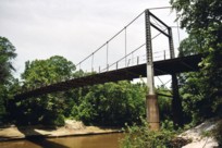
1905: Cambus O'May
Ballater, Scotland, United Kingdom - River Dee
| Bridgemeister ID: | 429 (added before 2003) |
| Year Completed: | 1905 |
| Name: | Cambus O'May |
| Also Known As: | Gordon |
| Location: | Ballater, Scotland, United Kingdom |
| Crossing: | River Dee |
| Coordinates: | 57.065803 N 2.956825 W |
| Maps: | Acme, GeoHack, Google, OpenStreetMap |
| Principals: | James Abernethy & Co. |
| References: | BC2, BC3, BEM, HARPER, HBR, NTB |
| Use: | Footbridge |
| Status: | In use (last checked: April, 2021) |
| Main Cables: | Wire (steel) |
| Suspended Spans: | 1 |
| Main Span: | 1 x 51.8 meters (170 feet) |
Notes:
- 1988: Refurbished (HBR)
- 2015, December: Damaged by the River Dee flood caused by Storm Frank. Closed indefinitely. Repairs expected to start in 2020.
- 2020, August 31: Repairs underway, expected to be completed in approximately 16 weeks.
- 2020, December: Storm Frank repairs now expected to be completed in January 2021.
- 2021, January: Completion of repairs delayed due to COVID-19 pandemic "stay at home" recommendations.
- 2021, April 1: Repairs completed, bridge reopened.
External Links:
- Cambus O' May | Harper Bridges
- The Happy Pontist: Scottish Bridges: 20. Cambus O'May Footbridge
- The Happy Pontist: Scottish Bridges: 43. Cambus O' May Bridge (revisited)
- The Happy Pontist: Scottish Bridges: 55. Cambus O'May Bridge (after the flood)
- Structurae - Structure ID 20019638

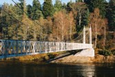
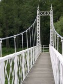
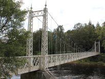
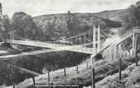
1905: Kelso
Kelso, Washington, USA - Cowlitz River
| Bridgemeister ID: | 1651 (added 2005-03-19) |
| Year Completed: | 1905 |
| Name: | Kelso |
| Location: | Kelso, Washington, USA |
| Crossing: | Cowlitz River |
| References: | AAJ, PTS2 |
| Use: | Vehicular |
| Status: | Collapsed, Jan. 3, 1923 |
| Main Cables: | Wire (steel) |
| Suspended Spans: | 1 |
| Main Span: | 1 x 91.4 meters (300 feet) |
Notes:
- Washed out, 1906. Rebuilt, 1907. Collapsed, 1923, killing "12 to 15 persons" when one of the cables parted with the anchorage.
External Links:
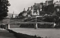
1905: Makartsteg
Salzburg, Austria - Salzach River
| Bridgemeister ID: | 647 (added 2003-02-17) |
| Year Completed: | 1905 |
| Name: | Makartsteg |
| Location: | Salzburg, Austria |
| Crossing: | Salzach River |
| Coordinates: | 47.801666 N 13.042172 E |
| Maps: | Acme, GeoHack, Google, OpenStreetMap |
| Use: | Footbridge |
| Status: | Demolished, 2000 |
| Main Cables: | Riveted plate |
| Suspended Spans: | 3 |
| Main Span: | 1 |
| Side Spans: | 2 |
Notes:
- 1967: Dismantled and supposedly replaced with a bridge that was referred to as a "swinging bridge." However, it appears several components of the original bridge were reassembled with a new deck. The bridge was finally demolished in 2000 and replaced with the bridge presently (2020s) known as the Marko-Feingold-Steg.
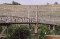
1905: Mangarere Road
Mangaweka, New Zealand - Rangitikei River
| Bridgemeister ID: | 687 (added 2003-03-08) |
| Year Completed: | 1905 |
| Name: | Mangarere Road |
| Location: | Mangaweka, New Zealand |
| Crossing: | Rangitikei River |
| References: | GAP |
| Use: | Vehicular (one-lane) |
| Main Cables: | Wire (steel) |
| Suspended Spans: | 1 |
External Links:
1905: Market Street
Steubenville, Ohio and East Steubenville, West Virginia, USA - Ohio River
| Bridgemeister ID: | 114 (added before 2003) |
| Year Completed: | 1905 |
| Name: | Market Street |
| Location: | Steubenville, Ohio and East Steubenville, West Virginia, USA |
| Crossing: | Ohio River |
| Coordinates: | 40.35833 N 80.61167 W |
| Maps: | Acme, GeoHack, Google, OpenStreetMap |
| Principals: | Hermann Laub |
| References: | AAJ, BPL, PTS2 |
| Use: | Vehicular (two-lane) |
| Status: | Closed, December 2023 |
| Main Cables: | Wire (steel) |
| Suspended Spans: | 3 |
| Main Span: | 1 x 207.3 meters (680 feet) |
| Side Spans: | 2 x 79.2 meters (260 feet) |
Notes:
- 2023, December: Closed by WVDOT because of safety concerns.
- Near 1928 Fort Steuben - Steubenville, Ohio and Weirton, West Virginia, USA.
External Links:
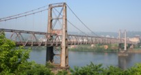
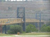
1905: Newell
East Liverpool, Ohio and Newell, West Virginia, USA - Ohio River
| Bridgemeister ID: | 117 (added before 2003) |
| Year Completed: | 1905 |
| Name: | Newell |
| Location: | East Liverpool, Ohio and Newell, West Virginia, USA |
| Crossing: | Ohio River |
| Coordinates: | 40.62167 N 80.595 W |
| Maps: | Acme, GeoHack, Google, OpenStreetMap |
| Principals: | Edwin Kirtland Morse, Dravo Company |
| References: | AAJ, BPL, PTS2 |
| Use: | Vehicular (two-lane), with walkway |
| Status: | In use (last checked: 2022) |
| Main Cables: | Wire (steel) |
| Suspended Spans: | 3 |
| Main Span: | 1 x 228.6 meters (750 feet) |
| Side Spans: | 2 |
Annotated Citations:
- Huba, Stephen. "There’s a new owner for the Newell Bridge." The Weirton Daily Times, 6 May 2022, www.weirtondailytimes.com/news/local-news/2022/05/theres-a-new-owner-for-the-newell-bridge/.
"Frank Six of Six Enterprises in Newell, assumed ownership Wednesday of one of the oldest suspension bridges on the Ohio River for an undisclosed sum from HLC Holdings Inc., parent company of the Fiesta Tableware Co., formerly known as the Homer Laughlin China Co."
- Bobby-Gilbert, Jo-Ann., "Fiesta Tableware Parent Sells Iconic Newell Bridge." The Business Journal, 5 May 2022, businessjournaldaily.com/fiesta-tableware-parent-sells-iconic-newell-bridge/.
"After 116 years of ownership by HLC Holdings Inc., parent company of The Fiesta Tableware Co., the Newell Bridge and Railway Co. changed hands at midnight Wednesday. Officials of Fiesta Tableware, formerly known as Homer Laughlin China Co., announced that the bridge has been purchased by Frank Six, owner of Six Enterprises in Newell."
External Links:

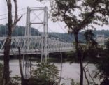
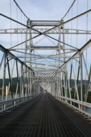
1905: Pangburn
Pangburn, Arkansas, USA - Little Red River
| Bridgemeister ID: | 7785 (added 2023-08-18) |
| Year Completed: | 1905 |
| Name: | Pangburn |
| Location: | Pangburn, Arkansas, USA |
| Crossing: | Little Red River |
| Coordinates: | 35.437946 N 91.845140 W |
| Maps: | Acme, GeoHack, Google, OpenStreetMap |
| Use: | Vehicular |
| Status: | Removed, 1958 |
| Main Cables: | Wire |
| Main Span: | 1 |
| Side Spans: | 2 |
External Links:
Do you have any information or photos for these bridges that you would like to share? Please email david.denenberg@bridgemeister.com.