Suspension Bridges Completed 1930-1939 (101-200 of 250)
This is a list of bridges 101 through 200 (of 250 total) from the suspension bridge inventory completed in the decade 1930-1939. Wherever you see a Bridgemeister ID number click it to isolate the bridge on its own page.
Related Lists:
1934: (footbridge)
Grey Valley, New Zealand - Slaty Creek
| Bridgemeister ID: | 750 (added 2003-03-08) |
| Year Completed: | 1934 |
| Name: | (footbridge) |
| Location: | Grey Valley, New Zealand |
| Crossing: | Slaty Creek |
| Use: | Footbridge |
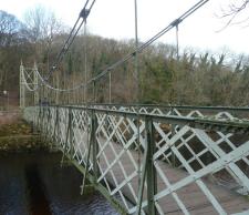
1934: (footbridge)
Ilkley, England, United Kingdom - River Wharfe
| Bridgemeister ID: | 1261 (added 2004-03-13) |
| Year Completed: | 1934 |
| Name: | (footbridge) |
| Location: | Ilkley, England, United Kingdom |
| Crossing: | River Wharfe |
| Coordinates: | 53.93241 N 1.81483 W |
| Maps: | Acme, GeoHack, Google, OpenStreetMap |
| Principals: | David Rowell & Co. |
| Use: | Footbridge |
| Status: | In use (last checked: 2022) |
| Main Cables: | Wire (steel) |
| Suspended Spans: | 1 |
Notes:
- Refurbished, 2001.
1934: (footbridge)
Rollag, Viken, Norway - Numedalslågen
| Bridgemeister ID: | 4099 (added 2020-04-05) |
| Year Completed: | 1934 |
| Name: | (footbridge) |
| Location: | Rollag, Viken, Norway |
| Crossing: | Numedalslågen |
| Coordinates: | 60.017909 N 9.276293 E |
| Maps: | Acme, GeoHack, Google, kart.1881.no, OpenStreetMap |
| Use: | Footbridge |
| Status: | In use (last checked: 2019) |
| Main Cables: | Wire (steel) |
| Suspended Spans: | 1 |
| Main Span: | 1 x 88 meters (288.7 feet) estimated |
| Deck width: | 1.5 meters |
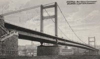
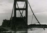
1934: King Alexander I
Belgrade, Serbia - Sava River
| Bridgemeister ID: | 957 (added 2003-11-01) |
| Year Completed: | 1934 |
| Name: | King Alexander I |
| Also Known As: | King Aleksandar |
| Location: | Belgrade, Serbia |
| Crossing: | Sava River |
| Coordinates: | 44.814946 N 20.448665 E |
| Maps: | Acme, GeoHack, Google, OpenStreetMap |
| Principals: | Société de Construction des Batignolles |
| References: | AAJ |
| Use: | Vehicular, with walkway |
| Status: | Destroyed, April 12, 1941 |
| Main Cables: | Wire (steel) |
| Suspended Spans: | 1 |
| Main Span: | 1 x 260.9 meters (856 feet) |
| Deck width: | 72 feet |
| Characteristics: | Rocker towers |
Notes:
- 1941, April 12: Partially demolished in an attempt to slow advancing German troops.
- 1944, April 16: Remainder of the bridge is demolished.
External Links:
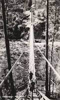
1934: Leppiniemi
Leppiniemi, Finland
| Bridgemeister ID: | 8080 (added 2023-12-24) |
| Year Completed: | 1934 |
| Name: | Leppiniemi |
| Location: | Leppiniemi, Finland |
| Use: | Footbridge |
| Status: | Demolished, 1947 |
| Main Cables: | Wire (steel) |
| Suspended Spans: | 1 |
External Links:
- WikiMedia Commons - Category:Leppiniemi Bridge. Several images of the bridge.
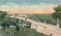
1934: Rio Higuamo
San Pedro de Macoris vicinity, Dominican Republic - Rio Higuamo
| Bridgemeister ID: | 448 (added before 2003) |
| Year Completed: | 1934 |
| Name: | Rio Higuamo |
| Also Known As: | Ramfis |
| Location: | San Pedro de Macoris vicinity, Dominican Republic |
| Crossing: | Rio Higuamo |
| Coordinates: | 18.503230 N 69.336561 W |
| Maps: | Acme, GeoHack, Google, OpenStreetMap |
| Principals: | John A. Roebling's Sons Co. |
| References: | AAJ, SSS |
| Use: | Vehicular |
| Status: | In use (last checked: 2023) |
| Main Cables: | Wire (steel) |
| Suspended Spans: | 3 |
| Main Span: | 1 x 168.9 meters (554 feet) |
| Side Spans: | 2 x 56.7 meters (186 feet) |
1934: Rugslandsbrua
Svaland, Birkenes, Agder, Norway - Tavdalselva
| Bridgemeister ID: | 4315 (added 2020-04-10) |
| Year Completed: | 1934 |
| Name: | Rugslandsbrua |
| Location: | Svaland, Birkenes, Agder, Norway |
| Crossing: | Tavdalselva |
| Coordinates: | 58.289171 N 8.183323 E |
| Maps: | Acme, GeoHack, Google, kart.1881.no, OpenStreetMap |
| Use: | Vehicular (one-lane) |
| Status: | In use (last checked: 2019) |
| Main Cables: | Wire (steel) |
| Suspended Spans: | 1 |
| Main Span: | 1 x 70 meters (229.7 feet) estimated |
| Deck width: | ~2 meters |
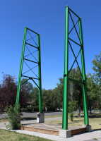
1934: Sifton Boulevard
Calgary, Alberta, Canada - Elbow River
| Bridgemeister ID: | 802 (added 2003-03-29) |
| Year Completed: | 1934 |
| Name: | Sifton Boulevard |
| Also Known As: | Riverdale Avenue, Sifton-Riverdale |
| Location: | Calgary, Alberta, Canada |
| Crossing: | Elbow River |
| Coordinates: | 51.019060 N 114.083178 W |
| Maps: | Acme, GeoHack, Google, OpenStreetMap |
| Use: | Footbridge |
| Status: | Wrecked, 2013 |
| Main Cables: | Wire |
| Suspended Spans: | 1 |
Notes:
- Footbridge with green steel towers. Distinct from the other Elbow River, Calgary footbridges in the inventory, but appeared very similar to the Sandy Beach bridge.
- Wrecked by flood, 2013.
- Similar to 1959 Sandy Beach (River Park, Riverpark) - Calgary, Alberta, Canada.
- Replaced by 2014 Riverdale Avenue - Calgary, Alberta, Canada.
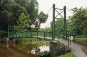
1934: Stewart Park I
Ithaca, New York, USA - Fall Creek arm
| Bridgemeister ID: | 839 (added 2003-06-28) |
| Year Completed: | 1934 |
| Name: | Stewart Park I |
| Location: | Ithaca, New York, USA |
| Crossing: | Fall Creek arm |
| At or Near Feature: | Stewart Park |
| Coordinates: | 42.458961 N 76.505590 W |
| Maps: | Acme, GeoHack, Google, OpenStreetMap |
| Principals: | Civil Works Administration |
| References: | AAJ |
| Use: | Footbridge |
| Status: | In use (last checked: 2014) |
| Main Cables: | Wire (steel) |
| Suspended Spans: | 1 |
| Main Span: | 1 x 25 meters (82 feet) estimated |
Notes:
- There are two suspension footbridges at this park. This one crosses a short run off of Fall Creek just before it enters Cayuga Lake. The other crosses Fall Creek.
- Near 1934 Stewart Park II - Ithaca, New York, USA.
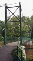
1934: Stewart Park II
Ithaca, New York, USA - Fall Creek
| Bridgemeister ID: | 840 (added 2003-06-28) |
| Year Completed: | 1934 |
| Name: | Stewart Park II |
| Location: | Ithaca, New York, USA |
| Crossing: | Fall Creek |
| At or Near Feature: | Stewart Park |
| Coordinates: | 42.458281 N 76.505359 W |
| Maps: | Acme, GeoHack, Google, OpenStreetMap |
| Principals: | Civil Works Administration |
| References: | AAJ |
| Use: | Footbridge |
| Status: | In use (last checked: 2014) |
| Main Cables: | Wire (steel) |
| Suspended Spans: | 1 |
| Main Span: | 1 x 33.8 meters (111 feet) estimated |
Notes:
- There are two suspension footbridges at this park.
- Near 1934 Stewart Park I - Ithaca, New York, USA.
1934: Tonnay-Charente
Tonnay-Charente, Charente-Maritime, France - Charente River
| Bridgemeister ID: | 7338 (added 2022-09-04) |
| Year Completed: | 1934 |
| Name: | Tonnay-Charente |
| Location: | Tonnay-Charente, Charente-Maritime, France |
| Crossing: | Charente River |
| Coordinates: | 45.939992 N 0.886099 W |
| Maps: | Acme, GeoHack, Google, OpenStreetMap |
| Use: | Vehicular |
| Status: | Restricted to foot traffic |
| Main Cables: | Wire (steel) |
| Main Span: | 1 x 90 meters (295.3 feet) |
| Side Spans: | 2 |
Notes:
External Links:
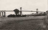
1935: (suspension bridge)
Hector vicinity, Stockton, West Coast, New Zealand - Ngakawau River
| Bridgemeister ID: | 7614 (added 2023-05-26) |
| Year Completed: | 1935 |
| Name: | (suspension bridge) |
| Location: | Hector vicinity, Stockton, West Coast, New Zealand |
| Crossing: | Ngakawau River |
| At or Near Feature: | Mangatini Falls |
| Coordinates: | 41.607568 S 171.912836 E |
| Maps: | Acme, GeoHack, Google, OpenStreetMap |
| Use: | Rail |
| Status: | Removed, c. 1981 |
| Main Cables: | Wire |
| Suspended Spans: | 1 |
Notes:
- Appears to have carried coal cars from nearby coal mine. May have replaced an earlier suspension bridge.
- Later at same location (footbridge) - Hector vicinity, Stockton, West Coast, New Zealand.
External Links:
1935: Capitan Usterez
Villamontes, Tarija, Bolivia - Rio Pilcomayo
| Bridgemeister ID: | 8429 (added 2024-03-09) |
| Year Completed: | 1935 |
| Name: | Capitan Usterez |
| Also Known As: | Usteres |
| Location: | Villamontes, Tarija, Bolivia |
| Crossing: | Rio Pilcomayo |
| Coordinates: | 21.258778 S 63.511528 W |
| Maps: | Acme, GeoHack, Google, OpenStreetMap |
| Use: | Vehicular |
| Status: | Removed |
| Main Cables: | Wire (steel) |
| Main Span: | 1 |
External Links:
- Facebook - Puente Capitan Usterez, Pilcomayo Villamontes, chaco tarijeño. Image and history of the bridge. Posted May 2, 2018.
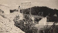
1935: Chaumont-sur-Loire
Chaumont-sur-Loire and Onzain, Loir-et-Cher, France - Loire River
| Bridgemeister ID: | 6719 (added 2021-10-16) |
| Year Completed: | 1935 |
| Name: | Chaumont-sur-Loire |
| Location: | Chaumont-sur-Loire and Onzain, Loir-et-Cher, France |
| Crossing: | Loire River |
| Use: | Vehicular |
| Status: | Destroyed, 1940 |
| Main Cables: | Wire (steel) |
| Main Spans: | 6 |
Notes:
External Links:
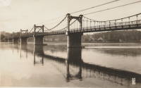
1935: Châteauneuf-sur-Loire
Châteauneuf-sur-Loire, Loiret, France - Loire River
| Bridgemeister ID: | 6790 (added 2021-10-30) |
| Year Completed: | 1935 |
| Name: | Châteauneuf-sur-Loire |
| Location: | Châteauneuf-sur-Loire, Loiret, France |
| Crossing: | Loire River |
| Coordinates: | 47.858608 N 2.223392 E |
| Maps: | Acme, GeoHack, Google, OpenStreetMap |
| Use: | Vehicular |
| Status: | Destroyed, June 17, 1940 |
| Main Cables: | Wire (steel) |
| Suspended Spans: | 5 |
| Main Spans: | 5 |
Notes:
- 1940, June 17: Destroyed to slow advancing German troops.
- Replaced 1841 Châteauneuf-sur-Loire - Châteauneuf-sur-Loire, Loiret, France.
- Replaced by 1946 Châteauneuf-sur-Loire - Châteauneuf-sur-Loire, Loiret, France.
External Links:
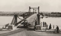
1935: Condrieu
Condrieu, Rhône and Les Roches-de-Condrieu, Isère, France - Rhône River
| Bridgemeister ID: | 1494 (added 2004-09-19) |
| Year Completed: | 1935 |
| Name: | Condrieu |
| Location: | Condrieu, Rhône and Les Roches-de-Condrieu, Isère, France |
| Crossing: | Rhône River |
| Coordinates: | 45.45655 N 4.768722 E |
| Maps: | Acme, GeoHack, Google, OpenStreetMap |
| References: | AAJ |
| Use: | Vehicular (two-lane), with walkway |
| Status: | Destroyed, June 1940 |
| Main Cables: | Wire (steel) |
| Suspended Spans: | 2 |
| Main Spans: | 2 |
Notes:
- Replaced 1831 Condrieu - Condrieu, Rhône and Les Roches-de-Condrieu, Isère, France.
- Replaced by Condrieu - Condrieu, Rhône and Les Roches-de-Condrieu, Isère, France.
External Links:
- Pont de Condrieu - Wikipedia
- Pont entre Condrieu et les Roches detruit le 20 juin 1940 - Wikimedia. Image of the destroyed bridge.
- Structurae - Structure ID 20013233
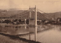
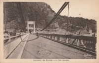
1935: Devèze
Thérondels vicinity, Aveyron and Paulhenc, Cantal, France - Lac de Sarrans
| Bridgemeister ID: | 2321 (added 2007-05-05) |
| Year Completed: | 1935 |
| Name: | Devèze |
| Also Known As: | Laussac |
| Location: | Thérondels vicinity, Aveyron and Paulhenc, Cantal, France |
| Crossing: | Lac de Sarrans |
| At or Near Feature: | Presqu'île De Laussac |
| Coordinates: | 44.861586 N 2.769710 E |
| Maps: | Acme, GeoHack, Google, OpenStreetMap |
| Use: | Vehicular (one-lane) |
| Status: | In use (last checked: 2020) |
| Main Cables: | Wire (steel) |
| Suspended Spans: | 1 |
Notes:
External Links:
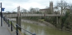
1935: Gaol Ferry
Bristol, England, United Kingdom - River Avon-New Cut
| Bridgemeister ID: | 1917 (added 2005-10-09) |
| Year Completed: | 1935 |
| Name: | Gaol Ferry |
| Also Known As: | Southville, St. Paul's, Coronation Road |
| Location: | Bristol, England, United Kingdom |
| Crossing: | River Avon-New Cut |
| Coordinates: | 51.445871 N 2.599464 W |
| Maps: | Acme, GeoHack, Google, OpenStreetMap |
| Principals: | David Rowell & Co. |
| Use: | Footbridge |
| Status: | Closed, August 2022 (last checked: August 2023) |
| Main Cables: | Wire (steel) |
| Suspended Spans: | 1 |
Notes:
- 2023, September: The bridge is scheduled to reopen following repairs.
Annotated Citations:
- Cork, Tristan. "Key footbridge connecting South Bristol to city centre to close for months." Bristol Post, 9 Dec. 2021, https://www.bristolpost.co.uk/news/bristol-news/key-footbridge-connecting-south-bristol-6326291.
Bridge is undergoing some repairs in late December 2021, but is still open. Expected to be closed January-March 2022 for more extensive repairs.
- Woolerton, Betty. "Gaol Ferry Bridge likely to be closed for another three months." Bristol 24/7, 24 Feb. 2023, https://www.bristol247.com/news-and-features/news/gaol-ferry-bridge-likely-to-be-closed-for-another-three-months/.
"A discovery of 'paper thin' steel work on Gaol Ferry Bridge has been cited as the reason for the extension of its closure by an unprecedented extra three months… Now, the council’s cabinet member for transport has apologised after contractors Griffiths have found 'the bridge is in a worse condition than we had thought.'"
External Links:
- Date for Gaol Ferry bridge closure in Bristol announced - BBC News. The bridge will be closed for 6-9 months from August 2022 for restoration.
- Structurae - Structure ID 20082369
| Bridgemeister ID: | 3789 (added 2020-02-29) |
| Year Completed: | 1935 |
| Name: | Gjølme |
| Location: | Orkanger, Orkland, Trøndelag, Norway |
| Crossing: | Orkla |
| Coordinates: | 63.30211 N 9.83417 E |
| Maps: | Acme, GeoHack, Google, kart.1881.no, OpenStreetMap |
| Use: | Vehicular (one-lane) |
| Status: | Restricted to foot traffic (last checked: 2019) |
| Main Cables: | Wire (steel) |
| Suspended Spans: | 1 |
| Main Span: | 1 x 61 meters (200.1 feet) estimated |
1935: Goyt Valley
Buxton, England, United Kingdom - River Goyt
| Bridgemeister ID: | 520 (added before 2003) |
| Year Completed: | 1935 |
| Name: | Goyt Valley |
| Also Known As: | Buxton |
| Location: | Buxton, England, United Kingdom |
| Crossing: | River Goyt |
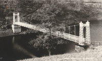
| References: | NTB |
| Use: | Footbridge |
| Status: | Removed, 1960s |
| Main Cables: | Wire |
| Suspended Spans: | 1 |
Notes:
- Dismantled during construction of the Errwood Reservoir.
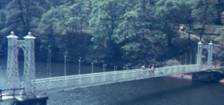
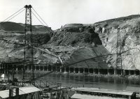
1935: Grand Coulee Dam
Grand Coulee, Washington, USA - Columbia River
| Bridgemeister ID: | 3157 (added 2019-11-03) |
| Year Completed: | 1935 |
| Name: | Grand Coulee Dam |
| Location: | Grand Coulee, Washington, USA |
| Crossing: | Columbia River |
| Use: | Conveyor |
| Status: | Removed |
| Main Cables: | Wire (steel) |
| Main Span: | 1 x 438 meters (1,437 feet) |
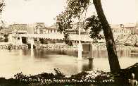
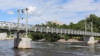
1935: Granite Falls
Granite Falls, Minnesota, USA - Minnesota River
| Bridgemeister ID: | 255 (added before 2003) |
| Year Completed: | 1935 |
| Name: | Granite Falls |
| Location: | Granite Falls, Minnesota, USA |
| Crossing: | Minnesota River |
| Coordinates: | 44.810108 N 95.537316 W |
| Maps: | Acme, GeoHack, Google, OpenStreetMap |
| Principals: | Minneapolis Bridge Company |
| References: | WCT20051125 |
| Use: | Footbridge |
| Status: | In use (last checked: 2019) |
| Main Cables: | Wire (steel) |
| Suspended Spans: | 3 |
| Main Span: | 1 |
| Side Spans: | 2 |
Notes:
- Damaged by floods, 1997 and 2001. Refurbished, 2014-2015.
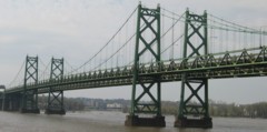
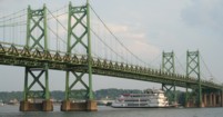
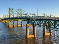
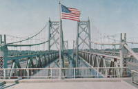
1935: Iowa-Illinois Memorial
Bettendorf, Iowa and Moline, Illinois, USA - Mississippi River
| Bridgemeister ID: | 180 (added before 2003) |
| Year Completed: | 1935 |
| Name: | Iowa-Illinois Memorial |
| Also Known As: | Interstate 74 Bridge, I-74 Bridge |
| Location: | Bettendorf, Iowa and Moline, Illinois, USA |
| Crossing: | Mississippi River |
| Coordinates: | 41.520264 N 90.513034 W |
| Maps: | Acme, GeoHack, Google, OpenStreetMap |
| Principals: | Modjeski, Masters, and Chase |
| References: | AAJ, CMR |
| Use: | Vehicular, with walkway |
| Status: | Bypassed, 2020 (last checked: 2022) |
| Main Cables: | Wire (steel) |
| Suspended Spans: | 3 |
| Main Span: | 1 x 225.6 meters (740 feet) |
| Side Spans: | 2 x 112.8 meters (370 feet) |
| Deck width: | 24.2 feet |
Notes:
- 2017, June 26: Groundbreaking ceremony for a replacement bridge for the twin Iowa-Illinois Memorial bridges. The new bridge is expected to be completed in 2020.
- 2020, November: Replacement span opens (for Iowa-bound traffic previously carried across the older of the two suspension bridges). Suspension bridge expected to be demolished in 2022.
- 2023: Demolition expected to be completed in 2024.
- Next to 1960 Iowa-Illinois Memorial (Interstate 74 Bridge, I-74 Bridge) - Bettendorf, Iowa and Moline, Illinois, USA.
External Links:
1935: l'Île d'Orléans
Quebec City, Quebec, Canada - St. Lawrence River
| Bridgemeister ID: | 183 (added before 2003) |
| Year Completed: | 1935 |
| Name: | l'Île d'Orléans |
| Also Known As: | Isle of Orleans, Orleans Island, Taschereau |
| Location: | Quebec City, Quebec, Canada |
| Crossing: | St. Lawrence River |
| Coordinates: | 46.880233 N 71.137883 W |
| Maps: | Acme, GeoHack, Google, OpenStreetMap |
| Principals: | Monsarrat and Pratley |
| References: | AAJ |
| Use: | Vehicular (two-lane, heavy vehicles), with walkway |
| Status: | In use (last checked: 2019) |
| Main Cables: | Wire (steel) |
| Suspended Spans: | 3 |
| Main Span: | 1 x 323 meters (1,059.7 feet) |
| Side Spans: | 2 x 127 meters (416.7 feet) |
| Deck width: | 30 feet |
Notes:
- Replacement proposed to start in 2024.
- Near Montmorency Falls - Quebec City vicinity, Quebec, Canada.
External Links:

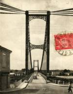
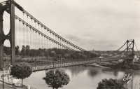
1935: La Réole
La Réole, Gironde, France - Garonne River
| Bridgemeister ID: | 1769 (added 2005-04-22) |
| Year Completed: | 1935 |
| Name: | La Réole |
| Also Known As: | Rouergue |
| Location: | La Réole, Gironde, France |
| Crossing: | Garonne River |
| Coordinates: | 44.578853 N 0.034028 W |
| Maps: | Acme, GeoHack, Google, OpenStreetMap |
| Use: | Vehicular (two-lane), with walkway |
| Status: | In use (last checked: 2019) |
| Suspended Spans: | 1 |
Notes:
- See 1835 La Réole - La Réole, Gironde, France. Unsure if the newer bridge is at the same location.
External Links:
1935: Mælen
Stjørdal, Trøndelag, Norway - Stjørdalselva
| Bridgemeister ID: | 1818 (added 2005-05-21) |
| Year Completed: | 1935 |
| Name: | Mælen |
| Also Known As: | Maelen |
| Location: | Stjørdal, Trøndelag, Norway |
| Crossing: | Stjørdalselva |
| Coordinates: | 63.448367 N 10.992617 E |
| Maps: | Acme, GeoHack, Google, kart.1881.no, OpenStreetMap |
| Use: | Vehicular |
| Status: | In use (last checked: 2005) |
| Main Cables: | Wire (steel) |
| Suspended Spans: | 1 |
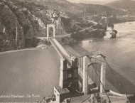
1935: Mirabeau
Mirabeau, Vaucluse and Bouches-du-Rhône, France - Durance River
| Bridgemeister ID: | 900 (added 2003-09-07) |
| Year Completed: | 1935 |
| Name: | Mirabeau |
| Location: | Mirabeau, Vaucluse and Bouches-du-Rhône, France |
| Crossing: | Durance River |
| Principals: | Auguste Rey |
| References: | BPF |
| Use: | Vehicular |
| Status: | Replaced, 1991 |
| Suspended Spans: | 1 |
| Main Span: | 1 x 175 meters (574.1 feet) |
| Deck width: | 8 meters |
Notes:
- Dismantled 1991. The towers from the older of the two Mirabeau suspension bridges are visible at the current crossing.
- Replaced 1831 Mirabeau - Mirabeau, Vaucluse and Bouches-du-Rhône, France.
External Links:
1935: Mirepoix-sur-Tarn
Mirepoix-sur-Tarn, Haute-Garonne, France - Tarn River
| Bridgemeister ID: | 3196 (added 2019-11-10) |
| Year Completed: | 1935 |
| Name: | Mirepoix-sur-Tarn |
| Location: | Mirepoix-sur-Tarn, Haute-Garonne, France |
| Crossing: | Tarn River |
| Coordinates: | 43.811976 N 1.571879 E |
| Maps: | Acme, GeoHack, Google, OpenStreetMap |
| Use: | Vehicular (two-lane) |
| Status: | Collapsed, November 18, 2019 |
| Main Cables: | Wire (steel) |
| Suspended Spans: | 1 |
| Main Span: | 1 x 152 meters (498.7 feet) |
Notes:
- Collapsed November 18, 2019 as an overweight vehicle crossed, killing two people.
- Replaced 1855 Mirepoix-sur-Tarn - Mirepoix-sur-Tarn, Haute-Garonne, France.
External Links:
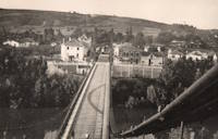
1935: Remoulins
Remoulins, Gard, France - Gardon River
| Bridgemeister ID: | 4910 (added 2020-07-19) |
| Year Completed: | 1935 |
| Name: | Remoulins |
| Location: | Remoulins, Gard, France |
| Crossing: | Gardon River |
| Coordinates: | 43.937978 N 4.556684 E |
| Maps: | Acme, GeoHack, Google, OpenStreetMap |
| Use: | Vehicular |
| Status: | Removed |
| Main Cables: | Wire (steel) |
Notes:
- Remnants of this bridge are preserved in a car park at the eastern end of the present day (2020s) Pont de Remoulins.
- Replaced 1830 Remoulins - Remoulins, Gard, France. The later bridge appears to have been built on an alignment about 175 meters north of the 1830 bridge.
External Links:
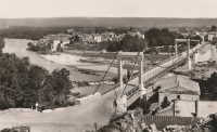
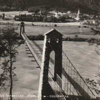
| Bridgemeister ID: | 1103 (added 2004-01-02) |
| Year Completed: | 1935 |
| Name: | Stamser |
| Also Known As: | Kanzler-Dollfuß, Kanzler-Dollfuss |
| Location: | Stams, Austria |
| Crossing: | Inn River |
| Coordinates: | 47.285914 N 10.985192 E |
| Maps: | Acme, GeoHack, Google, OpenStreetMap |
| Principals: | Heinrich Kluibenschädl |
| Use: | Footbridge |
| Status: | In use (last checked: 2019) |
| Main Cables: | Wire (steel) |
Notes:
- Long narrow footbridge with stone towers.
External Links:
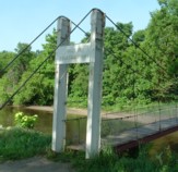
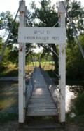
1935: Swinging
Neligh, Nebraska, USA - Elkhorn River
| Bridgemeister ID: | 181 (added before 2003) |
| Year Completed: | 1935 |
| Name: | Swinging |
| Location: | Neligh, Nebraska, USA |
| Crossing: | Elkhorn River |
| Coordinates: | 42.123433 N 98.0277 W |
| Maps: | Acme, GeoHack, Google, OpenStreetMap |
| Principals: | Byron Fuller |
| Use: | Footbridge |
| Status: | Destroyed, June 13, 2010 (last checked: 2010) |
| Main Cables: | Wire |
| Suspended Spans: | 1 |
| Main Span: | 1 x 30.5 meters (100 feet) estimated |
Notes:
- Destroyed by flood.
1935: Swinging
Thomson, Minnesota, USA - St. Louis River
| Bridgemeister ID: | 286 (added before 2003) |
| Year Completed: | 1935 |
| Name: | Swinging |
| Location: | Thomson, Minnesota, USA |
| Crossing: | St. Louis River |
| At or Near Feature: | Jay Cooke State Park |
| Coordinates: | 46.653436 N 92.370438 W |
| Maps: | Acme, GeoHack, Google, OpenStreetMap |
| Principals: | Oscar Newstrom, CCC |
| Use: | Footbridge |
| Status: | Destroyed, 1950 |
| Main Cables: | Wire |
| Main Span: | 1 x 38.4 meters (126 feet) |
Notes:
- Deck raised four feet, 1941. Wrecked by flood May, 1950.
- Replaced 1924 Swinging - Thomson, Minnesota, USA.
- Replaced by 1953 Swinging - Thomson, Minnesota, USA.
1935: Tréboul
Thérondels vicinity, Aveyron and Sainte-Marie, Cantal, France - Lac de Sarrans
| Bridgemeister ID: | 1989 (added 2005-12-02) |
| Year Completed: | 1935 |
| Name: | Tréboul |
| Location: | Thérondels vicinity, Aveyron and Sainte-Marie, Cantal, France |
| Crossing: | Lac de Sarrans |
| Coordinates: | 44.872780 N 2.867253 E |
| Maps: | Acme, GeoHack, Google, OpenStreetMap |
| Use: | Vehicular (one-lane) |
| Status: | In use (last checked: 2014) |
| Main Cables: | Wire (steel) |
| Suspended Spans: | 1 |
Notes:
External Links:

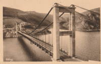
1935: Trews Weir
Exeter, Devon, England, United Kingdom - River Exe
| Bridgemeister ID: | 915 (added 2003-10-11) |
| Year Completed: | 1935 |
| Name: | Trews Weir |
| Also Known As: | New Cricklepit |
| Location: | Exeter, Devon, England, United Kingdom |
| Crossing: | River Exe |
| Coordinates: | 50.71295 N 3.52333 W |
| Maps: | Acme, GeoHack, Google, OpenStreetMap |
| Use: | Footbridge |
| Status: | In use (last checked: 2008) |
| Main Cables: | Wire (steel) |
| Suspended Spans: | 1 |
External Links:
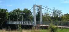
1935: Trude
Trude, Washington, USA - Cedar River
| Bridgemeister ID: | 1956 (added 2005-11-04) |
| Year Completed: | 1935 |
| Name: | Trude |
| Location: | Trude, Washington, USA |
| Crossing: | Cedar River |
| Use: | Vehicular (one-lane) |
| Main Cables: | Wire |
| Suspended Spans: | 1 |
Notes:
- Likely removed.
External Links:
- Seattle Municipal Archives Digital Collections : Image Record : Trude bridge Cedar River [under construction] [50628]. Several other images available in this collection.
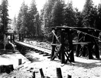
1935: Vizcainos
Arroyo Morote, Spain - Fuensanta Reservoir
| Bridgemeister ID: | 3075 (added 2019-10-26) |
| Year Completed: | 1935 |
| Name: | Vizcainos |
| Location: | Arroyo Morote, Spain |
| Crossing: | Fuensanta Reservoir |
| Coordinates: | 38.415262 N 2.276515 W |
| Maps: | Acme, GeoHack, Google, OpenStreetMap |
| Use: | Footbridge |
| Status: | In use (last checked: 2019) |
| Main Cables: | Wire (steel) |
| Suspended Spans: | 1 |
Notes:
- Companion to 1935 Vizcainos - Yeste, Spain.
1935: Vizcainos
Yeste, Spain - Fuensanta Reservoir
| Bridgemeister ID: | 3074 (added 2019-10-26) |
| Year Completed: | 1935 |
| Name: | Vizcainos |
| Location: | Yeste, Spain |
| Crossing: | Fuensanta Reservoir |
| Coordinates: | 38.346582 N 2.284406 W |
| Maps: | Acme, GeoHack, Google, OpenStreetMap |
| Use: | Footbridge |
| Status: | In use (last checked: 2018) |
| Main Cables: | Wire (steel) |
| Suspended Spans: | 1 |
Notes:
- In use in 2018 for foot traffic, but deck was in very rough shape. May have been redecked in late 2018 or early 2019.
- Companion to 1935 Vizcainos - Arroyo Morote, Spain.
1936: (footbridge)
Gisborne vicinity, New Zealand - Waimata River
| Bridgemeister ID: | 752 (added 2003-03-08) |
| Year Completed: | 1936 |
| Name: | (footbridge) |
| Location: | Gisborne vicinity, New Zealand |
| Crossing: | Waimata River |
| References: | GAP |
| Use: | Footbridge |
1936: (footbridge)
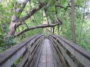
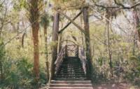
Hillsborough River State Park, Florida, USA - Hillsborough River
| Bridgemeister ID: | 285 (added before 2003) |
| Year Completed: | 1936 |
| Name: | (footbridge) |
| Location: | Hillsborough River State Park, Florida, USA |
| Crossing: | Hillsborough River |
| Coordinates: | 28.1499 N 82.23203 W |
| Maps: | Acme, GeoHack, Google, OpenStreetMap |
| Principals: | CCC |
| Use: | Footbridge |
| Status: | In use (last checked: 2004) |
| Main Cables: | Wire (steel) |
| Main Span: | 1 |
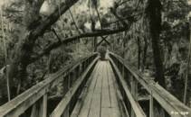
1936: (footbridge)
Motumote, Southland, New Zealand - Waiau River
| Bridgemeister ID: | 754 (added 2003-03-08) |
| Year Completed: | 1936 |
| Name: | (footbridge) |
| Location: | Motumote, Southland, New Zealand |
| Crossing: | Waiau River |
| References: | GAP |
| Use: | Footbridge |
1936: (footbridge)
Tower Lakes, Illinois, USA - Tower Lake
| Bridgemeister ID: | 1306 (added 2004-04-10) |
| Year Completed: | 1936 |
| Name: | (footbridge) |
| Location: | Tower Lakes, Illinois, USA |
| Crossing: | Tower Lake |
| Coordinates: | 42.230815 N 88.154552 W |
| Maps: | Acme, GeoHack, Google, OpenStreetMap |
| Use: | Footbridge |
| Status: | Extant (last checked: 2019) |
| Suspended Spans: | 3 |
| Main Spans: | 3 |
Notes:
- There is at least one other suspension footbridge in the Tower Lakes area, but this 1936 3-span bridge appears to be the largest and the only one with a level deck.
1936: (footbridge)
Waikino, New Zealand - Ohinemuri River
| Bridgemeister ID: | 755 (added 2003-03-08) |
| Year Completed: | 1936 |
| Name: | (footbridge) |
| Location: | Waikino, New Zealand |
| Crossing: | Ohinemuri River |
| Principals: | L.E. Shaw |
| References: | GAP |
| Use: | Footbridge |
| Status: | Destroyed, 1981 |
| Main Cables: | Wire |
| Main Span: | 1 x 42.1 meters (138.1 feet) |
Notes:
- GAP: Damaged by flood, 1964. Repaired. Destroyed by flood, 1981.
External Links:
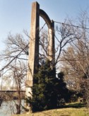
1936: (suspension bridge)
Black Rock vicinity, Randolph County and Lawrence County, Arkansas, USA - Spring River
| Bridgemeister ID: | 1075 (added 2003-12-27) |
| Year Completed: | 1936 |
| Name: | (suspension bridge) |
| Location: | Black Rock vicinity, Randolph County and Lawrence County, Arkansas, USA |
| Crossing: | Spring River |
| Coordinates: | 36.13987 N 91.08400 W |
| Maps: | Acme, GeoHack, Google, OpenStreetMap |
| Principals: | WPA |
| Use: | Vehicular |
| Status: | Derelict (last checked: 2005) |
| Main Cables: | Wire (steel) |
| Main Span: | 1 x 91.4 meters (300 feet) estimated |
1936: (suspension bridge)
Grave Creek, Oregon, USA - Rogue River
1936: (suspension bridge)
Ohura vicinity, New Zealand - Waikaka Stream
| Bridgemeister ID: | 751 (added 2003-03-08) |
| Year Completed: | 1936 |
| Name: | (suspension bridge) |
| Location: | Ohura vicinity, New Zealand |
| Crossing: | Waikaka Stream |
| References: | GAP |
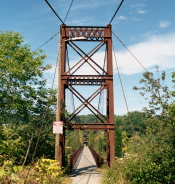
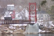
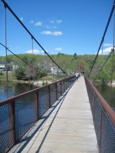
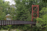
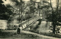
1936: Androscoggin Pedestrian
Topsham and Brunswick, Maine, USA - Androscoggin River
| Bridgemeister ID: | 182 (added before 2003) |
| Year Completed: | 1936 |
| Name: | Androscoggin Pedestrian |
| Also Known As: | Swinging |
| Location: | Topsham and Brunswick, Maine, USA |
| Crossing: | Androscoggin River |
| Coordinates: | 43.917500 N 69.972520 W |
| Maps: | Acme, GeoHack, Google, OpenStreetMap |
| Principals: | Works Progress Administration |
| References: | PPH19991019, PPH20050801 |
| Use: | Footbridge |
| Status: | In use (last checked: 2020) |
| Main Cables: | Wire (steel) |
| Suspended Spans: | 1 |
| Main Span: | 1 x 101.2 meters (332 feet) |
| Deck width: | 6 feet |
Notes:
- 2004, January: Added to National Register of Historic Places.
- 2006, December: Substantial rehabilitation completed.
- 2011, May: Dedicated as a Maine Historic Civil Engineering Landmark.
- Replaced 1892 Androscoggin Pedestrian (Swinging, Androscoggin Swinging) - Topsham and Brunswick, Maine, USA.
External Links:
1936: Bitan
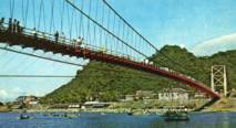
HsinTien, New Taipei City, Taiwan - Pitan "Green Lake"
| Bridgemeister ID: | 1680 (added 2005-03-25) |
| Year Completed: | 1936 |
| Name: | Bitan |
| Also Known As: | 碧潭吊橋, Green Lake, Pitan |
| Location: | HsinTien, New Taipei City, Taiwan |
| Crossing: | Pitan "Green Lake" |
| Coordinates: | 24.956483 N 121.53685 E |
| Maps: | Acme, GeoHack, Google, OpenStreetMap |
| Use: | Footbridge |
| Status: | In use (last checked: 2005) |
| Main Cables: | Wire (steel) |
Notes:
- Long, large footbridge. I've seen it spelled "Pitan" and "Bitan." Unclear which is correct.
External Links:
1936: Cross Mound
Tarlton, Ohio, USA - Salt Creek
| Bridgemeister ID: | 1460 (added 2004-08-21) |
| Year Completed: | 1936 |
| Name: | Cross Mound |
| Location: | Tarlton, Ohio, USA |
| Crossing: | Salt Creek |
| At or Near Feature: | Cross Mound Park |
| Coordinates: | 39.563433 N 82.783167 W |
| Maps: | Acme, GeoHack, Google, OpenStreetMap |
| Use: | Footbridge |
| Status: | In use (last checked: 2007) |
| Main Cables: | Wire (steel) |
| Suspended Spans: | 1 |
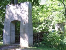
| Bridgemeister ID: | 3926 (added 2020-03-20) |
| Year Completed: | 1936 |
| Name: | Elverum |
| Also Known As: | Nybrua |
| Location: | Elverum, Innlandet, Norway |
| Crossing: | Glomma |
| Coordinates: | 60.88287 N 11.55644 E |
| Maps: | Acme, GeoHack, Google, kart.1881.no, OpenStreetMap |
| Use: | Vehicular (two-lane), with walkway |
| Status: | In use (last checked: 2023) |
| Main Cables: | Wire (steel) |
| Suspended Spans: | 1 |
| Main Span: | 1 x 160 meters (524.9 feet) estimated |
External Links:
- DigitaltMuseum - Bygging av Nybrua 1934.Reising av østre tårn.
- DigitaltMuseum - Bygging av Nybrua 1935.Arbeidere på brua.
- Hamar Dagblad - 80 år som Nybru - og like vakker!
- Structurae - Structure ID 20086232
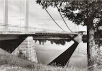
1936: Hinckesman's Access Road
Frasertown vicinity, Hawke's Bay, New Zealand - Mangapoike River
| Bridgemeister ID: | 727 (added 2003-03-08) |
| Year Completed: | 1936 |
| Name: | Hinckesman's Access Road |
| Location: | Frasertown vicinity, Hawke's Bay, New Zealand |
| Crossing: | Mangapoike River |
| Principals: | T. Delaney |
| References: | GAP |
| Use: | Vehicular |
| Status: | Destroyed |
Notes:
- GAP: Destroyed by flood.
- Replaced 1929 Hinckesman's Access Road - Frasertown vicinity, Hawke's Bay, New Zealand.
1936: Kellams
Kellams, New York and Stalker, Pennsylvania, USA - Delaware River
| Bridgemeister ID: | 97 (added before 2003) |
| Year Completed: | 1936 |
| Name: | Kellams |
| Also Known As: | Little Equinunk, Kellams-Stalker, Kellam |
| Location: | Kellams, New York and Stalker, Pennsylvania, USA |
| Crossing: | Delaware River |
| Coordinates: | 41.82333 N 75.11333 W |
| Maps: | Acme, GeoHack, Google, OpenStreetMap |
| References: | BDR, HHP, PTS2 |
| Use: | Vehicular (one-lane) |
| Status: | In use (last checked: 2019) |
| Main Cables: | Wire (steel) |
| Suspended Spans: | 1 |
| Main Span: | 1 x 117 meters (384 feet) |
Notes:
- Damaged by floodwaters June, 2006. Repaired October, 2006.
- Renovation completed, January, 2019.
- Replaced 1890 Kellams (Little Equinunk, Kellams-Stalker, Kellam) - Kellams, New York and Stalker, Pennsylvania, USA.
External Links:
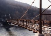
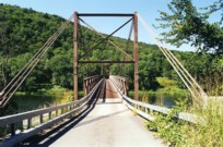
1936: Kindee
Kindee, Ellenborough vicinity, New South Wales, Australia - Hastings River
| Bridgemeister ID: | 1296 (added 2004-03-19) |
| Year Completed: | 1936 |
| Name: | Kindee |
| Location: | Kindee, Ellenborough vicinity, New South Wales, Australia |
| Crossing: | Hastings River |
| Coordinates: | 31.42233 S 152.47044 E |
| Maps: | Acme, GeoHack, Google, OpenStreetMap |
| References: | AAJ |
| Use: | Vehicular (one-lane) |
| Status: | In use (last checked: 2019) |
| Main Cables: | Wire (steel) |
| Suspended Spans: | 3 |
| Main Span: | 1 x 67.1 meters (220 feet) |
| Side Spans: | 2 x 26.8 meters (88 feet) |
| Characteristics: | Braced (trussed) chain/cable, Hinged cables |
Notes:
- Odd timber suspension bridge that has large diagonal stiffening members giving it the appearance of a "braced chain" bridge. AAJ describes it: "the construction in each span is of the three-hinged, trussed cable type or inverted three-hinged arch type. The form of the trussed cable is the Fidler truss."
- Brett Evill transcribed a plaque at the bridge: "This bridge with unusual trussed cables was designed by DMR engineers V Karmalsky and A T Britton. Steelwork was supplied by Morison and Bearby of Newcastle and timber by R McMillan of Long Flat. Sadly, the contractor R B Haydon was killed during construction and work was completed by the Department. Opened on 19 December 1936, the bridge and its approaches cost £5,000.
"Erected to commemorate Australia's bicentenary in 1988 by the Department of Main Roads and the National Roads and Motorists Association (NRMA)" - Similar to 1951 Marias River (Pugsley) - Chester vicinity, Montana, USA.
- Similar to (footbridge) - Sarov (Саров), Nizhny Novgorod Oblast, Russia.
- Similar to Allan - Segenhoe, Scone vicinity, New South Wales, Australia.
- Similar to Ininskiy (Ининский) - Inya (Иня), Altai Republic, Russia.
- Similar to Reku Vel' - Solginskiy (Солгинский), Arkhangelsk Oblast, Russia.
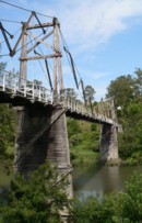
1936: Krefeld-Uerdinger
Uerdingen, Krefeld vicinity and Duisburg, Germany - Rhine River
| Bridgemeister ID: | 959 (added 2003-11-01) |
| Year Completed: | 1936 |
| Name: | Krefeld-Uerdinger |
| Location: | Uerdingen, Krefeld vicinity and Duisburg, Germany |
| Crossing: | Rhine River |
| Coordinates: | 51.349835 N 6.659175 E |
| Maps: | Acme, GeoHack, Google, OpenStreetMap |
| References: | AAJ |
| Use: | Vehicular (two-lane) |
| Status: | In use (last checked: 2020) |
| Main Cables: | Riveted plate |
| Suspended Spans: | 3 |
| Main Span: | 1 x 250 meters (820.25 feet) |
| Side Spans: | 2 |
| Deck width: | 64 feet |
Notes:
- Destroyed 1945, rebuilt 1950.
External Links:
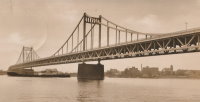
| Bridgemeister ID: | 3919 (added 2020-03-20) |
| Year Completed: | 1936 |
| Name: | Kveberg |
| Location: | Alvdal, Innlandet, Norway |
| Crossing: | Glomma |
| Coordinates: | 62.07803 N 10.69445 E |
| Maps: | Acme, GeoHack, Google, kart.1881.no, OpenStreetMap |
| Use: | Vehicular (one-lane) |
| Status: | In use (last checked: 2019) |
| Main Cables: | Wire (steel) |
| Suspended Spans: | 1 |
| Main Span: | 1 x 90 meters (295.3 feet) estimated |
1936: Memorial
Stockbridge, Massachusetts, USA - Housatonic River
| Bridgemeister ID: | 1572 (added 2004-12-11) |
| Year Completed: | 1936 |
| Name: | Memorial |
| Location: | Stockbridge, Massachusetts, USA |
| Crossing: | Housatonic River |
| Coordinates: | 42.2784 N 73.3073 W |
| Maps: | Acme, GeoHack, Google, OpenStreetMap |
| Use: | Footbridge |
| Status: | In use (last checked: 2019) |
| Main Cables: | Wire (steel) |
| Suspended Spans: | 1 |
1936: Mornay-sur-Allier
Mornay-sur-Allier, Cher and St-Pierre-le-Moûtier, Nièvre, France - Allier River
| Bridgemeister ID: | 1550 (added 2004-11-13) |
| Year Completed: | 1936 |
| Name: | Mornay-sur-Allier |
| Location: | Mornay-sur-Allier, Cher and St-Pierre-le-Moûtier, Nièvre, France |
| Crossing: | Allier River |
| Coordinates: | 46.815265 N 3.043460 E |
| Maps: | Acme, GeoHack, Google, OpenStreetMap |
| References: | BPF |
| Use: | Vehicular |
| Status: | Removed, circa 1970s |
| Main Cables: | Wire (steel) |
| Suspended Spans: | 3 |
| Main Span: | 1 x 80 meters (262.5 feet) |
| Side Spans: | 1 x 67.57 meters (221.7 feet), 1 x 64.27 meters (210.9 feet) |
Notes:
External Links:
- Art-et-Histoire - Nouveau pont de Mornay - St-Pierre-le-Moûtier - 1937
- Structurae - Structure ID 20003000
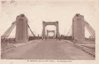
| Bridgemeister ID: | 4445 (added 2020-04-19) |
| Year Completed: | 1936 |
| Name: | Otterstad |
| Location: | Mo, Modalen, Vestland, Norway |
| Crossing: | Moelva |
| Coordinates: | 60.815923 N 5.800875 E |
| Maps: | Acme, GeoHack, Google, kart.1881.no, OpenStreetMap |
| Use: | Vehicular (one-lane) |
| Status: | In use (last checked: 2019) |
| Main Cables: | Wire (steel) |
| Suspended Spans: | 1 |
| Main Span: | 1 x 89 meters (292 feet) estimated |
| Deck width: | ~3 meters |
1936: Pauley
Pikeville, Kentucky, USA - Big Sandy River Levisa Fork
| Bridgemeister ID: | 1068 (added 2003-12-27) |
| Year Completed: | 1936 |
| Name: | Pauley |
| Location: | Pikeville, Kentucky, USA |
| Crossing: | Big Sandy River Levisa Fork |
| Coordinates: | 37.492833 N 82.5355 W |
| Maps: | Acme, GeoHack, Google, OpenStreetMap |
| Principals: | O.S. Batten, WPA |
| Use: | Vehicular (one-lane) |
| Status: | Restricted to foot traffic (last checked: 2021) |
| Main Cables: | Wire (steel) |
| Suspended Spans: | 1 |
| Main Span: | 1 x 115.8 meters (380 feet) estimated |
Notes:
- The National Register of Historic Places registration form is inconsistent regarding the completion year of this bridge stating (in one passage) it was completed in 1940 but also mentioning it was completed "circa 1940" a few times.
- Closed to vehicular traffic, 1991. Closed to all traffic, September 2000. Restored and reopened to pedestrian traffic, 2006.
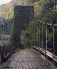
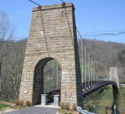
1936: S. Jijisaheb
Ambawade, Maharashtra, India
| Bridgemeister ID: | 3170 (added 2019-11-08) |
| Year Completed: | 1936 |
| Name: | S. Jijisaheb |
| Also Known As: | Ambawade |
| Location: | Ambawade, Maharashtra, India |
| Coordinates: | 18.071836 N 73.791943 E |
| Maps: | Acme, GeoHack, Google, OpenStreetMap |
| Use: | Footbridge |
| Status: | In use (last checked: 2022) |
| Main Cables: | Wire (steel) |
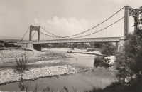
1936: Saint-Didier-sous-Aubenas
Saint-Didier-sous-Aubenas, Ardèche, France - Ardèche River
| Bridgemeister ID: | 2930 (added 2019-09-16) |
| Year Completed: | 1936 |
| Name: | Saint-Didier-sous-Aubenas |
| Location: | Saint-Didier-sous-Aubenas, Ardèche, France |
| Crossing: | Ardèche River |
| Coordinates: | 44.604219 N 4.419136 E |
| Maps: | Acme, GeoHack, Google, OpenStreetMap |
| Use: | Vehicular (two-lane) |
| Status: | Collapsed, 1995 |
| Main Cables: | Wire (steel) |
Notes:
- Collapsed, 1995. One tower remains.
- Replaced Saint-Didier-sous-Aubenas - Saint-Didier-sous-Aubenas, Ardèche, France.
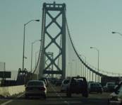
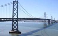
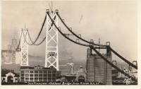
1936: San Francisco-Oakland Bay
Oakland and San Francisco, California, USA - San Francisco Bay
| Bridgemeister ID: | 184 (added before 2003) |
| Year Completed: | 1936 |
| Name: | San Francisco-Oakland Bay |
| Location: | Oakland and San Francisco, California, USA |
| Crossing: | San Francisco Bay |
| Coordinates: | 37.78667 N 122.39 W |
| Maps: | Acme, GeoHack, Google, OpenStreetMap |
| Principals: | C.H. Purcell, Glenn B. Woodruff |
| References: | AAJ, AZB, BAAW, BC3, BPL, GBD, LAB, OBB1, SFOM, USS |
| Use: | Vehicular (double-deck) |
| Status: | In use (last checked: 2022) |
| Main Cables: | Wire (steel) |
| Suspended Spans: | 6 |
| Main Spans: | 1 x 678 meters (2,224.4 feet), 1 x 673.6 meters (2,210 feet) |
| Side Spans: | 4 |
| Deck width: | 66 feet (58 feet roadway) |
Notes:
External Links:

| Bridgemeister ID: | 3719 (added 2020-02-15) |
| Year Completed: | 1936 |
| Name: | Skottleik |
| Location: | Bergsmoen, Grong, Trøndelag, Norway |
| Crossing: | Namsen |
| Coordinates: | 64.461520 N 12.164810 E |
| Maps: | Acme, GeoHack, Google, kart.1881.no, OpenStreetMap |
| Use: | Vehicular (one-lane) |
| Status: | In use (last checked: 2010) |
| Main Cables: | Wire (steel) |
| Suspended Spans: | 1 |
| Main Span: | 1 x 95 meters (311.7 feet) estimated |
1936: Smart's
Marlborough, New Zealand - Rai River
| Bridgemeister ID: | 748 (added 2003-03-08) |
| Year Completed: | 1936 |
| Name: | Smart's |
| Location: | Marlborough, New Zealand |
| Crossing: | Rai River |
| References: | GAP |
| Use: | Footbridge |
| Bridgemeister ID: | 3906 (added 2020-03-14) |
| Year Completed: | 1936 |
| Name: | Støbrua |
| Location: | Røros, Trøndelag, Norway |
| Crossing: | Håelva |
| Coordinates: | 62.56898 N 11.35406 E |
| Maps: | Acme, GeoHack, Google, kart.1881.no, OpenStreetMap |
| Use: | Vehicular (one-lane) |
| Status: | Restricted to foot traffic (last checked: 2019) |
| Main Cables: | Wire (steel) |
| Suspended Spans: | 1 |
External Links:
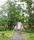
1936: Swinging
Skowhegan, Maine, USA - Kennebec River
| Bridgemeister ID: | 363 (added before 2003) |
| Year Completed: | 1936 |
| Name: | Swinging |
| Location: | Skowhegan, Maine, USA |
| Crossing: | Kennebec River |
| Coordinates: | 44.76244 N 69.72064 W |
| Maps: | Acme, GeoHack, Google, OpenStreetMap |
| Principals: | Gerald Marble |
| References: | KJ20030410 |
| Use: | Footbridge |
| Status: | In use (last checked: 2006) |
| Main Cables: | Wire (steel) |
| Suspended Spans: | 1 |
| Main Span: | 1 x 67.1 meters (220 feet) |
Notes:
- Connects Skowhegan Island to Alder Street across the south channel of the Kennebec River.
- Repaired, 1995. Rehabilitation completed, 2006.
- Replaced 1902 Swinging - Skowhegan, Maine, USA.
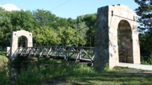
1936: Swinging
Story City, Iowa, USA - Skunk River
| Bridgemeister ID: | 1181 (added 2004-01-24) |
| Year Completed: | 1936 |
| Name: | Swinging |
| Location: | Story City, Iowa, USA |
| Crossing: | Skunk River |
| At or Near Feature: | South Park |
| Coordinates: | 42.186517 N 93.586683 W |
| Maps: | Acme, GeoHack, Google, OpenStreetMap |
| Principals: | WPA |
| Use: | Footbridge |
| Status: | Closed, 2019 (last checked: 2019) |
| Main Cables: | Wire (steel) |
| Suspended Spans: | 1 |
| Main Span: | 1 x 21.6 meters (71 feet) estimated |
Notes:
- Damaged by flood, early 2019. Repairs underway October, 2019, expected to reopen soon.

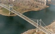
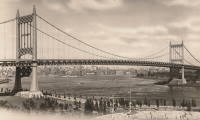
1936: Triborough
New York and Queens, New York, USA - East River
| Bridgemeister ID: | 186 (added before 2003) |
| Year Completed: | 1936 |
| Name: | Triborough |
| Also Known As: | Robert F. Kennedy |
| Location: | New York and Queens, New York, USA |
| Crossing: | East River |
| At or Near Feature: | Randalls-Wards Island |
| Coordinates: | 40.781283 N 73.9273 W |
| Maps: | Acme, GeoHack, Google, OpenStreetMap |
| Principals: | O.H. Ammann, Allston Dana |
| References: | AAJ, GBD, SIX |
| Use: | Vehicular (major highway), with walkway |
| Status: | In use (last checked: 2022) |
| Main Cables: | Wire (steel) |
| Suspended Spans: | 3 |
| Main Span: | 1 x 420.6 meters (1,380 feet) |
| Side Spans: | 2 x 214.8 meters (704.75 feet) |
| Deck width: | 96 feet |
External Links:
1936: Walter Taylor
Indooroopilly and Chelmer, Queensland, Australia - Brisbane River
| Bridgemeister ID: | 449 (added before 2003) |
| Year Completed: | 1936 |
| Name: | Walter Taylor |
| Location: | Indooroopilly and Chelmer, Queensland, Australia |
| Crossing: | Brisbane River |
| Coordinates: | 27.505467 S 152.9737 E |
| Maps: | Acme, GeoHack, Google, OpenStreetMap |
| References: | AAJ, STC |
| Use: | Vehicular |
| Status: | In use (last checked: 2015) |
| Main Cables: | Wire (steel) |
| Suspended Spans: | 1 |
| Main Span: | 1 x 182.9 meters (600.1 feet) |
Notes:
- Hybrid truss-suspension where truss rises up to meet main cables.
- Two-year refurbishment started, late 2007, to replace and strengthen joints along the cables and deck truss.
External Links:
1936: Waterloo
Waterloo, Oregon, USA - South Santiam River
| Bridgemeister ID: | 1980 (added 2005-11-27) |
| Year Completed: | 1936 |
| Name: | Waterloo |
| Location: | Waterloo, Oregon, USA |
| Crossing: | South Santiam River |
| Coordinates: | 44.497549 N 122.820969 W |
| Maps: | Acme, GeoHack, Google, OpenStreetMap |
| Use: | Vehicular |
| Status: | Collapsed, May 1960 |
| Main Cables: | Wire (steel) |
| Suspended Spans: | 1 |
Notes:
- Reconstructed, 1954.
External Links:
1937: (footbridge)
Bruce property, New Zealand - Maruia River
| Bridgemeister ID: | 757 (added 2003-03-08) |
| Year Completed: | 1937 |
| Name: | (footbridge) |
| Location: | Bruce property, New Zealand |
| Crossing: | Maruia River |
| References: | GAP |
| Use: | Footbridge |
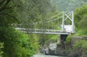
1937: (suspension bridge)
Briceburg, California, USA - Merced River
| Bridgemeister ID: | 642 (added 2003-02-16) |
| Year Completed: | 1937 |
| Name: | (suspension bridge) |
| Location: | Briceburg, California, USA |
| Crossing: | Merced River |
| Coordinates: | 37.604833 N 119.9669 W |
| Maps: | Acme, GeoHack, Google, OpenStreetMap |
| Use: | Vehicular (one-lane) |
| Status: | In use (last checked: 2016) |
| Main Cables: | Wire (steel) |
| Suspended Spans: | 1 |
Notes:
- Damaged by flood, 1999, when river level rose to approximately four feet above the bridge deck.

1937: (suspension bridge)
Waitaria Bay, Havelock vicinity, New Zealand
| Bridgemeister ID: | 758 (added 2003-03-08) |
| Year Completed: | 1937 |
| Name: | (suspension bridge) |
| Location: | Waitaria Bay, Havelock vicinity, New Zealand |
| References: | GAP |
| Use: | Stock |
| Main Span: | 1 x 18.3 meters (60 feet) |
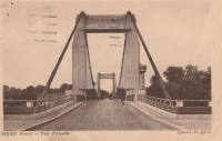
1937: Aiguilly
Roanne vicinity and Vougy vicinity, Loire, France - Loire River
| Bridgemeister ID: | 1567 (added 2004-11-28) |
| Year Completed: | 1937 |
| Name: | Aiguilly |
| Location: | Roanne vicinity and Vougy vicinity, Loire, France |
| Crossing: | Loire River |
| References: | AAJ, BPF |
| Use: | Vehicular |
| Status: | Destroyed, 1940 |
| Main Cables: | Wire (steel) |
| Suspended Spans: | 1 |
| Main Span: | 1 x 135 meters (442.9 feet) |
Notes:
- Destroyed to slow advancing German troops, 1940.
- Replaced 1841 Aiguilly - Roanne vicinity and Vougy vicinity, Loire, France.
- Replaced by 1945 Aiguilly - Roanne vicinity and Vougy vicinity, Loire, France.
External Links:
1937: Bryan's Crossing
Warsaw vicinity, Missouri, USA - South Grand River
| Bridgemeister ID: | 1074 (added 2003-12-27) |
| Year Completed: | 1937 |
| Name: | Bryan's Crossing |
| Also Known As: | Downing Bend |
| Location: | Warsaw vicinity, Missouri, USA |
| Crossing: | South Grand River |
| Principals: | Joseph A. Dice? |
| References: | BOTO |
| Use: | Vehicular (one-lane) |
| Status: | Removed |
| Main Cables: | Wire (steel) |
| Suspended Spans: | 1 |
Notes:
- Likely another Joseph A. Dice bridge.
- Location inundated by the Harry S. Truman Reservoir.
External Links:
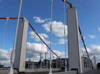
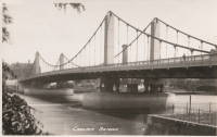
1937: Chelsea
London, England, United Kingdom - River Thames
| Bridgemeister ID: | 450 (added before 2003) |
| Year Completed: | 1937 |
| Name: | Chelsea |
| Location: | London, England, United Kingdom |
| Crossing: | River Thames |
| Coordinates: | 51.48438 N 0.14984 W |
| Maps: | Acme, GeoHack, Google, OpenStreetMap |
| Principals: | Sir Pierson Frank, Rendel, Tritton and Palmer |
| References: | AAJ, BTH |
| Use: | Vehicular (three or more lanes), with walkway |
| Status: | In use (last checked: 2019) |
| Main Cables: | Wire (steel) |
| Suspended Spans: | 3 |
| Main Span: | 1 x 107.3 meters (352 feet) |
| Side Spans: | 2 x 52.7 meters (173 feet) |
| Deck width: | 64 feet |
Notes:
External Links:
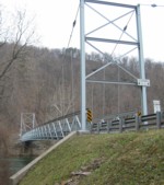
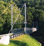
1937: Corbin's
Huntingdon vicinity, Pennsylvania, USA - Raystown Branch Juniata River
| Bridgemeister ID: | 187 (added before 2003) |
| Year Completed: | 1937 |
| Name: | Corbin's |
| Location: | Huntingdon vicinity, Pennsylvania, USA |
| Crossing: | Raystown Branch Juniata River |
| Coordinates: | 40.455 N 77.98333 W |
| Maps: | Acme, GeoHack, Google, OpenStreetMap |
| Use: | Vehicular (one-lane) |
| Status: | In use (last checked: 2021) |
| Main Cables: | Wire (steel) |
| Suspended Spans: | 1 |
| Bridgemeister ID: | 1041 (added 2003-12-06) |
| Year Completed: | 1937 |
| Name: | Fyksesund |
| Location: | Fykse, Kvam, Hordaland, Norway |
| Crossing: | Fyksesund |
| Coordinates: | 60.400028 N 6.260859 E |
| Maps: | Acme, GeoHack, Google, kart.1881.no, OpenStreetMap |
| Use: | Vehicular (two-lane, heavy vehicles) |
| Status: | In use (last checked: 2019) |
| Main Cables: | Wire (steel) |
| Suspended Spans: | 1 |
| Main Span: | 1 x 230 meters (754.6 feet) |
External Links:
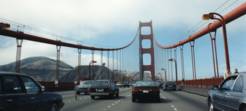
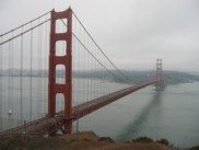
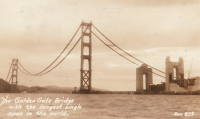
1937: Golden Gate
San Francisco and Marin County, California, USA - San Francisco Bay
| Bridgemeister ID: | 188 (added before 2003) |
| Year Completed: | 1937 |
| Name: | Golden Gate |
| Location: | San Francisco and Marin County, California, USA |
| Crossing: | San Francisco Bay |
| Coordinates: | 37.82 N 122.47667 W |
| Maps: | Acme, GeoHack, Google, OpenStreetMap |
| Principals: | Joseph B. Strauss, Leon Moisseiff, Charles A. Ellis, Irving F. Morrow |
| References: | AAJ, AZB, BAAW, BBR, BC3, BFL, BLD, BMA, BOU, BPL, BRU, COB, CTW, GAT, GBD, GGB, LAB, SPG |
| Use: | Vehicular (major highway), with walkway |
| Status: | In use (last checked: 2022) |
| Main Cables: | Wire (steel) |
| Suspended Spans: | 3 |
| Main Span: | 1 x 1,280.2 meters (4,200 feet) |
| Side Spans: | 2 x 343 meters (1,125.41 feet) |
| Deck width: | 80 feet |
Notes:
- Became longest suspension bridge by eclipsing 1931 George Washington (GWB) - New York, New York and Fort Lee, New Jersey, USA.
- Eclipsed by new longest suspension bridge 1964 Verrazzano Narrows (Verrazano Narrows) - Brooklyn and Staten Island, New York, USA.
External Links:


1937: Hodder
Seddon vicinity, Marlborough, New Zealand - Hodder River
| Bridgemeister ID: | 761 (added 2003-03-08) |
| Year Completed: | 1937 |
| Name: | Hodder |
| Location: | Seddon vicinity, Marlborough, New Zealand |
| Crossing: | Hodder River |
| Coordinates: | 41.884739 S 173.641185 E |
| Maps: | Acme, GeoHack, Google, OpenStreetMap |
| References: | GAP |
| Use: | Vehicular (one-lane) |
| Status: | In use (last checked: 2019) |
| Main Cables: | Wire (steel) |
| Suspended Spans: | 1 |
| Main Span: | 1 x 64 meters (210 feet) |
Notes:
- GAP: Refurbished 1982.
- Strengthened, 2015.
External Links:
1937: Hvåra
Hvåra, Larvik, Vestfold Og Telemark, Norway - Numedalslågen
| Bridgemeister ID: | 4086 (added 2020-04-04) |
| Year Completed: | 1937 |
| Name: | Hvåra |
| Location: | Hvåra, Larvik, Vestfold Og Telemark, Norway |
| Crossing: | Numedalslågen |
| Coordinates: | 59.271796 N 9.938096 E |
| Maps: | Acme, GeoHack, Google, kart.1881.no, OpenStreetMap |
| Use: | Vehicular (one-lane) |
| Status: | Dismantled |
| Main Cables: | Wire (steel) |
| Suspended Spans: | 1 |
| Main Span: | 1 x 95 meters (311.7 feet) |
Notes:
1937: Hyde Park Walking
Hyde Park and Leechburg, Pennsylvania, USA - Kiskiminetas River
| Bridgemeister ID: | 5843 (added 2021-05-13) |
| Year Completed: | 1937 |
| Name: | Hyde Park Walking |
| Location: | Hyde Park and Leechburg, Pennsylvania, USA |
| Crossing: | Kiskiminetas River |
| Coordinates: | 40.627834 N 79.596774 W |
| Maps: | Acme, GeoHack, Google, OpenStreetMap |
| Use: | Footbridge |
| Status: | Removed, c. 1948-1950 |
| Main Cables: | Wire (steel) |
| Suspended Spans: | 3 |
| Main Spans: | 3 |
Notes:
- Closed due to poor condition, 1948.
- Replaced 1920 Hyde Park Walking - Hyde Park and Leechburg, Pennsylvania, USA. The replacement was constructed based on the John A. Roebling's Sons plans from the first bridge.
- Replaced by 1950 Hyde Park (Walking) - Hyde Park and Leechburg, Pennsylvania, USA.
| Bridgemeister ID: | 3960 (added 2020-03-22) |
| Year Completed: | 1937 |
| Name: | Kolobrua |
| Also Known As: | Kollobrua |
| Location: | Sjoa, Sel, Innlandet, Norway |
| Crossing: | Lågen |
| Coordinates: | 61.68207 N 9.53778 E |
| Maps: | Acme, GeoHack, Google, kart.1881.no, OpenStreetMap |
| Use: | Vehicular (one-lane) |
| Status: | In use (last checked: 2017) |
| Main Cables: | Wire (steel) |
| Suspended Spans: | 1 |
| Main Span: | 1 x 95 meters (311.7 feet) estimated |
External Links:
1937: Lacq
Lacq and Abidos, Pyrénées-Atlantiques, France - Ousse River
| Bridgemeister ID: | 7968 (added 2023-11-25) |
| Year Completed: | 1937 |
| Name: | Lacq |
| Location: | Lacq and Abidos, Pyrénées-Atlantiques, France |
| Crossing: | Ousse River |
| Coordinates: | 43.404111 N 0.624083 W |
| Maps: | Acme, GeoHack, Google, OpenStreetMap |
| Use: | Vehicular (two-lane) |
| Status: | In use (last checked: 2023) |
| Main Cables: | Wire (steel) |
| Suspended Spans: | 1 |
| Main Span: | 1 x 77 meters (252.6 feet) estimated |
Notes:
- Next to (pipeline bridge) - Lacq and Abidos, Pyrénées-Atlantiques, France.
- Near (pipeline bridge) - Lacq and Abidos, Pyrénées-Atlantiques, France.
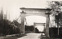
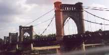
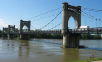
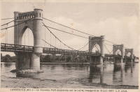
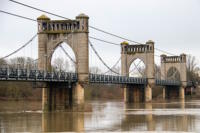
1937: Langeais
Langeais, Indre-et-Loire, France - Loire River
| Bridgemeister ID: | 1029 (added 2003-11-30) |
| Year Completed: | 1937 |
| Name: | Langeais |
| Location: | Langeais, Indre-et-Loire, France |
| Crossing: | Loire River |
| Coordinates: | 47.319667 N 0.404217 E |
| Maps: | Acme, GeoHack, Google, OpenStreetMap |
| References: | AAJ, BPF |
| Use: | Vehicular (two-lane), with walkway |
| Status: | In use (last checked: 2021) |
| Main Cables: | Wire (steel) |
| Suspended Spans: | 5 |
| Main Spans: | 3 x 90 meters (295.29 feet) |
| Side Spans: | 2 x 45 meters (147.64 feet) |
Notes:
- 1940: Deck collapsed.
- 1946: Repaired, but carrying just a footbridge.
- 1950: Rebuilt as a vehicular bridge.
- 1983: Reinforced to support heavier traffic.
- Replaced 1849 Langeais - Langeais, Indre-et-Loire, France.
External Links:
1937: Lenape Park I
Perkasie, Pennsylvania, USA - East Branch Perkiomen Creek
| Bridgemeister ID: | 189 (added before 2003) |
| Year Completed: | 1937 |
| Name: | Lenape Park I |
| Location: | Perkasie, Pennsylvania, USA |
| Crossing: | East Branch Perkiomen Creek |
| Coordinates: | 40.36658 N 75.29908 W |
| Maps: | Acme, GeoHack, Google, OpenStreetMap |
| Principals: | WPA |
| Use: | Footbridge |
| Status: | In use (last checked: 2003) |
| Main Cables: | Wire (steel) |
| Suspended Spans: | 1 |
Notes:
- Connects to 1937 Lenape Park II - Perkasie, Pennsylvania, USA.

1937: Lenape Park II
Perkasie, Pennsylvania, USA - East Branch Perkiomen Creek
| Bridgemeister ID: | 190 (added before 2003) |
| Year Completed: | 1937 |
| Name: | Lenape Park II |
| Location: | Perkasie, Pennsylvania, USA |
| Crossing: | East Branch Perkiomen Creek |
| Coordinates: | 40.36691 N 75.29920 W |
| Maps: | Acme, GeoHack, Google, OpenStreetMap |
| Principals: | WPA |
| Use: | Footbridge |
| Status: | In use (last checked: 2003) |
| Main Cables: | Wire (steel) |
| Suspended Spans: | 1 |
Notes:
- Connects to 1937 Lenape Park I - Perkasie, Pennsylvania, USA.

1937: Lorne
Lorne, Victoria, Australia - Erskine River
| Bridgemeister ID: | 1656 (added 2005-03-19) |
| Year Completed: | 1937 |
| Name: | Lorne |
| Location: | Lorne, Victoria, Australia |
| Crossing: | Erskine River |
| Coordinates: | 38.533600 S 143.977918 E |
| Maps: | Acme, GeoHack, Google, OpenStreetMap |
| Use: | Footbridge |
| Status: | In use (last checked: 2018) |
| Main Cables: | Wire |
| Suspended Spans: | 1 |
1937: Monymusk Farm
Leamington Valley, Cheviot vicinity, New Zealand - Leamington River
| Bridgemeister ID: | 759 (added 2003-03-08) |
| Year Completed: | 1937 |
| Name: | Monymusk Farm |
| Location: | Leamington Valley, Cheviot vicinity, New Zealand |
| Crossing: | Leamington River |
| Principals: | Ellis Upritchard |
| References: | GAP |
| Use: | Vehicular (one-lane) |
| Main Cables: | Wire (steel) |
| Suspended Spans: | 1 |
1937: Redpath's
Waioeka Gorge, Opotiki vicinity, New Zealand - Waioeka River
| Bridgemeister ID: | 756 (added 2003-03-08) |
| Year Completed: | 1937 |
| Name: | Redpath's |
| Location: | Waioeka Gorge, Opotiki vicinity, New Zealand |
| Crossing: | Waioeka River |
| References: | GAP |
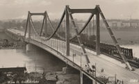
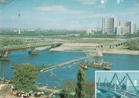
1937: Reichsbrücke
Vienna, Austria - Danube River
| Bridgemeister ID: | 4589 (added 2020-06-06) |
| Year Completed: | 1937 |
| Name: | Reichsbrücke |
| Location: | Vienna, Austria |
| Crossing: | Danube River |
| Coordinates: | 48.227267 N 16.407719 E |
| Maps: | Acme, GeoHack, Google, OpenStreetMap |
| References: | AAJ |
| Use: | Vehicular |
| Status: | Collapsed, August 1, 1976 |
| Main Cables: | Eyebar (steel) |
| Suspended Spans: | 1 |
| Main Span: | 1 x 241.2 meters (791.3 feet) |
Notes:
- Renovated 1948-1952.
External Links:
1937: Rio Chiriquí
David, Panama - Rio Chiriquí
| Bridgemeister ID: | 451 (added before 2003) |
| Year Completed: | 1937 |
| Name: | Rio Chiriquí |
| Location: | David, Panama |
| Crossing: | Rio Chiriquí |
| Principals: | Conde B. McCullough |
| References: | AAJ, CBM |
| Use: | Vehicular |
| Main Cables: | Wire (steel) |
| Suspended Spans: | 1 |
| Main Span: | 1 x 121.9 meters (400 feet) |
| Deck width: | 20 feet |
External Links:
1937: Rio Choluteca
Choluteca, Honduras - Rio Choluteca
| Bridgemeister ID: | 452 (added before 2003) |
| Year Completed: | 1937 |
| Name: | Rio Choluteca |
| Location: | Choluteca, Honduras |
| Crossing: | Rio Choluteca |
| Coordinates: | 13.312089 N 87.191631 W |
| Maps: | Acme, GeoHack, Google, OpenStreetMap |
| Principals: | Conde B. McCullough, R. Archibald |
| References: | AAJ, CBM, MSSB |
| Use: | Vehicular (two-lane), with walkway |
| Status: | In use (last checked: 2016) |
| Main Cables: | Wire (steel) |
| Suspended Spans: | 4 |
| Main Spans: | 2 x 100.6 meters (330 feet) |
| Side Spans: | 2 x 33.5 meters (110 feet) |
| Deck width: | 30 feet |
External Links:
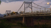
1937: Rio Tamasalupa
Asuncíon Mita, Guatemala - Rio Tamasalupa
| Bridgemeister ID: | 453 (added before 2003) |
| Year Completed: | 1937 |
| Name: | Rio Tamasalupa |
| Location: | Asuncíon Mita, Guatemala |
| Crossing: | Rio Tamasalupa |
| Coordinates: | 14.304190 N 89.717344 W |
| Maps: | Acme, GeoHack, Google, OpenStreetMap |
| Principals: | Conde B. McCullough, R. Archibald |
| References: | AAJ, CBM |
| Use: | Vehicular (two-lane) |
| Status: | In use (last checked: 2019) |
| Main Cables: | Eyebar (steel) |
| Suspended Spans: | 3 |
| Main Span: | 1 x 73.2 meters (240 feet) |
| Side Spans: | 2 x 30.5 meters (100 feet) |
| Deck width: | 20 feet |
External Links:
1937: San Rafael Swinging
San Rafael Bridge Recreation Site, Utah, USA - San Rafael River
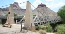
| Bridgemeister ID: | 362 (added before 2003) |
| Year Completed: | 1937 |
| Name: | San Rafael Swinging |
| Also Known As: | Buckhorn Wash |
| Location: | San Rafael Bridge Recreation Site, Utah, USA |
| Crossing: | San Rafael River |
| Coordinates: | 39.08112 N 110.66639 W |
| Maps: | Acme, GeoHack, Google, OpenStreetMap |
| Principals: | CCC, Milton P. Greaves |
| Use: | Vehicular |
| Status: | Restricted to foot traffic (last checked: 2020) |
| Main Cables: | Wire (steel) |
| Main Span: | 1 x 48.8 meters (160 feet) |
Notes:
- Restored, c.1994.
- Some web sites state this bridge was destroyed by fire in 2008. This appears to be caused by confusion with Utah's Dewey bridge destroyed by a fire in 2008. The San Rafael bridge was not destroyed and was still in active use as of 2020.
External Links:
1937: Stoddard Pack
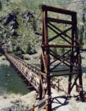
Salmon and North Fork vicinity, Idaho, USA - Salmon River
| Bridgemeister ID: | 641 (added 2003-02-15) |
| Year Completed: | 1937 |
| Name: | Stoddard Pack |
| Location: | Salmon and North Fork vicinity, Idaho, USA |
| Crossing: | Salmon River |
| Coordinates: | 45.29601 N 114.60448 W |
| Maps: | Acme, GeoHack, Google, OpenStreetMap |
| Principals: | CCC (Civilian Conservation Corps) |
| Use: | Pack and Footbridge |
| Status: | Replaced, 2014 |
| Main Cables: | Wire (steel) |
| Suspended Spans: | 1 |
| Main Span: | 1 x 106.7 meters (350 feet) estimated |
Notes:
- Was located about 35-40 miles west of North Fork.
- Replaced by 2014 Stoddard Pack - Salmon and North Fork vicinity, Idaho, USA.
1937: Swinging
Red Hill vicinity, Pennsylvania, USA - Perkiomen Creek
| Bridgemeister ID: | 7367 (added 2022-11-04) |
| Year Completed: | 1937 |
| Name: | Swinging |
| Location: | Red Hill vicinity, Pennsylvania, USA |
| Crossing: | Perkiomen Creek |
| Coordinates: | 40.353622 N 75.503263 W |
| Maps: | Acme, GeoHack, Google, OpenStreetMap |
| Use: | Footbridge |
| Status: | Removed, Early 1950s |
| Main Cables: | Wire (steel) |
| Suspended Spans: | 1 |
Notes:
- Replaced a much less substantial swinging bridge that was destroyed by flood in 1935.
- The site of this bridge was inundated with the creation of the Green Lane Reservoir in the 1950s. The coordinates indicate the approximate location of the bridge which would have been near the current end of Swinging Bridge Rd.
1938: (suspension bridge)
Gerung, West Lombok, West Nusa Tenggara, Indonesia
| Bridgemeister ID: | 3046 (added 2019-10-20) |
| Year Completed: | 1938 |
| Name: | (suspension bridge) |
| Location: | Gerung, West Lombok, West Nusa Tenggara, Indonesia |
| Coordinates: | 8.692476 S 116.108842 E |
| Maps: | Acme, GeoHack, Google, OpenStreetMap |
| Use: | Vehicular |
| Status: | In use (last checked: 2019) |
| Main Cables: | Wire (steel) |
Notes:
- In 2019, appears to be restricted to motorbike and pedestrian traffic.
External Links:
1938: Assat
Assat and Narcastet, Pyrénées-Atlantiques, France - Ousse
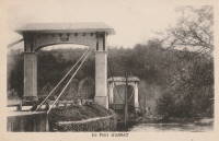
| Bridgemeister ID: | 4687 (added 2020-06-20) |
| Year Completed: | 1938 |
| Name: | Assat |
| Location: | Assat and Narcastet, Pyrénées-Atlantiques, France |
| Crossing: | Ousse |
| Coordinates: | 43.244390 N 0.308003 W |
| Maps: | Acme, GeoHack, Google, OpenStreetMap |
| Use: | Vehicular (two-lane) |
| Status: | In use (last checked: 2020) |
| Main Cables: | Wire (steel) |
| Suspended Spans: | 1 |
Notes:
- See Assat - Assat, Pyrénées-Atlantiques, France. The relationship between the two bridges is unclear, but likely the 1938 bridge was a direct replacement.
External Links:
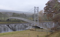
1938: Brae Doune
Brae Doune, Scotland, United Kingdom - River Oykel
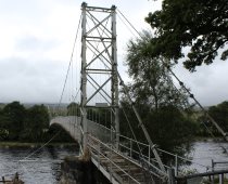
| Bridgemeister ID: | 2635 (added 2019-03-02) |
| Year Completed: | 1938 |
| Name: | Brae Doune |
| Also Known As: | Tuitean |
| Location: | Brae Doune, Scotland, United Kingdom |
| Crossing: | River Oykel |
| Coordinates: | 57.974258 N 4.638333 W |
| Maps: | Acme, GeoHack, Google, OpenStreetMap |
| Principals: | John Henderson and Co. (Aberdeen) |
| Use: | Footbridge |
| Status: | Closed (last checked: 2022) |
| Main Cables: | Wire (steel) |
| Suspended Spans: | 1 |
| Main Span: | 1 x 91.4 meters (300 feet) |
Do you have any information or photos for these bridges that you would like to share? Please email david.denenberg@bridgemeister.com.