Suspension Bridges Crossing St. Lawrence River
This is a list of all 7 bridges from the suspension bridge inventory crossing St. Lawrence River. Please note that different rivers with the same name will be grouped together. For example, selecting 'Bear Creek' shows bridges across several different Bear Creeks. Also, similarly named rivers are grouped separately. For example, 'River Dee' (UK) bridges are grouped separately from 'Dee River' (Australia) bridges. Wherever you see a Bridgemeister ID number click it to isolate the bridge on its own page.
Related Lists:
1935: l'Île d'Orléans
Quebec City, Quebec, Canada - St. Lawrence River
| Bridgemeister ID: | 183 (added before 2003) |
| Year Completed: | 1935 |
| Name: | l'Île d'Orléans |
| Also Known As: | Isle of Orleans, Orleans Island, Taschereau |
| Location: | Quebec City, Quebec, Canada |
| Crossing: | St. Lawrence River |
| Coordinates: | 46.880233 N 71.137883 W |
| Maps: | Acme, GeoHack, Google, OpenStreetMap |
| Principals: | Monsarrat and Pratley |
| References: | AAJ |
| Use: | Vehicular (two-lane, heavy vehicles), with walkway |
| Status: | In use (last checked: 2019) |
| Main Cables: | Wire (steel) |
| Suspended Spans: | 3 |
| Main Span: | 1 x 323 meters (1,059.7 feet) |
| Side Spans: | 2 x 127 meters (416.7 feet) |
| Deck width: | 30 feet |
Notes:
- Replacement proposed to start in 2024.
- Near Montmorency Falls - Quebec City vicinity, Quebec, Canada.
External Links:

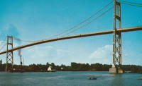
1938: Thousand Islands International I
Wellesley Island and Collins Landing, New York, USA - St. Lawrence River
| Bridgemeister ID: | 364 (added before 2003) |
| Year Completed: | 1938 |
| Name: | Thousand Islands International I |
| Location: | Wellesley Island and Collins Landing, New York, USA |
| Crossing: | St. Lawrence River |
| At or Near Feature: | American Channel |
| Coordinates: | 44.30333 N 75.98333 W |
| Maps: | Acme, GeoHack, Google, OpenStreetMap |
| Principals: | Robinson and Steinman |
| References: | AAJ, ADDS |
| Use: | Vehicular (two-lane, heavy vehicles), with walkway |
| Status: | In use (last checked: 2022) |
| Main Cables: | Wire (steel) |
| Suspended Spans: | 3 |
| Main Span: | 1 x 243.8 meters (800 feet) |
| Side Spans: | 2 x 106.7 meters (350 feet) |
Notes:
External Links:


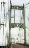
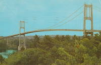
1938: Thousand Islands International II
Georgina Island and Selton, Ontario, Canada - St. Lawrence River
| Bridgemeister ID: | 365 (added before 2003) |
| Year Completed: | 1938 |
| Name: | Thousand Islands International II |
| Location: | Georgina Island and Selton, Ontario, Canada |
| Crossing: | St. Lawrence River |
| Coordinates: | 44.36323 N 75.98271 W |
| Maps: | Acme, GeoHack, Google, OpenStreetMap |
| Principals: | Robinson and Steinman |
| References: | AAJ, ADDS |
| Use: | Vehicular (two-lane, heavy vehicles), with walkway |
| Status: | In use (last checked: 2022) |
| Main Cables: | Wire (steel) |
| Suspended Spans: | 3 |
| Main Span: | 1 x 228.6 meters (750 feet) |
| Side Spans: | 2 x 91.4 meters (300 feet) |
Notes:
- Companion to 1938 Thousand Islands International I - Wellesley Island and Collins Landing, New York, USA.
External Links:
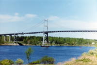
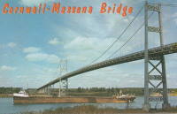
1958: Three Nations Crossing
Cornwall, Ontario, Canada and Massena, New York, USA - St. Lawrence River
| Bridgemeister ID: | 325 (added before 2003) |
| Year Completed: | 1958 |
| Name: | Three Nations Crossing |
| Also Known As: | Cornwall-Massena International, Seaway International |
| Location: | Cornwall, Ontario, Canada and Massena, New York, USA |
| Crossing: | St. Lawrence River |
| Coordinates: | 44.989962 N 74.739913 W |
| Maps: | Acme, GeoHack, Google, OpenStreetMap |
| References: | STL |
| Use: | Vehicular |
| Status: | In use (last checked: 2019) |
| Main Cables: | Wire (steel) |
| Suspended Spans: | 3 |
| Main Span: | 1 |
| Side Spans: | 2 |
Notes:
- Renamed "Three Nations Crossing" effective January 1, 2000 in recognition of the Mohawks of Akwesasne
External Links:
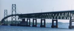
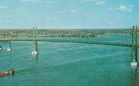
1960: Ogdensburg-Prescott International
Ogdensburg, New York, USA and Prescott, Ontario, Canada - St. Lawrence River
| Bridgemeister ID: | 214 (added before 2003) |
| Year Completed: | 1960 |
| Name: | Ogdensburg-Prescott International |
| Also Known As: | Seaway Skyway |
| Location: | Ogdensburg, New York, USA and Prescott, Ontario, Canada |
| Crossing: | St. Lawrence River |
| Coordinates: | 44.73 N 75.45667 W |
| Maps: | Acme, GeoHack, Google, OpenStreetMap |
| Principals: | Modjeski & Masters |
| Use: | Vehicular (major highway) |
| Status: | In use (last checked: 2019) |
| Main Cables: | Wire (steel) |
| Suspended Spans: | 3 |
| Main Span: | 1 x 350.75 meters (1,150.8 feet) |
| Side Spans: | 2 |
External Links:
1970: Pierre Laporte
Quebec City and Levis, Quebec, Canada - St. Lawrence River
| Bridgemeister ID: | 228 (added before 2003) |
| Year Completed: | 1970 |
| Name: | Pierre Laporte |
| Location: | Quebec City and Levis, Quebec, Canada |
| Crossing: | St. Lawrence River |
| Coordinates: | 46.741717 N 71.288333 W |
| Maps: | Acme, GeoHack, Google, OpenStreetMap |
| Principals: | Demers-Vandry-Grondquist |
| Use: | Vehicular (major highway) |
| Status: | In use (last checked: 2023) |
| Main Cables: | Wire (steel) |
| Suspended Spans: | 3 |
| Main Span: | 1 x 667.5 meters (2,190 feet) |
| Side Spans: | 2 x 186.5 meters (611.9 feet) |
Notes:
- 2021, November: Weight and lane restrictions imposed pending urgent replacement of several suspender cables.
External Links:
- CBC - Suspension cables on Quebec City's Pierre-Laporte bridge could give way at any time, report finds. June 16, 2022. Article reporting the alarming amount of corrosion found in the bridge's cables. Immediate repairs are recommended.
- Pierre Laporte Bridge - Wikipedia
- Structurae - Structure ID 20003362
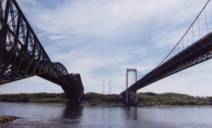
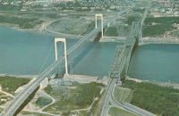
Beauharnois
Melocheville, Quebec, Canada - St. Lawrence River
| Bridgemeister ID: | 1146 (added 2004-01-17) |
| Name: | Beauharnois |
| Location: | Melocheville, Quebec, Canada |
| Crossing: | St. Lawrence River |
| Coordinates: | 45.316050 N 73.908033 W |
| Maps: | Acme, GeoHack, Google, OpenStreetMap |
| Use: | Vehicular (two-lane, heavy vehicles), with walkway |
| Status: | In use (last checked: 2018) |
| Main Cables: | Wire (steel) |
| Suspended Spans: | 1 |
Notes:
- Carries route 132 across a small arm of the St. Lawrence by the Canal de Beauharnois dam.
- Major rehabilitation efforts completed in 2011 and 2012 including replacement of 56 vertical suspenders.
External Links:
Do you have any information or photos for these bridges that you would like to share? Please email david.denenberg@bridgemeister.com.