Suspension Bridges of USA (901-1,000 of 1,437)
This is a list of bridges 901 through 1,000 (of 1,437 total) from the suspension bridge inventory for the country USA . Wherever you see a Bridgemeister ID number click it to isolate the bridge on its own page.
Related Lists:
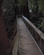
Bridgemeister ID: 2223 (added 2007-03-15)Name: (footbridge) Location: Mount Hermon, California , USA Crossing: Zayante Creek At or Near Feature: Mount Hermon Christian Conference Center Use: Footbridge Status: In use (last checked: 2007) Main Cables: Wire (steel)
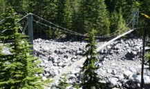
Bridgemeister ID: 262 (added before 2003)Name: (footbridge) Location: Mt. Rainier National Park, Washington , USA Crossing: Carbon River At or Near Feature: Carbon Glacier Trail Coordinates: 46.94956 N 121.79537 W Maps: Acme , GeoHack , Google , OpenStreetMap Use: Footbridge Status: In use (last checked: 2006) Main Cables: Wire (steel) Suspended Spans: 1 Main Span: 1 x 61 meters (200 feet) estimated
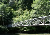
Bridgemeister ID: 651 (added 2003-02-22)Name: (footbridge) Location: Mt. Rainier National Park, Washington , USA Crossing: Ohanapecosh River At or Near Feature: Grove of the Patriarchs vicinity Coordinates: 46.76299 N 121.55637 W Maps: Acme , GeoHack , Google , OpenStreetMap Use: Footbridge Status: Closed, November 2021 (last checked: 2021) Main Cables: Wire (steel) Suspended Spans: 1 Main Span: 1 x 34.4 meters (113 feet) estimated
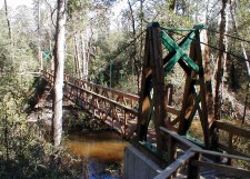
2021, November: Closed due to recent flood damage. Timeline for repair or replacement unclear. Bridgemeister ID: 2375 (added 2007-09-29)Name: (footbridge) Location: Munson vicinity, Florida , USA Crossing: Sweetwater Creek At or Near Feature: Sweetwater Trail - Blackwater State Forest Use: Footbridge Status: In use (last checked: 2012) Main Cables: Wire (steel) Suspended Spans: 1 Main Span: 1 x 30.5 meters (100 feet)
Bridgemeister ID: 6140 (added 2021-07-06)Name: (footbridge) Location: Nathrop, Colorado , USA Crossing: Arkansas River At or Near Feature: Chateau Chaparral Coordinates: 38.743944 N 106.067806 W Maps: Acme , GeoHack , Google , OpenStreetMap Use: Footbridge Status: In use (last checked: 2021) Main Cables: Wire (steel) Suspended Spans: 1 Main Span: 1
Bridgemeister ID: 4523 (added 2020-05-17)Name: (footbridge) Location: New Marlborough, Massachusetts , USA Crossing: Whiting River At or Near Feature: Thousand Acre Swamp Coordinates: 42.071662 N 73.201265 W Maps: Acme , GeoHack , Google , OpenStreetMap Use: Footbridge Status: In use (last checked: 2020) Main Cables: Wire (steel) Suspended Spans: 1
Small footbridge around the perimeter of Thousand Acre Swamp reservoir. Bridgemeister ID: 1305 (added 2004-04-09)Name: (footbridge) Location: Newhalem, Washington , USA Crossing: Skagit River Coordinates: 48.67490 N 121.24074 W Maps: Acme , GeoHack , Google , OpenStreetMap Use: Footbridge Status: In use Main Cables: Wire (steel) Suspended Spans: 1 Main Span: 1 x 112.8 meters (370 feet) estimated
Bridgemeister ID: 812 (added 2003-05-29)Name: (footbridge) Location: Norman, Oklahoma , USA Crossing: Duck Pond At or Near Feature: University of Oklahoma Coordinates: 35.207327 N 97.436762 W Maps: Acme , GeoHack , Google , OpenStreetMap Use: Footbridge Status: In use (last checked: 2018) Suspended Spans: 1
Tiny footbridge. Main span likely less than 30 feet. Bridgemeister ID: 861 (added 2003-08-09)Name: (footbridge) Location: North Riverside, Illinois , USA Crossing: Des Plaines River At or Near Feature: Riverside Golf Club Coordinates: 41.84336 N 87.82781 W Maps: Acme , GeoHack , Google , OpenStreetMap Use: Footbridge Status: In use Main Cables: Wire Suspended Spans: 1 Main Span: 1 x 45.7 meters (150 feet) estimated
This bridge employs an interesting system of cable stays and inclined suspenders. It accomodates foot and golf cart traffic. Bridgemeister ID: 2395 (added 2007-12-02)Name: (footbridge) Location: Oil City vicinity, Pennsylvania , USA Crossing: Read Run At or Near Feature: Camp Singing Hills Coordinates: 41.45763 N 79.75185 W Maps: Acme , GeoHack , Google , OpenStreetMap Use: Footbridge Status: In use (last checked: 2002) Main Cables: Wire Suspended Spans: 1
Bridgemeister ID: 2925 (added 2019-09-15)Name: (footbridge) Location: Oklahoma City, Oklahoma , USA Coordinates: 35.511623 N 97.478257 W Maps: Acme , GeoHack , Google , OpenStreetMap Use: Footbridge Status: Closed (last checked: 2019) Main Cables: Wire (steel) Suspended Spans: 1
Bridgemeister ID: 4950 (added 2020-08-08)Name: (footbridge) Location: Oldsmar, Florida , USA Coordinates: 28.027206 N 82.660163 W Maps: Acme , GeoHack , Google , OpenStreetMap Use: Footbridge Status: In use (last checked: 2020) Main Cables: Wire (steel) Suspended Spans: 1 Main Span: 1 x 47 meters (154.2 feet) estimated
Appears to be part of a private adventure course. Bridgemeister ID: 2336 (added 2007-08-11)Name: (footbridge) Location: Olympic National Park, Washington , USA Crossing: Elwha River At or Near Feature: Long Ridge Trail Coordinates: 47.94223 N 123.54115 W Maps: Acme , GeoHack , Google , OpenStreetMap Use: Footbridge Status: In use (last checked: 2007) Main Cables: Wire (steel) Suspended Spans: 1 Main Span: 1 x 37.5 meters (123 feet)
Bridgemeister ID: 1369 (added 2004-07-03)Name: (footbridge) Location: Oriskany vicinity, Virginia , USA Crossing: Craig Creek Coordinates: 37.61221 N 79.98092 W Maps: Acme , GeoHack , Google , OpenStreetMap Principals: VDOT Use: Footbridge Status: In use (last checked: 2004) Main Cables: Wire (steel) Suspended Spans: 1 Main Span: 1 x 51.2 meters (168 feet) estimated
Bridgemeister ID: 1374 (added 2004-07-03)Name: (footbridge) Location: Oriskany vicinity, Virginia , USA Crossing: Craig Creek Coordinates: 37.61505 N 79.98825 W Maps: Acme , GeoHack , Google , OpenStreetMap Principals: VDOT Use: Footbridge Status: In use (last checked: 2004) Main Cables: Wire (steel) Suspended Spans: 1 Main Span: 1 x 54.9 meters (180 feet) estimated
Bridgemeister ID: 1376 (added 2004-07-03)Name: (footbridge) Location: Oriskany vicinity, Virginia , USA Crossing: Craig Creek Coordinates: 37.60470 N 79.99361 W Maps: Acme , GeoHack , Google , OpenStreetMap Principals: VDOT Use: Footbridge Status: In use (last checked: 2004) Main Cables: Wire (steel) Suspended Spans: 1 Main Span: 1 x 70.1 meters (230 feet) estimated
Bridgemeister ID: 1591 (added 2005-02-05)Name: (footbridge) Location: Oriskany vicinity, Virginia , USA Crossing: Craig Creek Coordinates: 37.60917 N 79.96701 W Maps: Acme , GeoHack , Google , OpenStreetMap Principals: VDOT Use: Footbridge Status: In use (last checked: 2004) Main Cables: Wire (steel) Suspended Spans: 1 Main Span: 1 x 54.9 meters (180 feet) estimated
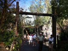
Bridgemeister ID: 2610 (added 2014-04-15)Name: (footbridge) Location: Orlando, Florida , USA At or Near Feature: Animal Kingdom Use: Footbridge Status: In use (last checked: 2013) Main Cables: Wire (steel) Suspended Spans: 1
Bridgemeister ID: 2351 (added 2007-08-18)Name: (footbridge) Location: Page Cutoff, Pineville vicinity, Kentucky , USA Crossing: Yellow Creek Use: Footbridge Main Cables: Wire
Built circa 1957. Damaged by flood, 1977. Partially repaired by December, 1977. Descriptions and photographs of the 1977 flood damage and repairs appear in the December 2 and 30, 1977 editions of the Daily News newspaper (Middlesboro, Kentucky). Bridgemeister ID: 2110 (added 2006-09-03)Name: (footbridge) Location: Pahaska vicinity, Wyoming , USA Crossing: North Fork Shoshone River At or Near Feature: Sleeping Giant Campground and Winter Sports Area Coordinates: 44.490833 N 109.938767 W Maps: Acme , GeoHack , Google , OpenStreetMap Use: Footbridge Status: Derelict (last checked: 2006) Main Cables: Wire Suspended Spans: 2 Main Span: 1 Side Span: 1
Bridgemeister ID: 1619 (added 2005-02-26)Name: (footbridge) Location: Palmer vicinity, Washington , USA Crossing: Green River At or Near Feature: Tacoma Water Supply Intake Diversion Dam Coordinates: 47.301141 N 121.842975 W Maps: Acme , GeoHack , Google , OpenStreetMap Use: Footbridge Status: In use (last checked: 2016) Main Cables: Wire Suspended Spans: 1
Bridgemeister ID: 2573 (added 2012-11-18)Name: (footbridge) Location: Parma, Ohio , USA Crossing: Big Creek At or Near Feature: Fern Hill Picnic Area Coordinates: 41.413165 N 81.754445 W Maps: Acme , GeoHack , Google , OpenStreetMap Use: Footbridge Status: In use (last checked: 2013) Main Cables: Wire (steel) Suspended Spans: 1
Bridgemeister ID: 1459 (added 2004-08-21)Name: (footbridge) Location: Pelican Rapids, Minnesota , USA Crossing: Pelican River Coordinates: 46.569583 N 96.082 W Maps: Acme , GeoHack , Google , OpenStreetMap Use: Footbridge Status: In use (last checked: 2019) Main Cables: Wire Suspended Spans: 3 Main Span: 1 Side Spans: 2
Bridgemeister ID: 1417 (added 2004-07-17)Name: (footbridge) Location: Pemigewasset Wilderness, New Hampshire , USA At or Near Feature: Cedar Brook Trail Use: Footbridge Status: Removed, 2009 Main Cables: Wire (steel) Suspended Spans: 1 Main Span: 1 x 54.9 meters (180 feet)
Bridgemeister ID: 1694 (added 2005-03-27)Name: (footbridge) Location: Peoria, Illinois , USA At or Near Feature: Madison Park Use: Footbridge Suspended Spans: 1
Bridgemeister ID: 2421 (added 2008-02-22)Name: (footbridge) Location: Perry County, Kentucky , USA Crossing: Troublesome Creek Coordinates: 37.38502 N 83.15154 W Maps: Acme , GeoHack , Google , OpenStreetMap Use: Footbridge Status: In use (last checked: 2007) Main Cables: Wire (steel) Suspended Spans: 2 Main Spans: 1 x 30.5 meters (100 feet) estimated,
Bridgemeister ID: 2406 (added 2007-12-23)Name: (footbridge) Location: Petersburg, Kentucky , USA At or Near Feature: Creation Museum Coordinates: 39.085137 N 84.782340 W Maps: Acme , GeoHack , Google , OpenStreetMap Use: Footbridge Status: In use (last checked: 2018) Main Cables: Wire (steel) Suspended Spans: 1
Bridgemeister ID: 1462 (added 2004-08-22)Name: (footbridge) Location: Pikeville, Kentucky , USA Crossing: Pikeville City Pond Coordinates: 37.48575 N 82.520067 W Maps: Acme , GeoHack , Google , OpenStreetMap Use: Footbridge Status: In use (last checked: 2004) Main Cables: Wire (steel) Suspended Spans: 2 Main Span: 1 x 96.9 meters (318 feet) estimated Side Span: 1
Crosses a pond formed by the Pikeville Cut-Thru project's diversion of the Levisa Fork of the Big Sandy River. Bridgemeister ID: 1344 (added 2004-05-08)Name: (footbridge) Location: Pine Grove vicinity, Virginia , USA Crossing: North Fork Holston River At or Near Feature: Fleenor Mill Ford Coordinates: 36.71495 N 82.26497 W Maps: Acme , GeoHack , Google , OpenStreetMap Principals: VDOT Use: Footbridge Status: In use (last checked: 2004) Main Cables: Wire (steel) Suspended Spans: 1 Main Span: 1 x 71.3 meters (234 feet) estimated
Bridgemeister ID: 1345 (added 2004-05-08)Name: (footbridge) Location: Pine Grove vicinity, Virginia , USA Crossing: North Fork Holston River At or Near Feature: Hobbs Ford Coordinates: 36.71058 N 82.28812 W Maps: Acme , GeoHack , Google , OpenStreetMap Principals: VDOT Use: Footbridge Status: In use (last checked: 2004) Main Cables: Wire (steel) Suspended Spans: 1 Main Span: 1 x 55.5 meters (182 feet) estimated Side Spans: 1 x 12.2 meters (40 feet) estimated,
Bridgemeister ID: 4933 (added 2020-08-04)Name: (footbridge) Location: Pineville vicinity, Kentucky , USA Crossing: Cumberland River Use: Footbridge Status: In use (last checked: 1975) Main Cables: Wire
The January 3, 1975 edition of the Middlesboro Daily News (Middlesboro, Kentucky) ran a front page photo with description: "As this young woman gazes out over the water of the Cumberland River she may be contemplating the first day of sunshine In the new year. The scenic suspension bridge from which she is gazing at the icy water below is located about two miles past Bell High School on the Harlan Road." That appears to place the bridge in Pineville or very nearby based on the present day (2020) locations of Bell County High School and Harlan Road (US119). Likely removed. Bridgemeister ID: 852 (added 2003-08-06)Name: (footbridge) Location: Pittsfield, Maine , USA Crossing: Sebasticook River At or Near Feature: Manson Park Coordinates: 44.77880 N 69.37425 W Maps: Acme , GeoHack , Google , OpenStreetMap Use: Footbridge and Snowmobile Status: In use (last checked: 2002) Main Cables: Wire Suspended Spans: 1
Bridgemeister ID: 1787 (added 2005-05-17)Name: (footbridge) Location: Plattsburgh, New York , USA Crossing: Saranac River Coordinates: 44.6991 N 73.449467 W Maps: Acme , GeoHack , Google , OpenStreetMap Use: Footbridge Status: In use (last checked: 2019) Main Cables: Wire (steel) Suspended Spans: 3 Main Span: 1 x 64 meters (210 feet) estimated Side Spans: 2 x 23.8 meters (78 feet) estimated
Bridgemeister ID: 1348 (added 2004-05-08)Name: (footbridge) Location: Portland vicinity, Oregon , USA Crossing: Eagle Creek At or Near Feature: Eagle Fern Park Coordinates: 45.324267 N 122.28895 W Maps: Acme , GeoHack , Google , OpenStreetMap Use: Footbridge Status: In use (last checked: 2004) Main Cables: Wire (steel) Suspended Spans: 1
Bridgemeister ID: 1368 (added 2004-07-03)Name: (footbridge) Location: Poteet Ford, Jonesville vicinity, Virginia , USA Crossing: Powell River Coordinates: 36.66681 N 83.08469 W Maps: Acme , GeoHack , Google , OpenStreetMap Principals: VDOT Use: Footbridge Status: Closed (last checked: 2021) Main Cables: Wire (steel)
Closed at some point between 2004 and 2020. Quon, Kristin. "Future of historic Lee County bridge up in the air." WCYB News 5 , 11 March 2021, wcyb.com/news/local/future-of-historic-lee-county-bridge-up-in-the-air."On Tuesday, March 16th, the Lee County Board of Supervisors will hold a public hearing to talk about the proposed abandonment of 1.1 miles of State Route 739 (Harris Hollow Road and Hunting Club Road) from State Route 783 to .95 miles south of State Route 617... The proposed abandonment also includes the abandonment of the swinging pedestrian bridge, which is currently not in use…"
Arintok, Angelique. "Historic swinging bridge and surrounding road in Lee County won't be under new supervision." WCYB News 5 , 1 May 2021, wcyb.com/news/local/historic-swinging-bridge-and-surrounding-road-wont-be-under-new-supervision.Discussed local controversy regarding the proposed abandonment of the segment of road leading up to the bridge and the abandonment of the bridge. Local citizens were against abandonment citing historical value of the bridge.
Bridgemeister ID: 1373 (added 2004-07-03)Name: (footbridge) Location: Potts Creek vicinity, Virginia , USA Crossing: Potts Creek Coordinates: 37.63544 N 80.17103 W Maps: Acme , GeoHack , Google , OpenStreetMap Principals: VDOT Use: Footbridge Status: In use (last checked: 2004) Main Cables: Wire (steel) Suspended Spans: 1 Main Span: 1 x 27.4 meters (90 feet) estimated
Bridgemeister ID: 1379 (added 2004-07-03)Name: (footbridge) Location: Potts Creek vicinity, Virginia , USA Crossing: Potts Creek Coordinates: 37.62819 N 80.17810 W Maps: Acme , GeoHack , Google , OpenStreetMap Principals: VDOT Use: Footbridge Status: In use (last checked: 2004) Main Cables: Wire (steel) Suspended Spans: 1 Main Span: 1 x 27.1 meters (89 feet) estimated
Bridgemeister ID: 1197 (added 2004-01-27)Name: (footbridge) Location: Presque Isle Falls vicinity, Michigan , USA Crossing: Presque Isle River At or Near Feature: Porcupine Mountains Wilderness State Park Use: Footbridge Status: In use
James Boxmeyer writes: "I was involved in a small way in the bridge's construction... Here are a few details about the design. I think it was constructed in the late 1990's or maybe 2000-2001. The camp director said it was designed by people who are familiar with construction of similar bridges by Christian missionaries in other countries where resources are limited and suspension bridges are easier to construct. I used to work for an elevator company. I gave the cable to Camp Sankanac that they said would be used in the main suspension cables as well as the vertical cables that support the walking surface. I think they might have also used some of the cable I donated to hold up the walking surface, but have not seen the bridge in person, so cannot verify that. The main suspension cables had been used in an elevator. They are called traction steel 1/2 inch diameter hoist cables 8x19 construction with a fiber core. Tensile strength of each cable is about 14,500 pounds. The vertical cables are 3/8 inch (without a fiber core) and had been used in a construction hoist." Bridgemeister ID: 1505 (added 2004-10-09)Name: (footbridge) Location: Racine, Wisconsin , USA Crossing: Root River At or Near Feature: Washington Park Coordinates: 42.72005 N 87.807933 W Maps: Acme , GeoHack , Google , OpenStreetMap Use: Footbridge Status: In use (last checked: 2004) Main Cables: Wire (steel) Suspended Spans: 1 Main Span: 1 x 48.8 meters (160 feet) estimated
Major renovation completed, 2017. Bridgemeister ID: 821 (added 2003-05-31)Name: (footbridge) Location: Richfield Center, Michigan , USA Crossing: Flint River At or Near Feature: Richfield Park Coordinates: 43.105184 N 83.530717 W Maps: Acme , GeoHack , Google , OpenStreetMap Use: Footbridge Status: In use (last checked: 2020) Main Cables: Wire Suspended Spans: 1
Bridgemeister ID: 862 (added 2003-08-09)Name: (footbridge) Location: Rockford vicinity, Illinois , USA Crossing: Kishwaukee River At or Near Feature: Atwood Park Coordinates: 42.183113 N 89.055943 W Maps: Acme , GeoHack , Google , OpenStreetMap Use: Footbridge Status: In use (last checked: 2021) Main Cables: Wire (steel) Suspended Spans: 1 Main Span: 1 x 64.9 meters (213 feet) estimated
Bridgemeister ID: 1341 (added 2004-05-03)Name: (footbridge) Location: Roebuck vicinity, Virginia , USA Crossing: North Fork Holston River Coordinates: 36.76827 N 82.11185 W Maps: Acme , GeoHack , Google , OpenStreetMap Principals: VDOT Use: Footbridge Status: In use (last checked: 2004) Main Cables: Wire (steel) Suspended Spans: 1 Main Span: 1 x 68.3 meters (224 feet) estimated
Bridgemeister ID: 3779 (added 2020-02-29)Name: (footbridge) Location: Rousseau, Kentucky , USA Crossing: Quicksand Creek Coordinates: 37.585230 N 83.241210 W Maps: Acme , GeoHack , Google , OpenStreetMap Use: Footbridge Status: In use (last checked: 2007) Main Cables: Wire (steel) Suspended Spans: 3 Main Span: 1 Side Spans: 2
Bridgemeister ID: 5655 (added 2021-01-01)Name: (footbridge) Location: Rowdy vicinity, Perry County, Kentucky , USA Crossing: Troublesome Creek Coordinates: 37.419410 N 83.210633 W Maps: Acme , GeoHack , Google , OpenStreetMap Use: Footbridge Status: In use (last checked: 2008) Main Cables: Wire (steel) Suspended Spans: 2 Main Span: 1 Side Span: 1
Bridgemeister ID: 265 (added before 2003)Name: (footbridge) Location: Rumford, Maine , USA Crossing: Androscoggin River At or Near Feature: Rumford Falls Use: Footbridge Status: Removed Main Cables: Wire
Bridgemeister ID: 1696 (added 2005-03-27)Name: (footbridge) Location: Rumford, Maine , USA Crossing: Androscoggin River Coordinates: 44.55148 N 70.54430 W Maps: Acme , GeoHack , Google , OpenStreetMap Use: Footbridge and Pipeline Status: In use (last checked: 2012) Main Cables: Wire (steel) Main Span: 1 x 91.4 meters (300 feet)
John A Roebling's Son Co. added the pipeline onto an existing footbridge. From a Roebling ad: "... supports a 400 foot section of the 30 inch diameter water line (capacity 12,000,000 gpd) across the Androscoggin River. A substantial saving was accomodated by erecting this bridge with its 300 ft. center span adjacent to and attached to an existing footbridge." See (pipeline bridge) - Rumford, Maine, USA . The pipelines were constructed as part of the same project. Bridgemeister ID: 1320 (added 2004-04-25)Name: (footbridge) Location: Russellville, Arkansas , USA Crossing: Prairie Creek At or Near Feature: Bona Dea Trails System Coordinates: 35.301683 N 93.159617 W Maps: Acme , GeoHack , Google , OpenStreetMap Use: Footbridge Status: Only towers remain (last checked: 2011) Main Cables: Wire Suspended Spans: 1
Destroyed (or dismantled) sometime between 2005 and 2009. Bridgemeister ID: 7345 (added 2022-10-07)Name: (footbridge) Location: Rutland, Vermont , USA At or Near Feature: Pine Hill Park Coordinates: 43.624189 N 73.003795 W Maps: Acme , GeoHack , Google , OpenStreetMap Use: Footbridge Status: In use (last checked: 2022) Main Cables: Wire (steel) Suspended Spans: 3 Main Span: 1 Side Spans: 2
Bridgemeister ID: 869 (added 2003-08-30)Name: (footbridge) Location: Salem, Utah , USA Crossing: Salem Lake Coordinates: 40.05256 N 111.67755 W Maps: Acme , GeoHack , Google , OpenStreetMap Use: Footbridge Status: In use (last checked: 2006) Main Cables: Wire (steel) Suspended Spans: 1 Main Span: 1 x 25.9 meters (85 feet) estimated
After collapse, main span rebuilt by suspending a large donated highway overhead sign truss making an effective through truss. Bridgemeister ID: 1554 (added 2004-11-23)Name: (footbridge) Location: Salida, Colorado , USA Crossing: Arkansas River Use: Footbridge Main Cables: Wire Suspended Spans: 1
Call numbers X-13282 and CHS.X5149 of the Denver Public Library's Western History Photos collection show a suspension footbridge (circa 1890-1910) near the base of Tenderfoot Hill. Bridgemeister ID: 872 (added 2003-08-30)Name: (footbridge) Location: Salina vicinity, Kansas , USA Crossing: Mulberry Creek Coordinates: 38.88861 N 97.59963 W Maps: Acme , GeoHack , Google , OpenStreetMap Use: Footbridge Status: In use (last checked: 2010) Suspended Spans: 3 Main Span: 1 x 23.5 meters (77 feet) estimated Side Spans: 1 x 11.6 meters (38 feet) estimated,
Bridgemeister ID: 4953 (added 2020-08-08)Name: (footbridge) Location: San Sebastián, Puerto Rico , USA At or Near Feature: Hacienda La Fe Adventure Park Coordinates: 18.345750 N 66.992278 W Maps: Acme , GeoHack , Google , OpenStreetMap Use: Footbridge Status: In use (last checked: 2019) Main Cables: Wire (steel) Suspended Spans: 1
Bridgemeister ID: 2383 (added 2007-11-07)Name: (footbridge) Location: Sarasota vicinity, Florida , USA At or Near Feature: Myakka River State Park Coordinates: 27.245110 N 82.302434 W Maps: Acme , GeoHack , Google , OpenStreetMap Use: Footbridge Status: In use (last checked: 2019) Main Cables: Wire (steel)
Appears to be removed or derelict in 2010s satellite imagery. Bridgemeister ID: 2469 (added 2008-12-19)Name: (footbridge) Location: Schramm Park State Recreation Area, Sarpy County, Nebraska , USA Use: Footbridge Status: In use (last checked: 2023) Main Cables: Wire (steel) Suspended Spans: 1 Main Span: 1 x 28.3 meters (93 feet)
Bridgemeister ID: 2286 (added 2007-04-23)Name: (footbridge) Location: Sedona vicinity, Arizona , USA Crossing: Oak Creek Coordinates: 34.96007 N 111.75343 W Maps: Acme , GeoHack , Google , OpenStreetMap Use: Footbridge Status: In use (last checked: 2012) Main Cables: Wire (steel) Suspended Spans: 1
Patrick S. O'Donnell provided a rough main span estimate of 120 feet. Bridgemeister ID: 1327 (added 2004-04-28)Name: (footbridge) Location: Seven Fountains, Virginia , USA Crossing: Narrow Passage Creek Coordinates: 38.85500 N 78.40410 W Maps: Acme , GeoHack , Google , OpenStreetMap Principals: VDOT Use: Footbridge Status: Removed Main Cables: Wire (steel) Suspended Spans: 1 Main Span: 1 x 25 meters (82 feet) estimated
Adjacent to Seven Fountains Rd. low-water vehicle crossing. Bridgemeister ID: 1636 (added 2005-03-13)Name: (footbridge) Location: Shattuck Clearing vicinity and Long Lake vicinity, New York , USA Crossing: Moose River At or Near Feature: Northville-Lake Placid Trail Use: Footbridge Status: In use (last checked: 2004) Main Cables: Wire
Bridgemeister ID: 1637 (added 2005-03-13)Name: (footbridge) Location: Shattuck Clearing vicinity and Long Lake vicinity, New York , USA Crossing: Cold River At or Near Feature: Northville-Lake Placid Trail Use: Footbridge Status: In use (last checked: 2004) Main Cables: Wire
Located at a hydroelectrical plant. 2011, September: At this point, the bridge is in a derelict state with large sections of the deck missing. 2014: At some point since 2011, the bridge is removed except for the abutments. Bridgemeister ID: 1592 (added 2005-02-05)Name: (footbridge) Location: Silent Dell, Virginia , USA Crossing: Craig Creek Coordinates: 37.64643 N 79.94933 W Maps: Acme , GeoHack , Google , OpenStreetMap Principals: VDOT Use: Footbridge Status: In use (last checked: 2004) Main Cables: Wire (steel) Suspended Spans: 1 Main Span: 1 x 51.2 meters (168 feet) estimated
Bridgemeister ID: 2570 (added 2012-02-05)Name: (footbridge) Location: Sitka, Alaska , USA Crossing: Indian River Use: Footbridge Main Cables: Wire (iron)
Alaska Digital Archives identifier UAA-HMC-0518-20b is a photograph of this bridge from the 1890s. Bridgemeister ID: 1351 (added 2004-05-08)Name: (footbridge) Location: Slabtown vicinity, Virginia , USA Crossing: Big Moccasin Creek Coordinates: 36.64503 N 82.56230 W Maps: Acme , GeoHack , Google , OpenStreetMap Principals: VDOT Use: Footbridge Status: In use (last checked: 2004) Main Cables: Wire (steel) Suspended Spans: 3 Main Span: 1 x 30.5 meters (100 feet) estimated Side Spans: 1 x 7.3 meters (24 feet) estimated,
Bridgemeister ID: 3802 (added 2020-03-01)Name: (footbridge) Location: Slanesville vicinity, West Virginia , USA Crossing: North River At or Near Feature: Ice Mountain Preserve Coordinates: 39.341870 N 78.495390 W Maps: Acme , GeoHack , Google , OpenStreetMap Use: Footbridge Status: In use (last checked: 2007) Main Cables: Wire (steel) Suspended Spans: 1 Main Span: 1 x 33.5 meters (110 feet) estimated
Bridgemeister ID: 3803 (added 2020-03-01)Name: (footbridge) Location: Slanesville vicinity, West Virginia , USA Crossing: North River At or Near Feature: Ice Mountain Preserve Coordinates: 39.34545 N 78.49895 W Maps: Acme , GeoHack , Google , OpenStreetMap Use: Footbridge Status: In use (last checked: 2007) Main Cables: Wire (steel) Suspended Spans: 1 Main Span: 1 x 44.2 meters (145 feet) estimated
Destroyed by major flood that ravaged the town, June 24, 1950. Bridgemeister ID: 1370 (added 2004-07-03)Name: (footbridge) Location: Snodgrass Ford, Wilson Hill vicinity, Virginia , USA Crossing: Powell River Coordinates: 36.61987 N 83.25140 W Maps: Acme , GeoHack , Google , OpenStreetMap Principals: VDOT Use: Footbridge Status: In use (last checked: 2004) Main Cables: Wire (steel) Suspended Spans: 3 Main Span: 1 x 67.7 meters (222 feet) estimated Side Spans: 1 x 10.1 meters (33 feet) estimated,
Bridgemeister ID: 868 (added 2003-08-30)Name: (footbridge) Location: South Buffalo, New York , USA Crossing: Cazenovia Creek At or Near Feature: Cazenovia Park Coordinates: 42.84315 N 78.80165 W Maps: Acme , GeoHack , Google , OpenStreetMap Principals: Works Progress Administration Use: Footbridge Status: In use (last checked: 2004)
Constructed by WPA in the 1930s, rebuilt in 1989. Bridgemeister ID: 268 (added before 2003)Name: (footbridge) Location: South Freeport, Maine , USA Crossing: Spar Creek At or Near Feature: Casco Castle and Amusement Park Coordinates: 43.818492 N 70.114426 W Maps: Acme , GeoHack , Google , OpenStreetMap Use: Footbridge Status: Removed Main Cables: Wire Suspended Spans: 1
Do you have any information or photos for these bridges that you would like to share? Please email david.denenberg@bridgemeister.com .
Mail | Facebook | Twitter
