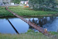
This is a single suspension bridge from the Bridgemeister historical inventory of suspension bridges.
(footbridge)
Shelburne Falls, Massachusetts, USA - Deerfield River
| Bridgemeister ID: | 2476 (added 2008-12-20) |
| Name: | (footbridge) |
| Location: | Shelburne Falls, Massachusetts, USA |
| Crossing: | Deerfield River |
| Coordinates: | 42.62021 N 72.73731 W |
| Maps: | Acme, GeoHack, Google, OpenStreetMap |
| Use: | Footbridge |
| Status: | Removed, c. 2011-2014 |
| Main Cables: | Wire |
| Suspended Spans: | 1 |
| Main Span: | 1 x 91.4 meters (300 feet) estimated |
Notes:
- Located at a hydroelectrical plant.
- 2011, September: At this point, the bridge is in a derelict state with large sections of the deck missing.
- 2014: At some point since 2011, the bridge is removed except for the abutments.

Do you have any information or photos about this bridge that you would like to share? Please email david.denenberg@bridgemeister.com.