Suspension Bridges of USA (801-900 of 1,437)
This is a list of bridges 801 through 900 (of 1,437 total) from the suspension bridge inventory for the country USA . Wherever you see a Bridgemeister ID number click it to isolate the bridge on its own page.
Related Lists:
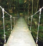
Bridgemeister ID: 794 (added 2003-03-28)Name: (footbridge) Location: Goshen Pass Gorge, Virginia , USA Crossing: Maury River At or Near Feature: Little North Mountain Wildlife Management Area Coordinates: 37.94831 N 79.45969 W Maps: Acme , GeoHack , Google , OpenStreetMap Use: Footbridge Status: In use Main Cables: Wire Suspended Spans: 1 Main Span: 1 x 50.3 meters (165 feet) estimated
Bridgemeister ID: 1464 (added 2004-08-28)Name: (footbridge) Location: Graham, Texas , USA Crossing: Salt Creek At or Near Feature: Fireman's Park Coordinates: 33.113059 N 98.597555 W Maps: Acme , GeoHack , Google , OpenStreetMap Use: Footbridge Status: In use (last checked: 2008) Main Cables: Wire Suspended Spans: 1
Bridgemeister ID: 2111 (added 2006-09-03)Name: (footbridge) Location: Great Falls vicinity, Montana , USA Crossing: Missouri River At or Near Feature: Ryan Island Day Use Area Coordinates: 47.568717 N 111.119083 W Maps: Acme , GeoHack , Google , OpenStreetMap Use: Footbridge Status: In use (last checked: 2006) Main Cables: Wire (steel)
Located just below Ryan Dam. Bridgemeister ID: 257 (added before 2003)Name: (footbridge) Location: Green Bay, Wisconsin , USA Crossing: Duck Creek At or Near Feature: Pamperin Park Coordinates: 44.54537 N 88.10242 W Maps: Acme , GeoHack , Google , OpenStreetMap Use: Footbridge Status: In use (last checked: 2008) Main Cables: Wire Suspended Spans: 1 Main Span: 1 x 32.6 meters (107 feet) estimated
Bridgemeister ID: 798 (added 2003-03-28)Name: (footbridge) Location: Griffith, Virginia , USA Crossing: Cowpasture River Coordinates: 37.86683 N 79.73335 W Maps: Acme , GeoHack , Google , OpenStreetMap Principals: VDOT Use: Footbridge Status: In use (last checked: 2015) Main Cables: Wire Suspended Spans: 1 Main Span: 1 x 56.1 meters (184 feet) estimated
Bridgemeister ID: 1365 (added 2004-07-03)Name: (footbridge) Location: Griffith, Virginia , USA Crossing: Pads Creek Coordinates: 37.86571 N 79.73183 W Maps: Acme , GeoHack , Google , OpenStreetMap Principals: VDOT Use: Footbridge Status: In use (last checked: 2004) Main Cables: Wire (steel) Suspended Spans: 1 Main Span: 1 x 22.6 meters (74 feet) estimated
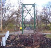
Bridgemeister ID: 1085 (added 2004-01-01)Name: (footbridge) Location: Halstead, Kansas , USA Crossing: Little Arkansas River At or Near Feature: Riverside Park Coordinates: 38.00838 N 97.50696 W Maps: Acme , GeoHack , Google , OpenStreetMap Use: Footbridge Status: In use (last checked: 2010) Main Cables: Wire Suspended Spans: 3 Main Span: 1 x 35.4 meters (116 feet) estimated Side Spans: 2 x 9.1 meters (30 feet) estimated
Small footbridge with steel towers. Evidently located in the park where the 1956 William Holden movie "Picnic" was filmed. Bridgemeister ID: 2275 (added 2007-04-21)Name: (footbridge) Location: Hamrick vicinity, North Carolina , USA Crossing: South Toe River Coordinates: 35.78000 N 82.20553 W Maps: Acme , GeoHack , Google , OpenStreetMap Use: Footbridge Status: In use (last checked: 2007) Main Cables: Wire (steel) Suspended Spans: 1 Main Span: 1 x 43 meters (141 feet) estimated
Bridgemeister ID: 2607 (added 2014-04-15)Name: (footbridge) Location: Hardenburgh vicinity, New York , USA Crossing: Beaverkill Creek At or Near Feature: Mongaup Hardenburgh Trail Use: Footbridge Status: In use (last checked: 2009) Main Cables: Wire
Bridgemeister ID: 3825 (added 2020-03-01)Name: (footbridge) Location: Hardshell, Kentucky , USA Crossing: Troublesome Creek Coordinates: 37.450200 N 83.228820 W Maps: Acme , GeoHack , Google , OpenStreetMap Use: Footbridge Status: In use (last checked: 2007) Main Cables: Wire (steel) Suspended Spans: 2 Main Span: 1 Side Span: 1 x 30.5 meters (100 feet) estimated
Bridgemeister ID: 2540 (added 2011-12-30)Name: (footbridge) Location: Haskell, New Jersey , USA Use: Footbridge Main Cables: Wire
Was in existence in 1914, on site of du Pont "Haskell Works" munitions facility. Bridgemeister ID: 1480 (added 2004-09-04)Name: (footbridge) Location: Hayfork, California , USA Crossing: Hayfork Creek Coordinates: 40.552217 N 123.1815 W Maps: Acme , GeoHack , Google , OpenStreetMap Use: Footbridge Status: In use (last checked: 2005) Main Cables: Wire Suspended Spans: 1 Main Span: 1 x 91.4 meters (300 feet) estimated
Bridgemeister ID: 1415 (added 2004-07-04)Name: (footbridge) Location: Helper, Utah , USA Crossing: Price River Coordinates: 39.688467 N 110.855617 W Maps: Acme , GeoHack , Google , OpenStreetMap Use: Footbridge Status: In use (last checked: 2022) Main Cables: Wire (steel) Suspended Spans: 1 Main Span: 1 x 37.8 meters (124 feet) estimated
Bridgemeister ID: 2216 (added 2007-02-13)Name: (footbridge) Location: Helper, Utah , USA Crossing: Price River Coordinates: 39.68397 N 110.85598 W Maps: Acme , GeoHack , Google , OpenStreetMap Use: Footbridge Status: In use (last checked: 2006) Main Cables: Wire (steel) Suspended Spans: 1 Main Span: 1 x 24.1 meters (79 feet) estimated
Bridgemeister ID: 2516 (added 2009-12-30)Name: (footbridge) Location: Heron Lake State Park, New Mexico , USA Crossing: Rio Chama Coordinates: 36.66036 N 106.70000 W Maps: Acme , GeoHack , Google , OpenStreetMap Use: Footbridge Status: In use (last checked: 2009) Main Cables: Wire (steel) Suspended Spans: 1
Bridgemeister ID: 1461 (added 2004-08-21)Name: (footbridge) Location: High Springs vicinity, Florida , USA Crossing: Santa Fe River At or Near Feature: O'Leno State Park Coordinates: 29.914417 N 82.579472 W Maps: Acme , GeoHack , Google , OpenStreetMap Use: Footbridge Status: Closed, August 2022 (last checked: 2022) Main Cables: Wire Suspended Spans: 1
Bridgemeister ID: 6988 (added 2022-04-03)Name: (footbridge) Location: Hilham, Tennessee , USA At or Near Feature: Standing Stone State Park Coordinates: 36.470954 N 85.418240 W Maps: Acme , GeoHack , Google , OpenStreetMap Use: Footbridge Status: In use (last checked: 2021) Main Cables: Wire (steel) Suspended Spans: 1
Bridgemeister ID: 2217 (added 2007-02-13)Name: (footbridge) Location: Hog Springs Rest Area, Utah , USA Crossing: North Wash At or Near Feature: Glen Canyon Nat. Rec. Area vicinity Coordinates: 37.96283 N 110.49188 W Maps: Acme , GeoHack , Google , OpenStreetMap Use: Footbridge Status: In use (last checked: 2006) Main Cables: Wire (steel) Suspended Spans: 1 Main Span: 1 x 21.6 meters (71 feet) estimated
Bridgemeister ID: 585 (added 2003-01-05)Name: (footbridge) Location: Horse Creek, California , USA Crossing: Klamath River Use: Footbridge Status: Replaced Main Cables: Wire
Bridgemeister ID: 2414 (added 2007-12-31)Name: (footbridge) Location: Hot Springs, Arkansas , USA At or Near Feature: Lake Catherine State Park Coordinates: 34.429010 N 92.910986 W Maps: Acme , GeoHack , Google , OpenStreetMap Use: Footbridge Status: In use (last checked: 2018) Main Cables: Chain Suspended Spans: 1
Bridgemeister ID: 258 (added before 2003)Name: (footbridge) Location: Indianapolis, Indiana , USA At or Near Feature: Riverside or Riverview Park Use: Footbridge Status: Destroyed, 1913 Main Cables: Wire
Wayne Grodkiewicz reports, "I have been doing some investigation on the Riverview Park bridge in Indianapolis. From my investigation so far I have found that there was no Riverview Park in Indianapolis, however it was pointed out by Meg Purnsle from the Indianapolis Historical Society that postcard manufacturers often got names of places wrong on the cards. So it is probably Riverside Park. This park is 'on the corner' of 30th street and the White River. The park is still there in a way. It used to be an amusement park from 1903 to 1970. According to a 1915 map 30th street was extended over the White River and the existence of a foot bridge is not noted. So, the bad news is that this bridge was [probably] torn down sometime between 1912 and 1915. As far as Riverside Park, there is nothing there now but trees. There are some ornate concrete park bridges there now over the White River and the Canal." After further investigation, Wayne wrote: "I have been in contact with the Indiana Historical Society about the bridge at Riverside Park. They have told me there is no concrete documentation about the demise of this bridge but it is general consensus that it was destroyed in the flood of March 1913. It was never replaced." Bridgemeister ID: 2876 (added 2019-09-13)Name: (footbridge) Location: Indianapolis, Indiana , USA Crossing: Indianapolis Motor Speedway Use: Footbridge Status: Removed Main Cables: Wire (steel) Suspended Spans: 3 Main Spans: 3
There have been at least two suspension bridges at the speedway. This was a larger three-span wide footbridge that was in existence in 1909. Patrick S. O'Donnell provided a rough main span estimate of 100 feet. Bridgemeister ID: 3810 (added 2020-03-01)Name: (footbridge) Location: Jackson, Kentucky , USA Crossing: Quicksand Creek Coordinates: 37.563010 N 83.291030 W Maps: Acme , GeoHack , Google , OpenStreetMap Use: Footbridge Status: In use (last checked: 2009) Main Cables: Wire Suspended Spans: 3 Main Span: 1 x 27.4 meters (90 feet) estimated Side Spans: 2
Bridgemeister ID: 2627 (added 2018-12-31)Name: (footbridge) Location: Jamestown vicinity, Tennessee , USA Crossing: Thompson Creek At or Near Feature: Pickett CCC Memorial State Park Coordinates: 36.55035 N 84.801530 W Maps: Acme , GeoHack , Google , OpenStreetMap Use: Footbridge Status: In use (last checked: 2015) Main Cables: Wire (steel)
Bridgemeister ID: 2927 (added 2019-09-15)Name: (footbridge) Location: Jenison, Michigan , USA At or Near Feature: Grand Ravines Park Coordinates: 42.946855 N 85.879794 W Maps: Acme , GeoHack , Google , OpenStreetMap Use: Footbridge Status: In use (last checked: 2019) Main Cables: Wire (steel) Suspended Spans: 1
Bridgemeister ID: 2021 (added 2006-01-22)Name: (footbridge) Location: Jenkins Corner vicinity, Pennsylvania , USA Crossing: Octoraro Creek At or Near Feature: Camp Horseshoe and Camp Ware Coordinates: 39.7268 N 76.125 W Maps: Acme , GeoHack , Google , OpenStreetMap Use: Footbridge Status: In use Main Cables: Wire (steel) Suspended Spans: 1
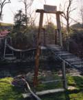
Rush Wickes writes: "It collapsed once during the mid-1980s due to being overloaded by mischievous Scout campers. It was subsequently rebuilt, explaining the mismatched steel and wood tower combination. The "W" in the tower may very well refer to the phrase, 'Wimachtendienk, Wingolauchsik, Witahemui', or WWW, a motto of the Order of the Arrow honor group. The Octararo lodge of the honor group has its ceremonial fire pit just beyond the steel tower." Near (footbridge) - Jenkins Corner vicinity, Pennsylvania, USA . Bridgemeister ID: 1412 (added 2004-07-04)Name: (footbridge) Location: Jonesville vicinity, Virginia , USA Crossing: Powell River Coordinates: 36.67621 N 83.05527 W Maps: Acme , GeoHack , Google , OpenStreetMap Principals: VDOT Use: Footbridge Status: In use (last checked: 2004) Main Cables: Wire (steel) Suspended Spans: 1 Main Span: 1 x 73.8 meters (242 feet) estimated
Bridgemeister ID: 1363 (added 2004-07-02)Name: (footbridge) Location: Jordan Mines, Virginia , USA Crossing: Potts Creek Coordinates: 37.66552 N 80.12227 W Maps: Acme , GeoHack , Google , OpenStreetMap Principals: VDOT Use: Footbridge Status: In use (last checked: 2004) Main Cables: Wire (steel) Suspended Spans: 1 Main Span: 1 x 25 meters (82 feet) estimated
Bridgemeister ID: 1385 (added 2004-07-03)Name: (footbridge) Location: Jordan Mines, Virginia , USA Crossing: Potts Creek Coordinates: 37.66542 N 80.11738 W Maps: Acme , GeoHack , Google , OpenStreetMap Principals: VDOT Use: Footbridge Status: In use (last checked: 2004) Main Cables: Wire (steel) Suspended Spans: 1 Main Span: 1 x 37.8 meters (124 feet) estimated
Bridgemeister ID: 2396 (added 2007-12-02)Name: (footbridge) Location: Kennerdell, Pennsylvania , USA Crossing: Dennison Run At or Near Feature: Kittanning State Forest Use: Footbridge Status: In use (last checked: 2002) Main Cables: Wire (steel) Suspended Spans: 1
Bridgemeister ID: 2397 (added 2007-12-02)Name: (footbridge) Location: Kennerdell, Pennsylvania , USA Crossing: Dennison Run At or Near Feature: Kittanning State Forest Use: Footbridge Status: In use (last checked: 2002) Main Cables: Wire (steel) Suspended Spans: 1
Bridgemeister ID: 2398 (added 2007-12-02)Name: (footbridge) Location: Kennerdell, Pennsylvania , USA Crossing: Dennison Run At or Near Feature: Kittanning State Forest Use: Footbridge Status: In use (last checked: 2002) Main Cables: Wire (steel) Suspended Spans: 1
Bridgemeister ID: 2399 (added 2007-12-02)Name: (footbridge) Location: Kennerdell, Pennsylvania , USA Crossing: Dennison Run At or Near Feature: Kittanning State Forest Use: Footbridge Status: In use (last checked: 2002) Main Cables: Wire (steel) Suspended Spans: 1
Bridgemeister ID: 7673 (added 2023-06-17)Name: (footbridge) Location: Killian, Louisiana , USA Crossing: Tickfaw River At or Near Feature: Tickfaw State Park Coordinates: 30.379685 N 90.650688 W Maps: Acme , GeoHack , Google , OpenStreetMap Use: Footbridge Status: In use (last checked: 2018) Main Cables: Wire (steel) Main Span: 1
Bridgemeister ID: 3780 (added 2020-02-29)Name: (footbridge) Location: Lambric, Kentucky , USA Crossing: Quicksand Creek Coordinates: 37.568500 N 83.141290 W Maps: Acme , GeoHack , Google , OpenStreetMap Use: Footbridge Status: Extant (last checked: 2007) Main Cables: Wire (steel) Suspended Spans: 3 Main Span: 1 Side Spans: 2
Bridgemeister ID: 1328 (added 2004-04-29)Name: (footbridge) Location: Lantz Mills, Wakemans Grove vicinity, Virginia , USA Crossing: Stoney Creek Coordinates: 38.84015 N 78.59558 W Maps: Acme , GeoHack , Google , OpenStreetMap Principals: VDOT Use: Footbridge Status: In use (last checked: 2009) Main Cables: Wire Suspended Spans: 1 Main Span: 1 x 34.1 meters (112 feet) estimated
Bridgemeister ID: 2043 (added 2006-05-07)Name: (footbridge) Location: Lawson and Vancleve, Kentucky , USA Crossing: North Fork Kentucky River Coordinates: 37.60233 N 83.45424 W Maps: Acme , GeoHack , Google , OpenStreetMap Principals: American Bridge Co., Mt. Carmel High School Use: Footbridge Status: Derelict (last checked: 2007) Main Cables: Wire (steel) Suspended Spans: 2 Main Span: 1 x 74.6 meters (244.625 feet) Side Span: 1 Deck width: 6 feet
According to an American Bridge Co. ad: Built for Mt. Carmel High School, fabricated by American Bridge Co, erected by the school's faculty and students. Bridgemeister ID: 2403 (added 2007-12-22)Name: (footbridge) Location: Lebanon vicinity, Virginia , USA Crossing: Big Cedar Creek At or Near Feature: Pinnacle Nature Preserve Coordinates: 36.95995 N 82.05195 W Maps: Acme , GeoHack , Google , OpenStreetMap Use: Footbridge Status: In use (last checked: 2004) Main Cables: Wire Suspended Spans: 1
Bridgemeister ID: 2561 (added 2012-02-04)Name: (footbridge) Location: Lebanon, Ohio , USA At or Near Feature: Colonial Park Coordinates: 39.440741 N 84.204230 W Maps: Acme , GeoHack , Google , OpenStreetMap Use: Footbridge Status: In use (last checked: 2021) Main Cables: Wire (steel) Suspended Spans: 1
Bridgemeister ID: 288 (added before 2003)Name: (footbridge) Location: Lincoln vicinity, New Hampshire , USA Crossing: Pemigewasset River E. Branch At or Near Feature: Pemigewasset Wilderness, Lincoln Woods trail Coordinates: 44.06425 N 71.58815 W Maps: Acme , GeoHack , Google , OpenStreetMap Use: Footbridge Status: In use (last checked: 2021) Main Cables: Wire (steel) Suspended Spans: 1 Main Span: 1 x 50 meters (164 feet) estimated
Bridgemeister ID: 1058 (added 2003-12-13)Name: (footbridge) Location: Lincoln, Nebraska , USA Crossing: Haines Branch At or Near Feature: Pioneers Park Coordinates: 40.77086 N 96.77576 W Maps: Acme , GeoHack , Google , OpenStreetMap Use: Footbridge Status: In use (last checked: 2006) Main Cables: Wire (steel) Suspended Spans: 1
One pier survives (as of 2020) along Young Road. Likely built in the 1970s. 2008, September 24: Collapsed with five people on it. All five were injured, but no fatalities. Bridgemeister ID: 2102 (added 2006-08-19)Name: (footbridge) Location: Little Falls, Minnesota , USA Crossing: Mississippi River At or Near Feature: Little Falls Hydro Electric Station Coordinates: 45.976983 N 94.369717 W Maps: Acme , GeoHack , Google , OpenStreetMap Use: Footbridge Status: In use (last checked: 2006) Main Cables: Wire Suspended Spans: 1
Appears to be derelict in 2010s satellite images. Was in use in 2007. Bridgemeister ID: 2272 (added 2007-04-21)Name: (footbridge) Location: Loafers Glory vicinity, North Carolina , USA Crossing: North Toe River Coordinates: 35.98999 N 82.19151 W Maps: Acme , GeoHack , Google , OpenStreetMap Use: Footbridge Status: In use (last checked: 2007) Main Cables: Wire (steel) Suspended Spans: 1 Main Span: 1 x 58.5 meters (192 feet) estimated
Bridgemeister ID: 2909 (added 2019-09-15)Name: (footbridge) Location: Loch Raven, Maryland , USA Use: Footbridge Status: Removed Main Cables: Wire (steel) Suspended Spans: 1
Bridgemeister ID: 1695 (added 2005-03-27)Name: (footbridge) Location: Logansport, Indiana , USA Crossing: Wabash River Use: Footbridge Status: Removed Main Cables: Wire Suspended Spans: 1
Bridgemeister ID: 1593 (added 2005-02-05)Name: (footbridge) Location: Long Hollow, Staffordsville vicinity, Virginia , USA Crossing: Walker Creek Coordinates: 37.25769 N 80.71242 W Maps: Acme , GeoHack , Google , OpenStreetMap Principals: VDOT Use: Footbridge Status: Removed Main Cables: Wire (steel) Suspended Spans: 1 Main Span: 1 x 50.3 meters (165 feet) estimated
Removed at some point between 2008 and 2020. BHC20041106: Closed by VDOT May, 2004 "because of deterioration of its wood support poles". Funds and schedule for repair unknown. BHC20050125: Reopened by VDOT January, 2005 after "State road crews spent two weeks and about $25,000 putting in steel and concrete footings and replacing floorboards." Bridgemeister ID: 1486 (added 2004-09-07)Name: (footbridge) Location: Luke vicinity, Maryland , USA Crossing: Savage River At or Near Feature: Savage River State Forest Coordinates: 39.50085 N 79.11467 W Maps: Acme , GeoHack , Google , OpenStreetMap Principals: 121st Engineer Battalion (CBT) of the Maryland Army National Guard (Companies B and C) Use: Footbridge Status: In use (last checked: 2004) Main Cables: Wire (steel) Suspended Spans: 1
Bridgemeister ID: 2485 (added 2008-12-22)Name: (footbridge) Location: Lynchburg, Virginia , USA Crossing: Blackwater Creek Coordinates: 37.41550 N 79.17759 W Maps: Acme , GeoHack , Google , OpenStreetMap Use: Footbridge Status: In use (last checked: 2008) Main Cables: Wire (steel) Suspended Spans: 1 Main Span: 1 x 29.9 meters (98 feet)
Bridgemeister ID: 2504 (added 2009-03-02)Name: (footbridge) Location: Makawao vicinity, Hawaii , USA At or Near Feature: Piiholo Ranch Coordinates: 20.845529 N 156.293467 W Maps: Acme , GeoHack , Google , OpenStreetMap Use: Footbridge Status: In use (last checked: 2020) Main Cables: Wire (steel) Main Span: 1 x 96.6 meters (317 feet)
Bridgemeister ID: 2085 (added 2006-06-24)Name: (footbridge) Location: Mammoth, Pennsylvania , USA Crossing: Welty Run At or Near Feature: Mammoth Park Coordinates: 40.212267 N 79.458667 W Maps: Acme , GeoHack , Google , OpenStreetMap Use: Footbridge Status: Only towers remain (last checked: 2006) Main Cables: Wire Suspended Spans: 1
Bridgemeister ID: 5726 (added 2021-04-03)Name: (footbridge) Location: Manchester vicinity, Iowa , USA Crossing: Spring Branch At or Near Feature: Manchester Trout Hatchery Coordinates: 42.460648 N 91.397808 W Maps: Acme , GeoHack , Google , OpenStreetMap Use: Footbridge Status: In use (last checked: 2019) Main Cables: Wire (steel) Main Span: 1
Bridgemeister ID: 1383 (added 2004-07-03)Name: (footbridge) Location: Marlbrook vicinity, Virginia , USA Crossing: South River Coordinates: 37.84764 N 79.27338 W Maps: Acme , GeoHack , Google , OpenStreetMap Principals: VDOT Use: Footbridge Status: In use (last checked: 2021) Main Cables: Wire (steel) Suspended Spans: 1 Main Span: 1 x 32 meters (105 feet) estimated
Appears to have been rebuilt in 2004, likely due to flood damage. Patrick S. O'Donnell provided a rough main span estimate of 200 feet. Bridgemeister ID: 1377 (added 2004-07-03)Name: (footbridge) Location: Marshalltown vicinity, Virginia , USA Crossing: Craig Creek Coordinates: 37.53598 N 80.03417 W Maps: Acme , GeoHack , Google , OpenStreetMap Principals: VDOT Use: Footbridge Status: In use (last checked: 2004) Main Cables: Wire (steel) Suspended Spans: 1 Main Span: 1 x 45.7 meters (150 feet) estimated
Bridgemeister ID: 2571 (added 2012-02-05)Name: (footbridge) Location: Matanuska-Susitna Borough, Alaska , USA Crossing: Chulitna River Use: Footbridge Main Cables: Wire
Alaska Digital Archives identifier UAF-2003-63-314 is a photograph from the Walter W. Hodge Papers collection (ca. 1925-1948) showing this bridge titled: " Chulitna suspension bridge, mile 287, Alaska Railroad". Bridgemeister ID: 1353 (added 2004-05-15)Name: (footbridge) Location: McConnell vicinity, Virginia , USA Crossing: Copper Creek Coordinates: 36.73020 N 82.46878 W Maps: Acme , GeoHack , Google , OpenStreetMap Principals: VDOT Use: Footbridge Status: In use (last checked: 2004) Main Cables: Wire Main Span: 1 x 26.8 meters (88 feet) estimated Side Spans: 1 x 4.3 meters (14 feet) estimated,
Located at the Scott County route 714 low-water vehicular crossing of Copper Creek. Bridgemeister ID: 1360 (added 2004-05-16)Name: (footbridge) Location: McConnell vicinity, Virginia , USA Crossing: Copper Creek Coordinates: 36.73500 N 82.46173 W Maps: Acme , GeoHack , Google , OpenStreetMap Principals: VDOT Use: Footbridge Status: In use Main Cables: Wire Main Span: 1 x 25.9 meters (85 feet) estimated Side Spans: 1 x 9.1 meters (30 feet) estimated,
Located about 1/4-mile walk from the intersection of Scott County routes 670 and 673. Bridgemeister ID: 2546 (added 2011-12-31)Name: (footbridge) Location: Merrillville, Indiana , USA At or Near Feature: Hidden Lake Park Coordinates: 41.50220 N 87.32817 W Maps: Acme , GeoHack , Google , OpenStreetMap Use: Footbridge Status: Collapsed, July 4, 2009 Main Cables: Wire
Collapsed July 4, 2009 under weight of crowd attending an Independence Day celebration. Main span is said to have been about 90 feet. Bridgemeister ID: 797 (added 2003-03-28)Name: (footbridge) Location: Millboro Springs vicinity, Virginia , USA Crossing: Cowpasture River At or Near Feature: Walton Tract/Beards Mountain Trail Coordinates: 37.96136 N 79.71183 W Maps: Acme , GeoHack , Google , OpenStreetMap Use: Footbridge Status: In use Main Cables: Wire Suspended Spans: 1 Main Span: 1 x 68 meters (223 feet) estimated
Bridgemeister ID: 1337 (added 2004-05-01)Name: (footbridge) Location: Montour Falls, New York , USA Crossing: L'Hommedieu Diversion Channel At or Near Feature: Frederick L. Warder Academy of Fire Science Coordinates: 42.34221 N 76.83645 W Maps: Acme , GeoHack , Google , OpenStreetMap Use: Footbridge Status: In use (last checked: 2004) Main Cables: Wire (steel) Suspended Spans: 3 Main Span: 1 Side Spans: 2
Bridgemeister ID: 1388 (added 2004-07-03)Name: (footbridge) Location: Mooretown, Virginia , USA Crossing: Little Back Creek Coordinates: 38.10547 N 79.90070 W Maps: Acme , GeoHack , Google , OpenStreetMap Principals: VDOT Use: Footbridge Status: In use (last checked: 2004) Main Cables: Wire (steel) Suspended Spans: 1 Main Span: 1 x 24.4 meters (80 feet) estimated
Bridgemeister ID: 1838 (added 2005-07-03)Name: (footbridge) Location: Mount Hermon, California , USA Crossing: Bean Creek At or Near Feature: Mount Hermon Christian Conference Center Coordinates: 37.052667 N 122.06005 W Maps: Acme , GeoHack , Google , OpenStreetMap Use: Footbridge Status: In use (last checked: 2005) Main Cables: Wire Suspended Spans: 1 Main Span: 1 x 25.6 meters (84 feet)
Bridgemeister ID: 1996 (added 2005-12-24)Name: (footbridge) Location: Mount Hermon, California , USA Crossing: Zayante Creek At or Near Feature: Mount Hermon Christian Conference Center Use: Footbridge Status: Replaced (last checked: 2006)
Do you have any information or photos for these bridges that you would like to share? Please email david.denenberg@bridgemeister.com .
Mail | Facebook | Twitter
