Suspension Bridges of Texas
This is a list of all 54 bridges from the suspension bridge inventory for Texas in USA. Wherever you see a Bridgemeister ID number click it to isolate the bridge on its own page.
Related Lists:
1869: (footbridge)
Salado, Texas, USA - Salado Creek
| Bridgemeister ID: | 920 (added 2003-10-18) |
| Year Completed: | 1869 |
| Name: | (footbridge) |
| Location: | Salado, Texas, USA |
| Crossing: | Salado Creek |
| At or Near Feature: | Salado College |
| Use: | Footbridge |
| Status: | Destroyed, 1913 |
| Main Cables: | Wire (iron) |
Notes:
- Destroyed by flood, 1913.
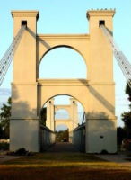
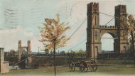
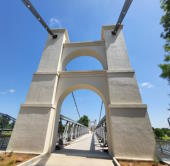
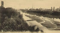
1869: Waco
Waco, Texas, USA - Brazos River
| Bridgemeister ID: | 72 (added before 2003) |
| Year Completed: | 1869 |
| Name: | Waco |
| Location: | Waco, Texas, USA |
| Crossing: | Brazos River |
| Coordinates: | 31.561314 N 97.127063 W |
| Maps: | Acme, GeoHack, Google, OpenStreetMap |
| Principals: | Thomas M. Griffith |
| References: | AAJ, BC3, BPL, BRAZ, GBD, HAERTX98, HBE, PTS2, WSB |
| Use: | Vehicular, with walkway |
| Status: | Restricted to foot traffic (last checked: 2023) |
| Main Cables: | Wire (iron) |
| Suspended Spans: | 1 |
| Main Span: | 1 x 144.8 meters (475 feet) |
| Deck width: | 18 feet |
Notes:
- 1915: Rebuilt.
- 2020, October: Closed for restoration project expecting to last 18-24 months.
- 2021, March: Major restoration project underway, led by Sparks Engineering, Inc.
- 2023, April: The restored bridge is rededicated on April 22. Patrick Sparks of Sparks Engineering reports: . The rededication was held April 22, 2023. "The project involved full rehabilitation including: replacement of the suspension system and anchor rods, strengthening of the anchorages, replacement of the saddle bearings, retrofit strengthening of the east tower, and deck replacement (concrete on the main deck, tropical hardwood on the side walks)."
External Links:
Image Sets:
1893: Dennis
Dennis, Texas, USA - Brazos River
| Bridgemeister ID: | 116 (added before 2003) |
| Year Completed: | 1893 |
| Name: | Dennis |
| Location: | Dennis, Texas, USA |
| Crossing: | Brazos River |
| Coordinates: | 32.615639 N 97.926361 W |
| Maps: | Acme, GeoHack, Google, OpenStreetMap |
| Principals: | Flinn-Moyer Co. |
| Use: | Vehicular |
| Status: | Demolished, 1962 |
| Main Cables: | Wire (steel) |
External Links:
- Flickr - Dennis, Texas Suspension Bridge. Image of the bridge. Taken c. 1960-1962.
- Flickr - Dennis, Texas Suspension Bridge. Image of the bridge. Taken c. 1960-1962.
1896: Beveridge
San Saba, Texas, USA - San Saba River
| Bridgemeister ID: | 102 (added before 2003) |
| Year Completed: | 1896 |
| Name: | Beveridge |
| Location: | San Saba, Texas, USA |
| Crossing: | San Saba River |
| Coordinates: | 31.21083 N 98.74083 W |
| Maps: | Acme, GeoHack, Google, OpenStreetMap |
| Principals: | Flinn-Moyer Co. |
| References: | HAERTX98 |
| Use: | Vehicular (one-lane) |
| Status: | Restricted to foot traffic (last checked: 2008) |
| Main Cables: | Wire |
| Suspended Spans: | 1 |
Notes:
- Located near the locally famous Wedding Oak tree.
- 1938: Reconstructed by Austin Bridge Co.
- 2006: Major restoration project completed.
External Links:
- Beveridge Bridge Restoration Project - YouTube. A 27-minute video.
- Bridgehunter.com - BH33362
- Structurae - Structure ID 20005565
Image Sets:
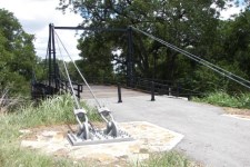
1896: Clear Fork Of The Brazos
Woodson vicinity, Shackelford County, Texas, USA - Clear Fork Brazos River
| Bridgemeister ID: | 103 (added before 2003) |
| Year Completed: | 1896 |
| Name: | Clear Fork Of The Brazos |
| Location: | Woodson vicinity, Shackelford County, Texas, USA |
| Crossing: | Clear Fork Brazos River |
| Coordinates: | 32.921611 N 99.167944 W |
| Maps: | Acme, GeoHack, Google, OpenStreetMap |
| Principals: | Flinn-Moyer Co. |
| References: | BRAZ, HAERTX64, HAERTX98 |
| Use: | Vehicular |
| Status: | Extant (last checked: 2019) |
| Main Cables: | Wire |
| Suspended Spans: | 1 |
External Links:
Image Sets:

1897: Pease River
Vernon, Texas, USA - Pease River
| Bridgemeister ID: | 5585 (added 2020-12-22) |
| Year Completed: | 1897 |
| Name: | Pease River |
| Location: | Vernon, Texas, USA |
| Crossing: | Pease River |
| Coordinates: | 34.179209 N 99.323843 W |
| Maps: | Acme, GeoHack, Google, OpenStreetMap |
| Use: | Vehicular (one-lane) |
| Status: | Destroyed, 1907 |
| Main Cables: | Wire |
Notes:
- Sometimes cited as completed 1897, 1899, or "around 1899".
- Sometimes attributed to Mitchell and Pigg, but that would have been several years before the earliest bridges typically attributed to Mitchell and Pigg. Mitchell and Pigg are more clearly associated with the 1909 replacement of this Pease River bridge. Texas suspension bridge dominant builder history generally evolved from Flinn/Moyer (1890s, early 1900s) to Mitchell/Pigg (mid-1900s thru early 1910s) to Austin Bridge (1910s onward) with design similarities (and employees) shared through that evolution.
- Destroyed by tornado, 1907. Coordinates are for the replacement suspension bridge, assumed to be on the same alignment or very close.
- Replaced by 1909 Pease River - Vernon, Texas, USA.
- All past and present bridges at this location.
1904: Brazos
Brazos, Texas, USA - Brazos River
| Bridgemeister ID: | 1857 (added 2005-07-17) |
| Year Completed: | 1904 |
| Name: | Brazos |
| Location: | Brazos, Texas, USA |
| Crossing: | Brazos River |
| Principals: | William Flinn |
| References: | HAERTX98 |
| Use: | Vehicular |
| Status: | Removed |
| Main Cables: | Wire |
| Suspended Spans: | 3 |
| Main Span: | 1 x 91.4 meters (300 feet) |
| Side Spans: | 2 x 45.7 meters (150 feet) |
1904: Dark Valley
Graford and Palo Pinto, Texas, USA - Brazos River
| Bridgemeister ID: | 921 (added 2003-10-18) |
| Year Completed: | 1904 |
| Name: | Dark Valley |
| Location: | Graford and Palo Pinto, Texas, USA |
| Crossing: | Brazos River |
| Coordinates: | 32.863306 N 98.302611 W |
| Maps: | Acme, GeoHack, Google, OpenStreetMap |
| Principals: | William Flinn |
| References: | BRAZ, HAERTX98 |
| Use: | Vehicular |
| Status: | Demolished, 1958 |
| Main Cables: | Wire (steel) |
| Suspended Spans: | 5 |
| Main Spans: | 2 x 76.2 meters (250 feet) |
| Side Spans: | 1 x 24.4 meters (80 feet), 2 x 38.1 meters (125 feet) |
| Deck width: | 16 feet |
Notes:
- The TxDOT Bridge Division website shows an image of this bridge with caption "The Dark Valley Bridge is shown here before its demolition in 1958," but BRAZ describes it as being destroyed by a flood on October 31, 1981. The TxDOT information is likely correct.
1906: Brannon's Crossing
Weatherford vicinity, Parker County, Texas, USA - Brazos River
| Bridgemeister ID: | 1298 (added 2004-03-28) |
| Year Completed: | 1906 |
| Name: | Brannon's Crossing |
| Location: | Weatherford vicinity, Parker County, Texas, USA |
| Crossing: | Brazos River |
| Coordinates: | 32.66256 N 98.03288 W |
| Maps: | Acme, GeoHack, Google, OpenStreetMap |
| Principals: | Mitchell & Pigg |
| References: | HAERTX98 |
| Use: | Vehicular |
| Status: | Replaced, 1934 |
| Main Cables: | Wire (steel) |
| Main Span: | 1 x 134.1 meters (440 feet) |
Notes:
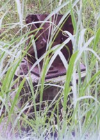
- Tony King believes he found the former location of this bridge a few hundred yards south of the I-20 Brazos River crossing west of Weatherford. This location is near a road named "Brannon Bridge Circle." Tony writes: "Just downstream from the modern Interstate 20 bridge in western Parker County, I've noticed a concrete and iron structure, and happened to take a photo of it recently. I've noticed the structure a couple of times in the past (most recently in May of 2007) while hiking a well-worn foot/ATV path that parallels the west bank of the river as it flows almost due south from the Interstate to Meeks Bend." The structure in Tony's photo appears to be a pier or support footing. The coordinates given here are Tony's approximation of the location of the structure.
- Built as part of the same contract as the Tin Top bridge.
- Similar to 1906 Tin Top (Hightower Valley) - Tin Top, Texas, USA.
Image Sets:
1906: Tin Top
Tin Top, Texas, USA - Brazos River
| Bridgemeister ID: | 119 (added before 2003) |
| Year Completed: | 1906 |
| Name: | Tin Top |
| Also Known As: | Hightower Valley |
| Location: | Tin Top, Texas, USA |
| Crossing: | Brazos River |
| Coordinates: | 32.575956 N 97.822697 W |
| Maps: | Acme, GeoHack, Google, OpenStreetMap |
| Principals: | Mitchell & Pigg |
| References: | BRAZ, HAERTX98 |
| Use: | Vehicular |
| Status: | Collapsed, Jan. 31, 1982 under weight of snow |
| Main Cables: | Wire (steel) |
| Main Span: | 1 x 121.9 meters (400 feet) |
Notes:
- Some internet resources suggest the "Tin Top" and "Hightower" suspension bridges were separate nearby structures, however, this does not appear to have been the case. Both names were used to describe the same structure and USGS topographical maps from the 1950s label the bridge due south of Tin Top as "Hightower". Mitchell and Pigg did build a similar structure, at Brannon's Crossing. The 2015 National Register of Historic Places Registration Form for "Historic Road Infrastructure of Texas, 1866-1965", the Texas Department of Transportation writes: "In 1905 [Mitchell and Pigg] constructed the practically identical Brannon's Crossing and Hightower Valley Bridges across the Brazos in Parker County. The former was a 440-foot clear span while the later, also known as Tin Top, was 400 feet."
- The coordinates appear to be the exact location of a pier remaining (as of 2020) from this bridge. The alignment indicated by the pier appears to exactly match the location of this bridge as indicated by 1958 USGS topographical map of the area.
- Similar to 1906 Brannon's Crossing - Weatherford vicinity, Parker County, Texas, USA.
Image Sets:
1908: Newcastle
Newcastle, Texas, USA - Brazos River
| Bridgemeister ID: | 1299 (added 2004-03-28) |
| Year Completed: | 1908 |
| Name: | Newcastle |
| Location: | Newcastle, Texas, USA |
| Crossing: | Brazos River |
| Principals: | Mitchell & Pigg |
| References: | HAERTX98 |
| Use: | Vehicular |
| Status: | Collapsed, 1930 |
| Main Cables: | Wire (steel) |
| Suspended Spans: | 3 |
| Main Span: | 1 x 213.4 meters (700 feet) |
| Side Spans: | 2 |
Notes:
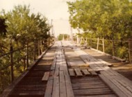
- Collapsed during flood, 1930.
1908: South Bend
South Bend, Texas, USA - Brazos River
| Bridgemeister ID: | 1858 (added 2005-07-17) |
| Year Completed: | 1908 |
| Name: | South Bend |
| Also Known As: | Hot Wells Road |
| Location: | South Bend, Texas, USA |
| Crossing: | Brazos River |
| Coordinates: | 33.003333 N 98.674139 W |
| Maps: | Acme, GeoHack, Google, OpenStreetMap |
| Principals: | Mitchell & Pigg |
| References: | HAERTX98 |
| Use: | Vehicular |
| Status: | Removed |
| Main Cables: | Wire |
| Main Span: | 1 x 121.9 meters (400 feet) |
Notes:
- As of the 2020s tower piers are still standing just west of the current Hot Wells Road bridge.
External Links:
1909: Pease River
Vernon, Texas, USA - Pease River
| Bridgemeister ID: | 597 (added 2003-01-11) |
| Year Completed: | 1909 |
| Name: | Pease River |
| Location: | Vernon, Texas, USA |
| Crossing: | Pease River |
| Coordinates: | 34.179636 N 99.324038 W |
| Maps: | Acme, GeoHack, Google, OpenStreetMap |
| Principals: | Mitchell & Pigg |
| References: | AUB |
| Use: | Vehicular |
| Status: | Only towers remain |
| Main Cables: | Wire |
| Suspended Spans: | 4 |
| Main Spans: | 2 |
| Side Spans: | 2 |
Notes:
- In September 2006, Howard Laker writes: "The bridge is no longer there, but one tower is still standing. It is located adjacent to US 287 and can be easily seen."
- 1927: Collapsed under weight of convoy of trucks.
- Replaced 1897 Pease River - Vernon, Texas, USA.
- All past and present bridges at this location.
External Links:
| Bridgemeister ID: | 600 (added 2003-01-11) |
| Year Completed: | 1914 |
| Name: | 98th Meridian |
| Also Known As: | Byers |
| Location: | Byers, Texas and Temple, Oklahoma, USA |
| Crossing: | Red River |
| Coordinates: | 34.124507 N 98.214251 W |
| Maps: | Acme, GeoHack, Google, OpenStreetMap |
| Principals: | Mitchell & Pigg |
| References: | AUB, HAERTX98, PTS2 |
| Use: | Vehicular |
| Status: | Destroyed, 1923 |
| Main Cables: | Wire (steel) |
| Suspended Spans: | 4 |
| Main Spans: | 3 x 172.8 meters (567 feet) |
| Side Span: | 1 x 32.6 meters (107 feet) |
Notes:
- Destroyed by tornado, 1923.
- Coordinates are the exact location of one of the remaining (as of 2020) piers of either this bridge or its replacement suspension bridge. Additional piers, south of that location, are also visible in satellite images.
- Replaced by 1923 98th Meridian (Byers) - Byers vicinity, Texas and Temple, Oklahoma, USA.
- Later at same location 1925 (pipeline bridge) - Byers vicinity, Texas and Hastings, Oklahoma, USA.
- All past and present bridges at this location.
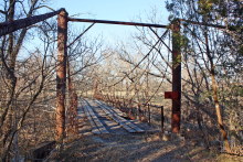
1917: Rock Church
Tolar vicinity, Hood County, Texas, USA - Paluxy River
| Bridgemeister ID: | 136 (added before 2003) |
| Year Completed: | 1917 |
| Name: | Rock Church |
| Location: | Tolar vicinity, Hood County, Texas, USA |
| Crossing: | Paluxy River |
| Coordinates: | 32.301402 N 97.957657 W |
| Maps: | Acme, GeoHack, Google, OpenStreetMap |
| References: | HAERTX98 |
| Use: | Vehicular (one-lane) |
| Status: | Extant (last checked: 2018) |
| Main Cables: | Wire |
| Suspended Spans: | 1 |
External Links:
Image Sets:
| Bridgemeister ID: | 595 (added 2003-01-11) |
| Year Completed: | 1917 |
| Name: | Terral-Ringgold |
| Location: | Ringgold, Texas and Terral, Oklahoma, USA |
| Crossing: | Red River |
| Coordinates: | 33.878143 N 97.934776 W |
| Maps: | Acme, GeoHack, Google, OpenStreetMap |
| References: | AUB, PTS2 |
| Use: | Vehicular |
| Status: | Removed |
| Main Cables: | Wire |
| Suspended Spans: | 5 |
| Main Spans: | 3 x 137.2 meters (450 feet) |
| Side Spans: | 2 |
Notes:
- 1931: Replacement opened.
| Bridgemeister ID: | 5589 (added 2020-12-22) |
| Year Completed: | 1923 |
| Name: | 98th Meridian |
| Also Known As: | Byers |
| Location: | Byers vicinity, Texas and Temple, Oklahoma, USA |
| Crossing: | Red River |
| Coordinates: | 34.127249 N 98.214114 W |
| Maps: | Acme, GeoHack, Google, OpenStreetMap |
| Principals: | Austin Bridge Co. |
| References: | AUB |
| Use: | Vehicular |
| Status: | Destroyed, 1938 |
| Main Cables: | Wire (steel) |
Notes:
- AUB describes the Byers bridge: "This bridge, three spans of 567' each, one side span of 107', and a 16' roadway, had originally been built in 1914."
- 1935: Damaged by flood.
- 1938: Destroyed by flood.
- Replaced 1914 98th Meridian (Byers) - Byers, Texas and Temple, Oklahoma, USA.
- Next to 1925 (pipeline bridge) - Byers vicinity, Texas and Hastings, Oklahoma, USA.
- All past and present bridges at this location.
Image Sets:
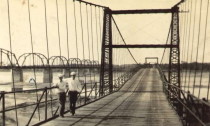
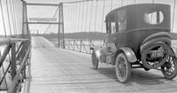
| Bridgemeister ID: | 140 (added before 2003) |
| Year Completed: | 1924 |
| Name: | Nocona |
| Also Known As: | Bluff, Ketchum Bluff, Ketchum's Bluff |
| Location: | Nocona vicinity, Texas and Jefferson County, Oklahoma, USA |
| Crossing: | Red River |
| At or Near Feature: | Ketchum Bluff |
| Coordinates: | 33.93579 N 97.75869 W |
| Maps: | Acme, GeoHack, Google, OpenStreetMap |
| Principals: | Austin Bridge Co. |
| References: | AUB, HAERTX98, PTS2 |
| Use: | Vehicular |
| Status: | Only towers remain (last checked: 2007) |
| Main Cables: | Wire (steel) |
| Main Span: | 1 x 213.4 meters (700 feet) |
Notes:
- Legend has it the bridge was burned during a dispute. This likely occurred before 1955. Some sources suggest it occurred before or during 1950. The road that leads to the Texas side of the former crossing is "Burned Out Bridge Road." Follow the image of the derelict tower to see the remains of the bridge.
- AUB mentions: "In January 1924, a contract was entered into with Nocona Bridge Company for a bridge across Red River, nine miles north of Nocona, connecting Texas and Oklahoma. The plans called for a 700' span, 16' roadway, and the main cables to contain 1,000 No. 9 galvanized wires each. The building of this, [the Austin Bridge Company's] first complete cable bridge, and the experience gained therefrom helped to launch Austin Bridge Company into an interesting and profitable line of work."
External Links:
- Nocona Suspension Bridge at Ketchum Bluff, Texas. University of Texas Arlington Libraries Digital Gallery
- Bridgehunter.com - BH70626
Image Sets:
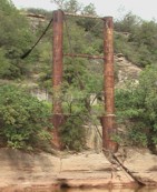
| Bridgemeister ID: | 1856 (added 2005-07-17) |
| Year Completed: | 1925 |
| Name: | (pipeline bridge) |
| Location: | Byers vicinity, Texas and Hastings, Oklahoma, USA |
| Crossing: | Red River |
| Coordinates: | 34.126861 N 98.213639 W |
| Maps: | Acme, GeoHack, Google, OpenStreetMap |
| Principals: | Austin Bridge Co. |
| References: | AUB |
| Use: | Pipeline |
| Status: | Removed |
| Main Cables: | Wire (steel) |
Notes:
- Coordinates provided here are the likely approximate location of the bridge. Two pipelines cross the Red River here. For many years they were elevated above the river. Piers are still (as of the 2020s) visible on the alignment indicated by the coordinates, and another set of piers slightly west.
- In AUB, two main spans and part of another suspended span are visible.
- At former location of 1914 98th Meridian (Byers) - Byers, Texas and Temple, Oklahoma, USA.
- Next to 1923 98th Meridian (Byers) - Byers vicinity, Texas and Temple, Oklahoma, USA.
- All past and present bridges at this location.
1926: Hidalgo-Reynosa International
Hidalgo, McAllen vicinity, Texas, USA and Reynosa, Tamaulipas, Mexico - Rio Grande
| Bridgemeister ID: | 146 (added before 2003) |
| Year Completed: | 1926 |
| Name: | Hidalgo-Reynosa International |
| Also Known As: | McAllen-Hidalgo, McAllen-Hidalgo-Reynosa |
| Location: | Hidalgo, McAllen vicinity, Texas, USA and Reynosa, Tamaulipas, Mexico |
| Crossing: | Rio Grande |
| Coordinates: | 26.095389 N 98.272000 W |
| Maps: | Acme, GeoHack, Google, OpenStreetMap |
| Principals: | Austin Bridge Co. |
| References: | AAJ, AUB, HAERTX98, PTS2 |
| Use: | Vehicular |
| Status: | Demolished, 1960's |
| Main Cables: | Wire (steel) |
| Suspended Spans: | 1 |
| Main Span: | 1 x 137.2 meters (450 feet) |
Notes:
- Damaged by flood, 1933. Rebuilt, 1934. Cables failed, 1939. Rebuilt.
External Links:
- The University of Texas Rio Grande Valley - Partial collapse of the McAllen–Hidalgo–Reynosa International. Image of the partial collapse of the bridge in 1933. Flooding completely undermined the foundation on one side.
Image Sets:
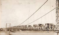
1927: Bryan-Fannin
Telephone, Bonham vicinity, Fannin County, Texas and Bryan County, Oklahoma, USA - Red River
| Bridgemeister ID: | 602 (added 2003-01-11) |
| Year Completed: | 1927 |
| Name: | Bryan-Fannin |
| Also Known As: | Telephone, Snow's Ferry, Bryant-Fannin |
| Location: | Telephone, Bonham vicinity, Fannin County, Texas and Bryan County, Oklahoma, USA |
| Crossing: | Red River |
| Coordinates: | 33.844484 N 96.011125 W |
| Maps: | Acme, GeoHack, Google, OpenStreetMap |
| Principals: | Austin Bridge Co. |
| References: | AUB, PTS2 |
| Use: | Vehicular |
| Status: | Collapsed, December, 1940 |
| Main Cables: | Wire (steel) |
| Suspended Spans: | 3 |
| Main Span: | 1 |
| Side Spans: | 2 |
Notes:
- Sometimes referenced as "Bryant-Fannin". The bridge unquestionably connected Fannin County to Bryan County, Oklahoma, but according to a www.rootsweb.com article (Fannin County TXGenWeb - Ferry's in Fannin County, from Pat Pryor, by Kathy J. Ellis) it was erected at a site known as "Bryant's Crossing" named for a local, Dave Bryant. The Steinman inventory lists it as "Bryan-Fannin". AUB mentions it as "Bryant-Fannin". The Rootsweb article also mentions it collapsed in 1940 under weight of a truck.
- An article in the December 6, 1940 issue of The Port Arthur News (Texas) titled: "Suspension Bridge Plunges Into Red River" describes the collapse: "Owners of a $75,000 tollbridge which plunged into the Red River Wednesday when a suspension cable anchor pulled loose were undecided today whether it would be rebuilt. The bridge, owned by the Austin Bridge company of Dallas, was near Telephone, Tex., 12 miles north of here, and was several miles from a principal highway. Most of the traffic from the Bonham area toward Oklahoma is across a structure built recently to replace a toll bridge at nearby Sowell's bluff that collapsed in 1930. Mrs. Jim Freeman, toll keeper, said she heard a 'rumble' and looked up to see the 'deadman anchor' pull loose, throwing the entire weight of the 1,300 foot span on the other cable. It snapped, and the flooring and steel framework of the bridge sagged into the water. No one was on the structure when it fell."
- Remains of three piers are still visible, 2019.
1927: Durant-Bonham
Bonham vicinity, Fannin County, Texas and Yuba/Durant vicinity, Oklahoma, USA - Red River
| Bridgemeister ID: | 603 (added 2003-01-11) |
| Year Completed: | 1927 |
| Name: | Durant-Bonham |
| Also Known As: | Sowell's Bluff |
| Location: | Bonham vicinity, Fannin County, Texas and Yuba/Durant vicinity, Oklahoma, USA |
| Crossing: | Red River |
| Principals: | Austin Bridge Co. |
| References: | AUB, PTS2 |
| Use: | Vehicular |
| Status: | Collapsed, 1934 |
| Main Cables: | Wire (steel) |
Notes:
- According to a rootsweb article (Fannin County TXGenWeb - Ferry's in Fannin County, from Pat Pryor, by Kathy J. Ellis), "when in 1932 this bridge fell, many people said that acid had been put on the cables to break them so that people from Oklahoma could not cross to Bonham." However, the true date of collapse may have been in 1934. The February 2, 1934 issue of The Daily Oklahoman has a front-page article with a photo of the bridge with collapsed deck. The photo is captioned: "The Red River Bridge on Highway 22 Near Durant After the Midnight Crash," and the article reads: "Here Is the debris of a $60,000 investment made by the states of Oklahoma and Texas eight months ago when they purchased the Bonham-Durant bridge across the Red river on highway 22. Three of the five spans of the 1,500-foot suspension bridge turned upside down and dropped into the river bed when a four-Inch wire cable rusted and broke in two about 15 feet from the ground on the Texas side. A lull in the usual heavy traffic across the bridge prevented accidents. The crash came at midnight, and one motorist had barely reached the Texas side when the cable gave away. Other motorists stopped their cars just in time to witness the spans of the bridge crash 40 feet into the stream. The bridge was built in 1926 and was operated as a toll bridge until 1933 when the two states bought it and made it a free crossing."
- In the October 1989 edition of the Oklahoma Water News an article (excerpted from an article in The Chronicles of Oklahoma by Dr. Bernice N. Crockett) states: "On January 15, 1934, a norther of terrific force came up which cause the Sowell's Bluff Bridge to fall. At 1 a.m. the wire cables on the Fannin side of the river became twisted, then snapped, broken in half, and the entire massive structure fell into the river below -- a complete wreck."
External Links:
1927: Saint Jo
Illinois Bend, Saint Jo vicinity, Texas and Wilson vicinity, Oklahoma, USA - Red River
| Bridgemeister ID: | 601 (added 2003-01-11) |
| Year Completed: | 1927 |
| Name: | Saint Jo |
| Also Known As: | Airline, Air-Line |
| Location: | Illinois Bend, Saint Jo vicinity, Texas and Wilson vicinity, Oklahoma, USA |
| Crossing: | Red River |
| Coordinates: | 33.917051 N 97.486010 W |
| Maps: | Acme, GeoHack, Google, OpenStreetMap |
| Principals: | Austin Bridge Co. |
| References: | AUB, PTS2 |
| Use: | Vehicular (one-lane) |
| Status: | Removed |
| Main Cables: | Wire (steel) |
| Suspended Spans: | 1 |
| Main Span: | 1 x 213.4 meters (700 feet) |
External Links:
- St Jo "Airline" Suspension Bridge over the Red River Texas - Facebook. Coordinates provided here are based on the research presented in this Bridgehunting Texas Facebook group post.
1928: (suspension bridge)
Rio Rico, Mexico and Mercedes, Texas, USA - Rio Grande
1928: Roma-Miguel Alemán International
Roma, Texas, USA and Ciudad Miguel Alemán, Mexico - Rio Grande
| Bridgemeister ID: | 157 (added before 2003) |
| Year Completed: | 1928 |
| Name: | Roma-Miguel Alemán International |
| Also Known As: | Roma-San Pedro International |
| Location: | Roma, Texas, USA and Ciudad Miguel Alemán, Mexico |
| Crossing: | Rio Grande |
| Coordinates: | 26.403821 N 99.018856 W |
| Maps: | Acme, GeoHack, Google, OpenStreetMap |
| Principals: | George Cole, Starr County Bridge Co., Compañía del Puente de San Pedro de Roma |
| References: | HAERTX98, PTS2 |
| Use: | Vehicular |
| Status: | Closed, 1979 (last checked: 2024) |
| Main Cables: | Wire (steel) |
| Suspended Spans: | 1 |
| Main Span: | 1 x 192 meters (629.9 feet) |
| Deck width: | 6.9 meters |
Notes:
- 2024, April: Funds secured to restore the bridge.
External Links:
- Funds secured to restore historic international suspension bridge in South Texas | WGNO.com. Article dated April 24, 2024 regarding funds secured for the bridge's restoration: "Final plans for the bridge’s renovation aren’t clear, but there is talk that the old suspension bridge could become a pedestrian bridge, since it is located next to the current vehicular international bridge"
- Bridgehunter.com - BH33373
- Structurae - Structure ID 20005556
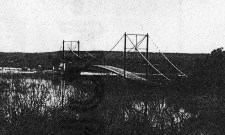
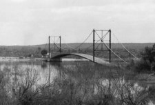
1928: Zapata
Zapata, Texas, USA and Ciudad Guerrero, Mexico - Rio Grande
| Bridgemeister ID: | 1445 (added 2004-07-31) |
| Year Completed: | 1928 |
| Name: | Zapata |
| Location: | Zapata, Texas, USA and Ciudad Guerrero, Mexico |
| Crossing: | Rio Grande |
| Coordinates: | 26.878472 N 99.326563 W |
| Maps: | Acme, GeoHack, Google, OpenStreetMap |
| References: | HAERTX98, PTS2 |
| Use: | Vehicular |
| Status: | Inundated, 1953 |
| Main Cables: | Wire (steel) |
| Suspended Spans: | 3 |
| Main Span: | 1 x 165 meters (541.3 feet) |
| Side Spans: | 2 |
Notes:
- Inundated during creation of Falcon Reservoir.
Image Sets:
| Bridgemeister ID: | 2378 (added 2007-10-21) |
| Year Completed: | 1929 |
| Name: | Idabel-Clarksville |
| Location: | Idabel vicinity, Oklahoma and Clarksville vicinity, Texas, USA |
| Crossing: | Red River |
| Principals: | Austin Bridge Co. |
| References: | AUB |
| Use: | Vehicular |
| Status: | Destroyed, 1933 |
| Main Cables: | Wire (steel) |
| Suspended Spans: | 3 |
| Main Span: | 1 x 213.4 meters (700 feet) |
| Side Spans: | 2 x 76.2 meters (250 feet) |
| Deck width: | 16 feet |
Notes:
- The November 1933 issue of The Wisconsin Engineer (a publication of the University of Wisconsin) has an article by C.W.P. Walter about research that was being performed by the University of Wisconsin's Engineering Department: "The particular hardware laden contrivance [in the Engineering Building] is a half-model of the Red River Bridge which carried light highway traffic between Clarksville, Texas, and Idabel, Oklahoma. In the early part of this year movement of the Red River as a result of flood waters washed away one of the intermediate piers supporting the end spans, and cause the cable to drop and be subjected to impact loading. It was contended by the company owning the bridge that the cable was overstressed and injured to such an extent that it would be necessary for the insurance company to replace the cable as well as the pier. A committee... was appointed to investigate the questions involved. While the investigation proceeded the Red River continued to scour away the foundation of the existing piers, ultimately causing the bridge to collapse completely."
- AUB mentions this bridge very briefly: "In 1928, [Jim Diamond] was employed by Austin Bridge Company as a consultant on the super-structure and cable work for the White River bridge at Des Arc. Later in the same year, he represented the owners as job engineer on the bridge built by the Company across Red River above Clarksville, Texas."
- Apparently this bridge was damaged by flood the same week it was supposed to open. In the October 1989 edition of the Oklahoma Water News an article (excerpted from an article in The Chronicles of Oklahoma by Dr. Bernice N. Crockett) writes: "The Austin Bridge Company completed the bridge May 19, 1929, but on May 23, when more than 400 people went to see the new bridge opened, an estimated 40 feet of the Red River bank had caved in near the bridge. Heavy rains continued to hinder road construction. A resident near the bridge recalled the night of May 19, 1929, as the night the river changed its course, and by morning had moved the entire structure into Oklahoma." The bridge eventually opened on June 20.
- The Friday December 30, 1932 edition of The Port Arthur News ran an article "Red River Bridge Damaged By Water". Texarkana, Dec. 30 (1932).: "High stages in Red River, that earlier this week demolished the Texas side approach to the privately owned suspension bridge [?] miles north of Clarksville on highway 37 to Idabel have been in recession since Wednesday but indicated continued heavy rains such as last night are expected to bring additional high water with probably further damage to the bridge. More than 50 feet of the approach is gone and the ground piers have crumpled, leaving the anchor cables alone holding the bridge in place."
- It appears the final end to this short-lived bridge didn't come until late May, 1933 when it was completely destroyed by flood.
External Links:
- Historic Suspension Bridges: Advent of the State Highway Department. This Texas Department of Transportation page mentions: "Five of the eleven suspension bridges built by [Austin Bridge Company] were toll bridges over the Red River. The Red River is notorious for its volatile, melting, red clay banks. The bridge between Clarksville, Texas, and Idabel, Oklahoma, was built by ABC in 1928, and washed out during flooding in 1932."
1931: Buchanan Dam
Buchanan Dam, Texas, USA - Colorado River
| Bridgemeister ID: | 2514 (added 2009-12-30) |
| Year Completed: | 1931 |
| Name: | Buchanan Dam |
| Location: | Buchanan Dam, Texas, USA |
| Crossing: | Colorado River |
| Use: | Vehicular (one-lane) |
| Status: | Removed |
| Main Cables: | Wire (steel) |
| Suspended Spans: | 1 |
Notes:
- Large one-lane suspension bridge built during the construction of Buchanan Dam.
1939: Bend
Bend, Texas, USA - Colorado River
| Bridgemeister ID: | 1616 (added 2005-02-26) |
| Year Completed: | 1939 |
| Name: | Bend |
| Location: | Bend, Texas, USA |
| Crossing: | Colorado River |
| Coordinates: | 31.101306 N 98.514083 W |
| Maps: | Acme, GeoHack, Google, OpenStreetMap |
| Principals: | Austin Bridge Co. |
| References: | AUB |
| Use: | Vehicular |
| Status: | Removed |
| Main Cables: | Wire (steel) |
| Suspended Spans: | 3 |
| Main Span: | 1 |
| Side Spans: | 2 |
Notes:
- Crossed the Colorado River a bit north of the current (2020s) bridge at Bend.
- Similar to 1939 Regency - Regency, Texas, USA. The Bend bridge is pictured in AUB. At first, I thought it was the nearby Regency bridge, but upon closer inspection, the Bend bridge had suspended approach spans. Regency did not. Otherwise, they are very similar in appearance, both having been built in the same year by the same company.
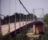
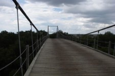
1939: Regency
Regency, Texas, USA - Colorado River
| Bridgemeister ID: | 195 (added before 2003) |
| Year Completed: | 1939 |
| Name: | Regency |
| Location: | Regency, Texas, USA |
| Crossing: | Colorado River |
| Coordinates: | 31.41167 N 98.84667 W |
| Maps: | Acme, GeoHack, Google, OpenStreetMap |
| Principals: | Austin Bridge Co. |
| References: | AUB |
| Use: | Vehicular (one-lane) |
| Status: | In use (last checked: 2008) |
| Main Cables: | Wire (steel) |
| Suspended Spans: | 1 |
| Main Span: | 1 x 103.6 meters (340 feet) |
Notes:
- Similar to 1939 Bend - Bend, Texas, USA.
External Links:
Image Sets:

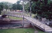
1976: (footbridge)
Lampasas, Texas, USA - Sulphur Creek
| Bridgemeister ID: | 1258 (added 2004-03-06) |
| Year Completed: | 1976 |
| Name: | (footbridge) |
| Location: | Lampasas, Texas, USA |
| Crossing: | Sulphur Creek |
| Coordinates: | 31.05598 N 98.18108 W |
| Maps: | Acme, GeoHack, Google, OpenStreetMap |
| Use: | Footbridge |
| Status: | In use (last checked: 2004) |
| Main Cables: | Rod |
| Suspended Spans: | 1 |
| Main Span: | 1 x 19.8 meters (65 feet) |
Notes:
- It is doubtful that this is a true suspension bridge. Follow the picture for more on this observation.
Image Sets:
2001: (footbridge)
Houston, Texas, USA - ravine along Lake Carter
| Bridgemeister ID: | 967 (added 2003-11-01) |
| Year Completed: | 2001 |
| Name: | (footbridge) |
| Location: | Houston, Texas, USA |
| Crossing: | ravine along Lake Carter |
| Coordinates: | 29.77431 N 95.47557 W |
| Maps: | Acme, GeoHack, Google, OpenStreetMap |
| Principals: | Sahale, LLC. |
| Use: | Footbridge |
| Status: | In use |
| Main Cables: | Wire (steel) |
| Suspended Spans: | 1 |
| Main Span: | 1 x 20.1 meters (66 feet) |
| Deck width: | 4 feet |
Notes:
- This bridge is located on private property.
External Links:
| Bridgemeister ID: | 2697 (added 2019-05-27) |
| Year Completed: | 2003 |
| Name: | Bob Mac's Crossing |
| Location: | Athens, Texas, USA |
| At or Near Feature: | East Texas Arboretum |
| Coordinates: | 32.207487 N 95.878114 W |
| Maps: | Acme, GeoHack, Google, OpenStreetMap |
| Principals: | Bob McDonald, San Jacinto Engineering |
| Use: | Footbridge |
| Status: | In use (last checked: 2019) |
| Main Cables: | Wire (steel) |
External Links:
(footbridge)
Belton vicinity, Texas, USA - Lampasas River
| Bridgemeister ID: | 1056 (added 2003-12-13) |
| Name: | (footbridge) |
| Location: | Belton vicinity, Texas, USA |
| Crossing: | Lampasas River |
| At or Near Feature: | Chalk Ridge Falls Park |
| Coordinates: | 31.018 N 97.525 W |
| Maps: | Acme, GeoHack, Google, OpenStreetMap |
| Use: | Footbridge |
| Status: | In use (last checked: 2020) |
| Main Cables: | Wire (steel) |
| Suspended Spans: | 1 |
Notes:
- Short footbridge with wood towers near Stillhouse Hollow Lake Dam.
(footbridge)
Del Rio, Texas, USA - San Felipe Creek
| Bridgemeister ID: | 1352 (added 2004-05-14) |
| Name: | (footbridge) |
| Location: | Del Rio, Texas, USA |
| Crossing: | San Felipe Creek |
| Coordinates: | 29.369034 N 100.884902 W |
| Maps: | Acme, GeoHack, Google, OpenStreetMap |
| Use: | Footbridge |
| Status: | In use (last checked: 2019) |
| Main Cables: | Wire (steel) |
| Suspended Spans: | 1 |
| Main Span: | 1 x 24.4 meters (80 feet) |
External Links:
Image Sets:
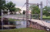
(footbridge)
El Paso, Texas, USA - Rio Grande
| Bridgemeister ID: | 1562 (added 2004-11-27) |
| Name: | (footbridge) |
| Location: | El Paso, Texas, USA |
| Crossing: | Rio Grande |
| Use: | Footbridge |
| Status: | Removed |
| Main Cables: | Wire |
| Suspended Spans: | 1 |
Notes:
- Narrow long footbridge circa early 1900s.
External Links:
- Swing Bridge over Rio Grande River, El Paso, Texas, 1912. Northern Arizona University, Cline Library, Colorado Plateau Digital Collections
(footbridge)
Graham, Texas, USA - Salt Creek
| Bridgemeister ID: | 1464 (added 2004-08-28) |
| Name: | (footbridge) |
| Location: | Graham, Texas, USA |
| Crossing: | Salt Creek |
| At or Near Feature: | Fireman's Park |
| Coordinates: | 33.113059 N 98.597555 W |
| Maps: | Acme, GeoHack, Google, OpenStreetMap |
| Use: | Footbridge |
| Status: | In use (last checked: 2008) |
| Main Cables: | Wire |
| Suspended Spans: | 1 |
(footbridge)
Wichita Falls, Texas, USA - Wichita River
| Bridgemeister ID: | 1060 (added 2003-12-13) |
| Name: | (footbridge) |
| Location: | Wichita Falls, Texas, USA |
| Crossing: | Wichita River |
| At or Near Feature: | Lucy Park |
| Coordinates: | 33.917 N 98.51218 W |
| Maps: | Acme, GeoHack, Google, OpenStreetMap |
| Use: | Footbridge |
| Status: | In use (last checked: 2012) |
| Main Cables: | Wire |
(pipeline bridge)
Antioch vicinity, Texas, USA - Trinity River
| Bridgemeister ID: | 3327 (added 2019-12-01) |
| Name: | (pipeline bridge) |
| Location: | Antioch vicinity, Texas, USA |
| Crossing: | Trinity River |
| Coordinates: | 31.061728 N 95.651119 W |
| Maps: | Acme, GeoHack, Google, OpenStreetMap |
| Use: | Pipeline |
| Status: | Extant (last checked: 2019) |
| Main Cables: | Wire (steel) |
Notes:
- 2019: Appears to be flood damaged.
(pipeline bridge)
Dayton Lakes vicinity, Texas, USA - Trinity River
| Bridgemeister ID: | 3326 (added 2019-12-01) |
| Name: | (pipeline bridge) |
| Location: | Dayton Lakes vicinity, Texas, USA |
| Crossing: | Trinity River |
| Coordinates: | 30.213426 N 94.825076 W |
| Maps: | Acme, GeoHack, Google, OpenStreetMap |
| Use: | Pipeline |
| Status: | Extant (last checked: 2019) |
| Main Cables: | Wire (steel) |
(pipeline bridge)
Orchard vicinity, Texas, USA - Brazos River
| Bridgemeister ID: | 2656 (added 2019-03-03) |
| Name: | (pipeline bridge) |
| Location: | Orchard vicinity, Texas, USA |
| Crossing: | Brazos River |
| Coordinates: | 29.636886 N 95.980795 W |
| Maps: | Acme, GeoHack, Google, OpenStreetMap |
| Use: | Pipeline |
| Status: | Extant (last checked: 2018) |
| Main Cables: | Wire (steel) |
(pipeline bridge)
Sealy and Brookshire, Texas, USA - Brazos River
| Bridgemeister ID: | 2655 (added 2019-03-03) |
| Name: | (pipeline bridge) |
| Location: | Sealy and Brookshire, Texas, USA |
| Crossing: | Brazos River |
| Coordinates: | 29.772165 N 96.036434 W |
| Maps: | Acme, GeoHack, Google, OpenStreetMap |
| Use: | Pipeline |
| Status: | Extant (last checked: 2014) |
| Main Cables: | Wire (steel) |
Notes:
- Adjacent to I-10 Brazos River crossing.
(pipeline bridge)
Wallis vicinity, Texas, USA - Brazos River
| Bridgemeister ID: | 2657 (added 2019-03-03) |
| Name: | (pipeline bridge) |
| Location: | Wallis vicinity, Texas, USA |
| Crossing: | Brazos River |
| Coordinates: | 29.649584 N 96.024012 W |
| Maps: | Acme, GeoHack, Google, OpenStreetMap |
| Use: | Pipeline |
| Status: | Extant (last checked: 2018) |
| Main Cables: | Wire (steel) |
Notes:
(pipeline bridge)
Wallis vicinity, Texas, USA - Brazos River
| Bridgemeister ID: | 2658 (added 2019-03-03) |
| Name: | (pipeline bridge) |
| Location: | Wallis vicinity, Texas, USA |
| Crossing: | Brazos River |
| Coordinates: | 29.648674 N 96.022830 W |
| Maps: | Acme, GeoHack, Google, OpenStreetMap |
| Use: | Pipeline |
| Status: | Extant (last checked: 2018) |
| Main Cables: | Wire (steel) |
Notes:
(suspension bridge)
Bazette Crossing and Trinidad, Texas, USA - Trinity River
| Bridgemeister ID: | 598 (added 2003-01-11) |
| Name: | (suspension bridge) |
| Location: | Bazette Crossing and Trinidad, Texas, USA |
| Crossing: | Trinity River |
| References: | AUB |
| Status: | Removed |
| Main Cables: | Wire |
Notes:
- Repaired by Austin Bridge Company, 1922.
(suspension bridge)
Decatur vicinity, Wise County, Texas, USA - Trinity River
| Bridgemeister ID: | 599 (added 2003-01-11) |
| Name: | (suspension bridge) |
| Location: | Decatur vicinity, Wise County, Texas, USA |
| Crossing: | Trinity River |
| References: | AUB |
Notes:
- Repaired by Austin Bridge Company, 1923.
| Bridgemeister ID: | 279 (added before 2003) |
| Name: | (suspension bridge) |
| Location: | Gainesville vicinity, Texas and Love County, Oklahoma, USA |
| Crossing: | Red River |
| Coordinates: | 33.718156 N 97.129504 W |
| Maps: | Acme, GeoHack, Google, OpenStreetMap |
| Use: | Vehicular |
| Status: | Removed |
| Main Cables: | Wire |
External Links:
- Lost Red River Suspension Bridges - Gainesville Texas. Coordinates provided here are based on the research presented in this Bridgehunting Texas Facebook group post.
(suspension bridge)
Mineral Wells and Palo Pinto, Texas, USA - Brazos River
| Bridgemeister ID: | 596 (added 2003-01-11) |
| Name: | (suspension bridge) |
| Location: | Mineral Wells and Palo Pinto, Texas, USA |
| Crossing: | Brazos River |
| Coordinates: | 32.797500 N 98.186306 W |
| Maps: | Acme, GeoHack, Google, OpenStreetMap |
| References: | AUB |
| Status: | Removed |
| Main Cables: | Wire |
External Links:
(suspension bridge)
Opelika, Henderson County, Texas, USA - Kickapoo Creek
| Bridgemeister ID: | 2025 (added 2006-02-11) |
| Name: | (suspension bridge) |
| Location: | Opelika, Henderson County, Texas, USA |
| Crossing: | Kickapoo Creek |
| Use: | Vehicular (one-lane) |
| Status: | Removed |
| Main Cables: | Wire |
| Suspended Spans: | 1 |
Notes:
- Cecelia Viteri writes: "the bridge was built around 1920 over the Kickapoo Creek, Henderson County Texas, near a now defunct rural town of Opelika. My great-grandfather's farm bordered the creek, which is a tributary of the Neches River. I was on this bridge several times, and it was dismantled mid-1960s. It was wide enough for cars to cross it, one at a time."
Image Sets:
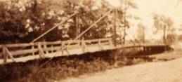
Buffalo Bayou
Houston, Texas, USA - Buffalo Bayou
| Bridgemeister ID: | 2693 (added 2019-05-27) |
| Name: | Buffalo Bayou |
| Location: | Houston, Texas, USA |
| Crossing: | Buffalo Bayou |
| At or Near Feature: | Bayou Bend Collection and Gardens |
| Coordinates: | 29.758388 N 95.421279 W |
| Maps: | Acme, GeoHack, Google, OpenStreetMap |
| Use: | Footbridge |
| Status: | In use (last checked: 2019) |
| Main Cables: | Wire (steel) |
Choctaw Creek
Bells vicinity, Grayson County, Texas, USA - Choctaw Creek
| Bridgemeister ID: | 133 (added before 2003) |
| Name: | Choctaw Creek |
| Location: | Bells vicinity, Grayson County, Texas, USA |
| Crossing: | Choctaw Creek |
| Coordinates: | 33.650717 N 96.480981 W |
| Maps: | Acme, GeoHack, Google, OpenStreetMap |
| Principals: | William H. C. Greer |
| References: | HAERTX98 |
| Use: | Vehicular (one-lane) |
| Status: | Derelict (last checked: 2018) |
| Main Cables: | Wire |
| Suspended Spans: | 1 |
Notes:
- Likely built in the 1910s.
External Links:
Image Sets:
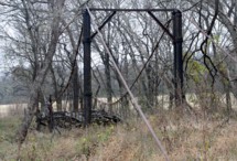
Dalton
Bloomington, Texas, USA - Guadalupe River
| Bridgemeister ID: | 4937 (added 2020-08-08) |
| Name: | Dalton |
| Location: | Bloomington, Texas, USA |
| Crossing: | Guadalupe River |
| Coordinates: | 28.658664 N 96.962659 W |
| Maps: | Acme, GeoHack, Google, OpenStreetMap |
| Use: | Vehicular (one-lane) |
| Status: | Derelict (last checked: 2020) |
| Main Cables: | Wire |
External Links:
Hamilton Dam
Blufton, Texas, USA - Colorado River
| Bridgemeister ID: | 4949 (added 2020-08-08) |
| Name: | Hamilton Dam |
| Location: | Blufton, Texas, USA |
| Crossing: | Colorado River |
| Status: | Removed |
| Main Cables: | Wire (steel) |
Notes:
- Completed 1930s during construction of the Hamilton (now Buchanan) Dam. Appears to have been a large one-lane bridge. Likely removed during 1930s.
| Bridgemeister ID: | 8956 (added 2024-11-29) |
| Name: | Skull Island |
| Location: | Arlington, Texas, USA |
| At or Near Feature: | Six Flags over Texas Amusement Park |
| Coordinates: | 32.757306 N 97.069528 W |
| Maps: | Acme, GeoHack, Google, OpenStreetMap |
| Use: | Footbridge |
| Status: | Removed, 1968 |
| Main Cables: | Wire (steel) |
Notes:
- Part of the Skull Island attraction within the Six Flags over Texas amusement park. The bridge was removed in 1968. The current (2020s) Roaring Rapids ride occupies much of the former Skull Island space. Coordinates provided here are the approximate location of the bridge.
Image Sets:

Do you have any information or photos for these bridges that you would like to share? Please email david.denenberg@bridgemeister.com.
Mail | Facebook | X (Twitter) | Bluesky