Suspension Bridges of New York
This is a list of all 80 bridges from the suspension bridge inventory for New York in USA. Wherever you see a Bridgemeister ID number click it to isolate the bridge on its own page.
Related Lists:
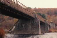
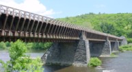
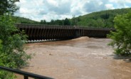
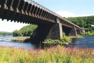
1848: Delaware Aqueduct
Lackawaxen, Pennsylvania and Minisink Ford, New York, USA - Delaware River
| Bridgemeister ID: | 30 (added before 2003) |
| Year Completed: | 1848 |
| Name: | Delaware Aqueduct |
| Also Known As: | Roebling Aqueduct |
| Location: | Lackawaxen, Pennsylvania and Minisink Ford, New York, USA |
| Crossing: | Delaware River |
| Coordinates: | 41.48262 N 74.98461 W |
| Maps: | Acme, GeoHack, Google, OpenStreetMap |
| Principals: | John A. Roebling |
| References: | AAJ, BDR, BOB, BPL, GBD, LAB, LACE, RDH, SJR |
| Use: | Aqueduct and Vehicular (one-lane), with walkway |
| Status: | In use (last checked: 2006) |
| Main Cables: | Wire (iron) |
| Suspended Spans: | 4 |
| Main Spans: | 1 x 43.3 meters (142 feet), 3 x 39.9 meters (131 feet) |
Notes:
- BPL: Completed 1848. RDH/BDR: Completed 1848, not used until 1849.
- Originally constructed to carry the Delaware and Hudson Canal. Converted to a one-lane vehicular bridge soon after the canal closed in 1898. Substantially restored in 1980's and 1990's, but retains original cables.
- Built as part of same project as 1849 Lackawaxen Aqueduct - Lackawaxen, Pennsylvania, USA.
- Built as part of same project as 1851 High Falls Aqueduct - High Falls, New York, USA.
- Built as part of same project as 1851 Neversink Aqueduct - Cuddebackville, New York, USA.
- Near 1849 Lackawaxen Aqueduct - Lackawaxen, Pennsylvania, USA.
External Links:
Image Sets:
1848: Niagara Suspension
Niagara Falls, New York, USA and Niagara Falls, Ontario, Canada - Niagara River
| Bridgemeister ID: | 29 (added before 2003) |
| Year Completed: | 1848 |
| Name: | Niagara Suspension |
| Location: | Niagara Falls, New York, USA and Niagara Falls, Ontario, Canada |
| Crossing: | Niagara River |
| Principals: | Charles Ellet |
| References: | BOB, BPL, HBE, ONF, PTS2 |
| Use: | Vehicular (one-lane) |
| Status: | Removed |
| Main Cables: | Wire (iron) |
| Suspended Spans: | 1 |
| Main Span: | 1 x 234.7 meters (770 feet) |
| Deck width: | 7.5 feet |
Notes:
1851: High Falls Aqueduct
High Falls, New York, USA - Rondout Creek
| Bridgemeister ID: | 34 (added before 2003) |
| Year Completed: | 1851 |
| Name: | High Falls Aqueduct |
| Location: | High Falls, New York, USA |
| Crossing: | Rondout Creek |
| Coordinates: | 41.828889 N 74.126583 W |
| Maps: | Acme, GeoHack, Google, OpenStreetMap |
| Principals: | John A. Roebling |
| References: | AAJ, BOB, BPL, RDH, SJR |
| Use: | Aqueduct |
| Status: | Removed, August, 1921 |
| Main Cables: | Wire (iron) |
| Suspended Spans: | 1 |
| Main Span: | 1 x 44.2 meters (145 feet) |
Notes:
- BPL, AAJ say completed 1848, RDH says not used until 1851 canal season.
- Heavy damaged by fire, 1921.
- Built as part of same project as 1848 Delaware Aqueduct (Roebling Aqueduct) - Lackawaxen, Pennsylvania and Minisink Ford, New York, USA.
- Built as part of same project as 1849 Lackawaxen Aqueduct - Lackawaxen, Pennsylvania, USA.
- Built as part of same project as 1851 Neversink Aqueduct - Cuddebackville, New York, USA.
External Links:
1851: Lewiston-Queenston
Lewiston, New York, USA and Queenston, Ontario, Canada - Niagara River
| Bridgemeister ID: | 35 (added before 2003) |
| Year Completed: | 1851 |
| Name: | Lewiston-Queenston |
| Location: | Lewiston, New York, USA and Queenston, Ontario, Canada |
| Crossing: | Niagara River |
| Principals: | Edward Serrell |
| References: | AAJ, BOB, BPL, HBE, PTS2 |
| Use: | Vehicular |
| Status: | Wrecked, 1864 |
| Main Cables: | Wire (iron) |
| Suspended Spans: | 1 |
| Main Span: | 1 x 258.8 meters (849 feet) |
| Deck width: | 21 feet (AAJ: 19.5 feet) |
Notes:
- Wrecked by wind February 1, 1864. Stay cables beneath the bridge had been disconnected to avoid damage from rising ice. Portions of the cables and deck remained, in a derelict state, as late as 1895. Replacement was not started until the late 1890's.
- The February 3, 1864 edition of Niagara Falls Gazette describes the wind event: "Partial Destruction Of The Lewiston Suspension Bridge -- A portion of the flooring and other wood-work of the Lewiston Suspension Bridge was blown down during the gale Monday forenoon. It seems that the long guys had been cut during the late ice jam to prevent injury to the structure and thus its strength to withstand a gale was much weakened. The wind swept through the gorge on Monday with terrific force and swayed the bridge so that some of the cross timbers, near the centre were loosened from their fastenings, and fell, of course carrying the floor with them. A large portion at each end, remains without material injury. The extent of the damage -- financially -- we have not yet learned, but we judge from what we hear that it may be about $10,000. The bridge was built in 1852 and cost not far from $40,000. It will doubtless soon be repaired and in use."
- Later at same location 1899 Lewiston-Queenston - Lewiston, New York, USA and Queenston, Ontario, Canada.
- See 1849 Wheeling (Wheeling and Belmont) - Wheeling, West Virginia, USA. The 1851 Lewiston-Queenston bridge is sometimes claimed to have become the longest in the world with a main span surpassing the length of the Wheeling suspension bridge. However, Don Sayenga notes the length of the suspended span of the Lewiston-Queenston bridge was only 849 feet, not the 1,043 feet sometimes cited. Don writes: "[1,043 feet] was the distance between the towers built high up on the cliffs above the crossing - because there was no space for them below. The roadway suspended from the towers was only 849 feet span over the water from abutment to abutment." Thus, Roebling's Cincinnati bridge should be considered the first to eclipse Wheeling's record main span.
- All past and present bridges at this location.
External Links:
Image Sets:
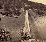
1851: Neversink Aqueduct
Cuddebackville, New York, USA - Neversink River
| Bridgemeister ID: | 36 (added before 2003) |
| Year Completed: | 1851 |
| Name: | Neversink Aqueduct |
| Location: | Cuddebackville, New York, USA |
| Crossing: | Neversink River |
| Coordinates: | 41.459806 N 74.604889 W |
| Maps: | Acme, GeoHack, Google, OpenStreetMap |
| Principals: | John A. Roebling |
| References: | AAJ, BOB, RDH, SJR |
| Use: | Aqueduct |
| Status: | Removed |
| Main Cables: | Wire (iron) |
| Suspended Spans: | 1 |
| Main Span: | 1 x 51.8 meters (170 feet) |
Notes:
- BPL says 1849, RDH says not used until 1851 canal season.
- Built as part of same project as 1848 Delaware Aqueduct (Roebling Aqueduct) - Lackawaxen, Pennsylvania and Minisink Ford, New York, USA.
- Built as part of same project as 1849 Lackawaxen Aqueduct - Lackawaxen, Pennsylvania, USA.
- Built as part of same project as 1851 High Falls Aqueduct - High Falls, New York, USA.
External Links:
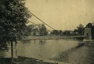
1853: Fort Hunter
Tribes Hill and Fort Hunter, New York, USA - Mohawk River
| Bridgemeister ID: | 44 (added before 2003) |
| Year Completed: | 1853 |
| Name: | Fort Hunter |
| Also Known As: | Fonda |
| Location: | Tribes Hill and Fort Hunter, New York, USA |
| Crossing: | Mohawk River |
| Coordinates: | 42.945500 N 74.287028 W |
| Maps: | Acme, GeoHack, Google, OpenStreetMap |
| Principals: | John W. Murphy, Thomas R. Hulett |
| References: | ONC, PTS2 |
| Use: | Vehicular |
| Status: | Dismantled, 1935 |
| Main Cables: | Wire (iron) |
| Suspended Spans: | 1 |
| Main Span: | 1 x 169.5 meters (556 feet) |
Notes:
- According to ONC: Designed by John W. Murphy (who designed several suspension bridges in the 1850s and 1860s in New York and Pennsylvania). Fort Hunter Suspension Bridge Company incorporated in 1852, but cables were not installed until 1853.
- Crossed the Mohawk River on the old alignment of Main Street, east of the current Main Street bridge, at the ends of the streets now known as Brown Place in Fort Hunter and Locust Avenue in Tribes Hill.
- 1935: Bridge is dismantled (ONC).
Image Sets:
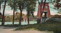
1855: Niagara Suspension
Niagara Falls, New York, USA and Niagara Falls, Ontario, Canada - Niagara River
| Bridgemeister ID: | 51 (added before 2003) |
| Year Completed: | 1855 |
| Name: | Niagara Suspension |
| Location: | Niagara Falls, New York, USA and Niagara Falls, Ontario, Canada |
| Crossing: | Niagara River |
| Principals: | John A. Roebling |
| References: | AAJ, BAAW, BBR, BFL, BMA, BOB, BPL, HBE, LIR, NSB, ONF, PTS2, SA18810716, SJR |
| Use: | Rail (heavy rail) and Vehicular (double-deck), with walkway |
| Status: | Replaced, 1897 |
| Main Cables: | Wire (iron) |
| Suspended Spans: | 1 |
| Main Span: | 1 x 250.3 meters (821.3 feet) |
Notes:
- Cables renovated, 1877. Wooden stiffening trusses replaced, 1880. Towers replaced, c. 1886. Bridge replaced with steel arch, 1897.
- AAJ notes the roadway deck opened in 1854, but the railway deck did not open until 1855.
- Replaced 1848 Niagara Suspension - Niagara Falls, New York, USA and Niagara Falls, Ontario, Canada.
- All past and present bridges at this location.
External Links:
Image Sets:
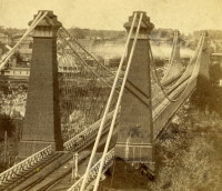
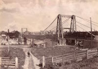
1855: Shohola
Barryville, New York and Shohola, Pennsylvania, USA - Delaware River
| Bridgemeister ID: | 41 (added before 2003) |
| Year Completed: | 1855 |
| Name: | Shohola |
| Also Known As: | Barryville-Shohola, Shohola-Barryville |
| Location: | Barryville, New York and Shohola, Pennsylvania, USA |
| Crossing: | Delaware River |
| Coordinates: | 41.477000 N 74.919000 W |
| Maps: | Acme, GeoHack, Google, OpenStreetMap |
| Principals: | Chauncy Thomas, John A. Roebling |
| References: | BDR, SHO |
| Use: | Vehicular |
| Status: | Dismantled, 1941 |
| Main Cables: | Wire (iron) |
| Suspended Spans: | 1 |
Notes:
- BDR: Built 1856, severely damaged 1859, rebuilt, collapsed Jan. 1st 1865, rebuilt 1866. Dale writes: "A respected historian, John Willard Johnston, who knew Chauncey Thomas personally and visited the area during his ownership of the toll bridge, insisted that Thomas, as the builder, was grossly incompetent."
- Originally constructed with one main span, the center pier was added during the 1866 reconstruction.
- Don Sayenga's research leads him to conclude the bridge was completed in the fall of 1855. He notes an article from the Pike County Democrat (June 21, 1872) stating the bridge was completed in 1855. The article also notes the 1859 collapse occurred on July 2, 1859. Don's interest in this bridge is piqued by the connection to John Roebling, "...this bridge seems to be the only John Roebling bridge that failed in service..." Roebling prepared plans, for the original bridge, for Chauncy Thomas (who, by Dale's account was inexperienced).
Image Sets:
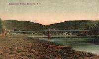
1856: Genesee
Carthage and Rochester, New York, USA - Genesee River
| Bridgemeister ID: | 54 (added before 2003) |
| Year Completed: | 1856 |
| Name: | Genesee |
| Also Known As: | Bridge of Sighs |
| Location: | Carthage and Rochester, New York, USA |
| Crossing: | Genesee River |
| Coordinates: | 43.161861 N 77.613472 W |
| Maps: | Acme, GeoHack, Google, OpenStreetMap |
| Principals: | Josiah Bissell, Jr. |
| Use: | Vehicular |
| Status: | Collapsed, 1857 |
| Main Cables: | Wire (iron) |
Notes:
- From May 2, 1857 edition of Scientific American: "Fall of a Suspension Bridge. The iron suspension bridge which spans the Genesee River at Rochester, fell on the 21st ult. from the weight of snow on it. The bridge was only finished last summer, and cost over $28,000. It was constructed between iron towers standing on the banks. They were built of cast iron cylinders, bolted together, and standing on high banks, 235 feet above the water. The road-way was 200 feet above the water, and proceeded in almost a straight line from the top of the high bank on one side, to the other. The cables were 780 feet long, and the entire length of the bridge was over 700 feet. It was calculated to sustain a weight of 2.000 tuns [sic]. It spanned the Genesee river below the Falls. The metal, it is stated, appears to be defective. The load that was on it when it fell did not amount to 100 tuns [sic]."
1857: Black River
Watertown, New York, USA - Black River
| Bridgemeister ID: | 55 (added before 2003) |
| Year Completed: | 1857 |
| Name: | Black River |
| Also Known As: | Bradford, Mill Street |
| Location: | Watertown, New York, USA |
| Crossing: | Black River |
| Coordinates: | 43.977000 N 75.906528 W |
| Maps: | Acme, GeoHack, Google, OpenStreetMap |
| Principals: | Gilbert Bradford |
| References: | AAJ, HBE, ONC |
| Use: | Vehicular |
| Status: | Removed, 1890s |
| Main Cables: | Wire (iron) |
| Suspended Spans: | 1 |
| Main Span: | 1 x 53 meters (173.9 feet) |
| Deck width: | 18 feet |
Notes:
- Replaced in 1890's (ONC).
Image Sets:
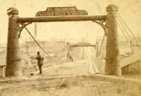
1868: Afton
Afton, New York, USA - Susquehanna River
| Bridgemeister ID: | 66 (added before 2003) |
| Year Completed: | 1868 |
| Name: | Afton |
| Location: | Afton, New York, USA |
| Crossing: | Susquehanna River |
| Coordinates: | 42.227167 N 75.524222 W |
| Maps: | Acme, GeoHack, Google, OpenStreetMap |
| Principals: | G. W. & J. V. V. Fishler, James Crowell |
| Use: | Vehicular |
| Status: | Removed |
| Main Cables: | Wire (iron) |
| Suspended Spans: | 1 |
| Main Span: | 1 x 110.3 meters (362 feet) |
| Deck width: | 16 feet |
Image Sets:
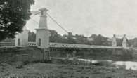
1868: Carpenter's Point
Port Jervis and Tristates, New York, USA - Neversink River
| Bridgemeister ID: | 2251 (added 2007-03-31) |
| Year Completed: | 1868 |
| Name: | Carpenter's Point |
| Also Known As: | Tristates |
| Location: | Port Jervis and Tristates, New York, USA |
| Crossing: | Neversink River |
| Coordinates: | 41.361194 N 74.685194 W |
| Maps: | Acme, GeoHack, Google, OpenStreetMap |
| Use: | Vehicular (one-lane) |
| Status: | Destroyed, 1904 |
| Main Cables: | Wire |
| Suspended Spans: | 1 |
1869: Clifton
Niagara Falls, New York, USA and Niagara Falls, Ontario, Canada - Niagara River
| Bridgemeister ID: | 70 (added before 2003) |
| Year Completed: | 1869 |
| Name: | Clifton |
| Also Known As: | Upper, Niagara-Clifton, Falls View, First Falls View |
| Location: | Niagara Falls, New York, USA and Niagara Falls, Ontario, Canada |
| Crossing: | Niagara River |
| Coordinates: | 43.089722 N 79.069694 W |
| Maps: | Acme, GeoHack, Google, OpenStreetMap |
| Principals: | Samuel Keefer |
| References: | AAJ, BPL, HBE, PTS2 |
| Use: | Vehicular |
| Status: | Replaced, 1889 |
| Main Cables: | Wire (iron) |
| Main Span: | 1 x 386.6 meters (1,268.3 feet) |
| Deck width: | 10 feet |
Notes:
- Opened January 2nd, 1869. Wooden towers replaced with steel towers, 1884. Widened to 17 feet, 1888. Wrecked by wind, January, 1889. Some of the images here may show the replacement bridge.
- Became longest suspension bridge by eclipsing 1867 John A. Roebling (Cincinnati, Cincinnati and Covington) - Cincinnati, Ohio and Covington, Kentucky, USA.
- Eclipsed by new longest suspension bridge 1883 Brooklyn (Great East River) - New York and Brooklyn, New York, USA.
- Replaced by 1889 Second Falls View (Upper) - Niagara Falls, New York, USA and Niagara Falls, Ontario, Canada.
- All past and present bridges at this location.
External Links:
Image Sets:
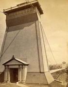
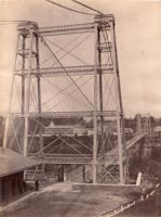
1869: Lordville
Lordville, New York and Equinunk, Pennsylvania, USA - Delaware River
| Bridgemeister ID: | 71 (added before 2003) |
| Year Completed: | 1869 |
| Name: | Lordville |
| Location: | Lordville, New York and Equinunk, Pennsylvania, USA |
| Crossing: | Delaware River |
| Coordinates: | 41.867938 N 75.213785 W |
| Maps: | Acme, GeoHack, Google, OpenStreetMap |
| Principals: | E.F. Farrington |
| References: | BDR, BOL, PTS2 |
| Use: | Vehicular (one-lane) |
| Status: | Destroyed, 1903 |
| Main Cables: | Wire (iron) |
Notes:
- Destroyed by flood 1903.
- Replaced by 1904 Lordville-Equinunk - Lordville, New York and Equinunk, Pennsylvania, USA.
- All past and present bridges at this location.
Image Sets:
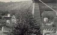
1870: Chehocton
Hancock, New York and Wayne County, Pennsylvania, USA - East Branch Delaware River
| Bridgemeister ID: | 284 (added before 2003) |
| Year Completed: | 1870 |
| Name: | Chehocton |
| Location: | Hancock, New York and Wayne County, Pennsylvania, USA |
| Crossing: | East Branch Delaware River |
| Coordinates: | 41.952583 N 75.278167 W |
| Maps: | Acme, GeoHack, Google, OpenStreetMap |
| Principals: | E.F. Farrington, John A. Roebling's Sons Co. |
| Use: | Vehicular |
| Status: | Removed, 1937 |
| Main Cables: | Wire (iron) |
| Suspended Spans: | 1 |
| Main Span: | 1 x 144.8 meters (475 feet) estimated |
Notes:
- Crossed the East Branch Delaware River on an alignment indicated by the current Old Bridge Street, between the rail crossing and the current (2020s) Stockport Road bridge.
- Replaced 1937.
Image Sets:
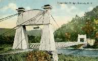
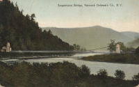
1870: Finck's
Little Falls, New York, USA - Mohawk River
| Bridgemeister ID: | 328 (added before 2003) |
| Year Completed: | 1870 |
| Name: | Finck's |
| Also Known As: | Fink's |
| Location: | Little Falls, New York, USA |
| Crossing: | Mohawk River |
| Coordinates: | 43.034102 N 74.830185 W |
| Maps: | Acme, GeoHack, Google, OpenStreetMap |
| References: | ONC |
| Use: | Vehicular |
| Status: | Destroyed, 1917 |
| Main Cables: | Wire |
Notes:
- Heavily damaged by fire, 1917.
- Coordinates reflect where modern Fincks Basin Road meets the Mohawk River, likely approximate location of this bridge.
Image Sets:
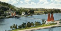
1870: Pond Eddy-Lumberland
Pond Eddy and Lumberland, New York, USA - Delaware River
| Bridgemeister ID: | 297 (added before 2003) |
| Year Completed: | 1870 |
| Name: | Pond Eddy-Lumberland |
| Also Known As: | Decker's |
| Location: | Pond Eddy and Lumberland, New York, USA |
| Crossing: | Delaware River |
| Coordinates: | 41.439349 N 74.819723 W |
| Maps: | Acme, GeoHack, Google, OpenStreetMap |
| Principals: | James D. Decker |
| References: | BDR |
| Use: | Vehicular |
| Status: | Destroyed, October 9, 1903 |
| Main Cables: | Wire (iron) |
| Suspended Spans: | 2 |
| Main Spans: | 2 |
| Deck width: | 12 feet |
Notes:
- Destroyed by flood.
- Coordinates are for the replacement bridge. The suspension bridge would have been extremely close, if not on the same alignment as the replacement.
Image Sets:
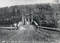
1871: (suspension bridge)
Washburn's Eddy, New York, USA - Hudson River
| Bridgemeister ID: | 74 (added before 2003) |
| Year Completed: | 1871 |
| Name: | (suspension bridge) |
| Location: | Washburn's Eddy, New York, USA |
| Crossing: | Hudson River |
| Principals: | Robert Gilchrist |
| References: | ABC |
| Status: | Removed |
Notes:
- This bridge was a few miles south of the more widely-known Hudson crossing at Riparius.
- Near 1872 Fulsom Landing (Riverside, Folsom Landing, Riparius) - Riparius, New York, USA.
1871: Ferry Street
Binghamton, New York, USA - Chenango River
| Bridgemeister ID: | 276 (added before 2003) |
| Year Completed: | 1871 |
| Name: | Ferry Street |
| Location: | Binghamton, New York, USA |
| Crossing: | Chenango River |
| Coordinates: | 42.103139 N 75.914917 W |
| Maps: | Acme, GeoHack, Google, OpenStreetMap |
| Principals: | John A. Roebling's Sons, Co. |
| Use: | Vehicular (one-lane) |
| Status: | Removed, 1897 |
| Main Cables: | Wire |
| Suspended Spans: | 1 |
| Main Span: | 1 x 109.7 meters (360 feet) |
Notes:
- This bridge was close to the alignment of Binghamton's present E. Clinton Street bridge. It replaced a bridge that was destroyed by flood in 1865. It was condemned in 1896 and removed in 1897. History Of Broome County indicates an act was passed March 13th, 1871 authorizing the bridge with the contract let to "W.A. Roebling & Son" each cable consisting of seven steel wire ropes, each two inches in diameter.
- An article from the Binghamton Democrat, July 20, 1871: "The Suspension Bridge -- The work on the west abutment of the suspension bridge has been commenced and will be rapidly as advisable pushed forward to completion, and soon thereafter the wire cables will be placed in position, the stays, supports and girders made fast, and ready for the flooring. In the course of six or eight weeks it is hoped that the bridge will be completed, and our people given another way of passing from the 1st to the 2nd wards, and the old-pleasant driveway re-opened, of which we have been debarred since the flood of St-Patrick's Day in the morning in [1865]. Upon the completion of this enterprise, surely no one will ever regret having voted in favor of the free suspension bridge."
- An article from the Binghamton Democrat, Nov. 30, 1871: "The New Bridge -- Its Cost -- For the suspenssion [sic] bridge, the tax-payers voted $28,000. It is finished, and in the Common Council last evening it was asserted that it cost over $30,000 and still all the claims are not satisfied. Mr. Jas. Fanning, contractor for building abutments, seeks relief for $1,000 or upwards which he is out no account of his contract. His petition was after considerable skirmishing finally referred to a committee. We hold that this is wrong, the Common Council has nothing to do with this matter. Mayor Dwight published a card binding himself to pay all over $28,000 that the bridge would cost. The people voted that amount and their representatives have nothing to do with any further cost or expense arrising [sic] from that source."
- Internet searches for this bridge often lead to an image on page 32 of the book "Binghamton", from the "Images of America" series, by Ed Aswad and Suzanne M. Meredith. However, that image is of the Warren Pensylvania suspension bridge and is erroneously captioned as the Binghamton Ferry Street bridge. The bridges may be sometimes confused because of similar surroundings and similar towers. Both are often depicted with a large warehouse building on the far side of the bridge, to the right. Both had "walk-through" towers where the pedestrian walkway passed through portals in the towers. Closer comparisons reveal the Warren towers are substantially larger than the Ferry Street towers. This is not surprising given the Warren bridge was substantially longer than the Ferry Street bridge. All this being said, there are different images purporting to be the Ferry Street bridge that show different towers. The stereoview image linked here appears to show the original towers. Later photos appear to show either replaced towers or, perhaps, the original towers clad in protective housing.
- See 1871 Warren (Hickory Street) - Warren, Pennsylvania, USA. The two bridges are sometimes confused despite the significant size difference.
Image Sets:
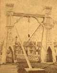
1872: Barrett
Port Jervis, New York and Matamoras, Pennsylvania, USA - Delaware River
| Bridgemeister ID: | 76 (added before 2003) |
| Year Completed: | 1872 |
| Name: | Barrett |
| Location: | Port Jervis, New York and Matamoras, Pennsylvania, USA |
| Crossing: | Delaware River |
| Coordinates: | 41.371917 N 74.697000 W |
| Maps: | Acme, GeoHack, Google, OpenStreetMap |
| References: | BDR |
| Use: | Vehicular |
| Status: | Destroyed, October 11, 1903 |
| Main Cables: | Wire (iron) |
| Suspended Spans: | 2 |
| Main Spans: | 2 |
Notes:
- BDR: Destroyed by ice March 17, 1875, rebuilt, destroyed by flood October 11, 1903.
Image Sets:
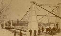
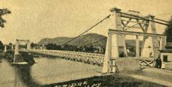
1872: Chemung
Chemung, New York, USA - Chemung River
| Bridgemeister ID: | 78 (added before 2003) |
| Year Completed: | 1872 |
| Name: | Chemung |
| Location: | Chemung, New York, USA |
| Crossing: | Chemung River |
| Coordinates: | 42.002944 N 76.634722 W |
| Maps: | Acme, GeoHack, Google, OpenStreetMap |
| Principals: | J.V. Fishler, J.R. Crowell |
| Use: | Vehicular |
| Status: | Removed |
| Main Cables: | Wire (iron) |
Image Sets:

1872: Fulsom Landing
Riparius, New York, USA - Hudson River
| Bridgemeister ID: | 330 (added before 2003) |
| Year Completed: | 1872 |
| Name: | Fulsom Landing |
| Also Known As: | Riverside, Folsom Landing, Riparius |
| Location: | Riparius, New York, USA |
| Crossing: | Hudson River |
| Coordinates: | 43.661963 N 73.898194 W |
| Maps: | Acme, GeoHack, Google, OpenStreetMap |
| Use: | Vehicular (one-lane) |
| Status: | Removed |
| Main Cables: | Wire |
| Suspended Spans: | 1 |
| Main Span: | 1 |
Notes:
- The location of this bridge was originally known as "Folsom Landing" and later became known as "Riverside." In 1886 the name was changed to "Riparius" to avoid confusion with another New York "Riverside" location. The suspension bridge is sometimes referenced by each of these names. To make matters even more confusing, the bridge was known as the "Fulsom Landing" bridge (instead of Folsom).
- Removed at some point after 1919.
- Near 1871 (suspension bridge) - Washburn's Eddy, New York, USA.
Image Sets:
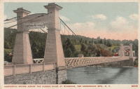
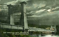
| Bridgemeister ID: | 79 (added before 2003) |
| Year Completed: | 1872 |
| Name: | Trinity Cemetery |
| Location: | New York, New York, USA |
| Crossing: | Broadway |
| Coordinates: | 40.832167 N 73.946250 W |
| Maps: | Acme, GeoHack, Google, OpenStreetMap |
| Principals: | Calvert Vaux |
| References: | CVA |
| Status: | Demolished, 1911 |
| Main Cables: | Wire |
| Suspended Spans: | 1 |
Notes:
- Connected Trinity Cemetery across Broadway. Demolished 1911. Appears to have been wide enough to handle vehicles.
- Eric K. Washington contacted me in 2011 wondering if the Trinity Cemetery bridge was the first suspension bridge constructed in New York City. While it seems unlikely that New York City (even just Manhattan) did not have, at least, other minor suspension bridges constructed before 1872, I have never encountered mention of one.
External Links:
- Audubon Park: Trinity Cemetery Bridge. Information and images of the bridge.
- WikiMedia. Image of the bridge.
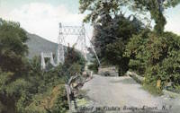
1882: Fitch's
Elmira, New York, USA - Chemung River
| Bridgemeister ID: | 88 (added before 2003) |
| Year Completed: | 1882 |
| Name: | Fitch's |
| Also Known As: | Fitches, Fisches, Lumbermens |
| Location: | Elmira, New York, USA |
| Crossing: | Chemung River |
| Coordinates: | 42.082409 N 76.866470 W |
| Maps: | Acme, GeoHack, Google, OpenStreetMap |
| Use: | Vehicular (one-lane) |
| Status: | Removed |
| Main Cables: | Wire |
| Main Span: | 1 |
External Links:
- Fitch Family History and Genealogy. Although this bridge is known by a variety of names (and misspellings), this Fitch family site states Daniel Hollenbeck Fitch contributed $10,000 to the construction of the bridge and refer to it as "Fitch's Bridge".
Image Sets:
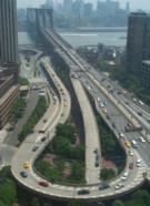
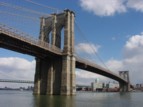
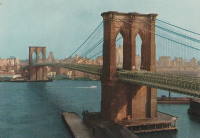
1883: Brooklyn
New York and Brooklyn, New York, USA - East River
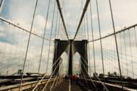
| Bridgemeister ID: | 89 (added before 2003) |
| Year Completed: | 1883 |
| Name: | Brooklyn |
| Also Known As: | Great East River |
| Location: | New York and Brooklyn, New York, USA |
| Crossing: | East River |
| Coordinates: | 40.706 N 73.99667 W |
| Maps: | Acme, GeoHack, Google, OpenStreetMap |
| Principals: | John A. Roebling, Washington A. Roebling |
| References: | AAJ, BAAW, BBR, BBTS, BC3, BFL, BLD, BMA, BOB, BOU, BPL, COB, CTW, GB, GBD, HBE, LAB, LACE, NG198305, ONF, PTS2, SJR |
| Use: | Rail (light rail) and Vehicular (major highway), with walkway |
| Status: | In use (last checked: 2022) |
| Main Cables: | Wire (steel) |
| Suspended Spans: | 3 |
| Main Span: | 1 x 486.3 meters (1,595.5 feet) |
| Side Spans: | 2 x 283.5 meters (930 feet) |
| Deck width: | 85 feet |
Notes:
- Became longest suspension bridge by eclipsing 1869 Clifton (Upper, Niagara-Clifton, Falls View, First Falls View) - Niagara Falls, New York, USA and Niagara Falls, Ontario, Canada.
- Eclipsed by new longest suspension bridge 1903 Williamsburg - New York and Brooklyn, New York, USA.
- Next to 1909 Manhattan - New York and Brooklyn, New York, USA.
- Near 1903 Williamsburg - New York and Brooklyn, New York, USA.
- All past and present bridges at this location.
External Links:
Image Sets:
1888: Swing
Keeseville, New York, USA - Ausable River
| Bridgemeister ID: | 93 (added before 2003) |
| Year Completed: | 1888 |
| Name: | Swing |
| Location: | Keeseville, New York, USA |
| Crossing: | Ausable River |
| Coordinates: | 44.503653 N 73.482490 W |
| Maps: | Acme, GeoHack, Google, OpenStreetMap |
| Principals: | Berlin Iron Bridge Co. |
| References: | ONC |
| Use: | Footbridge |
| Status: | In use (last checked: 2023) |
| Main Cables: | Wire (steel) |
| Suspended Spans: | 1 |
| Main Span: | 1 x 73.2 meters (240 feet) |
Notes:
- 2024, June: New York State announces US$1,948,000 awarded to to the Clinton County Planning Department for rehabilitation and refurbishment of the Keeseville Swing Bridge.
- At (or near) former location of Swing - Keeseville, New York, USA.
- All past and present bridges at this location.
External Links:
1889: Second Falls View
Niagara Falls, New York, USA and Niagara Falls, Ontario, Canada - Niagara River
| Bridgemeister ID: | 2120 (added 2006-09-17) |
| Year Completed: | 1889 |
| Name: | Second Falls View |
| Also Known As: | Upper |
| Location: | Niagara Falls, New York, USA and Niagara Falls, Ontario, Canada |
| Crossing: | Niagara River |
| Coordinates: | 43.088806 N 79.068722 W |
| Maps: | Acme, GeoHack, Google, OpenStreetMap |
| Principals: | G.M. Harrington, George W. McNulty |
| Use: | Vehicular |
| Status: | Removed, late 1890's |
| Main Cables: | Wire |
| Suspended Spans: | 1 |
Notes:
- Damaged by wind, January 1890. Repaired. Dismantled after being replaced by a steel arch bridge (the famous "Honeymoon Bridge"), 1899. Much of the dismantled bridge was reused for the 1899 Lewiston-Queenston bridge.
- Replaced 1869 Clifton (Upper, Niagara-Clifton, Falls View, First Falls View) - Niagara Falls, New York, USA and Niagara Falls, Ontario, Canada.
- See 1899 Lewiston-Queenston - Lewiston, New York, USA and Queenston, Ontario, Canada.
- All past and present bridges at this location.
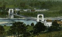
1890: Kellams
Kellams, New York and Stalker, Pennsylvania, USA - Delaware River
| Bridgemeister ID: | 7595 (added 2023-05-07) |
| Year Completed: | 1890 |
| Name: | Kellams |
| Also Known As: | Little Equinunk, Kellams-Stalker, Kellam |
| Location: | Kellams, New York and Stalker, Pennsylvania, USA |
| Crossing: | Delaware River |
| Coordinates: | 41.823641 N 75.113282 W |
| Maps: | Acme, GeoHack, Google, OpenStreetMap |
| Principals: | David Kellam |
| Use: | Vehicular |
| Status: | Replaced |
| Main Cables: | Wire |
| Main Span: | 1 |
Notes:
- Replaced by 1936 Kellams (Little Equinunk, Kellams-Stalker, Kellam) - Kellams, New York and Stalker, Pennsylvania, USA.
- All past and present bridges at this location.
Image Sets:
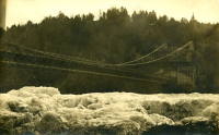
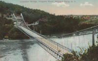
1899: Lewiston-Queenston
Lewiston, New York, USA and Queenston, Ontario, Canada - Niagara River
| Bridgemeister ID: | 108 (added before 2003) |
| Year Completed: | 1899 |
| Name: | Lewiston-Queenston |
| Location: | Lewiston, New York, USA and Queenston, Ontario, Canada |
| Crossing: | Niagara River |
| Principals: | L.L. Buck, R.S. Buck |
| References: | AAJ, BPL, HBE, PTS2 |
| Use: | Vehicular and Rail (streetcar) |
| Status: | Replaced, 1962 |
| Main Cables: | Wire (steel) |
| Suspended Spans: | 1 |
| Main Span: | 1 x 317 meters (1,040 feet) |
| Deck width: | 17 feet |
Notes:
- Reused parts from the recently dismantled Second Falls View Bridge.
- At former location of 1851 Lewiston-Queenston - Lewiston, New York, USA and Queenston, Ontario, Canada.
- See 1889 Second Falls View (Upper) - Niagara Falls, New York, USA and Niagara Falls, Ontario, Canada.
- All past and present bridges at this location.
Image Sets:
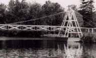
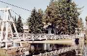
1902: Wanakena
Wanakena, New York, USA - Oswegatchie River
| Bridgemeister ID: | 109 (added before 2003) |
| Year Completed: | 1902 |
| Name: | Wanakena |
| Location: | Wanakena, New York, USA |
| Crossing: | Oswegatchie River |
| Coordinates: | 44.133217 N 74.921317 W |
| Maps: | Acme, GeoHack, Google, OpenStreetMap |
| Principals: | Rich Lumber Co. |
| Use: | Footbridge |
| Status: | Removed, 2014 |
| Main Cables: | Wire |
| Suspended Spans: | 1 |
| Main Span: | 1 x 52.1 meters (171 feet) |
Notes:
- Heavily damaged by ice jam, January 2014. Later dismantled.
- Near (footbridge) - Fine, Wanakena vicinity, New York, USA.
- Replaced by 2017 Wanakena - Wanakena, New York, USA.
- All past and present bridges at this location.
External Links:
Image Sets:
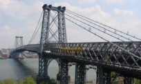
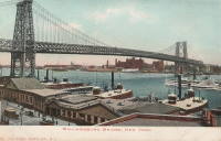
1903: Williamsburg
New York and Brooklyn, New York, USA - East River
| Bridgemeister ID: | 111 (added before 2003) |
| Year Completed: | 1903 |
| Name: | Williamsburg |
| Location: | New York and Brooklyn, New York, USA |
| Crossing: | East River |
| Coordinates: | 40.71355 N 73.97226 W |
| Maps: | Acme, GeoHack, Google, OpenStreetMap |
| Principals: | L.L. Buck |
| References: | AAJ, BAAW, BAR, BBR, BPL, GBD, HBE, PTS2, SJR |
| Use: | Rail (light rail) and Vehicular (major highway), with walkway |
| Status: | In use (last checked: 2022) |
| Main Cables: | Wire (steel) |
| Suspended Spans: | 1 |
| Main Span: | 1 x 487.7 meters (1,600 feet) |
Notes:
- Became longest suspension bridge by eclipsing 1883 Brooklyn (Great East River) - New York and Brooklyn, New York, USA.
- Eclipsed by new longest suspension bridge 1924 Bear Mountain - Anthony's Nose and Bear Mountain, New York, USA.
- Near 1883 Brooklyn (Great East River) - New York and Brooklyn, New York, USA.
- Near 1909 Manhattan - New York and Brooklyn, New York, USA.
External Links:
Image Sets:
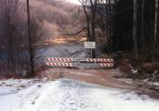
1904: Lordville-Equinunk
Lordville, New York and Equinunk, Pennsylvania, USA - Delaware River
| Bridgemeister ID: | 112 (added before 2003) |
| Year Completed: | 1904 |
| Name: | Lordville-Equinunk |
| Location: | Lordville, New York and Equinunk, Pennsylvania, USA |
| Crossing: | Delaware River |
| Coordinates: | 41.867745 N 75.213789 W |
| Maps: | Acme, GeoHack, Google, OpenStreetMap |
| Principals: | Owego Bridge Company |
| References: | BDR, BOL, BPL, HHP |
| Use: | Vehicular (one-lane) |
| Status: | Demolished, 1986 |
| Main Cables: | Eyebar (steel) |
| Suspended Spans: | 2 |
| Main Span: | 1 x 105.8 meters (347 feet) |
| Side Span: | 1 x 17.1 meters (56 feet) |
Notes:
- Eyebar suspension bridge.
- Replaced 1869 Lordville - Lordville, New York and Equinunk, Pennsylvania, USA.
- All past and present bridges at this location.
External Links:
Image Sets:
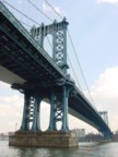
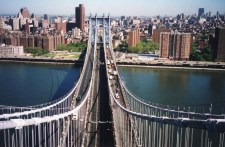
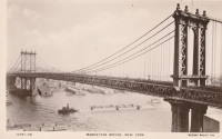
1909: Manhattan
New York and Brooklyn, New York, USA - East River
| Bridgemeister ID: | 123 (added before 2003) |
| Year Completed: | 1909 |
| Name: | Manhattan |
| Location: | New York and Brooklyn, New York, USA |
| Crossing: | East River |
| Coordinates: | 40.70667 N 73.99167 W |
| Maps: | Acme, GeoHack, Google, OpenStreetMap |
| Principals: | O.F. Nichols, Leon Moisseiff |
| References: | AAJ, BAAW, BBR, BC3, BPL, GBD, HBE, LAB, PTS2, SA19050909, SJR |
| Use: | Vehicular (double-deck) |
| Status: | In use (last checked: 2022) |
| Main Cables: | Wire (steel) |
| Suspended Spans: | 3 |
| Main Span: | 1 x 448.1 meters (1,470 feet) |
| Side Spans: | 2 x 221 meters (725 feet) |
Notes:
- Opened December 31, 1909, but not fully completed yet.
- Next to 1883 Brooklyn (Great East River) - New York and Brooklyn, New York, USA.
- Near 1903 Williamsburg - New York and Brooklyn, New York, USA.
- All past and present bridges at this location.
External Links:
Image Sets:

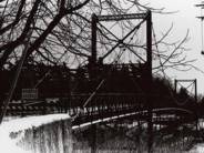
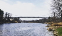
1910: Massena Center
Massena, New York, USA - Grasse River
| Bridgemeister ID: | 124 (added before 2003) |
| Year Completed: | 1910 |
| Name: | Massena Center |
| Location: | Massena, New York, USA |
| Crossing: | Grasse River |
| Coordinates: | 44.959213 N 74.830558 W |
| Maps: | Acme, GeoHack, Google, OpenStreetMap |
| Principals: | Holton D. Robinson |
| References: | AAJ, PTS2 |
| Use: | Vehicular (one-lane) |
| Status: | Closed, 1974 (last checked: 2024) |
| Main Cables: | Wire (steel) |
| Suspended Spans: | 3 |
| Main Span: | 1 x 121.9 meters (400 feet) |
| Side Spans: | 2 x 30.5 meters (100 feet) |
Notes:
- Standing, but closed to all foot and vehicular traffic.
Image Sets:
1911: Treyz
Cooks Falls, New York, USA - Beaver Kill
| Bridgemeister ID: | 6776 (added 2021-10-27) |
| Year Completed: | 1911 |
| Name: | Treyz |
| Also Known As: | George I. Treyz |
| Location: | Cooks Falls, New York, USA |
| Crossing: | Beaver Kill |
| Coordinates: | 41.956829 N 74.992559 W |
| Maps: | Acme, GeoHack, Google, OpenStreetMap |
| Principals: | John A. Roebling's Sons |
| Use: | Tramway |
| Status: | Only towers remain (last checked: 2016) |
| Main Cables: | Wire (steel) |
| Main Span: | 1 x 70 meters (229.7 feet) estimated |
| Side Spans: | 2 |
Notes:
- Facility served by the bridge closed in 1925 at which time the bridge was likely abandoned. Towers appear to still be standing (in late 2010s).
External Links:
- A Delaware County Primer complied by Sue Hudson. "West of Cooks Falls and east of Horton, on the O&W. Acid plant built here by Eugene King burned in June 1888, was rebuilt, and was later bought by local entrepreneur, George I. Treyz. Railroad suspension bridge constructed in 1911 by John A. Roebling's Sons Company of Trenton, NJ to connect Treyz's acid factory, saw mill, and planing mill on Russell Brook to the O&W, which ran on the other side of the Beaver Kill."
- Cooks Falls - Colchester Historical Society. "Arthur Leighton and George I. Treyz developed the acid factory industries in Cook's Falls... Treyz had a close relationship with the O&W Railroad, which helped both to prosper. Treyz installed a Roebling suspension bridge between his plant and the O&W Railroad. This siding was known as the Grove Switch. A narrow gauge railway was constructed and ran up Russell Brook to the Russell School. This line carried logs and sawed lumber down to the Treyz plant and the O&W Railroad."
1913: Fall Creek
Ithaca, New York, USA - Fall Creek Gorge
| Bridgemeister ID: | 260 (added before 2003) |
| Year Completed: | 1913 |
| Name: | Fall Creek |
| Location: | Ithaca, New York, USA |
| Crossing: | Fall Creek Gorge |
| At or Near Feature: | Cornell University campus |
| Use: | Footbridge |
| Status: | Removed |
Notes:
- Closed August, 1960.
- Replaced by 1961 Triphammer (Fall Creek) - Ithaca, New York, USA.
- All past and present bridges at this location.
Image Sets:
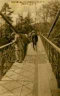
1921: Kingston-Port Ewen
Kingston, New York, USA - Rondout Creek
| Bridgemeister ID: | 138 (added before 2003) |
| Year Completed: | 1921 |
| Name: | Kingston-Port Ewen |
| Also Known As: | Wurts Street, Rondout Creek |
| Location: | Kingston, New York, USA |
| Crossing: | Rondout Creek |
| Coordinates: | 41.916129 N 73.983999 W |
| Maps: | Acme, GeoHack, Google, OpenStreetMap |
| Principals: | Holton D. Robinson, Daniel E. Moran, William Yates |
| References: | AAJ, PTS, PTS2, SJR, SSS |
| Use: | Vehicular (two-lane, heavy vehicles), with walkway |
| Status: | In use (last checked: 2024) |
| Main Cables: | Wire (steel) |
| Suspended Spans: | 3 |
| Main Span: | 1 x 214.9 meters (705 feet) |
| Side Spans: | 2 x 53.7 meters (176.25 feet) |
| Deck width: | 37 feet |
Notes:
- 2008, March: Closed for ten weeks for cable inspection.
- 2018, December: Closed for maintenance. Expected to reopen February, 2019.
- 2019: Major rehabilitation continues to be delayed for several years.
- 2020, September: Closed temporarily. Major renovation project continues to be delayed.
- 2020, December: Closed indefinitely.
- 2021, May: Bids for renovation to be sought in June. Work expected to start in September.
- 2021, October: Groundbreaking ceremony for long-anticipated restoration project. Expected to be completed in 2023 at a cost of US$44.6M
- 2024, July: The bridge reopens following the completion of the multi-year restoration project.
Annotated Citations:
- Kirby, Paul. "Bids for Rondout Creek Bridge overhaul to be sought next month; work expected to start in September." Daily Freeman, 5 May 2021, Bids for Rondout Creek Bridge overhaul to be sought next month; work expected to start in September.
"Bids for the planned overhaul of the Rondout Creek Bridge will be sought in June, and the state Department of Transportation expects to award contracts for the work in August, the office of state Assemblyman Kevin Cahill said this week... The rehabilitation of the suspension bridge, which carries Wurts Street over the creek between Kingston and Port Ewen, could cost as much as $37 million, Cahill said previously. The state will pay for the project, which is expected to begin this fall."
External Links:
- Dave Longendyke's website. Several photos of the bridge's construction.
- HudsonValleyOne.com - State and local officials reopen the Wurts Street suspension bridge. Article covering the reopening of the restored bridge, published July 2, 2024.
- Structurae - Structure ID 20007345
Image Sets:
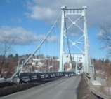
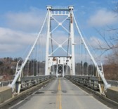
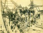
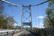
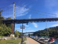
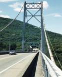
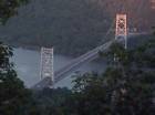
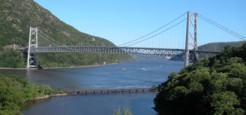
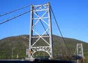
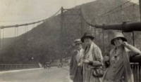
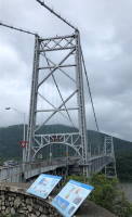
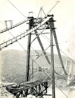
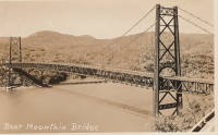
1924: Bear Mountain
Anthony's Nose and Bear Mountain, New York, USA - Hudson River
| Bridgemeister ID: | 141 (added before 2003) |
| Year Completed: | 1924 |
| Name: | Bear Mountain |
| Location: | Anthony's Nose and Bear Mountain, New York, USA |
| Crossing: | Hudson River |
| Coordinates: | 41.32 N 73.985 W |
| Maps: | Acme, GeoHack, Google, OpenStreetMap |
| Principals: | Howard C. Baird |
| References: | AAJ, BAAW, BBR, CPW, PTS2, SJR |
| Use: | Vehicular (two-lane, heavy vehicles), with walkway |
| Status: | In use (last checked: 2022) |
| Main Cables: | Wire (steel) |
| Suspended Spans: | 1 |
| Main Span: | 1 x 497.4 meters (1,632 feet) |
| Deck width: | 48 feet |
Notes:
- Became longest suspension bridge by eclipsing 1903 Williamsburg - New York and Brooklyn, New York, USA.
- Eclipsed by new longest suspension bridge 1926 Benjamin Franklin (Philadelphia-Camden) - Philadelphia, Pennsylvania and Camden, New Jersey, USA.
- Near 2002 Popolopen (William J. Moreau Popolopen) - Fort Montgomery, New York, USA.
External Links:
Image Sets:
1926: Corbett
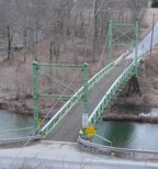
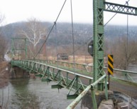
Corbett, New York, USA - East Branch Delaware River
| Bridgemeister ID: | 324 (added before 2003) |
| Year Completed: | 1926 |
| Name: | Corbett |
| Also Known As: | Corbett and Stuart |
| Location: | Corbett, New York, USA |
| Crossing: | East Branch Delaware River |
| Coordinates: | 42.04633 N 75.02768 W |
| Maps: | Acme, GeoHack, Google, OpenStreetMap |
| Principals: | John A. Roebling's Sons Co. |
| References: | SJR |
| Use: | Vehicular (one-lane) |
| Status: | In use (last checked: 2005) |
| Main Cables: | Wire (steel) |
| Suspended Spans: | 1 |
Image Sets:
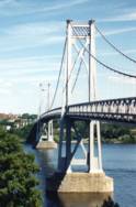
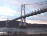
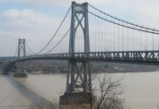
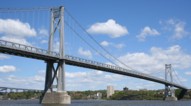
1930: Mid-Hudson
Poughkeepsie and Highland, New York, USA - Hudson River
| Bridgemeister ID: | 166 (added before 2003) |
| Year Completed: | 1930 |
| Name: | Mid-Hudson |
| Also Known As: | Franklin Delano Roosevelt Mid-Hudson |
| Location: | Poughkeepsie and Highland, New York, USA |
| Crossing: | Hudson River |
| Coordinates: | 41.702933 N 73.946683 W |
| Maps: | Acme, GeoHack, Google, OpenStreetMap |
| Principals: | Ralph Modjeski |
| References: | AAJ, BPL, PTS2, SJR, USS |
| Use: | Vehicular (two-lane, heavy vehicles), with walkway |
| Status: | In use (last checked: 2019) |
| Main Cables: | Wire (steel) |
| Suspended Spans: | 3 |
| Main Span: | 1 x 457.2 meters (1,500 feet) |
| Side Spans: | 2 x 228.6 meters (750 feet) |
| Deck width: | 39 feet |
Notes:
- Although the length of the main span of the bridge is officially 1,500 feet, the actual length is 1,495 feet. During construction one of the caissons slid and tilted from its intended location. While efforts were made to move the caisson back, it was ultimately fixed in a position that left the main span five feet short of 1,500. Not wanting to lose the claim of having a 1,500-foot bridge, the shortfall has been kept out of official records since.
External Links:
Image Sets:
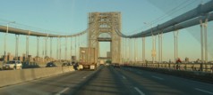
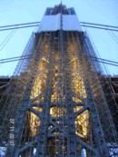
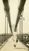
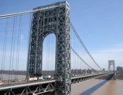
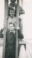
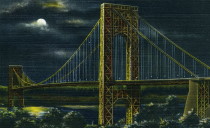
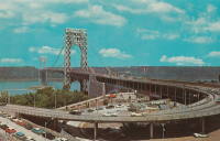
1931: George Washington
New York, New York and Fort Lee, New Jersey, USA - Hudson River
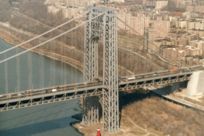
| Bridgemeister ID: | 169 (added before 2003) |
| Year Completed: | 1931 |
| Name: | George Washington |
| Also Known As: | GWB |
| Location: | New York, New York and Fort Lee, New Jersey, USA |
| Crossing: | Hudson River |
| Coordinates: | 40.85333 N 73.955 W |
| Maps: | Acme, GeoHack, Google, OpenStreetMap |
| Principals: | O.H. Ammann, Leon Moisseiff, Dana, Gilbert |
| References: | AAJ, AOB, ARF, BBR, BC3, BFL, BMA, BONJ, BOU, BPL, BRU, COB, CTW, ENR19270811a, ENR19270811b, ENR19290411c, GBD, LAB, LACE, PTS2, SIX, SJR |
| Use: | Vehicular (double-deck), with walkway |
| Status: | In use (last checked: 2022) |
| Main Cables: | Wire (steel) |
| Suspended Spans: | 3 |
| Main Span: | 1 x 1,066.8 meters (3,500 feet) |
| Side Spans: | 2 x 198.1 meters (650 feet) |
| Deck width: | 120 feet |
Notes:
- Became longest suspension bridge by eclipsing 1929 Ambassador - Detroit, Michigan, USA and Windsor, Ontario, Canada.
- Eclipsed by new longest suspension bridge 1937 Golden Gate - San Francisco and Marin County, California, USA.
External Links:
Image Sets:
1934: Stewart Park I
Ithaca, New York, USA - Fall Creek arm
| Bridgemeister ID: | 839 (added 2003-06-28) |
| Year Completed: | 1934 |
| Name: | Stewart Park I |
| Location: | Ithaca, New York, USA |
| Crossing: | Fall Creek arm |
| At or Near Feature: | Stewart Park |
| Coordinates: | 42.458961 N 76.505590 W |
| Maps: | Acme, GeoHack, Google, OpenStreetMap |
| Principals: | Civil Works Administration |
| References: | AAJ |
| Use: | Footbridge |
| Status: | In use (last checked: 2014) |
| Main Cables: | Wire (steel) |
| Suspended Spans: | 1 |
| Main Span: | 1 x 25 meters (82 feet) estimated |
Notes:
- There are two suspension footbridges at this park. This one crosses a short run off of Fall Creek just before it enters Cayuga Lake. The other crosses Fall Creek.
- Near 1934 Stewart Park II - Ithaca, New York, USA.
Image Sets:
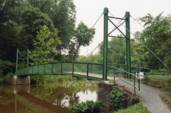
1934: Stewart Park II
Ithaca, New York, USA - Fall Creek
| Bridgemeister ID: | 840 (added 2003-06-28) |
| Year Completed: | 1934 |
| Name: | Stewart Park II |
| Location: | Ithaca, New York, USA |
| Crossing: | Fall Creek |
| At or Near Feature: | Stewart Park |
| Coordinates: | 42.458281 N 76.505359 W |
| Maps: | Acme, GeoHack, Google, OpenStreetMap |
| Principals: | Civil Works Administration |
| References: | AAJ |
| Use: | Footbridge |
| Status: | In use (last checked: 2014) |
| Main Cables: | Wire (steel) |
| Suspended Spans: | 1 |
| Main Span: | 1 x 33.8 meters (111 feet) estimated |
Notes:
- There are two suspension footbridges at this park.
- Near 1934 Stewart Park I - Ithaca, New York, USA.
Image Sets:
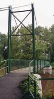
1936: Kellams
Kellams, New York and Stalker, Pennsylvania, USA - Delaware River
| Bridgemeister ID: | 97 (added before 2003) |
| Year Completed: | 1936 |
| Name: | Kellams |
| Also Known As: | Little Equinunk, Kellams-Stalker, Kellam |
| Location: | Kellams, New York and Stalker, Pennsylvania, USA |
| Crossing: | Delaware River |
| Coordinates: | 41.82333 N 75.11333 W |
| Maps: | Acme, GeoHack, Google, OpenStreetMap |
| References: | BDR, HHP, PTS2 |
| Use: | Vehicular (one-lane) |
| Status: | In use (last checked: 2019) |
| Main Cables: | Wire (steel) |
| Suspended Spans: | 1 |
| Main Span: | 1 x 117 meters (384 feet) |
| Characteristics: | Partially underspanned |
Notes:
- Damaged by floodwaters June, 2006. Repaired October, 2006.
- Renovation completed, January, 2019.
- Replaced 1890 Kellams (Little Equinunk, Kellams-Stalker, Kellam) - Kellams, New York and Stalker, Pennsylvania, USA.
- All past and present bridges at this location.
External Links:
Image Sets:
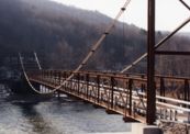
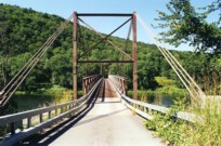
1936: Triborough
New York and Queens, New York, USA - East River
| Bridgemeister ID: | 186 (added before 2003) |
| Year Completed: | 1936 |
| Name: | Triborough |
| Also Known As: | Robert F. Kennedy |
| Location: | New York and Queens, New York, USA |
| Crossing: | East River |
| At or Near Feature: | Randalls-Wards Island |
| Coordinates: | 40.781283 N 73.9273 W |
| Maps: | Acme, GeoHack, Google, OpenStreetMap |
| Principals: | O.H. Ammann, Allston Dana |
| References: | AAJ, GBD, SIX |
| Use: | Vehicular (major highway), with walkway |
| Status: | In use (last checked: 2022) |
| Main Cables: | Wire (steel) |
| Suspended Spans: | 3 |
| Main Span: | 1 x 420.6 meters (1,380 feet) |
| Side Spans: | 2 x 214.8 meters (704.75 feet) |
| Deck width: | 96 feet |
External Links:
Image Sets:
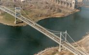
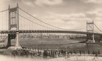
1938: Thousand Islands International I
Wellesley Island and Collins Landing, New York, USA - St. Lawrence River
| Bridgemeister ID: | 364 (added before 2003) |
| Year Completed: | 1938 |
| Name: | Thousand Islands International I |
| Location: | Wellesley Island and Collins Landing, New York, USA |
| Crossing: | St. Lawrence River |
| At or Near Feature: | American Channel |
| Coordinates: | 44.30333 N 75.98333 W |
| Maps: | Acme, GeoHack, Google, OpenStreetMap |
| Principals: | Robinson and Steinman |
| References: | AAJ, ADDS |
| Use: | Vehicular (two-lane, heavy vehicles), with walkway |
| Status: | In use (last checked: 2022) |
| Main Cables: | Wire (steel) |
| Suspended Spans: | 3 |
| Main Span: | 1 x 243.8 meters (800 feet) |
| Side Spans: | 2 x 106.7 meters (350 feet) |
Notes:
External Links:
Image Sets:


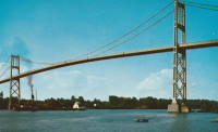
1939: Bronx-Whitestone
The Bronx and Queens, New York, USA - East River
| Bridgemeister ID: | 191 (added before 2003) |
| Year Completed: | 1939 |
| Name: | Bronx-Whitestone |
| Location: | The Bronx and Queens, New York, USA |
| Crossing: | East River |
| Coordinates: | 40.80167 N 73.83 W |
| Maps: | Acme, GeoHack, Google, OpenStreetMap |
| Principals: | O. H. Ammann, Allston Dana |
| References: | AAJ, ARF, BAAW, BBR, BFL, BPL, GBD, SIX |
| Use: | Vehicular (major highway) |
| Status: | In use (last checked: 2022) |
| Main Cables: | Wire (steel) |
| Suspended Spans: | 3 |
| Main Span: | 1 x 701 meters (2,300 feet) |
| Side Spans: | 2 x 224 meters (735 feet) |
Notes:
External Links:
Image Sets:

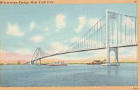
1948: (footbridge)
Stockport and Columbiaville, New York, USA - Kinderhook Creek
| Bridgemeister ID: | 8793 (added 2024-09-13) |
| Year Completed: | 1948 |
| Name: | (footbridge) |
| Location: | Stockport and Columbiaville, New York, USA |
| Crossing: | Kinderhook Creek |
| Coordinates: | 42.317444 N 73.746083 W |
| Maps: | Acme, GeoHack, Google, OpenStreetMap |
| Use: | Footbridge |
| Status: | Collapsed, 2010 |
| Main Cables: | Wire (steel) |
Notes:
- Crossed Kinderhook Creek just a few feet north of the confluence of Kinderhook, Claverack, and Stockport Creeks. Said to have replaced multiple prior suspension bridges built in the 1914, the 1920s, and 1938.
- 1983: Closed.
- 2010, February: Collapsed due to snow and ice accumulation.
External Links:
- Saturday, June 27, 2009 Along Stockport Creek - UpstateEarth.blogspot.com. Blog post with images of the derelict bridge prior to the 2010 collapse. Dated June 27, 2009.
- Suspension Bridge Collapses - DailyGazette.com. Article dated February 24, 2010 covering the bridge's collapse.
1958: Three Nations Crossing
Cornwall, Ontario, Canada and Massena, New York, USA - St. Lawrence River
| Bridgemeister ID: | 325 (added before 2003) |
| Year Completed: | 1958 |
| Name: | Three Nations Crossing |
| Also Known As: | Cornwall-Massena International, Seaway International |
| Location: | Cornwall, Ontario, Canada and Massena, New York, USA |
| Crossing: | St. Lawrence River |
| Coordinates: | 44.989962 N 74.739913 W |
| Maps: | Acme, GeoHack, Google, OpenStreetMap |
| References: | STL |
| Use: | Vehicular |
| Status: | In use (last checked: 2019) |
| Main Cables: | Wire (steel) |
| Suspended Spans: | 3 |
| Main Span: | 1 |
| Side Spans: | 2 |
Notes:
- Renamed "Three Nations Crossing" effective January 1, 2000 in recognition of the Mohawks of Akwesasne
External Links:
Image Sets:
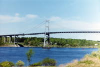
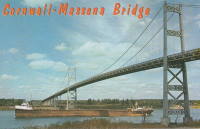
1960: Ogdensburg-Prescott International
Ogdensburg, New York, USA and Prescott, Ontario, Canada - St. Lawrence River
| Bridgemeister ID: | 214 (added before 2003) |
| Year Completed: | 1960 |
| Name: | Ogdensburg-Prescott International |
| Also Known As: | Seaway Skyway |
| Location: | Ogdensburg, New York, USA and Prescott, Ontario, Canada |
| Crossing: | St. Lawrence River |
| Coordinates: | 44.73 N 75.45667 W |
| Maps: | Acme, GeoHack, Google, OpenStreetMap |
| Principals: | Modjeski & Masters |
| Use: | Vehicular (major highway) |
| Status: | In use (last checked: 2019) |
| Main Cables: | Wire (steel) |
| Suspended Spans: | 3 |
| Main Span: | 1 x 350.75 meters (1,150.8 feet) |
| Side Spans: | 2 |
External Links:
Image Sets:
1961: Throgs Neck
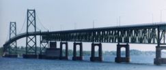
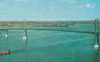
The Bronx and Queens, New York, USA - East River
| Bridgemeister ID: | 215 (added before 2003) |
| Year Completed: | 1961 |
| Name: | Throgs Neck |
| Location: | The Bronx and Queens, New York, USA |
| Crossing: | East River |
| Coordinates: | 40.8 N 73.795 W |
| Maps: | Acme, GeoHack, Google, OpenStreetMap |
| Principals: | O. H. Ammann |
| References: | ARF, BCO, SIX, VNB |
| Use: | Vehicular (major highway) |
| Status: | In use (last checked: 2022) |
| Main Cables: | Wire (steel) |
| Suspended Spans: | 3 |
| Main Span: | 1 x 548.6 meters (1,800 feet) |
| Side Spans: | 2 |
Notes:
External Links:
Image Sets:
1961: Triphammer
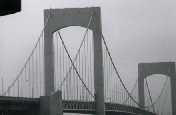
Ithaca, New York, USA - Fall Creek Gorge
| Bridgemeister ID: | 356 (added before 2003) |
| Year Completed: | 1961 |
| Name: | Triphammer |
| Also Known As: | Fall Creek |
| Location: | Ithaca, New York, USA |
| Crossing: | Fall Creek Gorge |
| At or Near Feature: | Cornell University campus |
| Coordinates: | 42.452017 N 76.486083 W |
| Maps: | Acme, GeoHack, Google, OpenStreetMap |
| Principals: | S.C. Hollister, William McGuire |
| Use: | Footbridge |
| Status: | In use (last checked: 2007) |
| Main Cables: | Wire (steel) |
| Suspended Spans: | 1 |
| Main Span: | 1 x 82.3 meters (270 feet) estimated |
Notes:
Image Sets:
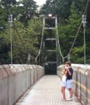
1964: Verrazzano Narrows
Brooklyn and Staten Island, New York, USA - Verrazano Narrows
| Bridgemeister ID: | 219 (added before 2003) |
| Year Completed: | 1964 |
| Name: | Verrazzano Narrows |
| Also Known As: | Verrazano Narrows |
| Location: | Brooklyn and Staten Island, New York, USA |
| Crossing: | Verrazano Narrows |
| Coordinates: | 40.60667 N 74.045 W |
| Maps: | Acme, GeoHack, Google, OpenStreetMap |
| Principals: | Othmar H. Ammann, Whitney |
| References: | BBR, BC3, BFL, BOU, COB, CTW, GBD, LAB, SIX, VNB |
| Use: | Vehicular (double-deck) |
| Status: | In use (last checked: 2022) |
| Main Cables: | Wire (steel) |
| Suspended Spans: | 3 |
| Main Span: | 1 x 1,298.4 meters (4,260 feet) |
| Side Spans: | 2 |
Notes:
- 2017: Long known as the "Verrazano" bridge, efforts to fix the spelling of the bridge's name to "Verrazzano" (such as Giovanni da Verrazzano) pick up momentum with New York state legislature and senate.
- Became longest suspension bridge by eclipsing 1937 Golden Gate - San Francisco and Marin County, California, USA.
- Eclipsed by new longest suspension bridge 1981 Humber - Hull, Humberside, England, United Kingdom.
External Links:
Image Sets:

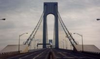
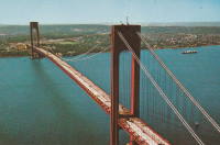
1983: Flat Rock
Ithaca, New York, USA - Fall Creek
| Bridgemeister ID: | 864 (added 2003-08-23) |
| Year Completed: | 1983 |
| Name: | Flat Rock |
| Also Known As: | Eva Howe Stevens, Rifle Range |
| Location: | Ithaca, New York, USA |
| Crossing: | Fall Creek |
| At or Near Feature: | Cornell Botanic Gardens |
| Coordinates: | 42.454983 N 76.45545 W |
| Maps: | Acme, GeoHack, Google, OpenStreetMap |
| Principals: | Cornell Student Chapter of American Society of Civil Engineers (ASCE) |
| Use: | Footbridge |
| Status: | In use (last checked: 2024) |
| Main Cables: | Wire (steel) |
| Suspended Spans: | 1 |
| Main Span: | 1 x 54.9 meters (180 feet) estimated |
Notes:
- 2023: Renovated by students in the same ASCE chapter that built the bridge in 1983.
Image Sets:
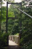
2002: Popolopen
Fort Montgomery, New York, USA - Popolopen Creek
| Bridgemeister ID: | 951 (added 2003-10-31) |
| Year Completed: | 2002 |
| Name: | Popolopen |
| Also Known As: | William J. Moreau Popolopen |
| Location: | Fort Montgomery, New York, USA |
| Crossing: | Popolopen Creek |
| At or Near Feature: | Bear Mountain Park, Appalachian Trail |
| Coordinates: | 41.323017 N 73.989017 W |
| Maps: | Acme, GeoHack, Google, OpenStreetMap |
| Principals: | Cleveland Bridge USA, Dorman Long Technology, Creative Pultrusions Inc. |
| Use: | Footbridge |
| Status: | In use (last checked: 2020) |
| Main Cables: | Wire (steel) |
| Suspended Spans: | 1 |
| Main Span: | 1 x 102.4 meters (336 feet) |
| Deck width: | 11 feet |
Notes:
- Hybrid truss-suspension.
- Dedicated June 27, 2014 to William J. Moreau, a former Chief Engineer of the New York State Bridge Authority.
- Near 1924 Bear Mountain - Anthony's Nose and Bear Mountain, New York, USA.
External Links:
Image Sets:
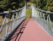
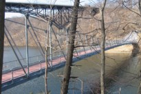
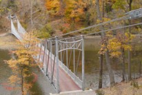
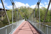
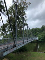
2017: Wanakena
Wanakena, New York, USA - Oswegatchie River
| Bridgemeister ID: | 2751 (added 2019-06-29) |
| Year Completed: | 2017 |
| Name: | Wanakena |
| Location: | Wanakena, New York, USA |
| Crossing: | Oswegatchie River |
| Coordinates: | 44.132886 N 74.921365 W |
| Maps: | Acme, GeoHack, Google, OpenStreetMap |
| Status: | In use (last checked: 2017) |
| Main Cables: | Wire (steel) |
Notes:
(footbridge)
Broadalbin, New York, USA - Kennyetto Creek
| Bridgemeister ID: | 246 (added before 2003) |
| Name: | (footbridge) |
| Location: | Broadalbin, New York, USA |
| Crossing: | Kennyetto Creek |
| Coordinates: | 43.060575 N 74.192652 W |
| Maps: | Acme, GeoHack, Google, OpenStreetMap |
| Use: | Footbridge |
| Status: | Removed |
| Main Cables: | Wire |
| Suspended Spans: | 1 |
Image Sets:
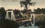
| Bridgemeister ID: | 7204 (added 2022-07-07) |
| Name: | (footbridge) |
| Location: | Copake, New York, USA |
| At or Near Feature: | Camp Pontiac |
| Coordinates: | 42.082996 N 73.594446 W |
| Maps: | Acme, GeoHack, Google, OpenStreetMap |
| Principals: | Norman Horowitz |
| Use: | Footbridge |
| Status: | In use (last checked: 2017) |
| Main Cables: | Wire (steel) |
| Suspended Spans: | 1 |
Notes:
- Completed at some point in the 1960s.
External Links:
(footbridge)
Esopus, New York, USA - Black Creek
| Bridgemeister ID: | 251 (added before 2003) |
| Name: | (footbridge) |
| Location: | Esopus, New York, USA |
| Crossing: | Black Creek |
| At or Near Feature: | Black Creek Forest Preserve |
| Coordinates: | 41.8211 N 73.96285 W |
| Maps: | Acme, GeoHack, Google, OpenStreetMap |
| Use: | Footbridge |
| Status: | In use (last checked: 2021) |
| Main Cables: | Wire (steel) |
| Suspended Spans: | 3 |
| Main Span: | 1 x 24.4 meters (80 feet) |
| Side Spans: | 1 x 4 meters (13 feet), 1 x 8.2 meters (27 feet) |
Image Sets:
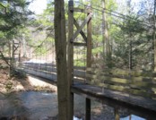
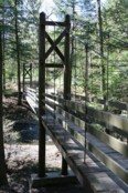
(footbridge)
Fine, Wanakena vicinity, New York, USA - Oswegatchie River Inlet
| Bridgemeister ID: | 1758 (added 2005-04-21) |
| Name: | (footbridge) |
| Location: | Fine, Wanakena vicinity, New York, USA |
| Crossing: | Oswegatchie River Inlet |
| Coordinates: | 44.125075 N 74.959212 W |
| Maps: | Acme, GeoHack, Google, OpenStreetMap |
| Use: | Footbridge |
| Status: | Extant (last checked: 2021) |
| Main Cables: | Wire (steel) |
| Main Span: | 1 |
Notes:
Image Sets:

(footbridge)
Hardenburgh vicinity, New York, USA - Beaverkill Creek
| Bridgemeister ID: | 2607 (added 2014-04-15) |
| Name: | (footbridge) |
| Location: | Hardenburgh vicinity, New York, USA |
| Crossing: | Beaverkill Creek |
| At or Near Feature: | Mongaup Hardenburgh Trail |
| Use: | Footbridge |
| Status: | In use (last checked: 2009) |
| Main Cables: | Wire |
(footbridge)
Montour Falls, New York, USA - L'Hommedieu Diversion Channel
| Bridgemeister ID: | 1337 (added 2004-05-01) |
| Name: | (footbridge) |
| Location: | Montour Falls, New York, USA |
| Crossing: | L'Hommedieu Diversion Channel |
| At or Near Feature: | Frederick L. Warder Academy of Fire Science |
| Coordinates: | 42.34221 N 76.83645 W |
| Maps: | Acme, GeoHack, Google, OpenStreetMap |
| Use: | Footbridge |
| Status: | In use (last checked: 2004) |
| Main Cables: | Wire (steel) |
| Suspended Spans: | 3 |
| Main Span: | 1 |
| Side Spans: | 2 |
Image Sets:
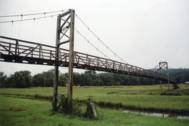
(footbridge)
Plattsburgh, New York, USA - Saranac River
| Bridgemeister ID: | 1787 (added 2005-05-17) |
| Name: | (footbridge) |
| Location: | Plattsburgh, New York, USA |
| Crossing: | Saranac River |
| Coordinates: | 44.6991 N 73.449467 W |
| Maps: | Acme, GeoHack, Google, OpenStreetMap |
| Use: | Footbridge |
| Status: | In use (last checked: 2019) |
| Main Cables: | Wire (steel) |
| Suspended Spans: | 3 |
| Main Span: | 1 x 64 meters (210 feet) estimated |
| Side Spans: | 2 x 23.8 meters (78 feet) estimated |
(footbridge)
Shattuck Clearing vicinity and Long Lake vicinity, New York, USA - Moose River
| Bridgemeister ID: | 1636 (added 2005-03-13) |
| Name: | (footbridge) |
| Location: | Shattuck Clearing vicinity and Long Lake vicinity, New York, USA |
| Crossing: | Moose River |
| At or Near Feature: | Northville-Lake Placid Trail |
| Use: | Footbridge |
| Status: | In use (last checked: 2004) |
| Main Cables: | Wire |
Notes:
(footbridge)
Shattuck Clearing vicinity and Long Lake vicinity, New York, USA - Cold River
| Bridgemeister ID: | 1637 (added 2005-03-13) |
| Name: | (footbridge) |
| Location: | Shattuck Clearing vicinity and Long Lake vicinity, New York, USA |
| Crossing: | Cold River |
| At or Near Feature: | Northville-Lake Placid Trail |
| Use: | Footbridge |
| Status: | In use (last checked: 2004) |
| Main Cables: | Wire |
Notes:
(footbridge)
South Buffalo, New York, USA - Cazenovia Creek
| Bridgemeister ID: | 868 (added 2003-08-30) |
| Name: | (footbridge) |
| Location: | South Buffalo, New York, USA |
| Crossing: | Cazenovia Creek |
| At or Near Feature: | Cazenovia Park |
| Coordinates: | 42.84315 N 78.80165 W |
| Maps: | Acme, GeoHack, Google, OpenStreetMap |
| Principals: | Works Progress Administration |
| Use: | Footbridge |
| Status: | In use (last checked: 2004) |
Notes:
- Constructed by WPA in the 1930s, rebuilt in 1989.
(pipeline bridge)
Watertown, New York, USA - Black River
| Bridgemeister ID: | 2039 (added 2006-05-07) |
| Name: | (pipeline bridge) |
| Location: | Watertown, New York, USA |
| Crossing: | Black River |
| Coordinates: | 43.9967 N 75.9336 W |
| Maps: | Acme, GeoHack, Google, OpenStreetMap |
| Use: | Pipeline |
| Status: | Extant |
| Main Cables: | Wire (steel) |
Image Sets:
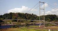
Addison
Addison, New York, USA - Canisteo River
| Bridgemeister ID: | 272 (added before 2003) |
| Name: | Addison |
| Location: | Addison, New York, USA |
| Crossing: | Canisteo River |
| Coordinates: | 42.107917 N 77.226333 W |
| Maps: | Acme, GeoHack, Google, OpenStreetMap |
| Use: | Vehicular (one-lane) |
| Status: | Removed |
| Main Cables: | Wire |
| Suspended Spans: | 1 |
Notes:
- Was located at the foot of Goodhue Street.
- 1935: Damaged by flood. Restricted to foot traffic.
- 1946: Further wrecked by flood and eventually removed.
Image Sets:
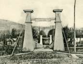

Bottcher's Landing
Big Flats, New York, USA - Chemung River
| Bridgemeister ID: | 2632 (added 2019-02-24) |
| Name: | Bottcher's Landing |
| Location: | Big Flats, New York, USA |
| Crossing: | Chemung River |
| Coordinates: | 42.123806 N 76.951028 W |
| Maps: | Acme, GeoHack, Google, OpenStreetMap |
| Use: | Vehicular |
| Status: | Removed |
| Main Cables: | Wire |
Guymard
Godeffroy, Cuddebackville vicinity and Guymard, New York, USA - Neversink River
| Bridgemeister ID: | 282 (added before 2003) |
| Name: | Guymard |
| Also Known As: | Cuddebackville |
| Location: | Godeffroy, Cuddebackville vicinity and Guymard, New York, USA |
| Crossing: | Neversink River |
| Coordinates: | 41.441 N 74.602 W |
| Maps: | Acme, GeoHack, Google, OpenStreetMap |
| Use: | Vehicular (one-lane) |
| Status: | Removed |
| Main Cables: | Wire (iron) |
Notes:
- Completed circa 1850. Deck failed, 1927.
Image Sets:
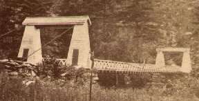
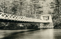
Halfway Brook
Barryville and Eldred, New York, USA - Halfway Brook
| Bridgemeister ID: | 863 (added 2003-08-09) |
| Name: | Halfway Brook |
| Also Known As: | Cable, Half Way |
| Location: | Barryville and Eldred, New York, USA |
| Crossing: | Halfway Brook |
| Use: | Vehicular |
| Main Cables: | Wire |
| Suspended Spans: | 1 |
Notes:
- This is a different bridge than the better-known Delaware crossing between Barryville and Shohola, Pennsylvania. The Halfway Brook bridge was a short, squat suspension bridge with stone towers, probably not longer than 75 feet.
- Was in use in 1917.
Mongaup
Mongaup, New York, USA - Mongaup River
| Bridgemeister ID: | 345 (added before 2003) |
| Name: | Mongaup |
| Location: | Mongaup, New York, USA |
| Crossing: | Mongaup River |
| References: | WDH |
| Status: | Removed |
| Main Cables: | Wire |
| Suspended Spans: | 1 |
Northville-Placid Trail
Whitehouse, Lake Pleasant, New York, USA - West Branch Sacandaga River
| Bridgemeister ID: | 5673 (added 2021-01-31) |
| Name: | Northville-Placid Trail |
| Location: | Whitehouse, Lake Pleasant, New York, USA |
| Crossing: | West Branch Sacandaga River |
| At or Near Feature: | Northville-Placid Trail, Silver Lake Wilderness |
| Coordinates: | 43.372984 N 74.435520 W |
| Maps: | Acme, GeoHack, Google, OpenStreetMap |
| Use: | Footbridge |
| Status: | In use (last checked: 2020) |
| Main Cables: | Wire (steel) |
| Main Spans: | 2 |
Orange County Golf Club
Middletown, New York, USA - Wallkill River
| Bridgemeister ID: | 348 (added before 2003) |
| Name: | Orange County Golf Club |
| Location: | Middletown, New York, USA |
| Crossing: | Wallkill River |
| Coordinates: | 41.432753 N 74.374064 W |
| Maps: | Acme, GeoHack, Google, OpenStreetMap |
| Principals: | John A. Roebling Sons, Co. |
| Use: | Golf cart |
| Status: | In use (last checked: 2016) |
| Main Cables: | Wire (steel) |
| Suspended Spans: | 1 |
| Main Span: | 1 x 61 meters (200 feet) |
Notes:
- Completed in 1926 or 1928. Now known as Orange Country Club.
- 2012: "Orange County Golf Club" renamed to "West Hills Country Club".
Sister Island
Niagara Falls, New York, USA - Niagara River
| Bridgemeister ID: | 649 (added 2003-02-17) |
| Name: | Sister Island |
| Location: | Niagara Falls, New York, USA |
| Crossing: | Niagara River |
| At or Near Feature: | Three Sister Islands |
| References: | HBE |
| Use: | Footbridge |
| Status: | Removed |
| Main Cables: | Wire |
| Suspended Spans: | 1 |
Image Sets:
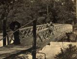
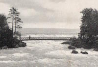
Swing
Keeseville, New York, USA - Ausable River
| Bridgemeister ID: | 357 (added before 2003) |
| Name: | Swing |
| Location: | Keeseville, New York, USA |
| Crossing: | Ausable River |
| References: | ONC |
| Status: | Collapsed, 1842 |
| Main Cables: | Chain (iron) |
Notes:
- Collapsed September 13, 1842 under weight of troops (ONC).
- Later at same (or nearby) location 1888 Swing - Keeseville, New York, USA.
- All past and present bridges at this location.
Swinging
Palenville, New York, USA - Kaaterskill Creek
| Bridgemeister ID: | 564 (added before 2003) |
| Name: | Swinging |
| Location: | Palenville, New York, USA |
| Crossing: | Kaaterskill Creek |
| Coordinates: | 42.17399 N 74.02395 W |
| Maps: | Acme, GeoHack, Google, OpenStreetMap |
| Use: | Footbridge |
| Status: | Destroyed, 2011 (last checked: 2011) |
| Main Cables: | Wire |
| Suspended Spans: | 1 |
| Main Span: | 1 x 24.4 meters (80 feet) |
Notes:
- Destroyed by flood following Hurricane Irene, 2011.
Image Sets:
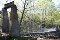
Wellsburg & Lowman
Wellsburg and Lowman, New York, USA - Chemung River
| Bridgemeister ID: | 368 (added before 2003) |
| Name: | Wellsburg & Lowman |
| Location: | Wellsburg and Lowman, New York, USA |
| Crossing: | Chemung River |
| Coordinates: | 42.017306 N 76.723167 W |
| Maps: | Acme, GeoHack, Google, OpenStreetMap |
| Status: | Removed |
Do you have any information or photos for these bridges that you would like to share? Please email david.denenberg@bridgemeister.com.
Mail | Facebook | X (Twitter) | Bluesky