Suspension Bridges of Arizona
This is a list of all 21 bridges from the suspension bridge inventory for Arizona in USA. Wherever you see a Bridgemeister ID number click it to isolate the bridge on its own page.
Related Lists:
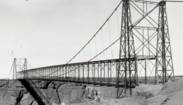
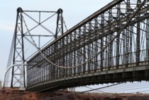
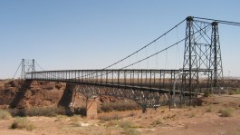
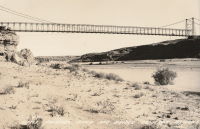
1911: Cameron
Cameron, Arizona, USA - Little Colorado River
| Bridgemeister ID: | 125 (added before 2003) |
| Year Completed: | 1911 |
| Name: | Cameron |
| Location: | Cameron, Arizona, USA |
| Crossing: | Little Colorado River |
| Coordinates: | 35.875733 N 111.412567 W |
| Maps: | Acme, GeoHack, Google, OpenStreetMap |
| Principals: | Midland Bridge Co., W.H. Code, John Charles |
| References: | GBD |
| Use: | Vehicular and Pipeline |
| Status: | Closed (last checked: 2012) |
| Main Cables: | Wire (steel) |
| Suspended Spans: | 1 |
| Main Span: | 1 x 201.2 meters (660 feet) |
Notes:
- The bridge currently carries a pipeline, but the road deck is closed to all traffic.
External Links:

1920: Kaibab Trail
Grand Canyon National Park, Arizona, USA - Colorado River
| Bridgemeister ID: | 2186 (added 2007-01-15) |
| Year Completed: | 1920 |
| Name: | Kaibab Trail |
| Location: | Grand Canyon National Park, Arizona, USA |
| Crossing: | Colorado River |
| Principals: | George C. Goodwin |
| References: | AAJ |
| Use: | Footbridge |
| Status: | Replaced, 1928 |
| Main Cables: | Wire |
| Suspended Spans: | 1 |
Notes:
- Replaced by 1928 Kaibab Trail (Black, South Kaibab) - Bright Angel Campground vicinity, Arizona, USA.
- All past and present bridges at this location.
External Links:
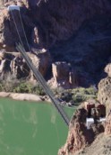
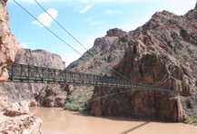
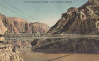
1928: Kaibab Trail
Bright Angel Campground vicinity, Arizona, USA - Colorado River
| Bridgemeister ID: | 155 (added before 2003) |
| Year Completed: | 1928 |
| Name: | Kaibab Trail |
| Also Known As: | Black, South Kaibab |
| Location: | Bright Angel Campground vicinity, Arizona, USA |
| Crossing: | Colorado River |
| At or Near Feature: | Grand Canyon National Park |
| Coordinates: | 36.10076 N 112.08918 W |
| Maps: | Acme, GeoHack, Google, OpenStreetMap |
| Principals: | Ward P. Webber, John H. Lawrence |
| Use: | Footbridge |
| Status: | In use (last checked: 2007) |
| Main Cables: | Wire (steel) |
| Suspended Spans: | 1 |
| Main Span: | 1 x 126.8 meters (416 feet) estimated |
| Deck width: | 5 feet |
Notes:
- Replaced 1920 Kaibab Trail - Grand Canyon National Park, Arizona, USA.
- Near Silver - Bright Angel Campground vicinity, Arizona, USA.
- All past and present bridges at this location.
External Links:
1929: McPhaul
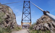
Yuma, Arizona, USA - Gila River
| Bridgemeister ID: | 161 (added before 2003) |
| Year Completed: | 1929 |
| Name: | McPhaul |
| Also Known As: | Dome, Gila River |
| Location: | Yuma, Arizona, USA |
| Crossing: | Gila River |
| Coordinates: | 32.75969 N 114.42158 W |
| Maps: | Acme, GeoHack, Google, OpenStreetMap |
| Principals: | Levy Construction Company |
| References: | AAJ, SJR, YS20041217 |
| Use: | Vehicular (one-lane) |
| Status: | Closed (last checked: 2008) |
| Main Cables: | Wire (steel) |
| Suspended Spans: | 1 |
| Main Span: | 1 x 283.5 meters (930.1 feet) |
| Deck width: | 16 feet |
Notes:
- YS20041217: Renamed McPhaul Bridge in honor of Henry Harrison "Harry" McPhaul, "the only Yuma resident who ever became an Arizona Ranger." Bypassed, 1968. 150 feet of deck damaged by fire, 1990.
External Links:
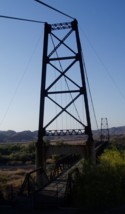
1943: Sheep
Sheep Crossing (Cave Creek vicinity), Arizona, USA - Verde River
| Bridgemeister ID: | 201 (added before 2003) |
| Year Completed: | 1943 |
| Name: | Sheep |
| Also Known As: | Red Point Sheep, Verde River Sheep |
| Location: | Sheep Crossing (Cave Creek vicinity), Arizona, USA |
| Crossing: | Verde River |
| Coordinates: | 34.077674 N 111.707743 W |
| Maps: | Acme, GeoHack, Google, OpenStreetMap |
| Principals: | Flagstaff Sheep Co., Cyril O. Gilliam, Frank Auza, George W. Smith. |
| References: | HAERAZ10 |
| Use: | Footbridge and Stock |
| Status: | Replaced, 1988 |
| Main Cables: | Wire |
| Main Span: | 1 x 145.1 meters (476 feet) |
| Deck width: | 3 feet |
Notes:
- From a sign at the site: "The Old Verde River Sheep Bridge. The original Verde River Sheep Bridge, also known as the Red Point Sheep Bridge, was constructed at this location in 1943 by Flagstaff Sheep Company, which had been grazing sheep in the area under a Forest Service permit since 1926....
"Erected with hand tools and a few mules during World War II, the bridge was constructed largely with salvaged materials. Overall length of the structure from cable anchorage to cable anchorage was 691 feet, and the distance between the towers was 568 feet. The walkway was 476 feet long and three feet wide. The towers originally were constructed with wood, as was the walkway. Soon after the bridge was completed, the wooden towers were reinforced with concrete buttresses. Each main suspension cable consisted of a pair of... lock-coil, spiral strands, which were obtained from an abandoned tramway that carted copper ore.... Only the towers of the old bridge remain.
"Although several other bridges of this type previously had been built in Arizona, Verde River Sheep Bridge was the last of its kind in the Southwest when it was entered into the National Register of Historic Places in 1978. In 1988, weakened by years of service and floods, the bridge was disassembled. In 1989 the bridge found here today was erected. Reminiscent of the original structure, the new bridge recalls the ingenuity of the pioneer sheepmen and a way of ranching that has virtually disappeared from the Arizona scene." - Many remnants from this bridge are still visible at the site.
- Replaced by 1989 Sheep - Sheep Crossing (Cave Creek vicinity), Arizona, USA.
- All past and present bridges at this location.
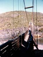
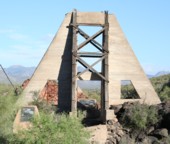
1957: Glen Canyon
Glen Canyon Dam, Arizona, USA - Colorado River
| Bridgemeister ID: | 1191 (added 2004-01-25) |
| Year Completed: | 1957 |
| Name: | Glen Canyon |
| Location: | Glen Canyon Dam, Arizona, USA |
| Crossing: | Colorado River |
| Principals: | Kiewit-Judson Pacific Murphy Co. |
| Use: | Footbridge |
| Status: | Removed |
| Main Cables: | Wire (steel) |
| Suspended Spans: | 1 |
| Main Span: | 1 x 390.1 meters (1,280 feet) |
Notes:
- Very long, very high footbridge spanning the canyon. Originally built for bridge workers building the Glen Canyon Bridge (the large deck arch next to the dam). Survived at least until 1959.
- From a Roebling ad in the July 1958 issue of Civil Engineering: "The bridge was completed in sixty days and features a steel mesh deck, to reduce wind resistance. Construction was started by lowering two 5/8 in. cables to the bottom of the west side of the gorge, transporting them across the river by boat and raising them on the east side by block and tackle. The six main suspension cables are 1 3/4 in. diameter prestretched galvanized bridge strands. From them are hung sixty-four 5/8 in. suspenders, attached to 7 ft-wide floor beams. The wire mesh floor is laid on eight 1 in. diameter deck cables. These in turn are supported every twenty feet by the floor beams. For safety, four handrail cables are attached to the suspenders. To add stability in strong winds, two 1 3/4 in. bridge strand wind brace cables run below the deck on either side for its length."
External Links:
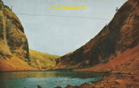
1989: Sheep
Sheep Crossing (Cave Creek vicinity), Arizona, USA - Verde River
| Bridgemeister ID: | 235 (added before 2003) |
| Year Completed: | 1989 |
| Name: | Sheep |
| Location: | Sheep Crossing (Cave Creek vicinity), Arizona, USA |
| Crossing: | Verde River |
| Coordinates: | 34.077578 N 111.707317 W |
| Maps: | Acme, GeoHack, Google, OpenStreetMap |
| Use: | Footbridge and Stock |
| Status: | In use (last checked: 2007) |
| Main Cables: | Wire (steel) |
| Suspended Spans: | 1 |
| Main Span: | 1 x 152.4 meters (500 feet) estimated |
Notes:
- Replaced 1943 Sheep (Red Point Sheep, Verde River Sheep) - Sheep Crossing (Cave Creek vicinity), Arizona, USA.
- All past and present bridges at this location.
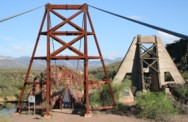
2004: Berber
Superior, Arizona, USA - Queen Creek
| Bridgemeister ID: | 2443 (added 2008-04-23) |
| Year Completed: | 2004 |
| Name: | Berber |
| Location: | Superior, Arizona, USA |
| Crossing: | Queen Creek |
| At or Near Feature: | Boyce Arboretum |
| Coordinates: | 33.277250 N 111.153117 W |
| Maps: | Acme, GeoHack, Google, OpenStreetMap |
| Use: | Footbridge |
| Status: | In use (last checked: 2017) |
| Main Cables: | Wire (steel) |
| Suspended Spans: | 1 |
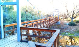
| Bridgemeister ID: | 2286 (added 2007-04-23) |
| Name: | (footbridge) |
| Location: | Sedona vicinity, Arizona, USA |
| Crossing: | Oak Creek |
| Coordinates: | 34.96007 N 111.75343 W |
| Maps: | Acme, GeoHack, Google, OpenStreetMap |
| Use: | Footbridge |
| Status: | In use (last checked: 2012) |
| Main Cables: | Wire (steel) |
| Suspended Spans: | 1 |
Notes:
- Patrick S. O'Donnell provided a rough main span estimate of 120 feet.
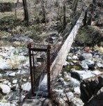
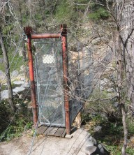
(footbridge)
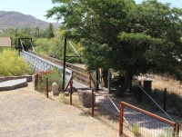
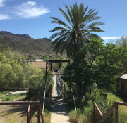
Superior, Arizona, USA - Queen Creek
| Bridgemeister ID: | 2611 (added 2014-04-15) |
| Name: | (footbridge) |
| Location: | Superior, Arizona, USA |
| Crossing: | Queen Creek |
| Coordinates: | 33.290709 N 111.105738 W |
| Maps: | Acme, GeoHack, Google, OpenStreetMap |
| Use: | Footbridge |
| Status: | In use (last checked: 2019) |
| Main Cables: | Wire (steel) |
| Suspended Spans: | 1 |
| Main Span: | 1 x 35.4 meters (116 feet) estimated |
(footbridge)
Superior, Arizona, USA - Queen Creek
| Bridgemeister ID: | 2920 (added 2019-09-15) |
| Name: | (footbridge) |
| Location: | Superior, Arizona, USA |
| Crossing: | Queen Creek |
| Coordinates: | 33.292711 N 111.098853 W |
| Maps: | Acme, GeoHack, Google, OpenStreetMap |
| Use: | Footbridge |
| Status: | In use (last checked: 2019) |
| Main Cables: | Wire (steel) |
(pipeline bridge)
Benson, Arizona, USA - San Pedro River
| Bridgemeister ID: | 2328 (added 2007-06-11) |
| Name: | (pipeline bridge) |
| Location: | Benson, Arizona, USA |
| Crossing: | San Pedro River |
| Coordinates: | 31.975290 N 110.278883 W |
| Maps: | Acme, GeoHack, Google, OpenStreetMap |
| Use: | Pipeline |
| Status: | Extant (last checked: 2019) |
| Main Cables: | Wire (steel) |
Notes:
- Likely several pipeline suspension bridges across the San Pedro near Benson.
- Next to (pipeline bridge) - Benson, Arizona, USA.
- Near (pipeline bridge) - Benson, Arizona, USA.
- All past and present bridges at this location.
(pipeline bridge)
Benson, Arizona, USA - San Pedro River
| Bridgemeister ID: | 3303 (added 2019-11-28) |
| Name: | (pipeline bridge) |
| Location: | Benson, Arizona, USA |
| Crossing: | San Pedro River |
| Coordinates: | 31.980649 N 110.281095 W |
| Maps: | Acme, GeoHack, Google, OpenStreetMap |
| Use: | Pipeline |
| Status: | Extant (last checked: 2019) |
| Main Cables: | Wire (steel) |
Notes:
(pipeline bridge)
Benson, Arizona, USA - San Pedro River
| Bridgemeister ID: | 3304 (added 2019-11-28) |
| Name: | (pipeline bridge) |
| Location: | Benson, Arizona, USA |
| Crossing: | San Pedro River |
| Coordinates: | 31.974698 N 110.278894 W |
| Maps: | Acme, GeoHack, Google, OpenStreetMap |
| Use: | Pipeline |
| Status: | Extant (last checked: 2019) |
| Main Cables: | Wire (steel) |
Notes:
(pipeline bridge)
Blythe, California and Ehrenberg, Arizona, USA - Colorado River
| Bridgemeister ID: | 2522 (added 2010-01-02) |
| Name: | (pipeline bridge) |
| Location: | Blythe, California and Ehrenberg, Arizona, USA |
| Crossing: | Colorado River |
| Coordinates: | 33.60182 N 114.53324 W |
| Maps: | Acme, GeoHack, Google, OpenStreetMap |
| Use: | Pipeline |
| Status: | Extant (last checked: 2010) |
| Main Cables: | Wire (steel) |
| Suspended Spans: | 1 |
(pipeline bridge)
Topock, Arizona and Needles vicinity, California, USA - Colorado River
| Bridgemeister ID: | 1507 (added 2004-10-09) |
| Name: | (pipeline bridge) |
| Location: | Topock, Arizona and Needles vicinity, California, USA |
| Crossing: | Colorado River |
| Coordinates: | 34.71531 N 114.48255 W |
| Maps: | Acme, GeoHack, Google, OpenStreetMap |
| Use: | Pipeline |
| Status: | Extant (last checked: 2004) |
| Main Cables: | Wire (steel) |
| Suspended Spans: | 1 |
Notes:
- One of two pipeline suspension bridges at this location (adjacent to the I-40 crossing). This one has triangular towers.
- Near (pipeline bridge) - Topock, Arizona and Needles vicinity, California, USA.
External Links:
(pipeline bridge)
Topock, Arizona and Needles vicinity, California, USA - Colorado River
| Bridgemeister ID: | 1508 (added 2004-10-09) |
| Name: | (pipeline bridge) |
| Location: | Topock, Arizona and Needles vicinity, California, USA |
| Crossing: | Colorado River |
| Coordinates: | 34.71587 N 114.48617 W |
| Maps: | Acme, GeoHack, Google, OpenStreetMap |
| Use: | Pipeline |
| Status: | Extant (last checked: 2004) |
| Main Cables: | Wire (steel) |
| Suspended Spans: | 1 |
Notes:
- One of two pipeline suspension bridges at this location (adjacent to the I-40 crossing). This one has rectangular towers.
- Near (pipeline bridge) - Topock, Arizona and Needles vicinity, California, USA.
External Links:
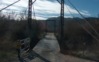
(suspension bridge)
Kearny, Arizona, USA - Gila River
| Bridgemeister ID: | 2934 (added 2019-09-16) |
| Name: | (suspension bridge) |
| Location: | Kearny, Arizona, USA |
| Crossing: | Gila River |
| Coordinates: | 33.054216 N 110.919548 W |
| Maps: | Acme, GeoHack, Google, OpenStreetMap |
| Use: | Vehicular (one-lane) |
| Status: | In use (last checked: 2017) |
| Main Cables: | Wire (steel) |
Blue Point Sheep
Mesa vicinity, Arizona, USA - Salt River
| Bridgemeister ID: | 5050 (added 2020-08-25) |
| Name: | Blue Point Sheep |
| Location: | Mesa vicinity, Arizona, USA |
| Crossing: | Salt River |
| Coordinates: | 33.555430 N 111.587640 W |
| Maps: | Acme, GeoHack, Google, OpenStreetMap |
| Use: | Stock |
| Status: | Removed |
| Main Cables: | Wire |
Notes:
- Pictured on page 464 of the 1956 series of National Geographic magazines. Some remnants appear to be present (as of 2020).
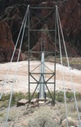
Silver
Bright Angel Campground vicinity, Arizona, USA - Colorado River
| Bridgemeister ID: | 351 (added before 2003) |
| Name: | Silver |
| Location: | Bright Angel Campground vicinity, Arizona, USA |
| Crossing: | Colorado River |
| At or Near Feature: | Grand Canyon National Park |
| Coordinates: | 36.09745 N 112.09550 W |
| Maps: | Acme, GeoHack, Google, OpenStreetMap |
| Use: | Footbridge and Pipeline |
| Status: | In use (last checked: 2020) |
| Main Cables: | Wire (steel) |
| Suspended Spans: | 1 |
| Main Span: | 1 x 149.4 meters (490 feet) |
Notes:
- 2020, September: Closed due to structural concerns. Reopened a week later after a formal structural assessment and some stabilization work. Additional maintenance planned for near future.
- Near 1928 Kaibab Trail (Black, South Kaibab) - Bright Angel Campground vicinity, Arizona, USA.

Do you have any information or photos for these bridges that you would like to share? Please email david.denenberg@bridgemeister.com.
Mail | Facebook | X (Twitter) | Bluesky