Suspension Bridges Completed 1970-1979
This is a list of all 82 bridges from the suspension bridge inventory completed in the decade 1970-1979. Wherever you see a Bridgemeister ID number click it to isolate the bridge on its own page.
Related Lists:
1970: A. Murray Mackay
Halifax and Dartmouth, Nova Scotia, Canada - Halifax Harbour
| Bridgemeister ID: | 227 (added before 2003) |
| Year Completed: | 1970 |
| Name: | A. Murray Mackay |
| Location: | Halifax and Dartmouth, Nova Scotia, Canada |
| Crossing: | Halifax Harbour |
| Coordinates: | 44.67737 N 63.61219 W |
| Maps: | Acme, GeoHack, Google, OpenStreetMap |
| Use: | Vehicular (four-lane) |
| Status: | In use (last checked: 2019) |
| Main Cables: | Wire (steel) |
| Suspended Spans: | 3 |
| Main Span: | 1 |
| Side Spans: | 2 |
External Links:
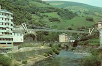
1970: Cangas del Narcea
Cangas del Narcea, Asturias, Spain
1970: Chaijiatai
Chaijiatai (柴家台村), Xigu District (西固区), Lanzhou (兰州市), Gansu, China - Yellow River
| Bridgemeister ID: | 8128 (added 2024-01-13) |
| Year Completed: | 1970 |
| Name: | Chaijiatai |
| Location: | Chaijiatai (柴家台村), Xigu District (西固区), Lanzhou (兰州市), Gansu, China |
| Crossing: | Yellow River |
| Coordinates: | 36.115444 N 103.563389 E |
| Maps: | Acme, GeoHack, Google, OpenStreetMap |
| References: | BCG |
| Status: | Extant (last checked: 2022) |
| Main Cables: | Wire (steel) |
| Main Span: | 1 x 150 meters (492.1 feet) |
1970: Jacob Alfredo Emmendöerfer
Vila Baependi, Jaraguá do Sul, Santa Catarina, Brazil - Rio Itapocu
| Bridgemeister ID: | 5024 (added 2020-08-16) |
| Year Completed: | 1970 |
| Name: | Jacob Alfredo Emmendöerfer |
| Location: | Vila Baependi, Jaraguá do Sul, Santa Catarina, Brazil |
| Crossing: | Rio Itapocu |
| Coordinates: | 26.487872 S 49.073418 W |
| Maps: | Acme, GeoHack, Google, OpenStreetMap |
| Use: | Footbridge |
| Status: | In use (last checked: 2019) |
| Main Cables: | Wire |
External Links:
- Ponte pênsil do Baependi será reaberta oficialmente nesta quinta-feira. 2019, December 12: The bridge has been restored and reopened.
1970: Jingyun
Midu and Lincang, Yunnan, China - Lancang River
| Bridgemeister ID: | 1222 (added 2004-02-15) |
| Year Completed: | 1970 |
| Name: | Jingyun |
| Location: | Midu and Lincang, Yunnan, China |
| Crossing: | Lancang River |
| References: | BYU |
| Use: | Vehicular |
| Main Cables: | Wire (steel) |
| Suspended Spans: | 1 |
| Main Span: | 1 x 80 meters (262.5 feet) |
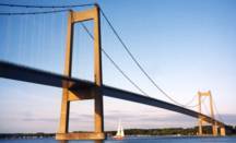
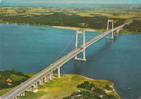
1970: New Little Belt
Jutland and Funen, Denmark - Little Belt
| Bridgemeister ID: | 471 (added before 2003) |
| Year Completed: | 1970 |
| Name: | New Little Belt |
| Also Known As: | New Lillebaelt, Nye Lillebæltsbro |
| Location: | Jutland and Funen, Denmark |
| Crossing: | Little Belt |
| Coordinates: | 55.518516 N 9.750336 E |
| Maps: | Acme, GeoHack, Google, OpenStreetMap |
| Principals: | Ostenfeld and Jonson |
| References: | BAR, BFL |
| Use: | Vehicular (major highway) |
| Status: | In use (last checked: 2019) |
| Main Cables: | Wire (steel) |
| Suspended Spans: | 3 |
| Main Span: | 1 x 600 meters (1,968.5 feet) |
| Side Spans: | 2 |
External Links:
Image Sets:
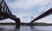
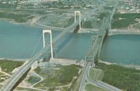
1970: Pierre Laporte
Quebec City and Levis, Quebec, Canada - St. Lawrence River
| Bridgemeister ID: | 228 (added before 2003) |
| Year Completed: | 1970 |
| Name: | Pierre Laporte |
| Location: | Quebec City and Levis, Quebec, Canada |
| Crossing: | St. Lawrence River |
| Coordinates: | 46.741717 N 71.288333 W |
| Maps: | Acme, GeoHack, Google, OpenStreetMap |
| Principals: | Demers-Vandry-Grondquist |
| Use: | Vehicular (major highway) |
| Status: | In use (last checked: 2023) |
| Main Cables: | Wire (steel) |
| Suspended Spans: | 3 |
| Main Span: | 1 x 667.5 meters (2,190 feet) |
| Side Spans: | 2 x 186.5 meters (611.9 feet) |
Notes:
- 2021, November: Weight and lane restrictions imposed pending urgent replacement of several suspender cables.
External Links:
- CBC - Suspension cables on Quebec City's Pierre-Laporte bridge could give way at any time, report finds. June 16, 2022. Article reporting the alarming amount of corrosion found in the bridge's cables. Immediate repairs are recommended.
- Pierre Laporte Bridge - Wikipedia
- Structurae - Structure ID 20003362
Image Sets:
1970: Pingbaodiao
Pingbaoxiang (平堡镇), Jingyuan (靖远县), Baiyin (白银市), Gansu, China - Yellow River
| Bridgemeister ID: | 8133 (added 2024-01-13) |
| Year Completed: | 1970 |
| Name: | Pingbaodiao |
| Also Known As: | Pingpu |
| Location: | Pingbaoxiang (平堡镇), Jingyuan (靖远县), Baiyin (白银市), Gansu, China |
| Crossing: | Yellow River |
| Coordinates: | 36.416917 N 104.388250 E |
| Maps: | Acme, GeoHack, Google, OpenStreetMap |
| References: | BCG |
| Use: | Vehicular |
| Status: | In use (last checked: 2021) |
| Main Cables: | Wire (steel) |
| Suspended Spans: | 1 |
| Main Span: | 1 x 133 meters (436.4 feet) |
| Bridgemeister ID: | 4209 (added 2020-04-08) |
| Year Completed: | 1970 |
| Name: | Tjønntveit |
| Location: | Bø, Vestfold Og Telemark, Norway |
| Crossing: | Bøelva |
| Coordinates: | 59.408794 N 8.959626 E |
| Maps: | Acme, GeoHack, Google, kart.1881.no, OpenStreetMap |
| Use: | Vehicular (one-lane) |
| Status: | Restricted to foot traffic (last checked: 2019) |
| Main Cables: | Wire (steel) |
| Suspended Spans: | 1 |
| Main Span: | 1 x 60 meters (196.9 feet) estimated |
| Deck width: | ~2.6 meters |
Notes:
- Renovated, 2019, for continued use by pedestrian and bicycle traffic.
1971: Bjarne Ness Memorial
Fort Ransom, North Dakota, USA - Sheyenne River
| Bridgemeister ID: | 1367 (added 2004-07-03) |
| Year Completed: | 1971 |
| Name: | Bjarne Ness Memorial |
| Location: | Fort Ransom, North Dakota, USA |
| Crossing: | Sheyenne River |
| Coordinates: | 46.51907 N 97.92599 W |
| Maps: | Acme, GeoHack, Google, OpenStreetMap |
| Principals: | Lisbon National Guard |
| Use: | Footbridge |
| Status: | In use (last checked: 2003) |
| Main Cables: | Wire (steel) |
| Suspended Spans: | 1 |
| Main Span: | 1 x 44.2 meters (145 feet) estimated |
Image Sets:

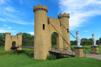
1971: Castle
Ida Grove, Iowa, USA - Odebolt Creek
| Bridgemeister ID: | 2982 (added 2019-10-12) |
| Year Completed: | 1971 |
| Name: | Castle |
| Location: | Ida Grove, Iowa, USA |
| Crossing: | Odebolt Creek |
| At or Near Feature: | Ida Grove Golf and Country Club |
| Coordinates: | 42.343539 N 95.458580 W |
| Maps: | Acme, GeoHack, Google, OpenStreetMap |
| Use: | Golf cart and Footbridge |
| Status: | In use (last checked: 2022) |
| Suspended Spans: | 1 |
Image Sets:
1971: Dent
Orofino vicinity, Idaho, USA - Dworshak Reservoir
| Bridgemeister ID: | 229 (added before 2003) |
| Year Completed: | 1971 |
| Name: | Dent |
| Location: | Orofino vicinity, Idaho, USA |
| Crossing: | Dworshak Reservoir |
| Coordinates: | 46.605 N 116.179 W |
| Maps: | Acme, GeoHack, Google, OpenStreetMap |
| Principals: | Army Corps of Engineers |
| Use: | Vehicular (two-lane, heavy vehicles), with walkway |
| Status: | In use (last checked: 2004) |
| Main Cables: | Wire (steel) |
| Suspended Spans: | 3 |
| Main Span: | 1 x 320 meters (1,050 feet) |
| Side Spans: | 2 |
Notes:
- Reservoir formed by damming of the North Fork of the Clearwater River.
External Links:
Image Sets:

| Bridgemeister ID: | 7603 (added 2023-05-16) |
| Year Completed: | 1971 |
| Name: | General De División Jose Cornelio Muñoz |
| Location: | Bruzual, Apure and Barinas, Venezuela |
| Crossing: | Rio Apure |
| Coordinates: | 8.053919 N 69.333121 W |
| Maps: | Acme, GeoHack, Google, OpenStreetMap |
| Principals: | Vandanca Company |
| Use: | Vehicular |
| Status: | In use (last checked: 2022) |
| Main Cables: | Wire (steel) |
| Suspended Spans: | 1 |
| Main Span: | 1 x 260 meters (853 feet) estimated |
1971: Revøysund
Lundegard and Revøy, Norway - Revøysundet
| Bridgemeister ID: | 4216 (added 2020-04-08) |
| Year Completed: | 1971 |
| Name: | Revøysund |
| Location: | Lundegard and Revøy, Norway |
| Crossing: | Revøysundet |
| Coordinates: | 58.032413 N 7.014400 E |
| Maps: | Acme, GeoHack, Google, kart.1881.no, OpenStreetMap |
| Use: | Vehicular |
| Status: | In use (last checked: 2019) |
| Main Cables: | Wire (steel) |
| Suspended Spans: | 1 |
| Main Span: | 1 x 120 meters (393.7 feet) |
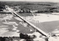
1971: Save River
Save, Mozambique - Save River
| Bridgemeister ID: | 5194 (added 2020-10-04) |
| Year Completed: | 1971 |
| Name: | Save River |
| Location: | Save, Mozambique |
| Crossing: | Save River |
| Coordinates: | 21.135212 S 34.565829 E |
| Maps: | Acme, GeoHack, Google, OpenStreetMap |
| Use: | Vehicular |
| Status: | In use (last checked: 2018) |
| Main Cables: | Wire (steel) |
| Suspended Spans: | 5 |
| Main Spans: | 3 x 210 meters (689 feet) |
| Side Spans: | 2 |
Notes:
- Replacement announced, 2018. Expected to be completed in 2021.
Image Sets:
1971: Shichuan
Shichuanzhen (什川镇), Gaolan County (皋兰县), Lanzhou (兰州市), Gansu, China - Yellow River
| Bridgemeister ID: | 8134 (added 2024-01-13) |
| Year Completed: | 1971 |
| Name: | Shichuan |
| Location: | Shichuanzhen (什川镇), Gaolan County (皋兰县), Lanzhou (兰州市), Gansu, China |
| Crossing: | Yellow River |
| Coordinates: | 36.151222 N 103.993583 E |
| Maps: | Acme, GeoHack, Google, OpenStreetMap |
| References: | BCG |
| Use: | Vehicular |
| Status: | In use (last checked: 2022) |
| Main Cables: | Wire (steel) |
| Main Span: | 1 x 124 meters (406.8 feet) |
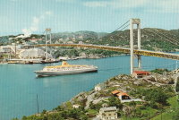
1971: Sotra
Bergen and Fjell, Hordaland, Norway - Knarreviksundet
| Bridgemeister ID: | 1102 (added 2004-01-02) |
| Year Completed: | 1971 |
| Name: | Sotra |
| Location: | Bergen and Fjell, Hordaland, Norway |
| Crossing: | Knarreviksundet |
| Coordinates: | 60.372652 N 5.167047 E |
| Maps: | Acme, GeoHack, Google, kart.1881.no, OpenStreetMap |
| Use: | Vehicular (two-lane, heavy vehicles) |
| Status: | In use (last checked: 2019) |
| Main Cables: | Wire (steel) |
| Suspended Spans: | 3 |
| Main Span: | 1 x 468 meters (1,535.4 feet) |
| Side Spans: | 2 |
External Links:
Image Sets:
| Bridgemeister ID: | 1223 (added 2004-02-15) |
| Year Completed: | 1971 |
| Name: | Xiangyang |
| Location: | Liuku (六库镇), Lushui (泸水市), Nujiang Lisu (怒江傈僳族自治州), Yunnan, China |
| Crossing: | Nujiang |
| Coordinates: | 25.851408 N 98.852680 E |
| Maps: | Acme, GeoHack, Google, OpenStreetMap |
| References: | BYU |
| Use: | Vehicular |
| Status: | Extant (last checked: 2021) |
| Main Cables: | Wire (steel) |
| Suspended Spans: | 1 |
| Main Span: | 1 x 131.4 meters (431.1 feet) |
1972: Pênsil
Bairro Trezidela, Grajaú, Maranhão, Brazil - Rio Grajaú
| Bridgemeister ID: | 7003 (added 2022-05-08) |
| Year Completed: | 1972 |
| Name: | Pênsil |
| Location: | Bairro Trezidela, Grajaú, Maranhão, Brazil |
| Crossing: | Rio Grajaú |
| Coordinates: | 5.818106 S 46.144946 W |
| Maps: | Acme, GeoHack, Google, OpenStreetMap |
| Use: | Vehicular (one-lane) |
| Status: | Restricted to foot traffic (last checked: 2022) |
| Main Cables: | Wire (steel) |
| Suspended Spans: | 1 |
| Main Span: | 1 |
| Bridgemeister ID: | 3038 (added 2019-10-13) |
| Year Completed: | 1972 |
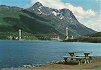
| Name: | Skjomen |
| Location: | Narvik, Nordland, Norway |
| Crossing: | Skjomen |
| Coordinates: | 68.370865 N 17.241603 E |
| Maps: | Acme, GeoHack, Google, kart.1881.no, OpenStreetMap |
| Use: | Vehicular (two-lane, heavy vehicles) |
| Status: | In use (last checked: 2022) |
| Main Cables: | Wire (steel) |
| Suspended Spans: | 1 |
| Main Span: | 1 x 525 meters (1,722.4 feet) |
External Links:
Image Sets:
1973: (footbridge)
Lincoln, Illinois, USA - Kickapoo Creek
| Bridgemeister ID: | 909 (added 2003-10-11) |
| Year Completed: | 1973 |
| Name: | (footbridge) |
| Location: | Lincoln, Illinois, USA |
| Crossing: | Kickapoo Creek |
| At or Near Feature: | Kickapoo Creek County Park |
| Coordinates: | 40.17338 N 89.37623 W |
| Maps: | Acme, GeoHack, Google, OpenStreetMap |
| Use: | Footbridge |
| Status: | In use (last checked: 2005) |
| Main Cables: | Wire |
| Suspended Spans: | 1 |
| Main Span: | 1 |
1973: (footbridge)
Newtown, Wales, United Kingdom - River Severn
| Bridgemeister ID: | 4616 (added 2020-06-07) |
| Year Completed: | 1973 |
| Name: | (footbridge) |
| Location: | Newtown, Wales, United Kingdom |
| Crossing: | River Severn |
| At or Near Feature: | Dolerw Park |
| Coordinates: | 52.514964 N 3.319958 W |
| Maps: | Acme, GeoHack, Google, OpenStreetMap |
| Use: | Footbridge |
| Status: | In use (last checked: 2018) |
| Main Cables: | Wire (steel) |
| Suspended Spans: | 1 |
External Links:
1973: Ben Tat
Truong Son, Vietnam - Ben Hai River
| Bridgemeister ID: | 1801 (added 2005-05-17) |
| Year Completed: | 1973 |
| Name: | Ben Tat |
| Location: | Truong Son, Vietnam |
| Crossing: | Ben Hai River |
| Coordinates: | 16.955355 N 106.951413 E |
| Maps: | Acme, GeoHack, Google, OpenStreetMap |
| Use: | Vehicular |
| Status: | Destroyed, October 8, 2005 |
| Main Cables: | Wire (steel) |
| Main Span: | 1 x 150 meters (492.1 feet) |
Notes:
- Destroyed by flood, October 8, 2005. Remnants removed December, 2006.
- Replaced by Ben Tat - Truong Son, Vietnam.
- All past and present bridges at this location.
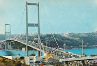
1973: Bosporus
Istanbul, Türkiye - Bosporus Strait
| Bridgemeister ID: | 472 (added before 2003) |
| Year Completed: | 1973 |
| Name: | Bosporus |
| Also Known As: | Bogaziçi, 15 July Martyrs, First, Bosphorus |
| Location: | Istanbul, Türkiye |
| Crossing: | Bosporus Strait |
| Coordinates: | 41.046655 N 29.033788 E |
| Maps: | Acme, GeoHack, Google, OpenStreetMap |
| References: | BAR, BDU, BFL, BMA, CTW |
| Use: | Vehicular (major highway) |
| Status: | In use (last checked: 2019) |
| Main Cables: | Wire (steel) |
| Suspended Spans: | 1 |
| Main Span: | 1 x 1,073.8 meters (3,523 feet) |
External Links:
Image Sets:
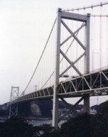
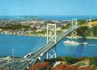
1973: Kanmon
Shimonoseki (下関市), Yamaguchi and Moji Ward, Kitakyushu City ( 北九州市), Fukuoka, Japan - Kanmon Straits
| Bridgemeister ID: | 468 (added before 2003) |
| Year Completed: | 1973 |
| Name: | Kanmon |
| Also Known As: | 関門橋, Kanmonkyō |
| Location: | Shimonoseki (下関市), Yamaguchi and Moji Ward, Kitakyushu City ( 北九州市), Fukuoka, Japan |
| Crossing: | Kanmon Straits |
| Coordinates: | 33.961829 N 130.958562 E |
| Maps: | Acme, GeoHack, Google, OpenStreetMap |
| References: | BAAW |
| Use: | Vehicular (major highway) |
| Status: | In use (last checked: 2019) |
| Main Cables: | Wire (steel) |
| Suspended Spans: | 3 |
| Main Span: | 1 x 712 meters (2,336 feet) |
| Side Spans: | 2 |
External Links:
Image Sets:
1973: Kjærfjord
Kjerstad, Tjeldsund, Troms og Finnmark, Norway - Kjærfjordstraumen
| Bridgemeister ID: | 4496 (added 2020-05-01) |
| Year Completed: | 1973 |
| Name: | Kjærfjord |
| Location: | Kjerstad, Tjeldsund, Troms og Finnmark, Norway |
| Crossing: | Kjærfjordstraumen |
| Coordinates: | 68.445834 N 16.157278 E |
| Maps: | Acme, GeoHack, Google, kart.1881.no, OpenStreetMap |
| Use: | Vehicular (one-lane) |
| Status: | In use (last checked: 2019) |
| Main Cables: | Wire (steel) |
| Suspended Spans: | 1 |
| Main Span: | 1 x 115 meters (377.3 feet) |
1973: Nam-Hae
Noryang and Namhae, South Korea
| Bridgemeister ID: | 473 (added before 2003) |
| Year Completed: | 1973 |
| Name: | Nam-Hae |
| Also Known As: | Namhae |
| Location: | Noryang and Namhae, South Korea |
| Coordinates: | 34.944605 N 127.871978 E |
| Maps: | Acme, GeoHack, Google, OpenStreetMap |
| Use: | Vehicular (two-lane, heavy vehicles), with walkway |
| Status: | In use (last checked: 2019) |
| Main Cables: | Wire (steel) |
| Suspended Spans: | 3 |
| Main Span: | 1 x 404 meters (1,325.5 feet) |
| Side Spans: | 2 x 125 meters (410.1 feet) |
| Deck width: | 12 meters |
Notes:
- Next to 2018 Second Namhae - Noryang and Namhae, South Korea.
- All past and present bridges at this location.
External Links:
Image Sets:
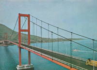
1973: Samora Michel
Tete and Moatize, Mozambique - Zambezi River
| Bridgemeister ID: | 1639 (added 2005-03-13) |
| Year Completed: | 1973 |
| Name: | Samora Michel |
| Also Known As: | Tete |
| Location: | Tete and Moatize, Mozambique |
| Crossing: | Zambezi River |
| Coordinates: | 16.154794 S 33.593791 E |
| Maps: | Acme, GeoHack, Google, OpenStreetMap |
| Principals: | Edgar Cardoso |
| Use: | Vehicular (two-lane, heavy vehicles), with walkway |
| Status: | In use (last checked: 2018) |
| Main Cables: | Wire (steel) |
| Suspended Spans: | 5 |
| Main Spans: | 3 |
| Side Spans: | 2 |
Notes:
- Large multi-span vehicular bridge with concrete towers and inclined suspenders.
External Links:
Image Sets:
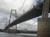
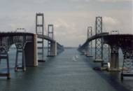
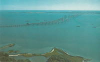
1973: William Preston Lane, Jr. Memorial II
Sandy Point, Maryland, USA - Chesapeake Bay
| Bridgemeister ID: | 230 (added before 2003) |
| Year Completed: | 1973 |
| Name: | William Preston Lane, Jr. Memorial II |
| Also Known As: | Chesapeake Bay |
| Location: | Sandy Point, Maryland, USA |
| Crossing: | Chesapeake Bay |
| Coordinates: | 38.994433 N 76.381929 W |
| Maps: | Acme, GeoHack, Google, OpenStreetMap |
| References: | GBD |
| Use: | Vehicular (major highway) |
| Status: | In use (last checked: 2022) |
| Main Cables: | Wire (steel) |
| Suspended Spans: | 3 |
| Main Span: | 1 x 487.7 meters (1,600 feet) |
| Side Spans: | 2 |
Notes:
- Next to 1952 William Preston Lane, Jr. Memorial I (Chesapeake Bay) - Sandy Point, Maryland, USA.
- All past and present bridges at this location.
External Links:
- Washington Post - Maryland recommends knocking down, rebuilding Chesapeake Bay Bridge spans. "The Maryland Transportation Authority has recommended knocking down both the eastbound and westbound spans of the Chesapeake Bay Bridge and replacing them with new, potentially wider, spans."
- Structurae - Structure ID 20000561
Image Sets:
1973: Yumenkou
Hancheng (韩城市), Weinan (渭南市), Shaanxi and Yumenkou (禹门口), Hejin (河津市), Yuncheng (运城市), Shanxi, China - Yellow River
| Bridgemeister ID: | 1285 (added 2004-03-16) |
| Year Completed: | 1973 |
| Name: | Yumenkou |
| Location: | Hancheng (韩城市), Weinan (渭南市), Shaanxi and Yumenkou (禹门口), Hejin (河津市), Yuncheng (运城市), Shanxi, China |
| Crossing: | Yellow River |
| Coordinates: | 35.659472 N 110.598778 E |
| Maps: | Acme, GeoHack, Google, OpenStreetMap |
| References: | BCG |
| Use: | Vehicular |
| Status: | Extant (last checked: 2021) |
| Main Cables: | Wire (steel) |
| Suspended Spans: | 1 |
| Main Span: | 1 x 144 meters (472.4 feet) |
External Links:
- Google Maps. Image of the bridge (and several other bridges in the background). Dated May 2021.
1974: (footbridge)
Hayfork, California, USA - Hayfork Creek
| Bridgemeister ID: | 6707 (added 2021-10-05) |
| Year Completed: | 1974 |
| Name: | (footbridge) |
| Location: | Hayfork, California, USA |
| Crossing: | Hayfork Creek |
| At or Near Feature: | Bar 717 Ranch |
| Coordinates: | 40.628631 N 123.371112 W |
| Maps: | Acme, GeoHack, Google, OpenStreetMap |
| Principals: | Paul Wills, Willy Wills, Ed Clark |
| Use: | Footbridge |
| Status: | In use (last checked: 2021) |
| Main Cables: | Wire (steel) |
| Main Span: | 1 |
1974: (pipeline bridge)
Kelif vicinity, Turkmenistan and Keleft, Afghanistan - Amu Darya
| Bridgemeister ID: | 1430 (added 2004-07-25) |
| Year Completed: | 1974 |
| Name: | (pipeline bridge) |
| Location: | Kelif vicinity, Turkmenistan and Keleft, Afghanistan |
| Crossing: | Amu Darya |
| Coordinates: | 37.345302 N 66.260926 E |
| Maps: | Acme, GeoHack, Google, OpenStreetMap |
| Use: | Pipeline |
| Main Cables: | Wire (steel) |
| Main Span: | 1 x 660 meters (2,165.4 feet) |
1974: Mestachibo
Beaupré, Quebec, Canada - Sainte-Anne River
| Bridgemeister ID: | 231 (added before 2003) |
| Year Completed: | 1974 |
| Name: | Mestachibo |
| Location: | Beaupré, Quebec, Canada |
| Crossing: | Sainte-Anne River |
| At or Near Feature: | Canyon Sainte-Anne |
| Coordinates: | 47.07486 N 70.87540 W |
| Maps: | Acme, GeoHack, Google, OpenStreetMap |
| Use: | Footbridge |
| Status: | In use (last checked: 2019) |
| Main Cables: | Wire (steel) |
| Suspended Spans: | 3 |
| Main Span: | 1 x 63 meters (206.7 feet) |
| Side Spans: | 2 |
1974: Slattum-Hewett
Fort Ransom vicinity, North Dakota, USA - Sheyenne River
| Bridgemeister ID: | 1366 (added 2004-07-03) |
| Year Completed: | 1974 |
| Name: | Slattum-Hewett |
| Location: | Fort Ransom vicinity, North Dakota, USA |
| Crossing: | Sheyenne River |
| Coordinates: | 46.56435 N 97.90429 W |
| Maps: | Acme, GeoHack, Google, OpenStreetMap |
| Use: | Footbridge |
| Status: | In use (last checked: 2003) |
| Main Cables: | Wire (steel) |
| Suspended Spans: | 1 |
| Main Span: | 1 x 38.1 meters (125 feet) estimated |
Image Sets:
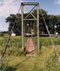
1975: (pipeline bridge)
Calumet vicinity, Louisiana, USA - Wax Lake Outlet
| Bridgemeister ID: | 1807 (added 2005-05-19) |
| Year Completed: | 1975 |
| Name: | (pipeline bridge) |
| Location: | Calumet vicinity, Louisiana, USA |
| Crossing: | Wax Lake Outlet |
| Coordinates: | 29.693867 N 91.374017 W |
| Maps: | Acme, GeoHack, Google, OpenStreetMap |
| Principals: | Clear Span Engineering |
| Use: | Pipeline |
| Status: | Removed, c. 2015-2019 |
| Main Cables: | Wire (steel) |
| Suspended Spans: | 1 |
| Main Span: | 1 x 243.8 meters (800 feet) |
Notes:
- Removed at some point in the 2015-2019 time frame.
- Carried a 22" oil line.
- Next to 1976 (pipeline bridge) - Calumet vicinity, Louisiana, USA.
- Next to 1976 (pipeline bridge) - Calumet vicinity, Louisiana, USA.
- Next to 1980 (pipeline bridge) - Calumet vicinity, Louisiana, USA.
- Next to 1980 (pipeline bridge) - Calumet vicinity, Louisiana, USA.
- Near 1980 (pipeline bridge) - Calumet vicinity, Louisiana, USA.
- All past and present bridges at this location.
Image Sets:
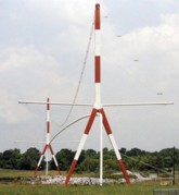
| Bridgemeister ID: | 2752 (added 2019-06-29) |
| Year Completed: | 1975 |
| Name: | (suspension bridge) |
| Location: | Dong vicinity, Savannakhet, Laos |
| Crossing: | Nam Sepon |
| Coordinates: | 16.625873 N 106.418546 E |
| Maps: | Acme, GeoHack, Google, OpenStreetMap |
| Use: | Vehicular (one-lane) |
| Status: | In use (last checked: 2015) |
| Main Cables: | Wire (steel) |
| Suspended Spans: | 1 |
1975: Aerobus
Mannheim, Germany - Neckar River
| Bridgemeister ID: | 9006 (added 2024-12-25) |
| Year Completed: | 1975 |
| Name: | Aerobus |
| Location: | Mannheim, Germany |
| Crossing: | Neckar River |
| Coordinates: | 49.493917 N 8.472528 E |
| Maps: | Acme, GeoHack, Google, OpenStreetMap |
| Use: | Aerobus |
| Status: | Removed |
| Main Cables: | Wire (steel) |
Notes:
- Temporary Aerobus installtion for the 1975 Bundesgartenschau (Federal Horticulture Exposition). The system included several suspension spans. It's not clear exactly how many, but the coordinates provided here are the location of a long suspended span over the Neckar next to the Kurpfalzbrücke.
- See 1975 Aerobus - Mont Sainte-Anne, Beaupré, Quebec, Canada.
External Links:
- Aerobus.com - Aerobus Installations. A list of Aerobus installations. "The 2.8 kilometer Aerobus guideway crossed the Neckar River, linking two parking sites of the Bundesgartenschau, or Federal Garden Show, in Mannheim, Germany. During a six-month period between April 1 and October 19, when the show ended, more than 2.5 million passengers rode the system without incident."
- Mannheim Aerobus - Forsyth's Compendium of Curious Contraptions
- WikiMedia - Mannheim Aerobus. Several photos of the Mannheim Aerobus system.
- YouTube - Aerobus Mannheim 1975 - Bundesgartenschau. Video of the Mannheim Aerobus.
| Bridgemeister ID: | 9007 (added 2024-12-25) |
| Year Completed: | 1975 |
| Name: | Aerobus |
| Location: | Mont Sainte-Anne, Beaupré, Quebec, Canada |
| Coordinates: | 47.075417 N 70.907000 W |
| Maps: | Acme, GeoHack, Google, OpenStreetMap |
| Use: | Aerobus |
| Status: | Removed |
| Main Cables: | Wire (steel) |
Notes:
- Coordinates indicate approximate location of one of the system's terminals.
- 1975: An Aerobus system previously erected for testing in Switzerland is dismantled and reassembled at the Mont Sainte-Anne ski center.
- 1992: Use of the Aerobus system is discontinued.
- See 1975 Aerobus - Mannheim, Germany.
External Links:
- Aerobus.com - Aerobus Installations. A list of Aerobus installations. "Ste. Anne, Quebec, Canada / 1975 ~ 1992. Expanded to a suspended guideway length of 820 meters, about one-half mile, the system carried patrons of a ski area from their lodges to the lifts in all weather conditions."
- Gallery of Aerobus Pictures - #2. Two photos of the Aerobus installation at Mont Sainte-Anne.
- X.com. October 1975 news article about an electrical issue forcing the Aerobus to be temporarily closed.
- X.com - Au parc du mont Sainte-Anne ... l'aérobus!. Video of what appears to the be Aerobus in operation in Switzerland before it was dismantled and moved to Mont Sainte-Anne with voiceover about the planned use at Mont Sainte-Anne.
1975: Dernol
Llanidloes, Powys, Wales, United Kingdom - River Wye
| Bridgemeister ID: | 8993 (added 2024-12-24) |
| Year Completed: | 1975 |
| Name: | Dernol |
| Location: | Llanidloes, Powys, Wales, United Kingdom |
| Crossing: | River Wye |
| Coordinates: | 52.361833 N 3.591139 W |
| Maps: | Acme, GeoHack, Google, OpenStreetMap |
| Principals: | N.R. Hope |
| References: | BRW |
| Use: | Footbridge |
| Status: | In use (last checked: 2022) |
| Main Cables: | Wire (steel) |
| Main Span: | 1 |
External Links:
- The Happy Pontist: Welsh Bridges: 23. Dernol Footbridge, River Wye. History and several images of the bridge.
| Bridgemeister ID: | 1870 (added 2005-08-06) |
| Year Completed: | 1975 |
| Name: | Hang Tom |
| Also Known As: | Shrimp Cave |
| Location: | Lai Chau, Lai Chau Province, Vietnam |
| Crossing: | Da River |
| Coordinates: | 22.078645 N 103.173458 E |
| Maps: | Acme, GeoHack, Google, OpenStreetMap |
| Use: | Vehicular |
| Status: | Removed |
| Main Cables: | Wire (steel) |
| Suspended Spans: | 1 |
| Main Span: | 1 x 140 meters (459.3 feet) |
Notes:
- Location inundated in 2010s. Coordinates are approximate former location.
| Bridgemeister ID: | 8143 (added 2024-01-28) |
| Year Completed: | 1975 |
| Name: | Khaneyatal |
| Location: | Mohanyal (मोहन्याल) and Dhanglagau (धङलगौ), Nepal |
| Crossing: | Thuli Gad |
| Coordinates: | 28.935397 N 80.909157 E |
| Maps: | Acme, GeoHack, Google, OpenStreetMap |
| Use: | Footbridge |
| Status: | Extant (last checked: 2023) |
| Main Cables: | Wire (steel) |
| Main Span: | 1 x 200.4 meters (657.5 feet) |
1975: Kjellingstraum
Kjøpstad vicinity, Nordland, Norway
| Bridgemeister ID: | 958 (added 2003-11-01) |
| Year Completed: | 1975 |
| Name: | Kjellingstraum |
| Location: | Kjøpstad vicinity, Nordland, Norway |
| Coordinates: | 67.078325 N 14.302455 E |
| Maps: | Acme, GeoHack, Google, kart.1881.no, OpenStreetMap |
| Use: | Vehicular (two-lane, heavy vehicles) |
| Status: | In use (last checked: 2019) |
| Main Cables: | Wire (steel) |
| Suspended Spans: | 1 |
| Main Span: | 1 x 260 meters (853 feet) |
External Links:
1975: Mayoc
Mayoc, Peru - Mantaro River
| Bridgemeister ID: | 7764 (added 2023-08-05) |
| Year Completed: | 1975 |
| Name: | Mayoc |
| Location: | Mayoc, Peru |
| Crossing: | Mantaro River |
| Coordinates: | 12.813461 S 74.385250 W |
| Maps: | Acme, GeoHack, Google, OpenStreetMap |
| Use: | Vehicular |
| Status: | Removed |
| Main Cables: | Wire (steel) |
| Suspended Spans: | 1 |
| Main Span: | 1 |
Notes:
- At former location of Mayoc - Mayoc, Peru. The 1975 bridge replaced the concrete arch bridge destroyed by the same 1974 flood that destroyed the older suspension bridge.
- All past and present bridges at this location.
External Links:
| Bridgemeister ID: | 8196 (added 2024-02-05) |
| Year Completed: | 1975 |
| Name: | Stádlecký |
| Also Known As: | Stádleck |
| Location: | Stádlec, Czechia |
| Crossing: | Lužnice |
| Coordinates: | 49.367400 N 14.514700 E |
| Maps: | Acme, GeoHack, Google, OpenStreetMap |
| Use: | Vehicular (one-lane) |
| Status: | In use |
| Main Cables: | Chain (iron) |
| Suspended Spans: | 1 |
Notes:
- Moved from 1848 Podolský Chain (Podolsko Řetězový) - Podolí, Czechia. Originally constructed in 1848 near Podolí, the bridge was dismantled in 1960 and erected at the Stádlec location in 1975.
External Links:
1975: Tanana River
Big Delta vicinity, Alaska, USA - Tanana River
| Bridgemeister ID: | 652 (added 2003-02-24) |
| Year Completed: | 1975 |
| Name: | Tanana River |
| Location: | Big Delta vicinity, Alaska, USA |
| Crossing: | Tanana River |
| Coordinates: | 64.15766 N 145.84964 W |
| Maps: | Acme, GeoHack, Google, OpenStreetMap |
| Use: | Pipeline |
| Status: | In use (last checked: 2024) |
| Main Cables: | Wire (steel) |
| Suspended Spans: | 1 |
| Main Span: | 1 x 365.8 meters (1,200 feet) |
Notes:
- Large pipeline bridge carrying the Trans-Alaska pipeline.
External Links:
Image Sets:
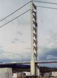
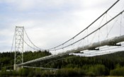
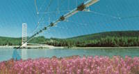
1975: Tofterøy
Berge, Øygarden, Vestland, Norway - Austefjorden
| Bridgemeister ID: | 4498 (added 2020-05-02) |
| Year Completed: | 1975 |
| Name: | Tofterøy |
| Location: | Berge, Øygarden, Vestland, Norway |
| Crossing: | Austefjorden |
| Coordinates: | 60.205563 N 5.071923 E |
| Maps: | Acme, GeoHack, Google, kart.1881.no, OpenStreetMap |
| Use: | Vehicular (one-lane) |
| Status: | In use (last checked: 2019) |
| Main Cables: | Wire (steel) |
| Suspended Spans: | 1 |
| Main Span: | 1 x 143 meters (469.2 feet) estimated |
External Links:
- Tofterøybroen i storm. Video from 2011 of the bridge undulating in high winds.
1975: Zabia Kladka
Wroclaw, Poland - Oder River
| Bridgemeister ID: | 2349 (added 2007-08-18) |
| Year Completed: | 1975 |
| Name: | Zabia Kladka |
| Location: | Wroclaw, Poland |
| Crossing: | Oder River |
| Coordinates: | 51.117363 N 17.037060 E |
| Maps: | Acme, GeoHack, Google, OpenStreetMap |
| Use: | Footbridge |
| Status: | In use (last checked: 2014) |
| Main Cables: | Wire (steel) |
| Suspended Spans: | 1 |
| Main Span: | 1 x 52 meters (170.6 feet) estimated |
External Links:
1976: (footbridge)
Alexeyevka, Belgorod Oblast, Russia - Reka Tikhaya Sosna
| Bridgemeister ID: | 6960 (added 2022-02-19) |
| Year Completed: | 1976 |
| Name: | (footbridge) |
| Location: | Alexeyevka, Belgorod Oblast, Russia |
| Crossing: | Reka Tikhaya Sosna |
| Coordinates: | 50.629171 N 38.684831 E |
| Maps: | Acme, GeoHack, Google, OpenStreetMap |
| Use: | Footbridge |
| Status: | In use (last checked: 2022) |
| Suspended Spans: | 1 |
| Main Span: | 1 x 80 meters (262.5 feet) estimated |
1976: (footbridge)
Brest, Belarus - Mukhovets River
| Bridgemeister ID: | 6207 (added 2021-07-16) |
| Year Completed: | 1976 |
| Name: | (footbridge) |
| Location: | Brest, Belarus |
| Crossing: | Mukhovets River |
| Coordinates: | 52.084229 N 23.668432 E |
| Maps: | Acme, GeoHack, Google, OpenStreetMap |
| Use: | Footbridge |
| Status: | In use (last checked: 2021) |
| Main Cables: | Wire (steel) |
| Suspended Spans: | 1 |
| Main Span: | 1 x 86 meters (282.2 feet) estimated |
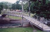
1976: (footbridge)
Lampasas, Texas, USA - Sulphur Creek
| Bridgemeister ID: | 1258 (added 2004-03-06) |
| Year Completed: | 1976 |
| Name: | (footbridge) |
| Location: | Lampasas, Texas, USA |
| Crossing: | Sulphur Creek |
| Coordinates: | 31.05598 N 98.18108 W |
| Maps: | Acme, GeoHack, Google, OpenStreetMap |
| Use: | Footbridge |
| Status: | In use (last checked: 2004) |
| Main Cables: | Rod |
| Suspended Spans: | 1 |
| Main Span: | 1 x 19.8 meters (65 feet) |
Notes:
- It is doubtful that this is a true suspension bridge. Follow the picture for more on this observation.
Image Sets:
1976: (pipeline bridge)
Calumet vicinity, Louisiana, USA - Wax Lake Outlet
| Bridgemeister ID: | 1808 (added 2005-05-19) |
| Year Completed: | 1976 |
| Name: | (pipeline bridge) |
| Location: | Calumet vicinity, Louisiana, USA |
| Crossing: | Wax Lake Outlet |
| Coordinates: | 29.693233 N 91.3743 W |
| Maps: | Acme, GeoHack, Google, OpenStreetMap |
| Principals: | Clear Span Engineering |
| Use: | Pipeline |
| Status: | Extant (last checked: 2023) |
| Main Cables: | Wire (steel) |
| Suspended Spans: | 1 |
| Main Span: | 1 x 243.8 meters (800 feet) |
Notes:
- Carries a 30" natural gas line.
- Next to 1975 (pipeline bridge) - Calumet vicinity, Louisiana, USA.
- Next to 1976 (pipeline bridge) - Calumet vicinity, Louisiana, USA.
- Next to 1980 (pipeline bridge) - Calumet vicinity, Louisiana, USA.
- Next to 1980 (pipeline bridge) - Calumet vicinity, Louisiana, USA.
- Near 1980 (pipeline bridge) - Calumet vicinity, Louisiana, USA.
- All past and present bridges at this location.
Image Sets:
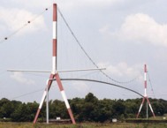
1976: (pipeline bridge)
Calumet vicinity, Louisiana, USA - Wax Lake Outlet
| Bridgemeister ID: | 1809 (added 2005-05-19) |
| Year Completed: | 1976 |
| Name: | (pipeline bridge) |
| Location: | Calumet vicinity, Louisiana, USA |
| Crossing: | Wax Lake Outlet |
| Coordinates: | 29.691483 N 91.37495 W |
| Maps: | Acme, GeoHack, Google, OpenStreetMap |
| Principals: | Clear Span Engineering |
| Use: | Pipeline |
| Status: | Extant (last checked: 2023) |
| Main Cables: | Wire (steel) |
| Suspended Spans: | 1 |
| Main Span: | 1 x 243.8 meters (800 feet) |
Notes:
- Carries three natural gas lines.
- Next to 1975 (pipeline bridge) - Calumet vicinity, Louisiana, USA.
- Next to 1976 (pipeline bridge) - Calumet vicinity, Louisiana, USA.
- Next to 1980 (pipeline bridge) - Calumet vicinity, Louisiana, USA.
- Next to 1980 (pipeline bridge) - Calumet vicinity, Louisiana, USA.
- Near 1980 (pipeline bridge) - Calumet vicinity, Louisiana, USA.
- All past and present bridges at this location.
Image Sets:
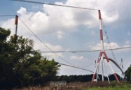
1976: Cheewhat River
British Columbia, Canada - Cheewhat River
| Bridgemeister ID: | 1451 (added 2004-08-01) |
| Year Completed: | 1976 |
| Name: | Cheewhat River |
| Location: | British Columbia, Canada |
| Crossing: | Cheewhat River |
| At or Near Feature: | West Coast Trail |
| Coordinates: | 48.663340 N 124.811974 W |
| Maps: | Acme, GeoHack, Google, OpenStreetMap |
| Use: | Footbridge |
| Status: | In use (last checked: 2016) |
| Main Cables: | Wire (steel) |
| Suspended Spans: | 1 |
1976: Coudes
Coudes, Montpeyroux vicinity and Parent, Puy-de-Dôme, France - Allier River
| Bridgemeister ID: | 3230 (added 2019-11-11) |
| Year Completed: | 1976 |
| Name: | Coudes |
| Location: | Coudes, Montpeyroux vicinity and Parent, Puy-de-Dôme, France |
| Crossing: | Allier River |
| Coordinates: | 45.615164 N 3.211313 E |
| Maps: | Acme, GeoHack, Google, OpenStreetMap |
| Use: | Vehicular (one-lane) |
| Status: | In use (last checked: 2023) |
| Main Cables: | Wire |
| Suspended Spans: | 1 |
| Main Span: | 1 x 101 meters (331.4 feet) estimated |
External Links:
- Le Pont de Coudes. History of the suspension bridges at Coudes.
1976: Kiwanis Club Bicentennial
Sulphur, Oklahoma, USA - Rock Creek
| Bridgemeister ID: | 5588 (added 2020-12-22) |
| Year Completed: | 1976 |
| Name: | Kiwanis Club Bicentennial |
| Location: | Sulphur, Oklahoma, USA |
| Crossing: | Rock Creek |
| Coordinates: | 34.508043 N 96.974723 W |
| Maps: | Acme, GeoHack, Google, OpenStreetMap |
| Use: | Footbridge |
| Status: | Removed |
Notes:
- The November 28, 1976 edition of The Ada Sunday News ran an article titled "Sulphur Foot Bridge Dedication Scheduled": "SULPHUR — The Kiwanis Club Bicentennial Bridge, a swinging foot bridge across Rock Creek, will be dedicated at 12:30 p.m. Tuesday... The suspension bridge, which was built across Rock Creek near the south end of Bulldog Stadium, has been open since late October. It provides easy access to the school grounds for students coming from east Sulphur. Designed by Supt. Calvin Agee and elementary Principal DeLannom, the bridge was built as the bicentennial project of the Sulphur Kiwanis Club. Club members and students from Sulphur's vocational training classes performed the work on the structure…"
- The Ada Sunday Newsarticle description leads one to believe this was not a very substantial structure and no trace of it appears to remain (in 2020). Coordinates provided here are, approximate, based on the location description in the article.
| Bridgemeister ID: | 3234 (added 2019-11-15) |
| Year Completed: | 1976 |
| Name: | Randøy |
| Location: | Hjelmeland, Rogaland, Norway |
| Crossing: | Olesundet |
| Coordinates: | 59.218697 N 6.097401 E |
| Maps: | Acme, GeoHack, Google, kart.1881.no, OpenStreetMap |
| Use: | Vehicular |
| Status: | In use (last checked: 2019) |
| Main Cables: | Wire (steel) |
| Suspended Spans: | 1 |
| Main Span: | 1 x 202 meters (662.7 feet) |
External Links:
1976: Rosenstein
Stuttgart, Germany
| Bridgemeister ID: | 922 (added 2003-10-18) |
| Year Completed: | 1976 |
| Name: | Rosenstein |
| Location: | Stuttgart, Germany |
| Coordinates: | 48.798233 N 9.20955 E |
| Maps: | Acme, GeoHack, Google, OpenStreetMap |
| Principals: | Schlaich Bergermann Partner |
| References: | AOB |
| Use: | Footbridge |
| Status: | In use (last checked: 2013) |
| Main Cables: | Wire (steel) |
| Suspended Spans: | 2 |
| Main Spans: | 1 x 27 meters (88.6 feet), 1 x 57.1 meters (187.3 feet) |
| Characteristics: | Self-anchored |
Notes:
- Monotower, self-anchored footbridge with inclined stays. Crosses a road.
External Links:
Image Sets:
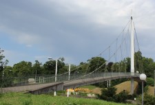
1977: (suspension bridge)
Mariano Dámaso Beraun District, Peru - Monzon River
| Bridgemeister ID: | 3102 (added 2019-10-27) |
| Year Completed: | 1977 |
| Name: | (suspension bridge) |
| Location: | Mariano Dámaso Beraun District, Peru |
| Crossing: | Monzon River |
| Coordinates: | 9.324963 S 76.029128 W |
| Maps: | Acme, GeoHack, Google, OpenStreetMap |
| Use: | Vehicular (two-lane) |
| Status: | In use (last checked: 2013) |
| Main Cables: | Wire (steel) |
1977: (suspension bridge)
Tocache, Peru - Huallaga River
| Bridgemeister ID: | 944 (added 2003-10-29) |
| Year Completed: | 1977 |
| Name: | (suspension bridge) |
| Location: | Tocache, Peru |
| Crossing: | Huallaga River |
| Coordinates: | 8.186801 S 76.507317 W |
| Maps: | Acme, GeoHack, Google, OpenStreetMap |
| Use: | Vehicular (two-lane, heavy vehicles) |
| Status: | In use (last checked: 2013) |
| Main Cables: | Wire (steel) |
| Suspended Spans: | 1 |
| Main Span: | 1 x 219.6 meters (720.5 feet) |
External Links:
1977: Cunyac
Estrella, Peru - Apurimac River
| Bridgemeister ID: | 3105 (added 2019-10-27) |
| Year Completed: | 1977 |
| Name: | Cunyac |
| Location: | Estrella, Peru |
| Crossing: | Apurimac River |
| Coordinates: | 13.562583 S 72.575156 W |
| Maps: | Acme, GeoHack, Google, OpenStreetMap |
| Use: | Vehicular (two-lane) |
| Status: | In use (last checked: 2015) |
| Main Cables: | Wire (steel) |
Notes:
1977: Dry River
Bretton Woods vicinity, New Hampshire, USA - Dry River
| Bridgemeister ID: | 2477 (added 2008-12-20) |
| Year Completed: | 1977 |
| Name: | Dry River |
| Location: | Bretton Woods vicinity, New Hampshire, USA |
| Crossing: | Dry River |
| At or Near Feature: | Dry River Trail, Dry River Wilderness |
| Coordinates: | 44.177914 N 71.351531 W |
| Maps: | Acme, GeoHack, Google, OpenStreetMap |
| Use: | Footbridge |
| Status: | Replaced, 2009 |
| Main Cables: | Wire (steel) |
| Suspended Spans: | 1 |
| Main Span: | 1 x 30.5 meters (100 feet) |
Notes:
- Damaged by flood and permanently closed, 2005.
- Replaced by 2009 Dry River - Hart's Location vicinity, New Hampshire, USA.
- All past and present bridges at this location.
Image Sets:
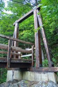
1977: Herrería
La Merced and Chunchuyacu, Peru - Rio Chanchamayo
| Bridgemeister ID: | 3108 (added 2019-10-27) |
| Year Completed: | 1977 |
| Name: | Herrería |
| Location: | La Merced and Chunchuyacu, Peru |
| Crossing: | Rio Chanchamayo |
| Coordinates: | 11.077142 S 75.329422 W |
| Maps: | Acme, GeoHack, Google, OpenStreetMap |
| Use: | Vehicular (two-lane) |
| Status: | In use (last checked: 2014) |
| Main Cables: | Wire (steel) |
| Suspended Spans: | 1 |
| Main Span: | 1 x 150 meters (492.1 feet) |
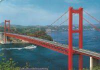
1977: Hirado
Hirado, Nagasaki and Japan - Hiradoseto Strait
| Bridgemeister ID: | 474 (added before 2003) |
| Year Completed: | 1977 |
| Name: | Hirado |
| Also Known As: | 平戸大橋 |
| Location: | Hirado, Nagasaki and Japan |
| Crossing: | Hiradoseto Strait |
| Coordinates: | 33.356794 N 129.572374 E |
| Maps: | Acme, GeoHack, Google, OpenStreetMap |
| References: | BAAW |
| Use: | Vehicular (two-lane, heavy vehicles), with walkway |
| Status: | In use (last checked: 2019) |
| Main Cables: | Wire (steel) |
| Suspended Spans: | 1 |
| Main Span: | 1 x 465.5 meters (1,527.2 feet) |
External Links:
Image Sets:
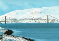
1977: Kvalsund
Kvalsund and Kvaløya, Troms og Finnmark, Norway - Kvalsundet
| Bridgemeister ID: | 961 (added 2003-11-01) |
| Year Completed: | 1977 |
| Name: | Kvalsund |
| Location: | Kvalsund and Kvaløya, Troms og Finnmark, Norway |
| Crossing: | Kvalsundet |
| Coordinates: | 70.51271 N 23.95136 E |
| Maps: | Acme, GeoHack, Google, kart.1881.no, OpenStreetMap |
| Use: | Vehicular (two-lane) |
| Status: | In use (last checked: 2019) |
| Main Cables: | Wire (steel) |
| Suspended Spans: | 1 |
| Main Span: | 1 x 525 meters (1,722.4 feet) |
External Links:
Image Sets:
1977: Lokkarbrua
Ramsvika, Namsos, Trøndelag, Norway - Lokkarsundet
| Bridgemeister ID: | 3713 (added 2020-02-09) |
| Year Completed: | 1977 |
| Name: | Lokkarbrua |
| Also Known As: | Lokkaren |
| Location: | Ramsvika, Namsos, Trøndelag, Norway |
| Crossing: | Lokkarsundet |
| Coordinates: | 64.507036 N 11.442759 E |
| Maps: | Acme, GeoHack, Google, kart.1881.no, OpenStreetMap |
| Use: | Vehicular (two-lane) |
| Status: | In use (last checked: 2020) |
| Main Cables: | Wire (steel) |
| Suspended Spans: | 1 |
| Main Span: | 1 x 225 meters (738.2 feet) |
External Links:
1977: Pizana
Puerto Pizana, Peru - Huallaga River
| Bridgemeister ID: | 3107 (added 2019-10-27) |
| Year Completed: | 1977 |
| Name: | Pizana |
| Location: | Puerto Pizana, Peru |
| Crossing: | Huallaga River |
| Coordinates: | 8.008642 S 76.649672 W |
| Maps: | Acme, GeoHack, Google, OpenStreetMap |
| Use: | Vehicular |
| Status: | Restricted to foot traffic (last checked: 2023) |
| Main Cables: | Wire (steel) |
1977: Punta Arenas
Punta Arenas, Peru - Huallaga River
| Bridgemeister ID: | 3106 (added 2019-10-27) |
| Year Completed: | 1977 |
| Name: | Punta Arenas |
| Location: | Punta Arenas, Peru |
| Crossing: | Huallaga River |
| Coordinates: | 7.529214 S 76.671460 W |
| Maps: | Acme, GeoHack, Google, OpenStreetMap |
| Use: | Vehicular (two-lane) |
| Status: | In use (last checked: 2015) |
| Main Cables: | Wire (steel) |
| Suspended Spans: | 1 |
1977: San Ramón
San Ramón, Peru - Rio Tulumayo
| Bridgemeister ID: | 3103 (added 2019-10-27) |
| Year Completed: | 1977 |
| Name: | San Ramón |
| Location: | San Ramón, Peru |
| Crossing: | Rio Tulumayo |
| Coordinates: | 11.125253 S 75.353022 W |
| Maps: | Acme, GeoHack, Google, OpenStreetMap |
| Use: | Vehicular (two-lane) |
| Status: | In use (last checked: 2014) |
| Main Cables: | Wire (steel) |
| Suspended Spans: | 1 |
| Main Span: | 1 x 110 meters (360.9 feet) |
1977: Toccoa River
Dahlonega vicinity, Georgia, USA - Toccoa River
| Bridgemeister ID: | 250 (added before 2003) |
| Year Completed: | 1977 |
| Name: | Toccoa River |
| Also Known As: | Swinging |
| Location: | Dahlonega vicinity, Georgia, USA |
| Crossing: | Toccoa River |
| At or Near Feature: | Benton MacKaye Trail |
| Coordinates: | 34.736857 N 84.167320 W |
| Maps: | Acme, GeoHack, Google, OpenStreetMap |
| Use: | Footbridge |
| Status: | In use (last checked: 2018) |
| Main Cables: | Wire (steel) |
| Main Span: | 1 x 80.8 meters (265 feet) |
1978: (footbridge)
Avegno vicinity, Ticino, Switzerland - Maggia River
| Bridgemeister ID: | 1796 (added 2005-05-17) |
| Year Completed: | 1978 |
| Name: | (footbridge) |
| Location: | Avegno vicinity, Ticino, Switzerland |
| Crossing: | Maggia River |
| At or Near Feature: | Valle Maggia |
| Coordinates: | 46.215524 N 8.744706 E |
| Maps: | Acme, GeoHack, Google, OpenStreetMap |
| Use: | Footbridge |
| Status: | In use (last checked: 2014) |
| Main Cables: | Wire (steel) |
| Suspended Spans: | 2 |
| Main Span: | 1 x 100 meters (328.1 feet) |
| Side Span: | 1 x 24 meters (78.7 feet) |
| Deck width: | 1.3 meters |
Notes:
- The side without a side span is anchored directly into rock.
External Links:
Image Sets:
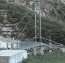
1978: (footbridge)
Kloster Ehrenstein vicinity, Rheinland-Pfalz, Germany - Wied River
| Bridgemeister ID: | 2211 (added 2007-02-11) |
| Year Completed: | 1978 |
| Name: | (footbridge) |
| Location: | Kloster Ehrenstein vicinity, Rheinland-Pfalz, Germany |
| Crossing: | Wied River |
| Coordinates: | 50.61750 N 7.45082 E |
| Maps: | Acme, GeoHack, Google, OpenStreetMap |
| Use: | Footbridge |
| Status: | In use (last checked: 2006) |
| Main Cables: | Wire (steel) |
| Suspended Spans: | 1 |
| Main Span: | 1 x 30.1 meters (98.8 feet) |
| Deck width: | 0.9 meters between side rails, 1.4 meters total |
Image Sets:
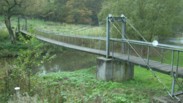
1978: (footbridge)
Pontiac, Illinois, USA - Vermilion River
| Bridgemeister ID: | 1710 (added 2005-04-02) |
| Year Completed: | 1978 |
| Name: | (footbridge) |
| Location: | Pontiac, Illinois, USA |
| Crossing: | Vermilion River |
| At or Near Feature: | Humiston Riverside Park |
| Coordinates: | 40.876867 N 88.63325 W |
| Maps: | Acme, GeoHack, Google, OpenStreetMap |
| Use: | Footbridge |
| Status: | In use (last checked: 2005) |
| Main Cables: | Wire (steel) |
| Suspended Spans: | 3 |
| Main Span: | 1 |
| Side Spans: | 2 |
Image Sets:
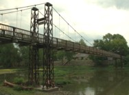
1978: Bernier
Bromptonville, Sherbrooke vicinity, Quebec, Canada - St. François River
| Bridgemeister ID: | 1162 (added 2004-01-19) |
| Year Completed: | 1978 |
| Name: | Bernier |
| Location: | Bromptonville, Sherbrooke vicinity, Quebec, Canada |
| Crossing: | St. François River |
| Use: | Footbridge and Snowmobile |
| Status: | Replaced, 2001 |
| Main Cables: | Wire (steel) |
| Main Span: | 1 x 66 meters (216.5 feet) |
Notes:
- Carried Trans Canada Trail. Intended for pedestrians, cyclists, and snowmobiles.
- Replaced by 2001 Bernier - Bromptonville, Sherbrooke vicinity, Quebec, Canada.
- All past and present bridges at this location.
1978: Klosowski
Walcz, Poland - Raduń Lake
| Bridgemeister ID: | 4968 (added 2020-08-15) |
| Year Completed: | 1978 |
| Name: | Klosowski |
| Location: | Walcz, Poland |
| Crossing: | Raduń Lake |
| Coordinates: | 53.263965 N 16.431102 E |
| Maps: | Acme, GeoHack, Google, OpenStreetMap |
| Use: | Footbridge |
| Status: | In use (last checked: 2020) |
| Main Cables: | Wire (steel) |
| Suspended Spans: | 1 |
1978: Magapit
Magapit, Lallo vicinity, Cagayan, Philippines - Cagayan River
| Bridgemeister ID: | 1444 (added 2004-07-31) |
| Year Completed: | 1978 |
| Name: | Magapit |
| Location: | Magapit, Lallo vicinity, Cagayan, Philippines |
| Crossing: | Cagayan River |
| Coordinates: | 18.122340 N 121.672697 E |
| Maps: | Acme, GeoHack, Google, OpenStreetMap |
| Use: | Vehicular (two-lane, heavy vehicles) |
| Status: | In use (last checked: 2019) |
| Main Cables: | Wire (steel) |
| Suspended Spans: | 1 |
External Links:
1979: (pipeline bridge)
Saporoshje (Zaporizzja) vicinity, Ukraine - Dnieper River
| Bridgemeister ID: | 1431 (added 2004-07-25) |
| Year Completed: | 1979 |
| Name: | (pipeline bridge) |
| Location: | Saporoshje (Zaporizzja) vicinity, Ukraine |
| Crossing: | Dnieper River |
| Coordinates: | 48.121897 N 35.068470 E |
| Maps: | Acme, GeoHack, Google, OpenStreetMap |
| Use: | Pipeline |
| Status: | Extant (last checked: 2019) |
| Main Cables: | Wire (steel) |
| Suspended Spans: | 1 |
| Main Span: | 1 x 720 meters (2,362.2 feet) |
Notes:
- This is likely the same bridge as the Pridneprovsk pipeline bridge referenced on Structurae.
External Links:
1979: Alpa Corral
Alpa Corral, Córdoba, Argentina - Rio De las Barrancas
| Bridgemeister ID: | 8513 (added 2024-03-24) |
| Year Completed: | 1979 |
| Name: | Alpa Corral |
| Also Known As: | Colgante |
| Location: | Alpa Corral, Córdoba, Argentina |
| Crossing: | Rio De las Barrancas |
| Coordinates: | 32.692472 S 64.713583 W |
| Maps: | Acme, GeoHack, Google, OpenStreetMap |
| Use: | Vehicular (one-lane) |
| Status: | In use (last checked: 2023) |
| Main Cables: | Wire (steel) |
| Suspended Spans: | 1 |
| Characteristics: | Hinged cables |
Notes:
- Hybrid cable-stayed/suspension bridge with offset hinged main cables.
- Moved from (suspension bridge) - Parque Sarmiento, Córdoba City, Córdoba, Argentina.
External Links:
- alpacorral.com - Puente Colgante Alpa Corral - Fotos, Origen y Historia. Article and several images of the bridge at its new (Alpa Corral) location.
- El puente que "se mudó" del Parque Sarmiento a las sierras - Córdoba - Cadena 3 Argentina. Article and several images of the bridge at its new (Alpa Corral) location.
1979: Lau Luhung
Gunung Meriah, Deli Serdang Regency, North Sumatra, Indonesia - Lau Kalimjubang
| Bridgemeister ID: | 8460 (added 2024-03-17) |
| Year Completed: | 1979 |
| Name: | Lau Luhung |
| Location: | Gunung Meriah, Deli Serdang Regency, North Sumatra, Indonesia |
| Crossing: | Lau Kalimjubang |
| Coordinates: | 3.185974 N 98.701131 E |
| Maps: | Acme, GeoHack, Google, OpenStreetMap |
| Use: | Footbridge |
| Status: | Derelict (last checked: 2021) |
| Main Cables: | Wire (steel) |
| Main Span: | 1 x 130 meters (426.5 feet) estimated |
External Links:
- Facebook. Image of a group of people on the bridge. Translated caption: "Photo 'old time' Posing on the Lau Luhung suspension bridge. On foot from Tiga Juhar (Deli Serdang) to Barus Jahe (Tanah Karo). With the Wiyata Dharma Pedestrian group. December 27, 1987".
- Facebook. Video showing the suspension bridge used as a launch platform for a swing attached to the adjacent deck arch.
- Google Maps - Jembatan Lau Luhung, Gunung Meriah. Image of the bridge alongside a newer deck arch bridge. Dated April 2014.
- Google Maps - Jembatan Lau Luhung, Gunung Meriah. Image of the bridge when the deck arch was under construction. Dated February 2012.
- medan.tribunnews.com - Jembatan Lau Hulung…. Article about the bridge. Dated August 26, 2020.
1979: McNicoll
Beaupré, Quebec, Canada - Sainte-Anne River
| Bridgemeister ID: | 232 (added before 2003) |
| Year Completed: | 1979 |
| Name: | McNicoll |
| Location: | Beaupré, Quebec, Canada |
| Crossing: | Sainte-Anne River |
| At or Near Feature: | Canyon Sainte-Anne |
| Coordinates: | 47.07333 N 70.87749 W |
| Maps: | Acme, GeoHack, Google, OpenStreetMap |
| Use: | Footbridge |
| Status: | In use (last checked: 2019) |
| Main Cables: | Wire (steel) |
| Main Span: | 1 x 58 meters (190.3 feet) |
| Bridgemeister ID: | 8566 (added 2024-04-06) |
| Name: | (suspension bridge) |
| Location: | Mocoa, Putumayo, Colombia |
| Crossing: | Rio Mocoa |
| Coordinates: | 1.194389 N 76.644917 W |
| Maps: | Acme, GeoHack, Google, OpenStreetMap |
| Use: | Vehicular (two-lane) |
| Status: | In use (last checked: 2022) |
| Main Cables: | Wire (steel) |
| Suspended Spans: | 1 |
| Main Span: | 1 x 92 meters (301.8 feet) estimated |
Notes:
- Completed at some point in the mid-1970s.
External Links:
- Facebook. Image of the bridge under construction in 1974.
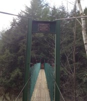
Clarendon Gorge
Rutland vicinity, Vermont, USA - Mill River
| Bridgemeister ID: | 323 (added before 2003) |
| Name: | Clarendon Gorge |
| Also Known As: | Robert Brugmann Memorial |
| Location: | Rutland vicinity, Vermont, USA |
| Crossing: | Mill River |
| At or Near Feature: | Appalachian Trail |
| Coordinates: | 43.520240 N 72.925480 W |
| Maps: | Acme, GeoHack, Google, OpenStreetMap |
| References: | PQU |
| Use: | Footbridge |
| Status: | Closed, April 2025 (last checked: 2025) |
| Main Cables: | Wire (steel) |
| Suspended Spans: | 1 |
| Main Span: | 1 |
Notes:
- Welles Lobb writes: "Bob Brugmann, my best friend from high school, was attempting to cross an older damaged version of the bridge on July 4, 1973 during a flood when he was swept to death in the raging waters. Bob was 17, a brilliant budding environmentalist, and was attempting a southbound thru-hike of the Appalachian Trail the time of his accident. Later, the Green Mountain Club (a hiking organization) rebuilt the bridge and dedicated it to my late friend."
- 1973: Destroyed by flood, rebuilt.
- 2025, April: A cable snaps. The bridge is closed pending repairs.
Image Sets:
Do you have any information or photos for these bridges that you would like to share? Please email david.denenberg@bridgemeister.com.
Mail | Facebook | X (Twitter) | Bluesky
