Suspension Bridges Completed 1890-1899 (1-100 of 110)
This is a list of bridges 1 through 100 (of 110 total) from the suspension bridge inventory completed in the decade 1890-1899. Wherever you see a Bridgemeister ID number click it to isolate the bridge on its own page.
Related Lists:
1890: (flume bridge)
Trimmer, California, USA - Kings River
| Bridgemeister ID: | 3351 (added 2019-12-14) |
| Year Completed: | 1890 |
| Name: | (flume bridge) |
| Location: | Trimmer, California, USA |
| Crossing: | Kings River |
| Principals: | Pacific Bridge Co. |
| Use: | Flume |
| Status: | Removed |
| Main Cables: | Wire |
Notes:
- Large suspension bridge carrying a flume to transport lumber for the Kings River Lumber Company of Sanger, California.
1890: (footbridge)
Hittisau, Austria - Bolgenach River
| Bridgemeister ID: | 1168 (added 2004-01-21) |
| Year Completed: | 1890 |
| Name: | (footbridge) |
| Location: | Hittisau, Austria |
| Crossing: | Bolgenach River |
| Coordinates: | 47.461957 N 9.970007 E |
| Maps: | Acme, GeoHack, Google, OpenStreetMap |
| Use: | Footbridge |
| Status: | In use (last checked: 2019) |
| Main Cables: | Wire |
| Suspended Spans: | 1 |
Notes:
- Rebuilt 1985.
External Links:
1890: (footbridge)
Lincoln, England, United Kingdom - Great Northern Railway track
| Bridgemeister ID: | 5083 (added 2020-09-02) |
| Year Completed: | 1890 |
| Name: | (footbridge) |
| Location: | Lincoln, England, United Kingdom |
| Crossing: | Great Northern Railway track |
| Principals: | Louis Harper |
| References: | HARPER |
| Use: | Footbridge |
| Status: | Removed |
| Main Cables: | Wire |
| Main Span: | 1 x 21.3 meters (70 feet) |
Notes:
- HARPER: Likely located at Pelham Street, just east of the present-day (2020) Lincoln train station.
1890: (suspension bridge)
Brookneal, Virginia, USA - Roanoke River
| Bridgemeister ID: | 4665 (added 2020-06-19) |
| Year Completed: | 1890 |
| Name: | (suspension bridge) |
| Location: | Brookneal, Virginia, USA |
| Crossing: | Roanoke River |
| Coordinates: | 37.083602 N 78.935547 W |
| Maps: | Acme, GeoHack, Google, OpenStreetMap |
| Principals: | Berlin Iron Bridge Co. |
| Use: | Vehicular |
| Status: | Demolished, 1940s |
| Main Cables: | Wire (steel) |
| Suspended Spans: | 1 |
1890: Ardnacarrig
Bandon, Ireland - River Bandon
| Bridgemeister ID: | 5076 (added 2020-08-30) |
| Year Completed: | 1890 |
| Name: | Ardnacarrig |
| Location: | Bandon, Ireland |
| Crossing: | River Bandon |
| Principals: | Harper & Co. |
| References: | HARPER |
| Use: | Footbridge |
| Status: | Removed |
| Main Cables: | Wire |
| Suspended Spans: | 1 |
| Main Span: | 1 x 36.6 meters (120 feet) |
| Deck width: | 4 feet |
External Links:
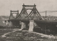
1890: Grand Avenue
St. Louis, Missouri, USA - Mill Creek Valley
| Bridgemeister ID: | 96 (added before 2003) |
| Year Completed: | 1890 |
| Name: | Grand Avenue |
| Location: | St. Louis, Missouri, USA |
| Crossing: | Mill Creek Valley |
| Coordinates: | 38.629167 N 90.235611 W |
| Maps: | Acme, GeoHack, Google, OpenStreetMap |
| Principals: | Carl Gayler |
| References: | AAJ, HBE, IEA, ONF, PTS2, SSB |
| Use: | Vehicular, with walkway |
| Status: | Demolished, 1960 |
| Main Cables: | Eyebar |
| Suspended Spans: | 3 |
| Main Span: | 1 x 121.9 meters (400 feet) |
| Side Spans: | 2 x 45.7 meters (150 feet) |
| Deck width: | 60 feet |
| Characteristics: | Braced (trussed) chain/cable |
Notes:
- Sometimes misidentified as the "Jefferson Avenue" bridge.
- Braced chain (stiffened-eyebar) design often espoused by Gustav Lindenthal. ONF (an article by Lindenthal) refers to this as the Jefferson Ave. bridge while Fowler's book (IEA) calls it "Grand Avenue". AAJ describes it as "a three-hinged inverted arch with two stiffened chains, one on each side."
External Links:
Image Sets:
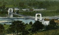
1890: Kellams
Kellams, New York and Stalker, Pennsylvania, USA - Delaware River
| Bridgemeister ID: | 7595 (added 2023-05-07) |
| Year Completed: | 1890 |
| Name: | Kellams |
| Also Known As: | Little Equinunk, Kellams-Stalker, Kellam |
| Location: | Kellams, New York and Stalker, Pennsylvania, USA |
| Crossing: | Delaware River |
| Coordinates: | 41.823641 N 75.113282 W |
| Maps: | Acme, GeoHack, Google, OpenStreetMap |
| Principals: | David Kellam |
| Use: | Vehicular |
| Status: | Replaced |
| Main Cables: | Wire |
| Main Span: | 1 |
Notes:
- Replaced by 1936 Kellams (Little Equinunk, Kellams-Stalker, Kellam) - Kellams, New York and Stalker, Pennsylvania, USA.
- All past and present bridges at this location.
Image Sets:
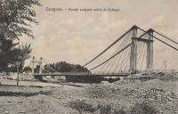
1890: Santa Isabel
Santa Isabel, Zaragoza, Spain - Gállego River
| Bridgemeister ID: | 7488 (added 2022-12-30) |
| Year Completed: | 1890 |
| Name: | Santa Isabel |
| Location: | Santa Isabel, Zaragoza, Spain |
| Crossing: | Gállego River |
| Coordinates: | 41.670978 N 0.841962 W |
| Maps: | Acme, GeoHack, Google, OpenStreetMap |
| References: | JSE |
| Use: | Vehicular |
| Status: | Demolished, c. 1930 |
| Main Cables: | Wire |
| Suspended Spans: | 1 |
External Links:
- (PDF) Jules Seguin en España: prefabricación e innovación en los puentes colgantes de Fuentidueña, Arganda, Carandia y Zaragoza construidos por el empresario francés. Paper from the Proceedings of the Ninth National Congress and First Hispano-American International Congress on the History of Construction. See references.
- Zaragoza - Puente Colgante y puente de hierro sobre el río Gállego (en Santa Isabel) | Europeana. 1930 image of the bridge just before it was demolished.
Image Sets:
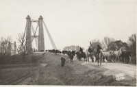
1890: Sylvéréal
Sylvéréal, Gard and Bouches-du-Rhône, France - Petit Rhône River
| Bridgemeister ID: | 7319 (added 2022-08-31) |
| Year Completed: | 1890 |
| Name: | Sylvéréal |
| Location: | Sylvéréal, Gard and Bouches-du-Rhône, France |
| Crossing: | Petit Rhône River |
| Coordinates: | 43.546406 N 4.350111 E |
| Maps: | Acme, GeoHack, Google, OpenStreetMap |
| Use: | Vehicular |
| Status: | Removed |
| Main Cables: | Wire |
| Suspended Spans: | 1 |
Image Sets:
1890: Wollaston
Warrnambool, Victoria, Australia - Merri River
| Bridgemeister ID: | 420 (added before 2003) |
| Year Completed: | 1890 |
| Name: | Wollaston |
| Location: | Warrnambool, Victoria, Australia |
| Crossing: | Merri River |
| Coordinates: | 38.36343 S 142.49163 E |
| Maps: | Acme, GeoHack, Google, OpenStreetMap |
| Principals: | Arthur Dobson |
| References: | STC |
| Use: | Vehicular (one-lane) |
| Status: | Restricted to foot traffic (last checked: 2005) |
| Main Cables: | Wire |
| Suspended Spans: | 1 |
| Main Span: | 1 x 36.6 meters (120.1 feet) |
| Deck width: | 3.2 meters |
| Bridgemeister ID: | 264 (added before 2003) |
| Year Completed: | 1891 |
| Name: | (footbridge) |
| Location: | Lewiston, Maine, USA |
| At or Near Feature: | Island Garden Amusement Park |
| Use: | Footbridge |
| Status: | Dismantled, 1903 |
| Main Cables: | Wire |
| Suspended Spans: | 1 |
Notes:
- Nancy Fraser writes: "The pedestrian suspension bridge [was] located at Island Garden Amusement Park in Lewiston, Maine. It started at the water gate house that you can see and led to an island over the water falls where they had entertainment. It was in existence in Lewiston from 1891 to 1903. It was later sold to Amos Gerald of Fairfield, Maine to be used for the trolley line leading to Casco Castle and Amusement Park in South Freeport, Maine."
- Moved to (footbridge) - South Freeport, Maine, USA.
Image Sets:

1891: (pipeline bridge)
Lane Cove North, New South Wales, Australia - Lane Cove River
| Bridgemeister ID: | 2685 (added 2019-05-26) |
| Year Completed: | 1891 |
| Name: | (pipeline bridge) |
| Location: | Lane Cove North, New South Wales, Australia |
| Crossing: | Lane Cove River |
| Coordinates: | 33.802904 S 151.143883 E |
| Maps: | Acme, GeoHack, Google, OpenStreetMap |
| Use: | Pipeline |
| Status: | Replaced |
| Main Cables: | Wire (steel) |
Notes:
- Multi-span pipeline suspension bridge carrying a large water main. Since replaced with a bridge carrying both pedestrians and a large pipeline.
1891: (suspension bridge)
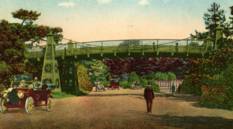
San Francisco, California, USA - Middle Drive
| Bridgemeister ID: | 98 (added before 2003) |
| Year Completed: | 1891 |
| Name: | (suspension bridge) |
| Location: | San Francisco, California, USA |
| Crossing: | Middle Drive |
| At or Near Feature: | Golden Gate Park |
| Coordinates: | 37.770611 N 122.459667 W |
| Maps: | Acme, GeoHack, Google, OpenStreetMap |
| Principals: | John A. Roebling's Sons Co. |
| Use: | Footbridge |
| Status: | Removed, 1928 |
| Main Cables: | Wire |
| Suspended Spans: | 1 |
| Main Span: | 1 |
| Side Spans: | 2 |
Notes:
- Coordinates indicate approximate location of the bridge which crossed Middle Drive (now Nancy Pelosi Drive) near the current location of the tennis courts in Golden Gate Park.
External Links:
- Chicken Point - FoundSF. Several images of the bridge.
- Golden Gate Park - OpenSFHistory - Western Neighborhoods Project. Image of the bridge.
Image Sets:
1891: Ölfusá
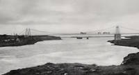
Selfoss, Iceland - Ölfusá River
| Bridgemeister ID: | 2922 (added 2019-09-15) |
| Year Completed: | 1891 |
| Name: | Ölfusá |
| Location: | Selfoss, Iceland |
| Crossing: | Ölfusá River |
| Use: | Vehicular |
| Status: | Collapsed, 1944 |
| Main Cables: | Wire (steel) |
Notes:
Image Sets:
1891: Friedrichsbrücke
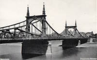
Mannheim, Germany - Neckar River
| Bridgemeister ID: | 8461 (added 2024-03-17) |
| Year Completed: | 1891 |
| Name: | Friedrichsbrücke |
| Location: | Mannheim, Germany |
| Crossing: | Neckar River |
| Coordinates: | 49.493861 N 8.471778 E |
| Maps: | Acme, GeoHack, Google, OpenStreetMap |
| Use: | Vehicular |
| Status: | Replaced |
| Suspended Spans: | 3 |
| Main Span: | 1 x 74.7 meters (245.1 feet) |
| Side Spans: | 2 x 56.15 meters (184.2 feet) |
Notes:
- This bridge likely functioned more as a cantilever bridge than a suspension bridge.
- 1938-1940: The bridge undergoes a major reconstruction to widen the bridge. The towers appear to have been replaced at this time, but the suspension/cantilever system is retained. The resulting structure is listed separately.
- Replaced 1845 Kettenbrücke (Chain, Ketten) - Mannheim, Germany.
- Replaced by 1940 Friedrichsbrücke - Mannheim, Germany.
- All past and present bridges at this location.
External Links:
- Wikipedia - Kurpfalzbrücke. History of several bridges at this location.
Image Sets:
1891: Geisecke
Geisecke vicinity, North Rhine-Westphalia, Germany - Ruhr River
| Bridgemeister ID: | 2292 (added 2007-04-24) |
| Year Completed: | 1891 |
| Name: | Geisecke |
| Location: | Geisecke vicinity, North Rhine-Westphalia, Germany |
| Crossing: | Ruhr River |
| Use: | Footbridge |
| Status: | Demolished, 1928 |
| Deck width: | 1.0 meters |
External Links:
1891: Livron
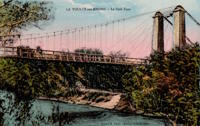
Livron-sur-Drôme, Drôme and La Voulte-sur-Rhône, Ardèche, France - Petit Rhône River
| Bridgemeister ID: | 1806 (added 2005-05-19) |
| Year Completed: | 1891 |
| Name: | Livron |
| Location: | Livron-sur-Drôme, Drôme and La Voulte-sur-Rhône, Ardèche, France |
| Crossing: | Petit Rhône River |
| Coordinates: | 44.795194 N 4.796055 E |
| Maps: | Acme, GeoHack, Google, OpenStreetMap |
| Use: | Vehicular (one-lane) |
| Status: | In use (last checked: 2022) |
| Main Cables: | Wire |
| Suspended Spans: | 1 |
| Main Span: | 1 x 101 meters (331.4 feet) estimated |
Notes:
External Links:
Image Sets:
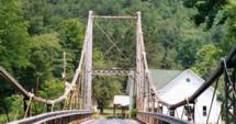
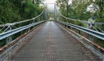
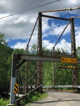
1891: Lower
English Center Borough, Pennsylvania, USA - Little Pine Creek
| Bridgemeister ID: | 99 (added before 2003) |
| Year Completed: | 1891 |
| Name: | Lower |
| Location: | English Center Borough, Pennsylvania, USA |
| Crossing: | Little Pine Creek |
| Coordinates: | 41.4349 N 77.28887 W |
| Maps: | Acme, GeoHack, Google, OpenStreetMap |
| Principals: | Dean & Westbrook |
| References: | HAERPA461, HHP, SSB |
| Use: | Vehicular (one-lane) |
| Status: | In use (last checked: 2023) |
| Main Cables: | Eyebar (steel) |
| Suspended Spans: | 1 |
| Main Span: | 1 x 91.4 meters (300 feet) |
Notes:
- This bridge is an eyebar suspension and truss hybrid similar to the Florianopolis, Silver, and Saint Marys bridges.
- 2012, May: Closed for two weeks for repairs after a snapped support was discovered.
- Companion to 1891 Upper - English Center Borough, Pennsylvania, USA.
- See 1926 Hercilio Luz (Florianopolis) - Florianopolis, Santa Catarina, Brazil.
- See 1928 Point Pleasant (Silver) - Point Pleasant, West Virginia and Kanauga, Gallipolis vicinity, Ohio, USA.
- See 1928 Saint Marys (Hi Carpenter, Short Route) - Saint Marys, West Virginia and Newport, Ohio, USA.
Annotated Citations:
- Crossley, Pat. "Historic bridge on the list to be rehabbed." Williamsport Sun-Gazette, 9 Mar. 2023, https://www.sungazette.com/news/top-news/2023/03/historic-bridge-on-the-list-to-be-rehabbed/
$12 million rehabilitation project planned. "According to Maggie Baker, a spokesperson with PennDOT… 'After traffic is switched to the temporary bridge, the existing bridge will be carefully dismantled. The existing structural components of the bridge will be shipped to a fabricator to be cleaned and painted. Remedies for damaged components will be coordinated with the onsite cultural resource representative. Abutments will be carefully dismantled and reconstructed.'"
External Links:
Image Sets:
1891: Upper
English Center Borough, Pennsylvania, USA - Little Pine Creek
| Bridgemeister ID: | 100 (added before 2003) |
| Year Completed: | 1891 |
| Name: | Upper |
| Location: | English Center Borough, Pennsylvania, USA |
| Crossing: | Little Pine Creek |
| Principals: | Dean & Westbrook |
| References: | HAERPA461 |
| Use: | Vehicular (one-lane) |
| Status: | Removed, 1932 |
| Main Cables: | Eyebar (steel) |
Notes:
- Slightly larger than the Lower Bridge at English Center.
- Companion to 1891 Lower - English Center Borough, Pennsylvania, USA.
1892: (footbridge)
Anderson, Indiana, USA - White River
| Bridgemeister ID: | 6467 (added 2021-08-13) |
| Year Completed: | 1892 |
| Name: | (footbridge) |
| Location: | Anderson, Indiana, USA |
| Crossing: | White River |
| Use: | Footbridge |
| Status: | Destroyed, March 27, 1921 |
| Main Cables: | Wire (steel) |
| Suspended Spans: | 3 |
| Main Span: | 1 |
| Side Spans: | 2 |
Annotated Citations:
- Jackson, Stephen T. "If the River Could Talk: Bridges at 27 sites." The Herald Bulletin., 3 July 2016, www.heraldbulletin.com/community/if-the-river-could-talk-bridges-at-27-sites/article_0141fb64-6416-526d-baa4-752e97f65b95.html
"Opened March 7, 1892, in what would today be the shadow of the Eisenhower Bridge, was a suspension bridge built to carry pedestrian traffic from Anderson to Park Place. Twin support towers at each end of the bridge held the suspension span in between… The fun lasted until a flood brought it down March 27, 1921."
External Links:
1892: (footbridge)
Ardtornish, Morvern, Scotland, United Kingdom - Abhainn a' Ghlinne Ghil
| Bridgemeister ID: | 9165 (added 2025-04-06) |
| Year Completed: | 1892 |
| Name: | (footbridge) |
| Location: | Ardtornish, Morvern, Scotland, United Kingdom |
| Crossing: | Abhainn a' Ghlinne Ghil |
| Coordinates: | 56.586333 N 5.748472 W |
| Maps: | Acme, GeoHack, Google, OpenStreetMap |
| Use: | Footbridge |
| Status: | Derelict (last checked: 2024) |
| Main Cables: | Wire |
| Suspended Spans: | 1 |
| Main Span: | 1 x 18 meters (59.1 feet) estimated |
| Characteristics: | Monocable |
Notes:
- Highly unusual short-span monocable suspension bridge seemingly constructed from a hodgepodge of material. It has been sitting derelict for many years, but supposedly retains most of its original components.
External Links:
- Flickr - Single cable suspension bridge, Ardtornish Estate. Image of the bridge. Taken June 6, 2013.
- Flickr - Single cable suspension bridge, Ardtornish Estate. Image of the bridge. Taken June 6, 2013.
- Flickr - Single cable suspension bridge, Ardtornish Estate. Image of the bridge. Taken June 6, 2013.
- Flickr - Single cable suspension bridge, Ardtornish Estate. Image of the bridge. Taken June 6, 2013.
- https://www.kweimar.de/Bilder_XML.php?ket=H1994. Description of the bridge and its components.
1892: Androscoggin Pedestrian
Topsham and Brunswick, Maine, USA - Androscoggin River
| Bridgemeister ID: | 101 (added before 2003) |
| Year Completed: | 1892 |
| Name: | Androscoggin Pedestrian |
| Also Known As: | Swinging, Androscoggin Swinging |
| Location: | Topsham and Brunswick, Maine, USA |
| Crossing: | Androscoggin River |
| Coordinates: | 43.918069 N 69.973122 W |
| Maps: | Acme, GeoHack, Google, OpenStreetMap |
| Principals: | John A. Roebling's Sons Co. |
| References: | PPH19991019, PPH20050801 |
| Use: | Footbridge |
| Status: | Destroyed, 1936 |
| Main Cables: | Wire (steel) |
Notes:
- c. 1913-1916: Original timber towers replaced with steel towers.
- 1936: Deck destroyed by flood. Steel towers and cables survive.
- Replaced by 1936 Androscoggin Pedestrian (Swinging) - Topsham and Brunswick, Maine, USA.
- All past and present bridges at this location.
External Links:
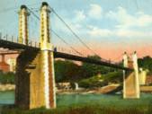
1892: Aurec-sur-Loire
Aurec-sur-Loire, Haute-Loire, France - Loire River
| Bridgemeister ID: | 1607 (added 2005-02-06) |
| Year Completed: | 1892 |
| Name: | Aurec-sur-Loire |
| Location: | Aurec-sur-Loire, Haute-Loire, France |
| Crossing: | Loire River |
| Coordinates: | 45.369475 N 4.196837 E |
| Maps: | Acme, GeoHack, Google, OpenStreetMap |
| Use: | Vehicular (one-lane) |
| Status: | Only towers remain (last checked: 2021) |
| Main Cables: | Wire |
| Suspended Spans: | 3 |
| Main Span: | 1 |
| Side Spans: | 2 |
Notes:
- Approaches, abutments, piers, and pylons still in existence, 2018, but the original deck and cables are completely gone. A newer pedestrian suspension bridge is effectively sitting on the original bridge's piers between the original pylons.
- Later at same location (footbridge) - Aurec-sur-Loire, Haute-Loire, France.
- All past and present bridges at this location.
Image Sets:
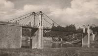
1892: Cammeray
Willoughby, New South Wales, Australia - Long Bay Gully
| Bridgemeister ID: | 421 (added before 2003) |
| Year Completed: | 1892 |
| Name: | Cammeray |
| Also Known As: | North Sydney, Northbridge |
| Location: | Willoughby, New South Wales, Australia |
| Crossing: | Long Bay Gully |
| Coordinates: | 33.816899 S 151.212336 E |
| Maps: | Acme, GeoHack, Google, OpenStreetMap |
| References: | PTS2, STC |
| Use: | Vehicular |
| Status: | Only towers remain, since 1939 (last checked: 2019) |
| Main Cables: | Wire |
| Suspended Spans: | 3 |
| Main Span: | 1 x 152.4 meters (500 feet) |
| Side Spans: | 2 x 38.1 meters (125 feet) |
Notes:
- Replaced with arch in 1939, but original towers retained. STC says replaced 1937.
External Links:
Image Sets:
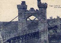
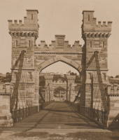
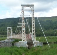
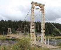
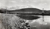
1892: Polhollick
Ballater vicinity, Aberdeenshire, Scotland, United Kingdom - River Dee
| Bridgemeister ID: | 1905 (added 2005-10-08) |
| Year Completed: | 1892 |
| Name: | Polhollick |
| Location: | Ballater vicinity, Aberdeenshire, Scotland, United Kingdom |
| Crossing: | River Dee |
| Coordinates: | 57.055048 N 3.083452 W |
| Maps: | Acme, GeoHack, Google, OpenStreetMap |
| Principals: | James Abernethy & Co. |
| References: | HARPER, HBR |
| Use: | Footbridge |
| Status: | In use (last checked: 2014) |
| Main Cables: | Wire (steel) |
| Suspended Spans: | 1 |
| Main Span: | 1 x 54.4 meters (178.5 feet) |
Notes:
- Closed May 2015 for repairs. Reopened October, 2015.
External Links:
- The Happy Pontist: Scottish Bridges: 19. Polhollick Suspension Bridge
- The Happy Pontist: Scottish Bridges: 44. Polhollick Bridge (revisited)
- Structurae - Structure ID 20021613
Image Sets:
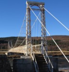
1893: (suspension bridge)
Hamua, New Zealand - Makakahi River
| Bridgemeister ID: | 674 (added 2003-03-08) |
| Year Completed: | 1893 |
| Name: | (suspension bridge) |
| Location: | Hamua, New Zealand |
| Crossing: | Makakahi River |
| Principals: | Joseph Dawson |
| References: | GAP |
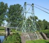
1893: Am Kaltenborn
Wetter and Volmarstein, North Rhine-Westphalia, Germany - Ruhr River
| Bridgemeister ID: | 2168 (added 2007-01-12) |
| Year Completed: | 1893 |
| Name: | Am Kaltenborn |
| Location: | Wetter and Volmarstein, North Rhine-Westphalia, Germany |
| Crossing: | Ruhr River |
| Coordinates: | 51.37610 N 7.39749 E |
| Maps: | Acme, GeoHack, Google, OpenStreetMap |
| Principals: | Siller & Jamart, B. Rittershausen |
| Use: | Footbridge |
| Status: | Extant (last checked: 2006) |
| Main Cables: | Wire |
| Suspended Spans: | 1 |
| Main Span: | 1 x 38 meters (124.7 feet) |
| Deck width: | 1.7 meters |
External Links:
Image Sets:
1893: Cable
Chicago, Illinois, USA - Garfield Park Lagoon
| Bridgemeister ID: | 320 (added before 2003) |
| Year Completed: | 1893 |
| Name: | Cable |
| Location: | Chicago, Illinois, USA |
| Crossing: | Garfield Park Lagoon |
| At or Near Feature: | Garfield Park |
| Coordinates: | 41.883548 N 87.714527 W |
| Maps: | Acme, GeoHack, Google, OpenStreetMap |
| References: | HBE |
| Use: | Footbridge |
| Status: | In use (last checked: 2021) |
| Main Cables: | Wire |
| Suspended Spans: | 1 |
Notes:
- 1870 and 1874 are also sometimes cited as year of completion.
Image Sets:

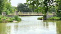
1893: Dennis
Dennis, Texas, USA - Brazos River
| Bridgemeister ID: | 116 (added before 2003) |
| Year Completed: | 1893 |
| Name: | Dennis |
| Location: | Dennis, Texas, USA |
| Crossing: | Brazos River |
| Coordinates: | 32.615639 N 97.926361 W |
| Maps: | Acme, GeoHack, Google, OpenStreetMap |
| Principals: | Flinn-Moyer Co. |
| Use: | Vehicular |
| Status: | Demolished, 1962 |
| Main Cables: | Wire (steel) |
External Links:
- Flickr - Dennis, Texas Suspension Bridge. Image of the bridge. Taken c. 1960-1962.
- Flickr - Dennis, Texas Suspension Bridge. Image of the bridge. Taken c. 1960-1962.
1893: Dorrator
Falkirk, Scotland, United Kingdom - River Carron
| Bridgemeister ID: | 2201 (added 2007-01-28) |
| Year Completed: | 1893 |
| Name: | Dorrator |
| Also Known As: | Falkirk, Carronvale |
| Location: | Falkirk, Scotland, United Kingdom |
| Crossing: | River Carron |
| Coordinates: | 56.011418 N 3.819145 W |
| Maps: | Acme, GeoHack, Google, OpenStreetMap |
| Principals: | Louis Harper |
| References: | AAJ, HARPER |
| Use: | Footbridge |
| Status: | Only towers remain (last checked: 2014) |
| Main Cables: | Wire |
| Suspended Spans: | 1 |
| Main Span: | 1 x 27 meters (88.6 feet) |
Notes:
- Replaced 2014. One tower remains as a monument to the Harper bridge.
- Similar to 1893 Trentham - Trentham, Stoke-on-Trent, England, United Kingdom.
External Links:
Image Sets:
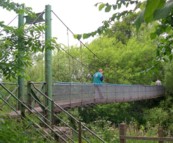
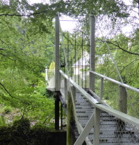
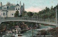
1893: Feugh
Banchory, Scotland, United Kingdom - Water of Feugh
| Bridgemeister ID: | 2196 (added 2007-01-26) |
| Year Completed: | 1893 |
| Name: | Feugh |
| Location: | Banchory, Scotland, United Kingdom |
| Crossing: | Water of Feugh |
| Coordinates: | 57.042679 N 2.493234 W |
| Maps: | Acme, GeoHack, Google, OpenStreetMap |
| Principals: | Louis Harper |
| References: | AAJ, HARPER |
| Use: | Footbridge |
| Status: | In use (last checked: 2014) |
| Main Cables: | Wire |
| Suspended Spans: | 1 |
| Main Span: | 1 x 30 meters (98.4 feet) |
Notes:
- Towers replaced, at some point. Unclear how much of the present-day (2020) bridge is original.
External Links:
Image Sets:
1893: Mandeville
Kaiapoi, New Zealand - Kaiapoi River
| Bridgemeister ID: | 673 (added 2003-03-08) |
| Year Completed: | 1893 |
| Name: | Mandeville |
| Also Known As: | Swing |
| Location: | Kaiapoi, New Zealand |
| Crossing: | Kaiapoi River |
| At or Near Feature: | Trousselot Park |
| Coordinates: | 43.3811 S 172.65584 E |
| Maps: | Acme, GeoHack, Google, OpenStreetMap |
| References: | GAP |
| Use: | Footbridge |
| Status: | In use (last checked: 2019) |
| Main Cables: | Wire |
| Suspended Spans: | 3 |
| Main Spans: | 3 |
Notes:
- Damaged by earthquake 2010, subsequently repaired.
- Similar to 1900 Mafeking (Revell's) - Raven Quay, New Zealand.
- Similar to Butcher's Ford (Durrell's Ford, Hassall's Ford, Butchers) - Kaiapoi, New Zealand.
External Links:
Image Sets:
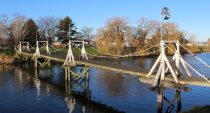
1893: Rivière de l'Est
Sainte Rose, Réunion, France - Rivière de l'Est
| Bridgemeister ID: | 992 (added 2003-11-16) |
| Year Completed: | 1893 |
| Name: | Rivière de l'Est |
| Also Known As: | River of the East |
| Location: | Sainte Rose, Réunion, France |
| Crossing: | Rivière de l'Est |
| Coordinates: | 21.125067 S 55.7484896 E |
| Maps: | Acme, GeoHack, Google, OpenStreetMap |
| Principals: | Ferdinand Arnodin |
| References: | PTS2 |
| Use: | Vehicular (one-lane) |
| Status: | In use (last checked: 2023) |
| Main Cables: | Wire |
| Suspended Spans: | 1 |
| Main Span: | 1 x 150 meters (492.1 feet) |
Notes:
- 2021-2023: Major renovation by Freyssinet.
External Links:
Image Sets:
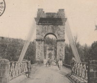
1893: Trentham
Trentham, Stoke-on-Trent, England, United Kingdom - River Trent
| Bridgemeister ID: | 2200 (added 2007-01-28) |
| Year Completed: | 1893 |
| Name: | Trentham |
| Location: | Trentham, Stoke-on-Trent, England, United Kingdom |
| Crossing: | River Trent |
| Coordinates: | 52.963486 N 2.198944 W |
| Maps: | Acme, GeoHack, Google, OpenStreetMap |
| References: | HARPER |
| Use: | Footbridge |
| Status: | Replaced, c.1930's |
| Main Cables: | Wire |
| Suspended Spans: | 1 |
| Main Span: | 1 x 21.3 meters (70 feet) |
Notes:
External Links:
Image Sets:
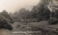
1893: Viscaya
Portugalete and Las Arenas, Spain - Nervión River (Ibaizabal River)
| Bridgemeister ID: | 422 (added before 2003) |
| Year Completed: | 1893 |
| Name: | Viscaya |
| Also Known As: | Biscay, Portugalete, Bizkaia |
| Location: | Portugalete and Las Arenas, Spain |
| Crossing: | Nervión River (Ibaizabal River) |
| Coordinates: | 43.32376 N 3.01655 W |
| Maps: | Acme, GeoHack, Google, OpenStreetMap |
| Principals: | Ferdinand Arnodin, Alberto Palacio |
| Use: | Transporter |
| Status: | In use (last checked: 2021) |
| Main Cables: | Wire |
| Suspended Spans: | 1 |
External Links:
Image Sets:
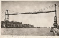
1893: Watson's
Riverside, Illinois, USA - Des Plaines River
| Bridgemeister ID: | 5669 (added 2021-01-30) |
| Year Completed: | 1893 |
| Name: | Watson's |
| Location: | Riverside, Illinois, USA |
| Crossing: | Des Plaines River |
| Coordinates: | 41.825778 N 87.817795 W |
| Maps: | Acme, GeoHack, Google, OpenStreetMap |
| Use: | Footbridge |
| Status: | Replaced |
| Main Cables: | Wire |
| Suspended Spans: | 1 |
| Characteristics: | Partially underspanned |
Notes:
- Appears to have been predominantly underspanned.
- Replaced by 1905 Swinging - Riverside, Illinois, USA.
- All past and present bridges at this location.
1894: (footbridge)
Grimsby, England, United Kingdom - River Freshney
| Bridgemeister ID: | 5079 (added 2020-08-30) |
| Year Completed: | 1894 |
| Name: | (footbridge) |
| Location: | Grimsby, England, United Kingdom |
| Crossing: | River Freshney |
| Coordinates: | 53.570454 N 0.095989 W |
| Maps: | Acme, GeoHack, Google, OpenStreetMap |
| Principals: | Harper & Co. |
| References: | HARPER |
| Use: | Footbridge |
| Status: | Only towers remain (last checked: 2014) |
| Main Cables: | Wire |
| Suspended Spans: | 1 |
| Main Span: | 1 x 10.7 meters (35 feet) |
Notes:
- Replaced, but elements of the suspension bridge were retained in the new structure which is now (2020) boarded up.
- Built as part of same project as 1894 (footbridge) - Grimsby, England, United Kingdom.
- Built as part of same project as 1894 (footbridge) - Grimsby, England, United Kingdom.
1894: (footbridge)
Grimsby, England, United Kingdom - River Freshney
| Bridgemeister ID: | 5080 (added 2020-08-30) |
| Year Completed: | 1894 |
| Name: | (footbridge) |
| Location: | Grimsby, England, United Kingdom |
| Crossing: | River Freshney |
| Coordinates: | 53.569623 N 0.094252 W |
| Maps: | Acme, GeoHack, Google, OpenStreetMap |
| Principals: | Harper & Co. |
| References: | HARPER |
| Use: | Footbridge |
| Status: | Replaced |
| Main Cables: | Wire |
| Suspended Spans: | 1 |
| Main Span: | 1 x 15.2 meters (50 feet) |
Notes:
- Coordinates are for likely location of this bridge, since replaced.
- Built as part of same project as 1894 (footbridge) - Grimsby, England, United Kingdom.
- Built as part of same project as 1894 (footbridge) - Grimsby, England, United Kingdom.
1894: (footbridge)
Grimsby, England, United Kingdom - River Freshney
| Bridgemeister ID: | 5081 (added 2020-08-30) |
| Year Completed: | 1894 |
| Name: | (footbridge) |
| Location: | Grimsby, England, United Kingdom |
| Crossing: | River Freshney |
| Coordinates: | 53.568240 N 0.092003 W |
| Maps: | Acme, GeoHack, Google, OpenStreetMap |
| Principals: | Harper & Co. |
| References: | HARPER |
| Use: | Footbridge |
| Status: | Replaced |
| Main Cables: | Wire |
| Suspended Spans: | 1 |
| Main Span: | 1 x 15.2 meters (50 feet) |
Notes:
- Coordinates are for likely location of this bridge, since replaced.
- Built as part of same project as 1894 (footbridge) - Grimsby, England, United Kingdom.
- Built as part of same project as 1894 (footbridge) - Grimsby, England, United Kingdom.
1894: Arcediano
Guadalajara vicinity, Mexico - Grande de Santiago River
| Bridgemeister ID: | 2492 (added 2008-12-23) |
| Year Completed: | 1894 |
| Name: | Arcediano |
| Location: | Guadalajara vicinity, Mexico |
| Crossing: | Grande de Santiago River |
| At or Near Feature: | Barranca de Portillo |
| Coordinates: | 20.741396 N 103.294783 W |
| Maps: | Acme, GeoHack, Google, OpenStreetMap |
| Use: | Vehicular (one-lane) |
| Status: | Restricted to foot traffic (last checked: 2022) |
| Main Cables: | Wire |
| Suspended Spans: | 1 |
| Main Span: | 1 x 71 meters (232.9 feet) estimated |
Notes:
- 2005: Dismantled and reassembled 700 meters downstream from original location to make way for construction of the Arcediano dam. Coordinates provided here are for the newer location.
Image Sets:
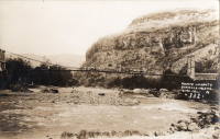
1894: Bonpas
Bonpas, Vaucluse and Bouches-du-Rhône, France - Durance River
| Bridgemeister ID: | 2082 (added 2006-06-11) |
| Year Completed: | 1894 |
| Name: | Bonpas |
| Also Known As: | Bompas, Bompard |
| Location: | Bonpas, Vaucluse and Bouches-du-Rhône, France |
| Crossing: | Durance River |
| Coordinates: | 43.887445 N 4.916439 E |
| Maps: | Acme, GeoHack, Google, OpenStreetMap |
| Use: | Vehicular |
| Status: | Destroyed, 1944 |
| Suspended Spans: | 4 |
| Main Spans: | 2 |
| Side Spans: | 2 |
External Links:
Image Sets:
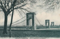
1894: Chamba
Chamba, Himachal Pradesh, India - Ravi River
| Bridgemeister ID: | 7711 (added 2023-07-07) |
| Year Completed: | 1894 |
| Name: | Chamba |
| Location: | Chamba, Himachal Pradesh, India |
| Crossing: | Ravi River |
| Coordinates: | 32.555334 N 76.120818 E |
| Maps: | Acme, GeoHack, Google, OpenStreetMap |
| Use: | Vehicular |
| Status: | Removed |
| Suspended Spans: | 1 |
Notes:
- Appears to have been located on the alignment currently (2020s) occupied by a large box girder bridge and immediately adjacent to a later suspension bridge (bypassed by the box girder bridge).
- See Chamba Cable-stayed Suspension Bridge for an old cable-stayed bridge that may have been at or near this location.
- Next to Sheetla (Old Sheetla, Old Shitla, Sheetala, ओल्ड शीतला ब्रिज) - Chamba, Himachal Pradesh, India.
- All past and present bridges at this location.
Image Sets:
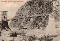
1894: Cromdale
Cromdale, Scotland, United Kingdom - River Spey
| Bridgemeister ID: | 5077 (added 2020-08-30) |
| Year Completed: | 1894 |
| Name: | Cromdale |
| Location: | Cromdale, Scotland, United Kingdom |
| Crossing: | River Spey |
| Coordinates: | 57.341528 N 3.553306 W |
| Maps: | Acme, GeoHack, Google, OpenStreetMap |
| References: | HARPER |
| Use: | Footbridge |
| Status: | Removed, 1921 |
| Main Cables: | Wire |
| Suspended Spans: | 1 |
Notes:
- Replaced 1881 Cromdale - Cromdale, Scotland, United Kingdom.
- All past and present bridges at this location.
Image Sets:
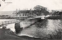
1894: Devil's Dyke Aerial Cableway
Fulking, Brighton vicinity, England, United Kingdom - Devil's Dyke
| Bridgemeister ID: | 4843 (added 2020-07-11) |
| Year Completed: | 1894 |
| Name: | Devil's Dyke Aerial Cableway |
| Location: | Fulking, Brighton vicinity, England, United Kingdom |
| Crossing: | Devil's Dyke |
| References: | AAJ |
| Use: | Tramway |
| Status: | Closed, 1909 |
| Main Cables: | Wire (steel) |
| Suspended Spans: | 3 |
| Main Span: | 1 |
| Side Spans: | 2 |
External Links:
1894: Kallar
Kallar, Nilgiri Hills and Coonoor, Tamil Nadu, India
| Bridgemeister ID: | 7474 (added 2022-12-25) |
| Year Completed: | 1894 |
| Name: | Kallar |
| Location: | Kallar, Nilgiri Hills and Coonoor, Tamil Nadu, India |
| Coordinates: | 11.337556 N 76.881783 E |
| Maps: | Acme, GeoHack, Google, OpenStreetMap |
| Use: | Vehicular |
| Status: | Demolished, 2015 |
| Suspended Spans: | 1 |
Notes:
- 1920s: Bypassed
- 1990s: Only towers remain.
- 2015: Tower(s) demolished.
External Links:
- Facebook - Bridge connecting Mettupalayam and Ooty/Coonoor in Tamilnadu.. Images of the demolition of the suspension bridge tower. Posted October 9, 2015
- Facebook - Bridge on the River Kallar. Post detailing the history of the bridge site. Posted January 20, 2018.
- Heritage Bridge near Kallar Demolished | The Hindu. Article about demolition of the bridge. October 12, 2015.
- Historians upset over demolition of 120-year-old structure that supports Kallar’s Hanging Bridge | Coimbatore News - Times of India. Article regarding demolition of the towers, October 10, 2015.
- Pradeep Damodaran: Oldest bridge connecting Nilgiris with Coimbatore at Kallar lies vandalized, uncared for. Blog post with image of one of the bridge towers, posted August 12, 2013.
- The eighty one years old suspension bridge across the Kallar River, connecting Coimbatore and the... | The Hindu Images. Image with suspension bridge tower visible in the background.
- The History of Coonoor - Clean Coonoor. History of the area including an image of the bridge.
- YouTube - Kallar Bridge connecting Mettupalayam and Ooty, Tamilnadu | India Video. Video with footage of the suspension bridge tower. Posted July 16, 2013.
Image Sets:
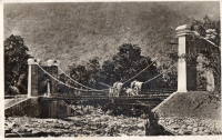
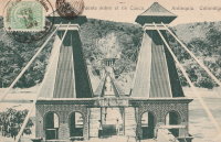
1894: Occidente
Santa Fé de Antioquia, Colombia - Cauca River
| Bridgemeister ID: | 934 (added 2003-10-25) |
| Year Completed: | 1894 |
| Name: | Occidente |
| Also Known As: | Western |
| Location: | Santa Fé de Antioquia, Colombia |
| Crossing: | Cauca River |
| Coordinates: | 6.577965 N 75.798177 W |
| Maps: | Acme, GeoHack, Google, OpenStreetMap |
| Principals: | José María Villa |
| References: | AAJ, HBE, PTS2 |
| Use: | Vehicular (one-lane), with walkway |
| Status: | In use (last checked: 2019) |
| Main Cables: | Wire |
| Main Span: | 1 x 286.5 meters (940 feet) |
External Links:
Image Sets:
1894: Partab
Bunji vicinity, Pakistan - Indus River
| Bridgemeister ID: | 2566 (added 2012-02-04) |
| Year Completed: | 1894 |
| Name: | Partab |
| Also Known As: | Bunji |
| Location: | Bunji vicinity, Pakistan |
| Crossing: | Indus River |
| Coordinates: | 35.729820 N 74.623571 E |
| Maps: | Acme, GeoHack, Google, OpenStreetMap |
| Principals: | Algernon Durand |
| Use: | Vehicular |
| Status: | In use (last checked: 2012) |
| Main Cables: | Wire |
1894: Pokororo
Ngatimoti and Woodstock, New Zealand - Motueka River
| Bridgemeister ID: | 675 (added 2003-03-08) |
| Year Completed: | 1894 |
| Name: | Pokororo |
| Also Known As: | Ngatimoti |
| Location: | Ngatimoti and Woodstock, New Zealand |
| Crossing: | Motueka River |
| References: | GAP |
| Use: | Footbridge |
| Main Cables: | Wire |
| Suspended Spans: | 1 |
| Main Span: | 1 x 91.4 meters (299.9 feet) |
Notes:
- GAP: Originally footbridge, widened 1916. Collapsed October, 1931. Rebuilt.
External Links:
1894: Stell
Chickasha, Oklahoma, USA - Washita River
| Bridgemeister ID: | 2332 (added 2007-07-07) |
| Year Completed: | 1894 |
| Name: | Stell |
| Location: | Chickasha, Oklahoma, USA |
| Crossing: | Washita River |
| Use: | Vehicular (one-lane) |
| Status: | Removed |
| Main Cables: | Wire |
External Links:
- Turnpikes and Toll Bridges | The Encyclopedia of Oklahoma History and Culture. Image of the bridge. It appears to have been similar to the Flinn-Moyer Beveridge Bridge in Texas.
1894: Swinging
Eureka Springs vicinity, Arkansas, USA - King's River
| Bridgemeister ID: | 1822 (added 2005-05-21) |
| Year Completed: | 1894 |
| Name: | Swinging |
| Location: | Eureka Springs vicinity, Arkansas, USA |
| Crossing: | King's River |
| Coordinates: | 36.389667 N 93.659528 W |
| Maps: | Acme, GeoHack, Google, OpenStreetMap |
| Use: | Vehicular |
| Status: | Removed |
| Main Cables: | Wire |
| Suspended Spans: | 2 |
| Main Spans: | 2 x 76.8 meters (252 feet) |
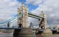
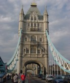
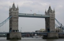
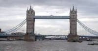
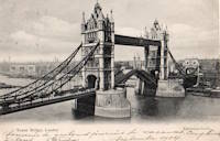
1894: Tower
London, England, United Kingdom - River Thames
| Bridgemeister ID: | 3845 (added 2020-03-07) |
| Year Completed: | 1894 |
| Name: | Tower |
| Location: | London, England, United Kingdom |
| Crossing: | River Thames |
| Coordinates: | 51.505837 N 0.075281 W |
| Maps: | Acme, GeoHack, Google, OpenStreetMap |
| References: | PTS2 |
| Use: | Vehicular |
| Status: | In use (last checked: 2023) |
| Suspended Spans: | 2 |
| Side Spans: | 2 x 82.3 meters (270 feet) |
Image Sets:
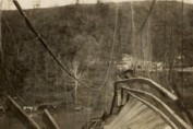
1895: Drake
Warsaw, Missouri, USA - Osage River
| Bridgemeister ID: | 1069 (added 2003-12-27) |
| Year Completed: | 1895 |
| Name: | Drake |
| Location: | Warsaw, Missouri, USA |
| Crossing: | Osage River |
| Principals: | Dr. Daniel M. Eddy |
| References: | BOTO |
| Use: | Vehicular |
| Status: | Collapsed, 1913 |
| Main Cables: | Wire |
Notes:
- Collapsed under weight of cattle 1913.
- Replaced by 1913 Middle - Warsaw, Missouri, USA.
- All past and present bridges at this location.
Image Sets:
1895: Duck Reach
Launceston, Tasmania, Australia - South Esk River
| Bridgemeister ID: | 1859 (added 2005-07-25) |
| Year Completed: | 1895 |
| Name: | Duck Reach |
| Location: | Launceston, Tasmania, Australia |
| Crossing: | South Esk River |
| Coordinates: | 41.458944 S 147.111885 E |
| Maps: | Acme, GeoHack, Google, OpenStreetMap |
| Use: | Footbridge |
| Status: | Destroyed, 1929, by flood |
Notes:
- Near 1904 Alexandra (Basin) - Launceston, Tasmania, Australia.
- Replaced by 1939 Duck Reach - Launceston, Tasmania, Australia.
- All past and present bridges at this location.
Image Sets:
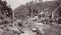
| Bridgemeister ID: | 3867 (added 2020-03-07) |
| Year Completed: | 1895 |
| Name: | Grøtte |
| Location: | Grøtan, Rennebu, Trøndelag, Norway |
| Crossing: | Orkla |
| Coordinates: | 62.83606 N 9.91830 E |
| Maps: | Acme, GeoHack, Google, kart.1881.no, OpenStreetMap |
| Principals: | Sivert Gunnes |
| Use: | Vehicular (one-lane) |
| Status: | In use (last checked: 2018) |
| Main Cables: | Wire |
| Suspended Spans: | 1 |
| Main Span: | 1 x 31 meters (101.7 feet) estimated |
External Links:
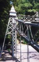
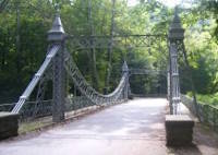
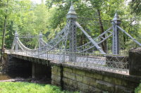
| Bridgemeister ID: | 343 (added before 2003) |
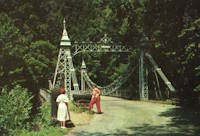
| Year Completed: | 1895 |
| Name: | Mill Creek Park |
| Also Known As: | White, Silver, Old Steel, Cinderella, Fairy Tale |
| Location: | Youngstown vicinity, Ohio, USA |
| At or Near Feature: | Mill Creek Park |
| Coordinates: | 41.07325 N 80.68886 W |
| Maps: | Acme, GeoHack, Google, OpenStreetMap |
| Principals: | Charles Evan Fowler |
| References: | AAJ, HBE, IEA, PTS2 |
| Use: | Vehicular (two-lane) |
| Status: | In use (last checked: 2021) |
| Main Cables: | Eyebar |
| Suspended Spans: | 1 |
| Main Span: | 1 x 27.4 meters (90 feet) |
| Characteristics: | Braced (trussed) chain/cable |
Notes:
- Short stiffened eyebar ("braced chain") of the style that Lindenthal often proposed. A mid-span support was added many years ago.
- Major rehabilitation started, June 2007. Reopened November, 2007.
External Links:
Image Sets:
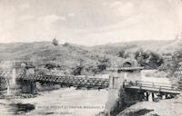
1895: Pantar
Pantar, Lanao Province, Mindanao, Philippines - Agus River
| Bridgemeister ID: | 1706 (added 2005-03-29) |
| Year Completed: | 1895 |
| Name: | Pantar |
| Location: | Pantar, Lanao Province, Mindanao, Philippines |
| Crossing: | Agus River |
| Coordinates: | 8.055806 N 124.267611 E |
| Maps: | Acme, GeoHack, Google, OpenStreetMap |
| Use: | Vehicular (one-lane) |
| Status: | Removed |
| Main Cables: | Wire |
| Suspended Spans: | 1 |
Notes:
- 1898: Burned during the Spanish-American War.
- 1903: The bridge is rebuilt.
External Links:
- Alamy - The Spanish Army in the Philippines 1896-1898. Suspension bridge over the Agus river. Philippine Island.. Possibly a predecessor bridge at the same location.
- Facebook. Image of the destroyed bridge. "The ruins of the Spanish-era Pantar bridge as found on arrival by the men of Company E, 2nd Battalion US Engineers in early 1903. The bridge was destroyed by the Spanish as they retreated during the Spanish-American War."
- Facebook. Possibly a predecessor bridge at the same location. "PUENTE DE ALFONSO XIII sobre al rio Agüs, entre los fuertes de Salazar y Sungut en el camino militar de Iligan á Marahuit".
- Flickr - Bridge at Pantar,Lanao del Norte, Northern Mindanao, Philippines 1898. Image of the bridge.
Image Sets:

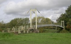
1895: Sellack Boat
Sellack Boat, Ross on Wye, England, United Kingdom - River Wye
| Bridgemeister ID: | 1210 (added 2004-02-07) |
| Year Completed: | 1895 |
| Name: | Sellack Boat |
| Location: | Sellack Boat, Ross on Wye, England, United Kingdom |
| Crossing: | River Wye |
| Coordinates: | 51.948935 N 2.634423 W |
| Maps: | Acme, GeoHack, Google, OpenStreetMap |
| Principals: | Louis Harper, Harpers Limited |
| References: | BRW, HARPER |
| Use: | Footbridge |
| Status: | In use (last checked: 2014) |
| Main Cables: | Wire |
| Suspended Spans: | 1 |
| Main Span: | 1 x 57.9 meters (190 feet) |
| Deck width: | 6 feet |
Notes:
- HARPER: Completed in 1895.
External Links:
Image Sets:
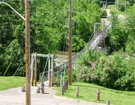
1895: Swinging
Renfrew, Ontario, Canada - Bonnechere River
| Bridgemeister ID: | 590 (added 2003-01-05) |
| Year Completed: | 1895 |
| Name: | Swinging |
| Location: | Renfrew, Ontario, Canada |
| Crossing: | Bonnechere River |
| Coordinates: | 45.478217 N 76.691764 W |
| Maps: | Acme, GeoHack, Google, OpenStreetMap |
| Use: | Footbridge |
| Status: | In use (last checked: 2020) |
| Main Cables: | Wire (steel) |
| Suspended Spans: | 2 |
| Main Spans: | 2 |
Notes:
- 1983: Rebuilt.
- 2020, December: Rehabilitation project likely.
- 2021, October: Contract awarded for repairs.
Annotated Citations:
- McIntyre, Bruce. "Swinging Bridge will be upgraded at a cost of almost $300,000." Toronto Star, 20 October 2021, https://www.thestar.com/news/canada/2021/10/20/swinging-bridge-will-be-upgraded-at-a-cost-of-almost-300000.html.
"In his report to council recently, Development and Property Director Mike Asselin said the bridge was an important piece of infrastructure and just like other municipal property like bridges and roads, council was faced with the prospect of investing in one of its assets or eventually be forced to close the bridge due to safety concerns. Although there had been some repairs completed in 2020, it was more of a stop-gap measure to deal with some immediate issues."
Image Sets:
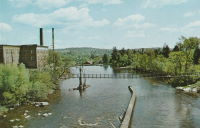
1896: Beveridge
San Saba, Texas, USA - San Saba River
| Bridgemeister ID: | 102 (added before 2003) |
| Year Completed: | 1896 |
| Name: | Beveridge |
| Location: | San Saba, Texas, USA |
| Crossing: | San Saba River |
| Coordinates: | 31.21083 N 98.74083 W |
| Maps: | Acme, GeoHack, Google, OpenStreetMap |
| Principals: | Flinn-Moyer Co. |
| References: | HAERTX98 |
| Use: | Vehicular (one-lane) |
| Status: | Restricted to foot traffic (last checked: 2008) |
| Main Cables: | Wire |
| Suspended Spans: | 1 |
Notes:
- Located near the locally famous Wedding Oak tree.
- 1938: Reconstructed by Austin Bridge Co.
- 2006: Major restoration project completed.
External Links:
- Beveridge Bridge Restoration Project - YouTube. A 27-minute video.
- Structurae - Structure ID 20005565
Image Sets:
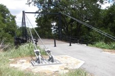
1896: Chosica
Lurigancho-Chosica, Peru
| Bridgemeister ID: | 5925 (added 2021-06-20) |
| Year Completed: | 1896 |
| Name: | Chosica |
| Location: | Lurigancho-Chosica, Peru |
| Coordinates: | 11.935041 S 76.692574 W |
| Maps: | Acme, GeoHack, Google, OpenStreetMap |
| Use: | Vehicular (one-lane) |
| Status: | Restricted to foot traffic (last checked: 2021) |
| Main Cables: | Wire (steel) |
| Suspended Spans: | 1 |
Image Sets:
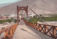
1896: Clear Fork Of The Brazos
Woodson vicinity, Shackelford County, Texas, USA - Clear Fork Brazos River
| Bridgemeister ID: | 103 (added before 2003) |
| Year Completed: | 1896 |
| Name: | Clear Fork Of The Brazos |
| Location: | Woodson vicinity, Shackelford County, Texas, USA |
| Crossing: | Clear Fork Brazos River |
| Coordinates: | 32.921611 N 99.167944 W |
| Maps: | Acme, GeoHack, Google, OpenStreetMap |
| Principals: | Flinn-Moyer Co. |
| References: | BRAZ, HAERTX64, HAERTX98 |
| Use: | Vehicular |
| Status: | Extant (last checked: 2019) |
| Main Cables: | Wire |
| Suspended Spans: | 1 |
External Links:
Image Sets:

1897: (footbridge)
Addingham, England, United Kingdom - River Wharfe
| Bridgemeister ID: | 1207 (added 2004-02-07) |
| Year Completed: | 1897 |
| Name: | (footbridge) |
| Location: | Addingham, England, United Kingdom |
| Crossing: | River Wharfe |
| Use: | Footbridge |
| Status: | Destroyed, 1936 |
| Main Cables: | Wire |
Notes:
- Destroyed by flood, 1936.
- Replaced by (footbridge) - Addingham, England, United Kingdom.
- All past and present bridges at this location.
1897: (suspension bridge)
Tiroiti, New Zealand - Capburn River
| Bridgemeister ID: | 676 (added 2003-03-08) |
| Year Completed: | 1897 |
| Name: | (suspension bridge) |
| Location: | Tiroiti, New Zealand |
| Crossing: | Capburn River |
| References: | GAP |
| Use: | Pack and Stock |
1897: (suspension bridge)
Utiku vicinity, New Zealand - Rangitikei River
| Bridgemeister ID: | 677 (added 2003-03-08) |
| Year Completed: | 1897 |
| Name: | (suspension bridge) |
| Location: | Utiku vicinity, New Zealand |
| Crossing: | Rangitikei River |
| References: | GAP |
| Status: | Replaced, 1970 |
1897: Bertrand Road
Huirangi, New Zealand - Waitara River
| Bridgemeister ID: | 717 (added 2003-03-08) |
| Year Completed: | 1897 |
| Name: | Bertrand Road |
| Also Known As: | Tikorangi |
| Location: | Huirangi, New Zealand |
| Crossing: | Waitara River |
| Coordinates: | 39.047353 S 174.255262 E |
| Maps: | Acme, GeoHack, Google, OpenStreetMap |
| References: | GAP |
| Use: | Vehicular (one-lane) |
| Status: | Replaced |
Notes:
1897: Carfin
Crossford, Carluke, Scotland, United Kingdom - River Clyde
| Bridgemeister ID: | 5172 (added 2020-09-26) |
| Year Completed: | 1897 |
| Name: | Carfin |
| Also Known As: | Crossford |
| Location: | Crossford, Carluke, Scotland, United Kingdom |
| Crossing: | River Clyde |
| Coordinates: | 55.693646 N 3.863803 W |
| Maps: | Acme, GeoHack, Google, OpenStreetMap |
| Principals: | P & R Flemming & Co. |
| Use: | Footbridge |
| Status: | Closed (last checked: 2020) |
| Main Cables: | Rod |
| Suspended Spans: | 2 |
| Main Spans: | 2 |
Notes:
- Restored early 1990s, but has since fallen into disrepair and is closed. Unusual main "cables" appear to be steel rods or some kind of segmented rigid steel members.
Image Sets:
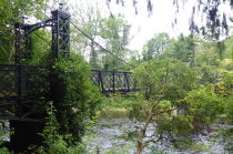
1897: Hackberry
Warsaw, Missouri, USA - Osage River
| Bridgemeister ID: | 2538 (added 2011-12-28) |
| Year Completed: | 1897 |
| Name: | Hackberry |
| Also Known As: | Lower |
| Location: | Warsaw, Missouri, USA |
| Crossing: | Osage River |
| Principals: | Joseph A. Dice, Dr. Daniel M. Eddy |
| References: | BOTO |
| Use: | Vehicular |
| Status: | Destroyed, 1926 |
| Main Cables: | Wire |
| Main Span: | 1 x 158.5 meters (520 feet) |
Notes:
- Destroyed by fire, 1926.
1897: Jubilee
Annan, Scotland, United Kingdom - River Annan
| Bridgemeister ID: | 6206 (added 2021-07-15) |
| Year Completed: | 1897 |
| Name: | Jubilee |
| Location: | Annan, Scotland, United Kingdom |
| Crossing: | River Annan |
| Coordinates: | 55.005848 N 3.265549 W |
| Maps: | Acme, GeoHack, Google, OpenStreetMap |
| Use: | Footbridge |
| Status: | Destroyed, October 28, 2021 |
| Main Cables: | Wire (steel) |
| Suspended Spans: | 1 |
Notes:
- 2021, October 28: Destroyed by flood.
Image Sets:
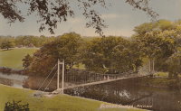
1897: Lincoln Highway
East Liverpool, Ohio and Chester, West Virginia, USA - Ohio River
| Bridgemeister ID: | 105 (added before 2003) |
| Year Completed: | 1897 |
| Name: | Lincoln Highway |
| Also Known As: | Chester |
| Location: | East Liverpool, Ohio and Chester, West Virginia, USA |
| Crossing: | Ohio River |
| Coordinates: | 40.613056 N 80.572806 W |
| Maps: | Acme, GeoHack, Google, OpenStreetMap |
| Principals: | Hermann Laub, E.S. Fickes |
| References: | AAJ, BPL, HBE, PTS2 |
| Use: | Vehicular, with walkway |
| Status: | Removed, 1970 |
| Main Cables: | Wire (steel) |
| Suspended Spans: | 3 |
| Main Span: | 1 x 214.9 meters (705 feet) |
| Side Spans: | 1 x 109.7 meters (360 feet), 1 x 128 meters (420 feet) |
| Deck width: | 27 feet |
Notes:
- Rebuilt 1939 by David Steinman. Closed and demolished, 1970.
External Links:
Image Sets:

1897: Macandrew
Bannockburn, New Zealand - Kawarau River
| Bridgemeister ID: | 661 (added 2003-03-08) |
| Year Completed: | 1897 |
| Name: | Macandrew |
| Location: | Bannockburn, New Zealand |
| Crossing: | Kawarau River |
| References: | GAP |
| Use: | Vehicular (one-lane) |
| Status: | Replaced, 1964 |
| Main Cables: | Wire |
| Suspended Spans: | 1 |
Notes:
- One tower remains preserved near the former site of the bridge.
- Replaced 1874 (suspension bridge) - Bannockburn, New Zealand.
- All past and present bridges at this location.
Image Sets:
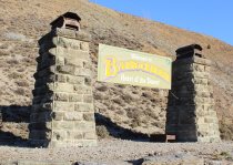
1897: Newey
Grahamstown and Qonce (King William's Town), South Africa - Keiskamma River
| Bridgemeister ID: | 5850 (added 2021-05-14) |
| Year Completed: | 1897 |
| Name: | Newey |
| Location: | Grahamstown and Qonce (King William's Town), South Africa |
| Crossing: | Keiskamma River |
| Use: | Vehicular |
| Status: | Removed |
| Main Cables: | Wire (steel) |
| Suspended Spans: | 3 |
| Main Span: | 1 x 61 meters (200 feet) |
| Side Spans: | 2 x 30.5 meters (100 feet) |
Notes:
- Described as being on the road between Grahamstown and King William's Town which possibly would have been located near the present-day Keiskamma road crossing at Kalana.
1897: Pailhès
Pézenas and Castelnau-de-Guers, Hérault, France - Hérault River
| Bridgemeister ID: | 4689 (added 2020-06-20) |
| Year Completed: | 1897 |
| Name: | Pailhès |
| Also Known As: | Castelnau |
| Location: | Pézenas and Castelnau-de-Guers, Hérault, France |
| Crossing: | Hérault River |
| Coordinates: | 43.449256 N 3.436369 E |
| Maps: | Acme, GeoHack, Google, OpenStreetMap |
| Use: | Vehicular |
| Status: | Demolished (last checked: 2009) |
| Main Cables: | Wire (steel) |
| Suspended Spans: | 1 |
| Main Span: | 1 x 101.47 meters (332.9 feet) |
Notes:
- Likely replaced an older suspension bridge.
External Links:
Image Sets:
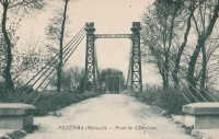
1897: Pease River
Vernon, Texas, USA - Pease River
| Bridgemeister ID: | 5585 (added 2020-12-22) |
| Year Completed: | 1897 |
| Name: | Pease River |
| Location: | Vernon, Texas, USA |
| Crossing: | Pease River |
| Coordinates: | 34.179209 N 99.323843 W |
| Maps: | Acme, GeoHack, Google, OpenStreetMap |
| Use: | Vehicular (one-lane) |
| Status: | Destroyed, 1907 |
| Main Cables: | Wire |
Notes:
- Sometimes cited as completed 1897, 1899, or "around 1899".
- Sometimes attributed to Mitchell and Pigg, but that would have been several years before the earliest bridges typically attributed to Mitchell and Pigg. Mitchell and Pigg are more clearly associated with the 1909 replacement of this Pease River bridge. Texas suspension bridge dominant builder history generally evolved from Flinn/Moyer (1890s, early 1900s) to Mitchell/Pigg (mid-1900s thru early 1910s) to Austin Bridge (1910s onward) with design similarities (and employees) shared through that evolution.
- Destroyed by tornado, 1907. Coordinates are for the replacement suspension bridge, assumed to be on the same alignment or very close.
- Replaced by 1909 Pease River - Vernon, Texas, USA.
- All past and present bridges at this location.
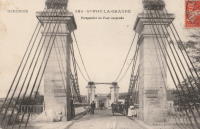
1897: Port-Sainte-Foy
Port-Sainte-Foy-et-Ponchapt, Dordogne and Sainte-Foy-la-Grande, Gironde, France - Dordogne River
| Bridgemeister ID: | 1594 (added 2005-02-06) |
| Year Completed: | 1897 |
| Name: | Port-Sainte-Foy |
| Location: | Port-Sainte-Foy-et-Ponchapt, Dordogne and Sainte-Foy-la-Grande, Gironde, France |
| Crossing: | Dordogne River |
| Coordinates: | 44.842400 N 0.211233 E |
| Maps: | Acme, GeoHack, Google, OpenStreetMap |
| Use: | Vehicular (two-lane) |
| Status: | Only towers remain (last checked: 2019) |
| Main Cables: | Wire |
| Suspended Spans: | 2 |
| Main Spans: | 2 |
Notes:
- Replaced by a nearby suspension bridge, but the end pylons are still present at the ends of the replacement span as of 2019.
- Replaced 1829 Port-Sainte-Foy - Port-Sainte-Foy-et-Ponchapt, Dordogne and Sainte-Foy-la-Grande, Gironde, France.
- Near future location of 1961 Saint-Foy-la-Grande - Saint-Foy-la-Grande, Gironde and Port-Sainte-Foy-et-Ponchapt, Dordogne, France.
- All past and present bridges at this location.
External Links:
Image Sets:
1897: Rochester-Monaca
Rochester and Monaca, Pennsylvania, USA - Ohio River
| Bridgemeister ID: | 104 (added before 2003) |
| Year Completed: | 1897 |
| Name: | Rochester-Monaca |
| Location: | Rochester and Monaca, Pennsylvania, USA |
| Crossing: | Ohio River |
| Coordinates: | 40.696833 N 80.280806 W |
| Maps: | Acme, GeoHack, Google, OpenStreetMap |
| Principals: | Edwin Kirtland Morse |
| References: | AAJ, BPL, HBE, PTS2 |
| Use: | Vehicular, with walkway |
| Status: | Replaced, 1930 |
| Main Cables: | Wire (steel) |
| Suspended Spans: | 3 |
| Main Span: | 1 x 243.8 meters (800 feet) |
| Side Spans: | 1 x 121.9 meters (400 feet), 1 x 126.8 meters (416 feet) |
| Deck width: | 28 feet |
External Links:
- Wikipedia - Rochester–Monaca Bridge
- YouTube - History in a Minute: Rochester-Monaca Bridge. Brief video about the bridges at this location.
- Structurae - Structure ID 20009575
Image Sets:

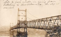
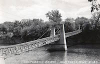
1897: Swinging
Iowa Falls, Iowa, USA - Iowa River
| Bridgemeister ID: | 106 (added before 2003) |
| Year Completed: | 1897 |
| Name: | Swinging |
| Location: | Iowa Falls, Iowa, USA |
| Crossing: | Iowa River |
| At or Near Feature: | Assembly Park |
| Coordinates: | 42.5215 N 93.2708 W |
| Maps: | Acme, GeoHack, Google, OpenStreetMap |
| Principals: | Commodore C.C. Bartlett, J.M. Eddy |
| Use: | Footbridge |
| Status: | In use (last checked: 2006) |
| Main Cables: | Wire |
| Suspended Spans: | 2 |
| Main Span: | 1 x 39 meters (128 feet) estimated |
| Side Span: | 1 x 20.7 meters (68 feet) estimated |
Notes:
- According to plaque at bridge, rebuilt 1909, 1925, 1956, 1989.
Image Sets:
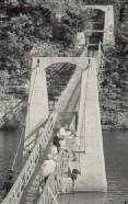
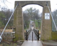
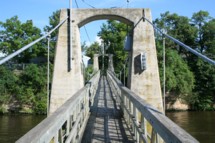
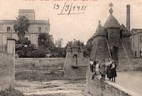
1897: Vapor Nou
Rubí, Barcelona, Spain - Riera de Rubí
| Bridgemeister ID: | 8197 (added 2024-02-05) |
| Year Completed: | 1897 |
| Name: | Vapor Nou |
| Location: | Rubí, Barcelona, Spain |
| Crossing: | Riera de Rubí |
| Coordinates: | 41.491722 N 2.028167 E |
| Maps: | Acme, GeoHack, Google, OpenStreetMap |
| Principals: | Ribas Brothers |
| Use: | Footbridge |
| Status: | Destroyed, 1962 |
| Main Cables: | Wire |
| Suspended Spans: | 1 |
Notes:
- Destroyed by flood, 1962.
External Links:
- El Vapor Nou i el seu pont penjant - TOTRubí.cat. Article about the bridge. Dated August 7, 2023
- Facebook - EL DESAPAREGUT PONT PENJANT DEL VAPOR NOU. Image and history of the bridge.
- Facebook - EL PONT PENJANT DEL VAPOR NOU. Image and history of the bridge.
Image Sets:
| Bridgemeister ID: | 3922 (added 2020-03-20) |
| Year Completed: | 1897 |
| Name: | Vollan |
| Location: | Yset, Tynset, Innlandet, Norway |
| Crossing: | Orkla |
| Coordinates: | 62.569644 N 10.307843 E |
| Maps: | Acme, GeoHack, Google, kart.1881.no, OpenStreetMap |
| Principals: | Johannes Sand |
| Use: | Vehicular (one-lane) |
| Status: | Removed, 2008 |
| Main Cables: | Wire |
| Suspended Spans: | 1 |
Notes:
- Closed to traffic in 1970s. Dismantled in 2008 and the wood used as fuel for a Sankthans bonfire that year.
- Replaced by 2009 Vollan - Yset, Tynset, Innlandet, Norway.
- All past and present bridges at this location.
External Links:
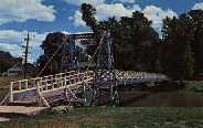
1898: (footbridge)
Pontiac, Illinois, USA - Vermilion River
| Bridgemeister ID: | 312 (added before 2003) |
| Year Completed: | 1898 |
| Name: | (footbridge) |
| Location: | Pontiac, Illinois, USA |
| Crossing: | Vermilion River |
| At or Near Feature: | Chautauqua Park |
| Coordinates: | 40.87696 N 88.62358 W |
| Maps: | Acme, GeoHack, Google, OpenStreetMap |
| Principals: | Joliet Bridge and Iron Co. |
| Use: | Footbridge |
| Status: | In use (last checked: 2005) |
| Main Cables: | Wire |
| Suspended Spans: | 2 |
| Main Span: | 1 |
| Side Span: | 1 |
Notes:
Image Sets:
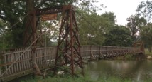
1898: (footbridge)
Pontiac, Illinois, USA - Vermilion River
| Bridgemeister ID: | 1862 (added 2005-07-31) |
| Year Completed: | 1898 |
| Name: | (footbridge) |
| Location: | Pontiac, Illinois, USA |
| Crossing: | Vermilion River |
| At or Near Feature: | Chautauqua Park |
| Coordinates: | 40.87554 N 88.62279 W |
| Maps: | Acme, GeoHack, Google, OpenStreetMap |
| Principals: | Joliet Bridge and Iron Co. |
| Use: | Footbridge |
| Status: | In use (last checked: 2005) |
| Main Cables: | Wire |
| Main Span: | 1 |
| Side Span: | 1 |
Notes:
Image Sets:
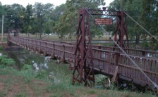
1898: Bizerte Transporter
Bizerte, Tunisia
| Bridgemeister ID: | 995 (added 2003-11-16) |
| Year Completed: | 1898 |
| Name: | Bizerte Transporter |
| Also Known As: | Bizerta |
| Location: | Bizerte, Tunisia |
| Principals: | Ferdinand Arnodin |
| Use: | Transporter |
| Status: | Dismantled, 1904 |
| Main Cables: | Wire (steel) |
| Suspended Spans: | 1 |
Notes:
- Moved to 1909 Brest Transporter - Brest, Finistère, France. The bridge was dismantled in 1904 and reassembled in Brest, France.
External Links:
Image Sets:
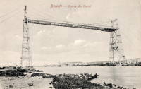
1898: Brinkburn
Morpeth, England, United Kingdom - River Coquet
| Bridgemeister ID: | 4657 (added 2020-06-18) |
| Year Completed: | 1898 |
| Name: | Brinkburn |
| Location: | Morpeth, England, United Kingdom |
| Crossing: | River Coquet |
| Coordinates: | 55.279751 N 1.819533 W |
| Maps: | Acme, GeoHack, Google, OpenStreetMap |
| Use: | Footbridge |
| Status: | Extant (last checked: 2016) |
| Main Cables: | Wire |
| Suspended Spans: | 1 |
External Links:
1898: Doveridge
Doveridge, England, United Kingdom - River Dove
| Bridgemeister ID: | 2151 (added 2006-11-18) |
| Year Completed: | 1898 |
| Name: | Doveridge |
| Location: | Doveridge, England, United Kingdom |
| Crossing: | River Dove |
| Coordinates: | 52.903130 N 1.836442 W |
| Maps: | Acme, GeoHack, Google, OpenStreetMap |
| Principals: | Louis Harper |
| References: | HARPER |
| Use: | Footbridge |
| Status: | Collapsed, 1946 |
| Main Cables: | Wire |
| Suspended Spans: | 1 |
Notes:
- Replaced by 1946 Doveridge - Doveridge, England, United Kingdom.
- All past and present bridges at this location.
External Links:
Image Sets:
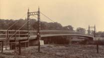

1898: Hampden
Kangaroo Valley, New South Wales, Australia - Kangaroo River
| Bridgemeister ID: | 423 (added before 2003) |
| Year Completed: | 1898 |
| Name: | Hampden |
| Location: | Kangaroo Valley, New South Wales, Australia |
| Crossing: | Kangaroo River |
| Coordinates: | 34.727454 S 150.520910 E |
| Maps: | Acme, GeoHack, Google, OpenStreetMap |
| Principals: | E.M. de Burgh |
| References: | AAJ, STC |
| Use: | Vehicular (one-lane) |
| Status: | In use (last checked: 2023) |
| Main Cables: | Wire (steel) |
| Suspended Spans: | 1 |
| Main Span: | 1 x 77.1 meters (253 feet) |
External Links:
Image Sets:
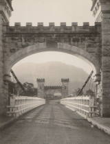
1898: Jaidhari
Jaidhari, Haryana, India - Western Yamuna Canal
| Bridgemeister ID: | 8896 (added 2024-11-26) |
| Year Completed: | 1898 |
| Name: | Jaidhari |
| Location: | Jaidhari, Haryana, India |
| Crossing: | Western Yamuna Canal |
| Coordinates: | 30.242361 N 77.425167 E |
| Maps: | Acme, GeoHack, Google, OpenStreetMap |
| Principals: | Harpers Limited |
| Use: | Footbridge |
| Status: | Replaced, 1942 |
| Main Cables: | Wire |
| Suspended Spans: | 1 |
| Main Span: | 1 x 61 meters (200.1 feet) |
External Links:
- Jaidhari | Harper Bridges. History and image of the bridge.
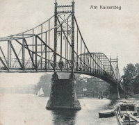
1898: Kaisersteg
Niederschöneweide, Berlin and Oberschöneweide, Berlin, Germany - Spree River
| Bridgemeister ID: | 5691 (added 2021-04-01) |
| Year Completed: | 1898 |
| Name: | Kaisersteg |
| Location: | Niederschöneweide, Berlin and Oberschöneweide, Berlin, Germany |
| Crossing: | Spree River |
| Coordinates: | 52.458179 N 13.519810 E |
| Maps: | Acme, GeoHack, Google, OpenStreetMap |
| Principals: | Heinrich Müller-Breslau, Karl Bernhard |
| Use: | Footbridge |
| Status: | Destroyed, April 22, 1945 |
| Main Cables: | Riveted plate |
| Suspended Spans: | 3 |
| Main Span: | 1 |
| Side Spans: | 2 |
Notes:
- Large hybrid truss/suspension bridge. While often classified as a suspension bridge, it is unclear if this bridge functioned as more of a cantilevered truss than a suspension bridge.
External Links:
Image Sets:
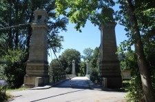
1898: Langenargen
Langenargen and Gohren, Kressbronn am Bodensee, Baden-Württemberg, Germany - Argen River
| Bridgemeister ID: | 929 (added 2003-10-24) |
| Year Completed: | 1898 |
| Name: | Langenargen |
| Location: | Langenargen and Gohren, Kressbronn am Bodensee, Baden-Württemberg, Germany |
| Crossing: | Argen River |
| Coordinates: | 47.59622 N 9.56208 E |
| Maps: | Acme, GeoHack, Google, OpenStreetMap |
| Principals: | Kubler, Leibbrand |
| References: | AAJ, HBE, PTS2 |
| Use: | Vehicular, with walkway |
| Status: | Restricted to foot traffic (last checked: 2022) |
| Main Cables: | Wire |
| Suspended Spans: | 1 |
| Main Span: | 1 x 71.9 meters (236 feet) |
Notes:
- Othmar Ammann worked as an intern on this bridge.
External Links:
Image Sets:
1898: Levey
Tsomo, South Africa
| Bridgemeister ID: | 2178 (added 2007-01-13) |
| Year Completed: | 1898 |
| Name: | Levey |
| Location: | Tsomo, South Africa |
| Principals: | Louis Harper |
| References: | HARPER |
| Status: | Dismantled, c. 1960s |
| Main Cables: | Wire |
| Suspended Spans: | 1 |
Notes:
- Denis Beukman writes: "The Levey bridge at Tsomo was damaged (timber work only) by a tree washed down the river during a flood some time in 1958 or 1959. In the mid 1960's it was either sold or donated to a church group which dismantled it and moved it lower down the river."
External Links:
1898: Lowther
Keswick, England, United Kingdom - River Greta
| Bridgemeister ID: | 2180 (added 2007-01-13) |
| Year Completed: | 1898 |
| Name: | Lowther |
| Also Known As: | Keswick |
| Location: | Keswick, England, United Kingdom |
| Crossing: | River Greta |
| Principals: | Louis Harper |
| References: | HARPER |
| Use: | Footbridge |
| Status: | Demolished, 1979 |
| Main Cables: | Wire |
| Suspended Spans: | 1 |
| Main Span: | 1 x 27.4 meters (90 feet) |
External Links:
1898: Margeaix
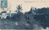
Beaulieu and Saint-Vincent, Haute-Loire, France - Loire River
| Bridgemeister ID: | 1539 (added 2004-10-31) |
| Year Completed: | 1898 |
| Name: | Margeaix |
| Also Known As: | Marjeaix, Margeix |
| Location: | Beaulieu and Saint-Vincent, Haute-Loire, France |
| Crossing: | Loire River |
| Coordinates: | 45.15324 N 3.924896 E |
| Maps: | Acme, GeoHack, Google, OpenStreetMap |
| References: | BPF |
| Use: | Vehicular (one-lane) |
| Status: | In use (last checked: 2019) |
| Main Cables: | Wire |
| Suspended Spans: | 1 |
| Main Span: | 1 x 66 meters (216.5 feet) |
Notes:
- Repaired, 1935 and 1975.
External Links:
Image Sets:
1898: Münden
Hannoversch Münden, Niedersachsen, Germany - Fulda River
| Bridgemeister ID: | 1204 (added 2004-02-02) |
| Year Completed: | 1898 |
| Name: | Münden |
| Location: | Hannoversch Münden, Niedersachsen, Germany |
| Crossing: | Fulda River |
| Coordinates: | 51.419667 N 9.6475 E |
| Maps: | Acme, GeoHack, Google, OpenStreetMap |
| Use: | Footbridge |
| Status: | In use (last checked: 2006) |
| Main Cables: | Wire |
| Suspended Spans: | 1 |
| Main Span: | 1 x 70.4 meters (231 feet) |
| Deck width: | 1.2 meters |
Notes:
- Long footbridge.
External Links:
Image Sets:
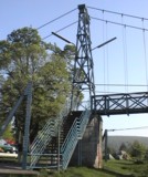
1898: Noble
Noble, Oklahoma, USA - South Canadian River
| Bridgemeister ID: | 107 (added before 2003) |
| Year Completed: | 1898 |
| Name: | Noble |
| Location: | Noble, Oklahoma, USA |
| Crossing: | South Canadian River |
| Coordinates: | 35.139500 N 97.407333 W |
| Maps: | Acme, GeoHack, Google, OpenStreetMap |
| Principals: | Ed Garee |
| Use: | Vehicular (one-lane) |
| Status: | Destroyed, 1904 |
| Main Cables: | Wire |
| Suspended Spans: | 3 |
| Main Span: | 1 x 80.8 meters (265 feet) |
| Side Spans: | 2 |
| Deck width: | 14 feet |
Notes:
- Coordinates are approximate location of the bridge.
- Wrecked by flood October 3rd or 4th, 1904.
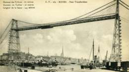
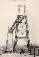
1898: Rouen Transporter
Rouen, Seine-Maritime, France
| Bridgemeister ID: | 953 (added 2003-10-31) |
| Year Completed: | 1898 |
| Name: | Rouen Transporter |
| Location: | Rouen, Seine-Maritime, France |
| Principals: | Ferdinand Arnodin |
| Use: | Transporter |
| Status: | Destroyed, 1940 |
| Suspended Spans: | 1 |
External Links:
Image Sets:
1898: Victoria
Hereford, England, United Kingdom - River Wye
| Bridgemeister ID: | 424 (added before 2003) |
| Year Completed: | 1898 |
| Name: | Victoria |
| Also Known As: | Hereford |
| Location: | Hereford, England, United Kingdom |
| Crossing: | River Wye |
| Coordinates: | 52.051075 N 2.712197 W |
| Maps: | Acme, GeoHack, Google, OpenStreetMap |
| Principals: | John Parker, Alexander Findlay and Co. |
| References: | BRW, NTB |
| Use: | Footbridge |
| Status: | In use (last checked: 2018) |
| Main Cables: | Eyebar |
| Suspended Spans: | 3 |
| Main Span: | 1 x 24.4 meters (80 feet) |
| Side Spans: | 2 |
Image Sets:

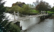
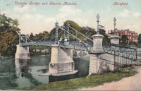
1899: (footbridge)
Bhiri (भीरी), Uttarakhand, India - Mandakini River
| Bridgemeister ID: | 7004 (added 2022-05-14) |
| Year Completed: | 1899 |
| Name: | (footbridge) |
| Location: | Bhiri (भीरी), Uttarakhand, India |
| Crossing: | Mandakini River |
| Coordinates: | 30.468578 N 79.074367 E |
| Maps: | Acme, GeoHack, Google, OpenStreetMap |
| Status: | In use (last checked: 2016) |
| Main Cables: | Wire (steel) |
| Main Span: | 1 |
External Links:
- Bridge over Mandakini near Bhiri a risk to lives - The Tribune India. Residents of Bhiri town in Rudprayag district are irked over the dilapidated condition of a footbridge over the Mandakini, which is on the verge of collapse. "The British constructed the bridge in1889 on the old Kedaranth trek route, near Bhiri, in Rudraprayag district."
1899: Baring
Baring, Washington, USA - Skykomish River
| Bridgemeister ID: | 1902 (added 2005-10-07) |
| Year Completed: | 1899 |
| Name: | Baring |
| Location: | Baring, Washington, USA |
| Crossing: | Skykomish River |
| Coordinates: | 47.765407 N 121.480206 W |
| Maps: | Acme, GeoHack, Google, OpenStreetMap |
| References: | SPW |
| Use: | Vehicular |
| Status: | Collapsed, 1952 |
Notes:
1899: Clifden
Clifden, Southland, New Zealand - Waiau River
| Bridgemeister ID: | 678 (added 2003-03-08) |
| Year Completed: | 1899 |
| Name: | Clifden |
| Location: | Clifden, Southland, New Zealand |
| Crossing: | Waiau River |
| Coordinates: | 46.029752 S 167.715139 E |
| Maps: | Acme, GeoHack, Google, OpenStreetMap |
| Principals: | C.H. Howorth, W. Baird, E.R. Ussher |
| References: | GAP |
| Use: | Vehicular (one-lane) |
| Status: | Restricted to foot traffic, since 1978 (last checked: 2016) |
| Main Cables: | Wire |
| Suspended Spans: | 1 |
| Main Span: | 1 x 111.5 meters (365.8 feet) |
External Links:
Image Sets:
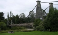
1899: Hanssenspark
Vilvoorde, Belgium
| Bridgemeister ID: | 2079 (added 2006-06-10) |
| Year Completed: | 1899 |
| Name: | Hanssenspark |
| Location: | Vilvoorde, Belgium |
| Coordinates: | 50.924332 N 4.428762 E |
| Maps: | Acme, GeoHack, Google, OpenStreetMap |
| References: | ISFF |
| Use: | Footbridge |
| Status: | In use (last checked: 2019) |
| Main Cables: | Wire |
| Main Span: | 1 x 17.55 meters (57.6 feet) |
| Deck width: | 3.08 meters |
Notes:
- ISFF: Renovated in 1970s and again in 2000.
External Links:
- PONTS SUSPENDUS - Les ponts métalliques historiques belges. Details about this bridge and several other Belgium suspension bridges.
- Structurae - Structure ID 20020527
Image Sets:
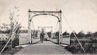
1899: Lance Mitan
Moruga, Victoria, Trinidad and Tobago - Moruga River
| Bridgemeister ID: | 542 (added before 2003) |
| Year Completed: | 1899 |
| Name: | Lance Mitan |
| Location: | Moruga, Victoria, Trinidad and Tobago |
| Crossing: | Moruga River |
| Coordinates: | 10.091576 N 61.256689 W |
| Maps: | Acme, GeoHack, Google, OpenStreetMap |
| Principals: | Walsh Wrightson |
| Use: | Vehicular (one-lane) |
| Status: | Extant (last checked: 2018) |
| Main Cables: | Wire |
| Suspended Spans: | 1 |
Notes:
- Failed February 28, 1998. Repaired.
- As of 2018 deck was in very poor shape and the bridge has been bypassed.
External Links:
Image Sets:
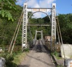
1899: Lewiston-Queenston
Lewiston, New York, USA and Queenston, Ontario, Canada - Niagara River
| Bridgemeister ID: | 108 (added before 2003) |
| Year Completed: | 1899 |
| Name: | Lewiston-Queenston |
| Location: | Lewiston, New York, USA and Queenston, Ontario, Canada |
| Crossing: | Niagara River |
| Principals: | L.L. Buck, R.S. Buck |
| References: | AAJ, BPL, HBE, PTS2 |
| Use: | Vehicular and Rail (streetcar) |
| Status: | Replaced, 1962 |
| Main Cables: | Wire (steel) |
| Suspended Spans: | 1 |
| Main Span: | 1 x 317 meters (1,040 feet) |
| Deck width: | 17 feet |
Notes:
- Reused parts from the recently dismantled Second Falls View Bridge.
- At former location of 1851 Lewiston-Queenston - Lewiston, New York, USA and Queenston, Ontario, Canada.
- See 1889 Second Falls View (Upper) - Niagara Falls, New York, USA and Niagara Falls, Ontario, Canada.
- All past and present bridges at this location.
Image Sets:
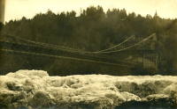
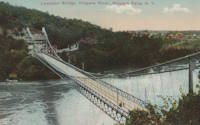
Do you have any information or photos for these bridges that you would like to share? Please email david.denenberg@bridgemeister.com.
Mail | Facebook | X (Twitter) | Bluesky