Suspension Bridges of United Kingdom (1-100 of 265)
This is a list of bridges 1 through 100 (of 265 total) from the suspension bridge inventory for the country United Kingdom. Wherever you see a Bridgemeister ID number click it to isolate the bridge on its own page.
Related Lists:
1741: Winch
Middleton-in-Teesdale, England, United Kingdom - River Tees
| Bridgemeister ID: | 372 (added before 2003) |
| Year Completed: | 1741 |
| Name: | Winch |
| Also Known As: | Wynch |
| Location: | Middleton-in-Teesdale, England, United Kingdom |
| Crossing: | River Tees |
| At or Near Feature: | Low Force |
| References: | AAJ, BEM, BPL, HBE, PTS2 |
| Use: | Footbridge |
| Main Cables: | Chain (iron) |
| Suspended Spans: | 1 |
| Main Span: | 1 x 21.3 meters (70 feet) |
Notes:
- Varying histories of this catwalk-style bridge exist. Some claim it was built 1704, a cable snapped in 1802 killing three people, and it was then rebuilt in 1830 (the present bridge). Others attribute the bridge to 1741 and have the 1802 incident killing "one or two people".
- Replaced by 1830 Wynch (Winch) - Middleton-in-Teesdale, England, United Kingdom.
- All past and present bridges at this location.
External Links:
1816: Galashiels
Galashiels, Scotland, United Kingdom - Gala Water
| Bridgemeister ID: | 584 (added 2003-01-01) |
| Year Completed: | 1816 |
| Name: | Galashiels |
| Location: | Galashiels, Scotland, United Kingdom |
| Crossing: | Gala Water |
| Principals: | Richard Lees |
| References: | AAJ, BSI, HBE, PTS2 |
| Use: | Footbridge |
| Status: | Destroyed, 1839 |
| Main Cables: | Wire (iron) |
| Suspended Spans: | 1 |
| Main Span: | 1 x 33.8 meters (111 feet) |
| Deck width: | 3 feet |
Notes:
- BSI: Originally erected in the form of a traditional suspension bridge, but soon reinforced with wire stays from much larger towers to reduce unwanted motion. Destroyed by flood, 1839.
1818: Dryburgh Abbey
Dryburgh and St. Boswells, Scotland, United Kingdom - River Tweed
| Bridgemeister ID: | 1440 (added 2004-07-31) |
| Year Completed: | 1818 |
| Name: | Dryburgh Abbey |
| Location: | Dryburgh and St. Boswells, Scotland, United Kingdom |
| Crossing: | River Tweed |
| References: | AAJ, BEM, MOS |
| Use: | Footbridge |
| Status: | Collapsed, 1838 |
| Main Cables: | Chain (iron) |
| Suspended Spans: | 1 |
| Main Span: | 1 x 79.2 meters (260 feet) |
| Deck width: | 4.5 feet |
Notes:
- May have been rebuilt around 1850. History of the bridge is unclear between the 1838 collapse and replacement in 1872.
- This 1818 bridge was a replacement for the 1817 Dryburgh Abbey suspension bridge which appears to have been primarily a cable-stayed structure and is not included in the inventory. The 1817 bridge failed due to wind in early 1818.
- Later at same location 1872 Dryburgh Abbey - Dryburgh and St. Boswells, Scotland, United Kingdom.
- All past and present bridges at this location.
External Links:
Image Sets:

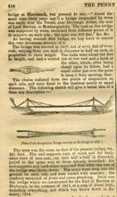
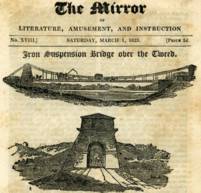
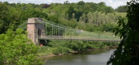
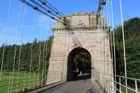
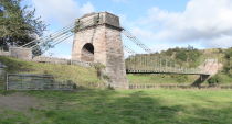
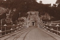
1820: Union
Horncliffe, Berwick-upon-Tweed vicinity, England and Fishwick, Scotland, United Kingdom - River Tweed
| Bridgemeister ID: | 373 (added before 2003) |
| Year Completed: | 1820 |
| Name: | Union |
| Location: | Horncliffe, Berwick-upon-Tweed vicinity, England and Fishwick, Scotland, United Kingdom |
| Crossing: | River Tweed |
| Coordinates: | 55.75256 N 2.10677 W |
| Maps: | Acme, GeoHack, Google, OpenStreetMap |
| Principals: | Sir Samuel Brown |
| References: | AAJ, BBR, BC3, BEM, BOB, HBE, MOS, NTB, PTS2, SBR |
| Use: | Vehicular (one-lane) |
| Status: | In use (last checked: 2023) |
| Main Cables: | Chain (iron) |
| Suspended Spans: | 1 |
| Main Span: | 1 x 136.9 meters (449 feet) |
| Deck width: | 18 feet |
Notes:
- 2007, March: Closed after a hanger snapped in high winds. Repaired and reopened August, 2007.
- 2020, October: Closed for major renovation and conservation project.
- 2023, April: The bridge is reopened.
- Eclipsed by new longest suspension bridge 1826 Menai Strait - Menai Bridge and Bangor vicinity, Wales, United Kingdom.
External Links:
- Conservation - Union Chain Bridge - unionchainbridge.org. Site devoted to the 2020-2023 renovation project. This page lists the highlights of the project.
- Structurae - Structure ID 20000162
Image Sets:
1821: Trinity Pier
Trinity, Edinburgh vicinity, Scotland, United Kingdom - River Forth
| Bridgemeister ID: | 374 (added before 2003) |
| Year Completed: | 1821 |
| Name: | Trinity Pier |
| Also Known As: | Newhaven Pier |
| Location: | Trinity, Edinburgh vicinity, Scotland, United Kingdom |
| Crossing: | River Forth |
| Principals: | Sir Samuel Brown |
| References: | AAJ, MOS, SBR |
| Use: | Footbridge |
| Status: | Destroyed, 1898 |
| Main Cables: | Chain (iron) |
| Main Spans: | 3 x 63.7 meters (209 feet) |
| Deck width: | 4 feet |
Notes:
- SBR: Chain pier extending into 700 feet into the Forth, with three main spans each of 209 feet. Wrecked by storm, 1898.
External Links:
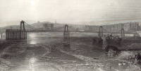
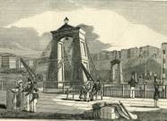
1823: Brighton Pier
Brighton, East Sussex, England, United Kingdom
| Bridgemeister ID: | 376 (added before 2003) |
| Year Completed: | 1823 |
| Name: | Brighton Pier |
| Location: | Brighton, East Sussex, England, United Kingdom |
| Principals: | Sir Samuel Brown |
| References: | AAJ, BEM, BOB, HBE, MOS, SBR |
| Use: | Footbridge |
| Status: | Destroyed, 1896 |
| Main Cables: | Chain (iron) |
| Suspended Spans: | 4 |
| Main Spans: | 4 x 77.7 meters (255 feet) |
Notes:
- SBR: Severely damaged 1833, 1836. Destroyed by storm 1896.
External Links:
Image Sets:
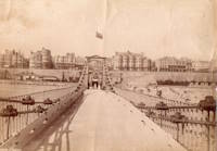
1826: (footbridge)
Milford, England, United Kingdom - River Derwent
| Bridgemeister ID: | 5550 (added 2020-12-14) |
| Year Completed: | 1826 |
| Name: | (footbridge) |
| Location: | Milford, England, United Kingdom |
| Crossing: | River Derwent |
| Coordinates: | 53.000982 N 1.479285 W |
| Maps: | Acme, GeoHack, Google, OpenStreetMap |
| Principals: | William Strutt |
| Use: | Footbridge |
| Status: | Removed, 1946 |
1826: Broughton
Lancashire, England, United Kingdom - River Irwell
| Bridgemeister ID: | 379 (added before 2003) |
| Year Completed: | 1826 |
| Name: | Broughton |
| Also Known As: | Gerald Road |
| Location: | Lancashire, England, United Kingdom |
| Crossing: | River Irwell |
| References: | AAJ, BOB, HBE, MOS, SBR |
| Use: | Vehicular |
| Status: | Replaced, 1914 |
| Main Cables: | Chain (iron) |
| Main Span: | 1 x 44.3 meters (145.5 feet) |
| Deck width: | 18.25 feet |
Notes:
- Famously collapsed under weight of marching troops April 12, 1831. Was rebuilt and strengthened and eventually replaced in 1914.
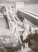
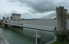
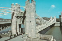
1826: Conwy
Conwy, Wales, United Kingdom - River Conwy
| Bridgemeister ID: | 380 (added before 2003) |
| Year Completed: | 1826 |
| Name: | Conwy |
| Also Known As: | Conway |
| Location: | Conwy, Wales, United Kingdom |
| Crossing: | River Conwy |
| Coordinates: | 53.280476 N 3.823742 W |
| Maps: | Acme, GeoHack, Google, OpenStreetMap |
| Principals: | Thomas Telford |
| References: | AAJ, BBR, BC3, BCO, BEM, HBE, MOS, NTB, PTS2 |
| Use: | Vehicular |
| Status: | Restricted to foot traffic (last checked: 2021) |
| Main Cables: | Chain (iron) |
| Suspended Spans: | 1 |
| Main Span: | 1 x 99.7 meters (327 feet) |
Notes:
- 1904: Major reinforcement and strengthening project.
- 2008, February: Major refurbishment project completed.
- Next to 1904 (footbridge) - Conwy, Wales, United Kingdom.
- All past and present bridges at this location.
Annotated Citations:
- "Conway Suspension Bridge." The Engineer, 20 May 1904.
Details regarding the 1904 reinforcement project: "...It was therefore decided to renew all the suspension rods, and pins, and to fix steel cables above the suspension links, to supplement them so that the maximum stress in the links due to any possible travelling load should not exceed 5 tons per square inch. It was also decided to build a stiffening girder coupled to the suspension rod on each side of the bridge, and at the same time to widen the bridge by building a footway 6ft. wide outside the suspenders on the north side of the bridge."
External Links:
Image Sets:
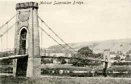
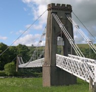
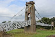
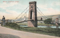
1826: Gattonside
Melrose, Scotland, United Kingdom - River Tweed
| Bridgemeister ID: | 381 (added before 2003) |
| Year Completed: | 1826 |
| Name: | Gattonside |
| Also Known As: | Melrose |
| Location: | Melrose, Scotland, United Kingdom |
| Crossing: | River Tweed |
| Coordinates: | 55.602830 N 2.723349 W |
| Maps: | Acme, GeoHack, Google, OpenStreetMap |
| Principals: | Redpath and Brown |
| References: | BC2, BSI, NTB |
| Use: | Footbridge |
| Status: | In use (last checked: 2014) |
| Main Cables: | Chain (iron) |
| Suspended Spans: | 3 |
| Main Span: | 1 x 91.4 meters (300 feet) |
| Side Spans: | 2 |
| Deck width: | 4 feet 4 inches |
Notes:
- Steel cables added, 1992.
External Links:
Image Sets:
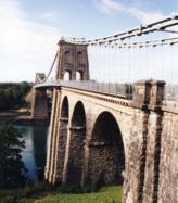
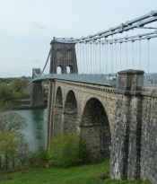
1826: Menai Strait
Menai Bridge and Bangor vicinity, Wales, United Kingdom - Menai Strait
| Bridgemeister ID: | 382 (added before 2003) |
| Year Completed: | 1826 |
| Name: | Menai Strait |
| Location: | Menai Bridge and Bangor vicinity, Wales, United Kingdom |
| Crossing: | Menai Strait |
| Coordinates: | 53.221367 N 4.1646 W |
| Maps: | Acme, GeoHack, Google, OpenStreetMap |
| Principals: | Thomas Telford |
| References: | AAJ, BBR, BC3, BCO, BDU, BEM, BOU, HBE, MOS, NTB, PTS2 |
| Use: | Vehicular (two-lane), with walkway |
| Status: | In use (last checked: 2024) |
| Main Cables: | Chain (iron) |
| Suspended Spans: | 1 |
| Main Span: | 1 x 176.5 meters (579 feet) |
Notes:
- 1839 (or 1840): Restored. Deck strengthened.
- 1893: Original wood deck replaced with a steel deck.
- 1938-1940: Original wrought-iron chains replaced with steel eyebars, deck strengthened.
- 1999: Deck resurfaced and other improvements to strengthen bridge.
- 2020: Major maintenance project planned to start January, 2021.
- 2022, October: Closed due to serious structural concerns. Expected to reopen January 2023 with a weight restriction.
- 2024, November: Reopened following replacement of all 168 hangers.
- Became longest suspension bridge by eclipsing 1820 Union - Horncliffe, Berwick-upon-Tweed vicinity, England and Fishwick, Scotland, United Kingdom.
- Eclipsed by new longest suspension bridge 1834 Zaehringen (Grand Pont Suspendu) - Fribourg, Switzerland.
External Links:
Image Sets:
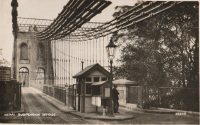
1826: Warden
Northumberland, England, United Kingdom - South Tyne River
| Bridgemeister ID: | 383 (added before 2003) |
| Year Completed: | 1826 |
| Name: | Warden |
| Also Known As: | Hexham, West Boat |
| Location: | Northumberland, England, United Kingdom |
| Crossing: | South Tyne River |
| Coordinates: | 54.988277 N 2.141917 W |
| Maps: | Acme, GeoHack, Google, OpenStreetMap |
| Principals: | Sir Samuel Brown |
| References: | SBR |
| Use: | Vehicular (one-lane) |
| Status: | Replaced, 1903 |
| Main Cables: | Chain (iron) |
| Suspended Spans: | 1 |
Notes:
- SBR: Replaced, 1903.
External Links:
Image Sets:
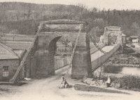
1826: Welney
Welney, England, United Kingdom - Hundred Foot River
| Bridgemeister ID: | 384 (added before 2003) |
| Year Completed: | 1826 |
| Name: | Welney |
| Location: | Welney, England, United Kingdom |
| Crossing: | Hundred Foot River |
| Principals: | Sir Samuel Brown |
| References: | SBR |
| Use: | Vehicular |
| Status: | Replaced, c. 1926 |
| Main Cables: | Chain (iron) |
Notes:
- Likely replaced 1926. SBR: Replaced "1926 or 1927". Design by Brown.
Image Sets:
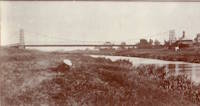
1827: (footbridge)
Denholm, Scotland, United Kingdom - River Teviot
| Bridgemeister ID: | 1555 (added 2004-11-24) |
| Year Completed: | 1827 |
| Name: | (footbridge) |
| Location: | Denholm, Scotland, United Kingdom |
| Crossing: | River Teviot |
| Coordinates: | 55.460001 N 2.686394 W |
| Maps: | Acme, GeoHack, Google, OpenStreetMap |
| Use: | Footbridge |
| Status: | Only towers remain, since 1875 (last checked: 2009) |
| Main Cables: | Chain (iron) |
Image Sets:
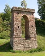
1827: Hammersmith
London, England, United Kingdom - River Thames
| Bridgemeister ID: | 386 (added before 2003) |
| Year Completed: | 1827 |
| Name: | Hammersmith |
| Location: | London, England, United Kingdom |
| Crossing: | River Thames |
| Principals: | William Tierney Clark |
| References: | AAJ, BEM, BTH, HBE, MOS, NTB, ONF, PTS2 |
| Use: | Vehicular, with walkway |
| Status: | Replaced |
| Main Cables: | Chain |
| Suspended Spans: | 3 |
| Main Span: | 1 x 121.9 meters (400 feet) |
| Side Spans: | 2 x 44.8 meters (147 feet) |
Notes:
- Replaced by 1887 Hammersmith - London, England, United Kingdom.
- All past and present bridges at this location.
External Links:
Image Sets:
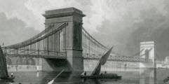
1828: South Stack
Holyhead, Wales, United Kingdom
| Bridgemeister ID: | 1212 (added 2004-02-08) |
| Year Completed: | 1828 |
| Name: | South Stack |
| Location: | Holyhead, Wales, United Kingdom |
| At or Near Feature: | Goleudy Ynys Lawd (Ynys Lawd Lighthouse) |
| Coordinates: | 53.306972 N 4.696822 W |
| Maps: | Acme, GeoHack, Google, OpenStreetMap |
| Use: | Footbridge |
| Status: | Only towers remain |
| Main Cables: | Chain |
| Suspended Spans: | 1 |
| Main Span: | 1 x 37 meters (121.4 feet) estimated |
Notes:
- Provided access to the lighthouse at South Stack. Iron chain suspension system replaced in 1964, surviving until until 1983, but unclear if it was still functioning as a suspension bridge. Towers are now used as abutments for a pedestrian truss bridge.
Image Sets:


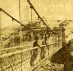
1829: Chain
Kemeys Commander, Wales, United Kingdom - River Usk
| Bridgemeister ID: | 7961 (added 2023-11-22) |
| Year Completed: | 1829 |
| Name: | Chain |
| Location: | Kemeys Commander, Wales, United Kingdom |
| Crossing: | River Usk |
| Coordinates: | 51.745000 N 2.948227 W |
| Maps: | Acme, GeoHack, Google, OpenStreetMap |
| Use: | Vehicular |
| Status: | Replaced, 1906 |
| Main Cables: | Chain (iron) |
| Suspended Spans: | 1 |
Notes:
- 1906: Replaced by a non-suspension bridge still referred to as "Chainbridge".
Image Sets:
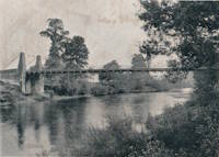
1829: Middleham
Middleham and Leyburn, England, United Kingdom - River Ure
| Bridgemeister ID: | 387 (added before 2003) |
| Year Completed: | 1829 |
| Name: | Middleham |
| Location: | Middleham and Leyburn, England, United Kingdom |
| Crossing: | River Ure |
| Coordinates: | 54.294316 N 1.818643 W |
| Maps: | Acme, GeoHack, Google, OpenStreetMap |
| Principals: | Edward Welch, Joseph Hansom |
| References: | NTB |
| Use: | Vehicular |
| Status: | Only towers remain (last checked: 2023) |
| Suspended Spans: | 1 |
Notes:
- 1830: Said to have collapsed under weight of cattle in 1830. At some point it was rebuilt as a non-suspension bridge with the original suspension bridge towers intact. The current (in the 2020s and for many years before) main span is steel plate girder.
Image Sets:
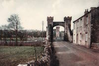
1829: Montrose
Montrose, Scotland, United Kingdom - South Esk River
| Bridgemeister ID: | 388 (added before 2003) |
| Year Completed: | 1829 |
| Name: | Montrose |
| Location: | Montrose, Scotland, United Kingdom |
| Crossing: | South Esk River |
| Coordinates: | 56.705802 N 2.475390 W |
| Maps: | Acme, GeoHack, Google, OpenStreetMap |
| Principals: | Sir Samuel Brown |
| References: | AAJ, BEM, BOB, HBE, PTS2, SBR |
| Use: | Vehicular |
| Status: | Demolished, 1929 |
| Main Cables: | Chain (iron) |
| Suspended Spans: | 1 |
Notes:
- SBR: March 19, 1830, with a "crowd of people, estimated at 700, ... watching a boat race," a chain broke "plunging most of the people into the river." Repaired.
- 1838: Wrecked by storm. Repaired.
Image Sets:
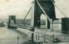

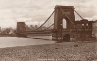
1830: Boharm
Boat o' Brig, Fochabers, Scotland, United Kingdom - River Spey
| Bridgemeister ID: | 4844 (added 2020-07-11) |
| Year Completed: | 1830 |
| Name: | Boharm |
| Also Known As: | Boat of Bridge, Boat o' Brig, New, Delfur |
| Location: | Boat o' Brig, Fochabers, Scotland, United Kingdom |
| Crossing: | River Spey |
| Coordinates: | 57.550528 N 3.140743 W |
| Maps: | Acme, GeoHack, Google, OpenStreetMap |
| Principals: | Sir Samuel Brown |
| Use: | Vehicular (one-lane) |
| Status: | Replaced, 1956 |
| Main Cables: | Chain (iron) |
| Suspended Spans: | 1 |
Notes:
- Completed 1830 or 1832.
Image Sets:
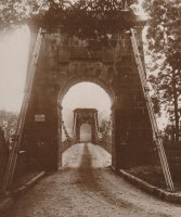
1830: Grosvenor
Bath, England, United Kingdom - River Avon
| Bridgemeister ID: | 389 (added before 2003) |
| Year Completed: | 1830 |
| Name: | Grosvenor |
| Location: | Bath, England, United Kingdom |
| Crossing: | River Avon |
| Coordinates: | 51.393597 N 2.342445 W |
| Maps: | Acme, GeoHack, Google, OpenStreetMap |
| Principals: | T. Shaw |
| References: | AAJ, MOS, SBR |
| Use: | Footbridge |
| Status: | Replaced, 1929 |
| Main Cables: | Chain (iron) |
| Suspended Spans: | 1 |
| Main Span: | 1 x 36 meters (118 feet) |
Notes:
- Suspension bridge abutments retained for 1929 non-suspension bridge replacement.
Image Sets:
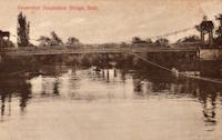
1830: Stockton Railway
Stockton on Tees, England, United Kingdom - River Tees
| Bridgemeister ID: | 390 (added before 2003) |
| Year Completed: | 1830 |
| Name: | Stockton Railway |
| Location: | Stockton on Tees, England, United Kingdom |
| Crossing: | River Tees |
| Principals: | Sir Samuel Brown |
| References: | AAJ, BEM, HBE, SBR |
| Use: | Rail |
| Status: | Replaced, 1842 |
| Main Cables: | Chain (iron) |
| Suspended Spans: | 1 |
| Main Span: | 1 x 85.6 meters (281 feet) |
Notes:
- First railway suspension bridge.
External Links:
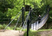
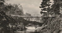
1830: Wynch
Middleton-in-Teesdale, England, United Kingdom - River Tees
| Bridgemeister ID: | 2465 (added 2008-10-04) |
| Year Completed: | 1830 |
| Name: | Wynch |
| Also Known As: | Winch |
| Location: | Middleton-in-Teesdale, England, United Kingdom |
| Crossing: | River Tees |
| Coordinates: | 54.646132 N 2.150488 W |
| Maps: | Acme, GeoHack, Google, OpenStreetMap |
| Use: | Footbridge |
| Status: | In use (last checked: 2019) |
| Main Cables: | Eyebar (iron) |
| Suspended Spans: | 1 |
Notes:
- Steel cables added, 2000.
- Replaced 1741 Winch (Wynch) - Middleton-in-Teesdale, England, United Kingdom.
- All past and present bridges at this location.
External Links:
Image Sets:
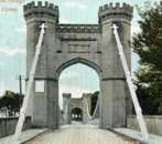
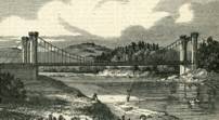
1831: Findhorn
Forres, Scotland, United Kingdom - River Findhorn
| Bridgemeister ID: | 391 (added before 2003) |
| Year Completed: | 1831 |
| Name: | Findhorn |
| Location: | Forres, Scotland, United Kingdom |
| Crossing: | River Findhorn |
| Coordinates: | 57.6018 N 3.6557 W |
| Maps: | Acme, GeoHack, Google, OpenStreetMap |
| Principals: | Sir Samuel Brown |
| References: | AAJ, MOS, SBR |
| Use: | Vehicular |
| Status: | Removed, 1938 |
| Main Cables: | Chain (iron) |
| Suspended Spans: | 1 |
Notes:
- Was still standing in 1938 when it was bypassed, but was likely demolished some time in 1938.
Image Sets:
1831: Scotswood
Newcastle-upon-Tyne, England, United Kingdom - River Tyne
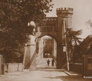
| Bridgemeister ID: | 392 (added before 2003) |
| Year Completed: | 1831 |
| Name: | Scotswood |
| Also Known As: | Chine |
| Location: | Newcastle-upon-Tyne, England, United Kingdom |
| Crossing: | River Tyne |
| Principals: | John Green |
| References: | AAJ, BRB, NTB |
| Use: | Vehicular (two-lane), with walkway |
| Status: | Demolished, 1967 |
| Main Cables: | Chain (iron) |
| Suspended Spans: | 3 |
| Main Span: | 1 x 112.2 meters (368 feet) |
| Side Spans: | 2 x 39.9 meters (131 feet) |
| Deck width: | 16 feet 10 inch roadway, 3 feet 3 inch footway |
Notes:
- "Chine" is the spelling/pronounciation of "Chain" in Geordie a dialect spoken in Tyneside.
- Widened (19ft 6in roadway, two 6ft walkways), iron chains replaced with steel cables 1931. Bypassed, 1967. Since demolished.
External Links:
- Scotswood Suspension Bridge (1831 - 1967) | Co-Curate. Several images of the bridge.
- Structurae - Structure ID 20013208
Image Sets:
1831: Wellington
Aberdeen, Scotland, United Kingdom - River Dee
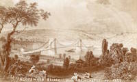
| Bridgemeister ID: | 393 (added before 2003) |
| Year Completed: | 1831 |
| Name: | Wellington |
| Also Known As: | Craiglug |
| Location: | Aberdeen, Scotland, United Kingdom |
| Crossing: | River Dee |
| Coordinates: | 57.13559 N 2.09560 W |
| Maps: | Acme, GeoHack, Google, OpenStreetMap |
| Principals: | Sir Samuel Brown |
| References: | SBR |
| Use: | Vehicular (one-lane) |
| Status: | Restricted to foot traffic (last checked: 2014) |
| Main Cables: | Chain (iron) |
| Suspended Spans: | 1 |
Notes:
- Reconstructed, 1930. Closed to vehicular traffic, 1984. Closed to all traffic 2002. Underwent extensive refurbishment, 2008.
External Links:
Image Sets:


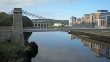
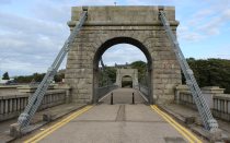
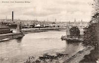
1831: Whorlton
Whorlton, Barnard Castle, England, United Kingdom - River Tees
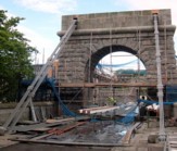
| Bridgemeister ID: | 1250 (added 2004-02-21) |
| Year Completed: | 1831 |
| Name: | Whorlton |
| Location: | Whorlton, Barnard Castle, England, United Kingdom |
| Crossing: | River Tees |
| Coordinates: | 54.526243 N 1.836740 W |
| Maps: | Acme, GeoHack, Google, OpenStreetMap |
| Principals: | John Green, Benjamin Green |
| Use: | Vehicular (one-lane) |
| Status: | Closed, July 2019 (last checked: October 2023) |
| Main Cables: | Chain (iron) |
| Suspended Spans: | 1 |
| Main Span: | 1 x 53 meters (173.9 feet) estimated |
Notes:
- 2003-2004: Refurbished.
- 2019, July: Closed following failure of a deck suspender.
- 2020, September: Remained closed, indefinitely, with no firm plan for repairs.
- 2020, December: Fears escalate over catastrophic failure.
- 2022, February: Repairs delayed, not expected to be completed until May 2023.
- 2023, October: New plans announced. The bridge will be fully dismantled and restored.
- 2024, December: The bridge has been fully dismantled.
Annotated Citations:
- "Plans to strengthen Whorlton bridge – but there's no quick fix." Teesdale Mercury, 16 Jan 2021, https://www.teesdalemercury.co.uk/news/plans-to-strengthen-whorlton-bridge-but-theres-no-quick-fix.
Reports plans are being prepared to strengthen the bridge, but the work won't be completed into 2022, followed by a review to determine if the bridge can be reopened to automobiles.
External Links:
- BBC - Historic bridge dismantled ahead of rebuild. Article published in December 2024. "As a designated historic monument, it is essential the bridge is reconstructed to its original specifications… This means we are striving to reuse as many of the original components as possible and are treating every piece with great care."
- Structurae - Structure ID 20014864
Image Sets:
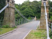
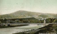
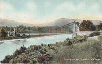
1832: Aboyne
Aboyne, Scotland, United Kingdom - River Dee
| Bridgemeister ID: | 2203 (added 2007-01-28) |
| Year Completed: | 1832 |
| Name: | Aboyne |
| Location: | Aboyne, Scotland, United Kingdom |
| Crossing: | River Dee |
| Use: | Vehicular |
| Status: | Removed |
Image Sets:
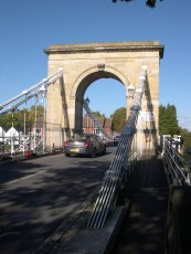
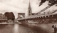
1832: Marlow
Marlow, England, United Kingdom - River Thames
| Bridgemeister ID: | 394 (added before 2003) |
| Year Completed: | 1832 |
| Name: | Marlow |
| Location: | Marlow, England, United Kingdom |
| Crossing: | River Thames |
| Coordinates: | 51.56735 N 0.773567 W |
| Maps: | Acme, GeoHack, Google, OpenStreetMap |
| Principals: | William Tierney Clark |
| References: | AAJ, BEM, BRB, BTH, MOS, NTB |
| Use: | Vehicular, with walkway |
| Status: | In use (last checked: 2023) |
| Main Cables: | Chain (iron) |
| Suspended Spans: | 3 |
| Main Span: | 1 |
| Side Spans: | 2 |
| Deck width: | 30 feet |
Annotated Citations:
- Butler, Rory. "Marlow Bridge repairs will take almost a year." BuckinghamshireLive, 1 October 2021, https://www.buckinghamshirelive.com/news/buckinghamshire-news/repairs-mould-covered-marlow-bridge-5994064
"A complete renovation of the road and foot bridge, currently covered in mould and rust, could take up to 40 weeks… The plans outline ‘refurbishment to the bridge, including works to the carriageway, footway, towers, lighting, drainage, parapet posts and timber rails’."
External Links:
Image Sets:
1832: Yarmouth
Great Yarmouth, England, United Kingdom - River Bure
| Bridgemeister ID: | 2381 (added 2007-11-04) |
| Year Completed: | 1832 |
| Name: | Yarmouth |
| Location: | Great Yarmouth, England, United Kingdom |
| Crossing: | River Bure |
| References: | AAJ |
| Status: | Collapsed, 1845 |
Notes:
- Possibly completed in 1829.
- 1845, May 2: Collapsed under weight of large crowd that had gathered to watch a famous clown sail down the River Bure in a washtub pulled by swans.
External Links:
1833: Norfolk
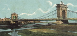
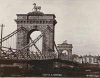
Shoreham, England, United Kingdom - River Adur
| Bridgemeister ID: | 604 (added 2003-01-12) |
| Year Completed: | 1833 |
| Name: | Norfolk |
| Location: | Shoreham, England, United Kingdom |
| Crossing: | River Adur |
| Principals: | William Tierney Clark |
| References: | AAJ, MOS |
| Use: | Vehicular, with walkway |
| Status: | Replaced, 1923 |
| Main Cables: | Chain (iron) |
| Suspended Spans: | 3 |
| Main Span: | 1 x 86.6 meters (284 feet) |
| Side Spans: | 2 |
Notes:
- According to MOS, the 284 foot measurement given for this bridge is for the "chord line" of the chains, not the pier-to-pier deck length.
External Links:
Image Sets:
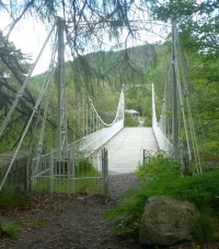
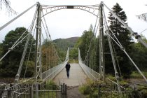
1834: Crathie
Crathie vicinity, Scotland, United Kingdom - River Dee
| Bridgemeister ID: | 1084 (added 2004-01-01) |
| Year Completed: | 1834 |
| Name: | Crathie |
| Also Known As: | Easter Balmoral |
| Location: | Crathie vicinity, Scotland, United Kingdom |
| Crossing: | River Dee |
| Coordinates: | 57.0335 N 3.211 W |
| Maps: | Acme, GeoHack, Google, OpenStreetMap |
| Principals: | Justice Junior and Co. |
| References: | AAJ, BSI, HBR |
| Use: | Vehicular (one-lane) |
| Status: | Restricted to foot traffic (last checked: 2024) |
| Main Cables: | Eyebar (iron) |
| Suspended Spans: | 1 |
| Main Span: | 1 x 42.1 meters (138 feet) |
| Deck width: | 14 feet |
Notes:
- BSI: Reported to have been "almost entirely renewed", 1885. Ruddock also suggests the bridge was originally constructed with just diagonal stays (as other Justice bridges) and the catenary chains were added during the renewal.
- 2024, May: Reopened after restoration completed.
External Links:
- The Happy Pontist: Scottish Bridges: 56. Crathie Suspension Bridge (after the flood)
- Structurae - Structure ID 20070665
Image Sets:
1836: Bonhill
Bonhill and Alexandria, Scotland, United Kingdom - River Leven
| Bridgemeister ID: | 5553 (added 2020-12-16) |
| Year Completed: | 1836 |
| Name: | Bonhill |
| Also Known As: | Bawbee |
| Location: | Bonhill and Alexandria, Scotland, United Kingdom |
| Crossing: | River Leven |
| Coordinates: | 55.984853 N 4.573088 W |
| Maps: | Acme, GeoHack, Google, OpenStreetMap |
| Use: | Vehicular |
| Status: | Removed, c. 1898 |
| Main Cables: | Chain (iron) |
| Suspended Spans: | 1 |
Notes:
- Coordinates are for the present-day (2020) bridge at this location, the replacement for the bridge that replaced the suspension bridge. The suspension bridge was either on the identical alignment of the current bridge or immediately adjacent.
1836: Horkstow
Horkstow, England, United Kingdom - River Ancholme
| Bridgemeister ID: | 1649 (added 2005-03-19) |
| Year Completed: | 1836 |
| Name: | Horkstow |
| Location: | Horkstow, England, United Kingdom |
| Crossing: | River Ancholme |
| Coordinates: | 53.65842 N 0.52837 W |
| Maps: | Acme, GeoHack, Google, OpenStreetMap |
| Principals: | Sir John Rennie |
| References: | AAJ |
| Use: | Vehicular (one-lane) |
| Status: | In use (last checked: 2013) |
| Main Cables: | Chain (iron) |
| Suspended Spans: | 1 |
| Main Span: | 1 x 40.8 meters (133.75 feet) |
Notes:
- 1835, 1836, and 1844 all sometimes cited as the year of completion.
External Links:
Image Sets:
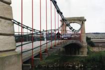
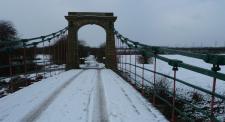
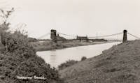
1836: Kalemouth
Eckford, Scotland, United Kingdom - River Teviot
| Bridgemeister ID: | 396 (added before 2003) |
| Year Completed: | 1836 |
| Name: | Kalemouth |
| Location: | Eckford, Scotland, United Kingdom |
| Crossing: | River Teviot |
| Coordinates: | 55.539902 N 2.463519 W |
| Maps: | Acme, GeoHack, Google, OpenStreetMap |
| Principals: | Sir Samuel Brown |
| References: | SBR |
| Use: | Vehicular (one-lane) |
| Status: | Restricted to foot traffic, since 2020 (last checked: 2022) |
| Main Cables: | Eyebar (iron) |
| Suspended Spans: | 1 |
| Main Span: | 1 x 64.6 meters (212 feet) |
Image Sets:

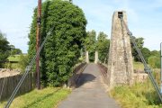
1836: Victoria
Bath, England, United Kingdom - River Avon
| Bridgemeister ID: | 397 (added before 2003) |
| Year Completed: | 1836 |
| Name: | Victoria |
| Location: | Bath, England, United Kingdom |
| Crossing: | River Avon |
| Coordinates: | 51.38350 N 2.37327 W |
| Maps: | Acme, GeoHack, Google, OpenStreetMap |
| Principals: | James Dredge |
| References: | AAJ |
| Use: | Vehicular (one-lane) |
| Status: | Restricted to foot traffic (last checked: 2019) |
| Main Cables: | Eyebar (iron) |
| Suspended Spans: | 1 |
| Main Span: | 1 x 45.7 meters (150 feet) |
| Deck width: | 18 feet |
Notes:
- Dredge patent bridge.
- Closed in 2010 due to safety concerns. Scheduled to be largely rebuilt as a replica, starting April 2013 to be completed April 2014. Temporary truss installed through the bridge to permit traffic during the refurbishment. Reopened January 2015.
External Links:
Image Sets:
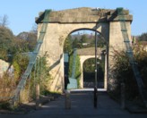
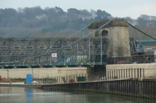
1837: Shakkin
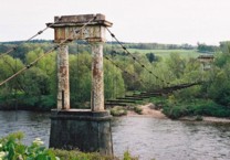
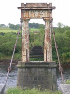
Cults, Aberdeen, Scotland, United Kingdom - River Dee
| Bridgemeister ID: | 1546 (added 2004-11-13) |
| Year Completed: | 1837 |
| Name: | Shakkin |
| Also Known As: | Shakin, St. Devenick's, Morrison |
| Location: | Cults, Aberdeen, Scotland, United Kingdom |
| Crossing: | River Dee |
| Coordinates: | 57.11460 N 2.17056 W |
| Maps: | Acme, GeoHack, Google, OpenStreetMap |
| Principals: | John Smith |
| Use: | Footbridge |
| Status: | Derelict (last checked: 2014) |
| Main Cables: | Chain (iron) |
| Suspended Spans: | 3 |
| Main Span: | 1 x 54.9 meters (180.1 feet) |
| Side Spans: | 2 |
Notes:
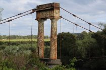
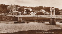
- Damaged by flood, 1876, and 1920. Reconstructed, 1921-1922. "Stranded" by shift in river's course, 1970's and 1980's, sweeping away southern approach spans. Deck removed, 1984.
- Known locally as "Shakin' Briggie" or "Shakkin' Briggie," but also referred to as Morrison Bridge and St. Devenick's Bridge.
- Restoration under consideration, 2005.
External Links:
Image Sets:
1839: Builth Wells
Builth Wells, Wales, United Kingdom - River Irfon
| Bridgemeister ID: | 1916 (added 2005-10-09) |
| Year Completed: | 1839 |
| Name: | Builth Wells |
| Location: | Builth Wells, Wales, United Kingdom |
| Crossing: | River Irfon |
| Coordinates: | 52.153074 N 3.414589 W |
| Maps: | Acme, GeoHack, Google, OpenStreetMap |
| Use: | Footbridge |
| Status: | Removed, 1983 |
Notes:
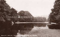
- Replaced by a stayed footbridge, opened 1984.
- See 1922 Llanstephan - Llanstephan, Wales, United Kingdom. This small vehicular bridge in nearby Llanstephan is sometimes misattributed as being located at Builth Wells. It is not.
Image Sets:
1841: Balloch Ferry
Balloch, Scotland, United Kingdom - River Leven
| Bridgemeister ID: | 5552 (added 2020-12-16) |
| Year Completed: | 1841 |
| Name: | Balloch Ferry |
| Location: | Balloch, Scotland, United Kingdom |
| Crossing: | River Leven |
| Coordinates: | 56.003420 N 4.581826 W |
| Maps: | Acme, GeoHack, Google, OpenStreetMap |
| Principals: | Sir James Colquhoun |
| References: | AAJ |
| Status: | Removed, c. 1887 |
| Main Cables: | Rod (iron) |
| Suspended Spans: | 3 |
| Main Span: | 1 x 61 meters (200 feet) |
| Side Spans: | 2 x 13.7 meters (45 feet) |
Notes:
- Design based on James Dredge's taper principle patent.
1842: (footbridge)
London, England, United Kingdom - Regent's Canal
| Bridgemeister ID: | 5088 (added 2020-09-04) |
| Year Completed: | 1842 |
| Name: | (footbridge) |
| Location: | London, England, United Kingdom |
| Crossing: | Regent's Canal |
| At or Near Feature: | Regent's Park |
| Principals: | James Dredge |
| References: | AAJ |
| Use: | Footbridge |
| Status: | Removed |
| Main Cables: | Rod (iron) |
| Suspended Spans: | 1 |
| Main Span: | 1 x 22.9 meters (75 feet) |
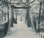
Notes:
- Built as part of same project as 1842 (footbridge) - London, England, United Kingdom.
- Built as part of same project as 1842 (footbridge) - London, England, United Kingdom.
- Built as part of same project as 1842 (footbridge) - London, England, United Kingdom.
- Built as part of same project as 1842 (footbridge) - London, England, United Kingdom.
Image Sets:
1842: (footbridge)
London, England, United Kingdom - Regent's Canal
| Bridgemeister ID: | 5089 (added 2020-09-04) |
| Year Completed: | 1842 |
| Name: | (footbridge) |
| Location: | London, England, United Kingdom |
| Crossing: | Regent's Canal |
| At or Near Feature: | Regent's Park |
| Principals: | James Dredge |
| References: | AAJ |
| Use: | Footbridge |
| Status: | Removed |
| Main Cables: | Rod (iron) |
| Suspended Spans: | 1 |
| Main Span: | 1 x 22.9 meters (75 feet) |
Notes:
- Built as part of same project as 1842 (footbridge) - London, England, United Kingdom.
- Built as part of same project as 1842 (footbridge) - London, England, United Kingdom.
- Built as part of same project as 1842 (footbridge) - London, England, United Kingdom.
- Built as part of same project as 1842 (footbridge) - London, England, United Kingdom.
Image Sets:

1842: (footbridge)
London, England, United Kingdom
| Bridgemeister ID: | 5090 (added 2020-09-04) |
| Year Completed: | 1842 |
| Name: | (footbridge) |
| Location: | London, England, United Kingdom |
| At or Near Feature: | Regent's Park |
| Principals: | James Dredge |
| References: | AAJ |
| Use: | Footbridge |
| Status: | Removed |
| Main Cables: | Rod (iron) |
| Main Span: | 1 x 45.7 meters (150 feet) |
Notes:
- Built as part of same project as 1842 (footbridge) - London, England, United Kingdom.
- Built as part of same project as 1842 (footbridge) - London, England, United Kingdom.
- Built as part of same project as 1842 (footbridge) - London, England, United Kingdom.
- Built as part of same project as 1842 (footbridge) - London, England, United Kingdom.
Image Sets:

1842: (footbridge)
London, England, United Kingdom
| Bridgemeister ID: | 5091 (added 2020-09-04) |
| Year Completed: | 1842 |
| Name: | (footbridge) |
| Location: | London, England, United Kingdom |
| At or Near Feature: | Regent's Park |
| Principals: | James Dredge |
| References: | AAJ |
| Use: | Footbridge |
| Status: | Removed |
| Main Cables: | Rod (iron) |
Notes:
- Built as part of same project as 1842 (footbridge) - London, England, United Kingdom.
- Built as part of same project as 1842 (footbridge) - London, England, United Kingdom.
- Built as part of same project as 1842 (footbridge) - London, England, United Kingdom.
- Built as part of same project as 1842 (footbridge) - London, England, United Kingdom.
Image Sets:

1842: (footbridge)
London, England, United Kingdom
| Bridgemeister ID: | 5092 (added 2020-09-04) |
| Year Completed: | 1842 |
| Name: | (footbridge) |
| Location: | London, England, United Kingdom |
| At or Near Feature: | Regent's Park |
| Principals: | James Dredge |
| References: | AAJ |
| Use: | Footbridge |
| Status: | Removed |
| Main Cables: | Rod (iron) |
Notes:
- Built as part of same project as 1842 (footbridge) - London, England, United Kingdom.
- Built as part of same project as 1842 (footbridge) - London, England, United Kingdom.
- Built as part of same project as 1842 (footbridge) - London, England, United Kingdom.
- Built as part of same project as 1842 (footbridge) - London, England, United Kingdom.
Image Sets:

1842: Welshmill
Frome, England, United Kingdom - River Frome
| Bridgemeister ID: | 4062 (added 2020-03-30) |
| Year Completed: | 1842 |
| Name: | Welshmill |
| Location: | Frome, England, United Kingdom |
| Crossing: | River Frome |
| Principals: | James Dredge |
| References: | AAJ |
| Status: | Removed |
| Suspended Spans: | 1 |
Notes:
Image Sets:
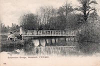
1842: Wraysbury
Wraysbury, England, United Kingdom
| Bridgemeister ID: | 4835 (added 2020-07-10) |
| Year Completed: | 1842 |
| Name: | Wraysbury |
| Location: | Wraysbury, England, United Kingdom |
| Principals: | James Dredge |
| References: | AAJ |
| Use: | Vehicular |
| Status: | Removed |
| Main Cables: | Rod (iron) |
| Main Span: | 1 x 30.5 meters (100 feet) |
1845: (footbridge)
Caledon, County Tyrone, Northern Ireland, United Kingdom - River Blackwater
| Bridgemeister ID: | 2424 (added 2008-03-12) |
| Year Completed: | 1845 |
| Name: | (footbridge) |
| Location: | Caledon, County Tyrone, Northern Ireland, United Kingdom |
| Crossing: | River Blackwater |
| Coordinates: | 54.34608 N 6.83276 W |
| Maps: | Acme, GeoHack, Google, OpenStreetMap |
| Principals: | James Dredge |
| References: | AAJ |
| Use: | Footbridge |
| Status: | Extant (last checked: 2021) |
| Main Cables: | Rod (iron) |
| Suspended Spans: | 1 |
| Main Span: | 1 x 22.6 meters (74 feet) |
Notes:
- This distinctly Dredge bridge is currently sitting atop modern concrete piers.
External Links:
1845: Ballievey
Banbridge, Northern Ireland, United Kingdom - River Bann
| Bridgemeister ID: | 2172 (added 2007-01-13) |
| Year Completed: | 1845 |
| Name: | Ballievey |
| Also Known As: | Ballievy |
| Location: | Banbridge, Northern Ireland, United Kingdom |
| Crossing: | River Bann |
| Coordinates: | 54.341862 N 6.219803 W |
| Maps: | Acme, GeoHack, Google, OpenStreetMap |
| Principals: | James Dredge |
| Use: | Vehicular |
| Status: | Collapsed, September 12, 1988 |
| Suspended Spans: | 1 |
| Main Span: | 1 x 22 meters (72.3 feet) |
Notes:
- Collapsed, September 12, 1988, under weight of truck that exceeded the posted weight limit.
Image Sets:

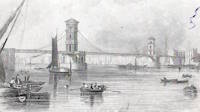
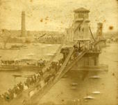
1845: Hungerford
London, England, United Kingdom - River Thames
| Bridgemeister ID: | 400 (added before 2003) |
| Year Completed: | 1845 |
| Name: | Hungerford |
| Location: | London, England, United Kingdom |
| Crossing: | River Thames |
| Principals: | Isambard K. Brunel |
| References: | BBR, BEM, BTH, HBE, PTS2 |
| Use: | Footbridge |
| Status: | Removed |
| Main Cables: | Chain (iron) |
| Suspended Spans: | 3 |
| Main Span: | 1 x 206 meters (676 feet) |
| Side Spans: | 2 x 100.3 meters (329 feet) |
Notes:
- BEM mentions three different years of completion: 1826, 1862, and 1843, all of which are likely incorrect. The bridge was out of service by 1864 as the chain cables were reused for the Clifton Bridge at Bristol, England.
- See 1864 Clifton - Bristol, England, United Kingdom.
External Links:
Image Sets:
1845: Stowell Park
Wilcot, England, United Kingdom - Kennet and Avon Canal
| Bridgemeister ID: | 401 (added before 2003) |
| Year Completed: | 1845 |
| Name: | Stowell Park |
| Location: | Wilcot, England, United Kingdom |
| Crossing: | Kennet and Avon Canal |
| Coordinates: | 51.35211 N 1.79251 W |
| Maps: | Acme, GeoHack, Google, OpenStreetMap |
| Status: | Extant (last checked: 2022) |
| Main Span: | 1 |
Notes:
- Dredge patent bridge.
External Links:
Image Sets:


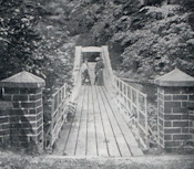
1847: Moyola Park
Castledawson, Northern Ireland, United Kingdom - Moyola River
| Bridgemeister ID: | 3888 (added 2020-03-13) |
| Year Completed: | 1847 |
| Name: | Moyola Park |
| Location: | Castledawson, Northern Ireland, United Kingdom |
| Crossing: | Moyola River |
| Coordinates: | 54.781235 N 6.560394 W |
| Maps: | Acme, GeoHack, Google, OpenStreetMap |
| Principals: | James Dredge |
| Use: | Footbridge |
| Status: | In use |
| Main Cables: | Rod (iron) |
External Links:
Image Sets:
1848: Shadwell
Shadwell, England, United Kingdom
| Bridgemeister ID: | 5641 (added 2020-12-30) |
| Year Completed: | 1848 |
| Name: | Shadwell |
| Location: | Shadwell, England, United Kingdom |
| At or Near Feature: | Ropery Grounds at Sun Tavern Fields |
| Principals: | William Dredge |
| References: | AAJ |
| Use: | Footbridge |
| Status: | Removed |
| Main Cables: | Rod (iron) |
Notes:
- William Dredge was the son of James Dredge known for his "taper principle" bridge design. Based on the description of the Shadwell bridge (in the sources cited by Jakkula), it is unclear if this Shadwell bridge followed Williams' father's design. 1848 is assumed as the year of completion based on the October 7, 1848 Mechanics' Magazine article cited by Jakkula which starts "A foot-suspension bridge has just been erected..."
1849: Lochy
Inverlochy, Fort William vicinity, Scotland, United Kingdom - River Lochy
| Bridgemeister ID: | 6209 (added 2021-07-16) |
| Year Completed: | 1849 |
| Name: | Lochy |
| Also Known As: | Lochybridge, Victoria |
| Location: | Inverlochy, Fort William vicinity, Scotland, United Kingdom |
| Crossing: | River Lochy |
| Coordinates: | 56.835137 N 5.076679 W |
| Maps: | Acme, GeoHack, Google, OpenStreetMap |
| Principals: | James Dredge |
| Use: | Vehicular |
| Status: | Removed |
| Main Cables: | Rod (iron) |
| Main Span: | 1 |
Notes:
- 1928: Deck replaced. The aging suspension system was bypassed and the new deck supported by additional piers.
- Similar to 1854 Oich (Aberchalder) - Invergarry vicinity, Scotland, United Kingdom.
Image Sets:
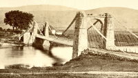
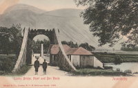
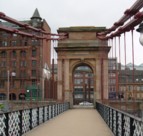
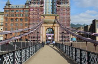
1851: South Portland
Glasgow, Scotland, United Kingdom - River Clyde
| Bridgemeister ID: | 404 (added before 2003) |
| Year Completed: | 1851 |
| Name: | South Portland |
| Also Known As: | Carlton |
| Location: | Glasgow, Scotland, United Kingdom |
| Crossing: | River Clyde |
| Coordinates: | 55.85433 N 4.25618 W |
| Maps: | Acme, GeoHack, Google, OpenStreetMap |
| Principals: | Alexander Kirkland, George Martin |
| References: | BEM, NTB |
| Use: | Footbridge |
| Status: | In use (last checked: 2019) |
| Main Cables: | Eyebar (iron) |
| Suspended Spans: | 1 |
Notes:
- 1853 sometimes cited as the year it opened.
External Links:
Image Sets:
1852: Pey
Blantyre, Scotland, United Kingdom - River Clyde
| Bridgemeister ID: | 2633 (added 2019-02-24) |
| Year Completed: | 1852 |
| Name: | Pey |
| Also Known As: | Mill, Toll, Swing |
| Location: | Blantyre, Scotland, United Kingdom |
| Crossing: | River Clyde |
| Coordinates: | 55.801972 N 4.081433 W |
| Maps: | Acme, GeoHack, Google, OpenStreetMap |
| Principals: | Henry Monteith & Co |
| Use: | Footbridge |
| Status: | Removed (last checked: 1949) |
| Main Cables: | Rod (iron) |
| Suspended Spans: | 3 |
| Main Span: | 1 |
| Side Spans: | 2 |
Notes:
- Dredge patent bridge.
Image Sets:
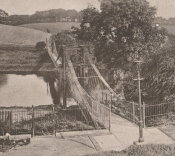
1852: Queens Park
Chester and Handbridge, England, United Kingdom - River Dee
| Bridgemeister ID: | 405 (added before 2003) |
| Year Completed: | 1852 |
| Name: | Queens Park |
| Location: | Chester and Handbridge, England, United Kingdom |
| Crossing: | River Dee |
| Principals: | Enoch Gerrard |
| References: | BRB, NTB |
| Use: | Footbridge |
| Status: | Replaced |
| Main Cables: | Chain (iron) |
| Suspended Spans: | 3 |
| Main Span: | 1 |
| Side Spans: | 2 |
Notes:
- Replaced by 1923 Queens Park - Chester and Handbridge, England, United Kingdom.
- All past and present bridges at this location.
Image Sets:
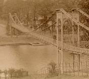
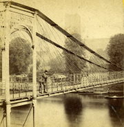
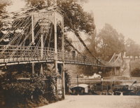
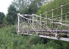
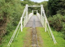
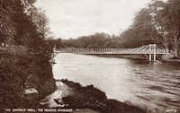
1853: General's Well
Inverness, Scotland, United Kingdom - River Ness
| Bridgemeister ID: | 406 (added before 2003) |
| Year Completed: | 1853 |
| Name: | General's Well |
| Location: | Inverness, Scotland, United Kingdom |
| Crossing: | River Ness |
| At or Near Feature: | Ness Islands |
| Coordinates: | 57.460944 N 4.237166 W |
| Maps: | Acme, GeoHack, Google, OpenStreetMap |
| Principals: | James Dredge |
| References: | HBR |
| Use: | Footbridge |
| Status: | In use (last checked: 2014) |
| Main Cables: | Rod (iron) |
| Suspended Spans: | 3 |
| Main Span: | 1 |
| Side Spans: | 2 |
Notes:
- Relocated to a nearby park (Whin Park) where it carries a miniature railway, 1988. The coordinates listed here are for that later (miniature railway park) location.
- Companion to 1853 Island Bank Road - Inverness, Scotland, United Kingdom.
- See 1988 (footbridge) - Inverness, Scotland, United Kingdom.
- See 1988 (footbridge) - Inverness, Scotland, United Kingdom.
External Links:
Image Sets:

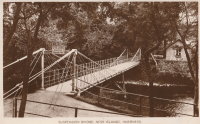
1853: Island Bank Road
Inverness, Scotland, United Kingdom - River Ness
| Bridgemeister ID: | 904 (added 2003-10-11) |
| Year Completed: | 1853 |
| Name: | Island Bank Road |
| Location: | Inverness, Scotland, United Kingdom |
| Crossing: | River Ness |
| At or Near Feature: | Ness Islands |
| Principals: | James Dredge |
| References: | HBR |
| Use: | Footbridge |
| Status: | Removed |
Notes:
- Companion to 1853 General's Well - Inverness, Scotland, United Kingdom.
- See 1988 (footbridge) - Inverness, Scotland, United Kingdom.
- See 1988 (footbridge) - Inverness, Scotland, United Kingdom.
Image Sets:
1854: Caerhowel
Caerhowel, Wales, United Kingdom - River Severn
| Bridgemeister ID: | 407 (added before 2003) |
| Year Completed: | 1854 |
| Name: | Caerhowel |
| Location: | Caerhowel, Wales, United Kingdom |
| Crossing: | River Severn |
| Status: | Collapsed, 1858 |
Notes:
- Based on Dredge's patent.
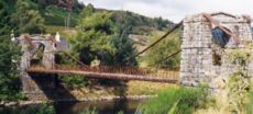
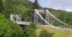
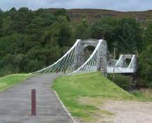
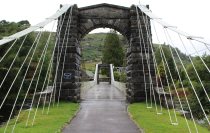
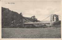
1854: Oich
Invergarry vicinity, Scotland, United Kingdom - River Oich
| Bridgemeister ID: | 403 (added before 2003) |
| Year Completed: | 1854 |
| Name: | Oich |
| Also Known As: | Aberchalder |
| Location: | Invergarry vicinity, Scotland, United Kingdom |
| Crossing: | River Oich |
| Coordinates: | 57.093377 N 4.745271 W |
| Maps: | Acme, GeoHack, Google, OpenStreetMap |
| Principals: | James Dredge |
| References: | BC3, HBR |
| Use: | Vehicular (one-lane) |
| Status: | Restricted to foot traffic (last checked: 2014) |
| Main Cables: | Rod (iron) |
| Suspended Spans: | 1 |
Notes:
- Restored and re-opened, late 1990's.
External Links:
Image Sets:
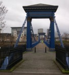
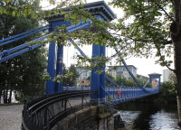
1854: Saint Andrew's
Glasgow, Scotland, United Kingdom - River Clyde
| Bridgemeister ID: | 408 (added before 2003) |
| Year Completed: | 1854 |
| Name: | Saint Andrew's |
| Location: | Glasgow, Scotland, United Kingdom |
| Crossing: | River Clyde |
| Coordinates: | 55.84883 N 4.23835 W |
| Maps: | Acme, GeoHack, Google, OpenStreetMap |
| Principals: | Neil Robson |
| References: | NTB |
| Use: | Footbridge |
| Status: | In use (last checked: 2019) |
| Main Cables: | Eyebar |
| Suspended Spans: | 1 |
| Main Span: | 1 x 67.1 meters (220 feet) |
| Deck width: | 13 feet |
Notes:
- Also sometimes attributed to Neil "Robinson" and completed 1853. May have originally been a narrow vehicular bridge.
External Links:
Image Sets:
1855: Ness
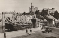
Inverness, Scotland, United Kingdom - River Ness
| Bridgemeister ID: | 526 (added before 2003) |
| Year Completed: | 1855 |
| Name: | Ness |
| Location: | Inverness, Scotland, United Kingdom |
| Crossing: | River Ness |
| Use: | Vehicular |
| Status: | Demolished, 1961 |
| Main Cables: | Eyebar (iron) |
| Suspended Spans: | 1 |
Notes:
- Near 1881 Greig Street (Wobbly) - Inverness, Scotland, United Kingdom. In some photos, the two bridges are visible within a few hundred yards of each other.
External Links:
Image Sets:

1857: Saint James's Park
London, England, United Kingdom
| Bridgemeister ID: | 6831 (added 2021-12-31) |
| Year Completed: | 1857 |
| Name: | Saint James's Park |
| Location: | London, England, United Kingdom |
| At or Near Feature: | Saint James's Park |
| References: | AAJ |
| Use: | Footbridge |
| Status: | Replaced, 1957 |
| Main Cables: | Eyebar (iron) |
| Suspended Spans: | 1 |
Notes:
- Reviews of this bridge were not favorable. Jakkula (AAJ) sites several contemporary sources (1857) objecting to the bridge obstructing the view of the scenery. One citation is summarized: "Regards the bridge as a hideous structure".
External Links:
Image Sets:
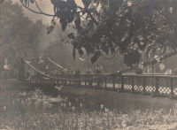
1858: Chelsea
London, England, United Kingdom - River Thames
| Bridgemeister ID: | 410 (added before 2003) |
| Year Completed: | 1858 |
| Name: | Chelsea |
| Also Known As: | Victoria |
| Location: | London, England, United Kingdom |
| Crossing: | River Thames |
| At or Near Feature: | Battersea Park |
| Coordinates: | 51.485061 N 0.149897 W |
| Maps: | Acme, GeoHack, Google, OpenStreetMap |
| Principals: | Thomas Page |
| References: | BTH, HBE, PTS2 |
| Use: | Vehicular |
| Status: | Replaced |
| Main Cables: | Eyebar (iron) |
| Suspended Spans: | 3 |
| Main Span: | 1 x 106.1 meters (348 feet) |
| Side Spans: | 1 x 116.7 meters (383 feet), 1 x 55.8 meters (183 feet) |
Notes:
- Replaced by 1937 Chelsea - London, England, United Kingdom.
- All past and present bridges at this location.
External Links:
Image Sets:
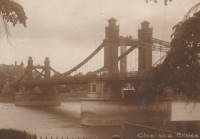
1862: (footbridge)
Greystead, England, United Kingdom - River North Tyne
| Bridgemeister ID: | 1252 (added 2004-02-21) |
| Year Completed: | 1862 |
| Name: | (footbridge) |
| Location: | Greystead, England, United Kingdom |
| Crossing: | River North Tyne |
| Coordinates: | 55.169017 N 2.353408 W |
| Maps: | Acme, GeoHack, Google, OpenStreetMap |
| Use: | Footbridge |
| Status: | Extant (last checked: 2019) |
| Main Cables: | Chain |
| Suspended Spans: | 1 |
Notes:
- Footbridge with large stone towers. Near Tarset Burn.
- Several sources suggest this bridge was completed in 1862.
- Similar to 1878 Sedgwick (Low Park Woods, New Sedgwick) - Sedgwick and Sizergh, England, United Kingdom.
External Links:
- Bridges on the Tyne. "Built to connect with Thorneyburn station on the Border Counties Railway."
1862: Lambeth
London, England, United Kingdom - River Thames
| Bridgemeister ID: | 829 (added 2003-05-31) |
| Year Completed: | 1862 |
| Name: | Lambeth |
| Location: | London, England, United Kingdom |
| Crossing: | River Thames |
| Principals: | P. W. Barlow |
| References: | BRB, HBE, ONF, PTS2 |
| Use: | Vehicular, with walkway |
| Status: | Replaced, 1932 |
| Suspended Spans: | 3 |
| Main Spans: | 3 x 81.7 meters (268 feet) |
External Links:
Image Sets:
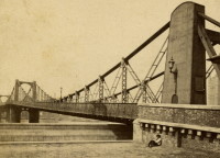
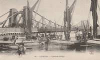
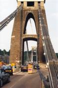
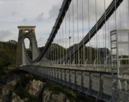
1864: Clifton
Bristol, England, United Kingdom - River Avon
| Bridgemeister ID: | 413 (added before 2003) |
| Year Completed: | 1864 |
| Name: | Clifton |
| Location: | Bristol, England, United Kingdom |
| Crossing: | River Avon |
| Coordinates: | 51.45496 N 2.62781 W |
| Maps: | Acme, GeoHack, Google, OpenStreetMap |
| Principals: | Isambard K. Brunel, P.W. Barlow, Hawkshaw |
| References: | AOB, BBR, BC3, BEM, BMA, BOU, BRB, CTW, HBE, NTB, ONF, PTS2 |
| Use: | Vehicular, with walkway |
| Status: | In use (last checked: 2021) |
| Main Cables: | Eyebar (iron) |
| Suspended Spans: | 1 |
| Main Span: | 1 x 214 meters (702 feet) |
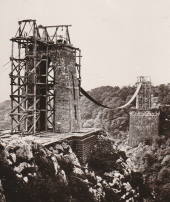
Notes:
- Built with chain cables reused from the Hungerford bridge.
- See 1845 Hungerford - London, England, United Kingdom.
External Links:
Image Sets:

1867: Corrieshalloch
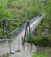
Braemore, Scotland, United Kingdom - River Droma
| Bridgemeister ID: | 1308 (added 2004-04-10) |
| Year Completed: | 1867 |
| Name: | Corrieshalloch |
| Location: | Braemore, Scotland, United Kingdom |
| Crossing: | River Droma |
| At or Near Feature: | Corrieshalloch Gorge, Falls of Measach |
| Coordinates: | 57.755753 N 5.021048 W |
| Maps: | Acme, GeoHack, Google, OpenStreetMap |
| Principals: | John Fowler |
| References: | AAJ, HBR |
| Use: | Footbridge |
| Status: | Closed, July 2024 (last checked: 2024) |
| Main Cables: | Wire |
| Suspended Spans: | 1 |
| Main Span: | 1 x 25.1 meters (82.5 feet) |
Notes:
- AAJ lists the bridge at "Corry Halloch" bridge completed in 1875. Other sources mention 1867, and 1874.
- 1977: Anchorages replaced (HBR).
- 2021: Closed September 10 due to safety concerns. Repaired and re-opened in October.
- 2022, May: Closed again for maintenance and inspection, reopened by month's end.
- 2024, July: Closed again as a precaution pending inspection of its structural integrity.
Image Sets:
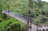
1867: Doldowlod
Doldowlod, Llandrindod Wells, Wales, United Kingdom - River Wye
| Bridgemeister ID: | 5085 (added 2020-09-04) |
| Year Completed: | 1867 |
| Name: | Doldowlod |
| Also Known As: | Llanwrthyl, Ystrad |
| Location: | Doldowlod, Llandrindod Wells, Wales, United Kingdom |
| Crossing: | River Wye |
| Coordinates: | 52.244210 N 3.462324 W |
| Maps: | Acme, GeoHack, Google, OpenStreetMap |
| Principals: | William Dredge |
| References: | BRW |
| Use: | Footbridge |
| Status: | In use (last checked: 2018) |
| Main Cables: | Rod (iron) |
| Suspended Spans: | 1 |
Notes:
- Dredge patent bridge, possibly completed by his son William Dredge.
External Links:
- The Happy Pontist: Welsh Bridges: 10. Doldowlod Bridge. Photos and discussion of its history and uncertainty about the year it was completed.
1871: Aboyne
Waterside, Aboyne vicinity, Scotland, United Kingdom - River Dee
| Bridgemeister ID: | 2202 (added 2007-01-28) |
| Year Completed: | 1871 |
| Name: | Aboyne |
| Location: | Waterside, Aboyne vicinity, Scotland, United Kingdom |
| Crossing: | River Dee |
| Principals: | Harper & Co. |
| References: | HARPER |
| Use: | Footbridge |
| Status: | Removed |
| Main Cables: | Wire |
| Main Span: | 1 x 91.4 meters (300 feet) |
Notes:
- HARPER: Likely destroyed by one of these major Dee River flood events: May 1913, December 1914, October 1920.
External Links:
1871: Boatford
Langholm, Borders, Scotland, United Kingdom - River Esk
| Bridgemeister ID: | 1428 (added 2004-07-24) |
| Year Completed: | 1871 |
| Name: | Boatford |
| Location: | Langholm, Borders, Scotland, United Kingdom |
| Crossing: | River Esk |
| References: | AAJ |
| Status: | Collapsed |
Notes:
- Collapsed soon after it was completed under weight of 200 spectators.
- Replaced by 1873 Boatford - Langholm, Borders, Scotland, United Kingdom.
- All past and present bridges at this location.
1871: Hunting
Shocklach Green vicinity, England, United Kingdom - River Dee
| Bridgemeister ID: | 2191 (added 2007-01-26) |
| Year Completed: | 1871 |
| Name: | Hunting |
| Location: | Shocklach Green vicinity, England, United Kingdom |
| Crossing: | River Dee |
| Principals: | Harper & Co. |
| References: | HARPER |
| Use: | Footbridge |
| Status: | Removed, 1935 |
| Main Cables: | Wire |
| Suspended Spans: | 1 |
| Main Span: | 1 x 48.8 meters (160 feet) |
External Links:
1871: Tanarmouth
Glen Tanar, Aboyne vicinity, Scotland, United Kingdom - Water of Tanar
| Bridgemeister ID: | 7972 (added 2023-11-26) |
| Year Completed: | 1871 |
| Name: | Tanarmouth |
| Location: | Glen Tanar, Aboyne vicinity, Scotland, United Kingdom |
| Crossing: | Water of Tanar |
| Coordinates: | 57.066833 N 2.805167 W |
| Maps: | Acme, GeoHack, Google, OpenStreetMap |
| Principals: | Harper & Co. |
| Use: | Footbridge |
| Status: | Removed, 1950 |
| Main Cables: | Wire |
| Main Span: | 1 x 30.5 meters (100 feet) |
External Links:
1872: Dryburgh Abbey
Dryburgh and St. Boswells, Scotland, United Kingdom - River Tweed
| Bridgemeister ID: | 1439 (added 2004-07-31) |
| Year Completed: | 1872 |
| Name: | Dryburgh Abbey |
| Location: | Dryburgh and St. Boswells, Scotland, United Kingdom |
| Crossing: | River Tweed |
| Coordinates: | 55.580771 N 2.654251 W |
| Maps: | Acme, GeoHack, Google, OpenStreetMap |
| Use: | Footbridge |
| Status: | Replaced, 1911 |
| Main Cables: | Wire |
| Suspended Spans: | 1 |
Notes:
- At former location of 1818 Dryburgh Abbey - Dryburgh and St. Boswells, Scotland, United Kingdom.
- Near Mertoun Estate - Mertoun, Scotland, United Kingdom.
- Replaced by 1911 Dryburgh Abbey - Dryburgh and St. Boswells, Scotland, United Kingdom.
- All past and present bridges at this location.
External Links:
Image Sets:
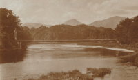
1872: Ravenscraig
Dundee, Scotland, United Kingdom - Caledonian Railway
| Bridgemeister ID: | 5078 (added 2020-08-30) |
| Year Completed: | 1872 |
| Name: | Ravenscraig |
| Location: | Dundee, Scotland, United Kingdom |
| Crossing: | Caledonian Railway |
| Coordinates: | 56.468350 N 2.901061 W |
| Maps: | Acme, GeoHack, Google, OpenStreetMap |
| Principals: | Harper & Co. |
| References: | HARPER |
| Use: | Footbridge |
| Status: | Removed |
| Main Cables: | Wire |
| Suspended Spans: | 1 |
| Main Span: | 1 x 16.8 meters (55.1 feet) |
Notes:
- Coordinates are approximate location of the bridge based on the description in HARPER noting the bridge crossed the railway at the estate of a Colonel Sandeman at Ravenscraig which is the location of the present day (2020) Ravenscraig Gardens in Dundee.
External Links:
1873: Boatford
Langholm, Borders, Scotland, United Kingdom - River Esk
| Bridgemeister ID: | 534 (added before 2003) |
| Year Completed: | 1873 |
| Name: | Boatford |
| Location: | Langholm, Borders, Scotland, United Kingdom |
| Crossing: | River Esk |
| Coordinates: | 55.15098 N 3.00273 W |
| Maps: | Acme, GeoHack, Google, OpenStreetMap |
| References: | AAJ |
| Use: | Footbridge |
| Status: | In use (last checked: 2004) |
| Main Span: | 1 x 53.3 meters (175 feet) |
Notes:
- Replaced 1871 Boatford - Langholm, Borders, Scotland, United Kingdom.
- All past and present bridges at this location.
Image Sets:
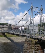
1875: Nith
Dumfries, Scotland, United Kingdom - River Nith
| Bridgemeister ID: | 524 (added before 2003) |
| Year Completed: | 1875 |
| Name: | Nith |
| Also Known As: | Biddall's |
| Location: | Dumfries, Scotland, United Kingdom |
| Crossing: | River Nith |
| Coordinates: | 55.065120 N 3.610292 W |
| Maps: | Acme, GeoHack, Google, OpenStreetMap |
| Principals: | J. Willett |
| Use: | Footbridge |
| Status: | In use (last checked: 2022) |
| Main Cables: | Chain (iron) |
| Suspended Spans: | 1 |
| Main Span: | 1 |
External Links:
Image Sets:

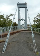
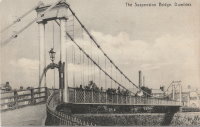
1877: Netherby
Kirksandrew-upon-Esk, Longtown vicinity, Cumbria and Netherby, England, United Kingdom - River Esk
| Bridgemeister ID: | 2369 (added 2007-09-28) |
| Year Completed: | 1877 |
| Name: | Netherby |
| Location: | Kirksandrew-upon-Esk, Longtown vicinity, Cumbria and Netherby, England, United Kingdom |
| Crossing: | River Esk |
| Coordinates: | 55.03855 N 2.95261 W |
| Maps: | Acme, GeoHack, Google, OpenStreetMap |
| Use: | Footbridge |
| Status: | In use (last checked: 2012) |
| Main Cables: | Wire |
| Suspended Spans: | 1 |
Image Sets:
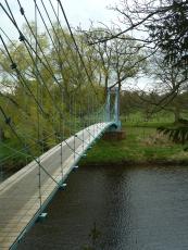
1878: Sedgwick
Sedgwick and Sizergh, England, United Kingdom - River Kent
| Bridgemeister ID: | 1313 (added 2004-04-16) |
| Year Completed: | 1878 |
| Name: | Sedgwick |
| Also Known As: | Low Park Woods, New Sedgwick |
| Location: | Sedgwick and Sizergh, England, United Kingdom |
| Crossing: | River Kent |
| Coordinates: | 54.281 N 2.7564 W |
| Maps: | Acme, GeoHack, Google, OpenStreetMap |
| Principals: | Francis James Willacy |
| Use: | Footbridge |
| Status: | In use (last checked: 2010) |
| Suspended Spans: | 1 |
Notes:
- 1988-1989: Restoration project completed
- 2022, August-September: Bridge closed for repairs. Reopened.
- Similar to 1862 (footbridge) - Greystead, England, United Kingdom.
External Links:
Image Sets:
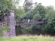
1878: Spider
Crewe, England, United Kingdom
| Bridgemeister ID: | 1843 (added 2005-07-15) |
| Year Completed: | 1878 |
| Name: | Spider |
| Also Known As: | Midge |
| Location: | Crewe, England, United Kingdom |
| Use: | Rail |
| Status: | Demolished, 1939 |
| Main Cables: | Wire |
Notes:
- Carried a narrow gauge rail line over several tracks at the Crewe Locomotive Works. Used as a footbridge, 1929-1939.
1879: Infirmary
Inverness, Scotland, United Kingdom - River Ness
| Bridgemeister ID: | 539 (added before 2003) |
| Year Completed: | 1879 |
| Name: | Infirmary |
| Location: | Inverness, Scotland, United Kingdom |
| Crossing: | River Ness |
| Coordinates: | 57.471653 N 4.228844 W |
| Maps: | Acme, GeoHack, Google, OpenStreetMap |
| Principals: | C. R. Manners |
| References: | HBR |
| Use: | Footbridge |
| Status: | In use (last checked: 2021) |
| Main Cables: | Wire |
| Suspended Spans: | 3 |
| Main Span: | 1 x 61 meters (200 feet) |
| Side Spans: | 2 x 12.8 meters (42 feet) |
Notes:
- 2020, November: Highland Council likely to close bridge if funding for urgent repairs cannot be raised.
- 2021, July: Reopened after interim repairs completed. Future major refurbishment expected.
- Companion to 1881 Greig Street (Wobbly) - Inverness, Scotland, United Kingdom.
Annotated Citations:
- Glen, Louise. “Closure Fears for Iconic Inverness Bridge Facing Huge Repair Bill.” Inverness Courier, 21 Apr. 2021, www.inverness-courier.co.uk/news/closure-fears-for-iconic-inverness-bridge-facing-huge-repair-235713/.
"Fears have been raised that decades of under investment in an iconic city bridge could see it closed permanently. Members of Ballifeary Community Council believe the cost of fixing and upgrading the Infirmary Bridge to bring it up to modern standards may be more than £1 million..."
- Duncan, Ian. "The future of Infirmary Bridge secured into the 2040s as Highland Council's Economy and Infrastructure Committee today agrees up to £550,000 in funding for repairs." Inverness Courier, 05 May 2021, www.inverness-courier.co.uk/news/the-future-of-infirmary-bridge-secured-into-the-2040s-237340/.
"Highland Council's Economy and Infrastructure Committee agreed today to include up to £550,000 for repairs for Infirmary Bridge… 'It will be 2022 before the repairs are completed, but once done the bridge's life will be extended for a further 20 to 25 years.'"
External Links:
Image Sets:

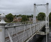
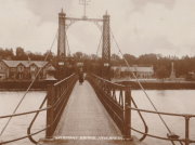
1879: Swing
Monymusk, Scotland, United Kingdom - River Don
| Bridgemeister ID: | 2192 (added 2007-01-26) |
| Year Completed: | 1879 |
| Name: | Swing |
| Location: | Monymusk, Scotland, United Kingdom |
| Crossing: | River Don |
| Principals: | Harper & Co. |
| References: | HARPER |
| Use: | Footbridge |
| Status: | Demolished, c. 2005 |
| Main Cables: | Wire |
| Suspended Spans: | 1 |
| Main Span: | 1 x 32.6 meters (107 feet) |
External Links:
Image Sets:
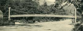
1880: Birkhall
Birkhall, Ballater, Scotland, United Kingdom - River Muick
| Bridgemeister ID: | 2193 (added 2007-01-26) |
| Year Completed: | 1880 |
| Name: | Birkhall |
| Location: | Birkhall, Ballater, Scotland, United Kingdom |
| Crossing: | River Muick |
| Coordinates: | 57.028215 N 3.072693 W |
| Maps: | Acme, GeoHack, Google, OpenStreetMap |
| Principals: | Harper & Co. |
| References: | HARPER |
| Use: | Footbridge |
| Status: | Destroyed, December, 2015 |
| Main Cables: | Wire |
| Suspended Spans: | 1 |
| Main Span: | 1 x 18.3 meters (60 feet) |
Notes:
- 2015, December: Destroyed by flooding during Storm Frank.
- Replaced by Birkhall - Birkhall, Ballater, Scotland, United Kingdom.
- All past and present bridges at this location.
External Links:
1880: Burnhervie
Burnhervie, Inverurie vicinity, Scotland, United Kingdom - River Don
| Bridgemeister ID: | 2174 (added 2007-01-13) |
| Year Completed: | 1880 |
| Name: | Burnhervie |
| Location: | Burnhervie, Inverurie vicinity, Scotland, United Kingdom |
| Crossing: | River Don |
| Coordinates: | 57.261024 N 2.440063 W |
| Maps: | Acme, GeoHack, Google, OpenStreetMap |
| Principals: | Harper & Co. |
| References: | HARPER |
| Use: | Footbridge |
| Status: | Collapsed, 1979 |
| Main Cables: | Wire |
| Main Span: | 1 x 30.5 meters (100 feet) |
Notes:
- Completed c. 1880. Douglas Harper writes: "The original bridge was built by Harper & Co, Aberdeen, around 1880 and its timber pylons were replaced with cast iron ones. In 1979 when overloaded during a raft race a bank stay cable failed and a major rebuild was undertaken by the local authority. This version was similar to its predecessor but was repalced in 2005 by a cable stayed bridge."
- Replaced by 1980 Shakin - Burnhervie, Inverurie vicinity, Scotland, United Kingdom.
- All past and present bridges at this location.
External Links:
Image Sets:
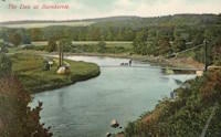
1880: Suspension Pier
Seaview, Isle of Wight, England, United Kingdom
| Bridgemeister ID: | 2409 (added 2007-12-24) |
| Year Completed: | 1880 |
| Name: | Suspension Pier |
| Location: | Seaview, Isle of Wight, England, United Kingdom |
| References: | AAJ |
| Use: | Footbridge |
| Status: | Destroyed, December, 1950 |
| Main Spans: | 3 |
1881: Cromdale
Cromdale, Scotland, United Kingdom - River Spey
| Bridgemeister ID: | 2194 (added 2007-01-26) |
| Year Completed: | 1881 |
| Name: | Cromdale |
| Location: | Cromdale, Scotland, United Kingdom |
| Crossing: | River Spey |
| Coordinates: | 57.341944 N 3.553111 W |
| Maps: | Acme, GeoHack, Google, OpenStreetMap |
| Principals: | Harper & Co. |
| References: | HARPER |
| Use: | Footbridge |
| Status: | Collapsed, 1892 |
| Main Cables: | Wire |
| Main Span: | 1 x 59.4 meters (195 feet) |
Notes:
- Replaced by 1894 Cromdale - Cromdale, Scotland, United Kingdom.
- All past and present bridges at this location.
Image Sets:
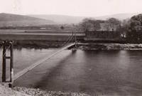
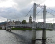
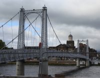
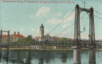
1881: Greig Street
Inverness, Scotland, United Kingdom - River Ness
| Bridgemeister ID: | 538 (added before 2003) |
| Year Completed: | 1881 |
| Name: | Greig Street |
| Also Known As: | Wobbly |
| Location: | Inverness, Scotland, United Kingdom |
| Crossing: | River Ness |
| Coordinates: | 57.479111 N 4.229796 W |
| Maps: | Acme, GeoHack, Google, OpenStreetMap |
| References: | HBR |
| Use: | Footbridge |
| Status: | In use (last checked: 2021) |
| Main Cables: | Wire |
| Suspended Spans: | 3 |
| Main Span: | 1 |
| Side Spans: | 2 |
Notes:
- Companion to 1879 Infirmary - Inverness, Scotland, United Kingdom.
- Near 1855 Ness - Inverness, Scotland, United Kingdom. In some photos, the two bridges are visible within a few hundred yards of each other.
External Links:
Image Sets:
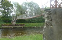
1885: Abergeldie Castle
Balmoral vicinity, Scotland, United Kingdom - River Dee
| Bridgemeister ID: | 1705 (added 2005-03-29) |
| Year Completed: | 1885 |
| Name: | Abergeldie Castle |
| Location: | Balmoral vicinity, Scotland, United Kingdom |
| Crossing: | River Dee |
| Coordinates: | 57.043806 N 3.176197 W |
| Maps: | Acme, GeoHack, Google, OpenStreetMap |
| Principals: | Blaikie Brothers |
| References: | AAJ, HBR |
| Use: | Footbridge |
| Status: | Derelict (last checked: 2016) |
| Main Cables: | Wire |
| Suspended Spans: | 1 |
Notes:
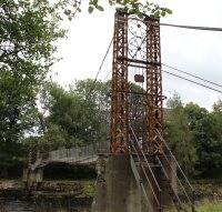
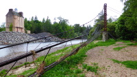
- William Craig describes the bridge, "A wood and angle iron deck supported from two pairs of wire cables and rod suspenders. The railings are of light woven wire. Pylons with ornamental heads are of lattice gider construction on concrete bases five miles west of Ballater, Scotland."
- Was already derelict before December 2015 flooding (Storm Frank) that severely damaged several River Dee bridges. Dave Cooper writes in early 2016: "The bridge's southern tower and its base are gone. The river bank has eroded back to within feet of the grade one listed Abergeldie Castle. Seat of Baron Abergeldie."
External Links:
Image Sets:


1885: Hebden
Hebden, England, United Kingdom - River Wharfe
| Bridgemeister ID: | 1340 (added 2004-05-02) |
| Year Completed: | 1885 |
| Name: | Hebden |
| Location: | Hebden, England, United Kingdom |
| Crossing: | River Wharfe |
| Coordinates: | 54.057126 N 1.962584 W |
| Maps: | Acme, GeoHack, Google, OpenStreetMap |
| Principals: | William Bell |
| Use: | Footbridge |
| Status: | In use (last checked: 2014) |
| Main Cables: | Wire |
| Suspended Spans: | 1 |
Notes:
- Refurbished, 1989.
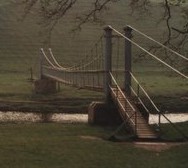
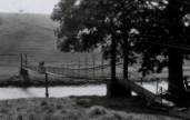
- John Gardner writes that William Bell was the village blacksmith and that the bridge once had an unusual mid-span support pillar. John writes: "It is not known when [the pillar] was dismantled, but the bottom section (you can see the dividing flange in the linked picture) can still be seen in normal water conditions."
- John Gardner later added: "[the bridge] was badly damaged by floods on December 14th 1936. It was reconstructed with the span a little higher, which was when the supporting pillar was removed."
Image Sets:
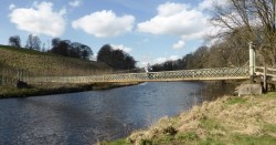
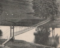
1886: (footbridge)
Huttons Ambo, North Yorkshire, England, United Kingdom - River Derwent
| Bridgemeister ID: | 417 (added before 2003) |
| Year Completed: | 1886 |
| Name: | (footbridge) |
| Location: | Huttons Ambo, North Yorkshire, England, United Kingdom |
| Crossing: | River Derwent |
| Coordinates: | 54.09975 N 0.8311 W |
| Maps: | Acme, GeoHack, Google, OpenStreetMap |
| References: | NTB |
| Use: | Footbridge |
| Status: | In use (last checked: 2014) |
| Main Cables: | Wire |
| Suspended Spans: | 1 |
| Main Span: | 1 x 29 meters (95 feet) |
Image Sets:
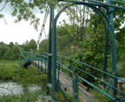
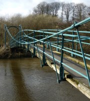
1886: Blairgowrie
Blairgowrie, Scotland, United Kingdom - River Ericht
| Bridgemeister ID: | 2181 (added 2007-01-13) |
| Year Completed: | 1886 |
| Name: | Blairgowrie |
| Location: | Blairgowrie, Scotland, United Kingdom |
| Crossing: | River Ericht |
| At or Near Feature: | Craighall Castle |
| Principals: | Louis Harper |
| References: | HARPER |
| Use: | Footbridge |
| Status: | Removed |
| Main Cables: | Wire |
| Suspended Spans: | 1 |
| Main Span: | 1 x 27.4 meters (89.9 feet) |
Notes:
- HARPER: Some remnants of the bridge still present, 2006.
External Links:
1887: (footbridge)
Offord, England, United Kingdom - Great Northern Railway track
| Bridgemeister ID: | 5084 (added 2020-09-04) |
| Year Completed: | 1887 |
| Name: | (footbridge) |
| Location: | Offord, England, United Kingdom |
| Crossing: | Great Northern Railway track |
| Principals: | John Harper, Harpers Limited |
| References: | HARPER |
| Use: | Footbridge |
| Status: | Removed |
| Main Cables: | Wire |
| Suspended Spans: | 1 |
External Links:
1887: Hammersmith
London, England, United Kingdom - River Thames
| Bridgemeister ID: | 419 (added before 2003) |
| Year Completed: | 1887 |
| Name: | Hammersmith |
| Location: | London, England, United Kingdom |
| Crossing: | River Thames |
| Coordinates: | 51.48845 N 0.23019 W |
| Maps: | Acme, GeoHack, Google, OpenStreetMap |
| Principals: | Sir Joseph Bazalgette |
| References: | BEM, BPL, HBE, NTB, PTS2 |
| Use: | Vehicular (two-lane), with walkway |
| Status: | Restricted to foot traffic, since 2021 (last checked: 2021) |
| Main Cables: | Eyebar |
| Suspended Spans: | 3 |
| Main Span: | 1 |
| Side Spans: | 2 |
Notes:
- 2019, April: Closed to vehicular traffic due to safety concerns after an inspection found fractures in the cast iron casings around the bridge pedestals. Some repair work followed, but was not fully funded or finished (as of mid-2020)
- 2020, August: Fractures found to have worsened during recent heatwave. Bridge is completely closed to all pedestrian and bicycle traffic. Pedestrian walkways under the bridge and all river traffic under the bridge are also prohibited (implying risk of collapse).
- 2020, December: Bridge may reopen to pedestrians and cyclists if deemed safe by maintenance contractor, Mott MacDonald.
- 2021, January: Plan discussed to "thread" a temporary truss along the length of the deck to permit traffic while the suspension bridge undergoes repairs.
- 2021, March: Feasibility study on "double-decker" temporary truss plan determines it is feasible, possibly opening to pedestrian and vehicular traffic by mid-2022.
- 2021, July: Reopened for pedestrian and bicycle use.
- Replaced 1827 Hammersmith - London, England, United Kingdom.
- All past and present bridges at this location.
External Links:
- ENR - Engineers Ponder Solutions for Damaged London Bridge. February 22, 2021 Engineering News-Record article discusses proposal to thread a temporary truss between the towers to allow traffic while the larger suspension bridge repairs are completed. Recaps the issue: "Cracks have been found in the cast-iron pedestals that support suspension cable saddles at the abutments. Engineers suspect that roller bearings between the saddles and pedestals seized up at least 30 years ago…"
- Hammersmith Bridge | Temporary ‘double-decker’ proposal deemed technically feasible - New Civil Engineer. March 22, 2021
- The Happy Pontist: London Bridges: 33. Hammersmith Bridge
- Structurae - Structure ID 20008013
Image Sets:
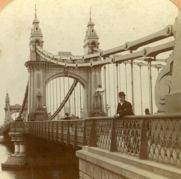
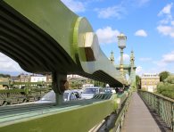
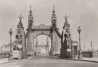
1887: Jubilee
Nairn, Scotland, United Kingdom - River Nairn
| Bridgemeister ID: | 1945 (added 2005-10-29) |
| Year Completed: | 1887 |
| Name: | Jubilee |
| Location: | Nairn, Scotland, United Kingdom |
| Crossing: | River Nairn |
| Principals: | Harpers Limited |
| References: | HARPER |
| Use: | Footbridge |
| Status: | Replaced, 1915 |
| Main Cables: | Wire |
| Suspended Spans: | 1 |
| Main Span: | 1 x 30.5 meters (100 feet) |
External Links:
Image Sets:
1888: Crathorne
Carthorne, England, United Kingdom - River Leven
| Bridgemeister ID: | 2195 (added 2007-01-26) |
| Year Completed: | 1888 |
| Name: | Crathorne |
| Location: | Carthorne, England, United Kingdom |
| Crossing: | River Leven |
| Principals: | Louis Harper |
| References: | HARPER |
| Use: | Footbridge |
| Status: | Destroyed, by flood, July 1930 |
| Main Cables: | Wire |
| Main Span: | 1 x 16.8 meters (55 feet) estimated |
External Links:
- Crathorne | Harper Bridges
- Suspension Bridge, Yorkshire – Arberdeen Archives, Gallery and Museums. Image of the bridge: "Suspension bridge at Craythorne, Yorkshire."
1889: Stapenhill
Burton-upon-Trent, Staffordshire, England, United Kingdom - River Trent
| Bridgemeister ID: | 2138 (added 2006-10-28) |
| Year Completed: | 1889 |
| Name: | Stapenhill |
| Also Known As: | Ferry |
| Location: | Burton-upon-Trent, Staffordshire, England, United Kingdom |
| Crossing: | River Trent |
| Coordinates: | 52.79455 N 1.62607 W |
| Maps: | Acme, GeoHack, Google, OpenStreetMap |
| Principals: | Thornewill & Warham |
| Use: | Footbridge |
| Status: | In use (last checked: 2007) |
| Suspended Spans: | 3 |
| Main Span: | 1 x 36.6 meters (120 feet) |
| Side Spans: | 2 x 18.3 meters (60 feet) |
| Deck width: | 11.5 feet |
External Links:
- The Happy Pontist: Staffordshire Bridges: 1. Ferry Bridge, Stapenhill
- Structurae - Structure ID 20024241
Image Sets:
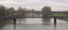
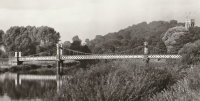
1889: Teddington
Teddington, England, United Kingdom - River Thames
| Bridgemeister ID: | 783 (added 2003-03-16) |
| Year Completed: | 1889 |
| Name: | Teddington |
| Location: | Teddington, England, United Kingdom |
| Crossing: | River Thames |
| Coordinates: | 51.42981 N 0.322517 W |
| Maps: | Acme, GeoHack, Google, OpenStreetMap |
| Use: | Footbridge |
| Status: | In use (last checked: 2015) |
| Main Cables: | Wire |
| Suspended Spans: | 2 |
| Main Span: | 1 |
| Side Span: | 1 |
External Links:
Image Sets:

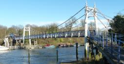
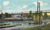
1890: (footbridge)
Lincoln, England, United Kingdom - Great Northern Railway track
| Bridgemeister ID: | 5083 (added 2020-09-02) |
| Year Completed: | 1890 |
| Name: | (footbridge) |
| Location: | Lincoln, England, United Kingdom |
| Crossing: | Great Northern Railway track |
| Principals: | Louis Harper |
| References: | HARPER |
| Use: | Footbridge |
| Status: | Removed |
| Main Cables: | Wire |
| Main Span: | 1 x 21.3 meters (70 feet) |
Notes:
- HARPER: Likely located at Pelham Street, just east of the present-day (2020) Lincoln train station.
1892: (footbridge)
Ardtornish, Morvern, Scotland, United Kingdom - Abhainn a' Ghlinne Ghil
| Bridgemeister ID: | 9165 (added 2025-04-06) |
| Year Completed: | 1892 |
| Name: | (footbridge) |
| Location: | Ardtornish, Morvern, Scotland, United Kingdom |
| Crossing: | Abhainn a' Ghlinne Ghil |
| Coordinates: | 56.586333 N 5.748472 W |
| Maps: | Acme, GeoHack, Google, OpenStreetMap |
| Use: | Footbridge |
| Status: | Derelict (last checked: 2024) |
| Main Cables: | Wire |
| Suspended Spans: | 1 |
| Main Span: | 1 x 18 meters (59.1 feet) estimated |
| Characteristics: | Monocable |
Notes:
- Highly unusual short-span monocable suspension bridge seemingly constructed from a hodgepodge of material. It has been sitting derelict for many years, but supposedly retains most of its original components.
External Links:
- Flickr - Single cable suspension bridge, Ardtornish Estate. Image of the bridge. Taken June 6, 2013.
- Flickr - Single cable suspension bridge, Ardtornish Estate. Image of the bridge. Taken June 6, 2013.
- Flickr - Single cable suspension bridge, Ardtornish Estate. Image of the bridge. Taken June 6, 2013.
- Flickr - Single cable suspension bridge, Ardtornish Estate. Image of the bridge. Taken June 6, 2013.
- https://www.kweimar.de/Bilder_XML.php?ket=H1994. Description of the bridge and its components.
1892: Polhollick
Ballater vicinity, Aberdeenshire, Scotland, United Kingdom - River Dee
| Bridgemeister ID: | 1905 (added 2005-10-08) |
| Year Completed: | 1892 |
| Name: | Polhollick |
| Location: | Ballater vicinity, Aberdeenshire, Scotland, United Kingdom |
| Crossing: | River Dee |
| Coordinates: | 57.055048 N 3.083452 W |
| Maps: | Acme, GeoHack, Google, OpenStreetMap |
| Principals: | James Abernethy & Co. |
| References: | HARPER, HBR |
| Use: | Footbridge |
| Status: | In use (last checked: 2014) |
| Main Cables: | Wire (steel) |
| Suspended Spans: | 1 |
| Main Span: | 1 x 54.4 meters (178.5 feet) |
Notes:
- Closed May 2015 for repairs. Reopened October, 2015.
External Links:
- The Happy Pontist: Scottish Bridges: 19. Polhollick Suspension Bridge
- The Happy Pontist: Scottish Bridges: 44. Polhollick Bridge (revisited)
- Structurae - Structure ID 20021613
Image Sets:
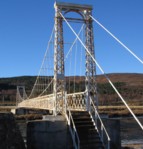
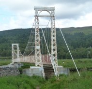
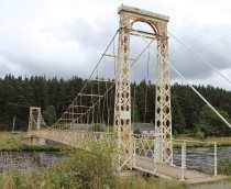
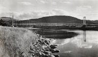
Do you have any information or photos for these bridges that you would like to share? Please email david.denenberg@bridgemeister.com.
Mail | Facebook | X (Twitter) | Bluesky