Inventory Search Results
50 suspension bridges were found for search criteria: james. All 50 bridges from the search results appear below. Click the Bridgemeister ID number to isolate the bridge on its own page. If you don't see what you were looking for, try an image search with the same criteria: james. This will find the bridge if it is pictured on the site, but is not a catenary suspension bridge.
Related:
1801: Jacob's Creek
Iron Bridge, Mount Pleasant vicinity, Pennsylvania, USA - Jacob's Creek
| Bridgemeister ID: | 3 (added before 2003) |
| Year Completed: | 1801 |
| Name: | Jacob's Creek |
| Also Known As: | Iron Bridge, Chain Bridge |
| Location: | Iron Bridge, Mount Pleasant vicinity, Pennsylvania, USA |
| Crossing: | Jacob's Creek |
| Coordinates: | 40.112598 N 79.553186 W |
| Maps: | Acme, GeoHack, Google, OpenStreetMap |
| Principals: | Judge James Finley |
| References: | AAJ, ASB, BBR, BOB, BPL, CAB, DSE20000116, HBE, LAB, PTS2 |
| Use: | Vehicular |
| Status: | Removed, 1833 |
| Main Cables: | Chain (iron) |
| Suspended Spans: | 3 |
| Main Span: | 1 x 21.3 meters (70 feet) |
| Deck width: | 12.5 feet |
Notes:
- In an email dated January 16, 2000, Don Sayenga provided information about the location of this bridge. Generally attributed to Uniontown (the seat of Fayette County, PA), Mr. Sayenga offers some clues about the bridge's true location. "[James Finley] stated that he built it near the home of his friend Meason which implies a connection for the iron as Meason was making iron. Meason's home has survived by the way, a beautiful place. Finley stated it was a combination contract with the cost split between two counties, and he stated it was built over Jacob's Creek which is the county boundary. He also makes it clear it was on the road to Greensburg. The only place the old road crossed Jacob's Creek is just south of Mount Pleasant, Pennsylvania. On the geodetic survey maps this spot is marked "Iron Bridge" but there is no town there. The last time I was there I saw a sign that said 'Iron Bridge' on an automobile scrap yard. I found absolutely no trace of the bridge, but it was not very big, so there was no need for a huge abutment."
- First suspension bridge with a rigid level deck, often considered the world's first modern suspension bridge.
- Coordinates are for the likely location of the bridge, where present-day (2020) Pennsylvania route 3105 crosses Jacob's Creek.
External Links:
1810: Chain
Newburyport, Massachusetts, USA - Merrimack River
| Bridgemeister ID: | 14 (added before 2003) |
| Year Completed: | 1810 |
| Name: | Chain |
| Also Known As: | Essex-Merrimack |
| Location: | Newburyport, Massachusetts, USA |
| Crossing: | Merrimack River |
| At or Near Feature: | Deer Island |
| Coordinates: | 42.833947 N 70.906811 W |
| Maps: | Acme, GeoHack, Google, OpenStreetMap |
| Principals: | John Templeman |
| References: | AAJ, BBR, CAB, GBD, HBE, POPE, PTS2, RDH |
| Use: | Vehicular (two-lane, light vehicles only) |
| Status: | Replaced, 1909 |
| Main Cables: | Chain (iron) |
| Suspended Spans: | 1 |
| Main Span: | 1 x 74.1 meters (243 feet) |
| Deck width: | 30 feet (2 roadways of 15 feet) |
Notes:
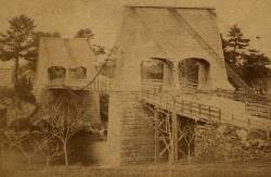
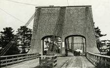
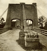
- John Templeman built several bridges (like this one) using James Finley's design.
- Repaired in 1827 after 5 of 10 chains snapped under weight of a team of oxen.
- The complete description from Thomas Pope's 1811 Treatise (POPE):
"The chain Bridge lately thrown over the Merrimack, three miles above Newburyport, in the state of Massachusetts, is now in constant use. This Bridge consists of a single arc, two hundred and forty-four feet span. The abutments are of stone, forty-seven feet long, and thirty-seven high; the uprights, or framed work, which stand on the abutments, are thirty-five feet high, over which are suspended ten distinct chains, the ends of which on both sides of the river are buried deep in pits and secured by large stones: each chain is five hundred and sixteen feet long; and, where they pass over the uprights, they are treble, and made in short links, which is said to be more secure than saddles made of plates of iron. The four middle joists rest on the chains; all the rest are suspended to the main chains to equalize the floor. This Bridge has two passage-ways of fifteen feet in width each, and the floor is so solid as to admit of horses, carriages, etc. to travel at any speed, with very little perceptible motion of the floors. The railing is stout and strong, which adds much firmness to the floor. There are three chains in each range on each side, and four in the middle range: they are calculated to support nearly five hundred tons. From the surface of the water to the middle of the floor is forty feet; and from the top of the abutments to the top of the uprights is thirty-five feet high, making seventy-two feet. The magnitude and power of the abutments, the width and length of the floors, the elevation of the work, the evident powers of the chains, etc. all conspire to make it a wonderful work. Every expense attending it did not amount to twenty-five thousand dollars. The abutment being of stone, the uprights covered, and the chains painted to prevent rust, leaves nothing but the flooring to decay. This Bridge was constructed by John Templeman, Esq. of the district of Columbia, whose talents for the productions of such work, and the various improvements suggested and used by him, have been highly beneficial, and do him great credit."
- Gregory W. Buff sent a transcription of an article describing the 1827 failure. The article was in the Saturday, February 24, 1827 issue (Volume IV, Number 31) of the Canadian Spectator (Montreal, Quebec) newspaper:
"Newburyport, Feb 9. Disastrious [sic] Accident. - On Tuesday morning last, the Essex Merrimack Bridge gave way in the centre, from the parting of the chains that support it. On the Bridge, at the moment, was a loaded team, drawn by six oxen and two horses, driven by two men, Messrs. Garlton [sic] and Jackman, all of whom were precipitated, forty feet, into the river beneath. The teamsters preserved themselves by means of swimming, and the support of fragments of the bridge; the team were all of them except one of the horses, swept beneath the ice a few rods below, and drowned. Five of the ten chains which supported the Bridge, were snapped in different places, and now remain upholding the broken and shattered timber altogether as sad a wreck as we ever witnessed. At the moment of the crash, the light evolved from the friction of the chains resembled the the vivid streaming of a meteor. Various excuses are assigned for the accident, and none, with more probability, than the united effect of the incumbent pressure of the immense body of snow lying upon the bridge, and the frost which had contracted the particles of iron. These produced a tenseness in the chains, which was incapable of resisting the additional pressure of the loaded team, and the whole gave way. The estimated expense of repairing the breach is about 4000 dollars; and the Directors, as we understand, plan to set about it immediately. It will be built up as before. To those who have been losers by this accident the corporation intend to make generous inumeration. The traveling will be uninterrupted, as the solidity of the ice above the bridge forms a safe passage way - and for the conveyance of carriages and heavy baggage the proprietors have promptly provided suitable boats. If any aversion to chain bridges has been produced by this accident, we should be sorry, for ourselves we feel yet unshaken faith in their superior security. The misfortune in this case was no doubt owing to the causes above stated, and not to any defect in the construction of the bridge. Probably hundreds of individuals, including each sex and all ages, have visited the ruins of the bridge. They present a sad and melancholy appearance - crushed and broken timbers suspended by the massy chains, which hang lazily from the pyramidical abutments, while the beholder instinctly shrinks back in terror at the reflection of the situation of the two human beings who were precipitated into the abyss beneath. The preservation of these two men is almost miraculous. Although hurled down 40 feet amid crashing and falling timber, entangled with their cattle, they fell without receiving the least injury, and attained the shore, after being for nearly half an hour, immerse in water chilled to the freezing point. Mr. Jackman is far advanced in years - and suffered somewhat from the exposure to the cold. Mr. Carlton [sic], escaped unhurt. The Chain Bridge has been built for about fifteen years, the span is 220 feet. We believe this was the second or third Chain Bridge built in the United States; and this is probably the first that has met with a similar accident. We understand the proprieters of the Rooks Bridge intend to rebuild theirs as a Chain Bridge."
- Replaced by 1909 Chain - Newburyport, Massachusetts, USA. The 1909 structure was almost entirely new (except for portions of the piers and abutments).
External Links:
1830: Barrackpore
Kolkata, West Bengal, India - Circular Canal
| Bridgemeister ID: | 3560 (added 2019-12-26) |
| Year Completed: | 1830 |
| Name: | Barrackpore |
| Also Known As: | Barrackpoor, Shambazar |
| Location: | Kolkata, West Bengal, India |
| Crossing: | Circular Canal |
| Principals: | James Prinsep, Captain Hugh Baker |
| References: | ISB |
| Use: | Vehicular (three-lane) |
| Status: | Removed |
| Main Cables: | Chain (iron) |
| Suspended Spans: | 1 |
| Main Span: | 1 x 30.5 meters (100 feet) |
| Deck width: | 30 feet |
Notes:
- ISB describes its location: "...is situated half a mile from the mouth of the Circular Canal on the great road to Barrackpoor."
1830: Boitakhana
Kolkata, West Bengal, India - Circular Canal
| Bridgemeister ID: | 3565 (added 2019-12-26) |
| Year Completed: | 1830 |
| Name: | Boitakhana |
| Also Known As: | Baliaghata |
| Location: | Kolkata, West Bengal, India |
| Crossing: | Circular Canal |
| Principals: | James Prinsep |
| References: | ISB |
| Use: | Vehicular |
| Status: | Removed |
| Main Cables: | Chain (iron) |
| Suspended Spans: | 1 |
| Main Span: | 1 x 30.5 meters (100 feet) |
| Deck width: | 18 feet |
Notes:
- ISB describes its location: "is the last or most southerly [of the chain suspension bridges] on the Circular Canal, being distant 3-1/2 miles from its mouth and a quarter of a mile from its junction with the Baliaghata and Circular Canals. It forms the principal line of communication between Calcutta (by the Lall-Bazar, Bow-Bazar and Boitakhana Streets,) Sealda, Soora and Baliaghata."
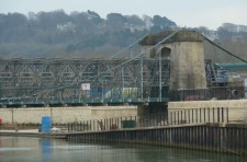
1836: Victoria
Bath, England, United Kingdom - River Avon
| Bridgemeister ID: | 397 (added before 2003) |
| Year Completed: | 1836 |
| Name: | Victoria |
| Location: | Bath, England, United Kingdom |
| Crossing: | River Avon |
| Coordinates: | 51.38350 N 2.37327 W |
| Maps: | Acme, GeoHack, Google, OpenStreetMap |
| Principals: | James Dredge |
| References: | AAJ |
| Use: | Vehicular (one-lane) |
| Status: | Restricted to foot traffic (last checked: 2019) |
| Main Cables: | Eyebar (iron) |
| Suspended Spans: | 1 |
| Main Span: | 1 x 45.7 meters (150 feet) |
| Deck width: | 18 feet |
Notes:
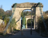
- Dredge patent bridge.
- Closed in 2010 due to safety concerns. Scheduled to be largely rebuilt as a replica, starting April 2013 to be completed April 2014. Temporary truss installed through the bridge to permit traffic during the refurbishment. Reopened January 2015.
External Links:
1841: Balloch Ferry
Balloch, Scotland, United Kingdom - River Leven
| Bridgemeister ID: | 5552 (added 2020-12-16) |
| Year Completed: | 1841 |
| Name: | Balloch Ferry |
| Location: | Balloch, Scotland, United Kingdom |
| Crossing: | River Leven |
| Coordinates: | 56.003420 N 4.581826 W |
| Maps: | Acme, GeoHack, Google, OpenStreetMap |
| Principals: | Sir James Colquhoun |
| References: | AAJ |
| Status: | Removed, c. 1887 |
| Main Cables: | Rod (iron) |
| Suspended Spans: | 3 |
| Main Span: | 1 x 61 meters (200 feet) |
| Side Spans: | 2 x 13.7 meters (45 feet) |
Notes:
- Design based on James Dredge's taper principle patent.
1842: (footbridge)
London, England, United Kingdom - Regent's Canal
| Bridgemeister ID: | 5088 (added 2020-09-04) |
| Year Completed: | 1842 |
| Name: | (footbridge) |
| Location: | London, England, United Kingdom |
| Crossing: | Regent's Canal |
| At or Near Feature: | Regent's Park |
| Principals: | James Dredge |
| References: | AAJ |
| Use: | Footbridge |
| Status: | Removed |
| Main Cables: | Rod (iron) |
| Suspended Spans: | 1 |
| Main Span: | 1 x 22.9 meters (75 feet) |
Notes:
- Built as part of same project as 1842 (footbridge) - London, England, United Kingdom.
- Built as part of same project as 1842 (footbridge) - London, England, United Kingdom.
- Built as part of same project as 1842 (footbridge) - London, England, United Kingdom.
- Built as part of same project as 1842 (footbridge) - London, England, United Kingdom.
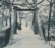
1842: (footbridge)
London, England, United Kingdom - Regent's Canal
| Bridgemeister ID: | 5089 (added 2020-09-04) |
| Year Completed: | 1842 |
| Name: | (footbridge) |
| Location: | London, England, United Kingdom |
| Crossing: | Regent's Canal |
| At or Near Feature: | Regent's Park |
| Principals: | James Dredge |
| References: | AAJ |
| Use: | Footbridge |
| Status: | Removed |
| Main Cables: | Rod (iron) |
| Suspended Spans: | 1 |
| Main Span: | 1 x 22.9 meters (75 feet) |
Notes:
- Built as part of same project as 1842 (footbridge) - London, England, United Kingdom.
- Built as part of same project as 1842 (footbridge) - London, England, United Kingdom.
- Built as part of same project as 1842 (footbridge) - London, England, United Kingdom.
- Built as part of same project as 1842 (footbridge) - London, England, United Kingdom.

1842: (footbridge)
London, England, United Kingdom
| Bridgemeister ID: | 5090 (added 2020-09-04) |
| Year Completed: | 1842 |
| Name: | (footbridge) |
| Location: | London, England, United Kingdom |
| At or Near Feature: | Regent's Park |
| Principals: | James Dredge |
| References: | AAJ |
| Use: | Footbridge |
| Status: | Removed |
| Main Cables: | Rod (iron) |
| Main Span: | 1 x 45.7 meters (150 feet) |
Notes:
- Built as part of same project as 1842 (footbridge) - London, England, United Kingdom.
- Built as part of same project as 1842 (footbridge) - London, England, United Kingdom.
- Built as part of same project as 1842 (footbridge) - London, England, United Kingdom.
- Built as part of same project as 1842 (footbridge) - London, England, United Kingdom.

1842: (footbridge)
London, England, United Kingdom
| Bridgemeister ID: | 5091 (added 2020-09-04) |
| Year Completed: | 1842 |
| Name: | (footbridge) |
| Location: | London, England, United Kingdom |
| At or Near Feature: | Regent's Park |
| Principals: | James Dredge |
| References: | AAJ |
| Use: | Footbridge |
| Status: | Removed |
| Main Cables: | Rod (iron) |
Notes:
- Built as part of same project as 1842 (footbridge) - London, England, United Kingdom.
- Built as part of same project as 1842 (footbridge) - London, England, United Kingdom.
- Built as part of same project as 1842 (footbridge) - London, England, United Kingdom.
- Built as part of same project as 1842 (footbridge) - London, England, United Kingdom.

1842: (footbridge)
London, England, United Kingdom
| Bridgemeister ID: | 5092 (added 2020-09-04) |
| Year Completed: | 1842 |
| Name: | (footbridge) |
| Location: | London, England, United Kingdom |
| At or Near Feature: | Regent's Park |
| Principals: | James Dredge |
| References: | AAJ |
| Use: | Footbridge |
| Status: | Removed |
| Main Cables: | Rod (iron) |
Notes:
- Built as part of same project as 1842 (footbridge) - London, England, United Kingdom.
- Built as part of same project as 1842 (footbridge) - London, England, United Kingdom.
- Built as part of same project as 1842 (footbridge) - London, England, United Kingdom.
- Built as part of same project as 1842 (footbridge) - London, England, United Kingdom.

1842: (suspension bridge)
Frome, England, United Kingdom - River Frome
| Bridgemeister ID: | 4062 (added 2020-03-30) |
| Year Completed: | 1842 |
| Name: | (suspension bridge) |
| Location: | Frome, England, United Kingdom |
| Crossing: | River Frome |
| Principals: | James Dredge |
| References: | AAJ |
| Status: | Removed |
1842: Wraysbury
Wraysbury, England, United Kingdom
| Bridgemeister ID: | 4835 (added 2020-07-10) |
| Year Completed: | 1842 |
| Name: | Wraysbury |
| Location: | Wraysbury, England, United Kingdom |
| Principals: | James Dredge |
| References: | AAJ |
| Use: | Vehicular |
| Status: | Removed |
| Main Cables: | Rod (iron) |
| Main Span: | 1 x 30.5 meters (100 feet) |
1845: (footbridge)
Caledon, County Tyrone, Northern Ireland, United Kingdom - River Blackwater
| Bridgemeister ID: | 2424 (added 2008-03-12) |
| Year Completed: | 1845 |
| Name: | (footbridge) |
| Location: | Caledon, County Tyrone, Northern Ireland, United Kingdom |
| Crossing: | River Blackwater |
| Coordinates: | 54.34608 N 6.83276 W |
| Maps: | Acme, GeoHack, Google, OpenStreetMap |
| Principals: | James Dredge |
| References: | AAJ |
| Use: | Footbridge |
| Status: | Extant (last checked: 2021) |
| Main Cables: | Rod (iron) |
| Suspended Spans: | 1 |
| Main Span: | 1 x 22.6 meters (74 feet) |
Notes:
- This distinctly Dredge bridge is currently sitting atop modern concrete piers.
External Links:
1845: Ballievey
Banbridge, Northern Ireland, United Kingdom - River Bann
| Bridgemeister ID: | 2172 (added 2007-01-13) |
| Year Completed: | 1845 |
| Name: | Ballievey |
| Also Known As: | Ballievy |
| Location: | Banbridge, Northern Ireland, United Kingdom |
| Crossing: | River Bann |
| Coordinates: | 54.341862 N 6.219803 W |
| Maps: | Acme, GeoHack, Google, OpenStreetMap |
| Principals: | James Dredge |
| Use: | Vehicular |
| Status: | Collapsed, September 12, 1988 |
| Suspended Spans: | 1 |
| Main Span: | 1 x 22 meters (72.3 feet) |
Notes:
- Collapsed, September 12, 1988, under weight of truck that exceeded the posted weight limit.

1847: Moyola Park
Castledawson, Northern Ireland, United Kingdom - Moyola River
| Bridgemeister ID: | 3888 (added 2020-03-13) |
| Year Completed: | 1847 |
| Name: | Moyola Park |
| Location: | Castledawson, Northern Ireland, United Kingdom |
| Crossing: | Moyola River |
| Coordinates: | 54.781235 N 6.560394 W |
| Maps: | Acme, GeoHack, Google, OpenStreetMap |
| Principals: | James Dredge |
| Use: | Footbridge |
| Status: | In use |
| Main Cables: | Rod (iron) |
External Links:
1848: Shadwell
Shadwell, England, United Kingdom
| Bridgemeister ID: | 5641 (added 2020-12-30) |
| Year Completed: | 1848 |
| Name: | Shadwell |
| Location: | Shadwell, England, United Kingdom |
| At or Near Feature: | Ropery Grounds at Sun Tavern Fields |
| Principals: | William Dredge |
| References: | AAJ |
| Use: | Footbridge |
| Status: | Removed |
| Main Cables: | Rod (iron) |
Notes:
- William Dredge was the son of James Dredge known for his "taper principle" bridge design. Based on the description of the Shadwell bridge (in the sources cited by Jakkula), it is unclear if this Shadwell bridge followed Williams' father's design. 1848 is assumed as the year of completion based on the October 7, 1848 Mechanics' Magazine article cited by Jakkula which starts "A foot-suspension bridge has just been erected..."
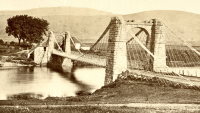
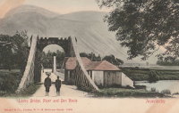
1849: Lochy
Inverlochy, Fort William vicinity, Scotland, United Kingdom - River Lochy
| Bridgemeister ID: | 6209 (added 2021-07-16) |
| Year Completed: | 1849 |
| Name: | Lochy |
| Also Known As: | Lochybridge, Victoria |
| Location: | Inverlochy, Fort William vicinity, Scotland, United Kingdom |
| Crossing: | River Lochy |
| Coordinates: | 56.835137 N 5.076679 W |
| Maps: | Acme, GeoHack, Google, OpenStreetMap |
| Principals: | James Dredge |
| Use: | Vehicular |
| Status: | Removed |
| Main Cables: | Rod (iron) |
| Main Span: | 1 |
Notes:
- 1928: Deck replaced. The aging suspension system was bypassed and the new deck supported by additional piers.
- Similar to 1854 Oich (Aberchalder) - Invergarry vicinity, Scotland, United Kingdom.
1852: Fairmont and Palatine
Fairmont, West Virginia, USA - Monongahela River
| Bridgemeister ID: | 39 (added before 2003) |
| Year Completed: | 1852 |
| Name: | Fairmont and Palatine |
| Location: | Fairmont, West Virginia, USA |
| Crossing: | Monongahela River |
| Principals: | James L. Randolph |
| References: | EOV, PTS2 |
| Status: | Removed |
| Main Cables: | Wire (iron) |
Notes:
- Was still part of Virginia at time of completion.
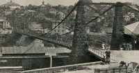
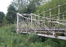
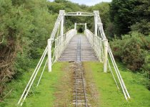
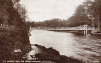
1853: General's Well
Inverness, Scotland, United Kingdom - River Ness
| Bridgemeister ID: | 406 (added before 2003) |
| Year Completed: | 1853 |
| Name: | General's Well |
| Location: | Inverness, Scotland, United Kingdom |
| Crossing: | River Ness |
| At or Near Feature: | Ness Islands |
| Coordinates: | 57.460944 N 4.237166 W |
| Maps: | Acme, GeoHack, Google, OpenStreetMap |
| Principals: | James Dredge |
| References: | HBR |
| Use: | Footbridge |
| Status: | In use (last checked: 2014) |
| Main Cables: | Rod (iron) |
| Suspended Spans: | 3 |
| Main Span: | 1 |
| Side Spans: | 2 |
Notes:
- Relocated to a nearby park (Whin Park) where it carries a miniature railway, 1988. The coordinates listed here are for that later (miniature railway park) location.
- Companion to 1853 Island Bank Road - Inverness, Scotland, United Kingdom.
- See 1988 (footbridge) - Inverness, Scotland, United Kingdom.
- See 1988 (footbridge) - Inverness, Scotland, United Kingdom.
External Links:

1853: Island Bank Road
Inverness, Scotland, United Kingdom - River Ness
| Bridgemeister ID: | 904 (added 2003-10-11) |
| Year Completed: | 1853 |
| Name: | Island Bank Road |
| Location: | Inverness, Scotland, United Kingdom |
| Crossing: | River Ness |
| At or Near Feature: | Ness Islands |
| Principals: | James Dredge |
| References: | HBR |
| Use: | Footbridge |
| Status: | Removed |
Notes:
- Companion to 1853 General's Well - Inverness, Scotland, United Kingdom.
- See 1988 (footbridge) - Inverness, Scotland, United Kingdom.
- See 1988 (footbridge) - Inverness, Scotland, United Kingdom.
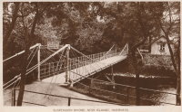
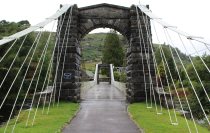
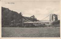
1854: Oich
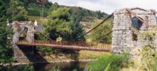
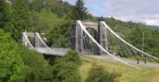
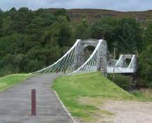
Invergarry vicinity, Scotland, United Kingdom - River Oich
| Bridgemeister ID: | 403 (added before 2003) |
| Year Completed: | 1854 |
| Name: | Oich |
| Also Known As: | Aberchalder |
| Location: | Invergarry vicinity, Scotland, United Kingdom |
| Crossing: | River Oich |
| Coordinates: | 57.093377 N 4.745271 W |
| Maps: | Acme, GeoHack, Google, OpenStreetMap |
| Principals: | James Dredge |
| References: | BC3, HBR |
| Use: | Vehicular (one-lane) |
| Status: | Restricted to foot traffic (last checked: 2014) |
| Main Cables: | Rod (iron) |
| Suspended Spans: | 1 |
Notes:
- Restored and re-opened, late 1990's.
External Links:
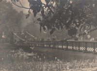
1857: Saint James's Park
London, England, United Kingdom
| Bridgemeister ID: | 6831 (added 2021-12-31) |
| Year Completed: | 1857 |
| Name: | Saint James's Park |
| Location: | London, England, United Kingdom |
| At or Near Feature: | Saint James's Park |
| References: | AAJ |
| Use: | Footbridge |
| Status: | Replaced, 1957 |
| Main Cables: | Eyebar (iron) |
| Suspended Spans: | 1 |
Notes:
- Reviews of this bridge were not favorable. Jakkula (AAJ) sites several contemporary sources (1857) objecting to the bridge obstructing the view of the scenery. One citation is summarized: "Regards the bridge as a hideous structure".
External Links:
1860: Grand Falls
Grand Falls, New Brunswick, Canada - St. John River
| Bridgemeister ID: | 60 (added before 2003) |
| Year Completed: | 1860 |
| Name: | Grand Falls |
| Location: | Grand Falls, New Brunswick, Canada |
| Crossing: | St. John River |
| Principals: | James Tomlinson |
| References: | AAJ |
| Use: | Vehicular (two-lane) |
| Status: | Replaced, 1915 |
| Main Cables: | Wire (iron) |
| Suspended Spans: | 1 |
| Main Span: | 1 x 63.9 meters (209.75 feet) |
| Deck width: | 16 feet |
Notes:
- Out of use, 1912.

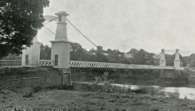
1868: (suspension bridge)
Afton, New York, USA - Susquehanna River
| Bridgemeister ID: | 66 (added before 2003) |
| Year Completed: | 1868 |
| Name: | (suspension bridge) |
| Location: | Afton, New York, USA |
| Crossing: | Susquehanna River |
| Principals: | G. W. & J. V. V. Fishler, James Crowell |
| Use: | Vehicular |
| Status: | Removed |
| Main Cables: | Wire (iron) |
| Suspended Spans: | 1 |
| Main Span: | 1 x 110.3 meters (362 feet) |
| Deck width: | 16 feet |
1870: Pond Eddy-Lumberland
Pond Eddy and Lumberland, New York, USA - Delaware River
| Bridgemeister ID: | 297 (added before 2003) |
| Year Completed: | 1870 |
| Name: | Pond Eddy-Lumberland |
| Also Known As: | Decker's |
| Location: | Pond Eddy and Lumberland, New York, USA |
| Crossing: | Delaware River |
| Coordinates: | 41.439349 N 74.819723 W |
| Maps: | Acme, GeoHack, Google, OpenStreetMap |
| Principals: | James D. Decker |
| References: | BDR |
| Use: | Vehicular |
| Status: | Destroyed, October 9, 1903 |
| Main Cables: | Wire (iron) |
| Suspended Spans: | 2 |
| Main Spans: | 2 |
| Deck width: | 12 feet |
Notes:
- Destroyed by flood.
- Coordinates are for the replacement bridge. The suspension bridge would have been extremely close, if not on the same alignment as the replacement.
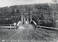
1873: Harrison
Harrison, Ohio and Dearborn County, Indiana, USA - Whitewater River
| Bridgemeister ID: | 81 (added before 2003) |
| Year Completed: | 1873 |
| Name: | Harrison |
| Location: | Harrison, Ohio and Dearborn County, Indiana, USA |
| Crossing: | Whitewater River |
| Principals: | James W. Shipman and Co. |
| References: | EOV |
| Use: | Vehicular (one-lane) |
| Status: | Destroyed, 1913, by flood |
| Main Cables: | Wire |
Notes:
- See 1868 Calloway's Ford (Whitewater, Harrison's) - Elizabethtown vicinity, Hamilton County, Ohio, USA.
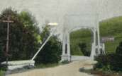
1878: Sedgwick
Sedgwick and Sizergh, England, United Kingdom - River Kent
| Bridgemeister ID: | 1313 (added 2004-04-16) |
| Year Completed: | 1878 |
| Name: | Sedgwick |
| Also Known As: | Low Park Woods, New Sedgwick |
| Location: | Sedgwick and Sizergh, England, United Kingdom |
| Crossing: | River Kent |
| Coordinates: | 54.281 N 2.7564 W |
| Maps: | Acme, GeoHack, Google, OpenStreetMap |
| Principals: | Francis James Willacy |
| Use: | Footbridge |
| Status: | In use (last checked: 2010) |
| Suspended Spans: | 1 |
Notes:
- 1988-1989: Restoration project completed
- 2022, August-September: Bridge closed for repairs. Reopened.
- Similar to 1862 (footbridge) - Greystead, England, United Kingdom.
External Links:
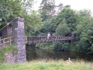
1886: (footbridge)
Huttons Ambo, North Yorkshire, England, United Kingdom - River Derwent
| Bridgemeister ID: | 417 (added before 2003) |
| Year Completed: | 1886 |
| Name: | (footbridge) |
| Location: | Huttons Ambo, North Yorkshire, England, United Kingdom |
| Crossing: | River Derwent |
| Coordinates: | 54.09975 N 0.8311 W |
| Maps: | Acme, GeoHack, Google, OpenStreetMap |
| References: | NTB |
| Use: | Footbridge |
| Status: | In use (last checked: 2014) |
| Main Cables: | Wire |
| Suspended Spans: | 1 |
| Main Span: | 1 x 29 meters (95 feet) |
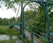
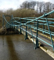
1886: (suspension bridge)
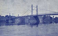
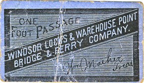
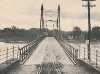
Windsor Locks and Warehouse Point, Connecticut, USA - Connecticut River
| Bridgemeister ID: | 306 (added before 2003) |
| Year Completed: | 1886 |
| Name: | (suspension bridge) |
| Location: | Windsor Locks and Warehouse Point, Connecticut, USA |
| Crossing: | Connecticut River |
| Principals: | James Shipman |
| References: | AAJ, PTS2 |
| Use: | Vehicular |
| Status: | Removed |
| Main Cables: | Wire |
| Suspended Spans: | 3 |
| Main Span: | 1 x 167.6 meters (550 feet) |
| Side Spans: | 2 x 91.4 meters (300 feet) |
External Links:
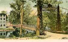
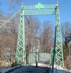
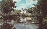
1889: Swing
Milford, New Hampshire, USA - Souhegan River
| Bridgemeister ID: | 293 (added before 2003) |
| Year Completed: | 1889 |
| Name: | Swing |
| Location: | Milford, New Hampshire, USA |
| Crossing: | Souhegan River |
| Coordinates: | 42.8366 N 71.645533 W |
| Maps: | Acme, GeoHack, Google, OpenStreetMap |
| Principals: | Berlin Iron Bridge Co. |
| Use: | Footbridge |
| Status: | In use (last checked: 2021) |
| Main Cables: | Wire (steel) |
| Suspended Spans: | 1 |
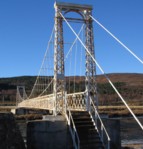
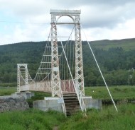
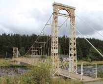
1892: Polhollick
Ballater vicinity, Aberdeenshire, Scotland, United Kingdom - River Dee
| Bridgemeister ID: | 1905 (added 2005-10-08) |
| Year Completed: | 1892 |
| Name: | Polhollick |
| Location: | Ballater vicinity, Aberdeenshire, Scotland, United Kingdom |
| Crossing: | River Dee |
| Coordinates: | 57.055048 N 3.083452 W |
| Maps: | Acme, GeoHack, Google, OpenStreetMap |
| Principals: | James Abernethy & Co. |
| References: | HARPER, HBR |
| Use: | Footbridge |
| Status: | In use (last checked: 2014) |
| Main Cables: | Wire (steel) |
| Suspended Spans: | 1 |
| Main Span: | 1 x 54.4 meters (178.5 feet) |
Notes:
- Closed May 2015 for repairs. Reopened October, 2015.
External Links:
- The Happy Pontist: Scottish Bridges: 19. Polhollick Suspension Bridge
- The Happy Pontist: Scottish Bridges: 44. Polhollick Bridge (revisited)
- Structurae - Structure ID 20021613
1904: Pomeroy's
Bainham, Golden Bay, New Zealand - Aorere River
| Bridgemeister ID: | 684 (added 2003-03-08) |
| Year Completed: | 1904 |
| Name: | Pomeroy's |
| Also Known As: | James's |
| Location: | Bainham, Golden Bay, New Zealand |
| Crossing: | Aorere River |
| References: | GAP |
Notes:
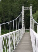
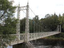
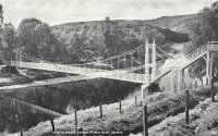
1905: Cambus O'May
Ballater, Scotland, United Kingdom - River Dee
| Bridgemeister ID: | 429 (added before 2003) |
| Year Completed: | 1905 |
| Name: | Cambus O'May |
| Also Known As: | Gordon |
| Location: | Ballater, Scotland, United Kingdom |
| Crossing: | River Dee |
| Coordinates: | 57.065803 N 2.956825 W |
| Maps: | Acme, GeoHack, Google, OpenStreetMap |
| Principals: | James Abernethy & Co. |
| References: | BC2, BC3, BEM, HARPER, HBR, NTB |
| Use: | Footbridge |
| Status: | In use (last checked: April, 2021) |
| Main Cables: | Wire (steel) |
| Suspended Spans: | 1 |
| Main Span: | 1 x 51.8 meters (170 feet) |
Notes:
- 1988: Refurbished (HBR)
- 2015, December: Damaged by the River Dee flood caused by Storm Frank. Closed indefinitely. Repairs expected to start in 2020.
- 2020, August 31: Repairs underway, expected to be completed in approximately 16 weeks.
- 2020, December: Storm Frank repairs now expected to be completed in January 2021.
- 2021, January: Completion of repairs delayed due to COVID-19 pandemic "stay at home" recommendations.
- 2021, April 1: Repairs completed, bridge reopened.
External Links:
- Cambus O' May | Harper Bridges
- The Happy Pontist: Scottish Bridges: 20. Cambus O'May Footbridge
- The Happy Pontist: Scottish Bridges: 43. Cambus O' May Bridge (revisited)
- The Happy Pontist: Scottish Bridges: 55. Cambus O'May Bridge (after the flood)
- Structurae - Structure ID 20019638

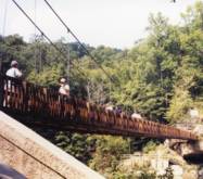
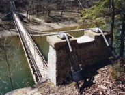
1918: Turkey Run State Park
Parke County, Indiana, USA - Sugar Creek
| Bridgemeister ID: | 269 (added before 2003) |
| Year Completed: | 1918 |
| Name: | Turkey Run State Park |
| Location: | Parke County, Indiana, USA |
| Crossing: | Sugar Creek |
| At or Near Feature: | Turkey Run State Park |
| Coordinates: | 39.88926 N 87.19948 W |
| Maps: | Acme, GeoHack, Google, OpenStreetMap |
| References: | IMB |
| Use: | Footbridge |
| Status: | In use (last checked: 2021) |
| Main Cables: | Wire (steel) |
| Suspended Spans: | 1 |
| Main Span: | 1 x 58.5 meters (192 feet) estimated |
Notes:
- IMB states, "The original bridge collapsed into Sugar Creek in 1917... the state's Department of Natural Resources promptly replaced the old with current structure."
- James Rader writes in 2008: "Three years ago flooding came up high enough to allow a couple of uprooted Sycamore trees to hit the bridge ripping out a large section of the wood railing and flooring from the middle of the bridge. Bridge was immediately closed. Structural analysis was completed and repairs were made including all new floor planks. Bridge is in great condition and should serve for many many more years to come."
External Links:
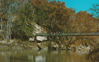
1924: Invercauld
Braemar vicinity, Scotland, United Kingdom - River Dee
| Bridgemeister ID: | 1906 (added 2005-10-08) |
| Year Completed: | 1924 |
| Name: | Invercauld |
| Also Known As: | Ballochbuie, Garbh Allt Shiel |
| Location: | Braemar vicinity, Scotland, United Kingdom |
| Crossing: | River Dee |
| Coordinates: | 57.001768 N 3.322743 W |
| Maps: | Acme, GeoHack, Google, OpenStreetMap |
| Principals: | James Abernethy & Co. |
| References: | HARPER, HBR |
| Use: | Footbridge |
| Status: | In use (last checked: 2014) |
| Main Cables: | Wire (steel) |
| Suspended Spans: | 1 |
External Links:
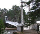
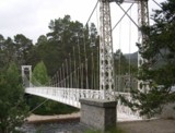
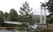
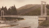
1924: Longmire
Packwood vicinity, Washington, USA - Nisqually River
| Bridgemeister ID: | 142 (added before 2003) |
| Year Completed: | 1924 |
| Name: | Longmire |
| Location: | Packwood vicinity, Washington, USA |
| Crossing: | Nisqually River |
| At or Near Feature: | Mt. Rainier National Park |
| Coordinates: | 46.74903 N 121.80777 W |
| Maps: | Acme, GeoHack, Google, OpenStreetMap |
| Principals: | James A. French |
| Use: | Vehicular (one-lane) and Pipeline |
| Status: | In use (last checked: 2006) |
| Main Cables: | Wire (steel) |
| Suspended Spans: | 1 |
| Main Span: | 1 x 55.8 meters (183 feet) estimated |
Notes:
- Reconstructed, 1950.
External Links:
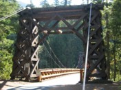
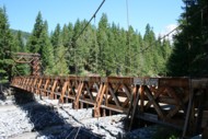
1924: Otowi
Otowi, New Mexico, USA - Rio Grande
| Bridgemeister ID: | 143 (added before 2003) |
| Year Completed: | 1924 |
| Name: | Otowi |
| Location: | Otowi, New Mexico, USA |
| Crossing: | Rio Grande |
| Coordinates: | 35.874725 N 106.141861 W |
| Maps: | Acme, GeoHack, Google, OpenStreetMap |
| Principals: | James A. French |
| References: | GBD |
| Use: | Vehicular |
| Status: | Extant (last checked: 2019) |
| Main Cables: | Wire (steel) |
| Suspended Spans: | 1 |
| Main Span: | 1 x 53 meters (174 feet) |
| Deck width: | 10 feet |
Notes:
- Bypassed, 1948.
External Links:

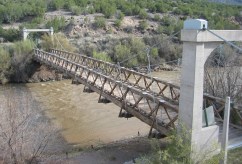
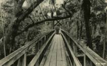
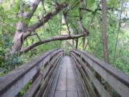
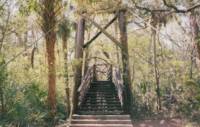
1936: (footbridge)
Hillsborough River State Park, Florida, USA - Hillsborough River
| Bridgemeister ID: | 285 (added before 2003) |
| Year Completed: | 1936 |
| Name: | (footbridge) |
| Location: | Hillsborough River State Park, Florida, USA |
| Crossing: | Hillsborough River |
| Coordinates: | 28.1499 N 82.23203 W |
| Maps: | Acme, GeoHack, Google, OpenStreetMap |
| Principals: | CCC |
| Use: | Footbridge |
| Status: | In use (last checked: 2004) |
| Main Cables: | Wire (steel) |
| Main Span: | 1 |
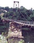
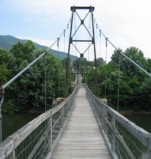
1938: James River
Buchanan, Virginia, USA - James River
| Bridgemeister ID: | 337 (added before 2003) |
| Year Completed: | 1938 |
| Name: | James River |
| Location: | Buchanan, Virginia, USA |
| Crossing: | James River |
| Coordinates: | 37.53038 N 79.67793 W |
| Maps: | Acme, GeoHack, Google, OpenStreetMap |
| Principals: | Virginia State Highway Department (now VDOT) |
| References: | RT20040413 |
| Use: | Footbridge |
| Status: | In use (last checked: 2022) |
| Main Cables: | Wire (steel) |
| Suspended Spans: | 2 |
| Main Span: | 1 |
| Side Span: | 1 |
Notes:
- This oddly-proportioned bridge has a long side-span on one side and no side-span on the other.
- Damaged by storm, November, 2003. Temporarily closed, February, 2004. Repaired and reopened March, 2004.
External Links:
1955: (footbridge)
Jersey Shore vicinity, Pennsylvania, USA - Pine Creek
| Bridgemeister ID: | 591 (added 2003-01-05) |
| Year Completed: | 1955 |
| Name: | (footbridge) |
| Location: | Jersey Shore vicinity, Pennsylvania, USA |
| Crossing: | Pine Creek |
| At or Near Feature: | Boy Scouts Camp Kline |
| Coordinates: | 41.273683 N 77.323883 W |
| Maps: | Acme, GeoHack, Google, OpenStreetMap |
| Principals: | Williamsport Technical Institute students |
| Use: | Footbridge |
| Status: | Destroyed, 1972 |
| Main Cables: | Wire |
Notes:
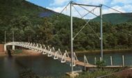
- The postcard (postmarked 1961) showing the bridge says, "The largest foot-suspension bridge in the East crosses Pine Creek at the Boy Scouts' Camp Kline, north of Jersey Shore, Pa. Built in 1955 by Williamsport Technical Institute students with materials donated by area industries. Valued over $25,000, the 409-foot span has concrete anchors and a 14-ton capacity. For 35 years previous, boats were used to reach the popular 360-acre camp-site, donated to the Scouts in 1920 by James N. Kline, a Williamsport merchant." It's doubtful this was anywhere close to being a 409-foot bridge.
- The message written on the postcard is amusing (though unrelated to the bridge): "Hi Mom and Dad, I had a fine time up here. I went on a boat trip Monday around the island. We got half way around and Tiny tiped [sic] his boat then we tiped ours. I didn't get to sleep until 2:00 Monday night. I am going to try to swim a mile today. I don't do nothing but lay in my bunk and listen to records. Ken."
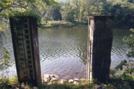
- Patrick O'Donnell is familiar with this area and notes that the bridge is gone, but the concrete footings are still visible. He suspects 1972's Hurricane Agnes brought down this bridge. Denny Keller confirms Patrick's suspicion with a firsthand account of Hurricane Agnes' impact on this bridge: "21 June 1972 is a date that I will never forget. I along with 340+ kids and adults were at Camp Kline during our yearly 4-H camp. I was the very last (along with the National Guard that performed the rescue) to leave and walk across the bridge that once stood at 11PM on the evening of June 21st. I along with two other senior 4-H counselors. I can remember the last trip across the bridge while mobile homes, trees, and all type of debris were floating down the creek and hitting the bridge underneath."
1988: (footbridge)
Dayton, Tennessee, USA - Richland Creek
| Bridgemeister ID: | 1263 (added 2004-03-13) |
| Year Completed: | 1988 |
| Name: | (footbridge) |
| Location: | Dayton, Tennessee, USA |
| Crossing: | Richland Creek |
| Coordinates: | 35.49 N 85.013667 W |
| Maps: | Acme, GeoHack, Google, OpenStreetMap |
| Use: | Footbridge |
| Status: | In use (last checked: 2006) |
| Main Cables: | Wire |
| Suspended Spans: | 1 |

1990: Vinton Swinging
Vinton, Ohio, USA - Raccoon Creek
| Bridgemeister ID: | 1190 (added 2004-01-25) |
| Year Completed: | 1990 |
| Name: | Vinton Swinging |
| Location: | Vinton, Ohio, USA |
| Crossing: | Raccoon Creek |
| At or Near Feature: | Vinton Community Park |
| Coordinates: | 38.977952 N 82.339157 W |
| Maps: | Acme, GeoHack, Google, OpenStreetMap |
| Principals: | James Baird, Carl DeWitt, Tony Werry, Mark Beaver, Kermit Brown |
| Use: | Footbridge |
| Status: | In use (last checked: 2005) |
| Main Cables: | Wire |
| Suspended Spans: | 1 |
2004: Liberty
Greenville, South Carolina, USA - Reedy River
| Bridgemeister ID: | 1524 (added 2004-10-16) |
| Year Completed: | 2004 |
| Name: | Liberty |
| Location: | Greenville, South Carolina, USA |
| Crossing: | Reedy River |
| At or Near Feature: | Falls Park |
| Coordinates: | 34.844568 N 82.401113 W |
| Maps: | Acme, GeoHack, Google, OpenStreetMap |
| Use: | Footbridge |
| Status: | In use (last checked: 2020) |
| Main Cables: | Wire (steel) |
Notes:
- Unconventional design with a curved deck that is only suspended along one edge.
- Similar to 1987 (footbridge) - Kelheim, Germany.
- Similar to 2003 Erzbahnschwinge - Bochum, Germany.
External Links:
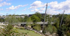
(footbridge)
Pughtown, Pennsylvania, USA - French Creek
| Bridgemeister ID: | 2450 (added 2008-06-22) |
| Name: | (footbridge) |
| Location: | Pughtown, Pennsylvania, USA |
| Crossing: | French Creek |
| At or Near Feature: | Camp Sankanac |
| Coordinates: | 40.15698 N 75.65073 W |
| Maps: | Acme, GeoHack, Google, OpenStreetMap |
| Use: | Footbridge |
| Status: | In use (last checked: 2004) |
| Main Cables: | Wire |
| Suspended Spans: | 1 |
Notes:
- James Boxmeyer writes: "I was involved in a small way in the bridge's construction... Here are a few details about the design. I think it was constructed in the late 1990's or maybe 2000-2001. The camp director said it was designed by people who are familiar with construction of similar bridges by Christian missionaries in other countries where resources are limited and suspension bridges are easier to construct. I used to work for an elevator company. I gave the cable to Camp Sankanac that they said would be used in the main suspension cables as well as the vertical cables that support the walking surface. I think they might have also used some of the cable I donated to hold up the walking surface, but have not seen the bridge in person, so cannot verify that. The main suspension cables had been used in an elevator. They are called traction steel 1/2 inch diameter hoist cables 8x19 construction with a fiber core. Tensile strength of each cable is about 14,500 pounds. The vertical cables are 3/8 inch (without a fiber core) and had been used in a construction hoist."
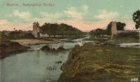
(suspension bridge)
Meerut, Uttar Pradesh, India
| Bridgemeister ID: | 7931 (added 2023-10-22) |
| Name: | (suspension bridge) |
| Location: | Meerut, Uttar Pradesh, India |
| Main Cables: | Rod (iron) |
| Suspended Spans: | 1 |
Notes:
- James Dredge patent bridge.
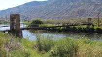
James Craig Bair Sheep Ranch
Dotsero vicinity, Colorado, USA - Colorado River
| Bridgemeister ID: | 822 (added 2003-05-31) |
| Name: | James Craig Bair Sheep Ranch |
| Location: | Dotsero vicinity, Colorado, USA |
| Crossing: | Colorado River |
| At or Near Feature: | Glenwood Canyon vicinity |
| Coordinates: | 39.64485 N 107.07813 W |
| Maps: | Acme, GeoHack, Google, OpenStreetMap |
| Use: | Footbridge and Stock |
| Status: | Extant (last checked: 2020) |
| Main Cables: | Wire (steel) |
| Suspended Spans: | 2 |
| Main Span: | 1 x 64 meters (210 feet) estimated |
| Side Span: | 1 x 16.5 meters (54 feet) estimated |
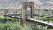
Swinging
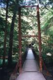
James Creek, Raystown Lake vicinity, Pennsylvania, USA - Trough Creek
| Bridgemeister ID: | 918 (added 2003-10-17) |
| Name: | Swinging |
| Location: | James Creek, Raystown Lake vicinity, Pennsylvania, USA |
| Crossing: | Trough Creek |
| At or Near Feature: | Trough Creek State Park |
| Coordinates: | 40.32213 N 78.13003 W |
| Maps: | Acme, GeoHack, Google, OpenStreetMap |
| Use: | Footbridge |
| Status: | In use (last checked: 2020) |
| Main Cables: | Wire |
| Suspended Spans: | 1 |
| Main Span: | 1 x 30.5 meters (100 feet) estimated |
Valparaiso Pier
Valparaiso, Chile
| Bridgemeister ID: | 6420 (added 2021-07-31) |
| Name: | Valparaiso Pier |
| Location: | Valparaiso, Chile |
| Principals: | Charles D. Young and Co., Frederick W. Etheredge |
| Use: | Footbridge |
| Status: | Destroyed, March, 1856 |
| Main Cables: | Rod (iron) |
| Suspended Spans: | 3 |
| Main Span: | 1 |
| Side Spans: | 2 |
Notes:
- Suspension pier based on James Dredge's patent.
- A large illustration of a suspension pier built based on Dredge's patent appears in Illustrated and Descriptive Catalogue of Machinery, Implements, Tools, Manufactured Articles, Raw Materials, etc.… published by Charles D. Young & Co. in the 1850s.
Annotated Citations:
- Lloyd, William. A Railway Pioneer Notes by a Civil Engineer in Europe and America from 1838 to 1888. London, Baines and Scarsbrook, 1900.
Mentions "In March of the same year [1856], a disastrous gale at Valparaiso drove several ships on shore, destroying a large iron suspension pier, erected by one of my Directors". This is very likely referring to the Dredge patent pier.
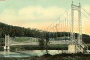
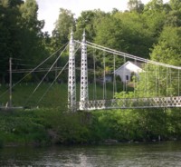
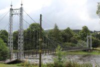
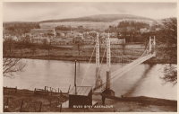
Victoria
Charlestown of Aberlour and Wester Elchies, Scotland, United Kingdom - River Spey
| Bridgemeister ID: | 781 (added 2003-03-16) |
| Name: | Victoria |
| Also Known As: | Penny, Aberlour |
| Location: | Charlestown of Aberlour and Wester Elchies, Scotland, United Kingdom |
| Crossing: | River Spey |
| Coordinates: | 57.47044 N 3.23173 W |
| Maps: | Acme, GeoHack, Google, OpenStreetMap |
| Principals: | James Abernethy & Co. "Abernethy Foundry" |
| References: | HARPER, HBR |
| Use: | Footbridge |
| Status: | In use (last checked: 2014) |
| Main Cables: | Wire (steel) |
| Suspended Spans: | 1 |
Notes:
- William Craig describes the bridge, "Built about 1900 by James Abernethy & Co. The pylons are tapered lattice girders with ball and spike finials and cross braced. Walkway is lattice girder hung from suspension cables."
- Near (footbridge) - Aberlour, Scotland, United Kingdom.
External Links:
