Suspension Bridges of England (101-116 of 116)
This is a list of bridges 101 through 116 (of 116 total) from the suspension bridge inventory for England in United Kingdom. Wherever you see a Bridgemeister ID number click it to isolate the bridge on its own page.
Related Lists:
(suspension bridge)
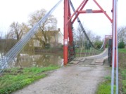
Ham, Somerset, England, United Kingdom - River Tone
| Bridgemeister ID: | 1467 (added 2004-08-28) |
| Name: | (suspension bridge) |
| Location: | Ham, Somerset, England, United Kingdom |
| Crossing: | River Tone |
| Coordinates: | 51.022483 N 3.014533 W |
| Maps: | Acme, GeoHack, Google, OpenStreetMap |
| Use: | Vehicular (one-lane) |
| Status: | In use (last checked: 2007) |
| Main Cables: | Wire (steel) |
| Suspended Spans: | 1 |
(suspension bridge)
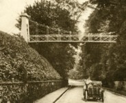
Painshill, Cobham, England, United Kingdom
| Bridgemeister ID: | 1489 (added 2004-09-11) |
| Name: | (suspension bridge) |
| Location: | Painshill, Cobham, England, United Kingdom |
| Status: | Removed |
| Suspended Spans: | 1 |
External Links:
- Painshill. Constructed prior to 1863 by Bramah and Sons. Believed to have been removed by the mid-1900s.
Alnwick Castle
Alnwick, England, United Kingdom
| Bridgemeister ID: | 2045 (added 2006-05-10) |
| Name: | Alnwick Castle |
| Location: | Alnwick, England, United Kingdom |
| At or Near Feature: | Alnwick Garden |
| Coordinates: | 55.414198 N 1.697342 W |
| Maps: | Acme, GeoHack, Google, OpenStreetMap |
| Use: | Footbridge |
| Status: | In use (last checked: 2017) |
| Main Cables: | Rope |
| Suspended Spans: | 1 |
Notes:
- Level rope footbridge. One of two at this location.
- Next to Alnwick Castle - Alnwick, England, United Kingdom.
External Links:
Alnwick Castle
Alnwick, England, United Kingdom
| Bridgemeister ID: | 3093 (added 2019-10-27) |
| Name: | Alnwick Castle |
| Location: | Alnwick, England, United Kingdom |
| At or Near Feature: | Alnwick Garden |
| Coordinates: | 55.414414 N 1.697201 W |
| Maps: | Acme, GeoHack, Google, OpenStreetMap |
| Use: | Footbridge |
| Status: | In use (last checked: 2017) |
| Main Cables: | Rope |
| Suspended Spans: | 1 |
Notes:
- One of two level rope footbridges at this location.
- Next to Alnwick Castle - Alnwick, England, United Kingdom.
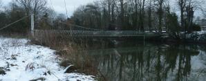
Canford
Wimborne vicinity, Dorset, England, United Kingdom - River Stour
| Bridgemeister ID: | 1126 (added 2004-01-11) |
| Name: | Canford |
| Location: | Wimborne vicinity, Dorset, England, United Kingdom |
| Crossing: | River Stour |
| Coordinates: | 50.78916 N 1.95831 W |
| Maps: | Acme, GeoHack, Google, OpenStreetMap |
| Use: | Footbridge |
| Status: | In use (last checked: 2022) |
| Main Cables: | Wire |
| Suspended Spans: | 1 |
Chain
Bampton, England, United Kingdom - River Exe
| Bridgemeister ID: | 2660 (added 2019-03-09) |
| Name: | Chain |
| Location: | Bampton, England, United Kingdom |
| Crossing: | River Exe |
| Coordinates: | 50.977313 N 3.512944 W |
| Maps: | Acme, GeoHack, Google, OpenStreetMap |
| Use: | Vehicular (one-lane) |
| Status: | In use (last checked: 2019) |
| Main Cables: | Eyebar |
| Suspended Spans: | 1 |
Notes:
- Short one-lane suspension bridge apparently on private property near gate house for Stuckeridge House. Visible from route A396.
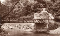
Coronation
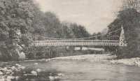
Stanhope, Durham, England, United Kingdom - River Wear
| Bridgemeister ID: | 6235 (added 2021-07-17) |
| Name: | Coronation |
| Location: | Stanhope, Durham, England, United Kingdom |
| Crossing: | River Wear |
| Use: | Footbridge |
| Suspended Spans: | 1 |
External Links:
Foy
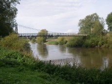
Foy, England, United Kingdom - River Wye
| Bridgemeister ID: | 1209 (added 2004-02-07) |
| Name: | Foy |
| Location: | Foy, England, United Kingdom |
| Crossing: | River Wye |
| Coordinates: | 51.952822 N 2.576809 W |
| Maps: | Acme, GeoHack, Google, OpenStreetMap |
| Principals: | David Rowell & Co. |
| Use: | Footbridge |
| Status: | In use (last checked: 2022) |
| Main Cables: | Wire (steel) |
| Suspended Spans: | 1 |
| Main Span: | 1 |
Gott's
Burley and Armley, England, United Kingdom - River Aire
| Bridgemeister ID: | 1194 (added 2004-01-26) |
| Name: | Gott's |
| Location: | Burley and Armley, England, United Kingdom |
| Crossing: | River Aire |
| Use: | Footbridge |
| Status: | Only towers remain (last checked: 2007) |
| Suspended Spans: | 1 |
Notes:
- In vicinity of Burley Mills. In use until 1954. Named for Benjamin Gott. Towers remain, but bridge does not.
- Similar to (footbridge) - Esholt, Apperley Bridge vicinity, England, United Kingdom.
North Stoke
North Stoke, England, United Kingdom - River Arun
| Bridgemeister ID: | 1643 (added 2005-03-18) |
| Name: | North Stoke |
| Location: | North Stoke, England, United Kingdom |
| Crossing: | River Arun |
| Coordinates: | 50.88455 N 0.546417 W |
| Maps: | Acme, GeoHack, Google, OpenStreetMap |
| Use: | Footbridge |
| Status: | In use (last checked: 2021) |
| Main Cables: | Wire (steel) |
Notes:
- Crosses a former channel of the River Arun.
- Damaged by falling tree, 2008. Repaired, 2009.
North York Moors Railway
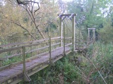
Grosmont, North Yorkshire, England, United Kingdom - Murk Esk
| Bridgemeister ID: | 2585 (added 2013-11-03) |
| Name: | North York Moors Railway |
| Location: | Grosmont, North Yorkshire, England, United Kingdom |
| Crossing: | Murk Esk |
| Coordinates: | 54.435413 N 0.724709 W |
| Maps: | Acme, GeoHack, Google, OpenStreetMap |
| Use: | Footbridge |
| Status: | In use (last checked: 2012) |
| Suspended Spans: | 1 |
Notes:
- A large steel girder can be seen under the bridge, circa 2012. Unclear if suspension elements are still supporting this bridge. Dave Cooper writes: "It is located over what used to be the trackbed for an early railway track alignment. The girders below the bridge may have carried the trackbed."
External Links:
- British Listed Buildings. Indicates it was built c. 1875.
Sparke Evans Park
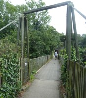
St. Philips, England, United Kingdom - River Avon
| Bridgemeister ID: | 2506 (added 2009-03-27) |
| Name: | Sparke Evans Park |
| Location: | St. Philips, England, United Kingdom |
| Crossing: | River Avon |
| Coordinates: | 51.44485 N 2.56314 W |
| Maps: | Acme, GeoHack, Google, OpenStreetMap |
| Principals: | David Rowell & Co. |
| Use: | Footbridge |
| Status: | In use (last checked: 2013) |
| Main Cables: | Wire (steel) |
| Suspended Spans: | 1 |
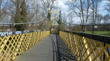
Swing
Braystones, England, United Kingdom - River Ehen
| Bridgemeister ID: | 1911 (added 2005-10-08) |
| Name: | Swing |
| Location: | Braystones, England, United Kingdom |
| Crossing: | River Ehen |
| Coordinates: | 54.435983 N 3.522433 W |
| Maps: | Acme, GeoHack, Google, OpenStreetMap |
| Use: | Footbridge |
| Status: | In use |
| Main Cables: | Wire |
Swing
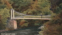
Cotherstone, England, United Kingdom - River Tees
| Bridgemeister ID: | 6516 (added 2021-08-27) |
| Name: | Swing |
| Location: | Cotherstone, England, United Kingdom |
| Crossing: | River Tees |
| Coordinates: | 54.577025 N 1.981017 W |
| Maps: | Acme, GeoHack, Google, OpenStreetMap |
| Use: | Footbridge |
| Status: | Collapsed, 1929 |
| Main Span: | 1 |
Notes:
- Replaced a bridge that was damaged by flood in 1881.
External Links:
- Cotherstone Footbridge. "...the second bridge [at this location] was a suspension bridge whose cable snapped in 1929 with 40 people on the bridge, killing one."
Whitchurch
Whitchurch, England, United Kingdom
| Bridgemeister ID: | 4618 (added 2020-06-07) |
| Name: | Whitchurch |
| Location: | Whitchurch, England, United Kingdom |
| Coordinates: | 52.970522 N 2.671135 W |
| Maps: | Acme, GeoHack, Google, OpenStreetMap |
| Use: | Footbridge |
| Status: | In use (last checked: 2019) |
| Main Cables: | Eyebar (iron) |
| Suspended Spans: | 3 |
| Main Span: | 1 x 36.4 meters (119.4 feet) estimated |
| Side Spans: | 2 |
Notes:
- Believed to be built circa 1872.
External Links:
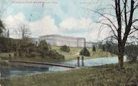
Wynyard Hall
Stockton-on-Tees, England, United Kingdom
| Bridgemeister ID: | 7963 (added 2023-11-23) |
| Name: | Wynyard Hall |
| Location: | Stockton-on-Tees, England, United Kingdom |
| At or Near Feature: | Wynyard Hall |
| Coordinates: | 54.625667 N 1.353194 W |
| Maps: | Acme, GeoHack, Google, OpenStreetMap |
| Use: | Footbridge |
| Status: | Removed |
| Suspended Spans: | 1 |
Do you have any information or photos for these bridges that you would like to share? Please email david.denenberg@bridgemeister.com.