Suspension Bridges of Métropole De Lyon
This is a list of all 26 bridges from the suspension bridge inventory for Métropole De Lyon in France. Wherever you see a Bridgemeister ID number click it to isolate the bridge on its own page.
Related Lists:
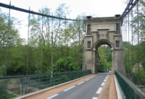
1827: L'île Barbe
Lyon, Métropole de Lyon, France - Saône River
| Bridgemeister ID: | 1535 (added 2004-10-31) |
| Year Completed: | 1827 |
| Name: | L'île Barbe |
| Location: | Lyon, Métropole de Lyon, France |
| Crossing: | Saône River |
| Coordinates: | 45.796883 N 4.83055 E |
| Maps: | Acme, GeoHack, Google, OpenStreetMap |
| Principals: | Favier |
| References: | AAJ, PQL, PTS2 |
| Use: | Vehicular (one-lane) |
| Status: | In use (last checked: 2005) |
| Main Cables: | Chain (iron) |
| Suspended Spans: | 2 |
| Main Spans: | 2 x 10² meters (334.66 feet) |
Notes:
- Originally built with iron chains. Later replaced with iron wire.
- Near 1831 Masaryk (Masarik, Mazarik, de la Gare) - Lyon vicinity, Métropole de Lyon, France.
External Links:
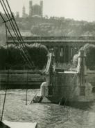
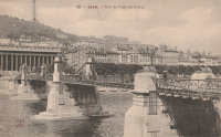
1829: Palais de Justice
Lyon, Métropole de Lyon, France - Saône River
| Bridgemeister ID: | 546 (added before 2003) |
| Year Completed: | 1829 |
| Name: | Palais de Justice |
| Location: | Lyon, Métropole de Lyon, France |
| Crossing: | Saône River |
| Principals: | Seguin Brothers |
| References: | PQL |
| Use: | Vehicular |
| Status: | Replaced, 1972 |
| Main Cables: | Wire (iron) |
Notes:
- Damaged by flood, 1840. Rebuilt. Bombed, 1944. Repaired, 1945. Location now occupied by a cable-stayed footbridge, completed 1986.
External Links:
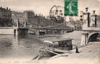
1831: La Feuillée
Lyon, Métropole de Lyon, France - Saône River
| Bridgemeister ID: | 1520 (added 2004-10-10) |
| Year Completed: | 1831 |
| Name: | La Feuillée |
| Location: | Lyon, Métropole de Lyon, France |
| Crossing: | Saône River |
| Coordinates: | 45.766642 N 4.829746 E |
| Maps: | Acme, GeoHack, Google, OpenStreetMap |
| References: | PQL |
| Use: | Vehicular, with walkway |
| Status: | Demolished, 1910 |
| Main Cables: | Wire (iron) |
| Suspended Spans: | 1 |
| Main Span: | 1 x 67 meters (219.8 feet) estimated |
| Deck width: | 7 meters |
Notes:
- Damaged by flood 1840, repaired 1841.
- Near 1832 Saint-Vincent - Lyon, Métropole de Lyon, France.
- Replaced by 1910 La Feuillée - Lyon, Métropole de Lyon, France.
External Links:
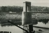
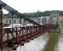
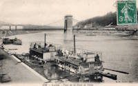
1831: Masaryk
Lyon vicinity, Métropole de Lyon, France - Saône River
| Bridgemeister ID: | 543 (added before 2003) |
| Year Completed: | 1831 |
| Name: | Masaryk |
| Also Known As: | Masarik, Mazarik, de la Gare |
| Location: | Lyon vicinity, Métropole de Lyon, France |
| Crossing: | Saône River |
| Coordinates: | 45.778267 N 4.809017 E |
| Maps: | Acme, GeoHack, Google, OpenStreetMap |
| References: | PQL |
| Use: | Vehicular (one-lane), with walkway |
| Status: | Restricted to foot traffic (last checked: 2022) |
| Main Cables: | Wire (iron) |
| Suspended Spans: | 2 |
| Main Spans: | 2 x 85.2 meters (279.5 feet) |
| Deck width: | 6.5 meters |
Notes:
- Bombed, 1944. Reopened 1945, but not fully restored until 1946.
- This bridge has been referenced by many spellings of "Masaryk", but the sign posted at the actual bridge reads "Masaryk".
- Next to 1844 Mouton - Lyon, Métropole de Lyon, France.
- Near 1827 L'île Barbe - Lyon, Métropole de Lyon, France.
External Links:
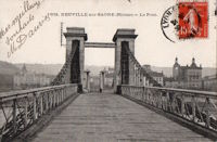
1832: Neuville-sur-Saône
Neuville-sur-Saône and Albigny-sur-Saône, Métropole de Lyon, France - Saône River
| Bridgemeister ID: | 1737 (added 2005-04-19) |
| Year Completed: | 1832 |
| Name: | Neuville-sur-Saône |
| Location: | Neuville-sur-Saône and Albigny-sur-Saône, Métropole de Lyon, France |
| Crossing: | Saône River |
| Coordinates: | 45.876840 N 4.836934 E |
| Maps: | Acme, GeoHack, Google, OpenStreetMap |
| Use: | Vehicular |
| Status: | Removed, 1934 |
| Suspended Spans: | 2 |
| Main Spans: | 2 |
External Links:
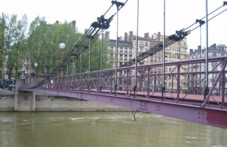
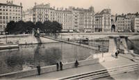
1832: Saint-Vincent
Lyon, Métropole de Lyon, France - Saône River
| Bridgemeister ID: | 1098 (added 2004-01-02) |
| Year Completed: | 1832 |
| Name: | Saint-Vincent |
| Location: | Lyon, Métropole de Lyon, France |
| Crossing: | Saône River |
| Coordinates: | 45.767583 N 4.827983 E |
| Maps: | Acme, GeoHack, Google, OpenStreetMap |
| References: | PQL |
| Use: | Footbridge |
| Status: | In use (last checked: 2022) |
| Main Cables: | Wire (iron) |
| Suspended Spans: | 1 |
Notes:
- Damaged by flood, 1840.
- Bridge appears to currently be suspended from a combination of wire rope and rigid rods.
- Near 1831 La Feuillée - Lyon, Métropole de Lyon, France.
External Links:
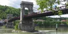
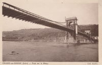
1835: Chasse
Chasse-sur-Rhône, Isère and Givors, Métropole De Lyon, France - Rhône River
| Bridgemeister ID: | 980 (added 2003-11-15) |
| Year Completed: | 1835 |
| Name: | Chasse |
| Also Known As: | Givors |
| Location: | Chasse-sur-Rhône, Isère and Givors, Métropole De Lyon, France |
| Crossing: | Rhône River |
| Coordinates: | 45.581666 N 4.780083 E |
| Maps: | Acme, GeoHack, Google, OpenStreetMap |
| References: | AAJ |
| Use: | Vehicular (one-lane) |
| Status: | In use (last checked: 2005) |
| Main Cables: | Wire (iron) |
| Suspended Spans: | 3 |
| Main Span: | 1 |
| Side Spans: | 2 |
Notes:
- Cables and deck appear to have been replaced (at least once).
- AAJ describes an accident in 1836: "...some of the iron-work, which was faulty, gave way and the platform fell into the river. Six persons were drowned."
External Links:
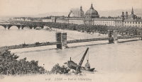
1839: L'Hôtel Dieu
Lyon, Métropole de Lyon, France - Rhône River
| Bridgemeister ID: | 966 (added 2003-11-01) |
| Year Completed: | 1839 |
| Name: | L'Hôtel Dieu |
| Location: | Lyon, Métropole de Lyon, France |
| Crossing: | Rhône River |
| Principals: | Clauzel |
| References: | AAJ, PQL |
| Use: | Vehicular |
| Status: | Demolished, 1912 |
| Main Cables: | Wire (iron) |
Notes:
- Was at location of present-day Pont Wilson.
- Rebuilt, 1850.
- Near 1845 College (Collège) - Lyon, Métropole de Lyon, France.
External Links:
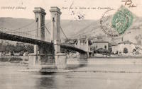
1840: Couzon
Couzon-au-Mont-d'Or and Rochetaillée-sur-Saône, Métropole de Lyon, France - Saône River
| Bridgemeister ID: | 1830 (added 2005-05-30) |
| Year Completed: | 1840 |
| Name: | Couzon |
| Location: | Couzon-au-Mont-d'Or and Rochetaillée-sur-Saône, Métropole de Lyon, France |
| Crossing: | Saône River |
| Coordinates: | 45.84503 N 4.83355 E |
| Maps: | Acme, GeoHack, Google, OpenStreetMap |
| Use: | Vehicular |
| Status: | In use (last checked: 2019) |
| Main Cables: | Wire |
| Suspended Spans: | 2 |
| Main Spans: | 2 |
External Links:
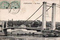
1842: Fontaines-sur-Saône
Fontaines-sur-Saône, Métropole de Lyon, France - Saône River
| Bridgemeister ID: | 1987 (added 2005-12-02) |
| Year Completed: | 1842 |
| Name: | Fontaines-sur-Saône |
| Location: | Fontaines-sur-Saône, Métropole de Lyon, France |
| Crossing: | Saône River |
| Use: | Vehicular (one-lane) |
| Status: | Removed |
| Main Cables: | Wire (iron) |
| Suspended Spans: | 1 |
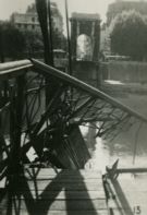
1844: Mouton
Lyon, Métropole de Lyon, France - Saône River
| Bridgemeister ID: | 544 (added before 2003) |
| Year Completed: | 1844 |
| Name: | Mouton |
| Location: | Lyon, Métropole de Lyon, France |
| Crossing: | Saône River |
| Coordinates: | 45.774187 N 4.810129 E |
| Maps: | Acme, GeoHack, Google, OpenStreetMap |
| References: | PQL |
| Use: | Vehicular (one-lane) |
| Status: | Replaced, 1952 |
| Main Cables: | Wire (iron) |
| Suspended Spans: | 1 |
Notes:
- Bombed, 1944. Rebuilt, 1946. Was located at the site of the current Pont Georges Clemenceau
- Next to 1831 Masaryk (Masarik, Mazarik, de la Gare) - Lyon vicinity, Métropole de Lyon, France.
External Links:
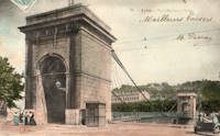
1845: College
Lyon, Métropole de Lyon, France - Rhône River
| Bridgemeister ID: | 1021 (added 2003-11-22) |
| Year Completed: | 1845 |
| Name: | College |
| Also Known As: | Collège |
| Location: | Lyon, Métropole de Lyon, France |
| Crossing: | Rhône River |
| Coordinates: | 45.765483 N 4.838717 E |
| Maps: | Acme, GeoHack, Google, OpenStreetMap |
| References: | BPF, PQL |
| Use: | Footbridge |
| Status: | Destroyed, 1944 |
| Main Cables: | Wire (iron) |
| Suspended Spans: | 3 |
| Main Span: | 1 |
| Side Spans: | 2 |
Notes:
- Destroyed 1944.
- Near 1839 L'Hôtel Dieu - Lyon, Métropole de Lyon, France.
- Near 1846 Saint Clair (Louis Philippe, Vaïsse) - Lyon, Métropole de Lyon, France.
- Replaced by 1945 College (Collège) - Lyon, Métropole de Lyon, France.
External Links:
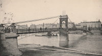
1846: Saint Clair
Lyon, Métropole de Lyon, France - Rhône River
| Bridgemeister ID: | 551 (added before 2003) |
| Year Completed: | 1846 |
| Name: | Saint Clair |
| Also Known As: | Louis Philippe, Vaïsse |
| Location: | Lyon, Métropole de Lyon, France |
| Crossing: | Rhône River |
| References: | AAJ, PQL |
| Use: | Vehicular |
| Status: | Demolished, 1953 |
| Main Cables: | Wire (iron) |
| Suspended Spans: | 2 |
| Deck width: | 7 meters |
Notes:
- Damaged by drifting boat, 1854. Rebuilt, 1856. Bombed, 1944. Rebuilt, 1946. Demolished, 1953.
- Crossed at present-day location of Pont Maréchal de Lattre de Tassigny.
- Originally constructed with two suspended spans. When it was rebuilt in 1856, towers were added increasing the number of suspended spans to six.
- Near 1845 College (Collège) - Lyon, Métropole de Lyon, France.
External Links:

1849: Galliéni
Lyon, Métropole de Lyon, France - Rhône River
| Bridgemeister ID: | 1164 (added 2004-01-19) |
| Year Completed: | 1849 |
| Name: | Galliéni |
| Also Known As: | Napoleon |
| Location: | Lyon, Métropole de Lyon, France |
| Crossing: | Rhône River |
| Principals: | Seguin Brothers |
| References: | PQL, PTS2 |
| Use: | Vehicular |
| Status: | Replaced |
| Main Cables: | Wire (iron) |
| Suspended Spans: | 3 |
| Main Span: | 1 x 60 meters (196.9 feet) |
| Side Spans: | 1 x 39 meters (128 feet), 1 x 67 meters (219.8 feet) |
| Deck width: | 7.4 meters |
Notes:
- Replaced by an arch bridge in the early 20th century. Built as part of the same project as the Kitchener-Marchand bridge; they were on the same alignment, with one crossing the Saône and the other the Rhône. Both were originally known as the Napoleon bridges.
- Companion to 1849 Kitchener-Marchand (Napoleon, Kitchener, Midi) - Lyon, Métropole de Lyon, France.
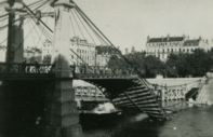
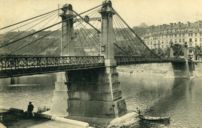
1849: Kitchener-Marchand
Lyon, Métropole de Lyon, France - Saône River
| Bridgemeister ID: | 540 (added before 2003) |
| Year Completed: | 1849 |
| Name: | Kitchener-Marchand |
| Also Known As: | Napoleon, Kitchener, Midi |
| Location: | Lyon, Métropole de Lyon, France |
| Crossing: | Saône River |
| Coordinates: | 45.751418 N 4.822519 E |
| Maps: | Acme, GeoHack, Google, OpenStreetMap |
| Principals: | Ferdinand Seguin |
| References: | PQL |
| Use: | Vehicular |
| Status: | Replaced, 1950's |
| Main Cables: | Wire (iron) |
| Main Span: | 1 x 82.1 meters (269.22 feet) |
Notes:
- Refurbished, 1888. Bombed, 1944. Rebuilt. Replaced, 1950-1959.
- Companion to 1849 Galliéni (Napoleon) - Lyon, Métropole de Lyon, France.
External Links:
1851: Trévoux
Trévoux, Ain and Quincieux, Métropole de Lyon, France - Saône River
| Bridgemeister ID: | 1625 (added 2005-02-27) |
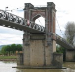
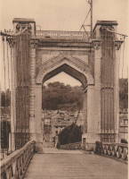
| Year Completed: | 1851 |
| Name: | Trévoux |
| Location: | Trévoux, Ain and Quincieux, Métropole de Lyon, France |
| Crossing: | Saône River |
| Coordinates: | 45.93945 N 4.772417 E |
| Maps: | Acme, GeoHack, Google, OpenStreetMap |
| Use: | Vehicular (one-lane) |
| Status: | Restricted to foot traffic (last checked: 2020) |
| Main Cables: | Wire (iron) |
| Suspended Spans: | 2 |
| Main Spans: | 2 |
Notes:
- Partially dismantled, 1982. Restored as a footbridge, 1985.
External Links:
1853: Saint-Georges
Lyon, Métropole de Lyon, France - Saône River
| Bridgemeister ID: | 552 (added before 2003) |
| Year Completed: | 1853 |
| Name: | Saint-Georges |
| Also Known As: | Sala |
| Location: | Lyon, Métropole de Lyon, France |
| Crossing: | Saône River |
| Coordinates: | 45.757117 N 4.82615 E |
| Maps: | Acme, GeoHack, Google, OpenStreetMap |
| References: | AAJ, BPF, PQL |
| Use: | Footbridge |
| Status: | In use (last checked: 2022) |
| Main Cables: | Wire (iron) |
| Suspended Spans: | 1 |
| Main Span: | 1 x 75 meters (246.1 feet) |
Notes:
- Destroyed 1944, rebuilt same year. Reconstructed 1999.
External Links:
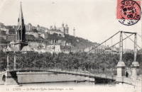
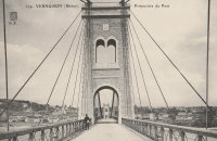
1902: Vernaison
Vernaison, Métropole de Lyon, France - Rhône River
| Bridgemeister ID: | 6431 (added 2021-08-11) |
| Year Completed: | 1902 |
| Name: | Vernaison |
| Location: | Vernaison, Métropole de Lyon, France |
| Crossing: | Rhône River |
| Coordinates: | 45.646369 N 4.815423 E |
| Maps: | Acme, GeoHack, Google, OpenStreetMap |
| Principals: | Ferdinand Arnodin |
| References: | AAJ, PTS2 |
| Use: | Vehicular |
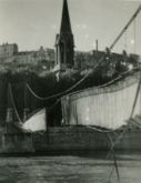
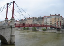
| Status: | Destroyed, June 1940 |
| Main Cables: | Wire (steel) |
Notes:
- Later at same location 1959 Vernaison - Vernaison and Solaize, Métropole de Lyon, France.
External Links:
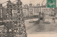
1910: La Feuillée
Lyon, Métropole de Lyon, France - Saône River
| Bridgemeister ID: | 6424 (added 2021-08-10) |
| Year Completed: | 1910 |
| Name: | La Feuillée |
| Location: | Lyon, Métropole de Lyon, France |
| Crossing: | Saône River |
| Coordinates: | 45.766389 N 4.829081 E |
| Maps: | Acme, GeoHack, Google, OpenStreetMap |
| References: | PQL |
| Use: | Footbridge |
| Status: | Destroyed, 1944 |
| Main Cables: | Wire (steel) |
| Suspended Spans: | 1 |
Notes:
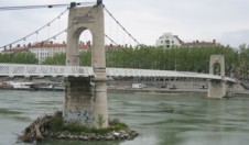
1945: College
Lyon, Métropole de Lyon, France - Rhône River
| Bridgemeister ID: | 6423 (added 2021-08-09) |
| Year Completed: | 1945 |
| Name: | College |
| Also Known As: | Collège |
| Location: | Lyon, Métropole de Lyon, France |
| Crossing: | Rhône River |
| Coordinates: | 45.765661 N 4.840563 E |
| Maps: | Acme, GeoHack, Google, OpenStreetMap |
| References: | BPF, PQL |
| Use: | Footbridge |
| Status: | In use (last checked: 2021) |
| Main Cables: | Wire (steel) |
| Suspended Spans: | 3 |
| Main Span: | 1 x 109.7 meters (359.9 feet) |
| Side Spans: | 2 |
Notes:
1950: (suspension bridge)
Saint-Germain-au-Mont-d'Or, Métropole de Lyon, France
| Bridgemeister ID: | 3214 (added 2019-11-11) |
| Year Completed: | 1950 |
| Name: | (suspension bridge) |
| Location: | Saint-Germain-au-Mont-d'Or, Métropole de Lyon, France |
| Coordinates: | 45.898758 N 4.794597 E |
| Maps: | Acme, GeoHack, Google, OpenStreetMap |
| Use: | Vehicular (two-lane) |
| Status: | In use (last checked: 2011) |
| Main Cables: | Wire (steel) |
| Suspended Spans: | 3 |
| Main Span: | 1 |
| Side Spans: | 2 |
External Links:
1959: Vernaison
Vernaison and Solaize, Métropole de Lyon, France - Rhône River
| Bridgemeister ID: | 1832 (added 2005-05-30) |
| Year Completed: | 1959 |
| Name: | Vernaison |
| Location: | Vernaison and Solaize, Métropole de Lyon, France |
| Crossing: | Rhône River |
| Coordinates: | 45.645621 N 4.816518 E |
| Maps: | Acme, GeoHack, Google, OpenStreetMap |
| Use: | Vehicular (two-lane) |
| Status: | In use (last checked: 2019) |
| Main Cables: | Wire (steel) |
| Suspended Spans: | 3 |
| Main Span: | 1 |
| Side Spans: | 2 |
Notes:
- At former location of 1902 Vernaison - Vernaison, Métropole de Lyon, France.
- Connects to Solaize - Solaize and Vernaison, Métropole de Lyon, France.
External Links:
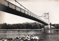
2013: Nelson Mandela
Décines-Charpieu, Métropole de Lyon, France - Jonage Canal
| Bridgemeister ID: | 4918 (added 2020-07-26) |
| Year Completed: | 2013 |
| Name: | Nelson Mandela |
| Location: | Décines-Charpieu, Métropole de Lyon, France |
| Crossing: | Jonage Canal |
| At or Near Feature: | Réservoir du Grand-Large |
| Coordinates: | 45.775461 N 4.953934 E |
| Maps: | Acme, GeoHack, Google, OpenStreetMap |
| Use: | Footbridge |
| Status: | In use (last checked: 2020) |
| Main Cables: | Wire (steel) |
| Suspended Spans: | 2 |
| Side Spans: | 2 |
External Links:
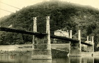
Collonges
Collonges-au-Mont-d'Or, Métropole de Lyon, France - Saône River
| Bridgemeister ID: | 2964 (added 2019-10-10) |
| Name: | Collonges |
| Location: | Collonges-au-Mont-d'Or, Métropole de Lyon, France |
| Crossing: | Saône River |
| Use: | Vehicular |
| Status: | Destroyed, September 2, 1944 |
| Main Cables: | Wire |
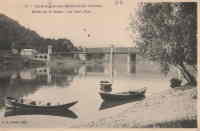
Feyzin
Feyzin, Métropole de Lyon, France - Rhône Canal
| Bridgemeister ID: | 6430 (added 2021-08-11) |
| Name: | Feyzin |
| Location: | Feyzin, Métropole de Lyon, France |
| Crossing: | Rhône Canal |
| Coordinates: | 45.666664 N 4.837612 E |
| Maps: | Acme, GeoHack, Google, OpenStreetMap |
| Use: | Vehicular (two-lane) |
| Status: | In use (last checked: 2019) |
| Main Cables: | Wire (steel) |
| Suspended Spans: | 1 |
Solaize
Solaize and Vernaison, Métropole de Lyon, France - Rhône Canal
| Bridgemeister ID: | 1831 (added 2005-05-30) |
| Name: | Solaize |
| Location: | Solaize and Vernaison, Métropole de Lyon, France |
| Crossing: | Rhône Canal |
| Coordinates: | 45.643584 N 4.824690 E |
| Maps: | Acme, GeoHack, Google, OpenStreetMap |
| Use: | Vehicular (two-lane) |
| Status: | In use (last checked: 2019) |
| Main Cables: | Wire (steel) |
| Suspended Spans: | 1 |
Notes:
External Links:
Do you have any information or photos for these bridges that you would like to share? Please email david.denenberg@bridgemeister.com.