Suspension Bridges of USA (701-800 of 1,437)
This is a list of bridges 701 through 800 (of 1,437 total) from the suspension bridge inventory for the country USA . Wherever you see a Bridgemeister ID number click it to isolate the bridge on its own page.
Related Lists:
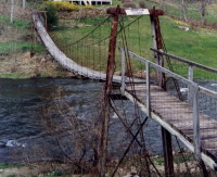
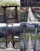
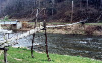
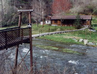
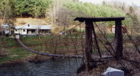
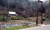
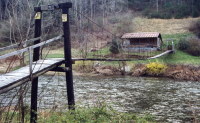
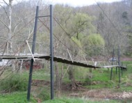
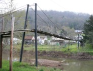
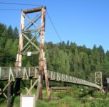
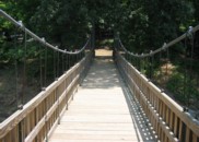
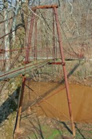
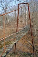
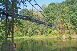
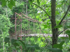
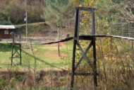
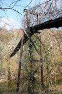
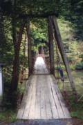
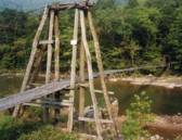
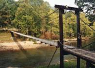
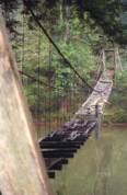
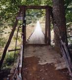
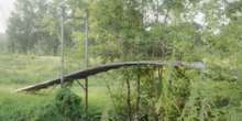
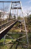
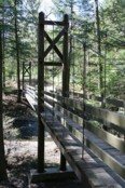
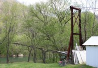
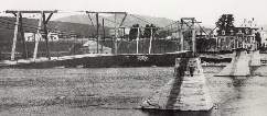
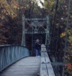
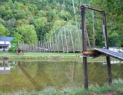
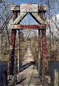
Bridgemeister ID: 4383 (added 2020-04-12)Name: (footbridge) Location: Burnsville vicinity, North Carolina , USA Crossing: Cane River Use: Footbridge Status: In use (last checked: 2003) Main Cables: Wire Main Span: 1
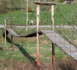
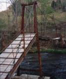
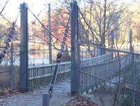
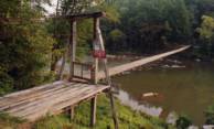
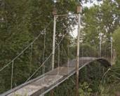
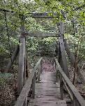
Bridgemeister ID: 4384 (added 2020-04-12)Name: (footbridge) Location: Burnsville vicinity, North Carolina , USA Crossing: Cane River Use: Footbridge Status: In use (last checked: 2003) Main Cables: Wire Main Span: 1
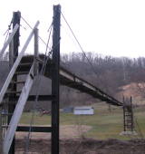
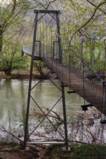
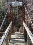
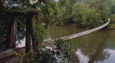
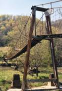
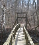
Bridgemeister ID: 4385 (added 2020-04-12)Name: (footbridge) Location: Burnsville vicinity, North Carolina , USA Crossing: Cane River Use: Footbridge Status: In use (last checked: 2003) Main Cables: Wire Main Span: 1
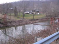
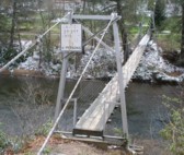
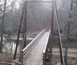
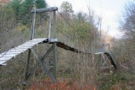
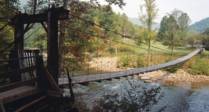
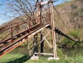
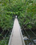
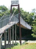
Bridgemeister ID: 4386 (added 2020-04-12)Name: (footbridge) Location: Burnsville vicinity, North Carolina , USA Crossing: Cane River Use: Footbridge Status: In use (last checked: 2003) Main Cables: Wire Suspended Spans: 1
Bridgemeister ID: 4387 (added 2020-04-12)Name: (footbridge) Location: Burnsville vicinity, North Carolina , USA Crossing: Cane River Use: Footbridge Status: In use (last checked: 2003) Main Cables: Wire Suspended Spans: 1
Bridgemeister ID: 4388 (added 2020-04-12)Name: (footbridge) Location: Burnsville vicinity, North Carolina , USA Crossing: Cane River Use: Footbridge Status: In use (last checked: 2003) Main Cables: Wire Suspended Spans: 1
Bridgemeister ID: 2408 (added 2007-12-24)Name: (footbridge) Location: Burnt Ranch vicinity, California , USA Crossing: Trinity River At or Near Feature: Six Rivers National Forest Use: Footbridge Status: Removed Main Cables: Wire Suspended Spans: 1
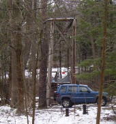
Completed 1915-1917, likely removed, 1970s. An article in the October 29, 1971 edition of The Times-Standard (Eureka, California) describes this bridge as being located over the Trinity River at New River. USGS topographical maps show a footbridge a few hundred yards north of the intersection of the two rivers at Gray Falls. The article has a photograph of the bridge and describes its possible replacement. The bridge was already closed at the time of the article: "A 50 year-old picturesque footbridge across the Trinity River at New River will be replaced if special funds can be obtained by the Six Rivers Nalional Forest, the federal agency has decided. 'Strong supportive response from people throughout the area to the continued need for a bridge' was reported by Forest Supervisor Bob Allison. The responses came after the Forest Service solicited comments in August on the replacement need for the span. The new bridge would be nearly as possible a replica of the present bridge constructed sometime between 1915 - 1917 by Jim and John Larson. It served as the main link between Denny and the outside world." Bridgemeister ID: 3086 (added 2019-10-27)Name: (footbridge) Location: Burton, Michigan , USA Crossing: Kearsley Creek At or Near Feature: For-Mar Nature Preserve Coordinates: 43.039600 N 83.607800 W Maps: Acme , GeoHack , Google , OpenStreetMap Use: Footbridge Status: In use (last checked: 2020) Main Cables: Wire (steel) Suspended Spans: 1
Bridgemeister ID: 6684 (added 2021-09-12)Name: (footbridge) Location: Cameron, Ohio , USA Crossing: Sunfish Creek Coordinates: 39.760249 N 80.934763 W Maps: Acme , GeoHack , Google , OpenStreetMap Use: Footbridge Status: In use (last checked: 2016) Main Cables: Wire (steel) Suspended Spans: 1
Bridgemeister ID: 2105 (added 2006-08-26)Name: (footbridge) Location: Canton vicinity, South Dakota , USA Crossing: Sargeant Creek At or Near Feature: Newton Hills State Park Coordinates: 43.2241 N 96.5803 W Maps: Acme , GeoHack , Google , OpenStreetMap Use: Footbridge Status: In use (last checked: 2006) Main Cables: Wire Suspended Spans: 1 Main Span: 1 x 16.2 meters (53 feet) estimated
Bridgemeister ID: 2106 (added 2006-08-26)Name: (footbridge) Location: Canton vicinity, South Dakota , USA Crossing: Sargeant Creek At or Near Feature: Newton Hills State Park Coordinates: 43.227333 N 96.57695 W Maps: Acme , GeoHack , Google , OpenStreetMap Use: Footbridge Status: In use (last checked: 2006) Main Cables: Wire Suspended Spans: 1 Main Span: 1 x 14.9 meters (49 feet) estimated
Bridgemeister ID: 773 (added 2003-03-14)Name: (footbridge) Location: Carnation, Washington , USA Crossing: Snoqualmie River At or Near Feature: Tolt-McDonald Park Coordinates: 47.64391 N 121.9251 W Maps: Acme , GeoHack , Google , OpenStreetMap Use: Footbridge Status: In use (last checked: 2015) Main Cables: Wire (steel) Suspended Spans: 1 Main Span: 1 x 90.5 meters (297 feet) estimated
Bridgemeister ID: 1356 (added 2004-05-15)Name: (footbridge) Location: Carrol Mill vicinity, Virginia , USA Crossing: Hardy Creek Coordinates: 36.66879 N 83.25842 W Maps: Acme , GeoHack , Google , OpenStreetMap Principals: VDOT Use: Footbridge Status: In use (last checked: 2004) Main Cables: Wire Suspended Spans: 1 Main Span: 1 x 18.3 meters (60 feet) estimated
Bridgemeister ID: 1355 (added 2004-05-15)Name: (footbridge) Location: Carrol Mill, Virginia , USA Crossing: Hardy Creek Coordinates: 36.67238 N 83.26071 W Maps: Acme , GeoHack , Google , OpenStreetMap Principals: VDOT Use: Footbridge Status: In use (last checked: 2004) Main Cables: Wire Suspended Spans: 1 Main Span: 1 x 12.2 meters (40 feet) estimated
Bridgemeister ID: 1381 (added 2004-07-03)Name: (footbridge) Location: Carter Ferry, Clinchport vicinity, Virginia , USA Crossing: Clinch River Coordinates: 36.69280 N 82.69012 W Maps: Acme , GeoHack , Google , OpenStreetMap Principals: VDOT Use: Footbridge Status: In use (last checked: 2004) Main Cables: Wire (steel) Suspended Spans: 3 Main Span: 1 x 68.6 meters (225 feet) estimated Side Spans: 1 x 29 meters (95 feet) estimated,
Bridgemeister ID: 1853 (added 2005-07-16)Name: (footbridge) Location: Cedar Rapids, Iowa , USA At or Near Feature: Ellis Park Use: Footbridge Suspended Spans: 1
Bridgemeister ID: 2274 (added 2007-04-21)Name: (footbridge) Location: Celo vicinity, North Carolina , USA Crossing: South Toe River Coordinates: 35.86893 N 82.17425 W Maps: Acme , GeoHack , Google , OpenStreetMap Use: Footbridge Status: In use (last checked: 2007) Main Cables: Wire (steel) Suspended Spans: 1 Main Span: 1 x 36.6 meters (120 feet) estimated
Bridgemeister ID: 2481 (added 2008-12-21)Name: (footbridge) Location: Chancellorsville, Virginia , USA Crossing: Clear Lake Coordinates: 38.30128 N 77.65755 W Maps: Acme , GeoHack , Google , OpenStreetMap Use: Footbridge Status: In use (last checked: 2008) Main Cables: Wire (steel) Suspended Spans: 1
Bridgemeister ID: 1387 (added 2004-07-03)Name: (footbridge) Location: Charlton vicinity, Virginia , USA Crossing: Craig Creek Coordinates: 37.58205 N 79.99082 W Maps: Acme , GeoHack , Google , OpenStreetMap Principals: VDOT Use: Footbridge Status: In use (last checked: 2004) Main Cables: Wire (steel) Suspended Spans: 1 Main Span: 1 x 56.4 meters (185 feet) estimated
Bridgemeister ID: 1335 (added 2004-05-01)Name: (footbridge) Location: Chatham Hill vicinity, Virginia , USA Crossing: North Fork Holston River Coordinates: 36.95624 N 81.49294 W Maps: Acme , GeoHack , Google , OpenStreetMap Principals: VDOT Use: Footbridge Status: In use (last checked: 2004) Main Cables: Wire Suspended Spans: 1 Main Span: 1 x 22.6 meters (74 feet) estimated
Bridgemeister ID: 1339 (added 2004-05-02)Name: (footbridge) Location: Chatham Hill vicinity, Virginia , USA Crossing: North Fork Holston River Coordinates: 36.95690 N 81.49520 W Maps: Acme , GeoHack , Google , OpenStreetMap Principals: VDOT Use: Footbridge Status: In use (last checked: 2004) Main Cables: Wire Suspended Spans: 1 Main Span: 1 x 28.3 meters (93 feet) estimated
Bridgemeister ID: 1260 (added 2004-03-13)Name: (footbridge) Location: Chauga Heights vicinity, South Carolina , USA Crossing: Chauga River At or Near Feature: Chau Ram County Park Coordinates: 34.68241 N 83.1468 W Maps: Acme , GeoHack , Google , OpenStreetMap Use: Footbridge Status: In use (last checked: 2009) Main Cables: Wire (steel) Suspended Spans: 1 Main Span: 1 x 53.3 meters (175 feet)
Douglas E. McClure writes (in 2009): "This bridge span is 175 feet and was constructed a few years ago. The earlier bridge was also a swinging bridge at the same location and type, but was washed out during heavy rains. The new bridge was raised 5 feet." Bridgemeister ID: 2562 (added 2012-02-04)Name: (footbridge) Location: Cheat Lake vicinity, West Virginia , USA Crossing: Cheat River At or Near Feature: Lake Lynn Power House and Dam Coordinates: 39.72056 N 79.85580 W Maps: Acme , GeoHack , Google , OpenStreetMap Use: Footbridge Status: Extant (last checked: 2011) Main Cables: Wire
Bridgemeister ID: 2604 (added 2014-04-14)Name: (footbridge) Location: Cherokee vicinity, North Carolina , USA Crossing: Oconaluftee River At or Near Feature: Chief Saunooke Trading Post Coordinates: 35.499332 N 83.304113 W Maps: Acme , GeoHack , Google , OpenStreetMap Use: Footbridge Status: Closed (last checked: 2016) Main Cables: Wire Suspended Spans: 2 Main Span: 1 x 36.6 meters (120 feet) estimated Side Span: 1 x 12.2 meters (40 feet) estimated
Bridgemeister ID: 2726 (added 2019-06-22)Name: (footbridge) Location: Cherry Grove vicinity, Pennsylvania , USA Crossing: Tionesta Creek At or Near Feature: Chapman State Park Coordinates: 41.744371 N 79.182978 W Maps: Acme , GeoHack , Google , OpenStreetMap Use: Footbridge Status: In use (last checked: 2018) Main Cables: Wire (steel) Suspended Spans: 1
Bridgemeister ID: 2454 (added 2008-09-20)Name: (footbridge) Location: Cisco vicinity, Ritchie County, West Virginia , USA Crossing: North Fork Hughes River Coordinates: 39.15388 N 81.23820 W Maps: Acme , GeoHack , Google , OpenStreetMap Use: Footbridge Status: In use (last checked: 2021) Main Cables: Wire Suspended Spans: 2 Main Span: 1 x 38.1 meters (125 feet) estimated Side Span: 1 x 9.8 meters (32 feet) estimated
2007: Failed when one of the main cables snapped. Subsequently repaired. 2022: Destroyed by flood. Bridgemeister ID: 3824 (added 2020-03-01)Name: (footbridge) Location: Clayhole, Kentucky , USA Crossing: Troublesome Creek Coordinates: 37.474070 N 83.280920 W Maps: Acme , GeoHack , Google , OpenStreetMap Use: Footbridge Status: In use (last checked: 2007) Main Cables: Wire Main Span: 1 x 27.4 meters (90 feet) estimated Side Spans: 2
Bridgemeister ID: 1389 (added 2004-07-03)Name: (footbridge) Location: Clearwater Park vicinity, Virginia , USA Crossing: Jackson River Coordinates: 37.86373 N 79.98956 W Maps: Acme , GeoHack , Google , OpenStreetMap Principals: VDOT Use: Footbridge Status: In use (last checked: 2004) Main Cables: Wire (steel) Suspended Spans: 1 Main Span: 1 x 62.2 meters (204 feet) estimated
Bridgemeister ID: 873 (added 2003-08-31)Name: (footbridge) Location: Clifftop vicinity, West Virginia , USA Crossing: Glade Creek At or Near Feature: Babcock State Park Coordinates: 37.98300 N 80.94377 W Maps: Acme , GeoHack , Google , OpenStreetMap Use: Footbridge Status: In use (last checked: 2008) Main Cables: Wire Suspended Spans: 1 Main Span: 1 x 21.3 meters (70 feet) estimated
There is at least one 'droopy' swinging bridge in this park that is excluded from the Bridgemeister inventory. Bridgemeister ID: 1670 (added 2005-03-22)Name: (footbridge) Location: Clifton Ford vicinity and Webster Springs vicinity, West Virginia , USA Crossing: Elk River Coordinates: 38.57102 N 80.48879 W Maps: Acme , GeoHack , Google , OpenStreetMap Use: Footbridge Status: In use (last checked: 2005) Main Cables: Wire Suspended Spans: 1 Main Span: 1 x 70.1 meters (230 feet) estimated
Bridgemeister ID: 1671 (added 2005-03-22)Name: (footbridge) Location: Clifton Ford vicinity and Webster Springs vicinity, West Virginia , USA Crossing: Elk River Coordinates: 38.56377 N 80.48884 W Maps: Acme , GeoHack , Google , OpenStreetMap Use: Footbridge Status: In use (last checked: 2005) Main Cables: Wire Suspended Spans: 1 Main Span: 1 x 79.2 meters (260 feet) estimated
Bridgemeister ID: 1672 (added 2005-03-22)Name: (footbridge) Location: Clifton Ford vicinity and Webster Springs vicinity, West Virginia , USA Crossing: Elk River Coordinates: 38.55854 N 80.48617 W Maps: Acme , GeoHack , Google , OpenStreetMap Use: Footbridge Status: In use (last checked: 2005) Main Cables: Wire Suspended Spans: 1 Main Span: 1 x 63.4 meters (208 feet) estimated
Bridgemeister ID: 1673 (added 2005-03-22)Name: (footbridge) Location: Clifton Ford vicinity and Webster Springs vicinity, West Virginia , USA Crossing: Elk River Coordinates: 38.52709 N 80.47652 W Maps: Acme , GeoHack , Google , OpenStreetMap Use: Footbridge Status: In use (last checked: 2005) Main Cables: Wire Suspended Spans: 1 Main Span: 1 x 72.5 meters (238 feet) estimated
Bridgemeister ID: 1674 (added 2005-03-22)Name: (footbridge) Location: Clifton Ford vicinity and Webster Springs vicinity, West Virginia , USA Crossing: Elk River Coordinates: 38.52487 N 80.48331 W Maps: Acme , GeoHack , Google , OpenStreetMap Use: Footbridge Status: In use (last checked: 2005) Main Cables: Wire Suspended Spans: 1 Main Span: 1 x 55.8 meters (183 feet) estimated
Bridgemeister ID: 1675 (added 2005-03-22)Name: (footbridge) Location: Clifton Ford vicinity and Webster Springs vicinity, West Virginia , USA Crossing: Elk River Coordinates: 38.51794 N 80.48419 W Maps: Acme , GeoHack , Google , OpenStreetMap Use: Footbridge Status: In use (last checked: 2005) Main Cables: Wire Suspended Spans: 1 Main Span: 1 x 59.4 meters (195 feet) estimated
Bridgemeister ID: 1682 (added 2005-03-26)Name: (footbridge) Location: Clifton Ford vicinity and Webster Springs vicinity, West Virginia , USA Crossing: Elk River Coordinates: 38.59299 N 80.49238 W Maps: Acme , GeoHack , Google , OpenStreetMap Use: Footbridge Status: Derelict (last checked: 2005) Main Cables: Wire Suspended Spans: 1
Bridgemeister.com gives you the good, the bad, and the ugly. Bridgemeister ID: 1683 (added 2005-03-26)Name: (footbridge) Location: Clifton Ford vicinity and Webster Springs vicinity, West Virginia , USA Crossing: Elk River Coordinates: 38.50829 N 80.47778 W Maps: Acme , GeoHack , Google , OpenStreetMap Use: Footbridge Status: In use (last checked: 2005) Main Cables: Wire Suspended Spans: 1 Main Span: 1 x 77.1 meters (253 feet) estimated
Bridgemeister ID: 1391 (added 2004-07-03)Name: (footbridge) Location: Clinchport, Virginia , USA Crossing: Clinch River Coordinates: 36.673533 N 82.747483 W Maps: Acme , GeoHack , Google , OpenStreetMap Principals: VDOT Use: Footbridge Status: In use (last checked: 2020) Main Cables: Wire (steel) Suspended Spans: 1 Main Span: 1 x 86 meters (282 feet) estimated
Bridgemeister ID: 2384 (added 2007-11-08)Name: (footbridge) Location: Clintonville, Wisconsin , USA Crossing: Pigeon River At or Near Feature: Walter A. Olen Park Coordinates: 44.61846 N 88.75838 W Maps: Acme , GeoHack , Google , OpenStreetMap Use: Footbridge Status: In use (last checked: 2007) Main Cables: Wire (steel)
Bridgemeister ID: 1884 (added 2005-09-24)Name: (footbridge) Location: Colville vicinity, Washington , USA Crossing: Mill Creek At or Near Feature: Douglas Falls Grange Park Coordinates: 48.6146 N 117.899917 W Maps: Acme , GeoHack , Google , OpenStreetMap Use: Footbridge Status: In use (last checked: 2005)
Bridgemeister ID: 2366 (added 2007-09-08)Name: (footbridge) Location: Cooksburg, Pennsylvania , USA Crossing: Toms Run At or Near Feature: Cook Forest State Park Coordinates: 41.34104 N 79.21433 W Maps: Acme , GeoHack , Google , OpenStreetMap Use: Footbridge Status: In use (last checked: 2002) Main Cables: Wire (steel) Suspended Spans: 1
Bridgemeister ID: 7204 (added 2022-07-07)Name: (footbridge) Location: Copake, New York , USA At or Near Feature: Camp Pontiac Coordinates: 42.082996 N 73.594446 W Maps: Acme , GeoHack , Google , OpenStreetMap Principals: Norman Horowitz Use: Footbridge Status: In use (last checked: 2017) Main Cables: Wire (steel) Suspended Spans: 1
Completed at some point in the 1960s. Bridgemeister ID: 1834 (added 2005-07-02)Name: (footbridge) Location: Deer Park vicinity, Michigan , USA Crossing: Two Hearted River At or Near Feature: North Country Trail Coordinates: 46.69857 N 85.422817 W Maps: Acme , GeoHack , Google , OpenStreetMap Use: Footbridge Status: In use (last checked: 2005) Main Cables: Wire Suspended Spans: 1
Bridgemeister ID: 1352 (added 2004-05-14)Name: (footbridge) Location: Del Rio, Texas , USA Coordinates: 29.369034 N 100.884902 W Maps: Acme , GeoHack , Google , OpenStreetMap Use: Footbridge Status: In use (last checked: 2019) Main Cables: Wire (steel) Suspended Spans: 1 Main Span: 1 x 24.4 meters (80 feet)
Bridgemeister ID: 2404 (added 2007-12-22)Name: (footbridge) Location: Delray, West Virginia , USA Crossing: North River Coordinates: 39.20732 N 78.59352 W Maps: Acme , GeoHack , Google , OpenStreetMap Use: Footbridge Status: In use (last checked: 2007) Main Cables: Wire (steel) Suspended Spans: 2 Main Spans: 2 x 27.4 meters (90 feet)
Bridgemeister ID: 2322 (added 2007-05-06)Name: (footbridge) Location: DeSoto, Missouri , USA Crossing: Joachim Creek Use: Footbridge Status: Removed Main Cables: Wire
Crossed Joachim Creek at East Clement Street. Bridgemeister ID: 1483 (added 2004-09-04)Name: (footbridge) Location: Dexter vicinity, Michigan , USA Crossing: Mill Creek Use: Footbridge Status: In use (last checked: 2007) Main Cables: Wire
Bridgemeister ID: 1955 (added 2005-11-04)Name: (footbridge) Location: Diablo vicinity, Washington , USA Use: Footbridge Main Cables: Wire
Circa 1930's, distinct from other Diablo-area suspension bridges listed. Bridgemeister ID: 1380 (added 2004-07-03)Name: (footbridge) Location: Dona vicinity, Virginia , USA Crossing: North Fork Clinch River Coordinates: 36.60260 N 82.96255 W Maps: Acme , GeoHack , Google , OpenStreetMap Principals: VDOT Use: Footbridge Status: In use (last checked: 2004) Main Cables: Wire Suspended Spans: 3 Main Span: 1 x 42.7 meters (140 feet) estimated Side Spans: 2
Bridgemeister ID: 1350 (added 2004-05-08)Name: (footbridge) Location: Dorter Mill, Virginia , USA Crossing: North Fork Holston River Coordinates: 36.61721 N 82.51891 W Maps: Acme , GeoHack , Google , OpenStreetMap Principals: VDOT Use: Footbridge Status: In use (last checked: 2004) Main Cables: Wire (steel) Suspended Spans: 2 Main Span: 1 x 85.3 meters (280 feet) estimated Side Span: 1 x 5.2 meters (17 feet) estimated
Bridgemeister ID: 1403 (added 2004-07-04)Name: (footbridge) Location: Dryden vicinity, Virginia , USA Crossing: Powell River Coordinates: 36.76043 N 82.94509 W Maps: Acme , GeoHack , Google , OpenStreetMap Principals: VDOT Use: Footbridge Status: In use (last checked: 2004) Main Cables: Wire (steel) Suspended Spans: 1 Main Span: 1 x 45.1 meters (148 feet) estimated
Bridgemeister ID: 3095 (added 2019-10-27)Name: (footbridge) Location: Dubuque vicinity, Iowa , USA Crossing: Catfish Creek At or Near Feature: Swiss Valley Nature Preserve Coordinates: 42.414786 N 90.766344 W Maps: Acme , GeoHack , Google , OpenStreetMap Use: Footbridge Status: In use (last checked: 2021) Main Cables: Wire (steel) Suspended Spans: 1
Bridgemeister ID: 5727 (added 2021-04-03)Name: (footbridge) Location: Dubuque vicinity, Iowa , USA Crossing: Catfish Creek At or Near Feature: Swiss Valley Nature Preserve Coordinates: 42.420553 N 90.764417 W Maps: Acme , GeoHack , Google , OpenStreetMap Use: Footbridge Status: In use (last checked: 2018) Main Cables: Wire (steel) Suspended Spans: 1 Main Span: 1 x 18.3 meters (60 feet) estimated
Bridgemeister ID: 5728 (added 2021-04-03)Name: (footbridge) Location: Dubuque vicinity, Iowa , USA Crossing: Catfish Creek At or Near Feature: Swiss Valley Nature Preserve Coordinates: 42.422724 N 90.757699 W Maps: Acme , GeoHack , Google , OpenStreetMap Use: Footbridge Status: In use (last checked: 2018) Main Cables: Wire (steel) Suspended Spans: 1 Main Span: 1 x 20.4 meters (67 feet) estimated
Bridgemeister ID: 559 (added before 2003)Name: (footbridge) Location: Dumfries vicinity, Virginia , USA Crossing: South Fork Quantico Creek At or Near Feature: Prince William Forest Coordinates: 38.5666 N 77.353167 W Maps: Acme , GeoHack , Google , OpenStreetMap Use: Footbridge Status: Closed, August 2020 (last checked: 2020) Main Cables: Wire (steel) Suspended Spans: 1
August 2020: Damaged by flood, closed. Bridgemeister ID: 806 (added 2003-03-30)Name: (footbridge) Location: Durham, North Carolina , USA Crossing: Eno River At or Near Feature: Eno River State Park Coordinates: 36.075453 N 79.007745 W Maps: Acme , GeoHack , Google , OpenStreetMap Use: Footbridge Status: In use (last checked: 2021) Main Cables: Wire (steel) Main Span: 1 x 38 meters (124.7 feet) estimated
Patrick S. O'Donnell provided a rough main span estimate of 300 feet. Bridgemeister ID: 1894 (added 2005-10-01)Name: (footbridge) Location: Eagle Lake vicinity, Minnesota , USA Crossing: LeSueur River At or Near Feature: Wildwood County Park Coordinates: 44.12445 N 93.864117 W Maps: Acme , GeoHack , Google , OpenStreetMap Use: Footbridge Status: In use (last checked: 2005) Main Cables: Wire (steel) Main Span: 1 x 42.7 meters (140 feet)
Bridgemeister ID: 1638 (added 2005-03-13)Name: (footbridge) Location: East End vicinity, Arkansas , USA Crossing: Mary Lake At or Near Feature: Carmelite Novitiate Coordinates: 34.538468 N 92.342199 W Maps: Acme , GeoHack , Google , OpenStreetMap Use: Footbridge Status: Extant (last checked: 2021) Main Cables: Wire Suspended Spans: 1 Main Span: 1 x 42 meters (137.8 feet) estimated
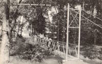
Coordinates given here are the likely location of the bridge, but it may be completely on private property. Bridgemeister ID: 8530 (added 2024-03-29)Name: (footbridge) Location: Eden Township, Utica vicinity, Ohio , USA Crossing: Rocky Fork Stream At or Near Feature: Camp Ohio Use: Footbridge Main Span: 1
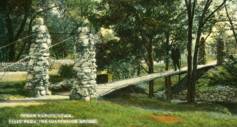
The bridge pictured here at "Camp Ohio" is usually attributed to Utica, Ohio (USA). The bridge was likely located within the 4-H "Camp Ohio" found about 10 miles east of Utica. However, historic photos of that Camp Ohio show a different short suspension bridge. 4-H Camp Ohio History - 1930s . The short suspension footbridge pictured on this page does not match the bridge in the postcard image linked here. Perhaps the bridge was rebuilt at some point or the postcard illustrator took liberties with the depiction.Bridgemeister ID: 1562 (added 2004-11-27)Name: (footbridge) Location: El Paso, Texas , USA Crossing: Rio Grande Use: Footbridge Status: Removed Main Cables: Wire Suspended Spans: 1
Narrow long footbridge circa early 1900s. Bridgemeister ID: 2539 (added 2011-12-30)Name: (footbridge) Location: Eleutherian Mills, Wilmington vicinity, Delaware , USA Crossing: Brandywine Creek Use: Footbridge
In existence in early 1900s, likely at or near Hagley Yard area of du Pont Eleutherian Mills property. Bridgemeister ID: 2461 (added 2008-09-27)Name: (footbridge) Location: Ellijay, Georgia , USA Crossing: Coosawattee River At or Near Feature: Coosawattee River Resort Coordinates: 34.674655 N 84.529773 W Maps: Acme , GeoHack , Google , OpenStreetMap Use: Footbridge Status: In use (last checked: 2021) Main Cables: Wire (steel) Suspended Spans: 3 Main Span: 1 x 45 meters (147.6 feet) estimated Side Spans: 1,
Bridgemeister ID: 251 (added before 2003)Name: (footbridge) Location: Esopus, New York , USA Crossing: Black Creek At or Near Feature: Black Creek Forest Preserve Coordinates: 41.8211 N 73.96285 W Maps: Acme , GeoHack , Google , OpenStreetMap Use: Footbridge Status: In use (last checked: 2021) Main Cables: Wire (steel) Suspended Spans: 3 Main Span: 1 x 24.4 meters (80 feet) Side Spans: 1 x 4 meters (13 feet),
Bridgemeister ID: 1397 (added 2004-07-04)Name: (footbridge) Location: Estacada vicinity, Oregon , USA Crossing: Clear Creek At or Near Feature: Metzler Park Coordinates: 45.228333 N 122.367333 W Maps: Acme , GeoHack , Google , OpenStreetMap Use: Footbridge Status: In use (last checked: 2018) Main Cables: Wire (steel) Suspended Spans: 1
Bridgemeister ID: 2221 (added 2007-03-11)Name: (footbridge) Location: Findlay vicinity, Ohio , USA Crossing: Eagle Creek At or Near Feature: Camp Berry Coordinates: 40.95892 N 83.65817 W Maps: Acme , GeoHack , Google , OpenStreetMap Use: Footbridge Status: In use (last checked: 2007) Suspended Spans: 1
Bridgemeister ID: 1262 (added 2004-03-13)Name: (footbridge) Location: Fleish, Mystic vicinity, California , USA Crossing: Truckee River Coordinates: 39.452067 N 120.00555 W Maps: Acme , GeoHack , Google , OpenStreetMap Use: Footbridge Status: Replaced, 2013 Main Cables: Wire (steel) Suspended Spans: 1 Main Span: 1 x 61 meters (200 feet) estimated
Crosses some a spillway just east of I-80 just before I-80 crosses from California to Nevada. North of Mystic in Sierra County. Jan Claire sends observations about the structure the bridge crosses: "The dam is a diverter. Water from the Truckee river is diverted into a canal which runs over to Verdi, Nevada at which point it is pumped up and over a hill and down into another river. Because this dam does not appear on the California Department of Water Resources inventory, I assume it is a long-ago-grandfathered dam operated under treaty with the state of Nevada for irrigation purposes. Satellite photos show this diverter-canal runs through what may still be, or probably was, farmland west of Verdi." Replaced by 2013 Fleish - Fleish, Mystic vicinity, California, USA . Patrick S. O'Donnell provided a rough main span estimate of 350 feet. Bridgemeister ID: 2541 (added 2011-12-31)Name: (footbridge) Location: Fort Belvoir, Virginia , USA Crossing: Accotink Creek At or Near Feature: Accotink Bay Wildlife Refuge Use: Footbridge Status: Replaced (last checked: 2014) Main Cables: Wire (steel)
Bridgemeister ID: 811 (added 2003-05-29)Name: (footbridge) Location: Fort Collins, Colorado , USA Crossing: Cache La Poudre River At or Near Feature: Environmental Learning Center Coordinates: 40.55705 N 105.019417 W Maps: Acme , GeoHack , Google , OpenStreetMap Use: Footbridge Status: In use (last checked: 2005) Main Cables: Wire Suspended Spans: 1
Bridgemeister ID: 5192 (added 2020-10-04)Name: (footbridge) Location: Fort Jennings, Ohio , USA Crossing: Auglaize River Coordinates: 40.904724 N 84.295338 W Maps: Acme , GeoHack , Google , OpenStreetMap Use: Footbridge Status: In use (last checked: 2020) Main Cables: Wire Suspended Spans: 3 Main Span: 1 Side Spans: 2
Bridgemeister ID: 2392 (added 2007-11-20)Name: (footbridge) Location: Fort Pillow Historic Park, Tennessee , USA Coordinates: 35.64206 N 89.83880 W Maps: Acme , GeoHack , Google , OpenStreetMap Use: Footbridge Status: In use (last checked: 2007) Main Cables: Wire (steel) Suspended Spans: 1
Bridgemeister ID: 644 (added 2003-02-16)Name: (footbridge) Location: Fort Wayne, Indiana , USA Crossing: St. Mary's River At or Near Feature: Foster Park Coordinates: 41.04716 N 85.16566 W Maps: Acme , GeoHack , Google , OpenStreetMap Use: Footbridge Status: In use (last checked: 2019) Main Cables: Wire (steel) Suspended Spans: 1
Bridgemeister ID: 778 (added 2003-03-16)Name: (footbridge) Location: Fredericksburg, Virginia , USA Crossing: Hazel Run At or Near Feature: Alum Springs Park Use: Footbridge Status: Removed Main Cables: Wire Suspended Spans: 1
Appears to have been removed in late 1990's or early 2000's. Bridgemeister ID: 824 (added 2003-05-31)Name: (footbridge) Location: Friendship, Virginia , USA Crossing: South Fork Holston River Coordinates: 36.71700 N 81.74703 W Maps: Acme , GeoHack , Google , OpenStreetMap Principals: VDOT Use: Footbridge Status: In use Main Cables: Wire Suspended Spans: 2 Main Span: 1 x 36.3 meters (119 feet) estimated Side Span: 1 x 7 meters (23 feet) estimated
Bridgemeister ID: 1330 (added 2004-04-30)Name: (footbridge) Location: Fulks Run vicinity, Virginia , USA Crossing: Little Dry River Coordinates: 38.65450 N 78.93848 W Maps: Acme , GeoHack , Google , OpenStreetMap Principals: VDOT Use: Footbridge Status: In use (last checked: 2004) Main Cables: Wire (steel) Suspended Spans: 1 Main Span: 1 x 52.4 meters (172 feet) estimated
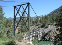
Bridgemeister ID: 2000 (added 2005-12-25)Name: (footbridge) Location: Gardiner vicinity, Montana , USA Crossing: Yellowstone River At or Near Feature: Blacktail Deer Creek Trail, Yellowstone National Park Coordinates: 44.996583 N 110.578867 W Maps: Acme , GeoHack , Google , OpenStreetMap Use: Footbridge Status: In use (last checked: 2006) Main Cables: Wire (steel) Suspended Spans: 1 Main Span: 1 x 67.1 meters (220 feet) estimated
Bridgemeister ID: 6687 (added 2021-09-12)Name: (footbridge) Location: Gates Mills, Ohio , USA Crossing: Chagrin River Coordinates: 41.506583 N 81.399896 W Maps: Acme , GeoHack , Google , OpenStreetMap Use: Footbridge Status: Removed, c. 2018-2019 Main Cables: Wire Main Span: 1 x 46 meters (151 feet) estimated
Removed at some point in late 2018 or early 2019. Do you have any information or photos for these bridges that you would like to share? Please email david.denenberg@bridgemeister.com .
Mail | Facebook | Twitter
