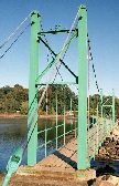
Suspension Bridges of USA (1,401-1,437 of 1,437)
This is a list of bridges 1,401 through 1,437 (of 1,437 total) from the suspension bridge inventory for the country USA. Wherever you see a Bridgemeister ID number click it to isolate the bridge on its own page.
Related Lists:
Swinging
Panola County, Mississippi, USA
| Bridgemeister ID: | 2199 (added 2007-01-27) |
| Name: | Swinging |
| Location: | Panola County, Mississippi, USA |
| Use: | Vehicular |
| Main Cables: | Wire |
Notes:
- The exact location of this bridge is unclear, but a photo in the December 6, 1937 edition of The Delta Weekly (Greenville, Mississippi) shows a short-span vehicular suspension bridge captioned, "Swinging Bridge - Panola County".
Swinging
Philo, California, USA - Navarro River
| Bridgemeister ID: | 1295 (added 2004-03-19) |
| Name: | Swinging |
| Location: | Philo, California, USA |
| Crossing: | Navarro River |
| Coordinates: | 39.058029 N 123.442550 W |
| Maps: | Acme, GeoHack, Google, OpenStreetMap |
| Use: | Footbridge |
| Status: | Extant (last checked: 2020) |
| Main Cables: | Wire |
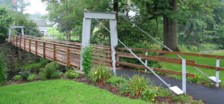
Swinging
Prompton, Pennsylvania, USA - Lackawaxen River West Branch
| Bridgemeister ID: | 2340 (added 2007-08-11) |
| Name: | Swinging |
| Location: | Prompton, Pennsylvania, USA |
| Crossing: | Lackawaxen River West Branch |
| Coordinates: | 41.58233 N 75.32416 W |
| Maps: | Acme, GeoHack, Google, OpenStreetMap |
| Use: | Footbridge |
| Status: | In use (last checked: 2007) |
| Main Cables: | Wire |
| Suspended Spans: | 1 |
| Main Span: | 1 x 27.4 meters (90 feet) |
Swinging
Richardson Springs, California, USA
| Bridgemeister ID: | 313 (added before 2003) |
| Name: | Swinging |
| Location: | Richardson Springs, California, USA |
| Coordinates: | 39.838927 N 121.769790 W |
| Maps: | Acme, GeoHack, Google, OpenStreetMap |
| Use: | Footbridge |
| Status: | Removed |
| Main Cables: | Wire |
| Suspended Spans: | 1 |
Notes:
- Wide footbridge.
Swinging
Silver City, New Mexico, USA
| Bridgemeister ID: | 1664 (added 2005-03-20) |
| Name: | Swinging |
| Location: | Silver City, New Mexico, USA |
| Use: | Footbridge |
| Main Cables: | Wire |
Notes:
- Was in use in 1909.
Swinging
South Connellsville, Pennsylvania, USA - Youghiogheny River
| Bridgemeister ID: | 8093 (added 2023-12-25) |
| Name: | Swinging |
| Location: | South Connellsville, Pennsylvania, USA |
| Crossing: | Youghiogheny River |
| Coordinates: | 39.988 N 79.591 W |
| Maps: | Acme, GeoHack, Google, OpenStreetMap |
| Use: | Footbridge |
| Status: | Removed |
| Main Cables: | Wire |
| Main Span: | 1 |
External Links:
- Facebook. Old image of the bridge. Posted December 9, 2012.
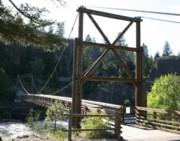
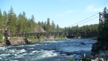
Swinging
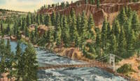
Spokane vicinity, Washington, USA - Spokane River
| Bridgemeister ID: | 315 (added before 2003) |
| Name: | Swinging |
| Location: | Spokane vicinity, Washington, USA |
| Crossing: | Spokane River |
| At or Near Feature: | Riverside State Park, "Bowl And Pitcher" area |
| Coordinates: | 47.69668 N 117.49828 W |
| Maps: | Acme, GeoHack, Google, OpenStreetMap |
| Principals: | Civilian Conservation Corps |
| Use: | Footbridge |
| Status: | In use (last checked: 2009) |
| Main Cables: | Wire (steel) |
| Suspended Spans: | 1 |
| Main Span: | 1 x 61 meters (200 feet) estimated |
Notes:
- Location also described "Down River Park" and "Downriver Park".
- Near (pipeline bridge) - Spokane, Washington, USA.
External Links:
- Riverside State Park Foundation. Built in the 1930s. Rebuilt, 1998.
Swinging
Townsend, Tennessee, USA - Little River
| Bridgemeister ID: | 1139 (added 2004-01-17) |
| Name: | Swinging |
| Location: | Townsend, Tennessee, USA |
| Crossing: | Little River |
| Coordinates: | 35.679553 N 83.750614 W |
| Maps: | Acme, GeoHack, Google, OpenStreetMap |
| Use: | Footbridge |
| Status: | In use (last checked: 2015) |
| Main Cables: | Wire |
| Suspended Spans: | 1 |
Notes:
- This is the droopier footbridge at the eastern end of Townsend, distinct from the bridge at the "Kinzel Springs" location on the western side of Townsend. Typically the droopy footbridges are omitted from the Bridgemeister inventory, but this one is included to avoid confusion with the other Townsend-area bridges.
Swinging
Walcott, Arkansas, USA - Dancing Rabbit Arroyo
| Bridgemeister ID: | 7203 (added 2022-07-07) |
| Name: | Swinging |
| Location: | Walcott, Arkansas, USA |
| Crossing: | Dancing Rabbit Arroyo |
| At or Near Feature: | Crowley's Ridge State Park |
| Coordinates: | 36.043750 N 90.666000 W |
| Maps: | Acme, GeoHack, Google, OpenStreetMap |
| Use: | Footbridge |
| Status: | In use (last checked: 2022) |
| Main Cables: | Chain (steel) |
| Main Span: | 1 |
| Side Spans: | 2 |
Notes:
- The park's trail guides mention two swinging bridges on the same trail, but it's unclear if the second bridge, perhaps 500 feet south of the coordinates for the bridge given here, is actually a suspension bridge.
Tazlina River
Alaska, USA - Tazlina River
| Bridgemeister ID: | 653 (added 2003-02-25) |
| Name: | Tazlina River |
| Location: | Alaska, USA |
| Crossing: | Tazlina River |
| Coordinates: | 62.07724 N 145.47434 W |
| Maps: | Acme, GeoHack, Google, OpenStreetMap |
| Use: | Pipeline |
| Status: | Extant (last checked: 2019) |
| Main Cables: | Wire (steel) |
Notes:
- Carries the Trans-Alaska pipeline.
External Links:
Thunder Creek
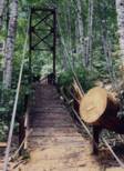
Ross Lake National Recreation Area, Washington, USA - Thunder Creek
| Bridgemeister ID: | 1283 (added 2004-03-14) |
| Name: | Thunder Creek |
| Location: | Ross Lake National Recreation Area, Washington, USA |
| Crossing: | Thunder Creek |
| At or Near Feature: | Diablo Lake vicinity, North Cascades National Park |
| Coordinates: | 48.67825 N 121.07848 W |
| Maps: | Acme, GeoHack, Google, OpenStreetMap |
| Use: | Footbridge |
| Status: | Destroyed, October 2003 |
| Main Cables: | Wire (steel) |
| Main Span: | 1 x 39.6 meters (130 feet) estimated |
Notes:
- Damaged by fallen tree, summer 2003. Soon repaired. Destroyed during storm, October 2003. According to a June 2004 National Park Service web page advising as to storm damage in North Cascade National Park: "The suspension bridge over Thunder Creek one-mile from the trailhead in Colonial Creek Campground was destroyed. This large bridge was in a location which flooded at the beginning of many summer seasons. Planning for a better location, environmental assessment of alternatives, and application for funding will take place this year with construction happening in 2005. The log jam at the former bridge site is closed to crossing because of safety considerations." The bridge was indeed replaced with a non-suspension bridge at a different location.
Tieton Nature Trail
Tieton, Naches vicinity, Washington, USA - Tieton River
| Bridgemeister ID: | 6142 (added 2021-07-06) |
| Name: | Tieton Nature Trail |
| Location: | Tieton, Naches vicinity, Washington, USA |
| Crossing: | Tieton River |
| Coordinates: | 46.718284 N 120.834342 W |
| Maps: | Acme, GeoHack, Google, OpenStreetMap |
| Use: | Footbridge |
| Status: | In use (last checked: 2021) |
| Main Cables: | Wire (steel) |
| Suspended Spans: | 1 |
| Main Span: | 1 |
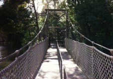
| Bridgemeister ID: | 2609 (added 2014-04-15) |
| Name: | Tom Sawyer Island |
| Location: | Orlando, Florida, USA |
| At or Near Feature: | Disney World |
| Coordinates: | 28.420305 N 81.583760 W |
| Maps: | Acme, GeoHack, Google, OpenStreetMap |
| Use: | Footbridge |
| Status: | In use (last checked: 2019) |
| Main Cables: | Wire (steel) |
| Suspended Spans: | 1 |
Notes:
- Suspension bridge inside Disney World at the Tom Sawyer Island attraction.
External Links:
Tower
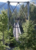
Mammoth Hot Springs vicinity, Wyoming, USA - Yellowstone River
| Bridgemeister ID: | 928 (added 2003-10-20) |
| Name: | Tower |
| Also Known As: | Hellroaring, Yellowstone River |
| Location: | Mammoth Hot Springs vicinity, Wyoming, USA |
| Crossing: | Yellowstone River |
| At or Near Feature: | Hellroaring Creek Trail, Yellowstone National Park |
| Coordinates: | 44.9597 N 110.447067 W |
| Maps: | Acme, GeoHack, Google, OpenStreetMap |
| Use: | Footbridge |
| Status: | In use (last checked: 2006) |
| Main Cables: | Wire (steel) |
| Suspended Spans: | 1 |
| Main Span: | 1 x 67.1 meters (220 feet) estimated |
Notes:
- Near the confluence of Hellroaring Creek and the Yellowstone River. Patrick S. O'Donnell clarifies: " It carries the Hellroaring Creek Trail. It crosses the Yellowstone River then continues to the Hellroaring Creek. Shortly thereafter the Yellowstone River Trail is met."
- Near (footbridge) - Gardiner vicinity, Montana, USA. The bridges are similar in appearance.
External Links:
Toxaway Creek
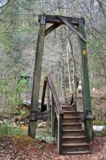
Cane Break vicinity, North Carolina, USA - Toxaway Creek
| Bridgemeister ID: | 2296 (added 2007-04-26) |
| Name: | Toxaway Creek |
| Location: | Cane Break vicinity, North Carolina, USA |
| Crossing: | Toxaway Creek |
| Use: | Footbridge |
| Status: | In use (last checked: 2009) |
| Main Cables: | Wire |
Notes:
Toxaway River
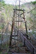
Cane Break vicinity, North Carolina, USA - Toxaway River
| Bridgemeister ID: | 287 (added before 2003) |
| Name: | Toxaway River |
| Location: | Cane Break vicinity, North Carolina, USA |
| Crossing: | Toxaway River |
| Coordinates: | 35.07168 N 82.88685 W |
| Maps: | Acme, GeoHack, Google, OpenStreetMap |
| Principals: | Duke Power |
| Use: | Footbridge |
| Status: | In use (last checked: 2019) |
| Main Cables: | Wire (steel) |
| Suspended Spans: | 3 |
| Main Span: | 1 x 50.6 meters (166 feet) estimated |
| Side Spans: | 1 x 7.3 meters (24 feet) estimated, 1 x 10.1 meters (33 feet) estimated |
Notes:
- Refurbished, 2019.
- Near Toxaway Creek - Cane Break vicinity, North Carolina, USA.
Trailhead Park
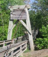
Delphi, Indiana, USA - Deer Creek
| Bridgemeister ID: | 2577 (added 2013-03-27) |
| Name: | Trailhead Park |
| Location: | Delphi, Indiana, USA |
| Crossing: | Deer Creek |
| At or Near Feature: | Delphi Trails Entrance |
| Coordinates: | 40.57327 N 86.68522 W |
| Maps: | Acme, GeoHack, Google, OpenStreetMap |
| Use: | Footbridge |
| Status: | In use (last checked: 2012) |
| Main Cables: | Wire (steel) |
| Suspended Spans: | 1 |
Tram
Tram, Kentucky, USA - Big Sandy River Levisa Fork
| Bridgemeister ID: | 5598 (added 2020-12-23) |
| Name: | Tram |
| Location: | Tram, Kentucky, USA |
| Crossing: | Big Sandy River Levisa Fork |
| Coordinates: | 37.573858 N 82.646108 W |
| Maps: | Acme, GeoHack, Google, OpenStreetMap |
| Use: | Vehicular (one-lane) |
| Status: | Removed |
| Main Cables: | Wire |
| Main Span: | 1 |
Notes:
- Appears to have been removed at some point in 1980s or early 1990s.
TVA Ocoee 2
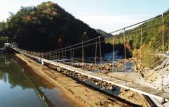
Ducktown vicinity, Tennessee, USA - Ocoee River
| Bridgemeister ID: | 791 (added 2003-03-22) |
| Name: | TVA Ocoee 2 |
| Location: | Ducktown vicinity, Tennessee, USA |
| Crossing: | Ocoee River |
| Coordinates: | 35.08295 N 84.4906 W |
| Maps: | Acme, GeoHack, Google, OpenStreetMap |
| Use: | Footbridge |
| Status: | In use |
| Main Cables: | Wire |
| Suspended Spans: | 1 |
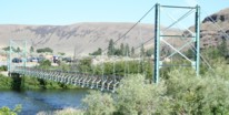
Umtanum
Yakima and Ellensburg, Washington, USA - Yakima River
| Bridgemeister ID: | 865 (added 2003-08-23) |
| Name: | Umtanum |
| Location: | Yakima and Ellensburg, Washington, USA |
| Crossing: | Yakima River |
| Coordinates: | 46.85555 N 120.48405 W |
| Maps: | Acme, GeoHack, Google, OpenStreetMap |
| Use: | Footbridge |
| Status: | In use (last checked: 2021) |
| Main Cables: | Wire (steel) |
| Suspended Spans: | 1 |
| Main Span: | 1 x 67.1 meters (220 feet) estimated |
Notes:
- 2021, February: Closed for planned repairs. Expected to reopen in May.
- 2021, June: Bridge reopened following rehabilitation project.
Upper Warm Springs Pack
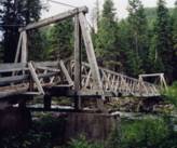
Clearwater National Forest, Idaho, USA - Warm Springs Creek
| Bridgemeister ID: | 1390 (added 2004-07-03) |
| Name: | Upper Warm Springs Pack |
| Location: | Clearwater National Forest, Idaho, USA |
| Crossing: | Warm Springs Creek |
| Coordinates: | 46.44903 N 114.86788 W |
| Maps: | Acme, GeoHack, Google, OpenStreetMap |
| Use: | Pack |
| Status: | In use (last checked: 2003) |
| Main Cables: | Wire (steel) |
| Suspended Spans: | 1 |
| Main Span: | 1 x 27.4 meters (90 feet) estimated |
Vienna Swinging
Vienna, Missouri, USA - Maries River
| Bridgemeister ID: | 2364 (added 2007-09-08) |
| Name: | Vienna Swinging |
| Location: | Vienna, Missouri, USA |
| Crossing: | Maries River |
| Coordinates: | 38.20176 N 91.97756 W |
| Maps: | Acme, GeoHack, Google, OpenStreetMap |
| Principals: | Joseph Dice |
| References: | BOTO |
| Use: | Vehicular (one-lane) |
| Status: | Destroyed, 1998 |
| Main Cables: | Wire |
| Suspended Spans: | 1 |
Notes:
- Destroyed by flood, but some remains still visible at site, 2006.
- BOTO refers to as "Ballpark Rd." bridge for lack of a known name as the bridge was on the route following Ballpark Road out of Vienna.
External Links:
Vietnam Veterans Memorial Swinging
Mannington, West Virginia, USA - Buffalo Creek
| Bridgemeister ID: | 7674 (added 2023-06-17) |
| Name: | Vietnam Veterans Memorial Swinging |
| Location: | Mannington, West Virginia, USA |
| Crossing: | Buffalo Creek |
| Coordinates: | 39.529786 N 80.342461 W |
| Maps: | Acme, GeoHack, Google, OpenStreetMap |
| Use: | Footbridge |
| Status: | Only towers remain, since c. 2014-2015 |
| Main Cables: | Wire (steel) |
Notes:
- 1990s-2000s: Rebuilt more than once.
- 2013-2014: Bridge is in a derelict state. By 2015 the deck is completely gone or removed.
Warm Springs Creek Pack
Clearwater National Forest, Idaho, USA - Lochsa River
| Bridgemeister ID: | 367 (added before 2003) |
| Name: | Warm Springs Creek Pack |
| Also Known As: | Jerry Johnson Hot Springs Pack |
| Location: | Clearwater National Forest, Idaho, USA |
| Crossing: | Lochsa River |
| Coordinates: | 46.474333 N 114.885067 W |
| Maps: | Acme, GeoHack, Google, OpenStreetMap |
| References: | PQU |
| Use: | Pack |
| Status: | In use (last checked: 2005) |
| Main Cables: | Wire (steel) |
| Suspended Spans: | 1 |
| Main Span: | 1 x 67.7 meters (222 feet) estimated |
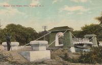
Waste Weir
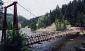
Trenton, New Jersey, USA - Waste Weir of the Delaware & Raritan Canal
| Bridgemeister ID: | 303 (added before 2003) |
| Name: | Waste Weir |
| Also Known As: | Shaky |
| Location: | Trenton, New Jersey, USA |
| Crossing: | Waste Weir of the Delaware & Raritan Canal |
| At or Near Feature: | Stacy Park |
| Coordinates: | 40.22314 N 74.77998 W |
| Maps: | Acme, GeoHack, Google, OpenStreetMap |
| References: | BONJ |
| Use: | Footbridge |
| Status: | In use (last checked: 2020) |
| Main Cables: | Wire |
| Suspended Spans: | 1 |
External Links:

Wawona
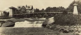
Wawona, California, USA - South Fork Merced River
| Bridgemeister ID: | 5594 (added 2020-12-23) |
| Name: | Wawona |
| Location: | Wawona, California, USA |
| Crossing: | South Fork Merced River |
| Coordinates: | 37.540392 N 119.623170 W |
| Maps: | Acme, GeoHack, Google, OpenStreetMap |
| Use: | Footbridge |
| Status: | In use (last checked: 2017) |
| Main Cables: | Wire (steel) |
| Suspended Spans: | 1 |
Weitchpec
Weitchpec, California, USA - Klamath River
| Bridgemeister ID: | 1048 (added 2003-12-06) |
| Name: | Weitchpec |
| Location: | Weitchpec, California, USA |
| Crossing: | Klamath River |
| Main Cables: | Wire |
Notes:
- Eric Sakowski asked the Humboldt County Historical Society for information about this bridge and received this answer from Catherine Mace: "You have a good picture of the bridge over the Klamath River at Weitchpec. The large tree you see through the bridge is the gambling tree and the village of Weitchpec is the structures behind it. The road goes across and makes almost a hairpin turn to the right then it branches . To the right you go up river and to the left goes down river through Weitchpec."
- See 1861 Weitchpec - Weitchpec, California, USA. The bridge pictured here was likely a replacement for the older bridge.
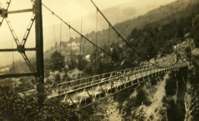
Wellsburg & Lowman
Wellsburg and Lowman, New York, USA - Chemung River
| Bridgemeister ID: | 368 (added before 2003) |
| Name: | Wellsburg & Lowman |
| Location: | Wellsburg and Lowman, New York, USA |
| Crossing: | Chemung River |
| Status: | Removed |
Wind River Pack
Green, Idaho, USA - Salmon River
| Bridgemeister ID: | 1334 (added 2004-05-01) |
| Name: | Wind River Pack |
| Location: | Green, Idaho, USA |
| Crossing: | Salmon River |
| Coordinates: | 45.45382 N 115.94525 W |
| Maps: | Acme, GeoHack, Google, OpenStreetMap |
| Use: | Pack and Footbridge |
| Status: | In use (last checked: 2003) |
| Main Cables: | Wire (steel) |
| Suspended Spans: | 1 |
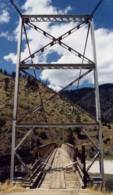
Windgap
Pittsburgh and McKees Rock, Pennsylvania, USA - Chartiers Creek
| Bridgemeister ID: | 370 (added before 2003) |
| Name: | Windgap |
| Also Known As: | McKees Rocks |
| Location: | Pittsburgh and McKees Rock, Pennsylvania, USA |
| Crossing: | Chartiers Creek |
| Coordinates: | 40.46333 N 80.07409 W |
| Maps: | Acme, GeoHack, Google, OpenStreetMap |
| References: | BOP |
| Use: | Footbridge |
| Status: | Removed, c. 2005 |
| Main Cables: | Wire (steel) |
| Suspended Spans: | 1 |
Notes:
- Damaged by flood (due to Hurricane Ivan), September 17, 2004. Removed, c. 2005.
External Links:
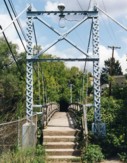
Winooski
Bolton, Vermont, USA - Winooski River
| Bridgemeister ID: | 2946 (added 2019-09-29) |
| Name: | Winooski |
| Also Known As: | Long Trail |
| Location: | Bolton, Vermont, USA |
| Crossing: | Winooski River |
| Coordinates: | 44.378585 N 72.916677 W |
| Maps: | Acme, GeoHack, Google, OpenStreetMap |
| Use: | Footbridge |
| Status: | In use (last checked: 2019) |
| Main Cables: | Wire (steel) |
| Suspended Spans: | 1 |
Wire
Grace, Springfield, West Virginia, USA - South Branch Potomac River
| Bridgemeister ID: | 4921 (added 2020-07-26) |
| Name: | Wire |
| Location: | Grace, Springfield, West Virginia, USA |
| Crossing: | South Branch Potomac River |
| Coordinates: | 39.427319 N 78.714996 W |
| Maps: | Acme, GeoHack, Google, OpenStreetMap |
| Use: | Vehicular |
| Status: | Removed |
| Main Cables: | Wire (iron) |
Notes:
- A Civil War skirmish known as the "Wire Bridge Engagement" occurred on October 24, 1861 at the location of the present day (2020) Grace crossing (John Blue Bridge). The bridge played a prominent role as the event unfolded on and around the bridge, described very specifically as a wire bridge. A historical marker at the site shows an illustration from the New York Illustrated News (1862) clearly showing a period-correct vehicular suspension bridge.
- This location was in Virginia at the time the bridge was completed (prior to 1861, presumably).
- Coordinates are of the present day (2020) crossing at this location, believed to be very close to the location of the suspension bridge, if not the same location.
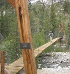
Wood's Creek
Rae Lakes vicinity, California, USA - Wood's Creek
| Bridgemeister ID: | 1213 (added 2004-02-14) |
| Name: | Wood's Creek |
| Location: | Rae Lakes vicinity, California, USA |
| Crossing: | Wood's Creek |
| At or Near Feature: | John Muir Trail, Kings Canyon National Park |
| Coordinates: | 36.873689 N 118.438052 W |
| Maps: | Acme, GeoHack, Google, OpenStreetMap |
| Use: | Footbridge |
| Status: | In use (last checked: 2018) |
| Main Cables: | Wire (steel) |
| Suspended Spans: | 1 |
Notes:
- Probably built in 1990's.
Workman's Bar
Rock Creek, Plumas County, California, USA - North Fork Feather River
| Bridgemeister ID: | 5674 (added 2021-01-31) |
| Name: | Workman's Bar |
| Location: | Rock Creek, Plumas County, California, USA |
| Crossing: | North Fork Feather River |
| Coordinates: | 39.905172 N 121.344949 W |
| Maps: | Acme, GeoHack, Google, OpenStreetMap |
| Use: | Vehicular (one-lane) |
| Status: | Destroyed, 1907 |
| Main Cables: | Wire |
| Suspended Spans: | 1 |
Notes:
- Workman's Bar (named for Robert Workman) was located near the current location of the Pacific Gas and Electric Rock Creek Powerhouse. The coordinates reflect the bar observed at the present-day (2020) powerhouse, but may not be the exact location of the bridge.
External Links:
Do you have any information or photos for these bridges that you would like to share? Please email david.denenberg@bridgemeister.com.
