Suspension Bridges of Pennsylvania (1-100 of 120)
This is a list of bridges 1 through 100 (of 120 total) from the suspension bridge inventory for Pennsylvania in USA. Wherever you see a Bridgemeister ID number click it to isolate the bridge on its own page.
Related Lists:
1801: Jacob's Creek
Iron Bridge, Mount Pleasant vicinity, Pennsylvania, USA - Jacob's Creek
| Bridgemeister ID: | 3 (added before 2003) |
| Year Completed: | 1801 |
| Name: | Jacob's Creek |
| Also Known As: | Iron Bridge, Chain Bridge |
| Location: | Iron Bridge, Mount Pleasant vicinity, Pennsylvania, USA |
| Crossing: | Jacob's Creek |
| Coordinates: | 40.112598 N 79.553186 W |
| Maps: | Acme, GeoHack, Google, OpenStreetMap |
| Principals: | Judge James Finley |
| References: | AAJ, ASB, BBR, BOB, BPL, CAB, DSE20000116, HBE, LAB, PTS2 |
| Use: | Vehicular |
| Status: | Removed, 1833 |
| Main Cables: | Chain (iron) |
| Suspended Spans: | 3 |
| Main Span: | 1 x 21.3 meters (70 feet) |
| Deck width: | 12.5 feet |
Notes:
- In an email dated January 16, 2000, Don Sayenga provided information about the location of this bridge. Generally attributed to Uniontown (the seat of Fayette County, PA), Mr. Sayenga offers some clues about the bridge's true location. "[James Finley] stated that he built it near the home of his friend Meason which implies a connection for the iron as Meason was making iron. Meason's home has survived by the way, a beautiful place. Finley stated it was a combination contract with the cost split between two counties, and he stated it was built over Jacob's Creek which is the county boundary. He also makes it clear it was on the road to Greensburg. The only place the old road crossed Jacob's Creek is just south of Mount Pleasant, Pennsylvania. On the geodetic survey maps this spot is marked "Iron Bridge" but there is no town there. The last time I was there I saw a sign that said 'Iron Bridge' on an automobile scrap yard. I found absolutely no trace of the bridge, but it was not very big, so there was no need for a huge abutment."
- First suspension bridge with a rigid level deck, often considered the world's first modern suspension bridge.
- Coordinates are for the likely location of the bridge, where present-day (2020) Pennsylvania route 3105 crosses Jacob's Creek.
External Links:
1809: (suspension bridge)
Brownsville vicinity, Pennsylvania, USA
| Bridgemeister ID: | 8 (added before 2003) |
| Year Completed: | 1809 |
| Name: | (suspension bridge) |
| Location: | Brownsville vicinity, Pennsylvania, USA |
| References: | AAJ, CAB, DSE20000203, HBE |
| Status: | Removed |
| Main Cables: | Chain (iron) |
1809: (suspension bridge)
Brownsville, Pennsylvania, USA - Dunlap's Creek
| Bridgemeister ID: | 7 (added before 2003) |
| Year Completed: | 1809 |
| Name: | (suspension bridge) |
| Location: | Brownsville, Pennsylvania, USA |
| Crossing: | Dunlap's Creek |
| Principals: | John Templeman |
| References: | AAJ, BCW, CAB, DSE20000118, DSE20000203, HBE |
| Use: | Vehicular |
| Status: | Removed |
| Main Cables: | Chain (iron) |
External Links:
- Dunlap's Creek Bridge (link reported not working). "The first recorded bridge across Dunlap's Creek was a wooden structure constructed prior to 1774. It was repaired in 1801, but was destroyed during a spring storm in 1808. A chain-link suspension bridge was built on the site in 1809; it collapsed under the weight of snow and a heavily laden wagon in 1820. A third bridge, another wooden structure, built in 1821 also failed. The present bridge is thus the fourth bridge at the site."
- Structurae - Structure ID 20008055
1809: Schuylkill Falls
Philadelphia, Pennsylvania, USA - Schuylkill River
| Bridgemeister ID: | 9 (added before 2003) |
| Year Completed: | 1809 |
| Name: | Schuylkill Falls |
| Location: | Philadelphia, Pennsylvania, USA |
| Crossing: | Schuylkill River |
| Principals: | John Templeman |
| References: | AAJ, BBR, BPL, CAB, DSE20000118, HBE, PTS2 |
| Status: | Removed |
| Main Cables: | Chain (iron) |
| Suspended Spans: | 2 |
| Main Spans: | 2 x 46.6 meters (153 feet) |
| Deck width: | 18 feet |
Notes:
- Failed 1811, 1816. HBE notes the 1811 was due to weight of cattle. The 1816 failure was due to weight of ice and snow.
External Links:
1810: (suspension bridge)
Paulings Ford, Pennsylvania, USA - Schuylkill River
| Bridgemeister ID: | 11 (added before 2003) |
| Year Completed: | 1810 |
| Name: | (suspension bridge) |
| Location: | Paulings Ford, Pennsylvania, USA |
| Crossing: | Schuylkill River |
| References: | CAB |
| Status: | Removed |
| Main Cables: | Chain (iron) |
External Links:
1810: (suspension bridge)
Reading, Pennsylvania, USA - Schuykill River
| Bridgemeister ID: | 12 (added before 2003) |
| Year Completed: | 1810 |
| Name: | (suspension bridge) |
| Location: | Reading, Pennsylvania, USA |
| Crossing: | Schuykill River |
| Principals: | Ulrich Kissinger |
| References: | CAB |
| Status: | Removed |
| Main Cables: | Chain (iron) |
External Links:
1810: (suspension bridge)
Wrightstown, Pennsylvania, USA - Neshaminy River
| Bridgemeister ID: | 13 (added before 2003) |
| Year Completed: | 1810 |
| Name: | (suspension bridge) |
| Location: | Wrightstown, Pennsylvania, USA |
| Crossing: | Neshaminy River |
| Principals: | John Parker |
| References: | AAJ, CAB, DSE20000403 |
| Use: | Vehicular |
| Status: | Removed |
| Main Cables: | Chain (iron) |
| Main Spans: | 2 x 30.5 meters (100 feet) |
External Links:
1811: (suspension bridge)
Juniata Crossing, Pennsylvania, USA - Juniata River
| Bridgemeister ID: | 15 (added before 2003) |
| Year Completed: | 1811 |
| Name: | (suspension bridge) |
| Location: | Juniata Crossing, Pennsylvania, USA |
| Crossing: | Juniata River |
| References: | CAB, DSE20000403 |
| Use: | Vehicular |
| Status: | Removed |
| Main Cables: | Chain (iron) |
External Links:
1811: Third Street
Easton, Pennsylvania, USA - Lehigh River
| Bridgemeister ID: | 18 (added before 2003) |
| Year Completed: | 1811 |
| Name: | Third Street |
| Location: | Easton, Pennsylvania, USA |
| Crossing: | Lehigh River |
| Principals: | Jacob Blumer (?) |
| References: | CAB, DSE20000203 |
| Use: | Vehicular |
| Status: | Removed |
| Main Cables: | Chain (iron) |
External Links:
1814: Hamilton Street
Allentown, Pennsylvania, USA - Lehigh River
| Bridgemeister ID: | 19 (added before 2003) |
| Year Completed: | 1814 |
| Name: | Hamilton Street |
| Location: | Allentown, Pennsylvania, USA |
| Crossing: | Lehigh River |
| Principals: | Jacob Blumer |
| References: | AAJ, CAB, DSE20000203, PTS2 |
| Status: | Removed |
| Main Cables: | Chain (iron) |
| Suspended Spans: | 4 |
| Main Spans: | 2 |
| Side Spans: | 2 |
External Links:
1816: Spider
Philadelphia, Pennsylvania, USA - Schuylkill River
| Bridgemeister ID: | 20 (added before 2003) |
| Year Completed: | 1816 |
| Name: | Spider |
| Location: | Philadelphia, Pennsylvania, USA |
| Crossing: | Schuylkill River |
| Principals: | Josiah White, Erskine Hazard |
| References: | AAJ, BOB, BPL, GHD, HBE, LAB, PTS2 |
| Use: | Footbridge |
| Status: | Removed |
| Main Cables: | Wire (iron) |
| Main Span: | 1 x 120 meters (393.75 feet) |
Notes:
- Narrow footbridge. First wire bridge in North America. HBE notes "first wire suspension bridge in any country."
- Often described as having collapsed under the weight of ice and snow, Don Sayenga notes that no contemporary sources confirm this demise. Since the nearby chain bridge did fail under weight of ice and snow, he believes this fate has been misattributed to the White and Hazard footbridge. Don believes the bridge was just dismantled at some point after June, 1816.
- Al Zagofsky also wrote to explain there was no evidence of this bridge collapsing under weight of ice and snow. Al writes: "According to an original source Captain Joshua Rowley Watson, who inspected the bridge on June 15, 1816: '...There was a bridge, but which by the weight of ice and snow, has been carried away.' This refers to the previous bridge that the cable bridge was temporarily replacing. I did not see any cause for failure of the wire rope bridge. My guess is that it was removed when the regular bridge was repaired. The same article shows a sketch that he made, showing the main span to be 407 feet. I am looking at the Canal History and Technology Proceedings Vol 5, March 22, 1986."
1824: Biery's
Biery's Port (Catasauqua), Pennsylvania, USA - Lehigh River
| Bridgemeister ID: | 21 (added before 2003) |
| Year Completed: | 1824 |
| Name: | Biery's |
| Location: | Biery's Port (Catasauqua), Pennsylvania, USA |
| Crossing: | Lehigh River |
| Principals: | Jacob Blumer, George Deily (?) |
| References: | CAB, DSE20000203 |
| Status: | Removed |
| Main Cables: | Chain (iron) |
1824: Lehigh Gap
Lehigh Gap, Pennsylvania, USA - Lehigh River
| Bridgemeister ID: | 22 (added before 2003) |
| Year Completed: | 1824 |
| Name: | Lehigh Gap |
| Also Known As: | Palmerton |
| Location: | Lehigh Gap, Pennsylvania, USA |
| Crossing: | Lehigh River |
| Principals: | Jacob Blumer |
| References: | AAJ, CAB, DSE20000203, WHSB |
| Use: | Vehicular |
| Status: | Replaced, 1933 |
| Main Cables: | Chain (iron) |
| Suspended Spans: | 3 |
Notes:
- Finley patent bridge.
External Links:
Image Sets:

1842: Fairmount
Philadelphia, Pennsylvania, USA - Schuylkill River
| Bridgemeister ID: | 24 (added before 2003) |
| Year Completed: | 1842 |
| Name: | Fairmount |
| Also Known As: | Callowhill Street, Upper Ferry |
| Location: | Philadelphia, Pennsylvania, USA |
| Crossing: | Schuylkill River |
| Principals: | Charles Ellet |
| References: | BBR, BOB, BPL, HBE, LAB, PTS2, WHSB |
| Use: | Vehicular |
| Status: | Replaced, 1875 |
| Main Cables: | Wire (iron) |
| Suspended Spans: | 1 |
| Main Span: | 1 x 104.2 meters (342 feet) |
Notes:
- BBR and BOB say the bridge was completed in 1841.
Image Sets:
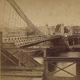
1845: Pittsburgh Aqueduct
Pittsburgh, Pennsylvania, USA - Allegheny River
| Bridgemeister ID: | 27 (added before 2003) |
| Year Completed: | 1845 |
| Name: | Pittsburgh Aqueduct |
| Location: | Pittsburgh, Pennsylvania, USA |
| Crossing: | Allegheny River |
| Principals: | John A. Roebling |
| References: | BOB, BOP, BPL, HBE, ONF, PTS2, RDH, SJR |
| Use: | Aqueduct |
| Status: | Removed, 1861 |
| Main Cables: | Wire (iron) |
| Suspended Spans: | 7 |
| Main Spans: | 7 x 49.4 meters (162 feet) |
Notes:
- In use until 1860.
External Links:
1846: Monongahela
Pittsburgh, Pennsylvania, USA - Monongahela River
| Bridgemeister ID: | 28 (added before 2003) |
| Year Completed: | 1846 |
| Name: | Monongahela |
| Also Known As: | Smithfield Street |
| Location: | Pittsburgh, Pennsylvania, USA |
| Crossing: | Monongahela River |
| Coordinates: | 40.435444 N 80.001778 W |
| Maps: | Acme, GeoHack, Google, OpenStreetMap |
| Principals: | John A. Roebling |
| References: | BOB, BOP, BPL, HBE, ONF, PBR, PTS2 |
| Use: | Vehicular |
| Status: | Removed, 1882 |
| Main Cables: | Wire (iron) |
| Suspended Spans: | 8 |
| Main Spans: | 8 x 57.3 meters (188 feet) |
| Deck width: | 20 feet |
External Links:
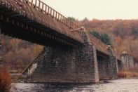
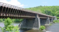
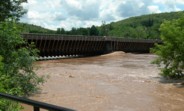
1848: Delaware Aqueduct
Lackawaxen, Pennsylvania and Minisink Ford, New York, USA - Delaware River
| Bridgemeister ID: | 30 (added before 2003) |
| Year Completed: | 1848 |
| Name: | Delaware Aqueduct |
| Also Known As: | Roebling Aqueduct |
| Location: | Lackawaxen, Pennsylvania and Minisink Ford, New York, USA |
| Crossing: | Delaware River |
| Coordinates: | 41.48262 N 74.98461 W |
| Maps: | Acme, GeoHack, Google, OpenStreetMap |
| Principals: | John A. Roebling |
| References: | AAJ, BDR, BOB, BPL, GBD, LAB, LACE, RDH, SJR |
| Use: | Aqueduct and Vehicular (one-lane), with walkway |
| Status: | In use (last checked: 2006) |
| Main Cables: | Wire (iron) |
| Suspended Spans: | 4 |
| Main Spans: | 1 x 43.3 meters (142 feet), 3 x 39.9 meters (131 feet) |
Notes:
- BPL: Completed 1848. RDH/BDR: Completed 1848, not used until 1849.
- Originally constructed to carry the Delaware and Hudson Canal. Converted to a one-lane vehicular bridge soon after the canal closed in 1898. Substantially restored in 1980's and 1990's, but retains original cables.
- Built as part of same project as 1849 Lackawaxen Aqueduct - Lackawaxen, Pennsylvania, USA.
- Built as part of same project as 1851 High Falls Aqueduct - High Falls, New York, USA.
- Built as part of same project as 1851 Neversink Aqueduct - Cuddebackville, New York, USA.
- Near 1849 Lackawaxen Aqueduct - Lackawaxen, Pennsylvania, USA.
External Links:
Image Sets:
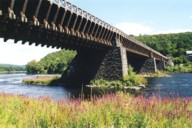
1849: Lackawaxen Aqueduct
Lackawaxen, Pennsylvania, USA - Lackawaxen River
| Bridgemeister ID: | 31 (added before 2003) |
| Year Completed: | 1849 |
| Name: | Lackawaxen Aqueduct |
| Location: | Lackawaxen, Pennsylvania, USA |
| Crossing: | Lackawaxen River |
| Coordinates: | 41.485528 N 74.995250 W |
| Maps: | Acme, GeoHack, Google, OpenStreetMap |
| Principals: | John A. Roebling |
| References: | AAJ, BOB, BPL, RDH, SJR |
| Use: | Aqueduct |
| Status: | Removed |
| Main Cables: | Wire (iron) |
| Suspended Spans: | 2 |
| Main Spans: | 2 x 34.9 meters (114.37 feet) |
Notes:
- BPL says 1848, RDH says same, but not used until 1849.
- Built as part of same project as 1848 Delaware Aqueduct (Roebling Aqueduct) - Lackawaxen, Pennsylvania and Minisink Ford, New York, USA.
- Built as part of same project as 1851 High Falls Aqueduct - High Falls, New York, USA.
- Built as part of same project as 1851 Neversink Aqueduct - Cuddebackville, New York, USA.
- Near 1848 Delaware Aqueduct (Roebling Aqueduct) - Lackawaxen, Pennsylvania and Minisink Ford, New York, USA.
External Links:
1855: Shohola
Barryville, New York and Shohola, Pennsylvania, USA - Delaware River
| Bridgemeister ID: | 41 (added before 2003) |
| Year Completed: | 1855 |
| Name: | Shohola |
| Also Known As: | Barryville-Shohola, Shohola-Barryville |
| Location: | Barryville, New York and Shohola, Pennsylvania, USA |
| Crossing: | Delaware River |
| Coordinates: | 41.477000 N 74.919000 W |
| Maps: | Acme, GeoHack, Google, OpenStreetMap |
| Principals: | Chauncy Thomas, John A. Roebling |
| References: | BDR, SHO |
| Use: | Vehicular |
| Status: | Dismantled, 1941 |
| Main Cables: | Wire (iron) |
| Suspended Spans: | 1 |
Notes:
- BDR: Built 1856, severely damaged 1859, rebuilt, collapsed Jan. 1st 1865, rebuilt 1866. Dale writes: "A respected historian, John Willard Johnston, who knew Chauncey Thomas personally and visited the area during his ownership of the toll bridge, insisted that Thomas, as the builder, was grossly incompetent."
- Originally constructed with one main span, the center pier was added during the 1866 reconstruction.
- Don Sayenga's research leads him to conclude the bridge was completed in the fall of 1855. He notes an article from the Pike County Democrat (June 21, 1872) stating the bridge was completed in 1855. The article also notes the 1859 collapse occurred on July 2, 1859. Don's interest in this bridge is piqued by the connection to John Roebling, "...this bridge seems to be the only John Roebling bridge that failed in service..." Roebling prepared plans, for the original bridge, for Chauncy Thomas (who, by Dale's account was inexperienced).
Image Sets:
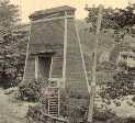
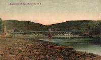
1857: Change
Glendon, Pennsylvania, USA - Lehigh River
| Bridgemeister ID: | 56 (added before 2003) |
| Year Completed: | 1857 |
| Name: | Change |
| Also Known As: | Chain, Lehigh Canal Swinging, Wire Towing Path at Pool No. 8 |
| Location: | Glendon, Pennsylvania, USA |
| Crossing: | Lehigh River |
| Coordinates: | 40.65382 N 75.24774 W |
| Maps: | Acme, GeoHack, Google, OpenStreetMap |
| Principals: | Lehigh Coal and Navigation Co., E.A. Douglas |
| References: | HAERPA461, HBP |
| Use: | Footbridge and Change |
| Status: | Derelict (last checked: 2007) |
| Main Cables: | Wire (iron) |
| Suspended Spans: | 2 |
| Main Spans: | 2 |
Notes:
- Often mistakenly called a "chain" bridge, this is a "change" bridge.
External Links:
- Aldrich Change Bridge. Dale Oswald explains (in the context of the Aldrich Change Bridge, a non-suspension bridge in Palmyra, New York): "A change bridge is one with low railings and an underpass that allowed draft teams to move from one side of the canal to the other without unhitching, cloverleaf-style."
Image Sets:
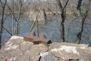
1860: Allegheny River
Pittsburgh, Pennsylvania, USA - Allegheny River
| Bridgemeister ID: | 59 (added before 2003) |
| Year Completed: | 1860 |
| Name: | Allegheny River |
| Also Known As: | Sixth Street, St. Clair |
| Location: | Pittsburgh, Pennsylvania, USA |
| Crossing: | Allegheny River |
| Coordinates: | 40.445028 N 80.003028 W |
| Maps: | Acme, GeoHack, Google, OpenStreetMap |
| Principals: | John A. Roebling |
| References: | BOB, BOP, BPL, HBE, PBR, PTS2, SJR |
| Use: | Vehicular, with walkway |
| Status: | Replaced, 1892 |
| Main Cables: | Wire (iron) |
| Suspended Spans: | 4 |
| Main Spans: | 2 x 104.9 meters (344 feet) |
| Side Spans: | 2 x 52.1 meters (171 feet) |
| Deck width: | 40 feet |
Notes:
- BPL cites this bridge as the first suspension bridge with metal towers. However, at least two earlier suspension bridges (1857 Watertown, New York and 1856 Bidwell Bar, California) are known to have metal towers and even Roebling's 1846 Smithfield Street Bridge in Pittsburgh had cast iron towers.
- Next to 1884 North Side (Seventh Street) - Pittsburgh, Pennsylvania, USA.
- Later at same location 1928 Roberto Clemente (Sixth Street) - Pittsburgh, Pennsylvania, USA.
- All past and present bridges at this location.
External Links:
Image Sets:
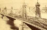
1861: Connellsville
Connellsville and New Haven, Pennsylvania, USA - Youghiogheny River
| Bridgemeister ID: | 278 (added before 2003) |
| Year Completed: | 1861 |
| Name: | Connellsville |
| Location: | Connellsville and New Haven, Pennsylvania, USA |
| Crossing: | Youghiogheny River |
| Coordinates: | 40.017528 N 79.592722 W |
| Maps: | Acme, GeoHack, Google, OpenStreetMap |
| Use: | Vehicular (one-lane) |
| Status: | Replaced, 1898 |
| Main Cables: | Wire |
| Suspended Spans: | 1 |
Image Sets:
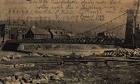
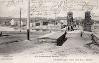
1864: Franklin
Franklin, Pennsylvania, USA - Allegheny River
| Bridgemeister ID: | 3186 (added 2019-11-09) |
| Year Completed: | 1864 |
| Name: | Franklin |
| Location: | Franklin, Pennsylvania, USA |
| Crossing: | Allegheny River |
| Principals: | John Murphy |
| References: | AAJ |
| Status: | Destroyed, 1870 |
Notes:
- 1870: Cable ends caught fire precipitating collapse, killing two.
1865: Market Street
Williamsport, Pennsylvania, USA - Susquehanna River
| Bridgemeister ID: | 64 (added before 2003) |
| Year Completed: | 1865 |
| Name: | Market Street |
| Location: | Williamsport, Pennsylvania, USA |
| Crossing: | Susquehanna River |
| Coordinates: | 41.237556 N 76.997861 W |
| Maps: | Acme, GeoHack, Google, OpenStreetMap |
| Principals: | Alfred P. Boller |
| References: | AAJ, JFI186604 |
| Use: | Vehicular |
| Status: | Destroyed, June 1, 1889 |
| Main Cables: | Wire (iron) |
| Suspended Spans: | 5 |
| Main Spans: | 5 x 61 meters (200 feet) |
Notes:
- JFI186604 (in which Boller mentions about the bridge's "peculiar system of trussing": "This general arrangement for suspension bridges was first practised by John Murphy, Esq., C.E., over the Gauley, in West Virginia, and also at Franklin, Pennsylvania.")
- Destroyed by flood June 1, 1889.
- Near 1878 Maynard Street - Williamsport, Pennsylvania, USA.
- Replaced by 1889 Market Street - Williamsport, Pennsylvania, USA.
- All past and present bridges at this location.
Image Sets:
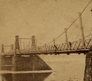
1869: Lordville
Lordville, New York and Equinunk, Pennsylvania, USA - Delaware River
| Bridgemeister ID: | 71 (added before 2003) |
| Year Completed: | 1869 |
| Name: | Lordville |
| Location: | Lordville, New York and Equinunk, Pennsylvania, USA |
| Crossing: | Delaware River |
| Coordinates: | 41.867938 N 75.213785 W |
| Maps: | Acme, GeoHack, Google, OpenStreetMap |
| Principals: | E.F. Farrington |
| References: | BDR, BOL, PTS2 |
| Use: | Vehicular (one-lane) |
| Status: | Destroyed, 1903 |
| Main Cables: | Wire (iron) |
Notes:
- Destroyed by flood 1903.
- Replaced by 1904 Lordville-Equinunk - Lordville, New York and Equinunk, Pennsylvania, USA.
- All past and present bridges at this location.
Image Sets:
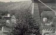
1869: Swinging
Warren and Glade, Pennsylvania, USA - Conewango Creek
| Bridgemeister ID: | 1623 (added 2005-02-27) |
| Year Completed: | 1869 |
| Name: | Swinging |
| Location: | Warren and Glade, Pennsylvania, USA |
| Crossing: | Conewango Creek |
| Coordinates: | 41.847389 N 79.141000 W |
| Maps: | Acme, GeoHack, Google, OpenStreetMap |
| Use: | Footbridge |
| Status: | Replaced, 1904 |
| Main Cables: | Wire (iron) |
Notes:
- Coordinates indicate approximate original location of the bridge.
- Destroyed by storm soon after completion and rebuilt.
- Images of America: Warren by Jodi L. Brandon shows an image of this bridge with a caption stating the bridge was moved to Kelletville (in Forest County, Pennsylvania) in 1906.
Image Sets:
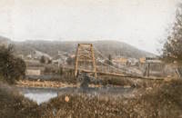
1870: Chehocton
Hancock, New York and Wayne County, Pennsylvania, USA - East Branch Delaware River
| Bridgemeister ID: | 284 (added before 2003) |
| Year Completed: | 1870 |
| Name: | Chehocton |
| Location: | Hancock, New York and Wayne County, Pennsylvania, USA |
| Crossing: | East Branch Delaware River |
| Coordinates: | 41.952583 N 75.278167 W |
| Maps: | Acme, GeoHack, Google, OpenStreetMap |
| Principals: | E.F. Farrington, John A. Roebling's Sons Co. |
| Use: | Vehicular |
| Status: | Removed, 1937 |
| Main Cables: | Wire (iron) |
| Suspended Spans: | 1 |
| Main Span: | 1 x 144.8 meters (475 feet) estimated |
Notes:
- Crossed the East Branch Delaware River on an alignment indicated by the current Old Bridge Street, between the rail crossing and the current (2020s) Stockport Road bridge.
- Replaced 1937.
Image Sets:
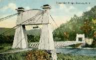
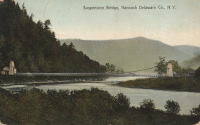
1871: Warren
Warren, Pennsylvania, USA - Allegheny River
| Bridgemeister ID: | 75 (added before 2003) |
| Year Completed: | 1871 |
| Name: | Warren |
| Also Known As: | Hickory Street |
| Location: | Warren, Pennsylvania, USA |
| Crossing: | Allegheny River |
| Coordinates: | 41.844056 N 79.149722 W |
| Maps: | Acme, GeoHack, Google, OpenStreetMap |
| Principals: | George W. Fishler |
| References: | AAJ, EOV, HAERPA461, HBE, PTS2 |
| Use: | Vehicular, with walkway |
| Status: | Replaced, 1918 |
| Main Cables: | Wire (iron) |
| Suspended Spans: | 1 |
| Main Span: | 1 x 143.3 meters (470 feet) |
| Deck width: | 29 feet |
Image Sets:
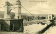
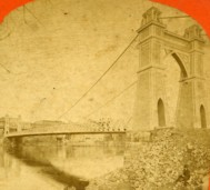
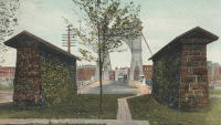
1872: Barrett
Port Jervis, New York and Matamoras, Pennsylvania, USA - Delaware River
| Bridgemeister ID: | 76 (added before 2003) |
| Year Completed: | 1872 |
| Name: | Barrett |
| Location: | Port Jervis, New York and Matamoras, Pennsylvania, USA |
| Crossing: | Delaware River |
| Coordinates: | 41.371917 N 74.697000 W |
| Maps: | Acme, GeoHack, Google, OpenStreetMap |
| References: | BDR |
| Use: | Vehicular |
| Status: | Destroyed, October 11, 1903 |
| Main Cables: | Wire (iron) |
| Suspended Spans: | 2 |
| Main Spans: | 2 |
Notes:
- BDR: Destroyed by ice March 17, 1875, rebuilt, destroyed by flood October 11, 1903.
Image Sets:
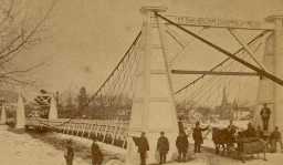
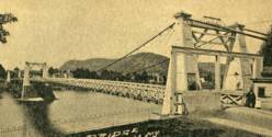
1873: South Street
Wilkes-Barre, Pennsylvania, USA - Lehigh Valley Railroad and North Branch Canal
| Bridgemeister ID: | 353 (added before 2003) |
| Year Completed: | 1873 |
| Name: | South Street |
| Also Known As: | Wire |
| Location: | Wilkes-Barre, Pennsylvania, USA |
| Crossing: | Lehigh Valley Railroad and North Branch Canal |
| Coordinates: | 41.239328 N 75.884643 W |
| Maps: | Acme, GeoHack, Google, OpenStreetMap |
| Use: | Vehicular |
| Status: | Removed, c. 1925 |
| Main Cables: | Wire |
Notes:
- In use until 1910, possibly longer. Replacement opened 1925.
Image Sets:
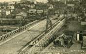
1876: Petroleum Street
Oil City, Pennsylvania, USA - Allegheny River
| Bridgemeister ID: | 83 (added before 2003) |
| Year Completed: | 1876 |
| Name: | Petroleum Street |
| Also Known As: | Oil City |
| Location: | Oil City, Pennsylvania, USA |
| Crossing: | Allegheny River |
| Coordinates: | 41.430083 N 79.712833 W |
| Maps: | Acme, GeoHack, Google, OpenStreetMap |
| Principals: | Charles Roebling |
| References: | AAJ, HAERPA461, HBE, PTS2, TRS |
| Use: | Vehicular |
| Status: | Removed |
| Main Cables: | Wire |
| Suspended Spans: | 3 |
| Main Span: | 1 x 152.4 meters (500 feet) |
| Side Spans: | 2 |
Notes:
- AAJ: Rebuilt, 1884, 1905.
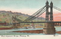
1876: Point
Pittsburgh, Pennsylvania, USA - Monongahela River
| Bridgemeister ID: | 84 (added before 2003) |
| Year Completed: | 1876 |
| Name: | Point |
| Location: | Pittsburgh, Pennsylvania, USA |
| Crossing: | Monongahela River |
| Coordinates: | 40.441000 N 80.014000 W |
| Maps: | Acme, GeoHack, Google, OpenStreetMap |
| Principals: | Edward Hemberle |
| References: | AAJ, BOP, BPL, HBE, IEA, ONF, PBR, PTS2, SA19000106 |
| Use: | Vehicular and Rail (streetcar) |
| Status: | Demolished, 1927 |
| Main Cables: | Eyebar |
| Suspended Spans: | 1 |
| Main Span: | 1 x 243.8 meters (800 feet) |
| Deck width: | 34 feet |
Notes:
- Partial floor collapse requiring extensive repairs, December 24, 1903. Repaired, 1904. Demolished 1927.
External Links:
Image Sets:
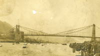
1878: Maynard Street
Williamsport, Pennsylvania, USA - Susquehanna River
| Bridgemeister ID: | 2140 (added 2006-10-31) |
| Year Completed: | 1878 |
| Name: | Maynard Street |
| Location: | Williamsport, Pennsylvania, USA |
| Crossing: | Susquehanna River |
| Coordinates: | 41.229083 N 77.019083 W |
| Maps: | Acme, GeoHack, Google, OpenStreetMap |
| Use: | Vehicular |
| Status: | Removed |
| Main Cables: | Wire |
Notes:
- Damaged by flood, June 1, 1889. Rebuilt, but unclear if rebuilt as a suspension bridge. May have been rebuilt as a truss bridge.
- Near 1865 Market Street - Williamsport, Pennsylvania, USA.
1884: McKeesport-Reynoldton
McKeesport, Pennsylvania, USA - Youghiogheny River
| Bridgemeister ID: | 90 (added before 2003) |
| Year Completed: | 1884 |
| Name: | McKeesport-Reynoldton |
| Also Known As: | Third Avenue |
| Location: | McKeesport, Pennsylvania, USA |
| Crossing: | Youghiogheny River |
| Coordinates: | 40.352359 N 79.870561 W |
| Maps: | Acme, GeoHack, Google, OpenStreetMap |
| Principals: | McKeesport and Reynoldton Bridge Co. |
| References: | AAJ, HAERPA461 |
| Use: | Rail (streetcar) and Vehicular |
| Status: | Dismantled, 1961 |
| Main Cables: | Wire (steel) |
| Suspended Spans: | 3 |
| Main Span: | 1 x 97.5 meters (320 feet) |
| Side Spans: | 2 x 48.8 meters (160 feet) |
Notes:
- 1896: Reconstructed by Hermann Laub
1884: North Side
Pittsburgh, Pennsylvania, USA - Allegheny River
| Bridgemeister ID: | 91 (added before 2003) |
| Year Completed: | 1884 |
| Name: | North Side |
| Also Known As: | Seventh Street |
| Location: | Pittsburgh, Pennsylvania, USA |
| Crossing: | Allegheny River |
| Coordinates: | 40.445972 N 80.001361 W |
| Maps: | Acme, GeoHack, Google, OpenStreetMap |
| Principals: | Gustav Lindenthal |
| References: | AAJ, BPL, HBE, PBR, PTS2 |
| Use: | Vehicular |
| Status: | Removed, 1924 |
| Main Cables: | Eyebar |
| Suspended Spans: | 4 |
| Main Spans: | 2 x 97.5 meters (320 feet) |
| Side Spans: | 2 x 50.3 meters (165 feet) |
| Deck width: | 42 feet |
Notes:
- Next to 1860 Allegheny River (Sixth Street, St. Clair) - Pittsburgh, Pennsylvania, USA.
- Replaced by 1926 Andy Warhol (Seventh Street) - Pittsburgh, Pennsylvania, USA.
- All past and present bridges at this location.
External Links:
1886: Lower
Easton, Pennsylvania, USA - Lehigh River
| Bridgemeister ID: | 813 (added 2003-05-29) |
| Year Completed: | 1886 |
| Name: | Lower |
| Location: | Easton, Pennsylvania, USA |
| Crossing: | Lehigh River |
| References: | DSL20030414, WGE20030513 |
| Use: | Footbridge |
| Status: | Demolished, 1951 |
| Main Cables: | Wire |
Notes:
- Damaged by windstorm 1950.
Image Sets:
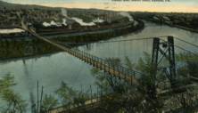
1887: Swinging
Reading, Pennsylvania, USA - Philadelphia and Reading Railroad tracks
| Bridgemeister ID: | 92 (added before 2003) |
| Year Completed: | 1887 |
| Name: | Swinging |
| Location: | Reading, Pennsylvania, USA |
| Crossing: | Philadelphia and Reading Railroad tracks |
| Coordinates: | 40.3405 N 75.923638 W |
| Maps: | Acme, GeoHack, Google, OpenStreetMap |
| Principals: | William Hildenbrand, John A. Roebling's Sons Co. |
| Use: | Footbridge |
| Status: | Dismantled, 1983 |
| Main Cables: | Wire |
| Suspended Spans: | 1 |
Notes:
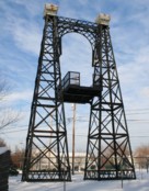
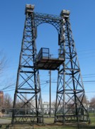
- Dismantled 1983. One tower used in extant (2007) Workers Memorial Tower at Reading, PA.
- The coordinates provided are for the original location of the bridge. The memorial is located at N 40.3245 W 75.9263.
External Links:
Image Sets:
1888: Tidewater Pipeline
Jim Thorpe, Pennsylvania, USA - Lehigh River
| Bridgemeister ID: | 1527 (added 2004-10-24) |
| Year Completed: | 1888 |
| Name: | Tidewater Pipeline |
| Location: | Jim Thorpe, Pennsylvania, USA |
| Crossing: | Lehigh River |
| Coordinates: | 40.90714 N 75.748544 W |
| Maps: | Acme, GeoHack, Google, OpenStreetMap |
| Principals: | William Hildenbrand |
| References: | AAJ, HBE |
| Use: | Pipeline |
| Status: | Extant (last checked: 2020) |
| Main Cables: | Wire |
| Main Span: | 1 x 109.7 meters (360 feet) |
Notes:
- The town was named "Mauch Chunk" at the time the pipeline was built.
Image Sets:
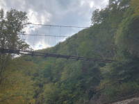
1889: Market Street
Williamsport, Pennsylvania, USA - Susquehanna River
| Bridgemeister ID: | 2134 (added 2006-10-27) |
| Year Completed: | 1889 |
| Name: | Market Street |
| Location: | Williamsport, Pennsylvania, USA |
| Crossing: | Susquehanna River |
| Coordinates: | 41.237333 N 76.997611 W |
| Maps: | Acme, GeoHack, Google, OpenStreetMap |
| Use: | Vehicular |
| Status: | Removed |
| Main Cables: | Wire |
| Suspended Spans: | 5 |
| Main Spans: | 5 x 61 meters (200 feet) |
Notes:
- Replaced 1865 Market Street - Williamsport, Pennsylvania, USA.
- All past and present bridges at this location.
Image Sets:
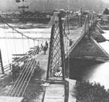
1890: Kellams
Kellams, New York and Stalker, Pennsylvania, USA - Delaware River
| Bridgemeister ID: | 7595 (added 2023-05-07) |
| Year Completed: | 1890 |
| Name: | Kellams |
| Also Known As: | Little Equinunk, Kellams-Stalker, Kellam |
| Location: | Kellams, New York and Stalker, Pennsylvania, USA |
| Crossing: | Delaware River |
| Coordinates: | 41.823641 N 75.113282 W |
| Maps: | Acme, GeoHack, Google, OpenStreetMap |
| Principals: | David Kellam |
| Use: | Vehicular |
| Status: | Replaced |
| Main Cables: | Wire |
| Main Span: | 1 |
Notes:
- Replaced by 1936 Kellams (Little Equinunk, Kellams-Stalker, Kellam) - Kellams, New York and Stalker, Pennsylvania, USA.
- All past and present bridges at this location.
Image Sets:
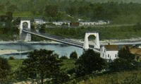
1891: Lower
English Center Borough, Pennsylvania, USA - Little Pine Creek
| Bridgemeister ID: | 99 (added before 2003) |
| Year Completed: | 1891 |
| Name: | Lower |
| Location: | English Center Borough, Pennsylvania, USA |
| Crossing: | Little Pine Creek |
| Coordinates: | 41.4349 N 77.28887 W |
| Maps: | Acme, GeoHack, Google, OpenStreetMap |
| Principals: | Dean & Westbrook |
| References: | HAERPA461, HHP, SSB |
| Use: | Vehicular (one-lane) |
| Status: | In use (last checked: 2023) |
| Main Cables: | Eyebar (steel) |
| Suspended Spans: | 1 |
| Main Span: | 1 x 91.4 meters (300 feet) |
Notes:
- This bridge is an eyebar suspension and truss hybrid similar to the Florianopolis, Silver, and Saint Marys bridges.
- 2012, May: Closed for two weeks for repairs after a snapped support was discovered.
- Companion to 1891 Upper - English Center Borough, Pennsylvania, USA.
- See 1926 Hercilio Luz (Florianopolis) - Florianopolis, Santa Catarina, Brazil.
- See 1928 Point Pleasant (Silver) - Point Pleasant, West Virginia and Kanauga, Gallipolis vicinity, Ohio, USA.
- See 1928 Saint Marys (Hi Carpenter, Short Route) - Saint Marys, West Virginia and Newport, Ohio, USA.
Annotated Citations:
- Crossley, Pat. "Historic bridge on the list to be rehabbed." Williamsport Sun-Gazette, 9 Mar. 2023, https://www.sungazette.com/news/top-news/2023/03/historic-bridge-on-the-list-to-be-rehabbed/
$12 million rehabilitation project planned. "According to Maggie Baker, a spokesperson with PennDOT… 'After traffic is switched to the temporary bridge, the existing bridge will be carefully dismantled. The existing structural components of the bridge will be shipped to a fabricator to be cleaned and painted. Remedies for damaged components will be coordinated with the onsite cultural resource representative. Abutments will be carefully dismantled and reconstructed.'"
External Links:
Image Sets:
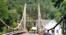
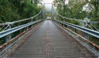
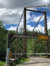
1891: Upper
English Center Borough, Pennsylvania, USA - Little Pine Creek
| Bridgemeister ID: | 100 (added before 2003) |
| Year Completed: | 1891 |
| Name: | Upper |
| Location: | English Center Borough, Pennsylvania, USA |
| Crossing: | Little Pine Creek |
| Principals: | Dean & Westbrook |
| References: | HAERPA461 |
| Use: | Vehicular (one-lane) |
| Status: | Removed, 1932 |
| Main Cables: | Eyebar (steel) |
Notes:
- Slightly larger than the Lower Bridge at English Center.
- Companion to 1891 Lower - English Center Borough, Pennsylvania, USA.
1897: Rochester-Monaca
Rochester and Monaca, Pennsylvania, USA - Ohio River
| Bridgemeister ID: | 104 (added before 2003) |
| Year Completed: | 1897 |
| Name: | Rochester-Monaca |
| Location: | Rochester and Monaca, Pennsylvania, USA |
| Crossing: | Ohio River |
| Coordinates: | 40.696833 N 80.280806 W |
| Maps: | Acme, GeoHack, Google, OpenStreetMap |
| Principals: | Edwin Kirtland Morse |
| References: | AAJ, BPL, HBE, PTS2 |
| Use: | Vehicular, with walkway |
| Status: | Replaced, 1930 |
| Main Cables: | Wire (steel) |
| Suspended Spans: | 3 |
| Main Span: | 1 x 243.8 meters (800 feet) |
| Side Spans: | 1 x 121.9 meters (400 feet), 1 x 126.8 meters (416 feet) |
| Deck width: | 28 feet |
External Links:
- Wikipedia - Rochester–Monaca Bridge
- YouTube - History in a Minute: Rochester-Monaca Bridge. Brief video about the bridges at this location.
- Structurae - Structure ID 20009575
Image Sets:

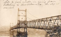
1900: Upper
Easton, Pennsylvania, USA - Lehigh River
| Bridgemeister ID: | 366 (added before 2003) |
| Year Completed: | 1900 |
| Name: | Upper |
| Location: | Easton, Pennsylvania, USA |
| Crossing: | Lehigh River |
| Principals: | Henry G. Tyrell, John McNeal |
| References: | AAJ, DSL20030414, EN19001122, HBE, PTS2, WGE20030513 |
| Use: | Footbridge |
| Status: | Demolished, 1955 |
| Main Cables: | Wire (steel) |
| Suspended Spans: | 3 |
| Main Spans: | 2 x 85 meters (279 feet) |
| Side Span: | 1 x 33.5 meters (110 feet) |
Notes:
- According to Tyrell, "[It] joins Dock Street on the lower side of the river with Glendon Avenue on the upper side, 90 feet above it. To overcome this difference in elevation of the two ends without incurring excessive expense for approach, the bridge floor was made to descend on a grade of 7.2 per cent from the upper bank to meet stairs rising from Dock Street..."
Image Sets:

1904: Lordville-Equinunk
Lordville, New York and Equinunk, Pennsylvania, USA - Delaware River
| Bridgemeister ID: | 112 (added before 2003) |
| Year Completed: | 1904 |
| Name: | Lordville-Equinunk |
| Location: | Lordville, New York and Equinunk, Pennsylvania, USA |
| Crossing: | Delaware River |
| Coordinates: | 41.867745 N 75.213789 W |
| Maps: | Acme, GeoHack, Google, OpenStreetMap |
| Principals: | Owego Bridge Company |
| References: | BDR, BOL, BPL, HHP |
| Use: | Vehicular (one-lane) |
| Status: | Demolished, 1986 |
| Main Cables: | Eyebar (steel) |
| Suspended Spans: | 2 |
| Main Span: | 1 x 105.8 meters (347 feet) |
| Side Span: | 1 x 17.1 meters (56 feet) |
Notes:
- Eyebar suspension bridge.
- Replaced 1869 Lordville - Lordville, New York and Equinunk, Pennsylvania, USA.
- All past and present bridges at this location.
External Links:
Image Sets:
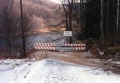
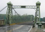
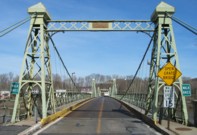
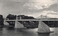
1904: Riegelsville
Riegelsville, Pennsylvania and Riegelsville, New Jersey, USA - Delaware River
| Bridgemeister ID: | 113 (added before 2003) |
| Year Completed: | 1904 |
| Name: | Riegelsville |
| Location: | Riegelsville, Pennsylvania and Riegelsville, New Jersey, USA |
| Crossing: | Delaware River |
| Coordinates: | 40.59427 N 75.19062 W |
| Maps: | Acme, GeoHack, Google, OpenStreetMap |
| Principals: | John A. Roebling's Sons Co., S. A. Cooney |
| References: | BDR, BPL, SSS |
| Use: | Vehicular (two-lane), with walkway |
| Status: | In use (last checked: 2024) |
| Main Cables: | Wire (steel) |
| Suspended Spans: | 3 |
| Main Spans: | 3 x 58 meters (190.3 feet) estimated |
External Links:
Image Sets:
1907: (footbridge)
Hooversville, Pennsylvania, USA - Stony Creek
| Bridgemeister ID: | 1569 (added 2004-12-05) |
| Year Completed: | 1907 |
| Name: | (footbridge) |
| Location: | Hooversville, Pennsylvania, USA |
| Crossing: | Stony Creek |
| Coordinates: | 40.147818 N 78.913939 W |
| Maps: | Acme, GeoHack, Google, OpenStreetMap |
| Use: | Footbridge |
| Status: | Destroyed, 1996 |
| Main Cables: | Wire |
Notes:
- Destroyed by flood, January 19, 1996.
- Replaced by 1996 (footbridge) - Hooversville, Pennsylvania, USA.
- All past and present bridges at this location.
1920: Bridge of Smiles
Marlborough Township, Pennsylvania, USA - Unami Creek
| Bridgemeister ID: | 8794 (added 2024-09-14) |
| Year Completed: | 1920 |
| Name: | Bridge of Smiles |
| Location: | Marlborough Township, Pennsylvania, USA |
| Crossing: | Unami Creek |
| At or Near Feature: | Camp Delmont, Musser Scout Reservation |
| Use: | Footbridge |
| Suspended Spans: | 1 |
Notes:
- Located on the grounds of Camp Delmont which is now part of the Musser Scout Reservation. Presumably no longer in existence.
External Links:
- Facebook. Image and history of the bridge.
1920: Hyde Park Walking
Hyde Park and Leechburg, Pennsylvania, USA - Kiskiminetas River
| Bridgemeister ID: | 5842 (added 2021-05-13) |
| Year Completed: | 1920 |
| Name: | Hyde Park Walking |
| Location: | Hyde Park and Leechburg, Pennsylvania, USA |
| Crossing: | Kiskiminetas River |
| Coordinates: | 40.627771 N 79.597369 W |
| Maps: | Acme, GeoHack, Google, OpenStreetMap |
| Principals: | John A. Roebling's Sons |
| Use: | Footbridge |
| Status: | Destroyed, March 17, 1936 |
| Main Cables: | Wire (steel) |
| Suspended Spans: | 3 |
| Main Spans: | 3 |
Notes:
- Destroyed by flood, March 17, 1936.
- Replaced by 1937 Hyde Park Walking - Hyde Park and Leechburg, Pennsylvania, USA. The replacement was constructed based on the John A. Roebling's Sons plans from the first bridge.
- All past and present bridges at this location.
1920: Swinging
Millersburg, Pennsylvania, USA - Wiconisco Creek
| Bridgemeister ID: | 1924 (added 2005-10-23) |
| Year Completed: | 1920 |
| Name: | Swinging |
| Location: | Millersburg, Pennsylvania, USA |
| Crossing: | Wiconisco Creek |
| Use: | Footbridge |
| Status: | Destroyed, 1972 |
Notes:
- Destroyed by Hurricane Agnes, June 22, 1972.
- Replaced by 1996 Swinging - Millersburg, Pennsylvania, USA.
- All past and present bridges at this location.
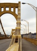
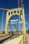
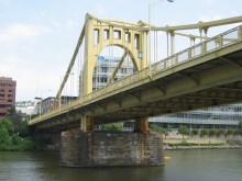
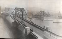
1926: Andy Warhol
Pittsburgh, Pennsylvania, USA - Allegheny River
| Bridgemeister ID: | 148 (added before 2003) |
| Year Completed: | 1926 |
| Name: | Andy Warhol |
| Also Known As: | Seventh Street |
| Location: | Pittsburgh, Pennsylvania, USA |
| Crossing: | Allegheny River |
| Coordinates: | 40.44626 N 80.00145 W |
| Maps: | Acme, GeoHack, Google, OpenStreetMap |
| Principals: | Vernon R. Covell, T.J. Wilkerson, A.D. Nutter, H.E. Dodge, Stanley L. Roush |
| References: | AAJ, BOP, BPL, PBR, PTS2, USS |
| Use: | Vehicular (four-lane), with walkway |
| Status: | In use (last checked: 2014) |
| Main Cables: | Eyebar (steel) |
| Suspended Spans: | 3 |
| Main Span: | 1 x 134.7 meters (442 feet) |
| Side Spans: | 2 x 67.4 meters (221 feet) |
| Deck width: | 62 feet |
| Characteristics: | Self-anchored |
Notes:
- Self-anchored.
- Replaced 1884 North Side (Seventh Street) - Pittsburgh, Pennsylvania, USA.
- Next to 1927 Rachel Carson (Ninth Street) - Pittsburgh, Pennsylvania, USA.
- Next to 1928 Roberto Clemente (Sixth Street) - Pittsburgh, Pennsylvania, USA.
- All past and present bridges at this location.
External Links:
Image Sets:
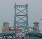
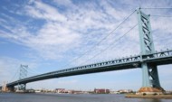
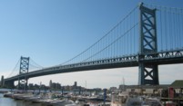
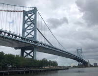
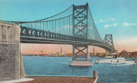
1926: Benjamin Franklin
Philadelphia, Pennsylvania and Camden, New Jersey, USA - Delaware River
| Bridgemeister ID: | 145 (added before 2003) |
| Year Completed: | 1926 |
| Name: | Benjamin Franklin |
| Also Known As: | Philadelphia-Camden |
| Location: | Philadelphia, Pennsylvania and Camden, New Jersey, USA |
| Crossing: | Delaware River |
| Coordinates: | 39.95333 N 75.135 W |
| Maps: | Acme, GeoHack, Google, OpenStreetMap |
| Principals: | Modjeski, Webster, Ball, Moiseff |
| References: | AAJ, BBR, BFL, BONJ, BPL, DRB, GBD, PTL, PTS2, USS |
| Use: | Vehicular (major highway) and Rail (subway), with walkway |
| Status: | In use (last checked: 2007) |
| Main Cables: | Wire (steel) |
| Suspended Spans: | 3 |
| Main Span: | 1 x 533.4 meters (1,750 feet) |
| Side Spans: | 2 x 219.3 meters (719.5 feet) |
| Deck width: | 125.5 feet |
Notes:
- Became longest suspension bridge by eclipsing 1924 Bear Mountain - Anthony's Nose and Bear Mountain, New York, USA.
- Eclipsed by new longest suspension bridge 1929 Ambassador - Detroit, Michigan, USA and Windsor, Ontario, Canada.
- Near 1957 Walt Whitman - Philadelphia, Pennsylvania and Camden, New Jersey, USA.
External Links:
Image Sets:
1927: Rachel Carson
Pittsburgh, Pennsylvania, USA - Allegheny River
| Bridgemeister ID: | 150 (added before 2003) |
| Year Completed: | 1927 |
| Name: | Rachel Carson |
| Also Known As: | Ninth Street |
| Location: | Pittsburgh, Pennsylvania, USA |
| Crossing: | Allegheny River |
| Coordinates: | 40.44669 N 79.99980 W |
| Maps: | Acme, GeoHack, Google, OpenStreetMap |
| Principals: | Vernon R. Covell, T.J. Wilkerson, A.D. Nutter, H.E. Dodge, Stanley L. Roush |
| References: | AAJ, BOP, BPL, PBR, PTS2, USS |
| Use: | Vehicular (four-lane), with walkway |
| Status: | In use (last checked: 2014) |
| Main Cables: | Eyebar (steel) |
| Suspended Spans: | 3 |
| Main Span: | 1 x 131.1 meters (430 feet) |
| Side Spans: | 2 x 65.5 meters (215 feet) |
| Characteristics: | Self-anchored |
Notes:
- Self-anchored.
- Next to 1926 Andy Warhol (Seventh Street) - Pittsburgh, Pennsylvania, USA.
- Next to 1928 Roberto Clemente (Sixth Street) - Pittsburgh, Pennsylvania, USA.
- All past and present bridges at this location.
External Links:
Image Sets:

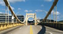
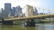

1928: Roberto Clemente
Pittsburgh, Pennsylvania, USA - Allegheny River
| Bridgemeister ID: | 158 (added before 2003) |
| Year Completed: | 1928 |
| Name: | Roberto Clemente |
| Also Known As: | Sixth Street |
| Location: | Pittsburgh, Pennsylvania, USA |
| Crossing: | Allegheny River |
| Coordinates: | 40.44558 N 80.00332 W |
| Maps: | Acme, GeoHack, Google, OpenStreetMap |
| Principals: | Vernon R. Covell, T.J. Wilkerson, A.D. Nutter, H.E. Dodge, Stanley L. Roush |
| References: | AAJ, BOP, BPL, PBR, PTS2, SSS, USS |
| Use: | Vehicular (four-lane), with walkway |
| Status: | In use (last checked: 2014) |
| Main Cables: | Eyebar (steel) |
| Suspended Spans: | 3 |
| Main Span: | 1 x 131.1 meters (430 feet) |
| Side Spans: | 2 x 65.5 meters (215 feet) |
| Characteristics: | Self-anchored |
Notes:
- Self-anchored.
- At former location of 1860 Allegheny River (Sixth Street, St. Clair) - Pittsburgh, Pennsylvania, USA.
- Next to 1926 Andy Warhol (Seventh Street) - Pittsburgh, Pennsylvania, USA.
- Next to 1927 Rachel Carson (Ninth Street) - Pittsburgh, Pennsylvania, USA.
- All past and present bridges at this location.
External Links:
Image Sets:

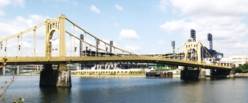
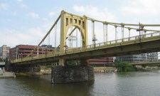
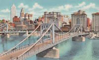
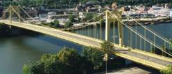
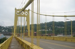
1931: South Tenth Street
Pittsburgh, Pennsylvania, USA - Monongahela River
| Bridgemeister ID: | 173 (added before 2003) |
| Year Completed: | 1931 |
| Name: | South Tenth Street |
| Also Known As: | South Side, Tenth Street, Philip Murray |
| Location: | Pittsburgh, Pennsylvania, USA |
| Crossing: | Monongahela River |
| Coordinates: | 40.43166 N 79.989 W |
| Maps: | Acme, GeoHack, Google, OpenStreetMap |
| Principals: | Sydney A. Shubin |
| References: | AAJ, BOP, BPL, PBR, SSS, USS |
| Use: | Vehicular (four-lane), with walkway |
| Status: | In use (last checked: 2019) |
| Main Cables: | Wire (steel) |
| Suspended Spans: | 3 |
| Main Span: | 1 x 228.6 meters (750 feet) |
| Side Spans: | 2 x 83.8 meters (275 feet) |
| Deck width: | 54 feet |
External Links:
Image Sets:
1936: Kellams
Kellams, New York and Stalker, Pennsylvania, USA - Delaware River
| Bridgemeister ID: | 97 (added before 2003) |
| Year Completed: | 1936 |
| Name: | Kellams |
| Also Known As: | Little Equinunk, Kellams-Stalker, Kellam |
| Location: | Kellams, New York and Stalker, Pennsylvania, USA |
| Crossing: | Delaware River |
| Coordinates: | 41.82333 N 75.11333 W |
| Maps: | Acme, GeoHack, Google, OpenStreetMap |
| References: | BDR, HHP, PTS2 |
| Use: | Vehicular (one-lane) |
| Status: | In use (last checked: 2019) |
| Main Cables: | Wire (steel) |
| Suspended Spans: | 1 |
| Main Span: | 1 x 117 meters (384 feet) |
| Characteristics: | Partially underspanned |
Notes:
- Damaged by floodwaters June, 2006. Repaired October, 2006.
- Renovation completed, January, 2019.
- Replaced 1890 Kellams (Little Equinunk, Kellams-Stalker, Kellam) - Kellams, New York and Stalker, Pennsylvania, USA.
- All past and present bridges at this location.
External Links:
Image Sets:
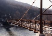
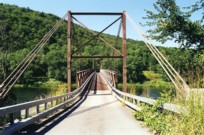
1937: Corbin's
Huntingdon vicinity, Pennsylvania, USA - Raystown Branch Juniata River
| Bridgemeister ID: | 187 (added before 2003) |
| Year Completed: | 1937 |
| Name: | Corbin's |
| Location: | Huntingdon vicinity, Pennsylvania, USA |
| Crossing: | Raystown Branch Juniata River |
| Coordinates: | 40.455 N 77.98333 W |
| Maps: | Acme, GeoHack, Google, OpenStreetMap |
| Use: | Vehicular (one-lane) |
| Status: | In use (last checked: 2021) |
| Main Cables: | Wire (steel) |
| Suspended Spans: | 1 |
Image Sets:
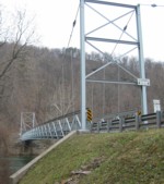
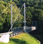
1937: Hyde Park Walking
Hyde Park and Leechburg, Pennsylvania, USA - Kiskiminetas River
| Bridgemeister ID: | 5843 (added 2021-05-13) |
| Year Completed: | 1937 |
| Name: | Hyde Park Walking |
| Location: | Hyde Park and Leechburg, Pennsylvania, USA |
| Crossing: | Kiskiminetas River |
| Coordinates: | 40.627834 N 79.596774 W |
| Maps: | Acme, GeoHack, Google, OpenStreetMap |
| Use: | Footbridge |
| Status: | Removed, c. 1948-1950 |
| Main Cables: | Wire (steel) |
| Suspended Spans: | 3 |
| Main Spans: | 3 |
Notes:
- Closed due to poor condition, 1948.
- Replaced 1920 Hyde Park Walking - Hyde Park and Leechburg, Pennsylvania, USA. The replacement was constructed based on the John A. Roebling's Sons plans from the first bridge.
- Replaced by 1950 Hyde Park (Walking) - Hyde Park and Leechburg, Pennsylvania, USA.
- All past and present bridges at this location.
1937: Lenape Park I
Perkasie, Pennsylvania, USA - East Branch Perkiomen Creek
| Bridgemeister ID: | 189 (added before 2003) |
| Year Completed: | 1937 |
| Name: | Lenape Park I |
| Location: | Perkasie, Pennsylvania, USA |
| Crossing: | East Branch Perkiomen Creek |
| Coordinates: | 40.36658 N 75.29908 W |
| Maps: | Acme, GeoHack, Google, OpenStreetMap |
| Principals: | WPA |
| Use: | Footbridge |
| Status: | In use (last checked: 2003) |
| Main Cables: | Wire (steel) |
| Suspended Spans: | 1 |
Notes:
- Connects to 1937 Lenape Park II - Perkasie, Pennsylvania, USA.
- All past and present bridges at this location.
Image Sets:

1937: Lenape Park II
Perkasie, Pennsylvania, USA - East Branch Perkiomen Creek
| Bridgemeister ID: | 190 (added before 2003) |
| Year Completed: | 1937 |
| Name: | Lenape Park II |
| Location: | Perkasie, Pennsylvania, USA |
| Crossing: | East Branch Perkiomen Creek |
| Coordinates: | 40.36691 N 75.29920 W |
| Maps: | Acme, GeoHack, Google, OpenStreetMap |
| Principals: | WPA |
| Use: | Footbridge |
| Status: | In use (last checked: 2003) |
| Main Cables: | Wire (steel) |
| Suspended Spans: | 1 |
Notes:
- Connects to 1937 Lenape Park I - Perkasie, Pennsylvania, USA.
- All past and present bridges at this location.
Image Sets:

1937: Swinging
Red Hill vicinity, Pennsylvania, USA - Perkiomen Creek
| Bridgemeister ID: | 7367 (added 2022-11-04) |
| Year Completed: | 1937 |
| Name: | Swinging |
| Location: | Red Hill vicinity, Pennsylvania, USA |
| Crossing: | Perkiomen Creek |
| Coordinates: | 40.353622 N 75.503263 W |
| Maps: | Acme, GeoHack, Google, OpenStreetMap |
| Use: | Footbridge |
| Status: | Removed, Early 1950s |
| Main Cables: | Wire (steel) |
| Suspended Spans: | 1 |
Notes:
- Replaced a much less substantial swinging bridge that was destroyed by flood in 1935.
- The site of this bridge was inundated with the creation of the Green Lane Reservoir in the 1950s. The coordinates indicate the approximate location of the bridge which would have been near the current end of Swinging Bridge Rd.
1947: Lumberville-Raven Rock
Lumberville, Pennsylvania and Bulls Island State Park, New Jersey, USA - Delaware River
| Bridgemeister ID: | 204 (added before 2003) |
| Year Completed: | 1947 |
| Name: | Lumberville-Raven Rock |
| Also Known As: | Bulls Island |
| Location: | Lumberville, Pennsylvania and Bulls Island State Park, New Jersey, USA |
| Crossing: | Delaware River |
| Coordinates: | 40.407017 N 75.038183 W |
| Maps: | Acme, GeoHack, Google, OpenStreetMap |
| Principals: | John A. Roebling's Sons Co. |
| References: | BDR, BONJ, SSB |
| Use: | Footbridge |
| Status: | In use (last checked: 2007) |
| Main Cables: | Wire (steel) |
| Suspended Spans: | 5 |
| Main Spans: | 5 |
| Characteristics: | Braced (trussed) chain/cable, Hinged cables |
Notes:
- SSB has an old picture of the bridge from a "Roebling publication". The original caption inside the picture says: "Practical application of Roebling Bridge research is the Lumberville footbridge which spans the Delaware River about twenty miles above Trenton. Pictured below, it utilizes four slabs of Roebling prestressed concrete and the Roebling-developed cable stiffening principle for the first time in the Western Hemisphere." and the authors of SSB go on to describe it as a "two-hinged braced cable suspension footbridge."
External Links:
Image Sets:
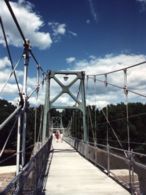
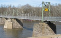
1950: Hyde Park
Hyde Park and Leechburg, Pennsylvania, USA - Kiskiminetas River
| Bridgemeister ID: | 776 (added 2003-03-15) |
| Year Completed: | 1950 |
| Name: | Hyde Park |
| Also Known As: | Walking |
| Location: | Hyde Park and Leechburg, Pennsylvania, USA |
| Crossing: | Kiskiminetas River |
| Coordinates: | 40.627633 N 79.59835 W |
| Maps: | Acme, GeoHack, Google, OpenStreetMap |
| References: | VND20050116 |
| Use: | Footbridge |
| Status: | In use (last checked: 2021) |
| Main Cables: | Wire (steel) |
| Suspended Spans: | 3 |
| Main Spans: | 1 x 47.5 meters (156 feet) estimated, 1 x 48.8 meters (160 feet) estimated, 1 x 47.9 meters (157 feet) estimated |
Notes:
- 2005-2008: Rehabilitation project improves access, approaches and adds a lighting system.
- Replaced 1937 Hyde Park Walking - Hyde Park and Leechburg, Pennsylvania, USA.
- All past and present bridges at this location.
External Links:
Image Sets:
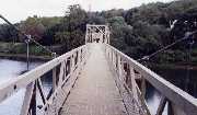
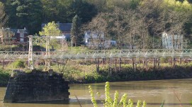
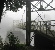
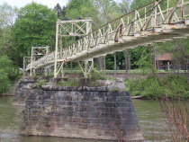
1955: (footbridge)
Jersey Shore vicinity, Pennsylvania, USA - Pine Creek
| Bridgemeister ID: | 591 (added 2003-01-05) |
| Year Completed: | 1955 |
| Name: | (footbridge) |
| Location: | Jersey Shore vicinity, Pennsylvania, USA |
| Crossing: | Pine Creek |
| At or Near Feature: | Boy Scouts Camp Kline |
| Coordinates: | 41.273683 N 77.323883 W |
| Maps: | Acme, GeoHack, Google, OpenStreetMap |
| Principals: | Williamsport Technical Institute students |
| Use: | Footbridge |
| Status: | Destroyed, 1972 |
| Main Cables: | Wire |
Notes:
- The postcard (postmarked 1961) showing the bridge says, "The largest foot-suspension bridge in the East crosses Pine Creek at the Boy Scouts' Camp Kline, north of Jersey Shore, Pa. Built in 1955 by Williamsport Technical Institute students with materials donated by area industries. Valued over $25,000, the 409-foot span has concrete anchors and a 14-ton capacity. For 35 years previous, boats were used to reach the popular 360-acre camp-site, donated to the Scouts in 1920 by James N. Kline, a Williamsport merchant." It's doubtful this was anywhere close to being a 409-foot bridge.
- The message written on the postcard is amusing (though unrelated to the bridge): "Hi Mom and Dad, I had a fine time up here. I went on a boat trip Monday around the island. We got half way around and Tiny tiped [sic] his boat then we tiped ours. I didn't get to sleep until 2:00 Monday night. I am going to try to swim a mile today. I don't do nothing but lay in my bunk and listen to records. Ken."
- Patrick O'Donnell is familiar with this area and notes that the bridge is gone, but the concrete footings are still visible. He suspects 1972's Hurricane Agnes brought down this bridge. Denny Keller confirms Patrick's suspicion with a firsthand account of Hurricane Agnes' impact on this bridge: "21 June 1972 is a date that I will never forget. I along with 340+ kids and adults were at Camp Kline during our yearly 4-H camp. I was the very last (along with the National Guard that performed the rescue) to leave and walk across the bridge that once stood at 11PM on the evening of June 21st. I along with two other senior 4-H counselors. I can remember the last trip across the bridge while mobile homes, trees, and all type of debris were floating down the creek and hitting the bridge underneath."
Image Sets:
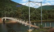
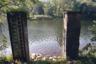
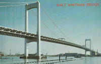
1957: Walt Whitman
Philadelphia, Pennsylvania and Camden, New Jersey, USA - Delaware River
| Bridgemeister ID: | 211 (added before 2003) |
| Year Completed: | 1957 |
| Name: | Walt Whitman |
| Location: | Philadelphia, Pennsylvania and Camden, New Jersey, USA |
| Crossing: | Delaware River |
| Coordinates: | 39.905 N 75.13 W |
| Maps: | Acme, GeoHack, Google, OpenStreetMap |
| Principals: | Othmar Ammann |
| References: | BFL |
| Use: | Vehicular (major highway) |
| Status: | In use (last checked: 2022) |
| Main Cables: | Wire (steel) |
| Suspended Spans: | 3 |
| Main Span: | 1 x 610 meters (2,001.3 feet) |
| Side Spans: | 2 x 234.7 meters (770 feet) |
| Deck width: | 83 feet |
Notes:
External Links:
Image Sets:
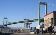
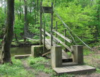
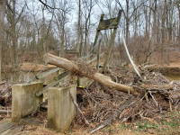
1984: Margaret Baker Memorial
Phoenixville, Pennsylvania, USA - Pickering Creek
| Bridgemeister ID: | 7371 (added 2022-11-06) |
| Year Completed: | 1984 |
| Name: | Margaret Baker Memorial |
| Location: | Phoenixville, Pennsylvania, USA |
| Crossing: | Pickering Creek |
| At or Near Feature: | Phoenixville YMCA |
| Coordinates: | 40.108065 N 75.519473 W |
| Maps: | Acme, GeoHack, Google, OpenStreetMap |
| Use: | Footbridge |
| Status: | Derelict, since September, 2021 |
| Main Cables: | Chain (steel) |
| Suspended Spans: | 1 |
Notes:
- 2021, September: Damaged by Hurricane Ida.
Image Sets:
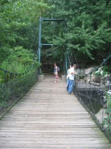
1995: (footbridge)
Pittsburgh, Pennsylvania, USA
| Bridgemeister ID: | 2533 (added 2011-12-25) |
| Year Completed: | 1995 |
| Name: | (footbridge) |
| Location: | Pittsburgh, Pennsylvania, USA |
| At or Near Feature: | Pittsburgh Zoo |
| Coordinates: | 40.481856 N 79.919181 W |
| Maps: | Acme, GeoHack, Google, OpenStreetMap |
| Principals: | American Bridge Co. |
| Use: | Footbridge |
| Status: | In use (last checked: 2010) |
| Suspended Spans: | 1 |
| Main Span: | 1 |
Image Sets:
1996: (footbridge)
Hooversville, Pennsylvania, USA - Stony Creek
| Bridgemeister ID: | 1302 (added 2004-04-03) |
| Year Completed: | 1996 |
| Name: | (footbridge) |
| Location: | Hooversville, Pennsylvania, USA |
| Crossing: | Stony Creek |
| Coordinates: | 40.147959 N 78.914295 W |
| Maps: | Acme, GeoHack, Google, OpenStreetMap |
| Use: | Footbridge |
| Status: | Closed, July 2024 |
| Main Cables: | Wire (steel) |
| Suspended Spans: | 1 |
| Main Span: | 1 x 42.1 meters (138 feet) estimated |
Notes:
- 2024, July: Closed for repairs after a small portion of the deck collapsed.
- Replaced 1907 (footbridge) - Hooversville, Pennsylvania, USA.
- All past and present bridges at this location.
Image Sets:
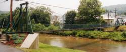
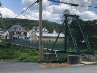
1996: Swinging
Millersburg, Pennsylvania, USA - Wiconisco Creek
| Bridgemeister ID: | 1533 (added 2004-10-30) |
| Year Completed: | 1996 |
| Name: | Swinging |
| Location: | Millersburg, Pennsylvania, USA |
| Crossing: | Wiconisco Creek |
| Coordinates: | 40.53588 N 76.96490 W |
| Maps: | Acme, GeoHack, Google, OpenStreetMap |
| Use: | Footbridge |
| Status: | In use (last checked: 2014) |
| Main Cables: | Wire (steel) |
| Suspended Spans: | 1 |
| Main Span: | 1 x 56.7 meters (186 feet) estimated |
Notes:
- Replaced 1920 Swinging - Millersburg, Pennsylvania, USA.
- All past and present bridges at this location.
Image Sets:
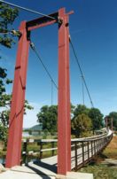
1998: Lyman Run
Galeton vicinity, Pennsylvania, USA - Lyman Run
| Bridgemeister ID: | 2400 (added 2007-12-02) |
| Year Completed: | 1998 |
| Name: | Lyman Run |
| Location: | Galeton vicinity, Pennsylvania, USA |
| Crossing: | Lyman Run |
| At or Near Feature: | Lyman Run State Park |
| Coordinates: | 41.72169 N 77.78674 W |
| Maps: | Acme, GeoHack, Google, OpenStreetMap |
| Principals: | Susquehannock Trail Club |
| Use: | Footbridge |
| Status: | In use (last checked: 2002) |
| Main Cables: | Wire (steel) |
| Suspended Spans: | 1 |
Image Sets:
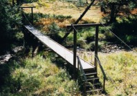
2001: Cross Fork
Cross Fork vicinity, Pennsylvania, USA - Cross Fork Creek
| Bridgemeister ID: | 2401 (added 2007-12-08) |
| Year Completed: | 2001 |
| Name: | Cross Fork |
| Location: | Cross Fork vicinity, Pennsylvania, USA |
| Crossing: | Cross Fork Creek |
| Coordinates: | 41.57235 N 77.78174 W |
| Maps: | Acme, GeoHack, Google, OpenStreetMap |
| Principals: | Potter County Trailblazers, Dept. of Conservation and Natural Resources |
| Use: | Footbridge |
| Status: | In use (last checked: 2002) |
| Main Cables: | Wire (steel) |
| Suspended Spans: | 1 |
Image Sets:
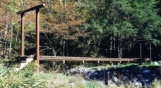
2006: (footbridge)
Green Lane, Pennsylvania, USA - Unami Creek
| Bridgemeister ID: | 4831 (added 2020-07-05) |
| Year Completed: | 2006 |
| Name: | (footbridge) |
| Location: | Green Lane, Pennsylvania, USA |
| Crossing: | Unami Creek |
| Coordinates: | 40.340001 N 75.438839 W |
| Maps: | Acme, GeoHack, Google, OpenStreetMap |
| Principals: | Frank Neeld, Hart Mechanical |
| Use: | Footbridge |
| Status: | In use (last checked: 2023) |
| Main Cables: | Wire (steel) |
| Suspended Spans: | 1 |
2007: Rock Cut Farm
Baoba, Pennsylvania, USA - Lackawaxen River
| Bridgemeister ID: | 3794 (added 2020-03-01) |
| Year Completed: | 2007 |
| Name: | Rock Cut Farm |
| Also Known As: | Baoba |
| Location: | Baoba, Pennsylvania, USA |
| Crossing: | Lackawaxen River |
| Coordinates: | 41.479214 N 75.093931 W |
| Maps: | Acme, GeoHack, Google, OpenStreetMap |
| Use: | Footbridge |
| Status: | In use (last checked: 2007) |
| Main Cables: | Wire (steel) |
Notes:
- Replaced Rock Cut Farm (Baoba) - Baoba, Pennsylvania, USA.
- All past and present bridges at this location.
Image Sets:
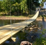
(conveyor bridge)
Starbrick, Pennsylvania, USA - Allegheny River
| Bridgemeister ID: | 1951 (added 2005-11-04) |
| Name: | (conveyor bridge) |
| Location: | Starbrick, Pennsylvania, USA |
| Crossing: | Allegheny River |
| Coordinates: | 41.837083 N 79.20475 W |
| Maps: | Acme, GeoHack, Google, OpenStreetMap |
| Use: | Conveyor |
| Status: | Removed (last checked: 2008) |
| Main Cables: | Wire (steel) |
| Suspended Spans: | 1 |
| Main Span: | 1 x 115.8 meters (380 feet) estimated |
Notes:
- Crossed a portion of the Allegheny River to Mead Island.
- Appears to have been removed 2006-2008. Jason Oliphant writes in early 2009: "The north shore suspension supports still exist but the bridge doesn't. I have no idea when it was taken down but I can say that it wasn't there in summer 2008."
Image Sets:
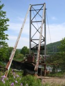
(footbridge)
Akron and Rothsville, Pennsylvania, USA - Cocalico Creek
| Bridgemeister ID: | 2393 (added 2007-12-02) |
| Name: | (footbridge) |
| Location: | Akron and Rothsville, Pennsylvania, USA |
| Crossing: | Cocalico Creek |
| Coordinates: | 40.14121 N 76.21860 W |
| Maps: | Acme, GeoHack, Google, OpenStreetMap |
| Use: | Footbridge |
| Status: | Derelict (last checked: 2020) |
| Main Cables: | Wire |
| Suspended Spans: | 1 |
Notes:
- Appears to have been damaged by flood in the 2018-2019 time frame.
Image Sets:
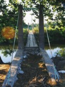
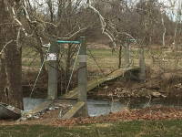
(footbridge)
Ansonia, Pennsylvania, USA - Pine Creek
| Bridgemeister ID: | 4830 (added 2020-07-05) |
| Name: | (footbridge) |
| Location: | Ansonia, Pennsylvania, USA |
| Crossing: | Pine Creek |
| Coordinates: | 41.712839 N 77.456030 W |
| Maps: | Acme, GeoHack, Google, OpenStreetMap |
| Use: | Footbridge |
| Status: | In use (last checked: 2020) |
| Main Cables: | Wire (steel) |
| Main Span: | 1 |
Image Sets:
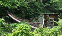
(footbridge)
Antes Fort vicinity, Pennsylvania, USA - Antes Creek
| Bridgemeister ID: | 1689 (added 2005-03-27) |
| Name: | (footbridge) |
| Location: | Antes Fort vicinity, Pennsylvania, USA |
| Crossing: | Antes Creek |
| Coordinates: | 41.179603 N 77.226050 W |
| Maps: | Acme, GeoHack, Google, OpenStreetMap |
| Use: | Footbridge |
| Status: | In use (last checked: 2020) |
| Main Cables: | Wire (steel) |
| Suspended Spans: | 1 |
| Main Span: | 1 x 30.8 meters (101 feet) estimated |
Image Sets:
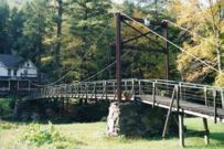
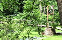
(footbridge)
Bellefonte, Pennsylvania, USA - Spring Creek
| Bridgemeister ID: | 1622 (added 2005-02-27) |
| Name: | (footbridge) |
| Location: | Bellefonte, Pennsylvania, USA |
| Crossing: | Spring Creek |
| At or Near Feature: | Talleyrand Park |
| Coordinates: | 40.910683 N 77.781517 W |
| Maps: | Acme, GeoHack, Google, OpenStreetMap |
| Use: | Footbridge |
| Status: | In use (last checked: 2007) |
| Main Cables: | Wire |
| Suspended Spans: | 1 |
Image Sets:
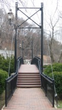
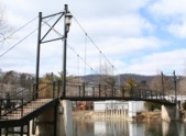
(footbridge)
Bethlehem, Pennsylvania, USA - Saucon Creek
| Bridgemeister ID: | 1495 (added 2004-09-24) |
| Name: | (footbridge) |
| Location: | Bethlehem, Pennsylvania, USA |
| Crossing: | Saucon Creek |
| At or Near Feature: | Saucon Park |
| Coordinates: | 40.603255 N 75.346362 W |
| Maps: | Acme, GeoHack, Google, OpenStreetMap |
| Use: | Footbridge |
| Status: | In use (last checked: 2021) |
| Main Cables: | Wire (steel) |
| Suspended Spans: | 1 |
Image Sets:
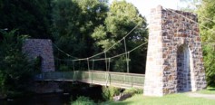
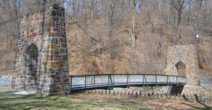
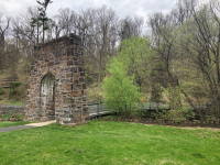
(footbridge)
Brookville, Pennsylvania, USA - North Fork Creek
| Bridgemeister ID: | 2084 (added 2006-06-18) |
| Name: | (footbridge) |
| Location: | Brookville, Pennsylvania, USA |
| Crossing: | North Fork Creek |
| At or Near Feature: | Dr. Walter Dick Memorial Park |
| Coordinates: | 41.168117 N 79.074767 W |
| Maps: | Acme, GeoHack, Google, OpenStreetMap |
| Use: | Footbridge |
| Status: | Closed, February, 2021 (last checked: July, 2022) |
| Main Cables: | Wire (steel) |
| Suspended Spans: | 1 |
| Main Span: | 1 x 54.3 meters (178 feet) estimated |
Notes:
- 2021, February: Closed indefinitely after failing a safety inspection.
- 2023, October: Brookville awarded grant from the Pennsylvania Department of Conservation and Natural Resources for the replacement of the bridge. Work expected to commence in mid-2024.
Annotated Citations:
- Nelson, Alex. "Good news for the swinging bridge." Jeffersonian Democrat, 14, Apr. 2021, http://www.thecourierexpress.com/jeffersonian_democrat/good-news-for-the-swinging-bridge/article_6a72a49c-7ed2-538d-a154-d719a7650c48.html
"Borough Manager Dana Rooney provided a positive update to the swinging bridge at the Walter Dick Memorial Park, saying there is a way for council to repair the existing bridge during last Tuesday’s meeting." Article discusses the council's plan to repair the bridge, rather than replace it, and their progress engaging an engineer to approve the repairs.
Image Sets:
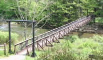
(footbridge)
Cherry Grove vicinity, Pennsylvania, USA - Tionesta Creek
| Bridgemeister ID: | 2726 (added 2019-06-22) |
| Name: | (footbridge) |
| Location: | Cherry Grove vicinity, Pennsylvania, USA |
| Crossing: | Tionesta Creek |
| At or Near Feature: | Chapman State Park |
| Coordinates: | 41.744371 N 79.182978 W |
| Maps: | Acme, GeoHack, Google, OpenStreetMap |
| Use: | Footbridge |
| Status: | In use (last checked: 2018) |
| Main Cables: | Wire (steel) |
| Suspended Spans: | 1 |
(footbridge)
Cooksburg, Pennsylvania, USA - Toms Run
| Bridgemeister ID: | 2366 (added 2007-09-08) |
| Name: | (footbridge) |
| Location: | Cooksburg, Pennsylvania, USA |
| Crossing: | Toms Run |
| At or Near Feature: | Cook Forest State Park |
| Coordinates: | 41.34104 N 79.21433 W |
| Maps: | Acme, GeoHack, Google, OpenStreetMap |
| Use: | Footbridge |
| Status: | In use (last checked: 2002) |
| Main Cables: | Wire (steel) |
| Suspended Spans: | 1 |
Image Sets:
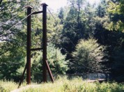
(footbridge)
Farragut, Pennsylvania, USA - Mill Creek
| Bridgemeister ID: | 2402 (added 2007-12-22) |
| Name: | (footbridge) |
| Location: | Farragut, Pennsylvania, USA |
| Crossing: | Mill Creek |
| Coordinates: | 41.27277 N 76.91025 W |
| Maps: | Acme, GeoHack, Google, OpenStreetMap |
| Use: | Footbridge |
| Status: | In use (last checked: 2002) |
| Main Cables: | Wire |
| Suspended Spans: | 1 |
Image Sets:
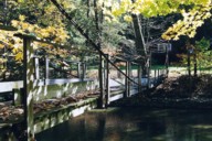
(footbridge)
Grantham, Pennsylvania, USA - Yellow Breeches Creek
| Bridgemeister ID: | 256 (added before 2003) |
| Name: | (footbridge) |
| Location: | Grantham, Pennsylvania, USA |
| Crossing: | Yellow Breeches Creek |
| At or Near Feature: | Messiah College |
| Coordinates: | 40.155317 N 76.988383 W |
| Maps: | Acme, GeoHack, Google, OpenStreetMap |
| Use: | Footbridge |
| Status: | In use (last checked: 2005) |
| Main Cables: | Wire |
| Suspended Spans: | 1 |
Image Sets:

(footbridge)
Holtwood, Pennsylvania, USA - Susquehanna River
| Bridgemeister ID: | 3331 (added 2019-12-07) |
| Name: | (footbridge) |
| Location: | Holtwood, Pennsylvania, USA |
| Crossing: | Susquehanna River |
| Use: | Footbridge |
| Status: | Removed |
| Main Cables: | Wire (steel) |
Image Sets:
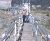
(footbridge)
Huntingdon, Pennsylvania, USA - Standing Stone Creek
| Bridgemeister ID: | 6979 (added 2022-03-27) |
| Name: | (footbridge) |
| Location: | Huntingdon, Pennsylvania, USA |
| Crossing: | Standing Stone Creek |
| Coordinates: | 40.555069 N 77.944703 W |
| Maps: | Acme, GeoHack, Google, OpenStreetMap |
| Use: | Footbridge |
| Status: | Extant (last checked: 2020) |
| Main Span: | 1 |
(footbridge)
Jenkins Corner vicinity, Pennsylvania, USA - Octoraro Creek
| Bridgemeister ID: | 2021 (added 2006-01-22) |
| Name: | (footbridge) |
| Location: | Jenkins Corner vicinity, Pennsylvania, USA |
| Crossing: | Octoraro Creek |
| At or Near Feature: | Camp Horseshoe and Camp Ware |
| Coordinates: | 39.7268 N 76.125 W |
| Maps: | Acme, GeoHack, Google, OpenStreetMap |
| Use: | Footbridge |
| Status: | In use |
| Main Cables: | Wire (steel) |
| Suspended Spans: | 1 |
Notes:
Image Sets:
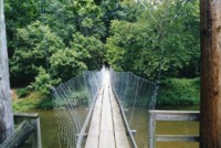
(footbridge)
Jenkins Corner vicinity, Pennsylvania, USA - Octoraro Creek
| Bridgemeister ID: | 2022 (added 2006-01-22) |
| Name: | (footbridge) |
| Location: | Jenkins Corner vicinity, Pennsylvania, USA |
| Crossing: | Octoraro Creek |
| At or Near Feature: | Camp Horseshoe |
| Coordinates: | 39.7225 N 76.1276 W |
| Maps: | Acme, GeoHack, Google, OpenStreetMap |
| Use: | Footbridge |
| Status: | In use |
| Main Cables: | Wire (steel) |
| Suspended Spans: | 1 |
Notes:
- Rush Wickes writes: "It collapsed once during the mid-1980s due to being overloaded by mischievous Scout campers. It was subsequently rebuilt, explaining the mismatched steel and wood tower combination. The "W" in the tower may very well refer to the phrase, 'Wimachtendienk, Wingolauchsik, Witahemui', or WWW, a motto of the Order of the Arrow honor group. The Octararo lodge of the honor group has its ceremonial fire pit just beyond the steel tower."
- Near (footbridge) - Jenkins Corner vicinity, Pennsylvania, USA.
Image Sets:
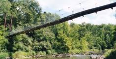
(footbridge)
Kennerdell, Pennsylvania, USA - Dennison Run
| Bridgemeister ID: | 2396 (added 2007-12-02) |
| Name: | (footbridge) |
| Location: | Kennerdell, Pennsylvania, USA |
| Crossing: | Dennison Run |
| At or Near Feature: | Kittanning State Forest |
| Use: | Footbridge |
| Status: | In use (last checked: 2002) |
| Main Cables: | Wire (steel) |
| Suspended Spans: | 1 |
Notes:
- Near (footbridge) - Kennerdell, Pennsylvania, USA.
- Near (footbridge) - Kennerdell, Pennsylvania, USA.
- Near (footbridge) - Kennerdell, Pennsylvania, USA.
Image Sets:
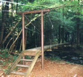
(footbridge)
Kennerdell, Pennsylvania, USA - Dennison Run
| Bridgemeister ID: | 2397 (added 2007-12-02) |
| Name: | (footbridge) |
| Location: | Kennerdell, Pennsylvania, USA |
| Crossing: | Dennison Run |
| At or Near Feature: | Kittanning State Forest |
| Use: | Footbridge |
| Status: | In use (last checked: 2002) |
| Main Cables: | Wire (steel) |
| Suspended Spans: | 1 |
Notes:
- Near (footbridge) - Kennerdell, Pennsylvania, USA.
- Near (footbridge) - Kennerdell, Pennsylvania, USA.
- Near (footbridge) - Kennerdell, Pennsylvania, USA.
Image Sets:
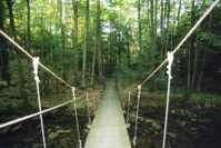
(footbridge)
Kennerdell, Pennsylvania, USA - Dennison Run
| Bridgemeister ID: | 2398 (added 2007-12-02) |
| Name: | (footbridge) |
| Location: | Kennerdell, Pennsylvania, USA |
| Crossing: | Dennison Run |
| At or Near Feature: | Kittanning State Forest |
| Use: | Footbridge |
| Status: | In use (last checked: 2002) |
| Main Cables: | Wire (steel) |
| Suspended Spans: | 1 |
Notes:
- Near (footbridge) - Kennerdell, Pennsylvania, USA.
- Near (footbridge) - Kennerdell, Pennsylvania, USA.
- Near (footbridge) - Kennerdell, Pennsylvania, USA.
Image Sets:
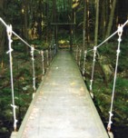
(footbridge)
Kennerdell, Pennsylvania, USA - Dennison Run
| Bridgemeister ID: | 2399 (added 2007-12-02) |
| Name: | (footbridge) |
| Location: | Kennerdell, Pennsylvania, USA |
| Crossing: | Dennison Run |
| At or Near Feature: | Kittanning State Forest |
| Use: | Footbridge |
| Status: | In use (last checked: 2002) |
| Main Cables: | Wire (steel) |
| Suspended Spans: | 1 |
Notes:
- Near (footbridge) - Kennerdell, Pennsylvania, USA.
- Near (footbridge) - Kennerdell, Pennsylvania, USA.
- Near (footbridge) - Kennerdell, Pennsylvania, USA.
Image Sets:
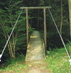
(footbridge)
Lewisburg vicinity, Pennsylvania, USA - Buffalo Creek
| Bridgemeister ID: | 4829 (added 2020-07-05) |
| Name: | (footbridge) |
| Location: | Lewisburg vicinity, Pennsylvania, USA |
| Crossing: | Buffalo Creek |
| Coordinates: | 40.981093 N 76.951261 W |
| Maps: | Acme, GeoHack, Google, OpenStreetMap |
| Use: | Footbridge |
| Status: | In use (last checked: 2020) |
| Main Cables: | Wire (steel) |
| Suspended Spans: | 1 |
Image Sets:
(footbridge)
Mammoth, Pennsylvania, USA - Welty Run
| Bridgemeister ID: | 2085 (added 2006-06-24) |
| Name: | (footbridge) |
| Location: | Mammoth, Pennsylvania, USA |
| Crossing: | Welty Run |
| At or Near Feature: | Mammoth Park |
| Coordinates: | 40.212267 N 79.458667 W |
| Maps: | Acme, GeoHack, Google, OpenStreetMap |
| Use: | Footbridge |
| Status: | Only towers remain (last checked: 2006) |
| Main Cables: | Wire |
| Suspended Spans: | 1 |
Image Sets:
(footbridge)
Oil City vicinity, Pennsylvania, USA - Read Run
| Bridgemeister ID: | 2395 (added 2007-12-02) |
| Name: | (footbridge) |
| Location: | Oil City vicinity, Pennsylvania, USA |
| Crossing: | Read Run |
| At or Near Feature: | Camp Singing Hills |
| Coordinates: | 41.45763 N 79.75185 W |
| Maps: | Acme, GeoHack, Google, OpenStreetMap |
| Use: | Footbridge |
| Status: | In use (last checked: 2002) |
| Main Cables: | Wire |
| Suspended Spans: | 1 |
Image Sets:
(footbridge)
Pughtown, Pennsylvania, USA - French Creek
| Bridgemeister ID: | 2450 (added 2008-06-22) |
| Name: | (footbridge) |
| Location: | Pughtown, Pennsylvania, USA |
| Crossing: | French Creek |
| At or Near Feature: | Camp Sankanac |
| Coordinates: | 40.15698 N 75.65073 W |
| Maps: | Acme, GeoHack, Google, OpenStreetMap |
| Use: | Footbridge |
| Status: | In use (last checked: 2004) |
| Main Cables: | Wire |
| Suspended Spans: | 1 |
Notes:
- James Boxmeyer writes: "I was involved in a small way in the bridge's construction... Here are a few details about the design. I think it was constructed in the late 1990's or maybe 2000-2001. The camp director said it was designed by people who are familiar with construction of similar bridges by Christian missionaries in other countries where resources are limited and suspension bridges are easier to construct. I used to work for an elevator company. I gave the cable to Camp Sankanac that they said would be used in the main suspension cables as well as the vertical cables that support the walking surface. I think they might have also used some of the cable I donated to hold up the walking surface, but have not seen the bridge in person, so cannot verify that. The main suspension cables had been used in an elevator. They are called traction steel 1/2 inch diameter hoist cables 8x19 construction with a fiber core. Tensile strength of each cable is about 14,500 pounds. The vertical cables are 3/8 inch (without a fiber core) and had been used in a construction hoist."
Image Sets:
(footbridge)
Worrell, Pennsylvania, USA - Springton Lake
| Bridgemeister ID: | 847 (added 2003-06-28) |
| Name: | (footbridge) |
| Location: | Worrell, Pennsylvania, USA |
| Crossing: | Springton Lake |
| Coordinates: | 39.95421 N 75.39321 W |
| Maps: | Acme, GeoHack, Google, OpenStreetMap |
| Use: | Footbridge |
| Status: | In use |
| Suspended Spans: | 1 |
| Main Span: | 1 x 45.7 meters (150 feet) estimated |
Notes:
- Connects the roadway to an intake tower in the Springton reservoir.
Image Sets:
(pipeline bridge)
Bradford, Pennsylvania, USA
| Bridgemeister ID: | 4827 (added 2020-07-05) |
| Name: | (pipeline bridge) |
| Location: | Bradford, Pennsylvania, USA |
| Coordinates: | 41.967963 N 78.625340 W |
| Maps: | Acme, GeoHack, Google, OpenStreetMap |
| Use: | Pipeline |
| Status: | Extant (last checked: 2020) |
| Main Cables: | Wire (steel) |
| Suspended Spans: | 1 |
(pipeline bridge)
Bradford, Pennsylvania, USA - Tunungwant Creek
| Bridgemeister ID: | 4828 (added 2020-07-05) |
| Name: | (pipeline bridge) |
| Location: | Bradford, Pennsylvania, USA |
| Crossing: | Tunungwant Creek |
| Coordinates: | 41.967349 N 78.629287 W |
| Maps: | Acme, GeoHack, Google, OpenStreetMap |
| Use: | Pipeline |
| Status: | Extant (last checked: 2020) |
| Main Cables: | Wire (steel) |
| Suspended Spans: | 1 |
(suspension bridge)
Apollo, Pennsylvania, USA - Kiskiminetas River
| Bridgemeister ID: | 4928 (added 2020-07-28) |
| Name: | (suspension bridge) |
| Location: | Apollo, Pennsylvania, USA |
| Crossing: | Kiskiminetas River |
| Use: | Vehicular |
| Status: | Collapsed, February, 1884 |
| Main Cables: | Wire |
Notes:
- Many American newspapers carried a brief story on February 29, 1884 or March 1, 1884 noting the failure of a wire suspension bridge at Apollo that sent two men and their horses into the river, killing one man and drowning the horses. The accounts are all similar, but with various misspellings and slight inconsistencies. From a Dakota Territory newspaper: "A wire bridge spanning the Kiskaminet river at Apollo, Pa., parted immediately over the pier in the middle of the river, and went down with a crash. William Henderson and Harry Yeneins were crossing the rivor with a load of sheet iron, and were thrown into the river. Henderson escaped with a cold bath, but Yenkins and the two horses were drowned." A Kansas newspaper: "A wire bridge spanning the Kiskamingo river, at Apollo, Pa., parted its wire cables on Tuesday, immediately over the pier in the middle of the river, and went down with a crash. Wm. Henderson and Harry Jenkins who were crossing with a loaded team, were thrown into the river. Jenkins and tho two horses were drowned."
Do you have any information or photos for these bridges that you would like to share? Please email david.denenberg@bridgemeister.com.
Mail | Facebook | X (Twitter) | Bluesky