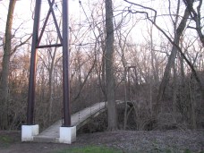
Suspension Bridges of Ohio
This is a list of all 63 bridges from the suspension bridge inventory for Ohio in USA. Wherever you see a Bridgemeister ID number click it to isolate the bridge on its own page.
Related Lists:
1843: Miami and Erie Canal
Cincinnati, Ohio, USA - Miami and Erie Canal
| Bridgemeister ID: | 25 (added before 2003) |
| Year Completed: | 1843 |
| Name: | Miami and Erie Canal |
| Location: | Cincinnati, Ohio, USA |
| Crossing: | Miami and Erie Canal |
| Coordinates: | 39.106916 N 84.516135 W |
| Maps: | Acme, GeoHack, Google, OpenStreetMap |
| References: | BOB |
| Status: | Removed |
| Suspended Spans: | 3 |
Notes:
- Located where Race Street intersected the Miami and Erie Canal. The canal no longer exists. West Central Parkway runs follows the former alignment of the canal at this location.
1853: (suspension bridge)
Delaware, Ohio, USA - Olentangy River
| Bridgemeister ID: | 774 (added 2003-03-14) |
| Year Completed: | 1853 |
| Name: | (suspension bridge) |
| Location: | Delaware, Ohio, USA |
| Crossing: | Olentangy River |
| At or Near Feature: | Winter Street |
| Principals: | John Gray |
| References: | SME20030311 |
| Use: | Footbridge |
| Status: | Destroyed, February 1883 |
| Main Cables: | Wire (iron) |
| Main Span: | 1 x 61 meters (200 feet) estimated |
Notes:
- SME20030311: Intended only for foot traffic, destroyed by ice jam February 1883.
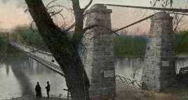
1853: Dresden
Dresden, Ohio, USA - Muskingum River
| Bridgemeister ID: | 43 (added before 2003) |
| Year Completed: | 1853 |
| Name: | Dresden |
| Location: | Dresden, Ohio, USA |
| Crossing: | Muskingum River |
| Coordinates: | 40.120889 N 81.999917 W |
| Maps: | Acme, GeoHack, Google, OpenStreetMap |
| Principals: | George Copland |
| References: | EOV, GBD, OCEN198202 |
| Use: | Vehicular |
| Status: | Destroyed, 1913 |
| Main Cables: | Wire (iron) |
| Suspended Spans: | 1 |
Notes:
- Destroyed by flood 1913.
- Replaced by 1914 Dresden - Dresden, Ohio, USA.
- All past and present bridges at this location.
External Links:
Image Sets:
1853: Tiffin
Tiffin, Ohio, USA - Sandusky River
| Bridgemeister ID: | 46 (added before 2003) |
| Year Completed: | 1853 |
| Name: | Tiffin |
| Location: | Tiffin, Ohio, USA |
| Crossing: | Sandusky River |
| Principals: | John Gray |
| References: | EOV |
| Status: | Removed |
| Main Cables: | Wire (iron) |
1858: Portsmouth
Portsmouth, Ohio, USA - Scioto River
| Bridgemeister ID: | 57 (added before 2003) |
| Year Completed: | 1858 |
| Name: | Portsmouth |
| Location: | Portsmouth, Ohio, USA |
| Crossing: | Scioto River |
| Principals: | E.B. Gray |
| References: | EOV |
| Status: | Collapsed, 1859 |
Notes:
1861: Portsmouth
Portsmouth, Ohio, USA - Scioto River
| Bridgemeister ID: | 61 (added before 2003) |
| Year Completed: | 1861 |
| Name: | Portsmouth |
| Location: | Portsmouth, Ohio, USA |
| Crossing: | Scioto River |
| Principals: | Max J. Becker |
| References: | EOV |
| Status: | Removed |
Notes:
- Reconstruction of the 1858 Portsmouth bridge. A completion year of 1861 is assumed given information provided in EOV. Failed 1884.
- Replaced 1858 Portsmouth - Portsmouth, Ohio, USA.
- All past and present bridges at this location.
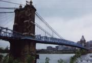
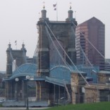
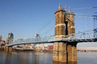
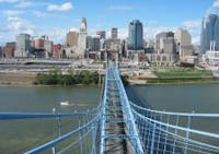
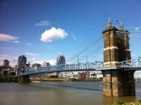
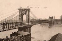
1867: John A. Roebling
Cincinnati, Ohio and Covington, Kentucky, USA - Ohio River
| Bridgemeister ID: | 65 (added before 2003) |
| Year Completed: | 1867 |
| Name: | John A. Roebling |
| Also Known As: | Cincinnati, Cincinnati and Covington |
| Location: | Cincinnati, Ohio and Covington, Kentucky, USA |
| Crossing: | Ohio River |
| Coordinates: | 39.09167 N 84.50833 W |
| Maps: | Acme, GeoHack, Google, OpenStreetMap |
| Principals: | John A. Roebling |
| References: | BAAW, BC3, BOB, BPL, COB, EOV, HBE, LAB, LACE, ONF, PTS2, SJR, TOB |
| Use: | Vehicular (two-lane), with walkway |
| Status: | Closed, February, 2021 (last checked: 2021) |
| Main Cables: | Wire (iron) |
| Suspended Spans: | 3 |
| Main Span: | 1 x 322.2 meters (1,057 feet) |
| Side Spans: | 2 |
Notes:
- 1892: Cable ends restored.
- 1899: Steel cables added to assist original cables.
- 2021, February: Closed to all vehicular traffic for a nine-month restoration project.
- Became longest suspension bridge by eclipsing 1849 Wheeling (Wheeling and Belmont) - Wheeling, West Virginia, USA.
- Eclipsed by new longest suspension bridge 1869 Clifton (Upper, Niagara-Clifton, Falls View, First Falls View) - Niagara Falls, New York, USA and Niagara Falls, Ontario, Canada.
External Links:
Image Sets:
1868: Calloway's Ford
Elizabethtown vicinity, Hamilton County, Ohio, USA - Whitewater River
| Bridgemeister ID: | 68 (added before 2003) |
| Year Completed: | 1868 |
| Name: | Calloway's Ford |
| Also Known As: | Whitewater, Harrison's |
| Location: | Elizabethtown vicinity, Hamilton County, Ohio, USA |
| Crossing: | Whitewater River |
| Coordinates: | 39.183116 N 84.792638 W |
| Maps: | Acme, GeoHack, Google, OpenStreetMap |
| Principals: | John Gray, Morse, Young |
| References: | EOV |
| Use: | Vehicular |
| Status: | Removed, 1920 |
| Main Cables: | Wire (iron) |
| Main Span: | 1 x 144.8 meters (475 feet) |
| Deck width: | 22 feet |
Notes:
- This bridge was located where present-day Suspension Bridge Road crosses the Whitewater River next to I-275 and north of US50. According to information provided by Sharon Lutz from Marjorie Byrnside Burress, this bridge was renamed "Harrison's Suspension Bridge" in 1891. This should not be confused with the nearby suspension bridge at Harrison.
- According to the information provided by Sharon Lutz from Marjorie Byrnside Burress, "Crossing this bridge was the main thoroughfare from Indiana into Ohio for many years (US 50 was not completed by then). [In 1920] it was decided that the Suspension Bridge had become obsolete and could no longer safely withstand the weight of vehicles. [On May 19, 1920] the cables were severed by means of an oxygen flame, the weight of the cables pulled down some towers. Other towers were weakened by dynamite at their bases and later they were pulled down by the weight of the cables severed at one end with an oxygen flame."
- See 1873 Harrison - Harrison, Ohio and Dearborn County, Indiana, USA.
Image Sets:
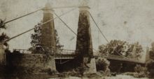

1868: High Street
Hamilton, Ohio, USA - Great Miami River
| Bridgemeister ID: | 67 (added before 2003) |
| Year Completed: | 1868 |
| Name: | High Street |
| Also Known As: | Hamilton |
| Location: | Hamilton, Ohio, USA |
| Crossing: | Great Miami River |
| Coordinates: | 39.401444 N 84.565389 W |
| Maps: | Acme, GeoHack, Google, OpenStreetMap |
| Principals: | John Gray |
| References: | EOV |
| Use: | Vehicular |
| Status: | Removed |
| Main Cables: | Wire |
| Suspended Spans: | 1 |
External Links:
- Butler County Engineer's Office (BCOE). Mentions this bridge stood from 1866 through 1895.
1872: Branch Hill
Branch Hill and Symmes, Ohio, USA - Little Miami River
| Bridgemeister ID: | 77 (added before 2003) |
| Year Completed: | 1872 |
| Name: | Branch Hill |
| Location: | Branch Hill and Symmes, Ohio, USA |
| Crossing: | Little Miami River |
| Principals: | John Gray |
| References: | EOV |
| Use: | Vehicular (one-lane) |
| Status: | Removed |
| Main Cables: | Wire |
Notes:
- Based on correspondence between "Gray's firm" and Washington Roebling, EOV suggests there may be a chance this early bridge contained steel cables.
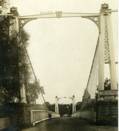
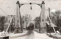
1873: Franklin
Franklin, Ohio, USA - Great Miami River
| Bridgemeister ID: | 80 (added before 2003) |
| Year Completed: | 1873 |
| Name: | Franklin |
| Location: | Franklin, Ohio, USA |
| Crossing: | Great Miami River |
| Coordinates: | 39.563222 N 84.305083 W |
| Maps: | Acme, GeoHack, Google, OpenStreetMap |
| Principals: | J. W. Shipman & Co., John A. Roebling's Sons Co. |
| References: | EOV, HWCO |
| Use: | Vehicular (one-lane) |
| Status: | Replaced, 1933 |
| Main Cables: | Wire |
| Suspended Spans: | 1 |
Notes:
- Traffic restricted to foot traffic, 1931. Closed, 1933, after the bridge sagged significantly.
- From HWCO: "The towers are thirty-eight feet high, and each consists of four columns, of Phoenix column iron. The cables are of steel wire and each is composed of 343 strands, the whole cable having a diameter of seven inches. The masonry is constructed of Dayton stone, and is of a very substantial character... The wire and iron work was done in the summer of 1873 under the superintendence of Roebling & Sons, of Trenton, N. J. The bridge is stayed by strong wire cables and stiffened by an iron truss. The whole cost was $43,900."
Image Sets:
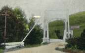
1873: Harrison
Harrison, Ohio and Dearborn County, Indiana, USA - Whitewater River
| Bridgemeister ID: | 81 (added before 2003) |
| Year Completed: | 1873 |
| Name: | Harrison |
| Location: | Harrison, Ohio and Dearborn County, Indiana, USA |
| Crossing: | Whitewater River |
| Principals: | James W. Shipman and Co. |
| References: | EOV |
| Use: | Vehicular (one-lane) |
| Status: | Destroyed, 1913, by flood |
| Main Cables: | Wire |
Notes:
- See 1868 Calloway's Ford (Whitewater, Harrison's) - Elizabethtown vicinity, Hamilton County, Ohio, USA.
Image Sets:
1876: Linwood
Linwood, Ohio, USA - Little Miami River
| Bridgemeister ID: | 82 (added before 2003) |
| Year Completed: | 1876 |
| Name: | Linwood |
| Location: | Linwood, Ohio, USA |
| Crossing: | Little Miami River |
| Principals: | Cincinnati Bridge Co. |
| References: | EOV |
| Status: | Removed |
Notes:
- Replaced after 1913 flood damage.
1877: (suspension bridge)
Kent, Ohio, USA - Cuyahoga River
| Bridgemeister ID: | 1979 (added 2005-11-27) |
| Year Completed: | 1877 |
| Name: | (suspension bridge) |
| Location: | Kent, Ohio, USA |
| Crossing: | Cuyahoga River |
| Status: | Removed |
| Main Cables: | Wire (iron) |
| Bridgemeister ID: | 343 (added before 2003) |
| Year Completed: | 1895 |
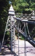
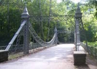
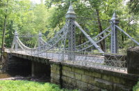
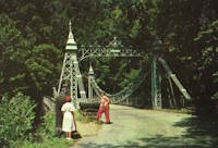
| Name: | Mill Creek Park |
| Also Known As: | White, Silver, Old Steel, Cinderella, Fairy Tale |
| Location: | Youngstown vicinity, Ohio, USA |
| At or Near Feature: | Mill Creek Park |
| Coordinates: | 41.07325 N 80.68886 W |
| Maps: | Acme, GeoHack, Google, OpenStreetMap |
| Principals: | Charles Evan Fowler |
| References: | AAJ, HBE, IEA, PTS2 |
| Use: | Vehicular (two-lane) |
| Status: | In use (last checked: 2021) |
| Main Cables: | Eyebar |
| Suspended Spans: | 1 |
| Main Span: | 1 x 27.4 meters (90 feet) |
| Characteristics: | Braced (trussed) chain/cable |
Notes:
- Short stiffened eyebar ("braced chain") of the style that Lindenthal often proposed. A mid-span support was added many years ago.
- Major rehabilitation started, June 2007. Reopened November, 2007.
External Links:
Image Sets:
1897: Lincoln Highway
East Liverpool, Ohio and Chester, West Virginia, USA - Ohio River
| Bridgemeister ID: | 105 (added before 2003) |
| Year Completed: | 1897 |
| Name: | Lincoln Highway |
| Also Known As: | Chester |
| Location: | East Liverpool, Ohio and Chester, West Virginia, USA |
| Crossing: | Ohio River |
| Coordinates: | 40.613056 N 80.572806 W |
| Maps: | Acme, GeoHack, Google, OpenStreetMap |
| Principals: | Hermann Laub, E.S. Fickes |
| References: | AAJ, BPL, HBE, PTS2 |
| Use: | Vehicular, with walkway |
| Status: | Removed, 1970 |
| Main Cables: | Wire (steel) |
| Suspended Spans: | 3 |
| Main Span: | 1 x 214.9 meters (705 feet) |
| Side Spans: | 1 x 109.7 meters (360 feet), 1 x 128 meters (420 feet) |
| Deck width: | 27 feet |
Notes:
- Rebuilt 1939 by David Steinman. Closed and demolished, 1970.
External Links:
Image Sets:

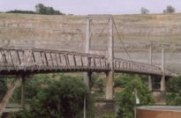
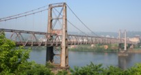
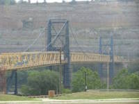
1905: Market Street
Steubenville, Ohio and East Steubenville, West Virginia, USA - Ohio River
| Bridgemeister ID: | 114 (added before 2003) |
| Year Completed: | 1905 |
| Name: | Market Street |
| Location: | Steubenville, Ohio and East Steubenville, West Virginia, USA |
| Crossing: | Ohio River |
| Coordinates: | 40.358222 N 80.609167 W |
| Maps: | Acme, GeoHack, Google, OpenStreetMap |
| Principals: | Hermann Laub |
| References: | AAJ, BPL, PTS2 |
| Use: | Vehicular (two-lane) |
| Status: | Closed, December 2023 (last checked: 2024) |
| Main Cables: | Wire (steel) |
| Suspended Spans: | 3 |
| Main Span: | 1 x 207.3 meters (680 feet) |
| Side Spans: | 2 x 79.2 meters (260 feet) |
Notes:
- 2023, December: Closed by WVDOT because of safety concerns.
- 2024, July: Funds are allocated for reconstruction of the Market Street bridge.
- Near 1928 Fort Steuben - Steubenville, Ohio and Weirton, West Virginia, USA.
External Links:
Image Sets:
1905: Newell
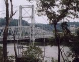
East Liverpool, Ohio and Newell, West Virginia, USA - Ohio River
| Bridgemeister ID: | 117 (added before 2003) |
| Year Completed: | 1905 |
| Name: | Newell |
| Location: | East Liverpool, Ohio and Newell, West Virginia, USA |
| Crossing: | Ohio River |
| Coordinates: | 40.62167 N 80.595 W |
| Maps: | Acme, GeoHack, Google, OpenStreetMap |
| Principals: | Edwin Kirtland Morse, Dravo Company |
| References: | AAJ, BPL, PTS2 |
| Use: | Vehicular (two-lane), with walkway |
| Status: | In use (last checked: 2022) |
| Main Cables: | Wire (steel) |
| Suspended Spans: | 3 |
| Main Span: | 1 x 228.6 meters (750 feet) |
| Side Spans: | 2 |
Annotated Citations:
- Huba, Stephen. "There’s a new owner for the Newell Bridge." The Weirton Daily Times, 6 May 2022, www.weirtondailytimes.com/news/local-news/2022/05/theres-a-new-owner-for-the-newell-bridge/.
"Frank Six of Six Enterprises in Newell, assumed ownership Wednesday of one of the oldest suspension bridges on the Ohio River for an undisclosed sum from HLC Holdings Inc., parent company of the Fiesta Tableware Co., formerly known as the Homer Laughlin China Co."
- Bobby-Gilbert, Jo-Ann., "Fiesta Tableware Parent Sells Iconic Newell Bridge." The Business Journal, 5 May 2022, businessjournaldaily.com/fiesta-tableware-parent-sells-iconic-newell-bridge/.
"After 116 years of ownership by HLC Holdings Inc., parent company of The Fiesta Tableware Co., the Newell Bridge and Railway Co. changed hands at midnight Wednesday. Officials of Fiesta Tableware, formerly known as Homer Laughlin China Co., announced that the bridge has been purchased by Frank Six, owner of Six Enterprises in Newell."
External Links:
Image Sets:

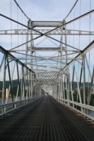
1914: Dresden
Dresden, Ohio, USA - Muskingum River
| Bridgemeister ID: | 132 (added before 2003) |
| Year Completed: | 1914 |
| Name: | Dresden |
| Location: | Dresden, Ohio, USA |
| Crossing: | Muskingum River |
| Coordinates: | 40.12079 N 82.00000 W |
| Maps: | Acme, GeoHack, Google, OpenStreetMap |
| Principals: | Bellefontaine Bridge and Steel Co. |
| References: | GBD, OCEN198202, PTS2 |
| Use: | Vehicular (one-lane) |
| Status: | Closed (last checked: 2022) |
| Main Cables: | Eyebar (steel) |
| Suspended Spans: | 2 |
| Main Span: | 1 x 135 meters (443 feet) |
| Side Span: | 1 |
Notes:
- 2022, January: Ohio Department of Transportation recommends removal of the bridge due to its deteriorating condition.
- Replaced 1853 Dresden - Dresden, Ohio, USA.
- All past and present bridges at this location.
Annotated Citations:
- Hannahs, Nichole. "ODOT Recommends Removal of Suspension Bridge." WHIZ News, 25 Jan. 2022, whiznews.com/2022/01/25/odot-recommends-removal-of-suspension-bridge/
"…ODOT recommended the removal of the structure, which would cost between $1-$2 million, which would be funded by the state. Other more costly options include more than $6 million to make it structurally sound for pedestrians to walk on and over $3.5 million to rehab it and then it still couldn’t be used."
External Links:
Image Sets:


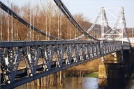
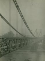
1916: Belpre-Parkersburg
Parkersburg, West Virginia and Belpre, Ohio, USA - Ohio River
| Bridgemeister ID: | 134 (added before 2003) |
| Year Completed: | 1916 |
| Name: | Belpre-Parkersburg |
| Location: | Parkersburg, West Virginia and Belpre, Ohio, USA |
| Crossing: | Ohio River |
| Coordinates: | 39.270500 N 81.566528 W |
| Maps: | Acme, GeoHack, Google, OpenStreetMap |
| Principals: | Hermann Laub |
| References: | AAJ, BPL, PTS2, SJR |
| Use: | Vehicular, with walkway |
| Status: | Demolished, March 16, 1980 |
| Main Cables: | Wire (steel) |
| Suspended Spans: | 3 |
| Main Span: | 1 x 236.2 meters (775 feet) |
| Side Spans: | 1 x 114.3 meters (375 feet), 1 x 83.8 meters (275 feet) |
| Deck width: | 22 feet |
External Links:
Image Sets:
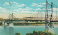
1918: Camp Sherman
Chillicothe, Ohio, USA - Scioto River
| Bridgemeister ID: | 4956 (added 2020-08-08) |
| Year Completed: | 1918 |
| Name: | Camp Sherman |
| Location: | Chillicothe, Ohio, USA |
| Crossing: | Scioto River |
| Principals: | U.S. Army |
| Status: | Removed |
| Main Cables: | Wire (steel) |
| Suspended Spans: | 1 |
| Main Span: | 1 |
Notes:
- Provided access to the Camp Sherman rifle range which sat across the Scioto River from the main part of the campl.
- From an article "Came the False Armistice but Weary Soldiers Unaware” in the September 7, 1968 edition of the Xenia Daily Gazette: "The firing range at old Camp Sherman during World War 1 was a long march from camp to the base of historic Mt. Logan. It was reached by way of a narrow suspension bridge which swayed sickeningly to the measured tempo of the marching soldiers and was an experience in itself."
External Links:
Image Sets:
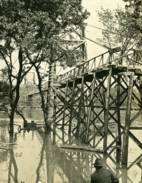
1922: (footbridge)
Bexley, Ohio, USA - Alum Creek
| Bridgemeister ID: | 819 (added 2003-05-31) |
| Year Completed: | 1922 |
| Name: | (footbridge) |
| Location: | Bexley, Ohio, USA |
| Crossing: | Alum Creek |
| At or Near Feature: | Wolfe Park |
| Coordinates: | 39.963831 N 82.947491 W |
| Maps: | Acme, GeoHack, Google, OpenStreetMap |
| References: | AAJ, PTS2 |
| Use: | Footbridge |
| Status: | In use (last checked: 2016) |
| Main Cables: | Wire (steel) |
| Suspended Spans: | 1 |
| Deck width: | 6.25 feet |
Notes:
- Closed 2013 for major refurbishment including a new deck. Reopened March. 2014.
- April 2015: Two main cables snap, causing a partial collapse of the bridge deck. Repaired and reopened August 5, 2016. Failure speculated to have been caused by the weight of the new deck installed 2013-2014.
Image Sets:
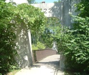
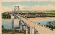
1927: General U.S. Grant
Portsmouth, Ohio and Fullerton, Kentucky, USA - Ohio River
| Bridgemeister ID: | 151 (added before 2003) |
| Year Completed: | 1927 |
| Name: | General U.S. Grant |
| Location: | Portsmouth, Ohio and Fullerton, Kentucky, USA |
| Crossing: | Ohio River |
| Coordinates: | 38.725 N 82.99833 W |
| Maps: | Acme, GeoHack, Google, OpenStreetMap |
| Principals: | Robinson and Steinman, J.E. Greiner, Dravo Co. |
| References: | AAJ, PTS2, SSS |
| Use: | Vehicular (two-lane, heavy vehicles) |
| Status: | Demolished, July 2001 |
| Main Cables: | Wire (steel) |
| Suspended Spans: | 3 |
| Main Span: | 1 x 213.4 meters (700 feet) |
| Side Spans: | 2 x 106.7 meters (350 feet) |
| Deck width: | 28.5 feet |
Notes:
- AAJ: "Recabled" in 1939.
External Links:
Image Sets:
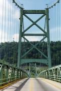
1928: Fort Steuben
Steubenville, Ohio and Weirton, West Virginia, USA - Ohio River
| Bridgemeister ID: | 154 (added before 2003) |
| Year Completed: | 1928 |
| Name: | Fort Steuben |
| Location: | Steubenville, Ohio and Weirton, West Virginia, USA |
| Crossing: | Ohio River |
| Coordinates: | 40.37833 N 80.615 W |
| Maps: | Acme, GeoHack, Google, OpenStreetMap |
| Principals: | Dravo Co. |
| References: | AAJ, PTS2 |
| Use: | Vehicular (two-lane, heavy vehicles), with walkway |
| Status: | Demolished, February 2012 (last checked: 2012) |
| Main Cables: | Wire (steel) |
| Suspended Spans: | 3 |
| Main Span: | 1 x 209.9 meters (688.75 feet) |
| Side Spans: | 2 x 86.3 meters (283 feet) |
| Deck width: | 20.25 feet |
Notes:
- January 2009: Closed indefinitely following inspections revealing major deterioration. Demolished in 2012.
- Near 1905 Market Street - Steubenville, Ohio and East Steubenville, West Virginia, USA.
External Links:
Image Sets:
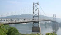
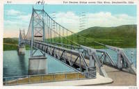
1928: Point Pleasant
Point Pleasant, West Virginia and Kanauga, Gallipolis vicinity, Ohio, USA - Ohio River
| Bridgemeister ID: | 156 (added before 2003) |
| Year Completed: | 1928 |
| Name: | Point Pleasant |
| Also Known As: | Silver |
| Location: | Point Pleasant, West Virginia and Kanauga, Gallipolis vicinity, Ohio, USA |
| Crossing: | Ohio River |
| Coordinates: | 38.845 N 82.141111 W |
| Maps: | Acme, GeoHack, Google, OpenStreetMap |
| Principals: | J.E. Greiner Co. |
| References: | AAJ, BDO, ENR19290620a, ENR19290620b, GBD, LAB, PTS2, SSS |
| Use: | Vehicular, with walkway |
| Status: | Collapsed, 1967 |
| Main Cables: | Eyebar (steel) |
| Suspended Spans: | 3 |
| Main Span: | 1 x 213.4 meters (700 feet) |
| Side Spans: | 2 x 115.8 meters (380 feet) |
| Deck width: | 27 feet |
Notes:
- Hybrid truss, suspension bridge. Collapsed December 15, 1967 while full with traffic. 46 people died.
- Companion to 1928 Saint Marys (Hi Carpenter, Short Route) - Saint Marys, West Virginia and Newport, Ohio, USA.
External Links:
Image Sets:

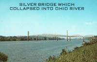
1928: Saint Marys
Saint Marys, West Virginia and Newport, Ohio, USA - Ohio River
| Bridgemeister ID: | 159 (added before 2003) |
| Year Completed: | 1928 |
| Name: | Saint Marys |
| Also Known As: | Hi Carpenter, Short Route |
| Location: | Saint Marys, West Virginia and Newport, Ohio, USA |
| Crossing: | Ohio River |
| Coordinates: | 39.391694 N 81.211083 W |
| Maps: | Acme, GeoHack, Google, OpenStreetMap |
| Principals: | J.E. Greiner Co. |
| References: | BPL, GBD, PTS2 |
| Use: | Vehicular |
| Status: | Demolished, 1971 |
| Main Cables: | Eyebar (steel) |
| Suspended Spans: | 3 |
| Main Span: | 1 x 213.4 meters (700 feet) |
| Side Spans: | 2 |
Notes:
- Same design as the Silver Bridge that famously collapsed in 1967. Demolished 1971 as a precautionary measure because the engineers decided they could not tell if it suffered from the same flaw as the Silver Bridge without dismantling the eyebars.
- Companion to 1928 Point Pleasant (Silver) - Point Pleasant, West Virginia and Kanauga, Gallipolis vicinity, Ohio, USA.
Image Sets:
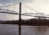

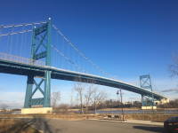
1931: Anthony Wayne
Toledo, Ohio, USA - Maumee River
| Bridgemeister ID: | 168 (added before 2003) |
| Year Completed: | 1931 |
| Name: | Anthony Wayne |
| Location: | Toledo, Ohio, USA |
| Crossing: | Maumee River |
| Coordinates: | 41.64086 N 83.53361 W |
| Maps: | Acme, GeoHack, Google, OpenStreetMap |
| Principals: | Waddell and Hardesty |
| References: | AAJ, SJR, SSS |
| Use: | Vehicular (major highway), with walkway |
| Status: | In use (last checked: 2021) |
| Main Cables: | Wire (steel) |
| Suspended Spans: | 3 |
| Main Span: | 1 x 239.3 meters (785 feet) |
| Side Spans: | 2 x 71.2 meters (233.5 feet) |
| Deck width: | 60 feet |
External Links:
Image Sets:


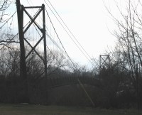
1931: Sidaway
Cleveland, Ohio, USA - Kingsbury Run
| Bridgemeister ID: | 171 (added before 2003) |
| Year Completed: | 1931 |
| Name: | Sidaway |
| Location: | Cleveland, Ohio, USA |
| Crossing: | Kingsbury Run |
| Coordinates: | 41.477805 N 81.642944 W |
| Maps: | Acme, GeoHack, Google, OpenStreetMap |
| Principals: | Wilbur Watson, Fred Plummer. New York, Chicago, and St. Louis Railroad Co. |
| References: | BMC |
| Use: | Footbridge |
| Status: | Derelict, since 1966 (last checked: 2023) |
| Main Cables: | Wire (steel) |
| Suspended Spans: | 3 |
| Main Span: | 1 x 121.9 meters (400 feet) |
| Side Spans: | 2 x 42.7 meters (140 feet) |
| Deck width: | 6 feet |
Notes:
- 2023, February: Given landmark status by the Cleveland City Council so that it is eligible to receive grants for preservation.
- BMC describes a feud between the neighborhoods on either side of the bridge that led to events in July 1966: "someone set fire to the wooden deck and ripped out fifteen feet of the southern portion. The bridge now is considered a nuisance."
- 2022, October: Added to National Register of Historic Places.
External Links:
- Sidaway Bridge once connected Black and white neighborhoods. Now it connects us to the past.. July 22, 2020 news article by News 5 (ABC) Cleveland.
- Structurae - Structure ID 20015438
Image Sets:
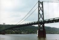
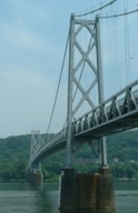
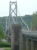
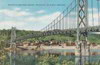
1931: Simon Kenton Memorial
Maysville, Kentucky and Aberdeen, Ohio, USA - Ohio River
| Bridgemeister ID: | 172 (added before 2003) |
| Year Completed: | 1931 |
| Name: | Simon Kenton Memorial |
| Also Known As: | Maysville |
| Location: | Maysville, Kentucky and Aberdeen, Ohio, USA |
| Crossing: | Ohio River |
| Coordinates: | 38.649890 N 83.759670 W |
| Maps: | Acme, GeoHack, Google, OpenStreetMap |
| Principals: | Modjeski, Masters & Chase |
| References: | AAJ, SJR, SSS |
| Use: | Vehicular (two-lane), with walkway |
| Status: | In use (last checked: 2022) |
| Main Cables: | Wire (steel) |
| Suspended Spans: | 3 |
| Main Span: | 1 x 323.1 meters (1,060 feet) |
| Side Spans: | 2 x 141.7 meters (464.9 feet) |
| Deck width: | 28 feet |
Notes:
- 2022, March: USD$23.4 million budgeted for rehabilitation project including suspender cable replacements, steel repairs, and painting.
- 2019: Closed late 2019 due to suspender cable corrosion. Short-term fixes applied to reduce the stress on the suspenders and to prevent rusting.
- 2020, June: Reopened with a 15-ton weight limit after installation of temporary support rods and brackets to reduce the stress on damaged cables.
External Links:
Image Sets:
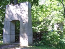
1936: Cross Mound
Tarlton, Ohio, USA - Salt Creek
| Bridgemeister ID: | 1460 (added 2004-08-21) |
| Year Completed: | 1936 |
| Name: | Cross Mound |
| Location: | Tarlton, Ohio, USA |
| Crossing: | Salt Creek |
| At or Near Feature: | Cross Mound Park |
| Coordinates: | 39.563433 N 82.783167 W |
| Maps: | Acme, GeoHack, Google, OpenStreetMap |
| Use: | Footbridge |
| Status: | In use (last checked: 2007) |
| Main Cables: | Wire (steel) |
| Suspended Spans: | 1 |
Image Sets:
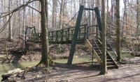
1956: Pete Mauthe
Poland, Ohio, USA - Yellow Creek
| Bridgemeister ID: | 2359 (added 2007-09-08) |
| Year Completed: | 1956 |
| Name: | Pete Mauthe |
| Location: | Poland, Ohio, USA |
| Crossing: | Yellow Creek |
| At or Near Feature: | Poland Village Park |
| Coordinates: | 41.01190 N 80.61908 W |
| Maps: | Acme, GeoHack, Google, OpenStreetMap |
| Use: | Footbridge |
| Status: | In use (last checked: 2024) |
| Main Cables: | Wire (steel) |
| Suspended Spans: | 1 |
Notes:
- Closed in 2019 for "safety reasons". Repairs scheduled for March 2020.
Image Sets:
1962: (pipeline bridge)
Grays Branch, Greenup vicinity, Kentucky and Franklin Furnace, Ohio, USA - Ohio River
| Bridgemeister ID: | 880 (added 2003-09-01) |
| Year Completed: | 1962 |
| Name: | (pipeline bridge) |
| Location: | Grays Branch, Greenup vicinity, Kentucky and Franklin Furnace, Ohio, USA |
| Crossing: | Ohio River |
| Coordinates: | 38.66058 N 82.85889 W |
| Maps: | Acme, GeoHack, Google, OpenStreetMap |
| Principals: | Weldon F. Appelt, P.E., Clear Span Engineering, Inc |
| Use: | Pipeline |
| Status: | Extant (last checked: 2021) |
| Main Cables: | Wire (steel) |
| Main Span: | 1 x 609.6 meters (2,000 feet) |
Notes:
- Just downstream of Greenup Dam. Built for Tennessee Gas Pipeline Co. Carries two 30" gas pipelines.
External Links:
Image Sets:
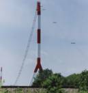
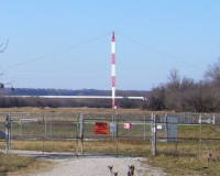
1990: Vinton Swinging
Vinton, Ohio, USA - Raccoon Creek
| Bridgemeister ID: | 1190 (added 2004-01-25) |
| Year Completed: | 1990 |
| Name: | Vinton Swinging |
| Location: | Vinton, Ohio, USA |
| Crossing: | Raccoon Creek |
| At or Near Feature: | Vinton Community Park |
| Coordinates: | 38.977952 N 82.339157 W |
| Maps: | Acme, GeoHack, Google, OpenStreetMap |
| Principals: | James Baird, Carl DeWitt, Tony Werry, Mark Beaver, Kermit Brown |
| Use: | Footbridge |
| Status: | In use (last checked: 2005) |
| Main Cables: | Wire |
| Suspended Spans: | 1 |
Image Sets:
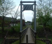
1991: Stokes Crossing
Defiance, Ohio, USA - Powell Creek
| Bridgemeister ID: | 1400 (added 2004-07-04) |
| Year Completed: | 1991 |
| Name: | Stokes Crossing |
| Location: | Defiance, Ohio, USA |
| Crossing: | Powell Creek |
| At or Near Feature: | Boy Scout Camp |
| Coordinates: | 41.25265 N 84.375983 W |
| Maps: | Acme, GeoHack, Google, OpenStreetMap |
| Use: | Footbridge |
| Status: | In use (last checked: 2009) |
| Main Cables: | Wire |
Notes:
- Located in a scout camp along Powell Creek.
Image Sets:
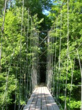
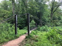
| Bridgemeister ID: | 5861 (added 2021-05-15) |
| Year Completed: | 2018 |
| Name: | Hemlock |
| Location: | Logan vicinity, Ohio, USA |
| At or Near Feature: | Hocking Hills State Park |
| Principals: | Woolpert, Ohio Department of Natural Resources |
| Use: | Footbridge |
| Status: | In use (last checked: 2022) |
| Main Cables: | Wire (steel) |
| Deck width: | 16 inches |
Image Sets:
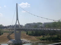
2020: Dublin Link
Dublin, Ohio, USA - Scioto River
| Bridgemeister ID: | 3903 (added 2020-03-14) |
| Year Completed: | 2020 |
| Name: | Dublin Link |
| Location: | Dublin, Ohio, USA |
| Crossing: | Scioto River |
| Coordinates: | 40.102094 N 83.111697 W |
| Maps: | Acme, GeoHack, Google, OpenStreetMap |
| Principals: | Endrestudio, T.Y. Lin International, Kokosing Construction Co. |
| Use: | Footbridge |
| Status: | In use (last checked: 2022) |
| Main Cables: | Wire (steel) |
External Links:
Image Sets:
2021: Mohican Cable Pedestrian
Loudounville, Ohio, USA - Clear Fork Mohican River
| Bridgemeister ID: | 6244 (added 2021-07-18) |
| Year Completed: | 2021 |
| Name: | Mohican Cable Pedestrian |
| Location: | Loudounville, Ohio, USA |
| Crossing: | Clear Fork Mohican River |
| At or Near Feature: | Mohican State Park |
| Coordinates: | 40.612051 N 82.286537 W |
| Maps: | Acme, GeoHack, Google, OpenStreetMap |
| Principals: | Woolpert, The Righter Company |
| Use: | Footbridge |
| Status: | In use (last checked: 2021) |
| Main Cables: | Wire (steel) |
| Suspended Spans: | 1 |
| Main Span: | 1 x 36.6 meters (120 feet) |
2021: Stillwater Prairie Connector
Covington, Ohio, USA - Stillwater River
| Bridgemeister ID: | 5860 (added 2021-05-15) |
| Year Completed: | 2021 |
| Name: | Stillwater Prairie Connector |
| Location: | Covington, Ohio, USA |
| Crossing: | Stillwater River |
| At or Near Feature: | Maple Ridge Reserve, Stillwater Prairie Reserve |
| Coordinates: | 40.156364 N 84.398538 W |
| Maps: | Acme, GeoHack, Google, OpenStreetMap |
| Principals: | Woolpert, Brumbaugh Construction |
| Use: | Footbridge |
| Status: | In use (last checked: 2021) |
| Main Cables: | Wire (steel) |
| Suspended Spans: | 1 |
| Main Span: | 1 x 51.8 meters (170 feet) |
| Deck width: | 32 inches |
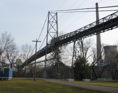
(conveyor bridge)
Beverly vicinity, Ohio, USA - Muskingum River
| Bridgemeister ID: | 2572 (added 2012-11-17) |
| Name: | (conveyor bridge) |
| Location: | Beverly vicinity, Ohio, USA |
| Crossing: | Muskingum River |
| At or Near Feature: | Muskingum River Power Plant |
| Coordinates: | 39.59230 N 81.68519 W |
| Maps: | Acme, GeoHack, Google, OpenStreetMap |
| Use: | Conveyor |
| Status: | Removed, c. 2015-2021 |
| Main Cables: | Wire (steel) |
| Suspended Spans: | 1 |
Notes:
- Approaches were dismantled by 2015. Another portion of the beltway collapsed during preparations for demolition in December 2015 killing the CEO of the demolition company. Unclear if the suspension span was completely demolished at this time.
- By 2021, the bridge appears to have been completely demolished.
External Links:
Image Sets:
(footbridge)
Akron, Ohio, USA - Cuyahoga River
| Bridgemeister ID: | 1151 (added 2004-01-18) |
| Name: | (footbridge) |
| Location: | Akron, Ohio, USA |
| Crossing: | Cuyahoga River |
| At or Near Feature: | High Bridge Glens Park, now Gorge Metro Park |
| Use: | Footbridge |
| Status: | Removed |
| Main Cables: | Wire |
Notes:
- This bridge is visible in the foreground of a popular late 19th century stereoview showing the "high bridge" and falls. No longer in existence.
| Bridgemeister ID: | 1784 (added 2005-05-16) |
| Name: | (footbridge) |
| Location: | Akron, Ohio, USA |
| At or Near Feature: | F.A. Seiberling Nature Realm, Sand Run Metro Park |
| Coordinates: | 41.135883 N 81.5735 W |
| Maps: | Acme, GeoHack, Google, OpenStreetMap |
| Use: | Footbridge |
| Status: | In use (last checked: 2012) |
| Main Cables: | Wire |
| Suspended Spans: | 1 |
Image Sets:
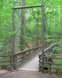
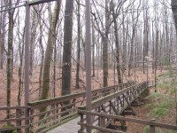
(footbridge)
Bellepoint vicinity, Ohio, USA - Mill Creek
| Bridgemeister ID: | 2220 (added 2007-03-11) |
| Name: | (footbridge) |
| Location: | Bellepoint vicinity, Ohio, USA |
| Crossing: | Mill Creek |
| Coordinates: | 40.248596 N 83.163559 W |
| Maps: | Acme, GeoHack, Google, OpenStreetMap |
| Use: | Footbridge |
| Status: | Derelict (last checked: 2007) |
| Main Cables: | Wire |
Image Sets:
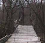
(footbridge)
Cameron, Ohio, USA - Sunfish Creek
| Bridgemeister ID: | 6684 (added 2021-09-12) |
| Name: | (footbridge) |
| Location: | Cameron, Ohio, USA |
| Crossing: | Sunfish Creek |
| Coordinates: | 39.760249 N 80.934763 W |
| Maps: | Acme, GeoHack, Google, OpenStreetMap |
| Use: | Footbridge |
| Status: | In use (last checked: 2016) |
| Main Cables: | Wire (steel) |
| Suspended Spans: | 1 |
Image Sets:
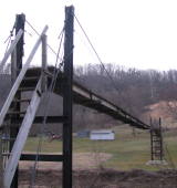
(footbridge)
Cameron, Ohio, USA - Sunfish Creek
| Bridgemeister ID: | 6685 (added 2021-09-12) |
| Name: | (footbridge) |
| Location: | Cameron, Ohio, USA |
| Crossing: | Sunfish Creek |
| Coordinates: | 39.754098 N 80.921516 W |
| Maps: | Acme, GeoHack, Google, OpenStreetMap |
| Use: | Footbridge |
| Status: | Extant (last checked: 2016) |
| Main Cables: | Wire (steel) |
| Main Span: | 1 |
Image Sets:
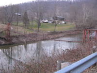
(footbridge)
Cameron, Ohio, USA - Sunfish Creek
| Bridgemeister ID: | 6686 (added 2021-09-12) |
| Name: | (footbridge) |
| Location: | Cameron, Ohio, USA |
| Crossing: | Sunfish Creek |
| Coordinates: | 39.763205 N 80.930582 W |
| Maps: | Acme, GeoHack, Google, OpenStreetMap |
| Use: | Footbridge |
| Status: | In use (last checked: 2016) |
| Main Cables: | Wire (steel) |
| Main Span: | 1 |
Image Sets:
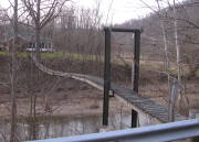
(footbridge)
East Fultonham, Ohio, USA - Jonathan Creek
| Bridgemeister ID: | 2436 (added 2008-04-22) |
| Name: | (footbridge) |
| Location: | East Fultonham, Ohio, USA |
| Crossing: | Jonathan Creek |
| Coordinates: | 39.855250 N 82.109278 W |
| Maps: | Acme, GeoHack, Google, OpenStreetMap |
| Use: | Footbridge |
| Status: | Extant (last checked: 2024) |
| Main Cables: | Wire |
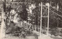
(footbridge)
Eden Township, Utica vicinity, Ohio, USA - Rocky Fork Stream
| Bridgemeister ID: | 8530 (added 2024-03-29) |
| Name: | (footbridge) |
| Location: | Eden Township, Utica vicinity, Ohio, USA |
| Crossing: | Rocky Fork Stream |
| At or Near Feature: | Camp Ohio |
| Use: | Footbridge |
| Main Span: | 1 |
Notes:
- The bridge pictured here at "Camp Ohio" is usually attributed to Utica, Ohio (USA). The bridge was likely located within the 4-H "Camp Ohio" found about 10 miles east of Utica. However, historic photos of that Camp Ohio show a different short suspension bridge.
External Links:
- 4-H Camp Ohio History - 1930s. The short suspension footbridge pictured on this page does not match the bridge in the postcard image linked here. Perhaps the bridge was rebuilt at some point or the postcard illustrator took liberties with the depiction.
Image Sets:
(footbridge)
Findlay vicinity, Ohio, USA - Eagle Creek
| Bridgemeister ID: | 2221 (added 2007-03-11) |
| Name: | (footbridge) |
| Location: | Findlay vicinity, Ohio, USA |
| Crossing: | Eagle Creek |
| At or Near Feature: | Camp Berry |
| Coordinates: | 40.95892 N 83.65817 W |
| Maps: | Acme, GeoHack, Google, OpenStreetMap |
| Use: | Footbridge |
| Status: | In use (last checked: 2007) |
| Suspended Spans: | 1 |
(footbridge)
Fort Jennings, Ohio, USA - Auglaize River
| Bridgemeister ID: | 5192 (added 2020-10-04) |
| Name: | (footbridge) |
| Location: | Fort Jennings, Ohio, USA |
| Crossing: | Auglaize River |
| Coordinates: | 40.904724 N 84.295338 W |
| Maps: | Acme, GeoHack, Google, OpenStreetMap |
| Use: | Footbridge |
| Status: | In use (last checked: 2020) |
| Main Cables: | Wire |
| Suspended Spans: | 3 |
| Main Span: | 1 |
| Side Spans: | 2 |
(footbridge)
Gates Mills, Ohio, USA - Chagrin River
| Bridgemeister ID: | 6687 (added 2021-09-12) |
| Name: | (footbridge) |
| Location: | Gates Mills, Ohio, USA |
| Crossing: | Chagrin River |
| Coordinates: | 41.506583 N 81.399896 W |
| Maps: | Acme, GeoHack, Google, OpenStreetMap |
| Use: | Footbridge |
| Status: | Removed, c. 2018-2019 |
| Main Cables: | Wire |
| Main Span: | 1 x 46 meters (151 feet) estimated |
Notes:
- Removed at some point in late 2018 or early 2019.
Image Sets:
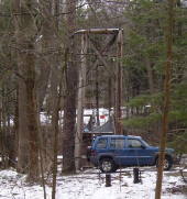
(footbridge)
Groveport, Ohio, USA - Little Walnut Creek
| Bridgemeister ID: | 6745 (added 2021-10-23) |
| Name: | (footbridge) |
| Location: | Groveport, Ohio, USA |
| Crossing: | Little Walnut Creek |
| Coordinates: | 39.847459 N 82.874600 W |
| Maps: | Acme, GeoHack, Google, OpenStreetMap |
| Use: | Footbridge and Golf cart |
| Status: | In use (last checked: 2011) |
| Main Cables: | Wire (steel) |
| Suspended Spans: | 1 |
Image Sets:
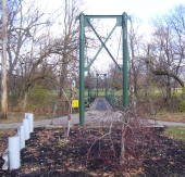
| Bridgemeister ID: | 2573 (added 2012-11-18) |
| Name: | (footbridge) |
| Location: | Parma, Ohio, USA |
| Crossing: | Big Creek |
| At or Near Feature: | Fern Hill Picnic Area |
| Coordinates: | 41.413165 N 81.754445 W |
| Maps: | Acme, GeoHack, Google, OpenStreetMap |
| Use: | Footbridge |
| Status: | In use (last checked: 2013) |
| Main Cables: | Wire (steel) |
| Suspended Spans: | 1 |
Image Sets:
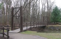
(footbridge)
Wolfhurst, Bridgeport, Ohio, USA - Wheeling Creek
| Bridgemeister ID: | 7095 (added 2022-05-29) |
| Name: | (footbridge) |
| Location: | Wolfhurst, Bridgeport, Ohio, USA |
| Crossing: | Wheeling Creek |
| Coordinates: | 40.067440 N 80.788920 W |
| Maps: | Acme, GeoHack, Google, OpenStreetMap |
| Use: | Footbridge |
| Status: | Extant (last checked: 2021) |
| Main Span: | 1 x 37.5 meters (123 feet) estimated |
(pipeline bridge)
Rayland, Ohio, USA - Short Creek
| Bridgemeister ID: | 2560 (added 2012-01-28) |
| Name: | (pipeline bridge) |
| Location: | Rayland, Ohio, USA |
| Crossing: | Short Creek |
| Coordinates: | 40.18757 N 80.68730 W |
| Maps: | Acme, GeoHack, Google, OpenStreetMap |
| Use: | Pipeline |
| Status: | Extant (last checked: 2011) |
| Main Cables: | Wire (steel) |
Image Sets:
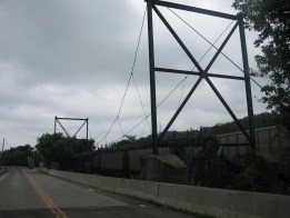
(pipeline bridge)
Roseville, Ohio, USA - Moxahala Creek
| Bridgemeister ID: | 7094 (added 2022-05-29) |
| Name: | (pipeline bridge) |
| Location: | Roseville, Ohio, USA |
| Crossing: | Moxahala Creek |
| Coordinates: | 39.800219 N 82.081253 W |
| Maps: | Acme, GeoHack, Google, OpenStreetMap |
| Use: | Pipeline |
| Status: | Extant (last checked: 2021) |
| Main Cables: | Wire (steel) |
| Suspended Spans: | 1 |
| Main Span: | 1 |
| Bridgemeister ID: | 5555 (added 2020-12-17) |
| Name: | Big Creek |
| Location: | Concord Township, Ohio, USA |
| Crossing: | Big Creek |
| At or Near Feature: | Girdled Road Reservation |
| Coordinates: | 41.659951 N 81.184281 W |
| Maps: | Acme, GeoHack, Google, OpenStreetMap |
| Use: | Footbridge |
| Status: | In use (last checked: 2020) |
| Main Cables: | Wire (steel) |
| Suspended Spans: | 1 |
Friendship
Bucyrus, Ohio, USA - Sandusky River
| Bridgemeister ID: | 2114 (added 2006-09-09) |
| Name: | Friendship |
| Location: | Bucyrus, Ohio, USA |
| Crossing: | Sandusky River |
| At or Near Feature: | Aumiller Park |
| Coordinates: | 40.802678 N 82.992352 W |
| Maps: | Acme, GeoHack, Google, OpenStreetMap |
| Use: | Footbridge |
| Status: | In use (last checked: 2014) |
| Main Cables: | Wire (steel) |
| Suspended Spans: | 1 |
| Main Span: | 1 x 30.5 meters (100 feet) estimated |
Notes:
- Eric Powell estimates the main span at approximately 100 feet.
External Links:
Image Sets:
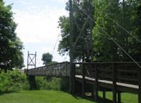
| Bridgemeister ID: | 2880 (added 2019-09-13) |
| Name: | Holden Arboretum |
| Location: | Kirtland, Ohio, USA |
| At or Near Feature: | Judith and Maynard H. Murch IV Canopy Walk |
| Use: | Footbridge |
| Status: | In use (last checked: 2019) |
| Main Cables: | Wire (steel) |
Notes:
- One of four suspension bridges along the canopy walk.
- Connects to Holden Arboretum - Kirtland, Ohio, USA.
- Connects to Holden Arboretum - Kirtland, Ohio, USA.
- Connects to Holden Arboretum - Kirtland, Ohio, USA.
- All past and present bridges at this location.
| Bridgemeister ID: | 2881 (added 2019-09-13) |
| Name: | Holden Arboretum |
| Location: | Kirtland, Ohio, USA |
| At or Near Feature: | Judith and Maynard H. Murch IV Canopy Walk |
| Use: | Footbridge |
| Status: | In use (last checked: 2019) |
| Main Cables: | Wire (steel) |
Notes:
- One of four suspension bridges along the canopy walk.
- Connects to Holden Arboretum - Kirtland, Ohio, USA.
- Connects to Holden Arboretum - Kirtland, Ohio, USA.
- Connects to Holden Arboretum - Kirtland, Ohio, USA.
- All past and present bridges at this location.
| Bridgemeister ID: | 2882 (added 2019-09-13) |
| Name: | Holden Arboretum |
| Location: | Kirtland, Ohio, USA |
| At or Near Feature: | Judith and Maynard H. Murch IV Canopy Walk |
| Use: | Footbridge |
| Status: | In use (last checked: 2019) |
| Main Cables: | Wire (steel) |
Notes:
- One of four suspension bridges along the canopy walk.
- Connects to Holden Arboretum - Kirtland, Ohio, USA.
- Connects to Holden Arboretum - Kirtland, Ohio, USA.
- Connects to Holden Arboretum - Kirtland, Ohio, USA.
- All past and present bridges at this location.
| Bridgemeister ID: | 2883 (added 2019-09-13) |
| Name: | Holden Arboretum |
| Location: | Kirtland, Ohio, USA |
| At or Near Feature: | Judith and Maynard H. Murch IV Canopy Walk |
| Use: | Footbridge |
| Status: | In use (last checked: 2019) |
| Main Cables: | Wire (steel) |
Notes:
- One of four suspension bridges along the canopy walk.
- Connects to Holden Arboretum - Kirtland, Ohio, USA.
- Connects to Holden Arboretum - Kirtland, Ohio, USA.
- Connects to Holden Arboretum - Kirtland, Ohio, USA.
- All past and present bridges at this location.
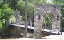
Swinging
Greenville, Ohio, USA - Greenville Creek
| Bridgemeister ID: | 1119 (added 2004-01-09) |
| Name: | Swinging |
| Location: | Greenville, Ohio, USA |
| Crossing: | Greenville Creek |
| At or Near Feature: | Greenville City Park |
| Coordinates: | 40.109252 N 84.630494 W |
| Maps: | Acme, GeoHack, Google, OpenStreetMap |
| Use: | Footbridge |
| Status: | In use (last checked: 2007) |
| Main Cables: | Wire (steel) |
| Suspended Spans: | 1 |
Image Sets:
Do you have any information or photos for these bridges that you would like to share? Please email david.denenberg@bridgemeister.com.
Mail | Facebook | X (Twitter) | Bluesky
