Suspension Bridges of Maine
This is a list of all 34 bridges from the suspension bridge inventory for Maine in USA. Wherever you see a Bridgemeister ID number click it to isolate the bridge on its own page.
Related Lists:
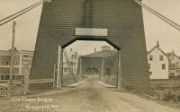
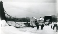
1853: Mill Pond
Kingfield, Maine, USA - Carrabasset River
| Bridgemeister ID: | 45 (added before 2003) |
| Year Completed: | 1853 |
| Name: | Mill Pond |
| Location: | Kingfield, Maine, USA |
| Crossing: | Carrabasset River |
| Principals: | Daniel Beedy |
| References: | AAJ, BPL |
| Use: | Vehicular (one-lane), with walkway |
| Status: | Replaced, 1916 |
| Main Cables: | Chain (iron) |
| Main Span: | 1 x 57.9 meters (190 feet) |
| Deck width: | 15 feet |
Notes:
- Similar to 1856 Strong - Strong, Maine, USA.
Image Sets:
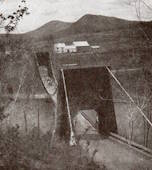
1856: Strong
Strong, Maine, USA - Sandy River
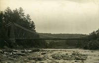
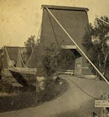
| Bridgemeister ID: | 53 (added before 2003) |
| Year Completed: | 1856 |
| Name: | Strong |
| Location: | Strong, Maine, USA |
| Crossing: | Sandy River |
| Principals: | Daniel Beedy |
| References: | BPL |
| Use: | Vehicular (one-lane) |
| Status: | Replaced, 1922 |
| Main Cables: | Wire (iron) |
| Suspended Spans: | 1 |
| Main Span: | 1 x 77.4 meters (254 feet) |
| Deck width: | 13 feet |
Notes:
- Similar to 1853 Mill Pond - Kingfield, Maine, USA.
Image Sets:
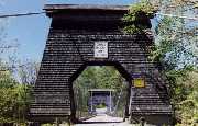
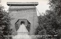
1868: Wire
New Portland, Maine, USA - Carrabasset River
| Bridgemeister ID: | 69 (added before 2003) |
| Year Completed: | 1868 |
| Name: | Wire |
| Location: | New Portland, Maine, USA |
| Crossing: | Carrabasset River |
| Coordinates: | 44.890783 N 70.0925 W |
| Maps: | Acme, GeoHack, Google, OpenStreetMap |
| References: | BC3, BPL, GBD, LAB, RDH |
| Use: | Vehicular (one-lane) |
| Status: | In use (last checked: 2023) |
| Main Cables: | Wire (iron) |
| Suspended Spans: | 1 |
| Main Span: | 1 x 60.5 meters (198.4 feet) |
Notes:
- BPL says c. 1866. Historic landmark plaque at bridge also says 1866.
- Extensive repairs, 1960.
External Links:
Image Sets:
1872: Gilead
Gilead, Maine, USA - Androscoggin River
| Bridgemeister ID: | 2157 (added 2006-12-10) |
| Year Completed: | 1872 |
| Name: | Gilead |
| Location: | Gilead, Maine, USA |
| Crossing: | Androscoggin River |
| Coordinates: | 44.398417 N 70.971500 W |
| Maps: | Acme, GeoHack, Google, OpenStreetMap |
| Use: | Vehicular |
| Status: | Replaced, 1923 |
| Main Cables: | Wire |
| Main Span: | 1 x 58.5 meters (192 feet) |
Notes:
- One of the abutments is still (as of the 2010s) present on the south side of the Androscoggin adjacent to the single-span truss bridge that replaced the suspension bridge.
Image Sets:
1883: Swinging
Skowhegan, Maine, USA - Kennebec River
| Bridgemeister ID: | 1575 (added 2004-12-19) |
| Year Completed: | 1883 |
| Name: | Swinging |
| Location: | Skowhegan, Maine, USA |
| Crossing: | Kennebec River |
| References: | KJ20030410 |
| Use: | Footbridge |
| Status: | Collapsed, 1888 |
| Main Cables: | Wire (steel) |
Notes:
- KJ20030410: "[The] span collapsed in 1888: it turned out the steel cables were not all steel, they had a core of hemp, according to the history 'Skowhegan on the Kennebec'."
- Replaced by 1888 Swinging - Skowhegan, Maine, USA.
- All past and present bridges at this location.
1888: Swinging
Skowhegan, Maine, USA - Kennebec River
| Bridgemeister ID: | 1576 (added 2004-12-19) |
| Year Completed: | 1888 |
| Name: | Swinging |
| Location: | Skowhegan, Maine, USA |
| Crossing: | Kennebec River |
| References: | KJ20030410 |
| Use: | Footbridge |
| Status: | Destroyed, 1901 |
| Main Cables: | Wire |
Notes:
- Destroyed by flood, 1901.
- Replaced 1883 Swinging - Skowhegan, Maine, USA.
- Replaced by 1902 Swinging - Skowhegan, Maine, USA.
- All past and present bridges at this location.
| Bridgemeister ID: | 264 (added before 2003) |
| Year Completed: | 1891 |
| Name: | (footbridge) |
| Location: | Lewiston, Maine, USA |
| At or Near Feature: | Island Garden Amusement Park |
| Use: | Footbridge |
| Status: | Dismantled, 1903 |
| Main Cables: | Wire |
| Suspended Spans: | 1 |
Notes:
- Nancy Fraser writes: "The pedestrian suspension bridge [was] located at Island Garden Amusement Park in Lewiston, Maine. It started at the water gate house that you can see and led to an island over the water falls where they had entertainment. It was in existence in Lewiston from 1891 to 1903. It was later sold to Amos Gerald of Fairfield, Maine to be used for the trolley line leading to Casco Castle and Amusement Park in South Freeport, Maine."
- Moved to (footbridge) - South Freeport, Maine, USA.
Image Sets:

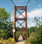
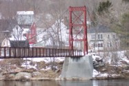
1892: Androscoggin Pedestrian
Topsham and Brunswick, Maine, USA - Androscoggin River
| Bridgemeister ID: | 101 (added before 2003) |
| Year Completed: | 1892 |
| Name: | Androscoggin Pedestrian |
| Also Known As: | Swinging, Androscoggin Swinging |
| Location: | Topsham and Brunswick, Maine, USA |
| Crossing: | Androscoggin River |
| Coordinates: | 43.918069 N 69.973122 W |
| Maps: | Acme, GeoHack, Google, OpenStreetMap |
| Principals: | John A. Roebling's Sons Co. |
| References: | PPH19991019, PPH20050801 |
| Use: | Footbridge |
| Status: | Destroyed, 1936 |
| Main Cables: | Wire (steel) |
Notes:
- c. 1913-1916: Original timber towers replaced with steel towers.
- 1936: Deck destroyed by flood. Steel towers and cables survive.
- Replaced by 1936 Androscoggin Pedestrian (Swinging) - Topsham and Brunswick, Maine, USA.
- All past and present bridges at this location.
External Links:
1902: Swinging
Skowhegan, Maine, USA - Kennebec River
| Bridgemeister ID: | 1577 (added 2004-12-19) |
| Year Completed: | 1902 |
| Name: | Swinging |
| Location: | Skowhegan, Maine, USA |
| Crossing: | Kennebec River |
| References: | KJ20030410 |
| Use: | Footbridge |
| Status: | Demolished, 1936 |
| Main Cables: | Wire |
Notes:
- Destroyed by flood, 1936.
- Replaced 1888 Swinging - Skowhegan, Maine, USA.
- Replaced by 1936 Swinging - Skowhegan, Maine, USA.
- All past and present bridges at this location.
Image Sets:
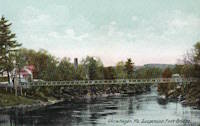
1903: Ticonic
Waterville, Maine, USA - Kennebec River
| Bridgemeister ID: | 110 (added before 2003) |
| Year Completed: | 1903 |
| Name: | Ticonic |
| Also Known As: | Tupenny, Two Cent |
| Location: | Waterville, Maine, USA |
| Crossing: | Kennebec River |
| Coordinates: | 44.55073 N 69.62728 W |
| Maps: | Acme, GeoHack, Google, OpenStreetMap |
| Principals: | Edwin D. Graves |
| References: | AAJ, HBE, PTS2 |
| Use: | Footbridge |
| Status: | In use (last checked: 2009) |
| Main Cables: | Wire |
| Suspended Spans: | 1 |
| Main Span: | 1 x 121.9 meters (400 feet) |
| Deck width: | 6 feet |
External Links:
Image Sets:
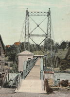
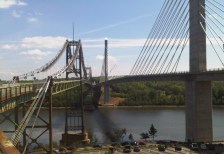
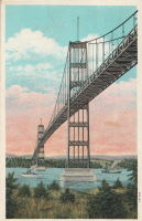
1931: Waldo-Hancock
Verona and Bucksport vicinity, Maine, USA - Penobscot River
| Bridgemeister ID: | 175 (added before 2003) |
| Year Completed: | 1931 |
| Name: | Waldo-Hancock |
| Location: | Verona and Bucksport vicinity, Maine, USA |
| Crossing: | Penobscot River |
| Coordinates: | 44.56 N 68.80333 W |
| Maps: | Acme, GeoHack, Google, OpenStreetMap |
| Principals: | Robinson and Steinman |
| References: | AAJ, ADDS, GBD, SSS, USS |
| Use: | Vehicular (two-lane, heavy vehicles), with walkway |
| Status: | Demolished, 2012 |
| Main Cables: | Wire (steel) |
| Suspended Spans: | 3 |
| Main Span: | 1 x 243.8 meters (800 feet) |
| Side Spans: | 2 x 106.7 meters (350 feet) |
| Deck width: | 27 feet |
Notes:
- Replacement cable-stayed bridge, (the Penobscot Narrows Bridge) completed, late 2006.
External Links:
Image Sets:
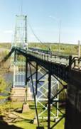
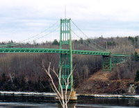
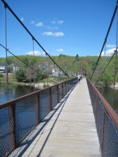
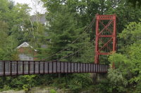
1936: Androscoggin Pedestrian
Topsham and Brunswick, Maine, USA - Androscoggin River
| Bridgemeister ID: | 182 (added before 2003) |
| Year Completed: | 1936 |
| Name: | Androscoggin Pedestrian |
| Also Known As: | Swinging |
| Location: | Topsham and Brunswick, Maine, USA |
| Crossing: | Androscoggin River |
| Coordinates: | 43.917500 N 69.972520 W |
| Maps: | Acme, GeoHack, Google, OpenStreetMap |
| Principals: | Works Progress Administration |
| References: | PPH19991019, PPH20050801 |
| Use: | Footbridge |
| Status: | In use (last checked: 2020) |
| Main Cables: | Wire (steel) |
| Suspended Spans: | 1 |
| Main Span: | 1 x 101.2 meters (332 feet) |
| Deck width: | 6 feet |
Notes:
- 2004, January: Added to National Register of Historic Places.
- 2006, December: Substantial rehabilitation completed.
- 2011, May: Dedicated as a Maine Historic Civil Engineering Landmark.
- Replaced 1892 Androscoggin Pedestrian (Swinging, Androscoggin Swinging) - Topsham and Brunswick, Maine, USA.
- All past and present bridges at this location.
External Links:
Image Sets:
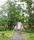
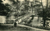
1936: Swinging
Skowhegan, Maine, USA - Kennebec River
| Bridgemeister ID: | 363 (added before 2003) |
| Year Completed: | 1936 |
| Name: | Swinging |
| Location: | Skowhegan, Maine, USA |
| Crossing: | Kennebec River |
| Coordinates: | 44.76244 N 69.72064 W |
| Maps: | Acme, GeoHack, Google, OpenStreetMap |
| Principals: | Gerald Marble |
| References: | KJ20030410 |
| Use: | Footbridge |
| Status: | In use (last checked: 2006) |
| Main Cables: | Wire (steel) |
| Suspended Spans: | 1 |
| Main Span: | 1 x 67.1 meters (220 feet) |
Notes:
- Connects Skowhegan Island to Alder Street across the south channel of the Kennebec River.
- Repaired, 1995. Rehabilitation completed, 2006.
- Replaced 1902 Swinging - Skowhegan, Maine, USA.
- All past and present bridges at this location.
Image Sets:
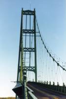
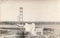
1939: Deer Isle
Sedgwick, Maine, USA - Eggemoggin Reach
| Bridgemeister ID: | 193 (added before 2003) |
| Year Completed: | 1939 |
| Name: | Deer Isle |
| Location: | Sedgwick, Maine, USA |
| Crossing: | Eggemoggin Reach |
| Coordinates: | 44.290167 N 68.691383 W |
| Maps: | Acme, GeoHack, Google, OpenStreetMap |
| Principals: | Robinson and Steinman |
| References: | AAJ, BBR, IT1999F |
| Use: | Vehicular (two-lane, heavy vehicles), with walkway |
| Status: | In use (last checked: 2022) |
| Main Cables: | Wire (steel) |
| Suspended Spans: | 3 |
| Main Span: | 1 x 329.2 meters (1,080 feet) |
| Side Spans: | 2 x 147.5 meters (484 feet) |
Notes:
- Gained much media attention in July 2018 when a bracket broke loose connecting the maintenance access cables to the main cables even though it had no impact on the structural integrity of the bridge.
External Links:
Image Sets:

1993: Smokey's Dream
Hartland, Maine, USA - Sebasticook River
| Bridgemeister ID: | 352 (added before 2003) |
| Year Completed: | 1993 |
| Name: | Smokey's Dream |
| Location: | Hartland, Maine, USA |
| Crossing: | Sebasticook River |
| Coordinates: | 44.88943 N 69.46198 W |
| Maps: | Acme, GeoHack, Google, OpenStreetMap |
| References: | PQU |
| Use: | Snowmobile |
| Status: | In use (last checked: 2003) |
| Main Cables: | Wire (steel) |
| Suspended Spans: | 1 |
| Main Span: | 1 x 57.9 meters (190 feet) |
Image Sets:
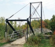
1997: Hastings Trail
Hastings, Maine, USA - Wild River
| Bridgemeister ID: | 335 (added before 2003) |
| Year Completed: | 1997 |
| Name: | Hastings Trail |
| Location: | Hastings, Maine, USA |
| Crossing: | Wild River |
| Coordinates: | 44.35558 N 70.9923 W |
| Maps: | Acme, GeoHack, Google, OpenStreetMap |
| References: | PQU |
| Use: | Footbridge |
| Status: | Removed |
| Main Span: | 1 x 54.9 meters (180 feet) |
Notes:
1997: Wentzell's Crossing
Dixfield and Mexico, Maine, USA - Webb River
| Bridgemeister ID: | 242 (added before 2003) |
| Year Completed: | 1997 |
| Name: | Wentzell's Crossing |
| Location: | Dixfield and Mexico, Maine, USA |
| Crossing: | Webb River |
| Coordinates: | 44.556269 N 70.462605 W |
| Maps: | Acme, GeoHack, Google, OpenStreetMap |
| Principals: | Mexico Trailblazers, Poodunck Snowmobile Club |
| Use: | Snowmobile |
| Status: | Extant (last checked: 2020) |
| Main Cables: | Wire |
2007: Aroostook Riders ATV Club
Houlton, Maine, USA - Meduxnekeag River
| Bridgemeister ID: | 2543 (added 2011-12-31) |
| Year Completed: | 2007 |
| Name: | Aroostook Riders ATV Club |
| Location: | Houlton, Maine, USA |
| Crossing: | Meduxnekeag River |
| Coordinates: | 46.143899 N 67.822960 W |
| Maps: | Acme, GeoHack, Google, OpenStreetMap |
| Use: | Snowmobile |
| Status: | Extant (last checked: 2022) |
| Main Cables: | Wire (steel) |
| Main Span: | 1 |
Notes:
- Intended for ATV and snowmobile traffic. Likely completed in 2007, possibly 2008.
2010: Mousam River Crossing
Sanford, Maine, USA - Mousam River
| Bridgemeister ID: | 2542 (added 2011-12-31) |
| Year Completed: | 2010 |
| Name: | Mousam River Crossing |
| Location: | Sanford, Maine, USA |
| Crossing: | Mousam River |
| Use: | Snowmobile |
| Status: | In use (last checked: 2010) |
| Main Cables: | Wire (steel) |
| Main Span: | 1 x 31.7 meters (104 feet) |
(footbridge)
Pittsfield, Maine, USA - Sebasticook River
| Bridgemeister ID: | 852 (added 2003-08-06) |
| Name: | (footbridge) |
| Location: | Pittsfield, Maine, USA |
| Crossing: | Sebasticook River |
| At or Near Feature: | Manson Park |
| Coordinates: | 44.77880 N 69.37425 W |
| Maps: | Acme, GeoHack, Google, OpenStreetMap |
| Use: | Footbridge and Snowmobile |
| Status: | In use (last checked: 2002) |
| Main Cables: | Wire |
| Suspended Spans: | 1 |
(footbridge)
Rumford, Maine, USA - Androscoggin River
| Bridgemeister ID: | 265 (added before 2003) |
| Name: | (footbridge) |
| Location: | Rumford, Maine, USA |
| Crossing: | Androscoggin River |
| At or Near Feature: | Rumford Falls |
| Use: | Footbridge |
| Status: | Removed |
| Main Cables: | Wire |
Image Sets:
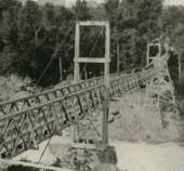
(footbridge)
Rumford, Maine, USA - Androscoggin River
| Bridgemeister ID: | 1696 (added 2005-03-27) |
| Name: | (footbridge) |
| Location: | Rumford, Maine, USA |
| Crossing: | Androscoggin River |
| Coordinates: | 44.55148 N 70.54430 W |
| Maps: | Acme, GeoHack, Google, OpenStreetMap |
| Use: | Footbridge and Pipeline |
| Status: | In use (last checked: 2012) |
| Main Cables: | Wire (steel) |
| Main Span: | 1 x 91.4 meters (300 feet) |
Notes:
- John A Roebling's Son Co. added the pipeline onto an existing footbridge. From a Roebling ad: "... supports a 400 foot section of the 30 inch diameter water line (capacity 12,000,000 gpd) across the Androscoggin River. A substantial saving was accomodated by erecting this bridge with its 300 ft. center span adjacent to and attached to an existing footbridge."
- See (pipeline bridge) - Rumford, Maine, USA. The pipelines were constructed as part of the same project.
Image Sets:
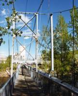
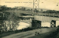
(footbridge)
South Freeport, Maine, USA - Spar Creek
| Bridgemeister ID: | 268 (added before 2003) |
| Name: | (footbridge) |
| Location: | South Freeport, Maine, USA |
| Crossing: | Spar Creek |
| At or Near Feature: | Casco Castle and Amusement Park |
| Coordinates: | 43.818492 N 70.114426 W |
| Maps: | Acme, GeoHack, Google, OpenStreetMap |
| Use: | Footbridge |
| Status: | Removed |
| Main Cables: | Wire |
| Suspended Spans: | 1 |
Notes:
- Nancy Fraser writes that this bridge was relocated from Lewiston by Amos Gerald.
- Coordinates indicate approximate location.
- Moved from 1891 (footbridge) - Lewiston, Maine, USA.
Image Sets:
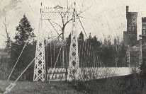
| Bridgemeister ID: | 2035 (added 2006-05-01) |
| Name: | (pipeline bridge) |
| Location: | Rumford, Maine, USA |
| Principals: | John A. Roebling's Sons Co. |
| Use: | Pipeline |
| Main Cables: | Wire (steel) |
| Suspended Spans: | 8 |
Notes:
- Described in a Roebling ad: "...carries 900 ft. of a 14 inch diameter stainless steel pulpline [built for Oxford Paper Co.] over a canal and uneven terrain. It has eight spans, the longest of which is 166 ft. Rigidity of the suspension system was achieved by running a pair of tie cables from one anchorage to the other, connecting all tower tops. The cost of a steel trestle to support this pulpline would have been much higher."
- See (footbridge) - Rumford, Maine, USA. The pipelines were constructed as part of the same project.
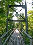
(snowmobile bridge)
Newry vicinity, Maine, USA - Bear River
| Bridgemeister ID: | 2478 (added 2008-12-21) |
| Name: | (snowmobile bridge) |
| Location: | Newry vicinity, Maine, USA |
| Crossing: | Bear River |
| Coordinates: | 44.52933 N 70.82639 W |
| Maps: | Acme, GeoHack, Google, OpenStreetMap |
| Use: | Snowmobile |
| Status: | In use (last checked: 2008) |
| Main Cables: | Wire (steel) |
| Suspended Spans: | 1 |
| Main Span: | 1 x 32 meters (105 feet) |
Notes:
- Possibly built 1996. Sign on bridge says "Windy Valleys Sno-Mobile Club 1996".
Image Sets:
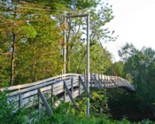
(snowmobile bridge)
North Leeds vicinity, Maine, USA - Dead River
| Bridgemeister ID: | 2480 (added 2008-12-21) |
| Name: | (snowmobile bridge) |
| Location: | North Leeds vicinity, Maine, USA |
| Crossing: | Dead River |
| Coordinates: | 44.35437 N 70.15510 W |
| Maps: | Acme, GeoHack, Google, OpenStreetMap |
| Use: | Snowmobile |
| Status: | In use (last checked: 2008) |
| Main Cables: | Wire (steel) |
| Suspended Spans: | 1 |
| Main Span: | 1 x 56.4 meters (185 feet) |
Image Sets:
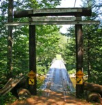
(snowmobile bridge)
Roxbury, Maine, USA - Swift River
| Bridgemeister ID: | 2479 (added 2008-12-21) |
| Name: | (snowmobile bridge) |
| Location: | Roxbury, Maine, USA |
| Crossing: | Swift River |
| Coordinates: | 44.67360 N 70.60651 W |
| Maps: | Acme, GeoHack, Google, OpenStreetMap |
| Use: | Snowmobile |
| Status: | In use (last checked: 2008) |
| Main Cables: | Wire (steel) |
| Suspended Spans: | 1 |
| Main Span: | 1 x 42.7 meters (140 feet) |
Image Sets:
Bowlin
Bowlin Camps, Patten, Maine, USA - Penobscot River E. Branch
| Bridgemeister ID: | 277 (added before 2003) |
| Name: | Bowlin |
| Location: | Bowlin Camps, Patten, Maine, USA |
| Crossing: | Penobscot River E. Branch |
| Coordinates: | 46.033778 N 68.726833 W |
| Maps: | Acme, GeoHack, Google, OpenStreetMap |
| Use: | Footbridge |
| Status: | In use (last checked: 2019) |
| Main Cables: | Wire (steel) |
| Main Span: | 1 |
Hastings Trail
Hastings, Maine, USA - Wild River
| Bridgemeister ID: | 3222 (added 2019-11-11) |
| Name: | Hastings Trail |
| Location: | Hastings, Maine, USA |
| Crossing: | Wild River |
| References: | PQU |
| Use: | Footbridge |
| Status: | Destroyed, October 22, 1995 |
| Main Cables: | Wire (steel) |
Notes:
- Destroyed by flood caused by Hurricane Opal, October 22, 1995.
- Replaced by 1997 Hastings Trail - Hastings, Maine, USA.
- All past and present bridges at this location.
Joe Long's
Fort Kent, Maine, USA and Clair, New Brunswick, Canada - St. John River
| Bridgemeister ID: | 252 (added before 2003) |
| Name: | Joe Long's |
| Also Known As: | Joe Lange's |
| Location: | Fort Kent, Maine, USA and Clair, New Brunswick, Canada |
| Crossing: | St. John River |
| Use: | Footbridge |
| Status: | Removed |
| Main Cables: | Wire |
| Main Spans: | 3 |
Notes:
- The bridge had at least three suspended spans, but likely more. Some sources attribute the bridge to a "Joe Long" and some to "Joe Lange". The 1905 Maine State Legislature proposed an act to authorize a "Joseph Long" to build a toll footbridge at Fort Kent.
External Links:
- Facebook. Several images of the bridge. Text states the bridge was built in the 1930s, but it may have actually been built several years earlier.
Image Sets:
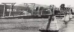
Swinging
Fairfield, Maine, USA - Kennebec River
| Bridgemeister ID: | 308 (added before 2003) |
| Name: | Swinging |
| Location: | Fairfield, Maine, USA |
| Crossing: | Kennebec River |
| At or Near Feature: | Mill Island |
| Coordinates: | 44.587477 N 69.593609 W |
| Maps: | Acme, GeoHack, Google, OpenStreetMap |
| Use: | Footbridge |
| Status: | Removed |
| Main Cables: | Wire |
| Suspended Spans: | 1 |
Notes:
- Crossed a channel of the Kennebec River to Mill Island. Appears to have been located at the coordinates provided here.
Image Sets:
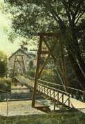
| Bridgemeister ID: | 369 (added before 2003) |
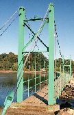
| Name: | Wiggly |
| Location: | York, Maine, USA |
| Coordinates: | 43.136717 N 70.650033 W |
| Maps: | Acme, GeoHack, Google, OpenStreetMap |
| Use: | Footbridge |
| Status: | In use (last checked: 2024) |
| Main Cables: | Wire (steel) |
| Suspended Spans: | 1 |
| Main Span: | 1 x 22.9 meters (75 feet) |
Notes:
- Often claimed to be the "smallest" suspension bridge in the world. It is not and never was. There are dozens of suspension bridges with main spans shorter than the 75 feet (22.86 meters) usually claimed as the Wiggly bridge's length.
External Links:
Image Sets:
Do you have any information or photos for these bridges that you would like to share? Please email david.denenberg@bridgemeister.com.
Mail | Facebook | X (Twitter) | Bluesky