Suspension Bridges of Illinois
This is a list of all 43 bridges from the suspension bridge inventory for Illinois in USA. Wherever you see a Bridgemeister ID number click it to isolate the bridge on its own page.
Related Lists:
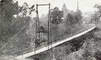
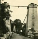
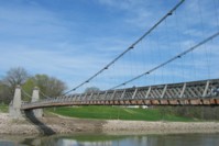
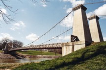
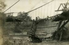
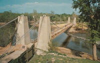
1859: General Dean
Carlyle, Illinois, USA - Kaskaskia River
| Bridgemeister ID: | 58 (added before 2003) |
| Year Completed: | 1859 |
| Name: | General Dean |
| Also Known As: | Carlyle |
| Location: | Carlyle, Illinois, USA |
| Crossing: | Kaskaskia River |
| Coordinates: | 38.611125 N 89.357476 W |
| Maps: | Acme, GeoHack, Google, OpenStreetMap |
| Principals: | D. Griffith Smith |
| References: | BPL, GBD |
| Use: | Vehicular (one-lane) |
| Status: | Restricted to foot traffic (last checked: 2021) |
| Main Cables: | Wire (iron) |
| Suspended Spans: | 1 |
| Main Span: | 1 x 80.5 meters (264 feet) |
Notes:
- Rebuilt 1920s, 1970s. Restored, 1950s, for use as a footbridge.
- Bypassed, 1924.
External Links:
Image Sets:
1870: (footbridge)
Rockford, Illinois, USA - Kent Creek
| Bridgemeister ID: | 594 (added 2003-01-11) |
| Year Completed: | 1870 |
| Name: | (footbridge) |
| Location: | Rockford, Illinois, USA |
| Crossing: | Kent Creek |
| At or Near Feature: | Tinker Swiss Cottage Museum |
| Principals: | Robert Tinker |
| Use: | Footbridge |
| Status: | Removed, 1976 |
Notes:
- Ground broken on replacement, October 6, 2004.
- Later at same location 2005 (footbridge) - Rockford, Illinois, USA.
- All past and present bridges at this location.
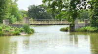
1893: Cable
Chicago, Illinois, USA - Garfield Park Lagoon
| Bridgemeister ID: | 320 (added before 2003) |
| Year Completed: | 1893 |
| Name: | Cable |
| Location: | Chicago, Illinois, USA |
| Crossing: | Garfield Park Lagoon |
| At or Near Feature: | Garfield Park |
| Coordinates: | 41.883548 N 87.714527 W |
| Maps: | Acme, GeoHack, Google, OpenStreetMap |
| References: | HBE |
| Use: | Footbridge |
| Status: | In use (last checked: 2021) |
| Main Cables: | Wire |
| Suspended Spans: | 1 |
Notes:
- 1870 and 1874 are also sometimes cited as year of completion.
Image Sets:

1893: Watson's
Riverside, Illinois, USA - Des Plaines River
| Bridgemeister ID: | 5669 (added 2021-01-30) |
| Year Completed: | 1893 |
| Name: | Watson's |
| Location: | Riverside, Illinois, USA |
| Crossing: | Des Plaines River |
| Coordinates: | 41.825778 N 87.817795 W |
| Maps: | Acme, GeoHack, Google, OpenStreetMap |
| Use: | Footbridge |
| Status: | Replaced |
| Main Cables: | Wire |
| Suspended Spans: | 1 |
| Characteristics: | Partially underspanned |
Notes:
- Appears to have been predominantly underspanned.
- Replaced by 1905 Swinging - Riverside, Illinois, USA.
- All past and present bridges at this location.
1898: (footbridge)
Pontiac, Illinois, USA - Vermilion River
| Bridgemeister ID: | 312 (added before 2003) |
| Year Completed: | 1898 |
| Name: | (footbridge) |
| Location: | Pontiac, Illinois, USA |
| Crossing: | Vermilion River |
| At or Near Feature: | Chautauqua Park |
| Coordinates: | 40.87696 N 88.62358 W |
| Maps: | Acme, GeoHack, Google, OpenStreetMap |
| Principals: | Joliet Bridge and Iron Co. |
| Use: | Footbridge |
| Status: | In use (last checked: 2005) |
| Main Cables: | Wire |
| Suspended Spans: | 2 |
| Main Span: | 1 |
| Side Span: | 1 |
Notes:
Image Sets:
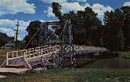
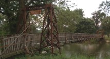
1898: (footbridge)
Pontiac, Illinois, USA - Vermilion River
| Bridgemeister ID: | 1862 (added 2005-07-31) |
| Year Completed: | 1898 |
| Name: | (footbridge) |
| Location: | Pontiac, Illinois, USA |
| Crossing: | Vermilion River |
| At or Near Feature: | Chautauqua Park |
| Coordinates: | 40.87554 N 88.62279 W |
| Maps: | Acme, GeoHack, Google, OpenStreetMap |
| Principals: | Joliet Bridge and Iron Co. |
| Use: | Footbridge |
| Status: | In use (last checked: 2005) |
| Main Cables: | Wire |
| Main Span: | 1 |
| Side Span: | 1 |
Notes:
Image Sets:
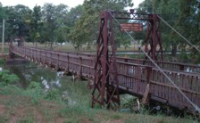
| Bridgemeister ID: | 2535 (added 2011-12-27) |
| Year Completed: | 1902 |
| Name: | Iron |
| Location: | Peoria, Illinois, USA |
| At or Near Feature: | Glen Oak Park |
| Coordinates: | 40.716042 N 89.573082 W |
| Maps: | Acme, GeoHack, Google, OpenStreetMap |
| Use: | Footbridge |
| Status: | Closed, 2003 (last checked: 2016) |
| Main Cables: | Wire |
| Suspended Spans: | 3 |
| Main Span: | 1 x 15.2 meters (50 feet) |
| Side Spans: | 2 x 7.6 meters (25 feet) |
Image Sets:
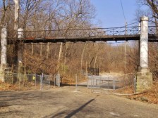
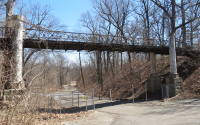
1905: Swinging
Riverside, Illinois, USA - Des Plaines River
| Bridgemeister ID: | 2617 (added 2018-12-30) |
| Year Completed: | 1905 |
| Name: | Swinging |
| Location: | Riverside, Illinois, USA |
| Crossing: | Des Plaines River |
| Coordinates: | 41.825603 N 87.817864 W |
| Maps: | Acme, GeoHack, Google, OpenStreetMap |
| Use: | Footbridge |
| Status: | Replaced, 1940 |
| Main Cables: | Wire |
| Suspended Spans: | 1 |
Notes:
- This replacement bridge appears to have been problematic. Most available images show some combination of mid-span supports assisting the suspension cables and failing deck.
- Replaced 1893 Watson's - Riverside, Illinois, USA.
- Replaced by 1940 H. Wallace Caldwell Memorial (Swinging) - Riverside, Illinois, USA.
- All past and present bridges at this location.
1928: (suspension bridge)
Galesburg, Illinois, USA - Lake Bracken
| Bridgemeister ID: | 280 (added before 2003) |
| Year Completed: | 1928 |
| Name: | (suspension bridge) |
| Location: | Galesburg, Illinois, USA |
| Crossing: | Lake Bracken |
| At or Near Feature: | Lake Bracken Country Club Boat Harbor |
| Coordinates: | 40.861999 N 90.350571 W |
| Maps: | Acme, GeoHack, Google, OpenStreetMap |
| Use: | Footbridge |
| Status: | In use (last checked: 2021) |
| Main Cables: | Wire |
| Suspended Spans: | 1 |
| Bridgemeister ID: | 1657 (added 2005-03-19) |
| Year Completed: | 1929 |
| Name: | Ogden Park |
| Location: | Chicago, Illinois, USA |
| At or Near Feature: | Ogden Park |
| Principals: | Linn White, C.R. Hoyt, George T. Donahue |
| References: | AAJ, ENR19290808 |
| Use: | Footbridge |
| Status: | Removed |
| Main Cables: | Wire |
| Suspended Spans: | 1 |
| Main Span: | 1 x 36 meters (118 feet) |
| Deck width: | 8.5 feet |
Notes:
- Looking at a picture of this bridge spanning about 150 feet of water, and looking at present-day maps and images of Ogden Park, it can be confusing trying to reconcile the location of this bridge as present-day Ogden Park has no waterways. The Chicago Park District web site explains, "Additionally, each [of several city parks] had a beautiful landscape with a meandering waterway near a meadow of ballfields. Ogden Park's waterway was drained and filled in 1940."
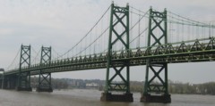
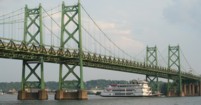
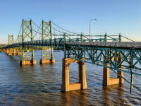
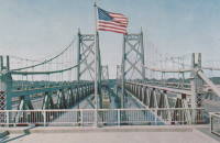
1935: Iowa-Illinois Memorial
Bettendorf, Iowa and Moline, Illinois, USA - Mississippi River
| Bridgemeister ID: | 180 (added before 2003) |
| Year Completed: | 1935 |
| Name: | Iowa-Illinois Memorial |
| Also Known As: | Interstate 74 Bridge, I-74 Bridge |
| Location: | Bettendorf, Iowa and Moline, Illinois, USA |
| Crossing: | Mississippi River |
| Coordinates: | 41.520264 N 90.513034 W |
| Maps: | Acme, GeoHack, Google, OpenStreetMap |
| Principals: | Modjeski, Masters, and Chase |
| References: | AAJ, CMR |
| Use: | Vehicular, with walkway |
| Status: | Bypassed, 2020 (last checked: 2022) |
| Main Cables: | Wire (steel) |
| Suspended Spans: | 3 |
| Main Span: | 1 x 225.6 meters (740 feet) |
| Side Spans: | 2 x 112.8 meters (370 feet) |
| Deck width: | 24.2 feet |
Notes:
- 2017, June 26: Groundbreaking ceremony for a replacement bridge for the twin Iowa-Illinois Memorial bridges. The new bridge is expected to be completed in 2020.
- 2020, November: Replacement span opens (for Iowa-bound traffic previously carried across the older of the two suspension bridges). Suspension bridge expected to be demolished in 2022.
- 2023: Demolition expected to be completed in 2024.
- Next to 1960 Iowa-Illinois Memorial (Interstate 74 Bridge, I-74 Bridge) - Bettendorf, Iowa and Moline, Illinois, USA.
- All past and present bridges at this location.
External Links:
Image Sets:
1936: (footbridge)
Tower Lakes, Illinois, USA - Tower Lake
| Bridgemeister ID: | 1306 (added 2004-04-10) |
| Year Completed: | 1936 |
| Name: | (footbridge) |
| Location: | Tower Lakes, Illinois, USA |
| Crossing: | Tower Lake |
| Coordinates: | 42.230815 N 88.154552 W |
| Maps: | Acme, GeoHack, Google, OpenStreetMap |
| Use: | Footbridge |
| Status: | Extant (last checked: 2019) |
| Suspended Spans: | 3 |
| Main Spans: | 3 |
Notes:
- There is at least one other suspension footbridge in the Tower Lakes area, but this 1936 3-span bridge appears to be the largest and the only one with a level deck.
1939: Sullivan-Hutsonville
Hutsonville, Illinois and Sullivan, Indiana, USA - Wabash River
| Bridgemeister ID: | 196 (added before 2003) |
| Year Completed: | 1939 |
| Name: | Sullivan-Hutsonville |
| Location: | Hutsonville, Illinois and Sullivan, Indiana, USA |
| Crossing: | Wabash River |
| Coordinates: | 39.1101 N 87.6551 W |
| Maps: | Acme, GeoHack, Google, OpenStreetMap |
| Principals: | Steinman & Robinson, R.V. Milbank, Wisconsin Bridge & Iron Co., Charles J. Glasgow |
| References: | AAJ, BPL, IMB, SJR19880926 |
| Use: | Vehicular (two-lane), with walkway |
| Status: | Demolished, 1989 |
| Main Cables: | Wire (steel) |
| Suspended Spans: | 3 |
| Main Span: | 1 x 106.7 meters (350 feet) |
| Side Spans: | 2 x 45.7 meters (150 feet) |
| Deck width: | 20 feet |
| Characteristics: | Self-anchored |
Notes:
- Demolished 1989. This bridge was Steinman's attempt at a self-anchored suspension bridge and met a controversial demise in 1989. An article in the September 26, 1988 issue of the Springfield, IL "The State Journal-Register" describes the ongoing controversy. The company to which the $100,000 demolition contract was let offered to turn the money over to save the bridge. The locals agreed, but the company's Chief Engineer Stephen Schneider was quoted, "I think Indiana really wants to tear it down. They've been ... forced to send inspectors out every two weeks. I think they just want the headache gone." Gary Abell, spokesman for the Indiana Dept. Of Highways said its design is "not one of the best. It works in theory, but not in practice. This is like trying to save a mistake." After a lot of back-and-forth, the locals gave up, "We've had it with them. We don't want anything more to do with it. They can tear the damn thing down." Animosity toward this bridge continues 13 years after its demolition. In 2002, in an email to Wayne Grodkiewicz (who provided me with much information about this bridge), an INDOT representative said, "I am not sure why you are interested in that bridge, but from our stand point, it was a very poorly designed bridge that had many many problems from the day that it was completed, until it was brought down."
External Links:
1940: H. Wallace Caldwell Memorial
Riverside, Illinois, USA - Des Plaines River
| Bridgemeister ID: | 775 (added 2003-03-14) |
| Year Completed: | 1940 |
| Name: | H. Wallace Caldwell Memorial |
| Also Known As: | Swinging |
| Location: | Riverside, Illinois, USA |
| Crossing: | Des Plaines River |
| Coordinates: | 41.826083 N 87.8176 W |
| Maps: | Acme, GeoHack, Google, OpenStreetMap |
| Use: | Footbridge |
| Status: | In use (last checked: 2021) |
| Main Cables: | Wire (steel) |
| Suspended Spans: | 1 |
| Main Span: | 1 x 64 meters (210 feet) estimated |
Notes:
- 2002, August 26-27: Deck replaced.
- 2023, March: Project to repaint the bridge expected to start, correcting issues with prior repainting efforts.
- Replaced 1905 Swinging - Riverside, Illinois, USA.
- All past and present bridges at this location.
Annotated Citations:
- Uphues, Bob. "Riverside Township confounded in effort to repaint bridge." Riverside-Brookfield Landmark, 19 October 2021, https://www.rblandmark.com/2021/10/19/riverside-township-confounded-in-effort-to-repaint-bridge/
"What was thought to be a pretty straightforward project to refurbish the 210-foot long H. Wallace Caldwell Memorial Bridge – known to local residents as the Swinging Bridge – has turned into something of a nightmare for the Riverside Township Board of Trustees… It turns out that not only was the $75,000 earmarked in the 2021-22 budget far below what it’s going to take to do the job, the township board has had trouble getting companies to even submit bids."
- Uphues, Bob. "Riverside Township confounded in effort to repaint bridge." Riverside-Brookfield Landmark, 21 March 2023, https://www.rblandmark.com/2023/03/21/swinging-bridge-overhaul-set-to-start-in-late-march/
"A long-awaited project to overhaul the painted surfaces of the Swinging Bridge will start March 27 after Riverside Township trustees voted 4-0 on March 14 to approve an ordinance announcing their intention to issue up to $500,000 in alternate revenue bonds to fund the work…"
Image Sets:

1955: Camp Saukenauk
Tioga vicinity, Adams County, Illinois, USA - Camp Saukenauk Lake
| Bridgemeister ID: | 5593 (added 2020-12-23) |
| Year Completed: | 1955 |
| Name: | Camp Saukenauk |
| Location: | Tioga vicinity, Adams County, Illinois, USA |
| Crossing: | Camp Saukenauk Lake |
| Coordinates: | 40.183546 N 91.319748 W |
| Maps: | Acme, GeoHack, Google, OpenStreetMap |
| Principals: | W.H. Klingner & Associates, Rose Construction Co. |
| Use: | Footbridge |
| Status: | In use (last checked: 2012) |
| Main Cables: | Wire (steel) |
| Suspended Spans: | 3 |
| Main Span: | 1 |
| Side Spans: | 2 |
External Links:
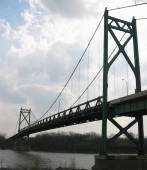
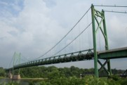
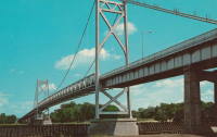
1955: Gateway
Clinton, Iowa and East Clinton, Illinois, USA - Mississippi River
| Bridgemeister ID: | 331 (added before 2003) |
| Year Completed: | 1955 |
| Name: | Gateway |
| Location: | Clinton, Iowa and East Clinton, Illinois, USA |
| Crossing: | Mississippi River |
| Coordinates: | 41.83785 N 90.18455 W |
| Maps: | Acme, GeoHack, Google, OpenStreetMap |
| References: | CMR |
| Use: | Vehicular (two-lane, heavy vehicles) |
| Status: | In use (last checked: 2019) |
| Main Cables: | Wire (steel) |
| Suspended Spans: | 1 |
| Main Span: | 1 x 196.3 meters (644 feet) |
External Links:
Image Sets:
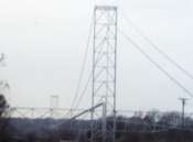
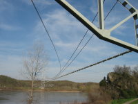
1955: Grand Tower Pipeline
Grand Tower, Illinois and Wittenberg vicinity, Missouri, USA - Mississippi River
| Bridgemeister ID: | 1028 (added 2003-11-30) |
| Year Completed: | 1955 |
| Name: | Grand Tower Pipeline |
| Location: | Grand Tower, Illinois and Wittenberg vicinity, Missouri, USA |
| Crossing: | Mississippi River |
| Coordinates: | 37.6417 N 89.513217 W |
| Maps: | Acme, GeoHack, Google, OpenStreetMap |
| Use: | Pipeline |
| Status: | In use (last checked: 2005) |
| Main Cables: | Wire (steel) |
| Suspended Spans: | 1 |
| Main Span: | 1 x 658.8 meters (2,161.5 feet) |
Notes:
- Large pipeline bridge, sometimes claimed to be "world's largest pipeline suspension bridge".
External Links:
Image Sets:

1960: Iowa-Illinois Memorial
Bettendorf, Iowa and Moline, Illinois, USA - Mississippi River
| Bridgemeister ID: | 213 (added before 2003) |
| Year Completed: | 1960 |
| Name: | Iowa-Illinois Memorial |
| Also Known As: | Interstate 74 Bridge, I-74 Bridge |
| Location: | Bettendorf, Iowa and Moline, Illinois, USA |
| Crossing: | Mississippi River |
| Coordinates: | 41.519372 N 90.513259 W |
| Maps: | Acme, GeoHack, Google, OpenStreetMap |
| References: | CMR |
| Use: | Vehicular |
| Status: | Bypassed, December 2021 (last checked: 2022) |
| Main Cables: | Wire (steel) |
| Suspended Spans: | 3 |
| Main Span: | 1 |
| Side Spans: | 2 |
Notes:
- 2017, June 26: Groundbreaking ceremony for a replacement bridge for the twin Iowa-Illinois Memorial bridges. The new bridge is expected to be completed in 2020.
- 2021, December: Replacement span opens. Suspension bridge expected to be demolished in 2022.
- 2023: Demolition expected to be completed in 2024.
- Next to 1935 Iowa-Illinois Memorial (Interstate 74 Bridge, I-74 Bridge) - Bettendorf, Iowa and Moline, Illinois, USA.
- All past and present bridges at this location.
External Links:
Image Sets:


| Bridgemeister ID: | 2544 (added 2011-12-31) |
| Year Completed: | 1964 |
| Name: | Citizens Bank |
| Location: | East Alton, Illinois, USA |
| At or Near Feature: | Citizens Bank building |
| Coordinates: | 38.884986 N 90.099109 W |
| Maps: | Acme, GeoHack, Google, OpenStreetMap |
| Use: | Footbridge |
| Status: | Extant (last checked: 2018) |
| Main Cables: | Wire (steel) |
| Suspended Spans: | 1 |
Notes:
- Small footbridge at the entrance to the circular Citizens Bank building in East Alton.
- Demolition of bridge and building slated for 2016 halted following public outcry. Bridge still standing in 2018.
1973: (footbridge)
Lincoln, Illinois, USA - Kickapoo Creek
| Bridgemeister ID: | 909 (added 2003-10-11) |
| Year Completed: | 1973 |
| Name: | (footbridge) |
| Location: | Lincoln, Illinois, USA |
| Crossing: | Kickapoo Creek |
| At or Near Feature: | Kickapoo Creek County Park |
| Coordinates: | 40.17338 N 89.37623 W |
| Maps: | Acme, GeoHack, Google, OpenStreetMap |
| Use: | Footbridge |
| Status: | In use (last checked: 2005) |
| Main Cables: | Wire |
| Suspended Spans: | 1 |
| Main Span: | 1 |
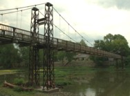
1978: (footbridge)
Pontiac, Illinois, USA - Vermilion River
| Bridgemeister ID: | 1710 (added 2005-04-02) |
| Year Completed: | 1978 |
| Name: | (footbridge) |
| Location: | Pontiac, Illinois, USA |
| Crossing: | Vermilion River |
| At or Near Feature: | Humiston Riverside Park |
| Coordinates: | 40.876867 N 88.63325 W |
| Maps: | Acme, GeoHack, Google, OpenStreetMap |
| Use: | Footbridge |
| Status: | In use (last checked: 2005) |
| Main Cables: | Wire (steel) |
| Suspended Spans: | 3 |
| Main Span: | 1 |
| Side Spans: | 2 |
Image Sets:
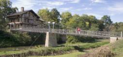
2005: (footbridge)
Rockford, Illinois, USA - Kent Creek
| Bridgemeister ID: | 1839 (added 2005-07-03) |
| Year Completed: | 2005 |
| Name: | (footbridge) |
| Location: | Rockford, Illinois, USA |
| Crossing: | Kent Creek |
| At or Near Feature: | Tinker Swiss Cottage Museum |
| Coordinates: | 42.2645 N 89.101667 W |
| Maps: | Acme, GeoHack, Google, OpenStreetMap |
| Use: | Footbridge |
| Status: | In use (last checked: 2014) |
| Main Cables: | Wire (steel) |
| Suspended Spans: | 2 |
| Main Span: | 1 |
| Side Span: | 1 |
Notes:
- At former location of 1870 (footbridge) - Rockford, Illinois, USA.
- All past and present bridges at this location.
Image Sets:
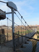
2008: North Avenue
Chicago, Illinois, USA - North Branch Chicago River
| Bridgemeister ID: | 3286 (added 2019-11-23) |
| Year Completed: | 2008 |
| Name: | North Avenue |
| Location: | Chicago, Illinois, USA |
| Crossing: | North Branch Chicago River |
| Coordinates: | 41.910792 N 87.656883 W |
| Maps: | Acme, GeoHack, Google, OpenStreetMap |
| Use: | Vehicular (four-lane), with walkway |
| Status: | In use (last checked: 2019) |
| Main Cables: | Wire (steel) |
| Suspended Spans: | 1 |
Notes:
- Hybrid cable-stayed and suspension bridge,
External Links:
(conveyor bridge)
Joliet, Illinois, USA - Des Plaines River
| Bridgemeister ID: | 2574 (added 2012-11-18) |
| Name: | (conveyor bridge) |
| Location: | Joliet, Illinois, USA |
| Crossing: | Des Plaines River |
| At or Near Feature: | Joliet 29 Generating Station |
| Coordinates: | 41.494281 N 88.119729 W |
| Maps: | Acme, GeoHack, Google, OpenStreetMap |
| Use: | Conveyor |
| Status: | Extant (last checked: 2012) |
| Main Cables: | Wire (steel) |
(footbridge)
Aurora, Illinois, USA - Blackberry Creek
| Bridgemeister ID: | 1559 (added 2004-11-26) |
| Name: | (footbridge) |
| Location: | Aurora, Illinois, USA |
| Crossing: | Blackberry Creek |
| At or Near Feature: | Virgil L. Gilman Trail |
| Coordinates: | 41.760533 N 88.388141 W |
| Maps: | Acme, GeoHack, Google, OpenStreetMap |
| Use: | Footbridge |
| Status: | In use (last checked: 2020) |
| Main Cables: | Wire (steel) |
| Suspended Spans: | 1 |
| Main Span: | 1 x 33 meters (108.3 feet) estimated |
| Deck width: | 2.7 meters |
Notes:
- On the Virgil L. Gilman Trail near the intersection of Orchard Rd. and Prairie St. At mile marker 6.5 on the trail.
External Links:
- Bridgehunter.com | Blackberry Creek Frankenbridge. Described here as "Frankenbridge" because the bridge appears to be constructed from parts recovered from other bridges or structures, hence a bridge akin to Frankenstein's monster.
Image Sets:
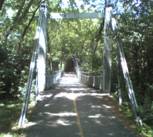
| Bridgemeister ID: | 808 (added 2003-05-28) |
| Name: | (footbridge) |
| Location: | Batavia, Illinois, USA |
| Crossing: | Fox River |
| At or Near Feature: | Clark Park |
| Coordinates: | 41.846869 N 88.307962 W |
| Maps: | Acme, GeoHack, Google, OpenStreetMap |
| Use: | Footbridge |
| Status: | Removed, c. 2005-2007 |
| Main Cables: | Wire (steel) |
| Suspended Spans: | 1 |
| Main Span: | 1 x 25 meters (82 feet) estimated |
| Deck width: | 1.5 meters |
Notes:
- There were two small footbridges at this location. This record represents the bridge that connected from the Batavia side (west) of the Fox River to a small island. The other bridge is about 200 feet away and connects the first island to another island.
- Removed at some point between 2005 and 2007.
- Connects to (footbridge) - Batavia, Illinois, USA.
- All past and present bridges at this location.
Image Sets:
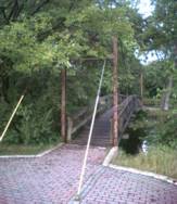
| Bridgemeister ID: | 1840 (added 2005-07-09) |
| Name: | (footbridge) |
| Location: | Batavia, Illinois, USA |
| Crossing: | Fox River |
| At or Near Feature: | Clark Park |
| Coordinates: | 41.846270 N 88.307685 W |
| Maps: | Acme, GeoHack, Google, OpenStreetMap |
| Use: | Footbridge |
| Status: | Closed (last checked: 2021) |
| Main Cables: | Wire (steel) |
| Suspended Spans: | 1 |
| Main Span: | 1 x 25 meters (82 feet) estimated |
| Deck width: | 1.5 meters |
Notes:
- Appeared to be closed in 2016 and 2019. Unclear if this is a long-term situation.
- Connects to (footbridge) - Batavia, Illinois, USA.
- All past and present bridges at this location.
Image Sets:
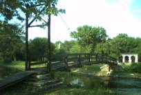
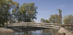
(footbridge)
Lake Forest, Illinois, USA - Mayflower Ravine
| Bridgemeister ID: | 9045 (added 2025-01-26) |
| Name: | (footbridge) |
| Location: | Lake Forest, Illinois, USA |
| Crossing: | Mayflower Ravine |
| At or Near Feature: | Jean and John Greene Nature Preserve |
| Coordinates: | 42.226444 N 87.814556 W |
| Maps: | Acme, GeoHack, Google, OpenStreetMap |
| Use: | Footbridge |
| Status: | In use (last checked: 2024) |
| Main Cables: | Wire (steel) |
| Suspended Spans: | 1 |
| Main Span: | 1 |
Notes:
- Completed at some point between late 2022 and early 2023.
External Links:
- A Bridge to Conversation | JWC Media. Article about the bridge. Dated September 2024.
- Bluesky. Image of the bridge. Posted January 13, 2025.
(footbridge)
North Riverside, Illinois, USA - Des Plaines River
| Bridgemeister ID: | 861 (added 2003-08-09) |
| Name: | (footbridge) |
| Location: | North Riverside, Illinois, USA |
| Crossing: | Des Plaines River |
| At or Near Feature: | Riverside Golf Club |
| Coordinates: | 41.84336 N 87.82781 W |
| Maps: | Acme, GeoHack, Google, OpenStreetMap |
| Use: | Footbridge |
| Status: | In use |
| Main Cables: | Wire |
| Suspended Spans: | 1 |
| Main Span: | 1 x 45.7 meters (150 feet) estimated |
Notes:
- This bridge employs an interesting system of cable stays and inclined suspenders. It accomodates foot and golf cart traffic.
Image Sets:
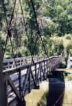
(footbridge)
Rockford vicinity, Illinois, USA - Kishwaukee River
| Bridgemeister ID: | 862 (added 2003-08-09) |
| Name: | (footbridge) |
| Location: | Rockford vicinity, Illinois, USA |
| Crossing: | Kishwaukee River |
| At or Near Feature: | Atwood Park |
| Coordinates: | 42.183113 N 89.055943 W |
| Maps: | Acme, GeoHack, Google, OpenStreetMap |
| Use: | Footbridge |
| Status: | In use (last checked: 2021) |
| Main Cables: | Wire (steel) |
| Suspended Spans: | 1 |
| Main Span: | 1 x 64.9 meters (213 feet) estimated |
Image Sets:
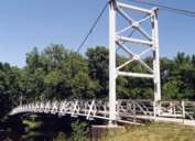
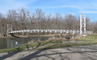
(footbridge)
St. Charles, Illinois, USA - Fox River arm
| Bridgemeister ID: | 1841 (added 2005-07-10) |
| Name: | (footbridge) |
| Location: | St. Charles, Illinois, USA |
| Crossing: | Fox River arm |
| At or Near Feature: | Pottawatomie Golf Course |
| Coordinates: | 41.924122 N 88.318123 W |
| Maps: | Acme, GeoHack, Google, OpenStreetMap |
| Use: | Footbridge |
| Status: | In use (last checked: 2005) |
| Main Cables: | Wire |
| Suspended Spans: | 1 |
| Main Span: | 1 x 30 meters (98.4 feet) estimated |
| Deck width: | 2.1 meters |
Image Sets:
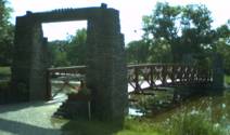
(pipeline bridge)
Alsip, Illinois, USA - Calumet Sag Channel
| Bridgemeister ID: | 3246 (added 2019-11-16) |
| Name: | (pipeline bridge) |
| Location: | Alsip, Illinois, USA |
| Crossing: | Calumet Sag Channel |
| Coordinates: | 41.651809 N 87.699943 W |
| Maps: | Acme, GeoHack, Google, OpenStreetMap |
| Use: | Pipeline |
| Status: | Extant (last checked: 2019) |
| Main Cables: | Wire (steel) |
Notes:
- Next to (pipeline bridge) - Alsip, Illinois, USA.
- Next to (pipeline bridge) - Alsip, Illinois, USA.
- Next to (pipeline bridge) - Alsip, Illinois, USA.
- All past and present bridges at this location.
External Links:
(pipeline bridge)
Alsip, Illinois, USA - Calumet Sag Channel
| Bridgemeister ID: | 3247 (added 2019-11-16) |
| Name: | (pipeline bridge) |
| Location: | Alsip, Illinois, USA |
| Crossing: | Calumet Sag Channel |
| Coordinates: | 41.651663 N 87.703783 W |
| Maps: | Acme, GeoHack, Google, OpenStreetMap |
| Use: | Pipeline |
| Status: | Extant (last checked: 2019) |
| Main Cables: | Wire (steel) |
Notes:
- Next to (pipeline bridge) - Alsip, Illinois, USA.
- Next to (pipeline bridge) - Alsip, Illinois, USA.
- Next to (pipeline bridge) - Alsip, Illinois, USA.
- All past and present bridges at this location.
External Links:
(pipeline bridge)
Alsip, Illinois, USA - Calumet Sag Channel
| Bridgemeister ID: | 3248 (added 2019-11-16) |
| Name: | (pipeline bridge) |
| Location: | Alsip, Illinois, USA |
| Crossing: | Calumet Sag Channel |
| Coordinates: | 41.651633 N 87.706524 W |
| Maps: | Acme, GeoHack, Google, OpenStreetMap |
| Use: | Pipeline |
| Status: | Extant (last checked: 2019) |
| Main Cables: | Wire (steel) |
Notes:
- Next to (pipeline bridge) - Alsip, Illinois, USA.
- Next to (pipeline bridge) - Alsip, Illinois, USA.
- Next to (pipeline bridge) - Alsip, Illinois, USA.
- All past and present bridges at this location.
External Links:
(pipeline bridge)
Alsip, Illinois, USA - Calumet Sag Channel
| Bridgemeister ID: | 3249 (added 2019-11-16) |
| Name: | (pipeline bridge) |
| Location: | Alsip, Illinois, USA |
| Crossing: | Calumet Sag Channel |
| Coordinates: | 41.651614 N 87.713846 W |
| Maps: | Acme, GeoHack, Google, OpenStreetMap |
| Use: | Pipeline |
| Status: | Extant (last checked: 2019) |
| Main Cables: | Wire (steel) |
Notes:
- Next to (pipeline bridge) - Alsip, Illinois, USA.
- Next to (pipeline bridge) - Alsip, Illinois, USA.
- Next to (pipeline bridge) - Alsip, Illinois, USA.
- All past and present bridges at this location.
External Links:
(suspension bridge)
Cornell, Illinois, USA - Vermilion River
| Bridgemeister ID: | 1693 (added 2005-03-27) |
| Name: | (suspension bridge) |
| Location: | Cornell, Illinois, USA |
| Crossing: | Vermilion River |
| At or Near Feature: | Valley View Acres |
| Status: | Removed |
| Main Cables: | Wire |
| Suspended Spans: | 1 |
Notes:
- The postcard says, "Valley View Acres. Cornell, Illinois. Located on Illinois Rte 23 between Streator, Illinois and Pontiac, Illinois. The picturesque suspension bridge spanning the old Vermilion River at Valley View Acres joining the camping area on both sides of river..."
Image Sets:
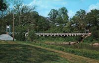
Acme Conveyor
Chicago, Illinois, USA - Calumet River
| Bridgemeister ID: | 2441 (added 2008-04-22) |
| Name: | Acme Conveyor |
| Location: | Chicago, Illinois, USA |
| Crossing: | Calumet River |
| Coordinates: | 41.69399 N 87.55206 W |
| Maps: | Acme, GeoHack, Google, OpenStreetMap |
| Use: | Conveyor |
| Status: | Demolished, August 22, 2005 |
| Main Span: | 1 x 121.9 meters (400 feet) |
Notes:
- Large industrial structure. According to the August 22, 2005 U.S. Coast Guard press release on the demolition: "The suspended conveyor bridge is approximately 26 feet wide, 400 feet in length, and has a vertical clearance of 130 feet. It is located in an industrial area approximately 15 miles south of downtown Chicago on the old Acme Steel and Heckett Slag properties."
Kankakee River Trail
Altorf vicinity, Illinois, USA - Rock Creek
| Bridgemeister ID: | 834 (added 2003-06-01) |
| Name: | Kankakee River Trail |
| Location: | Altorf vicinity, Illinois, USA |
| Crossing: | Rock Creek |
| At or Near Feature: | Kankakee River State Park |
| Coordinates: | 41.205533 N 87.984933 W |
| Maps: | Acme, GeoHack, Google, OpenStreetMap |
| Use: | Footbridge |
| Status: | In use (last checked: 2020) |
| Main Cables: | Wire (steel) |
| Suspended Spans: | 1 |
Pedestrian Swinging
Belvidere, Illinois, USA - Kishwaukee River
| Bridgemeister ID: | 6562 (added 2021-09-02) |
| Name: | Pedestrian Swinging |
| Location: | Belvidere, Illinois, USA |
| Crossing: | Kishwaukee River |
| Coordinates: | 42.255262 N 88.855792 W |
| Maps: | Acme, GeoHack, Google, OpenStreetMap |
| Use: | Footbridge |
| Status: | In use (last checked: 2021) |
| Main Cables: | Wire (steel) |
| Main Span: | 1 x 54 meters (177.2 feet) estimated |
Image Sets:
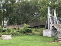
Pilgrim Park
Princeton, Illinois, USA - Brush Creek
| Bridgemeister ID: | 2634 (added 2019-02-26) |
| Name: | Pilgrim Park |
| Location: | Princeton, Illinois, USA |
| Crossing: | Brush Creek |
| At or Near Feature: | Pilgrim Park |
| Coordinates: | 41.340639 N 89.346194 W |
| Maps: | Acme, GeoHack, Google, OpenStreetMap |
| Use: | Footbridge |
| Status: | In use (last checked: 2011) |
| Main Cables: | Wire (steel) |
| Suspended Spans: | 1 |
Notes:
- Spring, 2011: Largely destroyed by flood.
- October, 2011: Rebuilt.
Do you have any information or photos for these bridges that you would like to share? Please email david.denenberg@bridgemeister.com.
Mail | Facebook | X (Twitter) | Bluesky
