Suspension Bridges of Ontario
This is a list of all 24 bridges from the suspension bridge inventory for Ontario in Canada. Wherever you see a Bridgemeister ID number click it to isolate the bridge on its own page.
Related Lists:
1844: Union
Ottawa, Ontario, Canada - Chaudière Falls
| Bridgemeister ID: | 26 (added before 2003) |
| Year Completed: | 1844 |
| Name: | Union |
| Location: | Ottawa, Ontario, Canada |
| Crossing: | Chaudière Falls |
| Principals: | Samuel Keefer |
| References: | AAJ |
| Use: | Vehicular |
| Status: | Replaced, 1889 |
| Main Cables: | Wire (iron) |
| Suspended Spans: | 1 |
| Main Span: | 1 x 74.2 meters (243.5 feet) |
Notes:
- At time of completion, Ottawa was still known as Bytown.
External Links:
Image Sets:

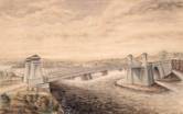
1848: Niagara Suspension
Niagara Falls, New York, USA and Niagara Falls, Ontario, Canada - Niagara River
| Bridgemeister ID: | 29 (added before 2003) |
| Year Completed: | 1848 |
| Name: | Niagara Suspension |
| Location: | Niagara Falls, New York, USA and Niagara Falls, Ontario, Canada |
| Crossing: | Niagara River |
| Principals: | Charles Ellet |
| References: | BOB, BPL, HBE, ONF, PTS2 |
| Use: | Vehicular (one-lane) |
| Status: | Removed |
| Main Cables: | Wire (iron) |
| Suspended Spans: | 1 |
| Main Span: | 1 x 234.7 meters (770 feet) |
| Deck width: | 7.5 feet |
Notes:
1851: Lewiston-Queenston
Lewiston, New York, USA and Queenston, Ontario, Canada - Niagara River
| Bridgemeister ID: | 35 (added before 2003) |
| Year Completed: | 1851 |
| Name: | Lewiston-Queenston |
| Location: | Lewiston, New York, USA and Queenston, Ontario, Canada |
| Crossing: | Niagara River |
| Principals: | Edward Serrell |
| References: | AAJ, BOB, BPL, HBE, PTS2 |
| Use: | Vehicular |
| Status: | Wrecked, 1864 |
| Main Cables: | Wire (iron) |
| Suspended Spans: | 1 |
| Main Span: | 1 x 258.8 meters (849 feet) |
| Deck width: | 21 feet (AAJ: 19.5 feet) |
Notes:
- Wrecked by wind February 1, 1864. Stay cables beneath the bridge had been disconnected to avoid damage from rising ice. Portions of the cables and deck remained, in a derelict state, as late as 1895. Replacement was not started until the late 1890's.
- The February 3, 1864 edition of Niagara Falls Gazette describes the wind event: "Partial Destruction Of The Lewiston Suspension Bridge -- A portion of the flooring and other wood-work of the Lewiston Suspension Bridge was blown down during the gale Monday forenoon. It seems that the long guys had been cut during the late ice jam to prevent injury to the structure and thus its strength to withstand a gale was much weakened. The wind swept through the gorge on Monday with terrific force and swayed the bridge so that some of the cross timbers, near the centre were loosened from their fastenings, and fell, of course carrying the floor with them. A large portion at each end, remains without material injury. The extent of the damage -- financially -- we have not yet learned, but we judge from what we hear that it may be about $10,000. The bridge was built in 1852 and cost not far from $40,000. It will doubtless soon be repaired and in use."
- Later at same location 1899 Lewiston-Queenston - Lewiston, New York, USA and Queenston, Ontario, Canada.
- See 1849 Wheeling (Wheeling and Belmont) - Wheeling, West Virginia, USA. The 1851 Lewiston-Queenston bridge is sometimes claimed to have become the longest in the world with a main span surpassing the length of the Wheeling suspension bridge. However, Don Sayenga notes the length of the suspended span of the Lewiston-Queenston bridge was only 849 feet, not the 1,043 feet sometimes cited. Don writes: "[1,043 feet] was the distance between the towers built high up on the cliffs above the crossing - because there was no space for them below. The roadway suspended from the towers was only 849 feet span over the water from abutment to abutment." Thus, Roebling's Cincinnati bridge should be considered the first to eclipse Wheeling's record main span.
- All past and present bridges at this location.
External Links:
Image Sets:
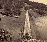
1855: Niagara Suspension
Niagara Falls, New York, USA and Niagara Falls, Ontario, Canada - Niagara River
| Bridgemeister ID: | 51 (added before 2003) |
| Year Completed: | 1855 |
| Name: | Niagara Suspension |
| Location: | Niagara Falls, New York, USA and Niagara Falls, Ontario, Canada |
| Crossing: | Niagara River |
| Principals: | John A. Roebling |
| References: | AAJ, BAAW, BBR, BFL, BMA, BOB, BPL, HBE, LIR, NSB, ONF, PTS2, SA18810716, SJR |
| Use: | Rail (heavy rail) and Vehicular (double-deck), with walkway |
| Status: | Replaced, 1897 |
| Main Cables: | Wire (iron) |
| Suspended Spans: | 1 |
| Main Span: | 1 x 250.3 meters (821.3 feet) |
Notes:
- Cables renovated, 1877. Wooden stiffening trusses replaced, 1880. Towers replaced, c. 1886. Bridge replaced with steel arch, 1897.
- AAJ notes the roadway deck opened in 1854, but the railway deck did not open until 1855.
- Replaced 1848 Niagara Suspension - Niagara Falls, New York, USA and Niagara Falls, Ontario, Canada.
- All past and present bridges at this location.
External Links:
Image Sets:
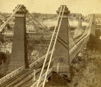
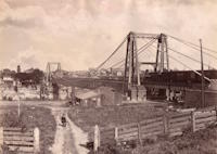
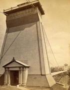
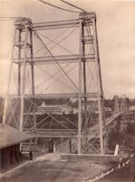
1869: Clifton
Niagara Falls, New York, USA and Niagara Falls, Ontario, Canada - Niagara River
| Bridgemeister ID: | 70 (added before 2003) |
| Year Completed: | 1869 |
| Name: | Clifton |
| Also Known As: | Upper, Niagara-Clifton, Falls View, First Falls View |
| Location: | Niagara Falls, New York, USA and Niagara Falls, Ontario, Canada |
| Crossing: | Niagara River |
| Coordinates: | 43.089722 N 79.069694 W |
| Maps: | Acme, GeoHack, Google, OpenStreetMap |
| Principals: | Samuel Keefer |
| References: | AAJ, BPL, HBE, PTS2 |
| Use: | Vehicular |
| Status: | Replaced, 1889 |
| Main Cables: | Wire (iron) |
| Main Span: | 1 x 386.6 meters (1,268.3 feet) |
| Deck width: | 10 feet |
Notes:
- Opened January 2nd, 1869. Wooden towers replaced with steel towers, 1884. Widened to 17 feet, 1888. Wrecked by wind, January, 1889. Some of the images here may show the replacement bridge.
- Became longest suspension bridge by eclipsing 1867 John A. Roebling (Cincinnati, Cincinnati and Covington) - Cincinnati, Ohio and Covington, Kentucky, USA.
- Eclipsed by new longest suspension bridge 1883 Brooklyn (Great East River) - New York and Brooklyn, New York, USA.
- Replaced by 1889 Second Falls View (Upper) - Niagara Falls, New York, USA and Niagara Falls, Ontario, Canada.
- All past and present bridges at this location.
External Links:
Image Sets:
1879: Castor
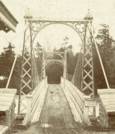
Cynthia Islands, Niagara Falls, Ontario, Canada - Niagara River
| Bridgemeister ID: | 319 (added before 2003) |
| Year Completed: | 1879 |
| Name: | Castor |
| Also Known As: | Burning Springs |
| Location: | Cynthia Islands, Niagara Falls, Ontario, Canada |
| Crossing: | Niagara River |
| Status: | Removed |
| Main Cables: | Wire |
| Suspended Spans: | 1 |
Notes:
- The "Cynthia Islands" were previously named the "Clark Hill Islands" and are now known as the "Dufferin Islands". The older "Clark Hill Islands" name was often used in describing the location of this bridge and its companion bridge.
- Companion to 1879 Pollux (Burning Springs) - Cynthia Islands, Niagara Falls, Ontario, Canada.
Image Sets:
1879: Pollux
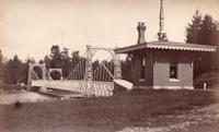
Cynthia Islands, Niagara Falls, Ontario, Canada - Niagara River
| Bridgemeister ID: | 848 (added before 2003) |
| Year Completed: | 1879 |
| Name: | Pollux |
| Also Known As: | Burning Springs |
| Location: | Cynthia Islands, Niagara Falls, Ontario, Canada |
| Crossing: | Niagara River |
| Status: | Removed |
| Main Cables: | Wire |
Notes:
- The "Cynthia Islands" were previously named the "Clark Hill Islands" and are now known as the "Dufferin Islands". The older "Clark Hill Islands" name was often used in describing the location of this bridge and its companion bridge.
- Companion to 1879 Castor (Burning Springs) - Cynthia Islands, Niagara Falls, Ontario, Canada.
Image Sets:
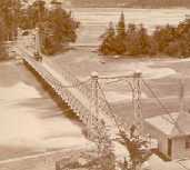
1889: Second Falls View
Niagara Falls, New York, USA and Niagara Falls, Ontario, Canada - Niagara River
| Bridgemeister ID: | 2120 (added 2006-09-17) |
| Year Completed: | 1889 |
| Name: | Second Falls View |
| Also Known As: | Upper |
| Location: | Niagara Falls, New York, USA and Niagara Falls, Ontario, Canada |
| Crossing: | Niagara River |
| Coordinates: | 43.088806 N 79.068722 W |
| Maps: | Acme, GeoHack, Google, OpenStreetMap |
| Principals: | G.M. Harrington, George W. McNulty |
| Use: | Vehicular |
| Status: | Removed, late 1890's |
| Main Cables: | Wire |
| Suspended Spans: | 1 |
Notes:
- Damaged by wind, January 1890. Repaired. Dismantled after being replaced by a steel arch bridge (the famous "Honeymoon Bridge"), 1899. Much of the dismantled bridge was reused for the 1899 Lewiston-Queenston bridge.
- Replaced 1869 Clifton (Upper, Niagara-Clifton, Falls View, First Falls View) - Niagara Falls, New York, USA and Niagara Falls, Ontario, Canada.
- See 1899 Lewiston-Queenston - Lewiston, New York, USA and Queenston, Ontario, Canada.
- All past and present bridges at this location.
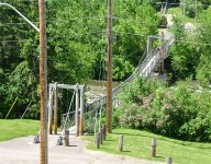
1895: Swinging
Renfrew, Ontario, Canada - Bonnechere River
| Bridgemeister ID: | 590 (added 2003-01-05) |
| Year Completed: | 1895 |
| Name: | Swinging |
| Location: | Renfrew, Ontario, Canada |
| Crossing: | Bonnechere River |
| Coordinates: | 45.478217 N 76.691764 W |
| Maps: | Acme, GeoHack, Google, OpenStreetMap |
| Use: | Footbridge |
| Status: | In use (last checked: 2020) |
| Main Cables: | Wire (steel) |
| Suspended Spans: | 2 |
| Main Spans: | 2 |
Notes:
- 1983: Rebuilt.
- 2020, December: Rehabilitation project likely.
- 2021, October: Contract awarded for repairs.
Annotated Citations:
- McIntyre, Bruce. "Swinging Bridge will be upgraded at a cost of almost $300,000." Toronto Star, 20 October 2021, https://www.thestar.com/news/canada/2021/10/20/swinging-bridge-will-be-upgraded-at-a-cost-of-almost-300000.html.
"In his report to council recently, Development and Property Director Mike Asselin said the bridge was an important piece of infrastructure and just like other municipal property like bridges and roads, council was faced with the prospect of investing in one of its assets or eventually be forced to close the bridge due to safety concerns. Although there had been some repairs completed in 2020, it was more of a stop-gap measure to deal with some immediate issues."
Image Sets:
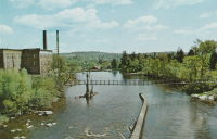
1899: Lewiston-Queenston
Lewiston, New York, USA and Queenston, Ontario, Canada - Niagara River
| Bridgemeister ID: | 108 (added before 2003) |
| Year Completed: | 1899 |
| Name: | Lewiston-Queenston |
| Location: | Lewiston, New York, USA and Queenston, Ontario, Canada |
| Crossing: | Niagara River |
| Principals: | L.L. Buck, R.S. Buck |
| References: | AAJ, BPL, HBE, PTS2 |
| Use: | Vehicular and Rail (streetcar) |
| Status: | Replaced, 1962 |
| Main Cables: | Wire (steel) |
| Suspended Spans: | 1 |
| Main Span: | 1 x 317 meters (1,040 feet) |
| Deck width: | 17 feet |
Notes:
- Reused parts from the recently dismantled Second Falls View Bridge.
- At former location of 1851 Lewiston-Queenston - Lewiston, New York, USA and Queenston, Ontario, Canada.
- See 1889 Second Falls View (Upper) - Niagara Falls, New York, USA and Niagara Falls, Ontario, Canada.
- All past and present bridges at this location.
Image Sets:
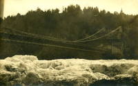
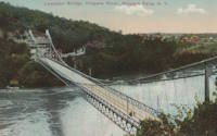
1912: Sewell's Road
Scarborough, Ontario, Canada - Rouge River
| Bridgemeister ID: | 831 (added 2003-06-01) |
| Year Completed: | 1912 |
| Name: | Sewell's Road |
| Location: | Scarborough, Ontario, Canada |
| Crossing: | Rouge River |
| Coordinates: | 43.82754 N 79.19962 W |
| Maps: | Acme, GeoHack, Google, OpenStreetMap |
| Principals: | Frank Barber, Lewis Construction |
| Use: | Vehicular (one-lane) |
| Status: | In use (last checked: 2021) |
| Main Cables: | Wire (steel) |
| Suspended Spans: | 3 |
| Main Span: | 1 x 30.5 meters (100 feet) estimated |
| Side Spans: | 2 x 9.1 meters (30 feet) estimated |
Notes:
- Restoration completed April, 1981.
Image Sets:
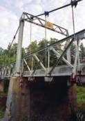
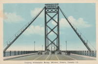
1929: Ambassador
Detroit, Michigan, USA and Windsor, Ontario, Canada - Detroit River
| Bridgemeister ID: | 160 (added before 2003) |
| Year Completed: | 1929 |
| Name: | Ambassador |
| Location: | Detroit, Michigan, USA and Windsor, Ontario, Canada |
| Crossing: | Detroit River |
| Coordinates: | 42.31210 N 83.07402 W |
| Maps: | Acme, GeoHack, Google, OpenStreetMap |
| Principals: | Jonathan Jones, McClintic-Marshall |
| References: | AAJ, AMB, GBD, PTS2 |
| Use: | Vehicular (major highway) |
| Status: | In use (last checked: 2022) |
| Main Cables: | Wire (steel) |
| Suspended Spans: | 1 |
| Main Span: | 1 x 563.9 meters (1,850 feet) |
| Deck width: | 55 feet |
Notes:
- Became longest suspension bridge by eclipsing 1926 Benjamin Franklin (Philadelphia-Camden) - Philadelphia, Pennsylvania and Camden, New Jersey, USA.
- Eclipsed by new longest suspension bridge 1931 George Washington (GWB) - New York, New York and Fort Lee, New Jersey, USA.
External Links:
Image Sets:

1929: Springbank
London, Ontario, Canada - River Thames
| Bridgemeister ID: | 290 (added before 2003) |
| Year Completed: | 1929 |
| Name: | Springbank |
| Location: | London, Ontario, Canada |
| Crossing: | River Thames |
| At or Near Feature: | Springbank Park |
| Principals: | J. R. Rostron |
| References: | AAJ |
| Use: | Footbridge |
| Status: | Replaced, 2002 |
| Main Cables: | Wire (steel) |
| Suspended Spans: | 1 |
| Main Span: | 1 x 71.6 meters (235 feet) |
| Deck width: | 5 feet |
Notes:
- Replaced by truss, 2002.
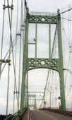
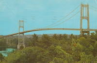
1938: Thousand Islands International II
Georgina Island and Selton, Ontario, Canada - St. Lawrence River
| Bridgemeister ID: | 365 (added before 2003) |
| Year Completed: | 1938 |
| Name: | Thousand Islands International II |
| Location: | Georgina Island and Selton, Ontario, Canada |
| Crossing: | St. Lawrence River |
| Coordinates: | 44.36323 N 75.98271 W |
| Maps: | Acme, GeoHack, Google, OpenStreetMap |
| Principals: | Robinson and Steinman |
| References: | AAJ, ADDS |
| Use: | Vehicular (two-lane, heavy vehicles), with walkway |
| Status: | In use (last checked: 2022) |
| Main Cables: | Wire (steel) |
| Suspended Spans: | 3 |
| Main Span: | 1 x 228.6 meters (750 feet) |
| Side Spans: | 2 x 91.4 meters (300 feet) |
Notes:
- Companion to 1938 Thousand Islands International I - Wellesley Island and Collins Landing, New York, USA.
External Links:
Image Sets:
1950: (footbridge)
New Hamburg vicinity, Ontario, Canada - Nith River
| Bridgemeister ID: | 803 (added 2003-03-30) |
| Year Completed: | 1950 |
| Name: | (footbridge) |
| Location: | New Hamburg vicinity, Ontario, Canada |
| Crossing: | Nith River |
| Coordinates: | 43.398709 N 80.707671 W |
| Maps: | Acme, GeoHack, Google, OpenStreetMap |
| Use: | Footbridge |
| Status: | Extant (last checked: 2020) |
| Main Cables: | Wire |
| Suspended Spans: | 3 |
| Main Span: | 1 |
| Side Spans: | 2 |
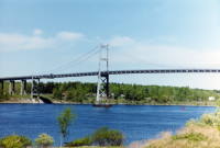
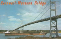
1958: Three Nations Crossing
Cornwall, Ontario, Canada and Massena, New York, USA - St. Lawrence River
| Bridgemeister ID: | 325 (added before 2003) |
| Year Completed: | 1958 |
| Name: | Three Nations Crossing |
| Also Known As: | Cornwall-Massena International, Seaway International |
| Location: | Cornwall, Ontario, Canada and Massena, New York, USA |
| Crossing: | St. Lawrence River |
| Coordinates: | 44.989962 N 74.739913 W |
| Maps: | Acme, GeoHack, Google, OpenStreetMap |
| References: | STL |
| Use: | Vehicular |
| Status: | In use (last checked: 2019) |
| Main Cables: | Wire (steel) |
| Suspended Spans: | 3 |
| Main Span: | 1 |
| Side Spans: | 2 |
Notes:
- Renamed "Three Nations Crossing" effective January 1, 2000 in recognition of the Mohawks of Akwesasne
External Links:
Image Sets:
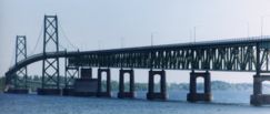
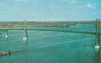
1960: Ogdensburg-Prescott International
Ogdensburg, New York, USA and Prescott, Ontario, Canada - St. Lawrence River
| Bridgemeister ID: | 214 (added before 2003) |
| Year Completed: | 1960 |
| Name: | Ogdensburg-Prescott International |
| Also Known As: | Seaway Skyway |
| Location: | Ogdensburg, New York, USA and Prescott, Ontario, Canada |
| Crossing: | St. Lawrence River |
| Coordinates: | 44.73 N 75.45667 W |
| Maps: | Acme, GeoHack, Google, OpenStreetMap |
| Principals: | Modjeski & Masters |
| Use: | Vehicular (major highway) |
| Status: | In use (last checked: 2019) |
| Main Cables: | Wire (steel) |
| Suspended Spans: | 3 |
| Main Span: | 1 x 350.75 meters (1,150.8 feet) |
| Side Spans: | 2 |
External Links:
Image Sets:
| Bridgemeister ID: | 916 (added 2003-10-12) |
| Year Completed: | 2003 |
| Name: | (footbridge) |
| Location: | Collingwood, Ontario, Canada |
| Coordinates: | 44.48883 N 80.31083 W |
| Maps: | Acme, GeoHack, Google, OpenStreetMap |
| Use: | Footbridge |
| Status: | In use (last checked: 2005) |
| Main Cables: | Wire (steel) |
| Suspended Spans: | 1 |
| Main Span: | 1 x 126 meters (413.4 feet) |
Notes:
- Located at the Scenic Caves attraction, the owners claim this large (126-meter main span) footbridge is the longest footbridge in Ontario.
(footbridge)
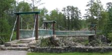
Englehart vicinity, Ontario, Canada - High Falls of the Englehart River
| Bridgemeister ID: | 870 (added 2003-08-30) |
| Name: | (footbridge) |
| Location: | Englehart vicinity, Ontario, Canada |
| Crossing: | High Falls of the Englehart River |
| At or Near Feature: | Kap-Kig-Iwan ProvincIal Park |
| Coordinates: | 47.7964 N 79.88803 W |
| Maps: | Acme, GeoHack, Google, OpenStreetMap |
| Use: | Footbridge |
| Status: | In use (last checked: 2004) |
| Main Cables: | Wire |
| Suspended Spans: | 2 |
| Main Spans: | 2 |
Notes:
- Two-span footbridge with an interesting bend in the middle (forming a shallow V-shaped bridge).
Image Sets:
(footbridge)
Guelph, Ontario, Canada - Speed River
| Bridgemeister ID: | 836 (added 2003-06-28) |
| Name: | (footbridge) |
| Location: | Guelph, Ontario, Canada |
| Crossing: | Speed River |
| At or Near Feature: | Riverside Park |
| Use: | Footbridge |
| Status: | Removed, c. 2004. |
| Main Cables: | Wire |
| Suspended Spans: | 1 |
Notes:
- This bridge was closed April 2003. Wayne Grodkiewicz reports that it has since been replaced by a truss bridge.
(footbridge)
Meadowvale, Mississauga, Ontario, Canada - Credit River
| Bridgemeister ID: | 1405 (added 2004-07-04) |
| Name: | (footbridge) |
| Location: | Meadowvale, Mississauga, Ontario, Canada |
| Crossing: | Credit River |
| At or Near Feature: | CVC Credit Valley Conservation Authority |
| Coordinates: | 43.628933 N 79.737567 W |
| Maps: | Acme, GeoHack, Google, OpenStreetMap |
| Use: | Footbridge |
| Status: | In use (last checked: 2004) |
| Main Cables: | Wire (steel) |
| Bridgemeister ID: | 1472 (added 2004-08-29) |
| Name: | (footbridge) |
| Location: | Mount Brydges vicinity, Ontario, Canada |
| At or Near Feature: | Longwoods Road Conservation Area |
| Coordinates: | 42.88338 N 81.47578 W |
| Maps: | Acme, GeoHack, Google, OpenStreetMap |
| Use: | Footbridge |
| Status: | In use (last checked: 2005) |
| Main Cables: | Wire (steel) |
| Suspended Spans: | 1 |
(footbridge)
Toronto, Ontario, Canada - West Don River
| Bridgemeister ID: | 1474 (added 2004-09-02) |
| Name: | (footbridge) |
| Location: | Toronto, Ontario, Canada |
| Crossing: | West Don River |
| At or Near Feature: | Serena Gundy Park |
| Coordinates: | 43.71918 N 79.35383 W |
| Maps: | Acme, GeoHack, Google, OpenStreetMap |
| Use: | Footbridge |
| Status: | In use (last checked: 2004) |
| Main Cables: | Wire (steel) |
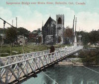
(suspension bridge)
Belleville, Ontario, Canada - Moira River
| Bridgemeister ID: | 275 (added before 2003) |
| Name: | (suspension bridge) |
| Location: | Belleville, Ontario, Canada |
| Crossing: | Moira River |
| Coordinates: | 44.165340 N 77.386448 W |
| Maps: | Acme, GeoHack, Google, OpenStreetMap |
| Status: | Removed |
| Main Cables: | Wire |
| Suspended Spans: | 1 |
Notes:
- Was located near (or exactly) the present-day footbridge at the foot of Catharine Street.
Image Sets:
Do you have any information or photos for these bridges that you would like to share? Please email david.denenberg@bridgemeister.com.
Mail | Facebook | X (Twitter) | Bluesky