Inventory Search Results (8,301-8,400 of 8,542)
Results : << < ... 7901-8000 8001-8100 8101-8200 8201-8300 8301-8400 8401-8500 8501-8542 > >> All
8,542 suspension bridges were found for search criteria: * .
Bridges 8,301 through 8,400 (of 8,542 total) appear below. Click the Bridgemeister ID number to isolate the bridge on its own page.
If you don't see what you were looking for, try an image search with the same criteria: *
Related:
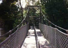
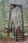
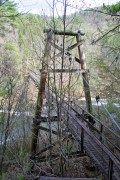
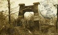
Bridgemeister ID: 607 (added 2003-01-14)Name: Swinging Location: Little Falls vicinity, Minnesota , USA Crossing: Pike Creek At or Near Feature: Lindbergh State Park Use: Footbridge Status: Removed
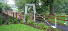
From David Denenberg: "I stopped by this park in 2006 and asked at the park station if the bridge was still in existence. They said there were some short modern steel footbridges, but no suspension bridges remaining. The person I spoke with knew such a bridge had existed at one point, in the park, but suspected it had been removed years ago. I hope he was right because I decided not to pay the permit fee and verify for myself." Now known as the Curtis Davis Bridge, the suspended span appears to have been replaced with a truss with, apparently, non-functional suspension cables. The original suspension bridge towers remain. Bridgemeister ID: 1310 (added 2004-04-10)Name: Swinging Location: Nowata, Oklahoma , USA Status: Removed Main Cables: Wire
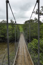
Bridgemeister ID: 1490 (added 2004-09-19)Name: Swinging Location: Paintsville, Kentucky , USA Crossing: Big Sandy River Levisa Fork At or Near Feature: Paintsville Country Club Coordinates: 37.808576 N 82.773829 W Maps: Acme , GeoHack , Google , OpenStreetMap Use: Footbridge and Golf cart Status: In use (last checked: 2019) Main Cables: Wire (steel) Suspended Spans: 1 Main Span: 1 x 112.8 meters (370 feet)
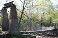
Used by golf carts. Just barely wide enough for one golf cart. Bridgemeister ID: 564 (added before 2003)Name: Swinging Location: Palenville, New York , USA Crossing: Kaaterskill Creek Coordinates: 42.17399 N 74.02395 W Maps: Acme , GeoHack , Google , OpenStreetMap Use: Footbridge Status: Destroyed, 2011 (last checked: 2011) Main Cables: Wire Suspended Spans: 1 Main Span: 1 x 24.4 meters (80 feet)
Destroyed by flood following Hurricane Irene, 2011. Bridgemeister ID: 2199 (added 2007-01-27)Name: Swinging Location: Panola County, Mississippi , USA Use: Vehicular Main Cables: Wire
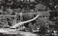
The exact location of this bridge is unclear, but a photo in the December 6, 1937 edition of The Delta Weekly (Greenville, Mississippi) shows a short-span vehicular suspension bridge captioned, "Swinging Bridge - Panola County". 2022: Destroyed by flood. Bridgemeister ID: 313 (added before 2003)Name: Swinging Location: Richardson Springs, California , USA Coordinates: 39.838927 N 121.769790 W Maps: Acme , GeoHack , Google , OpenStreetMap Use: Footbridge Status: Removed Main Cables: Wire Suspended Spans: 1
Bridgemeister ID: 1664 (added 2005-03-20)Name: Swinging Location: Silver City, New Mexico , USA Use: Footbridge Main Cables: Wire
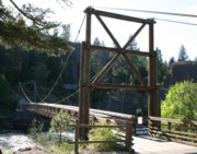
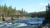
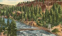
Facebook . Old image of the bridge. Posted December 9, 2012.Bridgemeister ID: 315 (added before 2003)Name: Swinging Location: Spokane vicinity, Washington , USA Crossing: Spokane River At or Near Feature: Riverside State Park, "Bowl And Pitcher" area Coordinates: 47.69668 N 117.49828 W Maps: Acme , GeoHack , Google , OpenStreetMap Principals: Civilian Conservation Corps Use: Footbridge Status: In use (last checked: 2009) Main Cables: Wire (steel) Suspended Spans: 1 Main Span: 1 x 61 meters (200 feet) estimated
Bridgemeister ID: 1751 (added 2005-04-20)Name: Swinging Location: Tidnish vicinity, Nova Scotia , Canada Crossing: Tidnish River Coordinates: 45.97675 N 64.042783 W Maps: Acme , GeoHack , Google , OpenStreetMap Use: Footbridge Status: Closed, January 2 015 (last checked: 2015) Main Cables: Wire (steel) Suspended Spans: 1 Main Span: 1 x 66 meters (216.5 feet)
A visitor sent the following information: "[The bridge is] located on a hiking trail on the bed of an abandoned late 19th century railway track, which is raised several meters above a low, marshy area. The bridge itself spans a gap where the Tidnish River flows through the embankment. When driving along the Sunrise Trail, you get a brief glimpse of the bridge, although you must take a small back road to get to it... The bridge is very sturdy, and does not 'swing' although a 70 kg (150 lb.) person can easily create a visible ripple that passes back and forth along the deck by stomping on it. The anchors for the main cables appear to be nothing more than two I-beams sticking out of the ground on a 45 degree angle to which the cables are bolted. The diagonal I-beams are most likely bolted or welded to a horizontal, buried I-beam. The suspender 'cables' are steel rods that are kept from sliding by resting behind a clamp. The bridge looks small and assymetrical when viewed from a distance because the towers and a large portion of the span aren't visible through the trees on each end. The path also passes over an old keystone bridge which was constructed when the railway was built in the late 19th century, you do not realize this when you are actually on the path because there is 2-3 m (7-10 ft.) of soil on top of the bridge, so you can only see the large stones when you are standing ON them." Patrick S. O'Donnell sent more information about 19th-century arch bridge at this location. It was part of an ambitious project known as the "Chignecto Marine Transport Railway" intended to transport large ships across the Isthmus of Chignetco. Closed indefinitely in early 2015 after approach span wood supports were found to have deteriorated. This is the droopier footbridge at the eastern end of Townsend, distinct from the bridge at the "Kinzel Springs" location on the western side of Townsend. Typically the droopy footbridges are omitted from the Bridgemeister inventory, but this one is included to avoid confusion with the other Townsend-area bridges. Bridgemeister ID: 7203 (added 2022-07-07)Name: Swinging Location: Walcott, Arkansas , USA Crossing: Dancing Rabbit Arroyo At or Near Feature: Crowley's Ridge State Park Coordinates: 36.043750 N 90.666000 W Maps: Acme , GeoHack , Google , OpenStreetMap Use: Footbridge Status: In use (last checked: 2022) Main Cables: Chain (steel) Main Span: 1 Side Spans: 2
The park's trail guides mention two swinging bridges on the same trail, but it's unclear if the second bridge, perhaps 500 feet south of the coordinates for the bridge given here, is actually a suspension bridge. Hybrid truss-suspension system where main cables join the upper chord of the truss midspan. Bridgemeister ID: 8290 (added 2024-02-08)Name: Tabu Location: Tabu, Benguet and Balucoc, Benguet, Philippines Crossing: Agno River Coordinates: 16.290944 N 120.742889 E Maps: Acme , GeoHack , Google , OpenStreetMap Use: Footbridge Status: In use (last checked: 2016) Main Cables: Wire (steel) Main Span: 1
Bridgemeister ID: 4023 (added 2020-03-28)Name: Tachog Llahkang Location: Tachog Llahkang, Bhutan Crossing: Paro Chu Coordinates: 27.329496 N 89.504805 E Maps: Acme , GeoHack , Google , OpenStreetMap Use: Footbridge Status: In use (last checked: 2020) Main Cables: Wire (steel) Suspended Spans: 1
Two suspension bridges at this location. This entry represents the modern level-decked bridge. The older ("old") bridge here is a drooping simple suspension bridge. Bridgemeister ID: 2179 (added 2007-01-13)Name: Taff Valley Location: Abercynon, Wales , United Kingdom Crossing: River Taff Principals: Louis Harper References: HARPER Use: Footbridge Status: Destroyed, by flood, 1942 Main Cables: Wire Suspended Spans: 1
HARPER: Completed circa 1900. Bridgemeister ID: 2833 (added 2019-07-04)Name: Taiji Gorge Location: Zhushan Township, Nantou County, Taiwan Coordinates: 23.660444 N 120.735914 E Maps: Acme , GeoHack , Google , OpenStreetMap Use: Footbridge Status: In use (last checked: 2019) Main Cables: Wire (steel)
Bridgemeister ID: 6103 (added 2021-07-04)Name: Takanosu Also Known As: 鷹の巣橋 Location: Sekikawa, Niigata , Japan Crossing: Arakawa River Coordinates: 38.070854 N 139.598397 E Maps: Acme , GeoHack , Google , OpenStreetMap Use: Vehicular (one-lane) Status: In use (last checked: 2021) Main Cables: Wire (steel) Suspended Spans: 1 Main Span: 1 x 74 meters (242.8 feet) estimated
Bridgemeister ID: 3360 (added 2019-12-20)Name: Takedao Location: Takedao, Hyogo , Japan Crossing: Muko River Coordinates: 34.854651 N 135.302926 E Maps: Acme , GeoHack , Google , OpenStreetMap Use: Vehicular (one-lane) Status: In use (last checked: 2022) Main Cables: Wire (steel) Suspended Spans: 1 Main Span: 1 x 55 meters (180.4 feet) estimated
Bridgemeister ID: 2947 (added 2019-09-29)Name: Talbot's Inch Location: Talbot's Inch Village, Kilkenny, Ireland Crossing: River Nore Use: Footbridge Status: Destroyed, 1947 Main Cables: Wire (steel) Suspended Spans: 1
Bridgemeister ID: 8439 (added 2024-03-09)Name: Talula Location: Talula, Chuquisaca and Potosí, Bolivia Crossing: Rio Pilcomayo Coordinates: 19.131667 S 65.450722 W Maps: Acme , GeoHack , Google , OpenStreetMap Use: Footbridge Status: In use (last checked: 2016) Main Cables: Wire (steel) Main Span: 1
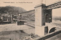
Google Maps . Image taken on the bridge. Dated May 2016.Coordinates are for one of the remaining piers of the rail tracks that sat on top of the suspension bridge. This highly unusual hybrid structure had a rail bridge supported by the suspension bridge towers and a suspension bridge mid-span tower. From a distance, it had the appearance of a deck suspended from a rail bridge, but this was not the case. See 1854 Sarp (Sarpsbro, Sarpsbrua) - Sarpsborg, Viken, Norway . Another interesting hybrid rail and suspension bridge. Bridgemeister ID: 6748 (added 2021-10-23)Name: Tambacan Location: Barangay Tambacan, Iligan City, Lanao del Norte, Philippines Crossing: Tubod River Coordinates: 8.227763 N 124.234445 E Maps: Acme , GeoHack , Google , OpenStreetMap Use: Footbridge Status: Replaced, 2020 Main Cables: Wire Main Span: 1
Closed October 8, 2020, pending "reconstruction" project expected to be completed in two months. Bridgemeister ID: 2428 (added 2008-04-12)Name: Tamparuli Location: Tamparuli, Tuaran, Sabah, Malaysia Coordinates: 6.134167 N 116.266918 E Maps: Acme , GeoHack , Google , OpenStreetMap Use: Footbridge Status: In use (last checked: 2016) Main Cables: Wire (steel)
Bridgemeister ID: 6955 (added 2022-02-18)Name: Tashironotsuri Also Known As: 田代の吊橋 Location: Koka, Shiga , Japan Crossing: Tashiro River Coordinates: 34.910944 N 136.016164 E Maps: Acme , GeoHack , Google , OpenStreetMap Use: Footbridge Status: In use (last checked: 2022) Main Cables: Wire (steel) Suspended Spans: 1 Main Span: 1
Bridgemeister ID: 4323 (added 2020-04-10)Name: Tatsuyama Also Known As: 竜山橋 Location: Hamamatsu, Shizuoka , Japan Crossing: Tenryu River Coordinates: 34.969966 N 137.828219 E Maps: Acme , GeoHack , Google , OpenStreetMap Use: Footbridge Status: In use (last checked: 2012) Main Cables: Wire (steel) Suspended Spans: 1 Main Span: 1 x 165 meters (541.3 feet) estimated
Coordinates are for present-day (2021) "Tawi Bridge" which is believed to be the approximate location of this multi-span suspension bridge. It had at least six suspended main spans, possibly more. Carries the Trans-Alaska pipeline. Bridgemeister ID: 6369 (added 2021-07-27)Name: Tängsta Location: Tängsta and Höven, Sweden Coordinates: 63.348140 N 17.018133 E Maps: Acme , GeoHack , Google , OpenStreetMap Use: Vehicular (one-lane) Status: In use (last checked: 2011) Main Cables: Wire (steel) Main Span: 1
Bridgemeister ID: 3750 (added 2020-02-28)Name: Tømmerdal Location: Nordnes, Saltdal, Nordland, Norway Crossing: Luonosjåhkå Coordinates: 66.95365 N 15.30116 E Maps: Acme , GeoHack , Google , kart.1881.no , OpenStreetMap Use: Footbridge Status: In use (last checked: 2014) Main Cables: Wire (steel) Suspended Spans: 1 Main Span: 1 x 71 meters (232.9 feet) estimated
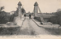
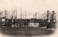
Rebuilt at some point between 2004 and June, 2010 when it was reopened. In use but crossings sometimes highly restricted. Bridgemeister ID: 7445 (added 2022-12-23)Name: Tercis-les-Bains Location: Tercis-les-Bains, Landes , France Crossing: Luy River Coordinates: 43.663829 N 1.101447 W Maps: Acme , GeoHack , Google , OpenStreetMap Use: Vehicular (one-lane) Status: Only towers remain (last checked: 2013) Main Cables: Wire (iron) Suspended Spans: 1
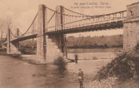
Bridgemeister ID: 7446 (added 2022-12-23)Name: Tercis-les-Bains Location: Tercis-les-Bains, Landes , France Crossing: Adour River Coordinates: 43.673966 N 1.135208 W Maps: Acme , GeoHack , Google , OpenStreetMap Use: Vehicular Status: Removed Main Cables: Wire (iron) Suspended Spans: 3 Main Span: 1 Side Spans: 2
Bridgemeister ID: 8165 (added 2024-02-03)Name: Termas de Cauquenes Location: Termas de Cauquenes, Rancagua vicinity, Chile Coordinates: 34.247750 S 70.553944 W Maps: Acme , GeoHack , Google , OpenStreetMap Use: Footbridge Status: In use (last checked: 2023) Main Cables: Wire Suspended Spans: 1
The Termas de Cauquenes suspension bridge pictured here may not be exactly the same bridge that survives (as of 2023) at the coordinates provided here. The terrain and view of the resort do not seem to match the location of the surviving bridge. Satellite images show what appears to be a derelict suspension bridge about 230 meters north, crossing an arm of the Cachapoal River to reach a large outcropping (S 34.245472, E 70.553833). This may be the location of the bridge pictured. However, the fact remains there is a 1920s-era (or older) suspension bridge at the coordinates provided with this record. Bridgemeister ID: 6177 (added 2021-07-08)Name: Tezikov Also Known As: Тезиков Location: Tambov (Тамбов), Tambov Oblast, Russia Crossing: Reka Tsna Coordinates: 52.711624 N 41.472909 E Maps: Acme , GeoHack , Google , OpenStreetMap Use: Footbridge Status: In use (last checked: 2021) Main Cables: Wire (steel) Suspended Spans: 3 Main Span: 1 x 49 meters (160.8 feet) estimated Side Spans: 2
Bridgemeister ID: 6146 (added 2021-07-07)Name: Tha Kha-nun Also Known As: สะพานแขวน วัดท่าขนุน Location: Tha Kha-nun, Thong Pha Phum District, Kanchanaburi, Thailand Crossing: Khwae Noi Coordinates: 14.742293 N 98.634510 E Maps: Acme , GeoHack , Google , OpenStreetMap Use: Footbridge Status: In use (last checked: 2021) Main Cables: Wire (steel) Main Span: 1 Side Spans: 2
Bridgemeister ID: 3468 (added 2019-12-23)Name: Thakot Location: Thakot and Dandai, Pakistan Crossing: Indus River Coordinates: 34.804124 N 72.936253 E Maps: Acme , GeoHack , Google , OpenStreetMap Use: Vehicular Status: In use (last checked: 2019) Main Cables: Wire (steel) Suspended Spans: 1
Bridgemeister ID: 2997 (added 2019-10-13)Name: Thenmala Location: Thenmala, Kerala , India Coordinates: 8.956652 N 77.065556 E Maps: Acme , GeoHack , Google , OpenStreetMap Use: Footbridge Status: In use (last checked: 2019) Main Cables: Wire (steel)
Bridgemeister ID: 2290 (added 2007-04-24)Name: Thierbach-Zinnberg Location: Thierbach and Zinnberg, Saxony, Germany Crossing: Zwickauer Mulde River Use: Footbridge Status: Destroyed, 1954, by flood Suspended Spans: 1
Bridgemeister ID: 6739 (added 2021-10-23)Name: Thredbo Valley Track Location: Thredbo, New South Wales , Australia Crossing: Thredbo River At or Near Feature: Kosciuszko National Park Coordinates: 36.489870 S 148.332086 E Maps: Acme , GeoHack , Google , OpenStreetMap Use: Footbridge Status: In use (last checked: 2021) Main Cables: Wire (steel) Suspended Spans: 3 Main Span: 1 Side Spans: 2
Bridgemeister ID: 6740 (added 2021-10-23)Name: Thredbo Valley Track Location: Thredbo, New South Wales , Australia Crossing: Thredbo River At or Near Feature: Kosciuszko National Park Coordinates: 36.494634 S 148.323923 E Maps: Acme , GeoHack , Google , OpenStreetMap Use: Footbridge Status: In use (last checked: 2021) Main Cables: Wire (steel) Suspended Spans: 3 Main Span: 1 Side Spans: 2
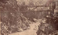
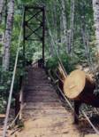
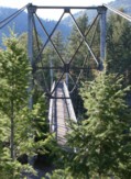
Bridgemeister ID: 1283 (added 2004-03-14)Name: Thunder Creek Location: Ross Lake National Recreation Area, Washington , USA Crossing: Thunder Creek At or Near Feature: Diablo Lake vicinity, North Cascades National Park Coordinates: 48.67825 N 121.07848 W Maps: Acme , GeoHack , Google , OpenStreetMap Use: Footbridge Status: Destroyed, October 2003 Main Cables: Wire (steel) Main Span: 1 x 39.6 meters (130 feet) estimated
Damaged by fallen tree, summer 2003. Soon repaired. Destroyed during storm, October 2003. According to a June 2004 National Park Service web page advising as to storm damage in North Cascade National Park: "The suspension bridge over Thunder Creek one-mile from the trailhead in Colonial Creek Campground was destroyed. This large bridge was in a location which flooded at the beginning of many summer seasons. Planning for a better location, environmental assessment of alternatives, and application for funding will take place this year with construction happening in 2005. The log jam at the former bridge site is closed to crossing because of safety considerations." The bridge was indeed replaced with a non-suspension bridge at a different location. Bridgemeister ID: 2763 (added 2019-06-30)Name: Tianchang Also Known As: 天長橋 Location: Fanlu Township, Chiayi County, Taiwan Crossing: Bazhang River Coordinates: 23.438911 N 120.605908 E Maps: Acme , GeoHack , Google , OpenStreetMap Use: Footbridge Status: In use (last checked: 2019) Main Cables: Wire (steel) Suspended Spans: 1
Bridgemeister ID: 2762 (added 2019-06-30)Name: Tianchang Location: Fanlu Township, Chiayi County, Taiwan Coordinates: 23.439673 N 120.607941 E Maps: Acme , GeoHack , Google , OpenStreetMap Use: Footbridge Status: In use (last checked: 2019) Main Cables: Wire (steel) Suspended Spans: 1
Bridgemeister ID: 4328 (added 2020-04-10)Name: Tianlong Also Known As: 天竜橋 Location: Tenryu, Nagano , Japan Crossing: Tenryu River Coordinates: 35.310277 N 137.847685 E Maps: Acme , GeoHack , Google , OpenStreetMap Status: In use (last checked: 2018) Main Cables: Wire (steel) Suspended Spans: 1 Main Span: 1 x 117 meters (383.9 feet) estimated
Bridgemeister ID: 3771 (added 2020-02-29)Name: Tianlong Location: Haiduan Township, Taitung County, Taiwan Coordinates: 23.173628 N 121.042297 E Maps: Acme , GeoHack , Google , OpenStreetMap Use: Footbridge Status: In use (last checked: 2013) Main Cables: Wire (steel)
Bridgemeister ID: 2776 (added 2019-06-30)Name: Tianlun Baileng Location: Heping District, Taichung City, Taiwan Coordinates: 24.186072 N 120.919595 E Maps: Acme , GeoHack , Google , OpenStreetMap Use: Footbridge Status: In use (last checked: 2019) Main Cables: Wire (steel)
Bridgemeister ID: 6142 (added 2021-07-06)Name: Tieton Nature Trail Location: Tieton, Naches vicinity, Washington , USA Crossing: Tieton River Coordinates: 46.718284 N 120.834342 W Maps: Acme , GeoHack , Google , OpenStreetMap Use: Footbridge Status: In use (last checked: 2021) Main Cables: Wire (steel) Suspended Spans: 1 Main Span: 1
Bridgemeister ID: 1556 (added 2004-11-24)Name: Tinlandia Location: Coconut Creek, Florida , USA Coordinates: 26.268251 N 80.171012 W Maps: Acme , GeoHack , Google , OpenStreetMap Use: Footbridge Status: In use (last checked: 2019) Main Cables: Wire (steel) Suspended Spans: 1
On the grounds of Butterfly World. Bridgemeister ID: 4422 (added 2020-04-19)Name: Tintrabrua Location: Vossevangen, Voss, Vestland, Norway Crossing: Vosso Coordinates: 60.619924 N 6.423772 E Maps: Acme , GeoHack , Google , kart.1881.no , OpenStreetMap Use: Footbridge Status: Replaced Main Cables: Wire Suspended Spans: 1 Main Span: 1 x 41.5 meters (136.2 feet) estimated
Appears to have been a pedestrian-only replacement middle span for a former non-suspension bridge vehicular crossing. Approach spans were much wider and clearly wide enough for automobile traffic. This hybrid configuration was in existence before 1958 and replaced by a three span suspension footbridge at some point between 1963 and 2004. Replaced by Tintrabrua - Vossevangen, Voss, Vestland, Norway . Bridgemeister ID: 4423 (added 2020-04-19)Name: Tintrabrua Location: Vossevangen, Voss, Vestland, Norway Crossing: Vosso Coordinates: 60.619616 N 6.424249 E Maps: Acme , GeoHack , Google , kart.1881.no , OpenStreetMap Use: Footbridge Status: Destroyed, October, 2014 Main Cables: Wire (steel) Suspended Spans: 3 Main Span: 1 x 41.5 meters (136.2 feet) estimated Side Spans: 2 x 31.5 meters (103.3 feet) estimated
Damaged by flood, 1928. Rebuilt, 1937. Bridgemeister ID: 7709 (added 2023-07-04)Name: Tiukcha Location: Shakai vicinity and Tiukcha, Ecuador Crossing: Rio Zamora Coordinates: 3.670111 S 78.548111 W Maps: Acme , GeoHack , Google , OpenStreetMap Use: Footbridge Status: In use (last checked: 2022) Main Cables: Wire (steel) Suspended Spans: 1 Main Span: 1 x 131 meters (429.8 feet) estimated
Completed at some point in the 2008-2010 time frame. Bridgemeister ID: 2799 (added 2019-07-04)Name: Tjavatjavang Also Known As: 達來吊橋, 三地門達來吊橋 Location: Sandimen Township, Pingtung County, Taiwan Coordinates: 22.726067 N 120.673068 E Maps: Acme , GeoHack , Google , OpenStreetMap Use: Footbridge Status: In use (last checked: 2020) Main Cables: Wire (steel) Suspended Spans: 1 Main Span: 1 x 127 meters (416.7 feet) estimated
Bridgemeister ID: 4319 (added 2020-04-10)Name: Tjærestrømbrua Location: Væting, Birkenes, Agder, Norway Crossing: Tovdalselva Coordinates: 58.403606 N 8.282574 E Maps: Acme , GeoHack , Google , kart.1881.no , OpenStreetMap Use: Vehicular (one-lane) Status: In use (last checked: 2019) Main Cables: Wire (steel) Suspended Spans: 2 Main Span: 1 x 53.5 meters (175.5 feet) estimated Side Span: 1 x 15 meters (49.2 feet)
Likely completed early 1960s. Bridgemeister ID: 8509 (added 2024-03-24)Name: Todaiji Also Known As: Dongda Temple Location: Rencheng District, Jining, Shandong , China Coordinates: 35.4040609 N 116.5831231 E Maps: Acme , GeoHack , Google , OpenStreetMap Status: Extant (last checked: 2023) Suspended Spans: 1 Main Span: 1 x 25 meters (82 feet) estimated
Bridgemeister ID: 7586 (added 2023-05-06)Name: Togakyo Gorge Location: Kofu, Yamanashi , Japan At or Near Feature: Shosenkyo Gorge vicinity Use: Footbridge Main Cables: Wire
Linked postcard image says "Views of the entrance of Togakyo Gorge and its neighbourhood, Shosenkyo Gorge." Unclear where the modern day location of "Togakyo Gorge" is, but it seems likely this bridge was at the present location of Nosen Lake (能泉湖) formed by the nearby Arakawa dam. Bridgemeister ID: 7633 (added 2023-05-27)Name: Tolantongo Location: Tolantongo, Hidalgo, Mexico Coordinates: 20.644276 N 98.991543 W Maps: Acme , GeoHack , Google , OpenStreetMap Use: Footbridge Status: In use (last checked: 2022) Main Cables: Wire (steel) Suspended Spans: 1
Bridgemeister ID: 2609 (added 2014-04-15)Name: Tom Sawyer Island Location: Orlando, Florida , USA At or Near Feature: Disney World Coordinates: 28.420305 N 81.583760 W Maps: Acme , GeoHack , Google , OpenStreetMap Use: Footbridge Status: In use (last checked: 2019) Main Cables: Wire (steel) Suspended Spans: 1
Suspension bridge inside Disney World at the Tom Sawyer Island attraction. Bridgemeister ID: 6346 (added 2021-07-25)Name: Tongjunshan Also Known As: 桐君山 Location: Tongjun, Tonglu County, Hangzhou, Zhejiang , China Crossing: Fenshui River Coordinates: 29.812263 N 119.678599 E Maps: Acme , GeoHack , Google , OpenStreetMap Use: Footbridge Status: In use (last checked: 2017) Main Cables: Wire (steel) Suspended Spans: 1 Main Span: 1 x 136 meters (446.2 feet) estimated
Bridgemeister ID: 3060 (added 2019-10-26)Name: Tongluo Skywalk Location: Tongxiao Township, Miaoli County, Taiwan Coordinates: 24.460374 N 120.753569 E Maps: Acme , GeoHack , Google , OpenStreetMap Use: Footbridge Status: In use (last checked: 2019) Main Cables: Wire (steel) Suspended Spans: 3 Main Span: 1 Side Spans: 2
Bridgemeister ID: 6161 (added 2021-07-07)Name: Tongmai Also Known As: Tong Mai Location: Tongmai (塘麦), Pome (波密县), Nyingchi (林芝市), Tibet , China Crossing: Yiong Tsangpo Coordinates: 30.097609 N 95.064564 E Maps: Acme , GeoHack , Google , OpenStreetMap Use: Vehicular Status: Extant (last checked: 2018) Main Cables: Wire (steel) Main Span: 1 x 212 meters (695.5 feet) estimated
Bridgemeister ID: 2760 (added 2019-06-30)Name: Tongtou Also Known As: 桶頭吊橋 Location: Zhushan Township, Nantou County, Taiwan Coordinates: 23.644842 N 120.659126 E Maps: Acme , GeoHack , Google , OpenStreetMap Use: Footbridge Status: In use (last checked: 2014) Main Cables: Wire (steel) Suspended Spans: 1
Bridgemeister ID: 3034 (added 2019-10-13)Name: Torreones Location: El Balseo, Chile Crossing: Rio Simpson Coordinates: 45.424330 S 72.427564 W Maps: Acme , GeoHack , Google , OpenStreetMap Use: Vehicular (one-lane) Status: In use (last checked: 2019) Main Cables: Wire (steel) Suspended Spans: 1
Bridgemeister ID: 7756 (added 2023-07-23)Name: Tournon-Saint-Martin Location: Tournon-Saint-Martin, Indre , France Crossing: Creuse River Use: Vehicular Status: Removed Main Cables: Wire (iron) Suspended Spans: 1
Bridgemeister ID: 928 (added 2003-10-20)Name: Tower Also Known As: Hellroaring, Yellowstone River Location: Mammoth Hot Springs vicinity, Wyoming , USA Crossing: Yellowstone River At or Near Feature: Hellroaring Creek Trail, Yellowstone National Park Coordinates: 44.9597 N 110.447067 W Maps: Acme , GeoHack , Google , OpenStreetMap Use: Footbridge Status: In use (last checked: 2006) Main Cables: Wire (steel) Suspended Spans: 1 Main Span: 1 x 67.1 meters (220 feet) estimated
Near the confluence of Hellroaring Creek and the Yellowstone River. Patrick S. O'Donnell clarifies: " It carries the Hellroaring Creek Trail. It crosses the Yellowstone River then continues to the Hellroaring Creek. Shortly thereafter the Yellowstone River Trail is met." Near (footbridge) - Gardiner vicinity, Montana, USA . The bridges are similar in appearance. Bridgemeister ID: 2296 (added 2007-04-26)Name: Toxaway Creek Location: Cane Break vicinity, North Carolina , USA Crossing: Toxaway Creek Use: Footbridge Status: In use (last checked: 2009) Main Cables: Wire
Bridgemeister ID: 287 (added before 2003)Name: Toxaway River Location: Cane Break vicinity, North Carolina , USA Crossing: Toxaway River Coordinates: 35.07168 N 82.88685 W Maps: Acme , GeoHack , Google , OpenStreetMap Principals: Duke Power Use: Footbridge Status: In use (last checked: 2019) Main Cables: Wire (steel) Suspended Spans: 3 Main Span: 1 x 50.6 meters (166 feet) estimated Side Spans: 1 x 7.3 meters (24 feet) estimated,
Bridgemeister ID: 2046 (added 2006-05-10)Name: Trabach Location: Santa Cruz do Sul, Rio Grande do Sul, Brazil Crossing: Rio Pardinho Use: Footbridge Status: In use Main Cables: Wire Suspended Spans: 1
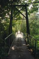
Bridgemeister ID: 2577 (added 2013-03-27)Name: Trailhead Park Location: Delphi, Indiana , USA Crossing: Deer Creek At or Near Feature: Delphi Trails Entrance Coordinates: 40.57327 N 86.68522 W Maps: Acme , GeoHack , Google , OpenStreetMap Use: Footbridge Status: In use (last checked: 2012) Main Cables: Wire (steel) Suspended Spans: 1
Appears to have been removed at some point in 1980s or early 1990s. Bridgemeister ID: 5637 (added 2020-12-29)Name: Tree Top Walk Location: O'Reilly, Queensland , Australia At or Near Feature: Lamington National Park Coordinates: 28.233076 S 153.138488 E Maps: Acme , GeoHack , Google , OpenStreetMap Use: Footbridge Status: In use (last checked: 2020) Main Cables: Wire (steel) Main Spans: 9
At least eight separate suspension spans at this site, all very tall, narrow, long footbridges along which you can walk to tour the tropical canopy. Bridgemeister ID: 8153 (added 2024-02-03)Name: Tribeni II Location: Chhintang (छिन्ताङ) and Hassanpur, Nepal Crossing: Arun River Coordinates: 26.923195 N 87.154837 E Maps: Acme , GeoHack , Google , OpenStreetMap Use: Footbridge Status: In use (last checked: 2021) Main Cables: Wire (steel) Suspended Spans: 1 Main Span: 1 x 79 meters (259.2 feet)
Mail | Facebook | Twitter
