Inventory Search Results (901-1,000 of 3,327)
3,327 suspension bridges were found for search criteria: *. Bridges 901 through 1,000 (of 3,327 total) appear below. Click the Bridgemeister ID number to isolate the bridge on its own page. If you don't see what you were looking for, try an image search with the same criteria: *. This will find the bridge if it is pictured on the site, but is not a catenary suspension bridge.
Related:
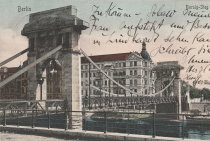
1906: Borsigsteg
Berlin, Germany - Spree River
| Bridgemeister ID: | 5692 (added 2021-04-01) |
| Year Completed: | 1906 |
| Name: | Borsigsteg |
| Also Known As: | Borsig |
| Location: | Berlin, Germany |
| Crossing: | Spree River |
| Coordinates: | 52.520874 N 13.339195 E |
| Maps: | Acme, GeoHack, Google, OpenStreetMap |
| Use: | Footbridge |
| Status: | Destroyed, April 1945 |
| Main Cables: | Eyebar (steel) |
| Suspended Spans: | 1 |
Notes:
- Abutments are still present (as of 2021).
- 1915: Damaged and rebuilt.
Image Sets:
1906: Brannon's Crossing
Weatherford vicinity, Parker County, Texas, USA - Brazos River
| Bridgemeister ID: | 1298 (added 2004-03-28) |
| Year Completed: | 1906 |
| Name: | Brannon's Crossing |
| Location: | Weatherford vicinity, Parker County, Texas, USA |
| Crossing: | Brazos River |
| Coordinates: | 32.66256 N 98.03288 W |
| Maps: | Acme, GeoHack, Google, OpenStreetMap |
| Principals: | Mitchell & Pigg |
| References: | HAERTX98 |
| Use: | Vehicular |
| Status: | Replaced, 1934 |
| Main Cables: | Wire (steel) |
| Main Span: | 1 x 134.1 meters (440 feet) |
Notes:
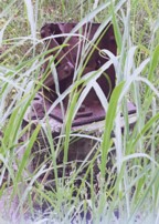
- Tony King believes he found the former location of this bridge a few hundred yards south of the I-20 Brazos River crossing west of Weatherford. This location is near a road named "Brannon Bridge Circle." Tony writes: "Just downstream from the modern Interstate 20 bridge in western Parker County, I've noticed a concrete and iron structure, and happened to take a photo of it recently. I've noticed the structure a couple of times in the past (most recently in May of 2007) while hiking a well-worn foot/ATV path that parallels the west bank of the river as it flows almost due south from the Interstate to Meeks Bend." The structure in Tony's photo appears to be a pier or support footing. The coordinates given here are Tony's approximation of the location of the structure.
- Built as part of the same contract as the Tin Top bridge.
- Similar to 1906 Tin Top (Hightower Valley) - Tin Top, Texas, USA.
Image Sets:
| Bridgemeister ID: | 3936 (added 2020-03-21) |
| Year Completed: | 1906 |
| Name: | Dølplass |
| Location: | Straalsjöaasen, Alvdal, Innlandet, Norway |
| Crossing: | Folla |
| Coordinates: | 62.19207 N 10.45023 E |
| Maps: | Acme, GeoHack, Google, kart.1881.no, OpenStreetMap |
| Use: | Vehicular (one-lane) |
| Status: | Removed |
| Main Cables: | Wire |
| Suspended Spans: | 1 |
| Main Span: | 1 x 40 meters (131.2 feet) estimated |
Notes:
- Rebuilt 1940. Unclear if the bridge was completely replaced at this point.
- Based on historic aerial images, removed between 1969 and 2004.
External Links:
1906: Forsæt
Forset, Brandvoll, Troms og Finnmark, Norway - Salangselva
| Bridgemeister ID: | 4077 (added 2020-04-04) |
| Year Completed: | 1906 |
| Name: | Forsæt |
| Location: | Forset, Brandvoll, Troms og Finnmark, Norway |
| Crossing: | Salangselva |
| Coordinates: | 68.774663 N 18.165802 E |
| Maps: | Acme, GeoHack, Google, kart.1881.no, OpenStreetMap |
| Use: | Vehicular (one-lane) |
| Status: | Removed |
| Main Cables: | Wire (steel) |
| Suspended Spans: | 1 |
| Main Span: | 1 x 27 meters (88.6 feet) |
External Links:
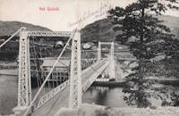
1906: Gulsvik
Gulsvik, Granheim, Flå, Viken, Norway - Hallingdalselva
| Bridgemeister ID: | 2864 (added 2019-09-08) |
| Year Completed: | 1906 |
| Name: | Gulsvik |
| Location: | Gulsvik, Granheim, Flå, Viken, Norway |
| Crossing: | Hallingdalselva |
| Coordinates: | 60.386333 N 9.578184 E |
| Maps: | Acme, GeoHack, Google, kart.1881.no, OpenStreetMap |
| Use: | Vehicular (one-lane) |
| Status: | Restricted to foot traffic (last checked: 2019) |
| Main Cables: | Wire (steel) |
| Suspended Spans: | 1 |
| Main Span: | 1 x 97 meters (318.2 feet) |
Notes:
- Upon completion claimed to be Scandinavia's longest suspension bridge.
- Bypassed 1971.
- Near 1940 (suspension bridge) - Gulsvik, Granheim, Flå, Viken, Norway.
External Links:
- DigitaltMuseum - Gamle Gulsvik hengebru i Flå
- DigitaltMuseum - Gamle Gulsvik hengebru under bygging 1903-1906
- DigitaltMuseum - Gamle Gulsvik hengebru under bygging 1903-1906
- DigitaltMuseum - Gamle Gulsvik hengebru under bygging 1903-1906
- DigitaltMuseum - Gamle Gulsvik hengebru under bygging 1903-1906
- DigitaltMuseum - Gamle Gulsvik hengebru under bygging 1903-1906
- DigitaltMuseum - Gamle Gulsvik hengebru under bygging 1903-1906
- DigitaltMuseum - Gamle Gulsvik hengebru under bygging 1903-1906
- DigitaltMuseum - Gulsvik bru på Hallingdalsvegen åpnet i 1906 og var i sin tid Skandinavias lengste hengebru
- DigitaltMuseum - Gulsvik hengebru ferdigbygd i 1905.når den vart bygd var den skandinavias lengste hengebru 92 m. Vart forsøkt sprengt av norske pionerstyrker 25 april 1940
- Structurae - Structure ID 20087388
Image Sets:
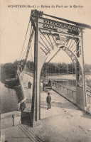
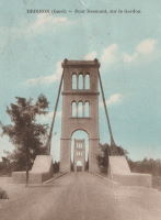
1906: Montfrin
Montfrin, Gard, France - Gardon River
| Bridgemeister ID: | 7275 (added 2022-07-22) |
| Year Completed: | 1906 |
| Name: | Montfrin |
| Location: | Montfrin, Gard, France |
| Crossing: | Gardon River |
| Use: | Vehicular |
| Status: | Removed |
| Main Cables: | Wire |
| Main Spans: | 2 |
Notes:
External Links:
- Art-et-Histoire - Nouveau pont suspendu de Montfrin - 1907. Suspects the bridge opened in 1907. The year 1906 is seen very prominently on the bridge tower, but the bridge may not have opened in 1906.
Image Sets:
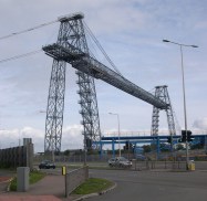
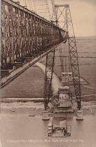
1906: Newport Transporter
Newport, Wales, United Kingdom - River Usk
| Bridgemeister ID: | 939 (added 2003-10-25) |
| Year Completed: | 1906 |
| Name: | Newport Transporter |
| Location: | Newport, Wales, United Kingdom |
| Crossing: | River Usk |
| Coordinates: | 51.570642 N 2.985246 W |
| Maps: | Acme, GeoHack, Google, OpenStreetMap |
| Principals: | Ferdinand Arnodin |
| References: | AAJ, NTB |
| Use: | Transporter |
| Status: | In use (last checked: 2011) |
| Main Cables: | Wire (steel) |
| Suspended Spans: | 1 |
| Main Span: | 1 x 196.6 meters (645 feet) |
External Links:
Image Sets:
1906: Puketapu-Moteo
Puketapu, Hawke's Bay, New Zealand - Tutaekuri River
| Bridgemeister ID: | 688 (added 2003-03-08) |
| Year Completed: | 1906 |
| Name: | Puketapu-Moteo |
| Also Known As: | Puketapu Swing |
| Location: | Puketapu, Hawke's Bay, New Zealand |
| Crossing: | Tutaekuri River |
| References: | GAP |
| Use: | Vehicular |
| Status: | Replaced, 1963 |
| Main Cables: | Wire (steel) |
| Main Span: | 1 x 129 meters (423.2 feet) |
Annotated Citations:
- Fowler, Michael. "Historic HB: After much ado the swing bridge was finally built." Hawke's Bay Today, 5 May 2022, www.nzherald.co.nz/hawkes-bay-today/news/historic-hb-after-much-ado-the-swing-bridge-was-finally-built/ZHUL7ZJHBPX3OML74PN6PUGJ6I/
"The swing bridge, at 494 feet (150m) in length was believed to have been the longest single-span structure of its type in the North Island. There was ten 700 feet (213m) supporting cables of plough steel (high quality steel containing carbon, used to make wire ropes) imported from England."
External Links:
Image Sets:
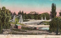
1906: Schönausteg
Berne, Switzerland - Aare River
| Bridgemeister ID: | 1396 (added 2004-07-04) |
| Year Completed: | 1906 |
| Name: | Schönausteg |
| Location: | Berne, Switzerland |
| Crossing: | Aare River |
| Coordinates: | 46.934417 N 7.445883 E |
| Maps: | Acme, GeoHack, Google, OpenStreetMap |
| References: | AAJ |
| Use: | Footbridge |
| Status: | In use (last checked: 2017) |
| Main Cables: | Eyebar (steel) |
| Suspended Spans: | 1 |
| Main Span: | 1 x 53.3 meters (174.88 feet) |
| Deck width: | 8.2 feet |
External Links:
Image Sets:
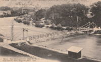
1906: Swinging
Charles City, Iowa, USA - Cedar River
| Bridgemeister ID: | 118 (added before 2003) |
| Year Completed: | 1906 |
| Name: | Swinging |
| Also Known As: | Charles City, Clark Street |
| Location: | Charles City, Iowa, USA |
| Crossing: | Cedar River |
| Coordinates: | 43.070433 N 92.685517 W |
| Maps: | Acme, GeoHack, Google, OpenStreetMap |
| Principals: | Charles Hart, O.B. Zimmerman |
| Use: | Footbridge |
| Status: | Destroyed, June 8, 2008 |
| Main Cables: | Wire |
| Suspended Spans: | 3 |
| Main Span: | 1 x 90.8 meters (298 feet) estimated |
| Side Spans: | 1 x 41.5 meters (136 feet) estimated, 1 x 9.1 meters (30 feet) estimated |
Notes:
- Bids accepted for refurbishment, expected to be completed October, 2007.
- Destroyed by floodwaters June 8, 2008.
External Links:
Image Sets:
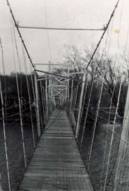
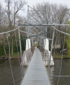
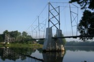
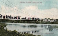
1906: Talbot's Inch
Talbot's Inch Village, Kilkenny, Ireland - River Nore
| Bridgemeister ID: | 2947 (added 2019-09-29) |
| Year Completed: | 1906 |
| Name: | Talbot's Inch |
| Location: | Talbot's Inch Village, Kilkenny, Ireland |
| Crossing: | River Nore |
| Use: | Footbridge |
| Status: | Destroyed, 1947 |
| Main Cables: | Wire (steel) |
| Suspended Spans: | 1 |
Notes:
- Wrecked by flood, 1947.
1906: Tin Top
Tin Top, Texas, USA - Brazos River
| Bridgemeister ID: | 119 (added before 2003) |
| Year Completed: | 1906 |
| Name: | Tin Top |
| Also Known As: | Hightower Valley |
| Location: | Tin Top, Texas, USA |
| Crossing: | Brazos River |
| Coordinates: | 32.575956 N 97.822697 W |
| Maps: | Acme, GeoHack, Google, OpenStreetMap |
| Principals: | Mitchell & Pigg |
| References: | BRAZ, HAERTX98 |
| Use: | Vehicular |
| Status: | Collapsed, Jan. 31, 1982 under weight of snow |
| Main Cables: | Wire (steel) |
| Main Span: | 1 x 121.9 meters (400 feet) |
Notes:
- Some internet resources suggest the "Tin Top" and "Hightower" suspension bridges were separate nearby structures, however, this does not appear to have been the case. Both names were used to describe the same structure and USGS topographical maps from the 1950s label the bridge due south of Tin Top as "Hightower". Mitchell and Pigg did build a similar structure, at Brannon's Crossing. The 2015 National Register of Historic Places Registration Form for "Historic Road Infrastructure of Texas, 1866-1965", the Texas Department of Transportation writes: "In 1905 [Mitchell and Pigg] constructed the practically identical Brannon's Crossing and Hightower Valley Bridges across the Brazos in Parker County. The former was a 440-foot clear span while the later, also known as Tin Top, was 400 feet."
- The coordinates appear to be the exact location of a pier remaining (as of 2020) from this bridge. The alignment indicated by the pier appears to exactly match the location of this bridge as indicated by 1958 USGS topographical map of the area.
- Similar to 1906 Brannon's Crossing - Weatherford vicinity, Parker County, Texas, USA.
Image Sets:
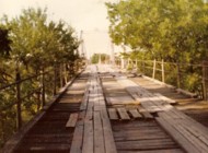
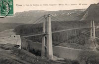
1906: Trellins
Vinay vicinity, Isère, France - Isère River
| Bridgemeister ID: | 1423 (added 2004-07-17) |
| Year Completed: | 1906 |
| Name: | Trellins |
| Location: | Vinay vicinity, Isère, France |
| Crossing: | Isère River |
| Coordinates: | 45.19536 N 5.42482 E |
| Maps: | Acme, GeoHack, Google, OpenStreetMap |
| References: | AAJ |
| Use: | Vehicular |
| Status: | Derelict (last checked: 2009) |
| Main Cables: | Wire |
| Suspended Spans: | 3 |
| Main Span: | 1 x 146.6 meters (481 feet) |
| Side Spans: | 2 x 25.3 meters (83 feet) |
Notes:
- 2022: Still standing, but suspenders and deck have been removed.
External Links:
Image Sets:
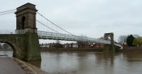
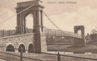
1906: Wilford
West Bridgford, Nottingham, England, United Kingdom - River Trent
| Bridgemeister ID: | 1087 (added 2004-01-01) |
| Year Completed: | 1906 |
| Name: | Wilford |
| Also Known As: | Nottingham, Meadows, Welbeck |
| Location: | West Bridgford, Nottingham, England, United Kingdom |
| Crossing: | River Trent |
| Coordinates: | 52.933167 N 1.137967 W |
| Maps: | Acme, GeoHack, Google, OpenStreetMap |
| Use: | Pipeline and Footbridge |
| Status: | In use (last checked: 2017) |
| Main Cables: | Wire |
| Suspended Spans: | 1 |
| Main Span: | 1 x 68.6 meters (225 feet) |
| Deck width: | 12 feet |
Notes:
- Designed primarily to carry water and gas mains, but also carries a wide footpath.
- Closed, July 2008, after reports of falling debris. In December 2008, Severn Trent Water announced plans to refurbish the bridge in 2009. Bridge was reopened February 12, 2010.
External Links:
Image Sets:

1907: (footbridge)
Hooversville, Pennsylvania, USA - Stony Creek
| Bridgemeister ID: | 1569 (added 2004-12-05) |
| Year Completed: | 1907 |
| Name: | (footbridge) |
| Location: | Hooversville, Pennsylvania, USA |
| Crossing: | Stony Creek |
| Coordinates: | 40.147818 N 78.913939 W |
| Maps: | Acme, GeoHack, Google, OpenStreetMap |
| Use: | Footbridge |
| Status: | Destroyed, 1996 |
| Main Cables: | Wire |
Notes:
- Destroyed by flood, January 19, 1996.
- Replaced by 1996 (footbridge) - Hooversville, Pennsylvania, USA.
- All past and present bridges at this location.
External Links:
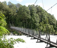
1907: Douglas
Franz Josef Glacier vicinity, New Zealand - Waiho River
| Bridgemeister ID: | 770 (added 2003-03-13) |
| Year Completed: | 1907 |
| Name: | Douglas |
| Location: | Franz Josef Glacier vicinity, New Zealand |
| Crossing: | Waiho River |
| Coordinates: | 43.418226 S 170.180737 E |
| Maps: | Acme, GeoHack, Google, OpenStreetMap |
| Use: | Footbridge |
| Status: | In use (last checked: 2019) |
| Main Cables: | Wire (steel) |
| Suspended Spans: | 1 |
External Links:
Image Sets:
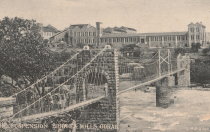
1907: Gokak Falls
Gokak, Karnataka, India - Ghataprabha River
| Bridgemeister ID: | 2219 (added 2007-03-04) |
| Year Completed: | 1907 |
| Name: | Gokak Falls |
| Location: | Gokak, Karnataka, India |
| Crossing: | Ghataprabha River |
| At or Near Feature: | Gokak Falls |
| Coordinates: | 16.191958 N 74.776933 E |
| Maps: | Acme, GeoHack, Google, OpenStreetMap |
| Use: | Footbridge |
| Status: | In use (last checked: 2019) |
| Main Cables: | Wire |
| Suspended Spans: | 4 |
| Main Spans: | 2 |
| Side Spans: | 2 |
Image Sets:
1907: Mangaltar
Mangaltar Bazar (मंगलटार बजार) vicinity, Nepal - Roshi Khola
| Bridgemeister ID: | 6434 (added 2021-08-12) |
| Year Completed: | 1907 |
| Name: | Mangaltar |
| Location: | Mangaltar Bazar (मंगलटार बजार) vicinity, Nepal |
| Crossing: | Roshi Khola |
| Coordinates: | 27.493573 N 85.730552 E |
| Maps: | Acme, GeoHack, Google, OpenStreetMap |
| Principals: | Louis Harper, Harpers Limited |
| Use: | Footbridge |
| Status: | In use (last checked: 2021) |
| Main Cables: | Wire (steel) |
| Suspended Spans: | 1 |
External Links:
1907: Romney
Kendal, England, United Kingdom - River Kent
| Bridgemeister ID: | 2426 (added 2008-03-12) |
| Year Completed: | 1907 |
| Name: | Romney |
| Also Known As: | Dockwray |
| Location: | Kendal, England, United Kingdom |
| Crossing: | River Kent |
| Coordinates: | 54.33595 N 2.74507 W |
| Maps: | Acme, GeoHack, Google, OpenStreetMap |
| Use: | Footbridge |
| Status: | In use (last checked: 2010) |
| Main Cables: | Wire |
Notes:
- Coordinates are for the current location of the bridge. It was moved there (from its original location where Romney Road meets the River Kent in Kendal) in the 1990s. A sign at the current (2011) bridge says: "The bridge was erected in 1993 on the initiative of Kendal Civic Society. It incorporates part of the structure of the former Romeny Footbridge erected in 1907..."
Image Sets:
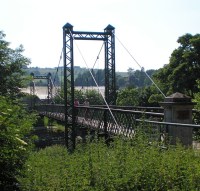
| Bridgemeister ID: | 3970 (added 2020-03-22) |
| Year Completed: | 1907 |
| Name: | Sand |
| Location: | Malangen, Troms og Finnmark, Norway |
| Crossing: | Sandselva |
| Coordinates: | 69.396363 N 18.604359 E |
| Maps: | Acme, GeoHack, Google, kart.1881.no, OpenStreetMap |
| Use: | Vehicular (one-lane) |
| Status: | Removed |
| Main Cables: | Wire (steel) |
| Suspended Spans: | 1 |
| Main Span: | 1 x 30 meters (98.4 feet) estimated |
External Links:
1907: Sandy Creek
Mackay, Queensland, Australia - Sandy Creek
| Bridgemeister ID: | 527 (added before 2003) |
| Year Completed: | 1907 |
| Name: | Sandy Creek |
| Location: | Mackay, Queensland, Australia |
| Crossing: | Sandy Creek |
| Coordinates: | 21.267726 S 149.138815 E |
| Maps: | Acme, GeoHack, Google, OpenStreetMap |
| References: | STC |
| Use: | Vehicular (one-lane) |
| Status: | Removed |
| Main Cables: | Wire |
| Suspended Spans: | 1 |
Notes:
- Damaged in 1957 and 1958 by overweight vehicles. Bridge was repaired each time. Structure was still standing when a replacement was completed in 1966.
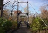
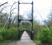
1907: Swinging
Kansas City, Missouri, USA - Blue River
| Bridgemeister ID: | 120 (added before 2003) |
| Year Completed: | 1907 |
| Name: | Swinging |
| Location: | Kansas City, Missouri, USA |
| Crossing: | Blue River |
| At or Near Feature: | Swope Park, Kansas City Zoo |
| Coordinates: | 39.00165 N 94.5244 W |
| Maps: | Acme, GeoHack, Google, OpenStreetMap |
| Principals: | Midland Bridge Co. |
| Use: | Footbridge |
| Status: | In use (last checked: 2020) |
| Main Cables: | Wire (steel) |
| Suspended Spans: | 1 |
| Main Span: | 1 x 69.2 meters (227 feet) |
| Deck width: | 8 feet |
External Links:
Image Sets:
1907: Vulcan
Vulcan, West Virginia and Pike County, Kentucky, USA - Tug Fork Big Sandy River
| Bridgemeister ID: | 2141 (added 2006-11-02) |
| Year Completed: | 1907 |
| Name: | Vulcan |
| Location: | Vulcan, West Virginia and Pike County, Kentucky, USA |
| Crossing: | Tug Fork Big Sandy River |
| References: | AAJ |
| Use: | Footbridge |
| Status: | Removed |
| Main Cables: | Wire |
| Main Span: | 1 x 121.9 meters (400 feet) |
Notes:
- On Page 13 of the December 27, 1967 edition of West Virginia's The Charleston Gazette newspaper, there is a photograph of this footbridge with a Jeep driving across. The caption reads: "Pedestrian bridge at Vulcan... is used by vehicles because it provides a route over the Tug River to Kentucky. A citizen's group has complained that the bridge is not strong enough to support cars." The photograph accompanies an article "Road Reform Call Urged" that says the bridge is "regularly used by Jeeps and small cars." Note the date of the article, December 27, 1967 is 12 days after the Silver Bridge disaster at Point Pleasant, West Virginia.
- Near (footbridge) - Vulcan, West Virginia and Pike County, Kentucky, USA. Although similar in appearance, these appear to have been different bridges.
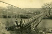
1908: (suspension bridge)
Aztec, New Mexico, USA - Las Animas River
| Bridgemeister ID: | 2505 (added 2009-03-07) |
| Year Completed: | 1908 |
| Name: | (suspension bridge) |
| Location: | Aztec, New Mexico, USA |
| Crossing: | Las Animas River |
| Principals: | Thurston and Co. |
| Use: | Vehicular (one-lane) |
| Status: | Removed |
| Main Cables: | Wire |
| Suspended Spans: | 1 |
Image Sets:
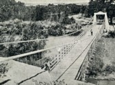
1908: (suspension bridge)
Isokylä, Ylistaro vicinity, Finland
| Bridgemeister ID: | 2969 (added 2019-10-12) |
| Year Completed: | 1908 |
| Name: | (suspension bridge) |
| Location: | Isokylä, Ylistaro vicinity, Finland |
| Coordinates: | 62.950875 N 22.451695 E |
| Maps: | Acme, GeoHack, Google, OpenStreetMap |
| Use: | Vehicular (one-lane) |
| Status: | In use (last checked: 2009) |
| Main Cables: | Wire (steel) |
| Suspended Spans: | 1 |
1908: Bailey
Warsaw vicinity, Missouri, USA - Osage River
| Bridgemeister ID: | 3516 (added 2019-12-24) |
| Year Completed: | 1908 |
| Name: | Bailey |
| Location: | Warsaw vicinity, Missouri, USA |
| Crossing: | Osage River |
| Principals: | Joseph A. Dice |
| References: | BOTO |
| Use: | Vehicular |
| Status: | Removed |
| Main Cables: | Wire (steel) |
Notes:
- Location inundated by the Harry S. Truman Reservoir.
External Links:
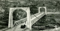
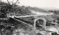
1908: Belisario Domínguez
Tuxtla Gutiérrez, Chiapas, Mexico - Rio Grijalva
| Bridgemeister ID: | 3219 (added 2019-11-11) |
| Year Completed: | 1908 |
| Name: | Belisario Domínguez |
| Also Known As: | Porfirio Díaz |
| Location: | Tuxtla Gutiérrez, Chiapas, Mexico |
| Crossing: | Rio Grijalva |
| Coordinates: | 16.742344 N 93.034593 W |
| Maps: | Acme, GeoHack, Google, OpenStreetMap |
| Use: | Vehicular (two-lane) |
| Status: | Only towers remain (last checked: 2021) |
| Main Cables: | Wire (steel) |
| Suspended Spans: | 1 |
Notes:
- 1955: Failed due to a truck colliding with part of the bridge. Adjacent replacement was already under construction.
- 2021: Towers are still present and one set of suspension cables is carrying a small pipeline. Unclear how long the bridge has been in this state.
External Links:
- Puente Belisario Domínguez en Chiapa de Corzo, que atravesaba el Río Grijalva alrededor de 1955. - Facebook
- Puente Belisario Domínguez, Chiapas, México - YouTube
Image Sets:
| Bridgemeister ID: | 3911 (added 2020-03-15) |
| Year Completed: | 1908 |
| Name: | Erlinesset |
| Location: | Tolga, Østerdalen, Innlandet, Norway |
| Crossing: | Glomma |
| Coordinates: | 62.42619 N 11.09129 E |
| Maps: | Acme, GeoHack, Google, kart.1881.no, OpenStreetMap |
| Use: | Vehicular (one-lane) |
| Status: | In use (last checked: 2019) |
| Main Cables: | Wire (steel) |
| Suspended Spans: | 2 |
| Main Spans: | 2 x 42.5 meters (139.4 feet) estimated |
Notes:
- Restored 1951 and 1999.
External Links:
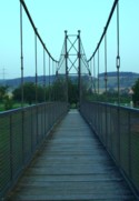
1908: Eutersdorfer Schaukelbrücke
Großeutersdorf and Kleineutersdorf, Thüringen, Germany - Saale River
| Bridgemeister ID: | 1450 (added 2004-08-01) |
| Year Completed: | 1908 |
| Name: | Eutersdorfer Schaukelbrücke |
| Location: | Großeutersdorf and Kleineutersdorf, Thüringen, Germany |
| Crossing: | Saale River |
| Coordinates: | 50.78555 N 11.56694 E |
| Maps: | Acme, GeoHack, Google, OpenStreetMap |
| Principals: | Paul Moser |
| Use: | Footbridge |
| Status: | In use (last checked: 2022) |
| Main Cables: | Wire |
| Suspended Spans: | 1 |
| Main Span: | 1 x 56 meters (183.7 feet) |
| Deck width: | 1.5 meters |
Notes:
- Reconstructed 1965, and 1993.
External Links:
Image Sets:
1908: Heath Ford
Warsaw vicinity, Missouri, USA - Osage River
| Bridgemeister ID: | 3515 (added 2019-12-24) |
| Year Completed: | 1908 |
| Name: | Heath Ford |
| Location: | Warsaw vicinity, Missouri, USA |
| Crossing: | Osage River |
| Principals: | Joseph A. Dice |
| References: | BOTO |
| Use: | Vehicular |
| Status: | Removed |
| Main Cables: | Wire (iron) |
| Main Span: | 1 x 157.6 meters (517 feet) |
Notes:
- Damaged by wind, 1932. Replaced, 1937
- Location inundated by the Harry S. Truman Reservoir.
External Links:
1908: Kockisch-Liebenhain
Kockisch, Mittweida and Rossau, Saxony, Germany - Zschopau River
| Bridgemeister ID: | 2164 (added 2007-01-12) |
| Year Completed: | 1908 |
| Name: | Kockisch-Liebenhain |
| Location: | Kockisch, Mittweida and Rossau, Saxony, Germany |
| Crossing: | Zschopau River |
| Coordinates: | 50.99595 N 13.00630 E |
| Maps: | Acme, GeoHack, Google, OpenStreetMap |
| Use: | Footbridge |
| Status: | In use (last checked: 2023) |
| Main Cables: | Wire (steel) |
| Suspended Spans: | 3 |
| Main Span: | 1 x 51 meters (167.3 feet) |
| Side Spans: | 1 x 7 meters (23 feet), 1 x 8 meters (26.2 feet) |
| Deck width: | 1.3 meters between side rails, 1.7 meters total |
Notes:
- Reconstructed 1996, and after damaged by flood, 2003.
External Links:
Image Sets:
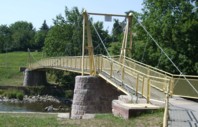
1908: Narva
Narva, Estonia - Narva River
| Bridgemeister ID: | 2177 (added 2007-01-13) |
| Year Completed: | 1908 |
| Name: | Narva |
| Location: | Narva, Estonia |
| Crossing: | Narva River |
| Coordinates: | 59.358667 N 28.195417 E |
| Maps: | Acme, GeoHack, Google, OpenStreetMap |
| Principals: | Louis Harper, Harpers Limited |
| Use: | Footbridge |
| Status: | Removed |
| Main Cables: | Wire |
| Suspended Spans: | 1 |
| Main Span: | 1 x 79.2 meters (260 feet) |
| Deck width: | 6 feet |
External Links:
Image Sets:
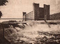
1908: Newcastle
Newcastle, Texas, USA - Brazos River
| Bridgemeister ID: | 1299 (added 2004-03-28) |
| Year Completed: | 1908 |
| Name: | Newcastle |
| Location: | Newcastle, Texas, USA |
| Crossing: | Brazos River |
| Principals: | Mitchell & Pigg |
| References: | HAERTX98 |
| Use: | Vehicular |
| Status: | Collapsed, 1930 |
| Main Cables: | Wire (steel) |
| Suspended Spans: | 3 |
| Main Span: | 1 x 213.4 meters (700 feet) |
| Side Spans: | 2 |
Notes:
- Collapsed during flood, 1930.
1908: Sagrada
Sagrada, Missouri, USA - Osage River
| Bridgemeister ID: | 2304 (added 2007-04-26) |
| Year Completed: | 1908 |
| Name: | Sagrada |
| Location: | Sagrada, Missouri, USA |
| Crossing: | Osage River |
| Principals: | J.S. Kidwell |
| References: | BOTO |
| Status: | Removed, 1931 |
| Main Cables: | Wire |
External Links:
1908: South Bend
South Bend, Texas, USA - Brazos River
| Bridgemeister ID: | 1858 (added 2005-07-17) |
| Year Completed: | 1908 |
| Name: | South Bend |
| Location: | South Bend, Texas, USA |
| Crossing: | Brazos River |
| Principals: | Mitchell & Pigg |
| References: | HAERTX98 |
| Use: | Vehicular |
| Status: | Removed |
| Main Cables: | Wire |
| Main Span: | 1 x 121.9 meters (400 feet) |
1908: Swinging
Marble Hill and Lutesville, Missouri, USA - Crooked Creek
| Bridgemeister ID: | 9308 (added 2025-06-21) |
| Year Completed: | 1908 |
| Name: | Swinging |
| Location: | Marble Hill and Lutesville, Missouri, USA |
| Crossing: | Crooked Creek |
| Use: | Footbridge |
| Status: | Removed |
External Links:
- Bollinger County Library Archives - Swinging Foot Bridge. Image of the bridge
- Bridgehunter.com - BH20888
1908: Tyngs Island
Lowell vicinity, Massachusetts, USA - Merrimack River
| Bridgemeister ID: | 844 (added 2003-06-28) |
| Year Completed: | 1908 |
| Name: | Tyngs Island |
| Location: | Lowell vicinity, Massachusetts, USA |
| Crossing: | Merrimack River |
| At or Near Feature: | Vesper Country Club |
| Coordinates: | 42.65574 N 71.39971 W |
| Maps: | Acme, GeoHack, Google, OpenStreetMap |
| Principals: | Westinghouse, Church, Kerr, and Co., J.R. Worcester |
| References: | AAJ, HBE |
| Use: | Footbridge |
| Status: | Destroyed, 1936 |
| Main Cables: | Wire (steel) |
| Suspended Spans: | 1 |
| Main Span: | 1 x 167.6 meters (550 feet) |
| Deck width: | 4.5 feet |
Notes:
- Destroyed by flood, 1936.
Image Sets:
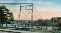
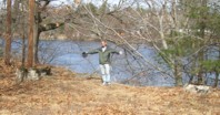
1908: Wardown Park
Luton, Bedfordshire, England, United Kingdom - River Lea
| Bridgemeister ID: | 784 (added 2003-03-16) |
| Year Completed: | 1908 |
| Name: | Wardown Park |
| Location: | Luton, Bedfordshire, England, United Kingdom |
| Crossing: | River Lea |
| At or Near Feature: | Wardown Park |
| Coordinates: | 51.89201 N 0.418833 W |
| Maps: | Acme, GeoHack, Google, OpenStreetMap |
| Use: | Footbridge |
| Status: | In use (last checked: 2015) |
| Main Cables: | Wire |
| Suspended Spans: | 1 |
Notes:
- 2015: Refurbished and reopened after having been closed for several years.
External Links:
Image Sets:

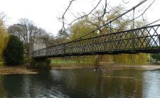
| Bridgemeister ID: | 996 (added 2003-11-16) |
| Year Completed: | 1909 |
| Name: | Brest Transporter |
| Location: | Brest, Finistère, France |
| Use: | Transporter |
| Status: | Removed, 1947 |
| Main Cables: | Wire (steel) |
| Suspended Spans: | 1 |
| Main Span: | 1 x 10⁹ meters (357.6 feet) |
Notes:
- Moved from 1898 Bizerte Transporter (Bizerta) - Bizerte, Tunisia. The bridge was dismantled and reassembled at Brest.
External Links:
Image Sets:
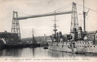
1909: Chain
Newburyport, Massachusetts, USA - Merrimack River
| Bridgemeister ID: | 122 (added before 2003) |
| Year Completed: | 1909 |
| Name: | Chain |
| Location: | Newburyport, Massachusetts, USA |
| Crossing: | Merrimack River |
| Coordinates: | 42.833459 N 70.906674 W |
| Maps: | Acme, GeoHack, Google, OpenStreetMap |
| Principals: | George F. Swain, Robert R. Evans |
| References: | PTS2 |
| Use: | Vehicular (two-lane), with walkway |
| Status: | In use (last checked: 2006) |
| Main Cables: | Wire (steel) |
| Suspended Spans: | 1 |
| Main Span: | 1 x 80.8 meters (265 feet) |
| Deck width: | 35.8 feet |
Notes:
- Deck replaced 1922, 1931, 1938, and 2002.
- Replaced 1810 Chain (Essex-Merrimack) - Newburyport, Massachusetts, USA.
- All past and present bridges at this location.
External Links:
Image Sets:
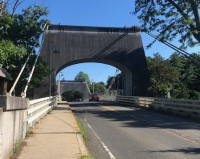
1909: Charchare
Tinau (तिनाउ), Palpa, Masyam (मस्याम) vicinity and Koldada (कोलडाँडा) vicinity, Nepal - Tinau Khola
| Bridgemeister ID: | 6803 (added 2021-10-31) |
| Year Completed: | 1909 |
| Name: | Charchare |
| Location: | Tinau (तिनाउ), Palpa, Masyam (मस्याम) vicinity and Koldada (कोलडाँडा) vicinity, Nepal |
| Crossing: | Tinau Khola |
| Coordinates: | 27.793304 N 83.550138 E |
| Maps: | Acme, GeoHack, Google, OpenStreetMap |
| Principals: | Louis Harper, Harpers Limited |
| Use: | Footbridge |
| Status: | Extant (last checked: 2021) |
| Main Cables: | Wire |
| Suspended Spans: | 1 |
| Main Span: | 1 x 71 meters (232.9 feet) |
| Deck width: | 1.2m |
External Links:
- Charchare | Harper Bridges. Images and history of the bridge. The coordinates given on this page are incorrect.
1909: Cowwarr
Cowwarr, Victoria, Australia - Thompson River
| Bridgemeister ID: | 430 (added before 2003) |
| Year Completed: | 1909 |
| Name: | Cowwarr |
| Location: | Cowwarr, Victoria, Australia |
| Crossing: | Thompson River |
| Use: | Footbridge |
| Status: | Destroyed, 1934 |
| Main Cables: | Wire |
Notes:
- 1934: Destroyed by flood
External Links:
- Facebook - COWWARR SUSPENSION BRIDGE. Images and history of the bridge, posted March 31, 2017.
Image Sets:
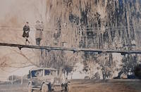
1909: Empire
Empire, Panama - Panama Canal
| Bridgemeister ID: | 525 (added before 2003) |
| Year Completed: | 1909 |
| Name: | Empire |
| Location: | Empire, Panama |
| Crossing: | Panama Canal |
| References: | PTS2 |
| Use: | Vehicular (one-lane) and Pipeline |
| Status: | Removed |
| Main Cables: | Wire (steel) |
| Suspended Spans: | 1 |
| Main Span: | 1 x 182.9 meters (600 feet) |
Notes:
- AAJ: Built to carry water and compressed air pipelines during canal construction, but also had a roadway.
Image Sets:
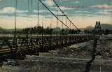
1909: Geithus
Geithus, Modum, Viken, Norway - Drammenselva
| Bridgemeister ID: | 4055 (added 2020-03-29) |
| Year Completed: | 1909 |
| Name: | Geithus |
| Location: | Geithus, Modum, Viken, Norway |
| Crossing: | Drammenselva |
| Coordinates: | 59.92837 N 9.96840 E |
| Maps: | Acme, GeoHack, Google, kart.1881.no, OpenStreetMap |
| Use: | Vehicular (one-lane) |
| Status: | In use (last checked: 2019) |
| Main Cables: | Wire (steel) |
| Suspended Spans: | 1 |
| Main Span: | 1 x 90 meters (295.3 feet) estimated |
Notes:
- Suspenders and deck destroyed to slow German advance during WWII, 1940. Later repaired.
External Links:
- DigitaltMuseum - Geithus bru i Modum bygget i 1909
- DigitaltMuseum - Geithus bru over Drammenselva ble åpnet 1909
- DigitaltMuseum - Geithus bru over Drammenselva åpnet november 1909
- DigitaltMuseum - Geithus bru, hengebru åpnet i 1909. For å sinke tysk framrykking i 1940 ble henge-stenger kuttet og brubanen falt i vannet
- Wikipedia - Geithus bru
Image Sets:
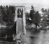
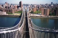
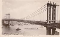
1909: Manhattan
New York and Brooklyn, New York, USA - East River
| Bridgemeister ID: | 123 (added before 2003) |
| Year Completed: | 1909 |
| Name: | Manhattan |
| Location: | New York and Brooklyn, New York, USA |
| Crossing: | East River |
| Coordinates: | 40.70667 N 73.99167 W |
| Maps: | Acme, GeoHack, Google, OpenStreetMap |
| Principals: | O.F. Nichols, Leon Moisseiff |
| References: | AAJ, BAAW, BBR, BC3, BPL, GBD, HBE, LAB, PTS2, SA19050909, SJR |
| Use: | Vehicular (double-deck) |
| Status: | In use (last checked: 2022) |
| Main Cables: | Wire (steel) |
| Suspended Spans: | 3 |
| Main Span: | 1 x 448.1 meters (1,470 feet) |
| Side Spans: | 2 x 221 meters (725 feet) |
Notes:
- Opened December 31, 1909, but not fully completed yet.
- Next to 1883 Brooklyn (Great East River) - New York and Brooklyn, New York, USA.
- Near 1903 Williamsburg - New York and Brooklyn, New York, USA.
- All past and present bridges at this location.
External Links:
Image Sets:


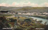
1909: Melling
Lower Hutt, New Zealand - Te Awa Kairangi / Hutt River
| Bridgemeister ID: | 690 (added 2003-03-08) |
| Year Completed: | 1909 |
| Name: | Melling |
| Location: | Lower Hutt, New Zealand |
| Crossing: | Te Awa Kairangi / Hutt River |
| Principals: | Joseph Dawson |
| References: | GAP |
| Use: | Vehicular (one-lane) |
| Status: | Replaced |
| Main Cables: | Wire (steel) |
| Suspended Spans: | 1 |
| Main Span: | 1 x 91.4 meters (299.9 feet) |
External Links:
Image Sets:
1909: Pease River
Vernon, Texas, USA - Pease River
| Bridgemeister ID: | 597 (added 2003-01-11) |
| Year Completed: | 1909 |
| Name: | Pease River |
| Location: | Vernon, Texas, USA |
| Crossing: | Pease River |
| Coordinates: | 34.179636 N 99.324038 W |
| Maps: | Acme, GeoHack, Google, OpenStreetMap |
| Principals: | Mitchell & Pigg |
| References: | AUB |
| Use: | Vehicular |
| Status: | Only towers remain |
| Main Cables: | Wire |
| Suspended Spans: | 4 |
| Main Spans: | 2 |
| Side Spans: | 2 |
Notes:
- In September 2006, Howard Laker writes: "The bridge is no longer there, but one tower is still standing. It is located adjacent to US 287 and can be easily seen."
- 1927: Collapsed under weight of convoy of trucks.
- Replaced 1897 Pease River - Vernon, Texas, USA.
- All past and present bridges at this location.
External Links:
1909: Ripley
Ripley, Oklahoma, USA - Cimarron River
| Bridgemeister ID: | 298 (added before 2003) |
| Year Completed: | 1909 |
| Name: | Ripley |
| Location: | Ripley, Oklahoma, USA |
| Crossing: | Cimarron River |
| Principals: | Mitchell & Pigg |
| Use: | Vehicular (one-lane) |
| Status: | Wrecked, 1912 |
| Main Cables: | Wire (steel) |
| Suspended Spans: | 3 |
| Main Span: | 1 |
| Side Spans: | 2 |
Notes:
- The photo linked here is dated March 2, 1909. Part of the builders plate is legible. The first line appears to be: "Wfd Mch & Fo... Co." (the portion between the Fo and Co is obscured) for Weatherford Machine and Foundry Company. The next two lines are clear: "BUILDERS 1908" and "WEATHERFORD TEXAS". The last line is largely obscured but it appears to say "MITCHELL & PIGG PAT'D 1..." with a year at the end. Mitchell & Pigg was a well-known builder of suspension bridges in Texas. Most sources cite 1909 as the year of completion.
- South tower washed out, 1912.
- Replaced by Ripley - Ripley, Oklahoma, USA.
- All past and present bridges at this location.
External Links:
Image Sets:
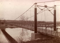
1909: Swinging
Carthage and Carterville, Missouri, USA - Center Creek
| Bridgemeister ID: | 358 (added before 2003) |
| Year Completed: | 1909 |
| Name: | Swinging |
| Location: | Carthage and Carterville, Missouri, USA |
| Crossing: | Center Creek |
| At or Near Feature: | Lakeside Park |
| Coordinates: | 37.164889 N 94.414694 W |
| Maps: | Acme, GeoHack, Google, OpenStreetMap |
| Use: | Footbridge |
| Status: | Removed |
| Main Cables: | Wire (steel) |
| Suspended Spans: | 1 |
Notes:
- Coordinates reflect approximate location of the bridge within the grounds of the former Lakeside amusement park. The entire location of this park has been reclaimed by forest. The suspension bridge was likely bit east/southeast of the coordinates.
External Links:
Image Sets:
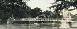
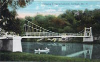
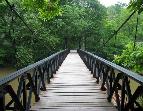
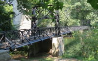
1909: Swinging
Wilmington, Delaware, USA - Brandywine Creek
| Bridgemeister ID: | 270 (added before 2003) |
| Year Completed: | 1909 |
| Name: | Swinging |
| Location: | Wilmington, Delaware, USA |
| Crossing: | Brandywine Creek |
| At or Near Feature: | Brandywine Park |
| Coordinates: | 39.76043 N 75.5564 W |
| Maps: | Acme, GeoHack, Google, OpenStreetMap |
| References: | FOWP1999S |
| Use: | Footbridge |
| Status: | In use (last checked: 2005) |
| Main Cables: | Wire (steel) |
| Suspended Spans: | 1 |
Notes:
- Replaced a nearby 1879 suspension footbridge.
External Links:
Image Sets:
1910: Bouchemaine
Bouchemaine, Maine-et-Loire, France - Maine River
| Bridgemeister ID: | 1324 (added 2004-04-26) |
| Year Completed: | 1910 |
| Name: | Bouchemaine |
| Location: | Bouchemaine, Maine-et-Loire, France |
| Crossing: | Maine River |
| Coordinates: | 47.420130 N 0.608157 W |
| Maps: | Acme, GeoHack, Google, OpenStreetMap |
| Use: | Vehicular |
| Status: | Destroyed, 1944 |
| Main Cables: | Wire (iron) |
| Suspended Spans: | 3 |
| Main Span: | 1 |
| Side Spans: | 2 |
Notes:
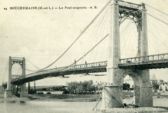
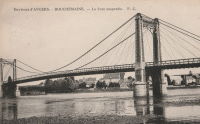
- Note the interesting stay and suspender arrangement in image. The side spans and much of the center span appear to be supported by stays. Only the center portion of the main span appears to be supported by verticle suspenders.
- Replaced by 1951 Bouchemaine - Bouchemaine, Maine-et-Loire, France.
- All past and present bridges at this location.
Image Sets:
1910: Castle
Shrewsbury, England, United Kingdom
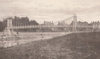
| Bridgemeister ID: | 1919 (added 2005-10-09) |
| Year Completed: | 1910 |
| Name: | Castle |
| Location: | Shrewsbury, England, United Kingdom |
| Principals: | David Rowell & Co. |
| Status: | Replaced, 1951 |
Image Sets:
1910: Grunwaldzki
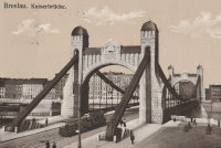
Wroclaw, Poland - Oder River
| Bridgemeister ID: | 431 (added before 2003) |
| Year Completed: | 1910 |
| Name: | Grunwaldzki |
| Also Known As: | Kaiser, Imperial, Kaiserbrücke |
| Location: | Wroclaw, Poland |
| Crossing: | Oder River |
| Coordinates: | 51.109503 N 17.052506 E |
| Maps: | Acme, GeoHack, Google, OpenStreetMap |
| Principals: | R. Weyerauch, M. Mayer |
| References: | AAJ |
| Use: | Vehicular (four-lane), with walkway |
| Status: | In use (last checked: 2019) |
| Main Cables: | Chain (steel) |
| Suspended Spans: | 1 |
| Main Span: | 1 x 126.5 meters (415 feet) |
External Links:
Image Sets:
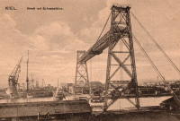
1910: Kiel Transporter
Kiel, Germany
1910: La Feuillée
Lyon, Métropole de Lyon, France - Saône River
| Bridgemeister ID: | 6424 (added 2021-08-10) |
| Year Completed: | 1910 |
| Name: | La Feuillée |
| Location: | Lyon, Métropole de Lyon, France |
| Crossing: | Saône River |
| Coordinates: | 45.766389 N 4.829081 E |
| Maps: | Acme, GeoHack, Google, OpenStreetMap |
| References: | PQL |
| Use: | Footbridge |
| Status: | Replaced, 1912 |
| Main Cables: | Wire (steel) |
| Suspended Spans: | 1 |
Notes:
- A temporary suspension bridge that stood for two years before being replaced.
- Replaced 1831 La Feuillée - Lyon, Métropole de Lyon, France.
- All past and present bridges at this location.
Image Sets:
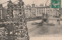
1910: Linn Creek
Linn Creek, Missouri, USA - Osage River
| Bridgemeister ID: | 289 (added before 2003) |
| Year Completed: | 1910 |
| Name: | Linn Creek |
| Location: | Linn Creek, Missouri, USA |
| Crossing: | Osage River |
| Principals: | T.S. Hart |
| References: | AAJ, PTS2 |
| Use: | Vehicular |
| Status: | Removed, 1931 |
| Main Cables: | Wire |
| Suspended Spans: | 1 |
| Main Span: | 1 x 160 meters (525 feet) |
Notes:
- Dismantled 1931 in preparation for inundation that created Lake Of The Ozarks.
External Links:
- www.LakeHistory.info. Michael Gillespie writes: "The supporting cables were cut and the tower was allowed to fall into the Osage River. The entire flood plain was being inundated by the waters of the newly created Lake of the Ozarks. During World War 2, the cables and tower were raised and sold for scrap. The shoreline of today's Lake of the Ozarks is just at the base of the bridge abutment. The toll house, seen in the photo just to the left of the bridge, is long gone, and everything below that has been underwater for 77 years. I have created a map of the road system at that location."
- Bridgehunter.com - BH84963
Image Sets:
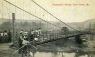
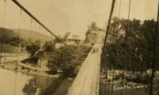
1910: Massena Center
Massena, New York, USA - Grasse River
| Bridgemeister ID: | 124 (added before 2003) |
| Year Completed: | 1910 |
| Name: | Massena Center |
| Location: | Massena, New York, USA |
| Crossing: | Grasse River |
| Coordinates: | 44.959213 N 74.830558 W |
| Maps: | Acme, GeoHack, Google, OpenStreetMap |
| Principals: | Holton D. Robinson |
| References: | AAJ, PTS2 |
| Use: | Vehicular (one-lane) |
| Status: | Closed, 1974 (last checked: 2024) |
| Main Cables: | Wire (steel) |
| Suspended Spans: | 3 |
| Main Span: | 1 x 121.9 meters (400 feet) |
| Side Spans: | 2 x 30.5 meters (100 feet) |
Notes:
- Standing, but closed to all foot and vehicular traffic.
External Links:
Image Sets:
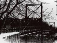
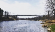
1910: Perttilä
Isokyrö, Finland - Kyrönjoki River
| Bridgemeister ID: | 2968 (added 2019-10-12) |
| Year Completed: | 1910 |
| Name: | Perttilä |
| Location: | Isokyrö, Finland |
| Crossing: | Kyrönjoki River |
| Coordinates: | 62.983733 N 22.355485 E |
| Maps: | Acme, GeoHack, Google, OpenStreetMap |
| Use: | Vehicular (one-lane) |
| Status: | Extant (last checked: 2019) |
| Main Cables: | Wire (steel) |
| Suspended Spans: | 1 |
1910: Skorpa
Kristiansund, Møre og Romsdal, Norway - Dunkersundet
| Bridgemeister ID: | 4461 (added 2020-04-25) |
| Year Completed: | 1910 |
| Name: | Skorpa |
| Location: | Kristiansund, Møre og Romsdal, Norway |
| Crossing: | Dunkersundet |
| Coordinates: | 63.123771 N 7.759424 E |
| Maps: | Acme, GeoHack, Google, kart.1881.no, OpenStreetMap |
| Use: | Footbridge |
| Status: | Removed |
| Main Cables: | Wire |
| Suspended Spans: | 2 |
| Main Span: | 1 x 40 meters (131.2 feet) estimated |
| Side Span: | 1 x 21 meters (68.9 feet) estimated |
Notes:
- Bypassed September 1, 1939. Removed at some point after. Tower piers still visible, 1970s. North tower pier removed by 2000s. South tower pier still remains, mid-2010s.
| Bridgemeister ID: | 4342 (added 2020-04-11) |
| Year Completed: | 1910 |
| Name: | Stoveland |
| Location: | Stoveland, Lindesnes, Agder, Norway |
| Crossing: | Marna |
| Coordinates: | 58.121219 N 7.529758 E |
| Maps: | Acme, GeoHack, Google, kart.1881.no, OpenStreetMap |
| Use: | Vehicular |
| Status: | Removed |
| Main Cables: | Wire (steel) |
| Main Span: | 1 x 46.3 meters (151.9 feet) estimated |
| Deck width: | 2.5 meters, expanded in 1948 to 3+ meters |
Notes:
- Removed at some point in 2009-2014 time frame.
1910: Swinging
Spelter, West Virginia, USA - West Fork River
| Bridgemeister ID: | 1983 (added 2005-12-02) |
| Year Completed: | 1910 |
| Name: | Swinging |
| Location: | Spelter, West Virginia, USA |
| Crossing: | West Fork River |
| Use: | Footbridge |
| Status: | Dismantled, 1951 |
| Main Cables: | Wire |
Notes:
- The book "Harrison County" in the "Images of America" series by Robert F. Stealey shows an image of this bridge stating it was "replaced by a new concrete span in the early 1960s".
External Links:
- Asturian-American Migration Forum :: Lleendu tema - History of Spelter, an American Asturian Community. Mentions: "The [Grasselli Company] built a swinging footbridge across the West Fork River in 1910 to connect the town of Spelter with the Fairmont-Clarksburg interurban trolley line. The trolley stop was called 'Ziesing'. Wagons forded the river to bring supplies not carried into the town by the B.&O. Railroad. A school house was built on the hill… DuPont sold the townsite in 1950, including the swinging bridge, to John J. Moschetta who immediately sold the houses to the employees occupying them at the time. Mr. Moschetta dismantled the swinging bridge in 1951… In 1962 a new cement bridge was constructed north of the old vehicular bridge."
1911: Affonso Penna
Itumbiara, Goiás and Araporã, Minas Gerais, Brazil - Paranaíba River
| Bridgemeister ID: | 7455 (added 2022-12-24) |
| Year Completed: | 1911 |
| Name: | Affonso Penna |
| Also Known As: | Afonso Pena |
| Location: | Itumbiara, Goiás and Araporã, Minas Gerais, Brazil |
| Crossing: | Paranaíba River |
| Coordinates: | 18.426530 S 49.206316 W |
| Maps: | Acme, GeoHack, Google, OpenStreetMap |
| Use: | Vehicular (one-lane) |
| Status: | In use (last checked: 2022) |
| Main Cables: | Wire (steel) |
| Suspended Spans: | 1 |
| Main Span: | 1 x 124 meters (406.8 feet) estimated |
1911: Attargu
Lingti (लिंगती) vicinity, Himachal Pradesh, India - Spiti River
| Bridgemeister ID: | 8783 (added 2024-09-01) |
| Year Completed: | 1911 |
| Name: | Attargu |
| Also Known As: | Attargo, अटार्गो ब्रिज |
| Location: | Lingti (लिंगती) vicinity, Himachal Pradesh, India |
| Crossing: | Spiti River |
| Coordinates: | 32.124333 N 78.162111 E |
| Maps: | Acme, GeoHack, Google, OpenStreetMap |
| Use: | Vehicular (one-lane) |
| Status: | Derelict |
| Main Cables: | Wire (steel) |
| Suspended Spans: | 1 |
| Main Span: | 1 |
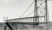
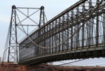
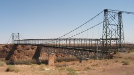
1911: Cameron
Cameron, Arizona, USA - Little Colorado River
| Bridgemeister ID: | 125 (added before 2003) |
| Year Completed: | 1911 |
| Name: | Cameron |
| Location: | Cameron, Arizona, USA |
| Crossing: | Little Colorado River |
| Coordinates: | 35.875733 N 111.412567 W |
| Maps: | Acme, GeoHack, Google, OpenStreetMap |
| Principals: | Midland Bridge Co., W.H. Code, John Charles |
| References: | GBD |
| Use: | Vehicular and Pipeline |
| Status: | Closed (last checked: 2012) |
| Main Cables: | Wire (steel) |
| Suspended Spans: | 1 |
| Main Span: | 1 x 201.2 meters (660 feet) |
Notes:
- The bridge currently carries a pipeline, but the road deck is closed to all traffic.
External Links:
Image Sets:

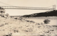
1911: Coronation
Pitlochry, Scotland, United Kingdom - River Tummel
| Bridgemeister ID: | 2621 (added 2018-12-30) |
| Year Completed: | 1911 |
| Name: | Coronation |
| Location: | Pitlochry, Scotland, United Kingdom |
| Crossing: | River Tummel |
| At or Near Feature: | Linn of Tummel vicinity |
| Coordinates: | 56.720118 N 3.793993 W |
| Maps: | Acme, GeoHack, Google, OpenStreetMap |
| Use: | Footbridge |
| Status: | In use (last checked: 2022) |
| Main Cables: | Wire (steel) |
| Suspended Spans: | 1 |
Image Sets:
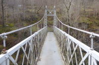
1911: Dryburgh Abbey
Dryburgh and St. Boswells, Scotland, United Kingdom - River Tweed
| Bridgemeister ID: | 6218 (added 2021-07-16) |
| Year Completed: | 1911 |
| Name: | Dryburgh Abbey |
| Location: | Dryburgh and St. Boswells, Scotland, United Kingdom |
| Crossing: | River Tweed |
| Coordinates: | 55.580452 N 2.654235 W |
| Maps: | Acme, GeoHack, Google, OpenStreetMap |
| Use: | Footbridge |
| Status: | In use (last checked: 2021) |
| Main Cables: | Wire (steel) |
| Suspended Spans: | 1 |
Notes:
- Although the current (as of 2021) Dryburgh Abbey bridge is often attributed to 1872, it more closely resembles bridges built starting in the 1890s.
- Replaced 1872 Dryburgh Abbey - Dryburgh and St. Boswells, Scotland, United Kingdom.
- Near Mertoun Estate - Mertoun, Scotland, United Kingdom.
- All past and present bridges at this location.
External Links:
- The Happy Pontist: Scottish Bridges: 15. Dryburgh Abbey Footbridge
- Structurae - Structure ID 20016083
Image Sets:
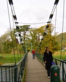
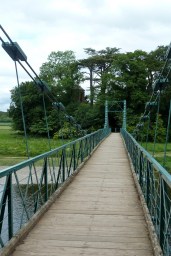
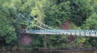
1911: Kaiwarra
Ethelton vicinity, North Canterbury, New Zealand - Hurunui River
| Bridgemeister ID: | 691 (added 2003-03-08) |
| Year Completed: | 1911 |
| Name: | Kaiwarra |
| Location: | Ethelton vicinity, North Canterbury, New Zealand |
| Crossing: | Hurunui River |
| Principals: | Arthur Falkner, T. Ridley |
| References: | GAP |
| Use: | Vehicular (one-lane) |
| Main Cables: | Wire |
| Suspended Spans: | 1 |
| Main Span: | 1 x 46.8 meters (153.5 feet) |
External Links:
1911: King George V
Newton Stewart, Scotland, United Kingdom - River Cree
| Bridgemeister ID: | 2468 (added 2008-12-19) |
| Year Completed: | 1911 |
| Name: | King George V |
| Location: | Newton Stewart, Scotland, United Kingdom |
| Crossing: | River Cree |
| Coordinates: | 54.967048 N 4.485349 W |
| Maps: | Acme, GeoHack, Google, OpenStreetMap |
| Principals: | D. H. and F. Reid Engineers, Victoria Bridge Works |
| Use: | Footbridge |
| Status: | In use (last checked: 2019) |
| Main Cables: | Wire (steel) |
| Suspended Spans: | 1 |
Notes:
- Plaques posted at the bridge indicate major refurbishments in 1982 and 2001.
External Links:
Image Sets:
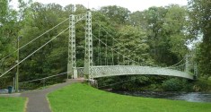
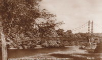
1911: Massena
Saint-Blaise, Alpes-Maritimes, France
| Bridgemeister ID: | 7202 (added 2022-07-05) |
| Year Completed: | 1911 |
| Name: | Massena |
| Location: | Saint-Blaise, Alpes-Maritimes, France |
| Coordinates: | 43.822410 N 7.241796 E |
| Maps: | Acme, GeoHack, Google, OpenStreetMap |
| Use: | Vehicular |
| Status: | Destroyed, 1944 |
| Main Cables: | Wire (steel) |
| Main Span: | 1 |
Image Sets:
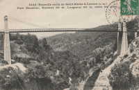
1911: Pessac-sur-Dordogne
Pessac-sur-Dordogne, Gironde and Dordogne, France - Dordogne River
| Bridgemeister ID: | 2333 (added 2007-07-09) |
| Year Completed: | 1911 |
| Name: | Pessac-sur-Dordogne |
| Location: | Pessac-sur-Dordogne, Gironde and Dordogne, France |
| Crossing: | Dordogne River |
| Status: | Removed |
| Main Cables: | Wire |
Notes:
- Replaced Pessac-sur-Dordogne - Pessac-sur-Dordogne, Gironde, France.
- All past and present bridges at this location.
Image Sets:
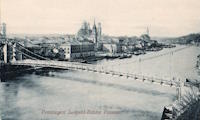
1911: Prinzregent-Luitpoldbrücke
Passau, Bavaria, Germany - Danube River
| Bridgemeister ID: | 2300 (added 2007-04-26) |
| Year Completed: | 1911 |
| Name: | Prinzregent-Luitpoldbrücke |
| Location: | Passau, Bavaria, Germany |
| Crossing: | Danube River |
| Use: | Vehicular |
| Status: | Destroyed, 1945 |
| Main Cables: | Wire (steel) |
| Suspended Spans: | 1 |
Notes:
- Near former location of 1869 Drahtsteg - Passau, Bavaria, Germany.
- Replaced by 1948 Luitpoldbrücke - Passau, Bavaria, Germany.
- All past and present bridges at this location.
Image Sets:
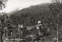
| Bridgemeister ID: | 4082 (added 2020-04-04) |
| Year Completed: | 1911 |
| Name: | Sponga |
| Location: | Setermoen, Bardu, Troms og Finnmark, Norway |
| Crossing: | Barduelva |
| Coordinates: | 68.872685 N 18.370350 E |
| Maps: | Acme, GeoHack, Google, kart.1881.no, OpenStreetMap |
| Use: | Vehicular (one-lane) |
| Status: | Removed |
| Main Cables: | Wire (steel) |
| Suspended Spans: | 1 |
| Main Span: | 1 x 50 meters (164 feet) |
| Deck width: | 2 meters |
External Links:
Image Sets:
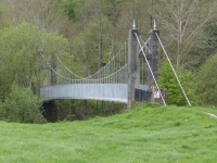
1911: Swing
Llandeilo, Wales, United Kingdom - Towy River
| Bridgemeister ID: | 1399 (added 2004-07-04) |
| Year Completed: | 1911 |
| Name: | Swing |
| Also Known As: | King's, Shaky |
| Location: | Llandeilo, Wales, United Kingdom |
| Crossing: | Towy River |
| Coordinates: | 51.884462 N 3.986061 W |
| Maps: | Acme, GeoHack, Google, OpenStreetMap |
| Use: | Footbridge |
| Status: | In use (last checked: 2018) |
| Main Cables: | Wire (steel) |
| Suspended Spans: | 1 |
External Links:
Image Sets:
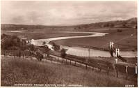
1911: Treyz
Cooks Falls, New York, USA - Beaver Kill
| Bridgemeister ID: | 6776 (added 2021-10-27) |
| Year Completed: | 1911 |
| Name: | Treyz |
| Also Known As: | George I. Treyz |
| Location: | Cooks Falls, New York, USA |
| Crossing: | Beaver Kill |
| Coordinates: | 41.956829 N 74.992559 W |
| Maps: | Acme, GeoHack, Google, OpenStreetMap |
| Principals: | John A. Roebling's Sons |
| Use: | Tramway |
| Status: | Only towers remain (last checked: 2016) |
| Main Cables: | Wire (steel) |
| Main Span: | 1 x 70 meters (229.7 feet) estimated |
| Side Spans: | 2 |
Notes:
- Facility served by the bridge closed in 1925 at which time the bridge was likely abandoned. Towers appear to still be standing (in late 2010s).
External Links:
- A Delaware County Primer complied by Sue Hudson. "West of Cooks Falls and east of Horton, on the O&W. Acid plant built here by Eugene King burned in June 1888, was rebuilt, and was later bought by local entrepreneur, George I. Treyz. Railroad suspension bridge constructed in 1911 by John A. Roebling's Sons Company of Trenton, NJ to connect Treyz's acid factory, saw mill, and planing mill on Russell Brook to the O&W, which ran on the other side of the Beaver Kill."
- Cooks Falls - Colchester Historical Society. "Arthur Leighton and George I. Treyz developed the acid factory industries in Cook's Falls... Treyz had a close relationship with the O&W Railroad, which helped both to prosper. Treyz installed a Roebling suspension bridge between his plant and the O&W Railroad. This siding was known as the Grove Switch. A narrow gauge railway was constructed and ran up Russell Brook to the Russell School. This line carried logs and sawed lumber down to the Treyz plant and the O&W Railroad."
1912: (flume bridge)
Rudsmoen, Kongsberg, Viken, Norway - Numedalslågen
| Bridgemeister ID: | 4097 (added 2020-04-05) |
| Year Completed: | 1912 |
| Name: | (flume bridge) |
| Location: | Rudsmoen, Kongsberg, Viken, Norway |
| Crossing: | Numedalslågen |
| At or Near Feature: | Gravenfoss |
| Coordinates: | 59.615535 N 9.677242 E |
| Maps: | Acme, GeoHack, Google, kart.1881.no, OpenStreetMap |
| Use: | Flume |
| Status: | Removed |
| Main Cables: | Wire (steel) |
| Suspended Spans: | 1 |
| Main Span: | 1 x 25 meters (82 feet) estimated |
Notes:
- Spans the head of a diversion channel of Numedalslågen at the crest of Gravenfoss.
- Based on historic aerial images, removed between 1979 and 2003.
- Connects to 1912 (flume bridge) - Sunnegrenda, Kongsberg, Viken, Norway.
- Connects to 1912 (flume bridge) - Sunnegrenda, Kongsberg, Viken, Norway.
- All past and present bridges at this location.
1912: (flume bridge)
Sunnegrenda, Kongsberg, Viken, Norway - Numedalslågen
| Bridgemeister ID: | 4095 (added 2020-04-05) |
| Year Completed: | 1912 |
| Name: | (flume bridge) |
| Location: | Sunnegrenda, Kongsberg, Viken, Norway |
| Crossing: | Numedalslågen |
| At or Near Feature: | Labrofossen |
| Coordinates: | 59.617045 N 9.667134 E |
| Maps: | Acme, GeoHack, Google, kart.1881.no, OpenStreetMap |
| Use: | Flume |
| Status: | Extant (last checked: 2019) |
| Main Cables: | Wire (steel) |
| Suspended Spans: | 1 |
| Main Span: | 1 x 54 meters (177.2 feet) |
Notes:
1912: (flume bridge)
Sunnegrenda, Kongsberg, Viken, Norway
| Bridgemeister ID: | 4096 (added 2020-04-05) |
| Year Completed: | 1912 |
| Name: | (flume bridge) |
| Location: | Sunnegrenda, Kongsberg, Viken, Norway |
| Coordinates: | 59.620334 N 9.667028 E |
| Maps: | Acme, GeoHack, Google, kart.1881.no, OpenStreetMap |
| Use: | Flume |
| Status: | Extant (last checked: 2019) |
| Main Cables: | Wire (steel) |
| Suspended Spans: | 2 |
| Main Spans: | 2 x 20.75 meters (68.1 feet) estimated |
Notes:
- Crosses a pair of intake tubes just south of the diversion of Numedalslågen at Labrofossen.
- Connects to 1912 (flume bridge) - Rudsmoen, Kongsberg, Viken, Norway.
- Connects to 1912 (flume bridge) - Sunnegrenda, Kongsberg, Viken, Norway.
- All past and present bridges at this location.
1912: Branstetter
Warsaw vicinity, Missouri, USA - Osage River
| Bridgemeister ID: | 2042 (added 2006-05-07) |
| Year Completed: | 1912 |
| Name: | Branstetter |
| Also Known As: | Peal Bend |
| Location: | Warsaw vicinity, Missouri, USA |
| Crossing: | Osage River |
| Principals: | Joseph A. Dice |
| References: | BOTO |
| Use: | Vehicular (one-lane) |
| Status: | Removed |
| Main Cables: | Wire (steel) |
| Main Span: | 1 x 182.9 meters (600 feet) |
Notes:
- Heavily damaged by wind, 1924. Rebuilt.
- Location inundated by the Harry S. Truman Reservoir.
External Links:
1912: County Line
Henry County and St. Clair County, Missouri, USA - Osage River
| Bridgemeister ID: | 3518 (added 2019-12-24) |
| Year Completed: | 1912 |
| Name: | County Line |
| Also Known As: | Gilbert-Harris |
| Location: | Henry County and St. Clair County, Missouri, USA |
| Crossing: | Osage River |
| Principals: | Joseph A. Dice |
| References: | BOTO |
| Use: | Vehicular (one-lane) |
| Status: | Removed |
| Main Cables: | Wire (steel) |
Notes:
- Location inundated by the Harry S. Truman Reservoir.
External Links:
- Bridgehunter.com - BH21593. Robert Hayden (BOTO) describes the County Line bridge briefly as being the first steel-towered Joe Dice bridge but the image at shows large timber towers like other pre-steel towered Dice bridges.
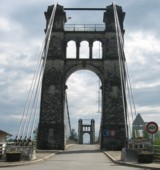
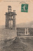
1912: Groslée
Groslée, Ain and Brangues, Isère, France - Rhône River
| Bridgemeister ID: | 1536 (added 2004-10-31) |
| Year Completed: | 1912 |
| Name: | Groslée |
| Location: | Groslée, Ain and Brangues, Isère, France |
| Crossing: | Rhône River |
| Coordinates: | 45.712333 N 5.548533 E |
| Maps: | Acme, GeoHack, Google, OpenStreetMap |
| Principals: | Ferdinand Arnodin |
| References: | BPF |
| Use: | Vehicular, with walkway |
| Status: | In use (last checked: 2019) |
| Main Cables: | Wire (steel) |
| Suspended Spans: | 1 |
| Main Span: | 1 x 177 meters (580.7 feet) estimated |
Notes:
External Links:
Image Sets:
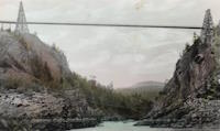
1912: Hagwilget
Hagwilget, British Columbia, Canada - Bulkley River
| Bridgemeister ID: | 1229 (added 2004-02-15) |
| Year Completed: | 1912 |
| Name: | Hagwilget |
| Also Known As: | Bulkley Canyon |
| Location: | Hagwilget, British Columbia, Canada |
| Crossing: | Bulkley River |
| At or Near Feature: | Hagwilget Canyon |
| Coordinates: | 55.257347 N 127.604616 W |
| Maps: | Acme, GeoHack, Google, OpenStreetMap |
| References: | AAJ |
| Use: | Vehicular (one-lane) |
| Status: | Replaced, 1931 |
| Main Cables: | Wire (steel) |
| Suspended Spans: | 1 |
| Main Span: | 1 x 137.5 meters (451 feet) |
| Deck width: | 9 feet |
Notes:
- AAJ: Restricted to foot traffic, 1929.
- Replaced by 1931 Hagwilget (Bulkley Canyon) - Hagwilget, British Columbia, Canada.
- See Walcott - Walcott, British Columbia, Canada. Part or all of the dismantled 1912 Hagwilget bridge may have been reused for this bridge at Walcott.
- All past and present bridges at this location.
Image Sets:

1912: Howley
Howley, Warrington, Cheshire and Latchford, England, United Kingdom - River Mersey
| Bridgemeister ID: | 1836 (added 2005-07-02) |
| Year Completed: | 1912 |
| Name: | Howley |
| Location: | Howley, Warrington, Cheshire and Latchford, England, United Kingdom |
| Crossing: | River Mersey |
| At or Near Feature: | Victoria Park |
| Coordinates: | 53.387333 N 2.57845 W |
| Maps: | Acme, GeoHack, Google, OpenStreetMap |
| Principals: | David Rowell & Co. |
| Use: | Footbridge |
| Status: | In use (last checked: 2012) |
| Main Cables: | Wire (steel) |
| Suspended Spans: | 1 |
Image Sets:
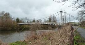
1912: Ireland's Road
Ashley Clinton vicinity, New Zealand
| Bridgemeister ID: | 693 (added 2003-03-08) |
| Year Completed: | 1912 |
| Name: | Ireland's Road |
| Also Known As: | Wilson Cutting Road |
| Location: | Ashley Clinton vicinity, New Zealand |
| Principals: | Joseph Dawson |
| References: | GAP |
| Use: | Vehicular |
| Status: | Replaced, 1968 |
| Main Span: | 1 x 43.4 meters (142.4 feet) |
Notes:
- GAP: Completed c. 1912. Replaced by culvert, c.1968.
- See 1912 Mangatewai Road (Boyle Road) - Ashley Clinton vicinity, New Zealand.
| Bridgemeister ID: | 3131 (added 2019-11-02) |
| Year Completed: | 1912 |
| Name: | Kirkesnes |
| Location: | Rundhaug, Målselv, Troms og Finnmark, Norway |
| Crossing: | Målselv |
| Coordinates: | 69.019334 N 18.897597 E |
| Maps: | Acme, GeoHack, Google, kart.1881.no, OpenStreetMap |
| Use: | Vehicular (one-lane) |
| Status: | Removed |
| Main Cables: | Wire (steel) |
Notes:
- 2010: Abutments remain.
1912: Mangatewai Road
Ashley Clinton vicinity, New Zealand - Mangatewai River
| Bridgemeister ID: | 692 (added 2003-03-08) |
| Year Completed: | 1912 |
| Name: | Mangatewai Road |
| Also Known As: | Boyle Road |
| Location: | Ashley Clinton vicinity, New Zealand |
| Crossing: | Mangatewai River |
| Principals: | Joseph Dawson |
| References: | GAP |
| Use: | Vehicular |
| Status: | Demolished, 1970 |
| Main Span: | 1 x 53.1 meters (174.2 feet) |
Notes:
- GAP: Completed c.1912. Destroyed by earthquake, 1931.
- Hamish Kynoch writes: "This bridge over the Mangatewai River was located on Boyle Road. It was damaged in the large earthquake in 1931, but stood for many years, and was used occasionally for livestock, with wooden planking over the crack in the concrete deck. It was demolished about 1970 by dynamiting the anchor blocks at one end of the bridge. There was no replacement and the old road is now closed. Another bridge of the same design was located about three miles away on Wilson Cutting Road."
- See 1912 Ireland's Road (Wilson Cutting Road) - Ashley Clinton vicinity, New Zealand.
1912: Miller
Miller, Cleburne County, Arkansas, USA - Little Red River
| Bridgemeister ID: | 1073 (added 2003-12-27) |
| Year Completed: | 1912 |
| Name: | Miller |
| Location: | Miller, Cleburne County, Arkansas, USA |
| Crossing: | Little Red River |
| At or Near Feature: | Millers Point |
| Coordinates: | 35.514000 N 92.127000 W |
| Maps: | Acme, GeoHack, Google, OpenStreetMap |
| Principals: | Henry Churchill |
| Use: | Vehicular (one-lane) |
| Status: | Inundated |
| Main Cables: | Wire (steel) |
| Suspended Spans: | 1 |
| Main Span: | 1 x 114.3 meters (375 feet) estimated |
| Deck width: | ~10 feet |
Notes:
- Built as part of same contract as nearby 1912 Winkley bridge.
- Inundated by Greer's Ferry Lake upon completion of Greer's Ferry Dam, early 1960's.
- Companion to 1912 Tumbling Shoals - Tumbling Shoals, Arkansas, USA.
- Companion to 1912 Winkley (Swinging) - Heber Springs, Arkansas, USA.
External Links:
1912: Miret
Saint-Denis-lès-Martel and Floirac, Lot, France - Dordogne River
| Bridgemeister ID: | 1986 (added 2005-12-02) |
| Year Completed: | 1912 |
| Name: | Miret |
| Also Known As: | Mezels |
| Location: | Saint-Denis-lès-Martel and Floirac, Lot, France |
| Crossing: | Dordogne River |
| Coordinates: | 44.927380 N 1.670215 E |
| Maps: | Acme, GeoHack, Google, OpenStreetMap |
| Use: | Vehicular (one-lane) |
| Status: | In use (last checked: 2019) |
| Main Cables: | Wire |
| Suspended Spans: | 1 |
| Main Span: | 1 x 140 meters (459.3 feet) |
Notes:
- Possibly completed 1914, not 1912.
- In vicinity of Mezels and Floirac.
External Links:
Image Sets:
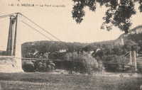
1912: Orleans
Orleans, California, USA - Klamath River
| Bridgemeister ID: | 126 (added before 2003) |
| Year Completed: | 1912 |
| Name: | Orleans |
| Location: | Orleans, California, USA |
| Crossing: | Klamath River |
| Use: | Vehicular (one-lane) |
| Status: | Destroyed, 1936? |
| Main Cables: | Wire |
Notes:
- Some accounts state this bridge was destroyed by fire in 1921. A brief mention in the July 18, 1926 edition of The Fresno Bee implies it was destroyed in June of 1926.
- Replaced by 1940 Orleans - Orleans, California, USA.
- All past and present bridges at this location.
External Links:
- Catalog Number 1983/001/SBPM01034 - Sacramento Bee. This "Center for Sacramento History" catalog entry suggests the bridge survived until 1936. Given the bridge was ultimately replaced in 1940, this later date makes more sense than some of the earlier claims of it being destroyed in the 1920s unless there were some intermediate reconstructions.
- Klamath River at Orleans - California State Library. This image shows a bridge of similar construction but apparently shorter span than the other images linked here. However, matching buildings seen in the background of multiple images place it at the same location. Given the muddled suspension bridge chronology at this location and frequency of Klamath River floods, it seems likely there were multiple reconstructions of this bridge.
- Orleans Bridge 1910 - California State Library. Image purporting to be the Orleans bridge under construction in 1910, but it does not appear to be the same location.
Image Sets:
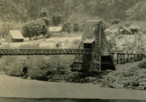
1912: Sauro
Vicenza, Veneto, Italy - Bacchiglione River
| Bridgemeister ID: | 3228 (added 2019-11-11) |
| Year Completed: | 1912 |
| Name: | Sauro |
| Location: | Vicenza, Veneto, Italy |
| Crossing: | Bacchiglione River |
| Coordinates: | 45.547632 N 11.550810 E |
| Maps: | Acme, GeoHack, Google, OpenStreetMap |
| Use: | Footbridge |
| Status: | In use (last checked: 2019) |
| Main Cables: | Wire (steel) |
| Suspended Spans: | 1 |
External Links:
1912: Sewell's Road
Scarborough, Ontario, Canada - Rouge River
| Bridgemeister ID: | 831 (added 2003-06-01) |
| Year Completed: | 1912 |
| Name: | Sewell's Road |
| Location: | Scarborough, Ontario, Canada |
| Crossing: | Rouge River |
| Coordinates: | 43.82754 N 79.19962 W |
| Maps: | Acme, GeoHack, Google, OpenStreetMap |
| Principals: | Frank Barber, Lewis Construction |
| Use: | Vehicular (one-lane) |
| Status: | In use (last checked: 2021) |
| Main Cables: | Wire (steel) |
| Suspended Spans: | 3 |
| Main Span: | 1 x 30.5 meters (100 feet) estimated |
| Side Spans: | 2 x 9.1 meters (30 feet) estimated |
Notes:
- Restoration completed April, 1981.
Image Sets:
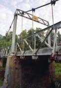
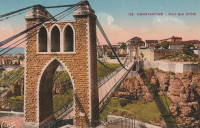
1912: Sidi M'Cid
Constantine, Algeria - Oued Rhumel
| Bridgemeister ID: | 1101 (added 2004-01-02) |
| Year Completed: | 1912 |
| Name: | Sidi M'Cid |
| Location: | Constantine, Algeria |
| Crossing: | Oued Rhumel |
| Coordinates: | 36.372592 N 6.614448 E |
| Maps: | Acme, GeoHack, Google, OpenStreetMap |
| Principals: | Ferdinand Arnodin |
| References: | AAJ |
| Use: | Vehicular (one-lane) |
| Status: | In use (last checked: 2022) |
| Main Cables: | Wire (steel) |
| Suspended Spans: | 1 |
| Main Span: | 1 x 164.6 meters (540 feet) |
| Deck width: | 19.5 feet |
External Links:
Image Sets:

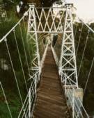
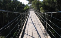
1912: Spruce Street
Hillcrest, San Diego, California, USA - Kate Sessions Canyon
| Bridgemeister ID: | 635 (added 2003-01-20) |
| Year Completed: | 1912 |
| Name: | Spruce Street |
| Location: | Hillcrest, San Diego, California, USA |
| Crossing: | Kate Sessions Canyon |
| At or Near Feature: | Bankers Hill Canyon |
| Coordinates: | 32.73878 N 117.16541 W |
| Maps: | Acme, GeoHack, Google, OpenStreetMap |
| Principals: | Edwin Capp |
| Use: | Footbridge |
| Status: | In use (last checked: 2021) |
| Main Cables: | Wire (steel) |
| Suspended Spans: | 2 |
| Main Span: | 1 x 91.4 meters (300 feet) |
| Side Span: | 1 |
External Links:
Image Sets:
1912: Tumbling Shoals
Tumbling Shoals, Arkansas, USA - Little Red River
| Bridgemeister ID: | 1072 (added 2003-12-27) |
| Year Completed: | 1912 |
| Name: | Tumbling Shoals |
| Location: | Tumbling Shoals, Arkansas, USA |
| Crossing: | Little Red River |
| Principals: | Henry Churchill |
| Use: | Vehicular |
| Status: | Removed |
| Main Cables: | Wire |
| Suspended Spans: | 1 |
| Main Span: | 1 x 134.1 meters (440 feet) estimated |
Notes:
- Built as part of same contract as nearby 1912 Winkley bridge.
- Inundated by Greer's Ferry Lake upon completion of Greer's Ferry Dam, early 1960's.
- Companion to 1912 Miller - Miller, Cleburne County, Arkansas, USA.
- Companion to 1912 Winkley (Swinging) - Heber Springs, Arkansas, USA.
External Links:
1912: Winkley
Heber Springs, Arkansas, USA - Little Red River
| Bridgemeister ID: | 127 (added before 2003) |
| Year Completed: | 1912 |
| Name: | Winkley |
| Also Known As: | Swinging |
| Location: | Heber Springs, Arkansas, USA |
| Crossing: | Little Red River |
| Coordinates: | 35.489833 N 91.973918 W |
| Maps: | Acme, GeoHack, Google, OpenStreetMap |
| Principals: | Henry Churchill |
| References: | GBD |
| Use: | Vehicular (one-lane) |
| Status: | Collapsed, 1989 |
| Main Cables: | Wire |
| Main Span: | 1 x 167.6 meters (550 feet) |
Notes:
- 1949: Wooden towers replaced by steel towers.
- 1972: Restricted to pedestrians.
- 1989, October 28: Collapsed killing 5 people and injuring 18 others.
- Location also known as "Winkley Ford" and "Turner's Ferry".
- Companion to 1912 Miller - Miller, Cleburne County, Arkansas, USA.
- Companion to 1912 Tumbling Shoals - Tumbling Shoals, Arkansas, USA.
External Links:
Image Sets:
1913: Øvre Salangen
Prestbakklia, Salangen, Troms og Finnmark, Norway - Salangsdalselva
| Bridgemeister ID: | 4083 (added 2020-04-04) |
| Year Completed: | 1913 |
| Name: | Øvre Salangen |
| Location: | Prestbakklia, Salangen, Troms og Finnmark, Norway |
| Crossing: | Salangsdalselva |
| Coordinates: | 68.867263 N 18.014549 E |
| Maps: | Acme, GeoHack, Google, kart.1881.no, OpenStreetMap |
| Use: | Vehicular (one-lane) |
| Status: | Removed |
| Main Cables: | Wire (steel) |
| Suspended Spans: | 1 |
| Main Span: | 1 x 54 meters (177.2 feet) |
External Links:
| Bridgemeister ID: | 3920 (added 2020-03-20) |
| Year Completed: | 1913 |
| Name: | Bellingmo |
| Location: | Bellingmo, Alvdal, Innlandet, Norway |
| Crossing: | Glomma |
| Coordinates: | 62.02715 N 10.78453 E |
| Maps: | Acme, GeoHack, Google, kart.1881.no, OpenStreetMap |
| Use: | Vehicular (one-lane) |
| Status: | In use (last checked: 2019) |
| Main Cables: | Wire (steel) |
| Suspended Spans: | 1 |
| Main Span: | 1 x 80 meters (262.5 feet) estimated |
1913: Brilliant
Castlegar vicinity, British Columbia, Canada - Kootenay River
| Bridgemeister ID: | 128 (added before 2003) |
| Year Completed: | 1913 |
| Name: | Brilliant |
| Also Known As: | Doukhobor |
| Location: | Castlegar vicinity, British Columbia, Canada |
| Crossing: | Kootenay River |
| Coordinates: | 49.31793 N 117.63023 W |
| Maps: | Acme, GeoHack, Google, OpenStreetMap |
| Principals: | J. R. Grant |
| References: | AAJ, PTS2 |
| Use: | Vehicular (one-lane) |
| Status: | Restricted to foot traffic (last checked: 2010) |
| Main Cables: | Wire (steel) |
| Suspended Spans: | 1 |
| Main Span: | 1 x 100.9 meters (331 feet) |
| Deck width: | 16 feet |
Notes:
- 2010, May: Bridge is reopened for pedestrian traffic after a restoration project. Bridge had been closed and derelict prior.
- Near 1984 Zuckerberg Island Heritage Park - Castlegar, British Columbia, Canada.
External Links:
1913: Desmons
Brignon, Gard, France - Gardon River
| Bridgemeister ID: | 6983 (added 2022-04-03) |
| Year Completed: | 1913 |
| Name: | Desmons |
| Location: | Brignon, Gard, France |
| Crossing: | Gardon River |
| Use: | Vehicular |
| Status: | Demolished, March, 1989 |
| Main Cables: | Wire |
| Suspended Spans: | 1 |
| Main Span: | 1 |
Notes:
External Links:
Image Sets:
1913: Fall Creek
Ithaca, New York, USA - Fall Creek Gorge
| Bridgemeister ID: | 260 (added before 2003) |
| Year Completed: | 1913 |
| Name: | Fall Creek |
| Location: | Ithaca, New York, USA |
| Crossing: | Fall Creek Gorge |
| At or Near Feature: | Cornell University campus |
| Use: | Footbridge |
| Status: | Removed |
Notes:
- Closed August, 1960.
- Replaced by 1961 Triphammer (Fall Creek) - Ithaca, New York, USA.
- All past and present bridges at this location.
Image Sets:
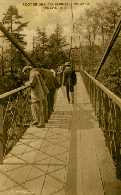
Mail | Facebook | X (Twitter) | Bluesky
