Inventory Search Results (1,301-1,400 of 3,332)
3,332 suspension bridges were found for search criteria: *. Bridges 1,301 through 1,400 (of 3,332 total) appear below. Click the Bridgemeister ID number to isolate the bridge on its own page. If you don't see what you were looking for, try an image search with the same criteria: *. This will find the bridge if it is pictured on the site, but is not a catenary suspension bridge.
Related:
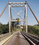
1931: Hagwilget
Hagwilget, British Columbia, Canada - Bulkley River
| Bridgemeister ID: | 170 (added before 2003) |
| Year Completed: | 1931 |
| Name: | Hagwilget |
| Also Known As: | Bulkley Canyon |
| Location: | Hagwilget, British Columbia, Canada |
| Crossing: | Bulkley River |
| At or Near Feature: | Hagwilget Canyon |
| Coordinates: | 55.25740 N 127.60380 W |
| Maps: | Acme, GeoHack, Google, OpenStreetMap |
| Principals: | BC Department of Public Works |
| References: | AAJ |
| Use: | Vehicular (one-lane) |
| Status: | In use (last checked: 2008) |
| Main Cables: | Wire (steel) |
| Suspended Spans: | 1 |
| Main Span: | 1 x 140.2 meters (460 feet) |
| Deck width: | 16 feet |
Notes:
- Replaced 1912 Hagwilget (Bulkley Canyon) - Hagwilget, British Columbia, Canada.
- All past and present bridges at this location.
External Links:
Image Sets:
1931: Long Shoal
Warsaw vicinity, Missouri, USA - Osage River
| Bridgemeister ID: | 3517 (added 2019-12-24) |
| Year Completed: | 1931 |
| Name: | Long Shoal |
| Location: | Warsaw vicinity, Missouri, USA |
| Crossing: | Osage River |
| Principals: | Joseph A. Dice |
| References: | BOTO |
| Use: | Vehicular |
| Status: | Collapsed, September 21, 1965 |
| Main Cables: | Wire (steel) |
Notes:
- Collapsed, killing three people, September 1965.
External Links:
1931: Mata River
Makarika, Waipiro, Ruatoria vicinity, New Zealand - Mata River
| Bridgemeister ID: | 735 (added 2003-03-08) |
| Year Completed: | 1931 |
| Name: | Mata River |
| Location: | Makarika, Waipiro, Ruatoria vicinity, New Zealand |
| Crossing: | Mata River |
| Coordinates: | 37.949111 S 178.211556 E |
| Maps: | Acme, GeoHack, Google, OpenStreetMap |
| References: | GAP |
| Use: | Vehicular (one-lane) |
| Status: | Replaced, c. 1960s |
| Main Cables: | Wire (steel) |
| Suspended Spans: | 1 |
| Main Span: | 1 x 151 meters (495.4 feet) |
External Links:
| Bridgemeister ID: | 1560 (added 2004-11-26) |
| Year Completed: | 1931 |
| Name: | Ponkila |
| Location: | Muhos, Finland |
| Crossing: | Muhosjoki |
| Coordinates: | 64.808996 N 26.005233 E |
| Maps: | Acme, GeoHack, Google, OpenStreetMap |
| Principals: | L. Iloniemi |
| Use: | Vehicular (one-lane) |
| Status: | Restricted to foot traffic (last checked: 2004) |
| Main Cables: | Wire (steel) |
1931: Raensbrua
Kråkebumoen vicinity, Kristiansand, Agder, Norway - Tovdalselva
| Bridgemeister ID: | 4314 (added 2020-04-10) |
| Year Completed: | 1931 |
| Name: | Raensbrua |
| Location: | Kråkebumoen vicinity, Kristiansand, Agder, Norway |
| Crossing: | Tovdalselva |
| Coordinates: | 58.277040 N 8.176805 E |
| Maps: | Acme, GeoHack, Google, kart.1881.no, OpenStreetMap |
| Use: | Footbridge |
| Status: | Only towers remain (last checked: 2019) |
| Main Cables: | Wire (steel) |
| Suspended Spans: | 1 |
| Main Span: | 1 x 75 meters (246.1 feet) estimated |
Notes:
- In a derelict state by late 2000s. Only the towers remain by late 2010s.
1931: Rubens
Los Angeles vicinity, Natales, Chile - Rio Rubens
| Bridgemeister ID: | 6917 (added 2022-01-21) |
| Year Completed: | 1931 |
| Name: | Rubens |
| Location: | Los Angeles vicinity, Natales, Chile |
| Crossing: | Rio Rubens |
| Coordinates: | 52.036240 S 71.947632 W |
| Maps: | Acme, GeoHack, Google, OpenStreetMap |
| Use: | Vehicular |
| Status: | Derelict (last checked: 2021) |
| Main Cables: | Wire (steel) |
| Main Span: | 1 x 42 meters (137.8 feet) estimated |
External Links:
- Licitan estudio de ingeniería para la reposición del puente Rubens | La Prensa Austral. "Tender for engineering study for the replacement of the Rubens bridge." Article (2018) discusses replacement of the adjacent highway bridge, but also mentions plans to restore the suspension bridge as tourist attraction.
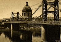
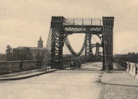
1931: Saint-Pierre
Toulouse, Haute-Garonne, France - Garonne River
| Bridgemeister ID: | 2049 (added 2006-05-21) |
| Year Completed: | 1931 |
| Name: | Saint-Pierre |
| Location: | Toulouse, Haute-Garonne, France |
| Crossing: | Garonne River |
| Coordinates: | 43.602833 N 1.435199 E |
| Maps: | Acme, GeoHack, Google, OpenStreetMap |
| Use: | Vehicular |
| Status: | Demolished, 1986 |
| Main Cables: | Wire |
Notes:
- Replaced 1852 Saint-Pierre - Toulouse, Haute-Garonne, France.
- All past and present bridges at this location.
External Links:
Image Sets:

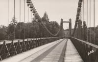
1931: Saint-Sulpice
Saint-Sulpice-la-Pointe, Tarn, France - Agout River
| Bridgemeister ID: | 7489 (added 2022-12-30) |
| Year Completed: | 1931 |
| Name: | Saint-Sulpice |
| Location: | Saint-Sulpice-la-Pointe, Tarn, France |
| Crossing: | Agout River |
| Coordinates: | 43.777048 N 1.686685 E |
| Maps: | Acme, GeoHack, Google, OpenStreetMap |
| Use: | Vehicular, with walkway |
| Status: | In use (last checked: 2022) |
| Main Cables: | Wire (steel) |
| Suspended Spans: | 1 |
Notes:
- Replaced 1849 Saint-Sulpice - Saint-Sulpice-la-Pointe, Tarn, France.
- All past and present bridges at this location.
Image Sets:
1931: Sidaway
Cleveland, Ohio, USA - Kingsbury Run
| Bridgemeister ID: | 171 (added before 2003) |
| Year Completed: | 1931 |
| Name: | Sidaway |
| Location: | Cleveland, Ohio, USA |
| Crossing: | Kingsbury Run |
| Coordinates: | 41.477805 N 81.642944 W |
| Maps: | Acme, GeoHack, Google, OpenStreetMap |
| Principals: | Wilbur Watson, Fred Plummer. New York, Chicago, and St. Louis Railroad Co. |
| References: | BMC |
| Use: | Footbridge |
| Status: | Derelict, since 1966 (last checked: 2023) |
| Main Cables: | Wire (steel) |
| Suspended Spans: | 3 |
| Main Span: | 1 x 121.9 meters (400 feet) |
| Side Spans: | 2 x 42.7 meters (140 feet) |
| Deck width: | 6 feet |
Notes:
- 2023, February: Given landmark status by the Cleveland City Council so that it is eligible to receive grants for preservation.
- BMC describes a feud between the neighborhoods on either side of the bridge that led to events in July 1966: "someone set fire to the wooden deck and ripped out fifteen feet of the southern portion. The bridge now is considered a nuisance."
- 2022, October: Added to National Register of Historic Places.
External Links:
- Sidaway Bridge once connected Black and white neighborhoods. Now it connects us to the past.. July 22, 2020 news article by News 5 (ABC) Cleveland.
- Bridgehunter.com - BH46807
- Structurae - Structure ID 20015438
Image Sets:
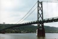
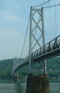
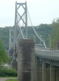
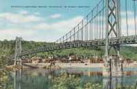
1931: Simon Kenton Memorial
Maysville, Kentucky and Aberdeen, Ohio, USA - Ohio River
| Bridgemeister ID: | 172 (added before 2003) |
| Year Completed: | 1931 |
| Name: | Simon Kenton Memorial |
| Also Known As: | Maysville |
| Location: | Maysville, Kentucky and Aberdeen, Ohio, USA |
| Crossing: | Ohio River |
| Coordinates: | 38.649890 N 83.759670 W |
| Maps: | Acme, GeoHack, Google, OpenStreetMap |
| Principals: | Modjeski, Masters & Chase |
| References: | AAJ, SJR, SSS |
| Use: | Vehicular (two-lane), with walkway |
| Status: | In use (last checked: 2022) |
| Main Cables: | Wire (steel) |
| Suspended Spans: | 3 |
| Main Span: | 1 x 323.1 meters (1,060 feet) |
| Side Spans: | 2 x 141.7 meters (464.9 feet) |
| Deck width: | 28 feet |
Notes:
- 2022, March: USD$23.4 million budgeted for rehabilitation project including suspender cable replacements, steel repairs, and painting.
- 2019: Closed late 2019 due to suspender cable corrosion. Short-term fixes applied to reduce the stress on the suspenders and to prevent rusting.
- 2020, June: Reopened with a 15-ton weight limit after installation of temporary support rods and brackets to reduce the stress on damaged cables.
External Links:
Image Sets:
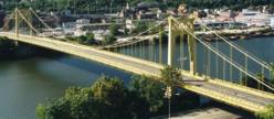
1931: South Tenth Street
Pittsburgh, Pennsylvania, USA - Monongahela River
| Bridgemeister ID: | 173 (added before 2003) |
| Year Completed: | 1931 |
| Name: | South Tenth Street |
| Also Known As: | South Side, Tenth Street, Philip Murray |
| Location: | Pittsburgh, Pennsylvania, USA |
| Crossing: | Monongahela River |
| Coordinates: | 40.43166 N 79.989 W |
| Maps: | Acme, GeoHack, Google, OpenStreetMap |
| Principals: | Sydney A. Shubin |
| References: | AAJ, BOP, BPL, PBR, SSS, USS |
| Use: | Vehicular (four-lane), with walkway |
| Status: | In use (last checked: 2019) |
| Main Cables: | Wire (steel) |
| Suspended Spans: | 3 |
| Main Span: | 1 x 228.6 meters (750 feet) |
| Side Spans: | 2 x 83.8 meters (275 feet) |
| Deck width: | 54 feet |
External Links:
Image Sets:
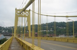
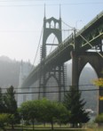
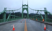
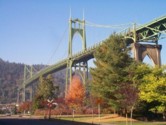
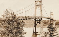
1931: St. Johns
Portland, Oregon, USA - Willamette River
| Bridgemeister ID: | 174 (added before 2003) |
| Year Completed: | 1931 |
| Name: | St. Johns |
| Location: | Portland, Oregon, USA |
| Crossing: | Willamette River |
| Coordinates: | 45.585 N 122.76333 W |
| Maps: | Acme, GeoHack, Google, OpenStreetMap |
| Principals: | Robinson and Steinman |
| References: | AAJ, ADDS, BC3, BCO, BFL, BPL, GBD, LAB, SJR |
| Use: | Vehicular (four-lane), with walkway |
| Status: | In use (last checked: 2022) |
| Main Cables: | Wire (steel) |
| Suspended Spans: | 3 |
| Main Span: | 1 x 367.9 meters (1,207 feet) |
| Side Spans: | 2 x 131.1 meters (430.25 feet) |
| Deck width: | 52 feet |
Notes:
- Substantially rehabilitated, 2003-2005.
External Links:
Image Sets:
1931: Star Mine
Rosedale, Drumheller vicinity, Alberta, Canada - Red Deer River
| Bridgemeister ID: | 350 (added before 2003) |
| Year Completed: | 1931 |
| Name: | Star Mine |
| Also Known As: | Rosedale Swinging |
| Location: | Rosedale, Drumheller vicinity, Alberta, Canada |
| Crossing: | Red Deer River |
| Coordinates: | 51.420021 N 112.614473 W |
| Maps: | Acme, GeoHack, Google, OpenStreetMap |
| Principals: | George Lester MacKenzie |
| Use: | Footbridge |
| Status: | In use (last checked: 2024) |
| Main Cables: | Wire (steel) |
| Suspended Spans: | 1 |
| Main Span: | 1 x 117 meters (383.9 feet) |
Notes:
- 1958: Rebuilt.
- 2020, May: Closed indefinitely due to safety concerns. During an inspection of the bridge "it was determined the northeast timber bridge support was in extremely poor condition."
- 2023, October: Contract to repair bridge awarded. Expected to reopen in April 2024.
Annotated Citations:
- Nairn, Lacie. "Town waiting on province for Rosedale suspension bridge repairs." The Drumheller Mail, 13 Apr. 2022, www.thestar.com/news/canada/2022/04/13/town-waiting-on-province-for-rosedale-suspension-bridge-repairs.html
The bridge is still closed. "The town initially hoped to complete repairs over the winter of 2021. However, as the land on the northern shore of the bridge was privately owned, land transfer negotiations were conducted between the Town, Alberta Transportation, and the landowner."
External Links:
Image Sets:

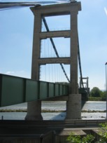
1931: Teil
Le Teil, Ardèche and Montélimar, Drôme, France - Rhône River
| Bridgemeister ID: | 1549 (added 2004-11-13) |
| Year Completed: | 1931 |
| Name: | Teil |
| Location: | Le Teil, Ardèche and Montélimar, Drôme, France |
| Crossing: | Rhône River |
| Coordinates: | 44.5519 N 4.692617 E |
| Maps: | Acme, GeoHack, Google, OpenStreetMap |
| References: | AAJ, BPF |
| Use: | Vehicular (two-lane, heavy vehicles), with walkway |
| Status: | In use (last checked: 2023) |
| Main Cables: | Wire (steel) |
| Suspended Spans: | 1 |
| Main Span: | 1 x 235 meters (771 feet) |
Notes:
- Destroyed, 1940. Rebuilt, 1943. Destroyed again, 1944. Rebuilt, 1950.
- Replaced 1839 Teil - Le Teil, Ardèche and Montélimar, Drôme, France.
- All past and present bridges at this location.
External Links:
- Pont routier du Teil - Inventaire Général du Patrimoine Culturel. Detailed history and many images of the suspension bridges at Le Teil. Translated: "In June 1940, the retreating French army cut the cables, which caused the deck and pylons to fall. A ferry was then put back into service. Rebuilt and reopened to traffic in 1943, the bridge was destroyed again in August 1944, following bombings, except for the gantries. Its reconstruction, almost identically, was undertaken from 1947 and completed in 1950, the year of its inauguration. In September 2007, following the rupture of a load-bearing cable, the bridge was closed to the public. Traffic was temporarily restored before definitive repairs were carried out in 2009."
- Structurae - Structure ID 20001106
Image Sets:
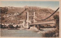
1931: Verdun-sur-Garonne
Verdun-sur-Garonne, Tarn-et-Garonne, France - Garonne River
| Bridgemeister ID: | 2347 (added 2007-08-18) |
| Year Completed: | 1931 |
| Name: | Verdun-sur-Garonne |
| Location: | Verdun-sur-Garonne, Tarn-et-Garonne, France |
| Crossing: | Garonne River |
| Coordinates: | 43.854713 N 1.242315 E |
| Maps: | Acme, GeoHack, Google, OpenStreetMap |
| Use: | Vehicular |
| Status: | Replaced, 2010 |
| Main Cables: | Wire (steel) |
| Suspended Spans: | 1 |
Notes:
- Coordinates are for the 2010 replacement suspension bridge, but construction photos of the newer bridge show the 1931 bridge was extremely close to the 2010 bridge.
- Replaced by 2010 Verdun-sur-Garonne - Verdun-sur-Garonne, Tarn-et-Garonne, France.
- See 1841 Verdun-sur-Garonne - Verdun-sur-Garonne, Tarn-et-Garonne, France. The relationship between the older and current bridges is unclear.
- All past and present bridges at this location.
External Links:
Image Sets:
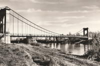
1931: Vicq-sur-Gartempe
Vicq-sur-Gartempe, Vienne, France - Gartempe River
| Bridgemeister ID: | 3997 (added 2020-03-27) |
| Year Completed: | 1931 |
| Name: | Vicq-sur-Gartempe |
| Location: | Vicq-sur-Gartempe, Vienne, France |
| Crossing: | Gartempe River |
| References: | AAJ |
| Use: | Vehicular |
| Status: | Replaced, 1989 |
| Main Cables: | Wire (steel) |
| Suspended Spans: | 1 |
Notes:
- 1989: Replaced and subsequently removed.
- Replaced 1881 Vicq-sur-Gartempe - Vicq-sur-Gartempe, Vienne, France.
- All past and present bridges at this location.
Image Sets:
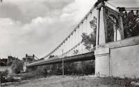
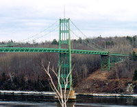
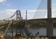
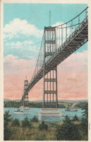
1931: Waldo-Hancock
Verona and Bucksport vicinity, Maine, USA - Penobscot River
| Bridgemeister ID: | 175 (added before 2003) |
| Year Completed: | 1931 |
| Name: | Waldo-Hancock |
| Location: | Verona and Bucksport vicinity, Maine, USA |
| Crossing: | Penobscot River |
| Coordinates: | 44.56 N 68.80333 W |
| Maps: | Acme, GeoHack, Google, OpenStreetMap |
| Principals: | Robinson and Steinman |
| References: | AAJ, ADDS, GBD, SSS, USS |
| Use: | Vehicular (two-lane, heavy vehicles), with walkway |
| Status: | Demolished, 2012 |
| Main Cables: | Wire (steel) |
| Suspended Spans: | 3 |
| Main Span: | 1 x 243.8 meters (800 feet) |
| Side Spans: | 2 x 106.7 meters (350 feet) |
| Deck width: | 27 feet |
Notes:
- Replacement cable-stayed bridge, (the Penobscot Narrows Bridge) completed, late 2006.
External Links:
Image Sets:
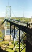
| Bridgemeister ID: | 446 (added before 2003) |
| Year Completed: | 1931 |
| Name: | Yagi-yama |
| Location: | Sendai, Miyagi, Japan |
| Coordinates: | 38.250273 N 140.852256 E |
| Maps: | Acme, GeoHack, Google, OpenStreetMap |
| Principals: | Yagi Kyubei |
| Use: | Vehicular |
| Status: | Replaced, 1965 |
| Main Cables: | Wire |
| Main Span: | 1 x 106.7 meters (350.1 feet) |
| Deck width: | 3.7 meters |
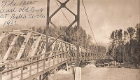
1932: (suspension bridge)
Bella Coola, British Columbia, Canada - Bella Coola River
| Bridgemeister ID: | 1436 (added 2004-07-30) |
| Year Completed: | 1932 |
| Name: | (suspension bridge) |
| Location: | Bella Coola, British Columbia, Canada |
| Crossing: | Bella Coola River |
| Status: | Removed, before 1966 |
| Main Cables: | Wire (steel) |
| Suspended Spans: | 1 |
Notes:
- Later at same location 1957 (footbridge) - Bella Coola, British Columbia, Canada.
- All past and present bridges at this location.
Image Sets:
1932: (suspension bridge)
Mangaohutu-Retaruke Road, New Zealand - Wanganui River
| Bridgemeister ID: | 738 (added 2003-03-08) |
| Year Completed: | 1932 |
| Name: | (suspension bridge) |
| Location: | Mangaohutu-Retaruke Road, New Zealand |
| Crossing: | Wanganui River |
| References: | GAP |
1932: (suspension bridge)
Placer County and El Dorado County, California, USA - Rubicon River
| Bridgemeister ID: | 5595 (added 2020-12-23) |
| Year Completed: | 1932 |
| Name: | (suspension bridge) |
| Location: | Placer County and El Dorado County, California, USA |
| Crossing: | Rubicon River |
| Coordinates: | 38.984847 N 120.694431 W |
| Maps: | Acme, GeoHack, Google, OpenStreetMap |
| Principals: | John Lawrence, US Forest Service |
| Use: | Vehicular (one-lane) |
| Status: | Derelict, since 1965 (last checked: 2020) |
| Main Cables: | Wire (steel) |
| Suspended Spans: | 1 |
| Main Span: | 1 x 48.8 meters (160 feet) |
Notes:
- Damaged by flood resulting from Hell Hole Dam failure in 1965. Never repaired.
- The September 30, 1932 edition of The Mountain Democrat (of Placerville, California) describes how a high line cable hanging 240 feet above the bridge site to transport people and material to the bridge site since the road (a now abandoned section of the Rubicon Road) had not been built yet: "They have a cable (Mr. Lawrence calls it a high-line") stretched across the Rubicon canyon a distance of more than 1100 feet. The cable has a "sag" of 165 feet, and some 240 feet straight down from the middle of the cable is the site of the 160-foot suspension bridge. And so, when a bridge worker goes to work, he climbs into a wooden cage, which travels out on the high-line until it is directly over the bridge site, and then the cage descends to the bottom of the canyon." About the bridge: "And that was no easy job, for the bridge is of the suspension type, has a 160-foot span, has one traffic lane and is designed to support a fifteen ton load."
External Links:
1932: (suspension bridge)
Rakautangi-Kohara Road, Waimarino County, New Zealand - Rakautangi Stream
| Bridgemeister ID: | 739 (added 2003-03-08) |
| Year Completed: | 1932 |
| Name: | (suspension bridge) |
| Location: | Rakautangi-Kohara Road, Waimarino County, New Zealand |
| Crossing: | Rakautangi Stream |
| References: | GAP |
1932: Bonneuil-Matours
Bonneuil-Matours, Vienne, France - Vienne River
| Bridgemeister ID: | 2356 (added 2007-08-19) |
| Year Completed: | 1932 |
| Name: | Bonneuil-Matours |
| Location: | Bonneuil-Matours, Vienne, France |
| Crossing: | Vienne River |
| Coordinates: | 46.681758 N 0.575535 E |
| Maps: | Acme, GeoHack, Google, OpenStreetMap |
| References: | AAJ |
| Use: | Vehicular (two-lane) |
| Status: | Closed, January 4, 2021 (last checked: 2022) |
| Main Cables: | Wire (steel) |
| Suspended Spans: | 1 |
Notes:
- 2021, January: Closed for replacement of deck and suspension system.
- 2021: While undergoing reconstruction, one of the piers settles abnormally.
- 2022, September: Work expected to be completed in November 2023.
- At former location of Bonneuil-Matours - Bonneuil-Matours, Vienne, France. Unclear if the newer bridge was a direct replacement.
- All past and present bridges at this location.
Image Sets:
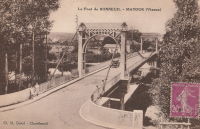
1932: Boyd Park
Eau Claire, Wisconsin, USA - Eau Claire River
| Bridgemeister ID: | 1803 (added 2005-05-18) |
| Year Completed: | 1932 |
| Name: | Boyd Park |
| Also Known As: | Uniroyal |
| Location: | Eau Claire, Wisconsin, USA |
| Crossing: | Eau Claire River |
| Coordinates: | 44.814139 N 91.486167 W |
| Maps: | Acme, GeoHack, Google, OpenStreetMap |
| Use: | Footbridge |
| Status: | Removed, 2006 |
| Main Cables: | Wire (steel) |
| Main Span: | 1 |
Image Sets:
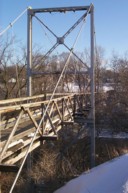
1932: Dawki
Dawki, Meghalaya, India - Dawki River
| Bridgemeister ID: | 3019 (added 2019-10-13) |
| Year Completed: | 1932 |
| Name: | Dawki |
| Location: | Dawki, Meghalaya, India |
| Crossing: | Dawki River |
| Coordinates: | 25.190051 N 92.018947 E |
| Maps: | Acme, GeoHack, Google, OpenStreetMap |
| Use: | Vehicular (one-lane) |
| Status: | In use |
| Main Cables: | Wire (steel) |
External Links:
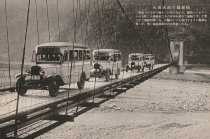
1932: Dazhuoshui
Nan'ao Township, Yilan County and Xiulin Township, Hualien County, Taiwan - Heping River
| Bridgemeister ID: | 5915 (added 2021-05-23) |
| Year Completed: | 1932 |
| Name: | Dazhuoshui |
| Also Known As: | 大濁水橋 |
| Location: | Nan'ao Township, Yilan County and Xiulin Township, Hualien County, Taiwan |
| Crossing: | Heping River |
| Coordinates: | 24.323766 N 121.742706 E |
| Maps: | Acme, GeoHack, Google, OpenStreetMap |
| Use: | Vehicular |
| Status: | Removed |
| Main Cables: | Wire (steel) |
Image Sets:
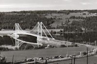
1932: Framnesbrua
Brumunddal, Ringsaker, Innlandet, Norway - Furnesfjorden
| Bridgemeister ID: | 3957 (added 2020-03-22) |
| Year Completed: | 1932 |
| Name: | Framnesbrua |
| Location: | Brumunddal, Ringsaker, Innlandet, Norway |
| Crossing: | Furnesfjorden |
| Coordinates: | 60.88195 N 10.89642 E |
| Maps: | Acme, GeoHack, Google, kart.1881.no, OpenStreetMap |
| Status: | Removed, 1989 |
| Suspended Spans: | 1 |
| Main Span: | 1 x 150 meters (492.1 feet) |
| Deck width: | 4.5 meters |
Notes:
- Deck largely damaged by storm while under construction
External Links:
- DigitaltMuseum - Framnesbrua i Bunnefjorden under bygging, skadet av sterk vind.
- DigitaltMuseum - Framnesbrua i Ringsaker.
- DigitaltMuseum - Framnesbrua under bygging, ødelagt av uvær. Veldre, Brumunddal.
- DigitaltMuseum - Framnesbrua, Brumunddal. Skade på brua under bygging.
- DigitaltMuseum - Framnesbrua, Brumunddal. Skader på brua under bygging før betongdekket er lagt.
- DigitaltMuseum - Framnesbrua, Kvarbergsvika, Nes.
- DigitaltMuseum - Framnesbrua, Ringsaker fra Veldresiden. Krøtter i vegen.
- DigitaltMuseum - Framnesbrua. Hengebru. Brumunddal-Nes over Mjøsa. Åpnet 1932.
- DigitaltMuseum - Skader på Framnesbrua under byggingen, stormkast før det ble lagt betongdekke. Ringsaker.
Image Sets:
1932: Gennes
Gennes and Les Rosiers-sur-Loire, Maine-et-Loire, France - Loire River
| Bridgemeister ID: | 1173 (added 2004-01-23) |
| Year Completed: | 1932 |
| Name: | Gennes |
| Location: | Gennes and Les Rosiers-sur-Loire, Maine-et-Loire, France |
| Crossing: | Loire River |
| Coordinates: | 47.345895 N 0.230081 W |
| Maps: | Acme, GeoHack, Google, OpenStreetMap |
| Use: | Vehicular |
| Status: | Destroyed, 1940 |
Notes:
- Replaced 1842 Gennes - Gennes and Les Rosiers-sur-Loire, Maine-et-Loire, France.
- Connects to 1932 Les Rosiers-sur-Loire - Les Rosiers-sur-Loire and Gennes, Maine-et-Loire, France.
- Replaced by 1948 Gennes - Gennes and Les Rosiers-sur-Loire, Maine-et-Loire, France.
- All past and present bridges at this location.
Image Sets:
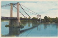
1932: Gué de Senac
Les Peintures and Chamadelle, Gironde, France - Dronne River
| Bridgemeister ID: | 7850 (added 2023-09-09) |
| Year Completed: | 1932 |
| Name: | Gué de Senac |
| Location: | Les Peintures and Chamadelle, Gironde, France |
| Crossing: | Dronne River |
| Coordinates: | 45.078922 N 0.087016 W |
| Maps: | Acme, GeoHack, Google, OpenStreetMap |
| Use: | Vehicular |
| Status: | Demolished, 2011 |
| Main Cables: | Wire (steel) |
| Suspended Spans: | 1 |
| Main Span: | 1 |
Notes:
- Replaced 1845 Gué de Senac - Les Peintures and Chamadelle, Gironde, France.
- All past and present bridges at this location.
External Links:
- Art-et-Histoire - Pont de Gué de Senac à Chamadelle - 1845
- Dans le rétro : le pont du Gué de Sénac sur la Dronne. Article about the suspension bridges at this location. Published March 8, 2022.
Image Sets:
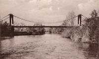
1932: Hamilton Gorge
Sequoia National Park, California, USA
| Bridgemeister ID: | 8886 (added 2024-11-22) |
| Year Completed: | 1932 |
| Name: | Hamilton Gorge |
| Location: | Sequoia National Park, California, USA |
| At or Near Feature: | High Sierra Trail |
| Coordinates: | 36.566500 N 118.571972 W |
| Maps: | Acme, GeoHack, Google, OpenStreetMap |
| Use: | Footbridge |
| Status: | Destroyed, 1937 |
| Main Cables: | Wire (iron) |
| Suspended Spans: | 1 |
Notes:
- Coordinates are likely location just northeast of the largest of the Hamilton Lakes. Possibly the bridge crossed the next gorge along the trail, about 360 meters east.
- 1937: Destroyed by avalanche.
External Links:
- Bridges, Hamilton Gorge Bridge, looking west — Calisphere. Image of the bridge.
- National Park Service - NP Gallery. Image of the bridge dated October 21, 1932. One of many images of the bridge in this gallery.
- National Park Service - NP Gallery. Search results for "Hamilton Gorge" showing 30+ images of the bridge.
1932: Horse
Milford Sound vicinity, New Zealand - Cleddau River
| Bridgemeister ID: | 741 (added 2003-03-08) |
| Year Completed: | 1932 |
| Name: | Horse |
| Location: | Milford Sound vicinity, New Zealand |
| Crossing: | Cleddau River |
| Coordinates: | 44.703778 S 167.967861 E |
| Maps: | Acme, GeoHack, Google, OpenStreetMap |
| References: | GAP |
| Use: | Pack and Footbridge |
| Status: | In use (last checked: 2022) |
| Main Cables: | Wire (steel) |
| Suspended Spans: | 1 |
| Main Span: | 1 x 36.5 meters (119.8 feet) |
1932: Lacy's
Retaruke, New Zealand - Retaruke River
| Bridgemeister ID: | 740 (added 2003-03-08) |
| Year Completed: | 1932 |
| Name: | Lacy's |
| Location: | Retaruke, New Zealand |
| Crossing: | Retaruke River |
| Coordinates: | 39.108536 S 175.075048 E |
| Maps: | Acme, GeoHack, Google, OpenStreetMap |
| Principals: | Bill Baker |
| References: | GAP |
| Use: | Vehicular (one-lane) |
| Status: | In use (last checked: 2013) |
| Main Cables: | Wire (steel) |
| Suspended Spans: | 1 |
| Main Span: | 1 x 45.7 meters (149.9 feet) |
Notes:
- GAP: Damaged by flood, 1940.
- Replaced 1920 Lacy's - New Zealand.
- All past and present bridges at this location.
External Links:
1932: Les Rosiers-sur-Loire
Les Rosiers-sur-Loire and Gennes, Maine-et-Loire, France - Loire River
| Bridgemeister ID: | 6763 (added 2021-10-25) |
| Year Completed: | 1932 |
| Name: | Les Rosiers-sur-Loire |
| Location: | Les Rosiers-sur-Loire and Gennes, Maine-et-Loire, France |
| Crossing: | Loire River |
| Coordinates: | 47.348253 N 0.227990 W |
| Maps: | Acme, GeoHack, Google, OpenStreetMap |
| Use: | Vehicular |
| Status: | Destroyed, 1940 |
| Main Cables: | Wire |
| Main Span: | 1 |
Notes:
- Replaced 1842 Les Rosiers-sur-Loire - Les Rosiers-sur-Loire and Gennes, Maine-et-Loire, France.
- Connects to 1932 Les Rosiers-sur-Loire - Les Rosiers-sur-Loire and Gennes, Maine-et-Loire, France.
- Replaced by 1948 Les Rosiers-sur-Loire - Les Rosiers-sur-Loire and Gennes, Maine-et-Loire, France.
- All past and present bridges at this location.
Image Sets:
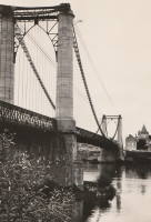
1932: Lewis River
Yale, Washington, USA - Lewis River
| Bridgemeister ID: | 176 (added before 2003) |
| Year Completed: | 1932 |
| Name: | Lewis River |
| Also Known As: | Yale |
| Location: | Yale, Washington, USA |
| Crossing: | Lewis River |
| Coordinates: | 45.96167 N 122.37167 W |
| Maps: | Acme, GeoHack, Google, OpenStreetMap |
| Principals: | Harold H. Gilbert, Gilpin Construction Co. |
| References: | AAJ, SPW, SSS |
| Use: | Vehicular (one-lane) |
| Status: | In use (last checked: 2005) |
| Main Cables: | Wire (steel) |
| Suspended Spans: | 1 |
| Main Span: | 1 x 91.4 meters (300 feet) |
| Deck width: | 17 feet |
Notes:
- Rebuilt 1957, 1958.
External Links:
Image Sets:
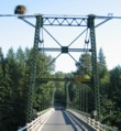
1932: Marmande
Marmande, Lot-et-Garonne, France - Garonne River
| Bridgemeister ID: | 1604 (added 2005-02-06) |
| Year Completed: | 1932 |
| Name: | Marmande |
| Also Known As: | Renaud Jean |
| Location: | Marmande, Lot-et-Garonne, France |
| Crossing: | Garonne River |
| Coordinates: | 44.498957 N 0.155951 E |
| Maps: | Acme, GeoHack, Google, OpenStreetMap |
| Use: | Vehicular (two-lane), with walkway |
| Status: | In use (last checked: 2020) |
| Main Cables: | Wire (steel) |
| Suspended Spans: | 1 |
Notes:
- Replaced 1838 Marmande - Marmande, Lot-et-Garonne, France.
- All past and present bridges at this location.
External Links:
Image Sets:
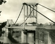
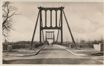
| Bridgemeister ID: | 4546 (added 2020-05-30) |
| Year Completed: | 1932 |
| Name: | Poujol |
| Location: | Le Poujol-sur-Orb, Lamalou-les-Bains vicinity, Hérault, France |
| Crossing: | Orb River |
| Coordinates: | 43.575381 N 3.063561 E |
| Maps: | Acme, GeoHack, Google, OpenStreetMap |
| Use: | Vehicular (one-lane) |
| Status: | In use (last checked: 2019) |
| Main Cables: | Wire (steel) |
| Suspended Spans: | 1 |
| Main Span: | 1 x 114.5 meters (375.7 feet) estimated |
External Links:
Image Sets:
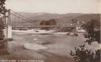
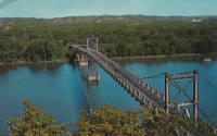
1932: Prairie du Chien
Praire du Chien, Wisconsin and Marquette, Iowa, USA - Mississippi River
| Bridgemeister ID: | 177 (added before 2003) |
| Year Completed: | 1932 |
| Name: | Prairie du Chien |
| Location: | Praire du Chien, Wisconsin and Marquette, Iowa, USA |
| Crossing: | Mississippi River |
| Coordinates: | 43.046 N 91.17 W |
| Maps: | Acme, GeoHack, Google, OpenStreetMap |
| Principals: | Austin Bridge Co. |
| References: | AAJ, AUB, BPL |
| Use: | Vehicular (two-lane) |
| Status: | Removed, 1974 |
| Main Cables: | Wire (steel) |
| Main Span: | 1 x 144.2 meters (473 feet) |
Notes:
- There were two back-to-back suspension bridges at this location.
- Connects to 1932 Prairie du Chien - Praire du Chien, Wisconsin and Marquette, Iowa, USA.
- All past and present bridges at this location.
External Links:
Image Sets:
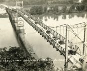
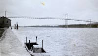
1932: Prairie du Chien
Praire du Chien, Wisconsin and Marquette, Iowa, USA - Mississippi River
| Bridgemeister ID: | 1256 (added before 2003) |
| Year Completed: | 1932 |
| Name: | Prairie du Chien |
| Location: | Praire du Chien, Wisconsin and Marquette, Iowa, USA |
| Crossing: | Mississippi River |
| Coordinates: | 43.05 N 91.162 W |
| Maps: | Acme, GeoHack, Google, OpenStreetMap |
| Principals: | Austin Bridge Co. |
| References: | AAJ, AUB, BPL |
| Use: | Vehicular (two-lane) |
| Status: | Removed, 1974 |
| Main Cables: | Wire (steel) |
| Main Span: | 1 x 144.2 meters (473 feet) |
Notes:
- There were two back-to-back suspension bridges at this location.
- Connects to 1932 Prairie du Chien - Praire du Chien, Wisconsin and Marquette, Iowa, USA.
- All past and present bridges at this location.
External Links:
Image Sets:


| Bridgemeister ID: | 4343 (added 2020-04-11) |
| Year Completed: | 1932 |
| Name: | Prestefossen |
| Location: | Valle, Agder, Norway |
| Crossing: | Otra |
| Coordinates: | 59.212189 N 7.529565 E |
| Maps: | Acme, GeoHack, Google, kart.1881.no, OpenStreetMap |
| Use: | Footbridge |
| Status: | Replaced, 2016 |
| Main Cables: | Wire |
Notes:
Image Sets:
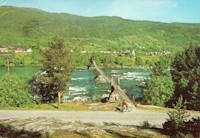
1932: Salzinnes
Namur, Belgium - Sambre River
| Bridgemeister ID: | 8961 (added 2024-11-30) |
| Year Completed: | 1932 |
| Name: | Salzinnes |
| Location: | Namur, Belgium |
| Crossing: | Sambre River |
| Coordinates: | 50.464278 N 4.855861 E |
| Maps: | Acme, GeoHack, Google, OpenStreetMap |
| Use: | Footbridge |
| Status: | Removed, 1940 |
| Main Cables: | Eyebar |
| Suspended Spans: | 1 |
External Links:
- PONTS SUSPENDUS - Les ponts métalliques historiques belges. Details about this bridge and several other Belgium suspension bridges.
| Bridgemeister ID: | 8455 (added 2024-03-13) |
| Year Completed: | 1932 |
| Name: | Sultan Ismail |
| Also Known As: | Kuala Krai, Gertak Gantung Sungai Nal |
| Location: | Kuala Krai, Kelantan, Malaysia |
| Crossing: | Nal River |
| Coordinates: | 5.602694 N 102.191778 E |
| Maps: | Acme, GeoHack, Google, OpenStreetMap |
| Use: | Vehicular |
| Status: | Derelict (last checked: 2024) |
| Main Cables: | Wire (iron) |
| Suspended Spans: | 3 |
| Main Span: | 1 |
| Side Spans: | 2 |
Notes:
- A monument at the bridge states it was opened in April 1932. Most other sources state it was completed at some point in the 1920s.
External Links:
- Bernama - Over Century-Old British-Era Suspension Bridge on the Verge of Collapse. Article dated March 11, 2024. Concerns are mounting over the imminent collapse of the derelict bridge. It was bypassed in 1986.
- Bernama - RM3 Million Needed To Restore Sultan Ismail Suspension Bridge. Article dated October 11, 2024. "Approximately RM3 million is required to repair the ageing Sultan Ismail Suspension Bridge, which is over 100 years old and currently shows signs of leaning, posing a risk of collapse."
- Wikipedia - Kuala Krai Bridge
1932: Villebrumier
Villebrumier, Tarn-et-Garonne, France - Tarn River
| Bridgemeister ID: | 1708 (added 2005-03-30) |
| Year Completed: | 1932 |
| Name: | Villebrumier |
| Location: | Villebrumier, Tarn-et-Garonne, France |
| Crossing: | Tarn River |
| Coordinates: | 43.903905 N 1.453091 E |
| Maps: | Acme, GeoHack, Google, OpenStreetMap |
| Use: | Vehicular (two-lane) |
| Status: | In use (last checked: 2019) |
| Main Cables: | Wire (steel) |
| Suspended Spans: | 1 |
Notes:
- Replaced Villebrumier - Villebrumier, Tarn-et-Garonne, France.
- All past and present bridges at this location.
External Links:
Image Sets:
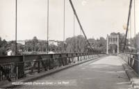
1932: Villemur-sur-Tarn
Villemur-sur-Tarn, Haute-Garonne, France - Tarn River
| Bridgemeister ID: | 1852 (added 2005-07-16) |
| Year Completed: | 1932 |
| Name: | Villemur-sur-Tarn |
| Location: | Villemur-sur-Tarn, Haute-Garonne, France |
| Crossing: | Tarn River |
| Coordinates: | 43.862459 N 1.505214 E |
| Maps: | Acme, GeoHack, Google, OpenStreetMap |
| Use: | Vehicular (two-lane), with walkway |
| Status: | In use (last checked: 2016) |
| Main Cables: | Wire (steel) |
| Suspended Spans: | 1 |
Notes:
- Replaced 1924 Villemur-sur-Tarn - Villemur-sur-Tarn, Haute-Garonne, France.
- All past and present bridges at this location.
External Links:
Image Sets:
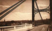
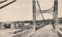
1932: Viterbe
Viterbe, Saint-Paul-Cap-de-Joux vicinity and Brazis, Tarn, France - Agout River
| Bridgemeister ID: | 2312 (added 2007-05-03) |
| Year Completed: | 1932 |
| Name: | Viterbe |
| Location: | Viterbe, Saint-Paul-Cap-de-Joux vicinity and Brazis, Tarn, France |
| Crossing: | Agout River |
| Coordinates: | 43.67635 N 1.93136 E |
| Maps: | Acme, GeoHack, Google, OpenStreetMap |
| Use: | Vehicular (one-lane) |
| Status: | In use (last checked: 2024) |
| Suspended Spans: | 1 |
Notes:
- 2024, June: Repairs completed to fix an issue with one of the main cables and several suspenders.
Image Sets:
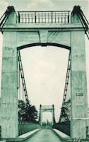
| Bridgemeister ID: | 3904 (added 2020-03-14) |
| Year Completed: | 1932 |
| Name: | Vrengen |
| Location: | Kjøpmannskjær, Nøtterøy and Tjøme, Færder, Vestfold og Telemark, Norway |
| Crossing: | Vrengen |
| Coordinates: | 59.16666 N 10.38559 E |
| Maps: | Acme, GeoHack, Google, kart.1881.no, OpenStreetMap |
| Use: | Vehicular |
| Status: | Removed, 1983 |
| Main Cables: | Wire (steel) |
| Main Span: | 1 x 162 meters (531.5 feet) estimated |
Notes:
- Bypassed, 1981. Removed, 1983.
External Links:
- DigitaltMuseum - Vrengen bru Vestfold 1932
- DigitaltMuseum - Vrengen bru Vestfold åpnet 1932
- DigitaltMuseum - Vrengen bru Vestfold åpnet 1932
Image Sets:
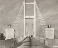
1933: (footbridge)
Buhølen, Lindesnes, Agder, Norway - Skarpesvingen
| Bridgemeister ID: | 4392 (added 2020-04-18) |
| Year Completed: | 1933 |
| Name: | (footbridge) |
| Location: | Buhølen, Lindesnes, Agder, Norway |
| Crossing: | Skarpesvingen |
| Coordinates: | 58.118716 N 7.341573 E |
| Maps: | Acme, GeoHack, Google, kart.1881.no, OpenStreetMap |
| Use: | Footbridge |
| Status: | Removed |
| Main Cables: | Wire (steel) |
| Suspended Spans: | 1 |
| Main Span: | 1 x 40 meters (131.2 feet) estimated |
Notes:
- Likely completed in 1933 or soon after. The bridge was built to provide access to a school built in 1933.
- Based on historic aerial images, removed at some point in time frame 1968-2004.
| Bridgemeister ID: | 178 (added before 2003) |
| Year Completed: | 1933 |
| Name: | (footbridge) |
| Location: | Palatka, Florida, USA |
| At or Near Feature: | Ravine Gardens State Park |
| Coordinates: | 29.63481 N 81.64594 W |
| Maps: | Acme, GeoHack, Google, OpenStreetMap |
| Use: | Footbridge |
| Status: | In use (last checked: 2021) |
| Main Cables: | Wire (steel) |
| Suspended Spans: | 1 |
| Main Span: | 1 |
Notes:
- Near 1933 (footbridge) - Palatka, Florida, USA. There are two nearby footbridges in this park. It is not clear if both were constructed in 1933.
External Links:
| Bridgemeister ID: | 2425 (added before 2003) |
| Year Completed: | 1933 |
| Name: | (footbridge) |
| Location: | Palatka, Florida, USA |
| At or Near Feature: | Ravine Gardens State Park |
| Coordinates: | 29.63343 N 81.64323 W |
| Maps: | Acme, GeoHack, Google, OpenStreetMap |
| Use: | Footbridge |
| Status: | In use (last checked: 2018) |
| Main Cables: | Wire (steel) |
| Suspended Spans: | 1 |
Notes:
- Near 1933 (footbridge) - Palatka, Florida, USA. There are two nearby footbridges in this park. It is not clear if both were constructed in 1933.
Image Sets:
1933: (suspension bridge)
Carluke vicinity, New Zealand - Tunakino River
| Bridgemeister ID: | 746 (added 2003-03-08) |
| Year Completed: | 1933 |
| Name: | (suspension bridge) |
| Location: | Carluke vicinity, New Zealand |
| Crossing: | Tunakino River |
| References: | GAP |
Notes:
- Distinct from other 1933 bridge in same vicinity.
1933: (suspension bridge)
Carluke vicinity, New Zealand - Tunakino River
| Bridgemeister ID: | 747 (added 2003-03-08) |
| Year Completed: | 1933 |
| Name: | (suspension bridge) |
| Location: | Carluke vicinity, New Zealand |
| Crossing: | Tunakino River |
| References: | GAP |
1933: (suspension bridge)
S.J. Butt's property, Marlborough, New Zealand - Rai River
| Bridgemeister ID: | 749 (added 2003-03-08) |
| Year Completed: | 1933 |
| Name: | (suspension bridge) |
| Location: | S.J. Butt's property, Marlborough, New Zealand |
| Crossing: | Rai River |
| References: | GAP |
Notes:
- GAP: completed circa 1933.
1933: (suspension bridge)
Totoro Road, New Zealand - Mokau River
| Bridgemeister ID: | 743 (added 2003-03-08) |
| Year Completed: | 1933 |
| Name: | (suspension bridge) |
| Location: | Totoro Road, New Zealand |
| Crossing: | Mokau River |
| References: | GAP |
Notes:
- GAP: Replaced.
1933: Andervag
Engenes vicinity, Ibestad, Troms og Finnmark, Norway
| Bridgemeister ID: | 2737 (added 2019-06-23) |
| Year Completed: | 1933 |
| Name: | Andervag |
| Location: | Engenes vicinity, Ibestad, Troms og Finnmark, Norway |
| Coordinates: | 68.913494 N 17.188251 E |
| Maps: | Acme, GeoHack, Google, kart.1881.no, OpenStreetMap |
| Use: | Vehicular (one-lane) |
| Status: | Restricted to foot traffic (last checked: 2010) |
| Main Cables: | Wire (steel) |
| Suspended Spans: | 1 |
| Bridgemeister ID: | 7086 (added 2022-05-29) |
| Year Completed: | 1933 |
| Name: | Colonial |
| Location: | Guamo, Tolima, Colombia |
| Crossing: | Rio Luisa |
| Coordinates: | 4.036234 N 74.969426 W |
| Maps: | Acme, GeoHack, Google, OpenStreetMap |
| Status: | In use (last checked: 2022) |
| Main Cables: | Wire (steel) |
| Suspended Spans: | 1 |
| Main Span: | 1 |
External Links:
- Google Maps. Photo of the bridge, November 2021.
- Puente colonial del Guamo, Tolima: un mito en la campaña de Simón Bolívar. States the bridge was built in 1933 and rebuilt after a 1942 collapse.
- YouTube - El Puente de Tabla en el Guamo, patrimonio histórico del Tolima | RTVC Noticias. Television news story about the bridge, posted November 2021.
1933: Dalton's
New Zealand - Pelorus River
| Bridgemeister ID: | 744 (added 2003-03-08) |
| Year Completed: | 1933 |
| Name: | Dalton's |
| Location: | New Zealand |
| Crossing: | Pelorus River |
| References: | GAP |
| Use: | Footbridge |
1933: Denham
Garraway Stream, Mahdia vicinity, Guyana - Potaro River
| Bridgemeister ID: | 2979 (added 2019-10-12) |
| Year Completed: | 1933 |
| Name: | Denham |
| Location: | Garraway Stream, Mahdia vicinity, Guyana |
| Crossing: | Potaro River |
| Coordinates: | 5.380437 N 59.120818 W |
| Maps: | Acme, GeoHack, Google, OpenStreetMap |
| Principals: | John Aldi |
| Use: | Vehicular (one-lane) |
| Status: | In use (last checked: 2020) |
| Main Cables: | Wire (steel) |
| Suspended Spans: | 1 |
Notes:
- Coordinates are suspected location of this bridge, but not confirmed.
Image Sets:
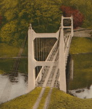
1933: Green's Mill
Camden County, Missouri, USA - Little Niangua River
| Bridgemeister ID: | 179 (added before 2003) |
| Year Completed: | 1933 |
| Name: | Green's Mill |
| Also Known As: | Little Niangua, J Road |
| Location: | Camden County, Missouri, USA |
| Crossing: | Little Niangua River |
| Coordinates: | 38.065326 N 92.909309 W |
| Maps: | Acme, GeoHack, Google, OpenStreetMap |
| Principals: | Howard Mullins, Scully Steel Co., American Steel & Wire Co., Clinton Bridge Works |
| References: | AAJ, SSS, USS |
| Use: | Vehicular (two-lane, heavy vehicles) |
| Status: | Bypassed, 2020 (last checked: 2023) |
| Main Cables: | Wire (steel) |
| Suspended Spans: | 3 |
| Main Span: | 1 x 68.6 meters (225 feet) |
| Side Spans: | 1 x 34.3 meters (112.5 feet), 1 x 34.3 meters (112.4 feet) |
| Deck width: | 20 feet |
| Characteristics: | Self-anchored |
Notes:
- Self-anchored.
- 2007, October: Closed for a few weeks for emergency repairs. According to an October 4, 2007 article in the Lake Sun Leader (Missouri): "a routine inspection revealed a problem in the substructure... too much movement was detected at a location underneath the north side of the bridge." Other sources mentioned a faulty "pin."
- 2018: Missouri Department of Transportation (MoDOT) plans to replace the bridge and is seeking groups to take ownership of the bridge and possibly relocate it.
- 2020: A new bridge is completed, bypassing the suspension bridge.
- 2023, March: Ownership transferred from Missouri Department of Transportation to Green's Mill Historic Bridge, Inc. to preserve the since bypassed bridge.
External Links:
Image Sets:
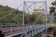
1933: Happy Camp
Happy Camp, California, USA - Klamath River
| Bridgemeister ID: | 1011 (added 2003-11-21) |
| Year Completed: | 1933 |
| Name: | Happy Camp |
| Location: | Happy Camp, California, USA |
| Crossing: | Klamath River |
| Coordinates: | 41.790056 N 123.377639 W |
| Maps: | Acme, GeoHack, Google, OpenStreetMap |
| Principals: | WPA |
| References: | AAJ |
| Use: | Vehicular (one-lane) |
| Status: | Dismantled |
| Main Cables: | Wire (steel) |
| Suspended Spans: | 1 |
| Main Span: | 1 x 91.4 meters (300 feet) |
Notes:
- Coordinates are for the current (2020s) crossing at Happy Camp. The suspension bridge was either at the same location or very close based on contemporary topographic maps.
- Moved to Cassidy - Sierra National Forest, California, USA. The bridge was disassembled, shortened, and relocated in the 1950's to the Ansel Adams Wilderness, Minarets Ranger District, Sierra National Forest, California as the "Cassidy" suspension bridge.
1933: Lamagistère
Lamagistère, Tarn-et-Garonne, France - Garonne River
| Bridgemeister ID: | 2963 (added 2019-10-06) |
| Year Completed: | 1933 |
| Name: | Lamagistère |
| Location: | Lamagistère, Tarn-et-Garonne, France |
| Crossing: | Garonne River |
| Coordinates: | 44.123552 N 0.819466 E |
| Maps: | Acme, GeoHack, Google, OpenStreetMap |
| Use: | Vehicular (two-lane) |
| Status: | In use (last checked: 2019) |
| Main Cables: | Wire (steel) |
| Suspended Spans: | 2 |
| Main Spans: | 2 |
Notes:
- Replaced 1876 Lamagistère - Lamagistère, Tarn-et-Garonne, France.
- All past and present bridges at this location.
External Links:
Image Sets:
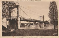
| Bridgemeister ID: | 3935 (added 2020-03-20) |
| Year Completed: | 1933 |
| Name: | Moan |
| Location: | Alvdal, Innlandet, Norway |
| Crossing: | Folla |
| Coordinates: | 62.11163 N 10.61047 E |
| Maps: | Acme, GeoHack, Google, kart.1881.no, OpenStreetMap |
| Use: | Vehicular (one-lane) |
| Status: | Removed, 1983 |
| Main Cables: | Wire (steel) |
| Suspended Spans: | 1 |
| Main Span: | 1 x 93 meters (305.1 feet) estimated |
External Links:
1933: Pertuiset
Pertuiset, Firminy vicinity, Loire, France - Loire River
| Bridgemeister ID: | 1166 (added 2004-01-19) |
| Year Completed: | 1933 |
| Name: | Pertuiset |
| Location: | Pertuiset, Firminy vicinity, Loire, France |
| Crossing: | Loire River |
| Coordinates: | 45.408785 N 4.248029 E |
| Maps: | Acme, GeoHack, Google, OpenStreetMap |
| Use: | Vehicular (one-lane) |
| Status: | Demolished, 1990 |
| Main Cables: | Wire (steel) |
| Suspended Spans: | 1 |
Notes:
- Bypassed by a cable-stayed bridge, 1989.
- Replaced 1842 Pertuiset - Pertuiset, Firminy vicinity, Loire, France.
- All past and present bridges at this location.
External Links:
Image Sets:
1933: Rutland's
New Zealand - Pelorus River
| Bridgemeister ID: | 745 (added 2003-03-08) |
| Year Completed: | 1933 |
| Name: | Rutland's |
| Location: | New Zealand |
| Crossing: | Pelorus River |
| References: | GAP |
| Use: | Footbridge |
1933: Sablons
Sablons, Isère and Serrières, Ardèche, France - Rhône River
| Bridgemeister ID: | 891 (added 2003-09-06) |
| Year Completed: | 1933 |
| Name: | Sablons |
| Location: | Sablons, Isère and Serrières, Ardèche, France |
| Crossing: | Rhône River |
| Status: | Destroyed, 1944 |
Notes:
- Replaced 1828 Sablons - Sablons, Isère and Serrières, Ardèche, France.
- Replaced by 1951 Sablons - Sablons, Isère and Serrières, Ardèche, France.
- All past and present bridges at this location.
Image Sets:
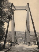
1933: San Rafael
Mao, Dominican Republic - Rio Yakue Del Norte
| Bridgemeister ID: | 447 (added before 2003) |
| Year Completed: | 1933 |
| Name: | San Rafael |
| Location: | Mao, Dominican Republic |
| Crossing: | Rio Yakue Del Norte |
| Principals: | John A. Roebling's Sons Co. |
| References: | AAJ, SJR, SSS |
| Use: | Vehicular (two-lane, heavy vehicles) |
| Main Cables: | Wire (steel) |
| Suspended Spans: | 1 |
| Main Span: | 1 x 137.6 meters (451.5 feet) |
| Deck width: | 18 feet |
1933: Sims
Sims, California, USA - Sacramento River
| Bridgemeister ID: | 650 (added 2003-02-22) |
| Year Completed: | 1933 |
| Name: | Sims |
| Also Known As: | CCC |
| Location: | Sims, California, USA |
| Crossing: | Sacramento River |
| At or Near Feature: | Sims Camp |
| Coordinates: | 41.063433 N 122.360067 W |
| Maps: | Acme, GeoHack, Google, OpenStreetMap |
| Principals: | Raymond Huber, Civilian Conservation Corps |
| References: | AAJ |
| Use: | Vehicular (one-lane) |
| Status: | Restricted to foot traffic (last checked: 2021) |
| Main Cables: | Wire (steel) |
| Suspended Spans: | 1 |
| Main Span: | 1 x 48.8 meters (160 feet) |
Notes:
- CCC is "Civilian Conservation Corps".
External Links:
Image Sets:
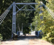
1933: Sparke Evans Park
Saint Philips, Bristol, England, United Kingdom - River Avon
| Bridgemeister ID: | 2506 (added 2009-03-27) |
| Year Completed: | 1933 |
| Name: | Sparke Evans Park |
| Location: | Saint Philips, Bristol, England, United Kingdom |
| Crossing: | River Avon |
| Coordinates: | 51.44485 N 2.56314 W |
| Maps: | Acme, GeoHack, Google, OpenStreetMap |
| Principals: | David Rowell & Co. |
| Use: | Footbridge |
| Status: | In use (last checked: 2021) |
| Main Cables: | Wire (steel) |
| Suspended Spans: | 1 |
Image Sets:
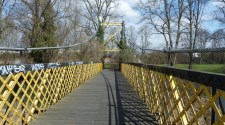
1933: Veurey
Veurey-Voroize, Isère, France - Isère River
| Bridgemeister ID: | 4881 (added 2020-07-18) |
| Year Completed: | 1933 |
| Name: | Veurey |
| Location: | Veurey-Voroize, Isère, France |
| Crossing: | Isère River |
| References: | AAJ |
| Use: | Vehicular |
| Status: | Removed |
| Main Cables: | Wire (steel) |
Notes:
Image Sets:
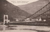
1934: (footbridge)
Green Valley vicinity, California, USA - Bouquet Reservoir
| Bridgemeister ID: | 1890 (added 2005-10-01) |
| Year Completed: | 1934 |
| Name: | (footbridge) |
| Location: | Green Valley vicinity, California, USA |
| Crossing: | Bouquet Reservoir |
| Coordinates: | 34.585833 N 118.395694 W |
| Maps: | Acme, GeoHack, Google, OpenStreetMap |
| References: | CE193408 |
| Use: | Footbridge |
| Status: | Removed |
| Main Cables: | Wire (steel) |
| Main Span: | 1 x 61 meters (200 feet) |
Notes:
- CE193408: "A bridge 276 ft long, consisting of a 200-ft suspension span and two equal shore spans, connects the [gate control] tower with the shore. The suspended span is supported by two prestressed cable strands and by arc-welded structural steel stiffening trusses." Article includes photo of the bridge and tower.
- Access bridge for the Bouquet Reservoir gate control tower. Likely completed 1933 or 1934. Both the bridge and the control tower have since been removed.
1934: (footbridge)
Grey Valley, New Zealand - Slaty Creek
| Bridgemeister ID: | 750 (added 2003-03-08) |
| Year Completed: | 1934 |
| Name: | (footbridge) |
| Location: | Grey Valley, New Zealand |
| Crossing: | Slaty Creek |
| Use: | Footbridge |
1934: (footbridge)
Ilkley, England, United Kingdom - River Wharfe
| Bridgemeister ID: | 1261 (added 2004-03-13) |
| Year Completed: | 1934 |
| Name: | (footbridge) |
| Location: | Ilkley, England, United Kingdom |
| Crossing: | River Wharfe |
| Coordinates: | 53.93241 N 1.81483 W |
| Maps: | Acme, GeoHack, Google, OpenStreetMap |
| Principals: | David Rowell & Co. |
| Use: | Footbridge |
| Status: | In use (last checked: 2022) |
| Main Cables: | Wire (steel) |
| Suspended Spans: | 1 |
Notes:
- Refurbished, 2001.
Image Sets:
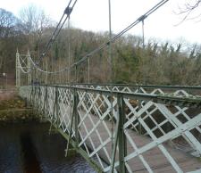
1934: (footbridge)
Rollag, Viken, Norway - Numedalslågen
| Bridgemeister ID: | 4099 (added 2020-04-05) |
| Year Completed: | 1934 |
| Name: | (footbridge) |
| Location: | Rollag, Viken, Norway |
| Crossing: | Numedalslågen |
| Coordinates: | 60.017909 N 9.276293 E |
| Maps: | Acme, GeoHack, Google, kart.1881.no, OpenStreetMap |
| Use: | Footbridge |
| Status: | In use (last checked: 2019) |
| Main Cables: | Wire (steel) |
| Suspended Spans: | 1 |
| Main Span: | 1 x 88 meters (288.7 feet) estimated |
| Deck width: | 1.5 meters |
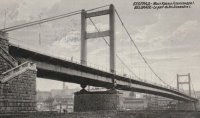
1934: King Alexander I
Belgrade, Serbia - Sava River
| Bridgemeister ID: | 957 (added 2003-11-01) |
| Year Completed: | 1934 |
| Name: | King Alexander I |
| Also Known As: | King Aleksandar |
| Location: | Belgrade, Serbia |
| Crossing: | Sava River |
| Coordinates: | 44.814946 N 20.448665 E |
| Maps: | Acme, GeoHack, Google, OpenStreetMap |
| Principals: | Société de Construction des Batignolles |
| References: | AAJ |
| Use: | Vehicular, with walkway |
| Status: | Destroyed, April 12, 1941 |
| Main Cables: | Wire (steel) |
| Suspended Spans: | 1 |
| Main Span: | 1 x 260.9 meters (856 feet) |
| Deck width: | 72 feet |
| Characteristics: | Rocker towers |
Notes:
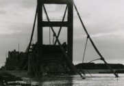
- 1941, April 12: Partially demolished in an attempt to slow advancing German troops.
- 1944, April 16: Remainder of the bridge is demolished.
External Links:
Image Sets:
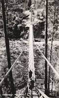
1934: Leppiniemi
Leppiniemi, Finland
| Bridgemeister ID: | 8080 (added 2023-12-24) |
| Year Completed: | 1934 |
| Name: | Leppiniemi |
| Location: | Leppiniemi, Finland |
| Use: | Footbridge |
| Status: | Demolished, 1947 |
| Main Cables: | Wire (steel) |
| Suspended Spans: | 1 |
External Links:
- WikiMedia Commons - Category:Leppiniemi Bridge. Several images of the bridge.
Image Sets:
1934: Mont-Olympe
Charleville-Mézières, Ardennes, France - Meuse River
| Bridgemeister ID: | 1052 (added 2003-12-08) |
| Year Completed: | 1934 |
| Name: | Mont-Olympe |
| Location: | Charleville-Mézières, Ardennes, France |
| Crossing: | Meuse River |
| Coordinates: | 49.776650 N 4.722679 E |
| Maps: | Acme, GeoHack, Google, OpenStreetMap |
| Principals: | Leinekugel le Cocq et Fils |
| Use: | Footbridge |
| Status: | In use (last checked: 2022) |
| Main Cables: | Wire (steel) |
| Suspended Spans: | 2 |
| Main Spans: | 2 x 64.2 meters (210.6 feet) |
Notes:
- 1945: The bridge is destroyed during WWII. It is subsequently rebuilt by Leinekugel.
- 2007: The bridge undergoes an extensive renovation.
- Near former location of Charleville - Charleville-Mézières, Ardennes, France.
External Links:
Image Sets:
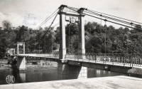
1934: Rio Higuamo
San Pedro de Macoris vicinity, Dominican Republic - Rio Higuamo
| Bridgemeister ID: | 448 (added before 2003) |
| Year Completed: | 1934 |
| Name: | Rio Higuamo |
| Also Known As: | Ramfis |
| Location: | San Pedro de Macoris vicinity, Dominican Republic |
| Crossing: | Rio Higuamo |
| Coordinates: | 18.503230 N 69.336561 W |
| Maps: | Acme, GeoHack, Google, OpenStreetMap |
| Principals: | John A. Roebling's Sons Co. |
| References: | AAJ, SSS |
| Use: | Vehicular |
| Status: | In use (last checked: 2023) |
| Main Cables: | Wire (steel) |
| Suspended Spans: | 3 |
| Main Span: | 1 x 168.9 meters (554 feet) |
| Side Spans: | 2 x 56.7 meters (186 feet) |
Image Sets:
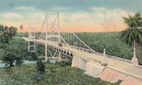
1934: Rugslandsbrua
Svaland, Birkenes, Agder, Norway - Tavdalselva
| Bridgemeister ID: | 4315 (added 2020-04-10) |
| Year Completed: | 1934 |
| Name: | Rugslandsbrua |
| Location: | Svaland, Birkenes, Agder, Norway |
| Crossing: | Tavdalselva |
| Coordinates: | 58.289171 N 8.183323 E |
| Maps: | Acme, GeoHack, Google, kart.1881.no, OpenStreetMap |
| Use: | Vehicular (one-lane) |
| Status: | In use (last checked: 2019) |
| Main Cables: | Wire (steel) |
| Suspended Spans: | 1 |
| Main Span: | 1 x 70 meters (229.7 feet) estimated |
| Deck width: | ~2 meters |
1934: Sifton Boulevard
Calgary, Alberta, Canada - Elbow River
| Bridgemeister ID: | 802 (added 2003-03-29) |
| Year Completed: | 1934 |
| Name: | Sifton Boulevard |
| Also Known As: | Riverdale Avenue, Sifton-Riverdale |
| Location: | Calgary, Alberta, Canada |
| Crossing: | Elbow River |
| Coordinates: | 51.019060 N 114.083178 W |
| Maps: | Acme, GeoHack, Google, OpenStreetMap |
| Use: | Footbridge |
| Status: | Wrecked, 2013 |
| Main Cables: | Wire |
| Suspended Spans: | 1 |
Notes:
- Footbridge with green steel towers. Distinct from the other Elbow River, Calgary footbridges in the inventory, but appeared very similar to the Sandy Beach bridge.
- Wrecked by flood, 2013.
- Similar to 1959 Sandy Beach (River Park, Riverpark) - Calgary, Alberta, Canada.
- Near 1947 Rideau Park - Calgary, Alberta, Canada.
- Near future location of 2014 Rideau Park - Calgary, Alberta, Canada.
- Replaced by 2014 Riverdale Avenue - Calgary, Alberta, Canada.
- All past and present bridges at this location.
Image Sets:
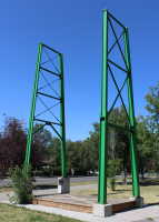
1934: Stewart Park I
Ithaca, New York, USA - Fall Creek arm
| Bridgemeister ID: | 839 (added 2003-06-28) |
| Year Completed: | 1934 |
| Name: | Stewart Park I |
| Location: | Ithaca, New York, USA |
| Crossing: | Fall Creek arm |
| At or Near Feature: | Stewart Park |
| Coordinates: | 42.458961 N 76.505590 W |
| Maps: | Acme, GeoHack, Google, OpenStreetMap |
| Principals: | Civil Works Administration |
| References: | AAJ |
| Use: | Footbridge |
| Status: | In use (last checked: 2014) |
| Main Cables: | Wire (steel) |
| Suspended Spans: | 1 |
| Main Span: | 1 x 25 meters (82 feet) estimated |
Notes:
- There are two suspension footbridges at this park. This one crosses a short run off of Fall Creek just before it enters Cayuga Lake. The other crosses Fall Creek.
- Near 1934 Stewart Park II - Ithaca, New York, USA.
Image Sets:
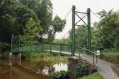
1934: Stewart Park II
Ithaca, New York, USA - Fall Creek
| Bridgemeister ID: | 840 (added 2003-06-28) |
| Year Completed: | 1934 |
| Name: | Stewart Park II |
| Location: | Ithaca, New York, USA |
| Crossing: | Fall Creek |
| At or Near Feature: | Stewart Park |
| Coordinates: | 42.458281 N 76.505359 W |
| Maps: | Acme, GeoHack, Google, OpenStreetMap |
| Principals: | Civil Works Administration |
| References: | AAJ |
| Use: | Footbridge |
| Status: | In use (last checked: 2014) |
| Main Cables: | Wire (steel) |
| Suspended Spans: | 1 |
| Main Span: | 1 x 33.8 meters (111 feet) estimated |
Notes:
- There are two suspension footbridges at this park.
- Near 1934 Stewart Park I - Ithaca, New York, USA.
Image Sets:
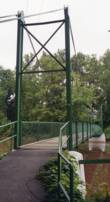
1934: Swing
Cooranbong, New South Wales, Australia - Dora Creek
| Bridgemeister ID: | 9116 (added 2025-03-30) |
| Year Completed: | 1934 |
| Name: | Swing |
| Location: | Cooranbong, New South Wales, Australia |
| Crossing: | Dora Creek |
| Coordinates: | 33.091028 S 151.464778 E |
| Maps: | Acme, GeoHack, Google, OpenStreetMap |
| Principals: | Harry Tempest |
| Use: | Footbridge |
| Status: | In use (last checked: 2024) |
| Main Cables: | Wire (steel) |
| Main Span: | 1 |
Notes:
- c. 1980s: The deck partially fails. The bridge is repaired and reopened.
- c. 2023-2024: An adjacent cable-stayed footbridge is constructed.
1934: Tonnay-Charente
Tonnay-Charente, Charente-Maritime, France - Charente River
| Bridgemeister ID: | 7338 (added 2022-09-04) |
| Year Completed: | 1934 |
| Name: | Tonnay-Charente |
| Location: | Tonnay-Charente, Charente-Maritime, France |
| Crossing: | Charente River |
| Coordinates: | 45.939992 N 0.886099 W |
| Maps: | Acme, GeoHack, Google, OpenStreetMap |
| Use: | Vehicular |
| Status: | Restricted to foot traffic |
| Main Cables: | Wire (steel) |
| Main Span: | 1 x 90 meters (295.3 feet) |
| Side Spans: | 2 |
Notes:
- Replaced 1884 Tonnay-Charente - Tonnay-Charente, Charente-Maritime, France.
- All past and present bridges at this location.
External Links:
Image Sets:
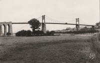
1935: (suspension bridge)
Hector vicinity, Stockton, West Coast, New Zealand - Ngakawau River
| Bridgemeister ID: | 7614 (added 2023-05-26) |
| Year Completed: | 1935 |
| Name: | (suspension bridge) |
| Location: | Hector vicinity, Stockton, West Coast, New Zealand |
| Crossing: | Ngakawau River |
| At or Near Feature: | Mangatini Falls |
| Coordinates: | 41.607568 S 171.912836 E |
| Maps: | Acme, GeoHack, Google, OpenStreetMap |
| Use: | Rail |
| Status: | Removed, c. 1981 |
| Main Cables: | Wire |
| Suspended Spans: | 1 |
Notes:
- Appears to have carried coal cars from nearby coal mine. May have replaced an earlier suspension bridge.
- Later at same location (footbridge) - Hector vicinity, Stockton, West Coast, New Zealand.
- All past and present bridges at this location.
External Links:
1935: Ambyne
Deddick Valley, Victoria, Australia - Deddick River
| Bridgemeister ID: | 9125 (added 2025-03-30) |
| Year Completed: | 1935 |
| Name: | Ambyne |
| Location: | Deddick Valley, Victoria, Australia |
| Crossing: | Deddick River |
| Coordinates: | 37.035722 S 148.549861 E |
| Maps: | Acme, GeoHack, Google, OpenStreetMap |
| Use: | Vehicular (one-lane) |
| Status: | Restricted to foot traffic (last checked: 2024) |
| Main Cables: | Wire (steel) |
| Suspended Spans: | 1 |
| Main Span: | 1 x 39.6 meters (130 feet) |
Notes:
- 1970: Closed to traffic.
- 2004: Restoration completed.
External Links:
- Ambyne Suspension Bridge, Deddick Valley, Victoria | Minky's Day Out. Photos and history of the bridge.
1935: Capitan Usterez
Villamontes, Tarija, Bolivia - Rio Pilcomayo
| Bridgemeister ID: | 8429 (added 2024-03-09) |
| Year Completed: | 1935 |
| Name: | Capitan Usterez |
| Also Known As: | Usteres |
| Location: | Villamontes, Tarija, Bolivia |
| Crossing: | Rio Pilcomayo |
| Coordinates: | 21.258778 S 63.511528 W |
| Maps: | Acme, GeoHack, Google, OpenStreetMap |
| Use: | Vehicular |
| Status: | Removed |
| Main Cables: | Wire (steel) |
| Main Span: | 1 |
External Links:
- Facebook - Puente Capitan Usterez, Pilcomayo Villamontes, chaco tarijeño. Image and history of the bridge. Posted May 2, 2018.
Image Sets:
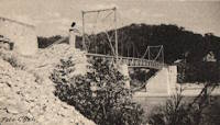
1935: Chaumont-sur-Loire
Chaumont-sur-Loire and Onzain, Veuzain-sur-Loire, Loir-et-Cher, France - Loire River
| Bridgemeister ID: | 6719 (added 2021-10-16) |
| Year Completed: | 1935 |
| Name: | Chaumont-sur-Loire |
| Location: | Chaumont-sur-Loire and Onzain, Veuzain-sur-Loire, Loir-et-Cher, France |
| Crossing: | Loire River |
| Coordinates: | 47.485278 N 1.190750 E |
| Maps: | Acme, GeoHack, Google, OpenStreetMap |
| Use: | Vehicular |
| Status: | Destroyed, 1940 |
| Main Cables: | Wire (steel) |
| Main Spans: | 6 |
Notes:
- Replaced 1858 Chaumont-sur-Loire - Chaumont-sur-Loire and Onzain, Veuzain-sur-Loire, Loir-et-Cher, France.
- All past and present bridges at this location.
External Links:
Image Sets:
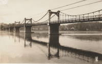
1935: Châteauneuf-sur-Loire
Châteauneuf-sur-Loire, Loiret, France - Loire River
| Bridgemeister ID: | 6790 (added 2021-10-30) |
| Year Completed: | 1935 |
| Name: | Châteauneuf-sur-Loire |
| Location: | Châteauneuf-sur-Loire, Loiret, France |
| Crossing: | Loire River |
| Coordinates: | 47.858608 N 2.223392 E |
| Maps: | Acme, GeoHack, Google, OpenStreetMap |
| Use: | Vehicular |
| Status: | Destroyed, June 17, 1940 |
| Main Cables: | Wire (steel) |
| Suspended Spans: | 5 |
| Main Spans: | 5 |
Notes:
- 1940, June 17: Destroyed to slow advancing German troops.
- Replaced 1841 Châteauneuf-sur-Loire - Châteauneuf-sur-Loire, Loiret, France.
- Replaced by 1946 Châteauneuf-sur-Loire - Châteauneuf-sur-Loire, Loiret, France.
- All past and present bridges at this location.
External Links:
Image Sets:
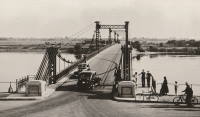
1935: Condrieu
Condrieu, Rhône and Les Roches-de-Condrieu, Isère, France - Rhône River
| Bridgemeister ID: | 1494 (added 2004-09-19) |
| Year Completed: | 1935 |
| Name: | Condrieu |
| Location: | Condrieu, Rhône and Les Roches-de-Condrieu, Isère, France |
| Crossing: | Rhône River |
| Coordinates: | 45.45655 N 4.768722 E |
| Maps: | Acme, GeoHack, Google, OpenStreetMap |
| References: | AAJ |
| Use: | Vehicular (two-lane), with walkway |
| Status: | Destroyed, June 1940 |
| Main Cables: | Wire (steel) |
| Suspended Spans: | 2 |
| Main Spans: | 2 |
Notes:
- Replaced 1831 Condrieu - Condrieu, Rhône and Les Roches-de-Condrieu, Isère, France.
- Replaced by Condrieu - Condrieu, Rhône and Les Roches-de-Condrieu, Isère, France.
- All past and present bridges at this location.
External Links:
- Pont de Condrieu - Wikipedia
- Pont entre Condrieu et les Roches detruit le 20 juin 1940 - Wikimedia. Image of the destroyed bridge.
- Structurae - Structure ID 20013233
Image Sets:
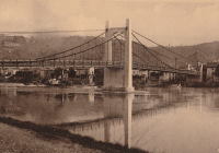
1935: Devèze
Thérondels vicinity, Aveyron and Paulhenc, Cantal, France - Lac de Sarrans
| Bridgemeister ID: | 2321 (added 2007-05-05) |
| Year Completed: | 1935 |
| Name: | Devèze |
| Also Known As: | Laussac |
| Location: | Thérondels vicinity, Aveyron and Paulhenc, Cantal, France |
| Crossing: | Lac de Sarrans |
| At or Near Feature: | Presqu'île De Laussac |
| Coordinates: | 44.861586 N 2.769710 E |
| Maps: | Acme, GeoHack, Google, OpenStreetMap |
| Use: | Vehicular (one-lane) |
| Status: | In use (last checked: 2020) |
| Main Cables: | Wire (steel) |
| Suspended Spans: | 1 |
Notes:
External Links:
Image Sets:
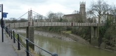
1935: Gaol Ferry
Bristol, England, United Kingdom - River Avon-New Cut
| Bridgemeister ID: | 1917 (added 2005-10-09) |
| Year Completed: | 1935 |
| Name: | Gaol Ferry |
| Also Known As: | Southville, St. Paul's, Coronation Road |
| Location: | Bristol, England, United Kingdom |
| Crossing: | River Avon-New Cut |
| Coordinates: | 51.445871 N 2.599464 W |
| Maps: | Acme, GeoHack, Google, OpenStreetMap |
| Principals: | David Rowell & Co. |
| Use: | Footbridge |
| Status: | Closed, August 2022 (last checked: August 2023) |
| Main Cables: | Wire (steel) |
| Suspended Spans: | 1 |
Notes:
- 2023, September: The bridge is scheduled to reopen following repairs.
Annotated Citations:
- Cork, Tristan. "Key footbridge connecting South Bristol to city centre to close for months." Bristol Post, 9 Dec. 2021, https://www.bristolpost.co.uk/news/bristol-news/key-footbridge-connecting-south-bristol-6326291.
Bridge is undergoing some repairs in late December 2021, but is still open. Expected to be closed January-March 2022 for more extensive repairs.
- Woolerton, Betty. "Gaol Ferry Bridge likely to be closed for another three months." Bristol 24/7, 24 Feb. 2023, https://www.bristol247.com/news-and-features/news/gaol-ferry-bridge-likely-to-be-closed-for-another-three-months/.
"A discovery of 'paper thin' steel work on Gaol Ferry Bridge has been cited as the reason for the extension of its closure by an unprecedented extra three months… Now, the council’s cabinet member for transport has apologised after contractors Griffiths have found 'the bridge is in a worse condition than we had thought.'"
External Links:
- Date for Gaol Ferry bridge closure in Bristol announced - BBC News. The bridge will be closed for 6-9 months from August 2022 for restoration.
- Structurae - Structure ID 20082369
Image Sets:
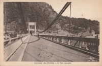
| Bridgemeister ID: | 3789 (added 2020-02-29) |
| Year Completed: | 1935 |
| Name: | Gjølme |
| Location: | Orkanger, Orkland, Trøndelag, Norway |
| Crossing: | Orkla |
| Coordinates: | 63.30211 N 9.83417 E |
| Maps: | Acme, GeoHack, Google, kart.1881.no, OpenStreetMap |
| Use: | Vehicular (one-lane) |
| Status: | Restricted to foot traffic (last checked: 2019) |
| Main Cables: | Wire (steel) |
| Suspended Spans: | 1 |
| Main Span: | 1 x 61 meters (200.1 feet) estimated |
1935: Goyt Valley
Buxton, England, United Kingdom - River Goyt
| Bridgemeister ID: | 520 (added before 2003) |
| Year Completed: | 1935 |
| Name: | Goyt Valley |
| Also Known As: | Buxton |
| Location: | Buxton, England, United Kingdom |
| Crossing: | River Goyt |
| References: | NTB |
| Use: | Footbridge |
| Status: | Removed, 1960s |
| Main Cables: | Wire |
| Suspended Spans: | 1 |
Notes:
- Dismantled during construction of the Errwood Reservoir.
Image Sets:
1935: Grand Coulee Dam
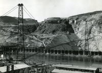
Grand Coulee, Washington, USA - Columbia River
| Bridgemeister ID: | 3157 (added 2019-11-03) |
| Year Completed: | 1935 |
| Name: | Grand Coulee Dam |
| Location: | Grand Coulee, Washington, USA |
| Crossing: | Columbia River |
| Use: | Conveyor |
| Status: | Removed |
| Main Cables: | Wire (steel) |
| Main Span: | 1 x 438 meters (1,437 feet) |
Image Sets:
1935: Granite Falls
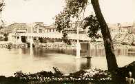
Granite Falls, Minnesota, USA - Minnesota River
| Bridgemeister ID: | 255 (added before 2003) |
| Year Completed: | 1935 |
| Name: | Granite Falls |
| Location: | Granite Falls, Minnesota, USA |
| Crossing: | Minnesota River |
| Coordinates: | 44.810108 N 95.537316 W |
| Maps: | Acme, GeoHack, Google, OpenStreetMap |
| Principals: | Minneapolis Bridge Company |
| References: | WCT20051125 |
| Use: | Footbridge |
| Status: | In use (last checked: 2019) |
| Main Cables: | Wire (steel) |
| Suspended Spans: | 3 |
| Main Span: | 1 |
| Side Spans: | 2 |
Notes:
- Damaged by floods, 1997 and 2001. Refurbished, 2014-2015.
External Links:
Image Sets:
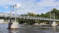
1935: Iowa-Illinois Memorial
Bettendorf, Iowa and Moline, Illinois, USA - Mississippi River
| Bridgemeister ID: | 180 (added before 2003) |
| Year Completed: | 1935 |
| Name: | Iowa-Illinois Memorial |
| Also Known As: | Interstate 74 Bridge, I-74 Bridge |
| Location: | Bettendorf, Iowa and Moline, Illinois, USA |
| Crossing: | Mississippi River |
| Coordinates: | 41.520264 N 90.513034 W |
| Maps: | Acme, GeoHack, Google, OpenStreetMap |
| Principals: | Modjeski, Masters, and Chase |
| References: | AAJ, CMR |
| Use: | Vehicular, with walkway |
| Status: | Demolished, 2024 |
| Main Cables: | Wire (steel) |
| Suspended Spans: | 3 |
| Main Span: | 1 x 225.6 meters (740 feet) |
| Side Spans: | 2 x 112.8 meters (370 feet) |
| Deck width: | 24.2 feet |
Notes:
- 2017, June 26: Groundbreaking ceremony for a replacement bridge for the twin Iowa-Illinois Memorial bridges. The new bridge is expected to be completed in 2020.
- 2020, November: Replacement span opens (for Iowa-bound traffic previously carried across the older of the two suspension bridges). Suspension bridge expected to be demolished in 2022.
- 2023: Demolition expected to be completed in 2024.
- 2024: Demolition of both bridges is complete.
- Next to 1960 Iowa-Illinois Memorial (Interstate 74 Bridge, I-74 Bridge) - Bettendorf, Iowa and Moline, Illinois, USA.
- All past and present bridges at this location.
External Links:
Image Sets:
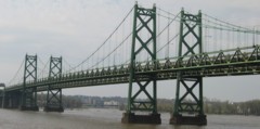
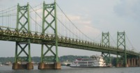
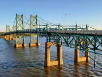
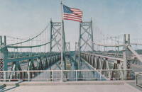
1935: l'Île d'Orléans
Quebec City, Quebec, Canada - St. Lawrence River
| Bridgemeister ID: | 183 (added before 2003) |
| Year Completed: | 1935 |
| Name: | l'Île d'Orléans |
| Also Known As: | Isle of Orleans, Orleans Island, Taschereau |
| Location: | Quebec City, Quebec, Canada |
| Crossing: | St. Lawrence River |
| Coordinates: | 46.880233 N 71.137883 W |
| Maps: | Acme, GeoHack, Google, OpenStreetMap |
| Principals: | Monsarrat and Pratley |
| References: | AAJ |
| Use: | Vehicular (two-lane, heavy vehicles), with walkway |
| Status: | In use (last checked: 2019) |
| Main Cables: | Wire (steel) |
| Suspended Spans: | 3 |
| Main Span: | 1 x 323 meters (1,059.7 feet) |
| Side Spans: | 2 x 127 meters (416.7 feet) |
| Deck width: | 30 feet |
Notes:
- Replacement proposed to start in 2024.
- Near Montmorency Falls - Quebec City vicinity, Quebec, Canada.
External Links:
Image Sets:

1935: La Réole
La Réole, Gironde, France - Garonne River
| Bridgemeister ID: | 1769 (added 2005-04-22) |
| Year Completed: | 1935 |
| Name: | La Réole |
| Also Known As: | Rouergue |
| Location: | La Réole, Gironde, France |
| Crossing: | Garonne River |
| Coordinates: | 44.578853 N 0.034028 W |
| Maps: | Acme, GeoHack, Google, OpenStreetMap |
| Use: | Vehicular (two-lane), with walkway |
| Status: | In use (last checked: 2019) |
| Suspended Spans: | 1 |
Notes:
- See 1835 La Réole - La Réole, Gironde, France. Unsure if the newer bridge is at the same location.
External Links:
Image Sets:
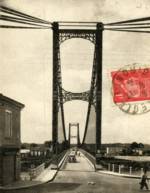
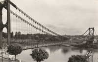
1935: Mælen
Stjørdal, Trøndelag, Norway - Stjørdalselva
| Bridgemeister ID: | 1818 (added 2005-05-21) |
| Year Completed: | 1935 |
| Name: | Mælen |
| Also Known As: | Maelen |
| Location: | Stjørdal, Trøndelag, Norway |
| Crossing: | Stjørdalselva |
| Coordinates: | 63.448367 N 10.992617 E |
| Maps: | Acme, GeoHack, Google, kart.1881.no, OpenStreetMap |
| Use: | Vehicular |
| Status: | In use (last checked: 2005) |
| Main Cables: | Wire (steel) |
| Suspended Spans: | 1 |
1935: Mirabeau
Mirabeau, Vaucluse and Bouches-du-Rhône, France - Durance River
| Bridgemeister ID: | 900 (added 2003-09-07) |
| Year Completed: | 1935 |
| Name: | Mirabeau |
| Location: | Mirabeau, Vaucluse and Bouches-du-Rhône, France |
| Crossing: | Durance River |
| Coordinates: | 43.690111 N 5.668000 E |
| Maps: | Acme, GeoHack, Google, OpenStreetMap |
| Principals: | Auguste Rey |
| References: | BPF |
| Use: | Vehicular |
| Status: | Replaced, 1991 |
| Suspended Spans: | 1 |
| Main Span: | 1 x 175 meters (574.1 feet) |
| Deck width: | 8 meters |
Notes:
- Dismantled 1991. The towers from the older of the two Mirabeau suspension bridges are visible at the current crossing.
- Replaced 1831 Mirabeau - Mirabeau, Vaucluse and Bouches-du-Rhône, France.
- All past and present bridges at this location.
External Links:
Image Sets:
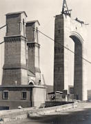
1935: Mirepoix-sur-Tarn
Mirepoix-sur-Tarn, Haute-Garonne, France - Tarn River
| Bridgemeister ID: | 3196 (added 2019-11-10) |
| Year Completed: | 1935 |
| Name: | Mirepoix-sur-Tarn |
| Location: | Mirepoix-sur-Tarn, Haute-Garonne, France |
| Crossing: | Tarn River |
| Coordinates: | 43.811976 N 1.571879 E |
| Maps: | Acme, GeoHack, Google, OpenStreetMap |
| Use: | Vehicular (two-lane) |
| Status: | Collapsed, November 18, 2019 |
| Main Cables: | Wire (steel) |
| Suspended Spans: | 1 |
| Main Span: | 1 x 152 meters (498.7 feet) |
Notes:
- Collapsed November 18, 2019 as an overweight vehicle crossed, killing two people.
- Replaced 1855 Mirepoix-sur-Tarn - Mirepoix-sur-Tarn, Haute-Garonne, France.
- All past and present bridges at this location.
External Links:
Image Sets:
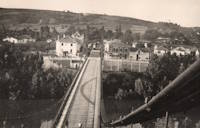
1935: Remoulins
Remoulins, Gard, France - Gardon River
| Bridgemeister ID: | 4910 (added 2020-07-19) |
| Year Completed: | 1935 |
| Name: | Remoulins |
| Location: | Remoulins, Gard, France |
| Crossing: | Gardon River |
| Coordinates: | 43.937978 N 4.556684 E |
| Maps: | Acme, GeoHack, Google, OpenStreetMap |
| Use: | Vehicular |
| Status: | Removed |
| Main Cables: | Wire (steel) |
Notes:
- Remnants of this bridge are preserved in a car park at the eastern end of the present day (2020s) Pont de Remoulins.
- Replaced 1830 Remoulins - Remoulins, Gard, France. The later bridge appears to have been built on an alignment about 175 meters north of the 1830 bridge.
- All past and present bridges at this location.
External Links:
Image Sets:
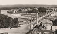
Mail | Facebook | X (Twitter) | Bluesky