Inventory Search Results (1,101-1,200 of 3,327)
3,327 suspension bridges were found for search criteria: *. Bridges 1,101 through 1,200 (of 3,327 total) appear below. Click the Bridgemeister ID number to isolate the bridge on its own page. If you don't see what you were looking for, try an image search with the same criteria: *. This will find the bridge if it is pictured on the site, but is not a catenary suspension bridge.
Related:
1922: Glaize
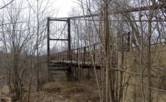
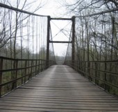
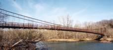
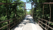
Brumley vicinity, Missouri, USA - Grand Glaize Creek
| Bridgemeister ID: | 332 (added before 2003) |
| Year Completed: | 1922 |
| Name: | Glaize |
| Also Known As: | Auglaize, Grand Glaize, Grand Auglaize |
| Location: | Brumley vicinity, Missouri, USA |
| Crossing: | Grand Glaize Creek |
| Coordinates: | 38.077098 N 92.526488 W |
| Maps: | Acme, GeoHack, Google, OpenStreetMap |
| Principals: | Joseph A. Dice |
| References: | BOTO |
| Use: | Vehicular (one-lane) |
| Status: | Closed, January 6, 2021 (last checked: 2021) |
| Main Cables: | Wire (steel) |
| Suspended Spans: | 2 |
| Main Span: | 1 x 126.2 meters (414 feet) estimated |
| Side Span: | 1 |
| Deck width: | 12 feet |
Notes:
- 2020, October 8: Added to National Register of Historic Places.
- 2021, January 6: Closed due to structural issues with the bridge's anchors.
- 2021, February 6: New inspection of the current issue ("loose cables"). Bridge is still closed.
- Near 1925 Mill Creek - Brumley vicinity, Missouri, USA.
External Links:
Image Sets:
1922: Kawamoto
Japan
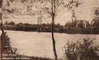
1922: Kyrkälv
Dala-Floda, Gagnef, Dalarna, Sweden - Västerdalälven
| Bridgemeister ID: | 8294 (added 2024-02-08) |
| Year Completed: | 1922 |
| Name: | Kyrkälv |
| Also Known As: | Kyrkälvbro, Kyrkbron |
| Location: | Dala-Floda, Gagnef, Dalarna, Sweden |
| Crossing: | Västerdalälven |
| Coordinates: | 60.507000 N 14.800972 E |
| Maps: | Acme, GeoHack, Google, OpenStreetMap |
| Use: | Vehicular (one-lane) |
| Status: | In use (last checked: 2023) |
| Main Cables: | Wire (steel) |
| Suspended Spans: | 1 |
| Main Span: | 1 x 122 meters (400.3 feet) |
Notes:
- 1980: Heavily damaged by fire. Rebuilt and reopened in 1983.
- Near Swing - Dala-Floda, Gagnef, Dalarna, Sweden.
External Links:
Image Sets:
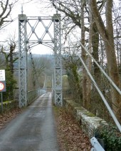
1922: Llanstephan
Llanstephan, Wales, United Kingdom - River Wye
| Bridgemeister ID: | 1964 (added 2005-11-12) |
| Year Completed: | 1922 |
| Name: | Llanstephan |
| Location: | Llanstephan, Wales, United Kingdom |
| Crossing: | River Wye |
| Coordinates: | 52.06604 N 3.29614 W |
| Maps: | Acme, GeoHack, Google, OpenStreetMap |
| Principals: | David Rowell & Co. |
| References: | BRW |
| Use: | Vehicular (one-lane) |
| Status: | In use (last checked: 2021) |
| Main Cables: | Wire (steel) |
| Suspended Spans: | 1 |
Notes:
- 1994: According to BRW, the bridge is closed due to cable corrosion
External Links:
Image Sets:
1922: Momosuke
Nagiso-cho, Kiso-gun, Nagano, Japan - Kiso River
| Bridgemeister ID: | 1051 (added 2003-12-07) |
| Year Completed: | 1922 |
| Name: | Momosuke |
| Also Known As: | 桃介橋 |
| Location: | Nagiso-cho, Kiso-gun, Nagano, Japan |
| Crossing: | Kiso River |
| Coordinates: | 35.600776 N 137.606515 E |
| Maps: | Acme, GeoHack, Google, OpenStreetMap |
| Use: | Footbridge |
| Status: | In use (last checked: 2019) |
| Main Cables: | Wire (steel) |
| Suspended Spans: | 4 |
| Main Spans: | 2 x 104.5 meters (342.8 feet) |
| Side Spans: | 2 x 23.9 meters (78.4 feet) |
Notes:
- Rebuilt 1993.
External Links:
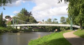
1922: Porthill
Shrewsbury, England, United Kingdom - River Severn
| Bridgemeister ID: | 434 (added before 2003) |
| Year Completed: | 1922 |
| Name: | Porthill |
| Location: | Shrewsbury, England, United Kingdom |
| Crossing: | River Severn |
| Coordinates: | 52.708233 N 2.763083 W |
| Maps: | Acme, GeoHack, Google, OpenStreetMap |
| Principals: | David Rowell & Co. |
| References: | NTB |
| Use: | Footbridge |
| Status: | In use (last checked: 2010) |
| Suspended Spans: | 1 |
External Links:
Image Sets:
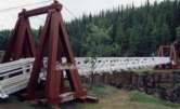
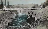
1922: Robert Lowe
Whitehorse vicinity, Yukon, Canada - Miles Canyon
| Bridgemeister ID: | 1054 (added 2003-12-13) |
| Year Completed: | 1922 |
| Name: | Robert Lowe |
| Also Known As: | Miles Canyon |
| Location: | Whitehorse vicinity, Yukon, Canada |
| Crossing: | Miles Canyon |
| Coordinates: | 60.66223 N 135.02921 W |
| Maps: | Acme, GeoHack, Google, OpenStreetMap |
| Use: | Footbridge |
| Status: | In use (last checked: 2022) |
| Main Cables: | Wire (steel) |
| Suspended Spans: | 1 |
| Main Span: | 1 x 39.6 meters (130 feet) estimated |
External Links:
Image Sets:
| Bridgemeister ID: | 4499 (added 2020-05-02) |
| Year Completed: | 1922 |
| Name: | Strandvoldbrua |
| Location: | Trysil, Innlandet, Norway |
| Crossing: | Klarälven |
| Coordinates: | 61.343151 N 12.230457 E |
| Maps: | Acme, GeoHack, Google, kart.1881.no, OpenStreetMap |
| Use: | Vehicular (one-lane) |
| Status: | Replaced |
| Main Cables: | Wire (steel) |
| Suspended Spans: | 1 |
| Main Span: | 1 x 90 meters (295.3 feet) estimated |
Notes:
- Closed December 7, 1993 after a cable snapped.
- Replaced by 2018 Strandvoldbrua - Trysil, Innlandet, Norway.
- All past and present bridges at this location.
| Bridgemeister ID: | 3884 (added 2020-03-08) |
| Year Completed: | 1922 |
| Name: | Teigen |
| Also Known As: | Vikvar |
| Location: | Mebonden, Selbu, Trøndelag, Norway |
| Crossing: | Nea |
| Coordinates: | 63.222013 N 11.013363 E |
| Maps: | Acme, GeoHack, Google, kart.1881.no, OpenStreetMap |
| Use: | Vehicular (one-lane) |
| Status: | Removed |
| Main Cables: | Wire |
| Suspended Spans: | 1 |
| Main Span: | 1 x 60 meters (196.9 feet) estimated |
Notes:
- Based on historical aerial images, removed at some point 1962-1975.
- Replaced 1903 Teigen (Vikvar) - Mebonden, Selbu, Trøndelag, Norway.
- All past and present bridges at this location.
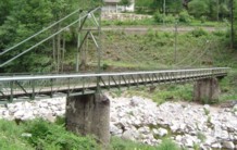
1923: (footbridge)
Kirschbaumwasen, Germany - Murg River
| Bridgemeister ID: | 1882 (added 2005-09-24) |
| Year Completed: | 1923 |
| Name: | (footbridge) |
| Location: | Kirschbaumwasen, Germany |
| Crossing: | Murg River |
| Coordinates: | 48.6233 N 8.354967 E |
| Maps: | Acme, GeoHack, Google, OpenStreetMap |
| Use: | Footbridge |
| Status: | In use (last checked: 2005) |
| Suspended Spans: | 1 |
Image Sets:
1923: (suspension bridge)
Karaka, New Zealand - Marokopa River
| Bridgemeister ID: | 703 (added 2003-03-08) |
| Year Completed: | 1923 |
| Name: | (suspension bridge) |
| Location: | Karaka, New Zealand |
| Crossing: | Marokopa River |
| References: | GAP |
1923: (suspension bridge)
Murchison vicinity, New Zealand - Buller River
| Bridgemeister ID: | 702 (added 2003-03-08) |
| Year Completed: | 1923 |
| Name: | (suspension bridge) |
| Location: | Murchison vicinity, New Zealand |
| Crossing: | Buller River |
| Coordinates: | 41.741556 S 172.401472 E |
| Maps: | Acme, GeoHack, Google, OpenStreetMap |
| References: | GAP |
| Status: | Removed |
| Main Span: | 1 x 47.5 meters (155.8 feet) |
| Side Spans: | 2 x 6.7 meters (22 feet) |
Notes:
- Coordinates indicate the approximate location of this bridge. GAP describes it as located where Nuggety Creek flows into the Buller. The current (as of the 2020s) Nuggety Creek Road crosses the Buller about one kilometer north of the coordinates.
| Bridgemeister ID: | 5589 (added 2020-12-22) |
| Year Completed: | 1923 |
| Name: | 98th Meridian |
| Also Known As: | Byers |
| Location: | Byers vicinity, Texas and Temple, Oklahoma, USA |
| Crossing: | Red River |
| Coordinates: | 34.127249 N 98.214114 W |
| Maps: | Acme, GeoHack, Google, OpenStreetMap |
| Principals: | Austin Bridge Co. |
| References: | AUB |
| Use: | Vehicular |
| Status: | Destroyed, 1938 |
| Main Cables: | Wire (steel) |
Notes:
- AUB describes the Byers bridge: "This bridge, three spans of 567' each, one side span of 107', and a 16' roadway, had originally been built in 1914."
- 1935: Damaged by flood.
- 1938: Destroyed by flood.
- Replaced 1914 98th Meridian (Byers) - Byers, Texas and Temple, Oklahoma, USA.
- All past and present bridges at this location.
Image Sets:
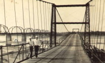
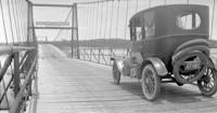
| Bridgemeister ID: | 3921 (added 2020-03-20) |
| Year Completed: | 1923 |
| Name: | Atna |
| Location: | Atna, Stor-Elvdal, Innlandet, Norway |
| Crossing: | Glomma |
| Coordinates: | 61.72890 N 10.82639 E |
| Maps: | Acme, GeoHack, Google, kart.1881.no, OpenStreetMap |
| Use: | Vehicular (one-lane) |
| Status: | In use (last checked: 2019) |
| Main Cables: | Wire (steel) |
| Suspended Spans: | 1 |
| Main Span: | 1 x 150 meters (492.1 feet) estimated |
Notes:
- Rehabilitated, 1989.
1923: Blagnac
Blagnac, Haute-Garonne, France - Garonne River
| Bridgemeister ID: | 2959 (added 2019-10-06) |
| Year Completed: | 1923 |
| Name: | Blagnac |
| Location: | Blagnac, Haute-Garonne, France |
| Crossing: | Garonne River |
| Coordinates: | 43.624930 N 1.401531 E |
| Maps: | Acme, GeoHack, Google, OpenStreetMap |
| Use: | Vehicular |
| Status: | Replaced, 1983 |
| Main Cables: | Wire (steel) |
| Suspended Spans: | 3 |
| Main Spans: | 3 |
Notes:
- Replaced 1844 Blagnac - Blagnac, Haute-Garonne, France.
- All past and present bridges at this location.
Image Sets:
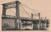
1923: Kaneyama
Japan
1923: Matela
Matela and Syal Khola, Kotjahari (कोटजहारी), Nepal - Bheri River
| Bridgemeister ID: | 6479 (added 2021-08-14) |
| Year Completed: | 1923 |
| Name: | Matela |
| Location: | Matela and Syal Khola, Kotjahari (कोटजहारी), Nepal |
| Crossing: | Bheri River |
| Coordinates: | 28.670929 N 82.194512 E |
| Maps: | Acme, GeoHack, Google, OpenStreetMap |
| Principals: | John M. Henderson and Co. (Aberdeen, Scotland) |
| Use: | Footbridge |
| Status: | In use (last checked: 2018) |
| Main Cables: | Wire (steel) |
| Suspended Spans: | 1 |
| Main Span: | 1 x 97 meters (318.2 feet) estimated |
External Links:
- Rising Nepal Daily - Century-old suspension bridge on verge of collapse. Article dated April 29, 2025 detailing concerns about the condition of the bridge. "In lack of maintenance, the bridge has continued to deteriorate. About 15 years ago, when there was no other bridge over the Bheri River, most villagers from Jajarkot used this bridge to travel to cities like Nepalgunj, Surkhet and Kathmandu. Among the suspension bridges in western Nepal, the Matela bridge of Bheri Municipality-11 was once considered one of the strongest, but it is now falling apart."
1923: McKeown
Tyrola, Ada vicinity and Konawa, Oklahoma, USA - Canadian River
| Bridgemeister ID: | 2146 (added 2006-11-11) |
| Year Completed: | 1923 |
| Name: | McKeown |
| Also Known As: | Ada-Konawa |
| Location: | Tyrola, Ada vicinity and Konawa, Oklahoma, USA |
| Crossing: | Canadian River |
| References: | PTS2 |
| Use: | Vehicular |
| Status: | Removed, 1936 |
| Main Cables: | Wire |
Notes:
- J.W. Pigg (of Mitchell & Pigg, prominent Texas suspension bridge builders of the early 20th century) was reportedly involved in the construction of the bridge. Steinman gives a date of 1922, but newspaper articles from mid-1923 describe the plans as still under consideration. The bridge was likely completed in 1923 or 1924.
- A photograph of the bridge appears in the December 16, 1934 issue of The Daily Oklahoman (Oklahoma City) with caption: "This Old Bridge Is Doomed," sub-caption "Suspension Bridge on Highway 48 North of Ada," and a blurb: "This old bridge, known as the McKeown bridge, across the Canadian River between Ada and Konawa, is being condemned and will be rebuilt. It is a suspension bridge, one of the few in the state, but when the bridge is rebuilt it will be minus its 'suspenders.'"
- The November 12, 1936 edition of The Ada Evening News reports: "The old suspension, bridge across the river north ot Ada is being torn down, but no one knew just where it will be located when and if it is rebuilt. Konawa wants to build it west of the city of Konawa. Mr. Clark [division engineer for the state highway department] did not know if any provisions have yet been made for its erection."
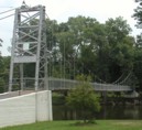
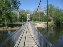
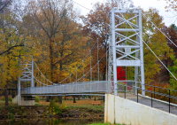
1923: Memorial Swinging
Winamac, Indiana, USA - Tippecanoe River
| Bridgemeister ID: | 849 (added 2003-07-27) |
| Year Completed: | 1923 |
| Name: | Memorial Swinging |
| Also Known As: | Soldiers and Sailors Memorial |
| Location: | Winamac, Indiana, USA |
| Crossing: | Tippecanoe River |
| At or Near Feature: | City Park |
| Coordinates: | 41.05245 N 86.59936 W |
| Maps: | Acme, GeoHack, Google, OpenStreetMap |
| Use: | Footbridge |
| Status: | In use (last checked: 2024) |
| Main Cables: | Wire (steel) |
| Suspended Spans: | 1 |
| Main Span: | 1 x 59 meters (193.6 feet) estimated |
External Links:
Image Sets:
1923: Oued Yquem
Skhirat and Temara, Morocco - Oued Yquem
| Bridgemeister ID: | 4610 (added 2020-06-07) |
| Year Completed: | 1923 |
| Name: | Oued Yquem |
| Location: | Skhirat and Temara, Morocco |
| Crossing: | Oued Yquem |
| Coordinates: | 33.873400 N 6.995066 W |
| Maps: | Acme, GeoHack, Google, OpenStreetMap |
| Use: | Vehicular |
| Status: | Extant (last checked: 2019) |
| Main Cables: | Wire |
| Suspended Spans: | 1 |
External Links:
Image Sets:

1923: Pepino
Mocoa vicinity and Villagarzón, Putumayo, Colombia - Rio Pepino
| Bridgemeister ID: | 9231 (added 2025-05-26) |
| Year Completed: | 1923 |
| Name: | Pepino |
| Location: | Mocoa vicinity and Villagarzón, Putumayo, Colombia |
| Crossing: | Rio Pepino |
| Coordinates: | 1.087917 N 76.627833 W |
| Maps: | Acme, GeoHack, Google, OpenStreetMap |
| Principals: | Julio Souza Alvez |
| Main Cables: | Wire |
| Suspended Spans: | 1 |
Notes:
- The coordinates provided here indicate the likely location of the bridge pictured.
External Links:
Image Sets:
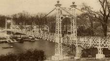
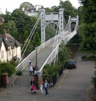
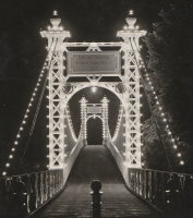
1923: Queens Park
Chester and Handbridge, England, United Kingdom - River Dee
| Bridgemeister ID: | 435 (added before 2003) |
| Year Completed: | 1923 |
| Name: | Queens Park |
| Location: | Chester and Handbridge, England, United Kingdom |
| Crossing: | River Dee |
| Coordinates: | 53.18796 N 2.88421 W |
| Maps: | Acme, GeoHack, Google, OpenStreetMap |
| Principals: | Charles Greenwood, David Rowell & Co., William E. Barker |
| References: | BRB, NTB |
| Use: | Footbridge |
| Status: | In use (last checked: 2019) |
| Main Cables: | Wire (steel) |
| Suspended Spans: | 1 |
| Main Span: | 1 x 83.8 meters (275 feet) |
Notes:
- Replaced 1852 Queens Park - Chester and Handbridge, England, United Kingdom.
- All past and present bridges at this location.
External Links:
- Chesterwiki - Suspension Bridge. Interesting details about the bridge.
Image Sets:
| Bridgemeister ID: | 3956 (added 2020-03-22) |
| Year Completed: | 1923 |
| Name: | Svanfoss |
| Location: | Brårud, Nes, Viken, Norway |
| Crossing: | Vorma |
| Coordinates: | 60.21450 N 11.35531 E |
| Maps: | Acme, GeoHack, Google, kart.1881.no, OpenStreetMap |
| Use: | Vehicular (one-lane) |
| Status: | Removed |
| Main Cables: | Wire (steel) |
| Suspended Spans: | 1 |
| Main Span: | 1 x 49 meters (160.8 feet) estimated |
Notes:
- Originally constructed as a stayed bridge in 1905, rebuilt as a suspension bridge in 1923.
- Based on historic aerial images, removed between 1972 and 2005.
External Links:
1923: Twin
Mangaweka vicinity, New Zealand - Kaiwhatau River
| Bridgemeister ID: | 704 (added 2003-03-08) |
| Year Completed: | 1923 |
| Name: | Twin |
| Location: | Mangaweka vicinity, New Zealand |
| Crossing: | Kaiwhatau River |
| References: | GAP |
1924: (footbridge)
Welling, Oklahoma, USA - Baron Fork Creek
| Bridgemeister ID: | 1804 (added 2005-05-18) |
| Year Completed: | 1924 |
| Name: | (footbridge) |
| Location: | Welling, Oklahoma, USA |
| Crossing: | Baron Fork Creek |
| Coordinates: | 35.888833 N 94.864889 W |
| Maps: | Acme, GeoHack, Google, OpenStreetMap |
| Use: | Footbridge |
| Status: | Extant (last checked: 2024) |
| Main Cables: | Wire (steel) |
| Suspended Spans: | 1 |
| Main Span: | 1 x 48.8 meters (160 feet) |
Image Sets:
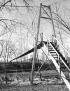
1924: (suspension bridge)
Cattle Flat, West Wanaka, Wanaka vicinity, New Zealand - Matukituki River
| Bridgemeister ID: | 715 (added 2003-03-08) |
| Year Completed: | 1924 |
| Name: | (suspension bridge) |
| Location: | Cattle Flat, West Wanaka, Wanaka vicinity, New Zealand |
| Crossing: | Matukituki River |
| Coordinates: | 44.636005 S 168.992132 E |
| Maps: | Acme, GeoHack, Google, OpenStreetMap |
| References: | GAP |
| Use: | Vehicular |
| Status: | Destroyed, September 10, 1970 |
| Main Cables: | Wire (steel) |
| Suspended Spans: | 1 |
Notes:
- GAP: Built circa 1924. Destroyed by flood c.1971.
- Later at same location Matukituki River - Cattle Flat, West Wanaka, Wanaka vicinity, Otago, New Zealand.
- All past and present bridges at this location.
External Links:
- Papers Past | Newspapers | Press | 12 September 1970 | BRIDGE DOWN. Article dated September 11, 1970: "The single-span suspension bridge across the West Matukituki River, 13 miles from Wanaka, was blown away by gale-force winds yesterday afternoon, cutting the only road access to West Wanaka station, where 10 persons are now isolated."
1924: (suspension bridge)
Moorefield, West Virginia, USA - South Fork South Branch Potomac River
| Bridgemeister ID: | 5584 (added 2020-12-21) |
| Year Completed: | 1924 |
| Name: | (suspension bridge) |
| Location: | Moorefield, West Virginia, USA |
| Crossing: | South Fork South Branch Potomac River |
| Coordinates: | 39.027926 N 78.947506 W |
| Maps: | Acme, GeoHack, Google, OpenStreetMap |
| Use: | Vehicular (one-lane) |
| Status: | Destroyed, After 1974 |
| Main Cables: | Wire (steel) |
| Main Span: | 1 |
Notes:
- Coordinates indicate likely location of this bridge, destroyed by flood debris at some point after 1974.
External Links:
1924: (suspension bridge)
Tolaga Bay vicinity, New Zealand - Mangaheia River
| Bridgemeister ID: | 712 (added 2003-03-08) |
| Year Completed: | 1924 |
| Name: | (suspension bridge) |
| Location: | Tolaga Bay vicinity, New Zealand |
| Crossing: | Mangaheia River |
| Principals: | Tom Ryan |
| References: | GAP |
Notes:
- GAP: completed circa 1924, in addition to "The Five Bridges" also spanning the Mangaheia
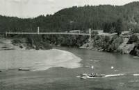
1924: Agness
Agness, Oregon, USA - Rogue River
| Bridgemeister ID: | 273 (added before 2003) |
| Year Completed: | 1924 |
| Name: | Agness |
| Location: | Agness, Oregon, USA |
| Crossing: | Rogue River |
| At or Near Feature: | Singing Springs Ranch |
| Coordinates: | 42.551639 N 124.063722 W |
| Maps: | Acme, GeoHack, Google, OpenStreetMap |
| Principals: | U.S. Forest Service |
| References: | AAJ |
| Use: | Vehicular |
| Status: | Destroyed, 1964 |
| Main Cables: | Wire (steel) |
| Main Span: | 1 x 92.7 meters (304 feet) |
| Side Span: | 1 |
Notes:
- A postcard reads, "This historic forestry suspension bridge over the Rogue River was... constructed of steel carried piece by piece up-river from Gold Beach by the mail boats. This bridge was swept away by flood waters 100 feet over flood stage during December 1964."
Image Sets:
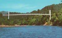
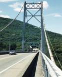
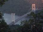
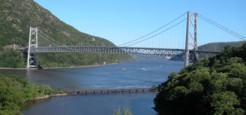
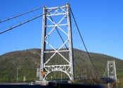
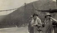
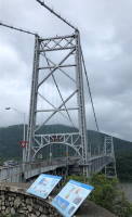
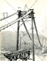
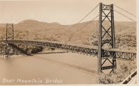
1924: Bear Mountain
Anthony's Nose and Bear Mountain, New York, USA - Hudson River
| Bridgemeister ID: | 141 (added before 2003) |
| Year Completed: | 1924 |
| Name: | Bear Mountain |
| Location: | Anthony's Nose and Bear Mountain, New York, USA |
| Crossing: | Hudson River |
| Coordinates: | 41.32 N 73.985 W |
| Maps: | Acme, GeoHack, Google, OpenStreetMap |
| Principals: | Howard C. Baird |
| References: | AAJ, BAAW, BBR, CPW, PTS2, SJR |
| Use: | Vehicular (two-lane, heavy vehicles), with walkway |
| Status: | In use (last checked: 2022) |
| Main Cables: | Wire (steel) |
| Suspended Spans: | 1 |
| Main Span: | 1 x 497.4 meters (1,632 feet) |
| Deck width: | 48 feet |
Notes:
- Became longest suspension bridge by eclipsing 1903 Williamsburg - New York and Brooklyn, New York, USA.
- Eclipsed by new longest suspension bridge 1926 Benjamin Franklin (Philadelphia-Camden) - Philadelphia, Pennsylvania and Camden, New Jersey, USA.
- Near 2002 Popolopen (William J. Moreau Popolopen) - Fort Montgomery, New York, USA.
External Links:
Image Sets:
1924: Burrator Reservoir
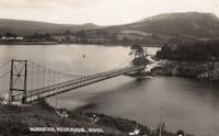
Sheepstor, England, United Kingdom - Burrator Reservoir
| Bridgemeister ID: | 2314 (added 2007-05-05) |
| Year Completed: | 1924 |
| Name: | Burrator Reservoir |
| Location: | Sheepstor, England, United Kingdom |
| Crossing: | Burrator Reservoir |
| Use: | Vehicular |
| Status: | Removed |
| Main Cables: | Wire (steel) |
| Suspended Spans: | 1 |
| Main Span: | 1 |
Notes:
- Large temporary bridge built to carry traffic across the reservoir while work was underway to raise Burrator Dam. Possibly completed 1925.
Image Sets:
1924: Curry
Curry, Alaska, USA - Susitna River
| Bridgemeister ID: | 1189 (added 2004-01-24) |
| Year Completed: | 1924 |
| Name: | Curry |
| Location: | Curry, Alaska, USA |
| Crossing: | Susitna River |
| Coordinates: | 62.617639 N 150.012306 W |
| Maps: | Acme, GeoHack, Google, OpenStreetMap |
| Use: | Footbridge |
| Status: | Removed, 1957 |
| Main Cables: | Wire |
| Suspended Spans: | 1 |
Notes:
- Long narrow footbridge with timber towers. Deck replaced, 1926.
External Links:
- Curry Hotel - Alaskarails.com. History of Curry Alaska.
Image Sets:
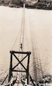
1924: Eikernsund
Darbu, Eikeren, Viken, Norway - Strait separating Eikeren and Fiskumvannet
| Bridgemeister ID: | 4085 (added 2020-04-04) |
| Year Completed: | 1924 |
| Name: | Eikernsund |
| Also Known As: | Eikernsundet, Eikern Strait |
| Location: | Darbu, Eikeren, Viken, Norway |
| Crossing: | Strait separating Eikeren and Fiskumvannet |
| Coordinates: | 59.699851 N 9.844541 E |
| Maps: | Acme, GeoHack, Google, kart.1881.no, OpenStreetMap |
| Use: | Vehicular (one-lane) |
| Status: | Removed |
| Main Cables: | Wire (steel) |
| Suspended Spans: | 1 |
| Main Span: | 1 x 90 meters (295.3 feet) estimated |
| Deck width: | ~3 meters |
Notes:
- Out of service, circa 1980. Subsequently removed.
External Links:
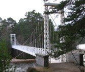
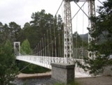
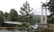
1924: Invercauld
Braemar vicinity, Scotland, United Kingdom - River Dee
| Bridgemeister ID: | 1906 (added 2005-10-08) |
| Year Completed: | 1924 |
| Name: | Invercauld |
| Also Known As: | Ballochbuie, Garbh Allt Shiel |
| Location: | Braemar vicinity, Scotland, United Kingdom |
| Crossing: | River Dee |
| Coordinates: | 57.001768 N 3.322743 W |
| Maps: | Acme, GeoHack, Google, OpenStreetMap |
| Principals: | James Abernethy & Co. |
| References: | HARPER, HBR |
| Use: | Footbridge |
| Status: | In use (last checked: 2014) |
| Main Cables: | Wire (steel) |
| Suspended Spans: | 1 |
External Links:
Image Sets:
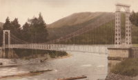
1924: Kemna
St. Elizabeth, Missouri, USA - Tavern Creek
| Bridgemeister ID: | 611 (added 2003-01-14) |
| Year Completed: | 1924 |
| Name: | Kemna |
| Location: | St. Elizabeth, Missouri, USA |
| Crossing: | Tavern Creek |
| Coordinates: | 38.247265 N 92.245431 W |
| Maps: | Acme, GeoHack, Google, OpenStreetMap |
| Principals: | Joseph A. Dice |
| References: | BOTO |
| Use: | Vehicular (one-lane) |
| Status: | In use (last checked: 2019) |
| Main Cables: | Wire (steel) |
| Suspended Spans: | 1 |
| Main Span: | 1 x 50.9 meters (167 feet) |
| Deck width: | 11.1 feet |
Notes:
- Original timber towers replaced, 1978.
- Similar to 1925 Mill Creek - Brumley vicinity, Missouri, USA.
- Near 1925 Kliethermes (Brumley) - St. Anthony vicinity, Missouri, USA.
External Links:
Image Sets:
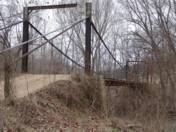
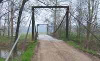
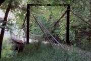
1924: Komnes
Komnes, Viken, Norway - Numedalslågen
| Bridgemeister ID: | 4094 (added 2020-04-05) |
| Year Completed: | 1924 |
| Name: | Komnes |
| Location: | Komnes, Viken, Norway |
| Crossing: | Numedalslågen |
| Coordinates: | 59.506986 N 9.890720 E |
| Maps: | Acme, GeoHack, Google, kart.1881.no, OpenStreetMap |
| Use: | Vehicular (one-lane) |
| Status: | In use (last checked: 2018) |
| Main Cables: | Wire (steel) |
| Suspended Spans: | 1 |
| Main Span: | 1 x 100 meters (328.1 feet) estimated |
External Links:
1924: Larry's River
Larry's River, Nova Scotia, Canada - Larry's River Estuary
| Bridgemeister ID: | 7594 (added 2023-05-07) |
| Year Completed: | 1924 |
| Name: | Larry's River |
| Location: | Larry's River, Nova Scotia, Canada |
| Crossing: | Larry's River Estuary |
| Use: | Footbridge |
| Status: | Dismantled, 1944 |
| Main Cables: | Wire (steel) |
| Suspended Spans: | 3 |
| Main Span: | 1 |
| Side Spans: | 2 |
External Links:
- Early Planning and Construction: 1922-1945 - Larry's River Footbridge Preservation Society. Blog post with several images of the site and bridge.
- Nova Scotia Archives - Clara Dennis Nova Scotia Archives 1981-541 no. 655. Image of Larry's River suspension bridge.
- Nova Scotia Archives - Clara Dennis Nova Scotia Archives 1981-541 no. 656. Image of Larry's River suspension bridge.
- Nova Scotia Archives - Clara Dennis Nova Scotia Archives 1981-541 no. 657. Image of Larry's River suspension bridge.
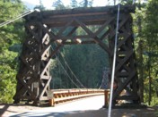
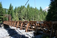
1924: Longmire
Packwood vicinity, Washington, USA - Nisqually River
| Bridgemeister ID: | 142 (added before 2003) |
| Year Completed: | 1924 |
| Name: | Longmire |
| Also Known As: | Nisqually |
| Location: | Packwood vicinity, Washington, USA |
| Crossing: | Nisqually River |
| At or Near Feature: | Mt. Rainier National Park |
| Coordinates: | 46.74903 N 121.80777 W |
| Maps: | Acme, GeoHack, Google, OpenStreetMap |
| Principals: | James A. French |
| Use: | Vehicular (one-lane) and Pipeline |
| Status: | In use (last checked: 2024) |
| Main Cables: | Wire (steel) |
| Suspended Spans: | 1 |
| Main Span: | 1 x 55.8 meters (183 feet) estimated |
Notes:
- 1950: Reconstructed.
- 2024, August: Weight restrictions imposed due to concerns over the bridge's age and condition.
External Links:
Image Sets:
1924: Mangaheia I
Tauwhareparae Road, Tolaga Bay vicinity, New Zealand - Mangaheia River
| Bridgemeister ID: | 707 (added 2003-03-08) |
| Year Completed: | 1924 |
| Name: | Mangaheia I |
| Location: | Tauwhareparae Road, Tolaga Bay vicinity, New Zealand |
| Crossing: | Mangaheia River |
| Principals: | Tom Ryan |
| References: | GAP |
| Use: | Vehicular (one-lane) |
| Status: | Replaced |
| Main Cables: | Wire (steel) |
| Suspended Spans: | 1 |
| Main Span: | 1 x 41 meters (134.5 feet) |
Notes:
- GAP: completed circa 1924. One of "The Five Bridges" that spanned the Mangaheia on the Tauwhareparae Road.
1924: Mangaheia II
Tauwhareparae Road, Tolaga Bay vicinity, New Zealand - Mangaheia River
| Bridgemeister ID: | 708 (added 2003-03-08) |
| Year Completed: | 1924 |
| Name: | Mangaheia II |
| Location: | Tauwhareparae Road, Tolaga Bay vicinity, New Zealand |
| Crossing: | Mangaheia River |
| Principals: | Tom Ryan |
| References: | GAP |
| Use: | Vehicular (one-lane) |
| Status: | Replaced |
| Main Cables: | Wire (steel) |
Notes:
- GAP: completed circa 1924. One of "The Five Bridges" that spanned the Mangaheia on the Tauwhareparae Road.
1924: Mangaheia III
Tauwhareparae Road, Tolaga Bay vicinity, New Zealand - Mangaheia River
| Bridgemeister ID: | 709 (added 2003-03-08) |
| Year Completed: | 1924 |
| Name: | Mangaheia III |
| Location: | Tauwhareparae Road, Tolaga Bay vicinity, New Zealand |
| Crossing: | Mangaheia River |
| Principals: | Tom Ryan |
| References: | GAP |
| Use: | Vehicular (one-lane) |
| Status: | Replaced |
| Main Cables: | Wire (steel) |
Notes:
- GAP: completed circa 1924. One of "The Five Bridges" that spanned the Mangaheia on the Tauwhareparae Road.
1924: Mangaheia IV
Tauwhareparae Road, Tolaga Bay vicinity, New Zealand - Mangaheia River
| Bridgemeister ID: | 710 (added 2003-03-08) |
| Year Completed: | 1924 |
| Name: | Mangaheia IV |
| Location: | Tauwhareparae Road, Tolaga Bay vicinity, New Zealand |
| Crossing: | Mangaheia River |
| Principals: | Tom Ryan |
| References: | GAP |
| Use: | Vehicular (one-lane) |
| Status: | Replaced |
| Main Cables: | Wire (steel) |
Notes:
- GAP: completed circa 1924. One of "The Five Bridges" that spanned the Mangaheia on the Tauwhareparae Road.
1924: Mangaheia V
Tauwhareparae Road, Tolaga Bay vicinity, New Zealand - Mangaheia River
| Bridgemeister ID: | 711 (added 2003-03-08) |
| Year Completed: | 1924 |
| Name: | Mangaheia V |
| Location: | Tauwhareparae Road, Tolaga Bay vicinity, New Zealand |
| Crossing: | Mangaheia River |
| Principals: | Tom Ryan |
| References: | GAP |
| Use: | Vehicular (one-lane) |
| Status: | Replaced |
| Main Cables: | Wire (steel) |
Notes:
- GAP: completed circa 1924. One of "The Five Bridges" that spanned the Mangaheia on the Tauwhareparae Road.
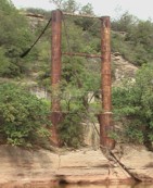
| Bridgemeister ID: | 140 (added before 2003) |
| Year Completed: | 1924 |
| Name: | Nocona |
| Also Known As: | Bluff, Ketchum Bluff, Ketchum's Bluff |
| Location: | Nocona vicinity, Texas and Jefferson County, Oklahoma, USA |
| Crossing: | Red River |
| At or Near Feature: | Ketchum Bluff |
| Coordinates: | 33.93579 N 97.75869 W |
| Maps: | Acme, GeoHack, Google, OpenStreetMap |
| Principals: | Austin Bridge Co. |
| References: | AUB, HAERTX98, PTS2 |
| Use: | Vehicular |
| Status: | Only towers remain (last checked: 2007) |
| Main Cables: | Wire (steel) |
| Main Span: | 1 x 213.4 meters (700 feet) |
Notes:
- Legend has it the bridge was burned during a dispute. This likely occurred before 1955. Some sources suggest it occurred before or during 1950. The road that leads to the Texas side of the former crossing is "Burned Out Bridge Road." Follow the image of the derelict tower to see the remains of the bridge.
- AUB mentions: "In January 1924, a contract was entered into with Nocona Bridge Company for a bridge across Red River, nine miles north of Nocona, connecting Texas and Oklahoma. The plans called for a 700' span, 16' roadway, and the main cables to contain 1,000 No. 9 galvanized wires each. The building of this, [the Austin Bridge Company's] first complete cable bridge, and the experience gained therefrom helped to launch Austin Bridge Company into an interesting and profitable line of work."
External Links:
- Nocona Suspension Bridge at Ketchum Bluff, Texas. University of Texas Arlington Libraries Digital Gallery
- Bridgehunter.com - BH70626
Image Sets:
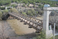
1924: Otowi
Otowi, New Mexico, USA - Rio Grande
| Bridgemeister ID: | 143 (added before 2003) |
| Year Completed: | 1924 |
| Name: | Otowi |
| Location: | Otowi, New Mexico, USA |
| Crossing: | Rio Grande |
| Coordinates: | 35.874725 N 106.141861 W |
| Maps: | Acme, GeoHack, Google, OpenStreetMap |
| Principals: | James A. French |
| References: | GBD |
| Use: | Vehicular |
| Status: | Extant (last checked: 2019) |
| Main Cables: | Wire (steel) |
| Suspended Spans: | 1 |
| Main Span: | 1 x 53 meters (174 feet) |
| Deck width: | 10 feet |
Notes:
- Bypassed, 1948.
External Links:
Image Sets:

1924: Saint-Leu
Saint-Leu-d'Esserent, Oise, France - Oise River
| Bridgemeister ID: | 1947 (added 2005-11-04) |
| Year Completed: | 1924 |
| Name: | Saint-Leu |
| Location: | Saint-Leu-d'Esserent, Oise, France |
| Crossing: | Oise River |
| Coordinates: | 49.213680 N 2.422861 E |
| Maps: | Acme, GeoHack, Google, OpenStreetMap |
| References: | AAJ |
| Use: | Vehicular (two-lane) |
| Status: | In use (last checked: 2022) |
| Main Cables: | Wire (steel) |
| Suspended Spans: | 1 |
External Links:
Image Sets:

1924: Shoki
Japan
| Bridgemeister ID: | 3355 (added 2019-12-15) |
| Year Completed: | 1924 |
| Name: | Skutskär |
| Location: | Skutskär, Sweden |
| Crossing: | Dalälven |
| Coordinates: | 60.611988 N 17.442079 E |
| Maps: | Acme, GeoHack, Google, OpenStreetMap |
| Use: | Vehicular (one-lane) |
| Status: | In use (last checked: 2019) |
| Main Cables: | Wire (steel) |
| Suspended Spans: | 1 |
| Main Span: | 1 x 10⁷ meters (351 feet) estimated |
Image Sets:

1924: Swinging
Thomson, Minnesota, USA - St. Louis River
| Bridgemeister ID: | 2103 (added 2006-08-19) |
| Year Completed: | 1924 |
| Name: | Swinging |
| Location: | Thomson, Minnesota, USA |
| Crossing: | St. Louis River |
| At or Near Feature: | Jay Cooke State Park |
| Coordinates: | 46.653649 N 92.370458 W |
| Maps: | Acme, GeoHack, Google, OpenStreetMap |
| Principals: | U.S. Forest Service |
| Use: | Footbridge |
| Status: | Replaced, 1935 |
| Main Cables: | Wire |
Notes:
External Links:
Image Sets:
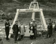
1924: Villemur-sur-Tarn
Villemur-sur-Tarn, Haute-Garonne, France - Tarn River
| Bridgemeister ID: | 1851 (added 2005-07-16) |
| Year Completed: | 1924 |
| Name: | Villemur-sur-Tarn |
| Location: | Villemur-sur-Tarn, Haute-Garonne, France |
| Crossing: | Tarn River |
| Use: | Vehicular |
| Status: | Destroyed, 1930 |
| Main Cables: | Wire (steel) |
Notes:
- 1930: Destroyed by flood.
- Replaced 1845 Villemur-sur-Tarn - Villemur-sur-Tarn, Haute-Garonne, France.
- Replaced by 1932 Villemur-sur-Tarn - Villemur-sur-Tarn, Haute-Garonne, France.
- All past and present bridges at this location.
Image Sets:
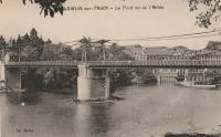
| Bridgemeister ID: | 1856 (added 2005-07-17) |
| Year Completed: | 1925 |
| Name: | (pipeline bridge) |
| Location: | Byers vicinity, Texas and Hastings, Oklahoma, USA |
| Crossing: | Red River |
| Coordinates: | 34.126861 N 98.213639 W |
| Maps: | Acme, GeoHack, Google, OpenStreetMap |
| Principals: | Austin Bridge Co. |
| References: | AUB |
| Use: | Pipeline |
| Status: | Removed |
| Main Cables: | Wire (steel) |
Notes:
- Coordinates provided here are the likely approximate location of the bridge. Two pipelines cross the Red River here. For many years they were elevated above the river. Piers are still (as of the 2020s) visible on the alignment indicated by the coordinates, and another set of piers slightly west.
- In AUB, two main spans and part of another suspended span are visible.
1925: (suspension bridge)
Hakis, Gilgit-Baltistan, Pakistan - Gilgit River
| Bridgemeister ID: | 6716 (added 2021-10-09) |
| Year Completed: | 1925 |
| Name: | (suspension bridge) |
| Location: | Hakis, Gilgit-Baltistan, Pakistan |
| Crossing: | Gilgit River |
| Coordinates: | 36.218917 N 73.510083 E |
| Maps: | Acme, GeoHack, Google, OpenStreetMap |
| Use: | Vehicular (one-lane) |
| Status: | In use (last checked: 2021) |
| Main Cables: | Wire |
| Suspended Spans: | 1 |
| Main Span: | 1 x 60.4 meters (198 feet) estimated |
External Links:
- X (Twitter). Post with several images of the bridge. September 12, 2021.
1925: A.A. Hadley
Honeydew vicinity, California, USA - Mattole River
| Bridgemeister ID: | 589 (added 2003-01-05) |
| Year Completed: | 1925 |
| Name: | A.A. Hadley |
| Also Known As: | Mattole River, Lindley |
| Location: | Honeydew vicinity, California, USA |
| Crossing: | Mattole River |
| Coordinates: | 40.25 N 124.165 W |
| Maps: | Acme, GeoHack, Google, OpenStreetMap |
| Use: | Vehicular (one-lane) |
| Status: | In use (last checked: 2004) |
| Main Cables: | Wire (steel) |
| Suspended Spans: | 1 |
External Links:
Image Sets:
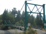
1925: Blair Grove
Miranda vicinity, California, USA - South Fork Eel River
| Bridgemeister ID: | 5667 (added 2021-01-30) |
| Year Completed: | 1925 |
| Name: | Blair Grove |
| Location: | Miranda vicinity, California, USA |
| Crossing: | South Fork Eel River |
| Coordinates: | 40.258954 N 123.841625 W |
| Maps: | Acme, GeoHack, Google, OpenStreetMap |
| Use: | Vehicular (one-lane) |
| Status: | Removed |
| Main Cables: | Wire (steel) |
| Main Span: | 1 |
Notes:
- May have been completed 1923-1924. Coordinates represent the suspected former location of this bridge.
- See 1925 A.A. Hadley (Mattole River, Lindley) - Honeydew vicinity, California, USA. The towers of the Blair Grove and Hadley bridges appear identical.
External Links:
1925: Bodie Creek
Falkland Islands
| Bridgemeister ID: | 1922 (added 2005-10-09) |
| Year Completed: | 1925 |
| Name: | Bodie Creek |
| Location: | Falkland Islands |
| Coordinates: | 51.853916 S 59.016884 W |
| Maps: | Acme, GeoHack, Google, OpenStreetMap |
| Principals: | David Rowell & Co., Charles Peters |
| Use: | Vehicular (one-lane) and Stock |
| Status: | Closed, 1997 (last checked: 2018) |
| Main Cables: | Wire (steel) |
| Suspended Spans: | 1 |
External Links:
- The Bodie Creek Suspension Bridge. Detailed account of the bridge's history and construction.
- Structurae - Structure ID 20035736
Image Sets:
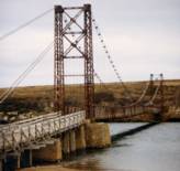
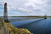
1925: Buechter
St. Anthony vicinity, Missouri, USA - Tavern Creek
| Bridgemeister ID: | 610 (added 2003-01-14) |
| Year Completed: | 1925 |
| Name: | Buechter |
| Location: | St. Anthony vicinity, Missouri, USA |
| Crossing: | Tavern Creek |
| Coordinates: | 38.141573 N 92.297910 W |
| Maps: | Acme, GeoHack, Google, OpenStreetMap |
| Principals: | Joseph A. Dice |
| References: | BOTO |
| Use: | Vehicular (one-lane) |
| Status: | Demolished, 2011 |
| Main Cables: | Wire (steel) |
| Suspended Spans: | 1 |
| Main Span: | 1 x 42.7 meters (140 feet) |
| Deck width: | 12.1 feet |
Notes:
- Completed circa 1925.
- Sometimes spelled Buetcher. The road the bridge carried is named with the "Buechter" spelling.
- Renovated 1986.
- Similar to 1925 Kliethermes (Brumley) - St. Anthony vicinity, Missouri, USA.
External Links:
Image Sets:
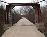
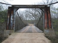
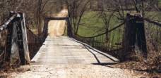
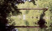
1925: Elvenes
Elvenes, Kirkenes, Sør-Varanger, Troms og Finnmark, Norway - Pasvikelva
| Bridgemeister ID: | 3765 (added 2020-02-29) |
| Year Completed: | 1925 |
| Name: | Elvenes |
| Location: | Elvenes, Kirkenes, Sør-Varanger, Troms og Finnmark, Norway |
| Crossing: | Pasvikelva |
| Coordinates: | 69.679423 N 30.113124 E |
| Maps: | Acme, GeoHack, Google, kart.1881.no, OpenStreetMap |
| Use: | Vehicular (one-lane) |
| Status: | Destroyed, 1944 |
| Main Cables: | Wire (steel) |
| Suspended Spans: | 1 |
| Main Span: | 1 x 10⁷ meters (351 feet) |
| Deck width: | 2.6 meters |
Notes:
- Later at same location 1950 Elvenes - Elvenes, Kirkenes, Sør-Varanger, Troms og Finnmark, Norway.
- All past and present bridges at this location.
External Links:
1925: Grimma
Grimma, Saxony, Germany - Mulde River
| Bridgemeister ID: | 1504 (added 2004-10-08) |
| Year Completed: | 1925 |
| Name: | Grimma |
| Location: | Grimma, Saxony, Germany |
| Crossing: | Mulde River |
| Coordinates: | 51.22805 N 12.72555 E |
| Maps: | Acme, GeoHack, Google, OpenStreetMap |
| Use: | Footbridge |
| Status: | In use (last checked: 2022) |
| Main Cables: | Wire (steel) |
| Suspended Spans: | 1 |
| Main Span: | 1 x 80 meters (262.5 feet) |
| Deck width: | 1.8 meters between side rails |
Notes:
- Rebuilt, 1949. Reconstruction, 1989, 1998, and in 2003 after 2002 flood damage.
External Links:
Image Sets:
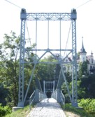
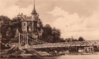
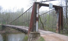
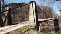
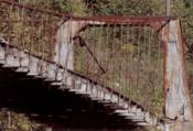
1925: Kliethermes
St. Anthony vicinity, Missouri, USA - Tavern Creek
| Bridgemeister ID: | 609 (added 2003-01-14) |
| Year Completed: | 1925 |
| Name: | Kliethermes |
| Also Known As: | Brumley |
| Location: | St. Anthony vicinity, Missouri, USA |
| Crossing: | Tavern Creek |
| Coordinates: | 38.178223 N 92.322981 W |
| Maps: | Acme, GeoHack, Google, OpenStreetMap |
| Principals: | Joseph A. Dice |
| References: | BOTO |
| Use: | Vehicular (one-lane) |
| Status: | Removed, March, 2008 |
| Main Cables: | Wire (steel) |
| Suspended Spans: | 1 |
| Main Span: | 1 x 65.8 meters (215.8 feet) |
| Deck width: | 10.8 feet |
Notes:
- Renovated, 1988. Closed, Spring 2006. Subsequently demolished in 2008.
- Completed circa 1925.
- Similar to 1925 Buechter - St. Anthony vicinity, Missouri, USA.
External Links:
Image Sets:
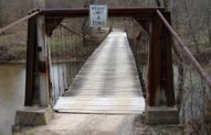
1925: Luzancy
Luzancy, Seine-et-Marne, France - Marne River
| Bridgemeister ID: | 4920 (added 2020-07-26) |
| Year Completed: | 1925 |
| Name: | Luzancy |
| Location: | Luzancy, Seine-et-Marne, France |
| Crossing: | Marne River |
| References: | AAJ, PTS2 |
| Use: | Vehicular |
| Status: | Destroyed |
| Main Cables: | Reinforced Concrete |
| Suspended Spans: | 1 |
Notes:
- Described as a "rigid suspension bridge of reinforced concrete."
- Replaced 1831 Luzancy - Luzancy, Seine-et-Marne, France.
- Similar to 1926 Laon - Laon, Aisne, France.
- Similar to Pommiers - Pommiers, Aisne, France.
- All past and present bridges at this location.
Image Sets:
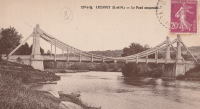
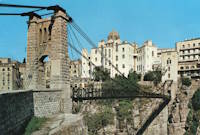
1925: Mellah Slimane
Constantine, Algeria - Oued Rhumel
| Bridgemeister ID: | 1117 (added 2004-01-05) |
| Year Completed: | 1925 |
| Name: | Mellah Slimane |
| Also Known As: | Perrégaux |
| Location: | Constantine, Algeria |
| Crossing: | Oued Rhumel |
| Coordinates: | 36.366261 N 6.615007 E |
| Maps: | Acme, GeoHack, Google, OpenStreetMap |
| Principals: | Ferdinand Arnodin |
| Use: | Footbridge |
| Status: | In use (last checked: 2019) |
| Main Cables: | Wire (steel) |
| Suspended Spans: | 1 |
| Main Span: | 1 x 125 meters (410.1 feet) |
| Deck width: | 2.4 meters |
External Links:
- Mellah Slimane Bridge - Wikipedia
- Perregaux Footbridge - HighestBridges.com
- Structurae - Structure ID 20009826
Image Sets:
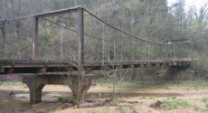
1925: Mill Creek
Brumley vicinity, Missouri, USA - Mill Creek
| Bridgemeister ID: | 342 (added before 2003) |
| Year Completed: | 1925 |
| Name: | Mill Creek |
| Location: | Brumley vicinity, Missouri, USA |
| Crossing: | Mill Creek |
| Coordinates: | 38.078408 N 92.524264 W |
| Maps: | Acme, GeoHack, Google, OpenStreetMap |
| Principals: | Joseph A. Dice |
| References: | BOTO |
| Use: | Vehicular (one-lane) |
| Status: | In use (last checked: 2020) |
| Main Cables: | Wire (steel) |
| Suspended Spans: | 2 |
| Main Span: | 1 x 29.3 meters (96 feet) estimated |
| Side Span: | 1 |
| Deck width: | 11.1 feet |
Notes:
- Original cables now assisted by additional steel cables.
- Similar to 1924 Kemna - St. Elizabeth, Missouri, USA.
- Near 1922 Glaize (Auglaize, Grand Glaize, Grand Auglaize) - Brumley vicinity, Missouri, USA. The bridges are less than half a mile apart.
External Links:
Image Sets:

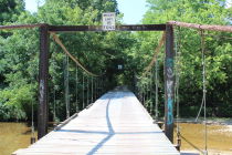
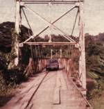
1925: Pandora
Pandora, Limón, Costa Rica - Estrella River
| Bridgemeister ID: | 436 (added before 2003) |
| Year Completed: | 1925 |
| Name: | Pandora |
| Also Known As: | Southeast Passage |
| Location: | Pandora, Limón, Costa Rica |
| Crossing: | Estrella River |
| Coordinates: | 9.736861 N 82.962167 W |
| Maps: | Acme, GeoHack, Google, OpenStreetMap |
| References: | PTS2, USS |
| Use: | Vehicular (one-lane) |
| Status: | Extant (last checked: 2022) |
| Main Cables: | Wire (steel) |
| Suspended Spans: | 1 |
| Main Span: | 1 x 73.2 meters (240 feet) |
Notes:
- Originally built with a set of tram tracks designed for cars hauling bananas.
- Next to (footbridge) - Pandora, Limón, Costa Rica.
- All past and present bridges at this location.
Image Sets:
1925: Powhatan
Powhatan, Arkansas, USA - Black River
| Bridgemeister ID: | 144 (added before 2003) |
| Year Completed: | 1925 |
| Name: | Powhatan |
| Location: | Powhatan, Arkansas, USA |
| Crossing: | Black River |
| Coordinates: | 36.081556 N 91.116222 W |
| Maps: | Acme, GeoHack, Google, OpenStreetMap |
| Principals: | Austin Bridge Co. |
| References: | AAJ, AUB |
| Use: | Vehicular |
| Status: | Removed |
| Main Cables: | Wire (steel) |
| Suspended Spans: | 1 |
| Main Span: | 1 x 116.4 meters (382 feet) |
External Links:
1925: Springvale
Taihape vicinity, New Zealand - Rangitikei River
| Bridgemeister ID: | 713 (added 2003-03-08) |
| Year Completed: | 1925 |
| Name: | Springvale |
| Location: | Taihape vicinity, New Zealand |
| Crossing: | Rangitikei River |
| Coordinates: | 39.488097 S 176.033601 E |
| Maps: | Acme, GeoHack, Google, OpenStreetMap |
| References: | GAP |
| Use: | Vehicular (one-lane) |
| Status: | Restricted to foot traffic (last checked: 2015) |
| Main Cables: | Wire (steel) |
| Suspended Spans: | 1 |
External Links:
1925: Swinging
River Falls, Wisconsin, USA - Kinnickinnic River South Fork
| Bridgemeister ID: | 1193 (added 2004-01-25) |
| Year Completed: | 1925 |
| Name: | Swinging |
| Location: | River Falls, Wisconsin, USA |
| Crossing: | Kinnickinnic River South Fork |
| At or Near Feature: | Glen Park |
| Coordinates: | 44.853817 N 92.6333 W |
| Maps: | Acme, GeoHack, Google, OpenStreetMap |
| Use: | Footbridge |
| Status: | In use (last checked: 2006) |
| Main Cables: | Wire (steel) |
| Suspended Spans: | 3 |
| Main Span: | 1 x 39.6 meters (130 feet) |
| Side Spans: | 2 x 9.1 meters (30 feet) |
Notes:
- Rehabilitated, 1985.
External Links:
Image Sets:
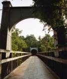
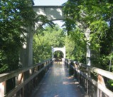
1925: Térénez
Landévennec vicinity and Rosnoen vicinity, Finistère, France - Aulne River
| Bridgemeister ID: | 1912 (added 2005-10-08) |
| Year Completed: | 1925 |
| Name: | Térénez |
| Location: | Landévennec vicinity and Rosnoen vicinity, Finistère, France |
| Crossing: | Aulne River |
| Coordinates: | 48.269120 N 4.262766 W |
| Maps: | Acme, GeoHack, Google, OpenStreetMap |
| Use: | Vehicular |
| Status: | Destroyed, 1944 |
| Main Cables: | Wire |
| Main Span: | 1 x 272 meters (892.4 feet) |
Notes:
- Coordinates are approximate, adjacent to the two subsequent replacement bridges.
- Replaced by 1952 Térénez - Landévennec vicinity and Rosnoen vicinity, Finistère, France.
- All past and present bridges at this location.
External Links:
Image Sets:


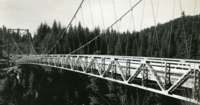
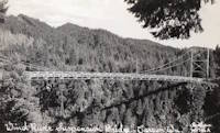
1925: Wind River
Carson, Washington, USA - Wind River
| Bridgemeister ID: | 1004 (added 2003-11-21) |
| Year Completed: | 1925 |
| Name: | Wind River |
| Location: | Carson, Washington, USA |
| Crossing: | Wind River |
| Coordinates: | 45.758333 N 121.837083 W |
| Maps: | Acme, GeoHack, Google, OpenStreetMap |
| References: | SPW |
| Use: | Vehicular |
| Status: | Replaced, 1961 |
| Main Cables: | Wire (steel) |
| Suspended Spans: | 1 |
Notes:
- Circa 1930's steel vehicular suspension bridge. Bypassed, 1961 (by the Conrad Lundy Jr. bridge) and removed some time after.
- Replaced 1913 Wind River - Carson, Washington, USA.
- All past and present bridges at this location.
Image Sets:

1926: (suspension bridge)
Arero, Tolaga Bay vicinity, New Zealand
| Bridgemeister ID: | 720 (added 2003-03-08) |
| Year Completed: | 1926 |
| Name: | (suspension bridge) |
| Location: | Arero, Tolaga Bay vicinity, New Zealand |
| References: | GAP |
1926: (suspension bridge)
Fort Collins, Colorado, USA - Cache La Poudre River
| Bridgemeister ID: | 2327 (added 2007-06-11) |
| Year Completed: | 1926 |
| Name: | (suspension bridge) |
| Location: | Fort Collins, Colorado, USA |
| Crossing: | Cache La Poudre River |
| Coordinates: | 40.578366 N 105.045251 W |
| Maps: | Acme, GeoHack, Google, OpenStreetMap |
| Status: | Extant (last checked: 2019) |
| Main Cables: | Wire |
Notes:
- Suspended flume, carried waste material away from the Great Western Sugar Co. factory. Has not been used since 1950s.
External Links:
1926: Andy Warhol
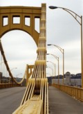
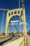
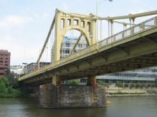
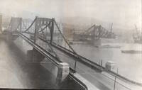
Pittsburgh, Pennsylvania, USA - Allegheny River
| Bridgemeister ID: | 148 (added before 2003) |
| Year Completed: | 1926 |
| Name: | Andy Warhol |
| Also Known As: | Seventh Street |
| Location: | Pittsburgh, Pennsylvania, USA |
| Crossing: | Allegheny River |
| Coordinates: | 40.44626 N 80.00145 W |
| Maps: | Acme, GeoHack, Google, OpenStreetMap |
| Principals: | Vernon R. Covell, T.J. Wilkerson, A.D. Nutter, H.E. Dodge, Stanley L. Roush |
| References: | AAJ, BOP, BPL, PBR, PTS2, USS |
| Use: | Vehicular (four-lane), with walkway |
| Status: | In use (last checked: 2014) |
| Main Cables: | Eyebar (steel) |
| Suspended Spans: | 3 |
| Main Span: | 1 x 134.7 meters (442 feet) |
| Side Spans: | 2 x 67.4 meters (221 feet) |
| Deck width: | 62 feet |
| Characteristics: | Self-anchored |
Notes:
- Self-anchored.
- Replaced 1884 North Side (Seventh Street) - Pittsburgh, Pennsylvania, USA.
- Next to 1927 Rachel Carson (Ninth Street) - Pittsburgh, Pennsylvania, USA.
- Next to 1928 Roberto Clemente (Sixth Street) - Pittsburgh, Pennsylvania, USA.
- All past and present bridges at this location.
External Links:
Image Sets:
1926: Arame de Rebordelo
Rebordelo and Lourido, Celorico de Basto, Portugal - Tâmega River
| Bridgemeister ID: | 9057 (added 2025-02-17) |
| Year Completed: | 1926 |
| Name: | Arame de Rebordelo |
| Also Known As: | Lourido |
| Location: | Rebordelo and Lourido, Celorico de Basto, Portugal |
| Crossing: | Tâmega River |
| Coordinates: | 41.347611 N 7.988306 W |
| Maps: | Acme, GeoHack, Google, OpenStreetMap |
| Use: | Footbridge |
| Status: | In use (last checked: 2025) |
| Main Cables: | Wire |
| Suspended Spans: | 1 |
Notes:
- 2025, January: Restoration is complete after the bridge had been in a derelict state for many years.
External Links:
- The Portugal News - 100 year old bridge reopens to the public. Article about the restored bridge. Dated January 26, 2025.
1926: Arapuni
Arapuni Power Station, New Zealand - Waikato River
| Bridgemeister ID: | 714 (added 2003-03-08) |
| Year Completed: | 1926 |
| Name: | Arapuni |
| Location: | Arapuni Power Station, New Zealand |
| Crossing: | Waikato River |
| Coordinates: | 38.070585 S 175.644480 E |
| Maps: | Acme, GeoHack, Google, OpenStreetMap |
| Principals: | David Rowell & Co., Armstrong Whitworth |
| References: | GAP |
| Use: | Footbridge |
| Status: | In use (last checked: 2019) |
| Main Cables: | Wire (steel) |
| Suspended Spans: | 1 |
External Links:
Image Sets:
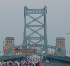
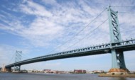
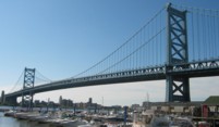
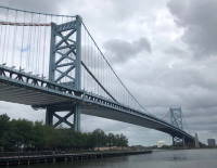
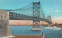
1926: Benjamin Franklin
Philadelphia, Pennsylvania and Camden, New Jersey, USA - Delaware River
| Bridgemeister ID: | 145 (added before 2003) |
| Year Completed: | 1926 |
| Name: | Benjamin Franklin |
| Also Known As: | Philadelphia-Camden |
| Location: | Philadelphia, Pennsylvania and Camden, New Jersey, USA |
| Crossing: | Delaware River |
| Coordinates: | 39.95333 N 75.135 W |
| Maps: | Acme, GeoHack, Google, OpenStreetMap |
| Principals: | Modjeski, Webster, Ball, Moiseff |
| References: | AAJ, BBR, BFL, BONJ, BPL, DRB, GBD, PTL, PTS2, USS |
| Use: | Vehicular (major highway) and Rail (subway), with walkway |
| Status: | In use (last checked: 2007) |
| Main Cables: | Wire (steel) |
| Suspended Spans: | 3 |
| Main Span: | 1 x 533.4 meters (1,750 feet) |
| Side Spans: | 2 x 219.3 meters (719.5 feet) |
| Deck width: | 125.5 feet |
Notes:
- Became longest suspension bridge by eclipsing 1924 Bear Mountain - Anthony's Nose and Bear Mountain, New York, USA.
- Eclipsed by new longest suspension bridge 1929 Ambassador - Detroit, Michigan, USA and Windsor, Ontario, Canada.
- Near 1957 Walt Whitman - Philadelphia, Pennsylvania and Camden, New Jersey, USA.
External Links:
Image Sets:
1926: Bertrand Road
Huirangi and Tikorangi, New Zealand - Waitara River
| Bridgemeister ID: | 716 (added 2003-03-08) |
| Year Completed: | 1926 |
| Name: | Bertrand Road |
| Location: | Huirangi and Tikorangi, New Zealand |
| Crossing: | Waitara River |
| Coordinates: | 39.047336 S 174.254549 E |
| Maps: | Acme, GeoHack, Google, OpenStreetMap |
| Principals: | N.C. Fookes |
| References: | GAP |
| Use: | Vehicular (one-lane) |
| Status: | In use (last checked: 2021) |
| Main Cables: | Wire (steel) |
| Suspended Spans: | 1 |
| Main Span: | 1 x 61 meters (200.1 feet) |
Notes:
- 1985: Closed to vehicular traffic.
- 2004: Closed to all traffic.
- 2006: Refurbished and reopened.
- 2017, May 20: Damaged by oversized truck. Bridge is closed.
- 2017, July: Bridge is repaired and reopened.
- At some point, the bridge reopened to vehicular traffic.
- Replaced 1897 Bertrand Road (Tikorangi) - Huirangi, New Zealand.
- All past and present bridges at this location.
External Links:
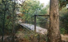
1926: Boeckman
St. Elizabeth, Missouri, USA - Big Tavern Creek
| Bridgemeister ID: | 608 (added 2003-01-14) |
| Year Completed: | 1926 |
| Name: | Boeckman |
| Location: | St. Elizabeth, Missouri, USA |
| Crossing: | Big Tavern Creek |
| Coordinates: | 38.22667 N 92.24 W |
| Maps: | Acme, GeoHack, Google, OpenStreetMap |
| Principals: | Joseph A. Dice |
| References: | BOTO |
| Use: | Vehicular |
| Status: | Replaced, 2003 |
| Main Cables: | Wire (steel) |
| Suspended Spans: | 1 |
| Main Span: | 1 x 48.8 meters (160 feet) |
| Deck width: | 12.4 feet |
Notes:
- Federal Highway Administration year 2000 data listed 1910 as the year of completion.
- Original timber towers replaced with steel towers, 1988.
External Links:
Image Sets:
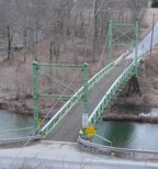
1926: Corbett
Corbett, New York, USA - East Branch Delaware River
| Bridgemeister ID: | 324 (added before 2003) |
| Year Completed: | 1926 |
| Name: | Corbett |
| Also Known As: | Corbett and Stuart |
| Location: | Corbett, New York, USA |
| Crossing: | East Branch Delaware River |
| Coordinates: | 42.04633 N 75.02768 W |
| Maps: | Acme, GeoHack, Google, OpenStreetMap |
| Principals: | John A. Roebling's Sons Co. |
| References: | SJR |
| Use: | Vehicular (one-lane) |
| Status: | In use (last checked: 2005) |
| Main Cables: | Wire (steel) |
| Suspended Spans: | 1 |
External Links:
Image Sets:
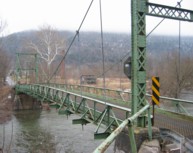
1926: Dhakuria
Rabindra Sarovar, Kolkata, West Bengal, India - Rabindra Sarovar Lake
| Bridgemeister ID: | 2847 (added 2019-07-07) |
| Year Completed: | 1926 |
| Name: | Dhakuria |
| Location: | Rabindra Sarovar, Kolkata, West Bengal, India |
| Crossing: | Rabindra Sarovar Lake |
| Coordinates: | 22.511127 N 88.355322 E |
| Maps: | Acme, GeoHack, Google, OpenStreetMap |
| Use: | Footbridge |
| Status: | In use (last checked: 2019) |
| Main Cables: | Wire (steel) |
| Suspended Spans: | 1 |
Image Sets:

1926: Eustaquio Palacios
Roldanillo vicinity and Zarzal vicinity, Colombia - Cauca River
| Bridgemeister ID: | 2012 (added 2006-01-04) |
| Year Completed: | 1926 |
| Name: | Eustaquio Palacios |
| Location: | Roldanillo vicinity and Zarzal vicinity, Colombia |
| Crossing: | Cauca River |
| Coordinates: | 4.405070 N 76.101374 W |
| Maps: | Acme, GeoHack, Google, OpenStreetMap |
| Use: | Vehicular (one-lane) |
| Status: | Derelict (last checked: 2007) |
| Main Cables: | Wire (steel) |
| Suspended Spans: | 1 |
Notes:
- Bypassed, 1978. Still standing, but partially dismantled.
- Next to (pipeline bridge) - Roldanillo vicinity and Zarzal vicinity, Colombia.
- All past and present bridges at this location.
1926: Fron
Fron, Llandyssil, Wales, United Kingdom - River Severn
| Bridgemeister ID: | 4617 (added 2020-06-07) |
| Year Completed: | 1926 |
| Name: | Fron |
| Location: | Fron, Llandyssil, Wales, United Kingdom |
| Crossing: | River Severn |
| Coordinates: | 52.568132 N 3.207281 W |
| Maps: | Acme, GeoHack, Google, OpenStreetMap |
| Principals: | David Rowell & Co. |
| Use: | Footbridge |
| Status: | Extant (last checked: 2009) |
| Main Cables: | Wire (steel) |
External Links:
| Bridgemeister ID: | 3880 (added 2020-03-08) |
| Year Completed: | 1926 |
| Name: | Henmo |
| Location: | Østeraunet, Aunet, Tydal and Henmo, Aunet, Tydal, Trøndelag, Norway |
| Crossing: | Nea |
| Coordinates: | 63.04982 N 11.58648 E |
| Maps: | Acme, GeoHack, Google, kart.1881.no, OpenStreetMap |
| Use: | Vehicular (one-lane) |
| Status: | Replaced, 1975 |
| Main Cables: | Wire (steel) |
| Main Span: | 1 x 60 meters (196.9 feet) estimated |
Notes:
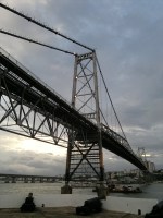
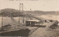
1926: Hercilio Luz
Florianopolis, Santa Catarina, Brazil
| Bridgemeister ID: | 437 (added before 2003) |
| Year Completed: | 1926 |
| Name: | Hercilio Luz |
| Also Known As: | Florianopolis |
| Location: | Florianopolis, Santa Catarina, Brazil |
| Coordinates: | 27.59393 S 48.56619 W |
| Maps: | Acme, GeoHack, Google, OpenStreetMap |
| Principals: | David B. Steinman, Holton D. Robinson |
| References: | AAJ, ADDS, BBR, PTS2, USS |
| Use: | Vehicular (two-lane, heavy vehicles), with walkway |
| Status: | In use (last checked: 2011) |
| Main Cables: | Eyebar (steel) |
| Suspended Spans: | 1 |
| Main Span: | 1 x 339.5 meters (1,113.75 feet) |
| Deck width: | 37 feet |
External Links:
Image Sets:
1926: Hidalgo-Reynosa International
Hidalgo, McAllen vicinity, Texas, USA and Reynosa, Tamaulipas, Mexico - Rio Grande
| Bridgemeister ID: | 146 (added before 2003) |
| Year Completed: | 1926 |
| Name: | Hidalgo-Reynosa International |
| Also Known As: | McAllen-Hidalgo, McAllen-Hidalgo-Reynosa |
| Location: | Hidalgo, McAllen vicinity, Texas, USA and Reynosa, Tamaulipas, Mexico |
| Crossing: | Rio Grande |
| Coordinates: | 26.095389 N 98.272000 W |
| Maps: | Acme, GeoHack, Google, OpenStreetMap |
| Principals: | Austin Bridge Co. |
| References: | AAJ, AUB, HAERTX98, PTS2 |
| Use: | Vehicular |
| Status: | Demolished, 1960's |
| Main Cables: | Wire (steel) |
| Suspended Spans: | 1 |
| Main Span: | 1 x 137.2 meters (450 feet) |
Notes:
- Damaged by flood, 1933. Rebuilt, 1934. Cables failed, 1939. Rebuilt.
External Links:
- The University of Texas Rio Grande Valley - Partial collapse of the McAllen–Hidalgo–Reynosa International. Image of the partial collapse of the bridge in 1933. Flooding completely undermined the foundation on one side.
Image Sets:
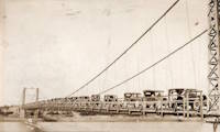
1926: La Guasca
El Peñol and Policarpa, Narino, Colombia - Patia River
| Bridgemeister ID: | 7648 (added 2023-06-03) |
| Year Completed: | 1926 |
| Name: | La Guasca |
| Also Known As: | Puerto Rico |
| Location: | El Peñol and Policarpa, Narino, Colombia |
| Crossing: | Patia River |
| Coordinates: | 1.594139 N 77.429486 W |
| Maps: | Acme, GeoHack, Google, OpenStreetMap |
| Principals: | Julio Souza Alves |
| Use: | Vehicular (one-lane) |
| Status: | Demolished, 2003 and 2020-2021 |
| Main Cables: | Wire (steel) |
Notes:
- 2003: Much of the bridge is dynamited. Stone towers remain.
- 2020 (or early 2021): The stone towers are demolished to make way for a replacement bridge.
External Links:
- Alcalde de Policarpa, en Nariño, dinamitó una joya de la ingeniería portuguesa de 100 años de antigüedad. Article about the history of the bridge and its destruction.
- Facebook. Several images of Claudia Cabrera, former mayor of Policarpa, escorted across a pulley system installed between the bridge towers.
- Facebook. Older image of the bridge with deck intact.
- Facebook. Work progressing on the replacement bridge. November 1, 2022.
- Google Maps - Puente De La Guaca. Image with the remaining towers visible, September 2018.
- Google Maps - Puente De La Guaca. Image taken in front of one of the towers, September 2018.
- Google Maps - Puente De La Guaca. Image of remaining tower , September 2018.
| Bridgemeister ID: | 8219 (added 2024-02-06) |
| Year Completed: | 1926 |
| Name: | Laon |
| Location: | Laon, Aisne, France |
| Coordinates: | 49.571000 N 3.635639 E |
| Maps: | Acme, GeoHack, Google, OpenStreetMap |
| References: | PTS2 |
| Use: | Vehicular |
| Status: | In use (last checked: 2023) |
| Main Cables: | Reinforced Concrete |
| Suspended Spans: | 2 |
| Side Spans: | 2 |
Notes:
- Rigid reinforced concrete suspension bridge.
- Similar to 1925 Luzancy - Luzancy, Seine-et-Marne, France.
- Similar to Pommiers - Pommiers, Aisne, France.
External Links:
Image Sets:
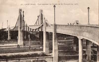
1926: Lower Hurunui
North Canterbury, New Zealand - Hurunui River
| Bridgemeister ID: | 719 (added 2003-03-08) |
| Year Completed: | 1926 |
| Name: | Lower Hurunui |
| Location: | North Canterbury, New Zealand |
| Crossing: | Hurunui River |
| Coordinates: | 42.907226 S 173.273596 E |
| Maps: | Acme, GeoHack, Google, OpenStreetMap |
| Principals: | H.F. Toogood |
| References: | GAP |
| Use: | Vehicular (one-lane) |
| Status: | In use (last checked: 2024) |
| Main Cables: | Wire (steel) |
| Suspended Spans: | 1 |
| Main Span: | 1 x 65 meters (213.3 feet) estimated |
Notes:
- GAP: Refurbished, 1983.
- Not entirely clear the bridge described in GAP as the "Lower Hurunui" bridge near the mouth of the Hurunui is the same bridge as the present day bridge carrying Blythe Road. The detailed description of the 1926 bridge does not seem to match the current structure. However, Thornton also implied major changes to the bridge during the 1983 refurbishment.
External Links:
Image Sets:
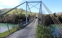
1926: Nassau
Nassau, Rheinland-Pfalz, Germany - Lahn River
| Bridgemeister ID: | 1133 (added 2004-01-16) |
| Year Completed: | 1926 |
| Name: | Nassau |
| Location: | Nassau, Rheinland-Pfalz, Germany |
| Crossing: | Lahn River |
| Coordinates: | 50.311299 N 7.795710 E |
| Maps: | Acme, GeoHack, Google, OpenStreetMap |
| References: | AAJ |
| Use: | Vehicular (two-lane) |
| Status: | Removed, c. 2004 |
| Main Cables: | Riveted plate |
| Suspended Spans: | 1 |
| Main Span: | 1 x 74.9 meters (245.75 feet) |
Notes:
- The "cables" of this bridge appear to have been steel plates riveted together. The deck is plate girder. Not surprisingly, recent photos of the bridge show it resting on two intermediate piers. AAJ describes the cables: "'laminated chains' made of flat iron plates, there being two such chains to a side, each of five plates riveted together."
- Replaced 1830 (suspension bridge) - Nassau, Germany.
- Replaced by 2005 Nassau - Nassau, Rheinland-Pfalz, Germany.
- All past and present bridges at this location.
External Links:
Image Sets:
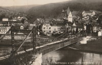
| Bridgemeister ID: | 7273 (added 2022-07-22) |
| Year Completed: | 1926 |
| Name: | Oiselay |
| Location: | Sorgues, Vaucluse, France |
| Coordinates: | 44.023850 N 4.843694 E |
| Maps: | Acme, GeoHack, Google, OpenStreetMap |
| Use: | Vehicular (one-lane) |
| Status: | Closed (last checked: 2021) |
| Main Cables: | Wire (steel) |
| Suspended Spans: | 1 |
| Main Span: | 1 x 151 meters (495.4 feet) estimated |
Image Sets:

1926: Oriente
Oriente, Jiménez, Cartago, Costa Rica - Pejibaye River
| Bridgemeister ID: | 438 (added before 2003) |
| Year Completed: | 1926 |
| Name: | Oriente |
| Location: | Oriente, Jiménez, Cartago, Costa Rica |
| Crossing: | Pejibaye River |
| Coordinates: | 9.834250 N 83.681556 W |
| Maps: | Acme, GeoHack, Google, OpenStreetMap |
| References: | PTS2, USS |
| Use: | Vehicular |
| Status: | Removed, c. 2002-2015 |
| Main Cables: | Wire (steel) |
| Suspended Spans: | 1 |
| Main Span: | 1 x 45.7 meters (150 feet) |
Notes:
- Built with a set of tram tracks designed for cars hauling fruit.
- Older sources refer to the "Pejivalle" river.
- Removed at some point in the 2002-2015 time frame.
1926: Satok
Kuching, Sarawak, Malaysia - Sarawak River
| Bridgemeister ID: | 1574 (added 2004-12-12) |
| Year Completed: | 1926 |
| Name: | Satok |
| Also Known As: | Yellow |
| Location: | Kuching, Sarawak, Malaysia |
| Crossing: | Sarawak River |
| Coordinates: | 1.554709 N 110.324370 E |
| Maps: | Acme, GeoHack, Google, OpenStreetMap |
| Use: | Footbridge and Pipeline |
| Status: | Collapsed, 2004 |
| Main Cables: | Wire (steel) |
| Suspended Spans: | 1 |
| Main Span: | 1 x 130 meters (426.5 feet) |
Notes:
- 1992: Closed to pedestrian traffic.
- 2004, October 7: Collapsed. Was still closed to pedestrian traffic at the time of the collapse, but was still carrying the local water supply.
- Later at same location 2021 Satok - Kuching, Sarawak, Malaysia.
- All past and present bridges at this location.
Image Sets:

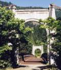
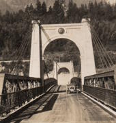
1926: Second Alexandra
Spuzzum, British Columbia, Canada - Fraser River
| Bridgemeister ID: | 147 (added before 2003) |
| Year Completed: | 1926 |
| Name: | Second Alexandra |
| Location: | Spuzzum, British Columbia, Canada |
| Crossing: | Fraser River |
| At or Near Feature: | Caribou Highway |
| Coordinates: | 49.70739 N 121.41669 W |
| Maps: | Acme, GeoHack, Google, OpenStreetMap |
| References: | BPL |
| Use: | Vehicular (one-lane) |
| Status: | Restricted to foot traffic (last checked: 2021) |
| Main Cables: | Wire (steel) |
| Suspended Spans: | 1 |
| Main Span: | 1 x 82.3 meters (270 feet) |
Notes:
- Replaced 1863 Alexandra (Trutch's) - Spuzzum, British Columbia, Canada.
- All past and present bridges at this location.
Image Sets:
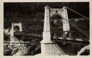
1926: Shirakawa
Shirakawa, Gifu, Japan - Hida River
| Bridgemeister ID: | 3206 (added 2019-11-10) |
| Year Completed: | 1926 |
| Name: | Shirakawa |
| Also Known As: | 白川橋 |
| Location: | Shirakawa, Gifu, Japan |
| Crossing: | Hida River |
| Coordinates: | 35.579518 N 137.186653 E |
| Maps: | Acme, GeoHack, Google, OpenStreetMap |
| Use: | Vehicular (one-lane) |
| Status: | Restricted to foot traffic (last checked: 2014) |
| Main Cables: | Wire (steel) |
| Suspended Spans: | 3 |
| Main Span: | 1 x 74.6 meters (244.8 feet) |
| Side Spans: | 2 x 20 meters (65.6 feet) |
External Links:
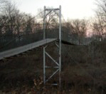
1926: Swinging
Pawhuska, Oklahoma, USA - Bird Creek
| Bridgemeister ID: | 3061 (added 2019-10-26) |
| Year Completed: | 1926 |
| Name: | Swinging |
| Location: | Pawhuska, Oklahoma, USA |
| Crossing: | Bird Creek |
| Coordinates: | 36.659110 N 96.341366 W |
| Maps: | Acme, GeoHack, Google, OpenStreetMap |
| Principals: | J.M. Buckley |
| Use: | Footbridge |
| Status: | In use (last checked: 2019) |
| Main Cables: | Wire (steel) |
Image Sets:
1926: Yunguita
Colombia - Suaza River
| Bridgemeister ID: | 439 (added before 2003) |
| Year Completed: | 1926 |
| Name: | Yunguita |
| Location: | Colombia |
| Crossing: | Suaza River |
| References: | USS |
| Use: | Vehicular |
| Main Cables: | Wire (steel) |
| Suspended Spans: | 1 |
| Main Span: | 1 x 103.3 meters (339 feet) |
| Deck width: | 10 feet |
External Links:
1927: (footbridge)
Forst, Germany - Lusatian Neisse River
| Bridgemeister ID: | 5562 (added 2020-12-19) |
| Year Completed: | 1927 |
| Name: | (footbridge) |
| Location: | Forst, Germany |
| Crossing: | Lusatian Neisse River |
| Coordinates: | 51.748356 N 14.659815 E |
| Maps: | Acme, GeoHack, Google, OpenStreetMap |
| References: | AAJ |
| Use: | Footbridge |
| Status: | Removed |
| Main Cables: | Eyebar (steel) |
| Suspended Spans: | 3 |
| Main Span: | 1 x 39.6 meters (129.89 feet) |
| Side Spans: | 2 x 19.8 meters (64.94 feet) |
Notes:
- Coordinates are for likely alignment of this former bridge, with at least one pier remaining (as of 2020).
1927: (footbridge)
Töpeln and Wöllsdorf, Saxony, Germany - Zschopau River
| Bridgemeister ID: | 2301 (added 2007-04-26) |
| Year Completed: | 1927 |
| Name: | (footbridge) |
| Location: | Töpeln and Wöllsdorf, Saxony, Germany |
| Crossing: | Zschopau River |
| Use: | Footbridge |
| Status: | Destroyed, 2002, by flood |
| Main Cables: | Wire (steel) |
| Suspended Spans: | 1 |
Notes:
- Replaced by a cable-stayed bridge April, 2004.
| Bridgemeister ID: | 3931 (added 2020-03-20) |
| Year Completed: | 1927 |
| Name: | Bingsfoss |
| Location: | Sørumsand, Lillestrøm, Viken, Norway |
| Crossing: | Glomma |
| Coordinates: | 59.98854 N 11.26129 E |
| Maps: | Acme, GeoHack, Google, kart.1881.no, OpenStreetMap |
| Use: | Vehicular |
| Status: | Removed, 1978 |
| Main Cables: | Wire (steel) |
| Suspended Spans: | 1 |
| Main Span: | 1 x 132 meters (433.1 feet) estimated |
External Links:
1927: Briollay
Briollay, Maine-et-Loire, France - Sarthe River
| Bridgemeister ID: | 6700 (added 2021-10-03) |
| Year Completed: | 1927 |
| Name: | Briollay |
| Location: | Briollay, Maine-et-Loire, France |
| Crossing: | Sarthe River |
| Use: | Vehicular |
| Status: | Removed |
| Main Cables: | Wire |
Notes:
- Replaced 1842 Briollay - Briollay, Maine-et-Loire, France.
- All past and present bridges at this location.
Image Sets:

1927: Bryan-Fannin
Telephone, Bonham vicinity, Fannin County, Texas and Bryan County, Oklahoma, USA - Red River
| Bridgemeister ID: | 602 (added 2003-01-11) |
| Year Completed: | 1927 |
| Name: | Bryan-Fannin |
| Also Known As: | Telephone, Snow's Ferry, Bryant-Fannin |
| Location: | Telephone, Bonham vicinity, Fannin County, Texas and Bryan County, Oklahoma, USA |
| Crossing: | Red River |
| Coordinates: | 33.844484 N 96.011125 W |
| Maps: | Acme, GeoHack, Google, OpenStreetMap |
| Principals: | Austin Bridge Co. |
| References: | AUB, PTS2 |
| Use: | Vehicular |
| Status: | Collapsed, December, 1940 |
| Main Cables: | Wire (steel) |
| Suspended Spans: | 3 |
| Main Span: | 1 |
| Side Spans: | 2 |
Notes:
- Sometimes referenced as "Bryant-Fannin". The bridge unquestionably connected Fannin County to Bryan County, Oklahoma, but according to a www.rootsweb.com article (Fannin County TXGenWeb - Ferry's in Fannin County, from Pat Pryor, by Kathy J. Ellis) it was erected at a site known as "Bryant's Crossing" named for a local, Dave Bryant. The Steinman inventory lists it as "Bryan-Fannin". AUB mentions it as "Bryant-Fannin". The Rootsweb article also mentions it collapsed in 1940 under weight of a truck.
- An article in the December 6, 1940 issue of The Port Arthur News (Texas) titled: "Suspension Bridge Plunges Into Red River" describes the collapse: "Owners of a $75,000 tollbridge which plunged into the Red River Wednesday when a suspension cable anchor pulled loose were undecided today whether it would be rebuilt. The bridge, owned by the Austin Bridge company of Dallas, was near Telephone, Tex., 12 miles north of here, and was several miles from a principal highway. Most of the traffic from the Bonham area toward Oklahoma is across a structure built recently to replace a toll bridge at nearby Sowell's bluff that collapsed in 1930. Mrs. Jim Freeman, toll keeper, said she heard a 'rumble' and looked up to see the 'deadman anchor' pull loose, throwing the entire weight of the 1,300 foot span on the other cable. It snapped, and the flooring and steel framework of the bridge sagged into the water. No one was on the structure when it fell."
- Remains of three piers are still visible, 2019.
Mail | Facebook | X (Twitter) | Bluesky