Suspension Bridges of Virginia
This is a list of all 99 bridges from the suspension bridge inventory for Virginia in USA. Wherever you see a Bridgemeister ID number click it to isolate the bridge on its own page.
Related Lists:
Bridgemeister ID: 4 (added before 2003)Year Completed: 1807 Name: Chain Location: Georgetown, District of Columbia and Virginia , USA Crossing: Potomac River Coordinates: 38.92959 N 77.11627 W Maps: Acme , GeoHack , Google , OpenStreetMap Principals: John Templeman References: AAJ , BBR , BCW , CAB , DSE20000118 , HBE , PTS2 Use: Vehicular Status: Destroyed, 1812 Main Cables: Chain (iron) Suspended Spans: 1 Main Span: 1 x 39.2 meters (128.5 feet)
BCW gives completion date of 1810 and says bridge was destroyed by flood two years later. Coordinates given are for the current crossing (VA SR123, still known locally as "Chain Bridge Road") which is on (or very close) to the alignment of Chain Bridge. Chain Bridge was the third bridge at this site. The current structure is the eighth and was completed in 1940. After several attempts by the Union Army to restore Rappahannock River bridges near Fredericksburg with pontoon bridges during the Civil War, Washington Roebling built a temporary wire suspension bridge on the piers of the former Chatham Bridge. The suspension bridge may have had twelve or more suspended spans (the former Chatham Bridge supposedly had 13 piers). Started July 1 and completed July 18, it survived less than two months, destroyed on September 1, 1862 by an evacuating Union Army. Bridgemeister ID: 4665 (added 2020-06-19)Year Completed: 1890 Name: (suspension bridge) Location: Brookneal, Virginia , USA Crossing: Roanoke River Coordinates: 37.083602 N 78.935547 W Maps: Acme , GeoHack , Google , OpenStreetMap Principals: Berlin Iron Bridge Co. Use: Vehicular Status: Demolished, 1940s Main Cables: Wire (steel) Suspended Spans: 1
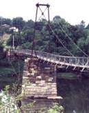
Bridgemeister ID: 337 (added before 2003)Year Completed: 1938 Name: James River Location: Buchanan, Virginia , USA Crossing: James River Coordinates: 37.53038 N 79.67793 W Maps: Acme , GeoHack , Google , OpenStreetMap Principals: Virginia State Highway Department (now VDOT) References: RT20040413 Use: Footbridge Status: In use (last checked: 2022) Main Cables: Wire (steel) Suspended Spans: 2 Main Span: 1 Side Span: 1
This oddly-proportioned bridge has a long side-span on one side and no side-span on the other. Damaged by storm, November, 2003. Temporarily closed, February, 2004. Repaired and reopened March, 2004. Bridgemeister ID: 1331 (added 2004-04-30)Year Completed: 1987 Name: (footbridge) Location: Criglersville, Virginia , USA Crossing: Robinson River Coordinates: 38.4633 N 78.309933 W Maps: Acme , GeoHack , Google , OpenStreetMap Principals: VDOT Use: Footbridge Status: In use (last checked: 2021) Main Cables: Wire (steel) Suspended Spans: 1 Main Span: 1 x 36.6 meters (120 feet) estimated
Bridgemeister ID: 236 (added before 2003)Year Completed: 1992 Name: Cowpasture River Location: Williamsville vicinity, Virginia , USA Crossing: Cowpasture River At or Near Feature: George Washington National Forest Coordinates: 38.16573 N 79.57665 W Maps: Acme , GeoHack , Google , OpenStreetMap Principals: Sahale, LLC Use: Footbridge Status: In use (last checked: 2005) Main Cables: Wire (steel) Suspended Spans: 1 Main Span: 1 x 45.7 meters (150 feet)
Bridgemeister ID: 237 (added before 2003)Year Completed: 1992 Name: Kimberling Creek Location: Mechanicsburg vicinity, Virginia , USA Crossing: Kimberling Creek At or Near Feature: Appalachian Trail Coordinates: 37.1708 N 80.9032 W Maps: Acme , GeoHack , Google , OpenStreetMap Principals: Sahale, LLC References: PQU Use: Footbridge Status: In use (last checked: 2020) Main Cables: Wire (steel) Suspended Spans: 1 Main Span: 1 x 45.7 meters (150 feet) Deck width: 3 feet
Bridgemeister ID: 826 (added 2003-05-31)Year Completed: 2002 Name: (suspension bridge) Location: Magee property, Blackwell vicinity, Virginia , USA Crossing: North Fork Holston River Coordinates: 36.83143 N 81.90466 W Maps: Acme , GeoHack , Google , OpenStreetMap Status: In use Main Cables: Wire Suspended Spans: 3 Main Span: 1 x 59.4 meters (195 feet) Side Spans: 1 x 15.2 meters (50 feet),
Patrick S. O'Donnell notes this private residential bridge is wide enough (6 feet) for the owner to drive his golf cart across. Bridgemeister ID: 2482 (added 2008-12-21)Year Completed: 2005 Name: Elizabeth Furnace Location: Elizabeth Furnace Campground, Dilbeck vicinity, Virginia , USA Crossing: Passage Creek Coordinates: 38.921 N 78.3308 W Maps: Acme , GeoHack , Google , OpenStreetMap Principals: Tri-State Company (Huntington, West Virginia) Use: Footbridge Status: In use (last checked: 2017) Main Cables: Wire (steel) Suspended Spans: 1 Main Span: 1 x 33.5 meters (110 feet)
Bridgemeister ID: 3693 (added 2020-02-08)Year Completed: 2014 Name: (footbridge) Location: Fort Belvoir, Virginia , USA Crossing: Accotink Creek At or Near Feature: Accotink Bay Wildlife Refuge Coordinates: 38.700000 N 77.161667 W Maps: Acme , GeoHack , Google , OpenStreetMap Principals: Western Wood Structures Use: Footbridge Status: In use (last checked: 2020) Main Cables: Wire (steel)
Bridgemeister ID: 3571 (added 2019-12-26)Year Completed: 2017 Name: Preddy Creek Location: Rivanna, Virginia , USA Crossing: Preddy Creek At or Near Feature: Preddy Creek Trail Park Coordinates: 38.178779 N 78.362761 W Maps: Acme , GeoHack , Google , OpenStreetMap Use: Footbridge Status: In use (last checked: 2017) Main Cables: Wire (iron)
Bridgemeister ID: 1342 (added 2004-05-08)Name: (footbridge) Location: Alum Wells vicinity and Craigs Mill vicinity, Virginia , USA Crossing: North Fork Holston River At or Near Feature: Buffalo Ford Coordinates: 36.74740 N 82.18636 W Maps: Acme , GeoHack , Google , OpenStreetMap Principals: VDOT Use: Footbridge Status: In use (last checked: 2004) Main Cables: Wire (steel) Suspended Spans: 2 Main Span: 1 x 58.2 meters (191 feet) estimated Side Span: 1 x 18.3 meters (60 feet) estimated
Bridgemeister ID: 2367 (added 2007-09-08)Name: (footbridge) Location: Artrip, Virginia , USA Crossing: Clinch River Coordinates: 36.96490 N 82.11193 W Maps: Acme , GeoHack , Google , OpenStreetMap Principals: VDOT Status: Closed (last checked: 2004) Main Cables: Wire Suspended Spans: 3 Main Span: 1 Side Spans: 2
Bridgemeister ID: 1375 (added 2004-07-03)Name: (footbridge) Location: Barbours Creek vicinity, Virginia , USA Crossing: Craig Creek Coordinates: 37.54998 N 80.01515 W Maps: Acme , GeoHack , Google , OpenStreetMap Principals: VDOT Use: Footbridge Status: In use (last checked: 2004) Main Cables: Wire (steel) Suspended Spans: 1 Main Span: 1 x 61.3 meters (201 feet) estimated
Bridgemeister ID: 1372 (added 2004-07-03)Name: (footbridge) Location: Bellamy vicinity, Virginia , USA Crossing: Copper Creek Coordinates: 36.66061 N 82.68509 W Maps: Acme , GeoHack , Google , OpenStreetMap Principals: VDOT Use: Footbridge Status: In use (last checked: 2004) Main Cables: Wire (steel) Suspended Spans: 3 Main Span: 1 x 26.5 meters (87 feet) estimated Side Spans: 1 x 6.1 meters (20 feet) estimated,
Bridgemeister ID: 1378 (added 2004-07-03)Name: (footbridge) Location: Bellamy vicinity, Virginia , USA Crossing: Copper Creek Coordinates: 36.66067 N 82.67929 W Maps: Acme , GeoHack , Google , OpenStreetMap Use: Footbridge Status: In use (last checked: 2004) Main Cables: Wire (steel) Suspended Spans: 2 Main Span: 1 x 27.4 meters (90 feet) estimated Side Span: 1 x 14 meters (46 feet) estimated
Bridgemeister ID: 1457 (added 2004-08-15)Name: (footbridge) Location: Blackford vicinity, Virginia , USA Crossing: Clinch River Coordinates: 37.00014 N 81.92902 W Maps: Acme , GeoHack , Google , OpenStreetMap Principals: VDOT Use: Footbridge Status: In use (last checked: 2004) Main Cables: Wire Suspended Spans: 1 Main Span: 1 x 59.1 meters (194 feet) estimated
Bridgemeister ID: 2338 (added 2007-08-11)Name: (footbridge) Location: Bridgewater, Virginia , USA Crossing: North River arm At or Near Feature: Wildwood Park Coordinates: 38.38494 N 78.98827 W Maps: Acme , GeoHack , Google , OpenStreetMap Use: Footbridge Status: In use (last checked: 2007) Main Cables: Wire Suspended Spans: 1 Main Span: 1 x 23.8 meters (78 feet)
Replaced a bridge destroyed by flood in 1996. Bridgemeister ID: 1356 (added 2004-05-15)Name: (footbridge) Location: Carrol Mill vicinity, Virginia , USA Crossing: Hardy Creek Coordinates: 36.66879 N 83.25842 W Maps: Acme , GeoHack , Google , OpenStreetMap Principals: VDOT Use: Footbridge Status: In use (last checked: 2004) Main Cables: Wire Suspended Spans: 1 Main Span: 1 x 18.3 meters (60 feet) estimated
Bridgemeister ID: 1355 (added 2004-05-15)Name: (footbridge) Location: Carrol Mill, Virginia , USA Crossing: Hardy Creek Coordinates: 36.67238 N 83.26071 W Maps: Acme , GeoHack , Google , OpenStreetMap Principals: VDOT Use: Footbridge Status: In use (last checked: 2004) Main Cables: Wire Suspended Spans: 1 Main Span: 1 x 12.2 meters (40 feet) estimated
Bridgemeister ID: 1381 (added 2004-07-03)Name: (footbridge) Location: Carter Ferry, Clinchport vicinity, Virginia , USA Crossing: Clinch River Coordinates: 36.69280 N 82.69012 W Maps: Acme , GeoHack , Google , OpenStreetMap Principals: VDOT Use: Footbridge Status: In use (last checked: 2004) Main Cables: Wire (steel) Suspended Spans: 3 Main Span: 1 x 68.6 meters (225 feet) estimated Side Spans: 1 x 29 meters (95 feet) estimated,
Bridgemeister ID: 2481 (added 2008-12-21)Name: (footbridge) Location: Chancellorsville, Virginia , USA Crossing: Clear Lake Coordinates: 38.30128 N 77.65755 W Maps: Acme , GeoHack , Google , OpenStreetMap Use: Footbridge Status: In use (last checked: 2008) Main Cables: Wire (steel) Suspended Spans: 1
Bridgemeister ID: 1387 (added 2004-07-03)Name: (footbridge) Location: Charlton vicinity, Virginia , USA Crossing: Craig Creek Coordinates: 37.58205 N 79.99082 W Maps: Acme , GeoHack , Google , OpenStreetMap Principals: VDOT Use: Footbridge Status: In use (last checked: 2004) Main Cables: Wire (steel) Suspended Spans: 1 Main Span: 1 x 56.4 meters (185 feet) estimated
Bridgemeister ID: 1335 (added 2004-05-01)Name: (footbridge) Location: Chatham Hill vicinity, Virginia , USA Crossing: North Fork Holston River Coordinates: 36.95624 N 81.49294 W Maps: Acme , GeoHack , Google , OpenStreetMap Principals: VDOT Use: Footbridge Status: In use (last checked: 2004) Main Cables: Wire Suspended Spans: 1 Main Span: 1 x 22.6 meters (74 feet) estimated
Bridgemeister ID: 1339 (added 2004-05-02)Name: (footbridge) Location: Chatham Hill vicinity, Virginia , USA Crossing: North Fork Holston River Coordinates: 36.95690 N 81.49520 W Maps: Acme , GeoHack , Google , OpenStreetMap Principals: VDOT Use: Footbridge Status: In use (last checked: 2004) Main Cables: Wire Suspended Spans: 1 Main Span: 1 x 28.3 meters (93 feet) estimated
Bridgemeister ID: 1389 (added 2004-07-03)Name: (footbridge) Location: Clearwater Park vicinity, Virginia , USA Crossing: Jackson River Coordinates: 37.86373 N 79.98956 W Maps: Acme , GeoHack , Google , OpenStreetMap Principals: VDOT Use: Footbridge Status: In use (last checked: 2004) Main Cables: Wire (steel) Suspended Spans: 1 Main Span: 1 x 62.2 meters (204 feet) estimated
Bridgemeister ID: 1391 (added 2004-07-03)Name: (footbridge) Location: Clinchport, Virginia , USA Crossing: Clinch River Coordinates: 36.673533 N 82.747483 W Maps: Acme , GeoHack , Google , OpenStreetMap Principals: VDOT Use: Footbridge Status: In use (last checked: 2020) Main Cables: Wire (steel) Suspended Spans: 1 Main Span: 1 x 86 meters (282 feet) estimated
Bridgemeister ID: 1380 (added 2004-07-03)Name: (footbridge) Location: Dona vicinity, Virginia , USA Crossing: North Fork Clinch River Coordinates: 36.60260 N 82.96255 W Maps: Acme , GeoHack , Google , OpenStreetMap Principals: VDOT Use: Footbridge Status: In use (last checked: 2004) Main Cables: Wire Suspended Spans: 3 Main Span: 1 x 42.7 meters (140 feet) estimated Side Spans: 2
Bridgemeister ID: 1350 (added 2004-05-08)Name: (footbridge) Location: Dorter Mill, Virginia , USA Crossing: North Fork Holston River Coordinates: 36.61721 N 82.51891 W Maps: Acme , GeoHack , Google , OpenStreetMap Principals: VDOT Use: Footbridge Status: In use (last checked: 2004) Main Cables: Wire (steel) Suspended Spans: 2 Main Span: 1 x 85.3 meters (280 feet) estimated Side Span: 1 x 5.2 meters (17 feet) estimated
Bridgemeister ID: 1403 (added 2004-07-04)Name: (footbridge) Location: Dryden vicinity, Virginia , USA Crossing: Powell River Coordinates: 36.76043 N 82.94509 W Maps: Acme , GeoHack , Google , OpenStreetMap Principals: VDOT Use: Footbridge Status: In use (last checked: 2004) Main Cables: Wire (steel) Suspended Spans: 1 Main Span: 1 x 45.1 meters (148 feet) estimated
August 2020: Damaged by flood, closed. Reopened at some point. Bridgemeister ID: 2541 (added 2011-12-31)Name: (footbridge) Location: Fort Belvoir, Virginia , USA Crossing: Accotink Creek At or Near Feature: Accotink Bay Wildlife Refuge Use: Footbridge Status: Replaced (last checked: 2014) Main Cables: Wire (steel)
Bridgemeister ID: 778 (added 2003-03-16)Name: (footbridge) Location: Fredericksburg, Virginia , USA Crossing: Hazel Run At or Near Feature: Alum Springs Park Use: Footbridge Status: Removed Main Cables: Wire Suspended Spans: 1
Appears to have been removed in late 1990's or early 2000's. Bridgemeister ID: 824 (added 2003-05-31)Name: (footbridge) Location: Friendship, Virginia , USA Crossing: South Fork Holston River Coordinates: 36.71700 N 81.74703 W Maps: Acme , GeoHack , Google , OpenStreetMap Principals: VDOT Use: Footbridge Status: In use Main Cables: Wire Suspended Spans: 2 Main Span: 1 x 36.3 meters (119 feet) estimated Side Span: 1 x 7 meters (23 feet) estimated
Bridgemeister ID: 1330 (added 2004-04-30)Name: (footbridge) Location: Fulks Run vicinity, Virginia , USA Crossing: Little Dry River Coordinates: 38.65450 N 78.93848 W Maps: Acme , GeoHack , Google , OpenStreetMap Principals: VDOT Use: Footbridge Status: In use (last checked: 2004) Main Cables: Wire (steel) Suspended Spans: 1 Main Span: 1 x 52.4 meters (172 feet) estimated
Bridgemeister ID: 794 (added 2003-03-28)Name: (footbridge) Location: Goshen Pass Gorge, Virginia , USA Crossing: Maury River At or Near Feature: Little North Mountain Wildlife Management Area Coordinates: 37.94831 N 79.45969 W Maps: Acme , GeoHack , Google , OpenStreetMap Use: Footbridge Status: In use Main Cables: Wire Suspended Spans: 1 Main Span: 1 x 50.3 meters (165 feet) estimated
Bridgemeister ID: 798 (added 2003-03-28)Name: (footbridge) Location: Griffith, Virginia , USA Crossing: Cowpasture River Coordinates: 37.86683 N 79.73335 W Maps: Acme , GeoHack , Google , OpenStreetMap Principals: VDOT Use: Footbridge Status: In use (last checked: 2015) Main Cables: Wire Suspended Spans: 1 Main Span: 1 x 56.1 meters (184 feet) estimated
Bridgemeister ID: 1365 (added 2004-07-03)Name: (footbridge) Location: Griffith, Virginia , USA Crossing: Pads Creek Coordinates: 37.86571 N 79.73183 W Maps: Acme , GeoHack , Google , OpenStreetMap Principals: VDOT Use: Footbridge Status: In use (last checked: 2004) Main Cables: Wire (steel) Suspended Spans: 1 Main Span: 1 x 22.6 meters (74 feet) estimated
Bridgemeister ID: 1412 (added 2004-07-04)Name: (footbridge) Location: Jonesville vicinity, Virginia , USA Crossing: Powell River Coordinates: 36.67621 N 83.05527 W Maps: Acme , GeoHack , Google , OpenStreetMap Principals: VDOT Use: Footbridge Status: In use (last checked: 2004) Main Cables: Wire (steel) Suspended Spans: 1 Main Span: 1 x 73.8 meters (242 feet) estimated
Bridgemeister ID: 1363 (added 2004-07-02)Name: (footbridge) Location: Jordan Mines, Virginia , USA Crossing: Potts Creek Coordinates: 37.66552 N 80.12227 W Maps: Acme , GeoHack , Google , OpenStreetMap Principals: VDOT Use: Footbridge Status: In use (last checked: 2004) Main Cables: Wire (steel) Suspended Spans: 1 Main Span: 1 x 25 meters (82 feet) estimated
Bridgemeister ID: 1385 (added 2004-07-03)Name: (footbridge) Location: Jordan Mines, Virginia , USA Crossing: Potts Creek Coordinates: 37.66542 N 80.11738 W Maps: Acme , GeoHack , Google , OpenStreetMap Principals: VDOT Use: Footbridge Status: In use (last checked: 2004) Main Cables: Wire (steel) Suspended Spans: 1 Main Span: 1 x 37.8 meters (124 feet) estimated
Bridgemeister ID: 1328 (added 2004-04-29)Name: (footbridge) Location: Lantz Mills, Wakemans Grove vicinity, Virginia , USA Crossing: Stoney Creek Coordinates: 38.84015 N 78.59558 W Maps: Acme , GeoHack , Google , OpenStreetMap Principals: VDOT Use: Footbridge Status: In use (last checked: 2009) Main Cables: Wire Suspended Spans: 1 Main Span: 1 x 34.1 meters (112 feet) estimated
Bridgemeister ID: 2403 (added 2007-12-22)Name: (footbridge) Location: Lebanon vicinity, Virginia , USA Crossing: Big Cedar Creek At or Near Feature: Pinnacle Nature Preserve Coordinates: 36.95995 N 82.05195 W Maps: Acme , GeoHack , Google , OpenStreetMap Use: Footbridge Status: In use (last checked: 2004) Main Cables: Wire Suspended Spans: 1
Bridgemeister ID: 1593 (added 2005-02-05)Name: (footbridge) Location: Long Hollow, Staffordsville vicinity, Virginia , USA Crossing: Walker Creek Coordinates: 37.25769 N 80.71242 W Maps: Acme , GeoHack , Google , OpenStreetMap Principals: VDOT Use: Footbridge Status: Removed Main Cables: Wire (steel) Suspended Spans: 1 Main Span: 1 x 50.3 meters (165 feet) estimated
Removed at some point between 2008 and 2020. BHC20041106: Closed by VDOT May, 2004 "because of deterioration of its wood support poles". Funds and schedule for repair unknown. BHC20050125: Reopened by VDOT January, 2005 after "State road crews spent two weeks and about $25,000 putting in steel and concrete footings and replacing floorboards." Bridgemeister ID: 2485 (added 2008-12-22)Name: (footbridge) Location: Lynchburg, Virginia , USA Crossing: Blackwater Creek Coordinates: 37.41550 N 79.17759 W Maps: Acme , GeoHack , Google , OpenStreetMap Use: Footbridge Status: In use (last checked: 2008) Main Cables: Wire (steel) Suspended Spans: 1 Main Span: 1 x 29.9 meters (98 feet)
Bridgemeister ID: 1383 (added 2004-07-03)Name: (footbridge) Location: Marlbrook vicinity, Virginia , USA Crossing: South River Coordinates: 37.84764 N 79.27338 W Maps: Acme , GeoHack , Google , OpenStreetMap Principals: VDOT Use: Footbridge Status: In use (last checked: 2021) Main Cables: Wire (steel) Suspended Spans: 1 Main Span: 1 x 32 meters (105 feet) estimated
Appears to have been rebuilt in 2004, likely due to flood damage. Bridgemeister ID: 1377 (added 2004-07-03)Name: (footbridge) Location: Marshalltown vicinity, Virginia , USA Crossing: Craig Creek Coordinates: 37.53598 N 80.03417 W Maps: Acme , GeoHack , Google , OpenStreetMap Principals: VDOT Use: Footbridge Status: In use (last checked: 2004) Main Cables: Wire (steel) Suspended Spans: 1 Main Span: 1 x 45.7 meters (150 feet) estimated
Bridgemeister ID: 1353 (added 2004-05-15)Name: (footbridge) Location: McConnell vicinity, Virginia , USA Crossing: Copper Creek Coordinates: 36.73020 N 82.46878 W Maps: Acme , GeoHack , Google , OpenStreetMap Principals: VDOT Use: Footbridge Status: In use (last checked: 2004) Main Cables: Wire Main Span: 1 x 26.8 meters (88 feet) estimated Side Spans: 1 x 4.3 meters (14 feet) estimated,
Located at the Scott County route 714 low-water vehicular crossing of Copper Creek. Bridgemeister ID: 1360 (added 2004-05-16)Name: (footbridge) Location: McConnell vicinity, Virginia , USA Crossing: Copper Creek Coordinates: 36.73500 N 82.46173 W Maps: Acme , GeoHack , Google , OpenStreetMap Principals: VDOT Use: Footbridge Status: In use Main Cables: Wire Main Span: 1 x 25.9 meters (85 feet) estimated Side Spans: 1 x 9.1 meters (30 feet) estimated,
Located about 1/4-mile walk from the intersection of Scott County routes 670 and 673. Bridgemeister ID: 797 (added 2003-03-28)Name: (footbridge) Location: Millboro Springs vicinity, Virginia , USA Crossing: Cowpasture River At or Near Feature: Walton Tract/Beards Mountain Trail Coordinates: 37.96136 N 79.71183 W Maps: Acme , GeoHack , Google , OpenStreetMap Use: Footbridge Status: In use Main Cables: Wire Suspended Spans: 1 Main Span: 1 x 68 meters (223 feet) estimated
Bridgemeister ID: 1388 (added 2004-07-03)Name: (footbridge) Location: Mooretown, Virginia , USA Crossing: Little Back Creek Coordinates: 38.10547 N 79.90070 W Maps: Acme , GeoHack , Google , OpenStreetMap Principals: VDOT Use: Footbridge Status: In use (last checked: 2004) Main Cables: Wire (steel) Suspended Spans: 1 Main Span: 1 x 24.4 meters (80 feet) estimated
Bridgemeister ID: 1369 (added 2004-07-03)Name: (footbridge) Location: Oriskany vicinity, Virginia , USA Crossing: Craig Creek Coordinates: 37.61221 N 79.98092 W Maps: Acme , GeoHack , Google , OpenStreetMap Principals: VDOT Use: Footbridge Status: In use (last checked: 2004) Main Cables: Wire (steel) Suspended Spans: 1 Main Span: 1 x 51.2 meters (168 feet) estimated
Bridgemeister ID: 1374 (added 2004-07-03)Name: (footbridge) Location: Oriskany vicinity, Virginia , USA Crossing: Craig Creek Coordinates: 37.61505 N 79.98825 W Maps: Acme , GeoHack , Google , OpenStreetMap Principals: VDOT Use: Footbridge Status: In use (last checked: 2004) Main Cables: Wire (steel) Suspended Spans: 1 Main Span: 1 x 54.9 meters (180 feet) estimated
Bridgemeister ID: 1376 (added 2004-07-03)Name: (footbridge) Location: Oriskany vicinity, Virginia , USA Crossing: Craig Creek Coordinates: 37.60470 N 79.99361 W Maps: Acme , GeoHack , Google , OpenStreetMap Principals: VDOT Use: Footbridge Status: In use (last checked: 2004) Main Cables: Wire (steel) Suspended Spans: 1 Main Span: 1 x 70.1 meters (230 feet) estimated
Bridgemeister ID: 1591 (added 2005-02-05)Name: (footbridge) Location: Oriskany vicinity, Virginia , USA Crossing: Craig Creek Coordinates: 37.60917 N 79.96701 W Maps: Acme , GeoHack , Google , OpenStreetMap Principals: VDOT Use: Footbridge Status: In use (last checked: 2004) Main Cables: Wire (steel) Suspended Spans: 1 Main Span: 1 x 54.9 meters (180 feet) estimated
Bridgemeister ID: 1344 (added 2004-05-08)Name: (footbridge) Location: Pine Grove vicinity, Virginia , USA Crossing: North Fork Holston River At or Near Feature: Fleenor Mill Ford Coordinates: 36.71495 N 82.26497 W Maps: Acme , GeoHack , Google , OpenStreetMap Principals: VDOT Use: Footbridge Status: In use (last checked: 2004) Main Cables: Wire (steel) Suspended Spans: 1 Main Span: 1 x 71.3 meters (234 feet) estimated
Bridgemeister ID: 1345 (added 2004-05-08)Name: (footbridge) Location: Pine Grove vicinity, Virginia , USA Crossing: North Fork Holston River At or Near Feature: Hobbs Ford Coordinates: 36.71058 N 82.28812 W Maps: Acme , GeoHack , Google , OpenStreetMap Principals: VDOT Use: Footbridge Status: In use (last checked: 2004) Main Cables: Wire (steel) Suspended Spans: 1 Main Span: 1 x 55.5 meters (182 feet) estimated Side Spans: 1 x 12.2 meters (40 feet) estimated,
Bridgemeister ID: 1368 (added 2004-07-03)Name: (footbridge) Location: Poteet Ford, Jonesville vicinity, Virginia , USA Crossing: Powell River Coordinates: 36.66681 N 83.08469 W Maps: Acme , GeoHack , Google , OpenStreetMap Principals: VDOT Use: Footbridge Status: Closed (last checked: 2021) Main Cables: Wire (steel)
Closed at some point between 2004 and 2020. Quon, Kristin. "Future of historic Lee County bridge up in the air." WCYB News 5 , 11 March 2021, wcyb.com/news/local/future-of-historic-lee-county-bridge-up-in-the-air."On Tuesday, March 16th, the Lee County Board of Supervisors will hold a public hearing to talk about the proposed abandonment of 1.1 miles of State Route 739 (Harris Hollow Road and Hunting Club Road) from State Route 783 to .95 miles south of State Route 617... The proposed abandonment also includes the abandonment of the swinging pedestrian bridge, which is currently not in use…"
Arintok, Angelique. "Historic swinging bridge and surrounding road in Lee County won't be under new supervision." WCYB News 5 , 1 May 2021, wcyb.com/news/local/historic-swinging-bridge-and-surrounding-road-wont-be-under-new-supervision.Discussed local controversy regarding the proposed abandonment of the segment of road leading up to the bridge and the abandonment of the bridge. Local citizens were against abandonment citing historical value of the bridge.
Bridgemeister ID: 1373 (added 2004-07-03)Name: (footbridge) Location: Potts Creek vicinity, Virginia , USA Crossing: Potts Creek Coordinates: 37.63544 N 80.17103 W Maps: Acme , GeoHack , Google , OpenStreetMap Principals: VDOT Use: Footbridge Status: In use (last checked: 2004) Main Cables: Wire (steel) Suspended Spans: 1 Main Span: 1 x 27.4 meters (90 feet) estimated
Bridgemeister ID: 1379 (added 2004-07-03)Name: (footbridge) Location: Potts Creek vicinity, Virginia , USA Crossing: Potts Creek Coordinates: 37.62819 N 80.17810 W Maps: Acme , GeoHack , Google , OpenStreetMap Principals: VDOT Use: Footbridge Status: In use (last checked: 2004) Main Cables: Wire (steel) Suspended Spans: 1 Main Span: 1 x 27.1 meters (89 feet) estimated
Bridgemeister ID: 1341 (added 2004-05-03)Name: (footbridge) Location: Roebuck vicinity, Virginia , USA Crossing: North Fork Holston River Coordinates: 36.76827 N 82.11185 W Maps: Acme , GeoHack , Google , OpenStreetMap Principals: VDOT Use: Footbridge Status: In use (last checked: 2004) Main Cables: Wire (steel) Suspended Spans: 1 Main Span: 1 x 68.3 meters (224 feet) estimated
Bridgemeister ID: 1327 (added 2004-04-28)Name: (footbridge) Location: Seven Fountains, Virginia , USA Crossing: Narrow Passage Creek Coordinates: 38.85500 N 78.40410 W Maps: Acme , GeoHack , Google , OpenStreetMap Principals: VDOT Use: Footbridge Status: Removed Main Cables: Wire (steel) Suspended Spans: 1 Main Span: 1 x 25 meters (82 feet) estimated
Adjacent to Seven Fountains Rd. low-water vehicle crossing. Bridgemeister ID: 1592 (added 2005-02-05)Name: (footbridge) Location: Silent Dell, Virginia , USA Crossing: Craig Creek Coordinates: 37.64643 N 79.94933 W Maps: Acme , GeoHack , Google , OpenStreetMap Principals: VDOT Use: Footbridge Status: In use (last checked: 2004) Main Cables: Wire (steel) Suspended Spans: 1 Main Span: 1 x 51.2 meters (168 feet) estimated
Bridgemeister ID: 1351 (added 2004-05-08)Name: (footbridge) Location: Slabtown vicinity, Virginia , USA Crossing: Big Moccasin Creek Coordinates: 36.64503 N 82.56230 W Maps: Acme , GeoHack , Google , OpenStreetMap Principals: VDOT Use: Footbridge Status: In use (last checked: 2004) Main Cables: Wire (steel) Suspended Spans: 3 Main Span: 1 x 30.5 meters (100 feet) estimated Side Spans: 1 x 7.3 meters (24 feet) estimated,
Bridgemeister ID: 1370 (added 2004-07-03)Name: (footbridge) Location: Snodgrass Ford, Wilson Hill vicinity, Virginia , USA Crossing: Powell River Coordinates: 36.61987 N 83.25140 W Maps: Acme , GeoHack , Google , OpenStreetMap Principals: VDOT Use: Footbridge Status: In use (last checked: 2004) Main Cables: Wire (steel) Suspended Spans: 3 Main Span: 1 x 67.7 meters (222 feet) estimated Side Spans: 1 x 10.1 meters (33 feet) estimated,
Bridgemeister ID: 1382 (added 2004-07-03)Name: (footbridge) Location: Spivey Ford, Bellamy vicinity, Virginia , USA Crossing: Copper Creek Coordinates: 36.65955 N 82.70329 W Maps: Acme , GeoHack , Google , OpenStreetMap Principals: VDOT Use: Footbridge Status: In use (last checked: 2004) Main Cables: Wire (steel) Suspended Spans: 3 Main Span: 1 x 30.5 meters (100 feet) estimated Side Spans: 1 x 10.1 meters (33 feet) estimated,
Bridgemeister ID: 1392 (added 2004-07-03)Name: (footbridge) Location: Starnes Slant, Kerns vicinity, Virginia , USA Crossing: Clinch River Coordinates: 36.73696 N 82.61993 W Maps: Acme , GeoHack , Google , OpenStreetMap Principals: VDOT Use: Footbridge Status: In use (last checked: 2004) Main Cables: Wire (steel) Suspended Spans: 3 Main Span: 1 x 79.2 meters (260 feet) estimated Side Spans: 1 x 18.9 meters (62 feet) estimated,
Adjacent to Deer Rapids Rd. low-water vehicular crossing. Bridgemeister ID: 786 (added 2003-03-22)Name: (footbridge) Location: Tyro vicinity, Virginia , USA Crossing: Tye River At or Near Feature: Appalachian Trail Coordinates: 37.83738 N 79.02061 W Maps: Acme , GeoHack , Google , OpenStreetMap Use: Footbridge Status: In use (last checked: 2007) Main Cables: Wire (steel) Suspended Spans: 1 Main Span: 1 x 75.6 meters (248 feet)
Adjacent to Chapman Landing Rd. low-water vehicular crossing near area known as "Narrow Passage" where Narrow Passage Creek flows into the Shenandoah. The side span against the hillside is suspended. Bridgemeister ID: 1354 (added 2004-05-15)Name: (footbridge) Location: Wilson Hill vicinity, Virginia , USA Crossing: Powell River Coordinates: 36.61521 N 83.29997 W Maps: Acme , GeoHack , Google , OpenStreetMap Principals: VDOT Use: Footbridge Status: In use (last checked: 2004) Main Cables: Wire Suspended Spans: 2 Main Span: 1 x 61 meters (200 feet) estimated Side Span: 1 x 15.8 meters (52 feet) estimated
Bridgemeister ID: 1364 (added 2004-07-02)Name: (footbridge) Location: Wilson Hill vicinity, Virginia , USA Crossing: Powell River Coordinates: 36.63608 N 83.22846 W Maps: Acme , GeoHack , Google , OpenStreetMap Principals: VDOT Use: Footbridge Status: In use (last checked: 2004) Main Cables: Wire (steel) Suspended Spans: 2 Main Span: 1 x 74.7 meters (245 feet) estimated Side Span: 1 x 15.2 meters (50 feet) estimated
Bridgemeister ID: 1371 (added 2004-07-03)Name: (footbridge) Location: Wood vicinity, Virginia , USA Crossing: Clinch River Coordinates: 36.78314 N 82.56162 W Maps: Acme , GeoHack , Google , OpenStreetMap Principals: VDOT Use: Footbridge Status: In use (last checked: 2007) Main Cables: Wire (steel) Suspended Spans: 3 Main Span: 1 x 68.6 meters (225 feet) estimated Side Spans: 1 x 11.6 meters (38 feet) estimated,
Bridgemeister ID: 1362 (added 2004-07-02)Name: (footbridge) Location: Wood, Virginia , USA Crossing: Clinch River Coordinates: 36.79557 N 82.53400 W Maps: Acme , GeoHack , Google , OpenStreetMap Principals: VDOT Use: Footbridge Status: Closed (last checked: 2004) Main Cables: Wire (steel) Suspended Spans: 3 Main Span: 1 x 74.4 meters (244 feet) estimated Side Spans: 1 x 11.6 meters (38 feet) estimated,
Adjacent to Lupton Rd. low-water vehicular crossing. Bridgemeister ID: 1343 (added 2004-05-08)Name: (footbridge) Location: Zenobia vicinity, Virginia , USA Crossing: North Fork Holston River Coordinates: 36.73956 N 82.20114 W Maps: Acme , GeoHack , Google , OpenStreetMap Principals: VDOT Use: Footbridge Status: In use (last checked: 2004) Main Cables: Wire (steel) Suspended Spans: 1 Main Span: 1 x 49.4 meters (162 feet) estimated
Bridgemeister ID: 1413 (added 2004-07-04)Name: (pipeline bridge) Location: Covington, Virginia , USA Crossing: Potts Creek Coordinates: 37.75240 N 79.99713 W Maps: Acme , GeoHack , Google , OpenStreetMap Use: Pipeline Status: In use (last checked: 2008) Main Cables: Wire (steel) Suspended Spans: 1 Main Span: 1 x 61 meters (200 feet) estimated
Just barely visible to the north as your cross over Potts Creek on VA18 heading into Covington. Bridgemeister ID: 830 (added 2003-06-01)Name: (suspension bridge) Location: Saltville vicinity, Virginia , USA Crossing: North Fork Holston River Coordinates: 36.84725 N 81.86802 W Maps: Acme , GeoHack , Google , OpenStreetMap Use: Footbridge Status: In use Main Cables: Wire (steel) Suspended Spans: 4 Main Spans: 1 x 25.9 meters (85 feet), Side Spans: 1 x 10.7 meters (35 feet),
Patrick S. O'Donnell notes the owners "drive their 4-wheeler with a trailer across this bridge." Bridgemeister ID: 988 (added 2003-11-15)Name: Anglers Way Road Location: Flat Rock, Clinchport, Virginia , USA Crossing: Clinch River Coordinates: 36.6111 N 82.84273 W Maps: Acme , GeoHack , Google , OpenStreetMap Principals: VDOT Use: Footbridge Status: In use (last checked: 2019) Main Cables: Wire (steel) Suspended Spans: 2 Main Span: 1 x 80.8 meters (265 feet) estimated Side Span: 1 x 15.2 meters (50 feet) estimated
Bridgemeister ID: 4853 (added 2020-07-12)Name: Brushy Hollow Swinging Location: Clifton Forge, Virginia , USA Crossing: Wilson Creek At or Near Feature: Brushy Hollow Trail, Douthat State Park Coordinates: 37.881186 N 79.807108 W Maps: Acme , GeoHack , Google , OpenStreetMap Use: Footbridge Status: In use (last checked: 2020) Main Cables: Wire (steel) Suspended Spans: 1
Bridgemeister ID: 2026 (added 2006-02-12)Name: Hidden Valley Trail Location: Warm Springs vicinity, Virginia , USA Crossing: Jackson River At or Near Feature: George Washington National Forest Coordinates: 38.1165 N 79.7916 W Maps: Acme , GeoHack , Google , OpenStreetMap Use: Footbridge Status: In use Main Cables: Wire Suspended Spans: 1
Bridgemeister ID: 1332 (added 2004-05-01)Name: Lindsay Lane Location: Criglersville, Virginia , USA Crossing: Robinson River Coordinates: 38.4574 N 78.301833 W Maps: Acme , GeoHack , Google , OpenStreetMap Principals: VDOT Use: Footbridge Status: Closed, October, 2020 (last checked: 2022) Main Cables: Wire (steel) Suspended Spans: 1 Main Span: 1 x 45.7 meters (150 feet) estimated
There are two suspension footbridges across the Robinson River at Criglersville. This one is located where Lindsay Lane fords Robinson River. 2020, October: Closed after failing safety inspection. 2021, February: VDOT (Virginia Department of Transportation) proposals to either rehabilitate or replace the bridge are being considered. Near 1987 (footbridge) - Criglersville, Virginia, USA . Bridgemeister ID: 796 (added 2003-03-28)Name: Mill Run Location: Williamsville vicinity, Virginia , USA Crossing: Bullpasture River At or Near Feature: Highland Wildlife Management Area Coordinates: 38.21390 N 79.59108 W Maps: Acme , GeoHack , Google , OpenStreetMap Use: Footbridge Status: In use (last checked: 2024) Main Cables: Wire (steel) Suspended Spans: 1 Main Span: 1 x 49.4 meters (162 feet) estimated
Bridgemeister ID: 2029 (added 2006-04-09)Name: Pedlar Location: Oronoco vicinity, Virginia , USA Crossing: Pedlar River At or Near Feature: George Washington National Forest Coordinates: 37.6669 N 79.2849 W Maps: Acme , GeoHack , Google , OpenStreetMap Use: Footbridge Status: In use (last checked: 2006) Main Cables: Wire (steel) Suspended Spans: 1 Main Span: 1 x 35.1 meters (115 feet)
In 2005, the Appalachian Trail was rerouted over this bridge. Bridgemeister ID: 793 (added 2003-03-28)Name: Rockbridge Baths Location: Rockbridge Baths, Virginia , USA Crossing: Maury River Coordinates: 37.90029 N 79.40998 W Maps: Acme , GeoHack , Google , OpenStreetMap Principals: VDOT Use: Footbridge Status: In use (last checked: 2021) Main Cables: Wire (steel) Suspended Spans: 1 Main Span: 1 x 56.7 meters (186 feet) estimated
Do you have any information or photos for these bridges that you would like to share? Please email david.denenberg@bridgemeister.com .
Mail | Facebook | Twitter
