Suspension Bridges Completed 1870-1879
This is a list of all 76 bridges from the suspension bridge inventory completed in the decade 1870-1879. Wherever you see a Bridgemeister ID number click it to isolate the bridge on its own page.
Related Lists:
1870: (footbridge)
Rockford, Illinois, USA - Kent Creek
| Bridgemeister ID: | 594 (added 2003-01-11) |
| Year Completed: | 1870 |
| Name: | (footbridge) |
| Location: | Rockford, Illinois, USA |
| Crossing: | Kent Creek |
| At or Near Feature: | Tinker Swiss Cottage Museum |
| Principals: | Robert Tinker |
| Use: | Footbridge |
| Status: | Removed, 1976 |
Notes:
- Ground broken on replacement, October 6, 2004.
- Later at same location 2005 (footbridge) - Rockford, Illinois, USA.
- All past and present bridges at this location.
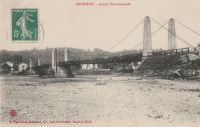
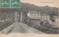
1870: Auzon
Auzon, Haute-Loire, France - Allier River
| Bridgemeister ID: | 6936 (added 2022-01-22) |
| Year Completed: | 1870 |
| Name: | Auzon |
| Location: | Auzon, Haute-Loire, France |
| Crossing: | Allier River |
| Coordinates: | 45.385908 N 3.357088 E |
| Maps: | Acme, GeoHack, Google, OpenStreetMap |
| Use: | Vehicular (one-lane) |
| Status: | Removed, c. 1934 |
| Main Cables: | Wire |
| Main Span: | 1 |
Notes:
- Replaced by an arch bridge in 1934.
- Replaced 1847 Auzon - Auzon, Haute-Loire, France.
- All past and present bridges at this location.
External Links:
Image Sets:
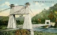
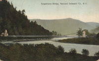
1870: Chehocton
Hancock, New York and Wayne County, Pennsylvania, USA - East Branch Delaware River
| Bridgemeister ID: | 284 (added before 2003) |
| Year Completed: | 1870 |
| Name: | Chehocton |
| Location: | Hancock, New York and Wayne County, Pennsylvania, USA |
| Crossing: | East Branch Delaware River |
| Coordinates: | 41.952583 N 75.278167 W |
| Maps: | Acme, GeoHack, Google, OpenStreetMap |
| Principals: | E.F. Farrington, John A. Roebling's Sons Co. |
| Use: | Vehicular |
| Status: | Removed, 1937 |
| Main Cables: | Wire (iron) |
| Suspended Spans: | 1 |
| Main Span: | 1 x 144.8 meters (475 feet) estimated |
Notes:
- Crossed the East Branch Delaware River on an alignment indicated by the current Old Bridge Street, between the rail crossing and the current (2020s) Stockport Road bridge.
- Replaced 1937.
Image Sets:
1870: Draht
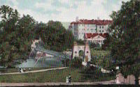
Kassel, Hessen, Germany - Fulda River
| Bridgemeister ID: | 7753 (added 2023-07-22) |
| Year Completed: | 1870 |
| Name: | Draht |
| Also Known As: | Wire |
| Location: | Kassel, Hessen, Germany |
| Crossing: | Fulda River |
| Coordinates: | 51.312209 N 9.504177 E |
| Maps: | Acme, GeoHack, Google, OpenStreetMap |
| Status: | Destroyed, 1940 |
| Main Cables: | Wire |
| Suspended Spans: | 1 |
Notes:
- 1940: Destroyed by ice.
- Replaced by 1940 Draht (Wire) - Kassel, Hessen, Germany.
- All past and present bridges at this location.
External Links:
Image Sets:
1870: Finck's
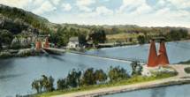
Little Falls, New York, USA - Mohawk River
| Bridgemeister ID: | 328 (added before 2003) |
| Year Completed: | 1870 |
| Name: | Finck's |
| Also Known As: | Fink's |
| Location: | Little Falls, New York, USA |
| Crossing: | Mohawk River |
| Coordinates: | 43.034102 N 74.830185 W |
| Maps: | Acme, GeoHack, Google, OpenStreetMap |
| References: | ONC |
| Use: | Vehicular |
| Status: | Destroyed, 1917 |
| Main Cables: | Wire |
Notes:
- Heavily damaged by fire, 1917.
- Coordinates reflect where modern Fincks Basin Road meets the Mohawk River, likely approximate location of this bridge.
Image Sets:
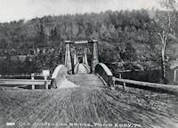
1870: Pond Eddy-Lumberland
Pond Eddy and Lumberland, New York, USA - Delaware River
| Bridgemeister ID: | 297 (added before 2003) |
| Year Completed: | 1870 |
| Name: | Pond Eddy-Lumberland |
| Also Known As: | Decker's |
| Location: | Pond Eddy and Lumberland, New York, USA |
| Crossing: | Delaware River |
| Coordinates: | 41.439349 N 74.819723 W |
| Maps: | Acme, GeoHack, Google, OpenStreetMap |
| Principals: | James D. Decker |
| References: | BDR |
| Use: | Vehicular |
| Status: | Destroyed, October 9, 1903 |
| Main Cables: | Wire (iron) |
| Suspended Spans: | 2 |
| Main Spans: | 2 |
| Deck width: | 12 feet |
Notes:
- Destroyed by flood.
- Coordinates are for the replacement bridge. The suspension bridge would have been extremely close, if not on the same alignment as the replacement.
Image Sets:
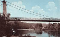
| Bridgemeister ID: | 7962 (added 2023-11-23) |
| Year Completed: | 1870 |
| Name: | Touzac |
| Location: | Touzac, Lot, France |
| Crossing: | Lot River |
| Coordinates: | 44.496083 N 1.049472 E |
| Maps: | Acme, GeoHack, Google, OpenStreetMap |
| Use: | Vehicular (one-lane) |
| Status: | Closed, January 2022 (last checked: 2023) |
| Main Cables: | Wire |
| Suspended Spans: | 1 |
| Main Span: | 1 x 110 meters (360.9 feet) estimated |
Notes:
- 2022, January 21: Bridge is severely damaged by a 40-ton truck attempting to cross. The bridge had a weight restriction of 16 tons since 1932. The long truck was also unable to negotiate the turn at the far end of the bridge and damaged the pylons attempting to reverse.
- 2023, June: Repair work is expected to start in September 2023 and complete in late 2024.
Image Sets:
1871: (suspension bridge)
Washburn's Eddy, New York, USA - Hudson River
| Bridgemeister ID: | 74 (added before 2003) |
| Year Completed: | 1871 |
| Name: | (suspension bridge) |
| Location: | Washburn's Eddy, New York, USA |
| Crossing: | Hudson River |
| Principals: | Robert Gilchrist |
| References: | ABC |
| Status: | Removed |
Notes:
- This bridge was a few miles south of the more widely-known Hudson crossing at Riparius.
- Near 1872 Fulsom Landing (Riverside, Folsom Landing, Riparius) - Riparius, New York, USA.
1871: Aboyne
Waterside, Aboyne vicinity, Scotland, United Kingdom - River Dee
| Bridgemeister ID: | 2202 (added 2007-01-28) |
| Year Completed: | 1871 |
| Name: | Aboyne |
| Location: | Waterside, Aboyne vicinity, Scotland, United Kingdom |
| Crossing: | River Dee |
| Principals: | Harper & Co. |
| References: | HARPER |
| Use: | Footbridge |
| Status: | Removed |
| Main Cables: | Wire |
| Main Span: | 1 x 91.4 meters (300 feet) |
Notes:
- HARPER: Likely destroyed by one of these major Dee River flood events: May 1913, December 1914, October 1920.
External Links:
1871: Boatford
Langholm, Borders, Scotland, United Kingdom - River Esk
| Bridgemeister ID: | 1428 (added 2004-07-24) |
| Year Completed: | 1871 |
| Name: | Boatford |
| Location: | Langholm, Borders, Scotland, United Kingdom |
| Crossing: | River Esk |
| References: | AAJ |
| Status: | Collapsed |
Notes:
- Collapsed soon after it was completed under weight of 200 spectators.
- Replaced by 1873 Boatford - Langholm, Borders, Scotland, United Kingdom.
- All past and present bridges at this location.
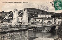
1871: Coubon
Coubon and Volhac, Haute-Loire, France - Loire River
| Bridgemeister ID: | 1724 (added 2005-04-05) |
| Year Completed: | 1871 |
| Name: | Coubon |
| Location: | Coubon and Volhac, Haute-Loire, France |
| Crossing: | Loire River |
| Use: | Vehicular |
| Status: | Destroyed, 1930 |
| Main Cables: | Wire |
| Suspended Spans: | 1 |
Notes:
- Replaced 1833 Coubon - Coubon and Volhac, Haute-Loire, France.
- All past and present bridges at this location.
External Links:
Image Sets:
1871: Ferry Street
Binghamton, New York, USA - Chenango River
| Bridgemeister ID: | 276 (added before 2003) |
| Year Completed: | 1871 |
| Name: | Ferry Street |
| Location: | Binghamton, New York, USA |
| Crossing: | Chenango River |
| Coordinates: | 42.103139 N 75.914917 W |
| Maps: | Acme, GeoHack, Google, OpenStreetMap |
| Principals: | John A. Roebling's Sons, Co. |
| Use: | Vehicular (one-lane) |
| Status: | Removed, 1897 |
| Main Cables: | Wire |
| Suspended Spans: | 1 |
| Main Span: | 1 x 109.7 meters (360 feet) |
Notes:
- This bridge was close to the alignment of Binghamton's present E. Clinton Street bridge. It replaced a bridge that was destroyed by flood in 1865. It was condemned in 1896 and removed in 1897. History Of Broome County indicates an act was passed March 13th, 1871 authorizing the bridge with the contract let to "W.A. Roebling & Son" each cable consisting of seven steel wire ropes, each two inches in diameter.
- An article from the Binghamton Democrat, July 20, 1871: "The Suspension Bridge -- The work on the west abutment of the suspension bridge has been commenced and will be rapidly as advisable pushed forward to completion, and soon thereafter the wire cables will be placed in position, the stays, supports and girders made fast, and ready for the flooring. In the course of six or eight weeks it is hoped that the bridge will be completed, and our people given another way of passing from the 1st to the 2nd wards, and the old-pleasant driveway re-opened, of which we have been debarred since the flood of St-Patrick's Day in the morning in [1865]. Upon the completion of this enterprise, surely no one will ever regret having voted in favor of the free suspension bridge."
- An article from the Binghamton Democrat, Nov. 30, 1871: "The New Bridge -- Its Cost -- For the suspenssion [sic] bridge, the tax-payers voted $28,000. It is finished, and in the Common Council last evening it was asserted that it cost over $30,000 and still all the claims are not satisfied. Mr. Jas. Fanning, contractor for building abutments, seeks relief for $1,000 or upwards which he is out no account of his contract. His petition was after considerable skirmishing finally referred to a committee. We hold that this is wrong, the Common Council has nothing to do with this matter. Mayor Dwight published a card binding himself to pay all over $28,000 that the bridge would cost. The people voted that amount and their representatives have nothing to do with any further cost or expense arrising [sic] from that source."
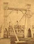
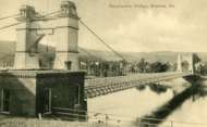
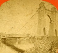
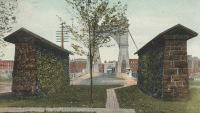
- Internet searches for this bridge often lead to an image on page 32 of the book "Binghamton", from the "Images of America" series, by Ed Aswad and Suzanne M. Meredith. However, that image is of the Warren Pensylvania suspension bridge and is erroneously captioned as the Binghamton Ferry Street bridge. The bridges may be sometimes confused because of similar surroundings and similar towers. Both are often depicted with a large warehouse building on the far side of the bridge, to the right. Both had "walk-through" towers where the pedestrian walkway passed through portals in the towers. Closer comparisons reveal the Warren towers are substantially larger than the Ferry Street towers. This is not surprising given the Warren bridge was substantially longer than the Ferry Street bridge. All this being said, there are different images purporting to be the Ferry Street bridge that show different towers. The stereoview image linked here appears to show the original towers. Later photos appear to show either replaced towers or, perhaps, the original towers clad in protective housing.
- See 1871 Warren (Hickory Street) - Warren, Pennsylvania, USA. The two bridges are sometimes confused despite the significant size difference.
Image Sets:
1871: Hunting
Shocklach Green vicinity, England, United Kingdom - River Dee
| Bridgemeister ID: | 2191 (added 2007-01-26) |
| Year Completed: | 1871 |
| Name: | Hunting |
| Location: | Shocklach Green vicinity, England, United Kingdom |
| Crossing: | River Dee |
| Principals: | Harper & Co. |
| References: | HARPER |
| Use: | Footbridge |
| Status: | Removed, 1935 |
| Main Cables: | Wire |
| Suspended Spans: | 1 |
| Main Span: | 1 x 48.8 meters (160 feet) |
External Links:
1871: Tanarmouth
Glen Tanar, Aboyne vicinity, Scotland, United Kingdom - Water of Tanar
| Bridgemeister ID: | 7972 (added 2023-11-26) |
| Year Completed: | 1871 |
| Name: | Tanarmouth |
| Location: | Glen Tanar, Aboyne vicinity, Scotland, United Kingdom |
| Crossing: | Water of Tanar |
| Coordinates: | 57.066833 N 2.805167 W |
| Maps: | Acme, GeoHack, Google, OpenStreetMap |
| Principals: | Harper & Co. |
| Use: | Footbridge |
| Status: | Removed, 1950 |
| Main Cables: | Wire |
| Main Span: | 1 x 30.5 meters (100 feet) |
External Links:
| Bridgemeister ID: | 2308 (added 2007-04-30) |
| Year Completed: | 1871 |
| Name: | Tarassac |
| Location: | St. Martin-de-l'Arcon vicinity, Hérault, France |
| Crossing: | Orb River |
| Coordinates: | 43.564251 N 2.974977 E |
| Maps: | Acme, GeoHack, Google, OpenStreetMap |
| Use: | Vehicular (one-lane) |
| Status: | Replaced |
| Suspended Spans: | 1 |
Notes:
- Replaced by 1928 Tarassac - St. Martin-de-l'Arcon vicinity, Hérault, France.
- All past and present bridges at this location.
Image Sets:
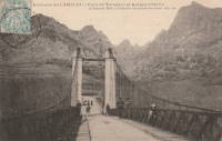
1871: Warren
Warren, Pennsylvania, USA - Allegheny River
| Bridgemeister ID: | 75 (added before 2003) |
| Year Completed: | 1871 |
| Name: | Warren |
| Also Known As: | Hickory Street |
| Location: | Warren, Pennsylvania, USA |
| Crossing: | Allegheny River |
| Coordinates: | 41.844056 N 79.149722 W |
| Maps: | Acme, GeoHack, Google, OpenStreetMap |
| Principals: | George W. Fishler |
| References: | AAJ, EOV, HAERPA461, HBE, PTS2 |
| Use: | Vehicular, with walkway |
| Status: | Replaced, 1918 |
| Main Cables: | Wire (iron) |
| Suspended Spans: | 1 |
| Main Span: | 1 x 143.3 meters (470 feet) |
| Deck width: | 29 feet |
Image Sets:
1872: Barrett
Port Jervis, New York and Matamoras, Pennsylvania, USA - Delaware River
| Bridgemeister ID: | 76 (added before 2003) |
| Year Completed: | 1872 |
| Name: | Barrett |
| Location: | Port Jervis, New York and Matamoras, Pennsylvania, USA |
| Crossing: | Delaware River |
| Coordinates: | 41.371917 N 74.697000 W |
| Maps: | Acme, GeoHack, Google, OpenStreetMap |
| References: | BDR |
| Use: | Vehicular |
| Status: | Destroyed, October 11, 1903 |
| Main Cables: | Wire (iron) |
| Suspended Spans: | 2 |
| Main Spans: | 2 |
Notes:
- BDR: Destroyed by ice March 17, 1875, rebuilt, destroyed by flood October 11, 1903.
Image Sets:
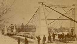
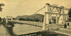
1872: Branch Hill
Branch Hill and Symmes, Ohio, USA - Little Miami River
| Bridgemeister ID: | 77 (added before 2003) |
| Year Completed: | 1872 |
| Name: | Branch Hill |
| Location: | Branch Hill and Symmes, Ohio, USA |
| Crossing: | Little Miami River |
| Principals: | John Gray |
| References: | EOV |
| Use: | Vehicular (one-lane) |
| Status: | Removed |
| Main Cables: | Wire |
Notes:
- Based on correspondence between "Gray's firm" and Washington Roebling, EOV suggests there may be a chance this early bridge contained steel cables.
1872: Chemung
Chemung, New York, USA - Chemung River
| Bridgemeister ID: | 78 (added before 2003) |
| Year Completed: | 1872 |
| Name: | Chemung |
| Location: | Chemung, New York, USA |
| Crossing: | Chemung River |
| Coordinates: | 42.002944 N 76.634722 W |
| Maps: | Acme, GeoHack, Google, OpenStreetMap |
| Principals: | J.V. Fishler, J.R. Crowell |
| Use: | Vehicular |
| Status: | Removed |
| Main Cables: | Wire (iron) |
Image Sets:

1872: Dryburgh Abbey
Dryburgh and St. Boswells, Scotland, United Kingdom - River Tweed
| Bridgemeister ID: | 1439 (added 2004-07-31) |
| Year Completed: | 1872 |
| Name: | Dryburgh Abbey |
| Location: | Dryburgh and St. Boswells, Scotland, United Kingdom |
| Crossing: | River Tweed |
| Coordinates: | 55.580771 N 2.654251 W |
| Maps: | Acme, GeoHack, Google, OpenStreetMap |
| Use: | Footbridge |
| Status: | Replaced, 1911 |
| Main Cables: | Wire |
| Suspended Spans: | 1 |
Notes:
- At former location of 1818 Dryburgh Abbey - Dryburgh and St. Boswells, Scotland, United Kingdom.
- Near Mertoun Estate - Mertoun, Scotland, United Kingdom.
- Replaced by 1911 Dryburgh Abbey - Dryburgh and St. Boswells, Scotland, United Kingdom.
- All past and present bridges at this location.
External Links:
Image Sets:
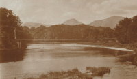
1872: Fulsom Landing
Riparius, New York, USA - Hudson River
| Bridgemeister ID: | 330 (added before 2003) |
| Year Completed: | 1872 |
| Name: | Fulsom Landing |
| Also Known As: | Riverside, Folsom Landing, Riparius |
| Location: | Riparius, New York, USA |
| Crossing: | Hudson River |
| Coordinates: | 43.661963 N 73.898194 W |
| Maps: | Acme, GeoHack, Google, OpenStreetMap |
| Use: | Vehicular (one-lane) |
| Status: | Removed |
| Main Cables: | Wire |
| Suspended Spans: | 1 |
| Main Span: | 1 |
Notes:
- The location of this bridge was originally known as "Folsom Landing" and later became known as "Riverside." In 1886 the name was changed to "Riparius" to avoid confusion with another New York "Riverside" location. The suspension bridge is sometimes referenced by each of these names. To make matters even more confusing, the bridge was known as the "Fulsom Landing" bridge (instead of Folsom).
- Removed at some point after 1919.
- Near 1871 (suspension bridge) - Washburn's Eddy, New York, USA.
Image Sets:
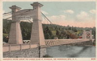
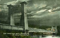
1872: Gilead
Gilead, Maine, USA - Androscoggin River
| Bridgemeister ID: | 2157 (added 2006-12-10) |
| Year Completed: | 1872 |
| Name: | Gilead |
| Location: | Gilead, Maine, USA |
| Crossing: | Androscoggin River |
| Coordinates: | 44.398417 N 70.971500 W |
| Maps: | Acme, GeoHack, Google, OpenStreetMap |
| Use: | Vehicular |
| Status: | Replaced, 1923 |
| Main Cables: | Wire |
| Main Span: | 1 x 58.5 meters (192 feet) |
Notes:
- One of the abutments is still (as of the 2010s) present on the south side of the Androscoggin adjacent to the single-span truss bridge that replaced the suspension bridge.
Image Sets:
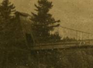
1872: Lower
Turners Falls, Montague, Massachusetts, USA - Connecticut River
| Bridgemeister ID: | 340 (added before 2003) |
| Year Completed: | 1872 |
| Name: | Lower |
| Also Known As: | White |
| Location: | Turners Falls, Montague, Massachusetts, USA |
| Crossing: | Connecticut River |
| Coordinates: | 42.609165 N 72.561433 W |
| Maps: | Acme, GeoHack, Google, OpenStreetMap |
| References: | CCR, PTS2 |
| Use: | Vehicular |
| Status: | Removed, circa 1936 |
| Main Cables: | Wire |
| Suspended Spans: | 1 |
Notes:
- Damaged by flood, 1936 and removed soon after.
- Near 1878 Upper (Red) - Turners Falls, Montague and Riverside, Gill, Massachusetts, USA.
Image Sets:
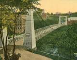
1872: Ravenscraig
Dundee, Scotland, United Kingdom - Caledonian Railway
| Bridgemeister ID: | 5078 (added 2020-08-30) |
| Year Completed: | 1872 |
| Name: | Ravenscraig |
| Location: | Dundee, Scotland, United Kingdom |
| Crossing: | Caledonian Railway |
| Coordinates: | 56.468350 N 2.901061 W |
| Maps: | Acme, GeoHack, Google, OpenStreetMap |
| Principals: | Harper & Co. |
| References: | HARPER |
| Use: | Footbridge |
| Status: | Removed |
| Main Cables: | Wire |
| Suspended Spans: | 1 |
| Main Span: | 1 x 16.8 meters (55.1 feet) |
Notes:
- Coordinates are approximate location of the bridge based on the description in HARPER noting the bridge crossed the railway at the estate of a Colonel Sandeman at Ravenscraig which is the location of the present day (2020) Ravenscraig Gardens in Dundee.
External Links:
| Bridgemeister ID: | 79 (added before 2003) |
| Year Completed: | 1872 |
| Name: | Trinity Cemetery |
| Location: | New York, New York, USA |
| Crossing: | Broadway |
| Coordinates: | 40.832167 N 73.946250 W |
| Maps: | Acme, GeoHack, Google, OpenStreetMap |
| Principals: | Calvert Vaux |
| References: | CVA |
| Status: | Demolished, 1911 |
| Main Cables: | Wire |
| Suspended Spans: | 1 |
Notes:
- Connected Trinity Cemetery across Broadway. Demolished 1911. Appears to have been wide enough to handle vehicles.
- Eric K. Washington contacted me in 2011 wondering if the Trinity Cemetery bridge was the first suspension bridge constructed in New York City. While it seems unlikely that New York City (even just Manhattan) did not have, at least, other minor suspension bridges constructed before 1872, I have never encountered mention of one.
External Links:
- Audubon Park: Trinity Cemetery Bridge. Information and images of the bridge.
- WikiMedia. Image of the bridge.
1873: Boatford
Langholm, Borders, Scotland, United Kingdom - River Esk
| Bridgemeister ID: | 534 (added before 2003) |
| Year Completed: | 1873 |
| Name: | Boatford |
| Location: | Langholm, Borders, Scotland, United Kingdom |
| Crossing: | River Esk |
| Coordinates: | 55.15098 N 3.00273 W |
| Maps: | Acme, GeoHack, Google, OpenStreetMap |
| References: | AAJ |
| Use: | Footbridge |
| Status: | In use (last checked: 2004) |
| Main Span: | 1 x 53.3 meters (175 feet) |
Notes:
- Replaced 1871 Boatford - Langholm, Borders, Scotland, United Kingdom.
- All past and present bridges at this location.
Image Sets:
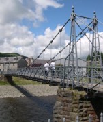
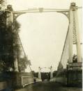
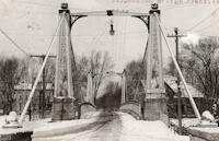
1873: Franklin
Franklin, Ohio, USA - Great Miami River
| Bridgemeister ID: | 80 (added before 2003) |
| Year Completed: | 1873 |
| Name: | Franklin |
| Location: | Franklin, Ohio, USA |
| Crossing: | Great Miami River |
| Coordinates: | 39.563222 N 84.305083 W |
| Maps: | Acme, GeoHack, Google, OpenStreetMap |
| Principals: | J. W. Shipman & Co., John A. Roebling's Sons Co. |
| References: | EOV, HWCO |
| Use: | Vehicular (one-lane) |
| Status: | Replaced, 1933 |
| Main Cables: | Wire |
| Suspended Spans: | 1 |
Notes:
- Traffic restricted to foot traffic, 1931. Closed, 1933, after the bridge sagged significantly.
- From HWCO: "The towers are thirty-eight feet high, and each consists of four columns, of Phoenix column iron. The cables are of steel wire and each is composed of 343 strands, the whole cable having a diameter of seven inches. The masonry is constructed of Dayton stone, and is of a very substantial character... The wire and iron work was done in the summer of 1873 under the superintendence of Roebling & Sons, of Trenton, N. J. The bridge is stayed by strong wire cables and stiffened by an iron truss. The whole cost was $43,900."
Image Sets:
1873: Harrison
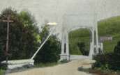
Harrison, Ohio and Dearborn County, Indiana, USA - Whitewater River
| Bridgemeister ID: | 81 (added before 2003) |
| Year Completed: | 1873 |
| Name: | Harrison |
| Location: | Harrison, Ohio and Dearborn County, Indiana, USA |
| Crossing: | Whitewater River |
| Principals: | James W. Shipman and Co. |
| References: | EOV |
| Use: | Vehicular (one-lane) |
| Status: | Destroyed, 1913, by flood |
| Main Cables: | Wire |
Notes:
- See 1868 Calloway's Ford (Whitewater, Harrison's) - Elizabethtown vicinity, Hamilton County, Ohio, USA.
Image Sets:
1873: South Street
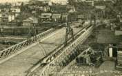
Wilkes-Barre, Pennsylvania, USA - Lehigh Valley Railroad and North Branch Canal
| Bridgemeister ID: | 353 (added before 2003) |
| Year Completed: | 1873 |
| Name: | South Street |
| Also Known As: | Wire |
| Location: | Wilkes-Barre, Pennsylvania, USA |
| Crossing: | Lehigh Valley Railroad and North Branch Canal |
| Coordinates: | 41.239328 N 75.884643 W |
| Maps: | Acme, GeoHack, Google, OpenStreetMap |
| Use: | Vehicular |
| Status: | Removed, c. 1925 |
| Main Cables: | Wire |
Notes:
- In use until 1910, possibly longer. Replacement opened 1925.
Image Sets:
1874: (suspension bridge)
Bannockburn, New Zealand - Kawarau River
| Bridgemeister ID: | 660 (added 2003-03-08) |
| Year Completed: | 1874 |
| Name: | (suspension bridge) |
| Location: | Bannockburn, New Zealand |
| Crossing: | Kawarau River |
| References: | GAP |
| Status: | Replaced |
Notes:
- GAP: Destroyed by flood 1878. Rebuilt 1879 by Jeremiah Drummey. Damaged by neglect, fire.
- Replaced by 1897 Macandrew - Bannockburn, New Zealand.
- All past and present bridges at this location.
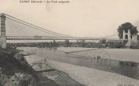
1874: Canet
Canet and Le Pouget, Hérault, France - Hérault River
| Bridgemeister ID: | 7491 (added 2022-12-30) |
| Year Completed: | 1874 |
| Name: | Canet |
| Location: | Canet and Le Pouget, Hérault, France |
| Crossing: | Hérault River |
| Coordinates: | 43.597444 N 3.493061 E |
| Maps: | Acme, GeoHack, Google, OpenStreetMap |
| Use: | Vehicular |
| Status: | Replaced |
| Main Cables: | Wire (iron) |
| Suspended Spans: | 1 |
Notes:
- Replaced 1845 Canet - Canet and Le Pouget, Hérault, France.
- Replaced by Canet - Canet and Le Pouget, Hérault, France.
- All past and present bridges at this location.
External Links:
Image Sets:
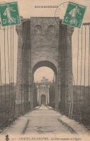
1874: Châtel-de-Neuvre
Châtel-de-Neuvre and La Ferté-Hauterive, Allier, France - Allier River
| Bridgemeister ID: | 4905 (added 2020-07-18) |
| Year Completed: | 1874 |
| Name: | Châtel-de-Neuvre |
| Location: | Châtel-de-Neuvre and La Ferté-Hauterive, Allier, France |
| Crossing: | Allier River |
| Coordinates: | 46.402296 N 3.317844 E |
| Maps: | Acme, GeoHack, Google, OpenStreetMap |
| References: | AAJ |
| Use: | Vehicular |
| Status: | Replaced, 1923 |
| Main Cables: | Wire |
| Suspended Spans: | 2 |
| Main Spans: | 2 |
External Links:
Image Sets:
1874: Huitong
Lamengxiang (腊勐乡), Longling County (龙陵县), Baoshan (保山市) and Shidian County (施甸县), Baoshan (保山市), Yunnan, China - Nujiang
| Bridgemeister ID: | 1232 (added 2004-02-15) |
| Year Completed: | 1874 |
| Name: | Huitong |
| Location: | Lamengxiang (腊勐乡), Longling County (龙陵县), Baoshan (保山市) and Shidian County (施甸县), Baoshan (保山市), Yunnan, China |
| Crossing: | Nujiang |
| Coordinates: | 24.734810 N 98.966987 E |
| Maps: | Acme, GeoHack, Google, OpenStreetMap |
| References: | BCG, BYU |
| Use: | Vehicular (one-lane) |
| Status: | Closed, 1971 (last checked: 2019) |
| Main Cables: | Chain (iron) |
| Suspended Spans: | 1 |
| Main Span: | 1 x 94.3 meters (309.4 feet) |
Notes:
- Originally built with iron chains, modified to steel wire cables, 1935.
External Links:
1874: Isidora
Lota, Chile
| Bridgemeister ID: | 7930 (added 2023-10-22) |
| Year Completed: | 1874 |
| Name: | Isidora |
| Location: | Lota, Chile |
| At or Near Feature: | Parque Isidora Cousiño De Lota |
| Status: | Only towers remain (last checked: 2023) |
External Links:
- Google Maps - Fuerte de Lota. Image of a suriving bridge tower, December 2022.
Image Sets:
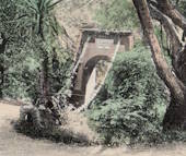
1874: Palmengarten
Frankfurt, Germany
1875: (suspension bridge)
Clyde, New Zealand - Clutha River
| Bridgemeister ID: | 662 (added 2003-03-08) |
| Year Completed: | 1875 |
| Name: | (suspension bridge) |
| Location: | Clyde, New Zealand |
| Crossing: | Clutha River |
| Coordinates: | 45.190381 S 169.315298 E |
| Maps: | Acme, GeoHack, Google, OpenStreetMap |
| Principals: | L.D. Macgeorge, William Grant |
| References: | GAP |
| Status: | Destroyed, 1878 |
Notes:
- GAP: Destroyed by flood 1878.
- Replaced by 1881 Clyde - Clyde, New Zealand.
- All past and present bridges at this location.
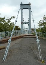
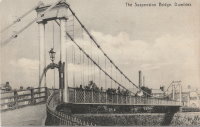
1875: Nith
Dumfries, Scotland, United Kingdom - River Nith
| Bridgemeister ID: | 524 (added before 2003) |
| Year Completed: | 1875 |
| Name: | Nith |
| Also Known As: | Biddall's |
| Location: | Dumfries, Scotland, United Kingdom |
| Crossing: | River Nith |
| Coordinates: | 55.065120 N 3.610292 W |
| Maps: | Acme, GeoHack, Google, OpenStreetMap |
| Principals: | J. Willett |
| Use: | Footbridge |
| Status: | In use (last checked: 2022) |
| Main Cables: | Chain (iron) |
| Suspended Spans: | 1 |
| Main Span: | 1 |
External Links:
Image Sets:

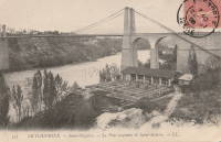
1875: Saint-Nazaire
Saint-Nazaire-en-Royans, Drôme and Saint-Hilaire-du-Rosier, Isère, France - Isère River
| Bridgemeister ID: | 7328 (added 2022-09-02) |
| Year Completed: | 1875 |
| Name: | Saint-Nazaire |
| Location: | Saint-Nazaire-en-Royans, Drôme and Saint-Hilaire-du-Rosier, Isère, France |
| Crossing: | Isère River |
| Coordinates: | 45.067313 N 5.243247 E |
| Maps: | Acme, GeoHack, Google, OpenStreetMap |
| Use: | Vehicular |
| Status: | Removed |
| Main Cables: | Wire |
| Suspended Spans: | 1 |
External Links:
Image Sets:
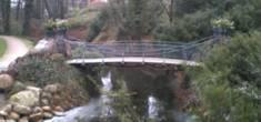
1875: Schloßbrücke
Castle Bergedorf, Bergedorf, Hamburg, Germany - Bergedorf Castle Moat
| Bridgemeister ID: | 799 (added 2003-03-29) |
| Year Completed: | 1875 |
| Name: | Schloßbrücke |
| Location: | Castle Bergedorf, Bergedorf, Hamburg, Germany |
| Crossing: | Bergedorf Castle Moat |
| Coordinates: | 53.489417 N 10.212 E |
| Maps: | Acme, GeoHack, Google, OpenStreetMap |
| Use: | Footbridge |
| Status: | In use (last checked: 2023) |
| Main Cables: | Wire |
| Suspended Spans: | 1 |
| Main Span: | 1 x 6.9 meters (22.6 feet) |
| Deck width: | 2 meters |
Notes:
- This may be the shortest span suspension bridge ever constructed.
Image Sets:
1875: Swinging
Arroyo Grande, California, USA - Arroyo Grande Creek
| Bridgemeister ID: | 307 (added before 2003) |
| Year Completed: | 1875 |
| Name: | Swinging |
| Location: | Arroyo Grande, California, USA |
| Crossing: | Arroyo Grande Creek |
| Coordinates: | 35.12336 N 120.57703 W |
| Maps: | Acme, GeoHack, Google, OpenStreetMap |
| Principals: | Newton Short |
| Use: | Footbridge |
| Status: | In use (last checked: 2007) |
| Main Cables: | Wire |
| Suspended Spans: | 1 |
| Main Span: | 1 x 52.1 meters (171 feet) |
Notes:
- A rotary club plaque at the bridge reads, "To connect his properties, Newton Short built this swinging bridge without sides about 1875. Sides were added after 1902. The bridge was given to the City of Arroyo Grande on July 14, 1911,... Due to severe storm damage, the bridge was rebuilt in 1995."
Image Sets:
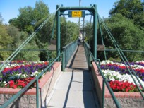
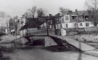
1875: Swinging
Frederick, Maryland, USA - Carroll Creek
| Bridgemeister ID: | 253 (added before 2003) |
| Year Completed: | 1875 |
| Name: | Swinging |
| Location: | Frederick, Maryland, USA |
| Crossing: | Carroll Creek |
| At or Near Feature: | Baker Park |
| Coordinates: | 39.415033 N 77.4208 W |
| Maps: | Acme, GeoHack, Google, OpenStreetMap |
| Use: | Footbridge |
| Status: | In use (last checked: 2022) |
| Main Cables: | Wire |
| Suspended Spans: | 1 |
Notes:
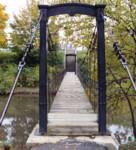
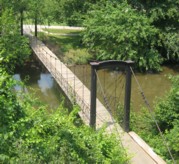
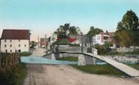
- The black and white photo shows the same bridge at its original location on Bentz Street (then Mill Alley). It was later moved to Baker Park, and then moved again (in 1927, 1928, or 1930 according to various sources) to its present location, another location in Baker Park.
- Local legend states this bridge was used by Stonewall Jackson and his troops when they entered Frederick on September 10, 1862.
- Closed March, 2008 due to safety concerns. Eventually reopened.
- Near 2006 William O. Lee (Carroll Creek Park) - Frederick, Maryland, USA.
External Links:
- Baker Park - Maryland Historic District. States bridge was built in 1875.
- Structurae - Structure ID 20011117
Image Sets:
1876: Brunner
Brunner, New Zealand - Grey River / Māwheranui
| Bridgemeister ID: | 414 (added before 2003) |
| Year Completed: | 1876 |
| Name: | Brunner |
| Location: | Brunner, New Zealand |
| Crossing: | Grey River / Māwheranui |
| Coordinates: | 42.433068 S 171.324420 E |
| Maps: | Acme, GeoHack, Google, OpenStreetMap |
| Principals: | John Carruthers |
| References: | GAP |
| Use: | Vehicular and Rail |
| Status: | Restricted to foot traffic (last checked: 2017) |
| Main Cables: | Wire |
| Suspended Spans: | 1 |
Notes:
- GAP: Collapsed just before opening due to anchor plate failure, rebuilt. Rebuilt again 1925-1926. Towers replaced 1963-1964.
Image Sets:

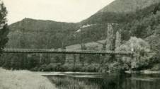
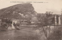
1876: Laissey
Laissey, Doubs, France - Doubs River
| Bridgemeister ID: | 2171 (added 2007-01-13) |
| Year Completed: | 1876 |
| Name: | Laissey |
| Location: | Laissey, Doubs, France |
| Crossing: | Doubs River |
| Coordinates: | 47.298411 N 6.236290 E |
| Maps: | Acme, GeoHack, Google, OpenStreetMap |
| Use: | Vehicular |
| Status: | Removed |
External Links:
Image Sets:
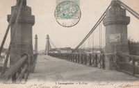
1876: Lamagistère
Lamagistère, Tarn-et-Garonne, France - Garonne River
| Bridgemeister ID: | 7175 (added 2022-07-01) |
| Year Completed: | 1876 |
| Name: | Lamagistère |
| Location: | Lamagistère, Tarn-et-Garonne, France |
| Crossing: | Garonne River |
| Coordinates: | 44.122921 N 0.819276 E |
| Maps: | Acme, GeoHack, Google, OpenStreetMap |
| Use: | Vehicular |
| Status: | Destroyed, 1930 |
| Main Cables: | Wire |
| Suspended Spans: | 2 |
| Main Spans: | 2 |
Notes:
- 1930: Destroyed by flood.
- Replaced 1850 Lamagistère - Lamagistère, Tarn-et-Garonne, France.
- Replaced by 1933 Lamagistère - Lamagistère, Tarn-et-Garonne, France.
- All past and present bridges at this location.
External Links:
Image Sets:
1876: Linwood
Linwood, Ohio, USA - Little Miami River
| Bridgemeister ID: | 82 (added before 2003) |
| Year Completed: | 1876 |
| Name: | Linwood |
| Location: | Linwood, Ohio, USA |
| Crossing: | Little Miami River |
| Principals: | Cincinnati Bridge Co. |
| References: | EOV |
| Status: | Removed |
Notes:
- Replaced after 1913 flood damage.
1876: Nile River
Charleston, New Zealand - Nile (Waitakere) River
| Bridgemeister ID: | 659 (added 2003-03-08) |
| Year Completed: | 1876 |
| Name: | Nile River |
| Location: | Charleston, New Zealand |
| Crossing: | Nile (Waitakere) River |
| Coordinates: | 41.899278 S 171.443694 E |
| Maps: | Acme, GeoHack, Google, OpenStreetMap |
| Principals: | Arthur Dudley Dobson |
| References: | GAP |
| Use: | Vehicular |
| Status: | Removed |
| Suspended Spans: | 1 |
Notes:
- A new suspension bridge was installed on the same piers in the 2020-2021 time frame.
- Later at same location 2021 Waitakere/Nile River - Charleston, New Zealand.
- All past and present bridges at this location.
External Links:
1876: Petroleum Street
Oil City, Pennsylvania, USA - Allegheny River
| Bridgemeister ID: | 83 (added before 2003) |
| Year Completed: | 1876 |
| Name: | Petroleum Street |
| Also Known As: | Oil City |
| Location: | Oil City, Pennsylvania, USA |
| Crossing: | Allegheny River |
| Coordinates: | 41.430083 N 79.712833 W |
| Maps: | Acme, GeoHack, Google, OpenStreetMap |
| Principals: | Charles Roebling |
| References: | AAJ, HAERPA461, HBE, PTS2, TRS |
| Use: | Vehicular |
| Status: | Removed |
| Main Cables: | Wire |
| Suspended Spans: | 3 |
| Main Span: | 1 x 152.4 meters (500 feet) |
| Side Spans: | 2 |
Notes:
- AAJ: Rebuilt, 1884, 1905.
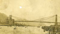
1876: Point
Pittsburgh, Pennsylvania, USA - Monongahela River
| Bridgemeister ID: | 84 (added before 2003) |
| Year Completed: | 1876 |
| Name: | Point |
| Location: | Pittsburgh, Pennsylvania, USA |
| Crossing: | Monongahela River |
| Coordinates: | 40.441000 N 80.014000 W |
| Maps: | Acme, GeoHack, Google, OpenStreetMap |
| Principals: | Edward Hemberle |
| References: | AAJ, BOP, BPL, HBE, IEA, ONF, PBR, PTS2, SA19000106 |
| Use: | Vehicular and Rail (streetcar) |
| Status: | Demolished, 1927 |
| Main Cables: | Eyebar |
| Suspended Spans: | 1 |
| Main Span: | 1 x 243.8 meters (800 feet) |
| Deck width: | 34 feet |
Notes:
- Partial floor collapse requiring extensive repairs, December 24, 1903. Repaired, 1904. Demolished 1927.
External Links:
Image Sets:
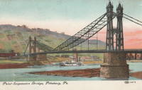
1876: Zoar
Stevenson vicinity, Connecticut, USA - Housatonic River
| Bridgemeister ID: | 85 (added before 2003) |
| Year Completed: | 1876 |
| Name: | Zoar |
| Location: | Stevenson vicinity, Connecticut, USA |
| Crossing: | Housatonic River |
| Coordinates: | 41.390444 N 73.182028 W |
| Maps: | Acme, GeoHack, Google, OpenStreetMap |
| Use: | Vehicular (one-lane) |
| Status: | Demolished, 1919 |
| Main Cables: | Wire |
| Suspended Spans: | 1 |
Notes:
- Located on the road connecting Monroe to Oxford, until 1919 when the Stevenson Dam was built.
- May have been significantly widened, c. 1910.
Image Sets:

1877: (suspension bridge)
Kent, Ohio, USA - Cuyahoga River
| Bridgemeister ID: | 1979 (added 2005-11-27) |
| Year Completed: | 1877 |
| Name: | (suspension bridge) |
| Location: | Kent, Ohio, USA |
| Crossing: | Cuyahoga River |
| Status: | Removed |
| Main Cables: | Wire (iron) |
1877: Canet
Ventenac-en-Minervois and Canet, Aude, France - Aude River
| Bridgemeister ID: | 5658 (added 2021-01-01) |
| Year Completed: | 1877 |
| Name: | Canet |
| Location: | Ventenac-en-Minervois and Canet, Aude, France |
| Crossing: | Aude River |
| Coordinates: | 43.240039 N 2.855134 E |
| Maps: | Acme, GeoHack, Google, OpenStreetMap |
| References: | AAJ |
| Use: | Vehicular |
| Status: | Removed |
| Main Cables: | Wire |
| Suspended Spans: | 1 |
Notes:
- Piers are still present (in 2020) next to the current Aude River crossing at this location.
Image Sets:
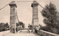
1877: Cottaneva
Cottaneva Creek, Rockport, California, USA - Rockport Bay, Pacific Ocean
| Bridgemeister ID: | 1152 (added 2004-01-18) |
| Year Completed: | 1877 |
| Name: | Cottaneva |
| Location: | Cottaneva Creek, Rockport, California, USA |
| Crossing: | Rockport Bay, Pacific Ocean |
| Coordinates: | 39.736703 N 123.832585 W |
| Maps: | Acme, GeoHack, Google, OpenStreetMap |
| Principals: | Pacific Bridge Co. |
| References: | AAJ |
| Use: | Vehicular (one-lane) |
| Status: | Removed |
| Main Cables: | Wire (iron) |
| Suspended Spans: | 1 |
| Main Span: | 1 x 82.3 meters (270 feet) |
Notes:
- This bridge was part of the Rockport lumber mill (Mendocino County). The bridge stretched over ocean to a large rock in the bay.
- Jakkula cites two sources describing the cables as steel.
- Don Sayenga transcribed one of Jakkula's references, The Iron Age Volume XX , No. 3 (August 2, 1877) Page 1: "A Steel Wire Suspension Bridge In California"
The Pacific Bridge Company are building in Mendocino county, California at Cottoneva, a suspension bridge which is described as follows "The distance from center to center of the saddles on the towers is 270 feet. The deflection or fall of the cable is 23 feet 6 inches. The cables are built in the same manner as those of the Clifton bridge at Niagara. The steel wire is about No. 11 Birmingham gauge, and is protected against rust by immersing in a bath which it a fine coat of zinc. There are eleven wires in each strand, seven strands in each rope, and seven ropes in each cable. The ropes are not twisted together to form the cable but gathered up every six feet by the suspender bands. Each rope is warranted to bear a strain of 60 tons. It is made fast to an independent anchor bar, 1 by 3 inches in diameter, and forming links 18 feet long, until connection is made with the anchors. The anchors are of cast iron, 3-1/2 by 3 feet in surface, weigh 1000 pounds each, and are placed 14 feet below the surface of the rock. Great care was taken in securing the anchors in place by means of cross I beams which run under the rock on either side. The lower part of each pit was enlarged to so as to form a hemispherical chamber, and the rock work, set in Portland cement, which is built upon the anchor, is so constructed that the upward strain is transmitted to the sides. The towers are of red wood. There are four posts 10 x 10 inches and two 10 x 12 inches, giving an effective area of 640 inches to withstand the strain of the cables on the tower. The wooden truss to prevent vertical vibration is 8 feet high and of the Howe truss pattern. The 270 feet of the bridge is divided into 45 pannels. The longest suspenders, 44 in number are of 7/8 inch steel wire, the 42 shorter ones are of 1-1/8 inch solid iron. The estimated dead load of the bridge is 1000 pounds per linear foot; live load, one ton per linear foot; in all, one and one half tons, or one fifth of actual breaking load. The bridge will be completed in about 30 days and promises to be a structure which the builders may well be proud of."
Don writes: "[In] Jakkula's last citation, he is saying that this is factory-made wire rope... The construction of the wire rope (7 by 11) used in the main cables is not common for the USA as of 1877; in fact it is extremely uncommon. The wire ropes used at Clifton/Niagara were made in England -- it wouldn't surprise me if these were made in England too."
| Bridgemeister ID: | 1931 (added 2005-10-27) |
| Year Completed: | 1877 |
| Name: | Douelle |
| Location: | Douelle, Lot, France |
| Crossing: | Lot River |
| Coordinates: | 44.471510 N 1.361864 E |
| Maps: | Acme, GeoHack, Google, OpenStreetMap |
| References: | AAJ |
| Use: | Vehicular (one-lane) |
| Status: | In use (last checked: 2019) |
| Main Cables: | Wire |
| Suspended Spans: | 1 |
Image Sets:
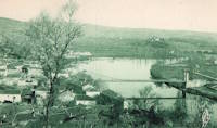
1877: Jhulaghat
Juluaghat, Dasharathchanda, Nepal and Jhulaghat, Uttarakhand, India - Sharda River
| Bridgemeister ID: | 4344 (added 2020-04-11) |
| Year Completed: | 1877 |
| Name: | Jhulaghat |
| Also Known As: | झुलाघाट |
| Location: | Juluaghat, Dasharathchanda, Nepal and Jhulaghat, Uttarakhand, India |
| Crossing: | Sharda River |
| Coordinates: | 29.571577 N 80.382849 E |
| Maps: | Acme, GeoHack, Google, OpenStreetMap |
| Use: | Vehicular (one-lane) |
| Status: | Restricted to foot traffic (last checked: 2023) |
| Main Cables: | Eyebar |
| Suspended Spans: | 1 |
Notes:
- 2022-2023: Damaged during 2022 monsoon season. Reopened October 2023.
External Links:
1877: Lead Mine
Gorham, New Hampshire, USA
| Bridgemeister ID: | 1198 (added 2004-01-28) |
| Year Completed: | 1877 |
| Name: | Lead Mine |
| Also Known As: | Hutchinson |
| Location: | Gorham, New Hampshire, USA |
| Coordinates: | 44.400583 N 71.179056 W |
| Maps: | Acme, GeoHack, Google, OpenStreetMap |
| Principals: | Timothy H. Hutchinson |
| Use: | Vehicular (one-lane) |
| Status: | Collapsed, 1921 |
| Main Cables: | Wire |
| Suspended Spans: | 1 |
Notes:
- Provided access to Mascot Mine. Collapsed, 1921.
Image Sets:
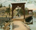
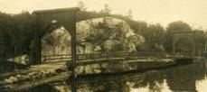
1877: Minneapolis
Minneapolis, Minnesota, USA - Mississippi River
| Bridgemeister ID: | 86 (added before 2003) |
| Year Completed: | 1877 |
| Name: | Minneapolis |
| Location: | Minneapolis, Minnesota, USA |
| Crossing: | Mississippi River |
| At or Near Feature: | Nicollet Island |
| Coordinates: | 44.985028 N 93.264556 W |
| Maps: | Acme, GeoHack, Google, OpenStreetMap |
| Principals: | Thomas M. Griffith |
| References: | AAJ, BPL, HBE, PTS2 |
| Use: | Vehicular, with walkway |
| Status: | Replaced, 1890 |
| Main Cables: | Wire (iron) |
| Suspended Spans: | 1 |
| Main Span: | 1 x 205.8 meters (675.1 feet) |
| Deck width: | 32 feet |
Notes:
- Replaced 1855 Minneapolis (St. Anthony's Falls) - Minneapolis, Minnesota, USA.
- Later at same location 1990 Hennepin Avenue (Father Louis Hennepin) - Minneapolis, Minnesota, USA.
- All past and present bridges at this location.
Image Sets:
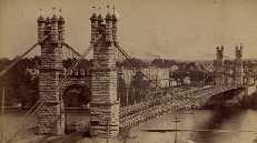
1877: Netherby
Kirksandrew-upon-Esk, Longtown vicinity, Cumbria and Netherby, England, United Kingdom - River Esk
| Bridgemeister ID: | 2369 (added 2007-09-28) |
| Year Completed: | 1877 |
| Name: | Netherby |
| Location: | Kirksandrew-upon-Esk, Longtown vicinity, Cumbria and Netherby, England, United Kingdom |
| Crossing: | River Esk |
| Coordinates: | 55.03855 N 2.95261 W |
| Maps: | Acme, GeoHack, Google, OpenStreetMap |
| Use: | Footbridge |
| Status: | In use (last checked: 2012) |
| Main Cables: | Wire |
| Suspended Spans: | 1 |
Image Sets:
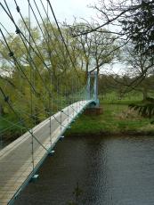
1877: Punalur
Punalur, Kerala, India - Kallada River
| Bridgemeister ID: | 415 (added before 2003) |
| Year Completed: | 1877 |
| Name: | Punalur |
| Location: | Punalur, Kerala, India |
| Crossing: | Kallada River |
| Coordinates: | 9.018114 N 76.927620 E |
| Maps: | Acme, GeoHack, Google, OpenStreetMap |
| Principals: | Albert Henry |
| Use: | Vehicular (one-lane) |
| Status: | Restricted to foot traffic (last checked: 2019) |
| Main Cables: | Eyebar |
| Suspended Spans: | 3 |
| Main Span: | 1 |
| Side Spans: | 2 |
Image Sets:
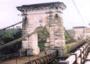
1877: Victoria
Mandi, Himachal Pradesh, India - Beas River
| Bridgemeister ID: | 2750 (added 2019-06-23) |
| Year Completed: | 1877 |
| Name: | Victoria |
| Location: | Mandi, Himachal Pradesh, India |
| Crossing: | Beas River |
| Coordinates: | 31.712668 N 76.933310 E |
| Maps: | Acme, GeoHack, Google, OpenStreetMap |
| Use: | Vehicular (one-lane) |
| Status: | In use (last checked: 2019) |
| Main Cables: | Wire |
| Suspended Spans: | 1 |
External Links:
1878: (suspension bridge)
New Zealand - Hawea River
| Bridgemeister ID: | 664 (added 2003-03-08) |
| Year Completed: | 1878 |
| Name: | (suspension bridge) |
| Location: | New Zealand |
| Crossing: | Hawea River |
| Principals: | William Grant, McKellar |
| References: | GAP |
1878: Maynard Street
Williamsport, Pennsylvania, USA - Susquehanna River
| Bridgemeister ID: | 2140 (added 2006-10-31) |
| Year Completed: | 1878 |
| Name: | Maynard Street |
| Location: | Williamsport, Pennsylvania, USA |
| Crossing: | Susquehanna River |
| Coordinates: | 41.229083 N 77.019083 W |
| Maps: | Acme, GeoHack, Google, OpenStreetMap |
| Use: | Vehicular |
| Status: | Removed |
| Main Cables: | Wire |
Notes:
- Damaged by flood, June 1, 1889. Rebuilt, but unclear if rebuilt as a suspension bridge. May have been rebuilt as a truss bridge.
- Near 1865 Market Street - Williamsport, Pennsylvania, USA.
1878: Sedgwick
Sedgwick and Sizergh, England, United Kingdom - River Kent
| Bridgemeister ID: | 1313 (added 2004-04-16) |
| Year Completed: | 1878 |
| Name: | Sedgwick |
| Also Known As: | Low Park Woods, New Sedgwick |
| Location: | Sedgwick and Sizergh, England, United Kingdom |
| Crossing: | River Kent |
| Coordinates: | 54.281 N 2.7564 W |
| Maps: | Acme, GeoHack, Google, OpenStreetMap |
| Principals: | Francis James Willacy |
| Use: | Footbridge |
| Status: | In use (last checked: 2010) |
| Suspended Spans: | 1 |
Notes:
- 1988-1989: Restoration project completed
- 2022, August-September: Bridge closed for repairs. Reopened.
- Similar to 1862 (footbridge) - Greystead, England, United Kingdom.
External Links:
Image Sets:
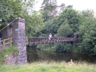
1878: Spider
Crewe, England, United Kingdom
| Bridgemeister ID: | 1843 (added 2005-07-15) |
| Year Completed: | 1878 |
| Name: | Spider |
| Also Known As: | Midge |
| Location: | Crewe, England, United Kingdom |
| Use: | Rail |
| Status: | Demolished, 1939 |
| Main Cables: | Wire |
Notes:
- Carried a narrow gauge rail line over several tracks at the Crewe Locomotive Works. Used as a footbridge, 1929-1939.
1878: Upper
Turners Falls, Montague and Riverside, Gill, Massachusetts, USA - Connecticut River
| Bridgemeister ID: | 87 (added before 2003) |
| Year Completed: | 1878 |
| Name: | Upper |
| Also Known As: | Red |
| Location: | Turners Falls, Montague and Riverside, Gill, Massachusetts, USA |
| Crossing: | Connecticut River |
| Coordinates: | 42.607611 N 72.549278 W |
| Maps: | Acme, GeoHack, Google, OpenStreetMap |
| Principals: | J.W. Shipman |
| References: | CCR |
| Use: | Vehicular |
| Status: | Dismantled, 1942 |
| Main Cables: | Wire |
| Suspended Spans: | 1 |
| Main Span: | 1 x 166 meters (544.6 feet) estimated |
Notes:
External Links:
Image Sets:
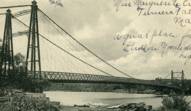
1879: Azuqueca
Azuqueca de Henares, Guadalajara, Spain - Henares River
| Bridgemeister ID: | 7625 (added 2023-05-27) |
| Year Completed: | 1879 |
| Name: | Azuqueca |
| Location: | Azuqueca de Henares, Guadalajara, Spain |
| Crossing: | Henares River |
| Coordinates: | 40.555941 N 3.246655 W |
| Maps: | Acme, GeoHack, Google, OpenStreetMap |
| Use: | Footbridge |
| Status: | Derelict (last checked: 2022) |
| Suspended Spans: | 1 |
External Links:
- Azuqueca: SOS Save "The Hanging Bridge". Blog devoted to saving the bridge. Includes many photos.
- Maneti Lugares qUe Disfrutar: Puente Colgante Rio Henares Azuqueca De Henares (Guadalajara)
1879: Castor
Cynthia Islands, Niagara Falls, Ontario, Canada - Niagara River
| Bridgemeister ID: | 319 (added before 2003) |
| Year Completed: | 1879 |
| Name: | Castor |
| Also Known As: | Burning Springs |
| Location: | Cynthia Islands, Niagara Falls, Ontario, Canada |
| Crossing: | Niagara River |
| Status: | Removed |
| Main Cables: | Wire |
| Suspended Spans: | 1 |
Notes:
- The "Cynthia Islands" were previously named the "Clark Hill Islands" and are now known as the "Dufferin Islands". The older "Clark Hill Islands" name was often used in describing the location of this bridge and its companion bridge.
- Companion to 1879 Pollux (Burning Springs) - Cynthia Islands, Niagara Falls, Ontario, Canada.
Image Sets:
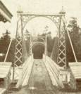
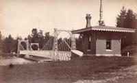
1879: Infirmary
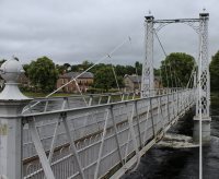
Inverness, Scotland, United Kingdom - River Ness
| Bridgemeister ID: | 539 (added before 2003) |
| Year Completed: | 1879 |
| Name: | Infirmary |
| Location: | Inverness, Scotland, United Kingdom |
| Crossing: | River Ness |
| Coordinates: | 57.471653 N 4.228844 W |
| Maps: | Acme, GeoHack, Google, OpenStreetMap |
| Principals: | C. R. Manners |
| References: | HBR |
| Use: | Footbridge |
| Status: | In use (last checked: 2021) |
| Main Cables: | Wire |
| Suspended Spans: | 3 |
| Main Span: | 1 x 61 meters (200 feet) |
| Side Spans: | 2 x 12.8 meters (42 feet) |
Notes:
- 2020, November: Highland Council likely to close bridge if funding for urgent repairs cannot be raised.
- 2021, July: Reopened after interim repairs completed. Future major refurbishment expected.
- Companion to 1881 Greig Street (Wobbly) - Inverness, Scotland, United Kingdom.
Annotated Citations:
- Glen, Louise. “Closure Fears for Iconic Inverness Bridge Facing Huge Repair Bill.” Inverness Courier, 21 Apr. 2021, www.inverness-courier.co.uk/news/closure-fears-for-iconic-inverness-bridge-facing-huge-repair-235713/.
"Fears have been raised that decades of under investment in an iconic city bridge could see it closed permanently. Members of Ballifeary Community Council believe the cost of fixing and upgrading the Infirmary Bridge to bring it up to modern standards may be more than £1 million..."
- Duncan, Ian. "The future of Infirmary Bridge secured into the 2040s as Highland Council's Economy and Infrastructure Committee today agrees up to £550,000 in funding for repairs." Inverness Courier, 05 May 2021, www.inverness-courier.co.uk/news/the-future-of-infirmary-bridge-secured-into-the-2040s-237340/.
"Highland Council's Economy and Infrastructure Committee agreed today to include up to £550,000 for repairs for Infirmary Bridge… 'It will be 2022 before the repairs are completed, but once done the bridge's life will be extended for a further 20 to 25 years.'"
External Links:
Image Sets:

1879: Pollux
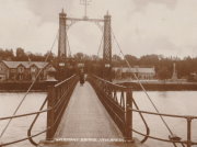
Cynthia Islands, Niagara Falls, Ontario, Canada - Niagara River
| Bridgemeister ID: | 848 (added before 2003) |
| Year Completed: | 1879 |
| Name: | Pollux |
| Also Known As: | Burning Springs |
| Location: | Cynthia Islands, Niagara Falls, Ontario, Canada |
| Crossing: | Niagara River |
| Status: | Removed |
| Main Cables: | Wire |
Notes:
- The "Cynthia Islands" were previously named the "Clark Hill Islands" and are now known as the "Dufferin Islands". The older "Clark Hill Islands" name was often used in describing the location of this bridge and its companion bridge.
- Companion to 1879 Castor (Burning Springs) - Cynthia Islands, Niagara Falls, Ontario, Canada.
Image Sets:
1879: Saint-Ilpize
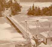
Saint-Ilpize, Haute-Loire, France - Allier River
| Bridgemeister ID: | 1097 (added 2004-01-02) |
| Year Completed: | 1879 |
| Name: | Saint-Ilpize |
| Location: | Saint-Ilpize, Haute-Loire, France |
| Crossing: | Allier River |
| Coordinates: | 45.198556 N 3.386866 E |
| Maps: | Acme, GeoHack, Google, OpenStreetMap |
| Principals: | Ferdinand Arnodin |
| References: | AAJ, BPF, HBE, PTS2 |
| Use: | Vehicular (one-lane) |
| Status: | In use (last checked: 2020) |
| Main Cables: | Wire |
| Suspended Spans: | 3 |
| Main Span: | 1 x 70.35 meters (230.8 feet) |
| Side Spans: | 2 |
| Deck width: | 18 feet |
Notes:
- The side spans are supported solely by inclined stays, not suspenders from the main cables.
- Closed to all traffic on July 15, 2004 due to damage to the deck, possibly caused by an overloaded truck. Repaired and reopened.
External Links:
Image Sets:
1879: Shaky
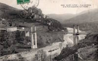
Alexandra, New Zealand - Manuherikia River
| Bridgemeister ID: | 665 (added 2003-03-08) |
| Year Completed: | 1879 |
| Name: | Shaky |
| Also Known As: | Manuherikia |
| Location: | Alexandra, New Zealand |
| Crossing: | Manuherikia River |
| Coordinates: | 45.253846 S 169.398651 E |
| Maps: | Acme, GeoHack, Google, OpenStreetMap |
| Principals: | L.D. Macgeorge, William Grant, McKellar |
| References: | GAP |
| Use: | Vehicular (one-lane) |
| Status: | Restricted to foot traffic (last checked: 2017) |
| Main Cables: | Wire |
| Suspended Spans: | 1 |
Notes:
- Restored as a pedestrian-only bridge, 1952. Refurbished, 2009.
- Near 1882 Alexandra - Alexandra, New Zealand.
Image Sets:
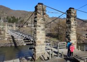
1879: Swing
Monymusk, Scotland, United Kingdom - River Don
| Bridgemeister ID: | 2192 (added 2007-01-26) |
| Year Completed: | 1879 |
| Name: | Swing |
| Location: | Monymusk, Scotland, United Kingdom |
| Crossing: | River Don |
| Principals: | Harper & Co. |
| References: | HARPER |
| Use: | Footbridge |
| Status: | Demolished, c. 2005 |
| Main Cables: | Wire |
| Suspended Spans: | 1 |
| Main Span: | 1 x 32.6 meters (107 feet) |
External Links:
Image Sets:
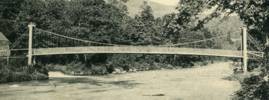
1879: Viljandi
Viljandi, Estonia
| Bridgemeister ID: | 2654 (added 2019-03-03) |
| Year Completed: | 1879 |
| Name: | Viljandi |
| Location: | Viljandi, Estonia |
| At or Near Feature: | Viljandi Castle Park |
| Coordinates: | 58.358912 N 25.594293 E |
| Maps: | Acme, GeoHack, Google, OpenStreetMap |
| Principals: | Felser and Co. |
| Use: | Footbridge |
| Status: | In use (last checked: 2018) |
| Suspended Spans: | 1 |
Notes:
- 1931: Relocated from original location at Tarvastu Manor. Coordinates provided here represent the new location of the bridge.
- 1995: Reconstructed.
Image Sets:
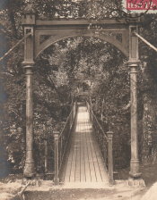
Cambridge Springs
Cambridge Springs, Pennsylvania, USA - French Creek
| Bridgemeister ID: | 1007 (added 2003-11-21) |
| Name: | Cambridge Springs |
| Location: | Cambridge Springs, Pennsylvania, USA |
| Crossing: | French Creek |
| Coordinates: | 41.804778 N 80.056000 W |
| Maps: | Acme, GeoHack, Google, OpenStreetMap |
| Status: | Replaced, 1906 |
| Suspended Spans: | 1 |
Notes:
- Completed, 1870s.
Image Sets:
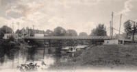
Rochsburg
Rochsburg, Lunzenau, Saxony, Germany - Zwickauer Mulde River
| Bridgemeister ID: | 2258 (added 2007-04-18) |
| Name: | Rochsburg |
| Also Known As: | Schwankender |
| Location: | Rochsburg, Lunzenau, Saxony, Germany |
| Crossing: | Zwickauer Mulde River |
| Coordinates: | 50.945537 N 12.762093 E |
| Maps: | Acme, GeoHack, Google, OpenStreetMap |
| Use: | Footbridge |
| Status: | Destroyed, 1954, by flood |
| Suspended Spans: | 1 |
Notes:
- Completed c. 1878.
- Replaced by 1954 Rochsburg - Rochsburg, Lunzenau, Saxony, Germany.
- All past and present bridges at this location.
Image Sets:

Do you have any information or photos for these bridges that you would like to share? Please email david.denenberg@bridgemeister.com.
Mail | Facebook | X (Twitter) | Bluesky
