Suspension Bridges Crossing River Dee
This is a list of all 14 bridges from the suspension bridge inventory crossing River Dee. Please note that different rivers with the same name will be grouped together. For example, selecting 'Bear Creek' shows bridges across several different Bear Creeks. Also, similarly named rivers are grouped separately. For example, 'River Dee' (UK) bridges are grouped separately from 'Dee River' (Australia) bridges. Wherever you see a Bridgemeister ID number click it to isolate the bridge on its own page.
Related Lists:
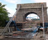
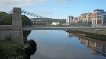
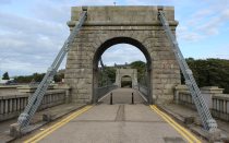
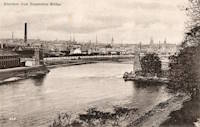
1831: Wellington
Aberdeen, Scotland, United Kingdom - River Dee
| Bridgemeister ID: | 393 (added before 2003) |
| Year Completed: | 1831 |
| Name: | Wellington |
| Also Known As: | Craiglug |
| Location: | Aberdeen, Scotland, United Kingdom |
| Crossing: | River Dee |
| Coordinates: | 57.13559 N 2.09560 W |
| Maps: | Acme, GeoHack, Google, OpenStreetMap |
| Principals: | Sir Samuel Brown |
| References: | SBR |
| Use: | Vehicular (one-lane) |
| Status: | Restricted to foot traffic (last checked: 2014) |
| Main Cables: | Chain (iron) |
| Suspended Spans: | 1 |
Notes:
- Reconstructed, 1930. Closed to vehicular traffic, 1984. Closed to all traffic 2002. Underwent extensive refurbishment, 2008.
External Links:
Image Sets:


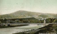
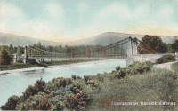
1832: Aboyne
Aboyne, Scotland, United Kingdom - River Dee
| Bridgemeister ID: | 2203 (added 2007-01-28) |
| Year Completed: | 1832 |
| Name: | Aboyne |
| Location: | Aboyne, Scotland, United Kingdom |
| Crossing: | River Dee |
| Use: | Vehicular |
| Status: | Removed |
Image Sets:
1834: Crathie
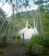
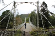
Crathie vicinity, Scotland, United Kingdom - River Dee
| Bridgemeister ID: | 1084 (added 2004-01-01) |
| Year Completed: | 1834 |
| Name: | Crathie |
| Also Known As: | Easter Balmoral |
| Location: | Crathie vicinity, Scotland, United Kingdom |
| Crossing: | River Dee |
| Coordinates: | 57.0335 N 3.211 W |
| Maps: | Acme, GeoHack, Google, OpenStreetMap |
| Principals: | Justice Junior and Co. |
| References: | AAJ, BSI, HBR |
| Use: | Vehicular (one-lane) |
| Status: | Restricted to foot traffic (last checked: 2024) |
| Main Cables: | Eyebar (iron) |
| Suspended Spans: | 1 |
| Main Span: | 1 x 42.1 meters (138 feet) |
| Deck width: | 14 feet |
Notes:
- BSI: Reported to have been "almost entirely renewed", 1885. Ruddock also suggests the bridge was originally constructed with just diagonal stays (as other Justice bridges) and the catenary chains were added during the renewal.
- 2024, May: Reopened after restoration completed.
External Links:
- The Happy Pontist: Scottish Bridges: 56. Crathie Suspension Bridge (after the flood)
- Structurae - Structure ID 20070665
Image Sets:
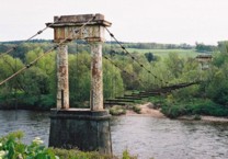
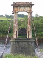
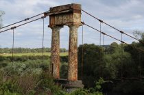
1837: Shakkin
Cults, Aberdeen, Scotland, United Kingdom - River Dee
| Bridgemeister ID: | 1546 (added 2004-11-13) |
| Year Completed: | 1837 |
| Name: | Shakkin |
| Also Known As: | Shakin, St. Devenick's, Morrison |
| Location: | Cults, Aberdeen, Scotland, United Kingdom |
| Crossing: | River Dee |
| Coordinates: | 57.11460 N 2.17056 W |
| Maps: | Acme, GeoHack, Google, OpenStreetMap |
| Principals: | John Smith |
| Use: | Footbridge |
| Status: | Derelict (last checked: 2014) |
| Main Cables: | Chain (iron) |
| Suspended Spans: | 3 |
| Main Span: | 1 x 54.9 meters (180.1 feet) |
| Side Spans: | 2 |
Notes:
- Damaged by flood, 1876, and 1920. Reconstructed, 1921-1922. "Stranded" by shift in river's course, 1970's and 1980's, sweeping away southern approach spans. Deck removed, 1984.
- Known locally as "Shakin' Briggie" or "Shakkin' Briggie," but also referred to as Morrison Bridge and St. Devenick's Bridge.
- Restoration under consideration, 2005.
External Links:
Image Sets:
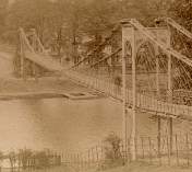
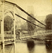
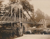
1852: Queens Park
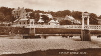
Chester and Handbridge, England, United Kingdom - River Dee
| Bridgemeister ID: | 405 (added before 2003) |
| Year Completed: | 1852 |
| Name: | Queens Park |
| Location: | Chester and Handbridge, England, United Kingdom |
| Crossing: | River Dee |
| Principals: | Enoch Gerrard |
| References: | BRB, NTB |
| Use: | Footbridge |
| Status: | Replaced |
| Main Cables: | Chain (iron) |
| Suspended Spans: | 3 |
| Main Span: | 1 |
| Side Spans: | 2 |
Notes:
- Replaced by 1923 Queens Park - Chester and Handbridge, England, United Kingdom.
- All past and present bridges at this location.
Image Sets:
1871: Aboyne
Waterside, Aboyne vicinity, Scotland, United Kingdom - River Dee
| Bridgemeister ID: | 2202 (added 2007-01-28) |
| Year Completed: | 1871 |
| Name: | Aboyne |
| Location: | Waterside, Aboyne vicinity, Scotland, United Kingdom |
| Crossing: | River Dee |
| Principals: | Harper & Co. |
| References: | HARPER |
| Use: | Footbridge |
| Status: | Removed |
| Main Cables: | Wire |
| Main Span: | 1 x 91.4 meters (300 feet) |
Notes:
- HARPER: Likely destroyed by one of these major Dee River flood events: May 1913, December 1914, October 1920.
External Links:
1871: Hunting
Shocklach Green vicinity, England, United Kingdom - River Dee
| Bridgemeister ID: | 2191 (added 2007-01-26) |
| Year Completed: | 1871 |
| Name: | Hunting |
| Location: | Shocklach Green vicinity, England, United Kingdom |
| Crossing: | River Dee |
| Principals: | Harper & Co. |
| References: | HARPER |
| Use: | Footbridge |
| Status: | Removed, 1935 |
| Main Cables: | Wire |
| Suspended Spans: | 1 |
| Main Span: | 1 x 48.8 meters (160 feet) |
External Links:
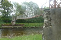
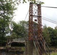
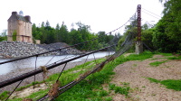
1885: Abergeldie Castle
Balmoral vicinity, Scotland, United Kingdom - River Dee
| Bridgemeister ID: | 1705 (added 2005-03-29) |
| Year Completed: | 1885 |
| Name: | Abergeldie Castle |
| Location: | Balmoral vicinity, Scotland, United Kingdom |
| Crossing: | River Dee |
| Coordinates: | 57.043806 N 3.176197 W |
| Maps: | Acme, GeoHack, Google, OpenStreetMap |
| Principals: | Blaikie Brothers |
| References: | AAJ, HBR |
| Use: | Footbridge |
| Status: | Derelict (last checked: 2016) |
| Main Cables: | Wire |
| Suspended Spans: | 1 |
Notes:
- William Craig describes the bridge, "A wood and angle iron deck supported from two pairs of wire cables and rod suspenders. The railings are of light woven wire. Pylons with ornamental heads are of lattice gider construction on concrete bases five miles west of Ballater, Scotland."
- Was already derelict before December 2015 flooding (Storm Frank) that severely damaged several River Dee bridges. Dave Cooper writes in early 2016: "The bridge's southern tower and its base are gone. The river bank has eroded back to within feet of the grade one listed Abergeldie Castle. Seat of Baron Abergeldie."
External Links:
Image Sets:


1892: Polhollick
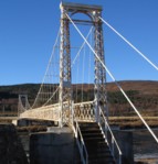
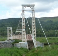
Ballater vicinity, Aberdeenshire, Scotland, United Kingdom - River Dee
| Bridgemeister ID: | 1905 (added 2005-10-08) |
| Year Completed: | 1892 |
| Name: | Polhollick |
| Location: | Ballater vicinity, Aberdeenshire, Scotland, United Kingdom |
| Crossing: | River Dee |
| Coordinates: | 57.055048 N 3.083452 W |
| Maps: | Acme, GeoHack, Google, OpenStreetMap |
| Principals: | James Abernethy & Co. |
| References: | HARPER, HBR |
| Use: | Footbridge |
| Status: | In use (last checked: 2014) |
| Main Cables: | Wire (steel) |
| Suspended Spans: | 1 |
| Main Span: | 1 x 54.4 meters (178.5 feet) |
Notes:
- Closed May 2015 for repairs. Reopened October, 2015.
External Links:
- The Happy Pontist: Scottish Bridges: 19. Polhollick Suspension Bridge
- The Happy Pontist: Scottish Bridges: 44. Polhollick Bridge (revisited)
- Structurae - Structure ID 20021613
Image Sets:
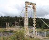
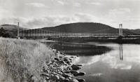
1903: Pickhill
Pickhill, Wales, United Kingdom - River Dee
| Bridgemeister ID: | 4562 (added 2020-06-01) |
| Year Completed: | 1903 |
| Name: | Pickhill |
| Also Known As: | Pickhill Meadows |
| Location: | Pickhill, Wales, United Kingdom |
| Crossing: | River Dee |
| Coordinates: | 53.017265 N 2.884666 W |
| Maps: | Acme, GeoHack, Google, OpenStreetMap |
| Principals: | David Rowell & Co. |
| Use: | Vehicular (one-lane) |
| Status: | Restricted to foot traffic (last checked: 2020) |
| Main Cables: | Wire (steel) |
| Suspended Spans: | 1 |
| Main Span: | 1 x 41 meters (134.5 feet) |
| Deck width: | 3 meters |
Image Sets:
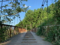
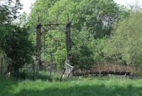
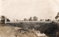
1905: Cambus O'May
Ballater, Scotland, United Kingdom - River Dee
| Bridgemeister ID: | 429 (added before 2003) |
| Year Completed: | 1905 |
| Name: | Cambus O'May |
| Also Known As: | Gordon |
| Location: | Ballater, Scotland, United Kingdom |
| Crossing: | River Dee |
| Coordinates: | 57.065803 N 2.956825 W |
| Maps: | Acme, GeoHack, Google, OpenStreetMap |
| Principals: | James Abernethy & Co. |
| References: | BC2, BC3, BEM, HARPER, HBR, NTB |
| Use: | Footbridge |
| Status: | In use (last checked: April, 2021) |
| Main Cables: | Wire (steel) |
| Suspended Spans: | 1 |
| Main Span: | 1 x 51.8 meters (170 feet) |
Notes:
- 1988: Refurbished (HBR)
- 2015, December: Damaged by the River Dee flood caused by Storm Frank. Closed indefinitely. Repairs expected to start in 2020.
- 2020, August 31: Repairs underway, expected to be completed in approximately 16 weeks.
- 2020, December: Storm Frank repairs now expected to be completed in January 2021.
- 2021, January: Completion of repairs delayed due to COVID-19 pandemic "stay at home" recommendations.
- 2021, April 1: Repairs completed, bridge reopened.
External Links:
- Cambus O' May | Harper Bridges
- The Happy Pontist: Scottish Bridges: 20. Cambus O'May Footbridge
- The Happy Pontist: Scottish Bridges: 43. Cambus O' May Bridge (revisited)
- The Happy Pontist: Scottish Bridges: 55. Cambus O'May Bridge (after the flood)
- Structurae - Structure ID 20019638
Image Sets:

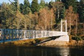
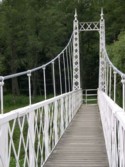
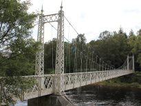
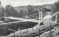
1923: Queens Park
Chester and Handbridge, England, United Kingdom - River Dee
| Bridgemeister ID: | 435 (added before 2003) |
| Year Completed: | 1923 |
| Name: | Queens Park |
| Location: | Chester and Handbridge, England, United Kingdom |
| Crossing: | River Dee |
| Coordinates: | 53.18796 N 2.88421 W |
| Maps: | Acme, GeoHack, Google, OpenStreetMap |
| Principals: | Charles Greenwood, David Rowell & Co., William E. Barker |
| References: | BRB, NTB |
| Use: | Footbridge |
| Status: | In use (last checked: 2019) |
| Main Cables: | Wire (steel) |
| Suspended Spans: | 1 |
| Main Span: | 1 x 83.8 meters (275 feet) |
Notes:
- Replaced 1852 Queens Park - Chester and Handbridge, England, United Kingdom.
- All past and present bridges at this location.
External Links:
- Chesterwiki - Suspension Bridge. Interesting details about the bridge.
Image Sets:
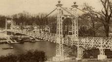
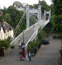
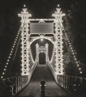
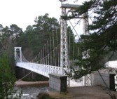
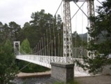
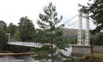
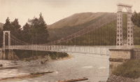
1924: Invercauld
Braemar vicinity, Scotland, United Kingdom - River Dee
| Bridgemeister ID: | 1906 (added 2005-10-08) |
| Year Completed: | 1924 |
| Name: | Invercauld |
| Also Known As: | Ballochbuie, Garbh Allt Shiel |
| Location: | Braemar vicinity, Scotland, United Kingdom |
| Crossing: | River Dee |
| Coordinates: | 57.001768 N 3.322743 W |
| Maps: | Acme, GeoHack, Google, OpenStreetMap |
| Principals: | James Abernethy & Co. |
| References: | HARPER, HBR |
| Use: | Footbridge |
| Status: | In use (last checked: 2014) |
| Main Cables: | Wire (steel) |
| Suspended Spans: | 1 |
External Links:
Image Sets:
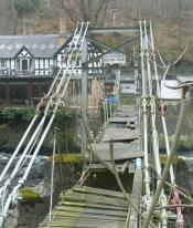
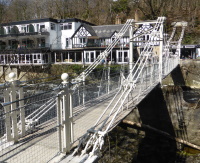
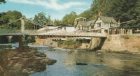
1929: Chainbridge
Berwyn, Llangollen, Wales, United Kingdom - River Dee
| Bridgemeister ID: | 1303 (added 2004-04-09) |
| Year Completed: | 1929 |
| Name: | Chainbridge |
| Also Known As: | Chain |
| Location: | Berwyn, Llangollen, Wales, United Kingdom |
| Crossing: | River Dee |
| Coordinates: | 52.98025 N 3.1946 W |
| Maps: | Acme, GeoHack, Google, OpenStreetMap |
| Principals: | Sir Henry Robertson |
| Use: | Footbridge |
| Status: | In use (last checked: 2019) |
| Main Cables: | Chain |
| Suspended Spans: | 1 |
| Main Span: | 1 |
Notes:
- Crosses both River Dee and Llangollen Canal
- A thorough report on these bridges was published in 2010 by the Royal Commission on the Ancient and Historical Monuments of Wales (RCAHMW), Chain Bridge, Llantysilio, Denbighshire. The Pickering bridge (built 1817, according to the report) was contructed with the deck laid on the chains. This bridge was removed in 1870 but appears not to have been replaced until at least 1876. The new bridge, not simply refurbished, was constructed with the deck supported by the chains underneath, but in an "underspanned" fashion with small pillars resting on the chains, supporting a level deck. This bridge was destroyed by flood on Feb. 16, 1928. The report also investigates whether the chains of the current (1929) bridge are the original chains from the 1817 Pickering bridge and concludes there is evidence "supporting the hypothesis that the chains we see on the bridge today are same as those put on the bridge in 1817" and adds "If the present chains are the originals, there is little reason to doubt that they are the oldest suspension bridge chains in the western world."
- 2015: Underwent major restoration and reopened.
External Links:
- Chainbridge Hotel. The bridge is situated next to the hotel. Their web site notes the original "chain bridge" at this location was built in 1814 by Exuperious Pickering and was refurbished in 1870 and rebuilt in 1929.
- Structurae - Structure ID 20074318
Image Sets:
Do you have any information or photos for these bridges that you would like to share? Please email david.denenberg@bridgemeister.com.
Mail | Facebook | X (Twitter) | Bluesky