Suspension Bridges Crossing Klamath River
This is a list of all 12 bridges from the suspension bridge inventory crossing Klamath River. Please note that different rivers with the same name will be grouped together. For example, selecting 'Bear Creek' shows bridges across several different Bear Creeks. Also, similarly named rivers are grouped separately. For example, 'River Dee' (UK) bridges are grouped separately from 'Dee River' (Australia) bridges. Wherever you see a Bridgemeister ID number click it to isolate the bridge on its own page.
Related Lists:
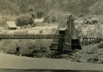
1861: Weitchpec
Weitchpec, California, USA - Klamath River
| Bridgemeister ID: | 1090 (added 2004-01-01) |
| Year Completed: | 1861 |
| Name: | Weitchpec |
| Location: | Weitchpec, California, USA |
| Crossing: | Klamath River |
| Principals: | Andrew S. Hallidie |
| References: | DSL200106 |
| Use: | Vehicular |
| Status: | Removed |
| Main Cables: | Wire (iron) |
| Suspended Spans: | 1 |
Notes:
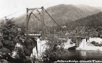
1912: Orleans
Orleans, California, USA - Klamath River
| Bridgemeister ID: | 126 (added before 2003) |
| Year Completed: | 1912 |
| Name: | Orleans |
| Location: | Orleans, California, USA |
| Crossing: | Klamath River |
| Use: | Vehicular (one-lane) |
| Status: | Destroyed, 1936? |
| Main Cables: | Wire |
Notes:
- Some accounts state this bridge was destroyed by fire in 1921. A brief mention in the July 18, 1926 edition of The Fresno Bee implies it was destroyed in June of 1926.
- Replaced by 1940 Orleans - Orleans, California, USA.
- All past and present bridges at this location.
External Links:
- Catalog Number 1983/001/SBPM01034 - Sacramento Bee. This "Center for Sacramento History" catalog entry suggests the bridge survived until 1936. Given the bridge was ultimately replaced in 1940, this later date makes more sense than some of the earlier claims of it being destroyed in the 1920s unless there were some intermediate reconstructions.
- Klamath River at Orleans - California State Library. This image shows a bridge of similar construction but apparently shorter span than the other images linked here. However, matching buildings seen in the background of multiple images place it at the same location. Given the muddled suspension bridge chronology at this location and frequency of Klamath River floods, it seems likely there were multiple reconstructions of this bridge.
- Orleans Bridge 1910 - California State Library. Image purporting to be the Orleans bridge under construction in 1910, but it does not appear to be the same location.
Image Sets:
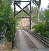
1930: Horse Creek
Horse Creek, California, USA - Klamath River
| Bridgemeister ID: | 586 (added 2003-01-05) |
| Year Completed: | 1930 |
| Name: | Horse Creek |
| Location: | Horse Creek, California, USA |
| Crossing: | Klamath River |
| Coordinates: | 41.824678 N 122.997667 W |
| Maps: | Acme, GeoHack, Google, OpenStreetMap |
| Use: | Vehicular (one-lane) |
| Status: | In use (last checked: 2024) |
| Main Cables: | Wire (steel) |
| Suspended Spans: | 1 |
| Main Span: | 1 x 61 meters (200.1 feet) estimated |
Notes:
External Links:
Image Sets:
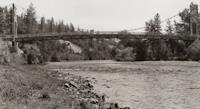
1933: Happy Camp
Happy Camp, California, USA - Klamath River
| Bridgemeister ID: | 1011 (added 2003-11-21) |
| Year Completed: | 1933 |
| Name: | Happy Camp |
| Location: | Happy Camp, California, USA |
| Crossing: | Klamath River |
| Coordinates: | 41.790056 N 123.377639 W |
| Maps: | Acme, GeoHack, Google, OpenStreetMap |
| Principals: | WPA |
| References: | AAJ |
| Use: | Vehicular (one-lane) |
| Status: | Dismantled |
| Main Cables: | Wire (steel) |
| Suspended Spans: | 1 |
| Main Span: | 1 x 91.4 meters (300 feet) |
Notes:
- Coordinates are for the current (2020s) crossing at Happy Camp. The suspension bridge was either at the same location or very close based on contemporary topographic maps.
- Moved to Cassidy - Sierra National Forest, California, USA. The bridge was disassembled, shortened, and relocated in the 1950's to the Ansel Adams Wilderness, Minarets Ranger District, Sierra National Forest, California as the "Cassidy" suspension bridge.
1940: Orleans
Orleans, California, USA - Klamath River
| Bridgemeister ID: | 197 (added before 2003) |
| Year Completed: | 1940 |
| Name: | Orleans |
| Location: | Orleans, California, USA |
| Crossing: | Klamath River |
| Coordinates: | 41.303306 N 123.533722 W |
| Maps: | Acme, GeoHack, Google, OpenStreetMap |
| Principals: | C.H. Purcell, Murphy Pacific Co. |
| References: | BPL, WOT |
| Use: | Vehicular |
| Status: | Destroyed, December 1964 |
| Main Cables: | Wire (steel) |
| Suspended Spans: | 1 |
Notes:
- 1964, December: Destroyed by the Christmas Flood of 1964 (Wikipedia).
- Replaced 1912 Orleans - Orleans, California, USA.
- Replaced by 1967 Orleans - Orleans, California, USA.
- All past and present bridges at this location.
Image Sets:
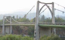
1967: Orleans
Orleans, California, USA - Klamath River
| Bridgemeister ID: | 223 (added before 2003) |
| Year Completed: | 1967 |
| Name: | Orleans |
| Location: | Orleans, California, USA |
| Crossing: | Klamath River |
| Coordinates: | 41.303194 N 123.533972 W |
| Maps: | Acme, GeoHack, Google, OpenStreetMap |
| Principals: | Ostap Bender, A.P. Bezzone, Jr. |
| References: | BCO, BPL, WOT |
| Use: | Vehicular (two-lane, heavy vehicles), with walkway |
| Status: | In use (last checked: 2021) |
| Main Cables: | Wire (steel) |
| Suspended Spans: | 3 |
| Main Span: | 1 x 131.1 meters (430 feet) |
| Side Spans: | 2 |
Notes:
External Links:
Image Sets:
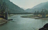
(footbridge)
Horse Creek, California, USA - Klamath River
| Bridgemeister ID: | 585 (added 2003-01-05) |
| Name: | (footbridge) |
| Location: | Horse Creek, California, USA |
| Crossing: | Klamath River |
| Use: | Footbridge |
| Status: | Replaced |
| Main Cables: | Wire |
Notes:
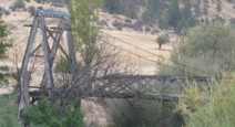
(suspension bridge)
Henley, Hornbrook, California, USA - Klamath River
| Bridgemeister ID: | 1083 (added 2004-01-01) |
| Name: | (suspension bridge) |
| Location: | Henley, Hornbrook, California, USA |
| Crossing: | Klamath River |
| Coordinates: | 41.88649 N 122.55474 W |
| Maps: | Acme, GeoHack, Google, OpenStreetMap |
| Status: | Collapsed, c. 2010-2012 |
| Main Cables: | Wire |
| Suspended Spans: | 1 |
Notes:
- Appears to have collapsed (or was dismantled) at some point between 2010 and 2012.
- Patrick S. O'Donnell notes (in the 2000s): "It looked at one time it may have carried one lane of traffic from the early 20th century. It was barely standing, I did manage to walk across it."
Image Sets:
Ishi Pishi
Orleans vicinity, California, USA - Klamath River
| Bridgemeister ID: | 5672 (added 2021-01-30) |
| Name: | Ishi Pishi |
| Location: | Orleans vicinity, California, USA |
| Crossing: | Klamath River |
| Coordinates: | 41.378467 N 123.496315 W |
| Maps: | Acme, GeoHack, Google, OpenStreetMap |
| Use: | Vehicular |
| Status: | Destroyed, December, 1964 |
| Main Cables: | Wire (steel) |
Notes:
- Likely completed in the 1930s.
- 1964, December: Destroyed by flood.
Martins Ferry
Martins Ferry, Weitchpec vicinity, California, USA - Klamath River
| Bridgemeister ID: | 1046 (added 2003-12-06) |
| Name: | Martins Ferry |
| Location: | Martins Ferry, Weitchpec vicinity, California, USA |
| Crossing: | Klamath River |
| Use: | Vehicular (one-lane) |
| Status: | Removed |
| Main Cables: | Wire |
Notes:
- At (or near) former location of Martins Ferry - Martins Ferry, Weitchpec vicinity, California, USA which is likely an older bridge at this location.
- All past and present bridges at this location.
Image Sets:

Martins Ferry
Martins Ferry, Weitchpec vicinity, California, USA - Klamath River
| Bridgemeister ID: | 1658 (added 2005-03-19) |
| Name: | Martins Ferry |
| Location: | Martins Ferry, Weitchpec vicinity, California, USA |
| Crossing: | Klamath River |
| Status: | Destroyed, Jan. 1890 |
| Main Cables: | Wire |
Notes:
- Destroyed by flood, January, 1890.
- Later at same location Martins Ferry - Martins Ferry, Weitchpec vicinity, California, USA which likely replaced this bridge.
- All past and present bridges at this location.
External Links:
- Bird's eye view of Martins Ferry Bridge and buildings beyond. Undated high-resolution image of a Martins Ferry suspension bridge with open-frame timber towers. Unclear if this photo was taken before 1890, the purported destruction date of this early Martins Ferry suspension bridge. Despite the resolution, there is not much to see in the image to help date it. Twisted strand main cables are evident, but such cables were manufactured as early as the mid-1850s.
Weitchpec
Weitchpec, California, USA - Klamath River
| Bridgemeister ID: | 1048 (added 2003-12-06) |
| Name: | Weitchpec |
| Location: | Weitchpec, California, USA |
| Crossing: | Klamath River |
| Main Cables: | Wire |
Notes:
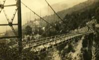
- Eric Sakowski asked the Humboldt County Historical Society for information about this bridge and received this answer from Catherine Mace: "You have a good picture of the bridge over the Klamath River at Weitchpec. The large tree you see through the bridge is the gambling tree and the village of Weitchpec is the structures behind it. The road goes across and makes almost a hairpin turn to the right then it branches . To the right you go up river and to the left goes down river through Weitchpec."
- See 1861 Weitchpec - Weitchpec, California, USA. The bridge pictured here was likely a replacement for the older bridge.
Image Sets:
Do you have any information or photos for these bridges that you would like to share? Please email david.denenberg@bridgemeister.com.
Mail | Facebook | X (Twitter) | Bluesky