Inventory Search Results (1-100 of 120)
Results : << < 1-100 101-120 > >> All
120 suspension bridges were found for search criteria: GAP .
Bridges 1 through 100 (of 120 total) appear below. Click the Bridgemeister ID number to isolate the bridge on its own page.
If you don't see what you were looking for, try an image search with the same criteria: GAP
Related:
Bridgemeister ID: 22 (added before 2003)Year Completed: 1824 Name: Lehigh Gap Also Known As: Palmerton Location: Lehigh Gap, Pennsylvania , USA Crossing: Lehigh River Principals: Jacob Blumer References: AAJ , CAB , DSE20000203 , WHSB Use: Vehicular Status: Replaced, 1933 Main Cables: Chain (iron) Suspended Spans: 3
Bridgemeister ID: 654 (added 2003-03-08)Year Completed: 1842 Name: (suspension bridge) Location: New Plymouth, New Zealand Crossing: Waiwakaiho River References: GAP Status: Replaced, 1859
GAP: May have been first New Zealand suspension bridge. Bridgemeister ID: 655 (added 2003-03-08)Year Completed: 1862 Name: Gloucester Street Location: Christchurch, New Zealand Crossing: Avon River References: GAP
Bridgemeister ID: 656 (added 2003-03-08)Year Completed: 1864 Name: Taieri River Also Known As: West Taieri Location: Outram, New Zealand Crossing: Taieri River Principals: John Turnbull Thomson References: GAP Use: Vehicular Status: Replaced, 1966 Main Cables: Eyebar (iron) Suspended Spans: 4 Main Spans: 2 Side Spans: 2
Bridgemeister ID: 657 (added 2003-03-08)Year Completed: 1867 Name: (suspension bridge) Location: Mataura, New Zealand Principals: John Turnbull Thomson References: GAP
Bridgemeister ID: 658 (added 2003-03-08)Year Completed: 1868 Name: Skippers Canyon Location: Maori Point vicinity, New Zealand Crossing: Shotover River At or Near Feature: Skippers Canyon Principals: John Turnbull Thomson References: GAP Use: Footbridge Status: Removed Main Cables: Wire
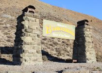
Bridgemeister ID: 660 (added 2003-03-08)Year Completed: 1874 Name: (suspension bridge) Location: Bannockburn, New Zealand Crossing: Kawarau River References: GAP Status: Replaced
Bridgemeister ID: 414 (added before 2003)Year Completed: 1876 Name: Brunner Location: Brunner, New Zealand Crossing: Grey River / Māwheranui Coordinates: 42.433068 S 171.324420 E Maps: Acme , GeoHack , Google , OpenStreetMap Principals: John Carruthers References: GAP Use: Vehicular and Rail Status: Restricted to foot traffic (last checked: 2017) Main Cables: Wire Suspended Spans: 1
GAP: Collapsed just before opening due to anchor plate failure, rebuilt. Rebuilt again 1925-1926. Towers replaced 1963-1964. Bridgemeister ID: 664 (added 2003-03-08)Year Completed: 1878 Name: (suspension bridge) Location: New Zealand Crossing: Hawea River Principals: William Grant, McKellar References: GAP
Bridgemeister ID: 665 (added 2003-03-08)Year Completed: 1879 Name: Shaky Also Known As: Manuherikia Location: Alexandra, New Zealand Crossing: Manuherikia River Coordinates: 45.253846 S 169.398651 E Maps: Acme , GeoHack , Google , OpenStreetMap Principals: L.D. Macgeorge, William Grant, McKellar References: GAP Use: Vehicular (one-lane) Status: Restricted to foot traffic (last checked: 2017) Main Cables: Wire Suspended Spans: 1
Bridgemeister ID: 666 (added 2003-03-08)Year Completed: 1880 Name: Daniel O'Connell Location: Ophir, New Zealand Crossing: Manuherikia River Coordinates: 45.110783 S 169.590268 E Maps: Acme , GeoHack , Google , OpenStreetMap Principals: L.D. Macgeorge, J.S. Derby, R. Edgar References: GAP Use: Vehicular (one-lane) Status: In use (last checked: 2018) Main Cables: Wire Suspended Spans: 1 Main Span: 1 x 65.5 meters (214.9 feet)
Bridgemeister ID: 667 (added 2003-03-08)Year Completed: 1880 Name: Kawarau Gorge Location: Kawarau Gorge, Central Otago, New Zealand Crossing: Kawarau River Gorge Coordinates: 45.008882 S 168.899938 E Maps: Acme , GeoHack , Google , OpenStreetMap Principals: H.P. Higginson, A.R.W Fulton, W.C. Edwards References: AAJ , GAP Use: Vehicular (one-lane) Status: Restricted to foot traffic (last checked: 2017) Main Cables: Wire (iron) Suspended Spans: 1 Main Span: 1 x 91.4 meters (300 feet)
Appears to now be used solely as a bungee-jumping platform. Bridgemeister ID: 663 (added 2003-03-08)Year Completed: 1881 Name: Clyde Location: Clyde, New Zealand Crossing: Clutha River Coordinates: 45.190387 S 169.315977 E Maps: Acme , GeoHack , Google , OpenStreetMap Principals: William Grant, McKellar References: GAP Use: Vehicular (one-lane) Status: Replaced, 1936 Main Cables: Wire Suspended Spans: 3 Main Span: 1 Side Spans: 2
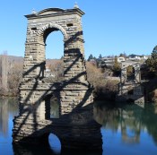
Bridgemeister ID: 668 (added 2003-03-08)Year Completed: 1882 Name: Alexandra Location: Alexandra, New Zealand Crossing: Clutha River Coordinates: 45.258245 S 169.391270 E Maps: Acme , GeoHack , Google , OpenStreetMap Principals: L.D. Macgeorge, Jeremiah Drummey, Robert Hay References: GAP Use: Vehicular (one-lane) Status: Only towers remain (last checked: 2017) Main Cables: Wire Main Span: 1 x 79.9 meters (262.1 feet)
Bridgemeister ID: 670 (added 2003-03-08)Year Completed: 1885 Name: Hope River Stock Location: Glynn Wye, North Canterbury, New Zealand Crossing: Hope River Coordinates: 42.588804 S 172.510846 E Maps: Acme , GeoHack , Google , OpenStreetMap Principals: J. & A. Anderson Ltd. References: GAP Use: Footbridge and Stock Status: Derelict (last checked: 2019) Main Cables: Wire Suspended Spans: 1 Main Span: 1 x 75.3 meters (247 feet)
GAP: Collapsed late 20th century. Bridgemeister ID: 669 (added 2003-03-08)Year Completed: 1885 Name: Sutton Location: Sutton vicinity and Middlemarch vicinity, New Zealand Crossing: Taieri River Coordinates: 45.575599 S 170.131762 E Maps: Acme , GeoHack , Google , OpenStreetMap Principals: Bain References: GAP Use: Vehicular (one-lane) Status: Dismantled, October, 2017 (last checked: 2017) Main Cables: Wire Suspended Spans: 1 Main Span: 1 x 44 meters (144.4 feet) estimated
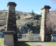
Wrecked by flood, July 2017. Dismantled, October 2017 Bridgemeister ID: 671 (added 2003-03-08)Year Completed: 1887 Name: Roxburgh Location: Roxburgh, New Zealand Crossing: Clutha River Coordinates: 45.542731 S 169.320220 E Maps: Acme , GeoHack , Google , OpenStreetMap Principals: J. McCormack References: GAP Use: Vehicular (one-lane) Status: Only towers remain (last checked: 2017) Main Cables: Wire Suspended Spans: 1
Bridgemeister ID: 674 (added 2003-03-08)Year Completed: 1893 Name: (suspension bridge) Location: Hamua, New Zealand Crossing: Makakahi River Principals: Joseph Dawson References: GAP
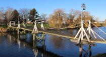
Bridgemeister ID: 673 (added 2003-03-08)Year Completed: 1893 Name: Mandeville Also Known As: Swing Location: Kaiapoi, New Zealand Crossing: Kaiapoi River At or Near Feature: Trousselot Park Coordinates: 43.3811 S 172.65584 E Maps: Acme , GeoHack , Google , OpenStreetMap References: GAP Use: Footbridge Status: In use (last checked: 2019) Main Cables: Wire Suspended Spans: 3 Main Spans: 3
Bridgemeister ID: 675 (added 2003-03-08)Year Completed: 1894 Name: Pokororo Also Known As: Ngatimoti Location: Ngatimoti and Woodstock, New Zealand Crossing: Motueka River References: GAP Use: Footbridge Main Cables: Wire Suspended Spans: 1 Main Span: 1 x 91.4 meters (299.9 feet)
GAP: Originally footbridge, widened 1916. Collapsed October, 1931. Rebuilt. 1983: Rebuilt. 2020, December: Rehabilitation project likely. 2021, October: Contract awarded for repairs. McIntyre, Bruce. "Swinging Bridge will be upgraded at a cost of almost $300,000." Toronto Star, 20 October 2021, https://www.thestar.com/news/canada/2021/10/20/swinging-bridge-will-be-upgraded-at-a-cost-of-almost-300000.html ."In his report to council recently, Development and Property Director Mike Asselin said the bridge was an important piece of infrastructure and just like other municipal property like bridges and roads, council was faced with the prospect of investing in one of its assets or eventually be forced to close the bridge due to safety concerns. Although there had been some repairs completed in 2020, it was more of a stop-gap measure to deal with some immediate issues."
Bridgemeister ID: 676 (added 2003-03-08)Year Completed: 1897 Name: (suspension bridge) Location: Tiroiti, New Zealand Crossing: Capburn River References: GAP Use: Pack and Stock
Bridgemeister ID: 677 (added 2003-03-08)Year Completed: 1897 Name: (suspension bridge) Location: Utiku vicinity, New Zealand Crossing: Rangitikei River References: GAP Status: Replaced, 1970
Bridgemeister ID: 661 (added 2003-03-08)Year Completed: 1897 Name: Macandrew Location: Bannockburn, New Zealand Crossing: Kawarau River References: GAP Use: Vehicular (one-lane) Status: Replaced, 1964 Main Cables: Wire Suspended Spans: 1
Bridgemeister ID: 678 (added 2003-03-08)Year Completed: 1899 Name: Clifden Location: Clifden, Southland, New Zealand Crossing: Waiau River Coordinates: 46.029752 S 167.715139 E Maps: Acme , GeoHack , Google , OpenStreetMap Principals: C.H. Howorth, W. Baird, E.R. Ussher References: GAP Use: Vehicular (one-lane) Status: Restricted to foot traffic, since 1978 (last checked: 2016) Main Cables: Wire Suspended Spans: 1 Main Span: 1 x 111.5 meters (365.8 feet)
Bridgemeister ID: 680 (added 2003-03-08)Year Completed: 1900 Name: Mafeking Also Known As: Revell's Location: Raven Quay, New Zealand Crossing: Kaiapoi River Coordinates: 43.377701 S 172.651679 E Maps: Acme , GeoHack , Google , OpenStreetMap Principals: Thompson and Murphy References: GAP Use: Footbridge Status: Modified, 1973
Bridgemeister ID: 679 (added 2003-03-08)Year Completed: 1901 Name: Skippers Location: Maori Point vicinity, New Zealand Crossing: Upper Shotover River At or Near Feature: Skippers Canyon Coordinates: 44.844355 S 168.686769 E Maps: Acme , GeoHack , Google , OpenStreetMap Principals: John Black, A.J. Fraser Co. References: GAP Use: Vehicular (one-lane) Status: In use (last checked: 2017) Main Cables: Wire (steel) Suspended Spans: 1 Main Span: 1 x 96.3 meters (315.9 feet)
Bridgemeister ID: 683 (added 2003-03-08)Year Completed: 1902 Name: Salisbury's Location: Golden Bay, New Zealand Crossing: Aorere River References: GAP Use: Footbridge Status: Destroyed, December 28, 2010 Main Cables: Wire Suspended Spans: 1 Main Span: 1 x 37.2 meters (122 feet)
Bridgemeister ID: 686 (added 2003-03-08)Year Completed: 1904 Name: (suspension bridge) Location: Mt. Bruce, New Zealand Crossing: Ruamahanga River Principals: Joseph Dawson References: GAP
Bridgemeister ID: 684 (added 2003-03-08)Year Completed: 1904 Name: Pomeroy's Also Known As: James's Location: Bainham, Golden Bay, New Zealand Crossing: Aorere River References: GAP
Bridgemeister ID: 687 (added 2003-03-08)Year Completed: 1905 Name: Mangarere Road Location: Mangaweka, New Zealand Crossing: Rangitikei River References: GAP Use: Vehicular (one-lane) Main Cables: Wire (steel) Suspended Spans: 1
Bridgemeister ID: 689 (added 2003-03-08)Year Completed: 1906 Name: Baton Location: Baton River valley vicinity, New Zealand Crossing: Motueka River References: GAP Use: Footbridge and Stock Status: Replaced, 1961 Main Cables: Wire Suspended Spans: 1 Main Span: 1 x 91.4 meters (299.9 feet)
Bridgemeister ID: 688 (added 2003-03-08)Year Completed: 1906 Name: Puketapu-Moteo Also Known As: Puketapu Swing Location: Puketapu, Hawke's Bay, New Zealand Crossing: Tutaekuri River References: GAP Use: Vehicular Status: Replaced, 1963 Main Cables: Wire (steel) Main Span: 1 x 129 meters (423.2 feet)
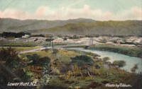
Bridgemeister ID: 690 (added 2003-03-08)Year Completed: 1909 Name: Melling Location: Lower Hutt, New Zealand Crossing: Te Awa Kairangi / Hutt River Principals: Joseph Dawson References: GAP Use: Vehicular (one-lane) Status: Replaced Main Cables: Wire (steel) Suspended Spans: 1 Main Span: 1 x 91.4 meters (299.9 feet)
Bridgemeister ID: 691 (added 2003-03-08)Year Completed: 1911 Name: Kaiwarra Location: Ethelton vicinity, North Canterbury, New Zealand Crossing: Hurunui River Principals: Arthur Falkner, T. Ridley References: GAP Use: Vehicular (one-lane) Main Cables: Wire Suspended Spans: 1 Main Span: 1 x 46.8 meters (153.5 feet)
Bridgemeister ID: 693 (added 2003-03-08)Year Completed: 1912 Name: Ireland's Road Also Known As: Wilson Cutting Road Location: Ashley Clinton vicinity, New Zealand Principals: Joseph Dawson References: GAP Use: Vehicular Status: Replaced, 1968 Main Span: 1 x 43.4 meters (142.4 feet)
Bridgemeister ID: 692 (added 2003-03-08)Year Completed: 1912 Name: Mangatewai Road Also Known As: Boyle Road Location: Ashley Clinton vicinity, New Zealand Crossing: Mangatewai River Principals: Joseph Dawson References: GAP Use: Vehicular Status: Demolished, 1970 Main Span: 1 x 53.1 meters (174.2 feet)
GAP: Completed c.1912. Destroyed by earthquake, 1931. Hamish Kynoch writes: "This bridge over the Mangatewai River was located on Boyle Road. It was damaged in the large earthquake in 1931, but stood for many years, and was used occasionally for livestock, with wooden planking over the crack in the concrete deck. It was demolished about 1970 by dynamiting the anchor blocks at one end of the bridge. There was no replacement and the old road is now closed. Another bridge of the same design was located about three miles away on Wilson Cutting Road." See 1912 Ireland's Road (Wilson Cutting Road) - Ashley Clinton vicinity, New Zealand . Bridgemeister ID: 695 (added 2003-03-08)Year Completed: 1913 Name: Horseshoe Bend Location: Horseshoe Bend, Millers Flat vicinity, New Zealand Crossing: Clutha River Coordinates: 45.722574 S 169.471335 E Maps: Acme , GeoHack , Google , OpenStreetMap Principals: John Edie, Jimmy Doake References: GAP Use: Footbridge Status: In use (last checked: 2017) Main Cables: Wire Suspended Spans: 1
Bridgemeister ID: 694 (added 2003-03-08)Year Completed: 1913 Name: Peninsula Location: Ngatimoti, New Zealand Crossing: Motueka River Principals: D.F. Whiteside References: GAP Use: Vehicular Main Cables: Wire (steel) Suspended Spans: 3 Main Span: 1 x 58.5 meters (191.9 feet)
GAP: Reconstructed, 1938. Bridgemeister ID: 697 (added 2003-03-08)Year Completed: 1914 Name: (suspension bridge) Location: Mangaweka vicinity, New Zealand Crossing: Rangitikei River At or Near Feature: 'Meeting of the Waters' Coordinates: 39.754594 S 175.835543 E Maps: Acme , GeoHack , Google , OpenStreetMap Principals: S.A.R. Mair References: GAP Use: Vehicular (one-lane) Status: Only towers remain, since 1961 (last checked: 2017) Main Cables: Wire Suspended Spans: 1
GAP: Located at junction of Rangitikei and Hautapu rivers. Replaced, 1961, but original towers remain at the site as of 2017. Bridgemeister ID: 696 (added 2003-03-08)Year Completed: 1914 Name: Mokai Location: Taoroa Junction, New Zealand Crossing: Rangitikei River Principals: Joseph Dawson References: GAP Use: Vehicular (one-lane) Status: Replaced, 1963 Main Cables: Wire Suspended Spans: 1 Main Span: 1 x 77 meters (252.6 feet)
GAP: Replaced, 1963, after overloaded sheep truck fell through deck. Bridgemeister ID: 718 (added 2003-03-08)Year Completed: 1916 Name: Te Koura Location: Okahukura vicinity, New Zealand Crossing: Ongarue River References: GAP Use: Footbridge Status: Derelict Main Cables: Wire Suspended Spans: 1
Bridgemeister ID: 699 (added 2003-03-08)Year Completed: 1917 Name: Maoribank Also Known As: Whiteman's Location: Maoribank, Upper Hutt, New Zealand Crossing: Te Awa Kairangi / Hutt River Principals: Joseph Dawson References: GAP Use: Vehicular (one-lane) Status: Collapsed, September 14, 1988 Main Cables: Wire (steel) Suspended Spans: 1
1988, September 14: Collapsed due to flood. Bridgemeister ID: 700 (added 2003-03-08)Year Completed: 1918 Name: (footbridge) Location: Wakefield vicinity, New Zealand Crossing: Dove River References: GAP Use: Footbridge
Bridgemeister ID: 698 (added 2003-03-08)Year Completed: 1918 Name: Opiki Toll Also Known As: Akers Toll Location: Rangitane, New Zealand Crossing: Manawatu River Coordinates: 40.431841 S 175.468575 E Maps: Acme , GeoHack , Google , OpenStreetMap Principals: Joseph Dawson References: AAJ , GAP , PTS2 Use: Vehicular Status: Derelict (last checked: 2024) Main Cables: Wire (steel) Main Span: 1
1969: Bypassed. 2023, September: After many years of the main cables and suspenders hanging with no deck, one of the main cables collapsed. 2024, March: The collapsed main cable is raised back into position. The bridge, however, is still a just derelict monument with no deck. Bridgemeister ID: 701 (added 2003-03-08)Year Completed: 1920 Name: Lacy's Location: New Zealand Crossing: Retaruke River References: GAP Use: Footbridge Status: Replaced
Bridgemeister ID: 702 (added 2003-03-08)Year Completed: 1923 Name: (suspension bridge) Location: Murchison vicinity, New Zealand Crossing: Buller River References: GAP
Bridgemeister ID: 715 (added 2003-03-08)Year Completed: 1924 Name: (suspension bridge) Location: Cattle Flat, West Wanaka, Wanaka vicinity, New Zealand Crossing: Matukituki River Coordinates: 44.636005 S 168.992132 E Maps: Acme , GeoHack , Google , OpenStreetMap References: GAP Use: Vehicular Status: Destroyed, September 10, 1970 Main Cables: Wire (steel) Suspended Spans: 1
Papers Past | Newspapers | Press | 12 September 1970 | BRIDGE DOWN . Article dated September 11, 1970: "The single-span suspension bridge across the West Matukituki River, 13 miles from Wanaka, was blown away by gale-force winds yesterday afternoon, cutting the only road access to West Wanaka station, where 10 persons are now isolated."Bridgemeister ID: 712 (added 2003-03-08)Year Completed: 1924 Name: (suspension bridge) Location: Tolaga Bay vicinity, New Zealand Crossing: Mangaheia River Principals: Tom Ryan References: GAP
GAP: completed circa 1924, in addition to "The Five Bridges" also spanning the Mangaheia Bridgemeister ID: 707 (added 2003-03-08)Year Completed: 1924 Name: Mangaheia I Location: Tauwhareparae Road, Tolaga Bay vicinity, New Zealand Crossing: Mangaheia River Principals: Tom Ryan References: GAP Use: Vehicular (one-lane) Status: Replaced Main Cables: Wire (steel) Suspended Spans: 1 Main Span: 1 x 41 meters (134.5 feet)
GAP: completed circa 1924. One of "The Five Bridges" that spanned the Mangaheia on the Tauwhareparae Road. Bridgemeister ID: 708 (added 2003-03-08)Year Completed: 1924 Name: Mangaheia II Location: Tauwhareparae Road, Tolaga Bay vicinity, New Zealand Crossing: Mangaheia River Principals: Tom Ryan References: GAP Use: Vehicular (one-lane) Status: Replaced Main Cables: Wire (steel)
GAP: completed circa 1924. One of "The Five Bridges" that spanned the Mangaheia on the Tauwhareparae Road. Bridgemeister ID: 709 (added 2003-03-08)Year Completed: 1924 Name: Mangaheia III Location: Tauwhareparae Road, Tolaga Bay vicinity, New Zealand Crossing: Mangaheia River Principals: Tom Ryan References: GAP Use: Vehicular (one-lane) Status: Replaced Main Cables: Wire (steel)
GAP: completed circa 1924. One of "The Five Bridges" that spanned the Mangaheia on the Tauwhareparae Road. Bridgemeister ID: 710 (added 2003-03-08)Year Completed: 1924 Name: Mangaheia IV Location: Tauwhareparae Road, Tolaga Bay vicinity, New Zealand Crossing: Mangaheia River Principals: Tom Ryan References: GAP Use: Vehicular (one-lane) Status: Replaced Main Cables: Wire (steel)
GAP: completed circa 1924. One of "The Five Bridges" that spanned the Mangaheia on the Tauwhareparae Road. Bridgemeister ID: 711 (added 2003-03-08)Year Completed: 1924 Name: Mangaheia V Location: Tauwhareparae Road, Tolaga Bay vicinity, New Zealand Crossing: Mangaheia River Principals: Tom Ryan References: GAP Use: Vehicular (one-lane) Status: Replaced Main Cables: Wire (steel)
GAP: completed circa 1924. One of "The Five Bridges" that spanned the Mangaheia on the Tauwhareparae Road. Bridgemeister ID: 713 (added 2003-03-08)Year Completed: 1925 Name: Springvale Location: Taihape vicinity, New Zealand Crossing: Rangitikei River Coordinates: 39.488097 S 176.033601 E Maps: Acme , GeoHack , Google , OpenStreetMap References: GAP Use: Vehicular (one-lane) Status: Restricted to foot traffic (last checked: 2015) Main Cables: Wire (steel) Suspended Spans: 1
Bridgemeister ID: 720 (added 2003-03-08)Year Completed: 1926 Name: (suspension bridge) Location: Arero, Tolaga Bay vicinity, New Zealand References: GAP
Bridgemeister ID: 714 (added 2003-03-08)Year Completed: 1926 Name: Arapuni Location: Arapuni Power Station, New Zealand Crossing: Waikato River Coordinates: 38.070585 S 175.644480 E Maps: Acme , GeoHack , Google , OpenStreetMap Principals: David Rowell & Co., Armstrong Whitworth References: GAP Use: Footbridge Status: In use (last checked: 2019) Main Cables: Wire (steel) Suspended Spans: 1
Bridgemeister ID: 716 (added 2003-03-08)Year Completed: 1926 Name: Bertrand Road Location: Huirangi, New Zealand Crossing: Waitara River Coordinates: 39.047336 S 174.254549 E Maps: Acme , GeoHack , Google , OpenStreetMap Principals: N.C. Fookes References: GAP Use: Vehicular (one-lane) Status: In use, 2006 (last checked: 2017) Main Cables: Wire (steel) Suspended Spans: 1 Main Span: 1 x 61 meters (200.1 feet)
Bridgemeister ID: 719 (added 2003-03-08)Year Completed: 1926 Name: Lower Hurunui Location: North Canterbury, New Zealand Crossing: Hurunui River Coordinates: 42.907226 S 173.273596 E Maps: Acme , GeoHack , Google , OpenStreetMap Principals: H.F. Toogood References: GAP Use: Vehicular (one-lane) Status: In use (last checked: 2017) Main Cables: Wire (steel)
GAP: Refurbished, 1983. Not entirely clear the bridge described in GAP as the "Lower Hurunui" bridge near the mouth of the Hurunui is the same bridge as the present day bridge carrying Blythe Road. The detailed description of the 1926 bridge does not seem to match the current structure. However, Thornton also implied major changes to the bridge during the 1983 refurbishment. Bridgemeister ID: 722 (added 2003-03-08)Year Completed: 1927 Name: Limestone Ford Location: Awatere Valley, Marlborough, New Zealand References: GAP Status: Replaced
GAP: Replaced, early 1970's. Bridgemeister ID: 721 (added 2003-03-08)Year Completed: 1927 Name: Waiho Gorge Location: Franz Josef Glacier vicinity, New Zealand Crossing: Waiho River Coordinates: 43.393202 S 170.180682 E Maps: Acme , GeoHack , Google , OpenStreetMap References: GAP Use: Vehicular Status: Removed, c. 1990 Main Cables: Wire (steel) Suspended Spans: 1 Main Span: 1 x 91.4 meters (300 feet)
Bridgemeister ID: 728 (added 2003-03-08)Year Completed: 1929 Name: (suspension bridge) Location: Waimata Valley, Gisborne vicinity, New Zealand Crossing: Waimata River References: GAP
Bridgemeister ID: 724 (added 2003-03-08)Year Completed: 1929 Name: Creighton's Location: Inangahua County, New Zealand Crossing: Maruia River References: GAP
Bridgemeister ID: 729 (added 2003-03-08)Year Completed: 1929 Name: Fox River Location: Fox Glacier, New Zealand Crossing: Fox River Coordinates: 43.487188 S 170.029302 E Maps: Acme , GeoHack , Google , OpenStreetMap References: GAP Use: Footbridge Status: In use (last checked: 2014) Main Cables: Wire (steel) Suspended Spans: 1 Main Span: 1 x 70 meters (229.7 feet)
Bridgemeister ID: 726 (added 2003-03-08)Year Completed: 1929 Name: Hinckesman's Access Road Location: Frasertown vicinity, Hawke's Bay, New Zealand Crossing: Mangapoike River Principals: T. Delaney References: GAP Use: Vehicular Status: Destroyed, 1935
Bridgemeister ID: 734 (added 2003-03-08)Year Completed: 1930 Name: (footbridge) Location: Grey Valley, Slaty Creek vicinity, New Zealand Crossing: Big River References: GAP Use: Footbridge
Bridgemeister ID: 731 (added 2003-03-08)Year Completed: 1930 Name: (suspension bridge) Location: Whangaehu Valley, Kakatahi, New Zealand Crossing: Whangaehu River At or Near Feature: Field's Track Coordinates: 39.621392 S 175.422532 E Maps: Acme , GeoHack , Google , OpenStreetMap References: GAP Status: Removed Main Span: 1 x 53.5 meters (175.5 feet)
GAP: "On Field's Track, which links the Parapara (Wanganui-Raethi) Road at Kakatahi with the Whangaehu Valley." Coordinates are for the current (2020) Field's Track crossing of the Whangaehu River. Bridgemeister ID: 737 (added 2003-03-08)Year Completed: 1931 Name: (suspension bridge) Location: Murchison District, New Zealand Crossing: Matiri River References: GAP Status: Removed
GAP: Maybe completed early 1932, no longer in existence. Bridgemeister ID: 736 (added 2003-03-08)Year Completed: 1931 Name: (suspension bridge) Location: Wakarara, Tikokino vicinity, New Zealand Crossing: Waipawa River Principals: S.T. Silver References: GAP
Bridgemeister ID: 735 (added 2003-03-08)Year Completed: 1931 Name: Mata River Location: Makarika, Ruatoria vicinity, New Zealand Crossing: Mata River References: GAP Use: Vehicular (one-lane) Status: Replaced Main Cables: Wire (steel) Suspended Spans: 1 Main Span: 1 x 151 meters (495.4 feet)
Bridgemeister ID: 738 (added 2003-03-08)Year Completed: 1932 Name: (suspension bridge) Location: Mangaohutu-Retaruke Road, New Zealand Crossing: Wanganui River References: GAP
Bridgemeister ID: 739 (added 2003-03-08)Year Completed: 1932 Name: (suspension bridge) Location: Rakautangi-Kohara Road, Waimarino County, New Zealand Crossing: Rakautangi Stream References: GAP
Bridgemeister ID: 741 (added 2003-03-08)Year Completed: 1932 Name: Horse Location: Milford Sound vicinity, New Zealand Crossing: Cleddau River Coordinates: 44.703778 S 167.967861 E Maps: Acme , GeoHack , Google , OpenStreetMap References: GAP Use: Pack and Footbridge Status: In use (last checked: 2022) Main Cables: Wire (steel) Suspended Spans: 1 Main Span: 1 x 36.5 meters (119.8 feet)
Bridgemeister ID: 740 (added 2003-03-08)Year Completed: 1932 Name: Lacy's Location: Retaruke, New Zealand Crossing: Retaruke River Coordinates: 39.108536 S 175.075048 E Maps: Acme , GeoHack , Google , OpenStreetMap Principals: Bill Baker References: GAP Use: Vehicular (one-lane) Status: In use (last checked: 2013) Main Cables: Wire (steel) Suspended Spans: 1 Main Span: 1 x 45.7 meters (149.9 feet)
Bridgemeister ID: 746 (added 2003-03-08)Year Completed: 1933 Name: (suspension bridge) Location: Carluke vicinity, New Zealand Crossing: Tunakino River References: GAP
Distinct from other 1933 bridge in same vicinity. Bridgemeister ID: 747 (added 2003-03-08)Year Completed: 1933 Name: (suspension bridge) Location: Carluke vicinity, New Zealand Crossing: Tunakino River References: GAP
Bridgemeister ID: 749 (added 2003-03-08)Year Completed: 1933 Name: (suspension bridge) Location: S.J. Butt's property, Marlborough, New Zealand Crossing: Rai River References: GAP
GAP: completed circa 1933. Bridgemeister ID: 743 (added 2003-03-08)Year Completed: 1933 Name: (suspension bridge) Location: Totoro Road, New Zealand Crossing: Mokau River References: GAP
Bridgemeister ID: 752 (added 2003-03-08)Year Completed: 1936 Name: (footbridge) Location: Gisborne vicinity, New Zealand Crossing: Waimata River References: GAP Use: Footbridge
Bridgemeister ID: 754 (added 2003-03-08)Year Completed: 1936 Name: (footbridge) Location: Motumote, Southland, New Zealand Crossing: Waiau River References: GAP Use: Footbridge
Bridgemeister ID: 755 (added 2003-03-08)Year Completed: 1936 Name: (footbridge) Location: Waikino, New Zealand Crossing: Ohinemuri River Principals: L.E. Shaw References: GAP Use: Footbridge Status: Destroyed, 1981 Main Cables: Wire Main Span: 1 x 42.1 meters (138.1 feet)
GAP: Damaged by flood, 1964. Repaired. Destroyed by flood, 1981. Bridgemeister ID: 751 (added 2003-03-08)Year Completed: 1936 Name: (suspension bridge) Location: Ohura vicinity, New Zealand Crossing: Waikaka Stream References: GAP
Bridgemeister ID: 727 (added 2003-03-08)Year Completed: 1936 Name: Hinckesman's Access Road Location: Frasertown vicinity, Hawke's Bay, New Zealand Crossing: Mangapoike River Principals: T. Delaney References: GAP Use: Vehicular Status: Destroyed
Bridgemeister ID: 748 (added 2003-03-08)Year Completed: 1936 Name: Smart's Location: Marlborough, New Zealand Crossing: Rai River References: GAP Use: Footbridge
Bridgemeister ID: 757 (added 2003-03-08)Year Completed: 1937 Name: (footbridge) Location: Bruce property, New Zealand Crossing: Maruia River References: GAP Use: Footbridge
Bridgemeister ID: 758 (added 2003-03-08)Year Completed: 1937 Name: (suspension bridge) Location: Waitaria Bay, Havelock vicinity, New Zealand References: GAP Use: Stock Main Span: 1 x 18.3 meters (60 feet)
Bridgemeister ID: 761 (added 2003-03-08)Year Completed: 1937 Name: Hodder Location: Seddon vicinity, Marlborough, New Zealand Crossing: Hodder River Coordinates: 41.884739 S 173.641185 E Maps: Acme , GeoHack , Google , OpenStreetMap References: GAP Use: Vehicular (one-lane) Status: In use (last checked: 2019) Main Cables: Wire (steel) Suspended Spans: 1 Main Span: 1 x 64 meters (210 feet)
GAP: Refurbished 1982. Strengthened, 2015. Bridgemeister ID: 759 (added 2003-03-08)Year Completed: 1937 Name: Monymusk Farm Location: Leamington Valley, Cheviot vicinity, New Zealand Crossing: Leamington River Principals: Ellis Upritchard References: GAP Use: Vehicular (one-lane) Main Cables: Wire (steel) Suspended Spans: 1
Bridgemeister ID: 756 (added 2003-03-08)Year Completed: 1937 Name: Redpath's Location: Waioeka Gorge, Opotiki vicinity, New Zealand Crossing: Waioeka River References: GAP
Bridgemeister ID: 763 (added 2003-03-08)Year Completed: 1938 Name: Fox River Location: Fox Glacier valley, West Coast, New Zealand Crossing: Fox River Coordinates: 43.477723 S 170.008270 E Maps: Acme , GeoHack , Google , OpenStreetMap References: GAP Use: Vehicular (one-lane) Status: In use (last checked: 2019) Main Cables: Wire (steel) Suspended Spans: 1 Main Span: 1 x 109.7 meters (359.9 feet)
Bridgemeister ID: 760 (added 2003-03-08)Year Completed: 1938 Name: Te Reinga Location: Wairoa vicinity, New Zealand Crossing: Wairoa River References: GAP Use: Vehicular (one-lane) Status: Extant (last checked: 2001) Main Cables: Wire (steel) Suspended Spans: 1
Scheduled to be demolished, 2003. Mail | Facebook | Twitter


