Suspension Bridges of California (101-125 of 125)
This is a list of bridges 101 through 125 (of 125 total) from the suspension bridge inventory for California in USA. Wherever you see a Bridgemeister ID number click it to isolate the bridge on its own page.
Related Lists:
(suspension bridge)
Willow Creek vicinity, California, USA - Trinity River
| Bridgemeister ID: | 2344 (added 2007-08-12) |
| Name: | (suspension bridge) |
| Location: | Willow Creek vicinity, California, USA |
| Crossing: | Trinity River |
| Use: | Vehicular |
| Main Cables: | Wire |
| Suspended Spans: | 1 |
Notes:
- The bridge pictured here appears to be similar to, but distinct from other Willow Creek vicinity bridges in the Bridgemeister inventory. The bridge does not match the bridges in images of the Salyer and Hawkins Bar bridges. The description on the reverse of this photo is: "Over Trinity River near Willow Creek, Cal. between Arcata and Redding. Nov. 21, 1951." Arcata and Redding are 141 miles apart, so that information is not helpful except to reinforce that the bridge was along the modern-day CA-299 corridor near Willow Creek. This bridge is likely no longer in existence.
- See 1940 Hawkins Bar - Trinity Village and Hawkins Bar, California, USA.
- See (suspension bridge) - Salyer and Willow Creek, California, USA.
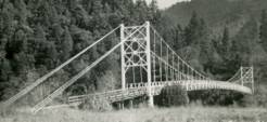
Bel-Air Country Club
Los Angeles, California, USA
| Bridgemeister ID: | 6777 (added 2021-10-28) |
| Name: | Bel-Air Country Club |
| Location: | Los Angeles, California, USA |
| Coordinates: | 34.078701 N 118.450619 W |
| Maps: | Acme, GeoHack, Google, OpenStreetMap |
| Use: | Golf cart and Footbridge |
| Status: | In use (last checked: 2021) |
| Main Cables: | Wire (steel) |
| Suspended Spans: | 1 |
| Main Span: | 1 x 58 meters (190.3 feet) estimated |
Blaney
Trinity Alps, California, USA - Stuart Fork Trinity River
| Bridgemeister ID: | 931 (added 2003-10-25) |
| Name: | Blaney |
| Also Known As: | Trinity Alps Resort |
| Location: | Trinity Alps, California, USA |
| Crossing: | Stuart Fork Trinity River |
| Coordinates: | 40.85663 N 122.88776 W |
| Maps: | Acme, GeoHack, Google, OpenStreetMap |
| Use: | Footbridge |
| Status: | In use (last checked: 2007) |
| Main Cables: | Wire (steel) |
| Suspended Spans: | 1 |
| Main Span: | 1 x 51.2 meters (168 feet) estimated |
Notes:
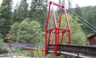
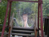
- Asymmetrical bridge with one tower much taller than the other. The larger tower appears to have been added in 2003 when the bridge was rebuilt following an August 2002 collapse due to a rusted cable. A sign on the current bridge reads "Blaney Bridge, Engineered by Colin Blaney, 2003," but there has been a suspension bridge at this location since before 2003. Follow the photo showing the damaged bridge for more information.
Cassidy
Sierra National Forest, California, USA - Middle Fork San Joaquin River
| Bridgemeister ID: | 321 (added before 2003) |
| Name: | Cassidy |
| Location: | Sierra National Forest, California, USA |
| Crossing: | Middle Fork San Joaquin River |
| At or Near Feature: | Ansel Adams Wilderness, Minarets Ranger District |
| Coordinates: | 37.48328 N 119.20778 W |
| Maps: | Acme, GeoHack, Google, OpenStreetMap |
| Use: | Footbridge and Pack |
| Status: | In use |
| Main Cables: | Wire (steel) |
| Suspended Spans: | 1 |
| Main Span: | 1 x 45.7 meters (150 feet) |
| Deck width: | 5 feet |
Notes:
- Severely damaged by flood winter of 1996-97. Rebuilt, 2000.
- Moved from 1933 (suspension bridge) - Happy Camp vicinity, California, USA. According to Sahale, LLC, the bridge was orginally constructed at Happy Camp, California and relocated to its present location in the mid-1950's and shortened.
External Links:
Cazadero
Cazadero, California, USA
| Bridgemeister ID: | 2352 (added 2007-08-18) |
| Name: | Cazadero |
| Location: | Cazadero, California, USA |
| Use: | Footbridge |
| Status: | In use |
| Main Cables: | Wire |
Notes:
- Appears to provide access to the Cazadero Performing Arts Camp.
China Flat Tract
Downiesville vicinity and Sierra City vicinity, California, USA - North Yuba River
| Bridgemeister ID: | 1432 (added 2004-07-25) |
| Name: | China Flat Tract |
| Location: | Downiesville vicinity and Sierra City vicinity, California, USA |
| Crossing: | North Yuba River |
| Coordinates: | 39.561033 N 120.754067 W |
| Maps: | Acme, GeoHack, Google, OpenStreetMap |
| Use: | Footbridge |
| Status: | In use (last checked: 2005) |
| Main Cables: | Wire (steel) |
| Suspended Spans: | 1 |
| Main Span: | 1 x 41.5 meters (136 feet) estimated |
Notes:
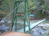
- Off Route 49 about midway between Downiesville and Sierra City.
Ecklon Toll
Folsom, California, USA - American River
| Bridgemeister ID: | 1552 (added 2004-11-14) |
| Name: | Ecklon Toll |
| Location: | Folsom, California, USA |
| Crossing: | American River |
| Coordinates: | 38.682343 N 121.175714 W |
| Maps: | Acme, GeoHack, Google, OpenStreetMap |
| References: | IHS |
| Use: | Vehicular (one-lane) |
| Status: | Collapsed, 1892 |
| Main Cables: | Wire (iron) |
| Suspended Spans: | 1 |
Notes:
- Folsom's Rainbow Bridge occupies the location where this bridge stood.
- IHS: Bridge is purchased by Christian L. Ecklon (a local butcher) in 1872 from "Kinsey & Whitely."
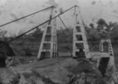
Euchre Bar
Casa Loma vicinity, California, USA - North Fork American River
| Bridgemeister ID: | 2119 (added 2006-09-17) |
| Name: | Euchre Bar |
| Location: | Casa Loma vicinity, California, USA |
| Crossing: | North Fork American River |
| At or Near Feature: | Tahoe National Forest |
| Coordinates: | 39.18558 N 120.7612 W |
| Maps: | Acme, GeoHack, Google, OpenStreetMap |
| Use: | Footbridge and Pack |
| Status: | In use |
| Main Cables: | Wire (steel) |
Fairview
Fairview, California, USA - Kern River
| Bridgemeister ID: | 3354 (added 2019-12-15) |
| Name: | Fairview |
| Also Known As: | McNally's |
| Location: | Fairview, California, USA |
| Crossing: | Kern River |
| Coordinates: | 35.927731 N 118.494214 W |
| Maps: | Acme, GeoHack, Google, OpenStreetMap |
| Use: | Footbridge |
| Status: | In use (last checked: 2019) |
| Main Cables: | Wire (steel) |
Goodwin Dam
Jamestown, California, USA - Stanislaus River
| Bridgemeister ID: | 4941 (added 2020-08-08) |
| Name: | Goodwin Dam |
| Location: | Jamestown, California, USA |
| Crossing: | Stanislaus River |
| Coordinates: | 37.862621 N 120.630156 W |
| Maps: | Acme, GeoHack, Google, OpenStreetMap |
| Use: | Footbridge |
| Status: | In use (last checked: 2020) |
| Main Cables: | Wire (steel) |
| Main Spans: | 2 |
Notes:
- At former location of Goodwin Dam - Jamestown, California, USA.
Goodwin Dam
Jamestown, California, USA - Stanislaus River
| Bridgemeister ID: | 4942 (added 2020-08-08) |
| Name: | Goodwin Dam |
| Location: | Jamestown, California, USA |
| Crossing: | Stanislaus River |
| Coordinates: | 37.862536 N 120.630411 W |
| Maps: | Acme, GeoHack, Google, OpenStreetMap |
| Use: | Footbridge |
| Status: | Removed |
| Main Cables: | Wire |
Notes:
- Later at same location Goodwin Dam - Jamestown, California, USA. Coordinates given here are for approximate location of this bridge which appeared to be slightly further downstream from Goodwin Dam as the present day (2020) suspension bridge.
Hartman Bar
Hartman Bar, Plumas County, California, USA - Middle Fork Feather River
| Bridgemeister ID: | 5668 (added 2021-01-30) |
| Name: | Hartman Bar |
| Location: | Hartman Bar, Plumas County, California, USA |
| Crossing: | Middle Fork Feather River |
| Coordinates: | 39.777210 N 121.158777 W |
| Maps: | Acme, GeoHack, Google, OpenStreetMap |
| Use: | Footbridge |
| Status: | In use (last checked: 2019) |
| Main Cables: | Wire (steel) |
| Suspended Spans: | 1 |
External Links:
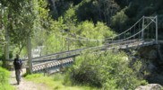
Horse
Tassajara Hot Springs vicinity, California, USA - Arroyo Seco
| Bridgemeister ID: | 1715 (added 2005-04-04) |
| Name: | Horse |
| Location: | Tassajara Hot Springs vicinity, California, USA |
| Crossing: | Arroyo Seco |
| At or Near Feature: | Los Padres National Forest |
| Coordinates: | 36.218867 N 121.502183 W |
| Maps: | Acme, GeoHack, Google, OpenStreetMap |
| Use: | Footbridge |
| Status: | Destroyed, January 9, 2023 |
| Main Cables: | Wire (steel) |
| Suspended Spans: | 1 |
| Main Span: | 1 x 29.6 meters (97 feet) estimated |
Notes:
- Located near confluence of Willow Creek and Arroyo Seco.
- 2023, January 9: Destroyed by flood.
External Links:
- Ventana Wilderness Forums - Arroyo Seco Gorge Horsebridge is Gone. Blog with several images of the bridge and its demise.
Hyampom
Hyampom, California, USA - South Fork Trinity River
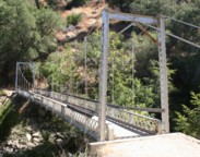
| Bridgemeister ID: | 6925 (added 2022-01-21) |
| Name: | Hyampom |
| Location: | Hyampom, California, USA |
| Crossing: | South Fork Trinity River |
| Coordinates: | 40.617562 N 123.463327 W |
| Maps: | Acme, GeoHack, Google, OpenStreetMap |
| Use: | Vehicular |
| Status: | Removed |
| Main Cables: | Wire (steel) |
Notes:
- The vehicular suspension bridge at Hyampom, not to be confused with the locally famous Hyampom Mule Bridge, was likely located at the coordinates provided here and likely destroyed by the Christmas flood of 1964.
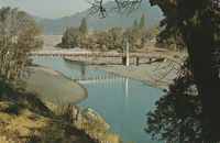
Ishi Pishi
Orleans vicinity, California, USA - Klamath River
| Bridgemeister ID: | 5672 (added 2021-01-30) |
| Name: | Ishi Pishi |
| Location: | Orleans vicinity, California, USA |
| Crossing: | Klamath River |
| Coordinates: | 41.378467 N 123.496315 W |
| Maps: | Acme, GeoHack, Google, OpenStreetMap |
| Use: | Vehicular |
| Status: | Destroyed, December, 1964 |
| Main Cables: | Wire (steel) |
Notes:
- Likely completed in the 1930s.
- 1964, December: Destroyed by flood.
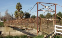
Mariposa Equestrian
Burbank, California, USA - Los Angeles River
| Bridgemeister ID: | 2422 (added 2008-02-23) |
| Name: | Mariposa Equestrian |
| Also Known As: | Horse |
| Location: | Burbank, California, USA |
| Crossing: | Los Angeles River |
| Coordinates: | 34.15550 N 118.31265 W |
| Maps: | Acme, GeoHack, Google, OpenStreetMap |
| Use: | Equestrian and Footbridge |
| Status: | In use (last checked: 2021) |
| Main Cables: | Wire (steel) |
| Suspended Spans: | 1 |
| Main Span: | 1 x 41.1 meters (135 feet) |
External Links:
Martins Ferry
Martins Ferry, Weitchpec vicinity, California, USA - Klamath River
| Bridgemeister ID: | 1046 (added 2003-12-06) |
| Name: | Martins Ferry |
| Location: | Martins Ferry, Weitchpec vicinity, California, USA |
| Crossing: | Klamath River |
| Use: | Vehicular (one-lane) |
| Status: | Removed |
| Main Cables: | Wire |
Notes:
- See Martins Ferry - Martins Ferry, Weitchpec vicinity, California, USA which may be an older bridge at this location.

Martins Ferry
Martins Ferry, Weitchpec vicinity, California, USA - Klamath River
| Bridgemeister ID: | 1658 (added 2005-03-19) |
| Name: | Martins Ferry |
| Location: | Martins Ferry, Weitchpec vicinity, California, USA |
| Crossing: | Klamath River |
| Status: | Destroyed, Jan. 1890 |
| Main Cables: | Wire |
Notes:
- Destroyed by flood, January, 1890.
- See Martins Ferry - Martins Ferry, Weitchpec vicinity, California, USA which may have replaced this bridge.
External Links:
- Bird's eye view of Martins Ferry Bridge and buildings beyond. Undated high-resolution image of a Martins Ferry suspension bridge with open-frame timber towers. Unclear if this photo was taken before 1890, the purported destruction date of this early Martins Ferry suspension bridge. Despite the resolution, there is not much to see in the image to help date it. Twisted strand main cables are evident, but such cables were manufactured as early as the mid-1850s.
South Fork Trinity River Trail
Forest Glen vicinity, California, USA - South Fork Trinity River
| Bridgemeister ID: | 1997 (added 2005-12-25) |
| Name: | South Fork Trinity River Trail |
| Location: | Forest Glen vicinity, California, USA |
| Crossing: | South Fork Trinity River |
| At or Near Feature: | Trinity National Forest |
| Coordinates: | 40.361383 N 123.306617 W |
| Maps: | Acme, GeoHack, Google, OpenStreetMap |
| Use: | Footbridge |
| Status: | In use (last checked: 2005) |
| Main Cables: | Wire (steel) |
| Suspended Spans: | 1 |
| Main Span: | 1 x 39.6 meters (130 feet) estimated |
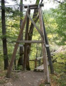
Swinging
Philo, California, USA - Navarro River
| Bridgemeister ID: | 1295 (added 2004-03-19) |
| Name: | Swinging |
| Location: | Philo, California, USA |
| Crossing: | Navarro River |
| Coordinates: | 39.058029 N 123.442550 W |
| Maps: | Acme, GeoHack, Google, OpenStreetMap |
| Use: | Footbridge |
| Status: | Extant (last checked: 2020) |
| Main Cables: | Wire |
Swinging
Richardson Springs, California, USA
| Bridgemeister ID: | 313 (added before 2003) |
| Name: | Swinging |
| Location: | Richardson Springs, California, USA |
| Coordinates: | 39.838927 N 121.769790 W |
| Maps: | Acme, GeoHack, Google, OpenStreetMap |
| Use: | Footbridge |
| Status: | Removed |
| Main Cables: | Wire |
| Suspended Spans: | 1 |
Notes:
- Wide footbridge.
Wawona
Wawona, California, USA - South Fork Merced River
| Bridgemeister ID: | 5594 (added 2020-12-23) |
| Name: | Wawona |
| Location: | Wawona, California, USA |
| Crossing: | South Fork Merced River |
| Coordinates: | 37.540392 N 119.623170 W |
| Maps: | Acme, GeoHack, Google, OpenStreetMap |
| Use: | Footbridge |
| Status: | In use (last checked: 2017) |
| Main Cables: | Wire (steel) |
| Suspended Spans: | 1 |
Weitchpec
Weitchpec, California, USA - Klamath River
| Bridgemeister ID: | 1048 (added 2003-12-06) |
| Name: | Weitchpec |
| Location: | Weitchpec, California, USA |
| Crossing: | Klamath River |
| Main Cables: | Wire |
Notes:
- Eric Sakowski asked the Humboldt County Historical Society for information about this bridge and received this answer from Catherine Mace: "You have a good picture of the bridge over the Klamath River at Weitchpec. The large tree you see through the bridge is the gambling tree and the village of Weitchpec is the structures behind it. The road goes across and makes almost a hairpin turn to the right then it branches . To the right you go up river and to the left goes down river through Weitchpec."
- See 1861 Weitchpec - Weitchpec, California, USA. The bridge pictured here was likely a replacement for the older bridge.
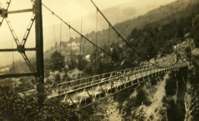
Wood's Creek
Rae Lakes vicinity, California, USA - Wood's Creek
| Bridgemeister ID: | 1213 (added 2004-02-14) |
| Name: | Wood's Creek |
| Location: | Rae Lakes vicinity, California, USA |
| Crossing: | Wood's Creek |
| At or Near Feature: | John Muir Trail, Kings Canyon National Park |
| Coordinates: | 36.873689 N 118.438052 W |
| Maps: | Acme, GeoHack, Google, OpenStreetMap |
| Use: | Footbridge |
| Status: | In use (last checked: 2018) |
| Main Cables: | Wire (steel) |
| Suspended Spans: | 1 |
Notes:
- Probably built in 1990's.
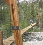
Workman's Bar
Rock Creek, Plumas County, California, USA - North Fork Feather River
| Bridgemeister ID: | 5674 (added 2021-01-31) |
| Name: | Workman's Bar |
| Location: | Rock Creek, Plumas County, California, USA |
| Crossing: | North Fork Feather River |
| Coordinates: | 39.905172 N 121.344949 W |
| Maps: | Acme, GeoHack, Google, OpenStreetMap |
| Use: | Vehicular (one-lane) |
| Status: | Destroyed, 1907 |
| Main Cables: | Wire |
| Suspended Spans: | 1 |
Notes:
- Workman's Bar (named for Robert Workman) was located near the current location of the Pacific Gas and Electric Rock Creek Powerhouse. The coordinates reflect the bar observed at the present-day (2020) powerhouse, but may not be the exact location of the bridge.
External Links:
Do you have any information or photos for these bridges that you would like to share? Please email david.denenberg@bridgemeister.com.