Undated/Named Suspension Bridges (701-800 of 1,567)
This is a list of bridges 701 through 800 (of 1,567 total) in the suspension bridge inventory that are undated named bridges. Wherever you see a Bridgemeister ID number click it to isolate the bridge on its own page.
Related Lists:
Bridgemeister ID: 8262 (added 2024-02-08)Name: Kitanojo Also Known As: 北の城橋 Location: Miyada, Nagano , Japan Crossing: Tenryu River Coordinates: 35.772361 N 137.961028 E Maps: Acme , GeoHack , Google , OpenStreetMap Use: Vehicular (one-lane) Status: In use (last checked: 2023) Main Cables: Wire (steel) Suspended Spans: 1 Main Span: 1 x 60 meters (196.9 feet) estimated
Bridgemeister ID: 3141 (added 2019-11-02)Name: Kjerkbrua Location: Rennebu, Trøndelag, Norway Crossing: Orkla Coordinates: 62.874897 N 9.831168 E Maps: Acme , GeoHack , Google , kart.1881.no , OpenStreetMap Principals: Sivert Gunnes Use: Vehicular (one-lane) Status: In use (last checked: 2010) Main Cables: Wire Suspended Spans: 1 Main Span: 1 x 56 meters (183.7 feet) estimated
Major rehabilitation completed, 2014. Bridgemeister ID: 4459 (added 2020-04-25)Name: Kløvstien Location: Rauma, Møre og Romsdal, Norway Crossing: Istra Coordinates: 62.480486 N 7.665235 E Maps: Acme , GeoHack , Google , kart.1881.no , OpenStreetMap Use: Footbridge Status: In use (last checked: 2019) Main Cables: Wire (steel) Suspended Spans: 1 Main Span: 1 x 16 meters (52.5 feet) estimated
Completed at some point between 1971 and 2006. Bridgemeister ID: 3079 (added 2019-10-26)Name: Klobenstein Location: Staffen vicinity, Kössen, Austria Crossing: Grossache River Coordinates: 47.688390 N 12.393899 E Maps: Acme , GeoHack , Google , OpenStreetMap Use: Footbridge Status: In use (last checked: 2020) Main Cables: Wire (steel) Suspended Spans: 1
Collapsed, July, 1962 while a car was crossing. Three adults were killed, one child was injured, but survived. From a UPI wire news article appearing in July 1962 Kentucky newspapers: "The swinging bridge fell when a cable snapped afler being weakened by rubbing against a concrele abutment, [Commisioner of Highways Henry Ward] said." Bridgemeister ID: 7531 (added 2023-01-14)Name: Kogoshinosenotsuri Also Known As: 小越の瀬の吊橋 Location: Nakahechicho Hyozei, Tanabe, Wakayama , Japan Crossing: Tonda River Coordinates: 33.849478 N 135.581287 E Maps: Acme , GeoHack , Google , OpenStreetMap Status: Derelict (last checked: 2021) Main Cables: Wire (steel) Suspended Spans: 1
Bridgemeister ID: 3486 (added 2019-12-23)Name: Kohala Location: Kohala vicinity, Azad Jammu and Kashmir and Khyber Pakhtunkhwa, Pakistan Crossing: Jhelum River Coordinates: 34.116019 N 73.494825 E Maps: Acme , GeoHack , Google , OpenStreetMap Use: Vehicular Status: In use (last checked: 2019) Main Cables: Wire Suspended Spans: 1
Bridgemeister ID: 7359 (added 2022-10-29)Name: Kohala Location: Kohala vicinity, Azad Jammu and Kashmir and Khyber Pakhtunkhwa, Pakistan Crossing: Jhelum River Coordinates: 34.116147 N 73.494633 E Maps: Acme , GeoHack , Google , OpenStreetMap Status: Destroyed, 1893 Main Cables: Wire Suspended Spans: 1
Bridgemeister ID: 6645 (added 2021-09-11)Name: Koletet Location: Kolelet Wetan, Lebak Regency and Kolelet Wetan, Lebak Regency, Banten , Indonesia Coordinates: 6.302264 S 106.271462 E Maps: Acme , GeoHack , Google , OpenStreetMap Status: In use (last checked: 2021) Main Cables: Wire (steel) Main Span: 1
Bridgemeister ID: 4043 (added 2020-03-29)Name: Kolsrud Location: Kolsrud, Stavn, Flå, Viken, Norway Crossing: Hallingdalselva Coordinates: 60.44697 N 9.31353 E Maps: Acme , GeoHack , Google , kart.1881.no , OpenStreetMap Use: Vehicular (one-lane) Status: In use (last checked: 2019) Main Cables: Wire (steel) Suspended Spans: 1 Main Span: 1 x 63 meters (206.7 feet) estimated
Based on historic aerial images, completed prior to 1962. Bridgemeister ID: 3392 (added 2019-12-21)Name: Kominoue Also Known As: 込之上橋 Location: Kominoue, Totsukawa, Yoshino, Nara , Japan Crossing: Totsukawa River Coordinates: 33.941999 N 135.796014 E Maps: Acme , GeoHack , Google , OpenStreetMap Use: Footbridge Status: In use (last checked: 2021) Main Cables: Wire (steel) Suspended Spans: 1
Bridgemeister ID: 2439 (added 2008-04-22)Name: Kon Tum Also Known As: Kon K'Lor, Kon Klor Location: Kon Tum and Kon K'Lor, Vietnam Crossing: Dak bla River Coordinates: 14.347364 N 108.035293 E Maps: Acme , GeoHack , Google , OpenStreetMap Use: Vehicular (one-lane) Status: In use (last checked: 2021) Main Cables: Wire (steel) Suspended Spans: 2 Main Span: 1 Side Span: 1 x 173 meters (567.6 feet) estimated
Bridgemeister ID: 2809 (added 2019-07-04)Name: Kongxi Location: Jianshi Township, Hsinchu County, Taiwan At or Near Feature: Xiuluan Hot Springs Coordinates: 24.621474 N 121.286673 E Maps: Acme , GeoHack , Google , OpenStreetMap Use: Footbridge Status: In use (last checked: 2019) Main Cables: Wire (steel) Suspended Spans: 1
Bridgemeister ID: 3878 (added 2020-03-08)Name: Korsbrua Location: Vindøla, Møre og Romsdal, Norway Crossing: Surna Coordinates: 62.99242 N 8.83704 E Maps: Acme , GeoHack , Google , kart.1881.no , OpenStreetMap Use: Vehicular (one-lane) Status: In use (last checked: 2018) Main Cables: Wire (steel) Main Span: 1 x 72 meters (236.2 feet) estimated
Based on historical aerial images, completed prior to 1963. Bridgemeister ID: 2093 (added 2006-07-03)Name: Kouran Location: Asuke, Higashikamo District, Aichi , Japan Use: Footbridge Status: In use Main Cables: Wire (steel) Suspended Spans: 1
Bridgemeister ID: 5126 (added 2020-09-06)Name: Kowasawa Also Known As: 小和沢橋 Location: Mitake, Gifu , Japan Crossing: Kiso River Coordinates: 35.467577 N 137.169592 E Maps: Acme , GeoHack , Google , OpenStreetMap Use: Vehicular (one-lane) Status: Restricted to foot traffic (last checked: 2017) Main Cables: Wire (steel) Suspended Spans: 1
Bridgemeister ID: 4871 (added 2020-07-12)Name: Koyama Also Known As: Takayama, 高山橋 Location: Minamiyamashiro, Kyoto , Japan Crossing: Nabari River At or Near Feature: Tsukigase Lake Coordinates: 34.740530 N 136.013871 E Maps: Acme , GeoHack , Google , OpenStreetMap Use: Vehicular (one-lane) Status: In use (last checked: 2013) Main Cables: Wire (steel) Suspended Spans: 1 Main Span: 1 x 195 meters (639.8 feet) estimated
Bridgemeister ID: 7914 (added 2023-10-22)Name: Kudamatsushima Also Known As: 下松嶋橋 Location: Midori (みどり市), Gunma , Japan Crossing: Watarase River Coordinates: 36.534583 N 139.338750 E Maps: Acme , GeoHack , Google , OpenStreetMap Use: Footbridge Status: In use (last checked: 2023) Main Cables: Wire (steel) Suspended Spans: 1
Bridgemeister ID: 4751 (added 2020-06-27)Name: Kuhankoski Location: Kuhankoski, Finland Coordinates: 62.376939 N 25.949845 E Maps: Acme , GeoHack , Google , OpenStreetMap Use: Footbridge Status: In use (last checked: 2020) Main Cables: Wire (steel) Suspended Spans: 1
Bridgemeister ID: 4532 (added 2020-05-17)Name: Kuolaidiao Also Known As: 闊瀨吊橋 Location: New Taipei City, Taiwan Coordinates: 24.964778 N 121.771127 E Maps: Acme , GeoHack , Google , OpenStreetMap Use: Footbridge Status: In use (last checked: 2020) Main Cables: Wire (steel)
Bridgemeister ID: 2954 (added 2019-10-04)Name: Kurenai Also Known As: Red, 紅の吊橋 Location: Nasushiobara, Tochigi , Japan Crossing: Hoki River Coordinates: 36.972092 N 139.820137 E Maps: Acme , GeoHack , Google , OpenStreetMap Status: In use (last checked: 2016) Main Cables: Wire (steel) Suspended Spans: 1
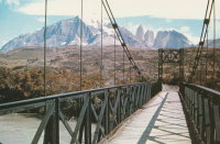
Bridgemeister ID: 1205 (added 2004-02-05)Name: Kusanovic Location: Torres del Paine and Amarga, Chile Crossing: Rio Paine Coordinates: 50.974692 S 72.802274 W Maps: Acme , GeoHack , Google , OpenStreetMap Principals: David Rowell & Co. Use: Vehicular (one-lane) Status: Bypassed (last checked: 2019) Main Cables: Wire Suspended Spans: 1 Main Span: 1
Bridgemeister ID: 8457 (added 2024-03-17)Name: Kutiya Kapar Location: Mahakali (Dodhara Chandani, दोधारा-चाँदनी नगरपालिका), Kanchanpur, Nepal Crossing: Jogbuda River Coordinates: 28.828035 N 80.096334 E Maps: Acme , GeoHack , Google , OpenStreetMap Use: Footbridge Status: In use (last checked: 2023) Main Cables: Wire (steel) Main Span: 1 x 136 meters (446.2 feet) estimated
Completed at some point in 2017 or 2018. Bridgemeister ID: 8301 (added 2024-02-09)Name: La Asunta Location: La Asunta and Boopi Motacal, Bolivia Crossing: Rio Boopi Coordinates: 16.137083 S 67.187278 W Maps: Acme , GeoHack , Google , OpenStreetMap Use: Footbridge Status: In use (last checked: 2022) Main Cables: Wire (steel) Main Span: 1 x 204 meters (669.3 feet) estimated
Completed at some point in the 2004-2016 time frame. Facebook . Image of the bridge. Posted July 8, 2022.Bridgemeister ID: 6022 (added 2021-07-02)Name: La Auvernia Location: Auvernia and La Victoria, Peru Crossing: Rio Tarma Coordinates: 11.107733 S 75.384482 W Maps: Acme , GeoHack , Google , OpenStreetMap Use: Vehicular (one-lane) Status: In use (last checked: 2020) Main Cables: Wire (steel) Suspended Spans: 1 Main Span: 1 x 42 meters (137.8 feet) estimated
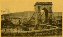
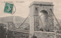
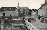
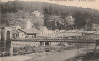
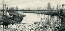
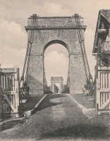
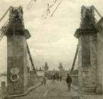
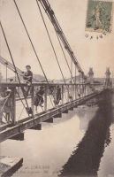
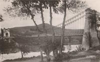
Bridgemeister ID: 2075 (added 2006-06-10)Name: La Grand-Combe Location: La Grand-Combe, Gard , France Crossing: Gardon River Use: Vehicular Status: Removed Main Cables: Wire Suspended Spans: 1
Bridgemeister ID: 2316 (added 2007-05-05)Name: La Palisse Location: La Palisse, Cros-de-Géorand vicinity, Ardèche , France Crossing: Loire River Coordinates: 44.779846 N 4.102626 E Maps: Acme , GeoHack , Google , OpenStreetMap Use: Vehicular (two-lane), with walkway Status: In use (last checked: 2021) Main Cables: Wire (steel) Suspended Spans: 1
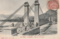
This record represents the bridge as rebuilt with the midspan pier in the 1880s. Ann Saul sent a synopsis of this bridge's history from La Roche-Guyon, Bourg Feodal de l'Ancien Vexin Francais by Ernest Colas. "The author states that the bridge was built in 1838, originally with two pylons, one on each bank of the Seine. In 1882, gale force winds turned over a wide stretch of the bridge floor. Afterwards, another pylon was placed in the middle of the river; however, the bridge was not considered stable enough for modern transportation (the automobile, perhaps). Plans were made for a new bridge and the old one was demolished. The new bridge was never built because of World War I." Replaced 1838 La Roche-Guyon - La Roche-Guyon, Val-d'Oise and Yvelines, France . Bridgemeister ID: 2311 (added 2007-05-02)Name: La Saulce Location: La Saulce, Hautes-Alpes , France Crossing: Durance River Use: Vehicular Status: Removed Main Cables: Wire Suspended Spans: 1
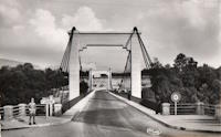
Bridgemeister ID: 5563 (added 2020-12-19)Name: La Sône Location: La Sône, Isère , France Crossing: Isère River Coordinates: 45.111177 N 5.280148 E Maps: Acme , GeoHack , Google , OpenStreetMap Use: Vehicular (two-lane), with walkway Status: In use (last checked: 2020) Main Cables: Wire (steel) Suspended Spans: 1
Likely built 1949-1953. Huge derelict industrial conveyor suspension bridge, mostly demolished by 2011. Patrick S. O'Donnell estimated the main span at approximately 750 feet. Mostly demolished as of late 2011. Bridgemeister ID: 6809 (added 2021-11-26)Name: Lacort Location: Lacort, Huesca, Spain Crossing: Rio Ara Coordinates: 42.472622 N 0.028726 W Maps: Acme , GeoHack , Google , OpenStreetMap Use: Footbridge Status: In use (last checked: 2021) Main Cables: Wire (steel) Suspended Spans: 1 Main Span: 1
Bridgemeister ID: 7852 (added 2023-09-15)Name: Lago Senaiga Location: Lamon, Belluno, Italy Crossing: Lago del Senaiga Coordinates: 46.033608 N 11.736865 E Maps: Acme , GeoHack , Google , OpenStreetMap Use: Footbridge Status: In use (last checked: 2018) Main Cables: Wire (steel) Suspended Spans: 1
Bridgemeister ID: 8334 (added 2024-02-09)Name: Laguwadi Location: Chengganxiang (称杆乡), Lushui (泸水市), Nujiang Lisu (怒江傈僳族自治州), Yunnan , China Crossing: Nujiang Coordinates: 26.212333 N 98.867222 E Maps: Acme , GeoHack , Google , OpenStreetMap Status: Extant (last checked: 2021) Main Span: 1 x 121 meters (397 feet) estimated
Bridgemeister ID: 7592 (added 2023-05-07)Name: Lake Monowai Road Location: Monowai and Blackmount, New Zealand Crossing: Waiau River Coordinates: 45.794496 S 167.630901 E Maps: Acme , GeoHack , Google , OpenStreetMap Use: Vehicular (one-lane) Status: In use (last checked: 2022) Main Cables: Wire (steel) Suspended Spans: 1
Bridgemeister ID: 2624 (added 2018-12-31)Name: Lake Pegasus Location: Pegasus, New Zealand Crossing: Lake Pegasus Coordinates: 43.310571 S 172.696599 E Maps: Acme , GeoHack , Google , OpenStreetMap Use: Footbridge Status: In use (last checked: 2017) Main Cables: Wire (steel) Suspended Spans: 3 Main Span: 1 Side Spans: 2
Bridgemeister ID: 8122 (added 2024-01-13)Name: Lansheng Also Known As: Automobile City Expo Park Location: Anting (安亭镇), Jiading District (嘉定区), Shanghai , China Crossing: Wusong River Coordinates: 31.277528 N 121.169778 E Maps: Acme , GeoHack , Google , OpenStreetMap Use: Footbridge Status: In use (last checked: 2023) Main Cables: Wire (steel) Suspended Spans: 3 Main Span: 1 Side Spans: 2 Characteristics: Self-anchored
Bridgemeister ID: 7611 (added 2023-05-19)Name: Lantian Baiyun Location: Beitun District, Taichung City, Taiwan Coordinates: 24.171287 N 120.728998 E Maps: Acme , GeoHack , Google , OpenStreetMap Use: Vehicular, with walkway Status: In use (last checked: 2022) Main Cables: Riveted plate Suspended Spans: 2 Side Spans: 2
Bridgemeister ID: 2796 (added 2019-07-04)Name: Laoqijia Also Known As: 老七佳吊橋 Location: Chunri Township, Pingtung County, Taiwan Coordinates: 22.439174 N 120.692870 E Maps: Acme , GeoHack , Google , OpenStreetMap Use: Footbridge Status: In use (last checked: 2019) Main Cables: Wire (steel) Suspended Spans: 1
Bridgemeister ID: 7486 (added 2022-12-30)Name: Las Delicias Location: Bajo San Joaquín, Delicias, Saravena, Arauca, Colombia Crossing: Rio Banadia Coordinates: 6.874941 N 71.810245 W Maps: Acme , GeoHack , Google , OpenStreetMap Use: Footbridge Status: Derelict, since 2021 (last checked: 2021) Main Cables: Wire (steel) Suspended Spans: 1 Main Span: 1 x 150 meters (492.1 feet) estimated
Likely replaced another suspension bridge at the same location. A tower and anchorage from the former bridge were still extant in the early 2020s. 2021: West approach of the bridge severely undermined and washed away by flood. Facebook . Image of the damaged bridge and the adjacent tower of another older suspension bridge, posted June 6, 2021.Facebook . Image of the bridge before the flood damage, posted May 10, 2021. A tower from a former suspension bridge at this location is also visible.Facebook - Puente la hamaca vereda las delicias . Video of the damaged bridge, posted August 12, 2021.Twitter . Image of the damaged bridge, posted July 14, 2021.Appears to have reinforced concrete main "cables". Bridgemeister ID: 7374 (added 2022-11-23)Name: Las Marías Km. 30 Location: Aguilares and Guazapa, El Salvador Crossing: Rio Guaza Coordinates: 13.927300 N 89.181006 W Maps: Acme , GeoHack , Google , OpenStreetMap Use: Footbridge Status: In use (last checked: 2021) Main Cables: Wire (steel) Suspended Spans: 1 Main Span: 1 x 39.9 meters (131 feet) estimated
Facebook - Puente Km. 30 . Image of the bridge before deck replacement, posted June 1, 2020.Facebook - Puente Km. 30 . Image of the bridge before deck replacement, posted June 1, 2020.Facebook - Puente Km. 30 . Image of the bridge before deck replacement, posted June 1, 2020.Facebook - Puente Km. 30 . Image of the bridge before deck replacement, posted June 1, 2020.Facebook - Puente Peatonal Las Marías Km.30 . Group of photos of the deck replacement, posted January 28, 2021.Bridgemeister ID: 5769 (added 2021-04-08)Name: Las Veguillas Location: San Fabián, Ñuble, Chile Crossing: Ñuble River Coordinates: 36.655620 S 71.384376 W Maps: Acme , GeoHack , Google , OpenStreetMap Use: Vehicular (one-lane) Status: In use (last checked: 2021) Main Cables: Wire (steel) Suspended Spans: 1 Main Span: 1 x 138 meters (452.8 feet) estimated
Instagram . Several images of the bridge, posted November 5, 2022.Bridgemeister ID: 3757 (added 2020-02-29)Name: Lasarettmoen Location: Skoganvarre, Porsanger, Troms og Finnmark, Norway Crossing: Fielbmá At or Near Feature: Lasarettmoen Nature Trail Coordinates: 69.83026 N 25.13412 E Maps: Acme , GeoHack , Google , kart.1881.no , OpenStreetMap Use: Footbridge Status: In use (last checked: 2019) Main Cables: Wire (steel) Suspended Spans: 1 Main Span: 1 x 60 meters (196.9 feet) estimated
Bridgemeister ID: 1700 (added 2005-03-28)Name: Laudenbach Conveyor Location: Laudenbach, Karlstadt am Main, Bavaria, Germany Crossing: Main River Coordinates: 49.952643 N 9.763726 E Maps: Acme , GeoHack , Google , OpenStreetMap Use: Conveyor Status: Extant (last checked: 2019) Main Cables: Wire (steel) Suspended Spans: 3 Main Span: 1 x 125 meters (410.1 feet) Side Spans: 2 Deck width: 4.7 meters
Bridgemeister ID: 4203 (added 2020-04-08)Name: Lauvøya Location: Grønvollfoss, Notodden, Vestfold Og Telemark, Norway Crossing: Tinne Coordinates: 59.651457 N 9.220381 E Maps: Acme , GeoHack , Google , kart.1881.no , OpenStreetMap Use: Footbridge Status: Extant (last checked: 2019) Main Cables: Wire (steel) Suspended Spans: 1 Main Span: 1 x 65.5 meters (214.9 feet) estimated
Completed in time frame 1913-1917. Bridgemeister ID: 5583 (added 2020-12-21)Name: Lava Creek Location: Mammoth, Wyoming , USA Crossing: Lava Creek At or Near Feature: Lava Creek Trail, Yellowstone National Park Coordinates: 44.973740 N 110.683292 W Maps: Acme , GeoHack , Google , OpenStreetMap Use: Footbridge Status: In use (last checked: 2020) Main Cables: Wire (steel) Suspended Spans: 1
Bridgemeister ID: 7477 (added 2022-12-25)Name: Layrac Location: Layrac, Lot-et-Garonne , France Crossing: Garonne River Use: Vehicular Status: Removed Main Cables: Wire (iron) Suspended Spans: 3 Main Spans: 3
Bridgemeister ID: 7183 (added 2022-07-02)Name: Layrac-sur-Tarn Location: Layrac-sur-Tarn and La Magdelaine-sur-Tarn, Haute-Garonne , France Crossing: Tarn River Use: Vehicular Status: Destroyed, 1930 Main Cables: Wire (iron) Suspended Spans: 3 Main Span: 1 Side Spans: 2
Bridgemeister ID: 8319 (added 2024-02-09)Name: Lazajia Location: Zilijiaxiang (子里甲乡), Fugong County (福贡县), Nujiang Lisu (怒江傈僳族自治州), Yunnan , China Crossing: Nujiang Coordinates: 26.633444 N 98.904972 E Maps: Acme , GeoHack , Google , OpenStreetMap Status: Extant (last checked: 2021) Main Span: 1 x 139 meters (456 feet) estimated
Completed at some point in the 2012-2019 time frame. Bridgemeister ID: 4854 (added 2020-07-12)Name: Längenfeld Also Known As: Burgstein Location: Längenfeld, Austria Coordinates: 47.062722 N 10.971271 E Maps: Acme , GeoHack , Google , OpenStreetMap Use: Footbridge Status: In use (last checked: 2020) Main Cables: Wire (steel) Suspended Spans: 1 Main Span: 1 x 83 meters (272.3 feet)
Bridgemeister ID: 8168 (added 2024-02-03)Name: Leiro Location: Leiro, Ourense, Spain Crossing: Rio Avia Coordinates: 42.371000 N 8.123528 W Maps: Acme , GeoHack , Google , OpenStreetMap Use: Footbridge Status: In use (last checked: 2023) Main Cables: Wire (steel) Main Span: 1 x 90 meters (295.3 feet) estimated
Bridgemeister ID: 4011 (added 2020-03-28)Name: Leite Location: Islandsmoen, Bagn, Sør-Aurdal, Innlandet, Norway Crossing: Begna Coordinates: 60.78448 N 9.60187 E Maps: Acme , GeoHack , Google , kart.1881.no , OpenStreetMap Status: Replaced, 2015 Suspended Spans: 1 Main Span: 1 x 38.25 meters (125.5 feet) estimated Deck width: ~2.2 meters
Removed between 2013-2015. Replaced 2015 by a timber bowstring arch bridge. Bridgemeister ID: 2761 (added 2019-06-30)Name: Lemi Also Known As: 樂米吊橋 Location: Alishan Township, Chiayi County, Taiwan Coordinates: 23.472398 N 120.714123 E Maps: Acme , GeoHack , Google , OpenStreetMap Use: Footbridge Status: In use (last checked: 2019) Main Cables: Wire (steel)
Bridgemeister ID: 7276 (added 2022-07-22)Name: Les Ormes Location: Les Ormes, Vienne , France Crossing: Vienne River Use: Vehicular Status: Removed Main Cables: Wire (steel) Suspended Spans: 1 Main Span: 1
Bridgemeister ID: 2032 (added 2006-04-23)Name: Les Taillades Location: Branoux-Les-Taillades and La Levade, Gard , France Crossing: Gardon d'Alès Use: Vehicular Status: Removed Main Cables: Wire Suspended Spans: 1
Bridgemeister ID: 1975 (added 2005-11-27)Name: Libourne Location: Libourne, Gironde , France Crossing: Isle River Use: Vehicular (one-lane) Status: Removed Main Cables: Wire Suspended Spans: 1
Bridgemeister ID: 7428 (added 2022-12-10)Name: Licantén Also Known As: Los Escalones Location: Licantén, Curicó, Chile Crossing: Mataquito River Coordinates: 34.984763 S 72.009507 W Maps: Acme , GeoHack , Google , OpenStreetMap Use: Footbridge Status: In use (last checked: 2022) Main Cables: Wire (steel) Suspended Spans: 1 Main Span: 1 x 161 meters (528.2 feet) estimated
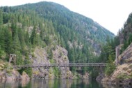
Bridgemeister ID: 2182 (added 2007-01-14)Name: Lightning Creek Location: Ross Lake National Recreation Area, Washington , USA Crossing: Lightning Creek At or Near Feature: North Cascades National Park Coordinates: 48.87465 N 121.01784 W Maps: Acme , GeoHack , Google , OpenStreetMap Use: Footbridge Status: In use (last checked: 2006) Main Cables: Wire (steel) Suspended Spans: 1 Main Span: 1 x 59.6 meters (195.5 feet)
Bridgemeister ID: 2777 (added 2019-06-30)Name: Lileng Location: Heping District, Taichung City, Taiwan Coordinates: 24.166322 N 120.948985 E Maps: Acme , GeoHack , Google , OpenStreetMap Use: Footbridge Status: Closed (last checked: 2014) Main Cables: Wire (steel) Suspended Spans: 1
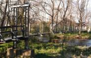
Bridgemeister ID: 1332 (added 2004-05-01)Name: Lindsay Lane Location: Criglersville, Virginia , USA Crossing: Robinson River Coordinates: 38.4574 N 78.301833 W Maps: Acme , GeoHack , Google , OpenStreetMap Principals: VDOT Use: Footbridge Status: Closed, October, 2020 (last checked: 2022) Main Cables: Wire (steel) Suspended Spans: 1 Main Span: 1 x 45.7 meters (150 feet) estimated
There are two suspension footbridges across the Robinson River at Criglersville. This one is located where Lindsay Lane fords Robinson River. 2020, October: Closed after failing safety inspection. 2021, February: VDOT (Virginia Department of Transportation) proposals to either rehabilitate or replace the bridge are being considered. Near 1987 (footbridge) - Criglersville, Virginia, USA . Bridgemeister ID: 8024 (added 2023-12-17)Name: Linzhi Taizhao Also Known As: 林芝太昭大桥 Location: Taizhao (太昭村), Nyingchi, Tibet , China Crossing: Niyang River Coordinates: 29.9988637 N 93.0809710 E Maps: Acme , GeoHack , Google , OpenStreetMap Use: Vehicular (one-lane) Status: Derelict (last checked: 2020) Main Cables: Wire (steel) Suspended Spans: 1
Deck removed at some point before 2010. Bridgemeister ID: 1316 (added 2004-04-18)Name: Little Mac Location: Marilla vicinity, Michigan , USA Crossing: Manistee River Coordinates: 44.3654 N 85.826467 W Maps: Acme , GeoHack , Google , OpenStreetMap Use: Footbridge Status: In use (last checked: 2007) Main Cables: Wire (steel) Suspended Spans: 1 Main Span: 1 x 50.9 meters (167 feet)
This is the third Michigan suspension footbridge I've found nicknamed "Little Mac". Stephen Quintana writes: "One of my first projects was to be the inspector on the construction of this bridge. This was somewhere between 1994 and 1996. I remember the contractor's only experience with any Forest Service projects was installing some toilets for us. He had never done anything like this before. I wasn't on the job site the day he pulled the cables across the river, so I asked him how he did it. He said he used a fishing pole with a small weight and cast it across the river. Then he used that to pull a larger rope, then a much larger rope, then finally the cables. I thought they did a pretty good job on this bridge. I remember the cost was somewhere around $100,000 for this project." Bridgemeister ID: 1055 (added 2003-12-13)Name: Little Mac Location: Reed City, Michigan , USA Crossing: Hersey River Coordinates: 43.88466 N 85.51286 W Maps: Acme , GeoHack , Google , OpenStreetMap Use: Footbridge Status: In use (last checked: 2007) Main Cables: Wire (steel) Suspended Spans: 1 Main Span: 1 x 45.7 meters (150 feet)
Bridgemeister ID: 3568 (added 2019-12-26)Name: Liujiadian Changshou Also Known As: 六家佃長壽橋 Location: Liujiao, Chiayi County, Taiwan Coordinates: 23.482533 N 120.295856 E Maps: Acme , GeoHack , Google , OpenStreetMap Use: Footbridge Status: In use (last checked: 2019) Main Cables: Wire (steel)
Bridgemeister ID: 2096 (added 2006-07-03)Name: Livinhac Location: Livinhac, Aveyron , France Crossing: Lot River Use: Vehicular (one-lane) Status: Demolished, 2004 Main Cables: Wire
HBR notes several other light footbridges in this area. Dave Cooper noted there are likely five River Helmsdale suspension bridges (including this one) in this area. Bridgemeister ID: 2113 (added 2006-09-03)Name: Long Bottom Location: Hinton, West Virginia , USA Crossing: New River Status: Removed Main Cables: Wire (steel)
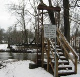
From a sign at the New River Gorge visitors center: "Built in the 1920's, this suspension bridge connected the New River Lumber Company sawmill with the Long bottom train station on the other side of the New River. Rail cars pulled by a steel cable carried lumber to the railroad station." Bridgemeister ID: 2061 (added 2006-06-03)Name: Long Creek Location: Melvern, Kansas , USA At or Near Feature: Melvern Dam vicinity Coordinates: 38.513867 N 95.704033 W Maps: Acme , GeoHack , Google , OpenStreetMap Use: Footbridge Status: In use (last checked: 2006)
Sign at bridge reads: "Long Creek Suspension Bridge. This is a replica of the bridge that once spanned Long Creek at Francis Crossing approximately 2 miles southwest of Melvern. It was the only known bridge of this design in Kansas. The bridge was originally constructed between 1885 and 1890 by the Wilden Bridge Company. The original bridge was 100 feet long and 13 feet wide. It was designed for horse drawn hay wagons..." See 1882 Long Creek - Melvern vicinity, Kansas, USA . Bridgemeister ID: 2818 (added 2019-07-04)Name: Longmen Also Known As: 龍門吊橋 Location: Gongliao District, New Taipei City, Taiwan Crossing: Shuang River Coordinates: 25.022898 N 121.935492 E Maps: Acme , GeoHack , Google , OpenStreetMap Use: Footbridge Status: In use (last checked: 2019) Main Cables: Wire (steel) Suspended Spans: 3 Main Span: 1 Side Spans: 2
Bridgemeister ID: 7590 (added 2023-05-06)Name: Longues Location: Longues, Vic-le-Comte and Les Martres-de-Veyre, Puy-de-Dôme , France Crossing: Allier River Use: Vehicular Status: Removed Main Span: 1
Bridgemeister ID: 2832 (added 2019-07-04)Name: Longyin Also Known As: 龍吟吊橋 Location: Wanrong Township, Hualien County, Taiwan Coordinates: 23.589316 N 121.338364 E Maps: Acme , GeoHack , Google , OpenStreetMap Use: Footbridge Status: In use (last checked: 2017) Main Cables: Wire (steel)
Bridgemeister ID: 7070 (added 2022-05-27)Name: Lord Curzon Also Known As: लॉर्ड कर्ज़न ब्रिज, Curzon's Location: Jhinji, F-2 vicinity, Uttarakhand , India Crossing: Birahi Ganga At or Near Feature: Kuari Pass Trek - Lord Curzon's Trail Coordinates: 30.364545 N 79.570162 E Maps: Acme , GeoHack , Google , OpenStreetMap Use: Footbridge Status: In use (last checked: 2019) Main Cables: Wire (steel) Main Span: 1 x 60.4 meters (198 feet) estimated
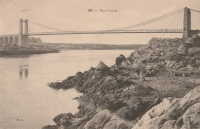
Bridgemeister ID: 1739 (added 2005-04-19)Name: Lorois Location: Plouhinec vicinity, Morbihan , France Crossing: Etel River Use: Vehicular (one-lane) Status: Replaced Main Cables: Wire (iron) Suspended Spans: 1
Bridgemeister ID: 2553 (added 2012-01-01)Name: Louis-Marie Gagnon Location: Grand-Fonds vicinity, Quebec , Canada Coordinates: 49.04213 N 66.69042 W Maps: Acme , GeoHack , Google , OpenStreetMap Use: Snowmobile Status: In use (last checked: 2010) Main Cables: Wire (steel) Suspended Spans: 1
Sign at bridge says "Passerelle - Louis-Marie Gagnon - Cap-Chat 2000" Bridgemeister ID: 7076 (added 2022-05-27)Name: Lover's Lake Location: Anle District, Keelung City, Taiwan Coordinates: 25.159448 N 121.704904 E Maps: Acme , GeoHack , Google , OpenStreetMap Use: Footbridge Status: In use (last checked: 2022) Main Cables: Wire (steel) Suspended Spans: 1
Bridgemeister ID: 2769 (added 2019-06-30)Name: Lovers' Valley Also Known As: 情人谷吊橋 Location: Maolin District, Kaohsiung City, Taiwan Crossing: Zhuokou River Coordinates: 22.882282 N 120.665932 E Maps: Acme , GeoHack , Google , OpenStreetMap Use: Footbridge Status: In use (last checked: 2019) Main Cables: Wire (steel) Suspended Spans: 1
Bridgemeister ID: 2712 (added 2019-06-16)Name: Lower Hooker Location: Aoraki Mount Cook Village vicinity, New Zealand Crossing: Hooker River At or Near Feature: Hooker Valley Track Coordinates: 43.715830 S 170.103086 E Maps: Acme , GeoHack , Google , OpenStreetMap Use: Footbridge Status: In use (last checked: 2015) Main Cables: Wire (steel) Suspended Spans: 1
Bridgemeister ID: 1105 (added 2004-01-03)Name: Luis I. Andrade Also Known As: Rio Magdalena Location: Honda (San Bartolomeo de Honda), Tolima, Colombia Crossing: Rio Magdalena Coordinates: 5.206923 N 74.734510 W Maps: Acme , GeoHack , Google , OpenStreetMap Use: Vehicular (two-lane, heavy vehicles), with walkway Status: In use (last checked: 2018) Main Cables: Wire (steel) Suspended Spans: 1
Bridgemeister ID: 8447 (added 2024-03-10)Name: Lujiao Location: Lujiao (鹿角镇), Pengshui (彭水县), Chongqing , China Crossing: Wu River Coordinates: 29.132711 N 108.284067 E Maps: Acme , GeoHack , Google , OpenStreetMap Use: Footbridge Status: In use (last checked: 2023) Main Cables: Wire (steel) Main Span: 1 x 250 meters (820.2 feet) estimated
Bridgemeister ID: 8309 (added 2024-02-09)Name: Lumadeng Location: Lumadengxiang (鹿马登乡), Fugong County (福贡县), Nujiang Lisu (怒江傈僳族自治州), Yunnan , China Crossing: Nujiang Coordinates: 27.028333 N 98.864500 E Maps: Acme , GeoHack , Google , OpenStreetMap Status: Extant (last checked: 2021) Main Span: 1 x 118 meters (387.1 feet) estimated
Do you have any information or photos for these bridges that you would like to share? Please email david.denenberg@bridgemeister.com .
Mail | Facebook | Twitter
