Suspension Bridges of Scotland (101-108 of 108)
This is a list of bridges 101 through 108 (of 108 total) from the suspension bridge inventory for Scotland in United Kingdom. Wherever you see a Bridgemeister ID number click it to isolate the bridge on its own page.
Related Lists:
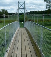
Mertoun Estate
Mertoun, Scotland, United Kingdom - River Tweed
| Bridgemeister ID: | 2531 (added 2011-12-24) |
| Name: | Mertoun Estate |
| Location: | Mertoun, Scotland, United Kingdom |
| Crossing: | River Tweed |
| Coordinates: | 55.57507 N 2.60970 W |
| Maps: | Acme, GeoHack, Google, OpenStreetMap |
| Principals: | John M. Henderson & Co. Ltd. |
| Use: | Footbridge |
| Status: | In use (last checked: 2022) |
| Main Cables: | Wire |
| Suspended Spans: | 1 |
| Main Span: | 1 |
Notes:
Milton
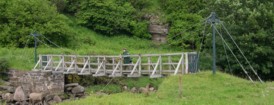
Dunbeath, Scotland, United Kingdom - Dunbeath Water
| Bridgemeister ID: | 1528 (added 2004-10-24) |
| Name: | Milton |
| Location: | Dunbeath, Scotland, United Kingdom |
| Crossing: | Dunbeath Water |
| Coordinates: | 58.254417 N 3.4419 W |
| Maps: | Acme, GeoHack, Google, OpenStreetMap |
| Use: | Footbridge |
| Status: | In use (last checked: 2010) |
| Main Cables: | Wire |
| Suspended Spans: | 1 |
Notes:
- Very short footbridge with small T-shaped towers.
- Signs posted at the bridge (2010) state: "Previous bridge washed away Oct 06 spate. Bridge replaced and rebuilt by Dunbeath Estate Oct 07" and "Milton Suspension Bridge. You Cross This Bridge At Your Own Risk."
- Near (footbridge) - Dunbeath, Scotland, United Kingdom.
Monessie Gorge
Roy Bridge vicinity, Scotland, United Kingdom - River Spean
| Bridgemeister ID: | 2466 (added 2008-10-05) |
| Name: | Monessie Gorge |
| Location: | Roy Bridge vicinity, Scotland, United Kingdom |
| Crossing: | River Spean |
| Coordinates: | 56.8894 N 4.7929 W |
| Maps: | Acme, GeoHack, Google, OpenStreetMap |
| Use: | Footbridge |
| Status: | In use (last checked: 2008) |
| Main Cables: | Wire (steel) |
| Suspended Spans: | 1 |
Shakkin'
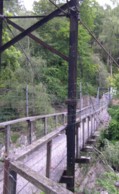
Edzell, Scotland, United Kingdom - North Esk River
| Bridgemeister ID: | 513 (added before 2003) |
| Name: | Shakkin' |
| Location: | Edzell, Scotland, United Kingdom |
| Crossing: | North Esk River |
| Coordinates: | 56.811071 N 2.653078 W |
| Maps: | Acme, GeoHack, Google, OpenStreetMap |
| Use: | Footbridge |
| Status: | Derelict, since October 2023 (last checked: 2023) |
| Main Cables: | Rod |
Notes:
- 2023, October: Badly damaged by wind and flood during Storm Babet.
External Links:
Swing
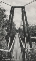
Kirckmichael, Tomintoul vicinity, Scotland, United Kingdom - River Avon
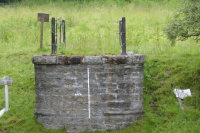
| Bridgemeister ID: | 2904 (added 2019-09-14) |
| Name: | Swing |
| Location: | Kirckmichael, Tomintoul vicinity, Scotland, United Kingdom |
| Crossing: | River Avon |
| At or Near Feature: | Tomintoul Distillery vicinity |
| Coordinates: | 57.314319 N 3.410730 W |
| Maps: | Acme, GeoHack, Google, OpenStreetMap |
| Use: | Footbridge |
| Status: | Collapsed, Winter 2009-2010 |
| Suspended Spans: | 1 |
Notes:
- Collapsed under weight of snow, winter 2009-2010. Remnants extant, 2019.
Tomintoul
Tomintoul, Scotland, United Kingdom - River Avon
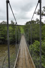
| Bridgemeister ID: | 1903 (added 2005-10-08) |
| Name: | Tomintoul |
| Location: | Tomintoul, Scotland, United Kingdom |
| Crossing: | River Avon |
| Coordinates: | 57.290323 N 3.418058 W |
| Maps: | Acme, GeoHack, Google, OpenStreetMap |
| References: | HBR |
| Use: | Footbridge |
| Status: | In use (last checked: 2019) |
| Main Cables: | Wire (steel) |
| Suspended Spans: | 1 |
Notes:
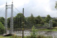
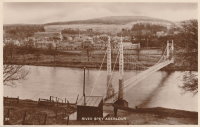
Victoria
Charlestown of Aberlour and Wester Elchies, Scotland, United Kingdom - River Spey
| Bridgemeister ID: | 781 (added 2003-03-16) |
| Name: | Victoria |
| Also Known As: | Penny, Aberlour |
| Location: | Charlestown of Aberlour and Wester Elchies, Scotland, United Kingdom |
| Crossing: | River Spey |
| Coordinates: | 57.47044 N 3.23173 W |
| Maps: | Acme, GeoHack, Google, OpenStreetMap |
| Principals: | James Abernethy & Co. "Abernethy Foundry" |
| References: | HARPER, HBR |
| Use: | Footbridge |
| Status: | In use (last checked: 2014) |
| Main Cables: | Wire (steel) |
| Suspended Spans: | 1 |
Notes:
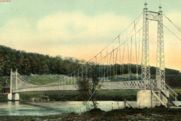
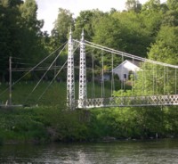
- William Craig describes the bridge, "Built about 1900 by James Abernethy & Co. The pylons are tapered lattice girders with ball and spike finials and cross braced. Walkway is lattice girder hung from suspension cables."
- Near (footbridge) - Aberlour, Scotland, United Kingdom.
External Links:
West Lodge
Blair Atholl, Bruar, Scotland, United Kingdom - River Garry
| Bridgemeister ID: | 1314 (added 2004-04-18) |
| Name: | West Lodge |
| Location: | Blair Atholl, Bruar, Scotland, United Kingdom |
| Crossing: | River Garry |
| Coordinates: | 56.769717 N 3.900783 W |
| Maps: | Acme, GeoHack, Google, OpenStreetMap |
| Use: | Footbridge |
| Status: | Dismantled, 2007 |
| Main Cables: | Wire |
| Suspended Spans: | 1 |
Notes:
- Closed August, 2006 due to concerns about the bridge's condition. Dismantled 2007. May be re-assembled at an Aberdeenshire River Dee crossing.
Do you have any information or photos for these bridges that you would like to share? Please email david.denenberg@bridgemeister.com.