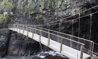
Suspension Bridges of Northern Ireland
This is a list of all 7 bridges from the suspension bridge inventory for Northern Ireland in United Kingdom. Wherever you see a Bridgemeister ID number click it to isolate the bridge on its own page.
Related Lists:
1845: (footbridge)
Caledon, County Tyrone, Northern Ireland, United Kingdom - River Blackwater
| Bridgemeister ID: | 2424 (added 2008-03-12) |
| Year Completed: | 1845 |
| Name: | (footbridge) |
| Location: | Caledon, County Tyrone, Northern Ireland, United Kingdom |
| Crossing: | River Blackwater |
| Coordinates: | 54.34608 N 6.83276 W |
| Maps: | Acme, GeoHack, Google, OpenStreetMap |
| Principals: | James Dredge |
| References: | AAJ |
| Use: | Footbridge |
| Status: | Extant (last checked: 2021) |
| Main Cables: | Rod (iron) |
| Suspended Spans: | 1 |
| Main Span: | 1 x 22.6 meters (74 feet) |
Notes:
- This distinctly Dredge bridge is currently sitting atop modern concrete piers.
External Links:
1845: Ballievey
Banbridge, Northern Ireland, United Kingdom - River Bann
| Bridgemeister ID: | 2172 (added 2007-01-13) |
| Year Completed: | 1845 |
| Name: | Ballievey |
| Also Known As: | Ballievy |
| Location: | Banbridge, Northern Ireland, United Kingdom |
| Crossing: | River Bann |
| Coordinates: | 54.341862 N 6.219803 W |
| Maps: | Acme, GeoHack, Google, OpenStreetMap |
| Principals: | James Dredge |
| Use: | Vehicular |
| Status: | Collapsed, September 12, 1988 |
| Suspended Spans: | 1 |
| Main Span: | 1 x 22 meters (72.3 feet) |
Notes:
- Collapsed, September 12, 1988, under weight of truck that exceeded the posted weight limit.

1847: Moyola Park
Castledawson, Northern Ireland, United Kingdom - Moyola River
| Bridgemeister ID: | 3888 (added 2020-03-13) |
| Year Completed: | 1847 |
| Name: | Moyola Park |
| Location: | Castledawson, Northern Ireland, United Kingdom |
| Crossing: | Moyola River |
| Coordinates: | 54.781235 N 6.560394 W |
| Maps: | Acme, GeoHack, Google, OpenStreetMap |
| Principals: | James Dredge |
| Use: | Footbridge |
| Status: | In use |
| Main Cables: | Rod (iron) |
External Links:
1902: Gobbins
Whitehead vicinity, Northern Ireland, United Kingdom
| Bridgemeister ID: | 1357 (added 2004-05-15) |
| Year Completed: | 1902 |
| Name: | Gobbins |
| Location: | Whitehead vicinity, Northern Ireland, United Kingdom |
| At or Near Feature: | Gobbins Cliff Path |
| Coordinates: | 54.808223 N 5.691737 W |
| Maps: | Acme, GeoHack, Google, OpenStreetMap |
| Use: | Footbridge |
| Status: | Replaced, 2015 |
| Main Cables: | Wire |
| Suspended Spans: | 1 |
Notes:
- 2014-2015: Gobbins Cliff Path restored to its original condition, including replacement of the suspension bridge.
- Replaced by 2015 Gobbins - Whitehead vicinity, Northern Ireland, United Kingdom.

2011: Peace
Derry, Northern Ireland, United Kingdom - River Foyle
| Bridgemeister ID: | 3557 (added 2019-12-26) |
| Year Completed: | 2011 |
| Name: | Peace |
| Location: | Derry, Northern Ireland, United Kingdom |
| Crossing: | River Foyle |
| Coordinates: | 54.997957 N 7.315452 W |
| Maps: | Acme, GeoHack, Google, OpenStreetMap |
| Use: | Footbridge |
| Status: | In use (last checked: 2019) |
| Main Cables: | Wire (steel) |
| Suspended Spans: | 3 |
| Main Span: | 1 |
| Side Spans: | 2 |
External Links:
2015: Gobbins
Whitehead vicinity, Northern Ireland, United Kingdom
| Bridgemeister ID: | 2682 (added 2019-05-26) |
| Year Completed: | 2015 |
| Name: | Gobbins |
| Location: | Whitehead vicinity, Northern Ireland, United Kingdom |
| At or Near Feature: | Gobbins Cliff Path |
| Coordinates: | 54.808021 N 5.691815 W |
| Maps: | Acme, GeoHack, Google, OpenStreetMap |
| Use: | Footbridge |
| Status: | In use (last checked: 2019) |
| Main Cables: | Wire (steel) |
| Suspended Spans: | 1 |
Notes:

Bearney
Sion Mills, Northern Ireland, United Kingdom - River Mourne
| Bridgemeister ID: | 994 (added 2003-11-16) |
| Name: | Bearney |
| Also Known As: | Swinging |
| Location: | Sion Mills, Northern Ireland, United Kingdom |
| Crossing: | River Mourne |
| Coordinates: | 54.785578 N 7.461796 W |
| Maps: | Acme, GeoHack, Google, OpenStreetMap |
| Use: | Footbridge |
| Status: | In use (last checked: 2019) |
| Main Cables: | Wire (steel) |
| Suspended Spans: | 1 |
| Main Span: | 1 x 62 meters (203.4 feet) |
External Links:
Do you have any information or photos for these bridges that you would like to share? Please email david.denenberg@bridgemeister.com.