Suspension Bridges of Côtes-d'Armor
This is a list of all 5 bridges from the suspension bridge inventory for Côtes-d'Armor in France. Wherever you see a Bridgemeister ID number click it to isolate the bridge on its own page.
Related Lists:
1834: Canada
Tréguier and Trédarzec, Côtes-d'Armor, France - Jaudy River
| Bridgemeister ID: | 1120 (added 2004-01-09) |
| Year Completed: | 1834 |
| Name: | Canada |
| Location: | Tréguier and Trédarzec, Côtes-d'Armor, France |
| Crossing: | Jaudy River |
| Coordinates: | 48.785102 N 3.220630 W |
| Maps: | Acme, GeoHack, Google, OpenStreetMap |
| Use: | Vehicular |
| Status: | Demolished, 1886 |
| Main Cables: | Wire (iron) |
| Suspended Spans: | 1 |
| Main Span: | 1 x 100 meters (328.1 feet) |
External Links:
1834: Saint Francois
Tréguier and Plouguiel, Côtes-d'Armor, France - Guindy River
| Bridgemeister ID: | 1122 (added 2004-01-09) |
| Year Completed: | 1834 |
| Name: | Saint Francois |
| Location: | Tréguier and Plouguiel, Côtes-d'Armor, France |
| Crossing: | Guindy River |
| Coordinates: | 48.789737 N 3.236838 W |
| Maps: | Acme, GeoHack, Google, OpenStreetMap |
| Use: | Footbridge |
| Status: | In use (last checked: 2019) |
| Main Cables: | Wire (iron) |
| Suspended Spans: | 1 |
| Main Span: | 1 x 71.2 meters (233.6 feet) |
External Links:
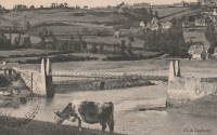
1840: Lézardrieux
Lézardrieux, Côtes-d'Armor, France - Trieux River
| Bridgemeister ID: | 1116 (added 2004-01-05) |
| Year Completed: | 1840 |
| Name: | Lézardrieux |
| Location: | Lézardrieux, Côtes-d'Armor, France |
| Crossing: | Trieux River |
| Coordinates: | 48.780778 N 3.106222 W |
| Maps: | Acme, GeoHack, Google, OpenStreetMap |
| Principals: | Seguin Brothers |
| References: | AAJ, PTS2 |
| Use: | Vehicular (one-lane) |
| Status: | Replaced, 1925 |
| Main Cables: | Wire (iron) |
| Suspended Spans: | 1 |
| Main Span: | 1 x 150 meters (492.1 feet) |
Notes:
- 1925: Replaced by a Gisclard suspension bridge reusing the approach spans and piers of the 1840 suspension bridge.
External Links:
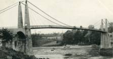
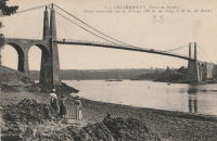
1928: Saint-Hubert
Port Saint-Hubert, Plouër-sur-Rance vicinity and La Ville-es-Nonais, Côtes-d'Armor, France - Rance River
| Bridgemeister ID: | 1492 (added 2004-09-19) |
| Year Completed: | 1928 |
| Name: | Saint-Hubert |
| Location: | Port Saint-Hubert, Plouër-sur-Rance vicinity and La Ville-es-Nonais, Côtes-d'Armor, France |
| Crossing: | Rance River |
| Use: | Vehicular |
| Status: | Destroyed, 1944 |
| Main Cables: | Wire |
| Suspended Spans: | 1 |
Notes:
- Replaced by 1959 Saint-Hubert - Port Saint-Hubert, Plouër-sur-Rance vicinity and La Ville-es-Nonais, Côtes-d'Armor, France.
External Links:
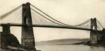
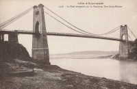
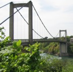
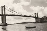
1959: Saint-Hubert
Port Saint-Hubert, Plouër-sur-Rance vicinity and La Ville-es-Nonais, Côtes-d'Armor, France - Rance River
| Bridgemeister ID: | 1493 (added 2004-09-19) |
| Year Completed: | 1959 |
| Name: | Saint-Hubert |
| Location: | Port Saint-Hubert, Plouër-sur-Rance vicinity and La Ville-es-Nonais, Côtes-d'Armor, France |
| Crossing: | Rance River |
| Coordinates: | 48.535455 N 1.970929 W |
| Maps: | Acme, GeoHack, Google, OpenStreetMap |
| Use: | Vehicular (two-lane, heavy vehicles), with walkway |
| Status: | In use (last checked: 2019) |
| Main Cables: | Wire (steel) |
| Suspended Spans: | 1 |
Notes:
External Links:
Do you have any information or photos for these bridges that you would like to share? Please email david.denenberg@bridgemeister.com.